
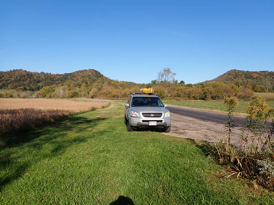
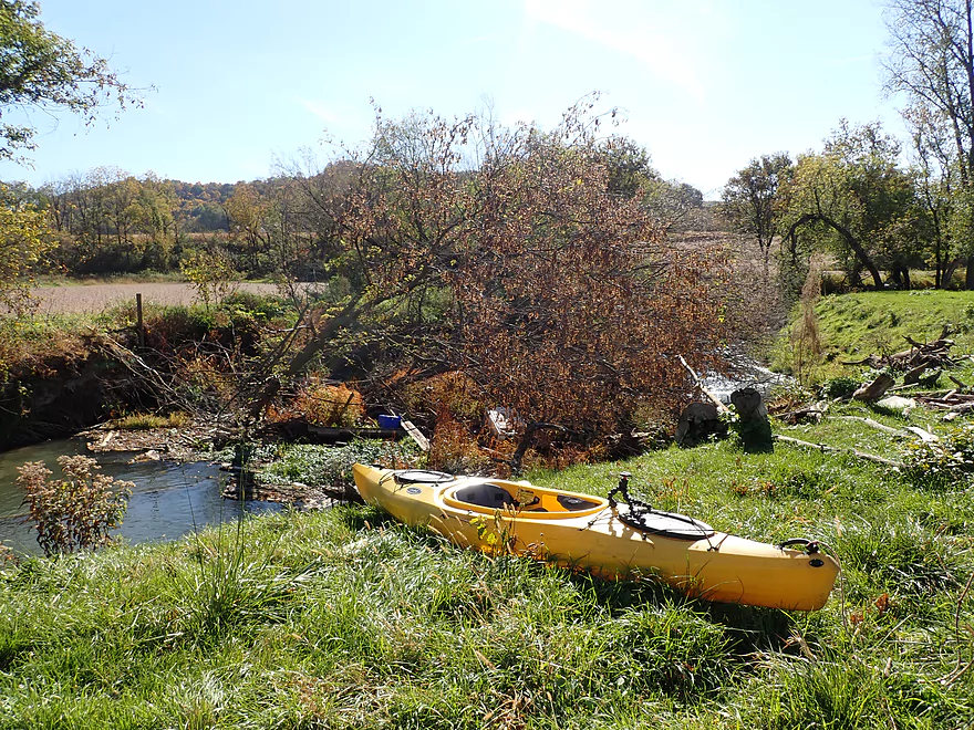
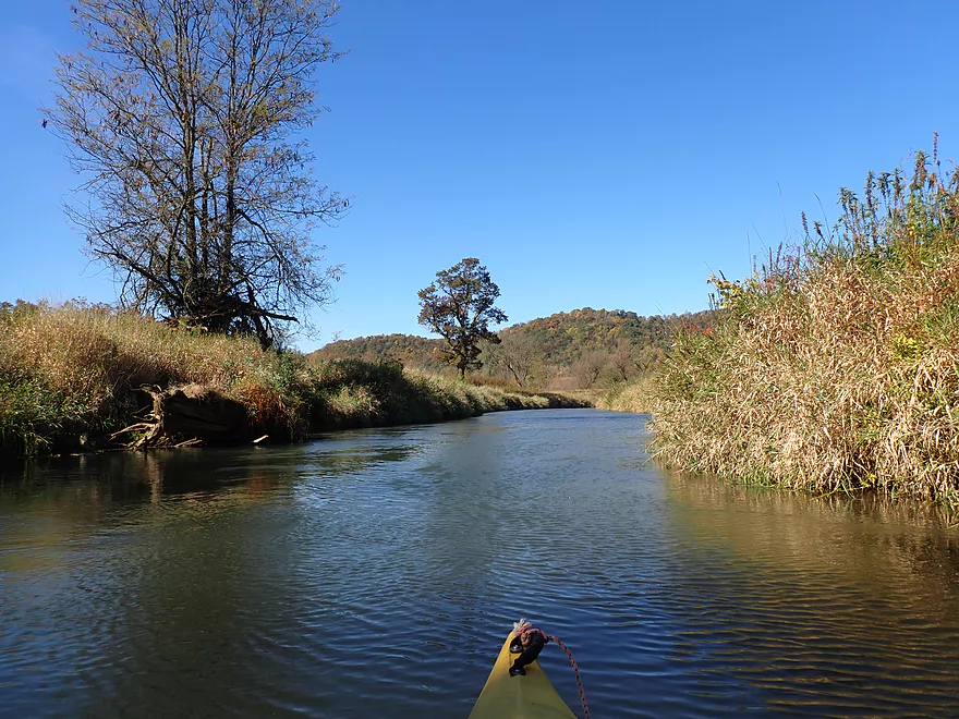
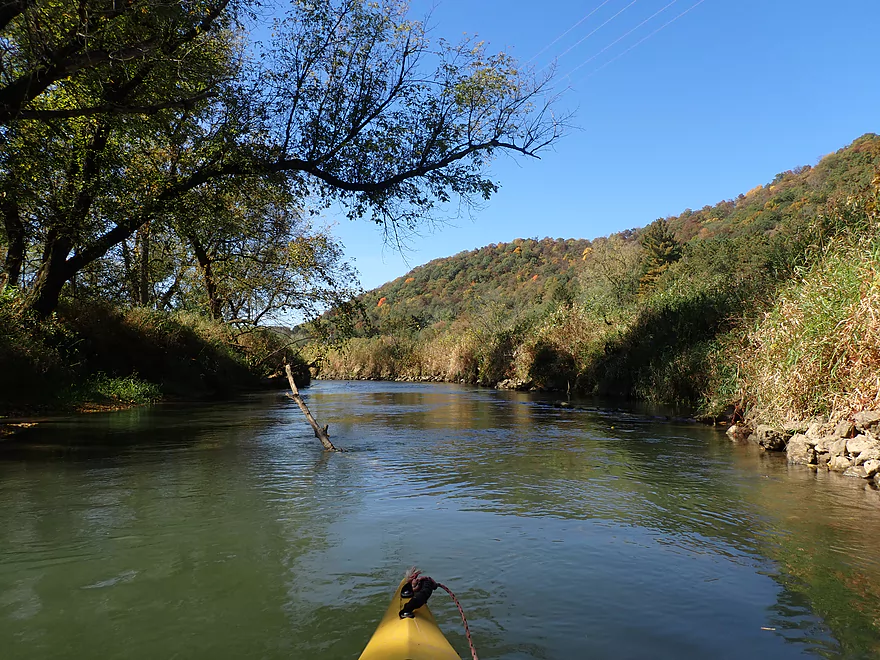
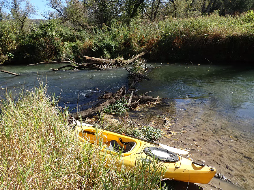
Starting the trip at Koll Road
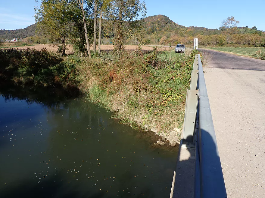
Kind of a steep bridge access
A stream of walnuts floating down the creek
A walnut “dam”
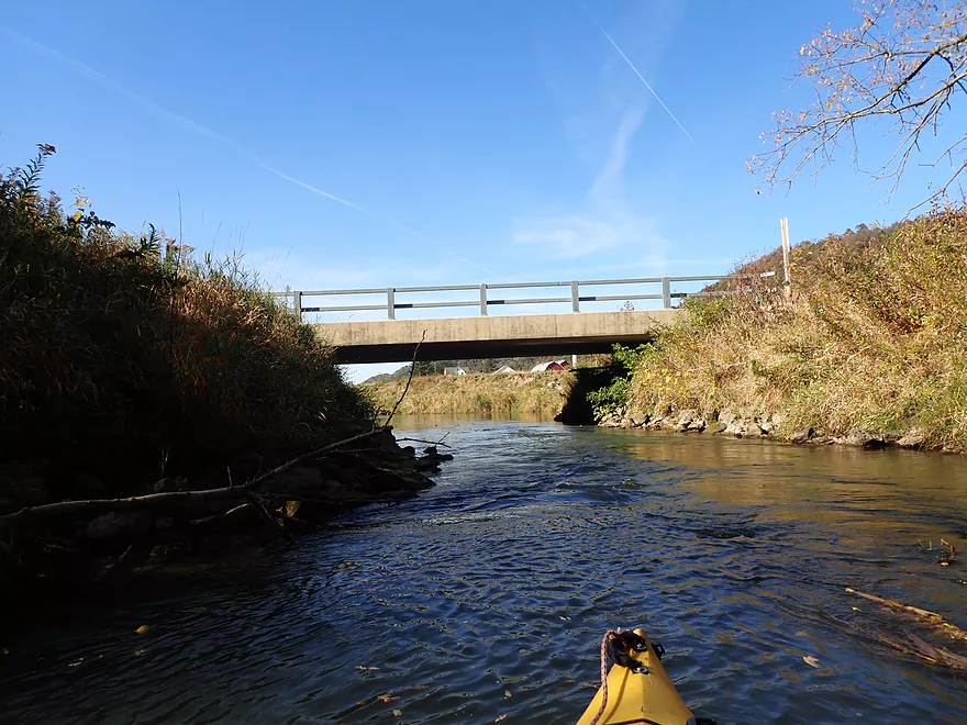
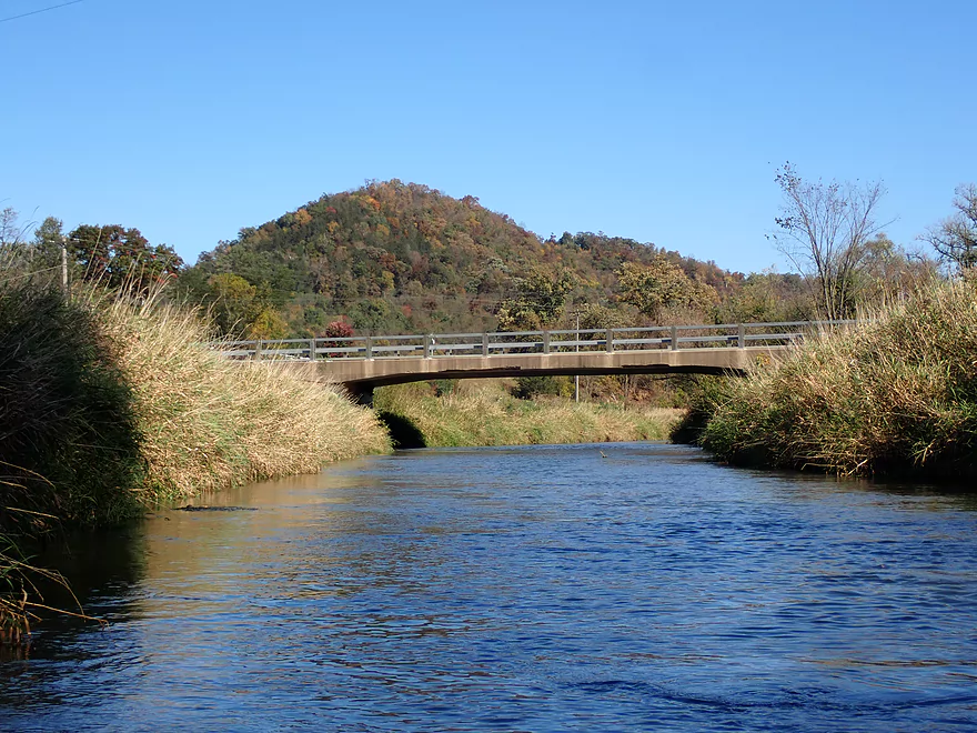
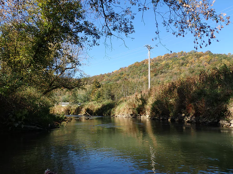
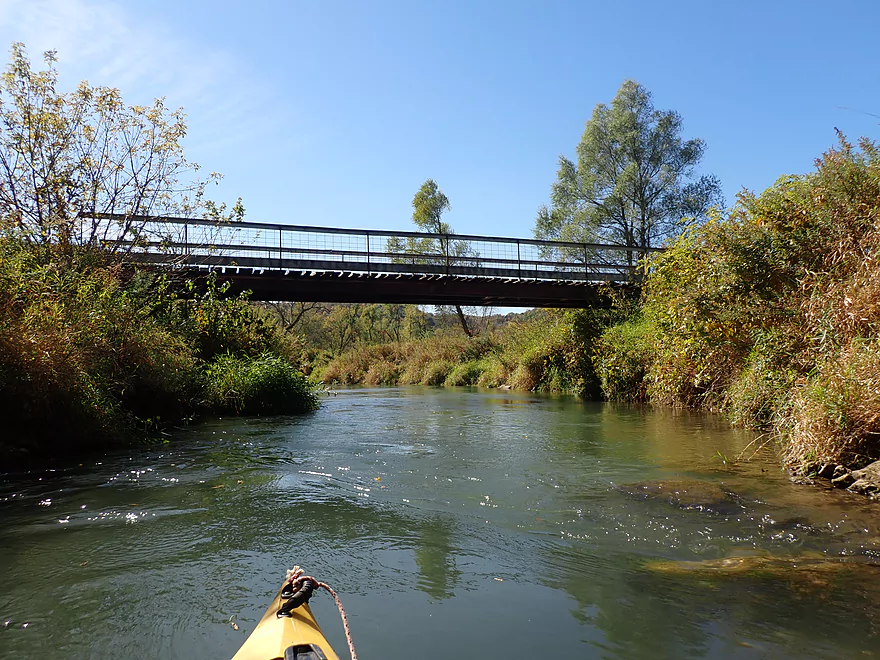
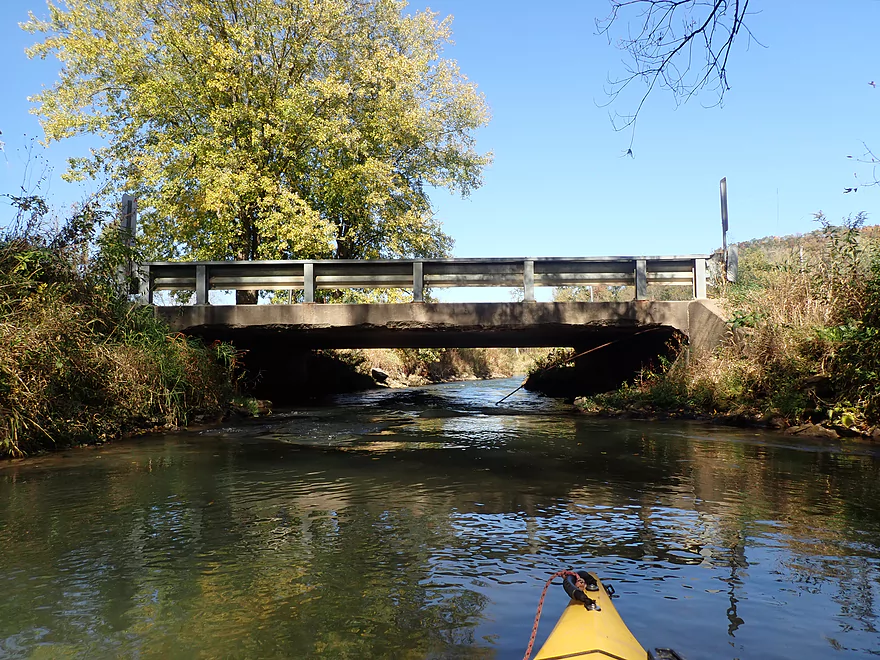
One of many bridge crossings
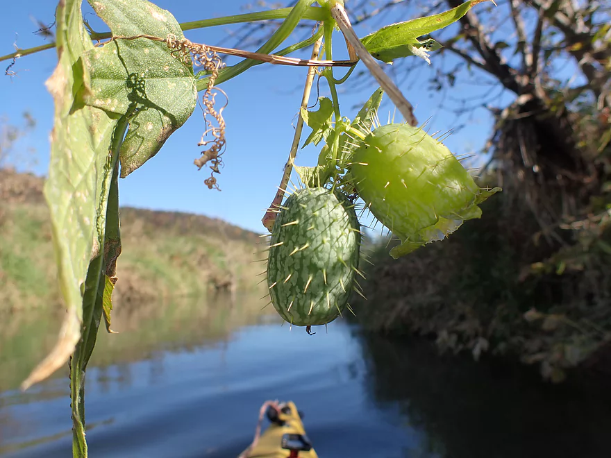
Wild cucumber fruit (one of them has already released its seeds)
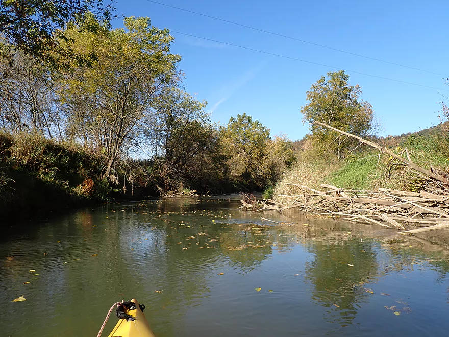
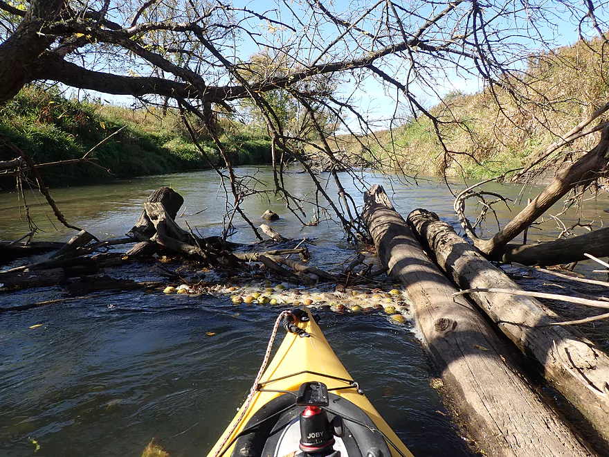
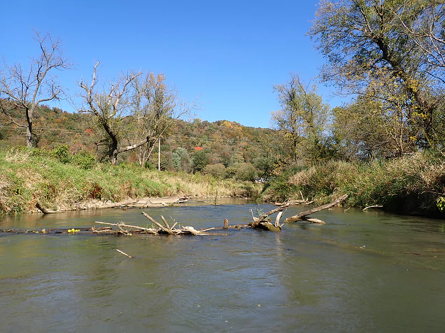
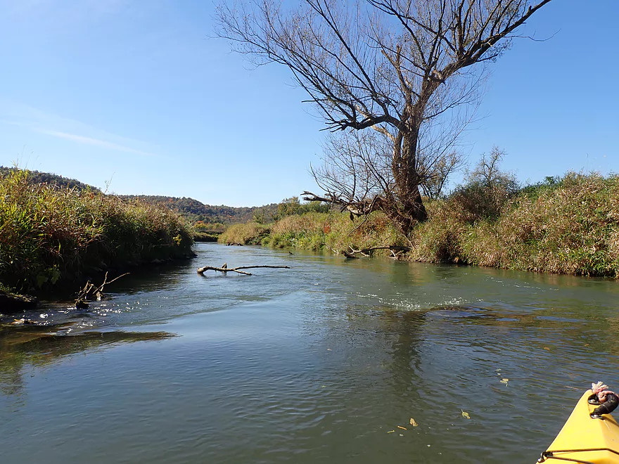
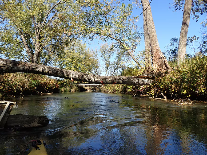
Only major logjam of the trip
Scenic portage
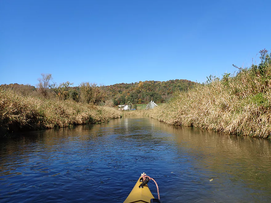
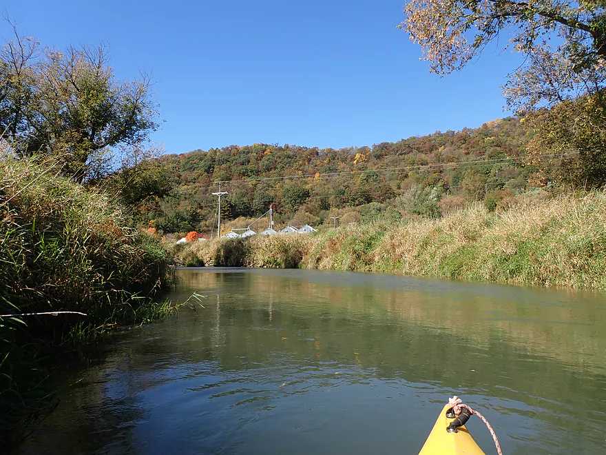
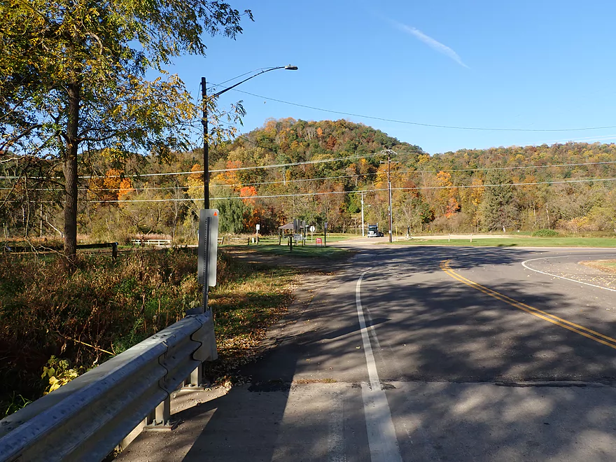
Dodson Hollow Road
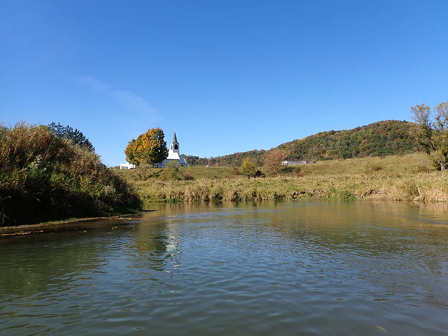
The steeple for the Middle Coon Valley Lutheran Church
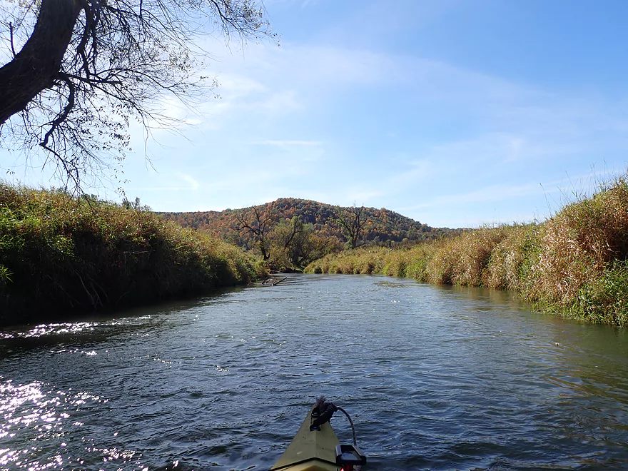
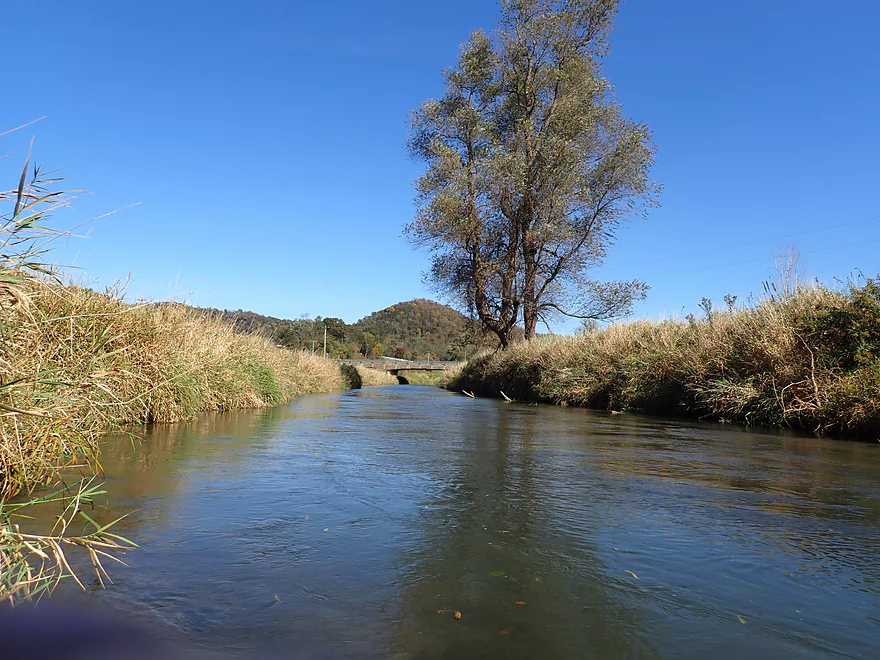
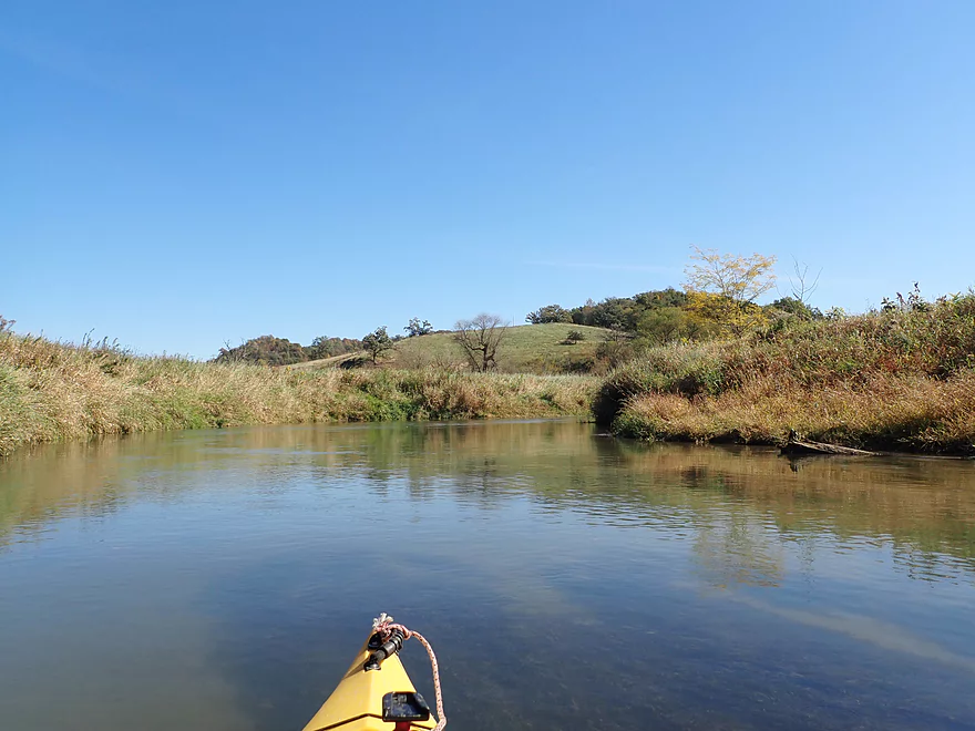
Some pointy hills
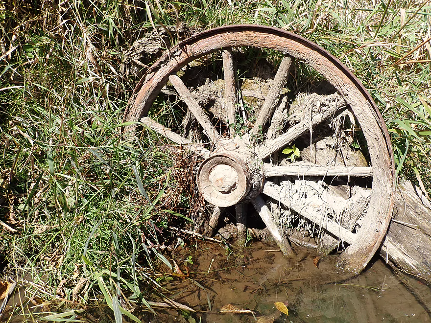
Antique wooden wheel (or could be Amish)
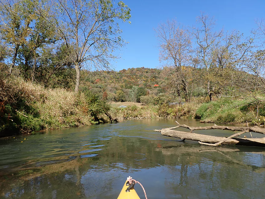
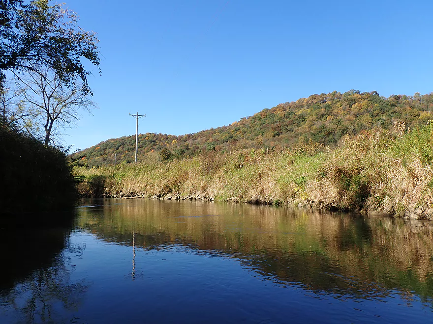
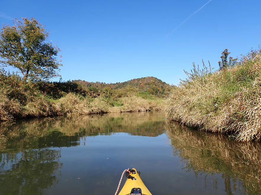
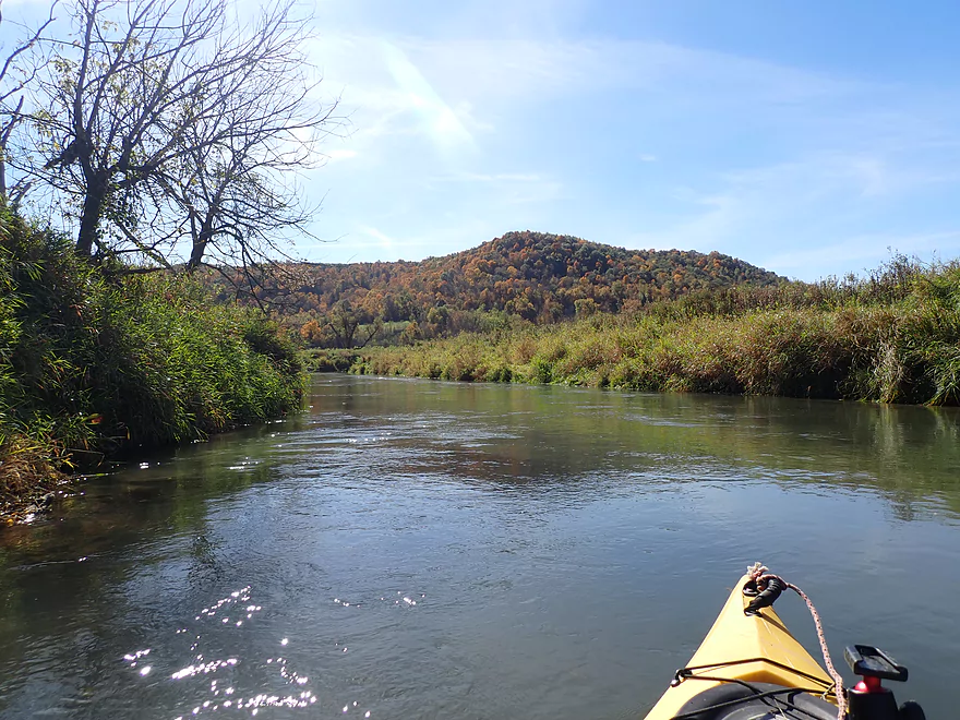
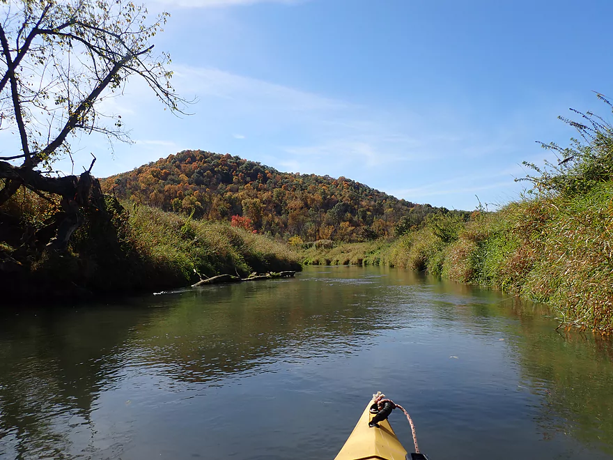
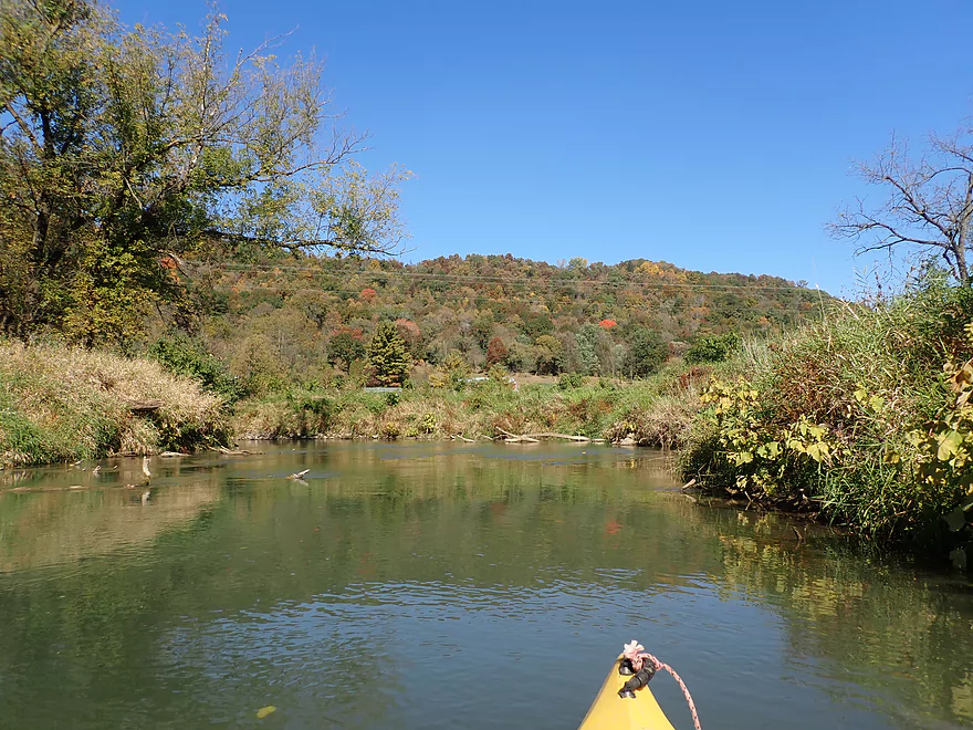
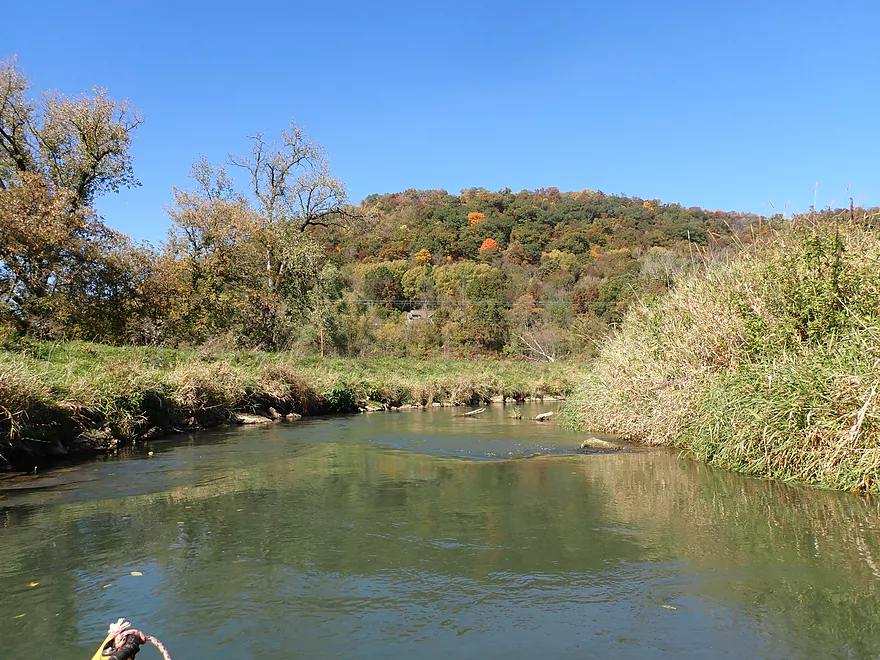
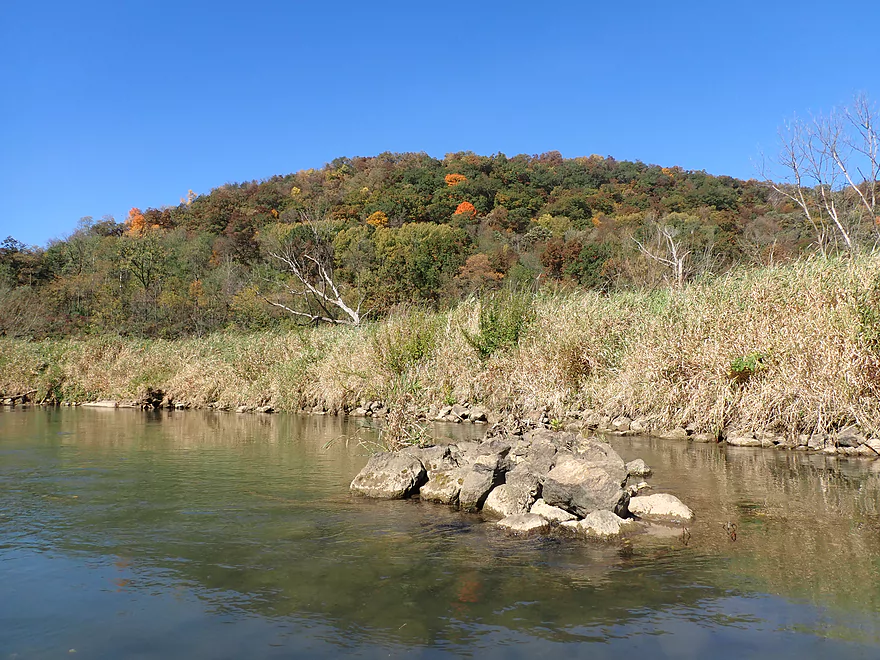
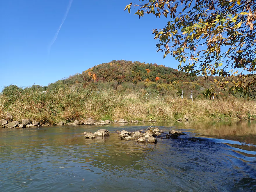
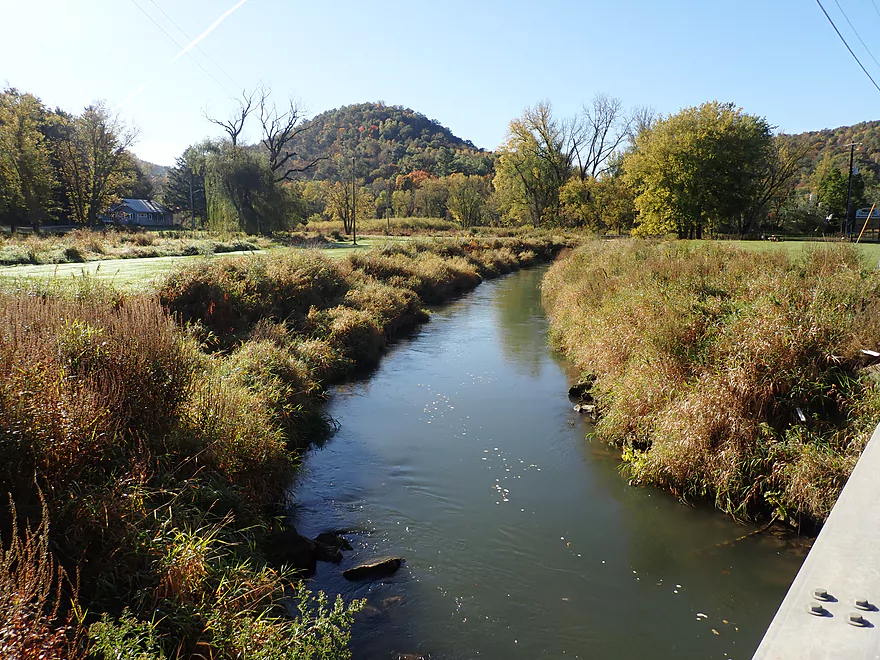
Some of the nicer Driftless Area scenery of the trip
Not quite peak color, but not bad
Part of the Chaseburg Nature Trail (really nice)
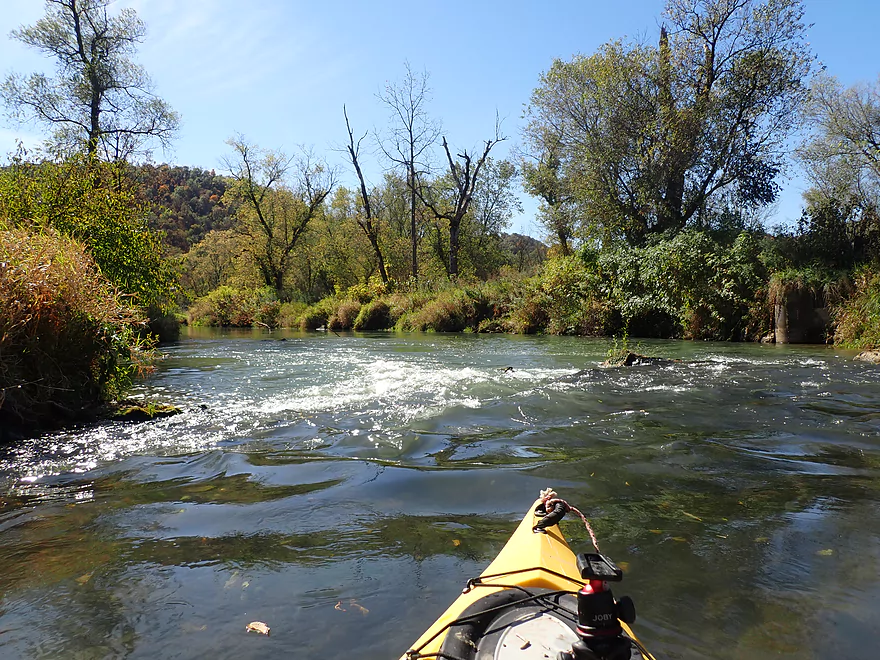
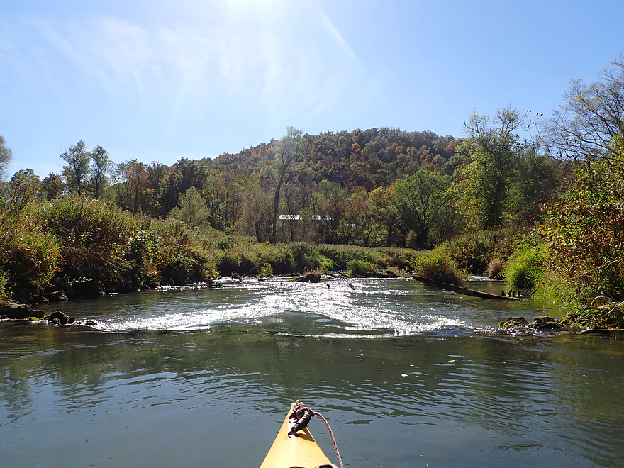
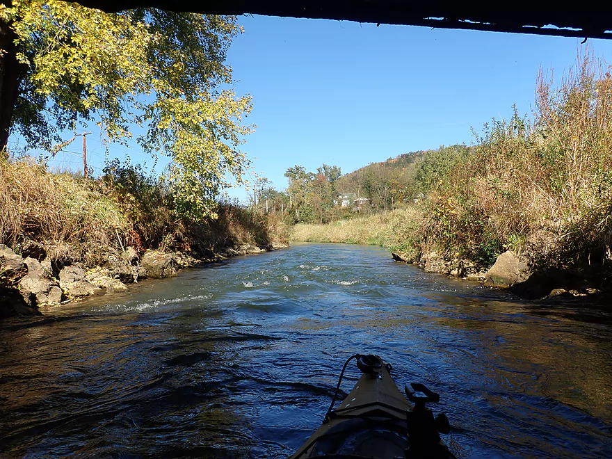
Finally some rapids
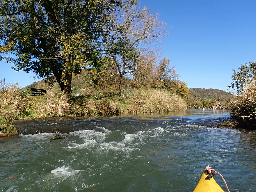
Easy Class 1s
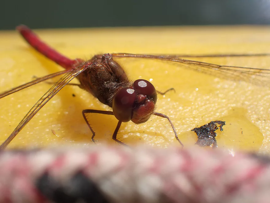
Sympetrium dragonfly
More rapids
Second trip portage…really easy
Squirrel bridge
Human bridge (Swain Street)
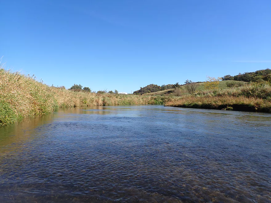
A short stretch before my take-out on Hwy K
View upstream from my take-out
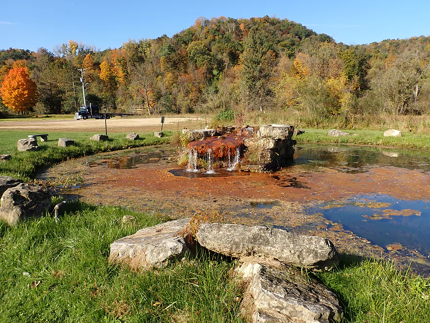
Chaseburg Memorial Park has a cool artesian well
Great bike shuttle back
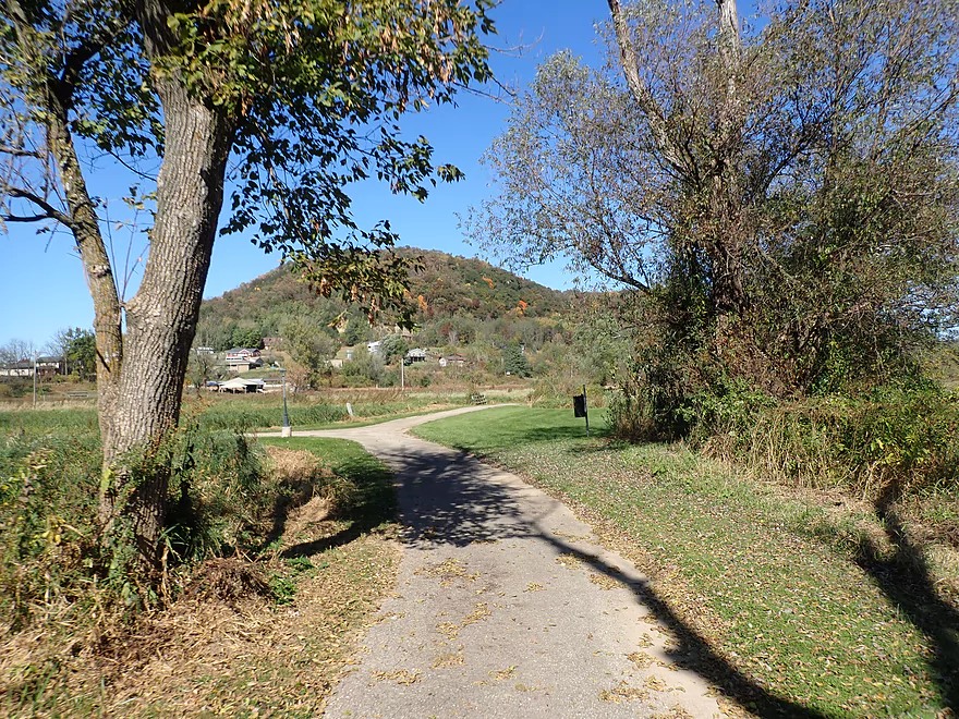
A mile of it was on the Chaseburg Nature Trail
Coon Creek – Chaseburg


Coon Creek is an obscure Mississippi tributary sandwiched between the La Crosse and Bad Axe rivers. It’s underrated for paddling but has gotten more attention in recent years thanks to the annual Coon Creek Canoe Race. This trip is my third time on the creek and this time around my goal was to explore the lower stretch down by Chaseburg.
Between Coon Valley and Chaseburg are a lot of bridges, which means a lot of access options. I opted to start the trip at Koll Road because that was where I ended my last trip. But I actually don’t think it is the best launch option. Knudson Lane or even Memorial Park in Coon Valley would be better put-ins.
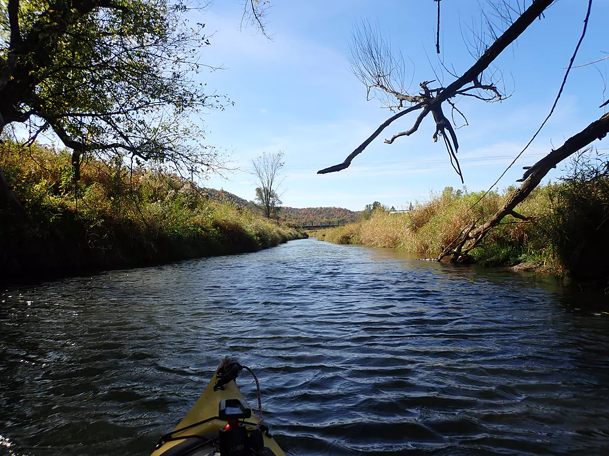
The creek is surprisingly deep and moves at a decent clip, but rapids were mostly absent (a marked contrast to the upper stretches). This leg of the river is also more impacted by agriculture with farm fields and pastures located closer to the banks. Despite all this and some high eroded banks, the creek was nice and it was a pleasant paddle.
There were multiple walnut trees by the water and they would drop their payloads into the creek like grenades. Many walnuts could be seen floating downstream and in spots they clumped together to form “walnut dams”.
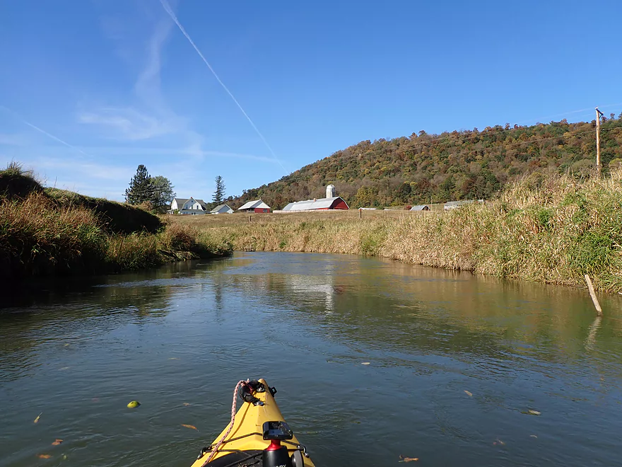
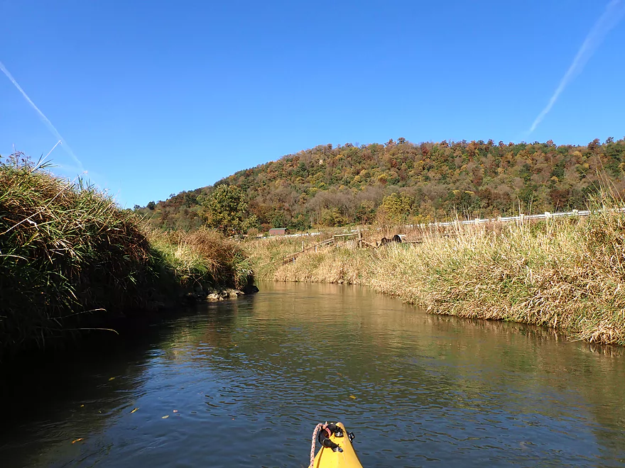
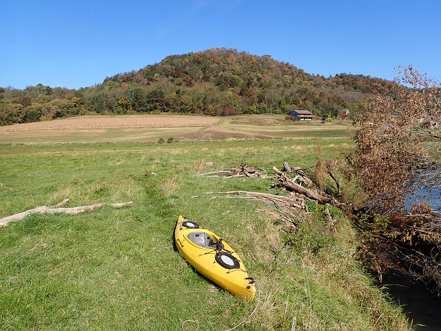
The main highlight of this trip were the Driftless Area bluffs that towered over the creek. Now these weren’t as nice as the upstream bluffs (located closer to Coon Valley), but were still good and provided some decent fall color.
This being a somewhat uncharted stretch of the creek I was a bit worried about logjams, but they proved to be mostly not an issue. I only had to portage twice and one was really easy.
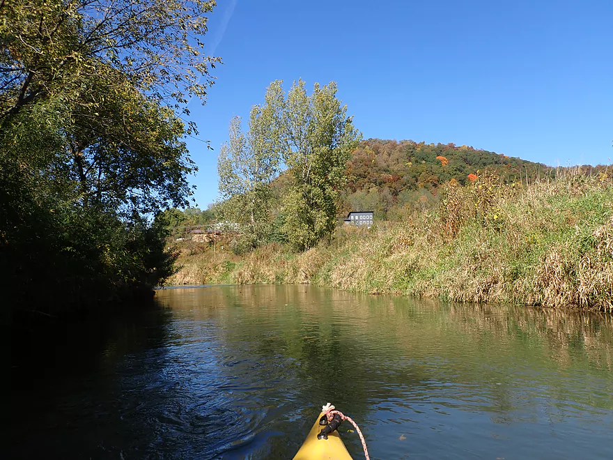
The best part of the trip was located at the end of the trip near Chaseburg. The creek skirts Hwy 162 alongside a tall bluff, but then swings south and wraps around the village. Here the shore was more undeveloped and (mostly) free of agriculture. My suspicion is this area has been worked on for trout habitat.
I finally encountered a few rapids near Chaseburg, but nothing major. I ended the day at Chaseburg Memorial Park which was a really nice area. Its centerpiece is a large artesian well. The bike trip back to the car was a surprise highlight, as I was able to shuttle about a mile along a scenic paved trail that paralleled the creek.
In summary this was a nice trip with some good Driftless Area scenery and fall color, but not an elite trip. In fact I would rate the previous two Coon Valley Creek trips I did as being better. However if you’re not nuts about rapids and don’t mind a few logjams, this might be your trip. What’s interesting is that I had done the Bad Axe River (a neighboring stream) two weeks earlier and in some ways they were similar. The Bad Axe while much smaller and shallower than Coon Creek, is more scenic. If water levels are high, I suggest doing the Bad Axe, but if levels are low, I suggest doing Coon Creek.
Koll Road: This is an ok bridge put-in with good parking. Note the bank is steep and a bit weedy though.
Alternate Put-ins: There are actually many bridges that cross the creek and could serve as an access. See overview map for ideas. For those prefering a long trip, launching from Coon Valley (Memorial Park) would be a nice option and would add 4.5 miles to the trip.
Chaseburg Memorial Park: There is a small park by the Main Street and Mill Street bridges. I took out by Main Street (2nd bridge), but this was weedy and in hindsight I should have taken out at Mill Street which would have been nicer. If you’re in the area make sure to check out the artesian well west of the road…it’s really cool!
Alternate Take-outs: There are many bridges upstream of the park where you could take out, but I think the park is the best option. Downstream from the park you could take out at Hanson Lane, but that would add 2 miles and maybe 4 logjams to a trip.
Bike Shuttle: 3.6 miles with 39′ of ascent. This was a really nice bike shuttle. Starting from Chaseburg you can turn right after the Swain Street and hop onto the Chaseburg Nature Trail. This is a scenic ~1 mile long paved trail that follows the river and is perfect for bikers. After KK you have to get back onto the main road for the remainder of the shuttle on Hwy 162. Note Google Maps does not accurately show both branches of the trail, but if you switch on satellite view you can pretty much figure out where it goes.
Rapids: Unlike upstream legs, this leg of Coon Creek actually doesn’t have that many. Near the end of the trip by Chaseburg the current picks up and there are some Class 1’s, but these are mostly nothing to worry about. In high water they might be tricky though.
Logjams: There were a few downed trees that required some tight maneuvers to get past, but only two logjams required full portages. The first had steep banks but I didn’t feel it was too difficult. The second portage was near the end of the trip in Chaseburg and is a super easy portage. Logjam locations are marked on the trip map.
There is no gauge on Coon creek and the best corollary is the Upper Kickapoo by Ontario, but I’m not sure I trust that. The following are only very rough estimates. Always scout and use your own judgement before paddling a stream.
- < 8.4′: Maybe too shallow.
- 8.5-8.6′: An average flow and good target range. I did the trip at 8.53′.
- 8.7-8.8′: A high depth only suitable for advanced paddlers.
- 8.9-9.1′: Very high depth only suitable for expert paddlers.
- 9.2+: Likely a bank bursting depth. The creek is likely very dangerous at these levels.
Norskedalen Nature & Heritage Center, Inc.: This is a non-profit dedicated to preserving the local environment and cultural heritage. The 43-acre property features rustic Norwegian log cabins. It’s located next to Coon Creek and is very scenic!
Organic Valley: This co-op is one of the largest producers of organic dairy in the US. Their headquarters are located in nearby Cashton. Their “corporate” campus is quite impressive and is worth checking out. A visitor center/outlet store is located at the south end and features many of their cheeses and other dairy products. Much of the campus has an “Epic” vibe with impressive landscaping and buildings. The main visitor center has a farm theme with part of it being a grain bin and the other part shaped like a barn. There is a strong environmental theme on the campus with electric car charging stations, a huge solar farm, several tall windmills, a bike shed for shuttling between buildings, and non-grass prairie plantings.
Viroqua Food Co+op: This is a neat grocery that contains a lot of local and organic products. If the Organic Valley outlet stores are closed, this is a nice alternative as it has much better hours and contains many obscure products sold by Organic Valley. Imagine a Willy Street Co-op…but with more organic and local selections.
Coon Creek Canoe Race and Festival: Enjoy the festivities or take part yourself. Canoes, kayaks, and paddleboards are provided with the registration fee. Races are typically held in August.
Trout fishing: Coon Creek is one of the state’s more famous trout streams.
- Upstream of Rullands Creek Junction: I believe this far upstream Timber Coulee is too congested to run.
- Hwp P (by Rullands Coulee) to Hwy P Fishing Wayside: 1.2 miles. Tricky put-in. Either park on Oakdale Ave and launch in Rullands Coulee Creek and negotiate a serious electric fence. Or park east of the Coon Creek bridge/Hwy P and launch there. The latter lets you float by scenic outcrops. Electric fences and shallow water can be issues.
- Hwy P Wayside to 2nd Hwy P Wayside: 3.8 miles. A future trip.
- Hwy P Wayside to Olstad Road: 1.2 miles. Creek here is small, shallow, open and fast. Maybe one logjam.
- Olstad Road to Hwy P Wayside: 2.6 miles. Interesting prospect I might do in the future. Mostly pasture but perhaps some outcrops. Public fishing access at Olstad.
- Hwy P Wayside to Coon Valley/Veterans Park: 5.3 miles.
- Hwy P Wayside to Hwy P Bridge: 1.4 miles. Scenic stretch with fun rapids. Note this stretch used to have difficult fences, but I believe per a source they are no longer an issue.
- Hwy P Bridge to Hwy 14: 3.9 miles. This stretch used to have very challenging electric fences, but I’m 99.99% sure they were all removed or raised. This is a scenic leg with many rapids and rocks. An annual canoe/kayak race also takes place along this route.
- Coon Valley/Veterans Park to Koll Road: 4.5 miles.
- Coon Valley to Knudson Lane: 3.7 miles. This is a surprisingly scenic stretch with nice Driftless vistas and rapids. Note, this leg does contain some Class 2’s, one logjam, and a few strainers that can be tricky for beginner paddlers.
- Knudson Lane to Koll Road: 0.7 miles. Aside from a sheep farm and a fun two foot ledge, this leg isn’t as scenic/interesting as the preceding one.
- Koll Road to Swain Street: 4.8 miles.
- Koll Road to Hagen Lane: 0.6 miles. A short open stretch with only one minor obstruction.
- Hagen Lane to Dodson Hollow Road: 1.3 miles. Mostly an open section through farm pastures. Solid stretch but not spectacular. One major logjam to portage.
- Dodson Hollow Road to Hwy KK: 2.1 miles. Scenic leg with great vistas of the nearby wooded hills.
- Hwy KK to Swain Street: 0.8 miles. Nice leg that wraps around Chaseburg and parallels a fantastic trail. One logjam, but a super easy portage.
- Swain Street to Hanson Lane: 2.0 miles. This stretch has more deadfall with maybe four major logjams.
- Hanson Lane to Hwy 162: 2.2 miles. An open stretch with maybe one logjam.
- Hwy 162 to Hilltop Road: 3.3 miles. A very eroded stretch with maybe 11 logjams.
- Hilltop Road to Hwy 35: 6.3 miles. Scenic, but I suspect too many jams (~14). A short ways after, you are on the Mississippi.
Detailed Overview
- Upstream of Rullands Creek Junction: I believe this far upstream Timber Coulee is too congested to run.
- Hwp P (by Rullands Coulee) to Hwy P Fishing Wayside: 1.2 miles. Tricky put-in. Either park on Oakdale Ave and launch in Rullands Coulee Creek and negotiate a serious electric fence. Or park east of the Coon Creek bridge/Hwy P and launch there. The latter lets you float by scenic outcrops. Electric fences and shallow water can be issues.
- Hwy P Wayside to 2nd Hwy P Wayside: 3.8 miles. A future trip.
- Hwy P Wayside to Olstad Road: 1.2 miles. Creek here is small, shallow, open and fast. Maybe one logjam.
- Olstad Road to Hwy P Wayside: 2.6 miles. Interesting prospect I might do in the future. Mostly pasture but perhaps some outcrops. Public fishing access at Olstad.
- Hwy P Wayside to Coon Valley/Veterans Park: 5.3 miles.
- Hwy P Wayside to Hwy P Bridge: 1.4 miles. Scenic stretch with fun rapids. Note this stretch used to have difficult fences, but I believe per a source they are no longer an issue.
- Hwy P Bridge to Hwy 14: 3.9 miles. This stretch used to have very challenging electric fences, but I'm 99.99% sure they were all removed or raised. This is a scenic leg with many rapids and rocks. An annual canoe/kayak race also takes place along this route.
- Coon Valley/Veterans Park to Koll Road: 4.5 miles.
- Coon Valley to Knudson Lane: 3.7 miles. This is a surprisingly scenic stretch with nice Driftless vistas and rapids. Note, this leg does contain some Class 2's, one logjam, and a few strainers that can be tricky for beginner paddlers.
- Knudson Lane to Koll Road: 0.7 miles. Aside from a sheep farm and a fun two foot ledge, this leg isn't as scenic/interesting as the preceding one.
- Koll Road to Swain Street: 4.8 miles.
- Koll Road to Hagen Lane: 0.6 miles. A short open stretch with only one minor obstruction.
- Hagen Lane to Dodson Hollow Road: 1.3 miles. Mostly an open section through farm pastures. Solid stretch but not spectacular. One major logjam to portage.
- Dodson Hollow Road to Hwy KK: 2.1 miles. Scenic leg with great vistas of the nearby wooded hills.
- Hwy KK to Swain Street: 0.8 miles. Nice leg that wraps around Chaseburg and parallels a fantastic trail. One logjam, but a super easy portage.
- Swain Street to Hanson Lane: 2.0 miles. This stretch has more deadfall with maybe four major logjams.
- Hanson Lane to Hwy 162: 2.2 miles. An open stretch with maybe one logjam.
- Hwy 162 to Hilltop Road: 3.3 miles. A very eroded stretch with maybe 11 logjams.
- Hilltop Road to Hwy 35: 6.3 miles. Scenic, but I suspect too many jams (~14). A short ways after, you are on the Mississippi.
Trip Map
Overview Map
Video
Photos Size: