
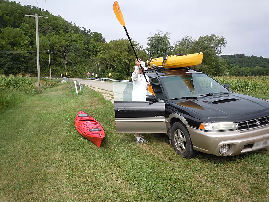
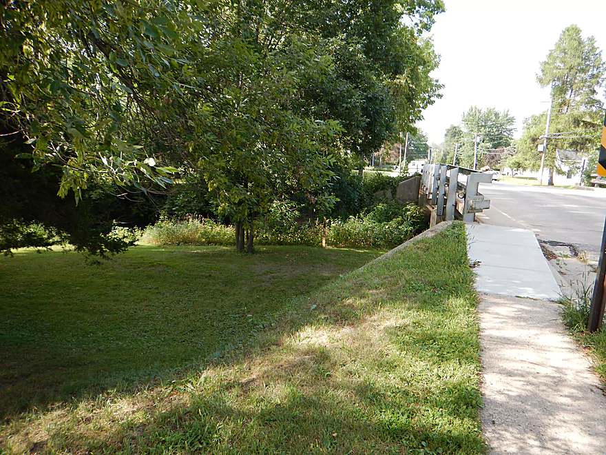
Olson Road–good parking but annoying guard rails
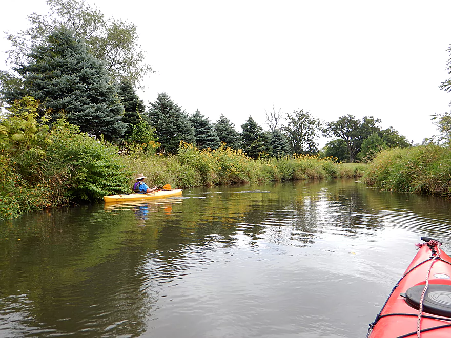
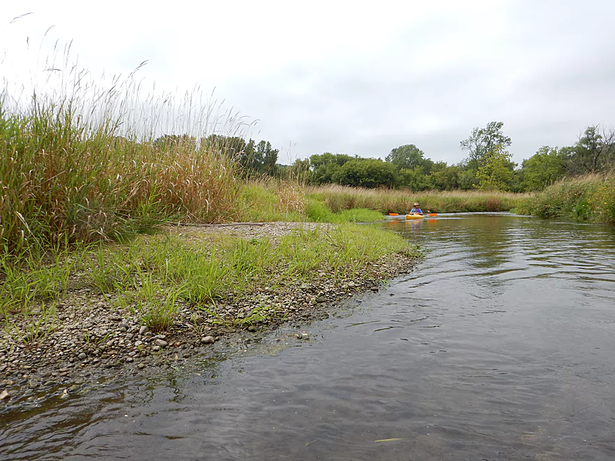
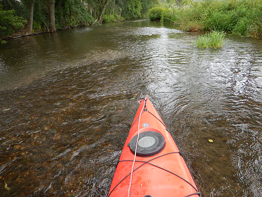
Nice shallow area for launching
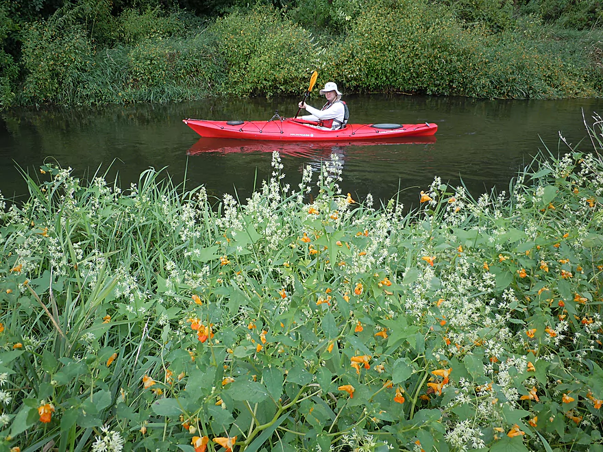
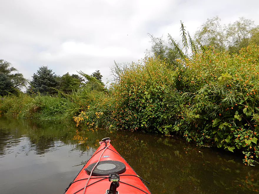
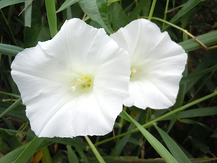
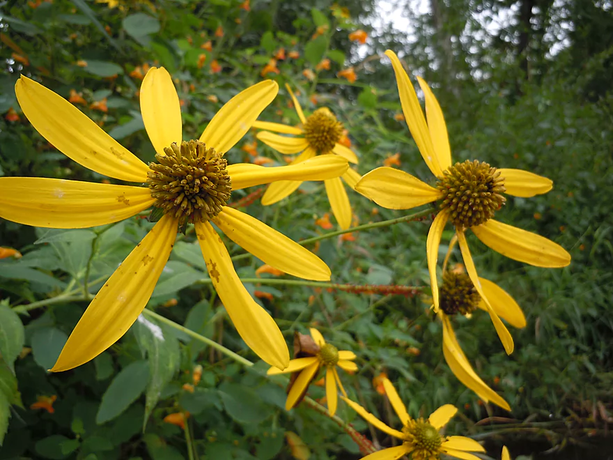
Terrific wildflowers on this trip
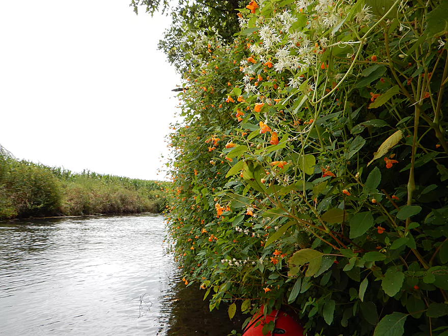
Sometimes forming walls of color
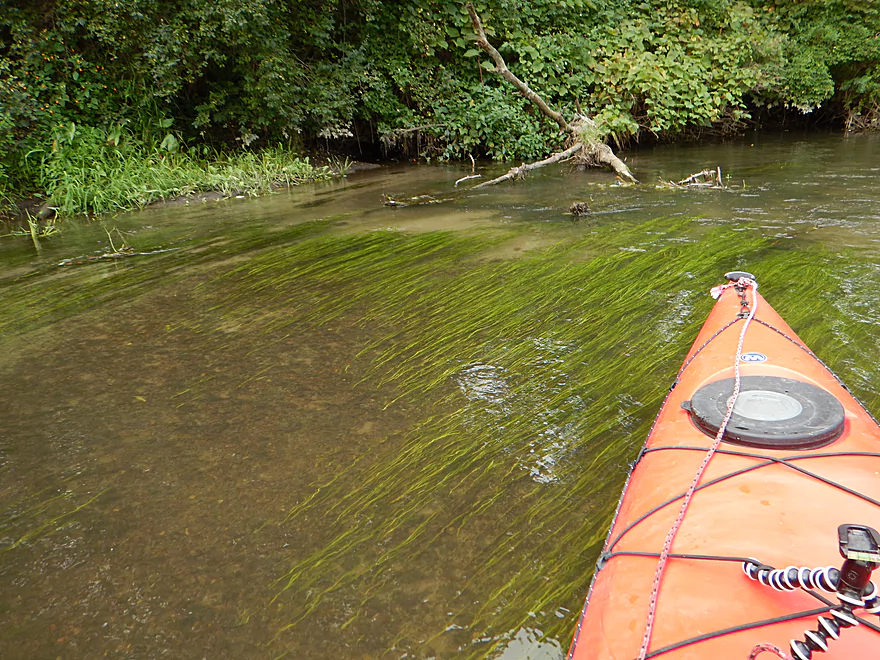
Flowing pondweed in clear water
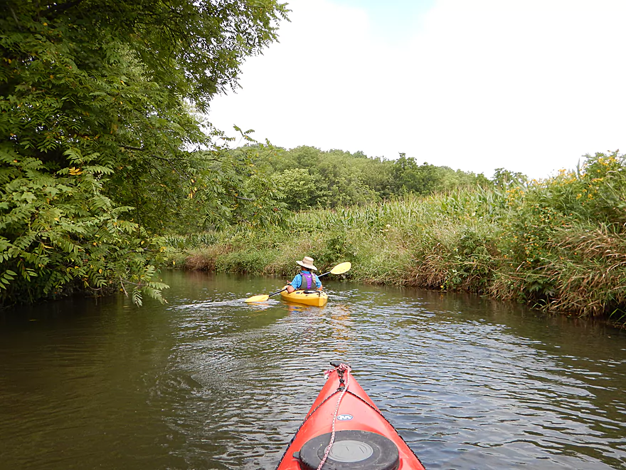
Trip starts by a cornfield
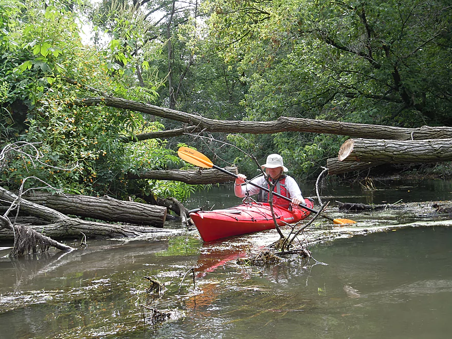
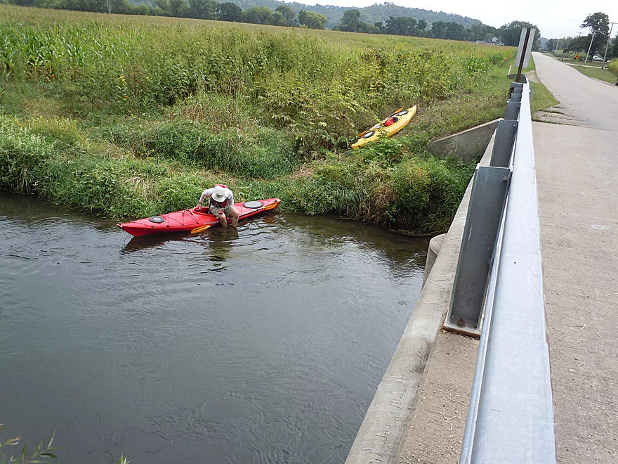
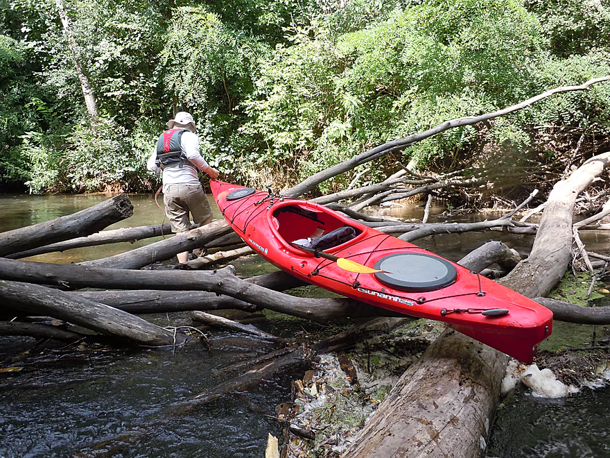
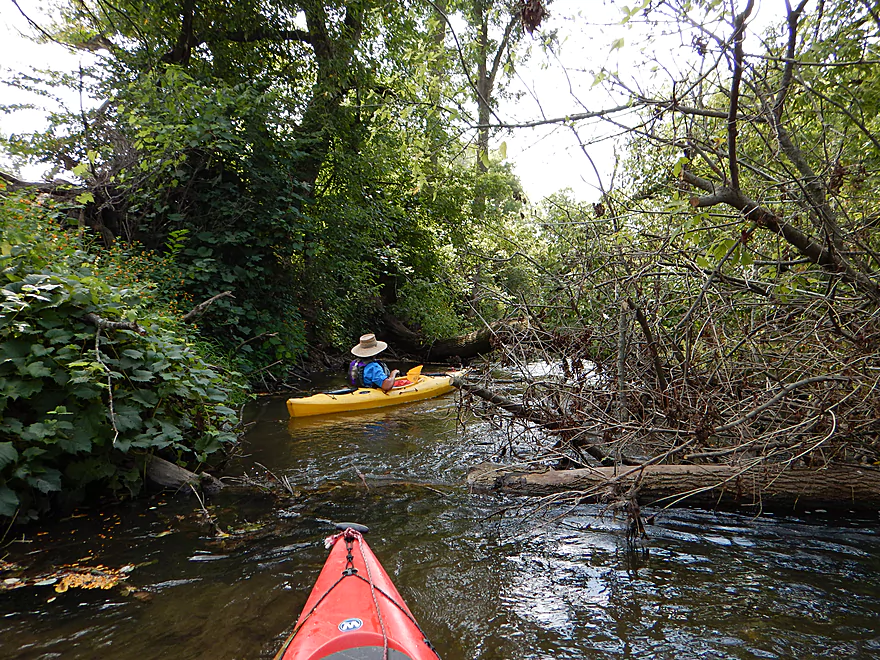
A hop-over early on–easy to deal with
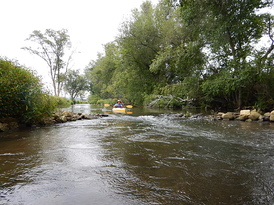
Zippy current
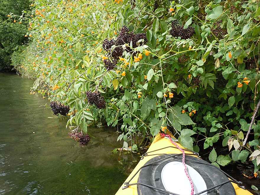
Elderberries–edible and almost ripe
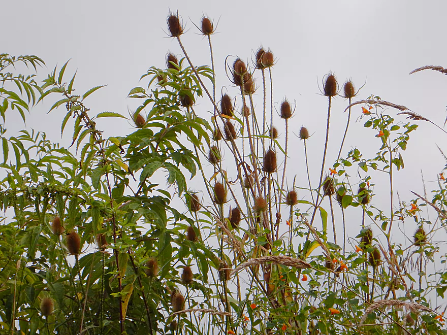
Tall teasels
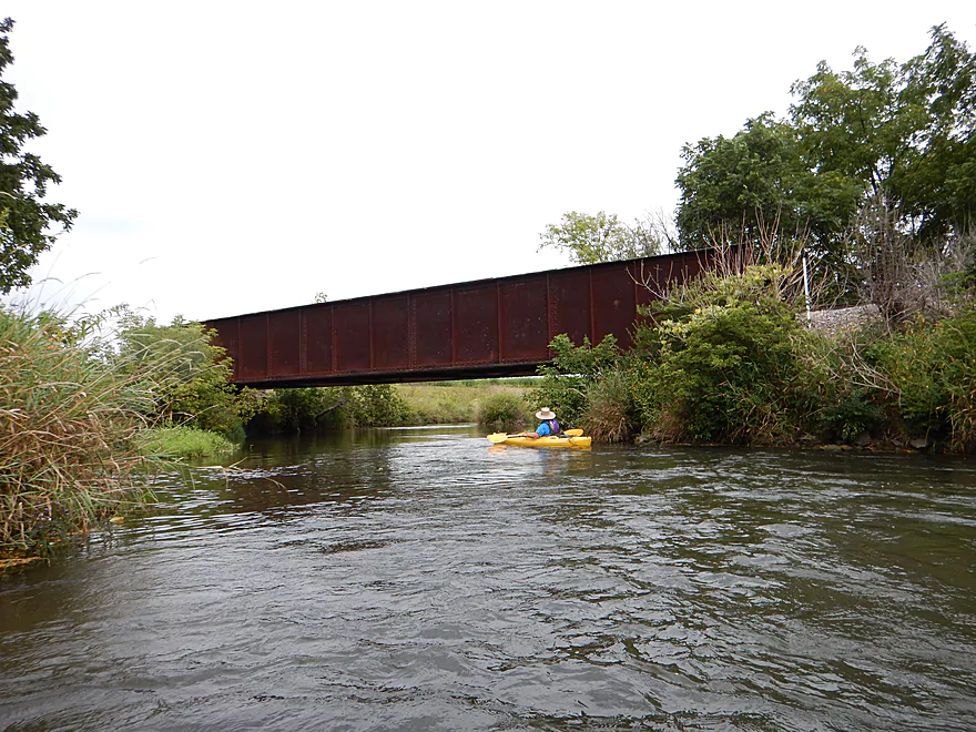
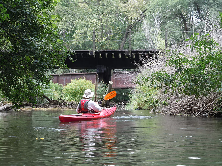
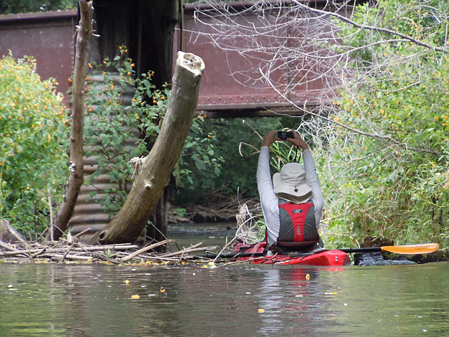
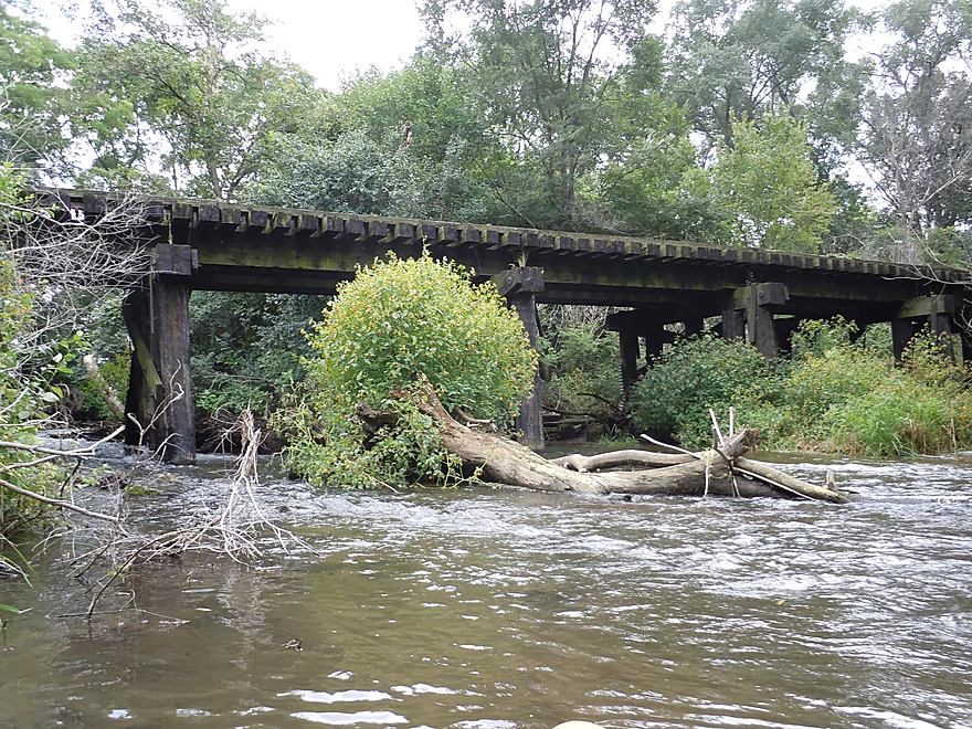
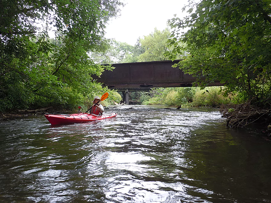
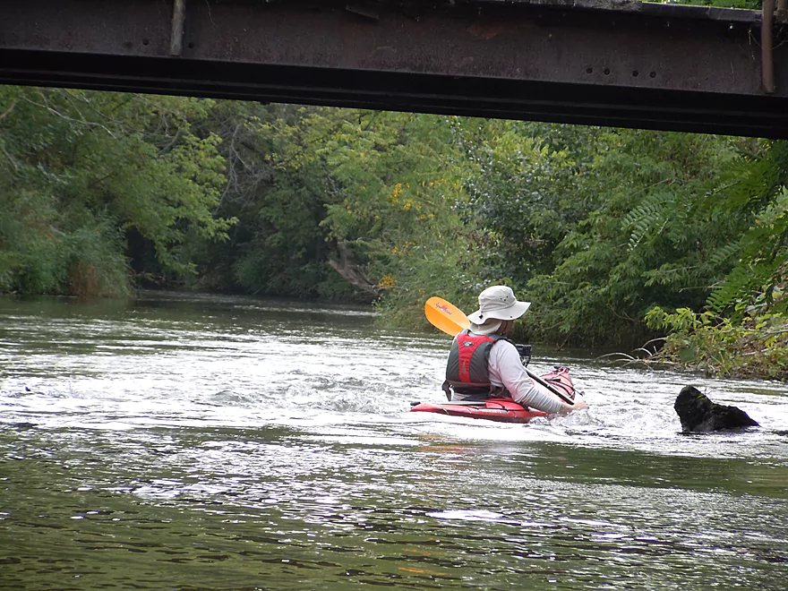
First railroad bridge
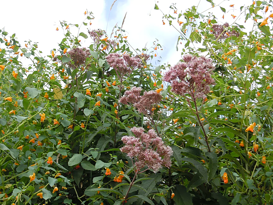
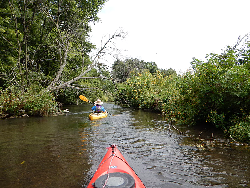
Joe-pye and jewelweed (seeds explode when touched)
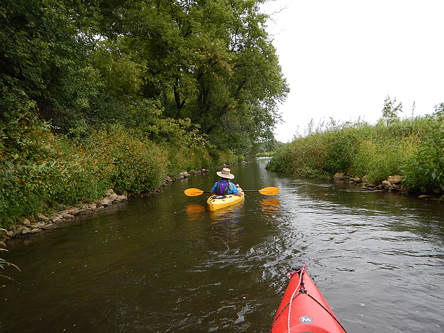
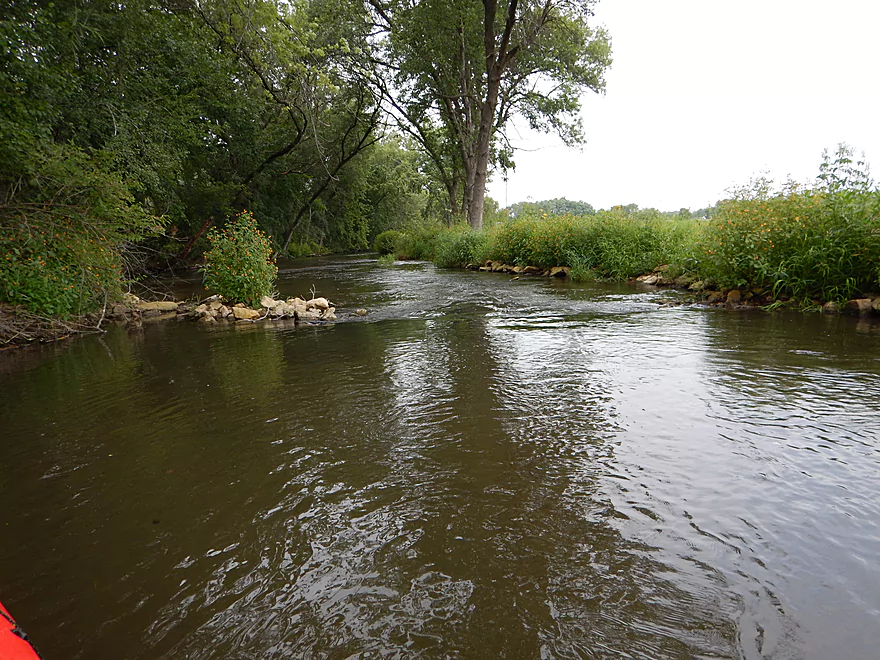
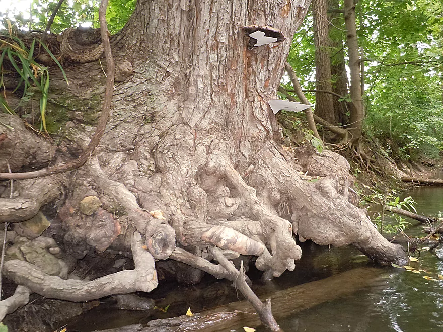
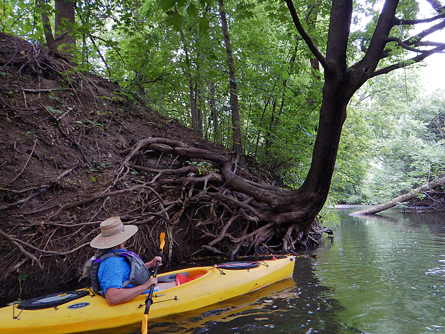
Attractive creek banks
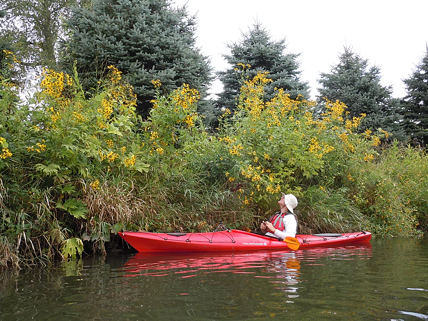
Cut-leaf coneflower
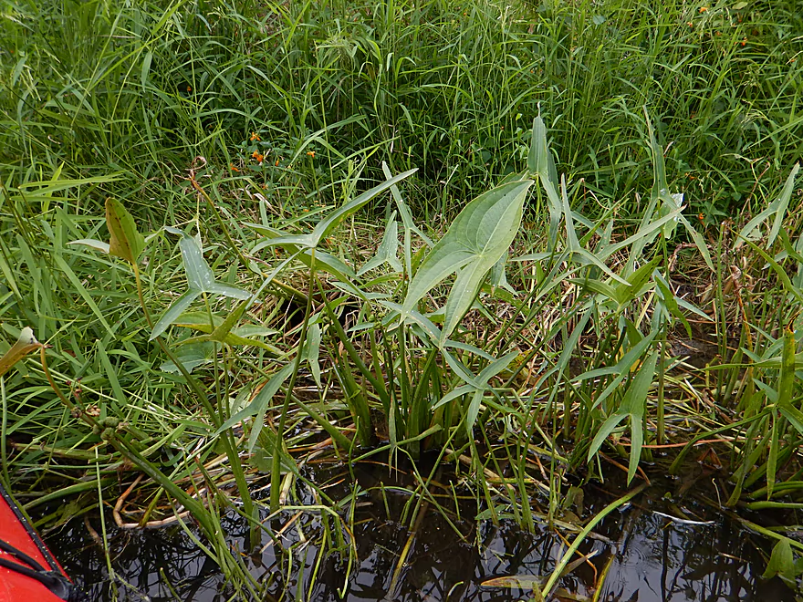
Arrowhead
More jewelweed–nonstop most of the trip
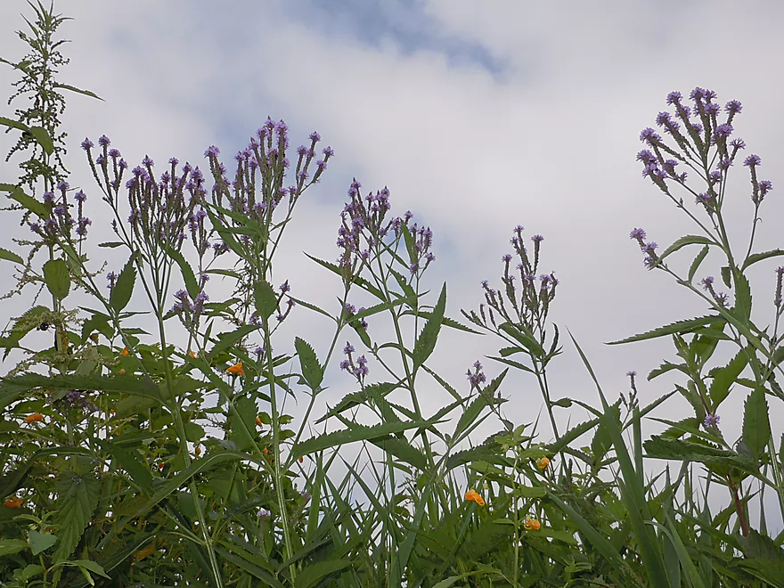
Blue vervain
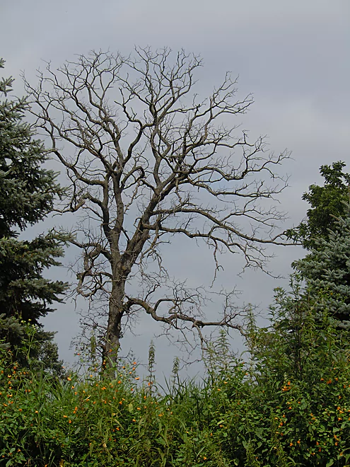
Blood vessel-like tree branches
Hills start to appear in the background
A mini-island
Bindweed
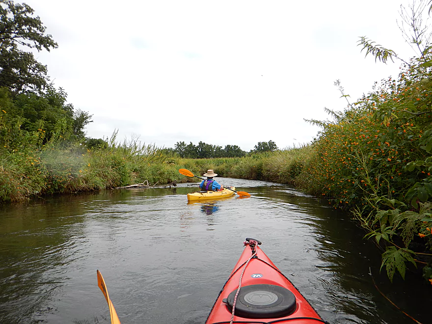
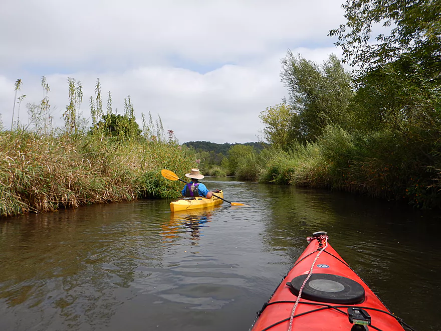
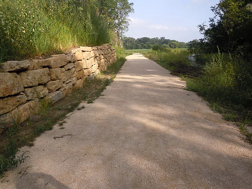
Scenic vistas
The biggest ledge on the trip
Easily class 1 though
Pretty safe
Mini-ledge after the big ledge
A very nice ‘prairie-paddle’

Lots more riffles
Artificial bank fill by the Wolf Farm
More brisk current
Several nice gravel bars on the creek
Nice clear water (reflections are covering it up though)
Creek winds back to the railroad
The old dam
Creek was recently moved away from railroad bed to a more natural setting
Lot of artificial but fun pool and riffle combos
Giant flower windmills (or coneflowers)
One of many wing-dam mini-ledges
Attractive mud-free banks

Badminton birdies! (or sneezeweed)
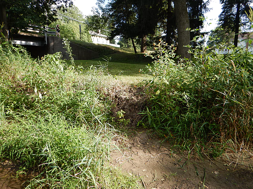
Wolf Run Trail is hidden just to the right
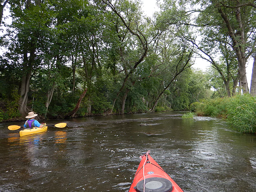
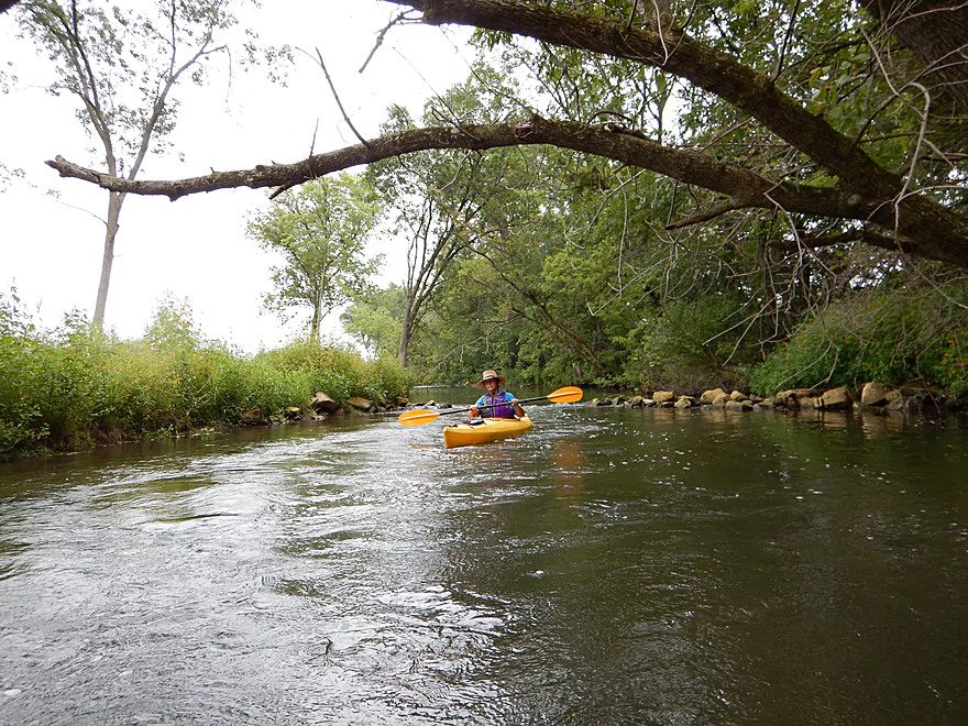
Nice tree canopy
At times great water clarity with nice gravel substrate
Another fun ledge
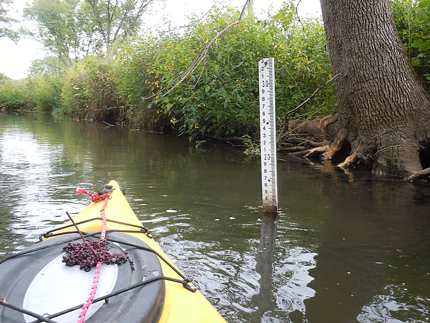
0.12 Meters?…Black Earth gauge is better
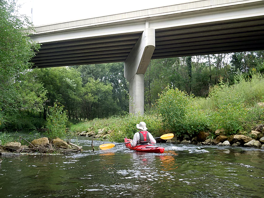
Hwy 14 bridge
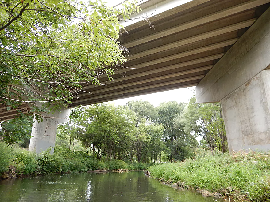
Very tall for a creek bridge
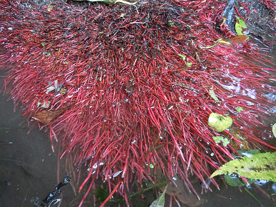
Colorful willow roots
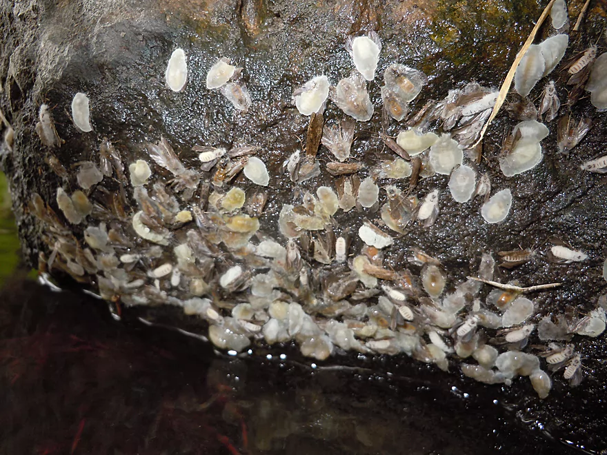
Some kind of insect cases
Entering Mazo
Trailhead and bridge for the Wolf Run Trail
Chute is clear on right, but bumpy
The double railroad bridge with a tough jam
I am majorly stuck
Reverse view of the jam with chute on left
Second railroad bridge is rocky but easy
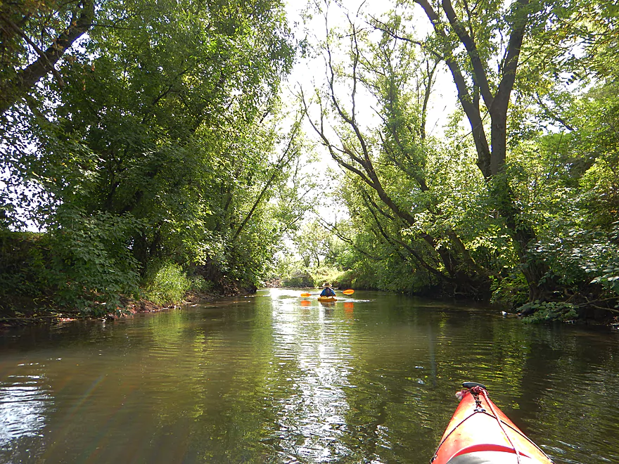
Wonderful forest canopy
Scenic arches

Like a landscape painting
A zipline chair across the river
Another nice gravel bar
Small pier for a very narrow walking bridge (long ago washed out)
A ginger root tree! (actually a beat-up silver maple)
Art nouveau–or future log jam?
Bridge St.–go river right or picture left (got stuck here)
Clear water (no polarized lens = bad reflections though)
Big jam…only portage of the trip
Shallow water in center allows a ‘step over-and-drag’ portage
Rope is handy
Great view of the substrate
Some creek-side houses, but not bad
Many fun little riffles
A serious jam?
But with an escape path to the right
Getting above the water line for this hop-over
This hop-over is easier
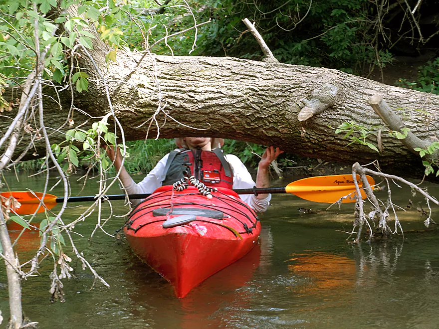
A serious duck-under
Creek gets bigger but is still nice
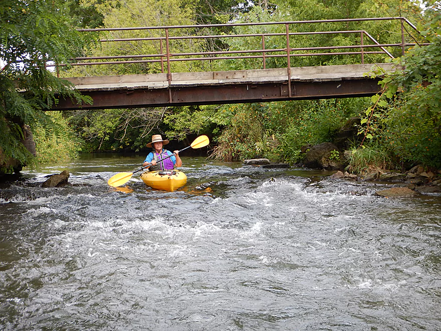
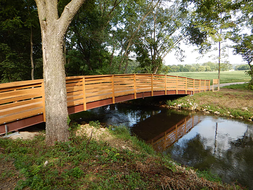
Walking Iron Park bridge and rapids
This one’s a lot of fun
Take-out is river right (after the bridge)
Looking downstream toward a future trip
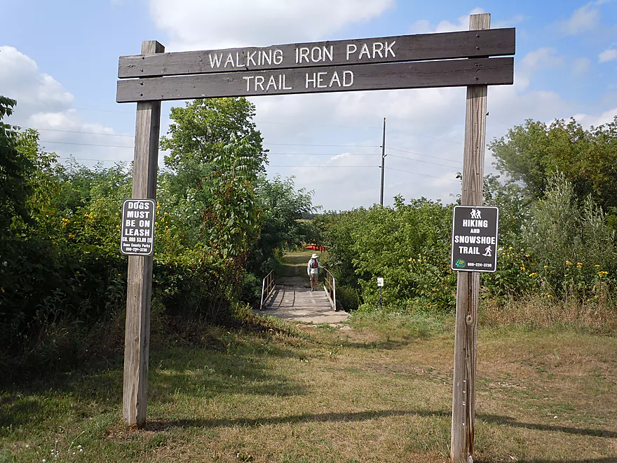
Nice park for paddle access
Scouting the public access at N. State Street
Very good with sandy launch area
At the Wolf Run trailhead (good alt paddle access)
Good hiking and biking trail (creek is to the right)
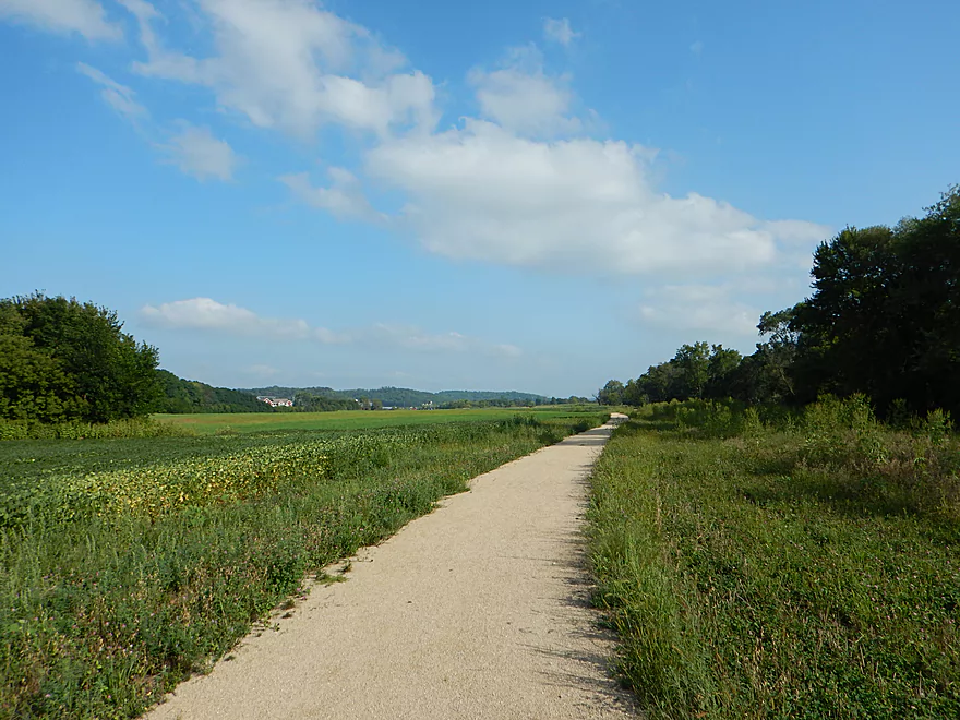
Wonderful scenic view of the prairie and hills
Black Earth Creek – Mazomanie

Connecting the city of Middleton to the Wisconsin River, Black Earth Creek is an obscure paddling prospect–more known for its nationally famous trout population. Nevertheless, this creek is a wonderful little gem with a great combination of prairie paddling and forest paddling that should not be overlooked by south-central Wisconsinites.
Previously in May, I had paddled and reviewed a section of Black Earth Creek from the city of Black Earth to Olson Road (mile upstream of Mazomanie). This was a positive experience, albeit with some challenging obstacles. I was recently notified (thanks John Wick!) that some locals were interested in forming FOLBEC (Friends of Lower Black Earth Creek), whose goal is to promote and improve the creek, including navigability for paddlers. Some cleanup work of log jams has already taken place and key sections are scheduled to be cleared in the future, including the two log jams that I had faced by Black Earth and the jams after Walking Iron Park. One of the notable contributions of the group so far was to very recently raise a super low farm fence (actually two) that was by far the biggest impediment for paddling from Black Earth to Mazo (see previous review).
One of the more interesting tidbits I recently heard was that several individuals had been able to paddle all the way through Mazomanie. This had me shocked! For many years, I’ve wanted to do this section based on what I saw from the roads and parks around the city, but was always leery of log jams. So with this news, I decided to take a chance and finally do the trip.
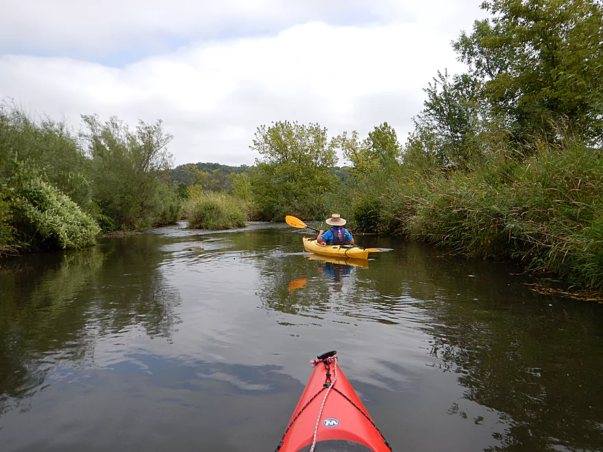
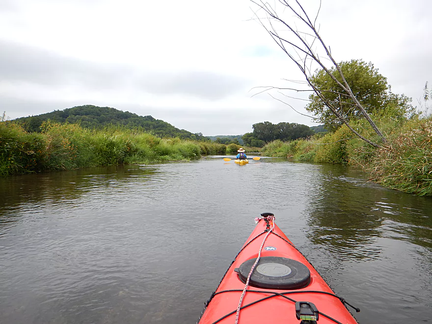
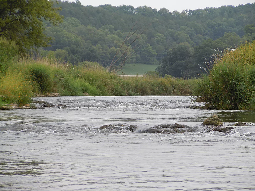
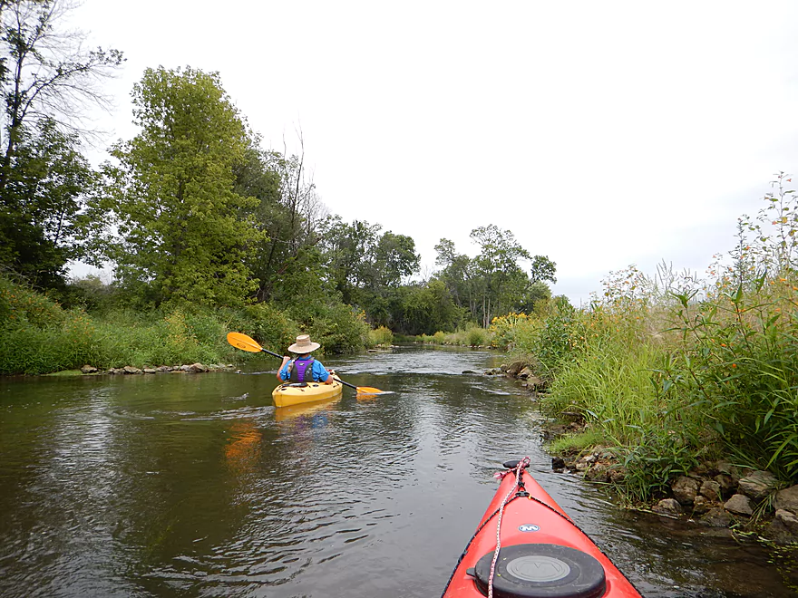
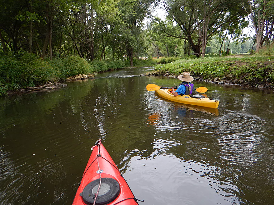
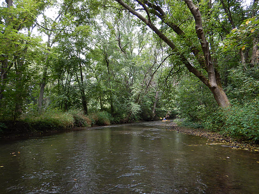
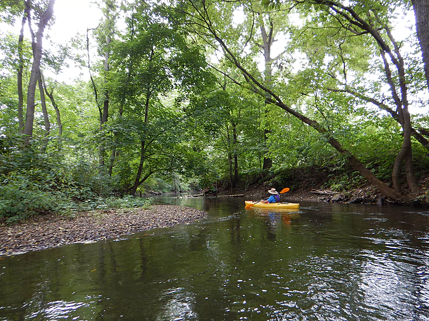
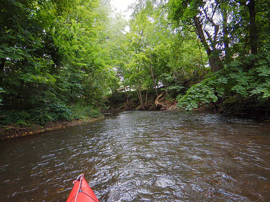
To start our trip, we put in at Olson Road between Black Earth and Mazomanie. This is where I took out from my last trip and is a good access point for the creek. Not exactly a luxury put-in, but for bridge access it is pretty good, with a convenient mow job that facilitates parking and access to the water. The water is also shallow at the put-in ledge, which makes it easy to just wade in and sit into your kayak.
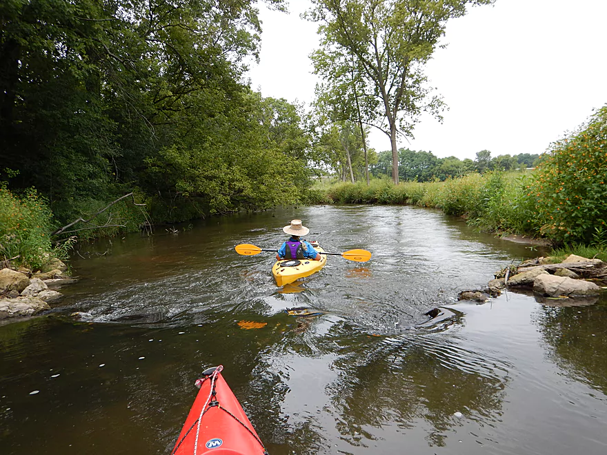
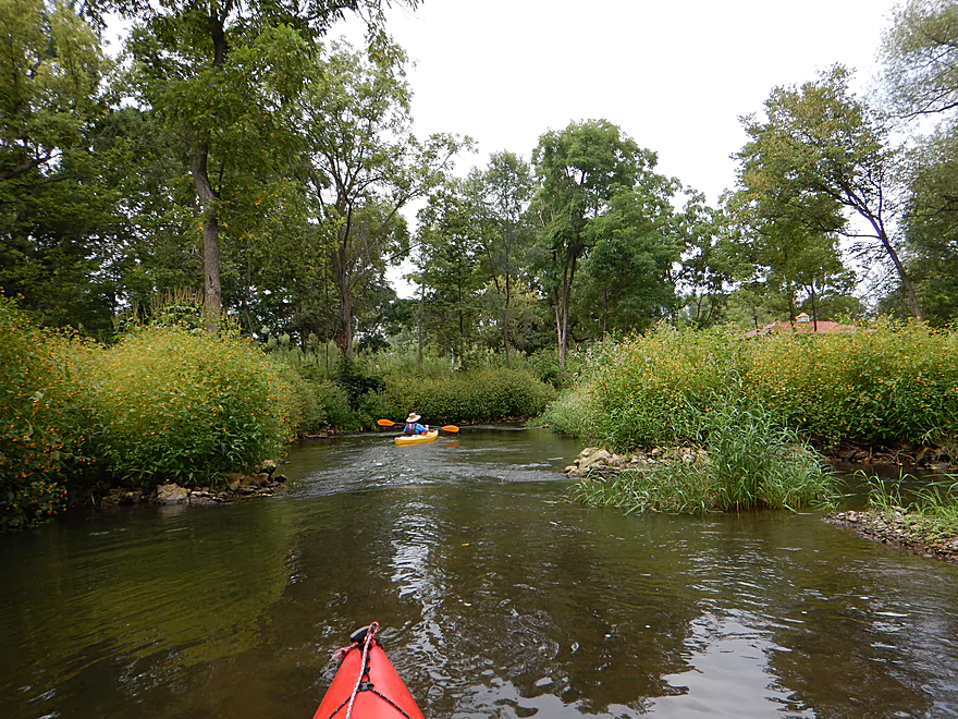
The first half mile or so is not why I gave this review five stars. It’s mostly grassy banks with a few trees and cornfields flanking the creek. During my spring trip, I had a wonderful view of the hills that form the creek valley, but I could rarely see them on this section because of the tall grass. On the flip side, the fall wildflowers were in full bloom, creating walls of yellow, orange, purple and white–which made for a terrific experience. Even early European settlers commented on the beautiful fields of colorful flowers in the area. The wildlife, however, was somewhat lacking on this trip…but this was probably just bad timing, as I saw plenty on my first trip.
Back 15,000 years….the creek looked a lot different and. in fact. actually was a huge glacial river. From the ice sheets to the east, Glacial Lake Middleton was formed and it (and other tributaries) contributed to a massive river that filled the Black Earth Creek Valley. The river eventually receded, leaving the creek, but also a lot of sand and gravel that has contributed to its character and clean consistency to this day. Here is a picture of what the old glacial river might have looked like.
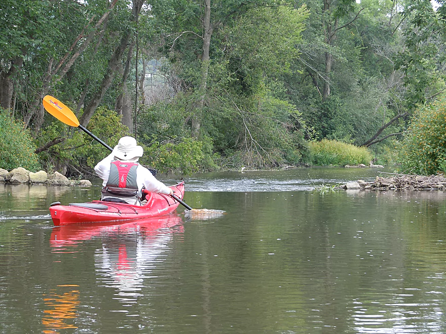
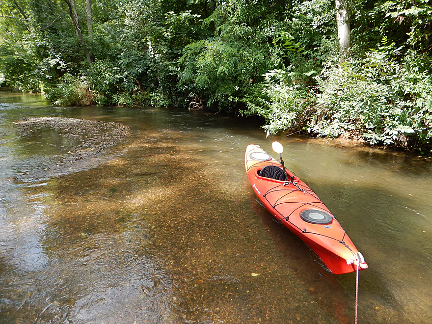
The current is respectable without being too pushy and the water quality alternated between being opaque and clear. Black Earth Creek is special in part because of its water clarity but unfortunately this trip didn’t show the creek’s best side. I suspect it was because of the rain the day before which usually dirties watersheds (I suspect municipal storm drains are a big factor as the creek has three in Cross Plains, Black Earth and Mazo…and maybe parts of Middleton). The section by Black Earth was most certainly clearer, but I don’t want to overstate the issue as the Mazo segment still had some pretty clear sections and suspect usually they are in better shape.
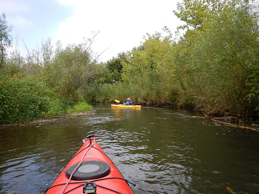
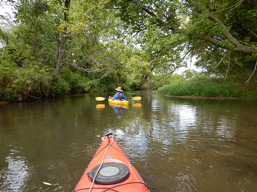
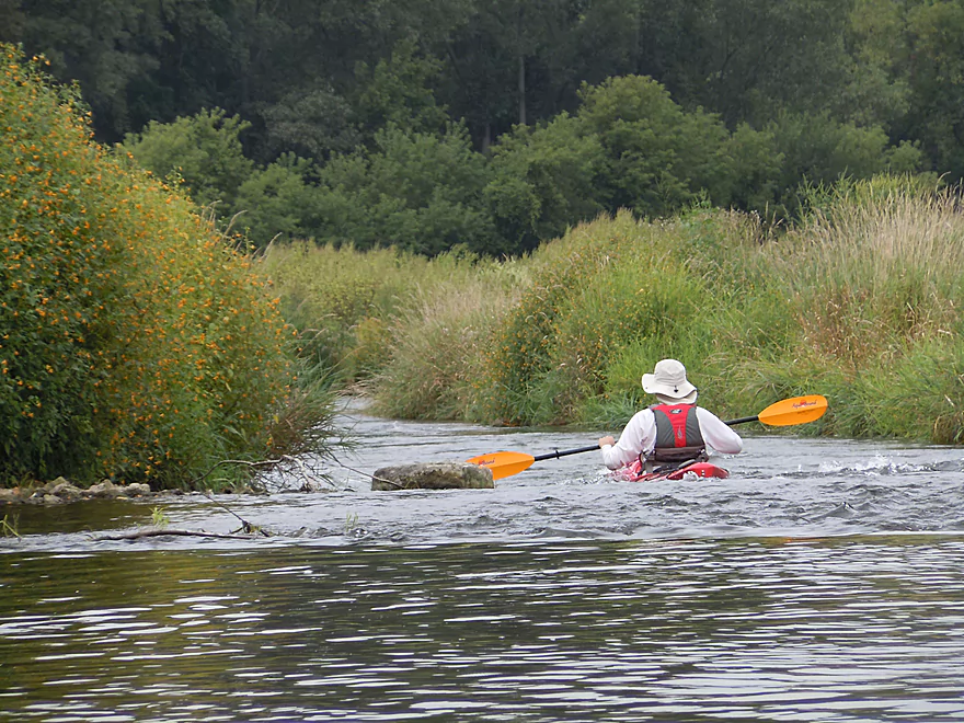
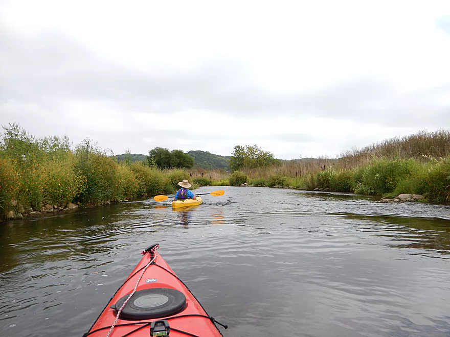
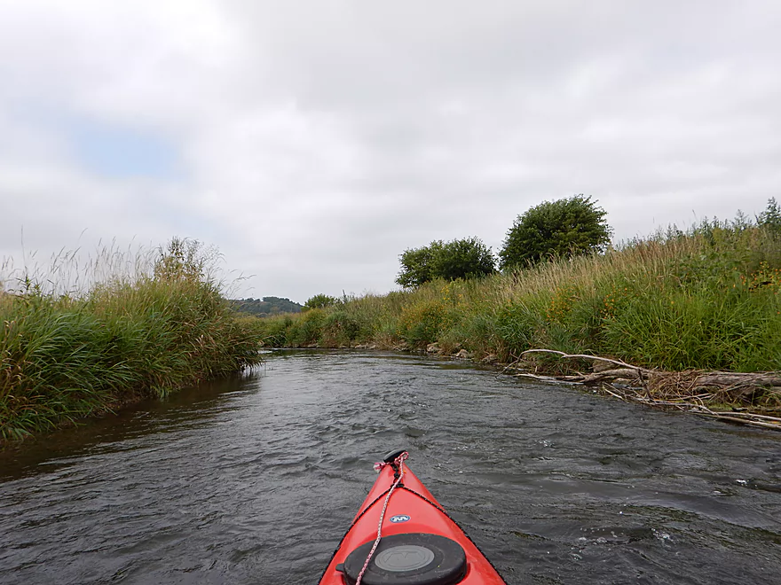
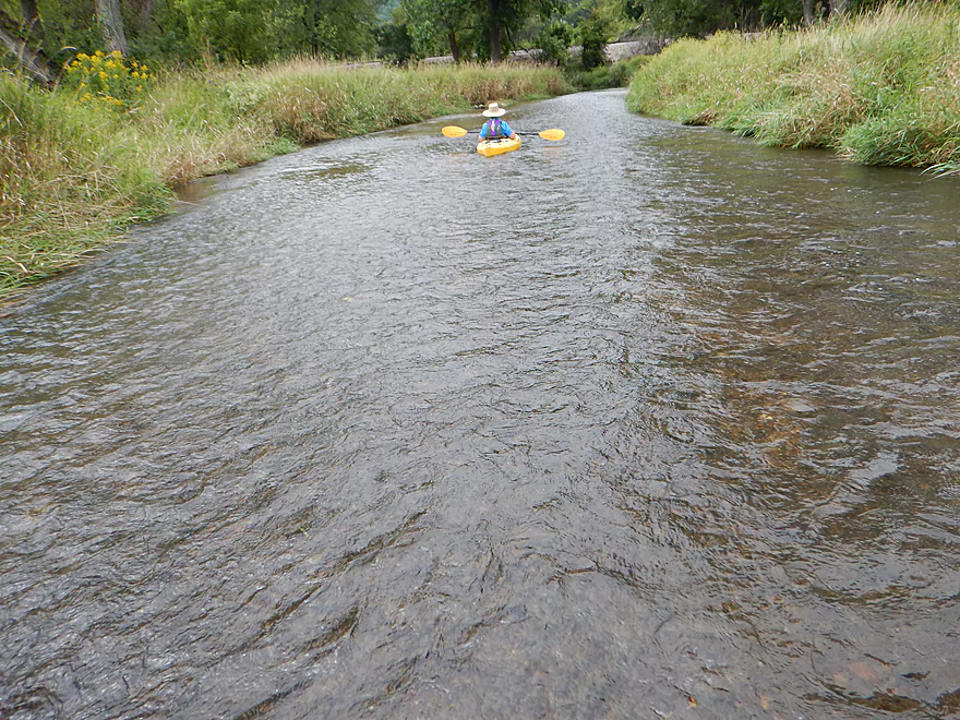
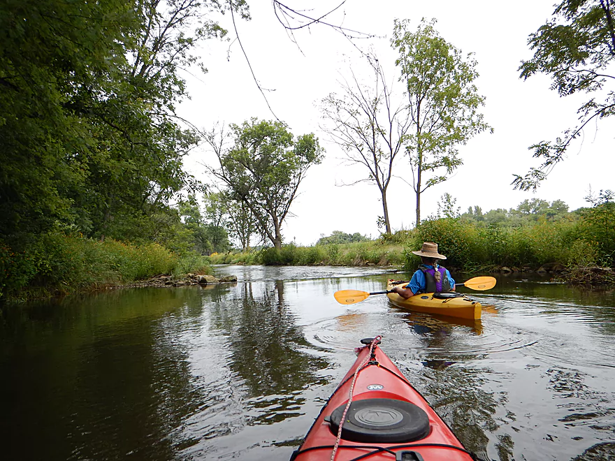
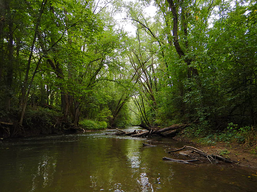
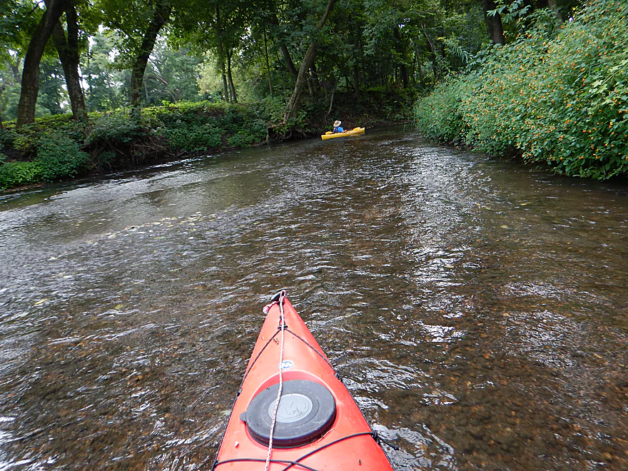
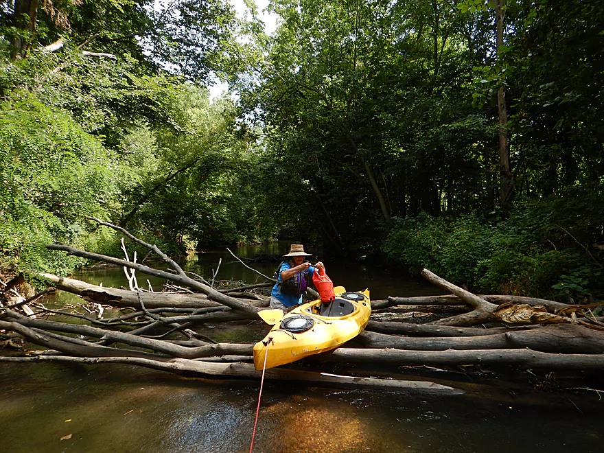
Prior to the first railroad bridge, the trip is ho-hum, with the only noteworthy item being a hop-over to contend with. Pretty easy to do in a kayak, but perhaps a problem for others. I don’t think this creek is suitable for boats over 13′ though. After the first railroad bridge, the creek really opens up and takes on a nice character. Not a lot of trees, but the grasses, wildflowers and prairie plants are very striking, and there are terrific views of the surrounding hills.
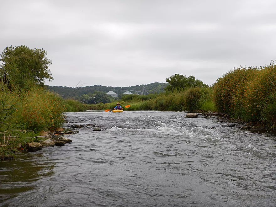
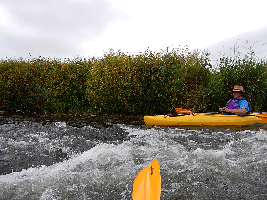
The creek current (never lazy) picks up and you’ll get to go over several ledges which are a lot of fun and all probably just class 1. The rapids I ran after Black Earth between the railroad bridges was most certainly more severe. Some of these ledges are a bit bumpy but all in all I can’t complain and really liked our flow rate of 47 CFS. Too much would cover up the character of the creek and too little could mean walking a kayak (which I never had to do). Unscientifically, I would recommend 40-60 CFS as a good target range. The water depth was actually surprisingly deep for much of the creek, with just a few shallow sections and bumps on the ledges. Most of the ledges are artificially created to force more oxygen into the creek for trout.
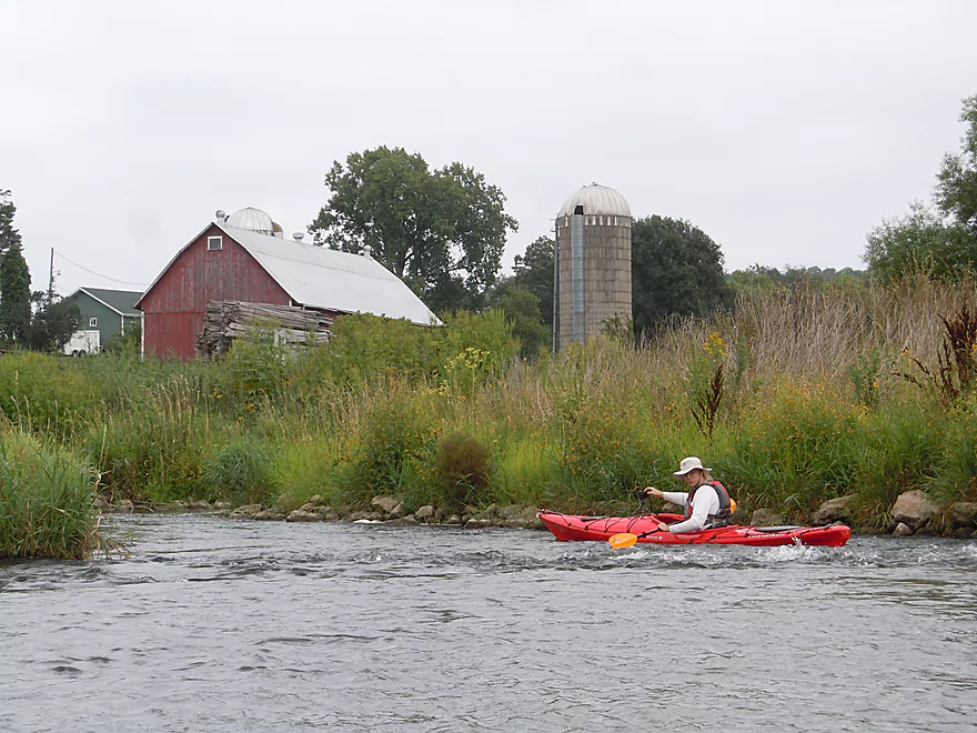
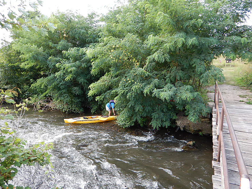
Soon you’ll come across the best and biggest ledge by a large barn and scenic overlook of the valley, which is still pretty easy and safe to run. This farm is noteworthy because the occupants (the Wolf Family) have really worked hard to help the creek and were significant benefactors in developing the Wolf Run Trail, which runs (roughly) from the farm to a trailhead in Mazo (by the double railroad bridges).
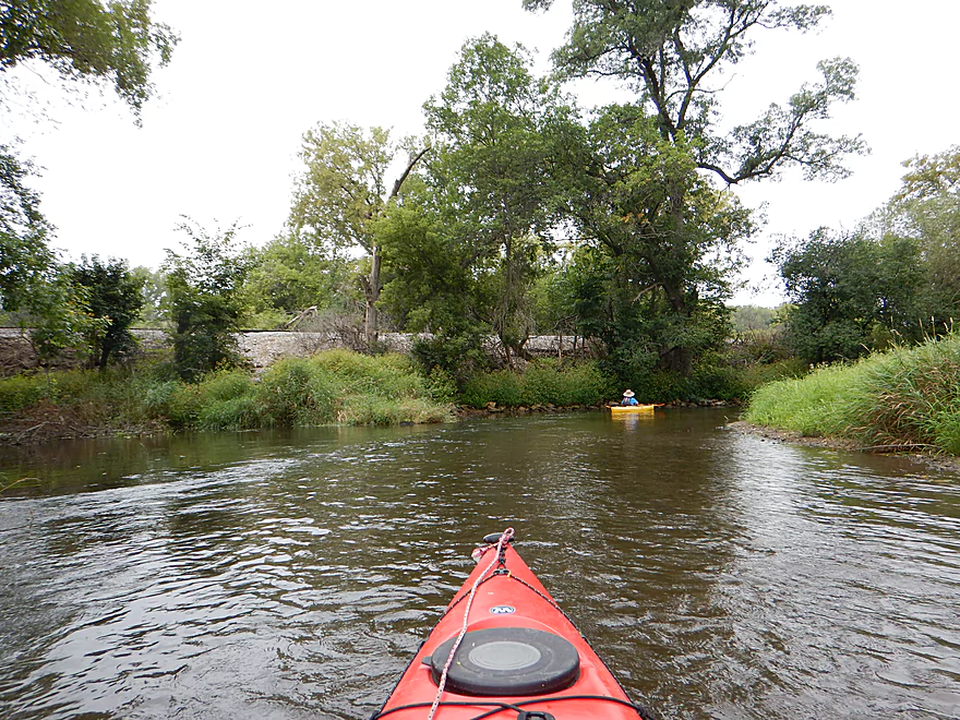
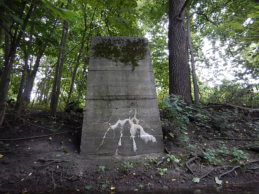
The creek from here to the Hwy 14 bridge has been heavily worked on and rerouted. There used to be a dam on the creek which formed Lake Marion which served as a water refueling stop for trains. The dam has since been removed but the lake remains (separate from the creek) and is artificially kept afloat by groundwater pumps. Because of the dam, its silt, the lake, and the artificial railroad banks funneling the creek…it was for the best that the creek was moved in an attempt to restore it to its natural state (it wasn’t moved far). The new channel is very nice — clean, fast and with fun riffles to paddle over. On occasion you’ll see nice tree canopies from the left bank hang over and it will be interesting to see how this section evolves over the years.
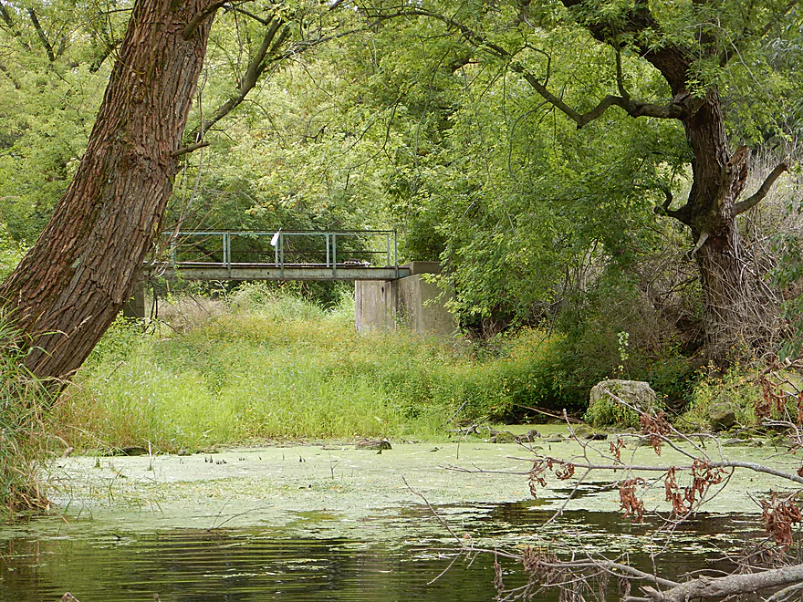
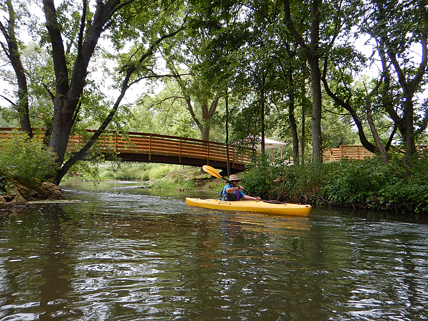
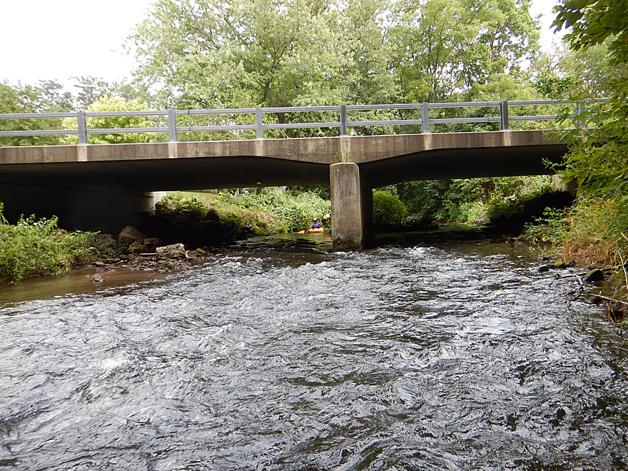
At the end of this section, the creek flows under Hwy 14…a remarkably tall creek bridge (because it has to go over a railroad bridge and the railroad bridge in turn goes over the creek). You’ll soon after Hwy 14, paddle by the Wolf Run Trailhead. Parking is on your left and a pedestrian bridge goes over the creek and connects to the main trail. This could certainly server as an alternative access point and there is an outhouse here. Wolf Run looks like it has potential to be a nice bike trail and the hope is to extend the trail all the way to Wisconsin Heights High School.
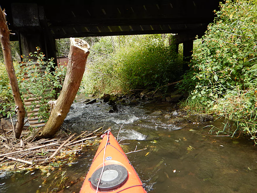
Soon after the trailhead, you’ll come across the second biggest impediment of this stretch by “two bridges” where the main railroad and a spur both cross the creek. The first bridge is a problem. Debris has clogged up the left and middle channels. The right channel is open but small, with big rocks in fast current. Not a stretch for expensive composite hulls! I went down the right channel…and got stuck. It took a lot of scooting and tossing rocks out of the way to get through (but I didn’t have to get out). This is not ideal though, and I suggest simply getting out and leading your kayak down this shallow section. [Editor’s Update—this has been reportedly cleared!] Don’t make my mistake of touching the railroad pylons. They have a nasty creosote preservative that is super difficult to get off if touched. The current is shallow but a tad tricky and can suck you between the pylons so be careful. The second railroad bridge has issues, but for the most part is easy to get through as long as you shoot left and dodge the rocks.
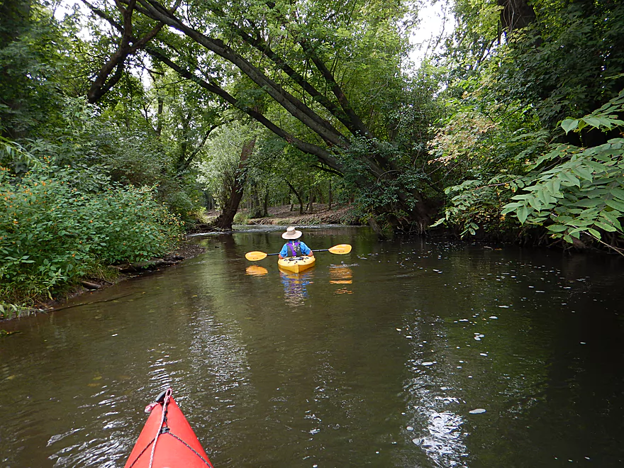
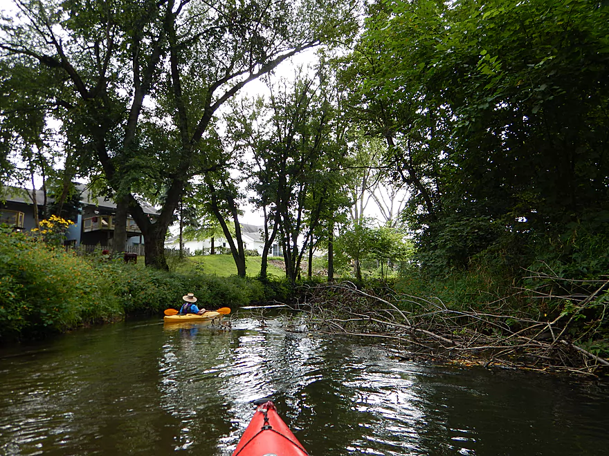
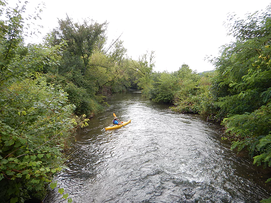
From here on, you’re paddling in the city of Mazo and this was my favorite part of the trip. The water clarity improves, the current stays fast, and you’ll paddle through incredible tree canopies. Together with the steep banks this creates a fantastic tunnel effect.
Maybe a third of your way into Mazo, you’ll paddle by the North State Street (aka Hwy Y) bridge. Very recently the county acquired access rights to the land by the bridge here and this is a very good launch area for paddlers. Parking is easy to do on the street above and the grass is mowed around the wing walls and down to a sandy ledge which facilitates easy access to the water. Located on the SW side of the bridge, I’ve marked this on the map.
The next bridge is the Bridge Street bridge, which was initially going to be our take-out. However a “No Trespassing” sign, steep unimproved terrain around the wing walls, a “Beware of Dog” sign, and a dog running around unleashed and with a muzzle on were enough to convince me to use the Walking Iron Park access instead (very glad I did so).
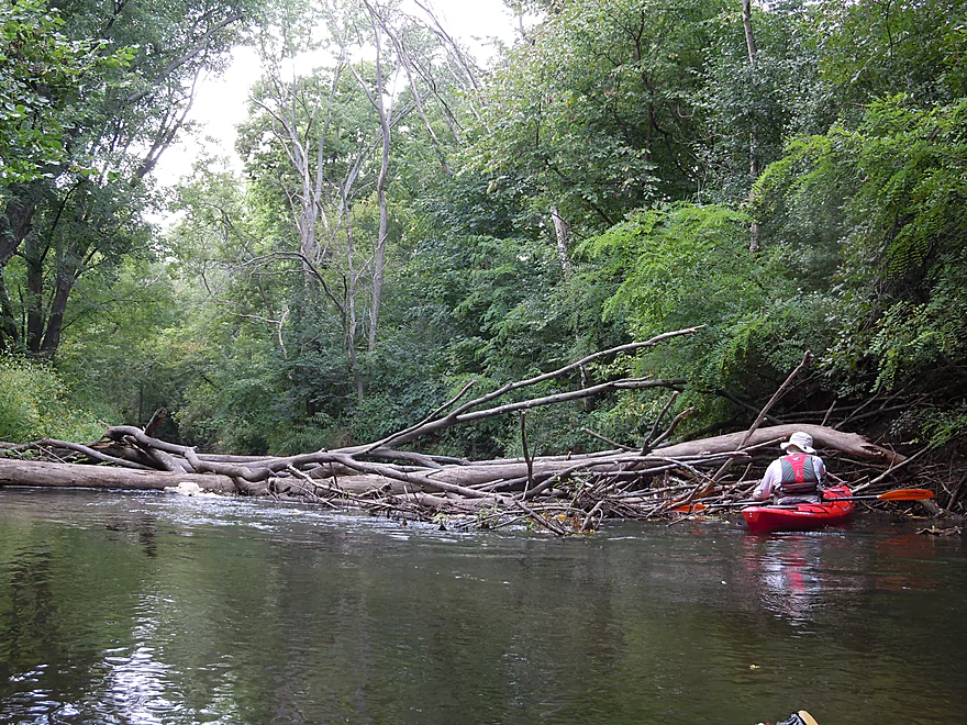
The following section to Walking Iron has the most deadfall and this is an issue. There were several tricky “hop-overs” which I handled ok but am a veteran paddler and long boats or trips at lower CFS might have to portage. There was a tight “duck-under” which a certain percentage of paddlers will not be able to execute and will have to portage. There were several big log piles but usually there was a path around or through. One jam was bad enough that we had to portage it completely. Not ideal, as the banks were rough here, but this was ok to do if you straddled the logs in the center of the creek. Here the creek is most shallow and it is easiest to pull your boat over the jam (it really helps to have rope). [Editor’s note — A good percentage of this has been cleaned up already]
At the jam, there was a gravel substrate that was quite attractive in the clear water. The substrate will vary on the trip with some mud, some sand, some rocks and a lot of artificial fill. In addition, there were several micro sandbars and gravel bars.
The take-out is easy and difficult to miss. Basically, a pedestrian bridge from Walking Iron Park crosses over some nice rapids and there is a hidden take-out area downstream right of the bridge (or NW side). Just dodge the poison ivy at the take-out, cross the bridge and you’ll be in the main park area. The park mows completely up to the bridge which is convenient, but I don’t think you can park by the creek bridge. We parked by the pool and facilities which is a small hike to the south (all of this is marked on the map). You can, of course, unload/pick up by the bridge though.
This trip is an easy car shuttle and despite there being liveries nearby on the Wisconsin River, I doubt they would service the creek (most of their rental boats would be too big, too). The bike shuttle is not bad at 2.6 miles, with no gravel roads and a pretty hill-less ride. Hwy 14 is very busy though, and I suggest avoiding it for as long as possible by peddling the streets of Mazo instead before you have to cross and use Hwy 14 briefly.
All in all, a trip I really enjoyed. I think some may disagree with the five star rating, and perhaps I’m biased because I’ve long wanted to do this for years, I have a preference for small creeks, and because it is somewhat local. But I really enjoyed the trip, the fast current, ledges, clear water, the prairie paddling and wooded canopy paddling and light riffles. I’m also giving it the benefit of the doubt in that I presume many of the obstacles will be cleared out shortly and if I hear of anything I’ll certainly update the review.
If you’re curious and want to learn more about Black Earth Creek, check out these links:
- Black Earth Creek Watershed Association – Terrific non-profit organization that works to protect and conserve the creek. Great info in their online newsletter section.
- Capitolwatertrails.org – Nice clean-up effort on the creek and the webmaster is knowledgeable about the area
- Seekingtrout.com – Nice local trout blog with great pictures. They have a lot of great info on the most recent restoration efforts on the Creek.
- National Heritage Trust – Good info about the creek and a nice map of the new Wolf Run Trail
- Wolfruntrail.net – Brand new website dedicated to promoting the new Wolf Run Trail
- FOLBEC (Friends of Lower Black Earth Creek) with hopefully a new website coming this fall
- Walking Iron Park Background
Webmaster’s Update 1 – As of 9-22-2014, the section from Olson Road to E. Hudson road should be clear. Blynn road to the mouth is clear as well, but work needs to be done on E. Hudson to Blynn.
Webmaster’s Update 2 – A new free kayak shuttle for Black Earth Creek has been formed. Click here for more information.
Thanks John for providing the information below!
The Village of Mazomanie was created by Brodhead the railroad head engineer to take advantage of a 20 ft head of water to generate power for a flour and grist mill which was promptly constructed. The then existing Village of Dover to the west on the county line lost out. Brodhead’s placement of dam, railroad and mill pond was all integrated into his industrial plan. Water flowed into a turbine in the basement of The Old Mill. A water tank tower did stand near the NE corner of the mill with the railroad between tank and mill when I moved my family to town in Feb 1955.
We use the term Two Bridges to describe the Trailhead and Shelter location because the shelter is on an island between the creek and the railroad Y. The Y connects the railroad line to Sauk City with the railroad line to Madison. The first and shorter new trail bridge is over a railroad drainages ditch and the second and longer new trail bridge you show in a picture is over the creek. The Sauk line will hopefully soon become a trail too as it no longer serves as a railroad over the broken Wisconsin River bridge.
The older steel railroad bridge carries the railroad from Mazo to Sauk over the BEC. The all-wood bridge with debris catching pilings was built during WW II and carries the connecting Y over the BEC. They look double because they are so close but they are on two different railroad lines.
What is now County Road KP as a main road once entered Mazomanie along the creek into Crescent Street, the curve being the source of the name. Two Bridges Trailhead is at the current east end of Crescent Street. The connection to KP was broken when the Y was built in the 1940s wartime. The first highway #14 high bridge into town was built earlier in 1936 before WW II. Still hidden in bushes is a short concrete bridge over the mill race from pond to mill along the railroad.
The bridge is high because the upper part of Mazomanie is at elevation 800 ft. The east end of the bridge was set high enough for the railroad line below to Madison, then continues rising to 800 ft. That Madison railroad line does not bridge the BEC until a 1/2 miles below Olson Road Bridge by the water.
The concrete towers you saw inside Mazo were left from a dam for a flour or grist mill downstream from what is now called The Old Mill. That downriver dam and mill were all washed out in a flood from what I remember hearing from mill owner old Ted Sawle, and never rebuilt, an event many years ago. There was another mill downstream just above Morrill Road bridge according to Ted. Ted, over 90 when he talked to our history group, owned a mill at Hyde, Wi. He said nearly a dozen mills on water power had been built in our area at one time or another.
Detailed Overview
- Upstream from N. Birch Trail: The creek is small, but might be surprisingly navigable during high water.
- N. Birch Trail to Stagecoach Rd: 0.5 miles. Creek here is small and wooded with possible congestion and a few jams.
- Stagecoach Rd to Cross Plains: 2.0 miles. An intriguing prospect that may now be viable because Black Earth Creek has grown in size. Starts narrow, rocky and wooded then opens up. Maybe 2-3 logjams. Stagecoach Rd may not be a good access as a "No Tresspassing" sign is on one side of the bridge.
- Cross Plains to Salmo Pond: 4.3 miles. Nice stretch. Half of this leg flows by the community of Cross Plains. One fence and one logjam to deal with but not major.
- Salmo Pond to Black Earth Community Park: 4.2 miles. Several fences to deal with, but all in all, one of the more underrated legs on the creek.
- Black Earth Community Park to Olson Road: 4.5 miles.
- Black Earth Community Park to The Shoe Box Landing: 1.5 miles. Nice stretch that passes through the outskirts of Black Earth. Might be a few minor logjams to sneak past.
- The Shoe Box Landing to Olson Road: 2.9 miles. Pleasant open stretch. This is a common "add-on" leg for those wanting to do the popular Mazo trip, but as a longer trip.
- Olson Road to Walking Iron Park: 3.7 miles. The best and most popular leg on the creek. Much of it flows around the outskirts of Mazomanie and though a nice woods.
- Walking Iron Park to W. Hudson Road: 1.1 miles. A small but great section that is recommended as an add-on to an Olson Road trip. This doesn't receive as much upkeep so paddlers may encounter a logjam or two.
- W. Hudson Road to Blynn Road: 4.4 miles. An ok section but nothing special. This leg while once clear, may now have a few surprise logjams.
- Blynn Road to Mouth at Arena: 6.8 miles. Technically now Blue Mounds Creek, this is the weakest section.
Trip Map
View Black Earth Creek - Mazomanie in a larger map
Overview Map
Video
Photos Size:
Paddled the creek today 9/22/14. Olson rd to walking iron park is clear! Awesome paddle, thanks for the write up on it! Would have never found otherwise. I live 10 min from badfish creek, and this is faster and more intimate. It is also more scenic with the hills in the distance.
Thanks for the comment! It’s actually clear now from Walking Iron to Hudson for maybe a mile longer trip. Great little creek that does rival the Badfish for the best paddle in Dane County.
What is the creek like riffle wise from the park to Hudson Rd? What side of the bridge has the best take out? Thanks!
Hi Mike,
I have not paddled this section so passed on your question to somebody who did (John Wick) and here is his reply:
“Park and launch from Olson Road, either side of road, with excellent riffles all the way to a landing on the right at a narrow takeout just below the trail bridge at Walking Iron Park. Most of your paddling will be for steering. I recommend you continue on to the bridge on Hudson Street West where you land on the left downstream side of the bridge right next to the concrete. You pull your kayak back under the bridge on flat, level ground to load out on the north east corner of the bridge. No current portages. A good run with a 3.1 mile bike ride back to Olson Road. Water flow at Black Earth is 34 CFS which means shallow water over some sand bars.
I made one run from Walking Iron past West Hudson to Morrill Rd before two spring windstorms. The run as far as West Hudson Road from Walking Iron was the best part. There was a good flow of water but probably not as many riffles as upstream. Still, it was a scenic and enjoyable trip.”
There’s a downed tree towards the end in Mezomanie we had to port across. The creek seems to be running a little faster and higher from the storm over the weekend compared to a few weeks ago when we paddled it.
Nov. 15, 2015 – Olson Rd to Walking Iron park at ~40 CFS, 2 ft at USGS Black Earth gauge (but noticed a physical gauge stick that read about 1.5 ft. part way through trip.) Downed tree just past Hwy 14 bridge required climbing out to pull over, but only a couple of other hang ups on gravel if reading the creek carefully.
Thanks Jon for the update!
For the folks who want to put in at the Shoe Box Landing, it won’t exactly be smooth sailing down to Olson Road…the cattle figured out how to get through our kayak gates that we had installed. What we did last week (after having to remove the gates and pull the cattle fence back into position across the width of the creek) was to put some i-bolts and wire in on the right side fence posts and if you want to get through…you just get out of your kayak (the water is shallow there with a firm base) unhook the double latches from the wire to the fence…bend over a wee bit, push your kayak through….close up the latches and then repeat the process for the second fence. This is pretty easy now considering that originally we would have to go on our stomach and scoot through. Impossible to do in high water. The best alternative thois just to put in at Olson Road and you won’t have to deal with any fences all the way down to John’s Landing. We are suggesting this route until we can improve the fence and reintroduce the kayak pvc gates. Kows before Kayaks. Gaila and Gary: Black Earthlings.
Really appreciate the update Gaila!
I did this section last weekend (9/23) and it was fantastic, water was clean and fast with no obstructions. The numerous wing dams had just enough drop to make it fun and exciting but still enjoyable and safe for my companion who had never kayaked before. There is a dedicated bike trail that runs from Mazo to right behind the High School that took us less than 15 mins, and is a perfect option for a bike shuttle so you only need one car. Had a great inexpensive lunch at a small cafe called the Base Camp Cafe on Brodhead Street in Mazo.
I don’t remember that bike path, so that must be new. Very good news for paddlers wanting to do bike shuttles.
I did the section from Olson Rd to the Wolf Run trail head, with a short easy bike shuttle. This would be a great trip for someone who wants to try some easy
fun whitewater. I would have liked to do a longer paddle but I did it on a bit of a lark, as I had my dog with me so she had to run along on the bike shuttle. The Wolf Run trail was the perfect length, about 2 miles and it runs right from the take out to right behind The Wisconsin Heights High School, which is only 1/4 mile down Olson road from the put-in. The whole trip from dropping of the boat,driving to the end, biking back,paddling the creek, loading the boat, and driving back to get my bike took just over 2 hours. A great way to spend a 78 degree late Oct afternoon
Appreciate the comment!
I did the section from Olson Rd bridge to John’s Landing at Lion’s Park on Fri 9/14/18 (70 CFS and 2.65ft). The part from Olson Rd to the Wolf Run landing is totally open and was a whole lot of fun. Despite the relatively low CFS there seemed to be a lot of water in the rapids, no shallow spots and the creek seemed fast. In the section through Mazo there were 2 big blockages and several smaller ones. The first blockage is a big solid jam involving many downed trees. It is solid enough to walk on and it was pretty simple to just pull my kayak up and over. Not sure how deep the creek was but there is not much current and all in all it was pretty simple portage. The next blockage was just one group of trees with several trunks and many branches,and steep banks. No way through, under, over or around. I had to go back up stream 20 yards to find an easy way to get out then it was an easy portage around and back in. There are a few other small tress down but it is fairly simple to get through all of them. The trip took less than 2 hours and I would strongly recommend it to any with good boat control, doesn’t mind a few simple portages, and is up for an adventure. The Wolf Run trail is closed due to damage from the flood, but Hwy 14 is open to Olson Road and is a great bike shuttle option because it has very little traffic because it is closed at Black Earth. I would NOT recommend doing a bike shuttle on Hwy KP because it is now a main route between Black Earth and Mazo and has very heavy traffic.
Thanks Eric for the update. I was really worried about the creek after the big floods, and it sounds like it has some jams, but it could have been much worse.
Paddled from Olson Rd. to Lions Park on 24Sept2018 at about 70 CFS at 2.6 ft. Water was turbid.
My logjam experiences were similar to Eric’s post above. However, the first jam didn’t feel entirely solid to me, and may have picked up more debris in the past week. Two tires, some balls, etc. were on the river left side where I climbed over. I somehow pulled through the second jam without exiting the boat.
The wing dams seem to have gotten blown out a bit by the flood, and the creek looked wider to me with some changes in its features. It looks like the flooding was worse through town than near the put-in, with debris much higher in the trees, and more bank scouring. I saw a step ladder jammed horizontally around a tree about 10 feet up. I expect more trees to fall during storms, due to their roots not having as much soil to anchor to.
I bike shuttled along KP due to the Wolf Run Trail being closed. Heavy equipment was re-lining Lake Marion. Here’s a link to a story:
https://madison.com/wsj/news/local/the-saga-of-lake-marion-in-mazomanie-appears-headed-toward/article_4e2449af-ab05-522a-9894-ba1c36cc20e6.html
Thanks for the information. Hopefully the garbage and logjams will get cleared out in the future.
Picture of the strainer:
https://imgur.com/a/7bXSqQe
Current looks pretty quick there…hopefully that gets cleared out in the future.
Ran this section on June 3, at 90 cfs. Wonderful paddling, until I got into Mazo, specifically past the Co. Y bridge. Ran into a tree, spanning across the creek, which became a difficult portage. Ended up dumping. Rather harrowing. Be very careful when approaching this, especially in higher water. There was a portage before this one that was very easy to navigate.
Yikes…appreciate the heads up.
June 6th, 2019
The Black Earth Creek from the Shoe Box to John’s Landing has a few glitches. The cattle fence (barbed wire) is up across the creek about 1.5 miles down from the Shoe Box. You will have to pull out about 50’ in advance and portage through the grass/fence. The fence with kayak gate got taken out in the spring flood. This is a work in progress. Patience please but paddle safely too.
Thanks for the info.
In Mazo below the high way 14 bridge inexperienced paddlers might get swept down the vee, river left, into some tree limbs hanging out on the side…courtesy of the spring flood. Further down through town there are at least three trees down….some gathering benches and picnic tables.
My husband and I did paddle the entire stretch on Sunday the 4th and didn’t have problems but we used our smaller 10’6” kayaks and in our younger years we were white water canoeists….so we still have a few moves in our memory banks that help us work our way through the obstacles!! Gaila
Appreciate the updates Gaila.
OK…I do give up . Just got off the creek (from wolf run trail to john’s landing) again in time before the storm came through this morning around 11:30. But here is the latest:
Blockage #1 that Gary, I , Jared, Chris had two encounters of the close kind with finally got taken out a few days ago with Gary’s chainsaw and we also sawed the 30’ section that fell off the river right bank into smaller pieces. Well, today #1 was alive and well but with a smaller tree that had cut across the curve with that very fast current. Our bowsaws took that limb down but we couldn’t catch the tree as it floated away…wanted to chop it into smaller pieces. But there is now no blockage #1 on that tight curve after Hudson Bridge.
Blockage #2. Was taken out by a paid contractor a few weeks ago and it is gone.
Blockage #2.5….the new kid on the block just showed up today and there is a great flat portage to river left….but we cut out the small branches and obstructions on river right and you can get through easily now otherwise it was blocked.
Blockage #3: the biggee that 6 of us spent 1.5 hours on has a mind of its own. On river left the big tree sunk in the creek and we just managed to eke over it…with lower water..forget it. As for river right…the 8’ swathe that the folks chainsawed….well that got filled up with larger branches and limbs. We got that cleared out, so that is now a go.
BUT HERE IS THE KICKER…. YES YOU CAN GET THROUGH IT NOW….BUT I HAVE NOW IDEA WHAT IT WILL LOOK IN A FEW DAYS. (Since last year’s huge flood the banks are so unstable.) We just had rain and wind storm come through. So Chris, if you go out paddling on Tuesday with the the mcp-ers can you give a heads up to me and possibly the other folks listed in the email.
—
Update: 2019-08-25:
Just to let you know that we paddled all the way down from olson road to john’s landing today…..someone has been very busy cutting off stumps that stick out from the banks for us and working on some jams….there was only one tree to deal with but if you go river left you can skim over it…..a nice paddle….creek is flowing quickly….gaila
Thanks Gaila for the updates. Sounds like there always could be a surprise still, but the creek should be in significantly better shape now.
Paddled from Olson Rd. to Lions Park (John’s Landing) on 20Aug2019, 90 CFS at 2.5 ft. A couple of blockages in Mazo, but not bad if you have the skills and the right boat to sneak through. Nothing like the logjams from hell in the spring of 2019.
I chatted with a kayaker named Dave was using a saw make passage even easier. (Thanks, Dave!)
Fun level for beginner whitewater paddlers, several surfable waves, and I took a lapful of water on two of the drops.
Appreciate the update Jon!
Paddled from Olson Rd. to Lions Park on 18Oct2019 at 105 CFS. Additional trees are down in town since I paddled it in August. I managed to sneak through without portaging, but the banks are steep and eroded in this section, so portaging would be difficult.
Unless you have a short boat and good skills at getting through logjams, I wouldn’t recommend paddling past N. State St. unless water levels are quite a bit lower than 105 CFS.
The waves worth playing in are mostly between Olson Rd. and Crescent St. (Wolf Run Two Bridges Trailhead.)
That’s too bad. Hopefully that same person who did that amazing cleanup in July will do another cleanup shortly here.
OK….as of a few days ago they got rid of that big log jam downstream of cty rd y=state st. that i had written about earlier in the week….however, there might be one smaller tree to encounter a wee bit further down…but the big one got taken out…yippee.,….but here is info on another tree to deal with as you enter town: after you go under hwy 14 past two bridges/railroad track/hudson st east bridge, the river goes north and then takes a tight curve southwest…it is narrow and zippy and there is a tree down there. all you need to do is hug river left and you can wind your way through the downed branches (we lopped off a bunch) .avoid river right tho… now if you don’t like the winding technique the portage there is very easy…up and over a sand bar…enjoy your paddle…
OK…just talked to the Mazo town crew and they said that the creek is now open in Mazo…so you can paddle from olson road all the way to john’s landing in walking iron park near the soccer fields with no problem. And if you want to put in at the shoe box in black earth…there will just be one cattle fence (almost all under water tho) to deal with. so you can get a nice long paddle done if you want to.
Great news! Thanks as always for your updates Gaila as they are very helpful for other paddlers.
I ran this section twice over the weekend with 2 different groups. We had young and old, with both experienced and first time kayakers. They all had a good time, fun enough for the experienced kayakers to play a bit and yet easy enough to be safe for the beginners. The Wolf Run Trail makes for an easy and pretty bike shuttle. The only obstruction was one easy scoot over, and there are few things to maneuver around. I did some clearing of overhanging branches as I went. The creek was at 97 CFS and 2.5 ft, which were great levels, water was still a bit cloudy from recent rains but still nice. The creek should be at great levels all this week.
Appreciate the update Eric as always!
A unique drone video of Black Earth Creek from Black Earth to Mazo was recently released. I highly recommend watching it: https://www.youtube.com/watch?v=XlqcxurpdAc&feature=emb_logo&fbclid=IwAR3puKLnwkuzLpIY-goB5JPIihfNCx8HDqTFHDsUDrXmB9SzuiUwd3FSDV8
I just received a noticed that Black Earth Creek will be closed from Olson Road to Wolf Run Trail head (Two Bridges) for all of September 2020. If I hear anything further, I will post an update here.
Eric just shared a really relive replay of this trip (nice map/timeline/pictures). This trip was done in early November, which if warm enough can be a surprisingly nice time to do a trip. https://www.relive.cc/view/vXOd5L3JQk6
Paddled from Olson Rd. to Lions Park on 08Aug2022 at about 120 CFS. At this level some of the wave trains gave a lapful of water in the absence of a spray skirt. We had a fun time surfing several little rapids.
Boat control and short kayaks helped us navigate through some deadfall in the section through town. We sneaked through some tight spots, rammed over some logs, etc. At lower water levels, some portaging might be needed. Link to photo album: https://photos.app.goo.gl/t7CzBepamwoLQiTE6
Thank Jon for the update.
We took advantage of a late fall sunny day and did this trip on Nov/27/22, levels were a bit low (37 CFS and 2.25 ft) but it was still a great fall trip. It is interesting to see how much more of the landscape you can see after all the leaves drop and the plants die back. We were surprised to see all the work being in Mazo. They are doing stream bank improvement and repairing damage from the 2018 floods. Unfortunately it is fairly ugly right now, and there are a few small blockages to deal with so probably not a good time to paddle (but I suspect there are not too many people like myself who try to paddle all year around in Wisconsin) From what I understand when they are done it is going to be better than ever… so I guess it is the Badfish and Lake columbia for me until the spring thaw. Here is a link to a video/map/pics of our trip using an app that I highly recommend called Relive https://www.relive.cc/view/vYvE3GGgEw6
It’s too bad to hear about these “stream bank improvements”. I appreciate the update as always.
Has anyone done this stretch of Black Earth Creek recently? Interested to know whether the part through Mazomanie to Walking Iron Park is clear now.
I think it was recently cleared out, but I’m not 100% sure.
Short version: Three of us paddled Black Earth Creek from Olson Rd. to Lions Park in Mazomanie on July 19, 2024 at about 60 CFS, and 2.64 ft. gauge height.
Until some clearing is done, there are a few hazards to avoid, especially at higher flows than we experienced. We were in whitewater kayaks, but longer and less maneuverable boats would have been difficult.
Shortly downstream from Olson Rd. is a strainer that requires the ability to slow down in moving water to hug the inside bend. We saw two pieces of a cheap kayak paddle caught in the strainer.
At the second railroad bridge there’s a log blocking the right channel completely, and good boat control is needed to sneak between the bridge pilings and woody debris on river left.
Black Earth Creek has crested above 5 ft. three times in the last 30 days. As always, assess your skill level and paddle safely. And, to avoid spreading invasive New Zealand Mudsnails to other waters, please clean your boat carefully after paddling Black Earth Creek. Tiny NZ Mudsnails “can survive in cool, damp environments for up to 26 days and survive exposure to toxins like bleach, ammonia and alcohol.” https://dnr.wisconsin.gov/sites/default/files/topic/Invasives/NZMFactsheet.pdf
Jon
Detailed version:
https://docs.google.com/document/d/14kR0UW5dRLsbliAB4SefTtYy38Vv-8nknikg2om0BME/edit?usp=sharing
Thanks as always Jon for the update.
As of 2024-08-13 the section from Olson to Lion’s Park is now clear (per Jared and Bob).
We paddled from Olson Rd. to the Wolf Run Two Bridges Trailhead (aka Wolf Run Trail North Trailhead) on Sept 25 at about 70CFS on the Black Earth gauge.
“John’s Landing” near the bridge between Lions Park and Walking Iron County Park has been removed due to a major stream restoration project, so don’t try to land there. I didn’t scout the alternate upstream landings at Bridge St., State St., etc.
Here’s a link to the stream restoration project:
https://lwrd.danecounty.gov/CurrentProjects/Detail/Black-Earth-Creek-Stream-Restoration
Here’s a link to photos near the bridge: https://photos.app.goo.gl/266gVUFqFEVkcJj49
Thanks Jon for the update. It’s a shame that these “restorations” often mean chopping down lots of trees.