
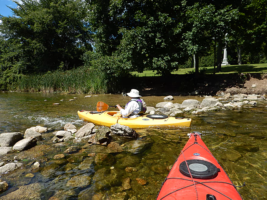
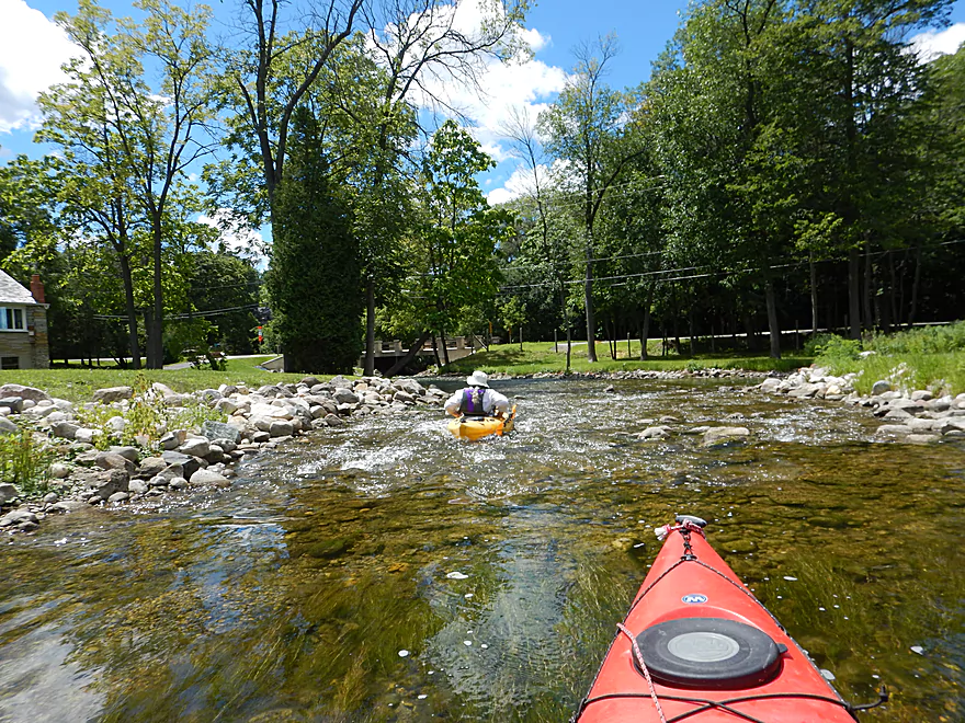
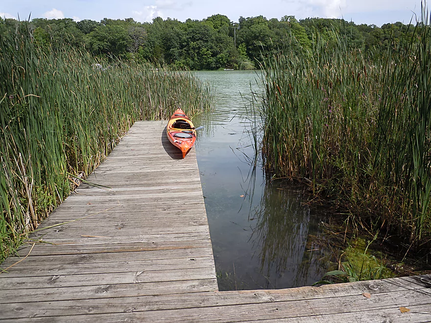
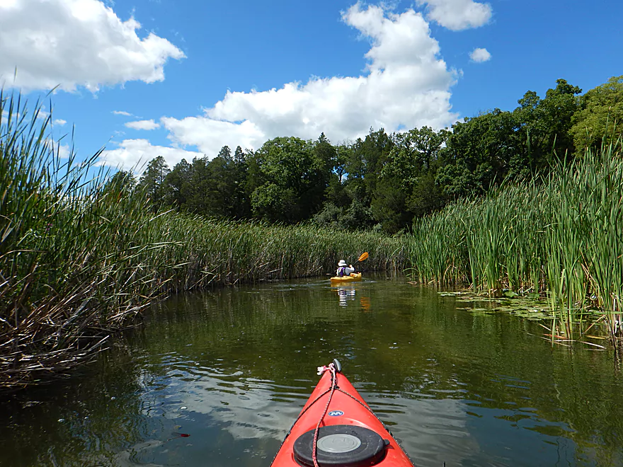
Putting in at St. John’s Park
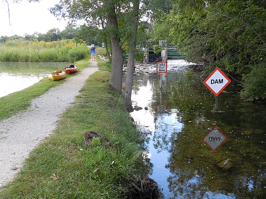
The dam below Nagawicka Lake
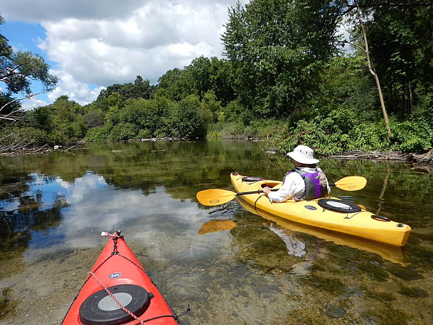
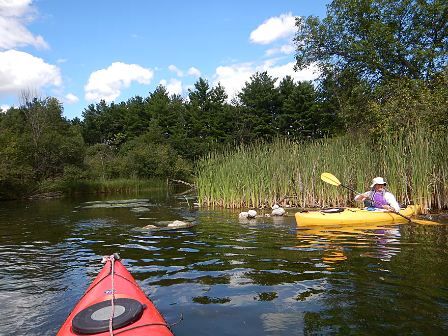
Actually a nice lake
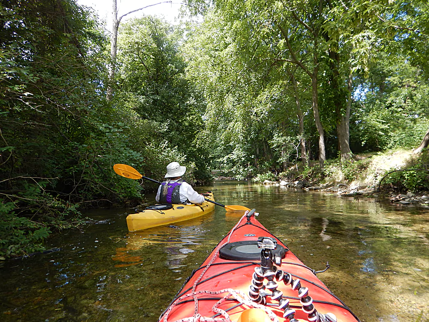
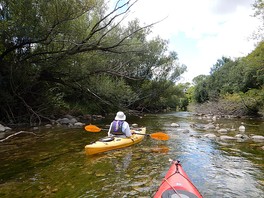
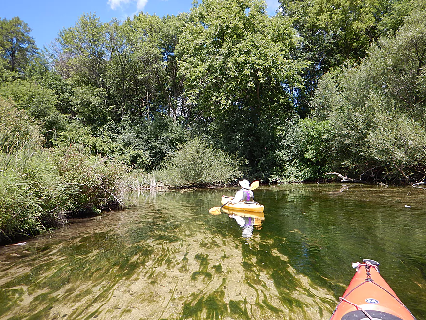
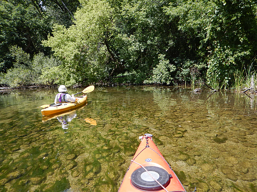
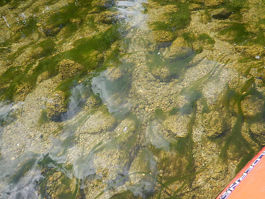
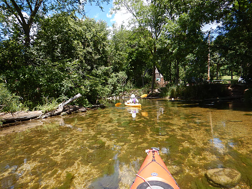
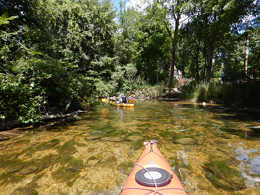
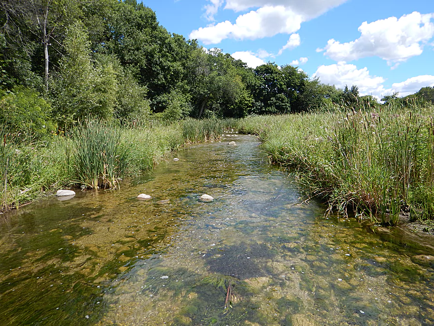
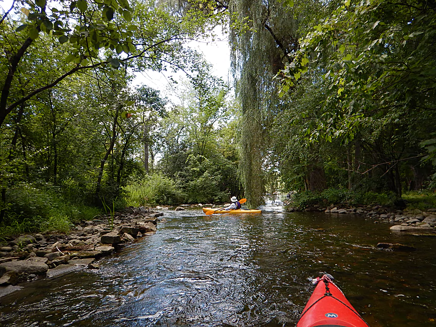
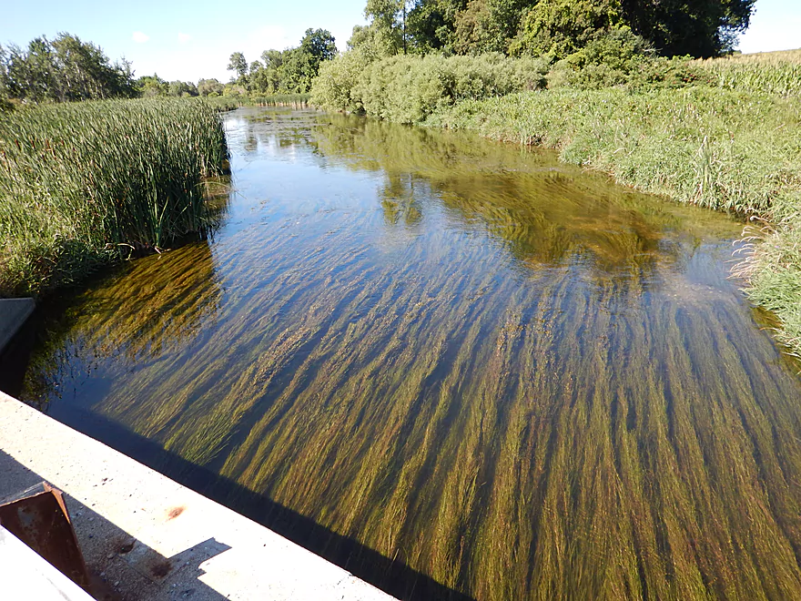
Terrific water clarity
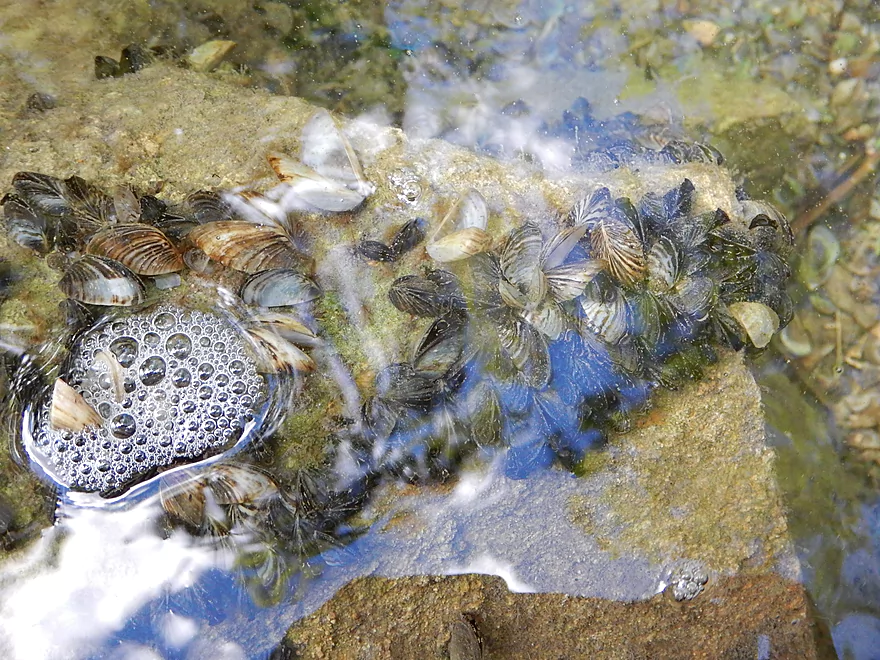
In part, thanks to zebra mussels
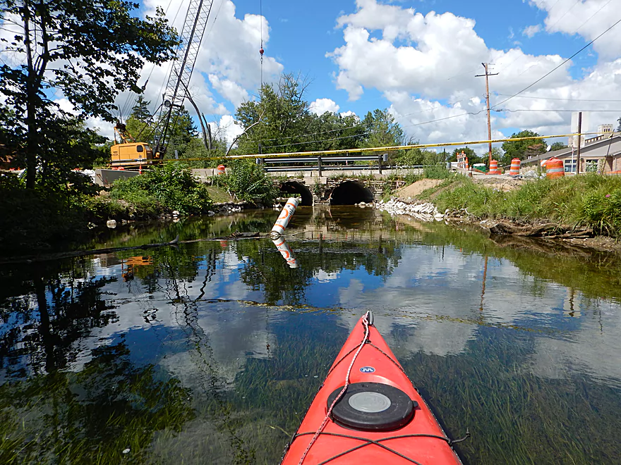
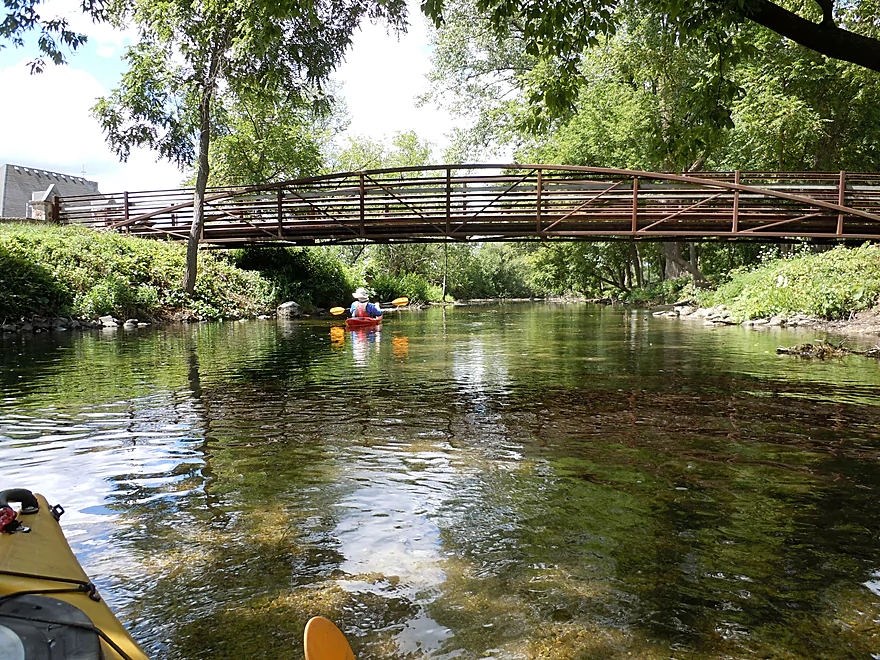
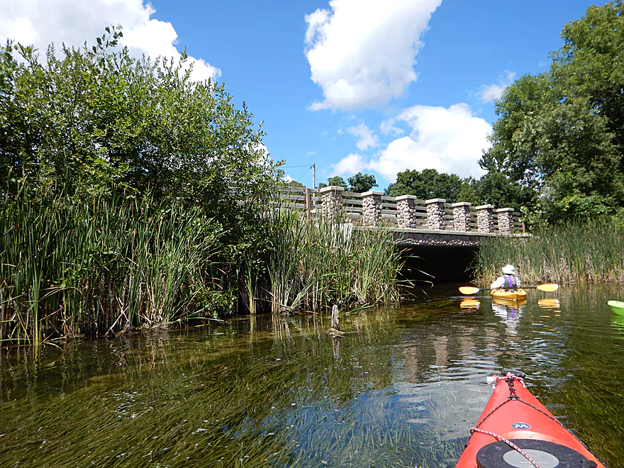
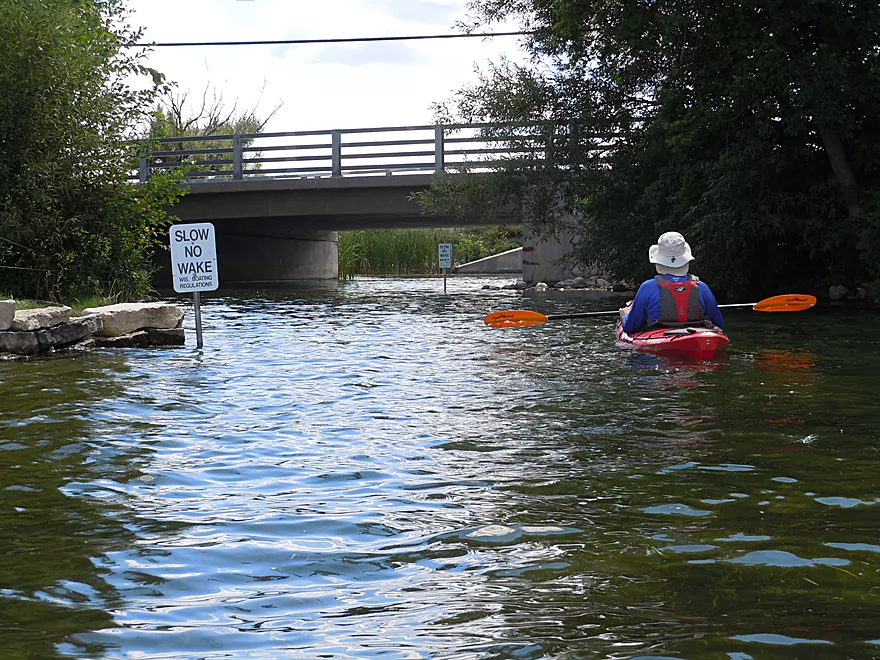
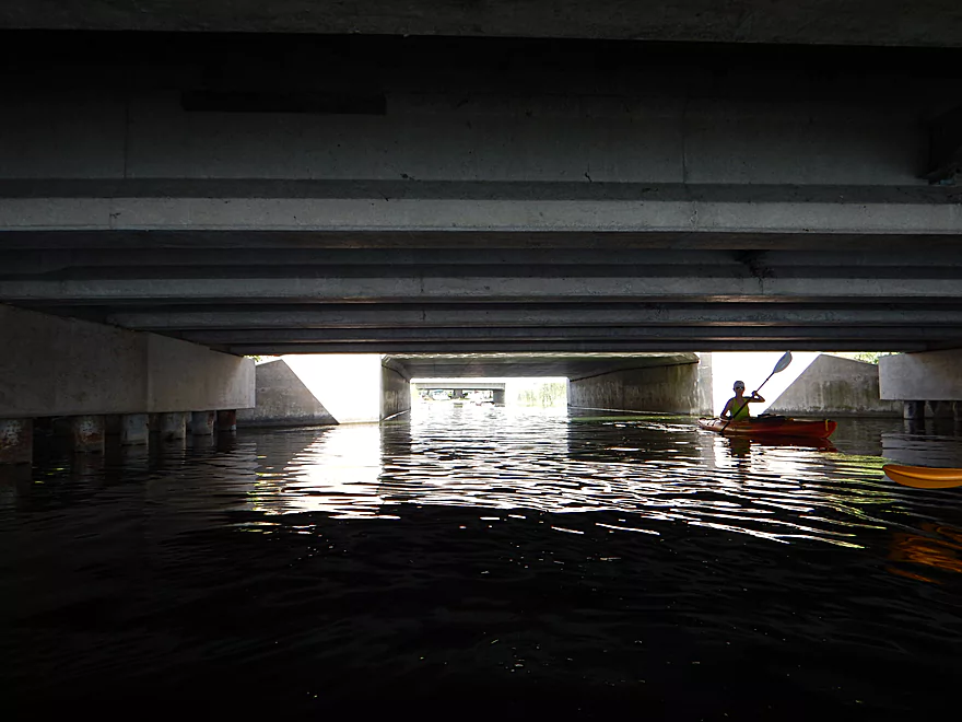
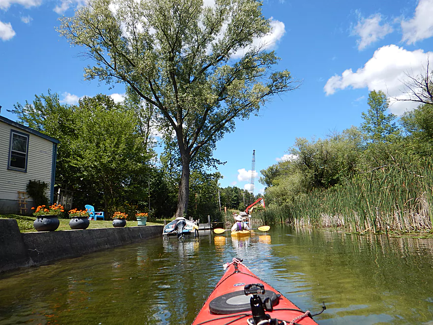
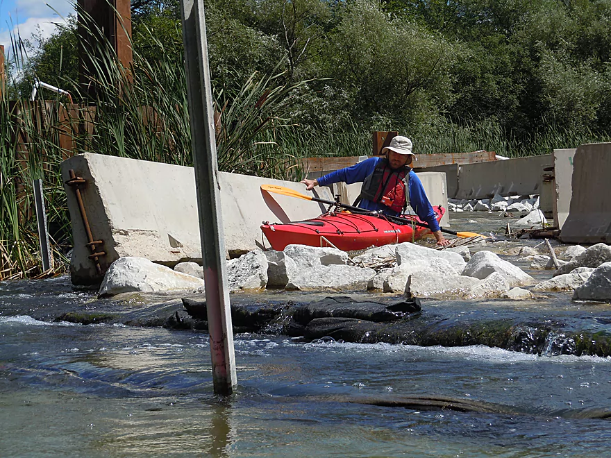
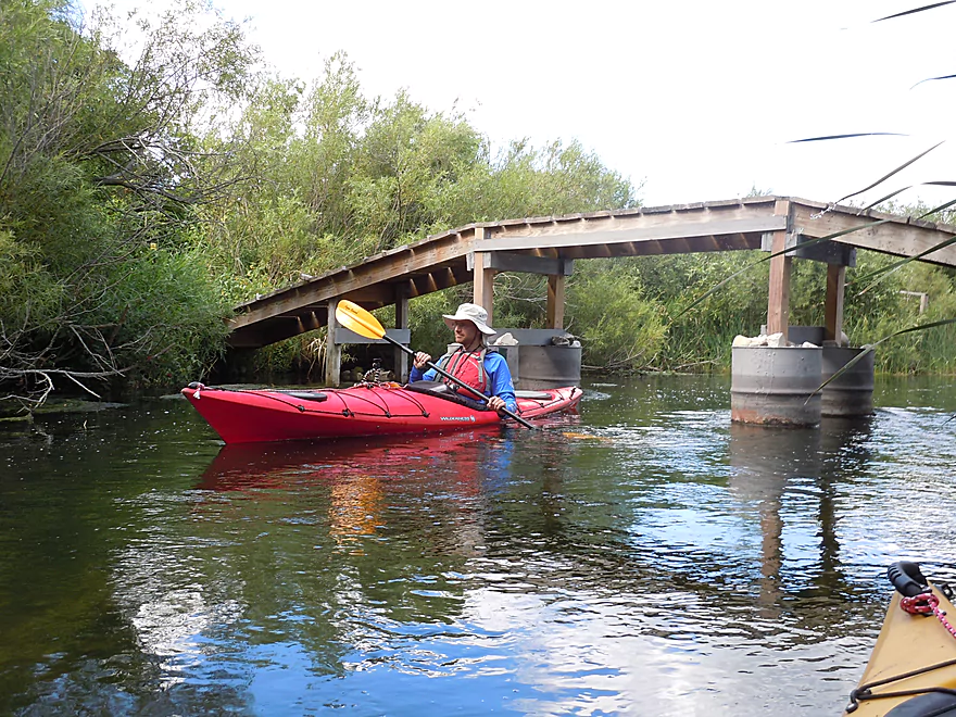
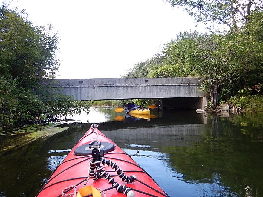
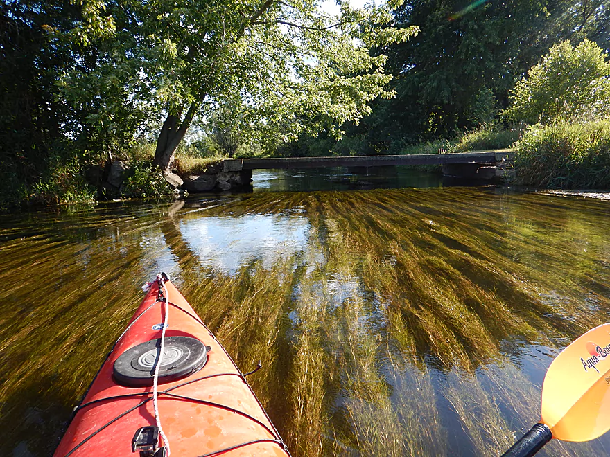
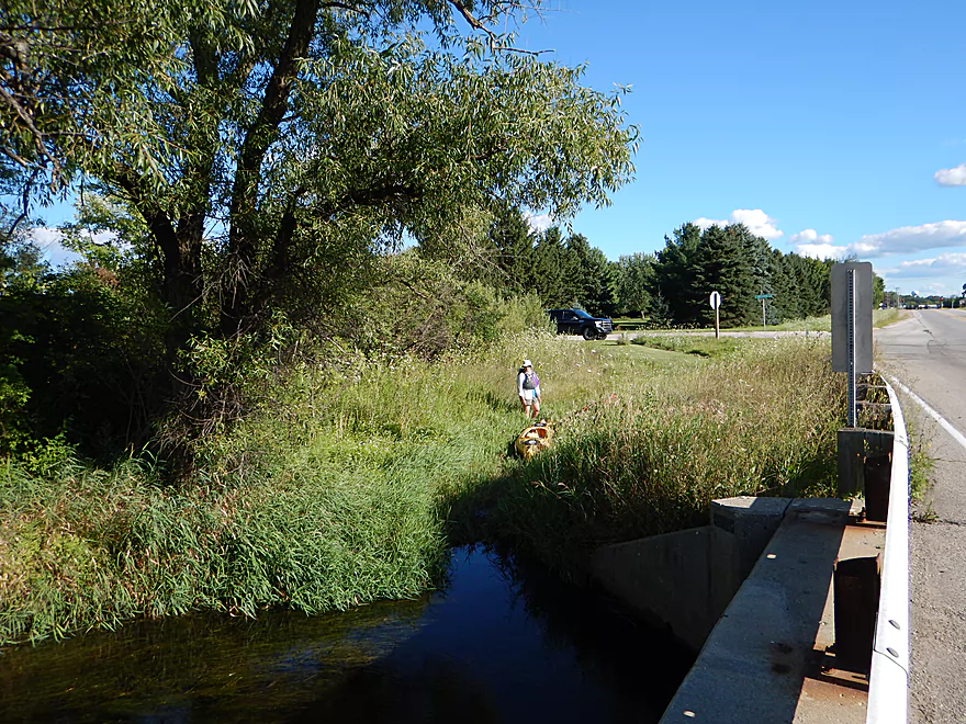
The bridge at Genesee Street is being replaced
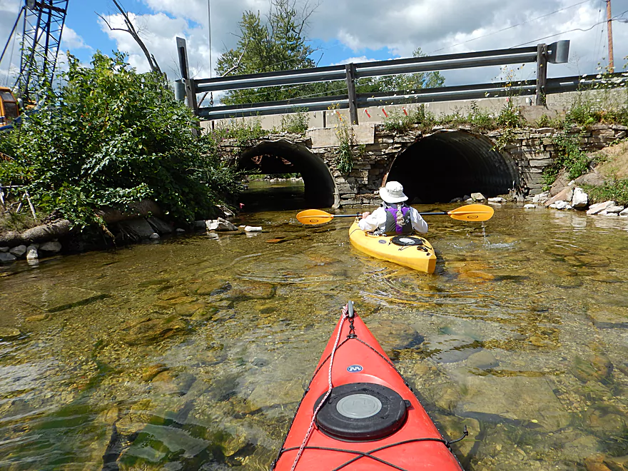
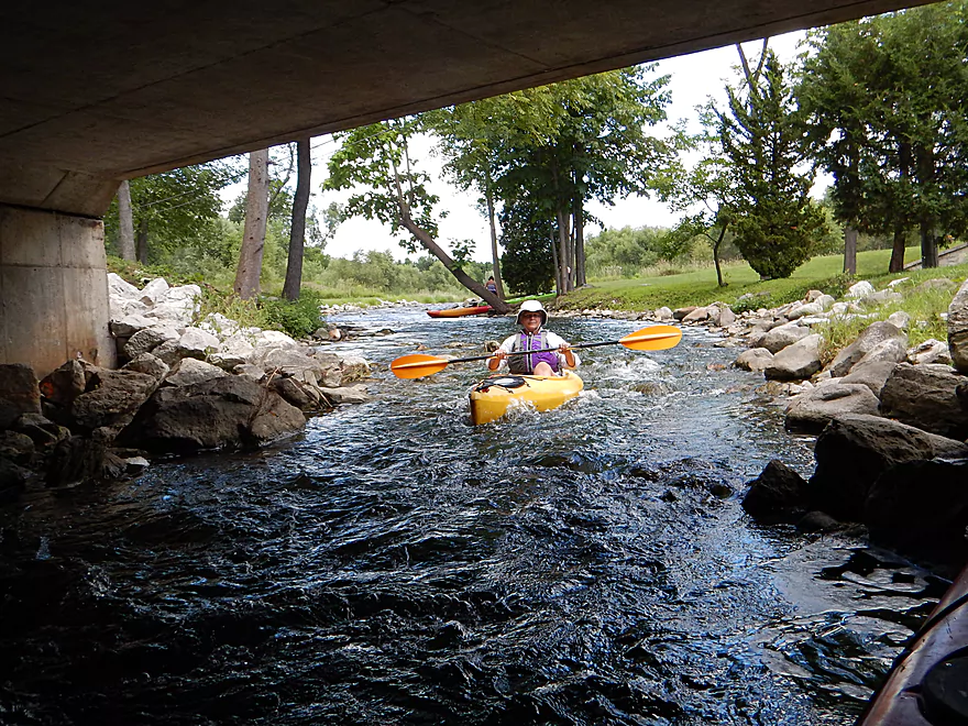
But this is easy to get through
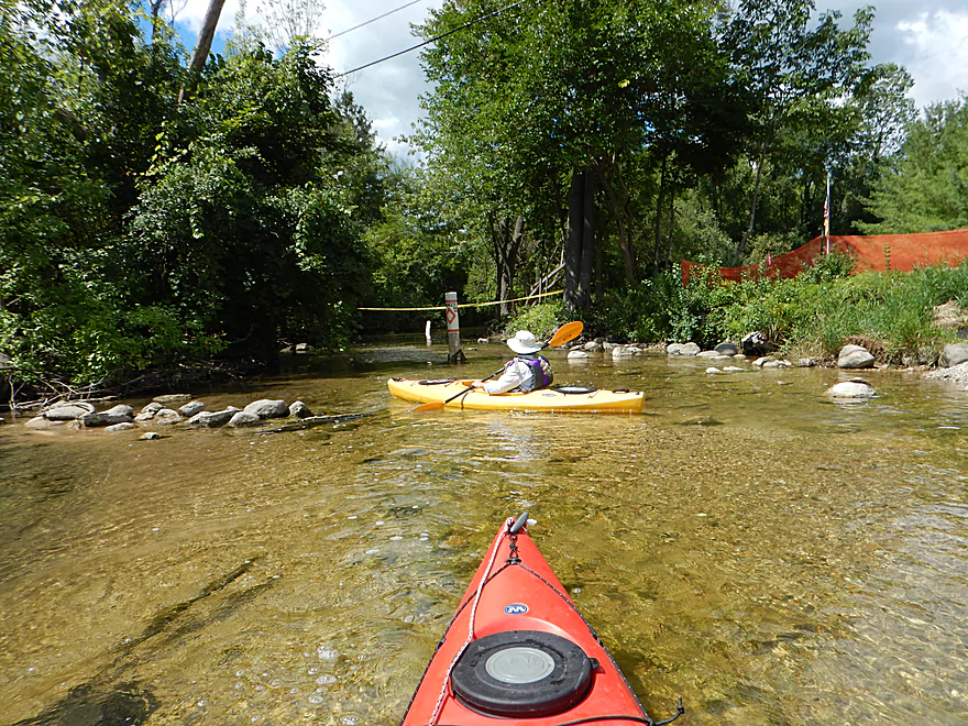
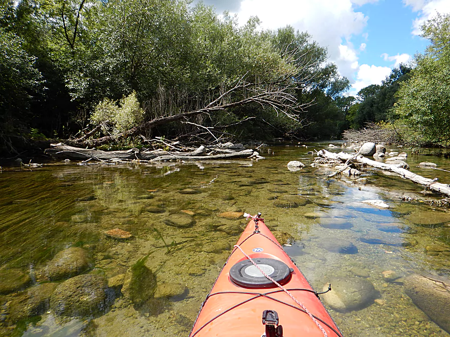
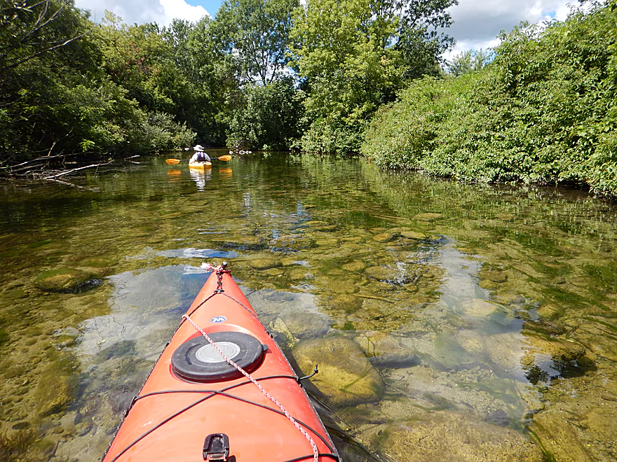
Phenomenal clarity
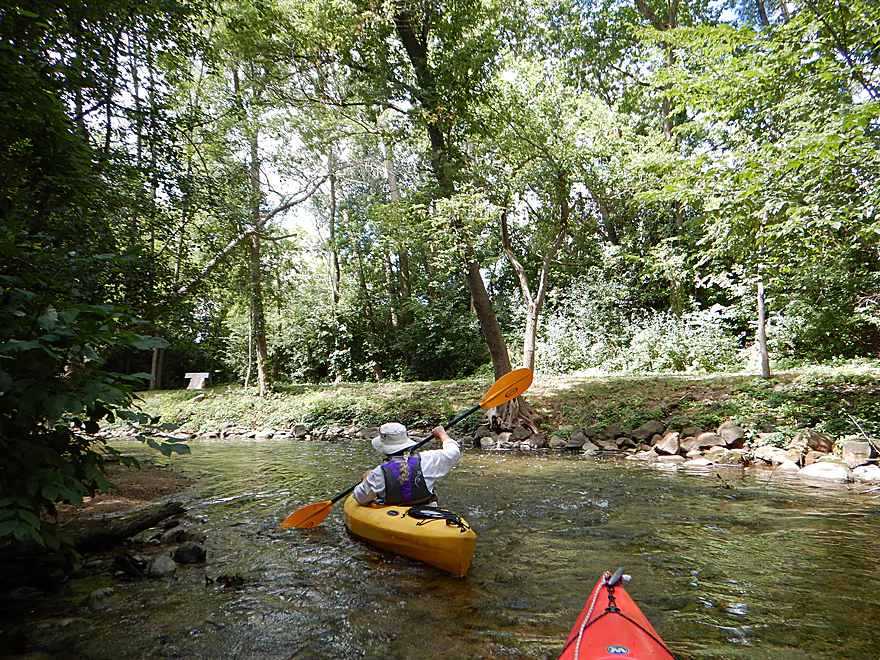
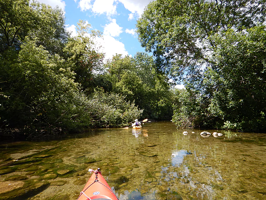
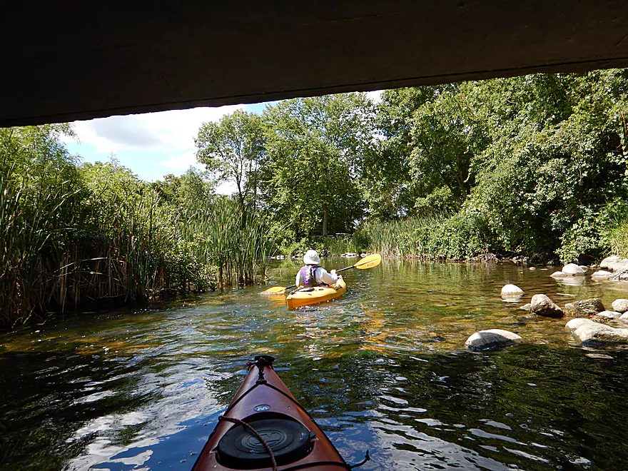
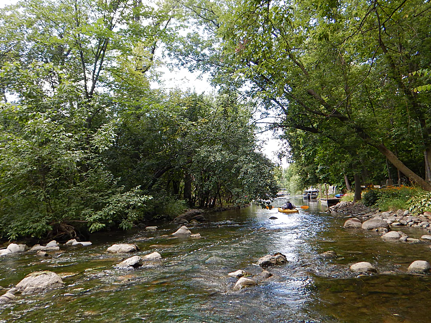
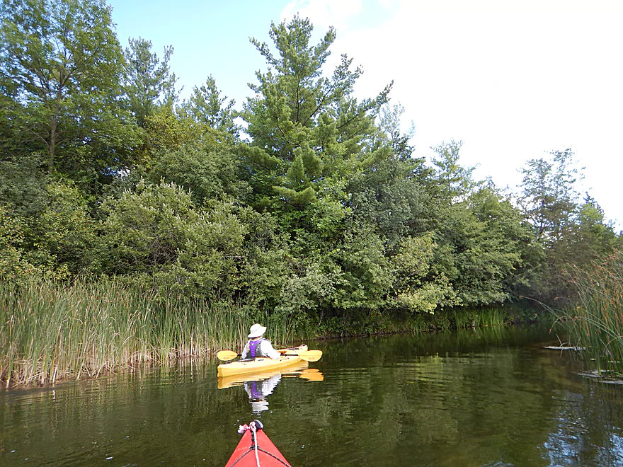
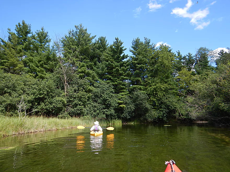
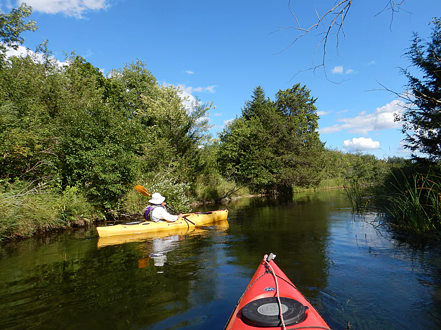
Cool wooded corridor
One of multiple riffles
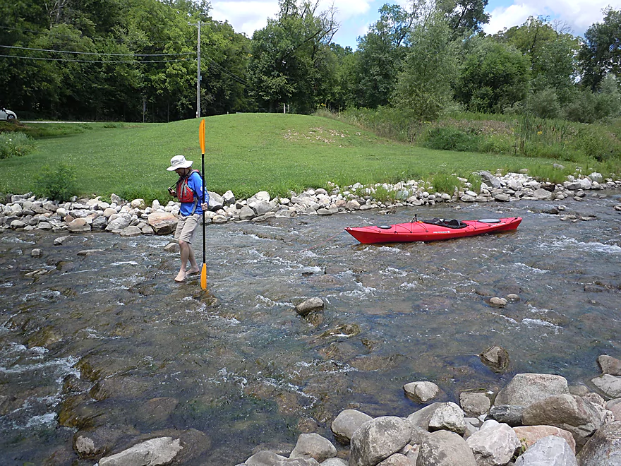
This section is a bit shallow…
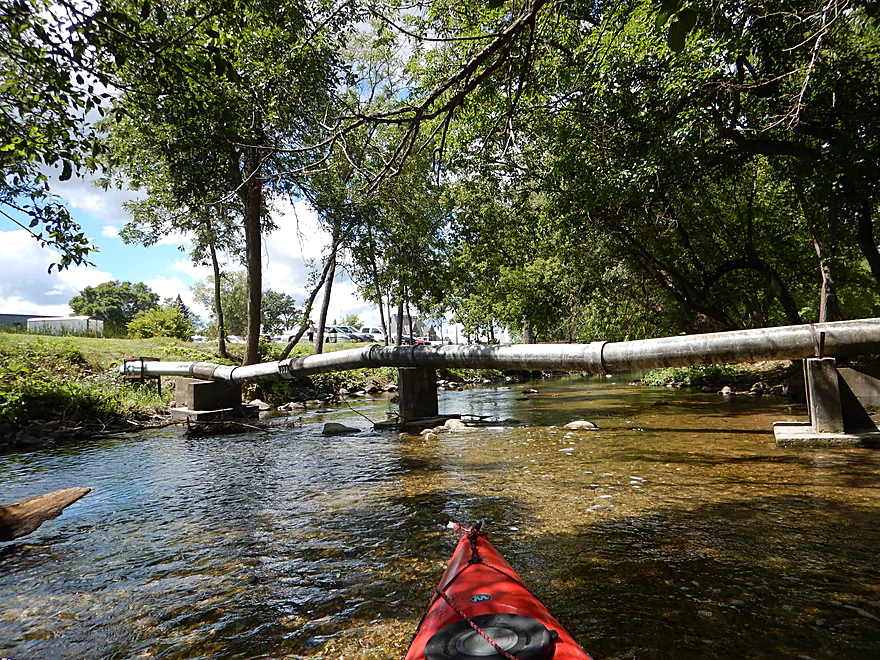
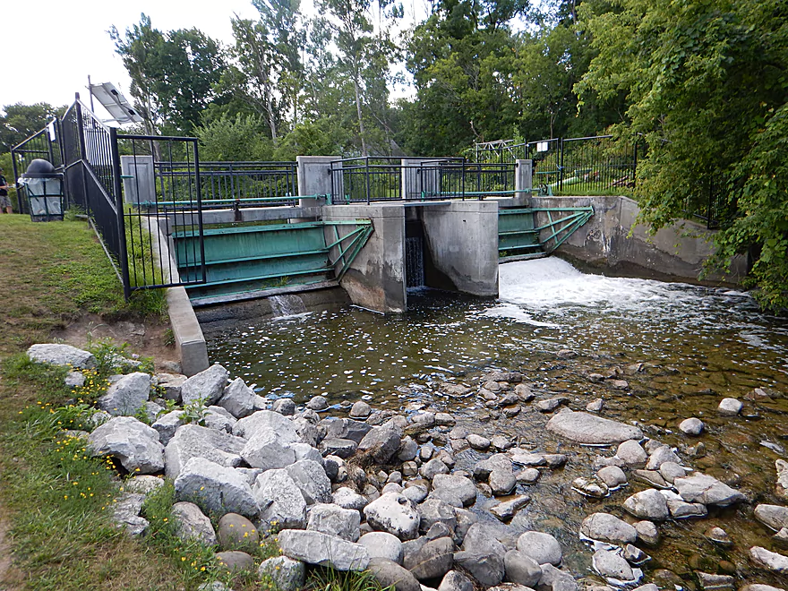
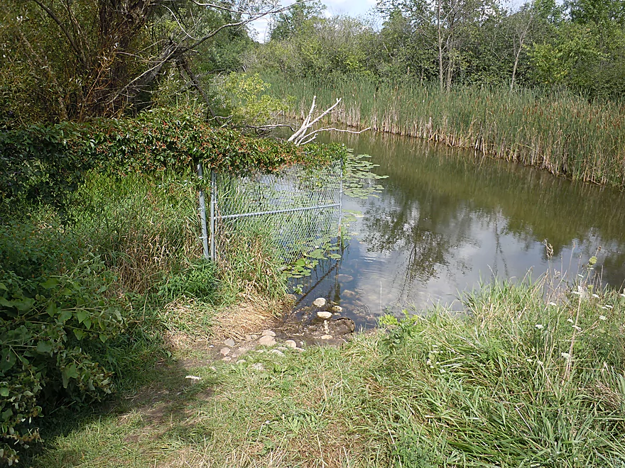
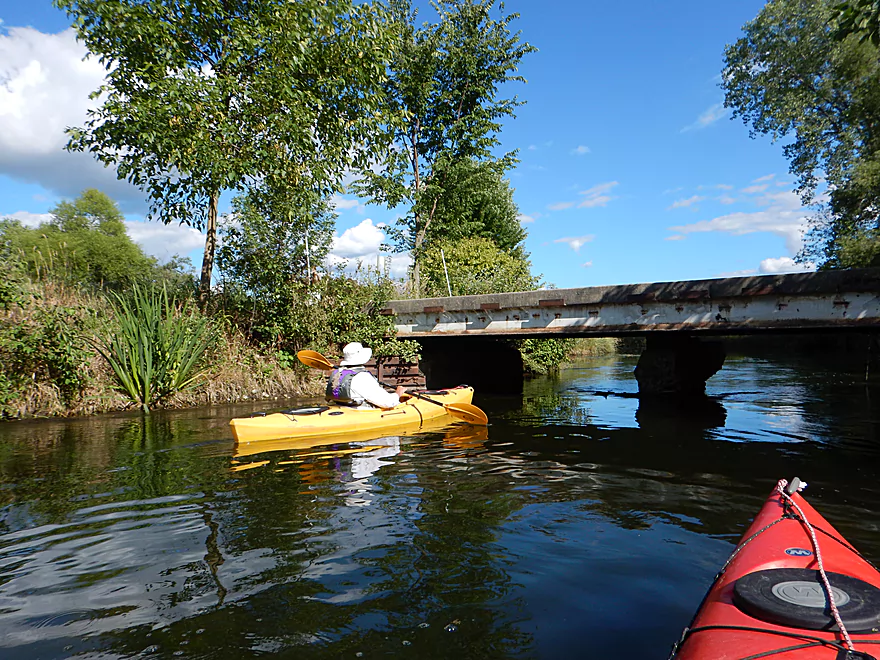
The pipe carries water to the local fish hatchery
Veteran’s Memorial Riverwalk (hatchery on left)
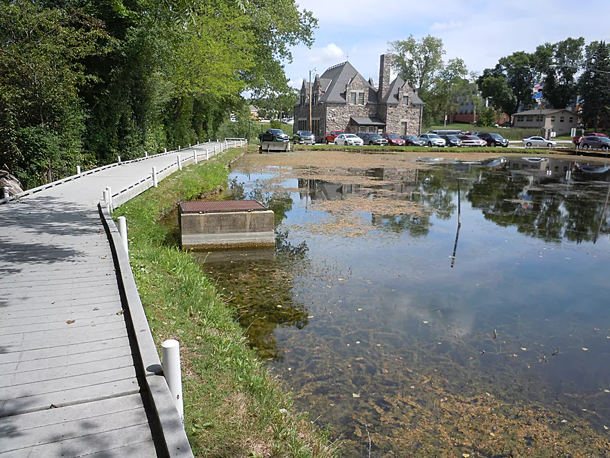
Riverwalk and fish pond. There is a nice canoe ramp below the hatchery building
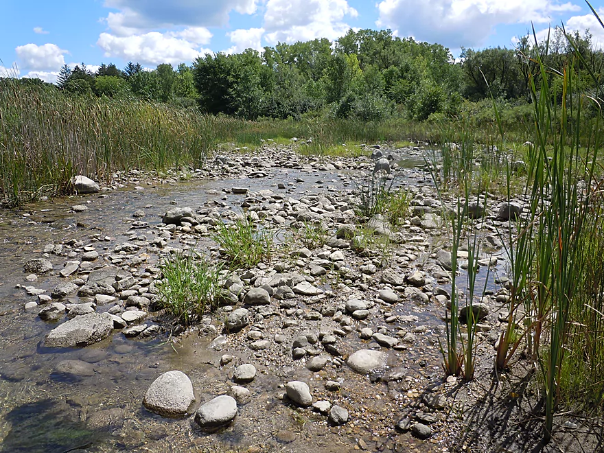
Very rocky river to start
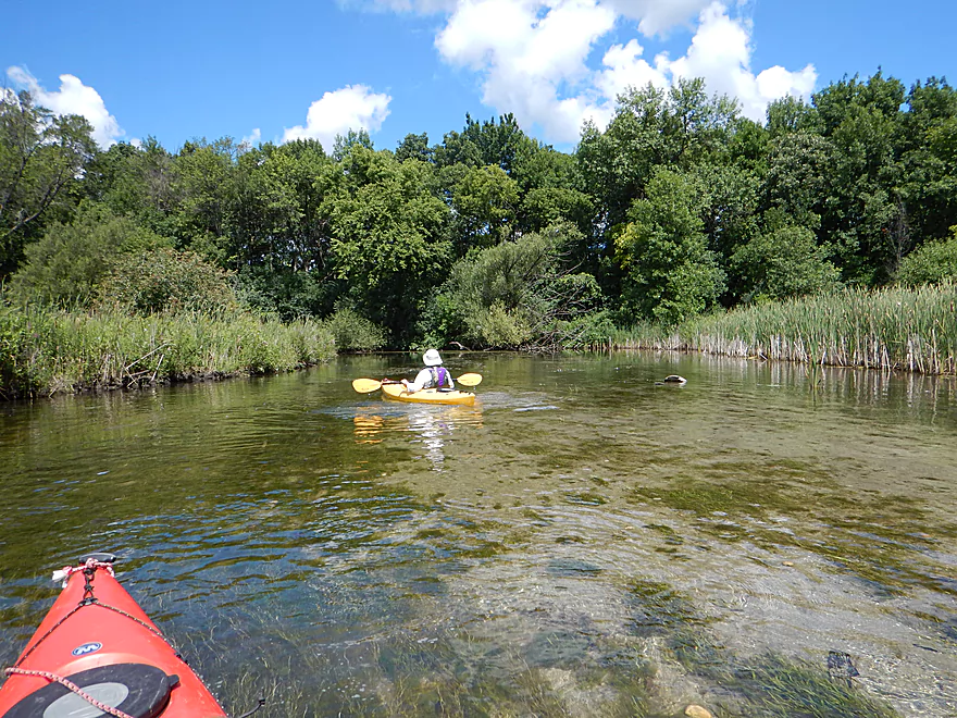
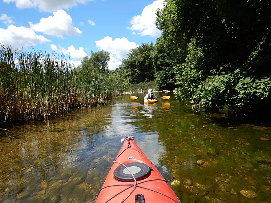
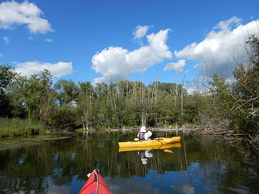
Marsh is starting to encroach on the river
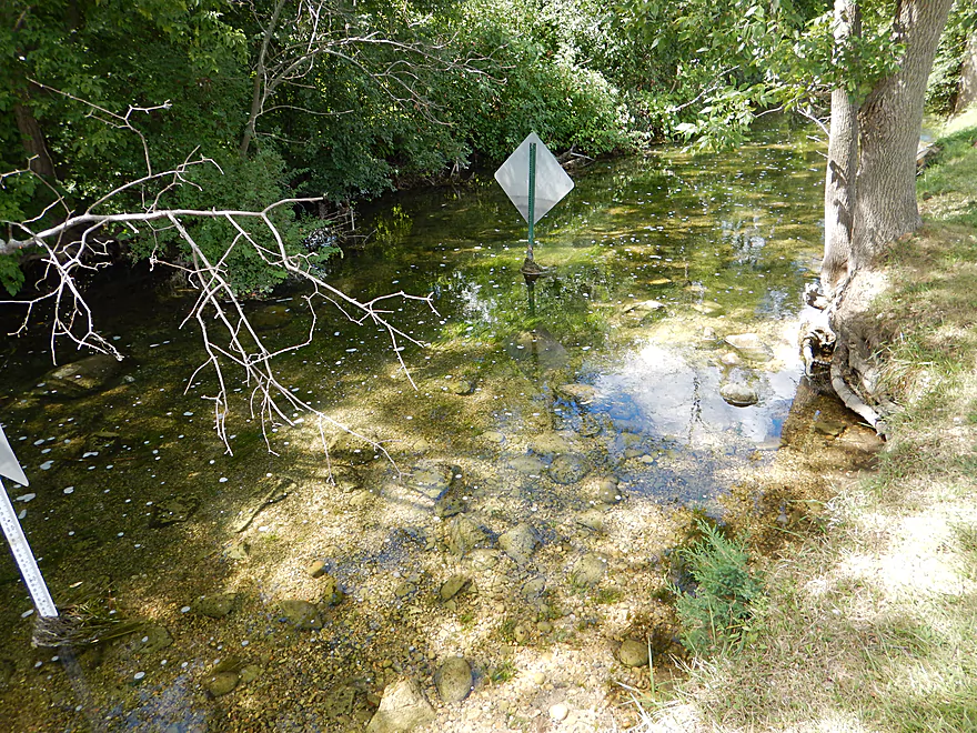
Strands of green algae
Attractively swaying in the current
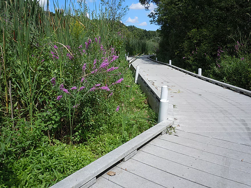
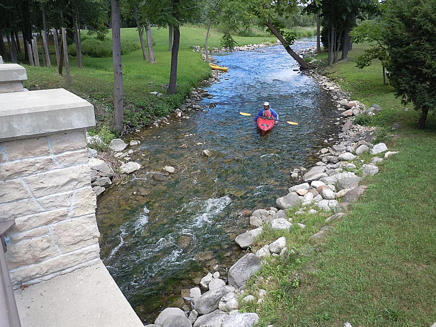
Riverwalk continues to flank the south shore of the river
Approaching North Cushing Park Road
Cushing Memorial Park is a good access option
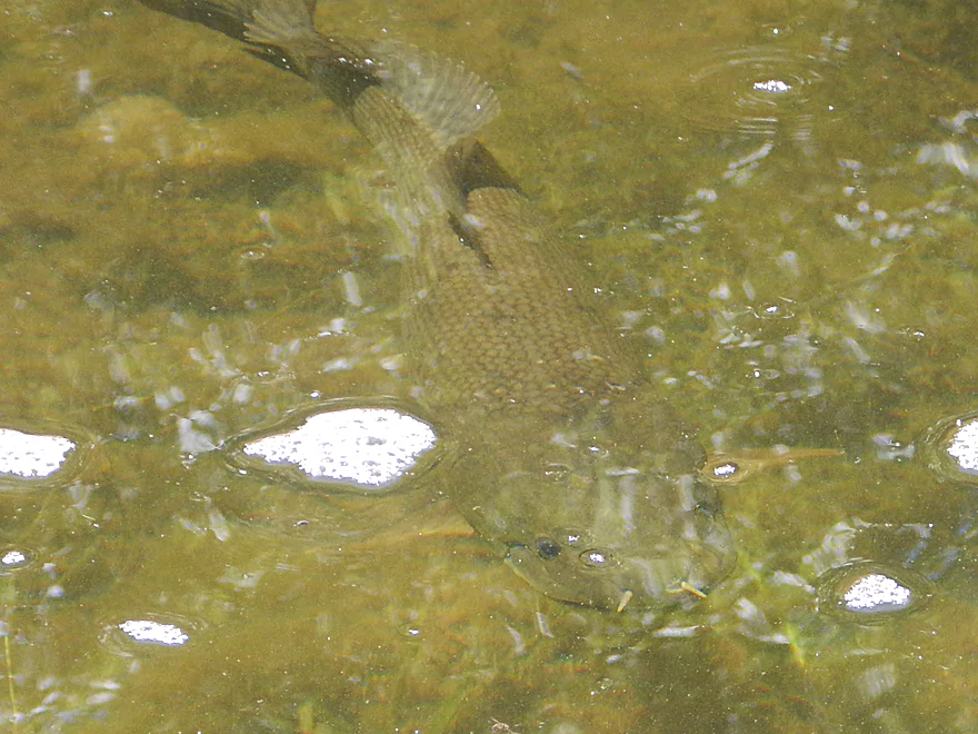
A friendly bowfin
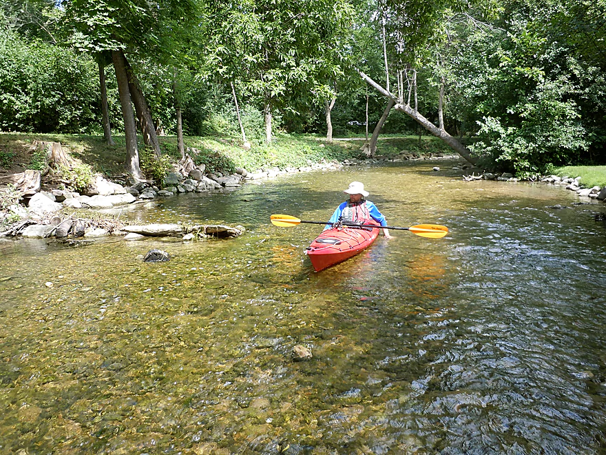
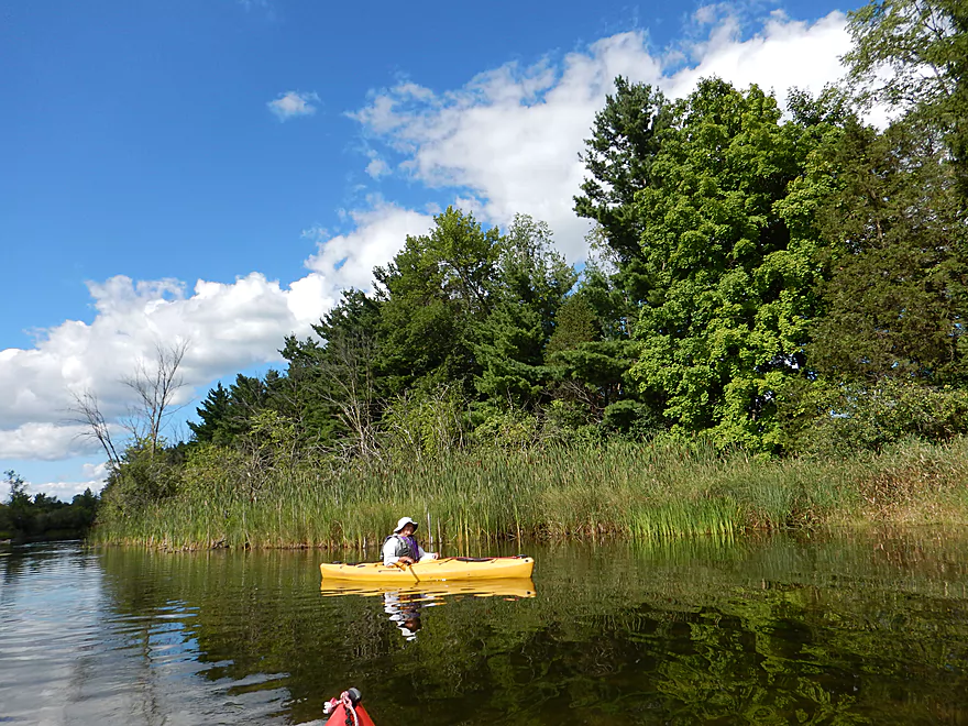
So scenic…
Coming up on a mini flowage?
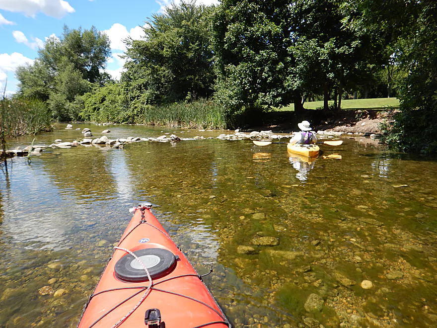
The locals created a homemade dam
Pretty easy to get through
Side channel flowing over a cool rock field
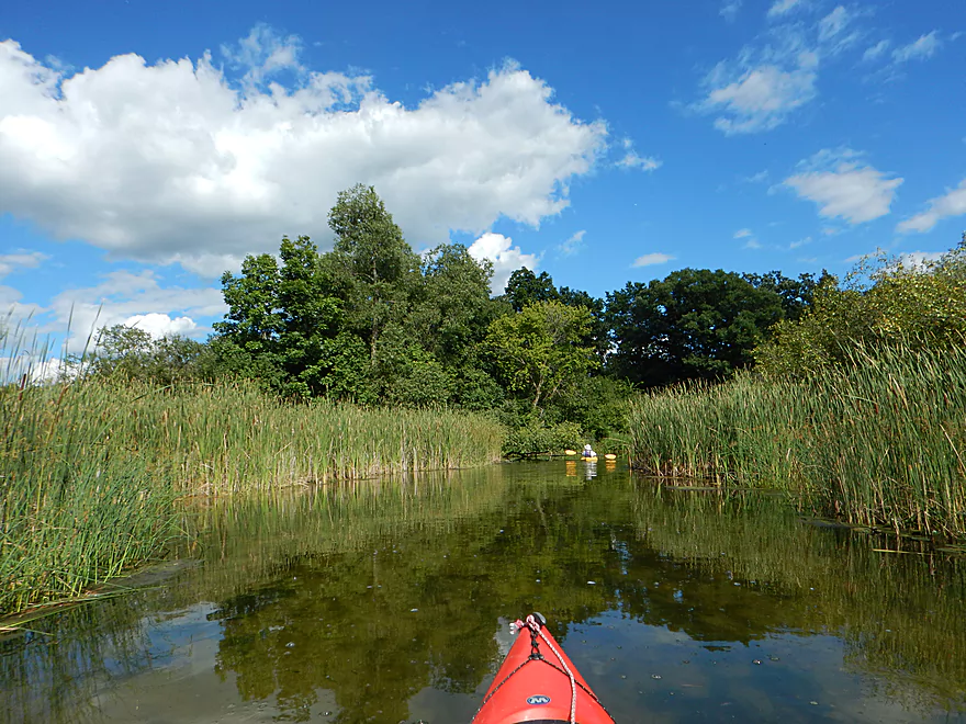
Very pretty marsh
Approaching the old Nemahbin Roller Mill
Fun rapids where the mill dam used to be
Just a tad shallow

River has been artificially reconstructed but is scenic
More fun rapids under North Mill Road bridge
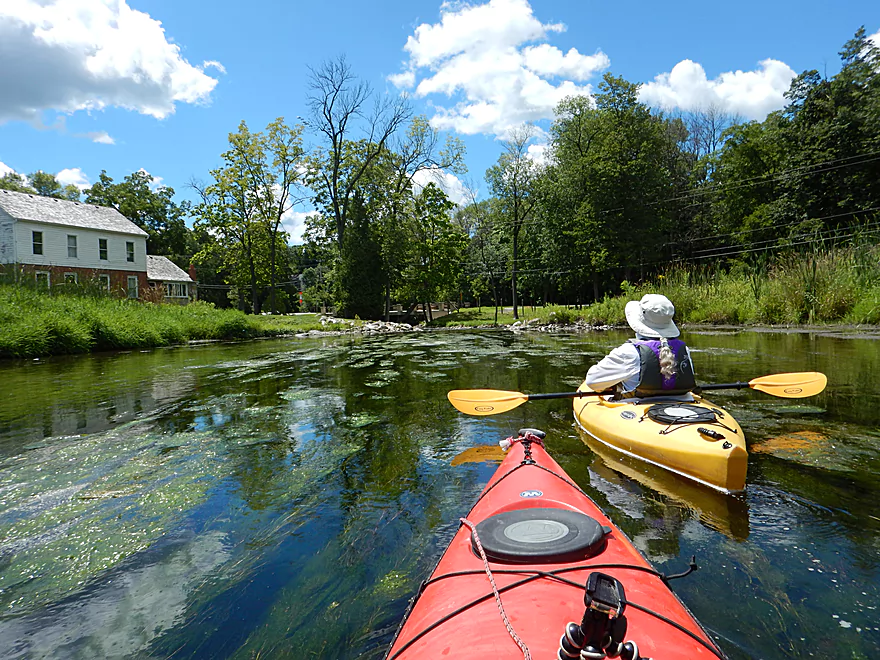
Entering a more developed section
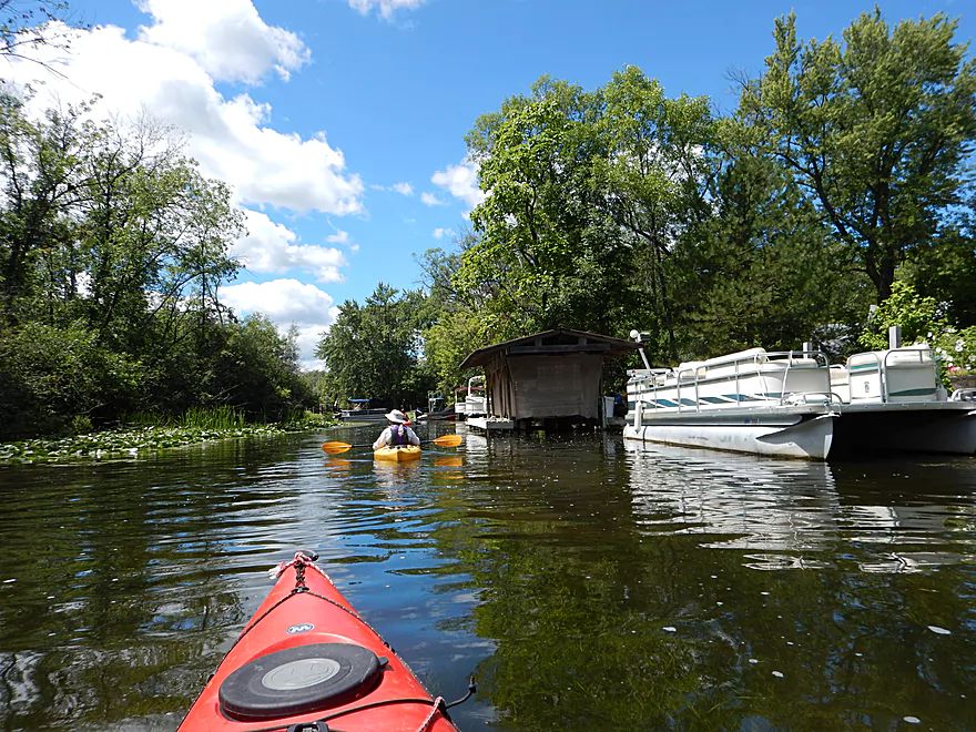
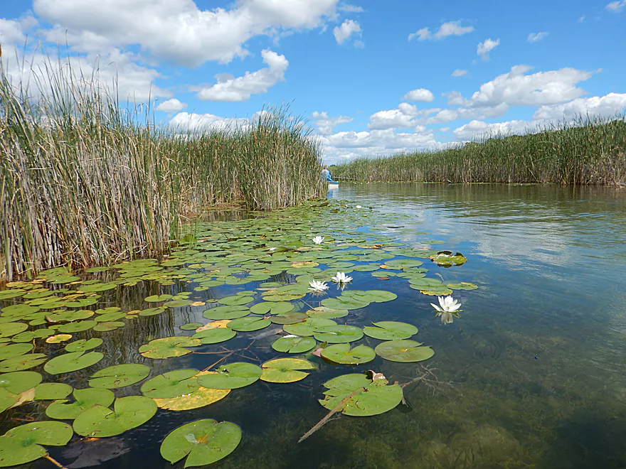
Boats and waterlily beds line this part of the river
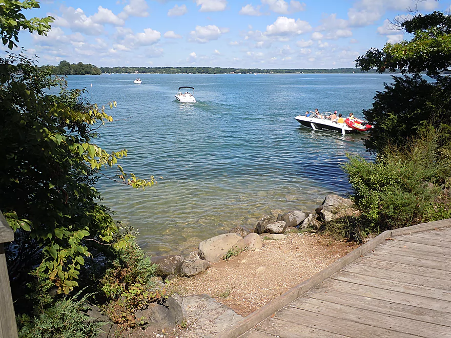
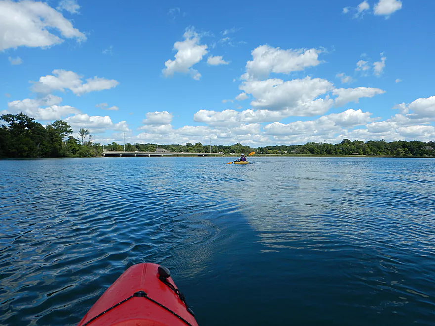
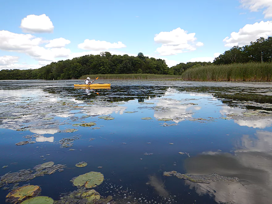
Entering Upper Nemahbin Lake
Only to quickly exit to the left
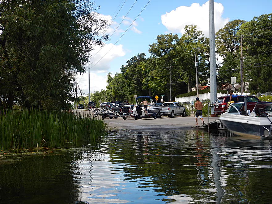
Public ramp by I-94
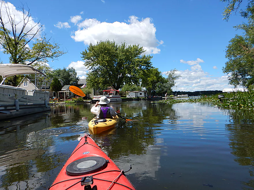
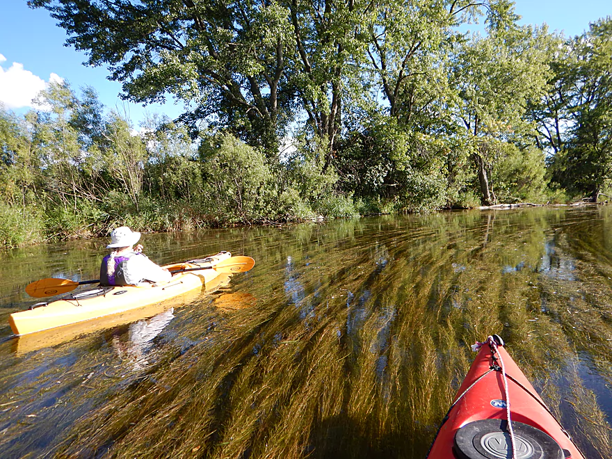
Lots of other kayakers on the lakes
Now on Lower Nemahbin Lake
The Sugar Island launch is a good access point on this lake
A little tricky, but we found the river again
This section is an attractive cattail marsh
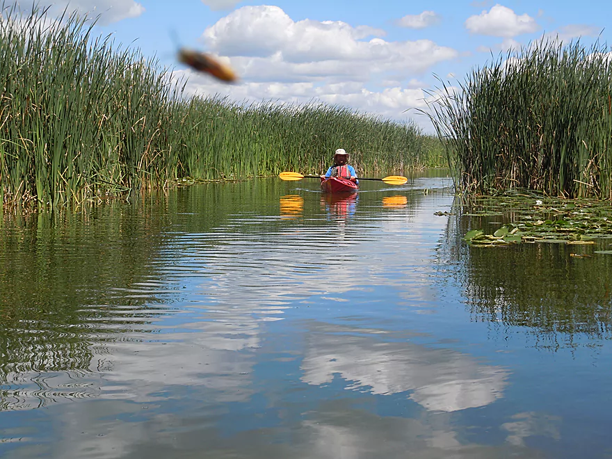
Bug photobombing the river shot
Back to pier-land again
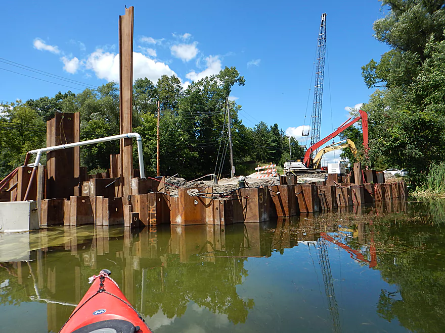
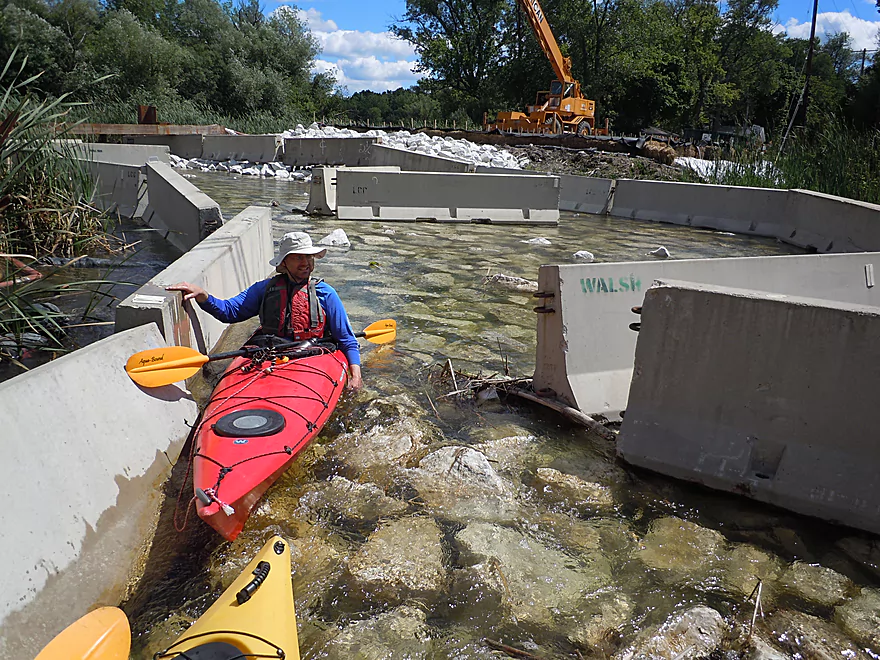
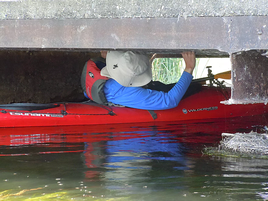
The Sawyer Road bridge is being replaced
You can kind of paddle around this
Very bumpy though
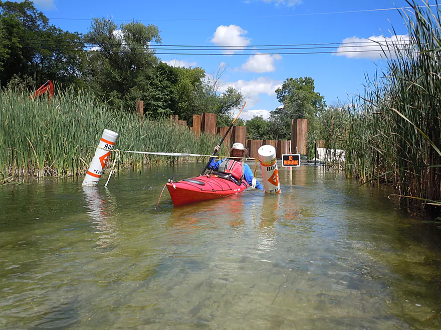
Signs warn against entry, but we had to get to our car
River now flows through a large cattail marsh
Cool cattail corridors
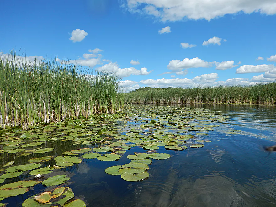
Great trip for waterlilies
Entering Crooked Lake
But just briefly…back on the river again
Fingernail clams reminiscent of the lower Bark
One of several low bridges
Be careful of the protruding nails
Trees mark a shift in the topography
Genesee Lake Road is a good launch option
Surprised to see a few pines
A suspicious looking boulder garden
Shrubs made this feel like an up-north river
An ecologically diverse riverbank
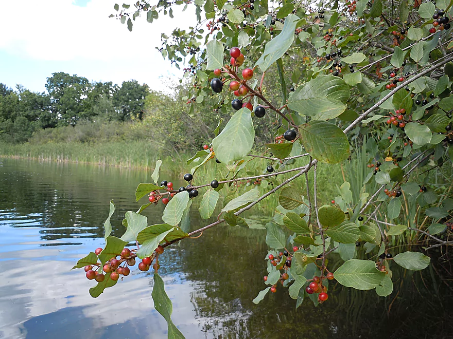
Lots of glossy buckthorn
Thoughtful of the bridge owner to create the arch
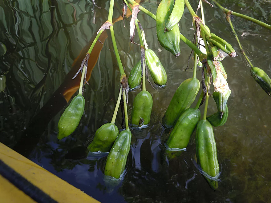
Wild iris/blue flag seed pods hanging in the current
Yet another low bridge
River starting to widen and slow down
Second lowest bridge
An island of dead tamarack trees
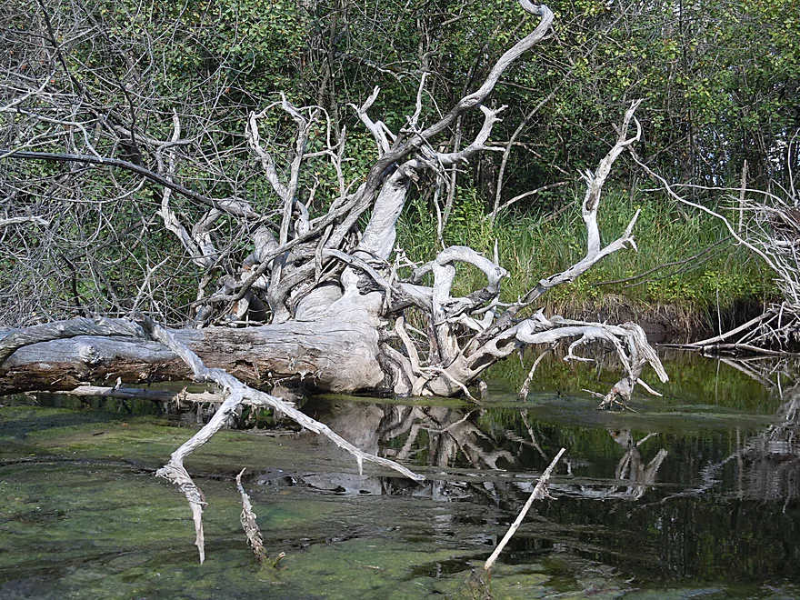
Gnarly roots
Gorgeous pondweeds
This is THE lowest bridge
Pondweeds guiding us to the landing like runway lights
Nice take-out at Summit Ave (Hwy 67)
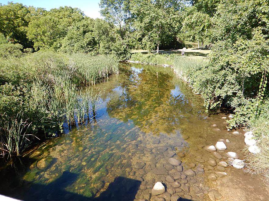
Looking downstream from the bridge
Bark River – Delafield


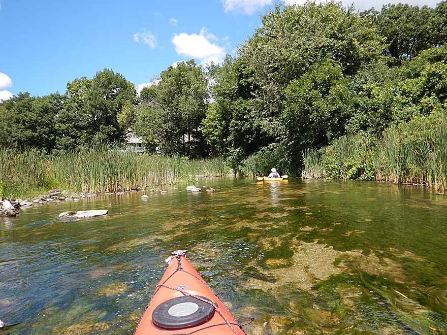
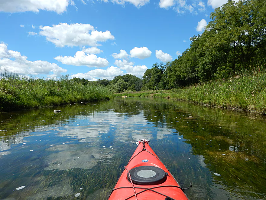
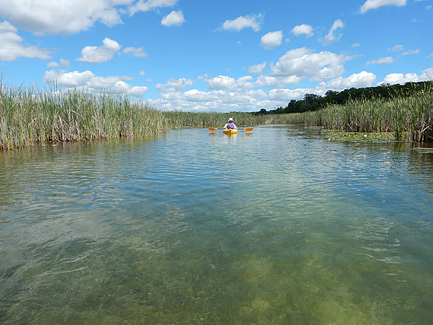
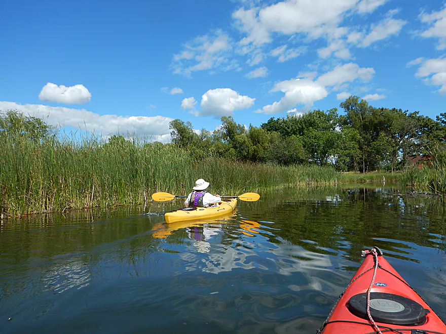
Comprising another “chain of lakes” very similar to its close neighbor, the Oconomowoc, the Bark threads its way through several kettle lakes before heading toward its junction with the Rock River near Ft. Atkinson. Exceptionally clear water carries the paddler past extremely diverse landscapes–the very urban, the busy lake, marshy cattail corridors, and a remote rural landscape with an “up-north” feel.
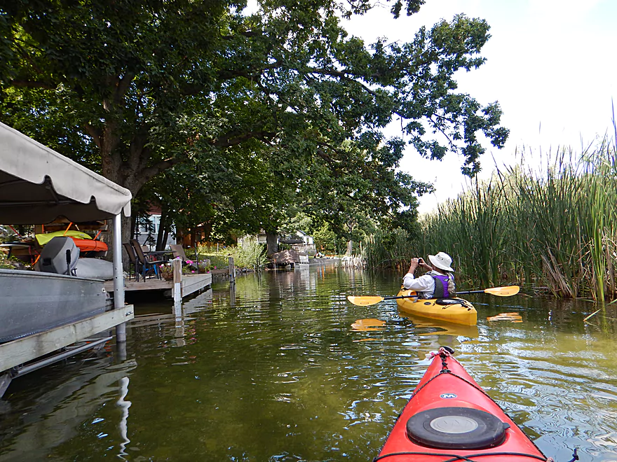
The trip starts in the heart of Delafield just downstream of Nagawicka Lake. Here you can park at St. John’s Park and launch below the dam. The first 2-3 miles are the best part of the trip, and while you can launch further downstream from St. John’s Park, you’ll miss out on some nice sections of the river.
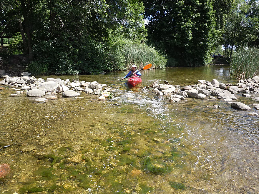
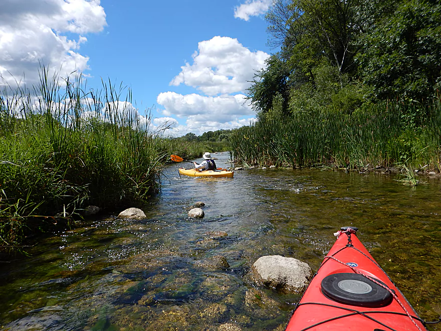
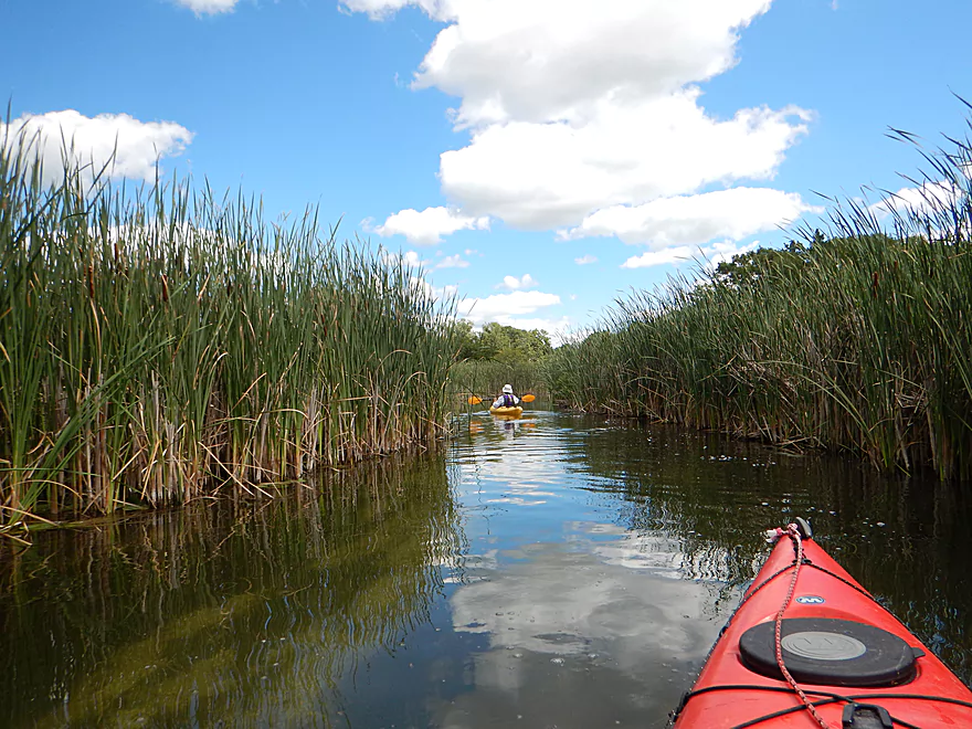
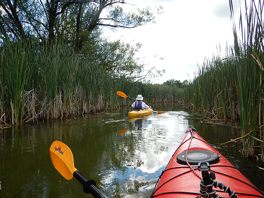
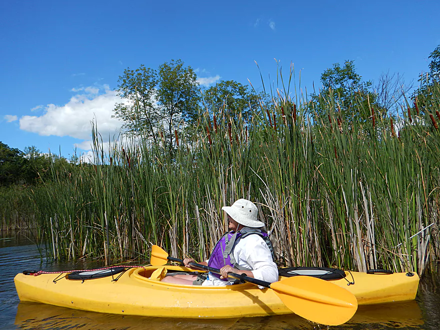
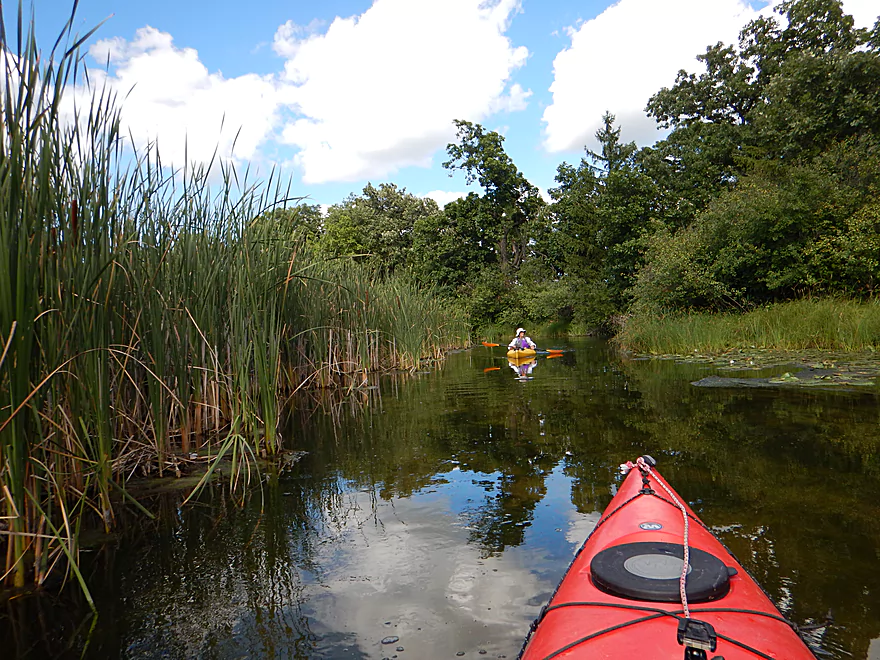
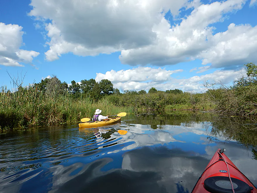
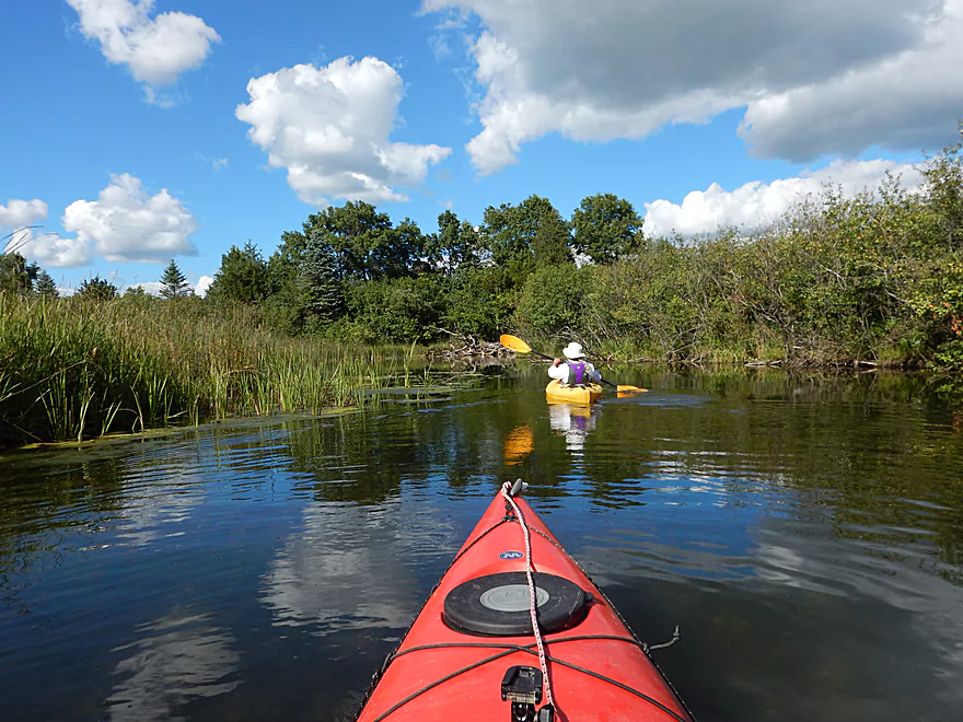
So how great can the upper Bark be if its first few miles wind through a heavily developed suburb of Milwaukee? Actually very. Because of the nearby parks and protected shoreline, you actually don’t see that many houses. The highlight in the Delafield section is the clarity. This is one of the clearest rivers I’ve ever paddled and afforded great views of the clean rocky substrate and the many fish scooting through the water. The current was also respectable with a number of light riffles that kept you scooting along.
Located maybe a mile into the trip are the remnants of the old Nemahbin Roller Mill Dam. Eight years ago, the owner faced a choice of removing the dam or upgrading it to meet DNR safety standards. The owner chose to remove it, but the neighbors reacted by suing the landowner claiming the removed flowage would lower their waterfront property value. After lengthy litigation and even a jury trial, the owner prevailed and the dam was removed. The result is an attractive rocky marsh where the flowage used to be and the dam itself has been replaced with a fun riffly section.
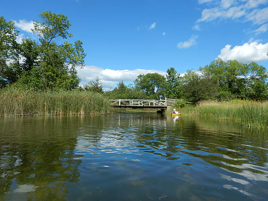
Soon after the old mill, you are on the big lakes. First Upper Nemahbin Lake, then after the I-94 bridge a longer stretch on Lower Nemahbin Lake. The lower lake is much nicer than the upper and is popular with paddlers. In the middle of Lower Nemahbin Lake is large, wooded and very developed Sugar Island. But this island has a twist… It was heavily developed in earlier years with the promise that a bridge would be built. This never happened, and to this day residents can only get to their homes via a boat launch located west of the lake.
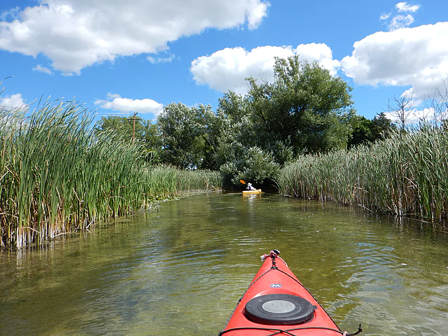
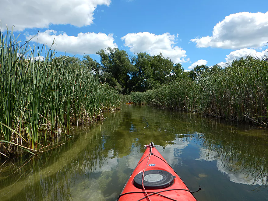
Finding where the river resumes is a bit tricky, but you should be able to find the small entrance on the western end of the lake amidst a massive cattail marsh. The marsh itself is pretty cool to traverse. Unlike other marshes, the river channel is actually narrow and has current. Together with the sheer height of the cattails, this creates a bit of a tunnel effect. Observant paddlers will notice the river forks in the cattail marsh with the north channel leading to the “Blue Hole.” Here paddlers can look down a very deep hole where a marl mine used to operate.
After leaving the lake area, you will come to Sawyer Road. The Sawyer Road bridge crossing was the only unpleasant part of the trip. The bridge and adjacent dam are being replaced, and the entire river channel was being diverted around the construction zone. Paddlers are warned away, but in our case, we had to get through to get to our car and portaging wasn’t an option. The huge chunks of fill rock made it difficult to get a boat over, but with enough “kayak push-ups,” we made it through. The good news is, this bridge and the dam are scheduled to be completed by November of 2016 (and ironically, according to the official plans, will make it easier for canoes and kayaks to portage!).
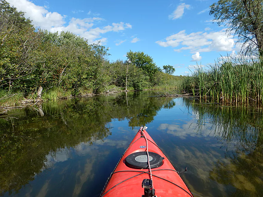
Following Sawyer Road, the river flows over a large glacial outwash plain with distinct deposits of sifted sand and gravel. The water clarity is still terrific as the channel narrows and snakes through a really cool cattail marsh with occasional lily beds. The Bark then enters the last “bead” on its chain, Crooked Lake, before making a quick exit to the immediate left.
Following Crooked Lake, there is a very popular access option for paddlers located by Genesee Lake Road. The river after the bridge changes significantly. You once again see river banks, and the cattails are mostly replaced with a much more natural and diverse landscape of shrubs, hardwoods, pines, grasses, and flowers. This is an attractive part of the river with a very “up-north” feel to it.
Milton Bates, in his book The Bark River Chronicles describes a favorite spot on this stretch–an island of tamaracks at a sharp bend in the river. The trees have since unfortunately (and mysteriously) died and only their skeletons remain (see a picture of this is in the gallery). It is still an outstanding paddle, with berry-laden shrubs, boggy fen areas, and clumps of blue flag (a June paddle would probably catch them in full bloom.)
Maybe a mile prior to the take-out, the Delafield-Hartland sanitation plant empties into the river after being piped 4 miles around the lakes. This plant has an unfortunate history of contributing pollutants and fertilizers to the Bark, which has led to the river being listed as “impaired” by the DNR. After the septic outlet, the pondweeds increase significantly, but in some ways are kind of scenic because of how they flow in the current and stand out in the clear water.
So, in summary, a great paddle that I highly recommend to others. My favorite section was the first few miles from Lake Nagawicka to Lake Nemahbin, although the lakes and other sections were all quite nice and it is easy to subdivide this trip or lengthen it if need be. The only downside was the road construction, so you might want to wait until November of 2016 to at least paddle the part by Sawyer Road.
St. John’s Park is a good launch option often overlooked by local paddlers. Parking is free, but there are only a few spots for cars and you do have to drag your boat 400′ over grass to reach the dam. Alternatively, you could park in downtown Delafield or by the Post Office, which is right across the street. There is an outhouse, but it was locked.
Ok take-out option off Summit Ave/Hwy 67. The road here is very busy, but there is room to park northwest of the bridge and a nicely mowed access area southeast of the bridge.
- Naga-Waukee Park: If you don’t mind a mile of lake paddling and portaging a dam, you can launch upstream off Nagawicka Lake’s only public ramp on Mariner Drive. Note:, Naga-Waukee Park has a separate fee from the launch, but if you pay the launch fee ($6), you don’t have to pay the park fee. This is a nice landing and park.
- Delafield Fish Hatchery: Very good parking here with a great canoe ramp northwest of the hatchery. However, if you launch here instead of St. John’s Park, you do miss out on a nice part of the river.
- Cushing Memorial Park: A popular put-in option with local paddlers that has free parking and multiple locations to launch from. If you put in here, you do miss out on nice upstream sections.
- Nemahbin Lakes Ramp: Located between Upper Nemahbin Lake and Lower Nemahbin Lake. This costs $6 for paddlers but does have an outhouse.
- Sugar Island Launch: A great option located on Lower Nemahbin Lake off Sugar Island Road. This launch is the main “ferry” line between the mainland and Sugar Island. You can’t park at the main docks or launch here…but just a bit north of the main docks there is an area set aside for paddlers to park (no cost) and launch which is quite nice.
- Sawyer Road: Traditionally a launch option for paddlers, this bridge (and adjacent dam) are currently under construction and won’t be in service until November 2016.
- Genesee Lake Road: A very popular bridge access with locals that is a good option for putting in or taking out.
- Hwy 18 Wayside: There is a park/wayside (Atkins-Olson) located by the Hwy 18 bridge that would be a very good take-out option. Note: Hwy 18 crosses the Bark multiple times by Dousman…this is the last Hwy 18 bridge. Also note, several paddlers have faced serious logjams between North Main Street and Atkins Olson Memorial Park. Paddle at your own risk.
Panga Bar and Grill located on Upper Namahbin Lake does rent kayaks. Another option is PRS Watersports.
For bike shuttlers this would be a longer 7-mile shuttle, but….a significant portion (at least 6 miles) would be on either the Glacial Drumlin State Trail or the Ice Age Trail (part of which follows the river).
While there are multiple riffles, none of these are dangerous. Logjams are not a problem as well.
The bridge at Genesee Street is being replaced and there are warning buoys to deter paddlers, but you can paddle though this, no problem (for now). Hopefully this will be done by the end of 2016.
Of much more significant consequence, the dam and bridge are being replaced at Sawyer Road. This area is roped off and the main channel has been sealed off (literally). If you are desperate to get by, you can by following a side channel around the dam. The current flows over large limestone blocks that make this almost impossible to portage, yet shallow enough not to run. If you are determined and use “kayak push-ups” you can get through (albeit, with a few scratches on your boat). The bridge and dam should be completed by November 2016, at which point it should be an easy portage.
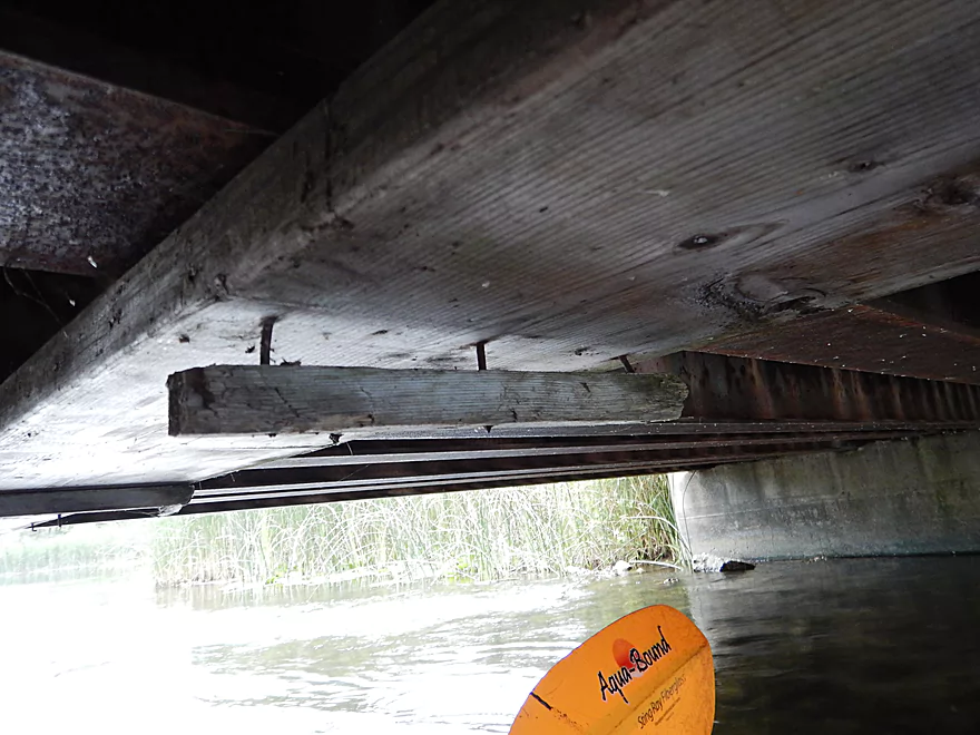
There are are also multiple low bridges to be concerned with. The first is between Crooked Lake and Genesee Lake Road. This should be pretty easy to duck under, but there are exposed nails that you do not want to hit your head on.
After Genesee Lake Road, there are two more low bridges that can be an issue in higher water. Canoes have been known to get stuck under these, so do be careful.
Lastly, there is a super low farm bridge close to a mile upstream of the take-out. Most paddlers portage this. We were able to get through, but have low riding kayaks and the water levels were very low.
2023 Webmaster Update: The dam and bridge repairs have been completed. The dam ledge isn’t that big and can be run at most water levels.
The local gauge at Delafield read 18 CFS which is below the summer average of ~20 CFS. Statistically the river very rarely gets below 15 CFS. In the spring or after a heavy rain, it will spike up to 30-50 CFS. From St. John’s Park to Upper Nemahbin Lake, you will have to portage (walk) a few shallow sections unless the river is very high. It is worth it though as this section is so nice and portaging in the clean rocky water is not a problem. In fact, I suggest going at the lowest CFS possible to maximize your ability to see through the water (going on a cloudless day helps too).
After the lakes, getting hung up on shallows will never be an issue. But more of a concern will be the four private bridges that are very low. In high water these may all require portages.
The current is decent upstream of Lake Nemahbin with a few riffles. The current slows after the lakes but is still respectable.
In winter the channel stays open between Genesee Lake Road and Dousman, if you’re into cold weather paddling.
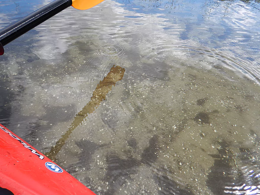
Blue herons, many green herons, one beaver, several painted turtles and many fish. The highlight was a large bowfin by Cushing Memorial Park that let me get very close. Bowfins are actually very cool fish. They can breath air, swim backwards and were around when dinosaurs roamed the planet.
Also of significance, the upper portion has a large number of zebra mussels. These are an invasive species, but they actually do a remarkable job of cleaning up water clarity (perhaps why the Bark is so clear). An interesting aside about zebra mussels is that in Lake Erie they are credited with improving the clarity from 10′ to 17′.
- Veterans Memorial Riverwalk
- Delafield Ice Age Trail Segment
- Old World Wisconsin
- Lapham Peak
- Delafield Coon Feed
Detailed Overview
For more information on access options, see my Overview Map. For a background on area human interest stories, I recommend the book “The Bark River Chronicles“.
- Cty Q to N Road: 0.1 miles. Small, channelized and weedy…this may require high water to run.
- N Road to Hillside Road: 1.4 miles. Small and marshy with maybe 2-4 logjams. High water is likely needed to run this part.
- Hillside Road to Hwy 164: 2.0 miles. Maybe 5-10 logjams. Very small and marshy. Likely needs high water to run.
- Hwy 164 to Lisbon Park: 2.9 miles. Maybe 2-4 logjams. The channel here is small, shallow, weedy and bog-like. High water is recommended.
- Lisbon Park to Merton Dam/Firemen’s Park: 1.3 miles. Mostly simple flowage paddling.
- Merton Dam to Bark River Park: 4.9 miles.
- Merton Dam to Dorn Road: 1.2 miles. Very scenic section with great fall color. Highlights include some boulder gardens, springs, clear water, and pine trees. Diverse banks with some woods and some marsh. There is one tricky logjam by the old mill.
- Dorn Road to Hartling Road: 0.7 miles. A short but pleasant open section with no logjams.
- Hartling Road to Rybeck Road: 1.0 miles. A scenic mix of light woods, marsh, and a few boulder gardens. There was one easy logjam to portage and a few hoppers/duckers, but it is mostly open.
- Rybeck Road to Centennial Park: 1.0 miles. Starts open and has a fantastic boulder garden. The last part is more cluttered with a number of logjams to hop over. I never had to portage though.
- Centennial Park to Bark River Park: 1.0 miles. A fast wooded section with multiple logjams. There are about four major logjams in a row, but you can skip them all by portaging on the boardwalk to the east (super easy). There are some additional hoppers beyond this stretch, but I didn’t think they were too bad.
- Bark River Park to Delafield Post Office: 6.1 miles.
- Bark River Park to Nixon Park: 0.7 miles. Terrific stretch through the heart of Hartland. Highlights included many fun Class 1 rapids and one Class 2.
- Nixon Park to Cottonwood Ave: 0.5 miles. Nice stretch with a mix of light woods and suburban homes.
- Cottonwood Ave to Hwy 83: 1.4 miles. Mostly an open marsh section. A few portages are required for downed trees.
- Hwy 83 to Lake Nagawicka Mouth: 1.3 miles. Less marsh and more woods…this is a nice stretch with good water clarity.
- Lake Nagawicka Mouth to Delafield Post Office: 2.2 miles. This is almost all lake paddling. Lake Nagawicka has good clarity and some attractive shoreline homes, but it is heavily developed and suffers from excess motorboat traffic. Several alternate access options exist along the lake shore.
- Delafield Post Office to Hwy 67: 7.7 miles.
- Delafield Post Office to Nemahbin Lake Boat Launch: 1.8 miles. Likely the best stretch on the entire river. Highlights include attractive rocky sections and stunning clarity.
- Nemahbin Lake Boat Launch to Sawyer Road: 0.7 miles. Mostly a simple paddle on Lower Nemahbin Lake. Highlights include great water clarity, an attractive cattail corridor and the “Blue Hole”.
- Sawyer Road to Genesee Lake Road: 2.2 miles. Very nice marsh paddle.
- Genesee Lake Road to Summit Ave: 3.0 miles. A good stretch with ecologically diverse banks.
- Summit Ave to Hwy 18 Wayside: 3.8 miles. A decent prospect. The take-out is a small park/wayside and the last of the three Hwy 18 bridge crossings. Note, a recent reader comment says this stretch has many serious logjams.
- Hwy 18 Wayside to Hwy E: 6.2 Miles. Heavily channelized, but some of it still seems like it has potential. Note a reader noted that this stretch has many serious logjams, some of which are difficult to portage.
- Hwy E to the Rome dam: 4.2 miles. Half of this leg would be a flowage paddle on Rome Pond.
- Rome to Cushman Road: 5.6 miles. A fantastic stretch and one of southeast Wisconsin’s paddling gems.
- Cushman Rd to Hwy 106 Canoe Launch: 4.4 miles.
- Cushman Rd to Hagedorn Rd: 0.6 miles. A great leg with clear, fast water and many rocks. Only downside is, it can get shallow.
- Hagedorn Rd to Hwy 106: 3.8 miles. The first half is pleasant, clear and rocky. The second half is more of a floodplain paddle with more mud and downed trees, which was less interesting.
- Hwy 106 canoe launch to Prince's Point Wildlife Area: 5.5 miles. Be careful of the partly removed dam at Hebron. There are definitely downed trees in this section.
- Prince's Point to Burnt Village County Park: 7.1 miles. Much of this was a mediocre wetgrass paddle through a large marsh. However kayaking through the floodplain forests of the Prince's Point Wildlife Area was very cool.
- Burnt Village County Park to the Rock River: 5.5 miles. Does not seem super interesting. Landing is just upstream of the mouth on the east bank.
Trip Map
Overview Map
Video
Photos Size:
Hi, we took the canoe along this stretch today, this guide and photos were really helpful so thank you. We put in at Sawyer Rd. just below the dam, and took out at Summit/67. The water was high and fast and there were more bridges than I remember from the last time we paddled this. We passed easily under some, VERY narrowly squeaked under two more but had to portage three, including one that required a steep bank climb and descent, and the final (the farm bridge at the end) that required us lifting the canoe straight up and over and straight down, which was challenging for me and my kiddos. The rains have left a lot of downed trees and branches also, making navigation a little challenging in parts. We will look into the Delafield stretch next time, maybe taking out at Sugar Island. Anyway, thanks again for the info and the photos. Happy 4th!
Really appreciate the comments Allison! Yeah, the Bark has unfortunately been high all year. I scouted it actually two days ago and saw kayakers easily go over the Sawyer Drive dam it was that high. But it still looked nice!
Thank you so much Aaron for your very helpful review. Six of us paddled this segment (Delafield to 67) on 10/19/2017 (CFS 31.7, Height 12.70′). Our group enjoyed this paddle very much and plan to keep it in our regular rotation. We put-in at the Delafield post office (across the street from St John’s park), which eliminated having to transport our kayaks 400′ at St John’s park. After shuttling the cars to Whitiker Lane (at the intersection of Whitiker and 67 (Summit)), we transported the drivers in one car back to St Johns park to leave the car there. The put-in and take-outs were easy to manage.
We were able to find our way into the cattail area channel on Lower Nemahbin Lake quite easily. On the day we paddled, the channel was much wider that what you describe as a tunnel. There was an area in the cattail channel, just as we were approaching Crooked Lake, where we could go either left or right. We initially chose right, but a low bridge would have required a portage. We decided to backtrack and follow the left channel which had low bridges that we could squeeze under.
We were fortunate on this particular day that we were able to scoot our kayaks over the new spillway dam at Sawyer Rd and the water level was shallow enough that we were able to squeeze under numerous low bridges. I am happy to report that not a single portage was necessary the entire distance.
Our favorite aspects of this segment of the Bark is the intimate river feel, ever changing landscape, quick current, rock garden run and crystal clear water.
Appreciate the information Theresa. Launching at the Post Office was a good idea.
The Bark River really is one of the state’s most underrated paddling rivers.
Hi Aaron, i am curious about some of the photos. Can we learn more? Thanks
Hi Kristen. Each photo in this write-up corresponds to the above write-up and map. If you have specific questions, I would be happy to help you.
Hi Aaron, ok, figured it out, a couple photos are near the Nemahbin Dam removal, if we would like to borrow images when discussing recreational opportunities around the removal, whom shall we talk to? Thanks
Has anyone recently taken this trip in a canoe? In some of the photos and video posted the water levels seem quite low. I’m concerned about scrapping the bottom with the canoe. I’m also interested in knowing if there are any areas this year that need to be portaged. Thank you!
The water levels are at 30 CFS now, which is much higher than the 18 CFS. I would aim for a minimum of 20 CFS…but you will still hit some rocks regardless. You could scout this before running…if too shallow, you could just do the section below I-94 which is much deeper. There are no real hazards, but there are a few low bridges that might need to be portaged later in the trip.
Does anyone know if you are able to get through the river at hwy 67 in Dousman? They are working on the bridge that crosses there, and there are signs posted about not crossing the river there. Just curious if you can still get through there.
You won’t be able to due to the construction. But you can park on Whitaker ln and take out at the last bridge. The farm has a grass path to the east of the bridge that runs south to the road.
So I’m sure this is a dumb question, but I’m a novice kayaker. Does anyone go down and then paddle back instead of shuttling cars back and forth?
Typically no. The current is usually too strong. But there are exceptions. Flowage and lake paddles can be done as round trips. Some slow rivers like the Crawfish or Rock can be done (partly) also as round trips. I usually post the gradient on a review. Anything over 1′ per mile is likely too fast to paddle against.
I’ve gone up river from genesee lake road to the nemahbin lakes several times. It might be a bit much at times for smaller children if that as a concern. However as long as you stay to the slower side of the river (typically the inside of the bends) it can be a nice way to work your way up to the lakes to spend time at one of the sand bars that always have people hanging out around. While still having a nice lazy river float down the bark to end the day.
Nice paddle and very much like you described. Two updates
1) They have re-done the river banks at the put-in in Delafield. The nice sloping grass is replace with a steeper bank and rip-rap rocks. Launching is still very do-able, but it’s either a 2 person job now or a scrape across some rocks. The launch / take-out at the base of the dam is not as friendly anymore. There’s still construction going on we’ll see how it all ends up.
2) There is bridge construction at the Summit Rd take-out through Sept 2018. The river is actually closed about 2 miles upstream of that, right at the take-out at Genessee Lake Road.
I appreciate the updates!
So i live in dousman and if you go past 67 and on to the park takout o. The far side of dousman there are a few spots where a tree is particularly blooking the river. A bit past the BP you will hit the first it is low so you have to go over the second there is a small slot on the left hand side there is a 3rd a fair bit down river from there where someone cut a path through it. Thats all i can remember its a really nice trip but the water is not as clear as pre 67
That doesn’t seem too bad…it’s definitely on my todo list. Thx for the heads up.
We did the section from Delafield to Hwy67/Summit St. bridge in Dousman yesterday, with a bike shuttle. The water levels seemed perfect (39 cfs and 12.75 ft) just a few shallow spots and we were able to squeeze under all the bridges. The only portage was the low head dam, but that was very simple. Excellent water clarity and a nice current the whole way. This is a trip I would recommend to anyone, truly a delightfully diverse and enjoyable trip from start to finish. Great scenery, lots of wild life, some development, but we only saw a few other people and that was on the lakes. It would be a great trip for someone who wants to try a bike or walk/running shuttle, as it is only about 6.5 miles, and it is on paved level bike trails (Glacial Drumlin , Cushing Park, and Ice Age Trail) the whole way except for a very short 2 block section from the take out to where you get on the Glacial Drumlin bike trail. The trails lead right back to the post office and go through some beautiful natural areas. I would recommend putting in across the river from the Post Office as it is a bit more level and there is a small gravel parking lot for unloading (I’m not sure if you can leave a car there but there is street parking nearby) at the take out there is a spot for parking on the north side of Whitaker Lane, we spoke to a nearby resident and he said it was fine as long as you were off the road way. A must do trip for anyone in southeastern Wis, and one well worth traveling to for the rest of us.
Yeah the Post Office sounds like a nicer launch option than the park. The bike shuttle also sounds great and I wasn’t aware it was paved. I do agree this is a must do trip for those living in SE Wisconsin…I would never have expected a Milwaukee suburb paddle to be so nice.
I was raised in Delafield from about 1950 until 1966. I now live in the Seattle area.
Me and one of my friends had a canoe that we mostly used on Lake Nagawicka. But in around 1960 (I was about 12 or 13) we launched our canoe just below the Nagawicka dam and paddled to Upper Nemahbin. Your pictures brought back so many great memories. Wow. Thank you so much.
Thanks for the comment!
I did this trip on 7/22 levels were about 33 CFS and 12.68 ft, higher than in your review but the water clarity was still fantastic. There is now a dedicated kayk/canoe launch across the street from the post office. Very nice concrete ramp that goes right into the water (see pics) There were a few low bridges to deal with but no blockages. I was able to get under all the bridges by laying down in my solo canoe but my paddle pal had to portage one bridge, but it is a very simple portage. We were both able to easily run the low head dam at Saywer Rd. Usually not recomended but it was easy and safe at these levels as there was plenty of water going over the lip and there was no backroller/hydraulic, but I cant speak for other levels. There were several people swimming there and they said kayakers run it all the time. We did a bike shuttle which I would strongly recommend as it is paved, fairly flat and goes through several very pretty areas. The amount of flowers, insects, wildlife and fish we saw was simply amazing, deer, eagles, owls, heron, crane, ducks, geese, muskrats, monarchs, swallow tails,and 1000’s of dragonflies link to a couple of pics https://1drv.ms/a/s!AjC8S6n5i35VgnfajP3H8Km6SFSR
https://1drv.ms/a/s!AjC8S6n5i35VgnfajP3H8Km6SFSR
Thanks Eric for the update!
We put in at summit. We took out on e. The last 2 miles were horrible. Apparently there had been a tornado that took out a lot of trees. Guess where we found them. We had to wade in chest high water and pull our kayaks through it. Our 11 mile kayak trip took almost 8 hours because of the last two miles. Before that it has been beautiful. Saw an eagle cranes and even a painted turtle.
So that mess must have been between Hwy 18 wayside to E. It’s too bad to hear about your experience…but hopefully others can learn from this.
Been very dry. Last night storm motivated me to try. Gage just under 20CFS. Nice trip. Bumpy at the removed dam site above Upper Nemahbin. River was beautiful after Sawyer rd. Clear and hard bottom. Got out at Genesee Lake rd. Had to drag through some shallow just before Gen. Lk Rd. Easy Bike shuttle, little narrow on Sawyer Rd and a short section of Delafield Rd. Seemed like we had river to ourselves, but much evidence of river use based on the cars with kayaks and racks parked at put-ins and take-outs. All-In-All we had a great trip thanks to wisconsinrivetrips.com
Thanks for the comment…your timing is funny. I was just thinking of doing the Bark tomorrow.
Looking to a 2-3 day camping trip. I would like to do some fishing. Is that possible? If so, how do I set this up? Thank you.
I honestly don’t know if there are practical camping options on the Bark. Sorry :(
If anyone does the stretch from the Sugar Island launch to Whitaker Lane after the rain Aug 9th-10th, can you let me know if you come across any major obstacles and also the navigability of the bridges and low head dam? I am looking to take Girl Scout’s on this stretch and need to assess skill level required. Thanks so much!
I just Kayaked from Delafield to Hwy 67. There are no snags that impede navigation but the low water level caused a lot of walking through the water between Delafield and Upper Nemahbin Lke. It was a very nice paddle.
My husband and I did this section of the Bark today. CFS around 23. I would highly recommend putting in at Sugar Island in Nemahbin and then taking out no later than the first HWY 18 Bridge. Delafield to Nemahbin is very shallow and we were constantly getting out of our yaks to get over rocks. It’s a scenic stretch to be sure, but more frustrating than fun.
After the 1st Hwy 18 bridge all the way to the Hwy 18 Wayside takeout is log jam after log jam. There are quite a few downed trees across the river that necessitate a portage. Again, this section is more frustrating than fun. I
In between was beautiful and I would highly recommend.
Thanks for the update…I think these downed trees are recent as that stretch used to be open.
Paddled from Sawyer Rd. to Hwy 67 on 28Apr2023. This gauge was at 43CFS, 12.7FT: https://waterdata.usgs.gov/monitoring-location/05426067/
I’m not sure how well this gauge predicts paddling conditions, so we scouted at the Mill Rd. rocky riffles to see if we wanted to put-in in downtown Delafield. The water level looked scrapey, and I didn’t feel like walking my kevlar canoe, so we put in below the weir/dam at Sawyer Rd. instead. (See this link to photos: https://photos.app.goo.gl/wk7bD26dEp6JoUR8A ). The water was crystal-clear for almost the entire trip.
Notable wildlife included a pileated woodpecker, sandhill cranes (flying), cardinals, lots of Canada geese and red-winged blackbirds.
As usual, we portaged some of the pedestrian/farm bridges and ducked under others, but I recommed careful scouting. Beware of the large downed tree just past the arched pedestrian bridge downstream from Genessee Lake Rd. Unless this blockage gets trimmed, paddlers will probably want to portage around it. My friend managed to make it through (see video in photo album), but described it as “a little gnarly”.
As usual, we parked on Whitaker Ln. near the Hwy 67 takeout. The Bark River between Delafield and Hwy 67 is one of my favorite paddles in the area.
Note to Aaron – maybe you want to update your descriptions of construction to reflect conditions in 2023. Also, during the summer, Sawyer to Genessee Lake Rd. has become a popular run for tubers, with lots of cars parked on the shoulder of Sawyer Rd. (Thanks, Aaron for this site.)
Thanks Jon for all the updates. Hopefully somebody clears out those low branches by the arched bridge. I did just recently update the main review to show that the construction is done and the dam is mostly runnable. The news about the tubers is actually really bad. Tubers can be noisy, drunk and disruptive. Hopefully they don’t ruin this stretch of the river for paddlers.
Second hand report from April 27, 2024… “Bark River. Hwy 67 to Atkins Olson Memorial Park. Went today and had to portage 4 times for fully blocked river on the second half of the trip. . Be ready if you take this route.”
Hello! Paddling newbie here and I have questions!! First, has anyone does this trip recently? Lots of comments about construction so I was hoping it’s mostly cleared up by now. Second, would this trip be safe for inflatables? We have an inflatable kayak and paddleboard with a kayak seat so it can be used as a kayak, both are very strong and durable. We could also rent kayaks if this isn’t an option. We are thinking about trying to put in at the Delafield post office and take out at the river access on Genesee Lake rd. Is there parking available near the river access?
Thank you so much for this info and map!! Love the pictures and all of the detailed information. Very helpful!!
I haven’t done this trip recently but others have. The fish pipe has been removed, the landing access in Delafield improved, and it should be a good paddle. There might be downtown construction I don’t know about though. Genesee Lake has good shoulder parking and should be fine. Delafield has shoulder parking kitty corner of the Post Office. https://maps.app.goo.gl/i4Qr24vTHpFRGu58A Not sure I woudl recommend tubing…swimmers itch is an issue on the upper Bark (my nephew got it when wading at Cushing Memorial Park). It’s also a long stretch for a tube…unless you just did the Post office to the Nemahbin Lake Boat Launch.
A warning from Tara about the section after this one: “However Hwy 18 bridge after Dousman to Atkins Wayside is almost impassable with over 40 dead falls some blocking the whole river.”