
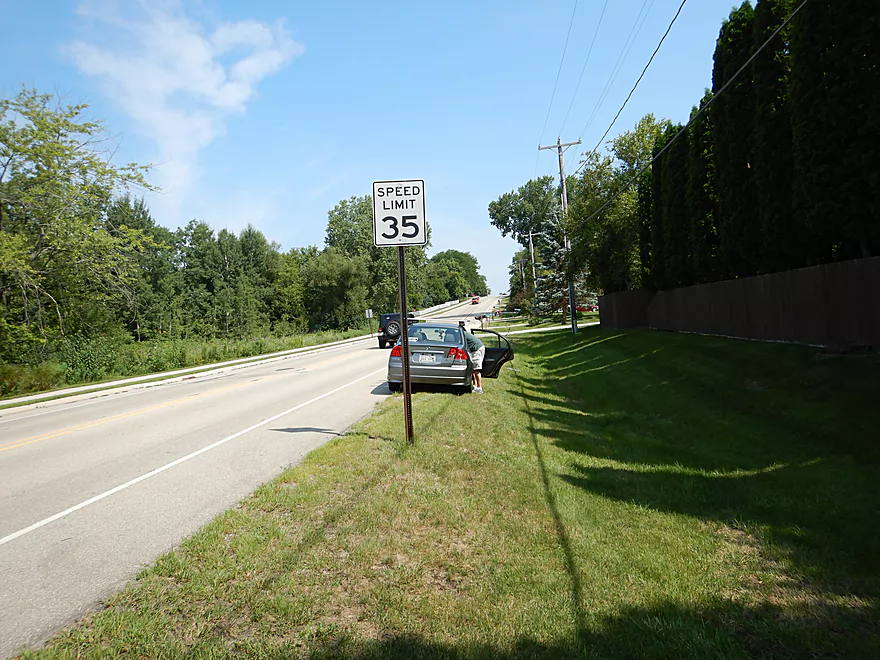
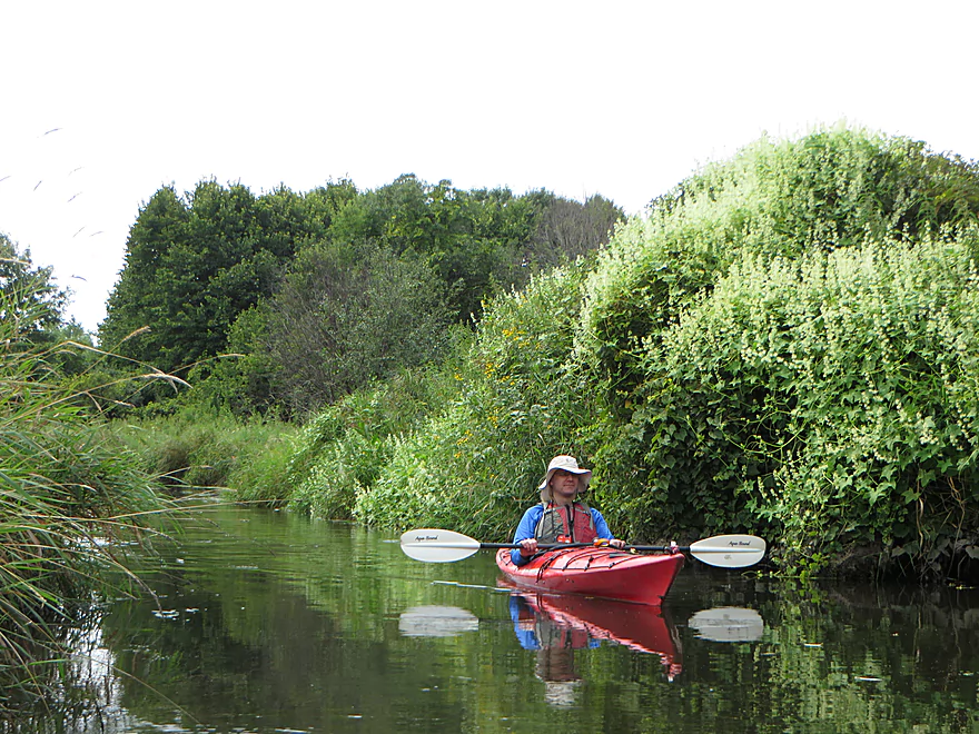
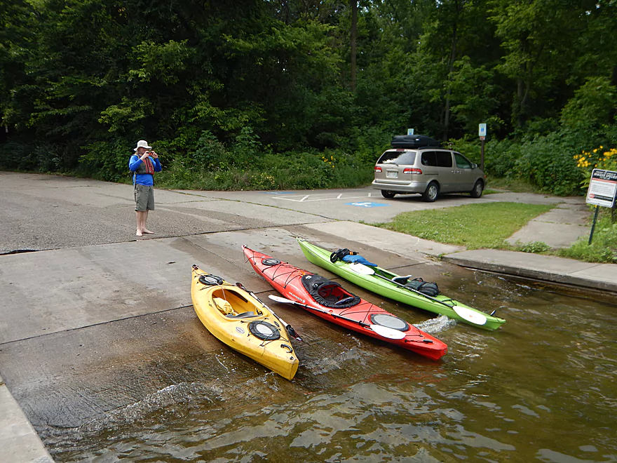
Starting the trip at Woodland Drive
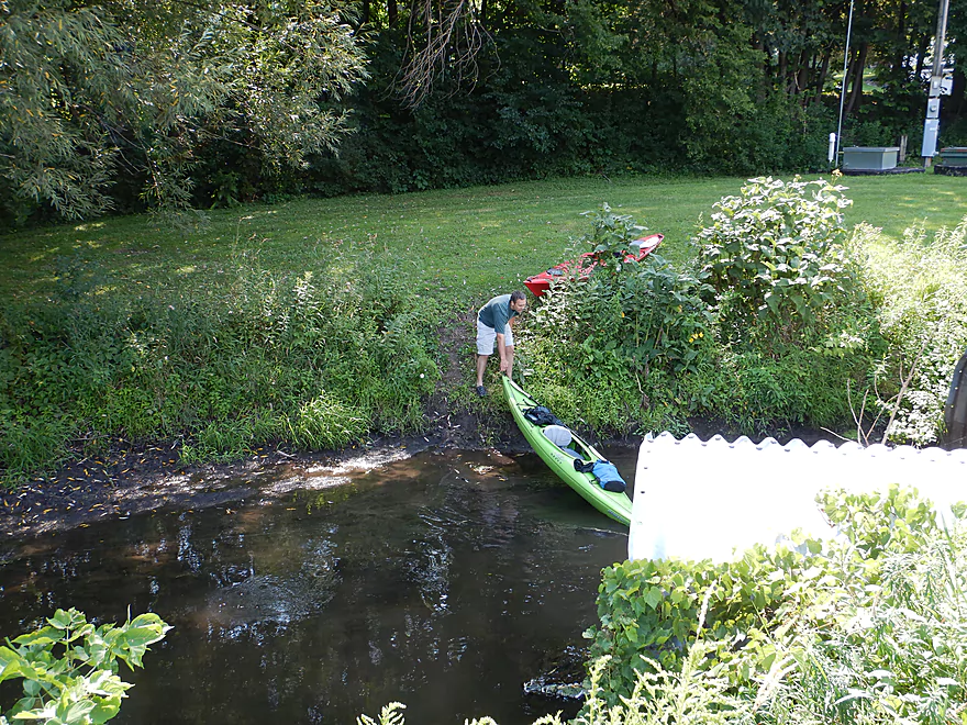
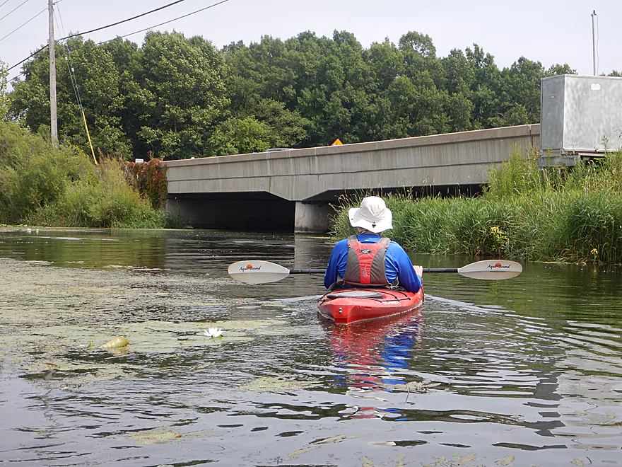
You can launch on either side of the bridge
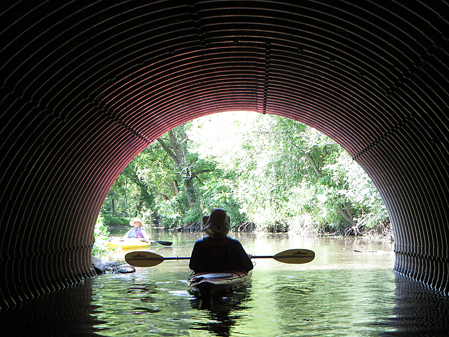
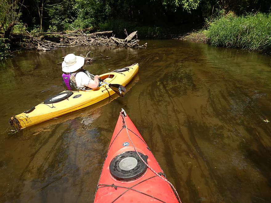
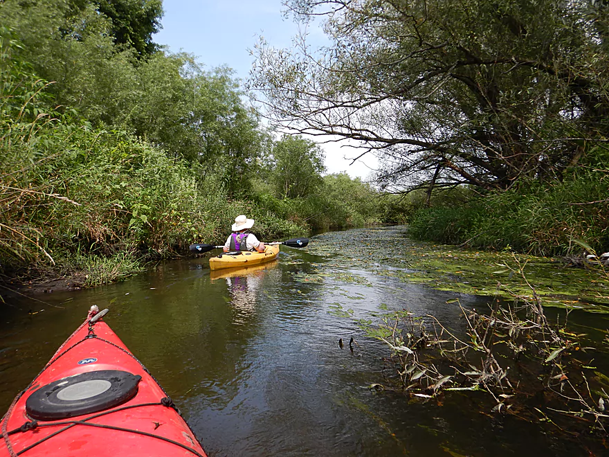
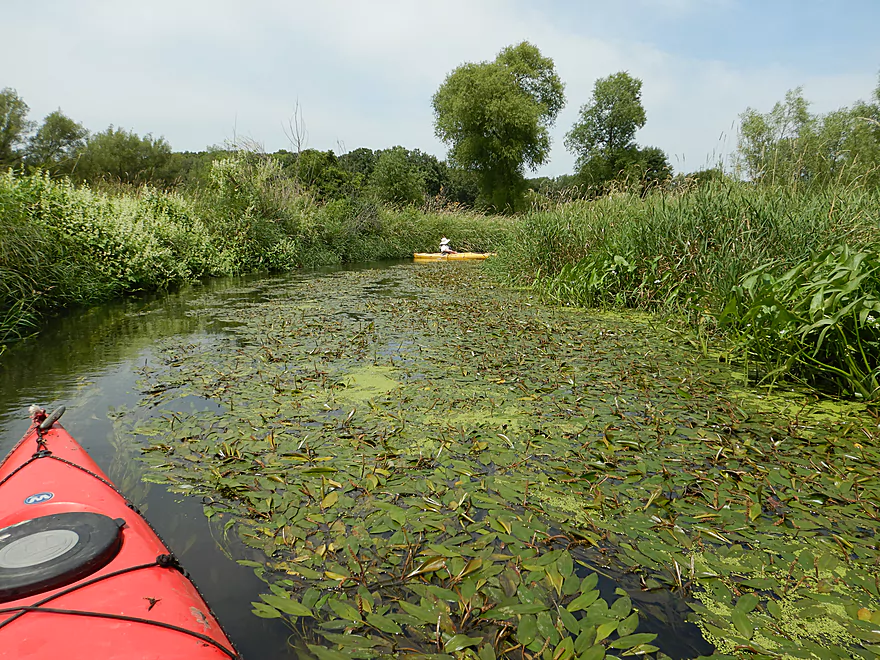
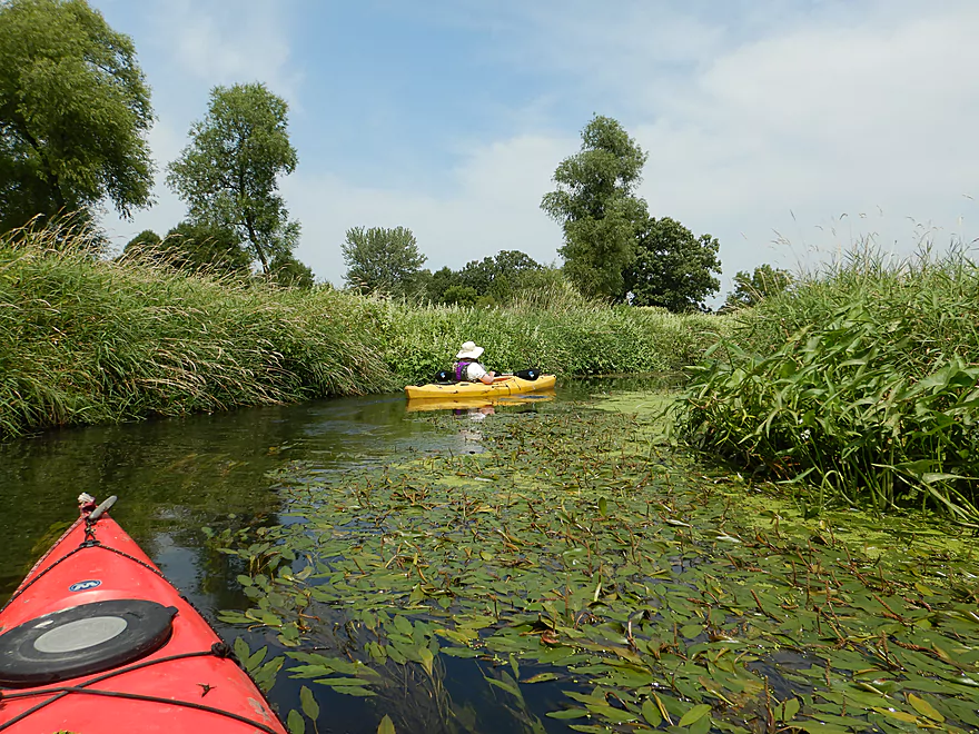
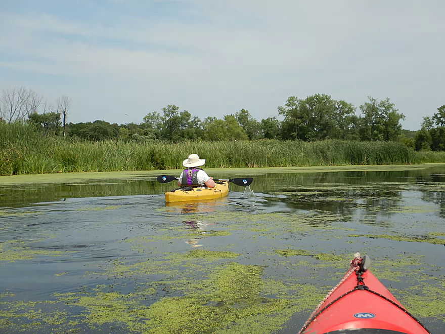
Kayak created a red halo
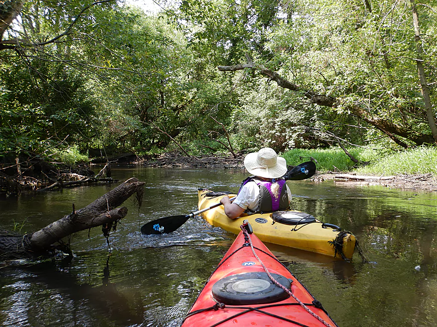
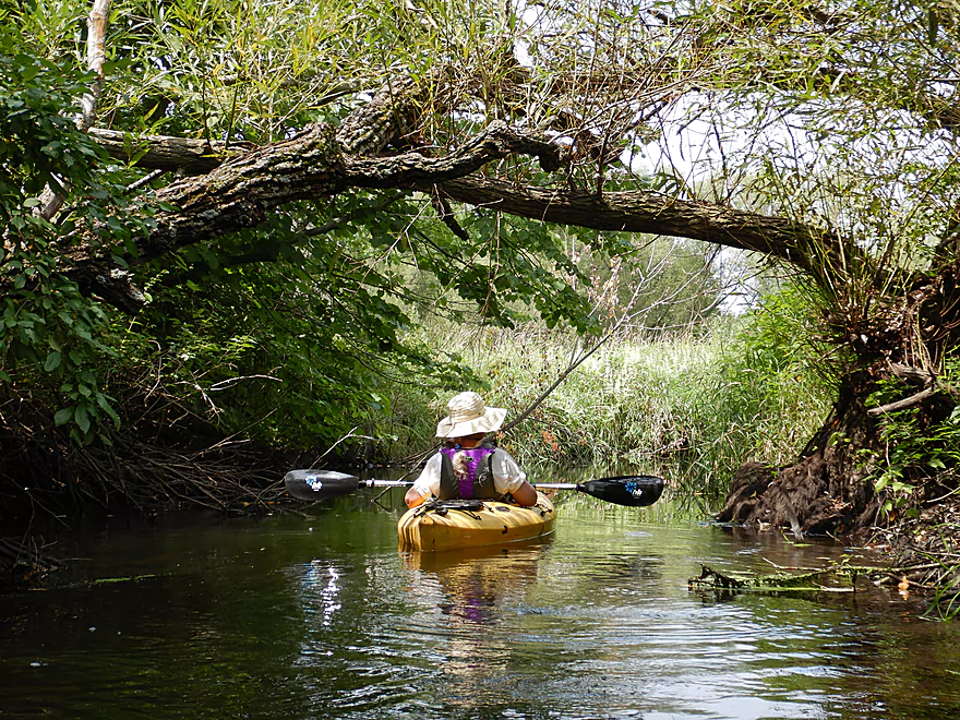
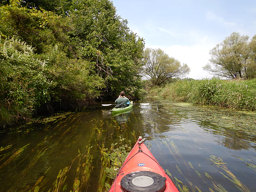
Entering the woods
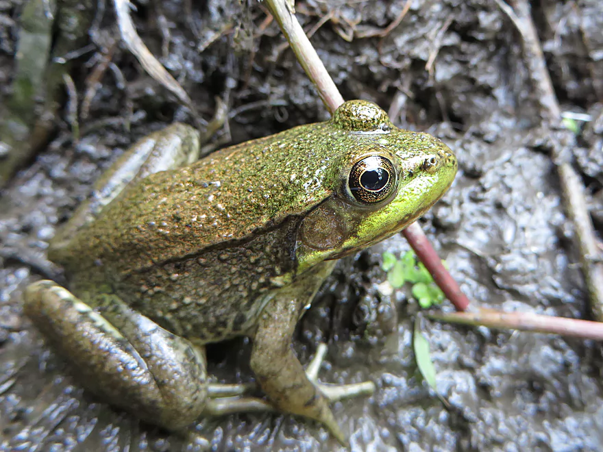
A green frog
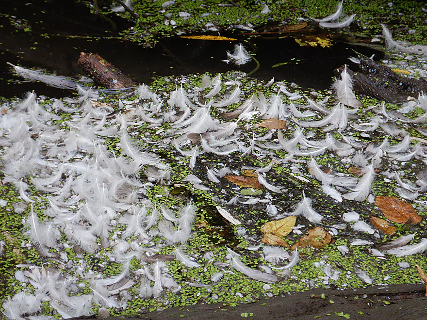
Molting time (a few of the many feathers we saw)
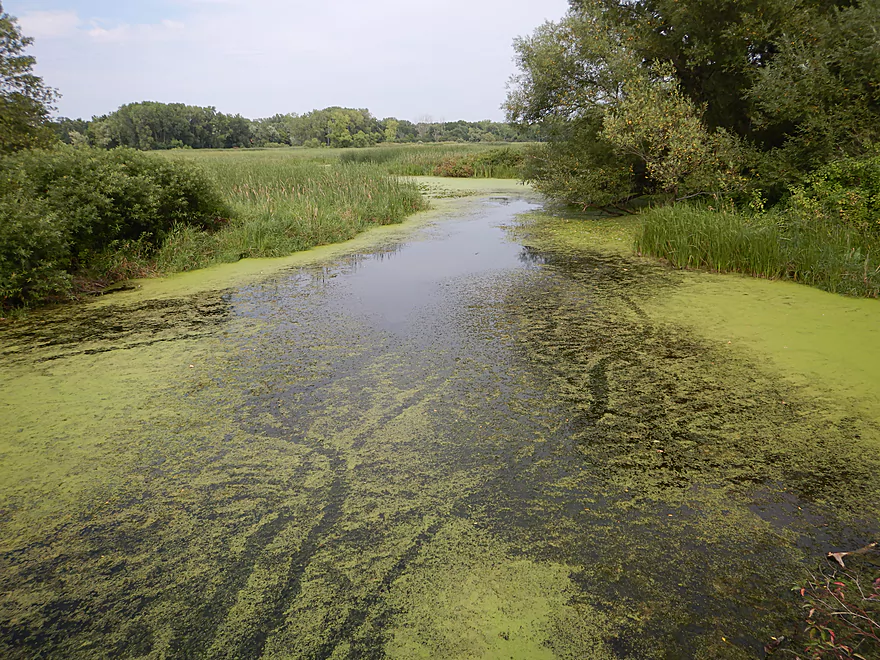
A bit of clarity in an otherwise turbid creek
The cleanup work was terrific
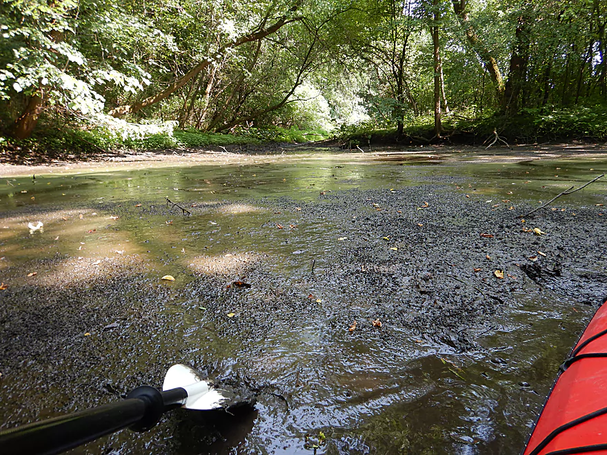
Quick mud…you do not want to wade in that
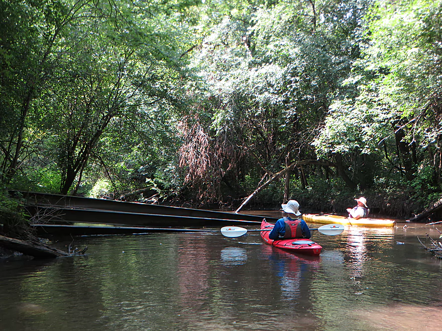
Trio of I-beams…maybe an old bridge
The creek was lined with black mud
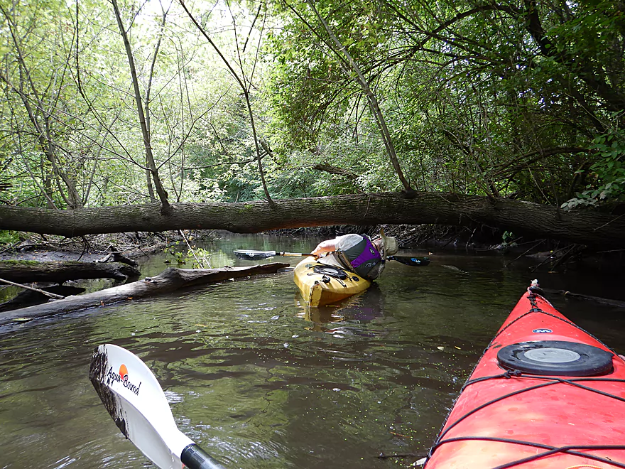
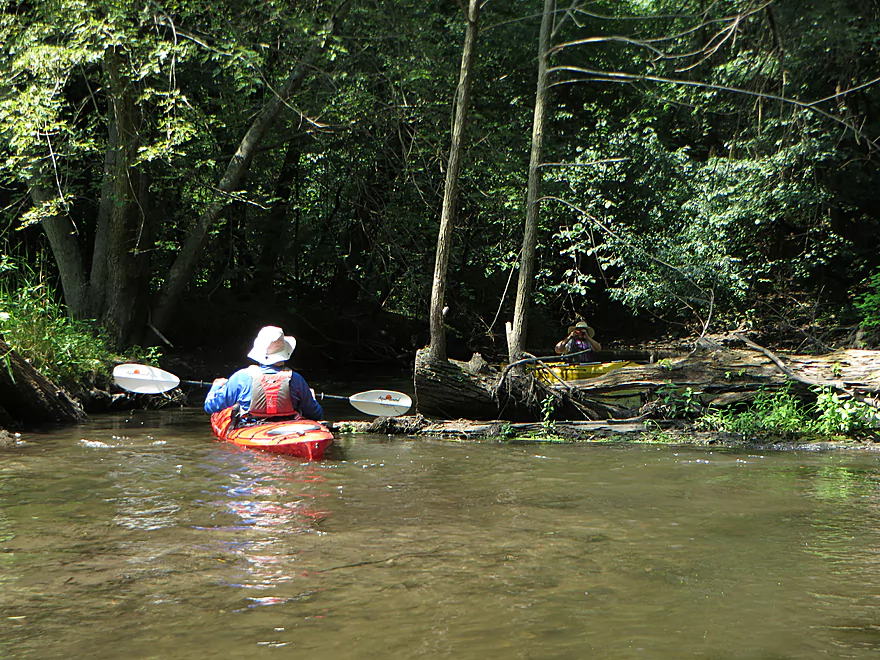
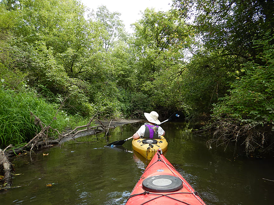
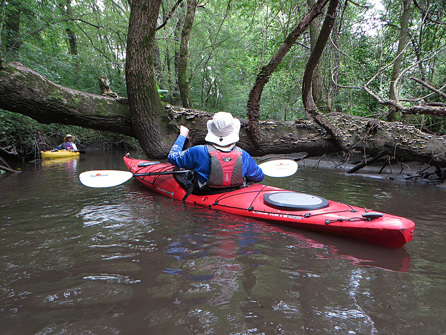
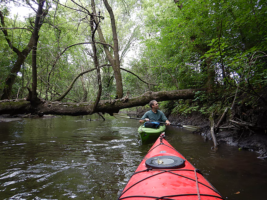
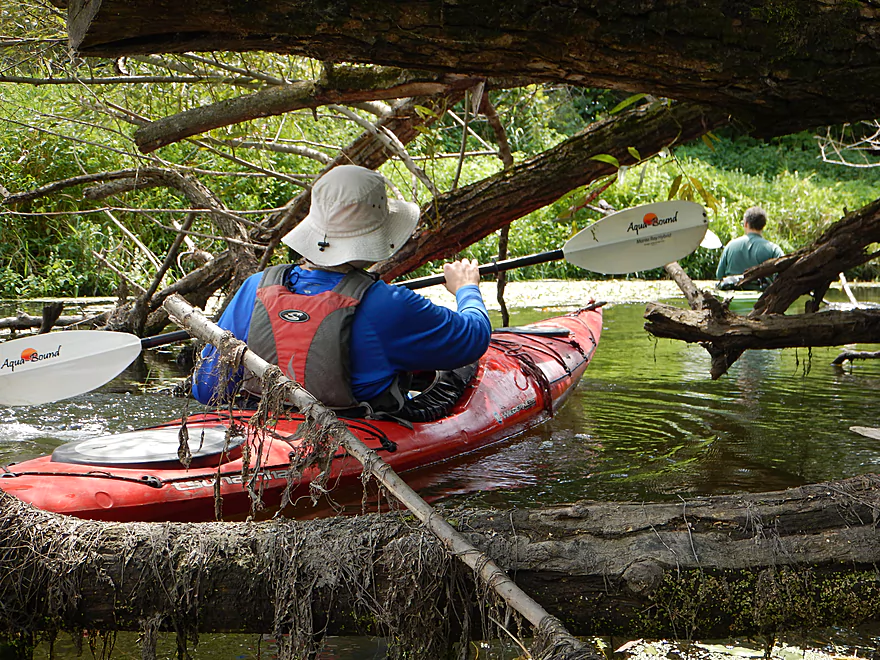
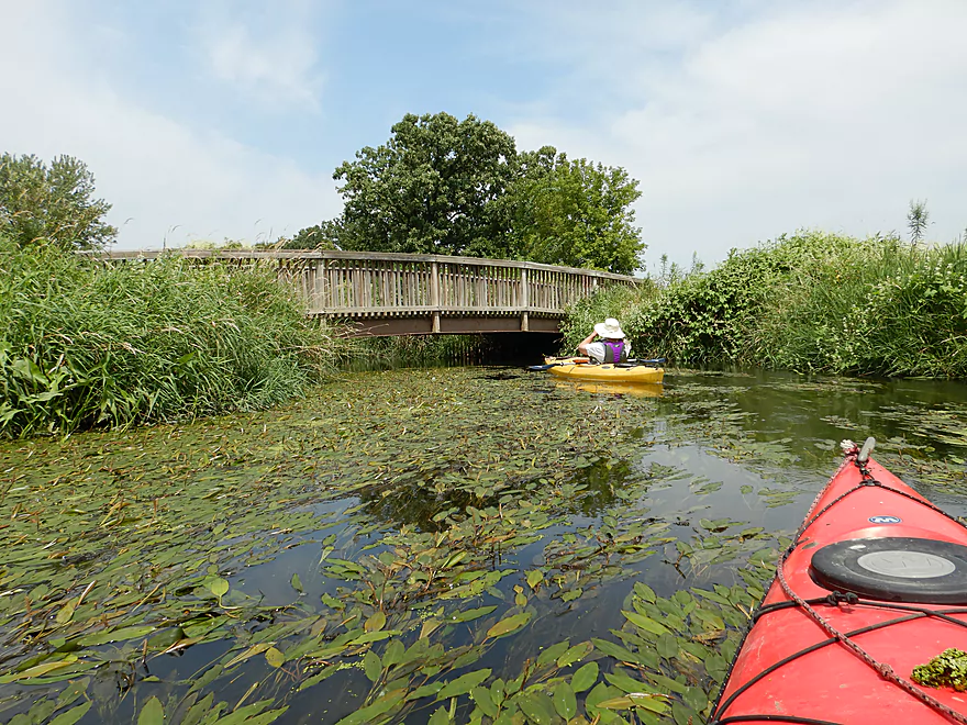
Some ducking required

Mushrooms growing through the moss
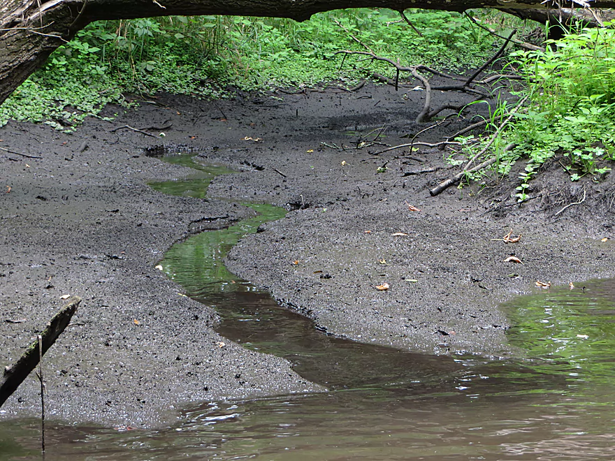
One of many side seeps, probably from springs
Stopping to check out…
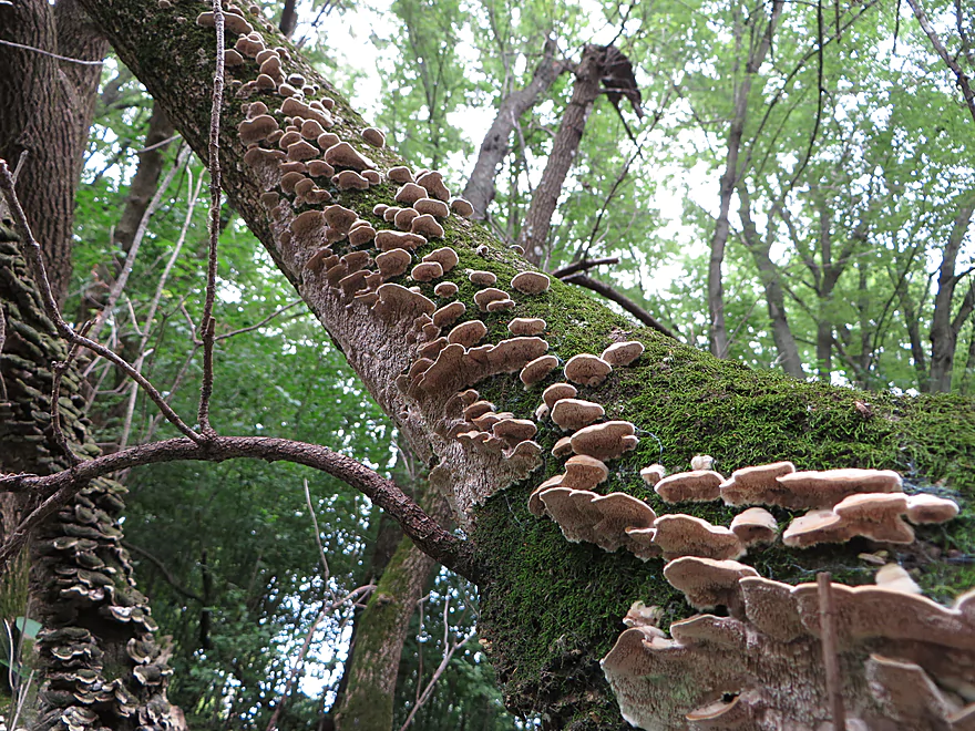
…a fantastic mushroom colony

Coneflowers were just starting to bloom
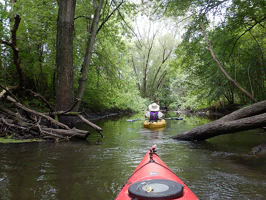
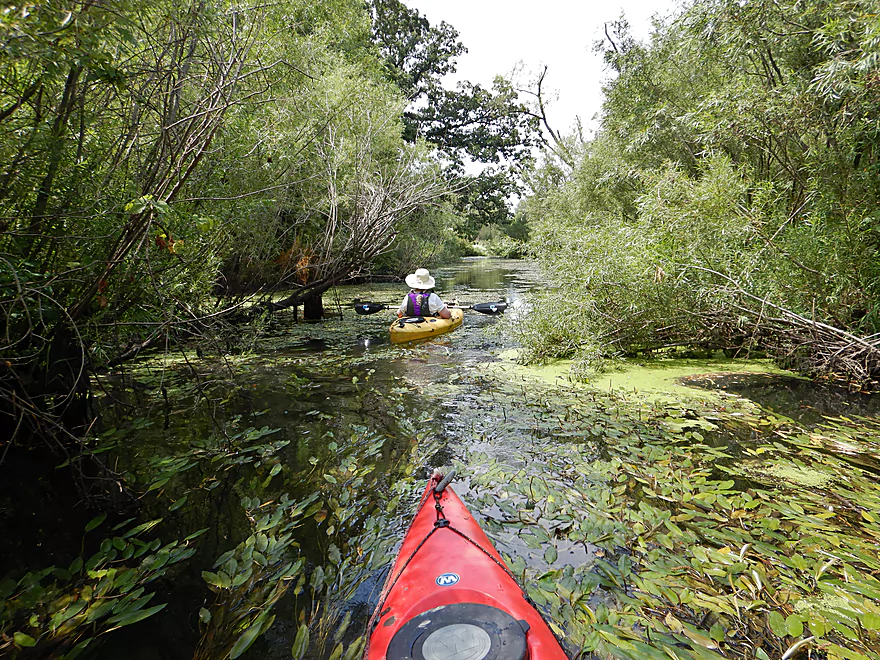
Creek transitions from woods to marsh
A natural wall along the creek
A black willow squirrel bridge
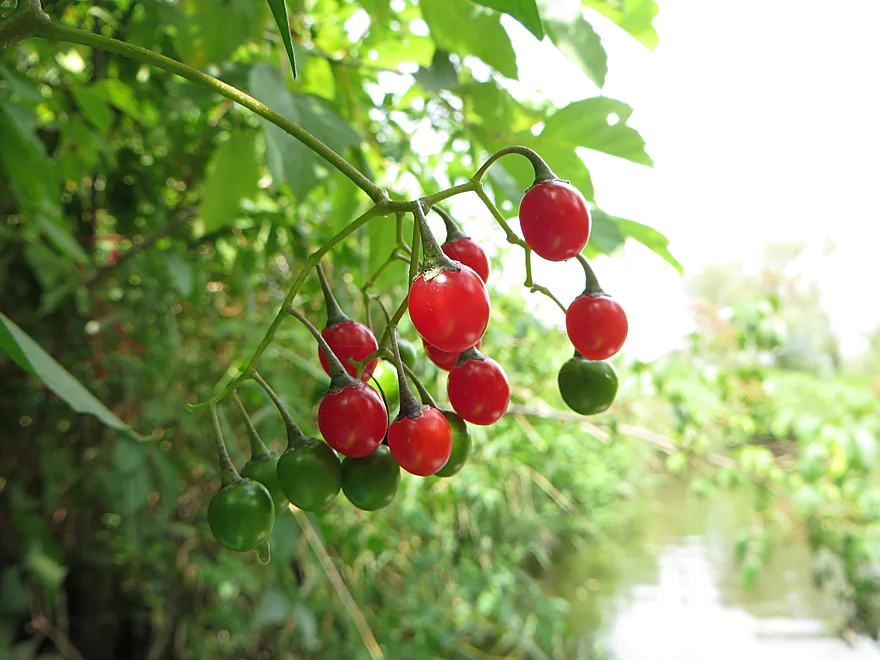
Nightshade berries…very poisonous
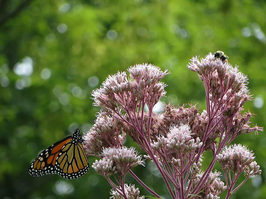
Two endangered insects in one shot
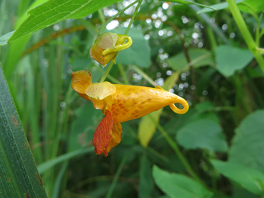
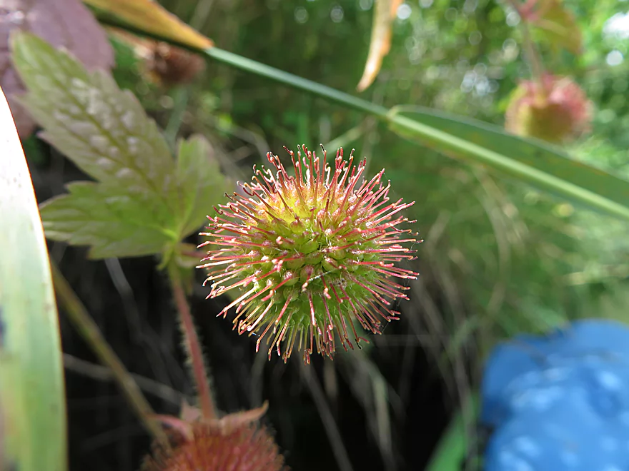
A touch-me-not…their seeds explode on contact
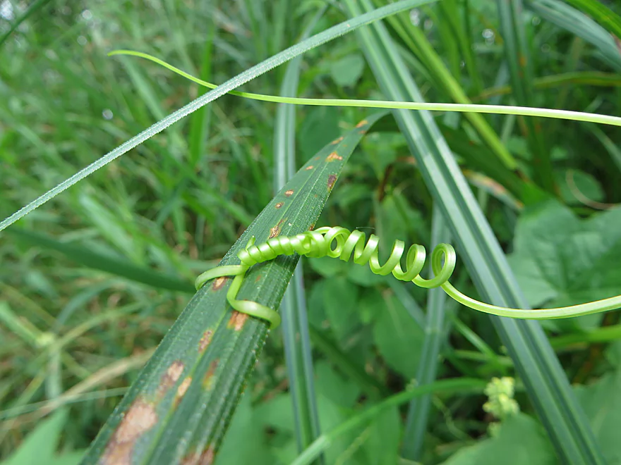
Wild cucumber vines and tendrils were everywhere
They were flowering as well
Flowing strands of potamogeton
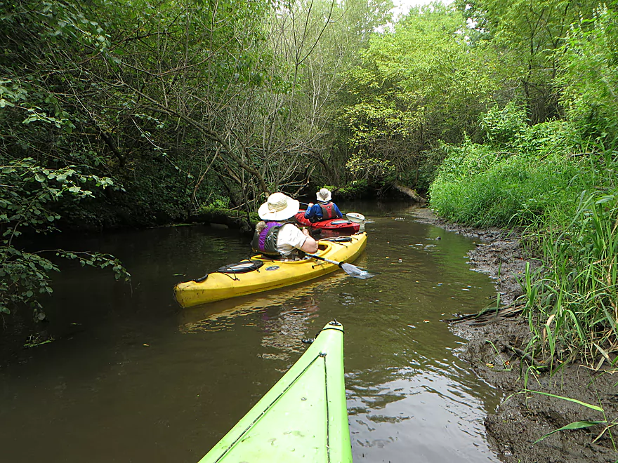
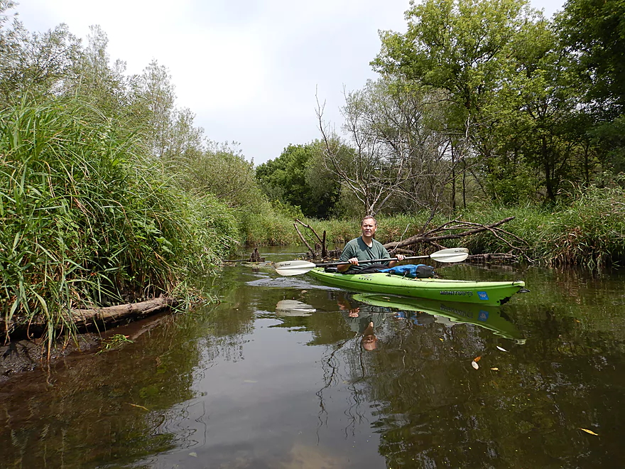
Pretty easy to get through
More interesting plants
An attractive section reminiscent of Token Creek
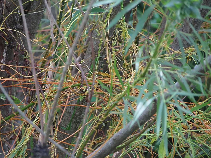
A parasitic dodder plant
Part of a local trail system (Carriage Ridge Trail)
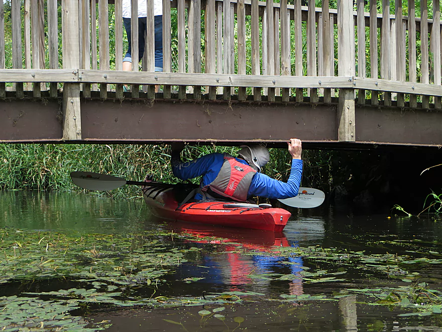
Low but I was able to get under
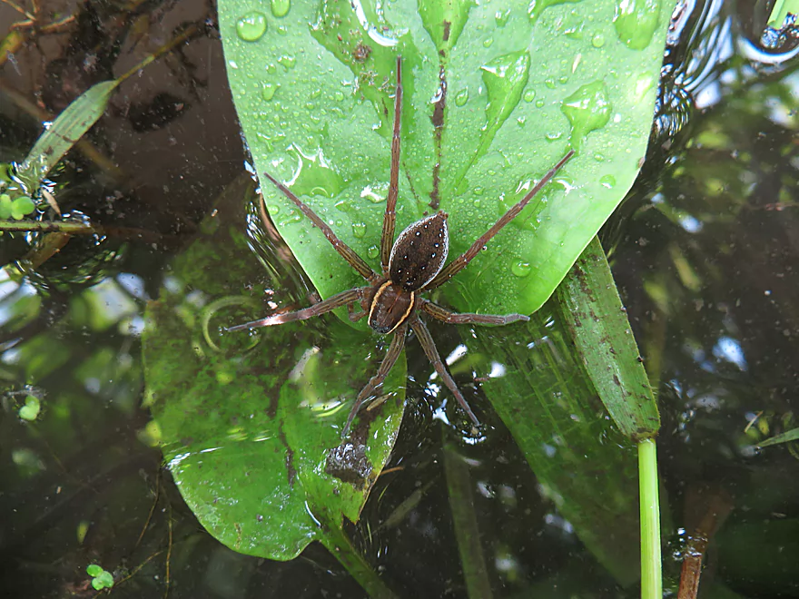
A large fishing spider
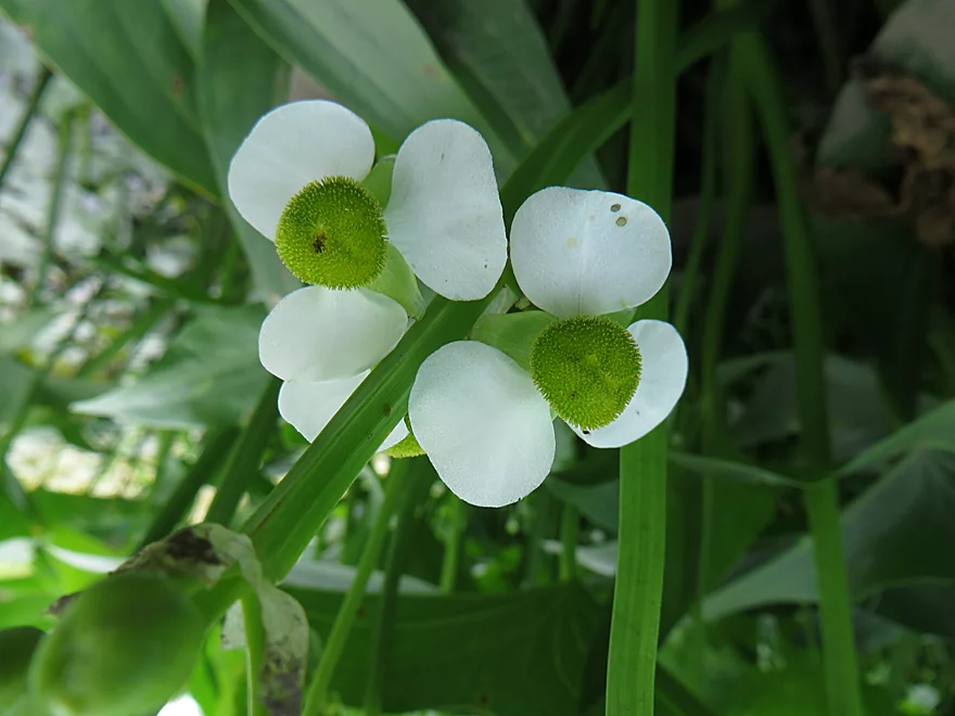
Arrowhead flowers (kind of like miniature propellers)
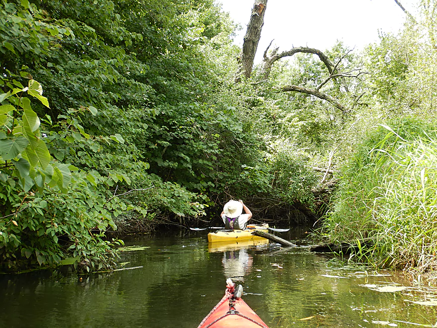
Looks impenetrable but was easy to get through
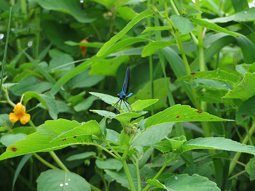
Ebony jewelwing
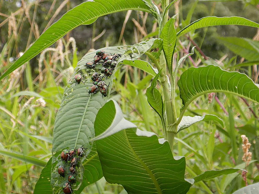
Japanese beatles having a feast
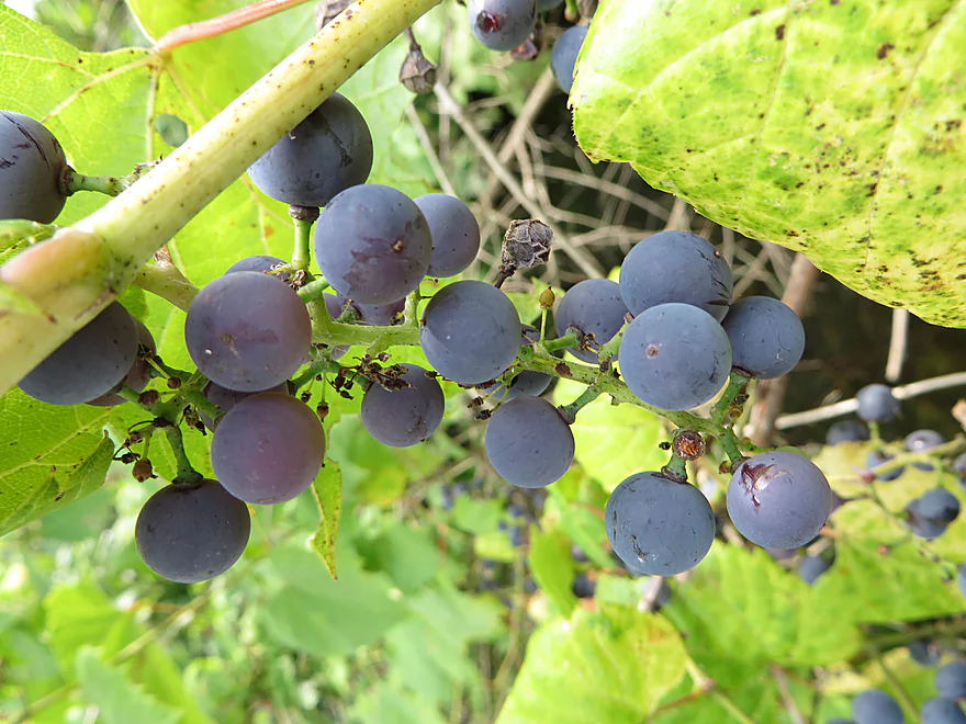
Wild grapes
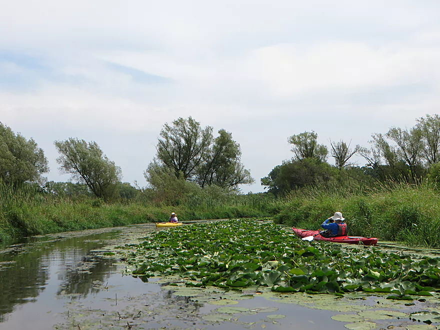
One of the nicer lily beds
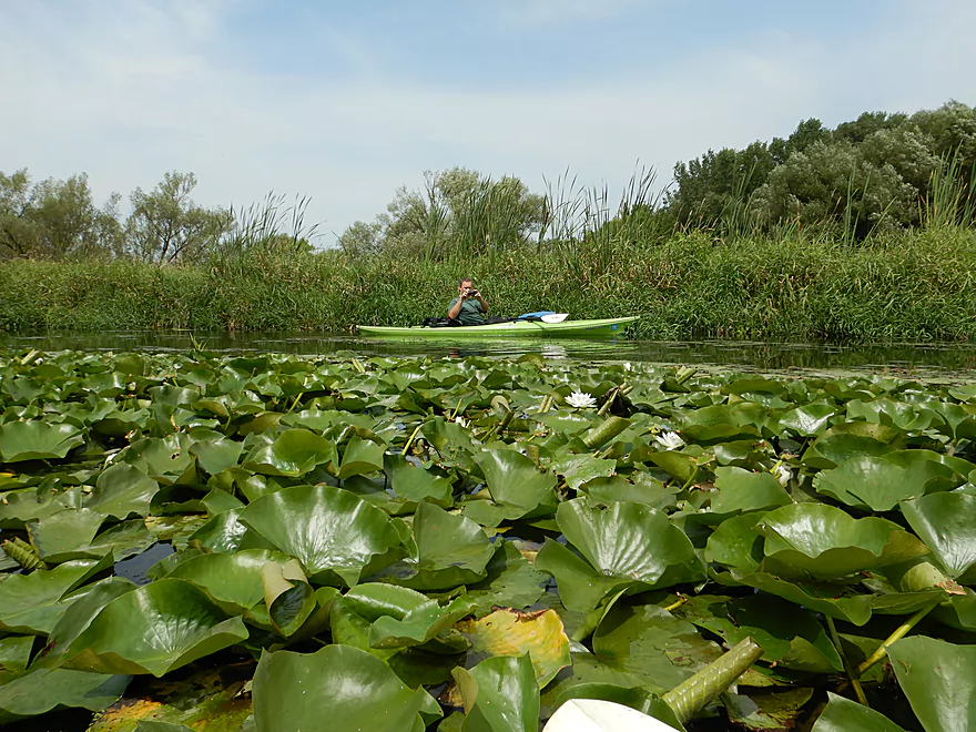
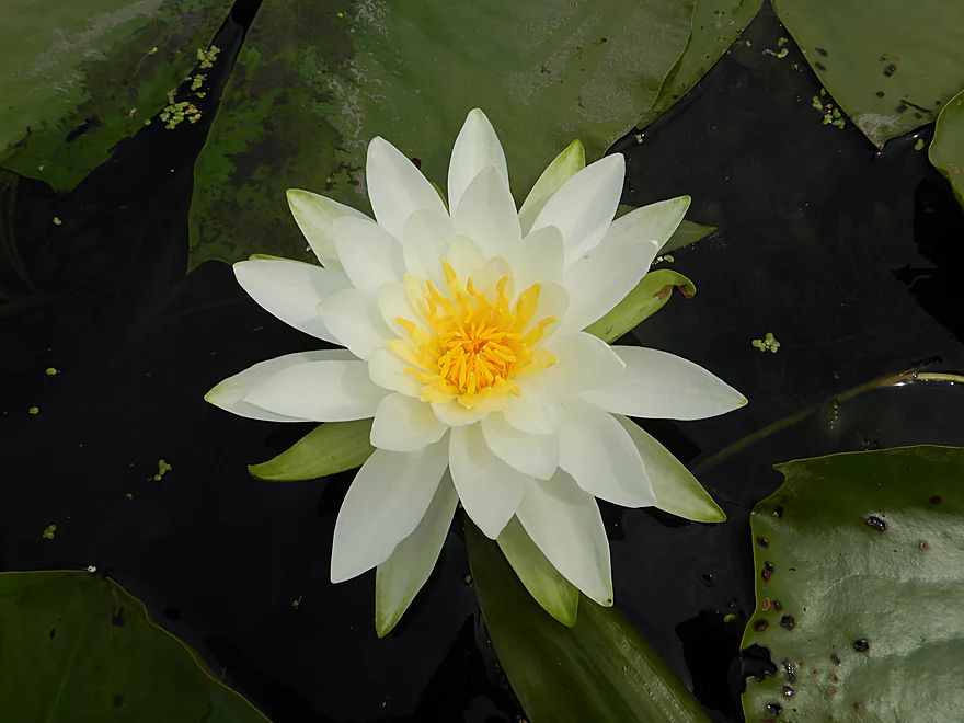
Lilly flowers were in bloom
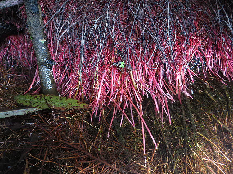
Some alien looking black willow roots
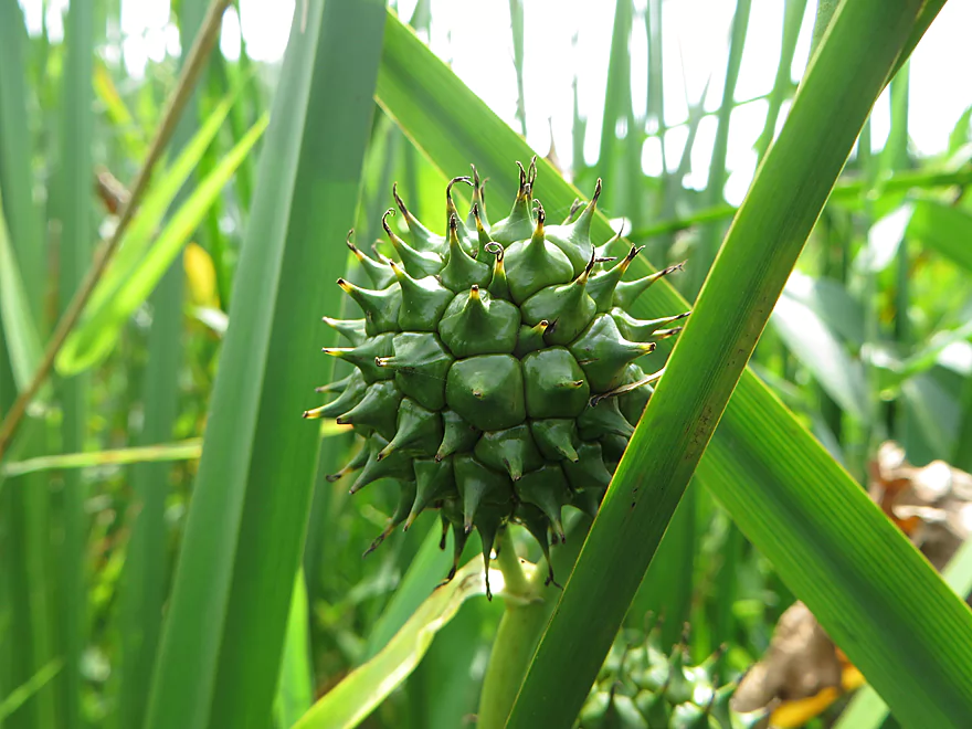
Bur reed fruit….looks medieval
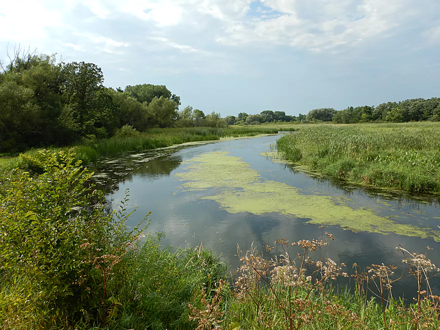
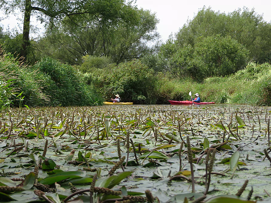
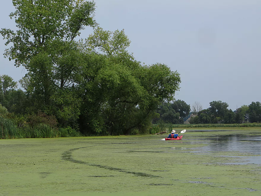
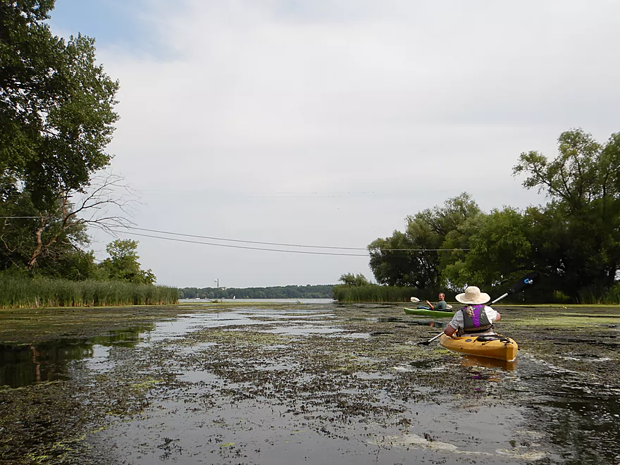
Creek really opens up at this point
Hwy M
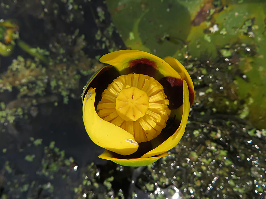
A bullhead lily
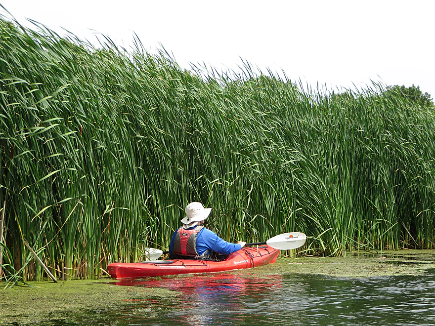
The cattails started taking over
Creating some duckweed trails
Quite soupy, but still navigable
Dorn Creek joins Six Mile Creek
Just upstream is a good take-out and parking option
But we continue on to Lake Mendota
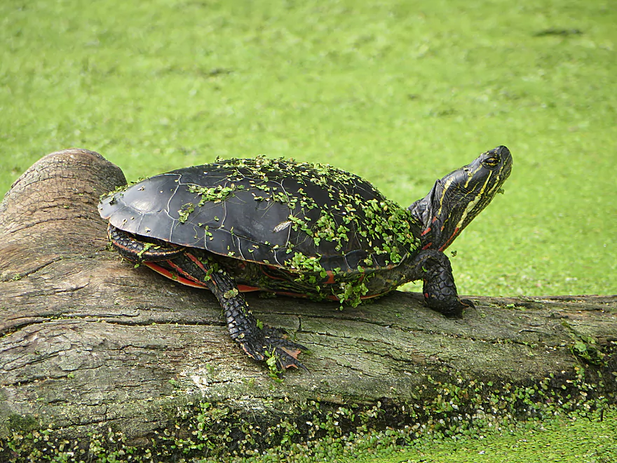
A painted turtle covered in duckweed
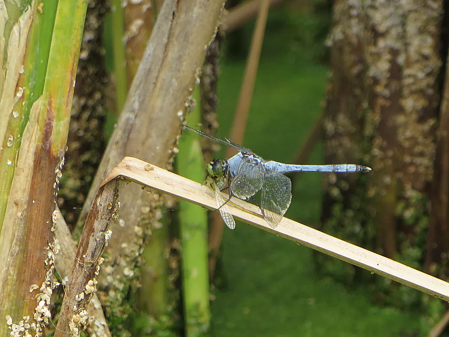
One odonata snacking on another
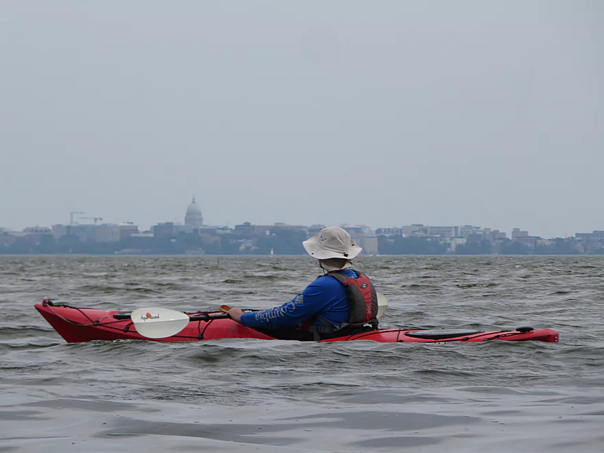
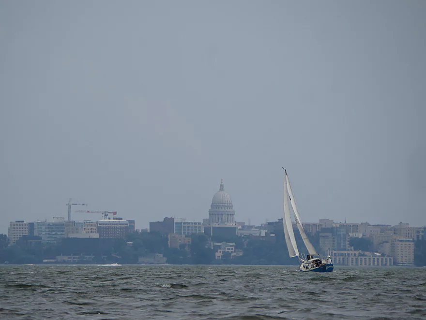
While hazy, we could see the capitol
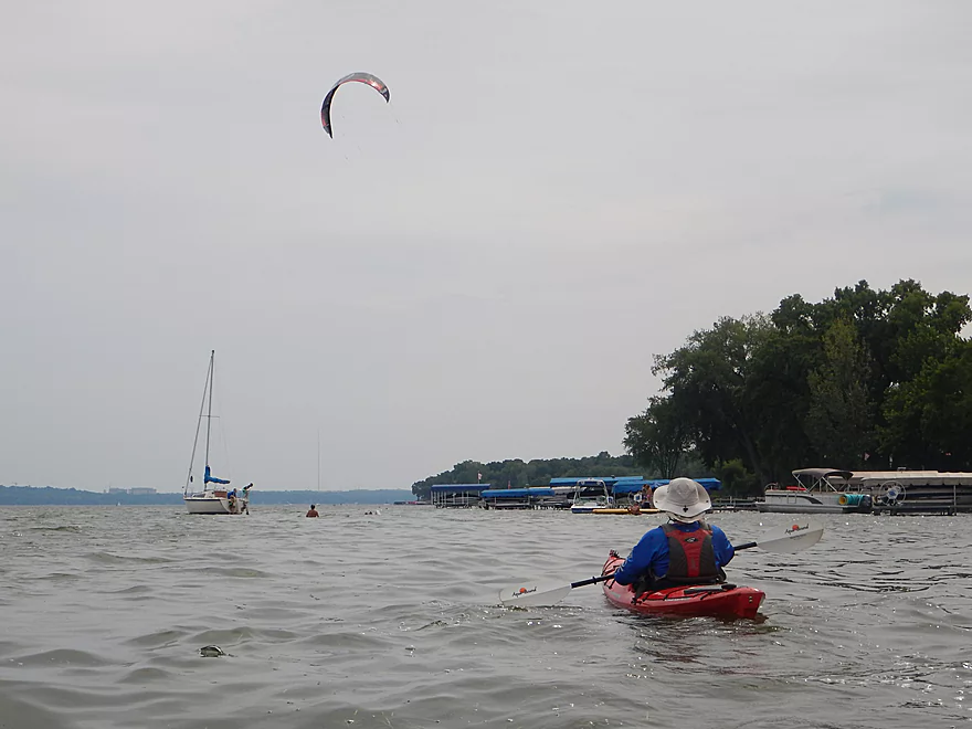
A tough headwind for kayaks, but the kite surfers loved it
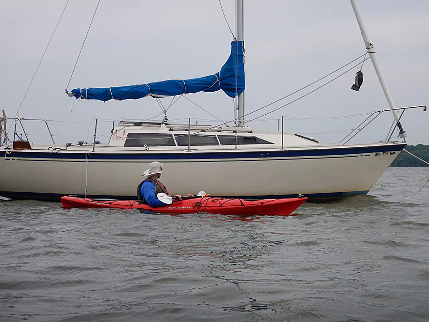
Several sailboats were simply parked on the lake
Tough paddling, but a great day for sailing
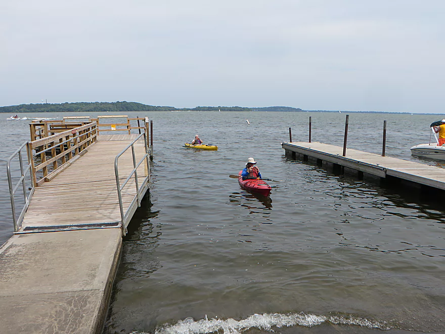
Taking out at Governor Nelson State Park
Decent access
Six Mile Creek: Woodland Drive to Lake Mendota

Six Mile Creek is a unique and attractive paddle but historically has suffered serious logjams. Most paddlers explore the creek from Lake Mendota by going upstream as far as they can before turning back. Recently Capitol Water Trails finished a large cleanup project on this last section of the creek, and Woodland Drive to the mouth is now a viable water trail. Capitol Water Trails is a fantastic organization and I highly suggest supporting them by either volunteering or donating money.
The first mile was the best part of the trip. While small, the creek had a lot of character, with twisty turns and dense woods encapsulating the channel. Countless open passages had been cut through the logjams which demonstrated what a herculean effort the cleanup had been. Much of the first mile was muddy with turbid water and black, mud-lined edges. In fact, based on the side seeps we saw, we suspect the area was underlaid by springs. With springs often comes quicksand, and in one location we came across a large delta of quick mud that would have been deadly to any land animal trying to cross it.
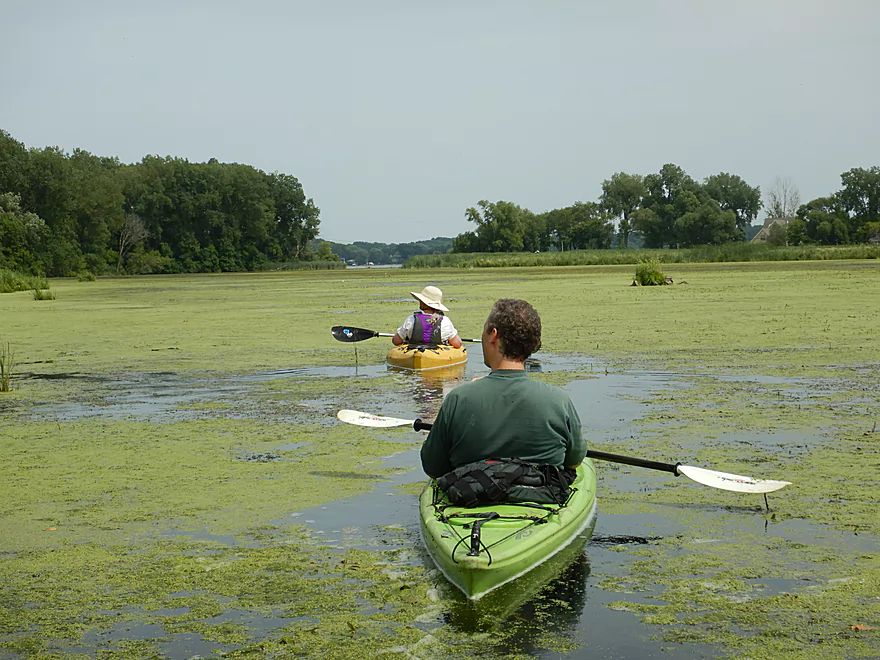
After the first mile, the creek opened up into a lowland marsh. This was a dramatic transformation as the woods were replaced with grasses, the water clarity improved and the channel deepened to a consistent 4-5′ depth. This reminded me of last year’s Token Creek trip and featured great plant life such as the vining cucumber plant. Outside of one home, and an oddly submerged set of I-beams, there was almost no sign of civilization. We did paddle past the Carriage Ridge Conservancy Trail which looked quite nice. It’s trail bridge was a bit low to get under, but we managed ok. Capitol Water Trails hopes to work with the township to make the bridge more navigable for paddlers.
Once we paddled past Hwy M, the creek widened dramatically and cattails started to replace the grasses. Aquatic weeds clogged much of the creek here which was a nuisance. We made it through ok, but we did have to pick our paths carefully. In some ways this was kind of cool as we left trails of duckweed in our wake. Not so cool was the head-wind that picked up and became difficult to paddle against. Hidden along the right side of the creek was the mouth of Dorn Creek. If you paddle just a bit upstream on this, you will encounter the North Shore Drive bridge which is a good take-out option.
At long last, we reached the mouth and Lake Mendota which was a scene of bustling activity with powerboats, sailboats, swimmers, and even a kite surfer. Lake Mendota is likely a bit big for casual paddlers, but is still nice especially with the scenic backdrop of the Madison skyline, the campus, and the state capitol building. This particular section of the lake was heavily developed with many nice homes, large piers, and expensive boats. The wind on the lake was horrendous not only for paddling but because the spray would repeatedly get on our camera lens. We concluded the trip at Governor Nelson State Park which was a good take-out. All in all a nice trip, with the best parts being in the upper half. Had it not been for the weeds and open water paddling in the second half, this trip would have had gotten a higher rating.
Sights included several frogs, great blue herons, painted turtles, cicadas, a bankside beaver den, ducks (in duckweed), a dragonfly munching on a damselfly, and a hoard of Japanese beetles going to town on some unlucky plant. This was molting time for ducks and geese, and there were many feathers on the creek…in fact, it sometimes looked like someone had shaken out a feather pillow on the water. Really cool!
The trip highlight was actually the plant life which included many wildflowers, blooming lilies, wild grapes, large clusters of wild cucumber vines, bur-reed fruits (which look like medieval clubs), touch-me-nots waiting to explode, and parasitic dodder plants strangling their victims. This was an exceptional trip for fungi and included many fantastic colonies.
Governor Nelson State Park: While perhaps not among the state’s elite parks, it’s still very nice and located conveniently near Madison. Highlights include a beach, boat landing, and trail system. A good portion of the trail system goes through a restored prairie and is very scenic (especially in August when the prairie flowers are blooming).
We launched at Woodland Drive which was a suitable bridge access option. Parking is a little tight and close to nearby homes, but you should be ok to park northeast of the bridge. Most paddlers likely launch northwest of the bridge where we saw trampled grass, but it is also very easy to launch along the southeast corner and then paddle under the massive culverts.
We took out at Governor Nelson State Park where there is a public boat landing. This is a good access with public parking, outhouses, and even a large fish cleaning station. Note, parking for kayakers (vehicles without trailers) is on the south end. This landing can be very congested on a weekend and it may be tempting to launch at the adjacent beach but park rules prohibit this (for the “safety” of swimmers).
An alternate access 1.5 miles “upstream” that I recommend is the North Shore Bay Drive bridge which is technically over Dorn Creek. Here there is a parking area by the bridge and taking out wouldn’t be difficult…in fact I suspect many Six Mile Creek paddlers take out and put-in here. In late summer, Dorn Creek can fill with aquatic weeds, but you should still be able make it through.
There are many alternate take-out options on Lake Mendota. For more information see my Yahara River Overview Map.
The bike shuttle route wouldn’t be too bad at just 2.8 miles and no hills. Hwy M is a busy road, but there should be adequate shoulder room for bikers. Dane County happens to be working on the North Mendota Trail which when finished will be a perfect shuttle option for bikers.
The current was very slow, with the last two miles having almost no current at all. While typically this creek would have a lot of deadfall, nearly all of it had been cleaned up (as of July 2018) thanks to Capitol Water Trails. There do remain a few “duckers” and “hoppers” but I thought these were easy to deal with. During high water levels, several of the “duckers” might require portaging. What paddlers really need to be concerned about is the wind, as much of the trip is over exposed water. During our paddle we endured gusts up to 21 mph which was a bit much (especially on Lake Mendota). As a general rule, you never want to paddle into headwinds greater than 10 mph on open water.
There is a gauge upstream at Hwy 19 which read 6.5 CFS for our trip. A bit low but plenty doable. Below is a rough depth guide for lower Six Mile Creek:
- 0-4 CFS: These are likely drought-like conditions. Several sections may require scootching to get through. The main issue would be aquatic weeds that could clog the channel at this low depth.
- 5-8 CFS: A low depth, but plenty doable.
- 9-12 CFS: Likely an average depth which would be good for paddling.
- 13-20 CFS: A high depth that may force paddlers to portage some of the “duckers”. But I think this should be ok.
- 21-28 CFS: A very high depth. This would be great for the marsh section, but it might make paddling the woods dicey.
- 29+ CFS: Perhaps too high? I’m just guessing here.
Detailed Overview
- Hwy 19 Culvert to Kingsley Road: 3.4 miles. An interesting prospect through the Waunakee Marsh with clear water. The first half mile is extremely narrow and may need very high water to be viable. Maybe 1-2 logjams.
- Kingsley Road to Ripp Park: 1.2 miles. Likely a nice marsh paddle with maybe 1-2 logjams. There is a mat of dead cattails to circumnavigate at Kingsly Road, otherwise this seems like an ok access.
- Ripp Park to Castle Creek Conservancy: 3.8 miles. A varied paddle with marsh, boulder gardens, rapids, urban parks, and dense woods. Very nice, but a few logjams.
- Ripp Park to Hwy 113: 1.8 miles. An open paddle through a grassy corridor with lazy current. One logjam, but an easy portage. Hwy 113 is a busy road, but access might be possible by parking north of the bridge and launching between the road and the trail bridges.
- Hwy 113 to Waunakee Village Park (North): 1.0 mile. A wooded section with some boulder gardens and rapids. Neat part of the creek. Most logjams should be cleared out by now.
- Waunakee Village Park (North) to Waunakee Village Park (South): 0.3 miles. A tidy part of the creek that flows though the park. Highlights are a few rapids and several stone arch bridges. The south end of the park doesn’t have a parking lot…so disembark by Madison Street(2nd bridge) and drag your boat north to 3rd Street to load up your car. Long-term parking is available by the Village Center. Creek here is shallow.
- Waunakee Village Park (South) to Castle Creek Conservancy: 0.7 miles. A densely wooded section that is scenic but shallow and should only be run in high water. There is a nice set of rapids just upstream of Division Street. I suspect Village Center Pond might be a take-out option.
- Castle Creek Conservancy to Woodland Drive: 3.9 miles. Scenic stretch with a lot of potential. But there are significant logjams (which are being cleaned out). This leg is rocky and can only be run in high water.
- Woodland Drive to Governor Nelson State Park Boat Ramp: 4.2 miles. Recently cleared out by Capitol Water Trails this is a nice section with a mixture of marsh and woodlands.
Trip Map
Overview Map
Video
Photos Size:
Just checked out possible put-in spots off of Woodland. West side of the road is damn near impossible due to steepness and lots of vegetation. SE is the best put-in spot but is super muddy. ☹️
I’m surprised to hear that the east side is in bad shape. Last year it was great for launching.
Has anyone paddled 6 mile from Castle Creek Conservancy to Woodland? Color me curious.
I haven’t, but multiple logjams can be seen from satellite view. If it were cleaned out, it could be a cool paddle though.
Satellite view. Awesome! Thanks Aaron!
I can attest that the work that Capital Water Trails did in Six Mile Creek has held — mostly. I paddled and up-and-back on an unusually warm mid-December day (2021) from the bridge at North Shoe Bay Drive to 200 yards short of Woodland Drive, where I encountered a double-trunked basswood blocking the stream — a beast I didn’t feel like portaging around.
By the looks of the photos, paddling this creek in fall/winter has the advantage of not struggling with aquatic vegetation. I also saw that the creek had cut a new channel, leaving behind a 200-yard long oxbow.
Things get quite shallow at the merger of Six Mile and Dorn creeks.
Thanks for the update! CWT is actually still working on the creek and hopefully in early 2022 a section further upstream by Waunakee will be navigable for paddling.
We did an out and back on 4/1/22 from the North Shore Bay Dr bridge, to see if we could make it to the Woodland Dr Bridge. We got close, maybe 1/4 mile away before we got to a blockage that would have required a portage or more sawing/lopping than we were up for. You can see where we turned around on the attached map, it is right were there are some old I-beams in the creek. There was also one duck under that would be hard for bigger boats or higher water levels. I also scouted down from the bridge on foot, there are a few places that need some cleaning up/clearing out, but nothing major. Here is a link to virtual map and pics from the trip. https://www.relive.cc/view/vNOPoYgAJ2v
Nice pictures!
Fyi sixmile creek from woodland drive to mendota is currently impassable regardless of water level due to tree obstructions. Love your site!
Thanks for the heads up. I’ll add a warning for readers.
Capitol Water Trails has cleared out the creek from Lake Mendota to Mary Lake. This is great news! https://www.facebook.com/CapitolWaterTrails/posts/pfbid02rUnwYxCNGmHH9Z666NE5mPCgj6avqjvaxpaXArkVwqSokSV8umLyUHaLTpe7KxZZl