
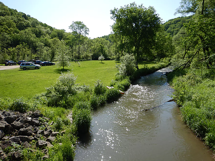
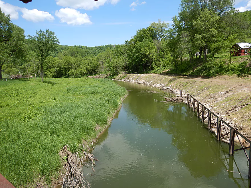
Starting the trip at Duck Egg County Park
Nice launch option…just above Irish Ridge Road
The first third of a mile is on the Springville Branch
It’s super shallow
Some deadfall…but easy to get around
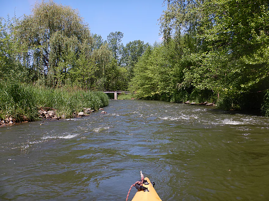
Finally….the Springville Branch joins the North Fork
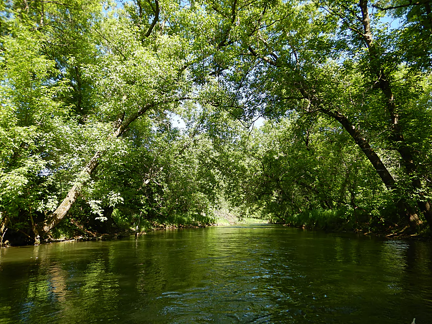
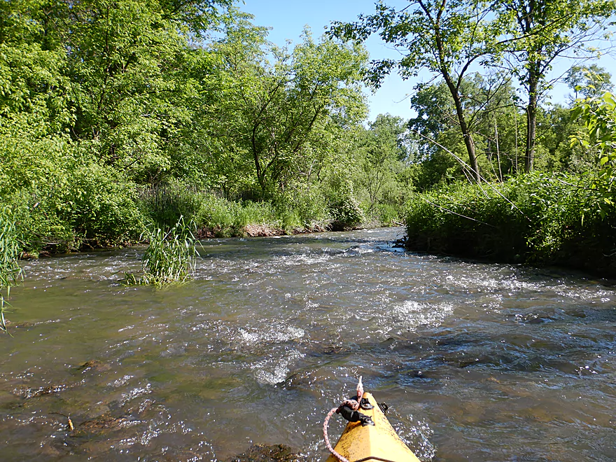
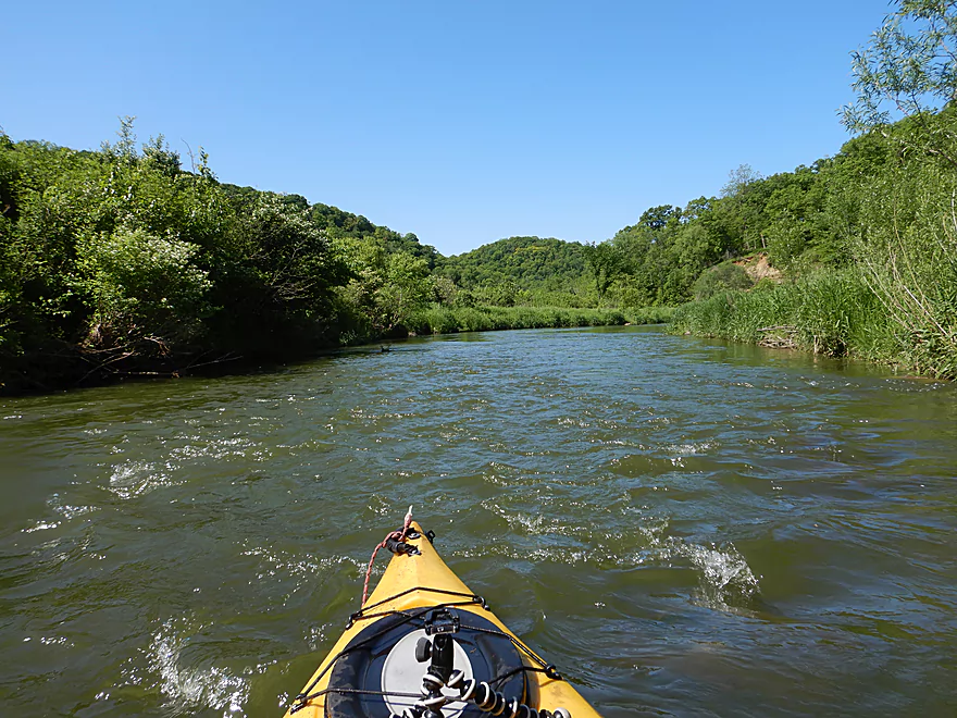
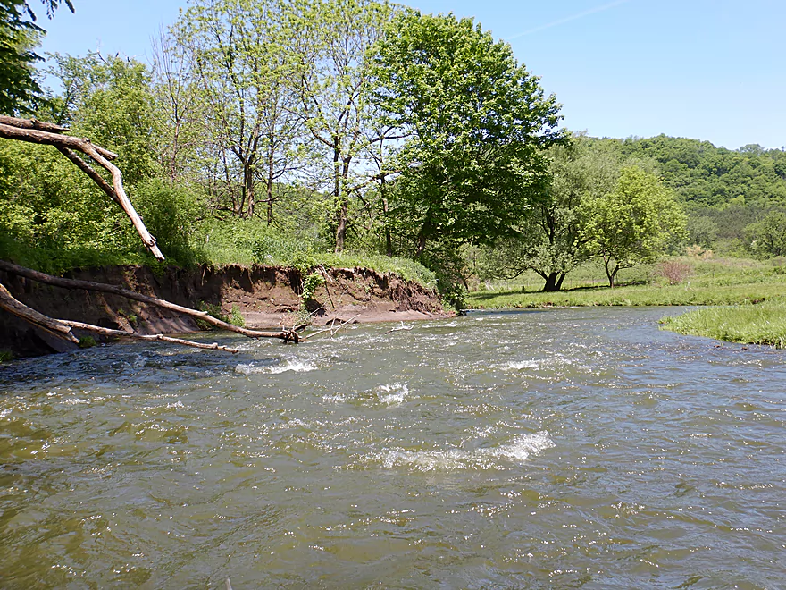
Wooded section to start the North Fork
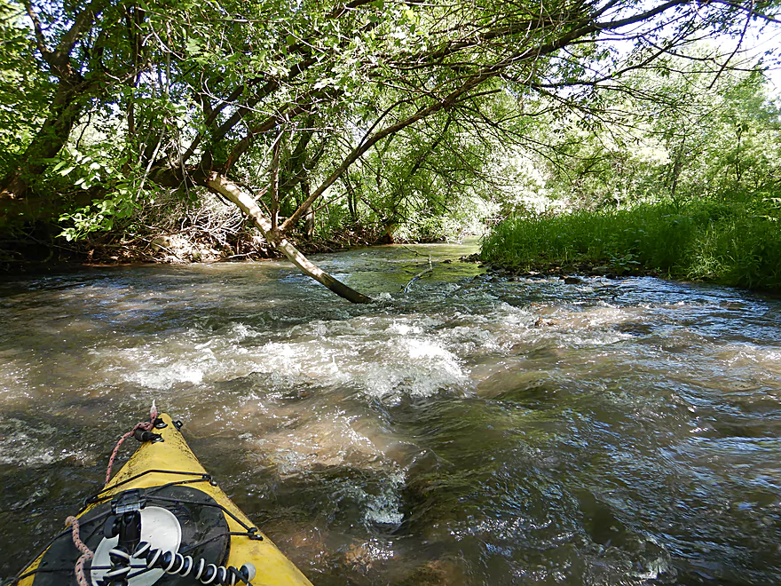
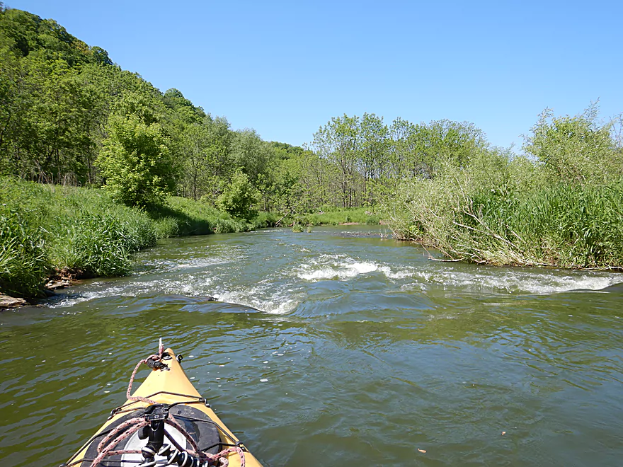
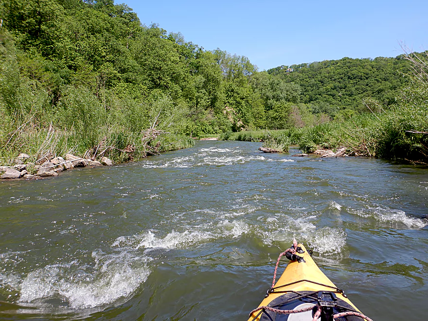
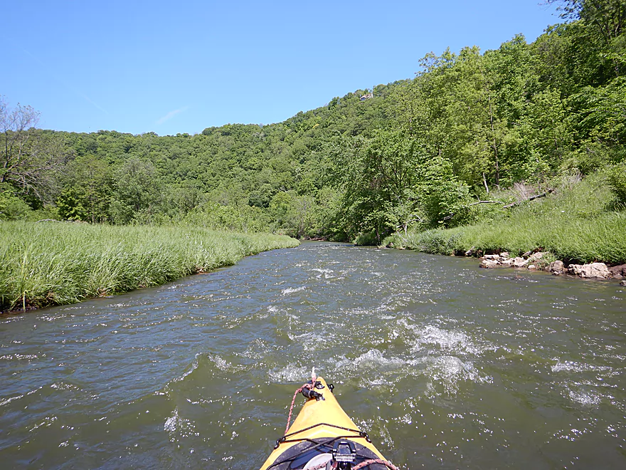
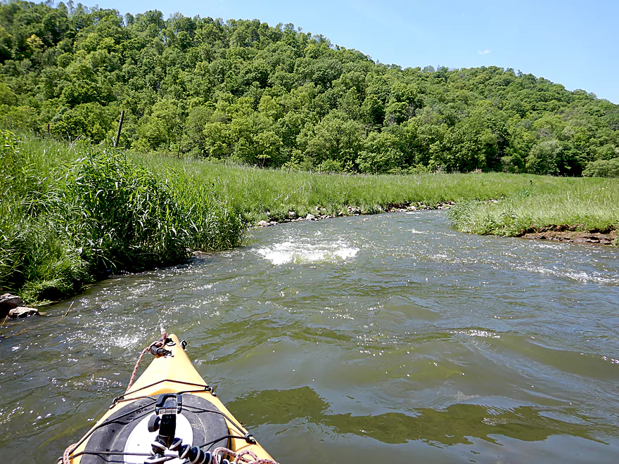
One of countless rapids
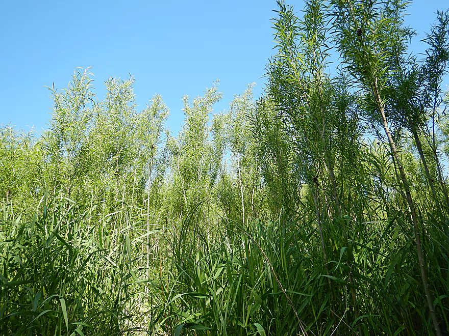
Baby willows
Entering Eagle Eye State Natural Area
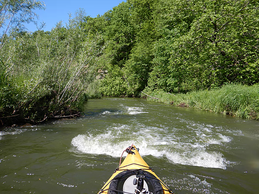
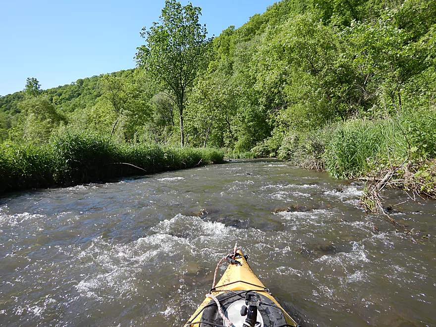
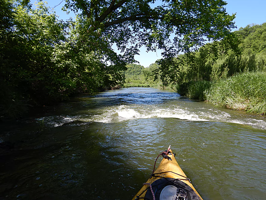
Rapids were great fun
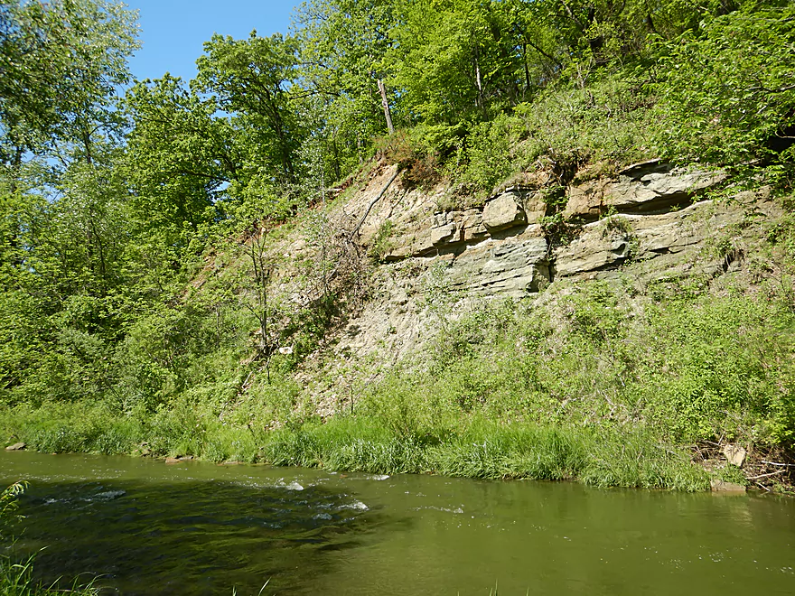
Attractive sandstone outcrop
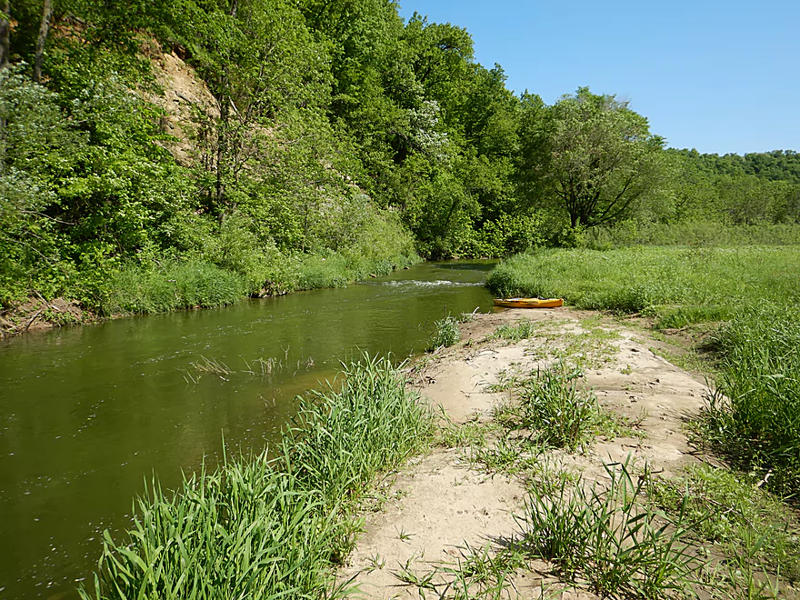
Perfect sandbar for a break
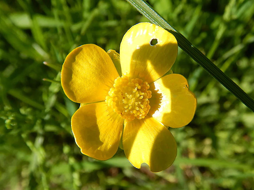
Somebody has been munching on this buttercup
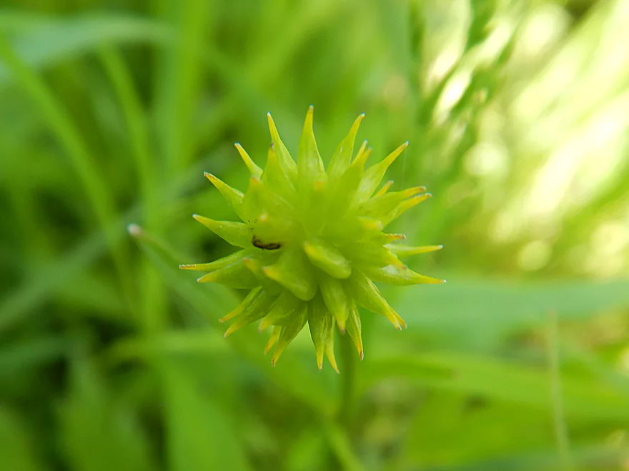
Bur sedge
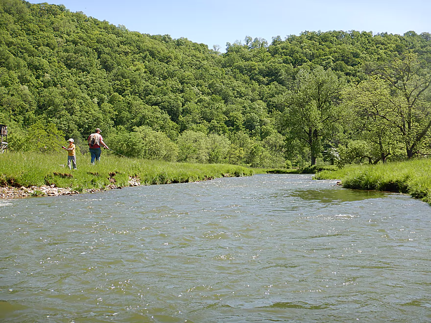
Paddling by Upper Newton Road access…a popular spot for fishermen
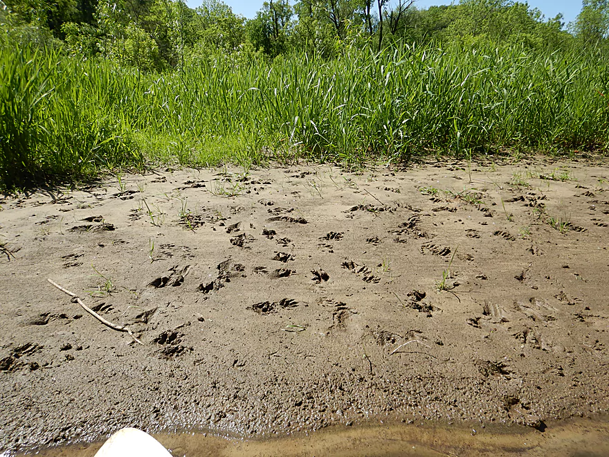
Evidence of a raccoon party
Eagle Eye SNA reminded me somewhat of Snow Bottom SNA
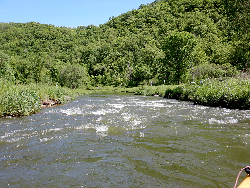
Some of the strongest rapids
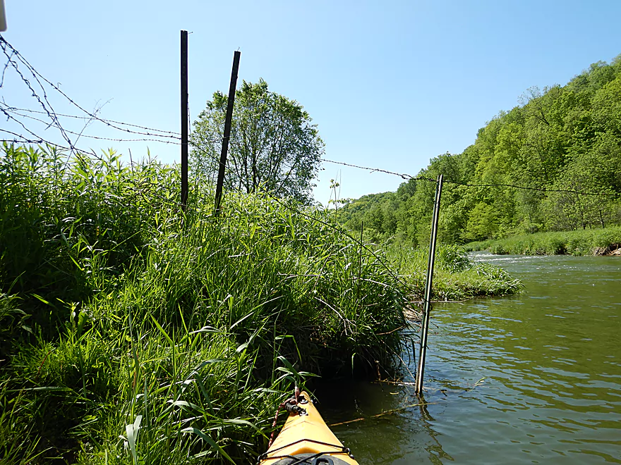
There were a handful of fences…all super easy to duck under
Leaving Eagle Eye SNA area behind
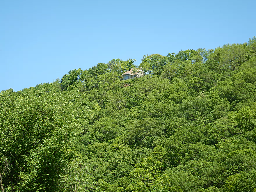
That house must have quite the view of the Bad Axe
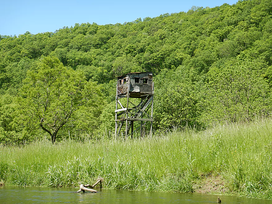
A rustic hunting tower
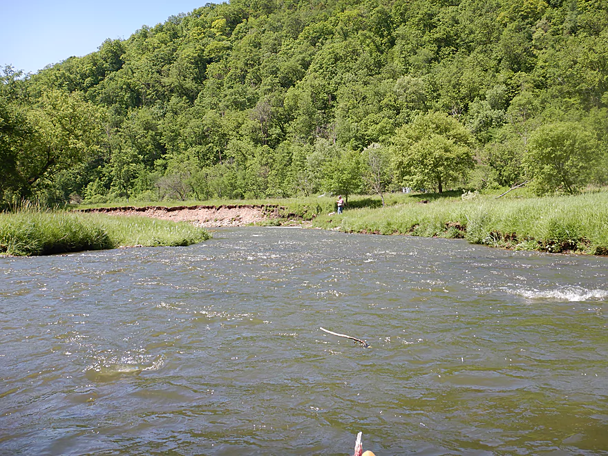
Coming up on some fishermen
In the fall this would be a gorgeous paddle
Entering a small woods
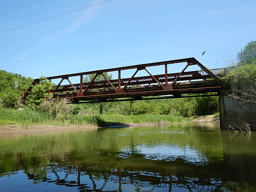
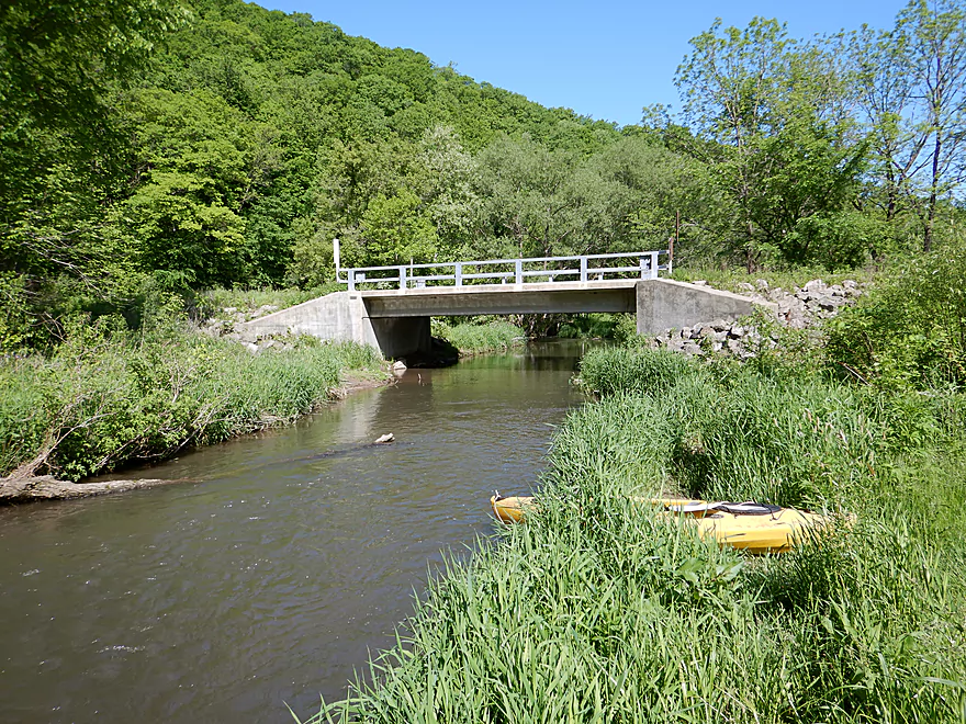
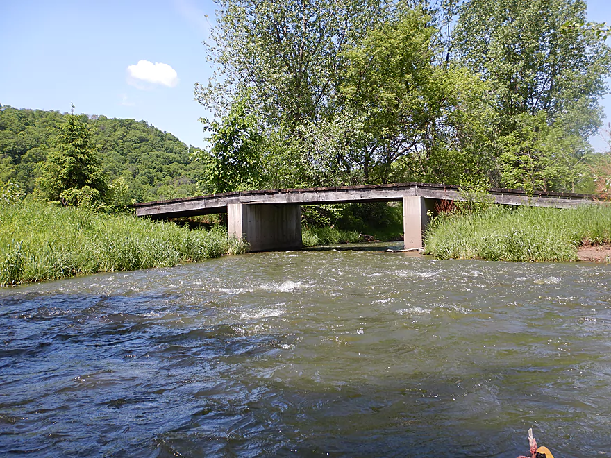
Upper Newton Road bridge is rustic and rusty
But not a viable access
View from the bridge

Little beaks peaking out from the nests
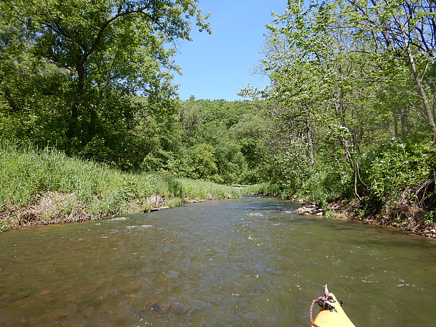
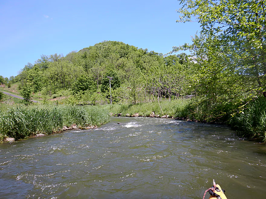
River is still fast
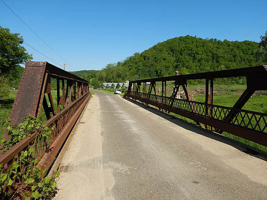
Attractive farm bridge
Banks have been worked on here for trout
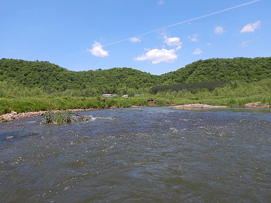
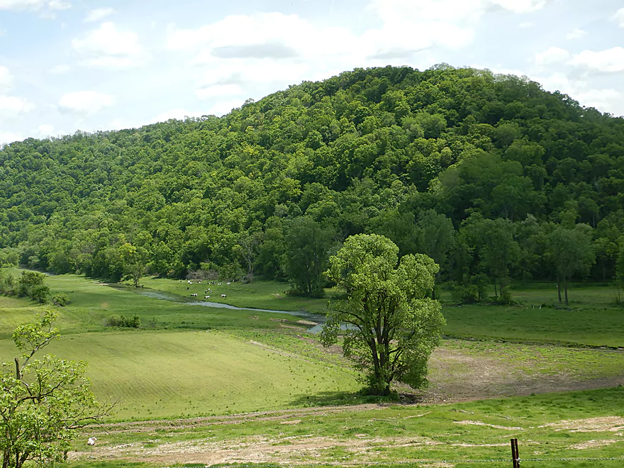
Some scenic driftless vistas
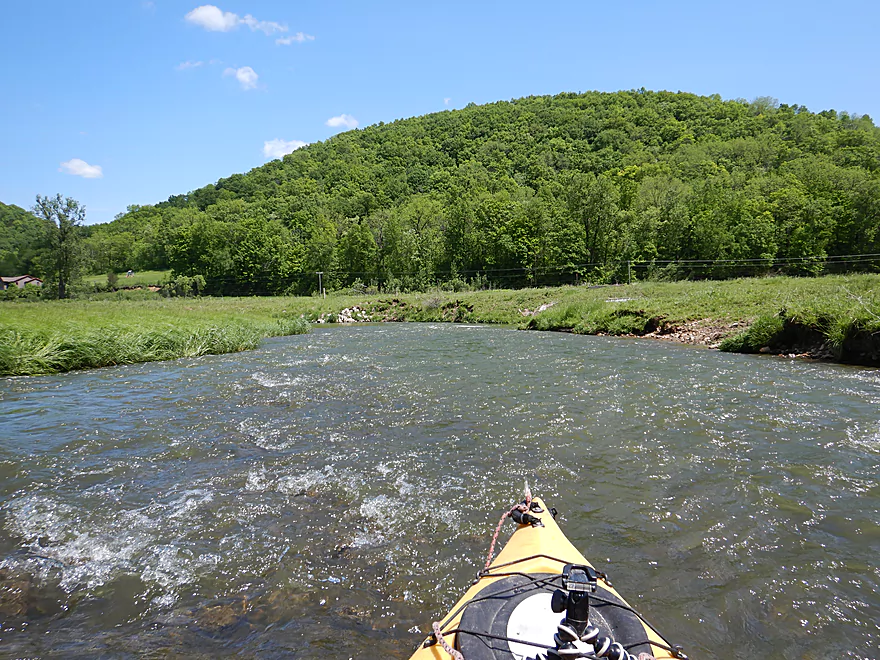
Entering open pasture
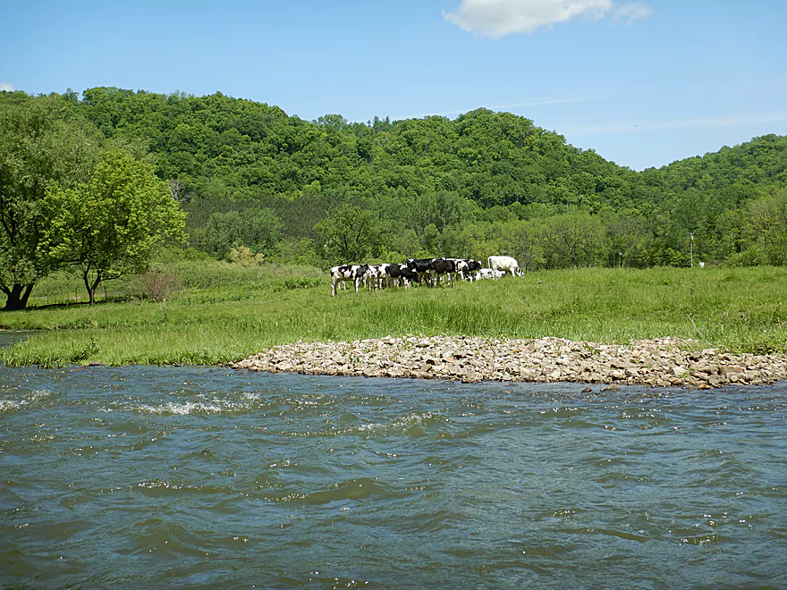
Only cows of the trip
Cows + river = eroded banks
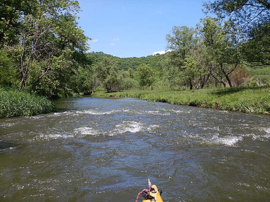
Among the fastest rivers I’ve ever paddled
Hills in all directions
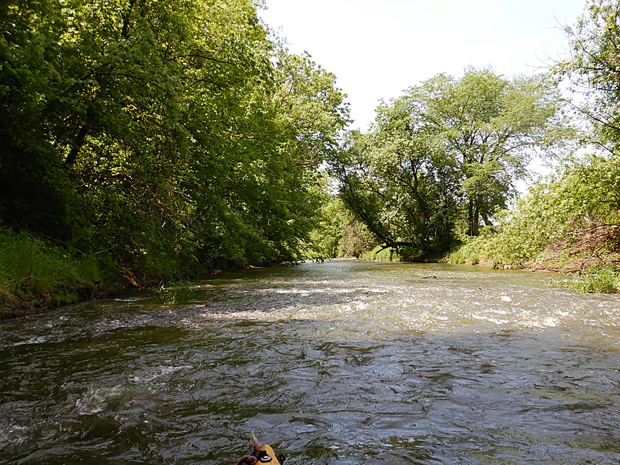
One last stretch of woods
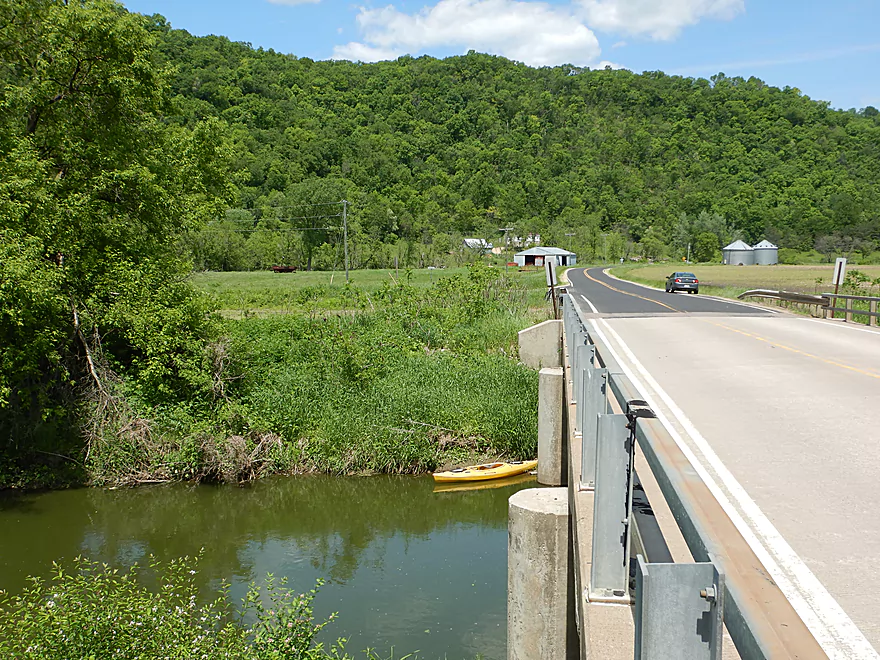
Weedy take-out at Hwy O
Scenic bike shuttle
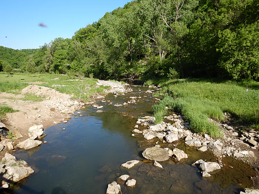
Scouting time…Esofea Park looks rocky but shallow
The North Fork West of Hwy O looks nice
Mud banks get much steeper by North Ridge Road
The South Fork by S. Bad Axe Road looks straightened
The further upstream the better though (S. Bad Axe Road again)
South Fork looks great by Hwy NN
Bad Axe River – North Fork – Duck Egg Park

The Bad Axe is a small driftless river that courses through coulee country just south of La Crosse. It’s lower reaches are muddy and not super appealing for paddling, but upstream of the North/South Fork confluence things start to get interesting. Both forks are intriguing water trail prospects and the further upstream you go on either, the more scenic and rugged they become. My initial plan was to do a four mile leg on the South Fork…but when map scouting the area I came upon a neat natural area along the upper North Fork that appeared pretty open. Not knowing too much more, I decided to drive two hours to gamble on a totally unknown section of river that only looked good from satellite maps.
In ideal circumstances my North Fork adventure would have started on Runge Hollow Lake (looks nice), but that would have been a tough bike shuttle (541′ of hill climbing). Instead I cheated by launching not on the North Fork, but rather on one of its tributaries in the Springville Branch at Duck Egg Park. This park is a big trailhead for trout fishermen and worked quite well as a kayak launch. The Springville Branch is a cool little creek with almost constant light rapids, but it was shallow and I did get hung up several times. This wasn’t the end of the world though as the stream soon joins the North Fork, which is significantly larger. Those wishing to recreate my exact trip may be advised to bring aqua-shoes for the first 1500′ of the trip because of its shallow depth.
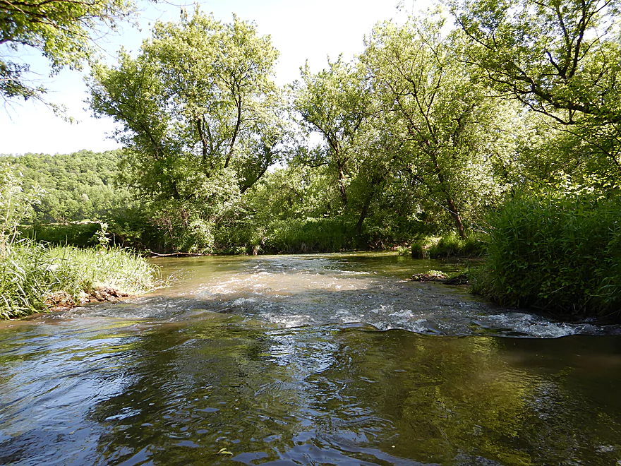
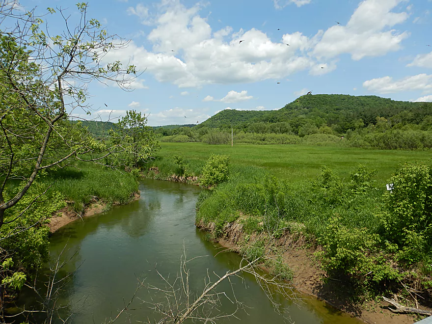
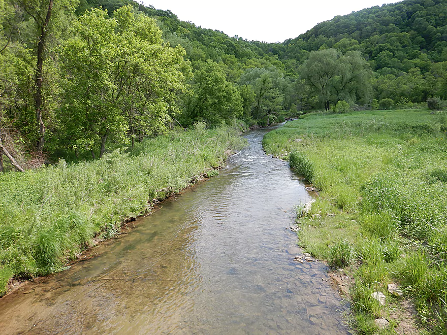
My first surprise paddling the North Fork was how fast it was…there were so many rapids I was practically never out of earshot of one. After paddling through some woods I came upon Eagle Eye State Natural Area. Basically this consists of a steep bluff to the north which has an eagle eye-shaped sandstone arch at the summit. I couldn’t see this from the water, but I did paddle past a smaller sandstone outcrop directly on the channel. Below the bluff was a flat open area that has undergone some prairie restoration work. This created some open and scenic vistas of the surrounding hills and coulees.
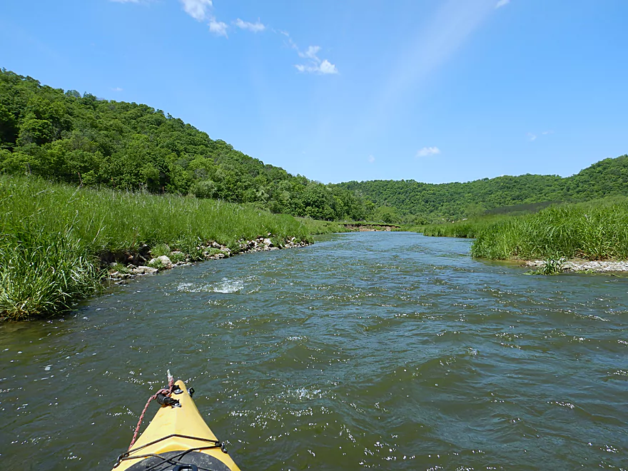
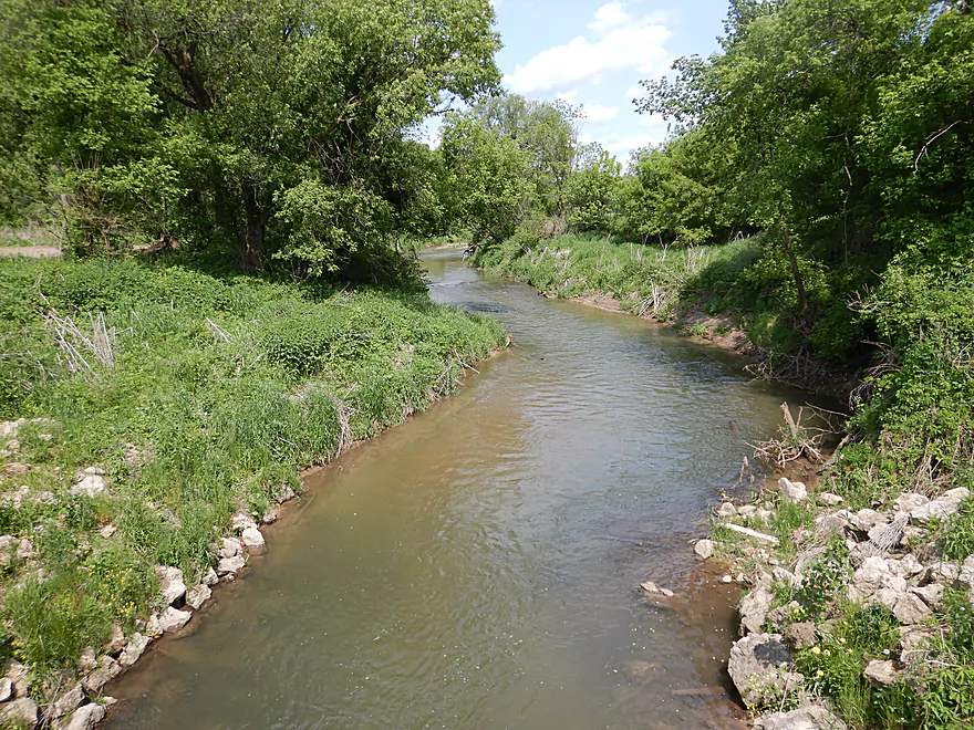
The river then exited Eagle Eye SNA and took a large hairpin turn to the left. This was the most scenic part of the trip and was reminiscent of Snow Bottom SNA. In fall the scenery here would be fantastic. The Bad Axe is very popular with trout fishermen, but I only saw a few. Often I saw riprap work done along the shoreline to improve the current and to protect against erosion.
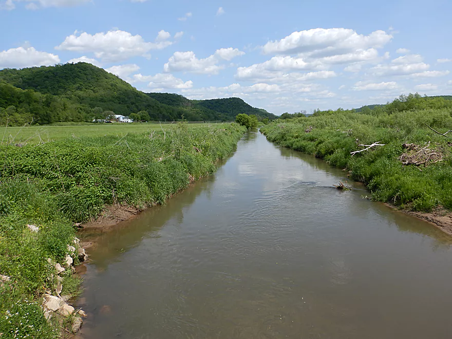
Following Upper Newton Road, the river changed somewhat as it entered pasture, but it stayed super fast and scenic. I ended the trip at Hwy O which was a bit weedy, but was a doable take-out.
In summary, this trip was a total paddling gamble that turned out great. No, it’s not a perfect paddle…the water clarity was a bit turbid and there are some mud banks (albeit far, far less than downstream sections). But what makes this a special trip is its whitewater which falls at an impressive 24′ per mile and the lack of logjams. The only minor downer was the photography conditions…which were bad. June + midday hours – clouds = harsh direct sunlight…and many of my photos didn’t turn out. In better lighting conditions like in the fall, this trip could be a photogenic gem.
Sights included cliff swallows, one deer, a great blue heron, one softshell, blackbirds, turkey vultures, a rabbit and many racoon footprints. This is a well-known trout stream, but I didn’t see any. The highlight was a farm by Upper Newton Road which included goats, chickens, and peacocks. The peacocks made an interesting sound which you could hear for some ways along the river.
Duck Egg County Forest: This is a large public forest that runs along the western end of the Springville Branch of the Bad Axe River. What makes this unique are the steep and narrow valleys. I suspect this is a very scenic area and I know some trout fishermen rank it among their favorite streams in the area. It likely is a bit shallow for kayaking (unless there is a high water event). The best way to experience the forest is via its extensive trail network.
Eagle Eye State Natural Area: This is a neat state natural area set aside by the Mississippi Valley Conservancy. Highlights include a steep bluff with a sandstone arch shaped like an eagle eye. There can be a nice view from on top of the bluff, but there are no official hiking trails so you would be roughing it to get up there. Along the south side of the bluff are several Indian effigy mounds. For pictures of the bluff click here. Honestly though…the best way to experience this SNA is by kayak where you can best see the valley bottom.
Battle of Bad Axe Memorial: Just south of the Bad Axe mouth there are several historical markers along Hwy 35 commemorating the Battle of Bad Axe. I recommend reading the full historical account if possible. But in a nutshell… Chief Black Hawk and the last of his tribe fled Sauk County and attempted to flee west. The Sauk Tribe tried to cross the Mississippi just south of the Bad Axe River, but were trapped by troops to the east and an armored steamer to the west. Black Hawk and members of the tribe did attempt to surrender, but troops still fired on them. Of the 400 Sauk, only 70 were able to cross the Mississippi…and those were slaughtered by the Sioux who were waiting on the western banks. All in all pretty tragic. This would become known as the Bad Axe Massacre.
I started the trip at Duck Egg Park. This is a nice public area and a good launch option.
An alternate upstream put-in on the North Fork would be at the Runge Hollow Dam. This would add 2.4 miles and could be scenic with some outcrops. On the downside the bike shuttle would be tough and the river (prior to the Springville Branch) is very small so would need high water.
An alternate downstream put-in would be a public fishing pull-off by Upper Newton Road (see map). This is a good access option, but you would miss out on a great part of the river including the sandstone outcrop.
I ended the trip at Hwy O. This was a bit weedy for taking out but was suitable. Best access is on the NW corner almost directly under the bridge.
An alternate take-out 4.5 miles downstream would be off the dead-end road Goede Lane or the fishing access just to the east of that (see map). This bonus segment looks like a good prospect with more hills and rapids…but cows and pasture encroach on the river and there could be two logjams.
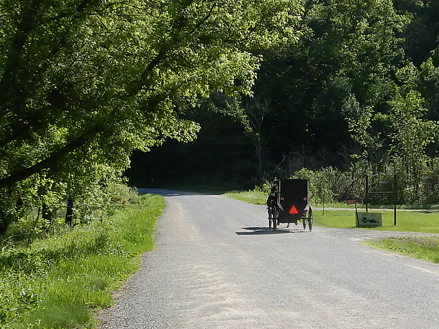
The bike shuttle was pretty nice…only 2.8 miles, paved and mostly flat. It was also scenic with the river running mostly along it and steep hills in all directions. Shuttle highlights included an active spring, horse sculptures, goats, peacocks, and a rustic one-lane bridge. This is Amish country and I saw my share of buggies.
Fences: There are maybe 4-5 fences…several were barbed and I think one was electric. But, these were super easy to get under…so much so I didn’t even bother marking these on the map.
Logjams: No logjams…that was a pleasant surprise. There was a minor strainer on the Springville Branch…but not a big deal.
Current: The current was fast, dropping at over 24′ per mile…among the fastest I’ve ever paddled. I never thought it was too pushy though.
Rapids: There are countless rapids and this is absolutely a whitewater river. I thought they were all really easy though and ranked them all as Class 1. Some of these could be Class 2 or greater during high flow rates though.
There is no gauge on the Bad Axe, but there is one on the upper Kickapoo that is probably a decent analogue. Note, I started the trip on a brief section of the Springville Branch before paddling the North Fork. The former is SIGNIFICANTLY shallower…in fact you might expect some wading regardless of water levels…but the Springville Branch is only a third of a mile.
- 0-80 CFS: Maybe too shallow.
- 81-120 CFS: Many of the rapids may be bumpy. Clarity might be good though.
- 121-200 CFS: Likely a good target range. I did the paddle at 165 CFS and maybe 90% of the rapids had good padding, while maybe 10% were a bit bumpy.
- 201-300 CFS: A high depth with likely muddy water…but likely a fun range for the rapids.
- 301-450 CFS: A pretty high depth. Perhaps only suitable for experienced paddlers.
- 451+ CFS: Maybe too high for paddling. If you know otherwise let me know in the comments below.
Detailed Overview
Note, for additional information on access points please see my overview map.
Main Branch/North Fork:
- Hwy B to Esofea County Park: 0.9 miles. Small stream that would need very high water. Attractive with many light rapids and steep hills. Maybe one logjam.
- Esofea Park to Helgeson Road: 1.1 miles. Very fast and rocky section with open banks. Small and requires very high water to be runnable.
- Helgeson Road to Hwy Y/Runge Hollow Dam: 3.0 miles. Very tiny creek that runs through woods with perhaps a few logjams. This would include Runge Hollow Lake which is nice and the dam can be portaged. There is also a landing on the southeast side of the lake.
- Runge Hollow Dam to Springville Branch Confluence: 2.4 miles. Small and narrow. Maybe a few outcrops and 2-3 logjams.
- Duck Egg Park to Springville Branch Confluence: 0.3 miles. The Springville Branch is extremely small and fast. I hit a lot of rocks here, but it was worth it as this is a good way to access the North Fork.
- Springville Branch Confluence to Hwy O: 3.5 miles. River gains significant volume from the Springville Branch. This is a great leg with countless rapids and scenic driftless vistas.
- Hwy O to Goede Lane: 4.5 miles. Good prospect with more rapids, some pasture and what looks like a massive rice farm. Deadfall finally starts to encroach on the creek here…maybe two logjams. Goede Lane might not be the greatest access (see map for details).
- Goede Lane to Munyon Lane: 2.1 miles. Maybe 6-7 logjams. Mud banks start to grow in size.
- Munyon Lane to N. Ridge Road: 1.9 miles. Very open and likely logjam free.
- N. Ridge Road to Hwy 56: 1.8 miles. Maybe 4 logjams.
- Hwy 56 to Confluence of North and South Branches: 3.2 miles. Maybe 5-6 logjams.
- North/South Confluence to Henry Lane: 0.8 miles. River doubles in size after both branches join. Banks become muddier and taller. Maybe one logjam.
- Henry Lane to Amann Road: 1.6 miles. Maybe 3 logjams. A beat-up and messy section of woods.
- Amann Road to Mouth on Mississippi: 2.0 miles. Messy section frequently back-filled by the Mississippi. Maybe one logjam. There is a nice public landing directly on the mouth of the river.
South Fork:
- Upstream Of Sidie Hollow Lake: The South Fork splinters into a number of small creeks. These are likely too narrow and shallow to paddle unless done during a very high water event.
- Sidie Hollow Lake: The river is impounded by a large dam to create a lake. This can be a pleasant paddle. A launch is available on the east end.
- Lower Lake Road to Hwy NN1st: 4.6 miles. The river is here is very small and shallow…but open and scenic. This might be a viable paddle during a high water event.
- Hwy NN1st to Hwy N: 4.5 miles.
- Hwy NN1st to Hwy NN2nd: 1.7 miles. A fast, narrow and shallow creek that is very scenic with many rapids. However this stretch is likely too small for most paddlers to enjoy. There are 3-4 logjams and a handful of strainers in this stretch…most of which are easy portages.
- Hwy NN2nd to Hwy N: 2.8 miles. A terrific open stretch with many rapids. There are a some strainers but these can be avoided with good boat control (or by simply portaging).
- Hwy N to Anderson Ridge Road: 2.1 miles.
- Hwy N to S. Bad Axe Road: 1.5 miles. A scenic stretch with many light rapids. Mostly free of logjams, but there is a fence to portage (not difficult).
- S. Bad Axe Road to Anderson Ridge Road: 0.6 miles. A good stretch, but not as good as the prior two legs.
- Anderson Ridge Road to Oliver Road: 1.9 miles. Maybe 1-2 logjams. The river looks like it has been ditched somewhat by farmers.
- Oliver Road to Lockington Road: 1.0 mile. Maybe one logjam and kind of muddy. There appears to be significant flood damage along this corridor.
- Lockington Road to S. Bad Axe Road: 1.4 miles. Very open section likely free of logjams, but muddy with tall banks.
- S. Bad Axe Road to North/South Confluence: 1.5 miles. Maybe 3-4 logjams.
Trip Map
Overview Map
Video
Photos Size: