
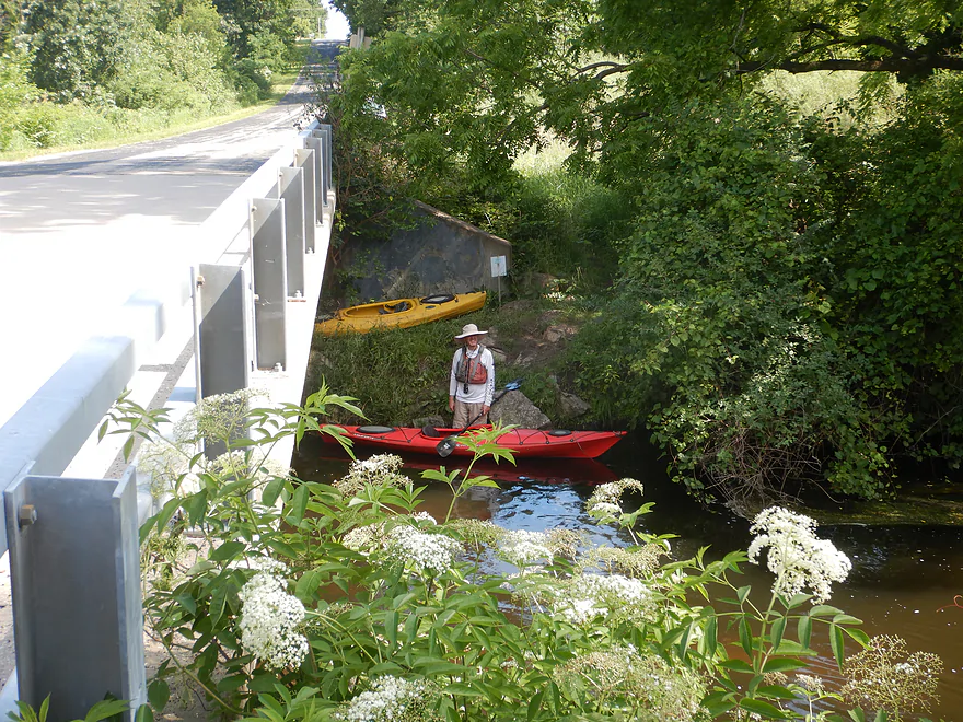
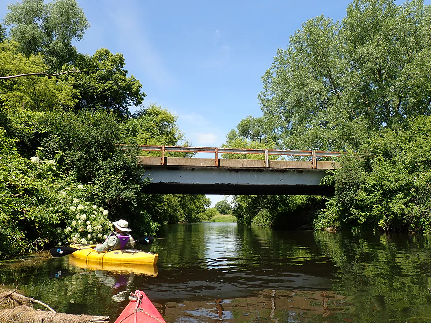
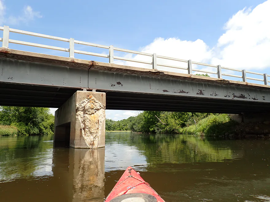
Good bridge access at N. Riley Road
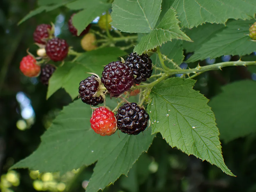
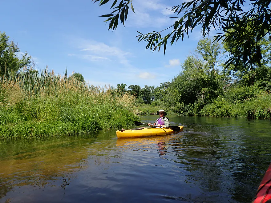
Ripe black raspberries
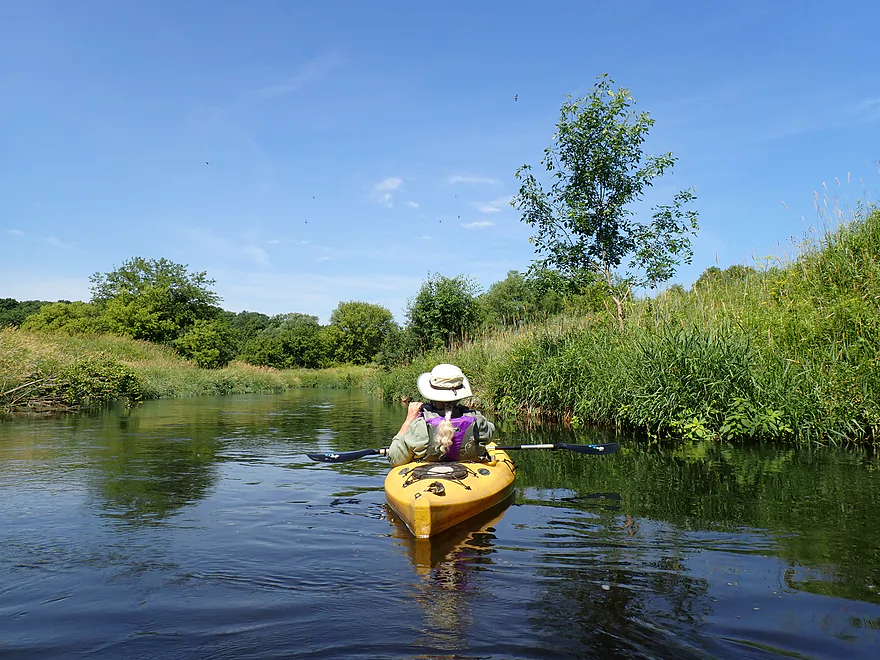
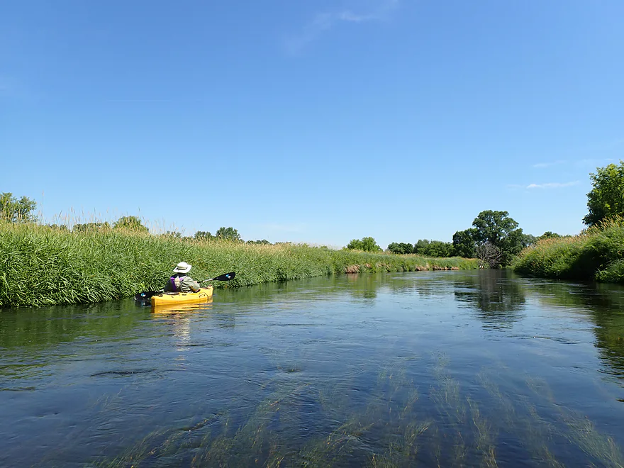
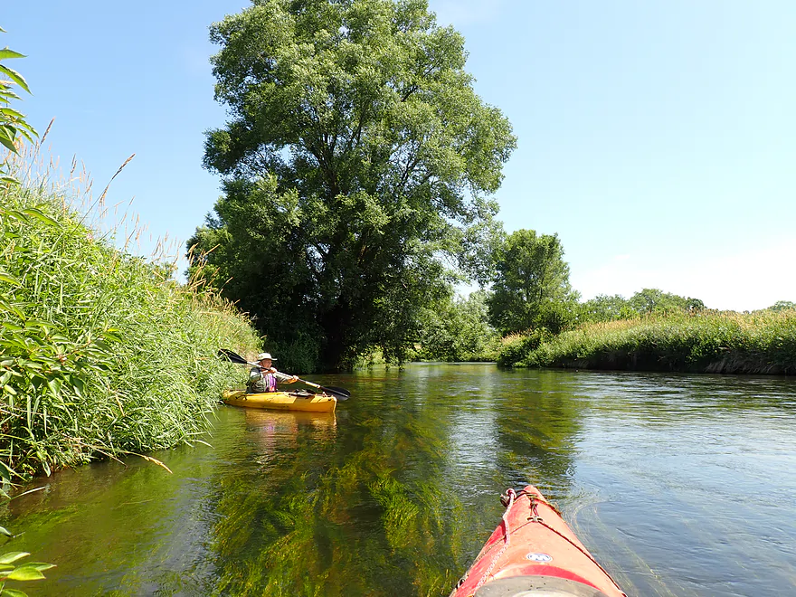
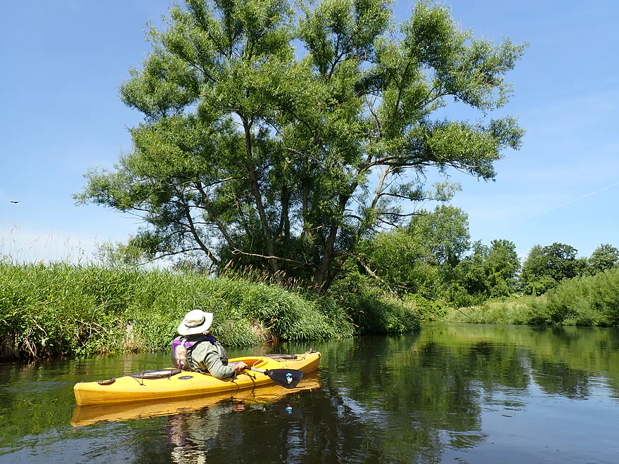
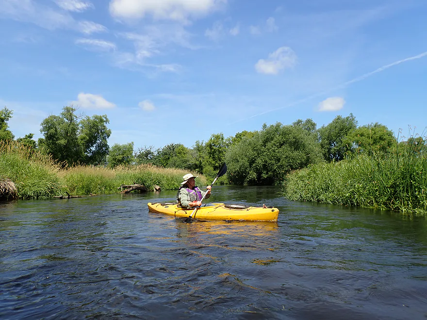
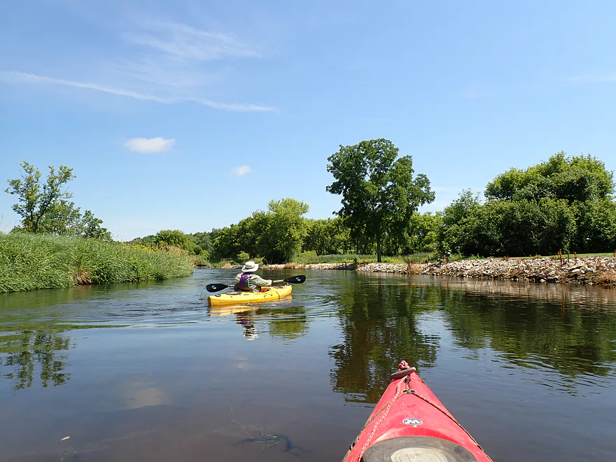
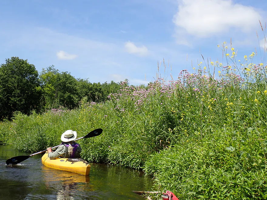
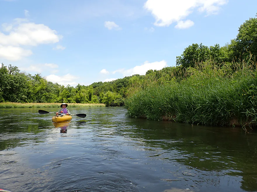
Nice grassy corridor
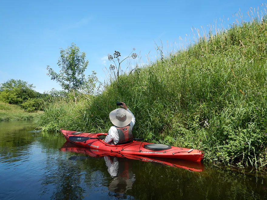
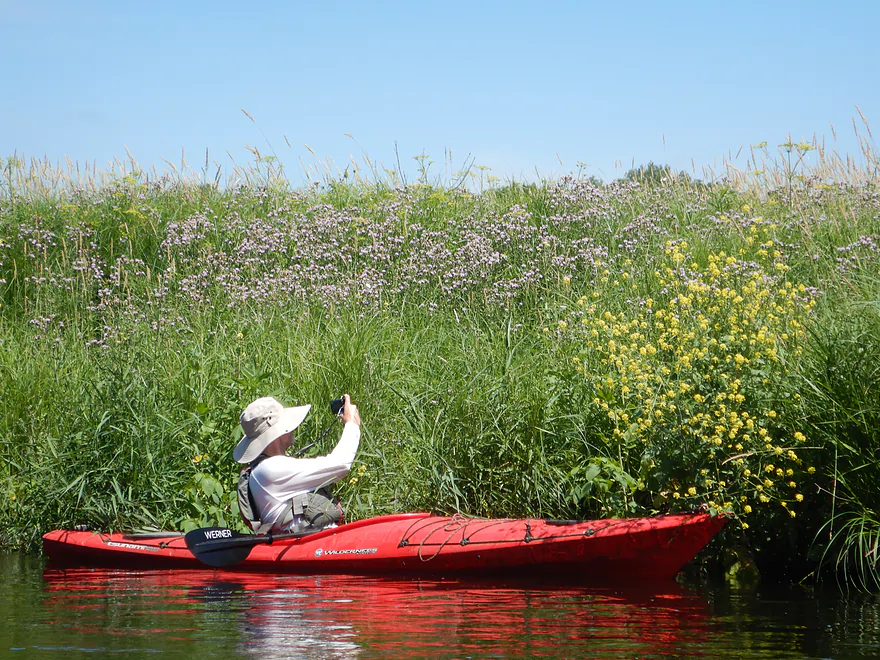
Lot of interesting plants growing on the banks
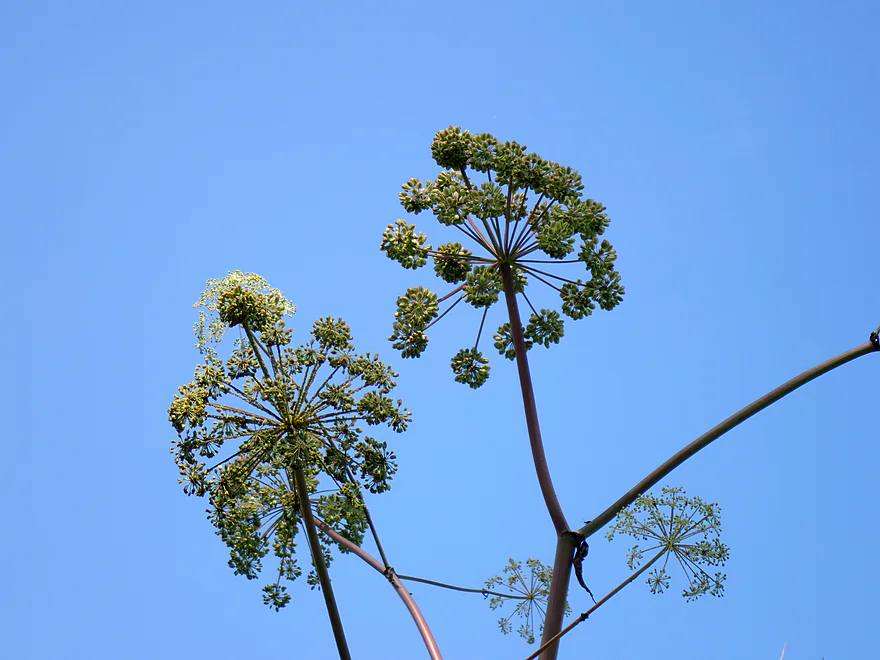
This is angelica
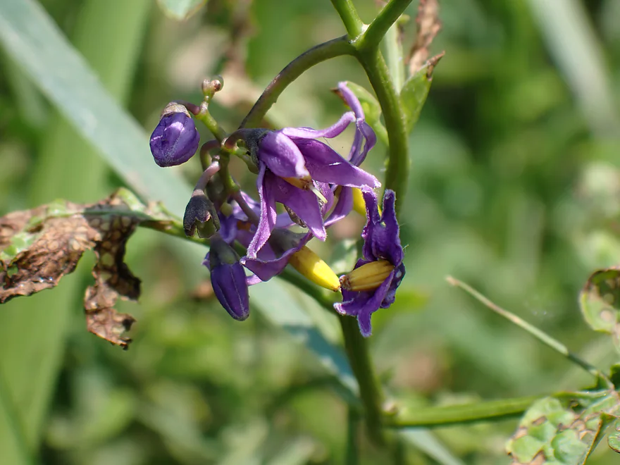
Nightshade flowers
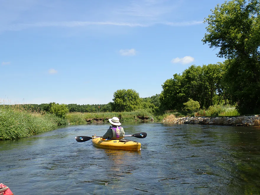
Good clarity
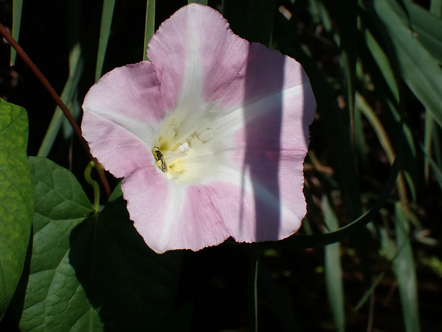
Bindweed
Lot of pondweeds swaying in the current
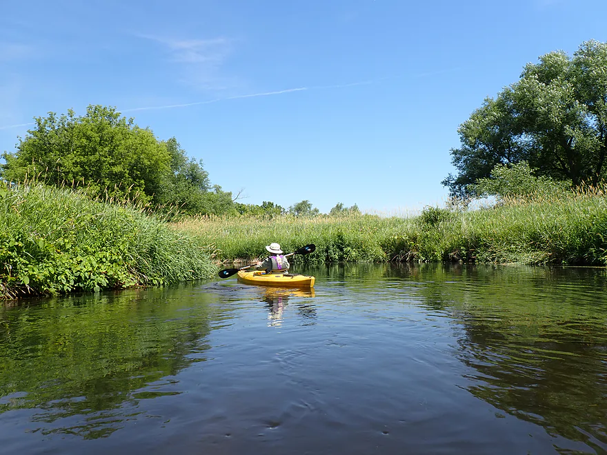
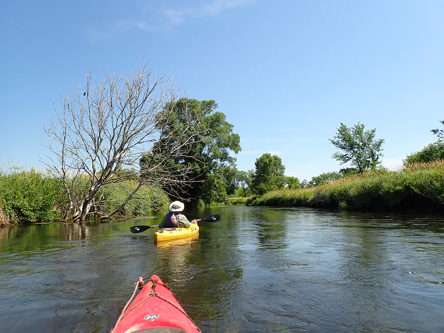
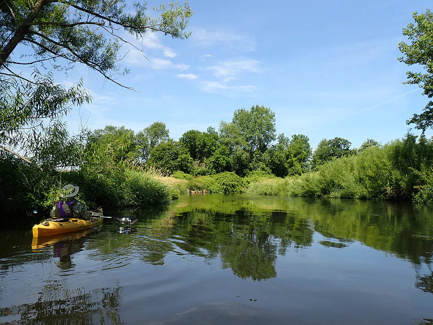
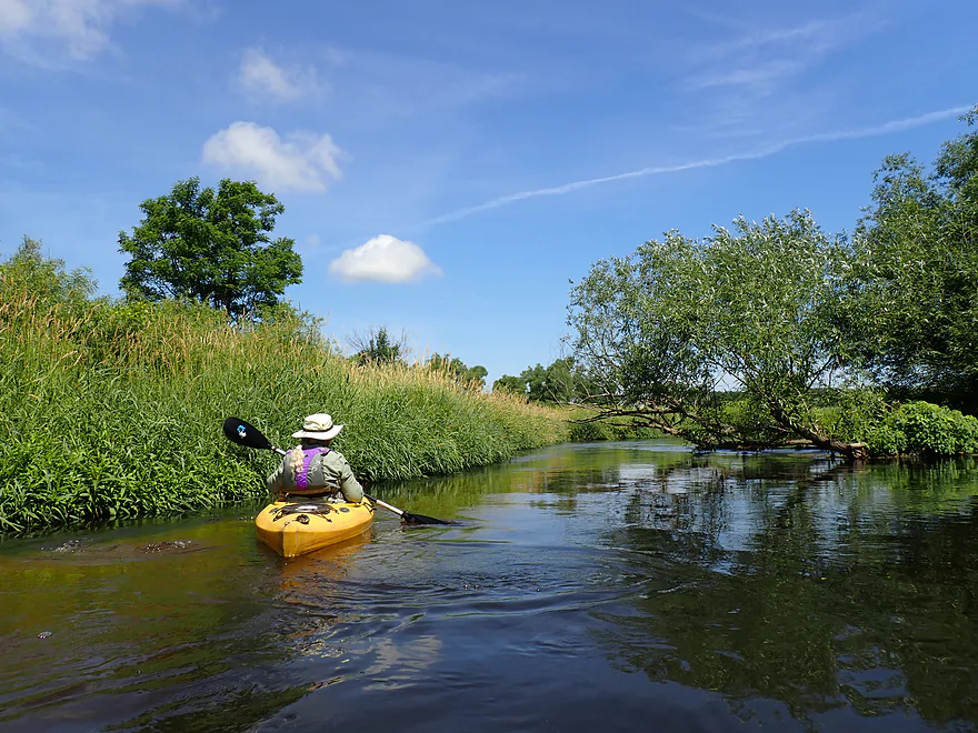
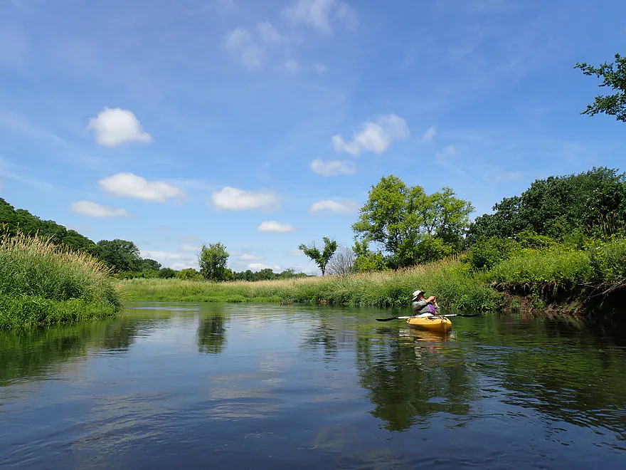
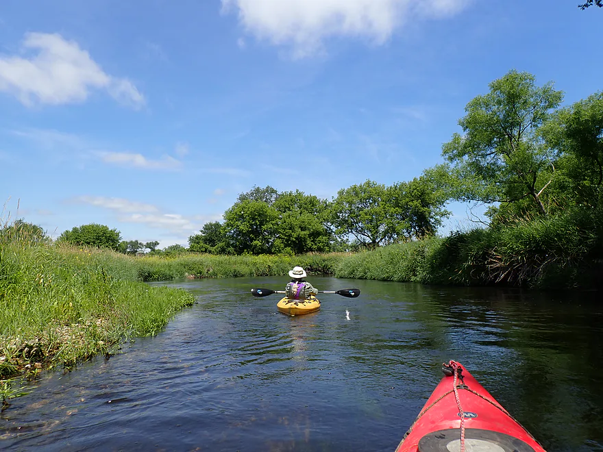
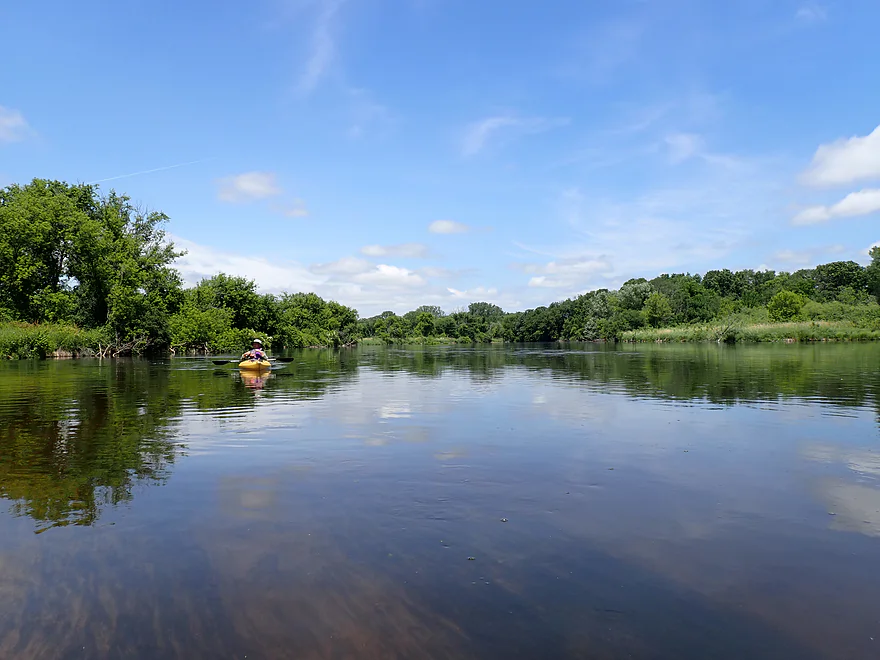
An open part of the creek
Nice blue sky day
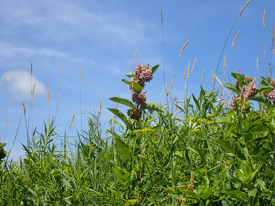
Milkweed flowers
Hwy 59 (we’ll see 59 again at our take-out)
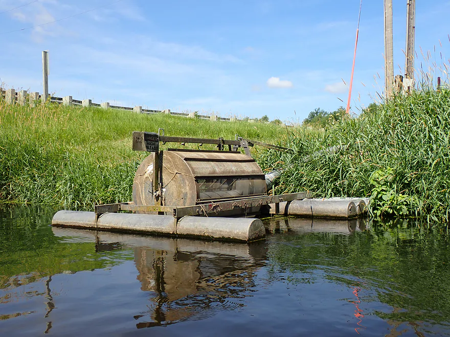
Interesting pump
Riprapped shoreline–one of the few lawns we saw on our trip
Pretty (but invasive) black mustard
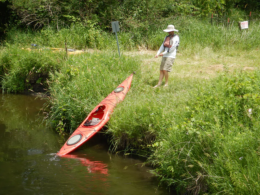
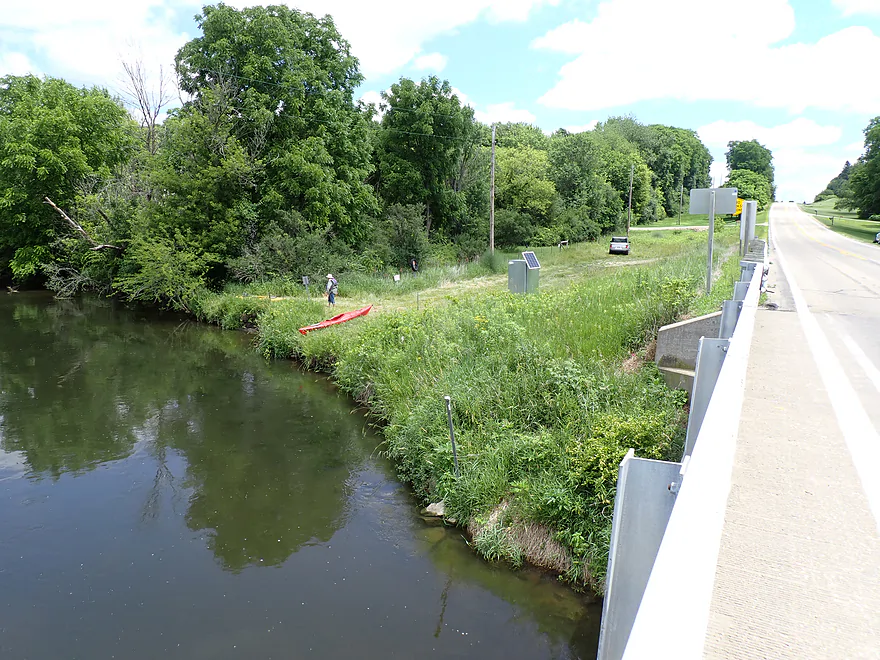
N Casey Road
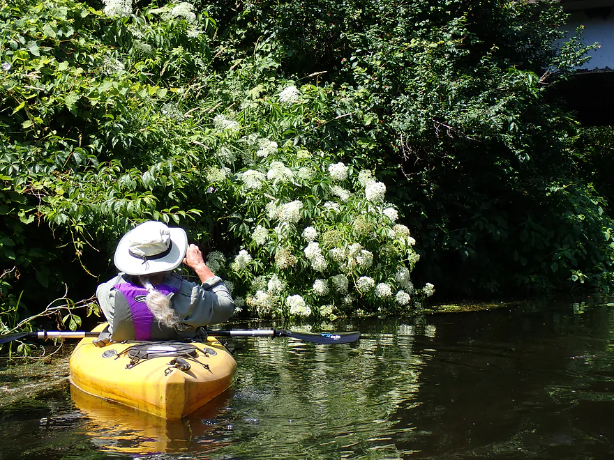
Lots of elderberry flowers (very fragrant)
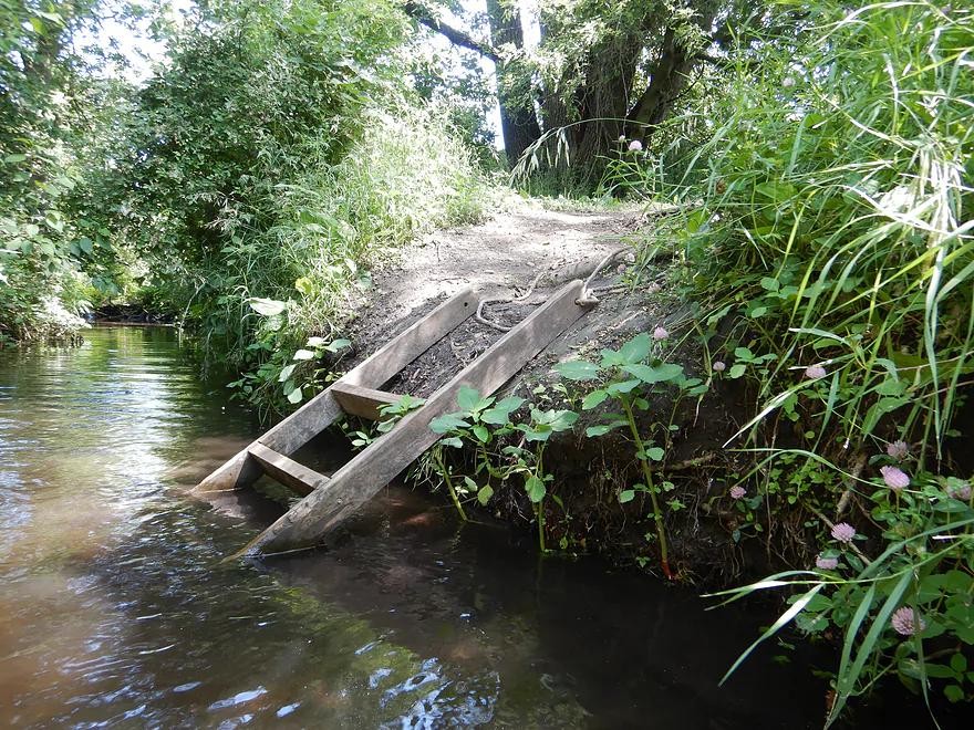
Helpful steps for those who want to get out here
More nice clarity
A bank of canada thistles
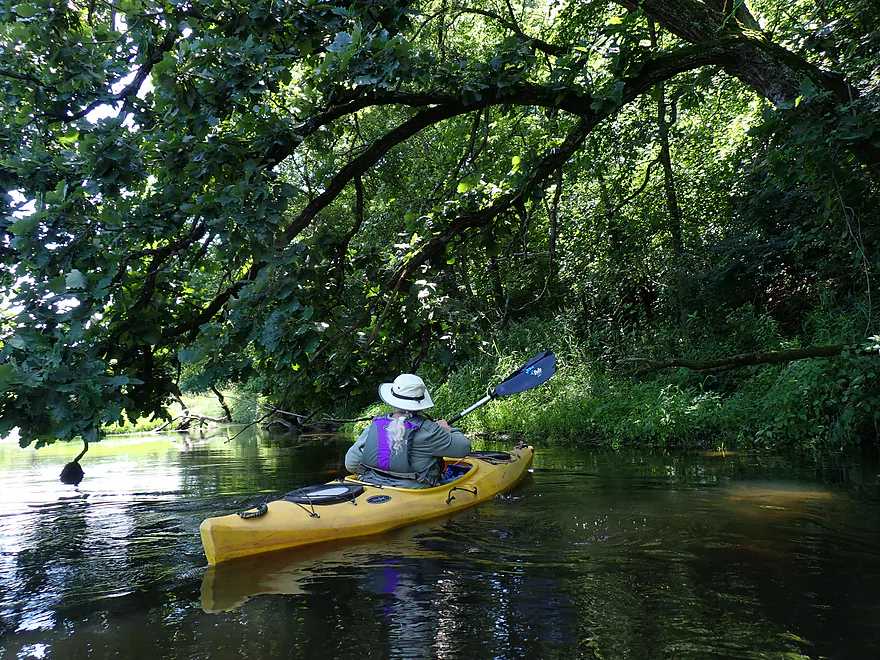
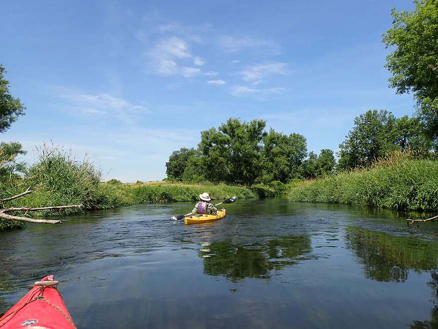
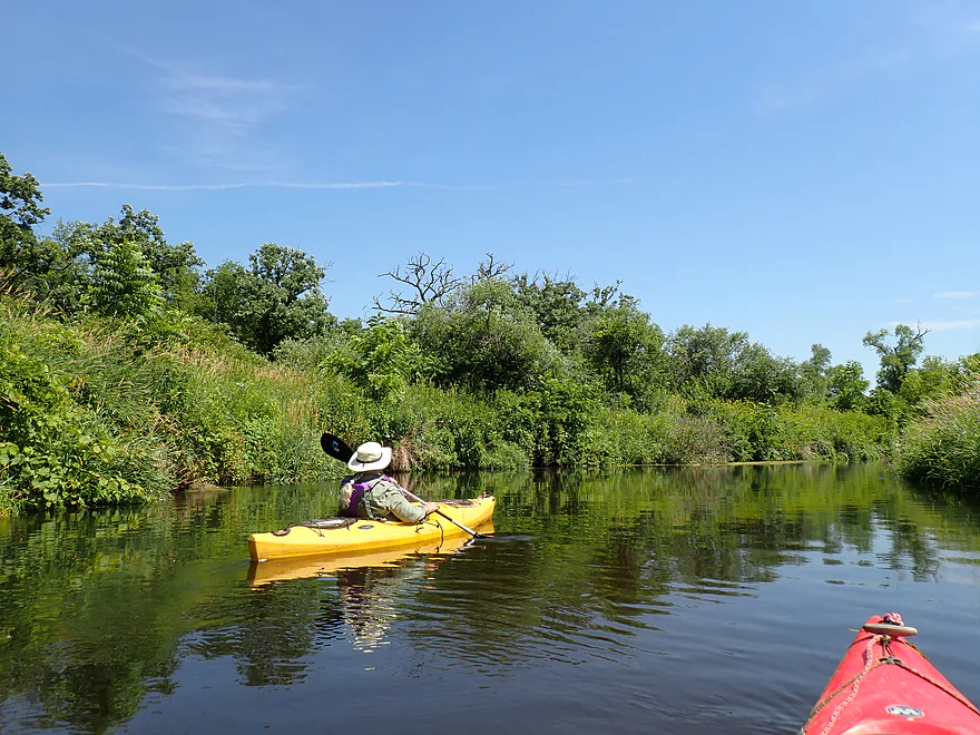
Oaks providing some nice shade
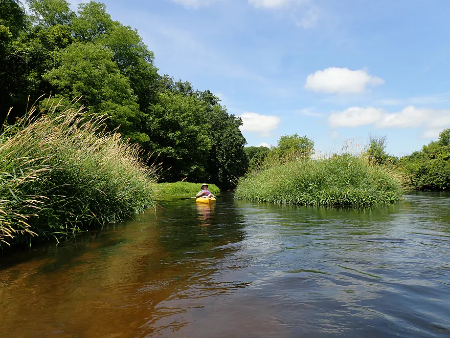
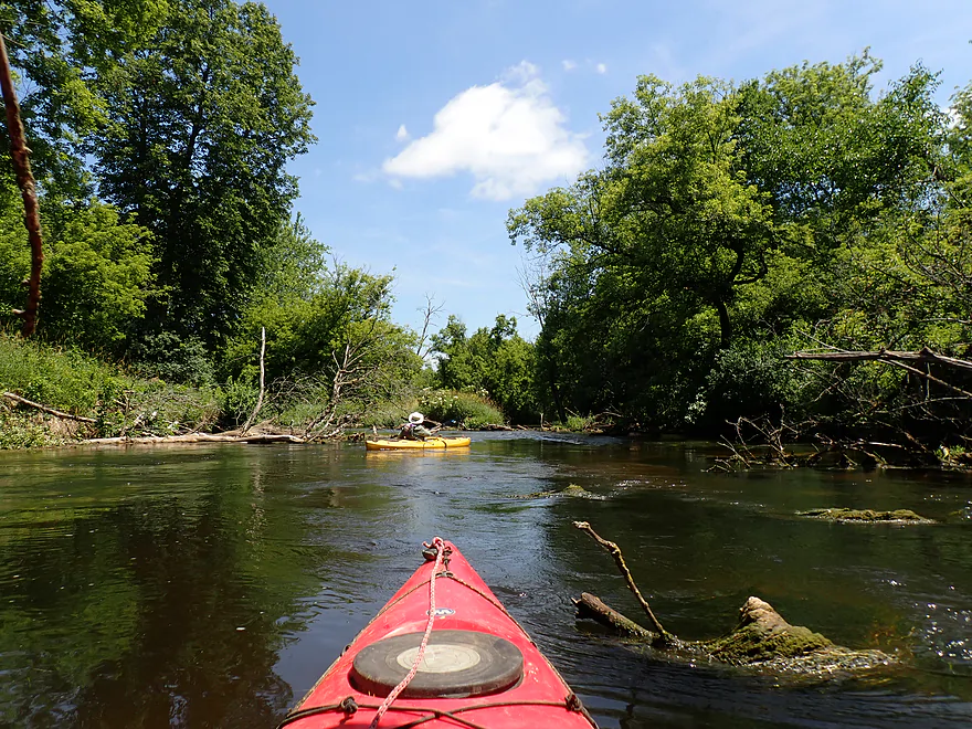
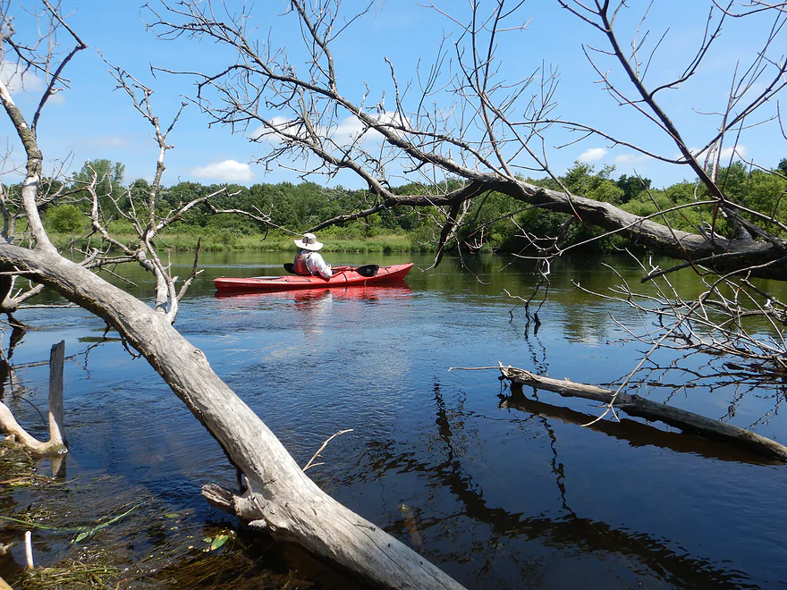
The creek split around occasional islands
There has been some great cleanup work
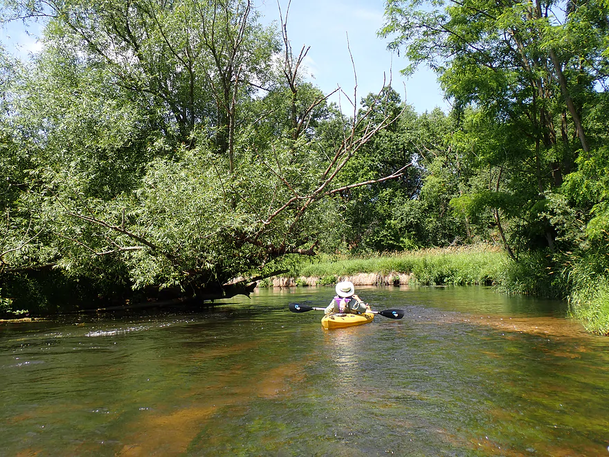
Entering a more wooded stretch
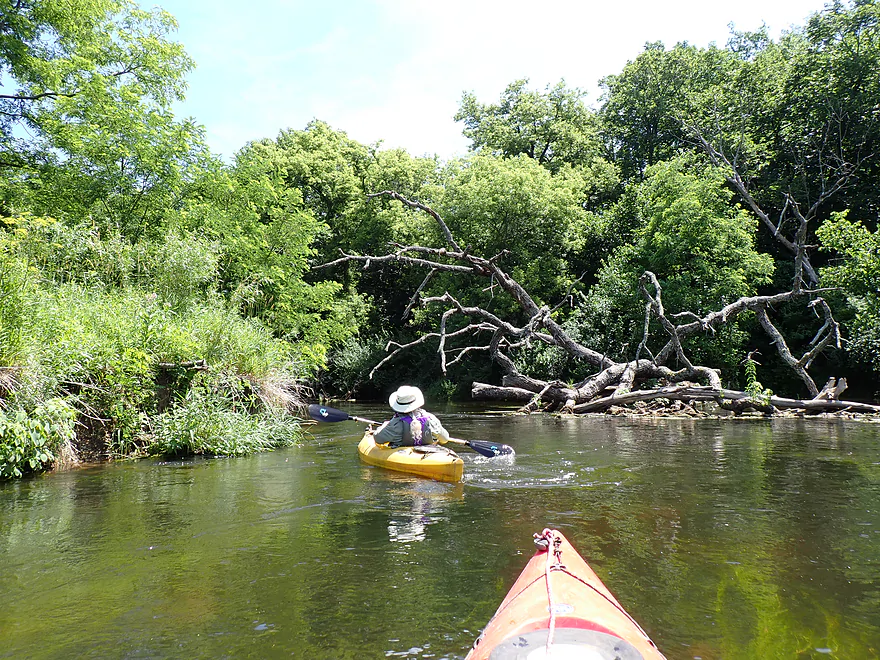
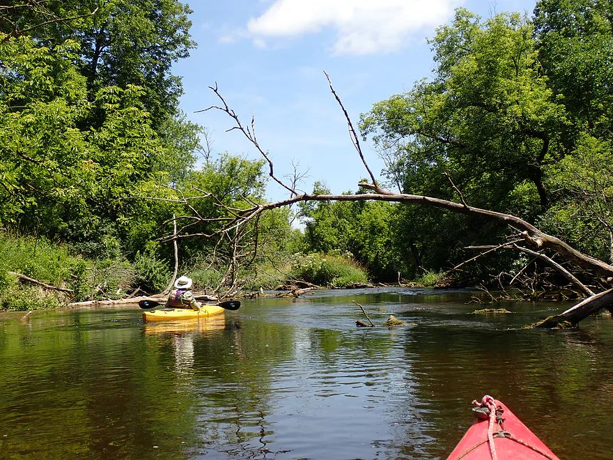
Minor rapids created by a downed tree…pretty fun
Some ducking…nothing major though
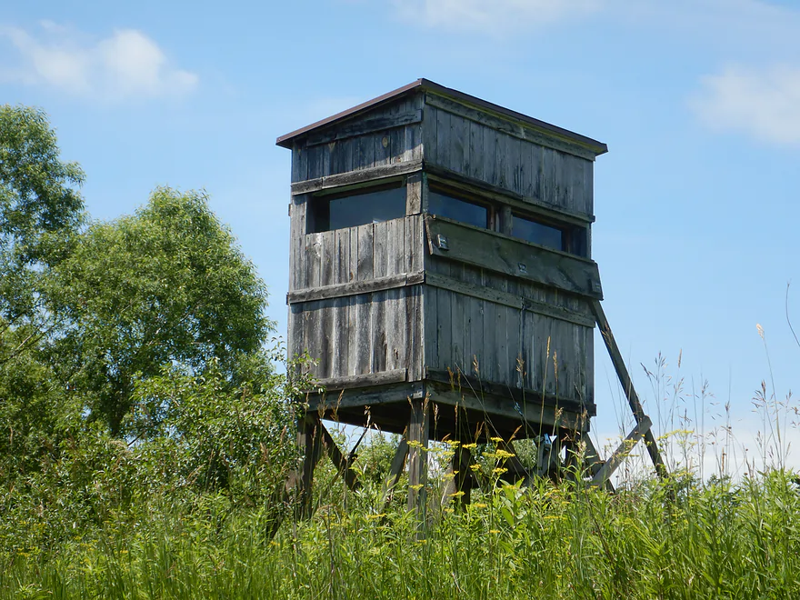
Rustic duck blind
Hard to see, but the fish here has a massive sore/tumor
The mouth of Badfish Creek
Now on the Yahara…which seems massive
The Yahara is an ok paddle…but is much less interesting
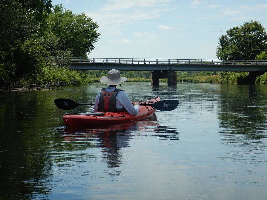
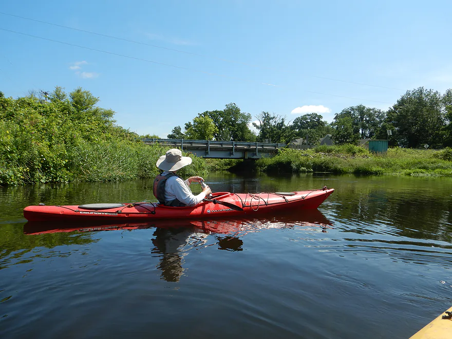
Hwy 59 again, but this time over the Yahara
In a bit of disrepair
There is a public access here, but the bank is steep
Zoomed out view of the landing
Downstream view of the Yahara from the bridge
Badfish Creek – Final Leg

Badfish Creek is a well regarded water trail located south of Madison. It is unique in that much of its volume comes from MMSD (Madison’s wastewater). Despite this (and a few faint chemical smells and some algae growth), it’s a remarkably nice creek. This website has reviewed the Badfish twice before, but not the last leg, which is this week’s trip.
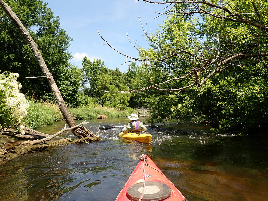
We started at N. Riley Road, which is not the usual put-in for Badfish paddlers (that would be Old Stage Road), but was plenty doable and a faint trail to the water suggested other kayakers do launch here.
The first impression you will get of Badfish Creek is…wow…that is some zippy current. Good current is a key ingredient to an enjoyable kayak trip and was definitely a highlight of this trip. The other major highlight was the incredibly clear water, which made it easy to see the sandy bottom, occasional patches of gravel and clumps of swaying pondweeds.
Badfish Creek is somewhat unique in that it is geologically situated along the terminal moraine of the Green Bay Lobe of the last glacier. Ice Age rivers that flow through these moraine transition zones tend to be remarkably clean and nice, and the Badfish is no exception.
The channel itself was mostly narrow and winding, but seemed to have been straightened by farmers in spots (which contributed to the speed). The banks were mostly topped with tall swaying grasses…some invasive, but also with some native flowering plants. Either way it actually looked nice.
The creek tends to have stable water levels which minimizes shoreline erosion and contributes to nicer bank quality. Some berry bushes were growing along the creek, including elderberries, wild grapes and black raspberries (which were tasty).
We passed N. Casey Road which had been the take-out for my 2012 trip. Most end their day here, and there are now wooden steps and a path which makes getting out easier.
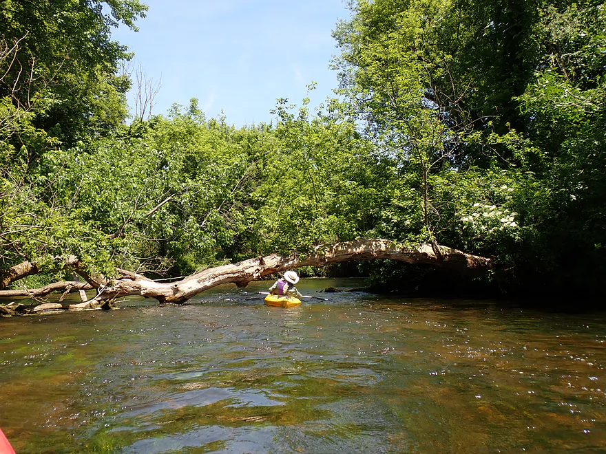
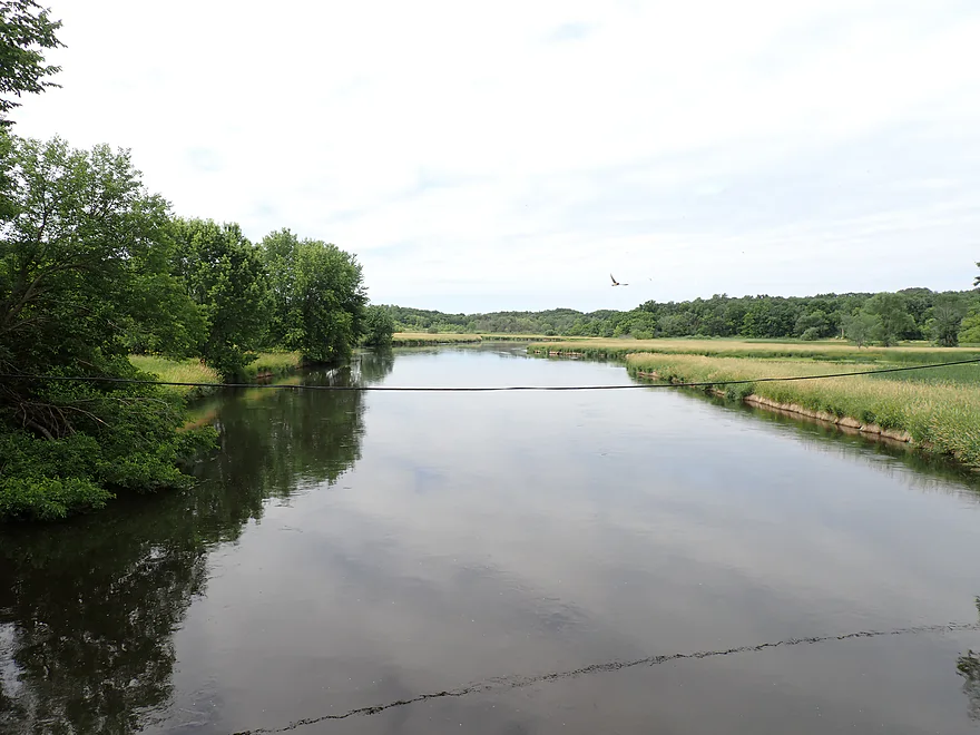
The creek downstream from N. Casey Road wasn’t as scenic, but was still very nice. Eventually the creek passed through a light woods which had some downed trees to paddle around, but no portages were required. There were logjams on this stretch about a year ago from an area tornado, but paddlers did a good job of making the creek navigable again. There are still a few trees to duck under or paddle past, but these were pretty easy and actually provided a bit of entertainment.
Eventually we reached the creek’s mouth on the Yahara River, which, in contrast to the Badfish, seemed like the Mississippi. Ok…that’s a bit of an exaggeration …but at 200′ wide the lower Yahara is pretty big. This bonus leg on the Yahara wasn’t too bad, but it just was not in the same league as Badfish Creek.
Soon after passing a couple relaxing in the river (in chairs), we came to the Hwy 59 bridge where there is a public access. This landing was crazy dilapidated and getting out was a bit of an adventure (more on this below), but it was doable.
In summary, this was a great trip that I highly recommend. It is getting five stars as I grade on a curve…if it were in Northern Wisconsin, it might be graded a bit lower…but for South Central Wisconsin it is a gem. Lastly I do recommend putting in further upstream than we did (say at Old Stage Road) as the fast current will make longer trips more viable.
Sights included three deer, three great blue herons, and many songbirds, which were singing nonstop the whole trip. Ironically enough I did see a “bad fish”. It was a decent-sized fish with two large sores (or tumors) on its body. It makes you wonder. MMSD does a good job of cleaning up some biological contaminants, but I believe a lot of chemicals, heavy metals, and even pharmaceuticals ultimately get discharged into Badfish Creek.
Riley Road: This is an ok bridge access. You can park on the shoulder where a faint trail leads to the water (northeast corner).
Alternate Put-ins:
- Hwy 138 (3.1 miles upstream from Riley Rd): Some paddlers do launch from Hwy 138. The leg between Riley and Hwy 138 is very nice and well worth doing.
- Old Stage Road (5.0 miles upstream from Riley Rd): Most paddlers start their trips here. The leg below Old Stage is more wooded, but very scenic and perhaps the best section on the creek.
Hwy 59: This is located on the Yahara River just downstream from the Badfish mouth. It’s an official access but is in poor condition. The bank where you get out is pretty steep. Then the landing area itself is rutted with huge potholes (and a rotting deer). But the most challenging situation is the ultra steep access drive that won’t be suitable for some vehicles. Parking on the Hwy 59 shoulder instead is recommended. All in all, a doable access, but in dire need of repair (and a gravel dump).
Alternate Take-out:
- North Casey Road (2.5 miles upstream from Hwy 59 on the Yahara and Badfish): This is a popular take-out. Small steps along the north bank make it easy to get out. The leg below North Casey Road is very nice…but the very best sections of the creek are located upstream from this bridge.
Bike Shuttle – Hwy 59 to N. Riley Road: 2.4 miles with 56′ of ascent. This would be a very easy bike shuttle.
Current/Rapids: The current is consistently fast which makes it a fun trip. There are a few riffles, but no major rapids.
Logjams: The creek was recently cleared of logjams. Closer to the Yahara River there were a few downed trees to zigzag and duck under, but I didn’t find these to be a problem.
Closest Gauge: Badfish Creek @ Cooksville
My Trip Depth: 88 CFS or 5.62′
Gauge Guide:
- 0-50 CFS: In recent years the creek hasn’t gotten this low. This might happen in drought conditions which would result in sublime clarity and maybe a few shallow areas. Otherwise I think this would be a great paddling depth.
- 51-100 CFS: A very good target with good clarity. This used to be a summertime norm 5+ years ago…but climate change these past few years has meant that the creek rarely dips down this low anymore.
- 101-150 CFS: An ok target range with decent clarity.
- 151-200 CFS: In times past this would have been a high depth, but it is now more of a norm. Clarity is still nice in spots.
- 201-300 CFS: A very high depth that might be pushy and dirty in spots. Only recommended for experienced paddlers.
- 301+ CFS: The creek might not be enjoyable at these levels.
Detailed Overview
- Hwy B to Rutland Dunn Town Line Road: 2.5 miles. A challenging section because of the steep put-in, low clearance bridge and logjams.
- Rutland Dunn Town Line Road to Sunrise Road: 2.5 miles. A good prospect with one dam to portage.
- Sunrise Road to Hwy 138: 1.4 miles. A good prospect with maybe a few jams, although Hwy 138 might not be a good access point.
- Hwy 138 to Hwy A: 2.8 miles. A good prospect, but again Hwy 138 is very busy.
- Hwy A to Old Stage Road: 4.2 miles.
- Hwy A to Old Stone Road Landing: 1.6 miles. A mediocre section...good clarity and current, but uninteresting scenery and poor bank quality. One logjam just above the put-in.
- Old Stone Road Landing to Old Stage Road: 2.6 miles. Starts open and channelized...not as interesting. The last half through dense woods in the Badfish Creek State Wildlife Area is terrific though.
- Old Stage Road to North Casey Road: 5.0 miles.
- Old Stage Road to Hwy 138: 1.9 miles. The best section on the entire creek.
- Hwy 138 to Riley Road: 3.1 miles. Probably the second best leg on Badfish Creek.
- Riley Road to Yahara River/Hwy 59: 5.0 miles.
- Riley Road to North Casey Road: 2.0 miles. A more open stretch but still very nice with great current and clear water.
- North Casey Road to Hwy 59: 3.1 miles. The final stretch on Badfish Creek. Starts open but then flows through a more wooded stretch. Not as scenic as previous legs, but still very nice.
Trip Map
Overview Map
Video
Photos Size:
I did the stretch from N. Casey Rd. to Murwin Park years ago and loved it, in spite of the obstacles in the way.
Some of the downed trees actually add a little character to the creek!
Agreed