Portage to Portage

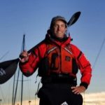
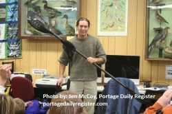
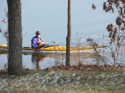
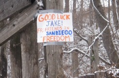
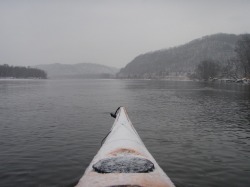
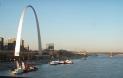
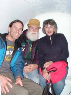
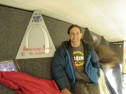
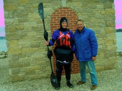
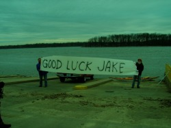
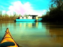
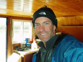
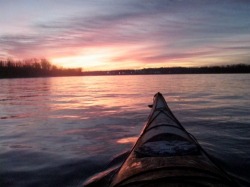
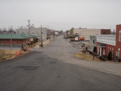
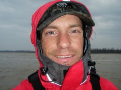
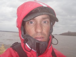
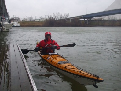
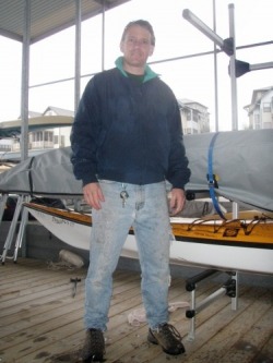
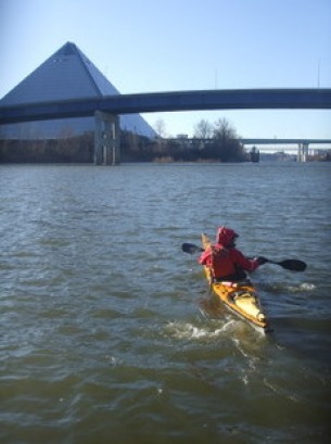
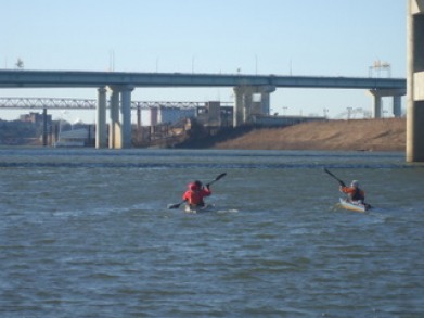
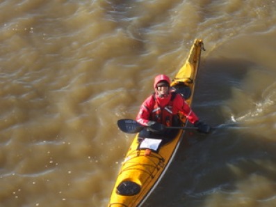
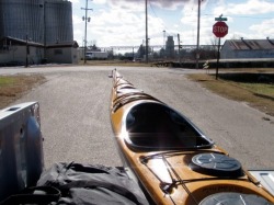
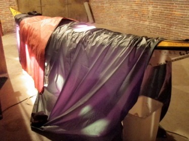
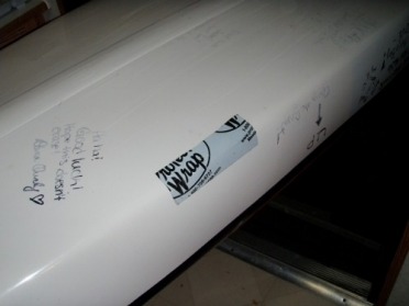
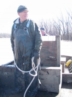
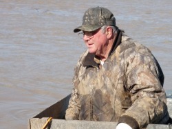
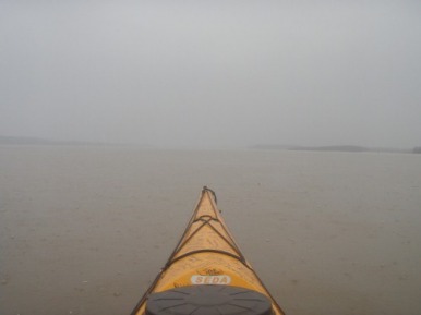
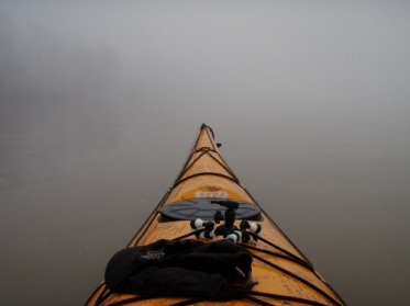
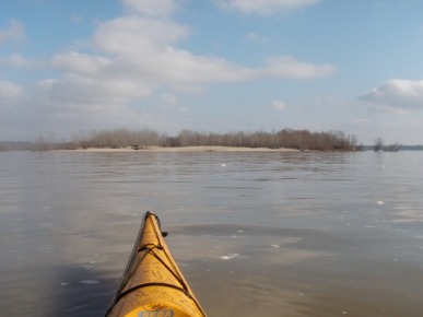
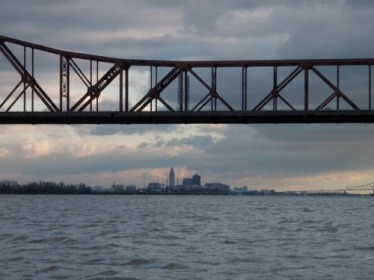
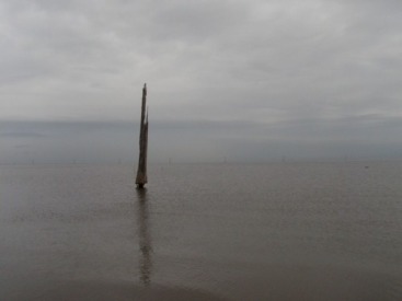
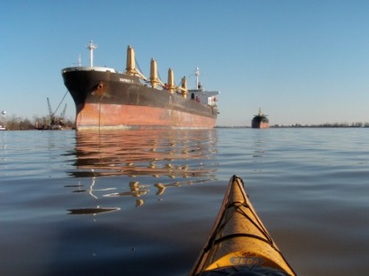
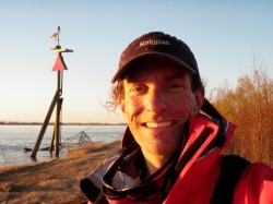
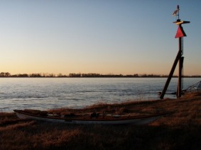
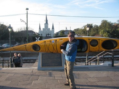
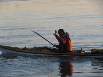
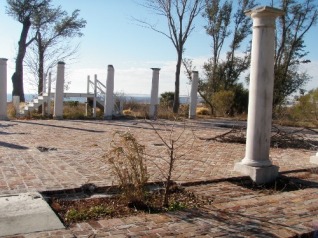
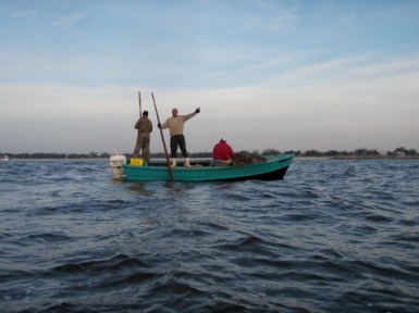
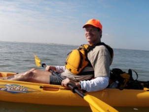
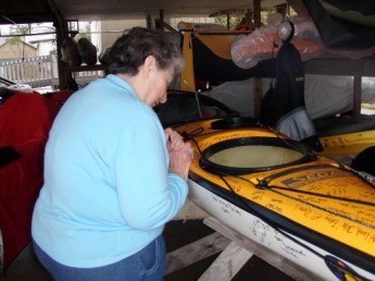
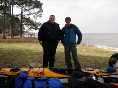
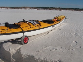
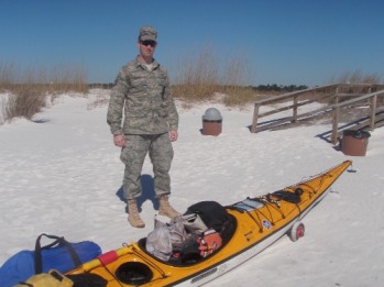
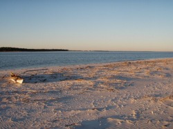
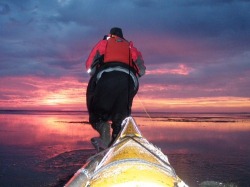
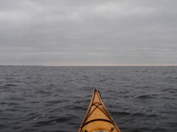
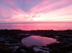
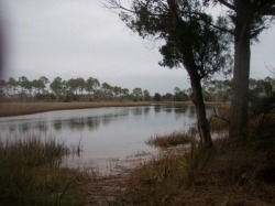
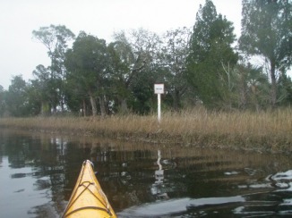
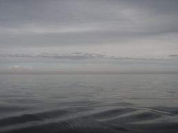
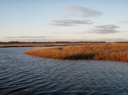
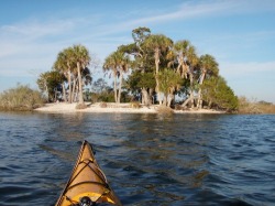
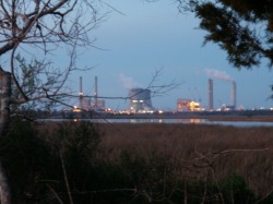
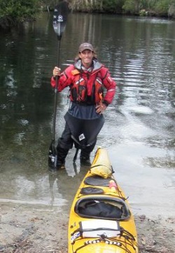
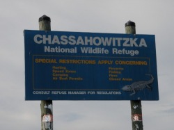
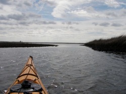
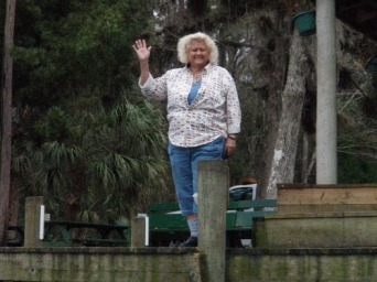
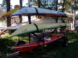
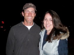
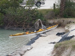
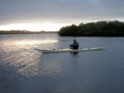
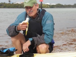
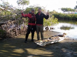
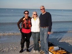
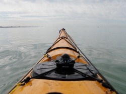
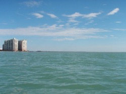
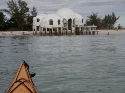
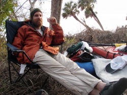
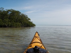
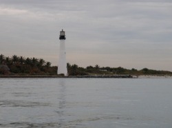
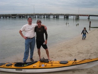
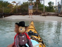
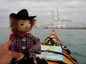
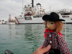
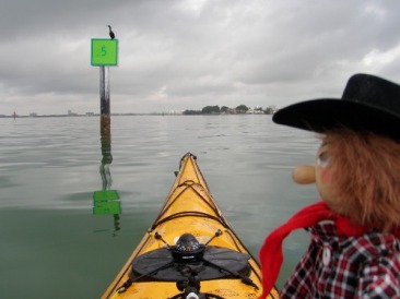
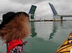
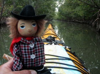
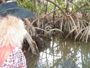
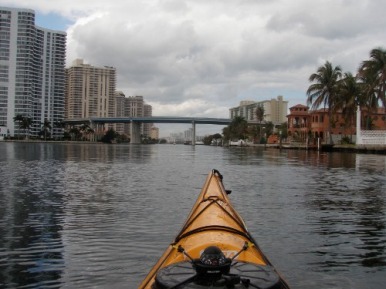
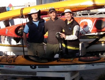
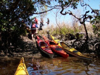
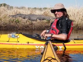
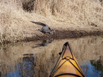
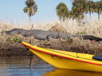
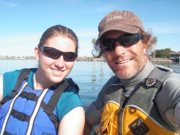
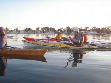
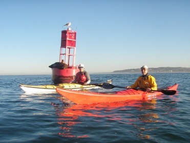
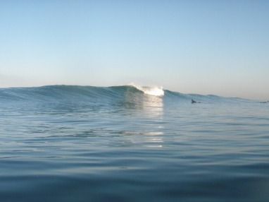
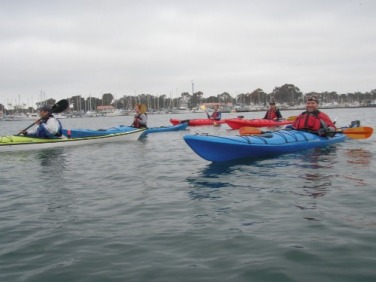
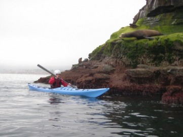
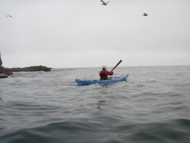
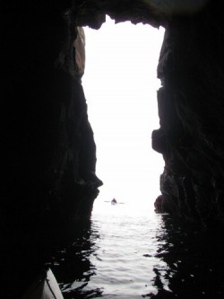
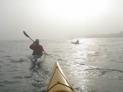
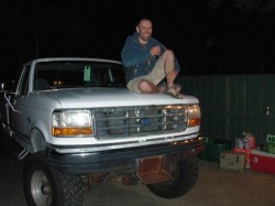
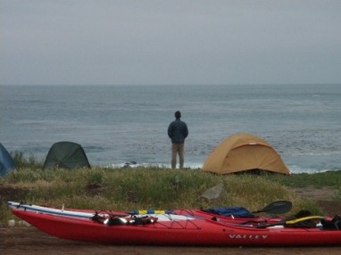
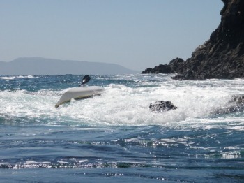
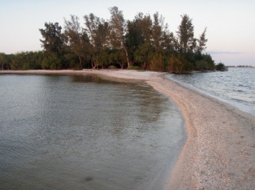
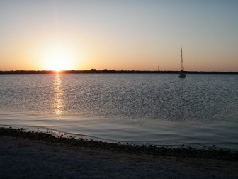
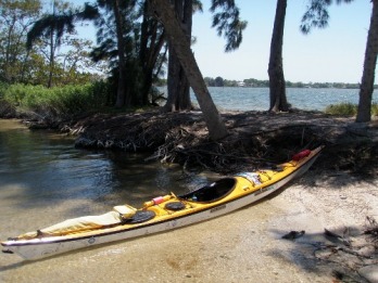
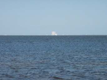
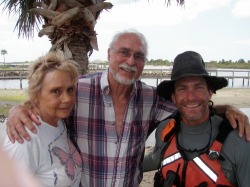
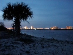
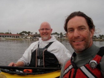
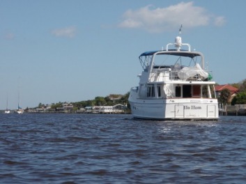
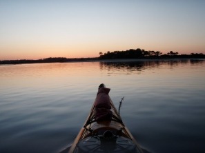
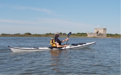
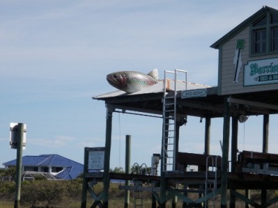
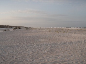
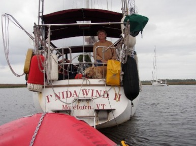
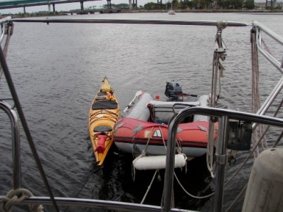
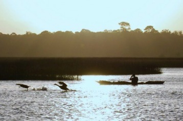
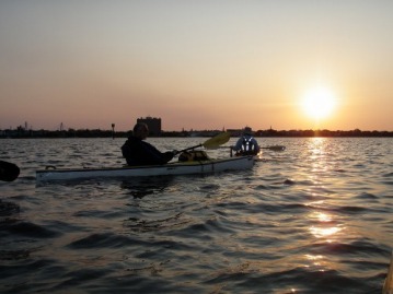
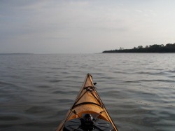
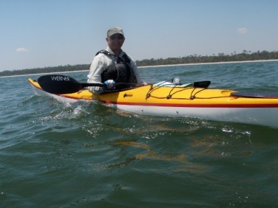
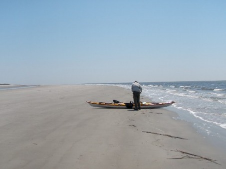
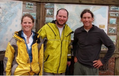
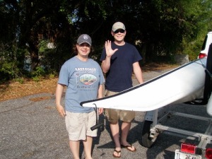
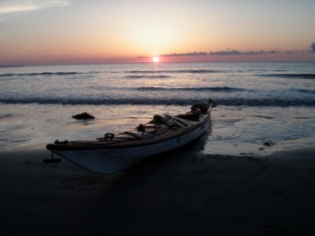
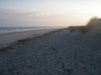
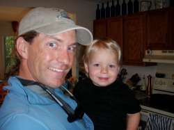
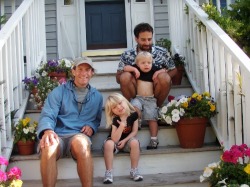
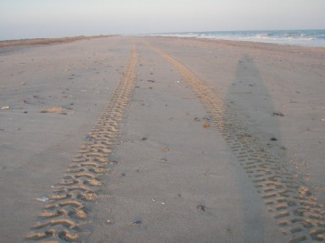
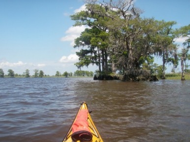
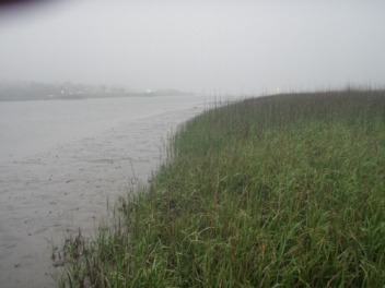
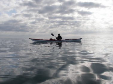
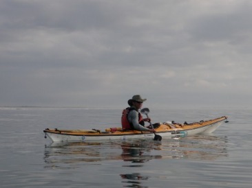
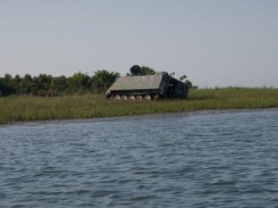
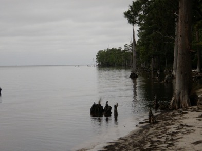
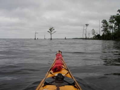
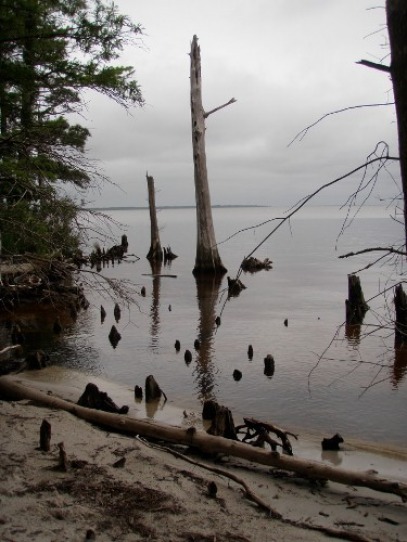
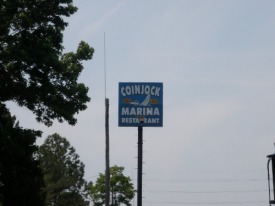
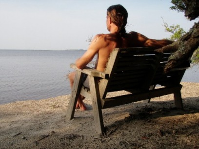
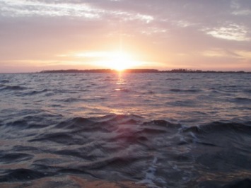
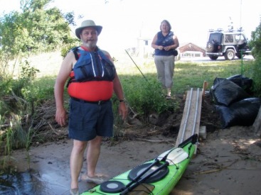
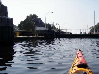
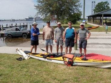
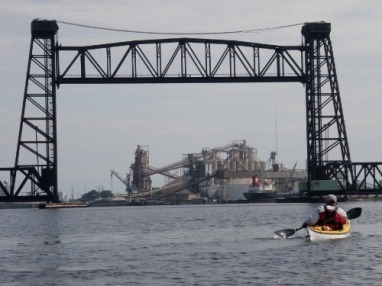
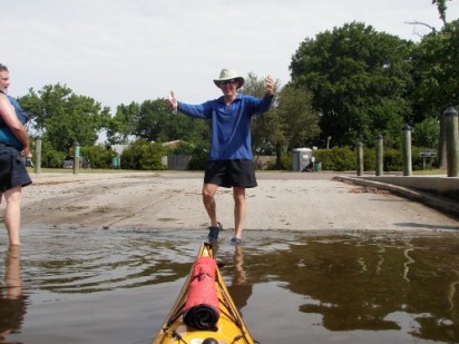
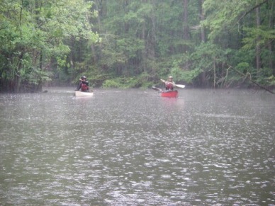
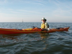
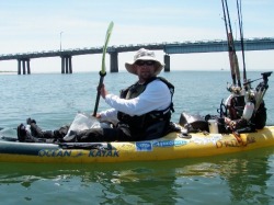
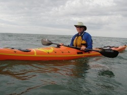
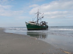
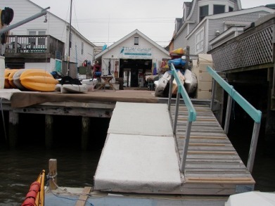
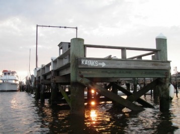
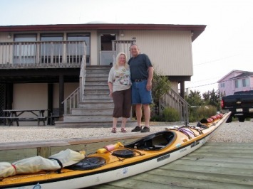
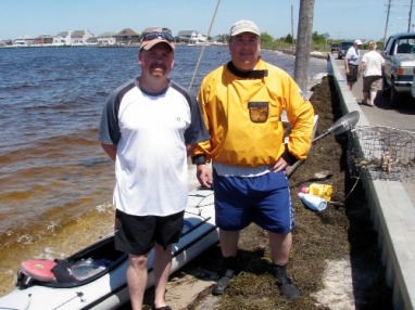
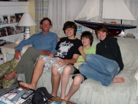
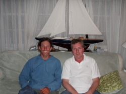
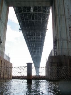
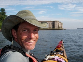
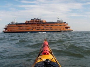
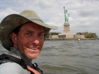
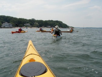
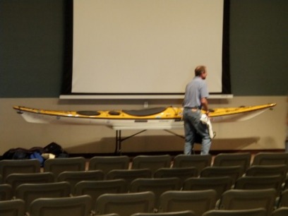
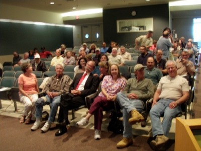
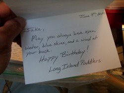
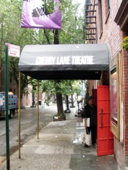
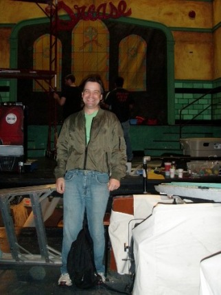
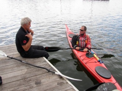
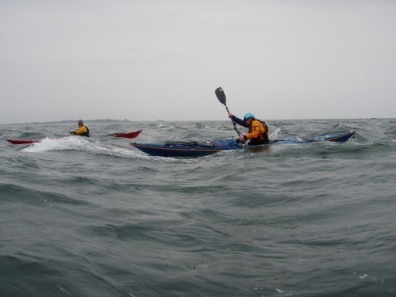
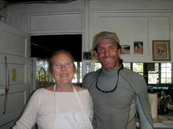
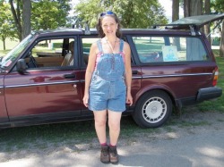
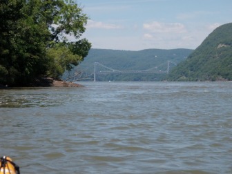
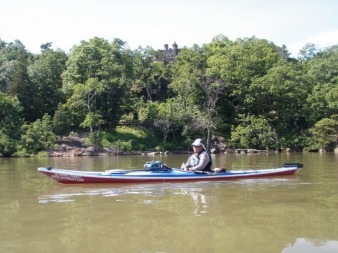
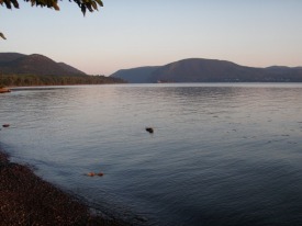
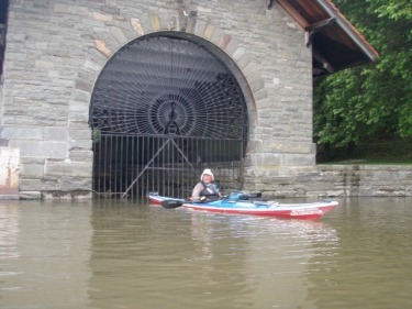
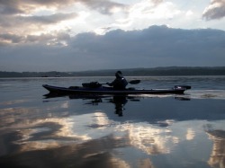
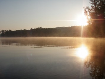
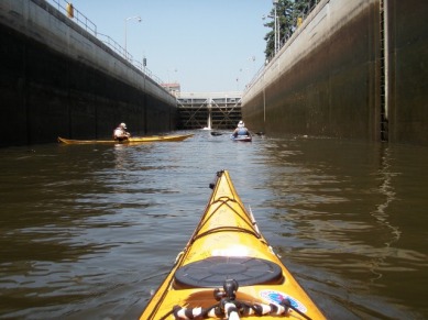
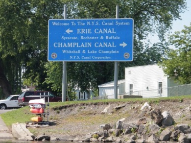
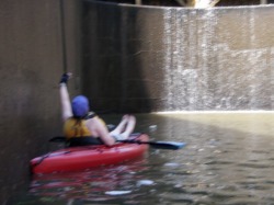
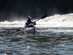
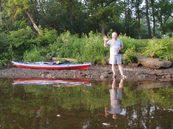
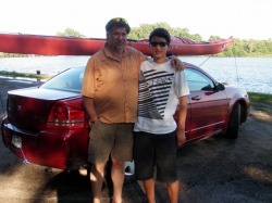
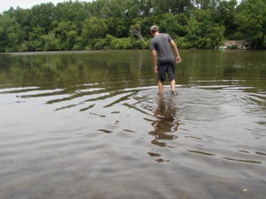
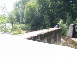
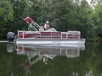
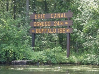
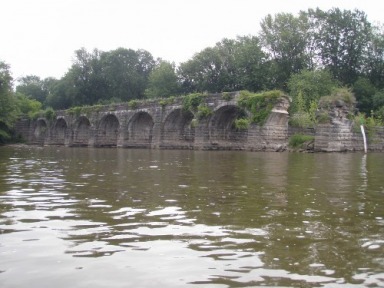
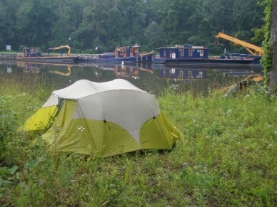
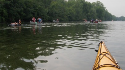
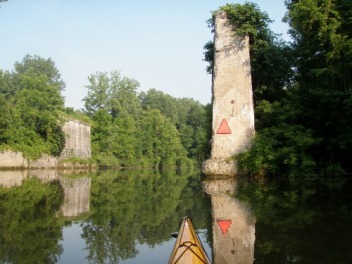
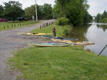
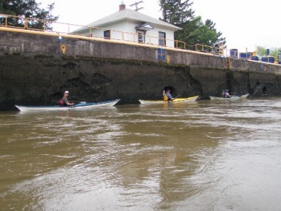
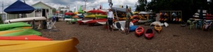
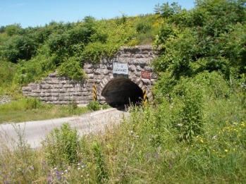
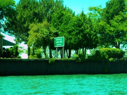
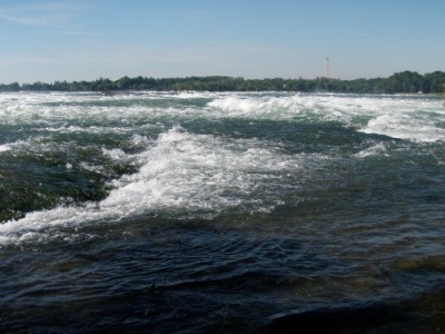
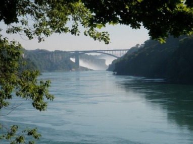
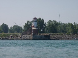
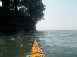
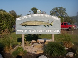
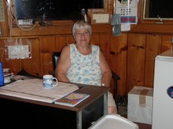
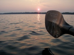
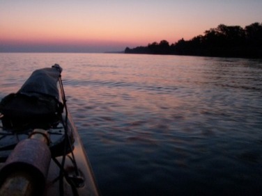
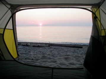
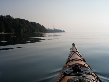
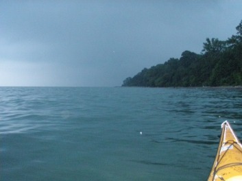
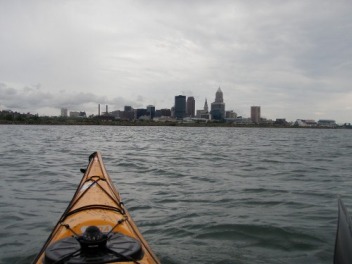
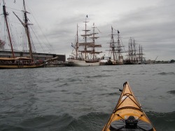
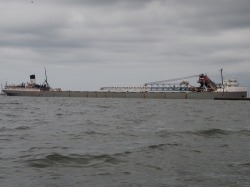
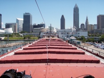
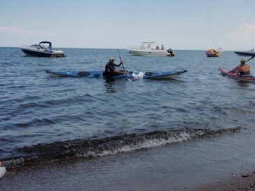
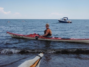
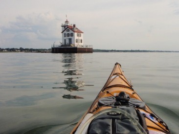
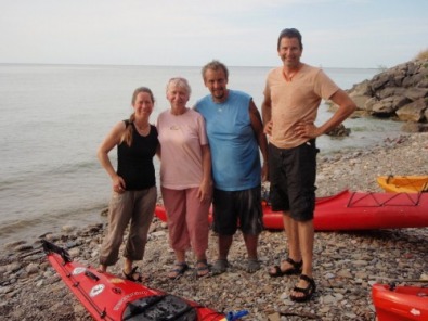
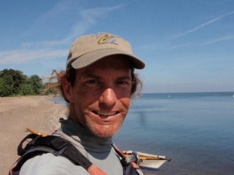
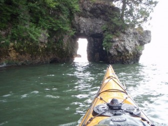
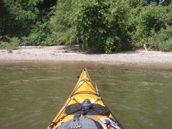
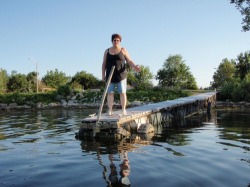
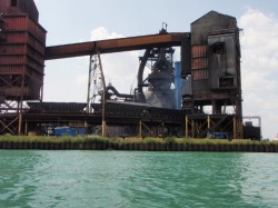
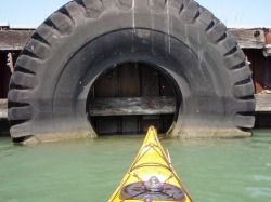
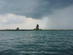
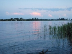
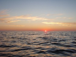
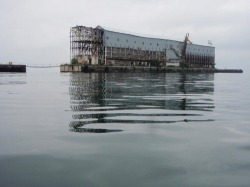
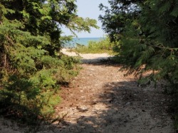
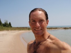
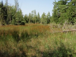
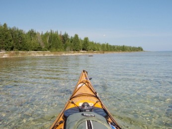
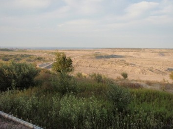
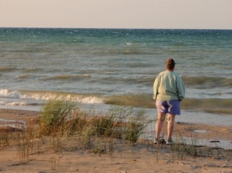
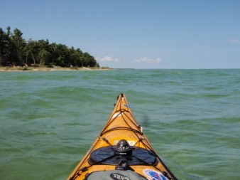
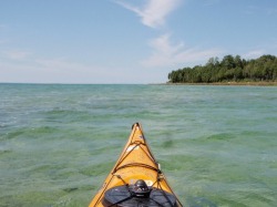
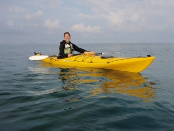
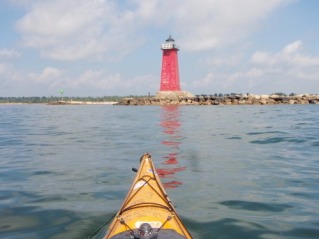
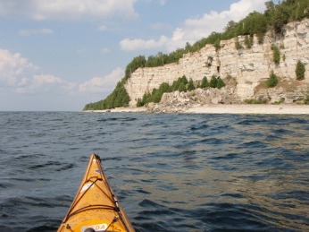
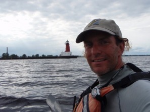
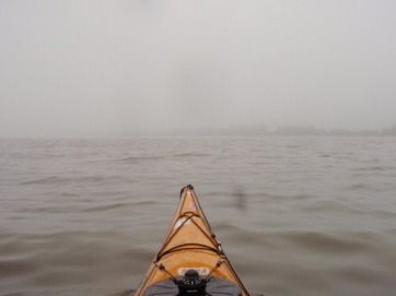
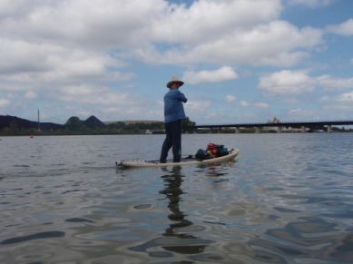
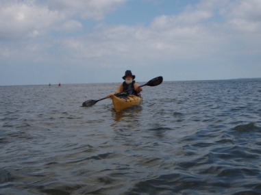
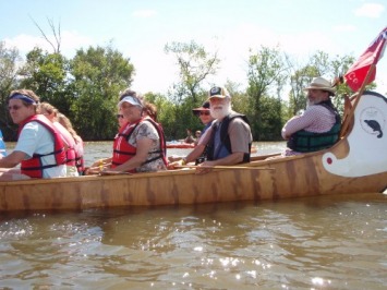
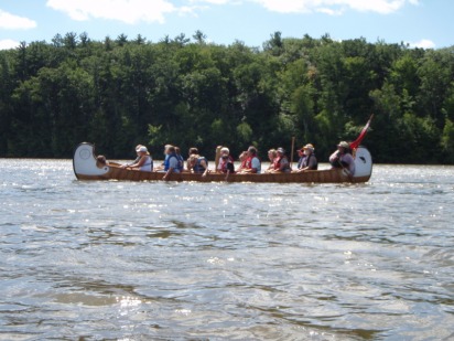
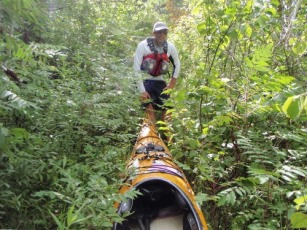
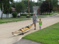
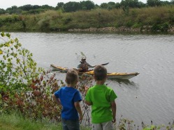
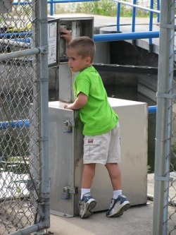
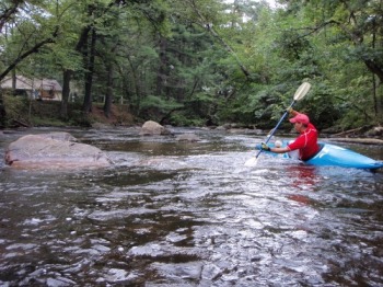
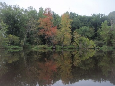
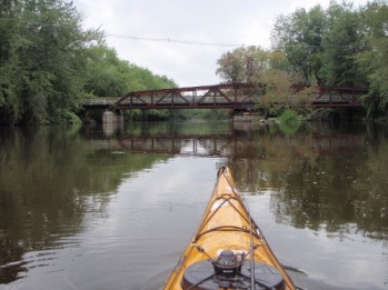
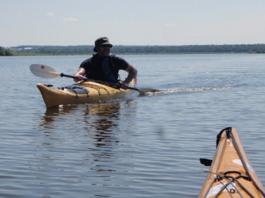
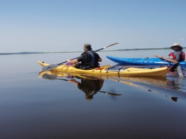
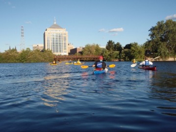
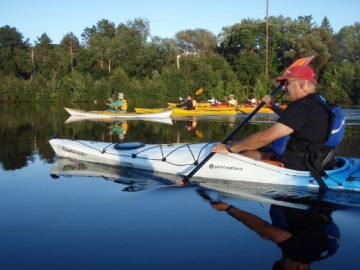
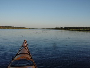
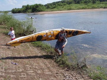
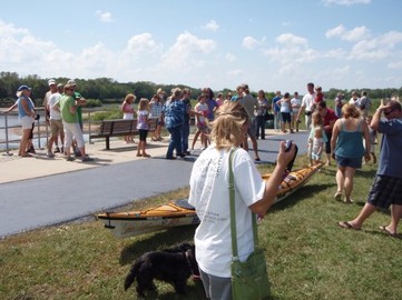
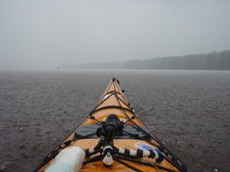
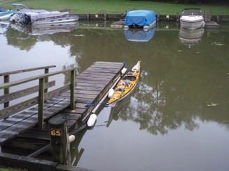
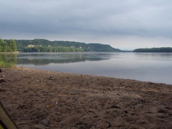
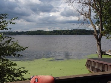
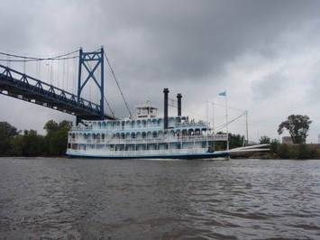
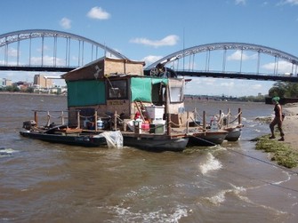
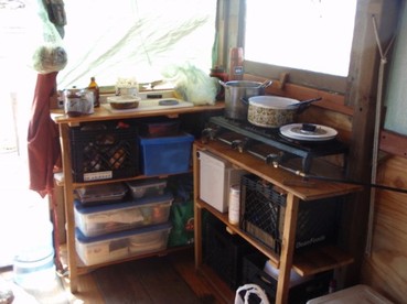
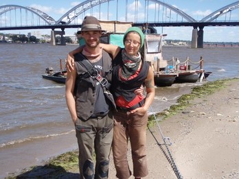
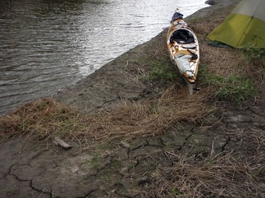
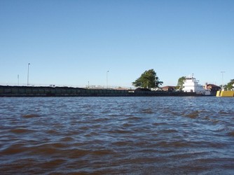
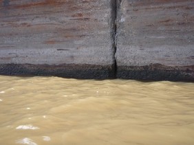
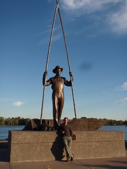
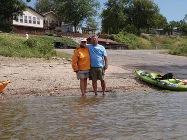
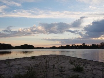
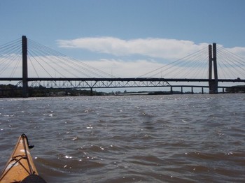
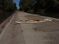
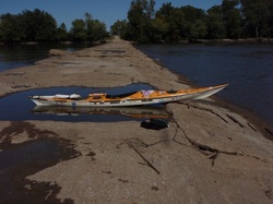
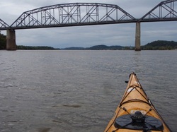
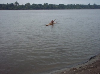
In 2010, Wausau resident Jake Stachovak paddled from Portage, WI to Portage, WI…via the Mississippi, Gulf Coast, Atlantic Ocean, Erie Canal and Great Lakes!  This kayak trip was a jaw-dropping 5000 miles. Jake posted a blog that detailed his journey, but this became inactive after he tragically passed from cancer in 2021.  I had met Jake by chance 10 years ago on the Eau Claire River.  It turned out we both knew about each other’s websites.  Jake was a really nice guy who provided some valuable tips about the Eau Claire that I didn’t know.  The following is a resurrection of his blog (with permission from his wife, Marit Haug) that detailed his trip.  I highly recommend reading Jake’s Wausau Daily Herald obituary and listening to the podcast “Remembering Jake Stachovak“.

For Jake’s exact route, including put-ins, take-outs, and leg miles, see this Google Map.

It’s time to make it real - October 5th, 2009

With only two short months to launch day, it’s past time to get the word out about this trip. Tonight I finally launched my web site, and am sending e-mails to all of my close friends and family to start sharing with the world what I’ve got cooking. From here on it’s really real and I’ll be closer to actually making it happen than ever before. 

For the last few weeks Jen and I have been telling our closest friends that the time has come for me to finally move back to Wisconsin, but that I’m going to be doing a bit of a trip before I get settled in. So far when we’ve explained the big trip idea we’ve been met with enthusiastic support. I’m hoping that as I spread the word it will be met with the same reaction.  

The one major concern I have in announcing this trip is my parents. They pretty much think I’m nuts and try to change the subject every time I mention it. In my mother’s words “you’ve figured out one more way to get yourself killed.” I’ve just got to figure out a way to help them understand why I’d undertake such a trip, what it means to me, and that there is no need to worry (more than normal) about me getting killed. 

Whatever happens in the end, the ball is finally rolling now.

A list of concerns - October 13th, 2009

Holy cow, where are the days going?  There is still so much to do before launch day.  We had a great time in the Black Canyon (Colorado River below Hoover Dam) this weekend with a bunch of clients from Aqua Adventures on what will probably be the last off site trip I guide for the store.  It happened that a large group of folks from SDKC were also on the river and it was great to be able to hang out with them a bit too. 

I rode over a day early with my good friend Thom to claim a campsite before the hordes of people arrived Friday.  The plan worked and our respective groups had pretty good spots in the popular Arizona Hot Springs camp.  During the six hour drive Thom endured my "one track mind" ramblings about this trip and offered, as always, balanced reflections on my plans and planning.  Thank you Thom, as always, for your patience and friendship.

On the top of my list of concerns right now is the harsh month of cold weather and water I'm in for when first starting the trip.  Any sane person that wanted to paddle a loop around the US, starting in the winter, might consider starting further south to get out of the snow and cold.  It would make sense (for me too) to push the start date back one month and set out from New Orleans.  The timing would still work for the rest of the trip and I'd complete the whole route while avoiding the worst of the winter weather.  However, after hashing it out with Thom I had to admit to a fixation not only to completing the loop, but starting and finishing from the same point, that point being Portage, WI.  The way it works out it may be the harshest start date possible, but it's the "Portage to Portage Project" that I've been thinking of for all these years, not the "Big Loop to the Big Easy".  More importantly it will mean a lot to me to be paddling HOME during the last months of the trip.  Not just passing through on my way, once again, to someplace else.

So the planning continues, including -20 deg. sleeping bags and four season tents.  Today the plan is to introduce this trip to a larger segment of the paddling community and see if folks are interested in following along.

Leaving friends - October 24th, 2009

Well, I finally worked up the guts to send out a newsletter to all the people on the Aqua Adventures e-mail list explaining that I'm going to be leaving Aqua Adventures (in San Diego) and moving home to the frozen north.  Like I just told a friend earlier, I feel sort of empty inside.  I only wish I could have all of the amazing people and great places I've been to in one place.  That must be what heaven is. 

My head has been in a cloud lately as I try to keep up with the day to day around the store and prepare for this trip, while at the same time coming to terms with what leaving here really means.  I'm going to miss all the friends I've made around here more than I ever realized.  Somehow ironing out the details of this trip has been an invaluable distraction for keeping my mind off all that I'm leaving behind.   

Thank you everyone for an amazing farewell - November 8th, 2009

This weekend dozens of people came to a farewell paddle and party in my honor. It was amazing to see so many folks turn up to wish me well, and drink beer and eat cake of course. In attendance at the day's events were paddlers from all of the local paddling clubs: The Night Herons, San Diego Kayak Club, California Kayak Friends, Valley Wide Kayak Club, and even the GNN's. To all of you that attended and who have been sending so many kind words and encouragement my way, I can only start to say how much I appreciate it and how much I will miss everyone I've come to know through Aqua Adventures and the rest of the paddling community in Southern California. A special thanks are in order for everyone that bought a Portage to Portage trip T-shirt or donated money outright to support the trip. Your generosity is going to help me achieve my goals with this trip and I will always be grateful for that.

The paddle down to San Diego Bay went very well despite some shenagins involving a stowaway banana peel on the stern of my boat, placed there by my friend Duane, with help from accomplices to distract me. I believe I was able to remove the offending fruit before any bad mojo was able to be transferred to my boat, but only time will tell.

My brand new Ikkuma 17 was put on display at the party so folks could see what I'd be paddling for the trip and more importantly, so everyone could sign it. Folks were reluctant to mark up such a beautiful boat, but after convincing Jen to go first, in a short while the boat was filled with the names of dozens of friends that I will take with me on the trip. These signatures are the first of what I hope will be thousands of names from all of the people I meet along the way.

On the road to Wisconsin - November 9th, 2009

After an emotional good by to Jen I rolled out of Aqua Adventures at 7:00 this morning.  I am a day behind when I planned to leave, but packing and saying goodby to everyone took longer than I expected.  Besides that, there were good waves yesterday and I didn't want to miss one last surf session with some good friends. 

My first destination was Phoenix, where I was to meet with a customer to drop off his new Ikkuma 17.  He decided that the most expeditious place to do the drop would be at the Hooters restaurant out by the interstate.  I had planned on just dropping the boat and getting back on the road, but his choice of venue warranted a stop for a bite to eat as well.  Hooters is very well known for their excellent wings, after all. 

After the boat drop I pushed on a bit further, but lost the battle to my ever heavier eyelids outside of Flagstaff where I called it a day and crashed out in the truck behind a gas station. 

Everything is going well and the truck is handling the heavy load like a champ.
 

First ice – cold water shakedown and workout - November 16th, 2009

Over the weekend (back in Wisconsin) we finished up all of the deer hunting prep work, so today I decided to get on the water and give my coldwater gear a shakedown.  I must admit it was a great experience to paddle the waters that I grew up fishing on with my dad and uncle Jim.  What was really cool was covering distances in minutes that used to take much longer plodding along in a rowboat.  

I put in at Memorial Park on the east side of Wausau in a back bay that was glazed with ice.  It was my first experience with paddling in ice water and it was interesting to feel and hear the ice breaking to the pressure of my bow.  Later, as I cruised along, my wake would run into the ice glaze along shore, sending off the sounds of shuttering waves of crackling ice. 
  
My Kokatat dry suit and thermals worked great.  If anything, I was a bit too warm, which is OK with me as I can simply adjust the layers I wear under the dry suit.  It was my first real experience at wearing pogies and found that I went from my hands being too warm inside and too cold outside.  The simple solution was to open up the velcro attachment closure a bit to ventilate them.  Overall it was a great day on the water and I'm feeling good about how everything is coming together.  
 

Overnighter on the Wisconsin River - November 17th, 2009

This was supposed to be an early winter camp outing to test out my new gear and get more time in my boat in cold weather conditions. However, mother nature did not see fit to comply with my cold weather wishes and instead gave me nearly summer like conditions for the day. I’m certainly not complaining.

This morning my parents rehearsed their support crew duties while they graciously gave me a ride up to the Grandfather Falls dam. The dam is a notable spot, not only for the large concrete wall that holds back the flow of the river, but for the two large tubes that the entire Wisconsin River is funneled into. The roughly 10’ diameter tubes are about a quarter mile long and concentrate the river’s flow down a steep drop into the powerhouse. It’s an impressive engineering feat, and even more so because the tubes are made of wood girdled with steel bands, much like a very long barrel. I would have been happy to put in further upstream, but avoiding the long portage around this dam is nice. Besides, the name of the game today was to test out my camping gear, not put miles and miles on my boat.
 
From the tubes I paddled downstream about 10 miles to the Council Grounds State Park just above Merrill, Wisconsin. At that location there is another dam, so the required portage makes for an opportune spot to make camp, which is what I did. With the river pushing the paddle down, it took only two hours. The Ikkuma handled great with the added weight of camp gear. I had forgotten how shallow the class II rapids are upstream and the boat earned its first few scratches--considering the venue, well earned badges of courage.

Much of the gear I’m using on this trip is new to me, having realized that the equipment I’ve been using for years probably didn’t have another 5000 miles left in it. I’m going with a North Face Mini Bus 23 for my tent. This being only my second time setting it up, it went well. It’s much bigger than only one person needs, but my thinking is that I’m going to be living in this thing for the next ten months, so I better be comfortable. I love the fact that I can sit upright in it and swing my arms 180 degrees and not touch the walls of the tent. I can bring all my gear inside with me and on weather days will be perfectly comfortable being stuck inside all day.
 
I also prepared the first dinner (mac and cheese) on my MSR Reactor cook system. I don’t think I’ve ever boiled water so fast, it’s almost supernatural. I think the system would serve me well, but obtaining the mixed fuel canisters it requires may be the catch. We ended up backtracking on our way up here today when the huge sporting goods department at the local everything store didn’t have the needed fuel. A sixteen mile round trip trek to Gander Mountain on the opposite end of town turned up what I needed. It’s all going to depend on what kind of mileage I can get out of the canisters of this fuel. If I can get five or six days out of each can, then I can probably carry enough to get me through to possible assisted resupply towns. Otherwise I’ll have to go back to my white gas-fueled Whisperlite.
 
With the temperature rapidly dropping with the setting sun, tonight will test the insulative qualities of my North Face “Snowshoe” zero degree bag. I have a twenty degree “Cat’s Meow” that I’ll be switching back to once the weather permits. But for now I’m not leaving anything to chance. A comfortable night’s sleep is going to be vitally important if I am to keep paddling every day.
 
One thing I’m discovering is that because of the very short days as we near the first days of winter I’m only going to be able to paddle about eight or nine hours a day. After cooking a meal and writing a blog post I’ll still have hours of time to fill before I feel ready to sleep. Or worse yet, if I turn in too early I’ll be up and ready to go hours before daylight returns in the morning. I may just have to carry along a good book or two.
 

Deer hunting is over – now it’s all about the trip - November 29th, 2009

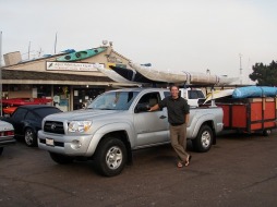
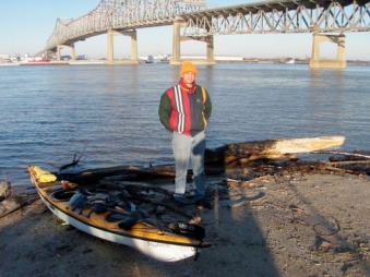
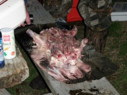
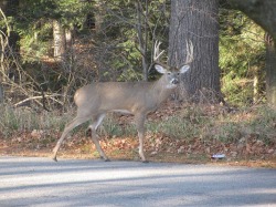
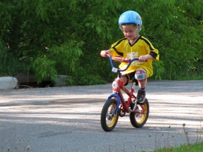
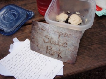
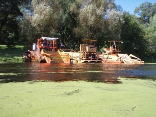
The nine day Wisconsin deer hunting season ended today. 

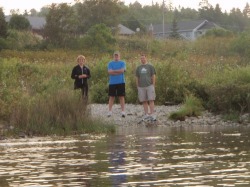
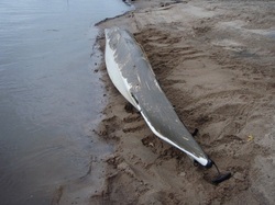
This year our group had one of the toughest seasons ever.  Between the four of us we ended up sharing the one buck my brother Luke got last Sunday.  Some friends of ours, that hunt near by, came up completely empty handed.  Statewide the deer totals were way down from years past so I guess we weren't alone.   

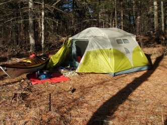
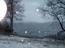
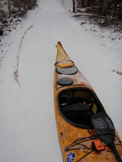
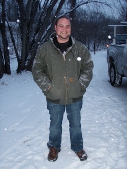
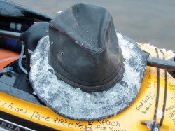
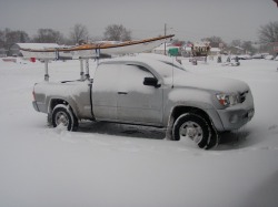
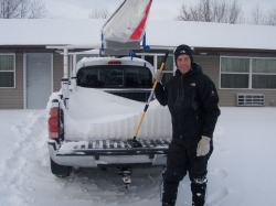
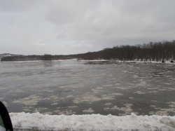
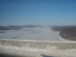
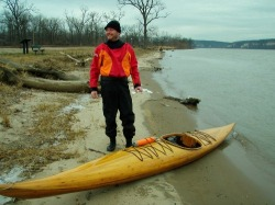
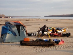
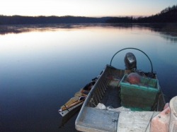
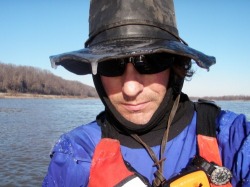
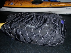
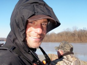
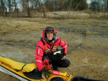
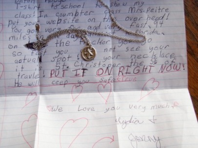
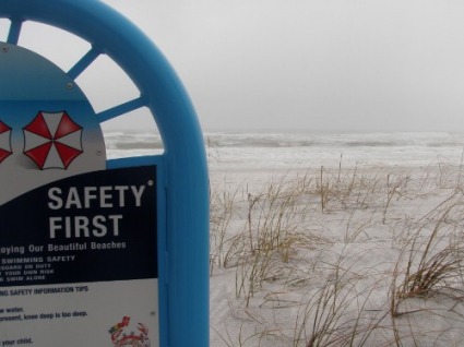
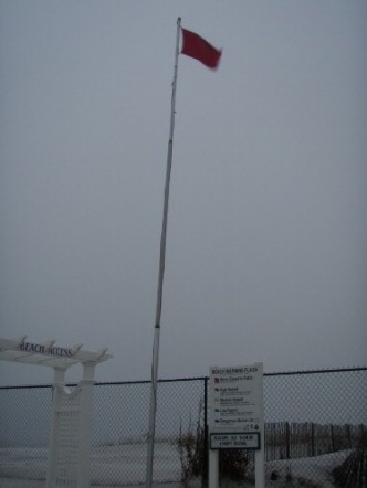
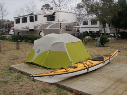
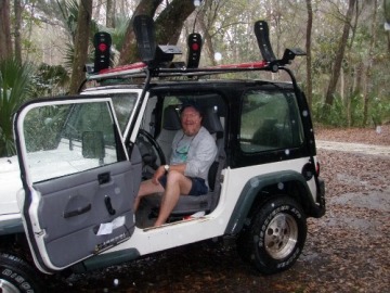
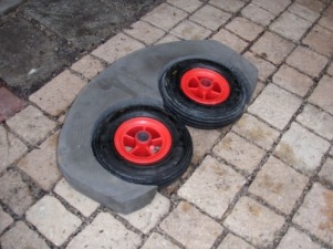
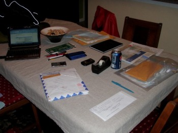
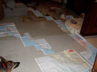
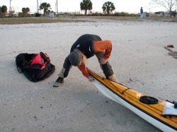
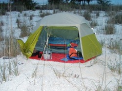
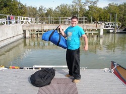
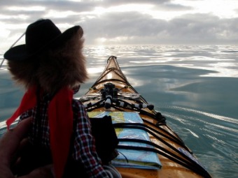
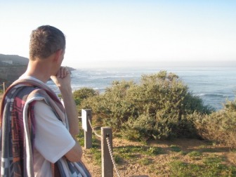
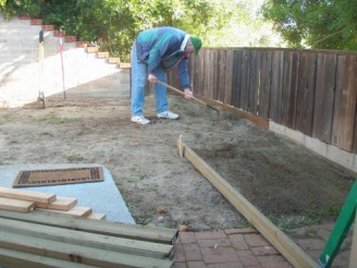
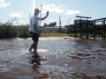
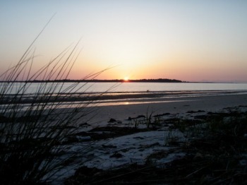
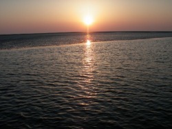
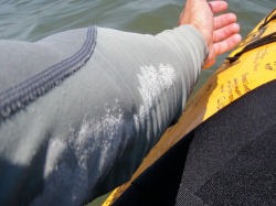
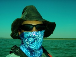
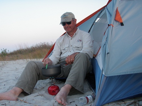
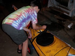
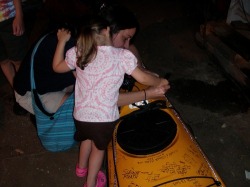
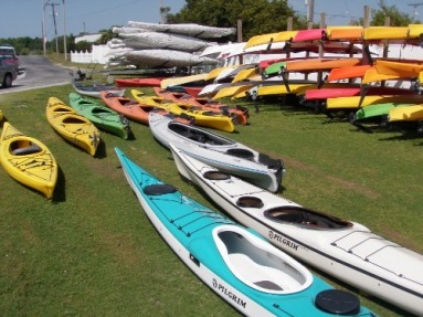
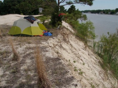
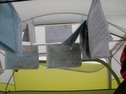
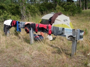
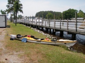
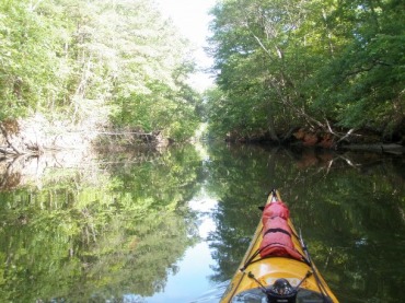
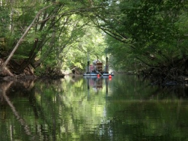
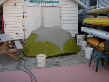
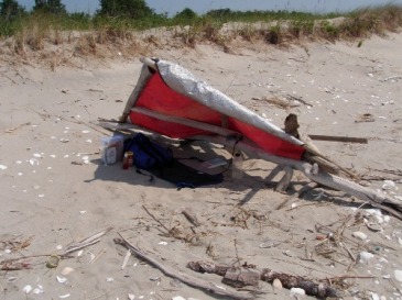
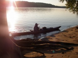
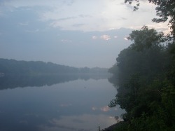
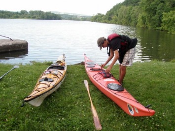
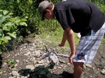
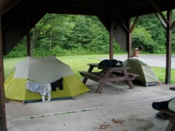
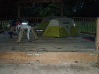
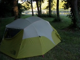
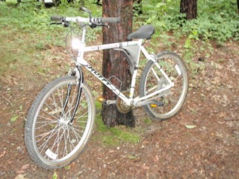
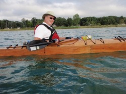
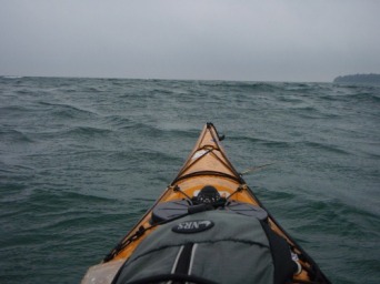
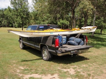
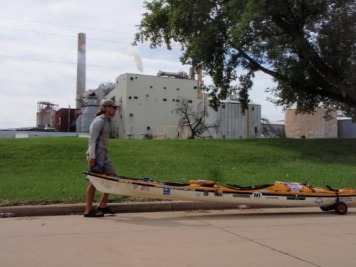
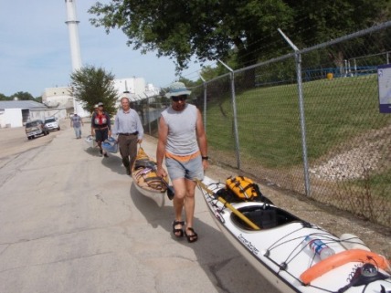
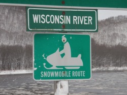
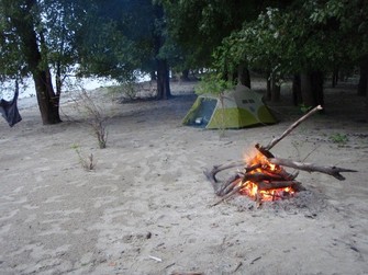
The weather for the last two weeks I was in town has been unseasonably warm with temps averaging 10-15 degrees above normal.  I held out hopes that the weather would hold for another week but today brought a dose of the real winter weather we should expect (with snow and highs in the 30's) so it looks like it will be a chilly start to the trip after all.  With all my deer hunting gear dried out and put away, I've got five more days to get the last details ironed out before the launch next weekend.  Tonight my mom presented me with some early Christmas presents helping me out with a few bits of gear that I needed.  One of the items was a nice wide brimmed hat that actually fits my head and is going to be great.        

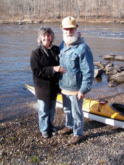
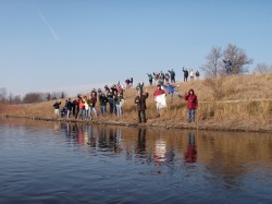
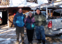
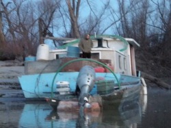
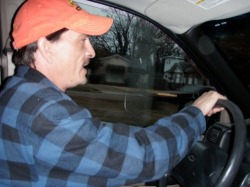
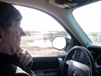
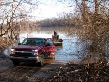
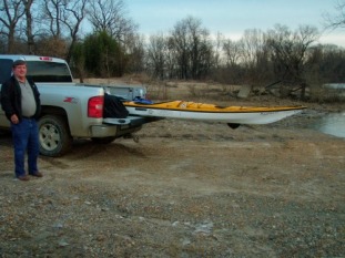
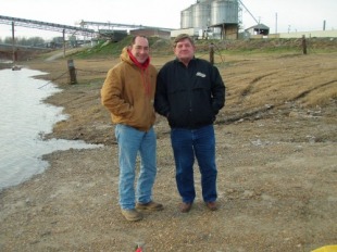
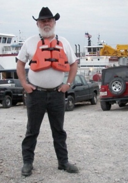
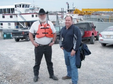
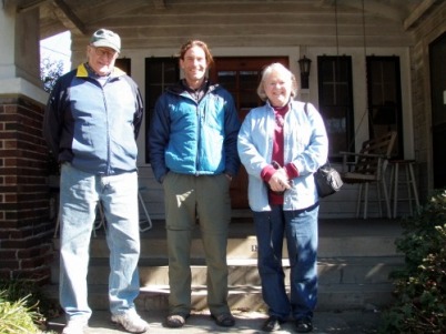
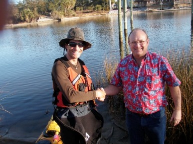
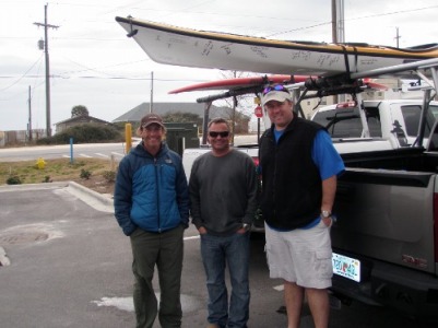
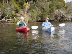
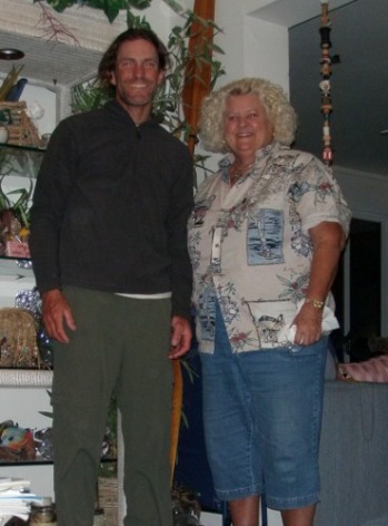
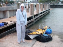
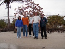
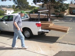
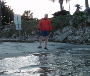
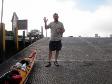
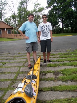
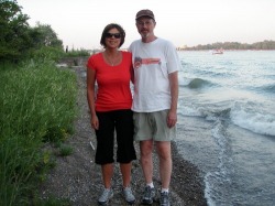
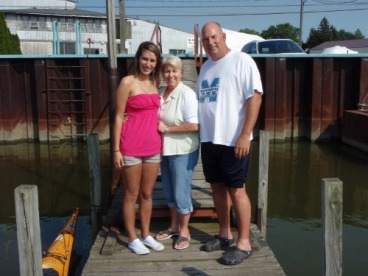
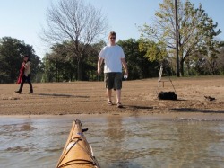
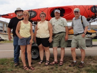
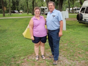
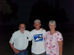
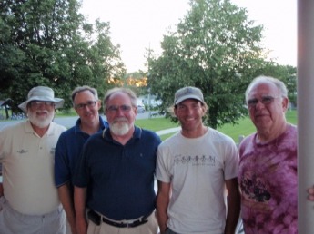
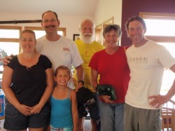
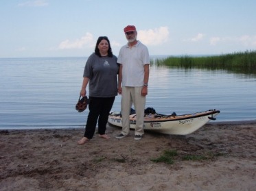
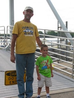
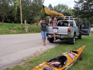
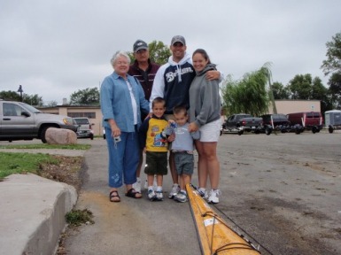
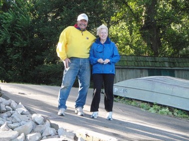
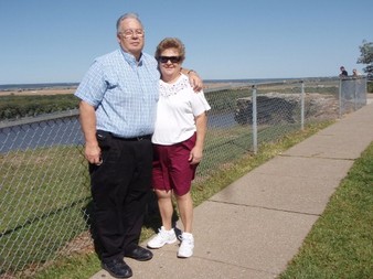
My parents are going to be driving me to the put in and following along as a support crew for the first week or so.  My mother actually volunteered for the task mostly out of her own fears of seeing her second born freeze to death on a sandbar in the middle of the river.  I'm geared up and ready for winter camping but I won't turn away any help they (or anybody) are willing to lend.  One hiccup has come up with my support crew and the launch date, however.  My dad (with his big white beard) plays Santa for different pre-schools and such this time of year.  It turns out he was booked for a Christmas party next Saturday (my planned launch date) but he had forgotten about it until today when my mother bumped into the teacher that had booked the event with my dad.  So, due to this prior obligation, we are being forced to push the start of the trip out one more day to next Sunday.  It's only one more day over a trip that I plan on taking ten months so, as anxious and ready I am to get started, I am happy to have one more day to get ready.
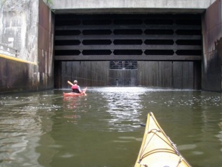
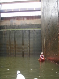
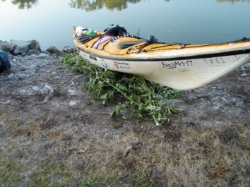
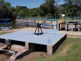
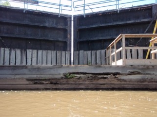
The launch date has been pushed back one day - November 29th, 2009

With his long white, and very real beard, my dad looks like Santa.  It's great whenever I'm in a big store or crowded place with him, all I have to do is ask people if they've seen a guy that looks like Old Saint Nick and they know exactly who I'm talking about.  A few years ago he started playing Santa for kids' Christmas parties and has a ball with it.  It turns out that he was booked to do a party next Saturday (launch day) that had been forgotten until today.  He and my mom are my ride to the put-in (and my support crew for the following week), so with this turn of events we've been forced to move the start date out one day to Sunday, December 6th.

If you're planning on coming for the start of the trip, let me know so I can get you specifics of the start time and location as they get sorted out.

Launch day is drawing near - December 2nd, 2009

Launch day is drawing near.  This coming Sunday, December 6th, at high noon I'll finally be getting on the water.  It sounds like a pretty good-sized group of folks are going to be seeing me off.  A bunch of family are driving over and a few kids from the local middle school want to see me launch.

Friday I'm driving down to do a presentation for a bunch of 7th and 8th grade kids from Victoria Rydberg and Jenny Karpelenia's classes from the Portage Middle School.  I'm planning on taking the boat and all the gear to show them firsthand what I'll be using and how it all fits in the boat.  I understand that the kids already think I'm crazy, and seeing how cold the temperatures are going to be this weekend, I can't say I disagree. 

Today I did a quick paddle on Lake Wausau to test out a new pair of boots and a seat pad.  I tried launching in the same lagoon I used two weeks ago, but the ice was a half inch thick.  It wasn't enough to stop the boat completely.  Instead, the boat would ride up on the ice until the weight of the bow would break the ice.  The problem was that it broke in large sheets on either side of the boat that I couldn't get my paddle through in order to get propulsion enough to push the bow further through the ice.  After back paddling/pushing my way back to shore, I carried over and put in on the river side where it wasn't frozen.             
 
On this outing I was trying out the fit of the new Kokatat paddling boots that Jen from Aqua Adventures sent in last week.  I had ordered a pair of size 11 (to accommodate my stockinged feet in the dry suit) but the boot was too big to fit in the boat.  So I ordered a pair of size tens, thinking I'd just have to squeeze into the boots when I was wearing the drysuit and socks.  It turned out that the boots themselves fit perfectly and the knee-high "gators" that are part of the shoe did a great job to keep my feet dry.  Even the size 10s were a bit snug, so I spent the evening shaving the deep tread off the toe and heal to make a little more room.  It will be tight but they should now work. 
 
Along with working on the boots I also devised a kayak cart that I'll be able to squeeze in the boat with the rest of my gear.  It consists of two 6" wheels, an aluminum axle, and an 18"x5" chunk of plastic (cut from a saucer sled) and bent over the axle as a cradle for the boat.  When taken apart the plastic lays flat on the bottom of the kayak behind the seat, the axle stores next to the seat along the inside of the boat, and the wheels are small enough to fit in any hatch.
 

It fits - December 3rd, 2009

Tonight was the first time I tried to load the Ikkuma with all of the gear I plan to carry.  The first few times loading a boat are always interesting as everything has yet to find its place.  Today was no exception and I had to pack, shuffle, and re-pack a few times to get everything in.  The computer and cold weather gear take up quite a bit of space but I made it happen.  Tomorrow I'll get to do another couple runs at it as I demonstrate the process to the kids at Portage Middle School. 
 
I don't expect to get much planning or packing done around the presentations at the schools but it's worth it.  I need a break from sorting gear anyway.  Saturday will be a full day of triple thinking every item I'm carrying and getting final pre-trip items taken care of. 
 

A day with Portage school kids - December 5th, 2009

A few weeks ago I sent out an e-mail to the school superintendent of almost every school district on the river from Portage all the way to the southern tip of Illinois. The e-mail described the trip and my desire to share my experiences with others along the way. I invited them to forward the e-mail on to their faculty to let them know what was up and see if their students would be interested in following along or even getting involved with the project. Of all of those school districts I contacted, so far only one responded, and that was Portage. From Portage Middle School I was contacted by Ms. Karpelenia, and from Portage River Crossings Charter School I was contacted by Ms. Rydberg. After several back and forth e-mails sorting out the exact details so some of the kids could watch the launch, I also learned that the kids had lots of questions and wanted to talk to me. So the idea was hatched for me to drive down to Portage to meet with the kids and answer what questions they might have.

It turned into quite a day. I had done a dry run packing job the night before to make sure all my gear would fit in the boat, and it does….barely. In the morning Dad and I loaded up all the gear (everything I will need for the next 10 months) and my boat and drove the two hours down to Portage. After a quick stop at Wal-Mart to get a couple Sharpie markers we found the school, checked in at the office, and proceeded to move four duffel bags of gear and a 17’ kayak into the theater (small auditorium). Then came the kids.

First it was a half hour with 65 kids from the 7th grade homeroom followed by 45 from the 8th grade homeroom. Both groups had already been introduced to the trip by Ms. Karpelenia. I did a quick recap of the trip with a little bit of why Portage and why December, then turned it loose to their questions, and there were many. The questioning ranged from “what kinds of animals are you going to see?” “are you going to fish along the way?” and “how are you going to charge your batteries?” with an underlying thread of questioning around the stability of my boat. These groups seemed especially interested in how I was going to communicate my location to the web site, so I explained the SPOT device I am going to be carrying. I was impressed and very pleased with how interested the kids were in the trip and was happy to have several add their signatures and notes to the many that already adorn the deck of my kayak.

Next, a bunch of the boys volunteered to help me move my gear over to the River Crossings classroom, which is housed in a stand-alone building behind the main middle school. After the boat and gear were safely deposited in the classroom we took a lunch break while we waited for Holly Kobza’s surprise group of fourth graders to arrive from John Muir Elementary School. In the meantime the students had a chance to explain that this school is a charter school with an outdoor emphasis wrapping all subject matter around things related to nature. Man…if only I could have gone to a school like that! It suffices to say that these kids were quite interested in this trip.
 
When we were all settled in I again re-capped the trip and then turned it over to what would end up being over two hours of questioning. There wasn’t a moment that there wasn’t a half dozen hands in the air eagerly waiting for me to satisfy at least a little of their curiosity. Again the questioning ranged from “how are you going to bathe?” “what if you run out of food or water?” “when did you first think about this trip?” and, of course, the underlying thread of “what if” questions regarding potential capsize.

Along with the questioning, I demonstrated a bunch of the gear and showed how the gear packs into the boat by filling up the rear hatch. After the questioning we turned the kids loose to sign the boat and get a chance to sit in it. To my surprise (and amusement), while one line formed to sign the boat, another line formed for me to sign autographs.

It was a fantastic day and downright inspiring to see the enthusiasm and sense of wonder the kids had for the trip. It was an honor to get a chance to talk with everyone. I hope to see them all again next fall when I paddle into town at the completion of the trip.

Day 1 (Launch day) - December 6th, 2009

Daily Stats

  • Start: 12:50 PM - Riverside Park, Portage WI
  • Finish: 4:15 PM - Pine Bluff (Lake Wisconsin)
  • Time: 3:25
  • Daily dist: 20 miles
  • Total dist: 20 miles
  • Companions: Doug (on a stand up board)
  • Weather: Fair, sunny and calm - high in upper 30s
  • Notes: Started day with over 40 people at the put in.
The launch today was about as perfect as I could have ever imagined. A whole pile of my family made the trek all the way down to have brunch at a local restaurant, then drive over to see me off. I expected that a small handful of locals would turn up for the launch, so you can imagine my surprise when we arrived at Riverside Park to discover a crowd of at least thirty people patiently waiting in the cold for us to arrive.

On the way to the restaurant a wrong turn gave me a chance to pre-scout the route and I was very relieved to see that Lake Wisconsin (the last lake on the Wisconsin River) was not frozen like the lakes are up north.

With a bunch of help from family and friends, we got the boat off my truck and set it up for everyone to sign. Meanwhile I changed into my dry suit and gear, then gave a bit of a speech to the group. I was afraid that watching me climb into my boat and paddle away would be as interesting as watching paint dry, but the spirit of the moment made it special and everyone seemed to have a good time.

I was joined by Doug on a stand up board the first couple miles, until he turned into a back channel to pull off the river early so he could get to the ski hill before the end of the day. Despite the relatively warm, bright sunny day, thoughts of skiing drove home the reality of my late season departure and served as a bit of foreshadowing to how the day would end.
 
I made great time, averaging almost six miles per hour with the current helping me along. I was paddling for about an hour before I heard a gong bell ring and a person shout, then turned to see a couple waving from the back deck of their riverside home. They wished me good luck and said they had a place in Florida where they‘d be staying this winter. I promised to stay in touch to see if we could cross paths down there in a few months.
 
Two hours into the days paddle (about 3:00) I called my support crew to give them the fix on where I figured I’d be coming ashore for the night. I had selected a back bay where the highway ran right alongside the water, where it’d be easy to find one another. As I paddled into the slack water of the dam created lake I found myself avoiding occasional slabs of ice floating free in the water. The rocks and trees along the eastern shore were gobbed with ice, as though they’d been dipped in watery wax. Apparently the winds and chilly temperatures we had late last week combined to form rough splashing waves that froze to form the globular clusters. All of this again should have served as a warning to what I discovered when I turned the corner around the last point to reveal the bay that was my destination.
 
Inside this formerly windward bay, all of the ice that had formed from last weeks storm had been blown into interlocking slabs of ¾” ice. This “flow” extended a half mile from shore and a mile to my west. Any thoughts of pushing through the tangle were quickly squelched when I tried to push the bow of my boat into the unyielding mess. Even if I had managed to wiggle a half mile through the icy maze, it was sure to freeze solid overnight, leaving me stranded and requiring me to violate my only rule and accept a ride further down the route. As daylight waned I checked my map and located a headland that juts into the lake leaving it more exposed to the wind, which should have stripped it clean of ice from last week's storm. So I alerted my shore crew and made haste in the rapidly approaching twilight to my new destination. My hunch proved to be true and the shore of this almost island was not choked in with ice. I did have to push through about ten yards of half inch ice, but with luck it won’t freeze much further out tonight and I’ll be able to get underway tomorrow without too much trouble.
 
With a little frantic searching my parents finally found my chilled carcass waiting alongside the road.

We quickly loaded up my boat and gear and they whisked me off to the night's accommodations they had already scouted. This will be the program for the next week or so as they help me put on big miles in an empty boat to get me just a little further south before I commit to camping out in the snow and cold. On one side I do feel a bit like I’m cheating, but on the other side (especially with the nasty weather that’s predicted for later this week) I am very glad they have volunteered to give me a boost on my way in the beginning of this trip.

Tomorrow the plan is to give me a ride back up to where I left off. Mom and Dad were going to cruise back up to Portage to grab a couple copies of the local newspaper with the article about the trip then move on down the river to Spring Green near tomorrow's takeout destination.

Day 2 (Ice, ice, and more ice) - December 7th, 2009

Daily Stats

  • Start: 7:50 AM - Pine Bluff (Lake Wisconsin)
  • Finish: 3:30 PM - Spring Green, WI
  • Time: 7:40
  • Daily dist: 38 miles
  • Total dist: 58 miles
  • Companions: None
  • Weather: Snow to partly cloudy - highs in upper 20’s
  • Notes: Dealt with ice accumulations on gear and boat
Ice, ice everywhere. I’ve seen salt accumulate on my paddling clothing many times in the past but I’ve never seen ice build up on my boat and gear, but that was the case today while I paddled through a snowstorm. We woke to about an inch of fresh snow on the ground and dealt with slippery roads as we drove to the put-in just after daybreak. After arriving at the put-in we had an interesting experience when it came to getting the boat off the truck when we discovered that the wet hull had frozen to the foam pads the night before. We took the boat (with pads attached) off the truck and used the MSR bag of warm drinking water I’d brought to thaw the pads off the hull. Rather than carry the boat to the water I slid it across the grass to the waters edge. The wind was up, which was a good thing because it had pulverized the ice that lined the shore the night before into piles of little shards.
 
I quickly launched and headed off to my first destination, the Merrimac ferry. This is the last remaining ferry operating within the state of Wisconsin, linking the town of Merrimac to the north with the small hamlets to the east and on to the bigger city of Madison to the south. It is a cable ferry, meaning that to move across the river it pulls itself along on a pair of large steel cables. When I was planning this trip I used the ferry schedule as an indicator that the lake wouldn’t be frozen in early December. I was of the understanding that the ferry quit running at the end of November, so I was a bit surprised to see it still operating. Mom and Dad were going to use this floating shortcut to get to the bigger (and hopefully less snow covered) roads on the north side of the lake. After watching the ferry containing my parents and truck pass by I continued on my way.
 
The morning’s paddle passed without incident and I made it to the Lake Wisconsin dam in a few hours. I had brought my cart to make the portage around the dam a bit easier but never pulled it out, opting instead to take advantage of the snow and slide the kayak to the put in below the dam. If portage is the French word for “to carry” I’m wondering what the French word is for “to slide.” This dam is noteworthy in that it’s the last dam on the Wisconsin River. For a person that starts at the headwaters in northern Wisconsin and carries around all 22 of the dams on the river, it is a welcome sight. Below the dam is 90 miles of free flowing water all the way to the Mississippi.

Apparently eagles appreciate the free flowing water, as they were almost constant company for the rest of the day. At one point I could see a nesting pair, two juveniles, and another huge adult at the same time. Photographing these majestic icons with a simple point-and-shoot is generally a waste of time but I did get a shot of a nest tree and one bird.

Just below the dam is the town of Prairie Du Sac.  A trip follower had alerted me to a surprise below the old train bridge which I discovered on an old bridge support.

Day 3 (The calm before the storm) - December 8th, 2009

Daily Stats

  • Start: 7:30 AM - Spring Green, WI
  • Finish: 3:30 PM - Boscobel, WI
  • Time: 8:00
  • Daily dist: 40 miles
  • Total dist: 98 miles
  • Companions: None
  • Weather: Snow - highs in upper 20’s
  • Notes: Carried enough gear to bivy for fear of support crew not being able to reach me.
Today we were met by Brian Butler at 7:00 AM at the put-in near Spring Green. Brian had tried for two days to catch up with me and was the one that put the good luck poster on the bridge in Prairie Du Sac. I've paddled with Brian's dad out in San Diego and it was Brian's mission to complete the cross country connection around this trip. Brian proved to be one hell of a nice guy and I’m glad he made such an effort because, as I launched into driving snow in the early morning light, I appreciated all the encouragement I could find.
 
The weatherman predicted several inches of snow and we had concerns of how well my parents would be able to get around with the truck with the resulting bad roads. With a remote chance that they may not be able to catch up with me at the end of the day, I carried enough camping gear to pull off a comfortable overnighter. The extra weight didn’t slow me down much, but judging how many times I grounded out on sandbars today I think it deepened my draft.
 
An interesting thing about a broad unrestrained river such as the lower Wisconsin river is that even though it’s a half mile wide you end up navigating a serpentine channel not much more than thirty feet wide. Ironically the deep channel in such a wide river is often right along the bank. I’ve spent the last two days weaving around strainers (downed trees) along the banks and scanning every ripple in the water for clues for where the channel may go from there. When I pay attention and get it right I can cruise along at up to seven miles an hour. When I get it wrong I can end up grinding to a stop on a sand bar. When this happens I push along with the paddle as long as I can and sometimes have to reach with my bare hands through the icy water to push myself forward off the bottom. I’m looking forward to the canalized Mississippi where hopefully this type of fun will be behind me.
 
The problem right now is getting to the Mississippi. We’re staged about a half day's paddle from there but Mother Nature has thrown us a curve ball in the way of a huge early winter snowstorm. Up to a foot of snow is predicted to fall from now until tomorrow evening, to be followed by subzero temperatures and strong winds, an outright blizzard. Right now schools have been cancelled for tomorrow and it’s snowing and blowing like crazy. I can handle paddling in those conditions but picking me up at the end of the day may prove to be a harrowing experience for my parents driving my little pickup truck. It was insanity to start this trip this late in the year but I never counted on having one of the biggest early winter storms in twenty years. My support crew has been promoted from a pure luxury to a near necessity. It would be pure suffering without my parents' help.

Our plan right now is to see what the morning brings. If it looks like the roads may be clear before the end of the day I’ll get on the water. If the roads are going to be impassable then I’ll have to take the day off, which would probably make the most sense.

One thing I forgot to mention (sorry the weather has been on my mind). The eagles were out again today. Between Spring Green and Lone Rock I was never - never - out of sight of an eagle. I started playing a game of sorts to see what the highest number of eagles I could see at one time might be. The answer is 14, by sitting in one spot and turning my head I could see 14 different eagles. Next the game became how many in one tree… can you believe 11. It was amazing. |

Day 4 (Time for Plan B) - December 9th, 2009

I knew all along that starting a trip like this on the Wisconsin River in December would put me precariously close to winter freeze up and real winter weather. However, because of the way things worked out with other things going on in my life, December was the earliest I could start. I could have launched further south (as any sane person would do, and my mother suggested) but my dream has always been to paddle from Portage all the way back to Portage. My stubborn streak wouldn’t waver from that idea and so it was that I launched from Portage on that beautiful sunny winter day just last Sunday.

The first day was pretty much the sort of weather I expected and planned for. Day two brought some snow but was not a surprise this time of year. By day three when I launched in falling snow and ended the day in a driving snow storm, I was grateful to have my parents shadowing me as a support crew… Then the hammer fell.
 
Over night we watched the small town of Boscobel, Wisconsin go from early December with snow to late January-like blizzard conditions. Six inches of snow had fallen over night with strong winds with subzero temperatures (and dangerously low wind chills) to follow. I had based my planning on the historical average temperatures and the memory of only wishing for a white Christmas this time of year. Call me naive if you will but this weather was a surprise.

As we sat in our motel room this morning it was obvious that the thought of getting back on the water was out for today. Not that I couldn’t have paddled, our main concern was that my parents wouldn’t be able to get to me with the truck later in the day. Take outs are far and few between down here and tend to be on back roads that are the last to be plowed open. With paddling out for the day, we turned our attention to the weather and to figuring out what our plan of action would be for the next few days.
 
What it boiled down to was this. We’d wait another day for the temperatures to go up to something more reasonable than the minus 11 wind chills that were predicted for tomorrow. Then, if the river was still unfrozen I would resume paddling with plans to finally reach the Mississippi and finally turn south. If the river was frozen then we’d be forced to head south to find open water to resume paddling. With this plan in place we anxiously watched the weather channel and reports of how hard Iowa and points south of here were being hit by this storm. The reality remained that even if the river wasn’t frozen, and I could continue from here, I would still be firmly in full on deep-winter conditions when my parents head back home six days from now. The idea of just cutting our losses and heading south was in the background until we drove to the river to have a look.  What we saw there removed all doubt that it would be wise to do just that. People have paddled in worse conditions (remember, it was Eskimos that invented the sport) but I believe it would be irresponsible to paddle solo in a river choked with slushy ice packs in wind chills at or below zero. This trip is supposed to be an adventure, not a death defying stunt.
 
Here is where luck and good timing came into play. Doug Klapper is the gentleman that joined me the first day to escort me out of town on a stand up paddleboard. I enjoyed his company and conversation for the first few miles of this trip. While we talked he mentioned that he knew some folks on the Mississippi that might be a good source of information and I asked him to please direct them to my web site. A day later Tammy Becker e-mailed me offering up a meal, shower, and warm bed to sleep in when I made it to the Quad cities area around Davenport, Iowa. She said that if I needed help with anything to just let her know. It turns out that Tammy’s boyfriend is Chad Pregracke. Chad started Living Lands & Waters, a nationally-renowned river cleanup organization (when he was just 23 years old). Tammy, Chad, and their crew have 4 barges, one with a house on it, and they travel up and down the Mississippi, Ohio, Illinois and other rivers collecting debris off the shorelines and islands for about 9 months out of the year. Check out their website if you have the chance.  What they‘re doing is incredible: www.livinglandsandwaters.org

I figured that if there is anybody that would be a good source of info to figure out my next steps, it would be them. While I was writing an e-mail to beg for information from her, Tammy was writing a follow up e-mail wondering how I was doing with this big storm. Long story short, we have come up with Plan B. Tomorrow while the winds are driving temperatures to a point that can freeze exposed flesh, we’ll be driving south a couple hundred miles to rendezvous with Tammy and Chad. Once there, we’ll spend a day tracking down a couple bits of gear that will make my life easier, then re-group and get back on the water. There is still a lot of snow on the ground down there but, the thought is that with my parents following me for a few more days, I’ll finally be far enough south to not have to worry about any more storms like this. Knock on wood.

This decision has not come easy to me as the continuity of the trip has always been intriguing to me. At the same time I’ve also been a bit disappointed that, it being winter, I wouldn’t be able to meet as many people on the water during the first leg of this trip - I haven’t seen a soul since Doug the first day… go figure - By jumping south now it leaves a gap in the loop that will need to be filled. Next October after I make it back to Portage I intend to come right back to Boscobel to do just that. Perhaps then I will be able to convince some of the local paddlers in the area to join me for a beautiful week long trip to enjoy the fall colors as we float down the river to Davenport.
 

Day 5 (Regrouping with our amazing hosts) - December 10th, 2009

Hello from East Moline, Illinois (across the river from Davenport) in the Quad Cities area. Today we experienced the most gracious offering of very real and true hospitality I’ve ever witnessed.

After breaking camp at the Sands Motel in Boscobel, Wisconsin this morning we drove south in search of open water and better weather. The plan was to re-group with Tammy Becker at the Living Lands and Waters headquarters in East Moline. As it turned out we ended up staying in the guest room of Gary and Keekee Pregracke who are the parents of the founder of Living Lands and Waters, Chad Pregracke. In essence these two kind hearted souls opened up their home to three complete strangers who’s only connection was the river that not only flows past but pretty much is their back yard. Visiting and staying with such amazing and warm hearted people was just what we needed to get re-centered on this trip and ready to continue on with the new plan. After being the recipient of so much kindness I can only hope that I’ll be able to pay it forward some way, some time, in the future.

As luck would have it, the river here is only slightly less frozen than upstream in Dubuque. The main channel is still open but for most of the way the shore is blocked by hundreds of feet of newly formed ice. I’ve finally accepted that it was a gamble to try to sneak out of the north before winter set in, and that I missed the weather window by five days and got caught in a very big way. Now that we have no choice but to jump further south, I need to make sure we jump far enough to be sure I don’t get caught again. So, after much deliberation, we’ve decided to push further south all the way to the St. Louis area before getting back on the water. Starting Saturday the weather is looking very favorable for at least the next ten days. In that time I should be far enough south that nothing but the most freak winter storm could stop me cold like this last one has. I’ll have an even bigger gap to fill next fall but already can’t wait to return here to say hi again to such amazing people.
 

Day 6 (Open water at last) - December 11th, 2009

Today we woke in East Moline and said farewell to the Pregreckes, loaded up the truck, and headed south on our run to St. Louis.
 
As we drove we slowly watched the snow amounts change from half a foot to a dusting, then finally to nothing at all. Every time we crossed a bridge we looked down, studying how much ice was on the water below. It really wasn’t until we reached the outskirts of St Louis that we found the completely open water we came for.
 
Of course what is a visit to St. Louis without a ride to the top of the famous Gateway Arch. So we ran directly to the Westward Expansion Museum and caught a bumpy elevator/tram ride to the top of the arch. I had been here once before seven years ago when I was moving to California. Then I took in the view of the surrounding city in broad daylight. This time we were running late, and because we had to wait for the maintenance crew to fix a problem with the elevator system, we ended up in the observation area well after dark. After seeing the view at both times I definitely recommend going up after sunset. The view with the city lights was incredible. After grabbing a couple pictures we rode back down and headed out to what should be my last motel room for quite a while.

My water bags are filled, gear is packed, and I’m ready to get some rest before waking early to head up to Grafton, IL where the Illinois River meets the Mississippi. There I will finally get back on the water to resume this trip.
 

Internet access may be hit and miss for a couple weeks - December 12th, 2009

So far I've been in populated areas with good cell coverage, which means my internet uplink has had a good signal. South of St. Louis towns are fewer and far between so I'm anticipating that there will be days where I don't get coverage. In addition I won't be able to charge my batteries every day so I'm going to be in power saver mode with my cell phone off all day and computer use limited to just an hour or so every day. I'll be posting what I can, then filling in the gaps when I get back to civilization.

Thank you to all of you that have been so supportive of this trip.

Stay tuned.


Day 7 (A short day but back on the water at last) - December 12th, 2009

Daily Stats
  • Start: 10:10 AM - Gafton Illinois
  • Finish: 3:00 PM - Alton marina - Alton, Illinois
  • Time: 4:50
  • Daily dist: 15 miles
  • Total dist: 105 miles
  • Companions: Jason Cummings
  • Weather: Overcast with drizzle, becoming steady rain after dark
  • Notes: David Diederich met us at the put in and offered his sailboat to stay in.  Thank you so much Dave!

As I write this, the wind is driving a cold rain that is pushing across the area in a fast moving weather system. All day long I paddled in and out of rain showers thinking that it was going to be a long cold night camping in these conditions. Thankfully, I’m not out there. Instead I’m warm and dry inside a cozy heated sailboat.

At the put in this morning in Grafton, Illinois we were met by David Diederich, who is a local paddler and general river enthusiast. David showed up at the put in with a huge banner that said “Good Luck Jake” as well as printed charts highlighted to show key landmarks in the area. Two of those landmarks included the location of his cabin on an island a few miles above Alton or his small but heated and cozy sailboat in the Alton marina along with an invite to stay at either if the necessity should arise.
 
It was a bit of an ordeal to get all of my gear loaded into the Ikkuma for the very first time. Loading all the gear in a kayak for a long trip always seems to go through an evolution. On the first go it’s a tedious pack and re-pack process where you end up all but standing on the hatch covers to get everything in the overstuffed hatches. The second time around you fill little nooks and crannies you missed the first time and gain a little more room and everything starts to fit. A few more times and everything seems to have a place and you can load up and get underway almost with room to spare in a timely manner. Today was the “stand on the hatches” stage of boat packing and it took quite a while for me to be ready to launch. So it was that finally at 10:10 AM I pushed off from shore and was underway once again.
 
As luck would have it, just as I launched, a local paddler, Jason Cummings, paddled up in the beautiful strip built kayak he built himself. Jason paddled with me for the first five miles back to a boat ramp near the town of Portage Des Sioux where he put in earlier this morning. As he noticed as we paddled along, he did a bit of a Portage to Portage paddle of his own.
 
After leaving Jason off at the landing I burned twenty minutes fussing with my camera which had just decided to start taking green pictures again, which is a problem it had earlier this summer. It was a problem I needed to have sorted out before I passed St. Louis by completely as it would be the last chance to go into town to get a replacement camera if, god forbid, it was necessary. The wind was a factor today as it blew directly upstream cancelling out any help the flowing river would give. Because of that, it was a bit slower go than I expected and I crawled the sixteen miles to Alton in about four hours. I stopped at a park on the south shore opposite town to eat lunch and take one more try at fixing the camera. Luck was with me and the camera finally quit taking photos that make everybody look green.

My daily plan now is to pull off the river by 3:00 to allow enough time to set up a comfortable camp before dark. It was 2:00 and I was about two miles above the first lock, which meant that by the time I got done with that I wouldn’t have much more time to paddle before it was time to set up camp. The red circle showing the location of the cozy heated sailboat was just across the river, so in the sputtery cold rain I decided to trade 4 or 5 miles of down river progress for a warm night out of the rain. With the cold rain sputtering against the deck of the boat I know that was one of the best decisions I’ve made on this trip so far. And once again I’ll be eternally thankful for the kindness and generosity provided me by almost total strangers.

Tomorrow I’ll be getting a nice early start and will have the new experience of locking through two different locks before I get to the free flowing river and paddle past downtown St. Louis. With luck my camera will keep taking good pictures and my blog won’t include photos of a green-tinted arch.
 

Day 8 (Two locks and free flowing river at last) - December 13th, 2009

Daily Stats

  • Start: 7:30 AM - Alton, Illinois
  • Finish: 3:30 PM - Kimmswick, Missouri
  • Time: 8:00
  • Daily dist: 44 miles
  • Total dist: 149 miles
  • Companions: None
  • Weather: Overcast in morning, becoming clear in the afternoon - warm
  • Notes: My first go at locking through a lock. Passed the St. Louis Arch at about noon.

Yesterday I traded a few miles of downstream progress in order to sleep in comfort but the payoff of starting the day fresh and ready was worth it.

Today I had my first experience of locking through on two different locks which was intimidating yet thrilling. The sheer size of the lock doors and walls made me feel like a flea on a St. Bernard’s back. The sight of a kayak in December was a bit of a surprise as one of the lock operators exclaimed “You’ve got to be kidding!“ when I pulled the rope to signal that I was there to lock through. Once I was clear of the second lock I was finally on the free flowing Mississippi and I could feel the pull of the current taking me south. I stopped to take some pictures at the marker where the Missouri and Mississippi rivers meet and sort of regretted the decision because the bank was soft mud into which I sank up to my knees.
 
Just after noon I passed the famous St. Louis Arch and made great time as the clouds cleared and I set up my first camp on the shores of the Mississippi.
 

Day 9 (50 miles with time to dry out) - December 14th, 2009

Daily Stats

  • Start: 7:15 AM - Kimmswick, Missouri
  • Finish: 2:30 PM - Illinois
  • Time: 7:15
  • Daily dist: 50 miles
  • Total dist: 199 miles
  • Companions: None
  • Weather: Overcast in morning, becoming clear in the afternoon - chilly
  • Notes: My first day starting from a tent - took time to dry things out
I’m writing this blog inside my tent wrapped up in my sleeping bag. It’s a bit chilly tonight and I’m a bit worn out after putting in my first full uninterrupted day of paddling that yielded 50 miles down the river.

I started the day by slithering into barely warm thermals that were still wet from the previous day of paddling. I decided that I’d rather give up ten miles of progress if it meant having at least somewhat dryer clothes to put on in the morning. With that in mind I knew I’d need to be off the water by no later than 3:00 if I was to have time to dry things out. I also wanted to see what it would take to log 50 miles on the river so I pulled hard all day to see what sort of progress I could make.

Once I hit the beach I strung up a line and laid out every bit of gear and clothing I have to try to chase away the dampness that has invaded every nook and cranny.

Fifty miles was do-able but an earlier start would make it a bit more humane and still leave time at the end of the day to set up camp and sort things out before dark. I’m going to see if I can streamline my morning routine to get on the water a half hour earlier. I need the daylight more in the afternoon than the morning.

Tomorrow my plan is to try to find Brent Pregracke, who is the other son of Gary and Keeke Pregracke, who we stayed with up in Moline last week. Brent is a commercial fisherman on the river and lives in a houseboat about forty miles from here. 

Day 10 - December 15th, 2009

Daily Stats

  • Start: 7:34 AM- Just south of Chester, IL
  • Finish: 1:23 PM - Grand Tower, IL
  • Time: 5:49
  • Daily dist: 30 miles
  • Total dist: 228 miles
  • Notes:  Jake is unable to get internet.

Hi all!  Jake has hunkered down for the day near Grand Tower, Illinois in a rustic houseboat (courtesy of a contact and follower of the portage project - I'm assuming it's Brent Pregracke?).  Unfortunately, he is out of internet range and about out of cell range and cell phone power so he won’t be blogging until tomorrow. 

He did want to report that he’s calling it quits early today.  He said he will probably “stretch for about an hour” and give his body a chance to rest.  He’s already enjoying being out of the cold and the wind and is enjoying an early dinner (late lunch?) on a sunny and enclosed patio. 

Keep up the great work, Jake!

Day 10 Fill in - December 15th, 2009

That was my good friend Neil that posted the last blog for me.  Like he said, I didn't have much of a net connection from the houseboat yesterday.  What I'm going to do is post what I had written yesterday while I was waiting for Brent to arrive at his houseboat.  The story of what happened after he arrived would be a stand alone chapter in a book.  Or a book all in its own, which is the only way to explain how I ended up losing ten of the 30 miles I gained yesterday.  The problem is that I have to get back on the river soon, so it will have to wait.   

-- My arrival at the houseboat --

Somehow I got the numbers wrong when I looked at the maps last night. I thought it would be 40 miles from where I camped to Brent’s houseboat, but instead it was only 30. With a brisk north wind pushing me along with the current I made it here faster than I might have imagined. I guess I should fill you in on who exactly Brent is. He is the other son of Gary and Keeke Pregracke. Remember, the Pregrackes are the folks that took us in and thawed us out up in Moline, IL last week. I learned from his dad that Brent is a commercial fisherman who pries a living out of the Mississippi. Gary thought I might like a place to warm up when I passed through, so he called Brent to see if he wouldn’t mind some company for a night. I’m not one to pass up a night up off the cold ground, so here I am.

With Gary’s aid I had sketched directions to the boat house on my charts - it is about three miles below Grand Tower, IL just up the Big Muddy River on the Illinois side. Aside from almost blowing right by, I didn’t have any problem finding the place. It’s the only boat around for miles. Brent and I had been playing phone tag since yesterday so we’d never really talked. When I arrived nobody was home so I tied up and cautiously heaved myself up four feet onto the deck of the boat. If ever someone asks me if there is any real need to be able to stand up in a kayak (other than to show off) I’m going to say absolutely.

Once on the boat I tried to let myself in as Gary had described but had no luck with the door. I tried Brent one more time on his cell and finally got through. He told me the door had been fussy lately so if I couldn’t get in through there to try a window. I checked every window all the way around the boat until I found one small window that entered the main “kitchen” area that wasn’t locked. So I stripped out of my paddling clothes and squeezed through the narrow window, over the sink, and into the boat house. The entire time I only hoped that I did have the right place and that nobody else would see some crazy man wearing only long johns breaking into somebody’s boat house.

Once inside I was able to get the door open, then set about the task of getting my gear out of my kayak. I discovered a motor mount platform at the rear of the boat where I cautiously balanced above the swiftly flowing and icy cold Big Muddy River while I dug out the essentials I’d need for the night.

The boathouse itself is not exactly a flag ship. Some would say it’s rustic, others that it’s in need of a woman’s touch (a woman other than the inflatable in the corner that is). What it is, is warm, dry, and out of the wind, which is all right with me. It feels good to sit in a soft chair in the warm sun and rest a bit. 
 
My paddling clothes are spread out and drying on the back deck and my next step is to make something to eat. Brent is due back in a couple hours so I’ll finally get to meet him then. With my boat mostly all packed I should be able to get on the water very early tomorrow morning refreshed and ready to go.

Day 11 - December 16th, 2009

Daily Stats

  • Start: 7:00 AM - 4 miles above Grand Tower, IL
  • Finish: 11:30 AM - Cape Girardeau, MO
  • Time: 4:30
  • Daily dist: 34 miles - 24 miles gained over yesterday (long story)
  • Total dist: approx. 210 miles
  • Companions: Brent in the morning, then solo on the water
  • Weather: Clear with slight SE breeze - cold
  • Notes: I don't have time right now to explain the ten mile loss in mileage.  Just know that it was one hell of a night.  I'll try to write it up tonight when I have more time.
Hi everyone.  I'm currently in Cape Girardeau, MO doing some laundry, eating two foot long subs, and charging up my batteries.  I hadn't intended to stop but when I saw the super easy access from river to downtown I couldn't pass it up.  I started the day in Brent's houseboat and was very happy to have totally warm and dry clothes to put on - still I could smell them from across the room.  I also took advantage of the houseboat heater and warmed up my boots (luxury for sure).

I got a nice early start out of the houseboat and pushed hard to make up the ten miles I lost last night.  I made great time and like I said, when I saw the easy take out I couldn't pass it up.

My plan now is to push hard to try to get to Helena, AR by Christmas.  I'll have to stop one more time for water, but with today's break I should be ready to make a good go of it. 

Day 12 - December 17th, 2009

Daily Stats
  • Start: 6:35 AM - Cape Girardeau, MO
  • Finish: 2:35 PM - Just south of the Mississippi - Ohio River confluence
  • Time: 8:18:16
  • Daily dist: 57 miles
  • Total dist: 318 miles
  • Weather: Start around 30 with a high in the mid-40s.  Clear and calm.
Today ran the risk of becoming the first of what I’m sure will be many routine days. That was, however, until I turned the corner at Cairo, IL (pronounced Kay-row) and saw what happens when the rain swollen Ohio river adds it’s flow to the mix. The river down here is huge, it’s stunning.

Up to this point I could change sides of the river whenever I chose to. After it took me twenty minutes to paddle from the Missouri side to the Kentucky side, I realized that from now on the bank I choose to paddle is going to be a weighty decision. Having all this high water means that I’ll be able to cut corners over what would normally be sandbars. The trouble is that the lack of sandbars is going to make finding camping spots much more interesting. Right now I’m set up on the edge of a hay field just up from the first shore access I could find for the last three miles.

Judging from the scolding splashing I’m hearing on the river, I believe I may have chosen a beaver’s access point. The last time I heard that noise was when my friend Neil and I put ourselves in a similar spot and ended up with angry beavers dragging branches past our tent all night long.

The day went well and I paddled nearly 60 miles. I did decide, whatever the mileage, my limit is 8 hours on the water. Any more than that and I start to fall apart.

The flood plain is noticeably wider down here so I know my web access is going to be hit and miss. I asked Neil to please at least post my daily stats which he’s been calculating off my SPOT hits every day. That way you all can at least see the progress I’ve made.

Day 13 (A significant setback) - December 18th, 2009

Much of my gear has been stolen.

Hello everyone,

I regret to inform you that sometime yesterday afternoon (Friday Dec. 18th) while I was in town charging batteries and gathering water and supplies, a very large portion of my camping equipment as well as vital paddling gear was stolen from the bank where I was planning to set up camp that evening. I still have my boat, paddles, and electronics (which I took into town to charge) but most of the rest is gone.  

Right now I’m being aided by two amazing residents of New Madrid Missouri, David and Cheryl White, while the better half of the local police force is working hard to recover my belongings. David and Cheryl have set me up with a place to stay for a few days while my old replacement gear is being sent in from home. I’ve already made calls to two of my sponsors and North Face and Kokatat are working on sending in what they can.  

The fact remains that a large amount of gear is going to need to be purchased outright.  A list of most of what was taken can be found below but I’m sure my memory is missing a few small items.

I guess my trip is on hold indefinitely while replacement gear can be found. In the meantime please pray that the lead the police are pursuing might lead them to my gear. Also, if you know anybody (or know anybody who knows anybody) that lives in the southeast corner of Missouri in or around the New Madrid area, please tell them to be on the lookout for high-tech camping and paddling gear that you wouldn’t normally find in a local duck hunter’s blind or fisherman’s truck.

I need your help in spreading the word about this in hopes of finding that gear.

Instead of focusing on the couple of bad people who may have done this, instead I’d like to make note of the many good residents of this town that have already stepped up to help me through this situation. 

           Thank you everybody for all your support. 
Jake
              Please stay tuned.
                   ----------------------------- 
From what I can remember this is what was taken.

1) Kokatat - Dry Suit - (with knife in clip on font) - Blue
2) Kokatat - MS Fit PFD - Orange 
3) Kokatat - Knee length boots - (neoprene bottoms and grey vinyl “legs”) - Black   
4) Snap Dragon - Spray Skirt - Neoprene deck and grey vinyl tunnel
5) North Face - Minibus 32 Tent - Green rain fly, grey main body
6) North Face - Sleeping bag - green/grey
7) North Face - Synthetic fill jacket - Blue/grey - Size Medium
8) North Face - Wind stopper hat - size XL - Black fleece
9) MSR - Whisperlite cook stove - Folding wire legs in black stuff sack
10) MSR - Cook kettles - Alloy Teflon coated
11) MSR - Fuel bottle - aluminum bottle (small) - Red
12) MSR - spoon - Alloy aluminum - grey
13) Expend - Sleeping mat - Orange/grey w/ built in pump
14) Brunton - battery lantern - Small backpacker size lantern runs on AA
15) Stanley - Mug/Bowl nesting combo
16) Sea to Summit - Various sizes of compression dry sacks  
         and regular dry sacks "big river version"
17) Misc - Red/metallic tarp
18) Misc - Small bag of toilet items
19) Misc - Off brand MP3 player
20) Misc - Knit wool full gloves and fingerless glove/mitten combo
21) Misc - Leather wide brimmed hat
22) Misc - Sunglasses with Chums floating retainer
23) Misc - Knit hat made by a friend - grey with red stripe

Daily Stats

  • Start: 6:37 AM - Just south of the Mississippi - Ohio River confluence
  • Finish: 1:51 PM - New Madrid, MO
  • Time: 7:13:20
  • Daily dist: 55 miles
  • Total dist: 373 miles
  • Weather: Start in around 30 with a high in the mid-40s.  Cloudy and calm.

Day 14 (Putting it all back together) - December 20th, 2009

First of all, thank you everyone for the tremendous outpouring of support that you’ve provided over the last two days. I fear I just don’t have time to thank each and every one of you personally, so please understand that I appreciate everything that everyone has done for me. I couldn’t do it without you. With all the support you’ve given this whole episode is quickly turning into a bump in the road and learning experience that will make the rest of the trip safer and run all the more smoothly.

---- On report of my day yesterday, Day 14 ----

The day was spent trying to put myself and this trip back on track. The town of New Madrid (largely through the efforts of Cheryl and David White) has rallied to help me get re-equipped and back on the water.

Cheryl is a remarkable woman who seems to have the power to move mountains with a simple call from her cell phone. When I discovered the theft Friday night David’s phone number was the only one I had, due to the fact that he had just given me his business card when I visited his store for supplies. In shock, and not sure what to do, I called David and explained my situation. While on the phone with David I could hear Cheryl in the background calling the police on her cell. Not 911, not the station phone number, rather their direct personal cell phone numbers... Cheryl is a good person to know. 

After years of working as a school teacher, and now by running a string of community health clinics in the area, as well as coordinating charitable organizations, Cheryl is connected. You might say she has her finger on the pulse of the town - I believe she is the source of the pulse of the town. It is in one of her (free to the community, funded by grants) health clubs that I am now catching up on my e-mails and blog posts. It is also here that I stayed Friday night after all the excitement, and where I’m keeping my boat and gear. 

One more call from Cheryl landed me a driver named JJ (I don’t know his full name - I’m not sure he has one). JJ was scheduled to arrive at 8:00 AM with a company (health clinic) van to drive me down to Memphis to track down the gear I need. After only two hours of sleep, I woke to sideways sleet and rain outside and a few moments later, right on schedule, JJ arrived. 

JJ is an interesting gentleman. About 5’ 9”, lanky, dark hair, scruffy goatee, high strung, completely likeable, and a little on the talkative side. Actually the only time I needed to speak was when he paused long enough to light a cigarette. JJ is the sort that knows everybody in town and, by his stories, seems to have done enough living in his 39 years to fill the lives of two men. He worked for a long time in the restaurant industry cooking and managing different establishments, then moved into the insurance billing field, and now into (self taught) computer technician duties. As much as I could ascertain, JJ seems now to be working for a few different people simultaneously, for his aunt’s catering business as a cook, Cheryl as a computer technician, and yesterday as my personal driver.

I had JJ for the day, as his only stipulation was to be back in time for his weekly Saturday night poker game, which kicks off around 9:00 PM. JJ’s main hobby seems to revolve around gambling, either on the many Casino boats along the river or card games at friend’s homes. While we weaved around 18 wheelers on the interstate, and between puffs on his cigarette, JJ provided me with a running commentary about the local industry, punctuated by the location of every river town that has a casino boat. 

I learned that the local economy is buoyed up mostly by farming (cotton, beans, and rice) as well as a large aluminum plant and power plant right outside of town. The river, the original source of the towns existence, growth, and prosperity, (now hidden on the back side of the levee) seems to have moved out of the average person’s consciousness. It’s twists and turns, boils, floods, and temperament a thing of low lying fear. The big muddy river that once went to New Madrid now just goes by.

On the way to Memphis I called Elmore Holmes, a gentleman that lives there and does a lot of paddling on the Mississippi all year. I found his web site last summer while I was putting together my plans for this trip and I have been harassing poor Elmore for information about the river ever since. Elmore suggested I check out Outdoors Inc., the local outdoor gear supplier to track down the gear I needed. After a quick car tour through downtown (did you know Memphis has street cars?) we found the store and worked with a knowledgeable kid named Brandon (younger than me anyway) to find all the gear I needed. 

One very important piece of my new kit came by way of a suggestion from Mike Boren at Aqua Adventures. It’s a wire mesh expandable and lockable bag that is designed to go around a backpacking pack then lock to a pole or tree. Mike suggested that when I get to a town I simply place my things in the duffel bags I already carry then secure those within one of these wire mesh cages. Mike is lucky he wasn’t right here because I my have kissed him full on the lips. That is the solution!

After a bit more running around, JJ and I doubled back to Elmore’s house so I could finally meet the man I’ve been e-mailing for months, and to borrow a PFD that I could use until a replacement comes in from out west. Elmore and his wife are great (I’m so sorry but I forgot her name). Both are artists in their trade, she does paintings and tile prints and he does wood working when he’s not in his boat. We were greeted at the door by their four and a half foot tall Great Dane named Merlin (who doesn't like hats by the way). With not much time to visit Elmore filled me in on what he knew of the river in his area and we laid plans to hook up on the river as I passed through if the timing works out. 

Next we were back on the highway with a brief stop at a truck stop for dinner on our way back to New Madrid. While I listened to JJ talk I struggled to keep up with my half of the conversation while I watched tail lights blur and the effects of too little sleep the night before worked me over. Once back in town we met up with David White who had a box for me that contained a replacement sleeping bag and jacket from North Face that my friend Haley had on its way within minutes of my desperate call Friday night. 

David escorted me to an apartment on main street where it was another call from Cheryl that put me in the spare bedroom of Gary Harris to stay until I can move on. Gary is the town’s one and only dentist who actually lives about five hours away and keeps the apartment here. In this very poor community it’s Cheryl and her clinic that have convinced Gary to travel so far from his family to provide one of the services this town needs. Gary took it upon himself to go out and round up breakfast food so I would feel at home. Upon his return we chatted for a bit as I totally lost the fight to fatigue and finally turned in for the night. 

                 ---------            -----------

On the technical side - All things considered the trip is coming back together very quickly.  Which is good because winter is still nipping at my heals and I need to get south.  My mom is sending down a box from Wisconsin containing my backpacking tent, spray skirt, and paddling jacket that will enable me to resume the trip. The paddling jacket a Kokatat Tec Tour is what I had planned on using once the ice-water winter leg of this trip was over. I’m making the carefully calculated decision to forgo a replacement dry suit and just switch over to the Tec Tour and paddling pants a bit sooner than planned. The tent will be a bit of a squeeze on the cold nights that still lie ahead but it will work in the short term until a replacement can be sent ahead of me from North Face. I must say that of all the assistance that I’ve gotten with gear (after Aqua Adventures) Haley and North Face have gone above and beyond while helping me out. The skirt is a full neoprene Snap Dragon which is replacing the “Glacier Breathable” tube version I’d been using up to this point. With the long hours in the cockpit (day after day) a breathable tunnel is important to allow the wicking layers I’m wearing to move moisture away from my body. I’m going to go with the neoprene tunnel and look for a replacement if I have any trouble with discomfort along the way. With holiday shipping volume things may be slow to come, but if all goes well I should be back on the water by Tuesday or Wednesday at the latest.

My stuff has been found! - December 21st, 2009

Just a few hours ago the New Madrid police department, with the efforts of Chief McFerren, Captain Chris Henry, and others, my gear was found and returned to the police department. All items are accounted for minus two hats, my shaving kit, and my mug. I’ll be spending the rest of today getting everything sorted and ready to launch back on the river tomorrow morning.

Thank you again everyone for going through such great efforts to keep me and this trip moving. I have come in contact with so many great people in the last couple days that, despite the terrible thing that occurred, my faith in what is good about mankind has been reinforced at its core.

I have learned a valuable lesson about keeping myself and my gear safe on this trip. More importantly, with the amazing outpouring of support I’ve received during this whole episode, I have been forced to pause and look hard at the lines that exist in our society and realized how blessed I am to be where I am in this world. Stealing is not right, yet I know those that took from me are not very well off due to problems that are (and are not) of their creation. Stealing doesn’t make you richer at any level, it only hurts others.  Yet, I never suffered for anything over the last few days. In fact I’ve been taken care of by the locals better than I take care of myself. All the while those who stole from me remained in the low place where they came with little hope of ever moving on. For all the help and care I’ve been given (that I didn’t really earn) thinking of those who are truly in need, I feel embarrassed. In this season of giving many people reached out to me in ways that I will always remember.   To all of you I can only say thank you as I’ve been put back together better than new. If I can ask just one more favor, please look close to home and find someone truly in need and see if you can’t help them too.

The river is waiting.  

I will be back on the water in an hour - December 22nd, 2009

I don't know how much internet access I'm going to have over the next couple days.  So I wanted to let everyone know that my bags are packed and in a few minutes David White, one of my friends here in New Madrid, is going to give me a ride to the water and send me on my way.

My plan is to try to hit it hard and get to Helena, AK by sometime Christmas day.  However, I'm running right into two days of rain and strong wind, so I may end up short.  I've had a couple offers to stay with folks in Memphis so if I don't make it that's probably where I'll stay.  

Right now I'm a little troubled trying to figure out what should be done with all of the generous donations that were given with the thought of paying to have all my gear replaced.  With my stuff turning up yesterday, I'm back on my feet and geared up better than ever, and am no longer in need of any kind.  There is a very good record of what everybody donated.  If you'd prefer I keep it for the rest of the trip, I thank you as it will make things a bit more comfortable.  If you'd like the money back so you can send it elsewhere just let me know and we'll get it to you.  Please let me know either way so I can put my mind at ease.        

For everyone waiting for "the rest of the story" from some of my tales, please hang in there.  I'm trying to find time to get it all down.

If you don't hear from me, have a very Merry Christmas!

Jake

Day 17 (Back home on the water) - December 22nd, 2009

Daily Stats

  • Start: 8:03 AM - New Madrid, MO
  • Finish: 3:34 PM - South of Caruthersville, MO
  • Time: 7:30:52
  • Daily dist: 50
  • Total dist: 423 miles
  • Weather: Start in around 30 with a high in the mid-50s.  Cloudy.
As I sit here wrapped up in my sleeping bag gorging myself on the Christmas candy my mother sent down, I can’t really say I’m roughing it. I had almost settled for a brambly muddy shore to land on this afternoon until my eye caught the glint of sand on an island a few miles further on. An extra half hour of paddling took me off the water late, but I ended up on a nice piece of real estate high and dry for the night, ready for the rain in the forecast.

The morning started off great with the better half of New Madrid coming to the water to see me off. Dave towed my boat and gear on his trailer right back to where I pulled out last Friday. He and Captain Chris suggested I launch from the town boat ramp but I had to refuse, explaining that would have violated my only rule for this trip (no downstream help). I know it sounds silly but it matters to me.

Everyone watched in awe (me included) as three full bags of gear disappeared into the hatches of the Ikkuma. With water bottles topped off and a full bag of Christmas candy it was a bit of a squeeze and one lucky kid got a bottle of soda that I just couldn’t quite fit in.

After a few pictures, a big hug to Cheryl for my mom, and many good byes, I launched into a thick morning fog.

The day was fairly routine, minus the first half hour. The fog was pea soup thick and I could only see a few boat lengths in any direction. I wanted to miss a side chute past the town grain elevator docks so I steered into the channel and ran with the flow. After a few minutes of paddling I came slowly upon a buoy that was leaning the wrong way in the current. As I paddled very slowly up to it, more than a moment passed while my mind worked to comprehend that I was on an upstream treadmill facing the wrong way on the wrong side of the river. In minutes from pushing off I’d managed to paddle a giant loop in the fog. As I tried to convince myself that the Mississippi does indeed know which way to go, I heard a low hiss and looked up to see a five barge wide tow on it’s way up stream with me in its path. A shot of adrenaline had me out of the channel in no time, but with a little less room than I like between me and a tow. Shaken, but not stirred, I decided that keeping close to the shore line would be the smart way to go until I could see more than tree tops in the mist.
 
This was a notable day in that it was the first that I didn’t have to wear my pogies (mittens) for even a minute. I also went without the dry suit for the first time in this trip, donning instead the Kokatat Tec Tour paddling jacket and paddling pants that my mom had sent down as replacements for the stolen dry suit. I was in heaven being able to open up the collar and ventilate the jacket when I got warm - so much more comfortable than being  sealed up in the dry suit all day.

Day 18 (First day in the rain – trying to make miles) - December 23rd, 2009

Daily Stats

  • Start: 6:30 AM - South of Caruthersville, MO
  • Finish: 3:40 PM - 35 miles north of Memphis, TN
  • Time: 9:10:00
  • Daily dist: 65
  • Total dist: 488 miles
  • Weather: Rainy, breezy and warm (50s)
I woke to the sound of rain drops splatting against the roof of my tent. As much as I wanted to curl deeper into my sleeping bag, I knew it was time to get moving. My goal for the day was to get within striking distance of Memphis where I will be hooking up with Elmore Holmes and his wife Martha for Christmas.
 
There are storms and big winds predicted for tomorrow, so I knew that in order to make it happen I’d have to get as close as possible today to shorten the potential slog tomorrow. People have warned me time and time again about the wind being a huge factor on this river. Today I learned first hand that they weren’t kidding. Because of its width there aren’t many places to hide from the wind on this river. If you get caught in a bend where the wind is blowing against the current it doesn’t take long before you encounter 1-2 foot waves stacked up by the opposing forces.

I spent most of the day running from bank to bank trying to stay out of the wind. My normal strategy of cutting corners and drawing the straightest line as possible took a back seat to trying to get out of the constant blow. I had another reason to not cut corners as well. Early this morning I took a side channel made passable by flood waters as a short cut on the inside of a bend. One dike was shown on the map which didn’t concern me as I’ve gone over dozens in the last several days. Even as I neared the dike and could hear the sound of rushing water I was not concerned. Often on the main channel water flowing over a dike makes plenty of noise but is very deep. This one was louder than normal so I even recorded it on my camera.
 
 It wasn’t until I was right on top of it did I realize that this dike was a bit shallower than others and the sound I could hear was a bony (rocky) class two rapid. All I could do was clinch my cheeks and grimace as my loaded boat went over the lip. I thought I’d get lucky until the boat hit up front with a scraping thud. I immediately pulled out to survey the damages and discovered to significant gouges in the boat’s gel coat on both sides about five feet from the bow. I squeezed and poked and it seems as though I got lucky and only did cosmetic damage. Still, this one is down to the fiber so it will have to be sealed until a more permanent gel coat repair can be done. I just need a dry day to do it. With that experience in mind I tested the waters on another chute further on then heard the same rushing water sound, so I turned on my heals and paddled back upstream to get back in the main river. I think from now on my use of side channels is going to be limited as well as running over dikes. The river has dropped over two feet since Cairo and things are starting to get boney (shallow).
 
Of course as I started the day in a little bit of rain I finished it in a downpour. Seems how there’d be no chance of drying things outside in the remaining sunshine of the day so I paddled a little longer to get a few more miles behind me. Right now I have all my (always wet) clothes hung from lines on the ceiling of the tent. As the water drains to the end of a sleeve or leg, I use my camp towel to squeeze it out before it drips on the floor. One should only imagine the (not experience) the smells associated with being nested under the wet clothes one has been sweating in for the last two days. I have a rule written in my list of personal camp rules that states “Rule #4 - Your clothes stink…there is no need to smell them.” In a set up like this I have no choice. Still, any amount of water I can squeeze out of my layers tonight will make that much easier to put back on in the morning. I’m seriously contemplating wearing my camp layers under my paddling clothes tomorrow but, if I don’t make Memphis I wouldn’t want to endure a night without something warm and dry to put on at the end of a long day on the water.

Day 19 (A hard run to Memphis on Christmas Eve) - December 24th, 2009

Daily Stats
  • Start: 7:00 AM - 35 miles north of Memphis, TN
  • Finish: 1:30 PM -Memphis, TN
  • Time: 6:30
  • Daily dist: 35
  • Total dist: 523 miles
  • Weather: Hard rain and strong wind
I woke to the sound of a hard rain driving against the roof of my tent. I only had 35 miles to paddle today so I wasn’t in a huge hurry to break camp and get on the water, so I took my time wrapping up the bits of gear in the tent. After my morning routine ran itself out, the rain had not let up so I had no choice but to pull down in the rain and get on the water. I slithered into my mostly wet thermal layers and donned my paddling clothes to protect me from the rain as I loaded my boat. The last step was to strike the tent and stuff its soaked bundle in the front hold of the kayak as well. Then I was off.

My camp site selection below a large clay bluff served its purpose in protecting me from the 15 to 20 mile per hour winds that had developed over night. The draw back was the constant bombardment of mud balls I could hear falling off the cliff face into the bushes a hundred yards behind me. As I eased into the river and rounded the first bend I was greeted with a blast of wind which was to be a precursor of what I was to experience for the rest of the day.
 
I’ve been sea kayaking for about ten years now, almost all of that time on the ocean. In that time I’ve paddled quite a few great places in a wide variety of conditions. None of that compared to the pounding I took on the river in that kind of wind. For the uninitiated, please picture San Francisco’s Yellow Bluff tide race on a big day with the 2-3 foot short period bouncing waves… that went on for miles. Next add driving rain, 20 mph winds with gusts half as much more, a hard driving current, 40 degree water, a boat loaded with camping gear, barge traffic, wing dams, and an already tired body from a night camping in the rain. It wasn’t constant, thank heaven, only where a curve in the river put the wind blowing straight upstream or where a wing dam would push me out of the lee and into the chaos out in the main channel.
 
I’d been warned about what can happen when the wind blows straight upstream. I thought I’d seen something yesterday but it paled in comparison to what I dealt with today. As my kayak crested a wave it would hover for a second before driving into the next, sending the bow under a cascade of ice cold water that would wash over my deck. Thankfully the boat rides high enough that it would shed most of the water off to the sides as it raced toward me, but often enough a curl of water would smash into my chest and splash my face. All the while the force of the driving wind and rain threatened to tear the paddle from my hand and slowed my progress, even with the current, to only what I could pull with all my might. From time to time I’d spot a flat spot in the wicked water ahead and my first thought was always “thank god, a break” but those flat spots were created by water flowing over (and being pushed up by) wing dams. The momentary reprieve the upswelling provided from the roller coaster ride gave me just enough time to gain as much speed as I could to try to pierce through the chaos of swirling eddies, now mixed with wind waves, that lay just down stream. Even when I wasn’t heading straight on into the wind and waves, the beam wind was so strong I found myself literally leaning into the wind to keep from getting blown over the other way. I was grateful for every ounce of training I’ve had and so very happy with how my boat and gear performed in those conditions. I never felt threatened, just frustrated with my slow, torturous progress down stream. It was all just something to be dealt with. It did take its toll and if it wasn’t for the thought of friends waiting to pick me up down stream, I know I would have sought refuge on shore and set up camp in the rain to wait it out.
 
Words can hardly describe how grateful I was to see Elmore waiting in the rain on the dock to take me home and dry me out. Probably the best Christmas present I could have received. I’d just met Elmore last Saturday when JJ drove me to Memphis looking for replacement gear. I had borrowed a life jacket, which of course I didn’t need. He and his wife Martha offered the invite to stay with them if I came through over Christmas and that’s exactly how it worked out.

After hanging up my gear in their basement and taking a wonderfully hot shower, I got dressed in my “street clothes” and went to Christmas Eve services with Martha. I don’t know if it was from the trials of late or the stress of the day but I must say that the Idlewild Church in Memphis and the service last night were the most beautiful I’ve ever seen. All day long to settle my nerves I sang Silent Night out loud to myself (me alone in a little yellow kayak in the wind torn waters of an upset river). Call me over emotional if you will (and I’m not even all that religious), but when the choir and congregation filled the church with the sounds of that song last night I had tears in my eyes.
 

Day 20 (Christmas with new friends) - December 25th, 2009

I hope the fact that I've been a day behind on my blogging reflects the fact that I've been kept quite busy with the activities of a very real Christmas with a wonderful family.

Elmore and Martha have taken me in and treated me like one of their own over the last two days.  Today I got a walking tour of their neighborhood as Martha and I exercised their giant Great Dane named Merlin.
 
Then it was on to her parents' house for breakfast with her family as well as Elmore's mother.  It was great company, fantastic conversation, and an amazing spread of food which included my first taste of grits, which I really like.
 
From there we walked (everything is nice a close around here) back to Elmore and Martha's to prepare for Christmas Day dinner for a bunch of their friends.  I took advantage of a quiet moment to call a bunch of my family to wish them a Merry Christmas.  In all of that calling I learned that my good friend Paul had just asked his girlfriend to marry him, which was great news - congratulations Paul and Stephanie.  I wasn't much help in the kitchen but I did draw from my camp food larder some fudge and Christmas candy my mother had sent.  The 150 river miles it had seen stowed in my boat didn't matter and it added nicely to the spread.   
 
I may have mentioned that Elmore and Martha are both artists.  She does paintings and prints in a studio in the house and he does carpentry in their backyard shop. 
 
Always up to checking out a workshop I requested a tour of Elmore's work space.  It turned out to be a carpenter/kayaker's dream place with a perfect mix of tools on the floor and kayaks in the rafters.
 
As we talked, I learned of Elmore's involvement in paddlesports starting young - he's done it all from competition slalom in white water to surf skis on the Mississippi.  While touring his shop I discovered this link to my home town where Elmore spent many a day weaving around gates.

It was a fantastic day that finished with a full belly in front of a warm fire talking to a great group of new friends.  I'll never be able to thank Elmore and Martha enough for taking me in over this special holiday. 
 

Day 21 (A day on the water with Elmore) - December 26th, 2009

Daily Stats
  • Start: 9:00 AM - Memphis, TN
  • Finish: 4:00 PM - Tunica, MS
  • Time: 7:00
  • Daily dist: 38 miles
  • Total dist: 561 miles
  • Weather: Strong SW wind (made water rough)
I was up late getting caught up on the blog but I really can’t use that as an excuse for wanting to stay in bed. I really couldn’t pry myself out because I didn’t want the warm Christmas glow to end. But, alas, the river was calling and today Elmore and I had plans to put in 35 miles together from Memphis to Tunica. With plans for Martha to drive to the take out to pick Elmore up, I had the welcome chance to paddle an empty boat while my gear rode down in the truck.
 
We got on the water by 9:00 AM and Martha’s family came down to the marina to see us off. After the obligatory signing of my boat, and photographs, we slipped away from the dock and began our long slog into the wind. Thankfully it was to be a relatively short day because we both knew we’d be working into a head wind almost all day. One thing that’s understood on this river is that, if the wind is blowing, it will be blowing upstream. Just like two days before, the force of the wind worked against the flow of the river, opposing forces that lump the surface of the water into 2 to 3 foot short interval waves. For much of the day we pulled ourselves down stream trying in vain to hide from the wind along whatever shore looked most likely to provide shelter. It worked for a couple sections, but much of the time we worked hard against the wind, barely making headway any faster than the current would have pushed us on a calm day.
 
When a bend in the river did provide a quiet moment, I had a chance to talk to Elmore - such a welcome change from talking to myself. He also managed to get a few snapshots of me. Unfortunately those moments were fleeting and we both spent most of the day bouncing through the waves on the river like bronc riders at a rodeo, which was fun in it’s own way.
 
Paddling with Elmore, for whom these are his local waters, gave me a chance to see how he navigates the river. My strategies haven’t been too far off but, just the same, several times I’d have to play catch up while Elmore surged ahead of me by catching a current or avoiding an eddy that I just hadn’t seen. Matched against his river knowledge, racing stroke, and longer boat, I had my work cut out for me to keep up.
 
After six hours of paddling we landed at the Tunica boat ramp where Martha was waiting. I quickly loaded my boat, bid them farewell and headed back across the river to set up camp on a beautiful sandbar. I’m set up within sight of two casinos on the Mississippi state side, but across a half mile of fast flowing river I may as well be in a different country.
 

Day 22 (Arrival in Helena, Arkansas) - December 27th, 2009

Daily Stats
  • Start: 6:30 AM - Tunica, MS
  • Finish: 11:30 AM - Helena, AR
  • Time: 5:00
  • Daily dist: 36
  • Total dist: 597 miles
  • Weather: NW breeze, clear and cool
Somehow I thought the state of Mississippi would be a bit warmer. But apparently winter is winter, wherever you go. I woke up a bit cold at about 3:30 this morning and managed to tough it out for an hour more rest. After that I ran through my morning routine of oatmeal and breaking camp and was on the water by 6:30 AM. The wind was already pushing ripples on the water before sunrise, so I was happy to have an early start to avoid the big blows I’ve seen the last two days on the water. Luck was with me and I actually had a tail wind for a change and made great time on the way into Helena.
 
Helena, Arkansas has been a spot on my map for a few months now, ever since a couple of friends, KC and Jole, from San Diego said they could set me up in their building if I wanted a place to stay when I came through. I had figured on blazing right on through from St. Louis to here (stopping for water and food of course) but as you know I’ve had several adventures that had me stopped for a few days, long before I made it here. Because I’m still rested from all of the hospitality I’ve received up north, I had made plans to make my layover here as short as possible and just move on. That was until I was shown by my local hosts all there is to explore in this little town.
 
Shortly after a call from me, Pat and Buddy Wheeler came down to the boat ramp with their pickup truck to relocate me to the building where I’ll be staying the next two nights. A full nine feet of my kayak hanging out the back end of their truck was a sight to see as we drove the two blocks to the warehouse that houses my friends camper trailer. KC and Jole were a little vague about what exactly their ’building’ is until just a day or so ago. All I knew was that they were renovating some sort of building in town. I didn’t know what kind.
 
It turns out the building is a 30,000 square foot, three story warehouse located a stones throw from the levy in the historic district of town. KC and Jole purchased this essentially unwanted building and have been restoring it into a useable condition with apartments on the third floor, community room on the second, and eventually a restaurant on the first floor. The brick walls and absolutely massive structural timbers are something you just don’t see in buildings of this kind any more. Parked inside this huge building is a camper trailer which is where I’m staying. This large space is the perfect place for me to spread out and do some gear maintenance before continuing on. I did discover today that I did do a slight amount of structural damage to the boat when I hit the dike the other day, so tomorrow I’m going to take the time to work on that.
 
My “hosts“, Pat and Buddy, farm over 6000 (yes, that’s Six Thousand) acres of crops on their farm just outside of town. I rode with Buddy all over their spread in his pickup truck learning all about farming operations in this region. On their land they grow a variety of crops ranging from soy beans to rice, cotton, and some wheat.

I was interested to learn about how rice is a huge crop in the area. It’s grown with the same flooded paddies that you envision in Asia, only at a commercial scale. Buddy explained that rice plants can be grown on dry land but do require a lot of water to remain healthy. Flooding the fields serves two purposes. First it keeps the thirsty plants watered and second, it acts as a sort of herbicide by preventing other grass (weeds) from growing amongst the rice… genius really. To make the flooding easier the fields have been contoured to what is called “zero grade” - meaning they have been scraped and molded to be perfectly flat and level. With no low or high spots it only takes a couple inches of water to keep the bottom of the plants covered. Of course the contour of the land does require some terracing, but the individual graded paddies can be up to hundreds of acres. The way Buddy's fields are set up, he’s able to pump water into the highest field and through a system of dikes and gates to control the flow of water down into the fields at lower elevations. The overall look of the land takes on a large patchwork of eerily flat fields delineated by ditches, dikes, and mounded access roads. Buddy rotates between crops to allow the land to rebound after feeding one type of plant for a couple years. He says that rice is great because its root structure and residual stalks left behind and burned after harvest do a great job of rebuilding the soil. Soy planted in a field after a couple years of rice often yields a good harvest.
 
Farming at this scale is no small task and Buddy (and more his son, he’ll tell you nowadays) employs several people and huge machinery to make it all happen. We stopped by his headquarters where he had a half dozen huge field working machines parked, each one valued at over a quarter million dollars new. Smartly Buddy has established a homestead for one of his crew right next door to keep an eye on the equipment. On another corner of the property a pair of grain towers have been built to house the better share of a seasons crop and again a home is being moved in to house a pair of watchful eyes to be sure the structures remain unmolested.
 
Riding with Buddy, who has lived most of the 76 years of his life right here in Helena, was an interesting experience. While we toured this massive ultra modern farming operation with zero grade fields worked by half million dollar auto-controlled sprayer machines. Buddy reminisced about the days when the huge fields were broken up into 40 acre homesteads worked by hand and horse by sharecroppers living in shotgun shacks scattered everywhere across the countryside. We visited the swimming hole, in a small backwater of the river, where he (and hundreds of others) have been baptized, as well as a couple now empty corners of fields where a home he once lived in once stood. He brims with pride with the success of the farm he now runs, yet saves a twinkling of nostalgia for what once was.
 
Buddy's wife Pat, I was warned by Jole, is a fireball. She instantly took to mothering me, making sure I was comfortable and fed and even, to my embarrassment, doing my laundry while Buddy and I were out touring the farm. She is originally from the Mobile, Alabama area and came to this area with Buddy after meeting him there. She, like Buddy, is a storehouse of information about the history of the area. She once worked for a touring company that serviced people that came off of the riverboats that used to cruise up and down the river. Unlike the other river towns that would try to impress the tourists with southern fluff and antebellum homes, the Helena tour was an unpretentious taste of river town farming community life. The bus tour of the town included a “taste of the South” meal and a visit to the Baptist church to hear a real choir lift the roof. As Pat put it, “You think you’ve heard a gospel choir when you see one on TV, but it’s nothing like the real thing!” Apparently the people loved it and often the Helena stop was the favorite of their river cruise. Sadly, the days of multi-day riverboat cruises are past - the river boat companies having gone bankrupt well over a decade ago.
 
The loss of this sort of river traffic seems to be the last nail in the coffin for the vitality and commerce in many of the small river towns. Much like New Madrid, Helena is a hollow shell of what it once was. Driving the streets around town is eerie. Store front after store front lie empty and the streets (once full of cars and people every Saturday night in Buddy’s distant memory) are now stone quiet and devoid of almost any sign of life. It’s almost as though thirty years ago someone just turned off the town and it has sat waiting for people to return ever since. If ever some industry said “Gosh, I need a complete town that I could fill up with all of my work force and have everything that it needs already there,” this would be the town. It’s all here…just empty and waiting.
 
Efforts have been made - in fact you can see that huge sums of money have been invested in keeping this town from completely imploding, with murals on the levy wall, a blues fest amphitheater, paved levy walkways and observation decks - even a state of the art slack water port on the river just outside of town. The building I’m in and the efforts of KC and Jole are another example. All of it an investment in the future, with hopes that industry and people will return. Buddy said that businesses have looked, but with the school system and city government in understandably poor shape, would-be industry is afraid to move in. They fear that their managers and administrators would balk at the thought of moving their families here, which they probably would. Hence it’s a “chicken or egg” situation. The town can’t improve without industry and industry won’t come unless the town improves.

If you happen to know of a Boeing size manufacturer that needs a town to move into, please let them know about Helena.
 

Day 23 (Boat maintenance) - December 28th, 2009

After the fishing outing, Pat (my Helena mom) stuffed me full of lunch, then took me into town to meet a couple local shop owners and then over to round up the re-supply package that my mother had sent down. After running errands, Pat dropped me off at the building where I’m staying to get started on doing some touch up repairs on my boat.
 
When I hit the wing dam last week I’d gouged out two sections of gel coat on the front sides of my hull. In addition I detected slight signs of impact damage on the inside of one of the affected areas. I wanted to lay a layer of fiberglass on the inside as a preventative reinforcement of the impacted area, then clear coat the gouges with resin to seal out water until I can get to a location where a proper gel coat repair can be done. It’s all really just preventative maintenance, but I can’t fool around and risk water intrusion considering how much time this boat is going to be in the water over the next several months.
 
In order to do the repair I needed to get the boat up to at least 60 degrees so the resin would set up. To do this I placed the boat on top of an old table, then put two borrowed electric space heaters beneath the boat and a work lamp inside the front hatch where I‘d be laying the glass patch. Next I laid my ground tarps over the boat, essentially creating a tent over the heaters to hold the heat in. It worked like a charm and in a couple hours the repaired areas were almost completely set. I’ll let it cook for a while, then unplug it before I go to bed.
 
One thing I should mention is the temporary/emergency band aid fix I’d used before I could get back to civilization. What I used is a product called “Protecto Wrap” which is used to seal around windows in new construction. This very pliable and incredibly sticky product comes in 4” wide 25’ long rolls and can be found at most building centers up north for less than $12.00 per roll. You can cut it easily with a knife or scissors and to apply it you just peal the protective plastic off of one side and press it over the area you want to cover, exactly like a band aid. I had put these patches on up in Memphis and after two full days of paddling they were still fixed solidly to the hull of my boat. In fact I had to work hard to scrape the stuff off with a knife. I was just trying to keep water from contacting the intact but exposed Kevlar of my hull. I’m certain this product would work well to patch an actual puncture. Find some if you can - I recommend it highly.
 

Day 23 (Fishing with Junior and Jack) - December 29th, 2009

There are two Day 23 blog posts
Also check out the Day 23 (boat maintenance) post


If you were watching the SPOT signals I sent today you would have been wondering what on earth I was doing bouncing all around on the St. Francis River just north of Helena, AR. The answer is… fishing!
 
When I was riding around with Buddy yesterday I learned that his brother “Junior” does a bit of commercial fishing out on the river. It seemed that since I decided to stay an extra day to catch up on re-supply and boat tune up chores I figured it would be fun to see if I could tag along with Junior. Pat and Buddy checked in with Junior and got the thumbs up to go along for today’s morning run lifting nets. At 7:00 AM Buddy came by and picked me up to go meet up with his brother. Buddy warned me that the wind will cut right through you when you’re motoring around on a boat on a cold morning like today. So I was dressed in as many clothes as I could fit under my paddling pants and rain coat. Buddy also told me a couple stories about his brother flipping and sinking boats out on the river so, life jacket in hand, I was ready to go when Junior and his fishing partner Jack picked me up at a local diner.
 
As we drove a long twisty road toward the boat ramp I learned that instead of going on the Mississippi we were going to be working on the St. Francis River which, because of recent rains, was flowing fast - which may make things interesting. The type of fish they expected to catch were catfish, buffalo, fat head carp, and various other rough fish. The catfish and buffalo were the main target - the carp nothing more than a nuisance. We arrived at the boat ramp and launched the boat only to discover that the motor was so cold that the grease in the lower unit was too stiff to let the motor turn over and start. After a few minutes of soaking in the marginally warmer river water and by spinning the prop by hand the motor finally started and we were on our way.
 
I asked what I could do to help and was politely told to “stay out of the way”. That was ok with me because it meant I could take a bunch of pictures and experiment with shooting video on my camera. I did have a go at gaffing a few fish later in the day, but really Junior and Jack have been doing this together so long, and have such a refined system, that an extra person really wouldn’t be much more help.
 
The way it works is Junior maneuvers the boat (by navigating with his GPS) over a net anchored to the river bottom. Jack would then toss a weighted grappling hook over the side of the boat and drag it on the bottom trying to hook the anchor rope of the net. Once the anchor rope was hooked the throw line was wrapped around an electric winch and the net was hauled up (via the grappling hook and anchor rope). Once the net reached the surface Jack would stop the winch and tie off the rope, which would essentially anchor the boat via the net anchor. With the boat held in position Junior could come to the front of the boat and help heave the net into the boat to dump any fish that had been caught. They would then clear any leaves and sticks that had become lodged in the weave of the net then throw it back over the side. The fish were then sorted, with catfish and buffalo kept in a holding box and carp thrown back into the river. When all goes well it’s a very smooth operation.
 
The guys did work a bit harder today because the fast flowing river pulled the grappling hook so fast down stream that it couldn’t reach the bottom. A few times two passes had to be made to get to the right position to get the hook to the bottom to find the anchor line of a trap. On a few occasions the grappling hook would miss the rope and find the weave of the net itself. If the net was damaged in such situations Junior would quickly repair the hole with a giant plastic tent stake sized ’needle’ like device. To make things easier next time, they were also picking up the nets that were in the faster flowing middle of the river and moving them to the reasonably slower water near the banks.
 
The nets themselves are really giant fish traps consisting of a 3-5 foot diameter tube of netting about 12 feet long held open by fiberglass rings spaced every three feet down its length. They look a little like giant vacuum cleaner tubes. One end of the net (the upstream end) tapers to a closed point to which the anchor rope is secured. The other end of the trap is nothing more than an open circle. Inside the outer tube of netting are two tipped cones of webbing pointing toward the top end of the trap. The way it works is the traps are anchored on about 50 feet of strong rope and the flow of the river is used to pull the anchor rope straight and to pull the rings apart thus expanding the net to its full length. The nets remain out throughout the season and are checked every other day or so and are moved as needed. Fish swimming upstream in the muddy dark waters of the river simply swim unknowingly into the trap. Once they squeeze past the open narrow ends of the cones of webbing, they are generally unable to find their way out of the relatively small opening. No bait is used - you simply rely on the pea-sized brains of the rough fish you’re pursuing to provide a willing victim. The traps are surprisingly effective and the guys caught over 200 pounds of sellable fish today and threw back at least as many unwanted carp. They both told of times in spring when the nets get so full you can hardly get them out of the water. They’ve been known to fill the boat to capacity by pulling only three nets.
 
I was quite impressed by how tough these southern boys are. They wore nothing more than thin cotton work gloves on their hands which were quickly soaking wet in the 40 degree water. Physical activity helped keep them warm for sure, but as I gratefully donned the extra jacket they had given me, they went about their work with little concern for the sub freezing air temps blowing over their cold water-soaked hands.
 
After three hours of finding, hauling, emptying, repairing, and relocating traps, the work was done and we returned to the boat landing and headed into town to track down a buyer for the fish. It was supposed to be a gentleman that makes house calls selling fish to a list of private customers. He was very sick today and couldn’t make the drive into town, so Junior contacted a local fish market that was interested in their catch. With 45 pounds of catfish at $.75 per pound and 145 pounds of Buffalo at $.35 per pound, the days take was split three ways. One third to each man and the last third to cover the expenses of the boat, motor, and equipment. I was warned in jest by many people that I was lucky to not have ended up in some sort of trouble with those two and at the fish market they suggested I was lucky they didn’t try to charge me for the pleasure cruise on their boat.
 
It was a very interesting outing and I have a whole new respect for any non-farm raised catfish I ever eat again.
 

Day 24 - December 30th, 2009

Daily Stats
  • Start: 8:10 AM - Helena, AR
  • Finish: 3:30 PM - Smith Point (river feature) - MS
  • Time: 7:20
  • Daily dist: 65
  • Total dist: 662 miles
  • Weather: Calm and cool
This morning Buddy and his son came down to the warehouse at 7:00 AM sharp to help move me and my gear back to the boat landing. With my food bags now plump and full to capacity, it took a bit of fussy packing (and repacking) to get everything back into the Ikkuma. Once again a quick handshake farewell and pictures (this time of me and the little Christmas tree my mother sent in the last food drop) and I was on the water again.
 
With the late start (8:10 AM) I was not expecting to put on more than 50 miles today. However, after just a few hours I had already surpassed the 30 mile mark and I started to wonder just exactly how fast I was going. So for the first time since St. Louis I dug out the GPS and fired it up. What I discovered was almost startling. Just floating in the current at rest I was moving 4 miles per hour. When I got straightened out and ran carefully in the main flow, I was sustaining 8.5 miles per hour - often spiking up to 9 mph. No wonder I was logging up the miles so fast this morning. Of course the slight tail wind blowing down stream helped too.
 
Actually, after complaining about what an upstream wind can do on the river, I must explain what a downstream wind can do. Instead of heaping the river up into waves as it does when it blows upstream, a down stream wind irons out the wrinkles in the water, making it mirror smooth. It was in conditions like that which I spent most of the day. In addition I went four hours without a single bit of tow traffic. I was able to pick my line in the main current and just cruise. It was the best day of paddling yet. Everything just felt good with the boat and paddle and the miles flew by.
 
Last night I spoke to John Ruskey from Quapaw Canoe company based in xxx with a Helena outpost as well. I had used the Helena location as a mail drop for my re-supply box. John was going to be running a tour in one of his multi paddler war canoes on the river today. Unfortunately, he was putting in over 40 miles from where I started. We figured it couldn’t hurt to try to find each other during the day just in case, so we did phone check-ins a couple times during the day. I caught John on the phone at 2:00 and for a moment, with how fast I was going, had hopes that I might be able to catch him, but he was still another 20 miles ahead of me. Some other day for sure. What I did learn was that just 12 miles ahead of me he had seen some nice sandbars, so I had a destination for the night.
 
I pounded out those last 12 miles in just an hour and a half and set up camp on a beautiful sandbar on the southern edge of a big bend in the river pretty close to river mile 600 - 65 miles from where I started seven and a half hours before. I can’t wait to see what an early start and full day of paddling will bring.
 

Day 25 (A day in the rain and a lesson in the river channel) - December 30th, 2009

Daily Stats
  • Start: 6:30 AM -
  • Finish: 2:30 PM - Outside Greenville, MS
  • Time: 8:00
  • Daily dist: 67 miles
  • Total dist: 729 miles
  • Companions: None
  • Weather: Off and on rain becoming steady rain after 2:00
I’m currently camped out on a grassy beach just above the highway 82 bridge just outside Greenville, MS. I had a little drizzle this morning but got packed up and on the water before the rains really started. After off and on showers all day it decided to really pour about an hour before I got off the water. After setting up in the rain it has pretty much been raining all evening. The weather man promises a couple hours of sunshine tomorrow before more rain after sunset, so I’m going to pull off the water a bit early to try to get dried out before I get all wet again.
 
I chose this spot because 67 miles is enough for one day and for its probable access to a cell phone connection. I wanted the cell connection because it would allow me to post a couple blogs as well as contact people further down stream to coordinate the next few days. Towns are few and far between down here so you don’t want to pass up access to civilization when it presents itself. As I’m nearing the gulf it’s time to think about gearing up for somewhat warmer weather and the likelihood of mosquitoes. Some of tonight’s duties included coordinating a couple gear drops into Baton Rogue, which is my last pre-planned stopover before I enter the gulf.
 
If you were to look at the river channel just north of here on a map it would stand out as an unusually straight course relative to all the twists and turns in the river around it. That is due to the work of the Army Corps of Engineers who are responsible for maintaining a navigable channel for all the commercial traffic on the Mississippi. Before they started the process of channeling the river into its current route, it meandered wildly from year to year and season to season all over the miles-wide flood plane that surrounds it. Stories are told of people long ago setting up a homestead on the west side of the river ending up living on the east side of the river when it decided to change course and cut a new channel.
 
On the lower Mississippi the Corps uses two main tools (among others) in controlling the river, which include wing dams (or dikes) and shore revetment (reinforcement). - Up north locks and dams are used as well - Wing dams are simply long piles of rocks designed to deflect and direct the flow of the river toward the main channel. You find them most often on the inside of bends where the flow of the river tends to slow and build up sand bars known as towheads. They show up on the river maps as long skinny lines spaced at intervals jutting out from shore much like the bony spines of a bluegill’s dorsal fin. Shore revetment is simply piles of rocks set along a shore to try to prevent erosion. You’ve undoubtedly seen shorelines along many high traffic or moving water areas completely lined with rocks. Most often you’ll find revetment along the outside of a bend where the scouring force of the main river flow tends to eat away at the shore line. By concentrating the scouring power of the river into one main channel it has nowhere to go but down, so in the main part of the river (especially in narrow sections) the river can be hundreds of feet deep. This conveniently reduces (almost eliminates) the need for dredging to keep the river deep enough for barge traffic. Of course all a paddler needs to worry about is the top six inches.
 
The straight section I paddled through today was created by actually digging out the bank to straighten the river past some very wild curves and bends. After going through the hairpin curves up around New Madrid where you paddle nearly 20 river miles to gain two miles in the direction you want to go, one wonders why the Corps hasn’t straightened out the entire river so tow traffic wouldn’t have to travel so far. I have a sense there are several reasons besides the incredible cost of such a project. One is the fact that the curves in the river create a wider flood plane between the levy system that has been built to contain it during floods. If the river had been straightened the levies would undoubtedly have been pushed much closer to the river, creating a much smaller flood plane, thus less capable of containing flood water and more apt to overflow its banks. Another is the speed at which the river would flow if it was mostly straight. The curves act as natural brakes to slow the river a bit, making it easier for upstream tow traffic to make headway. If straightened out, tows would undoubtedly have to work much harder to move upstream. An indication of this I witnessed today when (for the first time) I saw tow boats teaming up and working together to move the rafts of barges upstream along the straight section I came through earlier.
 
It’s interesting (actually a little confusing) to watch the Mississippi/state boundary weave back and forth across the current river on the map. Those borders were established along the old river channel as it existed before the Corps contained the river to where it is today. It’s not unusual to see an orphaned chunk of Arkansas surrounded by miles of Mississippi state land that could only be accessed from the Arkansas side after a long boat ride or an hours long drive to the nearest bridge.
 

Day 26 (A New Years Eve that started in the fog) - December 31st, 2009

Daily Stats
  • Start: 6:40 AM - Outside Greenville, MS
  • Finish: 1:40 PM - On the river
  • Time: 7:00
  • Daily dist: 50 miles
  • Total dist: miles
  • Companions: None
  • Weather: Very thick fog delayed launch and slowed progress all morning. Things cleared and became very nice in the afternoon.

HAPPY NEW YEARS EVERYONE!
.

Hey, guess what… It’s raining. I think this is three nights in a row that I’ve had rain. I can’t complain, though I pulled off the river early today to take advantage of sunshine and warm temps in order to spread out and get things dry. It felt good to get the dampness out of everything after yesterday's all day rain. This rain tonight is supposed to pass through by morning followed by a cold front that should bring dry conditions for the next several days. A dry cold front is good news to me - I’ll take cold and dry over warm and rainy any time.
 
I was prepped and ready to go nice and early this morning but a very heavy fog delayed my launch until I could at least see the fog rather than just bottomless darkness. When I finally did launch I had to navigate by staying within a hundred feet of shore to be sure I wasn’t drifting into the main channel. All was going well until I came to the inside of a bend and the shore line moved a half mile from the edge of the channel and a gauntlet of wing dams (at unknown depths) transected my course. The water is up fairly high but after running into a wing dam last week I’m a little gun shy.
 
Thankfully the first inside bend put me into an old cutoff channel which ran behind all the wing dams and far from any barge traffic. After about three miles of stress-free travel, the channel deposited me back into the main river channel. Still I was able to continue on by again following the shore line. After an hour of following the long route along the outside of every bend, the fog lifted enough to allow me to see both sides of the river. I was lured away from shore in search of the buoy lines I like to follow then the wind shifted and in a matter of seconds a foggy trap closed in, leaving me in mid channel with zero visibility. For the first time in this trip I fired up my GPS and, along with a compass, I did fly by wire navigation to follow the flooded edge of a towhead which put me safely at the edge of the channel and beyond the reach of wing dams jutting out from shore. I couldn’t see anything around me and had to put my trust in the GPS, reinforced every so often by the sight of a buoy straining against its anchor chain on the edge of the channel.
 
The thick fog persisted until 10:30 when I was finally able to see both sides of the channel and far enough ahead to know what kind of barge traffic was on the river. Finally I was able to get up to speed and put on some miles. A gentle tail wind helped smooth out the river and I set a brisk pace to try to make up for the slow start.
 
My plan was to put in about 50 miles (shorter than I have been doing) and pull off the water early to have time to dry out. As I rounded the last bend I eyed a likely towhead in search of a nice sand bar to camp on and was rewarded by a perfect sunny, dry, and accessible spot… The perfect New Years Eve camp.            
 

Day 27 (A rough start to the New Year in Vicksburg, MS) - January 2nd, 2010

Daily Stats

  • Start: 6:30 AM - On the river
  • Finish: 12:30 PM - Vicksburg, MS
  • Time: 6:00
  • Daily dist: 45 miles
  • Total dist: x miles
  • Companions: None
  • Weather: Partly cloudy and chilly - nice NE tail wind
Ever since it happened last night I’ve been wondering how exactly to go about telling my mom without worrying her to death. Lord only knows she’s been through enough with all the misadventures I’ve been through up to this point. I figured I’d wait till morning when I was safe and warm with a full belly. That’s where I am right now, in a river boat casino restaurant with the crumbs of a cheese burger on the plate in front of me. I’m taking advantage of a wall outlet to top off my batteries one last time before I push off to the embracing safety of the winter-cold Mississippi River with all it’s whirlpools, wing dams, barge traffic, and wind blown waves….all things that I know and am ready to deal with. 

My problem seems to be with towns and the people therein.

Yesterday I came into town and secured my gear in the new wire mesh bags and set about finding water, batteries, a place to charge my computer and phone, a place to do my laundry, and a warm meal. Being New Years day most shops were closed, but by walking two miles off the river I did find an open washamateria, as they call laundromats down here, and a warm meal came via an all you can eat pizza buffet. My trouble came when I was walking back down to the river later on.

Going on the suggestion of the police in New Madrid I approached a pair of police officers in a grocery store parking lot and let them know about me being camped down by the river. They weren’t too concerned and said that they’d let their sergeant know, so if there were any calls they’d know what was up. I bid them good night and continued on. I was walking along the sidewalk coming up on a gas station convenience store. Two teenage kids were walking my way sporting the ridiculous - pants around their knees - look some kids seem to like nowadays. I didn’t think much of them and simply said “how’s it goin” as I approached them. The next thing I knew one boy raised his hand and I heard the hissing sound of an aerosol can as something wet and at first cold hit me in the face. An initial sting like hairspray hit my eyes and I stumbled back a few paces and in complete shock said “what’s up with that?!” They didn’t do anything more, they just stood by smugly watching me slowly feel the burning effects of the spray take effect. - A PRANK!
 
At that point I didn’t know what they’d sprayed (hairspray, paint,…whatever) I just knew that it hurt and was hurting more. I stumbled immediately into the convenience store, eyes watering and nose running. As I tried to explain myself, the spray worked itself into my skin and eyes. Every time I closed my eyes in pain it got harder to open them again until they were all but sealed shut in pain. The store attendants (much less than really helpful) directed me to the bathroom where I ran water in my eyes and face to try to flush away whatever was causing the pain. After three times asking the store attendants to please call 911, they offered up their phone to me (barely able to keep my eyes open with my face feeling like it's on fire) so I could call myself. I said forget it and used my own phone to call. After briefly explaining myself, the police and paramedics were sent. Wouldn’t you know it, but the same officers I had just spoken to were the first to arrive.
 
So…for the second time on this trip I found myself surrounded by law enforcement answering questions and giving descriptions as to who had done something to me. I got my first ride in an ambulance to the hospital where they flushed my eyes properly and got me put back together. In the process I learned that I was the second person to fall victim to this terrible prank. Apparently a young woman had succumbed to the same fate twenty minutes before me. They didn’t know exactly what the kids were spraying but a simple guess was that I’d been maced.
 
Nice town, eh?
 
That’s it, I’m done with towns for now. My faith in people (especially this new-to-me kind of cold-hearted, terrible people found in this region) is wearing thin……very …very…very thin. I hate to admit it but the “knife lady” isn’t totally wrong. It is a dangerous world out there, especially along this impoverished corridor of the lower Mississippi. The river is huge, beautiful, powerful, and inspiring. The towns have problems…big problems…and are best left alone, or visited very briefly for only what I need, not necessarily all the town comforts I want after a few days on the river.
 
I once again received help from some good people, this time in a church shelter home who took me in last night and fed me breakfast this morning.  Even as I write this blog the waitress and cook here at the Casio restaurant, who know my story, are slipping me sausage and egg sandwiches on the sly.  There ARE good people all around... hopefully enough to make up for the bad ones.  I’m going to be back on the river in an hour and I intend to stay out there until I reach Baton Rogue where I’ll be staying with someone while I sort out the last two days on the river and my transition into the Gulf of Mexico.

What I’ve been told of the state of New Orleans after Hurricane Katrina is not good and I am searching in earnest for folks to paddle through with me or to give me a place to stay at night. If you know of anybody that lives in the New Orleans area that might be willing to give me a hand, please let me know. I only wish I could trust people more, but I’m learning that I simply can’t.

Sorry to put you through this mom…. what a world we live in.

DON’T ANYBODY DARE TELL ME TO STOP
 - NOBODY -
 I DON'T WANT ANY NAY-SAYERS OR I TOLD YOU SO'S
IT WILL TAKE A LOT MORE THAN A COUPLE LITTLE *!#$ &&*@'S IN MISSISSIPPI
 TO PULL ME OFF OF THIS TRIP

Day 28 (Paddling mad) - January 2nd, 2010

Daily Stats

  • Start: 11:30 AM- Vicksburg, MS
  • Finish: 4:30 PM - 30 miles above Natchez, MS
  • Time: 5:00
  • Daily dist: 45 miles
  • Total dist: ? miles
  • Companions: None
  • Weather: Clear with brisk north wind - cold
  • Notes: Got a late start after charging up in Vicksburg

See what happens when I paddle pissed off. Nine miles per hour sustained for five hours straight.

I managed to keep up with a downstream running tow full of coal for the entire day. The heavily loaded tows go down stream very cautiously. So on two occasions (yesterday and today) I ended up keeping up with a tow for hours. Toward the end of the evening today some of the crew of the tow I’d been chasing were standing along the railing of the wheel house watching me. I can’t imagine they see kayaks keeping up very often.

I didn’t necessarily want to be on the water until 4:30 but the high water is making finding good campsites a bit challenging. I passed by an island flanked by large sandbars at about 2:30, but I wanted to get at least another hour in before calling it a day. As luck would have it, no really decent spots came within that hour so I checked the map for a likely spot and went for it. There wasn’t much sand left above water on this island but it’s just enough and really not a bad spot at all. A bit exposed to the wind, but not bad.

When I woke up this morning at the shelter home I found the shower and climbed eagerly under the hot water spray. It felt so good to wash away the sweat and grime of yesterday until I went to rinse my hair and ended up washing more hidden pepper spray back into my eyes. - Note to hospital staff: When treating someone for a mace or pepper spray incident, don’t send them home until you have their entire head detoxed. - What an unwelcome reminder of the previous night's excitement that was. Enough to get me riled up all over again. I was ready to call a cab and get back to the water bright and early, but Vicksburg (population of 20,000 or so odd people) doesn’t have a cab service. Randal, the shelter director, said I could get a ride after breakfast, so I’d only have to wait a bit longer and I’d be getting fed in the meantime, so it wasn’t such a bad deal after all. A place to sleep, a warm meal, and a ride back to the river. The shelter really did take good care of me and for that I’m grateful.

I had hoped that time on the water would let me get over my experiences in Vicksburg. However, with nothing but time to sit and ponder what on earth would cause people to behave like those two boys did, I have to admit I got a little angry. Stealing I can understand, at least at a level where I believe if I was desperate enough I could see myself stealing food for survival. Vandalism I’ve never understood. Essentially it’s taking something from someone, not to be used but only to be mean. In whatever form, graffiti or breaking things (for fun?), I just don’t get it. Hitting and hurting people is something I have done, in fights as a kid and such. Nowadays though the thought of causing someone else pain is one of my worst fears. There are so many other ways to deal with tense situations that don’t involve physical violence. What those two boys did by hurting me (and the other girl that they also sprayed) was essentially vandalism of another human. That, I really, really don’t understand. Why…why on earth would you do something like that? I’ll never understand, it’s just senseless…. animals don’t even do that.

By the time I landed I was too tired to think about things any more, so I just ate dinner and went to bed. Tomorrow will be a new day.


Day 29 (Just me and the river – a lesson on navigating the Mississippi) - January 3rd, 2010

Daily Stats
  • Start: 6:30 AM- 30 miles above Natchez, MS
  • Finish: 2:30 PM - On the river
  • Time: 8:00
  • Daily dist: 65 miles
  • Total dist: ? miles
  • Companions: None
  • Weather: Clear with brisk north wind - chilly when I slow down but warm when I match speed with the wind.
  • Notes: Very nice day on the water.
Today was delightfully routine…just me and the river… a bend up ahead to navigate, all else moving into the past.

I was up at 4:30 AM, ate breakfast, broke camp, and was on the water by 6:30. Try as I might I still haven’t improved on my morning routine time. It simply takes two hours to take care of everything I need to do in the morning.

Once on the water I maneuvered into the main flow of the river and began my system of running down the river.
 
I have learned that to make the best time you need to stay in the main flow of the river. On a small river the main current is normally found in mid channel on straight sections and along the outside bank on curves. Centrifugal force pushes more water to the outside of curves, often creating faster water there that eats away at the bank, and slower water on the other side (inside of the curve) where sand is deposited, creating sandbars. To make the best time on the Wisconsin River, where I started this trip, I would run right along the outside curves of the river in the deeper and faster moving current. When the river would curve the other way, I had to pick my way across the middle of the river to find the deeper, faster water on the other side.
 
The Mississippi, because of its size and the sheer volume of water it’s carrying, behaves differently than smaller rivers. The fastest moving water is most often not on the outer edges of the outsides of curves. Instead it’s a couple hundred yards off of that bank. What happens is the amount of water piling into the outside of curves is so great that it bounces off the bottom and outer shore line creating a confusing pile of eddies, whirlpools, and boils. Very often the water in these areas is moving upstream rather than down as one should expect. The same thing happens on smaller rivers but at a much smaller scale. Actually everything on the Mississippi is on a grand scale.
 
On the inside of bends in the river you do see the water slow and deposit sand in huge sandbars called towheads. Like I said in a previous post, the Army Corps of Engineers has installed a system of dikes to try to deflect this slow moving water toward the main channel. With the river at flood stage, like it is now, the dikes are completely submerged under water. They can be detected only by the turbulent water found on the downstream side of the dike. Because the dikes are submerged, there is a huge temptation to try to paddle across the flooded areas in a more direct line toward points downstream. Cutting corners does indeed shorten your distance to travel. However, because of the basic nature of inside of curves having less current, combined with the turbulent water found after each submerged dike, it is rarely any faster (if not slower) to try to cut corners.

The approach I have come up with is to follow the buoy lines that mark the navigable channel around every bend. These buoys (and the related navigation beacons on shore) are placed and maintained by the United States Coast Guard. Essentially the Army Corps of Engineers creates the boating channel and the Coast Guard makes sure everybody knows where it is. Moving upstream from the Gulf all the way to Minneapolis (as well as into any port in the United States) you will find red colored buoys and beacons on the right hand side. The tops of the buoys taper to a point (like a cone) and related navigation beacons are triangular with the point to the top mimicking the points on the buoys. On the left side you will find green buoys and beacons with a square shape. The different shapes allow a person to identify which buoy type they’re looking at in less than ideal light situations, such as low light or glare. The buoys are placed to show a boat captain where the safest (or preferred) channel is located. All a captain needs to do is keep his boat between the buoys and on the correct side (when there is traffic) and things should work out.
 
For a shallow draft boat like a kayak you generally don’t need to know where the main channel is to keep from running aground. It is nice to know where the navigable channel is, however, because it allows you to know where most of the big boat traffic is going to be and gives you a rough idea of which direction it may be going. On the upper Mississippi, where the channel is shallower and narrower, it is delineated by buoys and beacons on both sides at regular intervals. On the lower Mississippi the channel is so wide and deep that very often only the most necessary buoys are placed, such as at the edge of the channel along the insides of curves. I imagine it’s believed that common sense can keep a captain from running into trouble. On the upper river the lanes established by the buoys are almost always adhered to. Up river traffic normally stays on the east side of the river and down river traffic on the west side. Exceptions are made when steering the unruly barges around corners, but for the most part the rules apply. On the lower Mississippi the buoys seem to serve only as suggestions. Very often I’ve encountered tow boats with huge rafts of barges traveling less than 50 yards from shore, way outside the delineated shipping channel. What the captains are trying to do there is hide from the main flow along the inside of curves to make more efficient headway upstream. It’s a little unsettling for a paddler who relies on the space outside of the channel as their safety zone away from tow traffic, but you adjust.
 
Now, knowing that the buoys mark the edge of deeper water and that in shallow water the river flows slower, I’ve come up with the technique of using the edges of the shipping lane rather than the edges of the river to navigate. For example, on a curve, rather than cut the corner as close as flooded dikes will allow, I stay in the main current paddling from buoy to buoy all the way around the curve. Once the river straightens out (traffic permitting) I drift into the middle of the channel, then cut a long diagonal to the other side in order to follow the buoys on the opposite bank on the inside of the next curve (which normally bends back the other way). It is like this, curve to curve to curve, that I run the river all day. Barge traffic can force me to one side longer than I’d like, but for the most part I pretty much run from inside of curve to inside of curve (delineated by buoys) all day long. On long straight sections of river I simply just paddle down the middle of the channel avoiding any turbulence along either side. With the river at flood stage like it is I end up centered between the banks indefinitely (with a half mile of river to either side of me) unless there is tow traffic.
 
I wouldn’t recommend this kind of positioning in the river with a slower boat, you do need to be able to move out of the way of oncoming tow traffic. But for a swift kayak like the Ikkuma there is no reason not to take advantage of every drop of current that you can.

Day 30 (95 miles to Baton Rouge) - January 4th, 2010

Daily Stats

  • Start: 6:00 AM - On the river mile marker 324 
  • Finish: 5:15 PM - Baton Rouge
  • Time: 11:15
  • Daily dist: 95 miles
  • Total dist: ? miles
  • Companions: None
  • Weather: Mostly cloudy with a strong, cold north wind - one of the coldest days so far 
  • Notes: Rather than taking time and energy to set up and tear down camp one more night, I opted to push through and get to Baton Rogue in one long day.  I've been wanting to see how far the wind and current could take me anyway.
With all my complaining of all the bad people of the world, I had lost sight of the many people that have gone out of their way to help me out with this trip. Even after all the sponsor support, donated money, free meals, hot showers, places to stay, rides for new gear, and logistical support, I already have a growing list of people who have stood at a boat landing in nasty foul weather waiting for me to arrive so they could take me home and warm me up. First it was my parents, shin deep in snow in Boscobel, Wisconsin. Then it was Elmore Holmes on Christmas Eve in the driving rain in Memphis, and today it was Michael Beck in the bitter cold wind at sunset at a boat ramp in Baton Rogue.

Thank you everyone for all your help, I couldn’t do it without you.

To top things off, Michael didn’t even know I was going to arrive until about 3:00 PM this afternoon. I’ve been out of cell and internet contact for the last three days so I had no way of telling him when I was due to arrive until I finally got a signal this afternoon. We had been corresponding off and on for a few months, but all he knew was that I was due sometime this week. Michael was one of the first people to respond to my initial announcement of this trip and shameless request for places to stay along the way. With his spare bedroom and location just six blocks from the river, Michael has made a hobby of taking in wayward river paddlers, giving them a chance to dust themselves off before they push on to the end of the river just a few days away. After such a long day on the water I was grateful to have a place to stay tonight. Ironically, here in Louisiana (with the wind chill) we are experiencing the coldest temperatures I’ve seen since we hightailed it out of Wisconsin after the big winter storm caught us last month. The weather is supposed to remain bad (with rain added to the mix) for the next several days, so I’m glad to have a place to stay off the river.

The plan right now is to plan. With the transition into the Gulf of Mexico only two or three days downstream, I need to get the details of the next phase of this trip sorted out. I’ll be sorting through my kit, repairing a few things and purging out a few that I haven’t used in the last thousand miles. In addition I need to round up charts and info for the route from here to the Florida Everglades and gear up (or down) for somewhat warmer weather. I figure I’ll be taking advantage of Michael’s hospitality for at least a few days, then moving on by next weekend. Along with preparing the next leg of the trip I’ll be updating a few things on my website and exploring Baton Rogue itself. Michael already walked me around his (very safe) neighborhood and showed me some of the many things there are to see within walking distance. There certainly is a lot to explore in this town. He said I could stay as long as I like, but if I’m still here in February he’d start charging me rent.

Day 31 - January 5th, 2010

Baton Rouge is a great town.
 
My host, Michael, keeps telling me that it isn’t all like the part I’m seeing. That it does sprawl out into typical American suburbia, that isn’t all that much different from many other places. However, Michael’s home is located in an old section of town called “Spanishtown.” The neighborhood’s history dates all the way back to the days of the Louisiana Purchase. Somehow, through luck, a long history of ups and downs, and now a very close-knit community of concerned citizens, this neighborhood has remained intact. Spiritually it has remained intact as a real community of neighbors that know and care about each other. Structurally it has remained intact (via constant fighting with developers) as it was when it was built into its “modern” state in the early 1900’s. The beautiful Craftsman style bungalows and large trees that line the streets give the neighborhood so much more soul and character than so many of the new sprawling subdivisions. It is true, “They don’t build em’ like they used to.”

Located just five blocks off the water, what’s also great about this part of town is that it’s located within a stone’s throw of the sparkling downtown “business” district, and everything you need (and some things you don’t need) are within easy walking distance. Today I was able to get breakfast and free wifi internet access at the “Main Street Market,” then check out some of the town’s beautiful architecture, stop in at the local printer to ask about charts and maps for the Gulf, and walk down to the waterfront to see what is happening down there. A visitor could spend weeks here and not get bored and never need a car.
 
My visit at the printer was actually a highlight. Michael recommended “Baton Rouge Blueprint” as an excellent source of any charts or maps I might need of the next leg of this journey. I’m not sure he knew how knowledgeable and helpful the owners are. What I expected to be a quick stop in to see what they had ended up being an hours long visit where I was served up a mother load of local knowledge regarding the entire Gulf Coast from Texas to the Florida border, along with many anecdotes about local slang and food. It turns out that the owners, George Simon, Sr. (pronounced See-moan), George, Jr., and his soon to be wife Jamie are very active sport fishermen who have fished and boated along the coast all the way back into the 40’s. Jamie added more to the knowledge base by having also grown up on the coast in the Mississippi/Alabama region. They are super people and a reminder of how valuable real shops run by real people are over the sterile corporate box stores that are becoming the norm nowadays. Mom and pop shops like this may cost a few cents more, but man it’s worth it. I’m sure I wouldn’t have gotten much out of the pierced nose college kids at Kinkos in the way of local coastal knowledge or even where to find a good lunch. “Uh…McDonalds is down the street.”
 
The way it’s looking now (assuming the temperatures ever get back up to normal), as soon as I get myself out to the open coast along the Gulf, things are going to get very fun. The problem remains on just how to get there… That’s tomorrow’s project.

Day 32 (A meeting with a tow boat captain) - January 6th, 2010

Another day off the river today, still putting things together for the next leg of the journey. The pieces are falling together nicely for the transition into the Gulf of Mexico. I learned that the lock just below downtown New Orleans that links the river to the Gulf Intracoastal waterway is operational. I had heard rumors that it was not, which would have meant a difficult portage or a different route. I’m still not completely sure that is the route I’ll be taking, but it is looking like the most likely spot right now. Tomorrow (Thursday) Michael volunteered to take me on a road trip to explore by truck a bit of the coast line I’ll be seeing in a few days when I enter the Gulf. I’m starting to feel like I’m cheating by pre-scouting but Michael really wants to go down and see it anyway (it’s near the Pearl River, one of his favorite areas to paddle), so he’s totally up for the drive. If we can locate one spot of high ground between the lock on the river and a town called Waveland on the coast, I’ll have almost all the pieces put together and won’t have to wing it as I go. I’m probably making more of this section than I need to but this pre-planning can mean the difference between having fun and suffering through a night on a mud bank.

I did take a break today to see a bit more of the town and visited the Baton Rouge art and science museum and planetarium. It was a nice museum and I saw an interesting video (projected in 360 degrees on the dome ceiling of the planetarium) about underwater dinosaurs. As big as those animals were it’s interesting to think that the biggest known animal the earth has ever seen is alive right now. The blue whale - and it’s a mammal besides.

After the museum I walked up the levy bank to the Ingram Barge Company docks to see if I could get a shot at the main goal of my day…a chance to meet a tow boat captain, and if I was lucky, a tour on one of their boats. I had checked in the night before and the security guard said that the shift change was at 4:00 and that’d be my best chance. So at 4:00 I arrived and approached the first two guys I saw coming off the docks. One of them turned out to be partly in charge of that facility. Unfortunately, because of post 911 Homeland Security regulations, there is no way I could get on one of the boats. However, Tommy Grantham turned out to be a super guy and was very willing to tolerate all my questions. I chatted with him for over an hour, then he introduced me to the mysterious man in the black hat that even the security guard had told me to look for. The man they all call “Cowboy”. 
 
About six foot three, with a full white beard, wearing black denim pants, and always the black cowboy hat, Bill Williams is a man not to be messed with. Cowboy got his start in the barge industry shortly after getting out of Vietnam in the late 60’s. He didn’t answer some mystical call to the river, he simply needed a job and his father knew they were hiring on the barges, so he applied and got on as a deck hand. After two seasons of working on the deck, he talked to the boss and said he wasn’t interested in working another season like that - he wanted to get up into the wheel house. The boss was apparently impressed with the young Cowboy because he got moved up and started the long process of becoming a tow boat captain. The rest is forty years of history operating barges from the gulf canals all the way up the Mississippi and Ohio rivers. Tommy said that Cowboy is a tough captain that demands that things are done…just so, on his tows. His experience has earned him the respect of his crews and he is a very good captain.

When Tommy introduced me as a guy that’s kayaking down the river, Cowboy instantly asked if I was the crazy guy that came through the other night. I replied cautiously, “Yep, that’s me,” and Cowboy just shook his head. Tow operators pretty much all think that kayakers and canoeists are crazy. Like Cowboy said, “Crazy, not stupid… there’s a difference.”

After paddling for 1000 miles on the river and seeing hundreds of tows going up and down with me, I just wanted to know what tow operators would like us (in our tiny boats) to do to make their jobs easier when interacting with us. From talking to Cowboy what it pretty much boils down to is that for much of the time they can’t see us. We don’t show up on their radar and there is an enormous “blind spot” in front of a tow (several hundred feet long) where they can’t see what’s on the river in front of them. If you’re crossing in front of a tow, up to a quarter mile away, they may not be able to see you. All they know is that you’re out there somewhere and that they’re moving toward you fast. It makes them nervous, kind of like the mouse under the elephant's foot scenario. In a perfect world for a tow operator, we wouldn’t be out there. Cowboy even said it though:

“I know why you all’er doin’ it, for the adventure and everything. But you’re crazy. Crazy, not stupid….”

On bends in the river, small boats are of exceptional concern for tow operators. They have two main techniques for making a bend in the river. Both require a lot of room to maneuver and can put either end of the tow very close to shore. I saw the tows take up a lot of the river but at flood stage like I’ve seen it there has always been room to spare. At lower water the ends of the tow and often the back of the tow boat can end up “up in the willas” along the bank. Of course depending on which technique the tow captain is using to make the turn will determine which bank he is closest to. If they know where you are, they can adjust a bit to accommodate you if you can’t get out of the way. What it boils down to is communication. They would love to know where you are and just exactly what it is you’re planning to do, and to be able to tell you what they are going to do. It’s a whole lot easier for a paddler to hang out above a turn and let the tow clear out than it is for them to move for us. I carried a VHF all the way down the river with me and never found occasion to turn it on. Because the river was so wide I never felt threatened by the tows. I know now that I probably should have turned it on for some of the tight turns just to let the tows know I was there and was staying out of their way. I’ll definitely be using the radio a lot over the next two days on the river where I’ll be seeing more traffic than I have on the entire river combined.
 
Tommy is a manager of sorts in the engineering side of the operation, which his brother bought a long time ago and the two of them grew from a one boat operation to a much larger three boat operation.  Judging by the hellos from the crew coming and going and by what Cowboy said, Tommy and his brother are well liked by their crews. They were recently bought out by the Ingram Barge Company and are still adjusting to the way things are done in a big corporate business. What this facility does is essentially act like a sorting hub where they use somewhat smaller tow boats to build tows (rafts of barges) and pull barges off of tows coming up and down the river to get them to the specific locations where they need to go. I learned from Tommy that the smaller tow boats can have from 800 to 1000 horsepower engines driving the screws (props). The big tow boats pushing the big rafts of barges up and down the river can run up to three engines with a combined power of ten times the smaller boats…10,000 horsepower. It’s no wonder you can feel the vibrations of the motors through the water.

I had heard stories about the crews being stuck on the boats for months. I learned that it’s not true, the crew schedules vary from company to company and route to route. But the long haulers can work anywhere from 12 to 28 days on the tow followed by a bunch of time off. The companies generally have a home “port” where the crews must report, then are driven or flown to where the tow boat is waiting to do a crew change. The outgoing crew is then driven or flown back to the home port. A tow boat company is certainly not a small time thing.

As I had guessed after detecting the smell of bacon and eggs coming from the kitchen of a passing tow boat (of course after I ate another bowl of oatmeal) that the crews are very well fed. Tommy laughed and said that they’re actually trying to change the culture on the boats a bit. As you might expect meals are brought to the captain or pilot steering the tow so he can keep working. Of course he’s not exactly doing jumping jacks up in the wheel house, so he pretty much stands around and eats all day. Consequently tow boat captains tend to carry a little more weight around the mid section than they probably should. Crew sizes vary but on a big tow you can expect to see a captain, pilot, engineer, a half dozen deck hands, and of course the cook. Sometimes a couple more deck hands are added to work fill-in shifts when things get busy. They generally work six hour watches followed by six hours off. There isn’t much for the crew to do once the tows are assembled, so much of their time is spent cleaning the boat. It shows too because almost every tow boat on the river is spotless, they are absolutely gleaming bright.

I was amazed to hear exactly how the “switching” operation that this facility operates actually works. Depending on where the barges are that need to be shuffled out of the raft are located, very often the big tow never stops moving. They just slow down and the smaller tow boats pull what needs to be pulled (while moving) and the big tow continues on…. Time is money in the shipping industry I guess.

Check out this link to the Ingram Barge Company web site - it should go to a cargo comparison feature. It’s amazing just how much those barges can haul.

http://www.ingrambarge.com/default.aspx?v=barge/about/industry

Day 33 (Pre-scouting road trip) - January 7th, 2010

Today was spent road tripping with my host Michael. He took the day off of work and volunteered the idea of driving down to New Orleans to scout out possible routes and camping locations that I might use to get to the Gulf of Mexico. He said he didn’t mind doing the drive as his favorite place to paddle (the Pearl River) is in the area.  In addition he hadn’t seen much of the area since Hurricane Katrina so he was curious to see how it looks.

I must say that Michael is another one of those amazing people without whom I’m not sure how this trip would have gone. He not only picked me up off the river on one of the coldest days yet. He’s given me a place to stay for a week and has kept me fed at the same time. As I write I’m looking at the Ikkuma, which we’ve put up on chairs in his dining room, so I can take care of some of the wear and tear that the last 1000 miles have put on it. Michael is an avid kayaker and an all round great guy - I’m not sure I’ll ever be able to thank him enough for the help he’s given me.
 
We did a big loop south out of Baton Rouge to the Bonnet Carre Spillway to scout a possible back route into Lake Pontchartrain along the back side of New Orleans and on into the Gulf Intracoastal Waterway. The spillway is used to divert flood water from the Mississippi to the lake to ease the pressure on the levies further down stream. The structure leaks, so there is always a trickle of water flowing from the river to the lake. It could work as an alternative route, but right now would involve a bit of a portage and more than a bit of finding my way through a maze of dead-end sloughs and channels.
 
From the flood control structure we drove along the spillway to the lake just to take a look. Then it was back up to the highway and on to Bayou Sauvage to see if I could use it as a shortcut to come out of the Intercoastal to find dry land along the lake to camp, however it didn’t look promising. From there we continued down Highway 90 and came to a town called Venetian Isles and the ruins of Fort Macomb which is some of the first high land along the Intercoastal and uncomfortably close to the end of my range for one day of flat water paddling. We did find a couple less than ideal but promising spots to pitch a tent, so it was a relief.
 
From the Venetian Isles we drove further on finally through Michael’s reason for getting into kayaking, the Pearl River Basin, and into Mississippi to check out a piece of property a friend of his owns on a bleak hurricane ravaged manmade dry spot where I could pitch a tent if needed.

On the way back home we passed back over the Pearl River and as I looked down from the highway above I could see why Michael likes it. Even on a dark rainy January day Pearl River is very beautiful with stands of cypress trees dripping with Spanish moss and an endless maze of river channels to explore by boat. I only wish the weather had been warmer because we might have paddled a section of the Pearl together while we were down there. Some other day for sure.

- - - - -

It’s a good thing I don’t make my living as a reporter. After reviewing my pictures from today I realized that I somehow managed to spend an entire day sight seeing through one of the areas hardest hit by Hurricane Katrina and I didn’t get one shot of anything resembling storm damage. It was there though, and I guess by now we’ve all seen those disturbing images of ghostly storm damaged buildings left abandoned and rotting, or rows and rows of completely empty lots where homes once stood. Michael, my host here in Baton Rouge, did point out something that you probably haven’t seen on the news, which is almost more disturbing than the empty houses. It’s the new houses and how they’re being built (as if nothing ever happened) - slab on grade right on the ground that during the floods was several feet under water. The lesson has not been learned. They’re just building the same way in the same place and praying they get (taxpayer subsidized) flood insurance to fix it all again the next time.
 
Michael works for the Louisiana state government in a department in charge of trying to slow the subsidence (loss) of coastal land. That land is (actually was) the outer barrier that surrounded the New Orleans area protecting it from storms in the Gulf of Mexico. With the loss of so much of that protective land New Orleans is becoming increasingly vulnerable to hurricanes. Michael volunteers as an emergency relief worker for the American Red Cross. During Katrina he was in charge of a storm relief center that housed over 2000 people here in Baton Rouge. He said that when he stood on the stage of the auditorium where the people were housed and looked out over all those folks he couldn’t help but think just how lucky they were. Despite all the attention New Orleans got by the press after Katrina, people forget that it didn’t get hit by the most powerful part of the storm, which was further east. The major damage to New Orleans happened when the levy that surrounds the city failed, allowing the topographic bowl in which the new part of town rests to fill with water. So why were all those folks who lost their homes and belongings…lucky?

Because if the main part of the storm had hit there…they’d probably be dead. The large hurricane named Camille that hit this coast in 1969 (I believe the one featured in Forest Gump) brought with it a record setting and astonishing tidal surge around 23 feet. Remember, a tidal surge is not a tidal wave that comes in as one big wave then retreats. Essentially a tidal surge is a bulge of water pushed in by the storm that moves in and stays for a while. On top of that surge you still have the chaos of the wind driven normal waves you’d expect in any storm. Just a few miles east of New Orleans the storm surge that accompanied the winds of Katrina was 27 feet deep. That was a surge of water that would have easily topped the levy surrounding New Orleans and filled the (lower than sea level) town well above the roof tops. Those people in the emergency shelter that Michael was helping were the ones that chose not to, or just couldn’t, evacuate before the storm. If the surge had hit New Orleans dead on they would have first moved from the first floor of their house to the second. Then as the surge water continued to rise they would have moved into the attic. The prepared ones would have then used their emergency ax to chop through the roof to take refuge up there. The problem was that from there they would have eventually been swept away in an additional five feet or more of water.

It’s with this knowledge… or without it… or ignoring it… or trusting that the levy that already failed won’t again, that people are choosing to re-build the same old way in New Orleans. It’s not that I think they shouldn’t move back to their town and start again. But how bout learning the lesson and rebuilding in a way that can help you and your home survive the next one that is ever more likely to come as the protective coast line slowly disappears. 
 

Day 34 and 35 (Don’t count the strokes) - January 9th, 2010

I know it’s time to get going when all I have to write about is writing. That’s pretty much all I did yesterday. I wanted to get an equipment list up on the web site so I spent the better part of the day working on that. I did get it roughed out pretty well, so if you are interested in what sort of gear I’ve brought along with me on this trip, check it out by clicking here - EQUIPMENT LIST - In addition to working on the web site I spent a few hours organizing e-mails and contact information for folks along the Gulf Coast, which was no small chore.  I also worked on a video clip that will go in my slide show - you can check it out below. 
 
Toward the end of the day I did get a little cabin fever, so I went for a walk over to Baton Rouge Blue Print to get a couple more maps and to thank George and Jamie for steering me toward a Pensacola fishing forum that put me in contact with a bunch of great people willing to make my journey a bit easier in the weeks to come. If I accepted every invite to a warm bed or couch to sleep on, I could almost leave my tent here. However, I do have to make miles, so there will be a few invites I’ll have to graciously turn down in order to get further down the coast and finish this trip before the snow starts to fly next winter.
 
After my visit with George I got a call from some friends of my parents, Dale and Rosy. They were two hours north of Baton Rouge pulling their fifth wheel camper on their way south to escape the cold. They figured if they could find a campground in the area we could meet up for breakfast. They did find a spot just a few miles from town and one of the highlights of my day today was breakfast with Dale and Rosy. Michael invited them over to his place afterward and we visited a bit more - discussing my trip and the status of my worried mother (Dale and Rosy were sent as spies to check up on me, you know). Of course I didn’t miss the chance to have them sign the Ikkuma, adding two more signatures to the hundreds that crowd the decks already.
 
Another highlight of the day was a care package that arrived in the mail from my cousin Jenny and her daughter Lydia. In it was a St. Christopher medallion (the patron saint of travelers) and a note that said “PUT IT ON RIGHT NOW!”  I do have it on and between the note and medallion I feel better than ever.
 
I did have a bit of good logistical news today when I got permission via a phone call to camp behind a bar near a boat landing at the end of the first day east of New Orleans in the Intracoastal.  If the spot I have tagged on my map doesn't pan out, it is a relief to know that this backup spot a bit further on is there to use. 
 

Day 36 - January 10th, 2010

Daily Stats
  • Start: 8:00 AM - Baton Rouge boat ramp
  • Finish: 5:00 PM - On the river
  • Time: 9:00
  • Daily dist: 72 miles
  • Total dist: xx miles
  • Companions: None
  • Weather: Sunny and cold with a slight NW tail wind
  • Notes: First day back on the water after five days off.
I came to a realization at about 10:00 last night that I wouldn’t be any more ready by the end of today than I was yesterday. So I made the decision to finally get back on the water this morning before I got any more used to sleeping in a bed. Michael was up by 6:30 AM to help be get the Ikkuma and my gear back to the river where he picked me up last Monday.
 
I must admit that I had reservations when I set out from the boat landing this morning. For one, I feared that five days off would have put me out of the paddling groove I’d been in for so many weeks, but as soon as I climbed into my boat I felt right at home and was ready to go. Secondly, everything I had heard of the river between Baton Rouge and New Orleans made it sound like a continuous loading zone for a one hundred mile long oil refinery. Yes, once you float under the bridge on the upper end of Baton Rouge the river takes on a much more industrial feel. At the same time you suddenly find yourself sharing the water not only with more intense barge traffic but giant ocean going ships as well. It’s one thing to hear about full size ships sailing 200 miles up the river, it’s a whole other thing to see them first hand from the water level. However, even with the intensity of boat traffic increasing, the river today really didn’t seem that much different than what I’ve dealt with over the last 1000 miles. Water, barges, and bends in the river followed by more of the same.
 
I had worried incessantly over the last five days about the availability of campsites on this section of river. With the water up, and reports of so much industry, I feared that I’d end up sleeping on an undesirable mud bank next to a refinery dock. The truth is that there are almost as many camp spots over the last 70 miles as anywhere else on the river. Not all giant golden sandbars, but nice enough campsites just the same. John Rusky from Quapaw Canoe Company (who knows more about paddling the river than anybody) had suggested a few camp spots which I highlighted on my maps. As I paddled today I looked for the spots he recommended and picked up on where in the river I could find more of the same. That technique led me here to what is probably one of the best spots I’ve had all the way down the river. A beautiful grassy point away from people with a great view of the river and out of the wind. As my last camp on the Mississippi River on this part of the trip, I couldn’t have asked for anything more.
 
I pushed hard for nine hours today in order to get within easy striking distance of New Orleans tomorrow. If all goes well I should be arriving in the French Quarter by the end of the day. I have a contact arranged to pick me up there and I’ll be staying with him tomorrow night. After a week in Baton Rouge I plan to keep my New Orleans stay very short and expect to be back on the water again Tuesday, where I’ll paddle three more miles of the river before turning East into a lock that will put me into the Intracoastal waterway.
 

Day 37 (Arrival in New Orleans) - January 11th, 2010

Daily Stats
  • Start: 6:45 AM - On the river
  • Finish: 3:00 PM - New Orleans (staircase in French Quarter)
  • Time: 8:15
  • Daily dist: 61 miles
  • Total dist: x miles
  • Companions: None
  • Weather: Chilly, with clear skies and almost no wind
  • Notes: Launch was delayed due to frozen gear. Probably the coldest morning of entire trip due to heavy frost. Very heavy tow and ship traffic kept me out of the main channel. Picked up by Bill Strickland to spend the night at his place.
While all the stories of the river between Baton Rouge and New Orleans being all industry and boat traffic was not true yesterday, it was most certainly the case today. In the 61 miles I paddled today I would guess that the shore along almost 45 of those miles was lined with either loading docks, parked barges, or moored super tankers. Add to that a dizzying number of tow boats running every which way while they jockey barges into rafts and a few super tankers coming and going in the river, and chaos barely describes the scene on the river today. I was able to handle the rough water created by all the traffic but my hat is off to anybody that has done that run in an open canoe. Camping would have been a challenge along the way today but there was still a few spots that would work if one was not too fussy.

The cold snap we’ve been experiencing is due to lift, but it was still very cold around here overnight last night. It may not have been the lowest temperature I’ve seen on this trip, but with the heavy frost that accompanied the cold, my gear was iced up worse than I’ve ever seen. I ended up pulling out my cook stove to thaw my tent poles so I could take them apart and stow them in my boat. Getting into my frozen boots proved to be challenging and I had to stand in the river to use the somewhat warmer river water to thaw them enough to squeeze my feet into them. It took about three hours of vigorous paddling until my body warmed the inside of the Ikkuma enough that the tube leading to my water bag was thawed enough to drink from.

The cold and shipping traffic conspired to delay me today and I ended up in New Orleans a bit later than I expected, but it worked out well, giving me enough time to empty the Ikkuma and get changed before Bill came to pick me up. Where I pulled off the water was at a wide set of wooden stairs that leads right to the water's edge. The spot is right in the heart of the French Quarter, just across the street from the iconic St. Louis Cathedral. Certainly a good place to make an entrance into New Orleans. When I arrived, several people were hanging out on the steps enjoying the sunshine and view of the river. A few men (the unshaved sort that seem to have nothing but time to kill) were very curious about where I started and where I was going. When I told them I left Baton Rouge yesterday, they were impressed. When they learned that I left St. Lewis a month ago, they had to shake my hand. They ended up adding their signatures to the few blank spots left on the deck while I packed my gear into the duffel bags and waited for my ride.

From today’s take out I could see one of the lift bridges over the Intracoastal waterway - the entrance to which lies only one mile further downstream. That means that today was the last full day on the Mississippi River for this phase of the journey. It has been a fun run down from St. Louis and with all the bumps I hit along the way I’ve already had an adventure I will never forget. For as much as I’ve enjoyed the raw beauty and power of the river I am really looking forward to moving on into new waters. The river, especially in winter and at nearly flood levels is a demanding place to paddle.
 

Day 38 (A day on the town) - January 12th, 2010

After taking five days off up in Baton Rouge I had myself convinced that all I’d do is stop in New Orleans only long enough to take advantage of Bill’s hospitality for one night, then get right back on the water. However, as soon as I climbed off the water right below the St. Louis Cathedral yesterday, I realized that I’d never forgive myself if I didn’t give this town a look. So today I boarded a street car a few blocks from Bill’s house and headed back to the French Quarter to have a look around.
 
In a nut shell, my New Orleans experience was this: I got a belly full at the Gumbo shop, a mind full at the Louisiana Museum, and an eye full on Bourbon street. And I had a great time doing it.
 
So often places I have visited as a tourist never quite measured up to the over imaginative mental image I may have had before I made it there. I didn't see Sasquatch ducking behind the trees in Redwood National Forest, or the sun bleached skeletons of dead oxen on the ground in Death Valley. Instead I’m faced with reality and end up discovering a place for what it really is, which really is what travel should be all about. New Orleans and the French Quarter, however, delivered (almost to the smallest detail) everything I had imagined New Orleans to be. There really were jazz bands on every other street corner, the food was abundant and amazing, and on Bourbon Street you can hardly fall over and not land inside a drinking establishment of one kind or another. New Orleans is a party town, there is no doubt, but it also drips of history and architecture, and not to mention has a thousand places to get something great to eat.
 
While I was walking around I paused to take a photo of one of the many festively decorated balcony railings that you see lining the streets of the French Quarter. The woman that lives in the apartment that goes with the balcony caught me taking the picture and invited me up to see it from the inside. I accepted the offer and that’s how I met Georgia from Chicago, who came down for Mardi Gras in '75 and never went back. With a couple of roommates and her 13 (yes, thirteen) cats, the apartment is barely big enough to contain her large book collection and many unique and eclectic artifacts that she has accumulated over the years. It’s not very often that you see an antelope mount adorned with beads next to a black painted silhouette mannequin wearing a lacy garter belt. Her balcony afforded a different perspective of the streets below and as we visited on her porch she relayed the story of how liberated she felt when the National Guard rolled down Royal Street to restore some sort of order a week after Hurricane Katrina. Georgia was one of the few people that stayed through the storm (to be with the cats) and was lucky enough to live in an old enough part of town that she didn’t get flooded out. She shuddered when she told of the things she saw directly after the floods, such as people breaking into the pharmacy just a couple doors down.
 
After my visit downtown I rode the street cars back to Bill’s house and had a wonderful meal with him and one of his friends, then spent the rest of the evening packing my bags in preparation for an early ride back to the river tomorrow morning. There is much more to see here in New Orleans, but it is going to have to wait for another visit.
 

Day 39 (Saltwater at last!) - January 13th, 2010

Daily Stats
  • Start: 7:28 AM - French Quarter, New Orleans
  • Finish: 2:14 PM - Between Lake Borgne and Lake Pontchartrain
  • Time: 6:46
  • Daily dist: 28 miles
  • Total dist: 1,191 miles
  • Companions: none
  • Weather: Started in the low 30s, reaching upper 40s by mid-afternoon.  Partly cloudy, with a breeze out of the north.
  • Notes:  Warmer weather ahead
First, a thank you to Bill Strickland for picking me up and giving me a place to stay while passing through New Orleans.  I'm not sure how this trip would have gone without all the help from people like Bill here in New Orleans and last week Michael up in Baton Rouge.  Thank you everyone that has helped me on this trip.  I truly appreciate it.

Saltwater at last!


At 8:15 this morning, after descending ten feet, the downstream doors of the New Orleans Industrial Lock opened onto the Gulf Intracoastal Waterway and I paddled out into salt water at last! I said it to my friends in the beginning that I wouldn’t feel like I was really doing this trip until I made it to the Gulf. Somehow up to this point it has been something I wanted to do or was trying to do. Now I feel that I can stand on my own and declare that this trip is something that I AM doing.
 
As far as paddling goes, the ocean is my home turf, and when I caught a glimpse through a side channel of the clear horizon on the open gulf, I must say that it feels good to be home. The oppressive size and raw energy of the Mississippi River is behind me and, while I already miss the incredible distances the river’s fast flowing current allows, it is a relief to be off the river into more stable and predictable waters. The feeling is like when a loud noise you were talking over is suddenly shut off. You may not have noticed the stress it was causing but you appreciate the sudden calm. Today I felt like I had turned off a fast moving busy interstate onto a quiet neighborhood street.
 
Up to today, I had never paddled the Ikkuma fully loaded in flat water. Almost all of my experience paddling the Ikkuma fully loaded was on the fast moving Mississippi. I had no clue what kind of pace I would be able to maintain in that boat. I had only predicted that I would be able to do a sustained pace of 3 miles per hour. Today I was happy to see that I could maintain a somewhat better 4 mile per hour pace, which will allow me to do my planned 25 miles per day with a few miles to spare.

I stopped a bit early today at 22 miles because beyond here there is very little dry ground to be had for another 20 miles. I’m set up on a ridge of land that was deposited here by the dredging operation that created the canal I was paddling. It’s a nice spot, all things considered - not much more than a rough grassy bank, but way better than the mucky salt marsh that is the norm in this region. Finding today’s campsite was a crux move and something I’ve been stressing over since last week. I spotted the lighter colored ground of this bank on Google Earth and assumed it was something other (and hopefully dryer) than the black soil and marsh that surrounds it. I really didn’t know what was here, and if this spot would work out until I arrived at 2:00 this afternoon. I had a back up plan, but it would have meant hours more paddling and a lot of stress. It made my day when I saw how nice this spot is today.
 
Besides the nice camp spot, today everything seemed to fall in place. I had heard rumor that the Industrial Lock can be very busy with barge traffic that can lead to hours long delays. However, luck was with me when I called to check in with the lock this morning and learned that there is a bridge curfew on the two draw bridges that flank the lock, and that no barge traffic can go through until after the morning rush hour. It pays to be small because I easily paddled under the bridges and locked through all alone in less than a half hour. From there I made great time and enjoyed the first truly warm day of paddling I’ve had so far - in fact this was the first pogey free (paddling mitten) day I’ve had as well. I also discovered that GorTex must have a temperature below which moisture simply condenses faster than it can pass through the fabric. It was warmer today than ever before but I stayed dry and comfortable inside my paddling clothes all day long.

Being on less intense water brought with it something else that has been missing with this trip so far… people. For nearly the first time I saw boats other than barges and ships out using the water for recreation - be it fishing, hunting, or just boating. They were a welcome site and made me feel much less alone on the water. Even the tow operators (which there still are many) seemed less annoyed by my presence than they did on the river. I got more than a few waves and a few hearty hellos from tow captains and crew as they passed by. Two young men I encountered near a huge billion dollar Army Corps project even slowed and approached me in their personnel transport boats to say hello and to find out just what on earth I was doing. They seemed hard pressed to get their head around the magnitude of my trip, I believe, mostly because they are not familiar with what sea kayaks can do.
 
From here I have a few more miles to paddle before I cross the Pearl River and float back into Mississippi State waters and the open Gulf.
 

Day 40 (Adjusting to open water) - January 14th, 2010

Don’t miss the Day 39 post below. I thought it had posted last night, but with the sketchy internet connection I had, apparently it didn’t.

Yesterday’s run down the Intracoastal was a sort of kayaking purgatory for me. Not the river and still not quite the ocean. Today was different. A half hour after I left camp I turned a corner and was greeted by one of the most beautiful sights I’ve ever seen. Sunrise on the Gulf of Mexico. Perhaps not the best sunrise ever, but after a month on the water it was a sight I will never ever forget.
 
This first full day of open water paddling proved to be a day of adjustment for me. Without shore close to me on either side the passage of distance takes on a whole new relevance. The headland I’m aiming toward may take hours to get to, and with the nearest shore over a mile away it sometimes doesn’t seem like I’m moving at all. I’ve adapted a version of my friend Duane Strosaker’s method for long channel crossings. Rather than paddle to a location… I paddle to the clock. What I mean is that my destination is the next break 45 minutes away, not the point of land two and a half hours away. To keep my sanity I need the mini goals to chase even if it’s another swallow of water and mouthful of GORP. The regular breaks also mean that I do stay fed, hydrated, and stretched out. I find that if you just grind out until you get tired or thirsty you’ve started to dig yourself into a hole that’s hard to get out of. I believe on an endeavor like this you need to drink and eat before you get hungry or thirsty.

Another thing I’m adjusting to is human shore development. On yesterday’s blog I mentioned how people were a new thing that I hadn’t seen much of on the river. While it’s a delight to see folks on the water, their houses and condos lining every inch of shoreline made finding a camp spot a bit challenging. Melissa from South Coast Paddling Company in Ocean Springs called around and recommended a spot just outside of Bay of St. Louis. I arrived here very early but because the next possible campsite is a full day of paddling further down the coast, I had to pull off the water a bit earlier than normal. I could have opted to take the off shore route from island to island but I want to visit Melissa and her shop tomorrow, as well as other people in the area, so I opted for the mainland route. I’m not complaining though, this spot is nice. It’s situated on a bit of land that had been occupied by a home until hurricane Katrina swept it bare. Tomorrow I’ll be heading on into Biloxi to check in with Melissa.
 

Day 41 (A little wind and some fellow paddlers) - January 16th, 2010

The breeze was already wiggling my tent and pushing up wavelets on the water when I woke up this morning. I knew by the predictions that it was supposed to blow out of the NE, which was EXACTLY where I was headed. I only had 25 miles to go to reach Gulf Shores, which isn't so far, even with a head wind, but I knew it wouldn’t be a day at the park. I had paddled most of that same distance in six hours yesterday, but today turned out to be an 8 hour slog directly into a persistent 10 mph wind and 2-3 foot choppy wind waves. I did have a few moments of calm, such as when I neared Gulf Port and was able to paddle a few miles in the shadow of their break water, as well as a mystery hour and a half when the wind just died out. Otherwise I pulled into the wind all day long. It really wasn’t that bad - it’s just that I’ve become so accustomed to making amazing time on the river and had two good days on the open water so far, so working hard to average just over 3 miles per hour today took something to get used to mentally.

Along the way I did see something interesting - there were a bunch of small boats clustered about a half mile off shore with men standing on the decks with long poles, the ends of which they had under water which they were wiggling back and forth. As I drew nearer I realized they were oyster “rakes” and all of these men were harvesting oysters. Piles of the muddy grey shells were mounded on the fore deck of each boat. As one or two men scooped them up off the bottom, another would sort the pile, throwing back empty shells and other debris. One guy waved me over and I stopped and chatted for a bit. He could tell I was out for more than a day-paddle and asked me where I had started. When I replied St. Louis, he thought I meant Bay St. Louis near where I had just spent the night. When I corrected him and said St. Louis…St. Louis, the other two men in his boat, and a few that overheard us in nearby boats, stopped working and looked our way. I explained the trip and the standard reply was issued “In that little thing?” as well as the standard questions, “Where do you stop at night?” “What do you eat?”, “Can you really fit all your gear in that little boat?”
 
I have to pause here and explain my response to the question of where I had started out. My true starting point, as most readers of this blog know, was Portage, Wisconsin. Of course the story goes that I had to re-start in St. Louis after a winter storm froze things solid up north. For a long time I did answer the “Where did you start?” question with Portage Wisconsin. However, the St. Louis answer has proven to be much more efficient when talking to people as I bob around in my boat on the water. It was proving to be a challenge to educate people on where exactly Wisconsin is and then how on earth I got to the Mississippi River from some small town 5 hours northwest of Chicago. The location of St. Louis most people know. So now when explaining the trip, I need only explain that, “No, I won’t be turning around to paddle back upstream.” I had to chuckle today when the guy I was talking to remarked on the head wind I was dealing with and said. “Well…at least you’ll have a tail wind on the way back.”

At this point in the trip I have also come to expect some sort of warning about the potential perils that lie ahead along my route. Usually greatly exaggerated and always from the perspective of a shore bound person or large boat operator. I was forewarned this time about the Gulf Stream and it’s fast currents and huge seas that I’ll encounter off shore from Miami. The currents and seas are there, and for a big boat captain operating ten miles off the coast they are a very real concern. For a kayaker following the coast in clear tropical warm waters… not so much. Of course there is always advice for things to check out in the area. Often upstream or behind where I’ve already come. This time however the oystermen pointed toward the casino buildings 12 miles down the coast and recommended stopping there for the cheap beer and all the "p... er.. um "women" I could want. I thanked him for his advice and continued on into the wind.
 
The real adventure started for me today when I was greeted on shore by Melissa from South Coast Paddling Company in Ocean Springs, MS and shortly thereafter by Sylvia, a young reporter from the local news station. Melissa was there to take me home to meet the core of the local paddling community, and Sylvia for an interview to be aired on the 10:00 news. I answered Sylvia’s questions, then got in my boat to paddle around a bit so she’d have some footage for her report.

Click here to see the televison report


After the interview Melissa and I loaded my stuff in her company van and trailer and she took me home to get cleaned up. From there we drove into town to meet everyone at her business partner’s home in town. Before we caught up with everyone we had to stop at the grocery store to buy fixings for a salad to go along with the pizzas that were ordered.

Taking me into a grocery store after a hard 8 hour day of paddling proved to be a bit of a mistake. I made us a bit late as I cruised the isles picking up the few necessities I needed to replenish my stocks and ogling ALL THAT FOOD!

By the time we arrived, quite a crew had assembled and I was quite surprised at the turnout. I was also surprised to learn that more than a few had been following the trip and blog long before I ever found and contacted Melissa a few weeks ago. It felt great to be amongst a group of fellow paddlers again and we had a great time swapping stories (mostly me telling mine I guess) and of course, as every paddle group get-together requires, eating food and having a few beers.

I had never thought of this area as a great paddling destination but when I was talking to the folks at the party I learned that (beyond the open coast) there is an almost limitless number of paddling routes you can choose from in the local bays, rivers, and bayous. Not to mention the lower 48’s largest un-dammed/un-screwed-with river, the Pascagoula, is nearby. This area is truly a paddling treasure. Melissa and her business partners understand the value of the area in which they live and are paving the way (post Katrina) to get ecotourism running around here. Melissa’s kayak operation is brand new and she is going at it with all the enthusiasm and excitement a fledgling operation like hers needs. Already she is planning events such as the “Battle on the Bayou” kayak race as well as other events that will build the paddling community in the area and hopefully start to attract attention from outside as to the opportunities for paddlers this region holds. I have a feeling that once the word gets out Melissa and her partners will be doing well.

I only wish I had more time to check it out and was here when the area is at it’s seasonal prime… Another place to add to my ever growing list of places I must re-visit some day.
 

Day 42 (A weather day and driving tour of the area) - January 17th, 2010

It was already raining steadily at the gathering last night and with 20-25 mph winds and rain in the forecast we already knew there would be no kayaking happening today. So plans were laid for me to get a driving tour of the area with two local paddlers, Nick and Damien. Early this morning I counted my lucky stars for not being on an island in the bay when I woke to the smell of Melissa cooking bacon and grits downstairs while wind driven rain lashed against the window panes. Because it was so nasty outside Melissa knew there would be no kayak rental or tour business happening either so she decided to join us for the day. The four of us rendezvoused at the shop and loaded into Damien’s SUV and headed out to explore the area.
 
We got a bit of a late start (one of our group had to sleep off the effects of a little too much indulgence last night), so our first stop was a local eatery called “The Shed” for some authentic southern style BBQ. It was a great place and truly not much more than a shed with a ramshackle assemblage of enclosed porches added to it over the years. Definitely the kind of place where you can let your hair down and be yourself. It happens to be right where the “Battle on the Bayou” race that Melissa, Nick, and Damien are planning for this coming March is going to finish up. Plans are being made to have a post race party catered by “The Shed” complete with live entertainment. Judging by the excellent pulled pork BBQ I had today, it’s certain to be a great finally to a fantastic event.
 
After lunch we drove around taking sneak peeks at the local waterways from the comfort of the dry interior of Damien’s truck. During a break in the rain we visited Mark at the local Audubon society field station and visitor’s center. The center resides in an old house next to what used to be a marina. The society has funded a project to turn the formerly concrete enclosed dock filled area back into a natural wetland. The results are a very beautiful wetland that acts as a outdoor classroom for the numerous groups that stop by to learn about the local ecology. The house itself has a classroom area is full of fish tanks displaying many of the critters you can find in the local waters and a very interesting pelican skeleton mobile hanging from the ceiling (which I was very impressed by). We chatted with Mark for a while about the upcoming race and other events that Melissa and South Coast Paddling are going to help the Audubon society with. Melissa is certainly true to her cause of promoting eco tourism in the area.
 
Next we continued our driving tour of the area by going back over the Pascagula River delta on the Highway 90 bridge.  On top of the bridge we could see down onto the almost endless maze of channels there are to explore below.  We continued on to Biloxi, MS to a West Marine store where I could pick up a flare gun to complete my safety kit as I continue on down the open coast. The entire tour today, and really every place I’ve been and everyone I’ve been with in this region, there is always an underscore story of what it was before, during, and after Hurricane Katrina. It is hard to grasp the reality of the entire first floor of Melissa’s house being full of water, even after she points out the repaired dry-wall (well above the door heights) where the water line was. As we drove the beach in Biloxi, past the beach homes and casinos, my three guides explained that pretty much everything we were seeing was brand new. The storm had essentially wiped the slate clean. The rebuild has been remarkably fast but is far from complete, with vacant lots, some with only concrete slabs, others with stairways going to where homes once stood.

We ended the day at Melissa’s shop where Nick and Melissa helped me assemble the last of the charts I’d need to navigate my way into Florida waters. We feasted on a box of chicken purchased at the nearby fast food joint and made plans for Nick Damien and I to paddle a section of the cost together tomorrow. I can’t wait to have some company on the water again.
 

Day 43 (Good company and challenging conditions) - January 17th, 2010

Daily Stats
  • Start: 8:10 AM - Ocean Springs, MS
  • Finish: 3:30 PM - Petit Bouis Island, MS
  • Time: 7:20
  • Daily dist: 25 miles
  • Total dist: x miles
  • Companions: Nick
  • Weather: Windy and overcast
  • Notes: Great day with good company and challenging conditions

What a great day of paddling. I was joined for the first leg of today’s journey by Nick, who is one of the folks that showed me around town yesterday. Nick has been paddling for a few years now, mostly on the rivers and bayous in the area. He was stretching his skill and experience level a bit today by joining me on a 16 mile coastal run in some pretty strong winds and less than calm seas. He handled the conditions just fine and we had a great time paddling from Ocean Springs down to Pascagoula. This was only the second time in this entire trip that someone has been able to join me on the water. I had to laugh at the fact that both times it was very windy and in conditions that barely allowed me to enjoy someone’s company. We spent the entire morning shouting over the constant rush of the wind, which made conversation a bit of a challenge. We got a little bit of everything from wind today. For the first few miles it was directly on our beam, which meant waves hitting us broad side, washing over our decks and laps. As we rounded Bellefontaine Point the waves and wind were quartering in from behind us, meaning we had to work a bit to prevent weather cocking. Then still further on, the wind was directly behind us, providing a good push and surfable waves the last six miles into Pascagoula. Nick handled the conditions quite well but was very happy to be back on land when we parted ways at a boat ramp in Pascagoula. It was a nice change to have company on the water for a while.

It was at the boat ramp that Melissa from South Coast Paddling once again went above and beyond and volunteered to come down to pick Nick up. In order to give me a rare chance to paddle an empty boat for a while, Melissa also hauled down my camping gear. After dropping Nick off, the plan was for me to load up and then paddle only a couple miles out to Round Island to spend the night. Because the strong winds would have meant an upwind crawl to Round Island, I decided instead to run a bit further but across the wind to Petit Bois (Petty Boy) island. Spending the night on Petit Bois also put me in a better position to reach Mobile in a timely manner tomorrow. So after dropping Nick off I headed back out and set a course of 150 degrees and paddled for two hours in exciting quartering winds and choppy seas. It was a fun crossing that tested my skills just enough to keep things interesting.

I touched sand on Petit Bois Island after two hours of paddling, just as the seas were organizing themselves into three foot steep swells, a perfect time to be getting off the water. I had heard a lot about the off shore islands in the Mississippi Sound and this island is every bit as beautiful as everyone described. Even on a grey blustery day the sand dunes and grasses combined with shell covered beaches make for a tranquil setting. It took a little searching but I was able to find a low spot behind one of the largest dunes in order to get out of the wind a bit, providing for a nice snug camp. Right now I can hear waves crashing on the beach on the other side of the dune along with the sound of buoy bells ringing out in the wind tossed shipping channel beyond. The sound of the bells ringing is a reminder of how rough it is out there, which makes camp tonight seem all the more secure. It was an all around great day of paddling with good company and challenging conditions to keep it interesting. Now I hope this wind blows itself out by morning so I can enjoy a steady run east toward Mobile, Alabama.


Day 44 (Dolphins in the morning, friends on Dauphin in the evening) - January 18th, 2010

Daily Stats
  • Start: 6:45 AM - Petit Bois Island
  • Finish: 1:30 PM - Little Dauphin Island (entrance to Mobile Bay)
  • Time: 6:45
  • Daily dist: 26 miles
  • Total dist: 1,302 miles
  • Companions: Rob, from the Mobile kayaking club
  • Weather: Gentle breeze and warm
  • Notes: Took paddling jacket off for the first time in the trip.
Today was about as close to a textbook perfect day as I could have imagined. The wind that was blowing so strong yesterday wore itself out over night leaving a dead calm morning with glassy smooth water in its place. As I slipped my boat into the water the sound of a pod of dolphins feeding in the channel to the west caught my attention and I paused for a moment to enjoy the sight of a half dozen of them working together to hunt for fish.
 
The goal for today was to reach Dauphin Island (named after the French prince) with enough time left in the day to set up camp and catch up with a few members of the local paddling club to say hi, swap a few stories, and share a bite to eat. As I approached the new pass (aptly named Katrina Pass, as it was that hurricane that created it) that separates the west end of the island from the more substantial and populated east end, I came upon a gentleman in a pedal powered kayak. Rob was out on the water today to see if he could intersect me on my way in and paddle with me for a bit. His plan worked and we enjoyed a nice chat as we paddled the last two hours of the day together. As we neared a bridge that accesses the island we were waved to shore by another kayak club member, Maggie, who had also come to greet me. Once she found out our destination she too launched her kayak and shared some time on the water with us as well.
 
It was nice to have a little local knowledge on my side with Rob as he helped direct me into the perfect campsite. I’m set up on Little Dauphin Island behind a large sand dune out of sight of the nearby homes on the main island but within a five minute paddle of the local boat ramp. It was at the boat ramp where I caught up with Maggie for a ride into town for dinner. The Ikkuma with all the signatures is beginning to attract a bit of attention from passersby - I ended up fielding a few questions from a few curious folks and even had a couple add their signatures to the boat too.

In town we caught up with Tracy, who is the kayak club president that helped coordinate my meeting with everyone, as well as Nick who I paddled with yesterday. Nick thought it’d be worth the not so long drive over from Ocean Springs to meet Tracy and some of the local paddlers right along with me. It was good to see a now familiar face again and I’m glad he made the drive. We had an excellent dinner and I had a chance to learn a bit more about the local paddling scene and get to know a sampling of the core of the paddling community. 
 

Day 45 (About as good as it gets) - January 19th, 2010

Daily Stats
  • Start: 6:15 AM- Dauphin Island, AL
  • Finish: 2:00 PM - Perdido Cut, AL
  • Time: 7:45
  • Daily dist: 35 miles
  • Total dist: 1,337 miles
  • Companions: None
  • Weather: Absolutely flat calm almost all day with temps in the upper 60's
  • Notes: The nicest day of paddling so far on this trip, actually one of the nicest days I’ve ever spent paddling.
All day long I kept retracing my steps over the last week to make sure that it was indeed just eight days ago when I had to thaw my tent poles with my cook stove in order to get them apart, because today was absolutely gorgeous. Sorry for everyone who had to work, it was about as good as it gets out on the water today and I was thinking about you. Everything came together right today, the water was glassy smooth and my paddling cadence seemed to match the roll of the ocean in such a way that the kayak almost seemed to levitate above the water. It was paddling zen.
 
Of course with a day so sublime I don’t really have that much to report. Early this morning, just after crossing the entrance to Mobile Bay, I did see literally thousands of cormorants flying east in long single file rows. At first the flocks came through in trickles of 50 or so birds. Then it was like someone opened a faucet wide open and the birds came in continuous rows at least a half mile long. At the end of the day I also had a little adventure finding a spot to camp. The beach I had spotted on Google Maps turned out to be situated directly under the nose of two multi story beach condos.  So after a 32 mile day I was without a place to call home for the night. Thankfully, just inside Perdido pass I discovered a small island in the middle of the bay. It's dry land but not by much, yet a very nice spot to camp.  Tonight the island is playing host to the usual number of great blue herons and one kayaker.
 

Day 46 (Welcome to Florida) - January 21st, 2010

Daily Stats

  • Start: 6:30 AM - Walker Island in Perdido Pass, AL
  • Finish: 12:00 PM - Pensacola Kayak and Sail, Pensacola, FL
  • Time: 5:30
  • Daily dist: 22 miles
  • Total dist: 1,359 miles
  • Companions: None
  • Weather: Mostly cloudy with slight east wind with storms once I got off the water
  • Notes: I took out at the kayak shop just as a very wet thunder storm came through. I’m storing my boat and gear there while I stay with the aunt and uncle of my friend/coworker Alicia.
All along the route up to this point everyone I talked to (almost without fail) warned me of the many perils I would face further down the line. It was as though a map of the unknown waters that lie ahead was marked with notes and pictures that read “Thar be dragons.” It was with an undercurrent of deep-seeded caution that I worked my way down the Mississippi always waiting for the monster whirlpool that would suck me and my kayak completely under water. Or of tow barges in the Intracoastal that would kick up wake so big it would wreck my day. Then in the upper Gulf of Bull, sharks taking a bight out of anything that moves because they can‘t see that well in the dark waters. The passage was not without its risks and very rough conditions can exist. However, people’s visions of what is out there tend to be greatly exaggerated or geared toward the worst case scenario.

That was, of course, everything up to this point. As I neared Florida all of the skull and crossbones warnings were replaced with smiley faces as people gushed about of all the wonderful beaches, clear water, and sunshine I’d experience once I got here. In my mind Florida became the promised land of all things pleasant and I looked forward to making it. So it was this morning when I passed by the last piece of land that was anything but Florida I took a picture, noted the time (8:00 AM), and started looking for the beautiful mermaids.

Of course there are still risks that I’ll face over the next two months in Florida, as I will for the entirety of this trip. But there is a lot of truth to the beauty that Florida has to offer (especially to a kayaker like me) and especially on the west coast of the state. Because of the sheer amount of coastline that Florida has and because of the tourism industry (which is geared toward people using the water) Florida’s waterways are designed less for heavy industry and more for recreational boat users. There are pockets of industry where high sea walls and heavy machinery prevail, but those areas are easily avoided and accessible beaches are never too far away. There are sections of coast, just like what I saw in MS and AL, that are almost continuously developed with beach houses and condos, but here state parks are sprinkled throughout, meaning there will almost always be a place where I can pull off the water and not be under the watchful eyes of a ten story apartment complex.

What’s really great for a kayaker traveling along Florida’s coast is that the path ahead has already been paved. An excellent guide has been written for the entire coastline highlighting the camp spots, re-supply points, take outs, points of interest, etc. that a paddler could need. In addition, in what would be the most tricky spots where sand coast gives way to mud and dense mangrove forests, actual canoe and kayak trails have been established, complete with marked and maintained camp spots and even elevated platforms, making the passage much easier.

It’s no secret that Florida has a lot to offer sea kayakers and other water enthusiasts.  Add the fact that this state is where I started kayaking ten years ago and I must say it feels good to be back.

My entry into Florida came in the Intracoastal waterway, which I decided to paddle this morning, because I was already camped a mile in the night before. My welcome into Florida came later in the day when I reached Pensacola (the western gate to the Sunshine State). I had been corresponding with the folks at Pensacola Sail and Kayak and made arrangements to store the Ikkuma and much of my gear with them. I paddled right up behind their shop at noon today and walked upstairs in my paddling clothes to Jerry who said simply, “You must be the guy.” Jerry helped me get squared away and I took advantage of a hose to rinse the salt and sand off my gear that had been accumulating over the last several days. Once all the gear maintenance was done, I called Bob and Rosemary Blackington (the uncle and aunt of my friend/coworker Alicia at Aqua Adventures in San Diego). Alicia had started making arrangements for me to stay with them way back when I had a rough go of things in Vicksburg. In a few minutes they arrived and after a quick signing of the boat, then a stop for a burger, took me home to get cleaned up and rest a bit. Bob and Mary are every bit as fun and entertaining as Alicia told me they’d be, and they made me feel right at home in their beautiful house and even offered up the use of their vehicle to get around town while I’m here. I took them up on the offer of the car as I had some other folks in town that I needed to meet.

Way back in Baton Rouge I wrote about Jamie and George at Baton Rouge Blueprint and how they were so helpful in getting me sorted out for the beginning of the Gulf Coast portion of this trip. They suggested that I post a message on the Pensacola sport fishing forum (of which they are members) to see if I could get any advice from the local boaters. The avalanche of advice, information, and offers of places to stay that came from that one post was amazing. One of the folks I heard from the most, “Banana Tom,” told me that many of the people get together on Wednesday night for happy hour so I seized the opportunity to meet many of the people and thank them for their offers of hospitality in person. It was at the Oar House Restaurant (pronounced very carefully) that I finally met Tom and a whole pile of people that were interested in the trip. I spoke for quite a while to a great couple originally from Kansas (forgive me guys, I forgot your names) - he kayak fishes a lot in the area and has been following along with the trip very closely. 

A highlight of the evening was when Dale (a very close “like sisters” friend of Jamie back in Baton Rouge) presented me with a Mardi Gras bead (medalion) and a very rare pin showing the insignia of the Molly Rogers Pirates, of which I have now met two of the select few of this very exclusive group. It wasn’t until I was all set up in camp last night, and started studying my maps, that I realized that I was only a few miles short of Dale’s house right on the Intracoastal. She had offered up the apartment above the garage to stay and I was a little frustrated that I missed the opportunity. Not because I missed a bed to sleep in but because I missed the chance to meet with her a little more.

I also didn’t get much of a chance to talk to Banana Tom, but we made plans to meet before I left, which should be easy because (small world that it is) it turns out he lives in the same neighborhood as the Blackingtons.

After the happy hour I took further advantage of wheels and headed over to the Super Wal-Mart to get provisions for the next week or so. In a effort to fill the bottomless pit my stomach has become I purchased a small chocolate cake and swiped a fork from the deli counter so I could eat it in the parking lot. To my wonderment, when I got back to the Blackingtons I discovered that Mary had made brownies, which I was happy to have a serving of as well.

Florida truly is the promised land.
 

Day 47 (A day spent exploring Naval Aviation) - January 22nd, 2010

If I was to think of one thing that would sum up what Pensacola, Florida is all about, it would be naval aviation. On the map, as I was paddling in yesterday, I counted no less than seven air strips within the city limits that are controlled by the Navy. There was hardly a moment when I didn’t see some sort of military aircraft in the sky practicing maneuvers. On the ground the Navy’s presence is felt by simply seeing military guys all over the place, as well as businesses advertising with Navy inspired designs (commonly an image of the Blue Angels). The fact that it’s a military town is unmistakable.

Seems how Pensacola is a Navy town with almost 100 years of naval aviation history, there was no better place to spend a day off the water than the Naval Aviation Museum. I had the added benefit of being escorted to and through the museum by my host, Robert Blackington, who is a retired Navy pilot and flight instructor who not only knows much of the history but lived it. 
 
Robert had always been interested in flying and actually flew an airplane long before he had his drivers license. He joined the Navy shortly after WWII and entered flight school, which is what brought him to Pensacola. It was while he was here that he met a local girl, Rosemary, who he eventually married and had a family. Robert flew the “Douglas AD Skyraider” during the Korean war as well as a bunch of other aircraft over the course of his career. He probably would have flown even more planes but his 6’-3” frame wouldn’t let him fit in the tiny cockpits of some of the planes. His knowledge of the history of aircraft carriers and the planes that had to try to land on them is amazing. There were times when other people in the museum were tagging along with us to hear him tell his vivid stories of flying the planes during wartime and to hear him explain the details of what we were seeing.
 
The museum itself is enormous and expanding all the time. There must be over a hundred aircraft parked on the ground and suspended from the ceiling. What I found as amazing as the number and variety of planes housed in the museum is how accessible everything is. There are no rope or glass barriers separating you from the displays - you can walk in, around, and under the aircraft, tapping on the wings, and touching the propellers as you please, which makes the entire experience much more personal. It is an incredible museum, free to the public, that I highly recommend visiting.
 
After visiting the museum, the Blackingtons invited me out to dinner with a group of their friends with whom they’ve been having dinner once a month for nearly thirty years. It is a group of retired Navy pilots who met while they were all stationed in Memphis. Many of the men in the group had also met and married Pensacola girls. So when their military carreers, spent moving all over the country, ended they all ended up moving back to Pensacola. It was a great dinner and a fun group of people that had as many questions about my trip as I did about their time flying for the Navy.
 

Day 48 (At peace with the banana) - January 22nd, 2010

Daily Stats

  • Start: 8:15 AM - Pensacola Kayak and Sail, Pensacola, FL
  • Finish: 4:09 PM - Fort Walton Beach, FL
  • Time: 7:52:49
  • Daily dist: 37 miles
  • Total dist: 1,396 miles
Plans had been made for me to stay at the kayak shop last night in order to get an early start today. However, after dinner I was just too sleepy and comfortable to re-locate all my gear and get settled into a whole other location for one night. So I stayed with the Blackingtons one more night and they gave me a ride over to the kayak shop bright and early this morning. Waiting for us at the marina was Tom, whom I have been corresponding with ever since I put out the call to the Pensacola fishing forum looking for info on the local waters. I didn’t have the energy to visit with him last night so he made the trek down to the put in to see me off this morning.

Aside from providing me with some excellent information about the local waterways, I believe this fortuitous connection with Tom may have come with it a higher meaning. You see… Tom’s on-line moniker is “Banana Tom.”
 
There was a thread of thought, from those who appreciate my observation of the superstition around bananas on boats, that it was bananas that may have caused the streak of bad luck that befell me on the first month of this trip. I had purged the dehydrated bananas from my food stores and thoroughly scrubbed the location where a prankster stashed a banana peel under my deck lines last fall. Yet I still felt a twinge of doubt that the banana curse had been completely exercised from my craft. This morning, however, I think I finally removed all doubt that the bad luck of the banana has been neutralized by handling the curse on a more diplomatic level by inviting Banana Tom to sign my boat.
 
Of course I asked him to sign it “Tom” not “Banana Tom”… there is no need to push my luck.
 
One notable thing I saw today was another group of kayak campers.  They were set up on the far west end of the series of islands where I am camped now.  This was only the third group I've seen since the start of the trip.  The first was on an island just above Lake Wisconsin on the first day, the second was below Natchez, MS on the Mississippi River.  I hope with the weather getting warmer this becomes a trend that continues for the rest of the trip.
 

Day 49 (Six hours into a head wind is enough) - January 23rd, 2010

Daily Stats
  • Start: 6:09 AM - Fort Walton Beach, FL
  • Finish: 12:00 PM - Destin, FL
  • Time: 5:50
  • Daily dist: 18 miles
  • Total dist: x miles
  • Companions: None
  • Weather: WINDY, 15-20 mph head wind
  • Notes: The wind took it out of me today so I pulled off the water early.
If you had asked me this morning "What is the worst wind you could see today?" I would have said, “East... please no east wind.” Of course that is exactly what I had…. All day. The wind is actually what woke me up at 3:00 AM. I had planned on paddling out of the Intracoastal to the open coast and down to Grayton Beach. However, when I woke to the wind already blowing so early I opted to stay on the inside to try to hide from the wind as much as possible. Going on the open coast to Grayton would have committed me to the outside (and potential big seas) for the next couple days, which could mean I‘d be going nowhere. With big winds in the forecast until Tuesday I figured staying inside would increase my chances of being able to move and put more miles on. I had set my sights on an island 32 miles away at the entrance of a very narrow dredged-out portion of the waterway known as the “Big ditch.” In the end, however, the wind changed all my plans.
 
After six hours of slogging into harsh headwinds, I finally threw in the towel and decided to go for Plan B and find someplace to hunker down for the next couple nights. I originally had plans to meet up with a local paddle boarder named Cory - he had been the one to recommend Grayton State Park as a great place to stay, and wanted to meet up and paddle a bit with me down there. The big winds took paddle boarding out of the picture, but thankfully not Cory. Cory is a truly great guy who is currently at ground zero of the local paddleboard community. He has started "Waterman Gulf Coast"on-line and with that organization he has put on several great events to promote this relatively new sport beyond surfing and racing to everyone else. When I found a place to land I gave Cory a call and he (and his friend, another local SUP paddler, David) came down to the park where he was to pick me up and take me out for a bite to eat. When they found me I was engrossed in a conversation with a local Sherriff’s deputy in his squad car (nothing but good things this time) and yet another local SUP paddler just in after playing around in the very wind that was too much for me. The SUP community is certainly alive and well in northwest Florida.
 
It’s interesting how, in my experience, almost all of the folks I come in contact with who are involved in paddle-sports are great people. Cory and David showed me that stand up paddlers are no different. It seems as though if you are the type that enjoys putting paddle to water, in no matter what craft, you’re probably going to be OK in my book.
 
After lunch Cory drove me to Wal-Mart to replace the watch I had lost the day before (which of course I found later on) then on to a nearby RV park “Camping on the Gulf.” Cory turned on his charm and helped me explain my predicament to see if they could make room for me for a couple nights. The campground was very sympathetic to my cause and helped me get set up on one of their smaller sites. I was warned by the staff that when it rains (there are storms in the forecast) the grassy areas usually flood, so I ended up setting my tent up on the concrete slab there for RV’s to park on. With my good sleeping mat I wasn’t worried about the hard ground, but anchoring my tent to deal with the blowing winds was interesting. I ended up using the Ikkuma itself to anchor one side of the tent and was able to pull my anchor lines over the edge of the slab to anchor the other three sides.

I'm not much for RV camping and have come to prefer my tent on a nice sandbar in the river to just about any other place to stay.  However, “Camping on the Gulf” is amazing and the manager David and the rest of the staff have gone out of their way to make sure I'm comfortable during my stay. The campground has every amenity a person could want, complete with two pools, a hot tub, rec. center, store, laundry, and (of course) campsites right on the beach. I’m looking forward to a nice shower and might just take a soak in the hot tub, despite my brother’s warnings that it can sap my energy.  Somehow I don't think twenty minutes in a hot tub could be any worse than six hours of headwinds.
 
The plan now is to lay low for the day tomorrow (Sunday) to wait for the storms and wind that are still in the forecast to finally clear out. Then I’ll be back on the water Monday to put on some miles toward Panama City. David volunteered to give me a ride back to the park where I took out today and is planning on paddling along with me for part of the day. With the sunshine and a nice tail wind that’s predicted we should have a great time.
 

Day 50 (A weather and real rest day) - January 24th, 2010

The big winds that were predicted certainly held true but, as of yet, the thunderstorms that were promised never materialized. We did have a couple downpours and big gusts of wind but no thunder and lightning to really make things interesting. At any rate it was still a no go for paddling today. After a day spent fighting head winds yesterday I had no desire to do it again today in even bigger winds. Instead I took the chance to have a real rest day not doing much more than eat, catch up on e-mails, and putter around the RV park with my camera. It felt good to have some down time to myself, but I’m itching to get back on the water and get back at it tomorrow. Dave (one of the standup board paddlers that helped me out yesterday) is going to stop by the campground office tomorrow morning at 6:00 AM to cart me and my gear back to the water. He’s planning on joining me for a while, so it should be a great start to what I hope is a great day. 
 

Day 51 (A long run and a big ditch) - January 25th, 2010

Daily Stats
  • Start: 7:20 AM - Destin, FL
  • Finish: 6:00 PM - Panama City, FL
  • Time: 10:40
  • Daily dist: 51 miles
  • Total dist: 1,467 miles
  • Companions: None
  • Weather: Sunny and cooler with a great tail wind from the west
  • Notes: The longest day (by time) of paddling yet
When David showed up at 6:00 AM this morning to give me a ride back to the water I had no idea this would be the longest day of paddling I'd do so far.  It was only after I made really good time with a strong tail wind across the first stretches of open water that I started considering my options.  Because of the way the campable land is situated, in order to avoid camping illegally on military land it would mean three short days of paddling or at least one really long day of paddling.  I figured that I was well rested, got an early enough start, had a good tail wind, and would be finishing up inside sheltered waters, so why not crank out a really long day today.   
 
A sixteen mile section in the middle of today's route passed through a dredged-out canal I've been told is nicknamed "The Big Ditch".  It really isn't much more than that.  It seems as though the original canal was dug and the spoils were piled along the sides creating 20-40 foot high sand and soil banks.  On top of the banks pine trees have taken root and have grown into a dark green forest.  One can almost imagine they're paddling through the Badlands of South Dakota capped with green pines.  It was a rare opportunity to get close to the pine forests that cover much of Northern Florida.  Beyond the wooded banks I could occasionally catch a glimpse of the newer dredged spoils that have been pumped in a sand and water slurry beyond the original earthen berm.  If one chose to scale the steep banks they would discover acres of white sand beyond the row of trees that flank the ditch.  It could make good camping but would be a lot of work.  
 
The 6:00 arrival into Shell Island (just outside Panama City) meant finding and setting up camp completely in the dark.  I've taken down camp in the dark so many times that it really was no trouble.  Super long days like today however do take it out of me.  I am plenty tired and ate a double dinner trying to put the calories I burned back in.  Tomorrow should see the first day back on the open coast I've had since entering Florida waters.  It might be a bit bumpy considering the winds we've been having, but I'm looking forward to paddling beside an endless horizon again.
 

Day 52 - January 26th, 2010

Daily Stats
  • Start: 6:40 AM - Panama City, FL
  • Finish: 4:10 PM - South of Tyndall Air Force Base
  • Time: 9:30
  • Daily dist: 20 miles
  • Total dist: 1,487 miles
  • Companions: None
  • Notes:  Windy, portages
Today was one of those days that I probably shouldn't have broken camp.  I did get twenty miles in but I earned every inch.  I launched at 6:30 knowing that the seas on the open gulf were rough, so I decided to stay behind Shell Island until I was warmed up.  It was an hour and a half later when I should have reached the end of Shell Island I learned that the island is no longer an island but a peninsula connected to the mainland.
 
So began portage number one.  I scouted a route over the sand dunes, assembled my kayak cart, lightened the load by putting some gear into duffel bags to carry, and made the portage to the other side.  What I saw when I finally caught sight of the open coast was heartbreaking.  Beyond a do-able 2'-3' surf zone was a blown out confused sea of rolling whitecaps.  I could have gotten through the surf but I wasn't ready to subject myself to what would have been 20 miles and 5 hours of the kayaking equivalent of being in a Maytag washer. 
 
The weather is supposed to improve a bit by tomorrow so I was ready, even at 9:00 AM, to call it a day and wait for better conditions.  However, I happened to be sitting right on the very same military property I was trying to avoid by paddling so far yesterday.  So setting up camp so early on a fairly frequently visited beach was not an option.  I happened upon some folks out doing a bird survey and asked them what they thought would happen if I did set up camp, even after dark.  They knew the beach was patrolled and said it probably wouldn't be a good idea.  They did present an option of portaging down the beach a way to access the next lagoon to the east which would then allow me to continue on another ten miles and reach non-military land.  I had nothing else to do for the rest of the day, so why not.
 
So began portage number two.  I once again put the boat on the cart and this time wheeled it, alternating with carrying bags of gear, over a mile and a half to the next lagoon.  While I was scouting exactly where I could drop back in, I met a couple military guys out on their lunch break seeing the sights.  I explained what I was up to and they ended up helping me move my boat and gear the last quarter mile, half way up the boardwalk, then over the railing into the marsh grass bordering the water below.  After bidding them farewell I re-packed the Ikkuma and pushed off into St. Andrew's sound.  I followed this narrow body of water another six miles south until it dwindled into a narrow channel and came to a gravel road.  After verifying with a passerby I knew I had found the road that would lead me back to the beach. 
 
So began portage number three.  Once again I went through the now familiar routine of assembling the cart and putting my gear into duffel bags to be carried on my back.  A half mile portage later I was finally back on the beach and at my campsite for the night.  Of course still on military land, but hopefully far enough out of everyone's way that they won't notice or care. 
 
Tomorrow I may get a small break in the wind, so I'm going to try to make the best of it.  My goal over the next two days is to make sure I end up someplace comfortable for Friday and Saturday when another weather system is supposed to pass through, making things too rough to paddle.  I literally got on my knees and prayed for less wind this afternoon.
 

Day 53 - January 27th, 2010

Daily Stats
  • Start: 6:15 AM - South of Tyndall Air Force Base
  • Finish: 2:30 PM - South Apalachicola Bay
  • Time: 8:15
  • Daily dist: 38 miles
  • Total dist: 1,525 miles
  • Companions: None
  • Notes: Clear, calm, and great paddling. 
The sun rose at 7:00 AM on the bow of my boat and 6:00 AM on the stern as I crossed the line into the Eastern Time Zone this morning, already an hour into my day. This was the first morning in the last several that my tent wasn’t already shaking in the wind when I woke up. So I wrapped up my gear cautiously, not wanting to alert the wind gods to my presence and have them unleash their blustery wrath. The seas had calmed overnight and I launched easily into one foot surf. There was a puff of a northwest tail wind all morning as I paddled on the outside of the St. Joseph Peninsula then, as I rounded the corner at Cape San Blas and grabbed a photo of the lighthouse there, the winds went flat. Figuring I better make hay while the sun shines, I stayed on the water an extra hour and a half and made good time all the way to Little St. George Island on the west end of Apalachicola Bay.

I could have kept on paddling, but after two long hard days, me and my gear were beginning to show some signs of wear. I spent the afternoon rinsing gear, tuning up my cook stove, changing batteries in my headlamp, lantern, and SPOT device, and figuring out why my VHF radio suddenly couldn’t find the weather reports. After all of that I turned to doing a little repair work on my feet as well. After all the walking yesterday (some in my paddling boots, some barefoot, and some in sand-covered sandals), my feet were rubbed raw and blistered in several places. Thank goodness I’m sitting on my rear all day instead of walking.

The campsite I ended up at tonight is probably the best I’ve had on this trip so far. I’m set up amongst sand dunes on the end of a peninsula looking west across a half mile of shimmering blue water at the uninhabited and tree covered St. Vincent Island. For the first time since I was on the river there are no signs of human habitation or development anywhere in site. It‘s just me, the sand, the water, and the dolphins hunting in the channel. It’s amazing.

Tomorrow promises to bring a bit of a head wind once again so I’m going to get as early a start as possible to try to get as far east as I can before it catches up with me. Bigger winds and rain are in the forecast Friday and Saturday but I think I have a plan to deal with that. It might get interesting but should be fun.
 

Day 54 – (Thursday – 1/28/10) - January 29th, 2010

Daily Stats
  • Start: 6:30 AM - South Apalachicola Bay
  • Finish: 3:30 PM - Carrabelle, FL
  • Time: 9:00
  • Daily dist: 31 miles
  • Total dist: 1,556 miles
  • Companions: None
  • Notes: Clear, breezy and choppy, with SE current.
Before dinner I didn’t have much to report about today except that it was another long hard day spent paddling into a persistent head wind. I’m also convinced I was working against a long shore current as well. Both combined forces kept my average speed at just below three miles per hour which meant I had to work hard for nine hours to achieve the same distance I could normally do in seven. All day long I was headed toward a town called Carrabelle where just outside of town there is an undeveloped point of land where one can pitch a tent and not upset the locals. The Florida Circumnavigation Trail guide that I’ve been using the last few days has been a huge help by highlighting places just like this. It truly makes the logistics of handling the Florida coast much easier.

As I toiled against the wind I could see on the map that the town of Carrabelle is only about a two mile walk from camp, so a seed of hope was planted that perhaps I could fill my water bags and more importantly get a burger for dinner. It was with visions of a juicy burger that I found the resolve to grind out the last five miles of the day, arriving on the beach exhausted and hungry. I set up camp and hung my things out to dry, then fired up my computer to see if Google Earth could tell me where the nearest restaurant might be. It turned out that a place called “Wild Hogs BBQ” was about two miles down the road. I called the number shown to be sure it was open and an ornery voice on the other end said “Yea, till eight.“ It didn’t sound welcoming but I wasn’t in a position to be fussy, so I stashed all my gear, grabbed my valuables and empty water bags and started off on a long walk to town. A half mile later I had just stepped off the sand trail I’d been following onto pavement when right before me stood the most beautiful sight I’d seen all day - “Two Al’s Cafe.”  And it was not only open but the parking lot was full, a very good sign. To find a perfect little restaurant like this so close to camp is like winning the lottery. I stepped inside and grabbed one of the few remaining tables.
 
As I waited for the one very busy waitress to catch up with me I reviewed maps of the next few days route and watched the already busy restaurant fill up with even more people. It turns out that Thursday is trivia night at “Two Al’s” and as one person put it, “In this town, it’s the ONLY thing going.” As the last remaining tables were grabbed I invited a pair of people to join me at my table. Before my burger (and hot dog) arrived, the game started, so I figured I’d play along too and joined the pair seated at my table to make a team of three named “Fish”. The three of us proved to be an intellectual powerhouse and managed to maintain a fair lead throughout the night. I even won a mini puppet on a speed answer round by knowing that, after the White House, Graceland is the second most visited home in the US.
 
Before the game was ended we lost our lead in a bonus round and missed our chances at $10 coupons for the café. It was no matter to me, after the last few days of hard paddling it was enough to be around people having a good time. I walked back to camp with a full belly, a fresh supply of water, and renewed desire to continue on down the coast. Who knew such a hard frustrating day could turn out so great.
 

Day 55 - January 29th, 2010

It was a late night for me last night so it was very hard to get up this morning. It didn’t matter because with the intricate shallow water channels outside of Carrabelle I needed daylight to see where I was going anyway. Before I could do any paddling at all I had to drag my boat over a couple hundred yards of tidal mud flats due to the fact that the tide was out and I pulled out of very shallow water last night. The drag went well and thankfully the mud was firm enough that I didn’t sink in past the top of my boots.

From camp it was a short mile and a half paddle into town where I pulled out at a boat ramp and walked a block up to the IGA grocery store to replenish my supplies. By now I know when my food reserves are getting low - when I start to notice surplus room in the Ikkuma‘s hatches. As long as I was at the store I indulged in a few donuts and a pint of milk. The donuts only came in packs of a half dozen, which I feared would be too much, but somehow they all disappeared in minutes. It’s remarkable to see just how much food I can eat and still be hungry. Once I was re-packed and ready to go I pointed my boat inland and continued on my way.

Anybody that was following along with the SPOT hits that didn’t know about the river route I took must have been baffled as to why my location was showing up five miles inland. Taking a cue from the Florida Circumnavigation Guide, I used this route to get a day away from the winds which lately have been a constant hindrance to my progress. The irony is that I ended up working harder in a full day of paddling verses what I would have achieved in a few hours on the open coast, even with the wind. However, if I had stayed on the open coast I would have missed one of the most beautiful paddling routes I’ve ever seen. If you ever end up in the northwest corner of Florida, I strongly recommend paddling this section of water. It is amazing.

I spent the day on the Crooked River, which I picked up in Carrabelle and followed roughly NE toward Ochlocknee Bay. True to it’s name, the Crooked River is very crooked. Starting out near Carrabelle, the river is mostly a salt water tidal stream surrounded by salt water tolerant grasses. As you move inland and upstream, the water becomes less salty and the grasses give way to pines and cypress. At the same time the river narrows, drawing the tree-lined banks even closer. I was on a constant look out on all the sun warmed banks for a potential sighting of an alligator, but all I saw was a few camera shy turtles. The river passes through state forest land and the state has set up a series of very nice camp sites for paddlers to use. With storms in the forecast tomorrow I don’t expect do much paddling on the open coast, so I took my time on the river and decided to camp back here tonight. It is a very different experience camping amongst pines and cypress rather than sand dunes and grasses. The frogs are singing a constant chorus and the sound of the wind blowing through the pines is one of the most soothing sounds I’ve ever heard.
 
Storms are supposed to blow in tonight so I made sure everything was staked down tight and am now enjoying the calm before the storm.
 

56 (Edge of the wind at last) - January 30th, 2010

To me tonight Spring Creek, Florida is a little slice of heaven. After a full week of slogging against persistent head winds out of the east, I’m finally at a point where the east winds can blow all they want and I’ll be protected by land. Tomorrow might be trouble, but if the weather does as is predicted I should have a break from the wind for the next few days. To add to the good feeling of finally being able to look ahead at a few days of good paddling is the fact that a pair of RV campers (Tom and Patsy Junes) at the campground where I’m staying have graciously adopted me for the night. I struck up a conversation with Patsy at the boat landing when I arrived.  Later on when I mentioned that I was going to walk over to the restaurant for dinner she insisted that I help them eat up some of the leftovers that they had from yesterday’s dinner. Not being one to pass up food, I was happy to oblige by making a heaping plate full of meatballs and mashed potatoes disappear. Patsy was an army cook for years and judging by the meal she fed me, those soldiers must have eaten well. Afterward Patsy invited me to stay and charge my batteries and work on today’s blog inside their cozy camper. Once again I’m wowed by the generosity and kindness people can be capable of.

Patsy and Tom are from Kansas and after their recent retirements they sold their home, bought this RV, and are setting out to explore the country. They settled on Florida first in order to be a bit closer to Tom’s family for a while. They had first set up in an RV park near Tallahassee and endured a summer in the heat, then got smart and relocated down here where the breeze keeps things a bit cooler and the open spaces and swaying marsh grass reminds Patsy of home in Kansas. When the weather warms this spring they plan on hitting the road with no overworked plan on where to go, rather they’re going to go wherever the road and adventure takes them.

It was a very lucky break in the weather that got me this far today. The winds were predicted to blow out of the southwest at 15-20 mph, swinging to the north at 20 mph later on. I figured if I could make it out of the river where I was and to the coast before the winds swung to the north I’d have a chance to make it here. A thunderstorm and torrential rains kept me tent bound, so I got a little later start than normal. I can’t say I felt bad when the storm was raging at 5:00 this morning and I had to stay in bed a bit longer. The sleep-in ended however, when I realized that the river that had had been 40 feet away last night had climbed it’s banks and was now only 30 feet away and gaining. Besides that, I also managed to situate the back half of the tent in a low spot which was beginning to get wet. So I broke camp in a light rain and finally got on the water by 9:00 AM.

The river proved to be even more beautiful this morning than it was yesterday. Wispy clouds of fog hung along the banks and hardly a whisper of wind wrinkled the mirror smooth surface. The most remarkable thing was the sounds of all the birds, their songs carrying across the water so clearly that it seemed like they were right next to me. Again, I highly recommend paddling the Crooked River if you ever get a chance. One thing I’d like someone to explain is how on earth a river can flow downstream in two directions which is exactly what this river does. I had paddled upstream all day yesterday and this morning I paddled down stream all the way back out the other side. The fast moving current of the river was a blessing that got me to the open coast in short order. When I realized the predicted winds that had yet to arrive, I didn’t even slow down, rather I turned north and made my way up the coast to Spring Creek. I made it here just in time - it was literally minutes after I arrived that the wind switched to the north and started to howl.
 
The Florida Circumnavigation guide I’m using said I could find water and a restaurant (which means a chance to charge batteries) so it is a perfect place to stop before making my way across the top of Florida and down the other side. The only thing this camp is lacking is a laundry, which I could have used. However, a few weeks into the trip somebody suggested doing my laundry by shaking it around inside a dry bag with water and soap. I gave it a try today and it worked like a charm and I now have fresh clothes to last another week. Thank you to whoever it was that made that suggestion.
 

Day 57 (Happy Birthday to Micah & Heart Day to Dad!) - January 31st, 2010

Daily Stats
  • Start: 7:00 AM - Spring Creek, FL
  • Finish: 3:30 PM - on Rock Island
  • Time: 9:30
  • Daily dist: 29 miles
  • Total dist: x miles
  • Companions: None
  • Weather: NE wind 20 mph, overcast until evening
  • Notes: It’s my nephew Micah’s 2nd birthday and 6th anniversary of my dad surviving his heart attack!
I was very excited yesterday to finally be where I’ll have some protection by land from the east winds that have been blowing since I made it to Florida. It was that very protection that enabled me to go anywhere at all today in the 20 mph winds that were blowing out of the northeast. Of course the nature of the shore around here meant that I didn’t get quite as much shelter from the wind as I had hoped. The trees that block the wind are a mile inland from the salt grass marsh that borders the shore line. On top of that, sandbars and oyster beds pushed me even further off shore, often up to two miles from what little protection the trees could give to begin with. Still, the most I had to deal with today was an occasional run against two foot seas when I crossed open bays. Otherwise it was relatively smooth cruising on light chop. However, the constant sound of wind blowing in my ears and splashing water blowing in my face, was psychologically tiring. What I did to lift my spirits was sing Happy Birthday for my nephew Micah who turned 2 today. At first it made me homesick, but with thoughts of being with him when he turns 3 next year I felt better as I crawled my way through the wind.
 
For most of the day it was just a dull slog in the wind. The skies were overcast and gloomy, the shore was so far away it appeared as a featureless green mass. The only thing that marked my progress down the coast was the passage of time. A highlight was when I came upon a channel marker for the Econfina River. Finally I knew exactly where I was on the map. I was afraid the gloom and drudgery would be all I’d have to write about but things did change for the better. At about 2:00 the skies cleared and the sun finally shone on Rock Island - my home away from home for the night.

I should tell you that rocks are a strangely rare thing in Florida - most of my experience in this state in the past has shown me only sand, shells, and, mud. There is a spine of limestone (ancient coral reef) that runs down the center of the peninsula, but along the coast you just don’t see much rock unless it was put there by man. So when I saw the name “Rock Island” on the map I was curious as to exactly what kind of rock this island could be made of. As I approached I was happy to discover that the island was high enough to support trees and not just marsh grass. In addition my eyes could detect the shadow of a ridge along the shore. I assumed it was mud banks but sure enough, it was rock. In fact, almost the whole island is rock - the same type of ancient coral reef that is seen in the center of the state. It actually still looks like coral - full of holes and tunnels much like a block of Swiss cheese. The receding tide left numerous pools still full of water which reflected the shimmering sun and now blue sky, a beautiful sight indeed.
 
Instead of set up camp in the same overused established campsite complete with a steel fire ring I opted to get out of the wind and in the sun a hundred yards down the beach to the west. It was a chilly day but once I had the tent set up and was completely out of the wind for the first time in the day it was a nice cozy spot and a great end to a tough day.

Because of the nature of the relatively featureless shoreline (which is hard to get close to because of the shallows), paddling this section of coast runs the risk of being a dull slog. However, Rock Island is a jewel of an island that makes all the effort worthwhile.
 

Day 58 - February 1st, 2010

Daily Stats

  • Start: 7:00 AM - Rock Island
  • Finish: 5:40 PM - Sink Creek
  • Time: 10:40
  • Daily dist: 41 miles
  • Total dist: 1,685 miles
  • Companions: None
  • Weather: NE wind 15 mph dropping to 10 mph (quartering head wind)
  • Notes: Took advantage of decreased wind to make miles
If there is anybody reading this blog who has worked on or is still working to maintain a part of the Big Bend Water Trail I owe you a huge thank you for all your efforts. Due to the weather, the paddling up here has been a bit on the dull and difficult side. However, the campsites that have been established as part of the trail are amazing. I only wish I had more time and better weather to enjoy them more

The wind was already blowing hard (again) when I got up this morning. It was once again a NE wind, which was not quite a full on head wind but enough to make me work for most of the miles I made. The wind has become my constant companion almost since I entered Florida. I’ve gotten used to planning my routes and mileage around the wind, but what I have not gotten used to is the constant (wind in my ears) noise that comes along with it. If you want to see what I’m talking about, go for a ride with a friend and stick your head out the window. One thing I’ve discovered is that singing or talking out loud can provide some relief from the constant wind noise. I’m not sure if it’s a distraction or that my ears are being filled with some other noise than the wind. All I know is that it helps… a lot. Unfortunately I only know a couple songs so I spent the better part of the day talking out loud to myself like some sort of lunatic.
 
The wind did drop off for a few hours in the early afternoon, so I took advantage of this rare moment and set my sights on a campsite that was an extra 12 miles down the coast. The lull in the wind even made me confident enough to stray away from the coast a bit into more open and deeper water. It was a relief to not have to steer around and worry about oyster bars for a few hours. I didn’t know what to expect as far as what the campsite would be. But once again, it turned out to be a fantastic spot.

Tomorrow a NW tail wind is being predicted.  If it stays at or below 15 mph I should be able to make good time with much less effort than the last couple days. I hope the predictions are correct.  If so it should be a good day of paddling.

Day 59 - February 2nd, 2010

Daily Stats
  • Start: 7:00 AM - Sink Creek Camp
  • Finish: 2:40 PM - Shell Mound Campground (5 miles north of Cedar Key, FL)
  • Time: 7:40
  • Daily dist: 33 miles
  • Total dist: x miles
  • Companions: None
  • Weather: Calm for first two hours, then 15 mph NW tail wind…ye ha!
  • Notes: Made incredible time with nice tail wind for a change. It was plenty rough by the time I reached the campground.

When I woke up to the sound of a steady rain pattering against the roof of my tent, I never would have dreamed that I’d finish the day swapping stories with a group of hunters while dining on a variety of local favorites. But that’s exactly where I ended up.

I don’t really have a process for choosing one campsite over another. I simply plot out where 25 or 30 miles of paddling will put me and make plans to spend the night at whichever site works the best. Sometimes there are no sites within that distance range, so I have to do a shorter day or hunker down and put in a few more miles. Shell Mound happened to land right on the 32 mile mark, which is perfect for my average eight hour day at four miles per hour. The math may work out but it’s still up to me to make it happen. Today began with a steady rain, but dead calm, which is how it remained for the first two hours. There was a cold front on the way so I knew it wouldn’t last, but it sure was nice. Once the front did reach me the winds did build, but for the first time in ten days I had a tail wind. It was with that 15 mph NW wind that I made incredible time and reached the Shell Mound Campground (32 miles from where I started) in less than eight hours.

Named after an Indian midden (pile of shells laid down by people over the centuries) the Shell Mound Campground is a county run affair and for just five dollars you gain access to excellent campsites and….HOT SHOWERS! Immediately after landing I took advantage of every minute of sunshine and wind to try to dry my gear after two days of hard use and rain. Once everything was hung up I checked in and then found my way to the shower house. I hadn’t had a shower since I stayed at the RV park in Destin and this shower was probably the best I’ve ever had. To say it felt good would be a gross understatement. It was heaven. There is no laundry facility at the campground, so I once again used the dry bag trick and took advantage of the hot water to get my clothes freshened up. They’re far from totally clean but at least the smell is tolerable.

After I finished getting cleaned up and dried out, I walked over to a campsite that was populated by huge pickup trucks and men wearing camouflage. I guessed deer hunters and was close…hogs and squirrels…my kind of people. I had asked the group where to go to register when I came in so they had seen me straight off the water in all my paddling clothes, which is quite a sight to the unaccustomed eye. They had a few questions as to what exactly I was up to and when I told them about my trip they offered up a beer and food if I was interested. At this point in the trip I absolutely never pass up on the offer of food, so as soon as the guys returned from this evening’s hunt I walked over to visit and see what was cooking…hey, they offered. The hunt had been successful and they brought back a couple squirrels and an Armadillo. One of the group had eaten one before and said it was great, so the others were curious enough to give it a try. It was an ordeal watching them try to skin the armored beast, but once they were finished it yielded quite a bit of meat. They seasoned the carcass, triple wrapped it in tin foil, and put it on the grill to roast.

In the meantime they offered me a steady flow of all manner of food, potato salad, smoked mullet, steak, and oyster stew. I ate until my stomach could take no more and while country music blared from one of the truck stereos, I listened to the guys talk. Oddly enough the main topic of conversation revolved around cooking. Judging by the amount and variety of food in that camp, it shouldn’t have been a surprise.

I tried to hang on long enough to get a taste of the armadillo, but it was already late. When an electric space heater in one of their huge tents tripped a breaker and put the lights out I called it a sign that it was time to go. So I bid the gentlemen farewell and floated back to my tent clean, warm, dry, and with a very swollen belly. It felt good.

Day 60 - February 3rd, 2010

Daily Stats
  • Start: 7:00 AM - Shell Mound Campground (5 miles north of Cedar Key, FL)
  • Finish: 4:40 PM - Shell Island (at the mouth of Crystal River, FL)
  • Time: 9:40
  • Daily dist: 37 miles
  • Total dist: 1755 miles
  • Companions: None
  • Weather: NE wind about 10 mph, clear and nice. Wind was only an issue for a few hours
  • Notes: Very happy to be at the start of an interior route to get out of the wind for a day.

Finally, what I call a day with normal winds. By normal I mean blowing but not so hard that it’s blowing up white-capped waves and laying streaks of foam across the surface of the water. It was just enough wind to make it interesting, but not so much as to make it a force to be reckoned with. Besides the wind, there is another issue that one needs to deal with around here and that is low tide over shallow water. There was another very beautiful sunrise this morning but I didn’t dare pause long enough to take a picture. The tide was going out fast and I was a mile inside of a twisty backwater that turns into a mud flat at low tide. I needed every second to paddle myself out of there before it dried up. Luck was with me and I made it out without even rubbing bottom. If I’d slept another half hour it would have been a very different story.

After escaping the shallows, my next navigational chore was to pick up on the channel markers that would take me to and past Cedar Key. The channel is marked with the same red and green navigational beacons/signs that I described on the Mississippi River. Red is on your right on the way back in to a port and green is on your left. Around here, because it’s so shallow (even miles from shore) finding and staying within the marked channels can save a kayaker a lot of aggravation. You wouldn’t think it for a boat that drafts only a few inches, but I need about six feet of water under my kayak to get top performance. When it’s too shallow (even though I’m not touching bottom) there is bottom turbulence from the boat passing above that causes the boat to slow. I don’t know the finite details of how or why it works. I just know that when I’m in water that’s too shallow my kayak doesn’t behave like it should. It doesn’t seem to glide and often feels like I’m dragging something behind me. In addition, when I try to turn it’s a slow lumbering process. All due to the drag caused by the bottom.

Because shallow water slows me down I often find myself running miles from shore to be sure that I’m in deep water. When I see a point of land or island ahead of me, I turn and head off shore very early to avoid running into the shallow water around those features. Part of what has made dealing with the wind such an adventure is that in order to run close enough to get out of the roughest water I’ve had to run across shallow water that slows me in its own way. It’s become a trade off between cruising in calmer (but shallow) water with a constant feeling like I’ve got an extra forty pounds in my rear hatch verses running further out in deeper water, but where the waves are big enough to give me a constant beating. That’s why finding and following a marked channel can be such a pleasure. It takes all the guess work out of finding your way around the shallows and keeps the kayak moving efficiently.

Following the marked channels around Cedar Key today was exceptionally important because much of the surrounding area is not only shallow, but shallow with oyster beds. There is no sound worse than the screeeeeeeccch of a fiberglass hull coming to a stop against a clump of razor sharp oyster shells. I’ve had a couple run-ins already, but thankfully the Ikkuma came out not too much worse for wear. It’s always tempting to try to cut corners when I’m following a channel, but I know the risks to my hull are not worth the few minutes of time I might save.

My goal for today was to try to get as close to the entrance to Crystal River as I could. There was one campsite on a dredge spoil island at about 30 miles from where I started which would be a normal day of paddling. Then there was this spot at 36 miles out which meant a long day if I was going to make it here. Thank goodness the weather cooperated and I was able to make it. What’s important about this spot is that it sits at the north end of over 20 miles of “interior” interlinked bays and rivers which means protection from the wind. The winds that are predicted for tomorrow aren’t bad, but it’s Friday and Saturday I’m concerned about. I’m already planning Friday as a rest day, of which I’m overdue, and Saturday looks like it may be a no go day as well. Getting to this spot puts another campground within a day’s paddle tomorrow which I hope will be a good place to stay for a couple days. After 11 consecutive days of hard paddling, my body and mind need a rest.

Today also brought with it a sort of return to civilization. By the nature of the inaccessible coast line up here, it has remained mostly undeveloped. Towns are small and far between and the shore line is mostly unbroken trees and marsh grass. It is quiet and remote with loads of waterfowl and other wildlife almost everywhere you look. When I rounded the point past Cedar Key my eyes detected the faint white shape on the horizon of the twin stacks of a nuclear power plant. While it was somewhat disappointing to be re-entering civilization again, having a prominent feature on the horizon did make finding my location on the map much easier.


Day 61 (Manatees and calling out Florida paddlers) - February 4th, 2010

Daily Stats
  • Start: 7:30 AM - Entrance to Crystal River, FL
  • Finish: 3:30 PM - Chassahowitzka Springs, FL
  • Time: 8:00
  • Daily dist: 28 miles
  • Total dist: 1783 miles
  • Companions: None
  • Weather: SE wind 10-15 mph
  • Notes: Saw manatees and the first kayakers in Florida

Hey, Joe from Kansas, you can relax man… I saw some manatees!

Poor Joe, who I met up in Pensacola, has been e-mailing repeatedly urging me to stop and check out Crystal River to see the manatees. I can only imagine his disappointment when my spot marks touched at the end of Crystal River but never went up to where the manatees would be. He had no need to worry though, once I realized that the weather was going to throw a system my way that would stop me in my tracks for a couple days, I made plans to be some place that would be comfortable and fun. The Florida Circumnavigation guide showed only a couple campsites along this section of coast and one happened to be right at the end of the Chassahowitzka River at the like named springs. The guide not only said the campground there not only has showers, but that the area is popular with manatees. The perfect place to wait out the wind.
 
Today was the eleventh consecutive day of paddling for me and my body and psyche were nearing their limit of effective use. I was grateful to have a sheltered water route, mostly out of the wind, to run the twenty odd miles south from Crystal River to Chasahowitzka. I was doubly glad when I started on the route and discovered that the trail is well marked and I wouldn’t have to think too hard to make sure I stayed on track through the labyrinth of channels and bays that links the two rivers. Quite frankly, my tired body and mind were not up to the task.

The route from Crystal River down to Homosassa River is very well marked and absolutely gorgeous. The route winds around Indian shell middens and coral rock islands covered with palms and cedars. With the first mangroves I’ve seen on the trip, the area offers an amazing mix of several coastal plant environments. It was a great morning of paddling through an area I can’t recommend enough. Things changed drastically however, when I passed south of the Homosassa River. The trail markers I’d been able to mindlessly follow suddenly disappeared along with the water. After taking two turns south of the Homosassa (convinced I was on the right route) I suddenly found myself temporally misplaced (I won’t say lost) in a broad maze of low featureless salt marsh islands. To make matters more interesting, the already shallow water was rapidly receding with the outgoing tide, turning the always shallow channels into mud flats.

The upper half of the trail had been so well marked I was convinced that I must have wondered off the course. So I backtracked a bit and fired up my GPS to verify my location. Sure enough I was still on track but, right when I could have used them most, the red and green trail markers were gone. I’m not sure why the top half of the route would be so well marked and not the bottom. Judging by the night and day difference between the two halves of the route I’m guessing the trail keepers might not want to admit to the lower half. In place of the beautiful palm-covered islands were just featureless grass islands, oyster banks, and mud. With the tide out I found myself on foot dragging my loaded boat over oysters and mud. 
 
There is no feeling like walking through an area like that with a rope over your shoulder, only -thinking- that you’re on the right path. I dragged through impossibly narrow channels that the route on my map indicated as the correct path, but with no other indicator than faith that it indeed was.
 
For a mile I continued on like this, sometimes dragging, sometimes paddling, until the route finally widened and got deep enough to commit completely to paddling again. All along the way I watched my map and GPS closely until I finally came upon a rotten shell-covered wooden stake stuck in the mud, then another, and another. Were these the channel markers or just long forgotten sign posts for lord knows what? I didn’t know. At any rate, it was something, and I was convinced I was on the right path, so I was again able to relax and focus on the task of avoiding exposed oyster beds and crab traps in the still receding water. At last I came into the entrance of the Chassahowitzka River and turned inland for the last four mile run upstream to the river’s source.

Along the way the river got increasingly clearer and warmer and the plant life changed from salt marsh to freshwater palm and oak forest. As I came to within a mile of the rivers source, I saw a sight more rare than any other on the water - not a dolphin doing back flips, not a shark leaping out of the water, not an osprey grabbing a fish off the surface of the water, not a cormorant swallowing a fish bigger than it’s head (which I did see today), not a flock of several hundred waterfowl (which I have also seen), even more rare than a manatee. After 15 days and over 300 miles of paddling the Florida coast, the very rare sight I saw when I rounded that bend was… OTHER KAYAKERS!

With an un-concealable feeling of excitement I paddled right up to the startled couple and asked them if I could take their picture. I didn’t want to miss the chance to preserve an image of such a rare occurrence. After taking their picture and getting their names, John and Maryann. I learned that they are…get this…from Kansas.

HEY, FLORIDA PADDLERS, ARE YOU OUT THERE!?

I know I’ve been paddling some of the most remote coastline in the state in during a streak of outright unpleasant paddling weather, which has to explain why I had yet to see one other kayak on the water since I left Alabama. I know that when the weather conditions improve and I get to more populated areas, Florida’s paddlers will come out of the woodwork to show me just what this state's paddling and paddlers are all about…right?

John and Maryann were about to turn and head back upstream to the campground where they are also staying, so they joined me on the paddle back to the boat landing. Along the way they took me into the small side bay where they know manatees like to hang out. Sure enough, in a cove not much more than 50 yards across, and as much deep, a half dozen of the gentle beasts were hanging out. John and I approached gently and hovered next to one of the largest of the animals - its back (as is so often the case) scarred from numerous encounters with boats. It paid us no attention, but before long the younger and smaller manatees came right up to us and started to gently nudge our boats.
 
I tickled the water with my fingers and one curious youngster came to the sound and stuck its snout out of the water and let me caress its head. It was incredible. We stayed in the cove for a half hour with one and sometimes two manatees at a time coming up to our boats to check us out and seemingly looking for a pet. After a while even the big scarred back giant we first saw rose to the surface and came over to check us out. I can’t say if the weather had been better, if I would have made the time to take the inside route today or paddle all the way up this river. The big winds that put me here today are a true blessing. Sometimes it does pay to slow down and smell the roses.
 

Day 62 (The weather brings rest) - February 6th, 2010

 
After eleven consecutive days of paddling I was finally shut down completely by the weather. Where I am four miles off the Gulf under a thick canopy of trees it was calm and I felt a little ridiculous to not be on the water. However, the swaying tree tops and NOAA weather reports suggested that I made the right choice. My grateful resting body agreed as well.
 
After sleeping in I visited the little campground store to see if I could find something for breakfast OTHER than oatmeal. From there I took my Frosted Flakes, milk, and Pop Tarts to the laundry room to finally freshen up my rather stinky clothes. Later in the day, after getting a ride to lunch and the grocery store with Matt (more on that below) the rains did come, so I did what all resting expedition paddlers should do… I took a nap. Afterward I visited the local bar/restaurant and ordered the fried fish dinner with onion rings and a house salad. When the waitress came around to see if I needed another soda I said no, but could I have a cheeseburger. I slowed a bit for the last few bites, but two hours later I was ready for a late night snack. There is no bottom to my stomach lately.
 
For the last few days I’d been playing e-mail tennis with a gentleman named Matt who owns Aardvark’s Florida Kayak Company. Based in Crystal River Florida, the operation is run by Matt and his wife and includes a retail store, rentals, and tours of the local waters, which of course includes manatees. Matt was supposed to have a tour going out right from the boat launch here at the campground, so the plan was for me to stop down there and say hello before he launched his group. With rain and lightning predicted to be mixed in with the building winds, Matt decided that it was a good idea to scrub their trip and stay off the water as well. Rather than pass up the chance to meet at all, Matt made the drive all the way down here so we could finally cross paths. He generously offered to drive me up to the grocery store to pick up whatever provisions I might need and also treated me to lunch.
 
Matt is a very knowledgeable guy who has been working in the Florida natural resources world since the 70’s. Not too long ago he retired from his job as a state biologist and opened Aardvark’s. With his training as a biologist he is especially attuned to the effects we humans have on the animals and environment around us. His tours are run with a strong effort to disturb the animals they’re observing as little as possible. As it’s written on his flyer “All our programs are conducted with a Leave No Trace ethic and a hands off approach. We believe that wild animals need to stay wild.”

We had a long conversation discussing the laws, rules, and logic around the way manatees are being interacted with in the local waters. Not only by kayakers but divers and swimmers as well. Matt’s “hands off” approach to the manatees and reasons for it gave me a different perspective to how the animals should be viewed and my own actions when I was with the manatees yesterday.

Despite the differing laws that federal and state agencies have come up with regarding how people should deal with manatees, we need to consider the long term effects close human contact (touching) the manatees may have. The real reason the manatees yesterday approached our boats was not so much curiosity (they’ve seen PLENTY of kayaks), nor was it to get their forehead rubbed. They were looking for handouts. Feeding manatees is, most definitely, illegal but people still sneak cabbage and other leafy foods out to where the animals are found. While we were not breaking the law by “harassing” the manatees outright, what we are doing by interacting with them when they approach our kayaks (or other boats) is reinforce that behavior. Through that reinforcement the manatees start to associate all boats and people with food (or any other positive reinforcement for that matter). This association and propensity of manatees to now approach boats (and boat lanes) is being attributed to more of them being hit by boats.

So our simple action of petting a manatee, while they do seem to like it, can actually harm them in the long run. The simple fact is they are wild animals and as such need to stay wild in order to survive. Just because we legally can touch them doesn’t mean we should. My experience with them yesterday would have been no less magical if I had refrained from touching them and kept a polite distance. I’ve observed several whales and countless seals and sea lions from hundreds of yards away and those experiences have been just as amazing. So please, if you do get a chance to visit this area and paddle with the manatees, consider the long term health of the animals and look, but don’t touch.

“Those who wish to pet and baby wild animals “love” them, but those who respect their natures and wish to let them live normal lives, love them more.”
(Edwin Way Teale)

Day 63 - February 6th, 2010

When I came in off the gulf on Thursday I paid for a campsite for just two nights not knowing when I’d be able to get back on the water. When the weather reports showed 20-30 mph winds for today I knew it’d be another day off. As luck would have it, when I checked my e-mails yesterday I found a note from a paddler the locals between Crystal River and Pensacola know as “The Kayak Queen”. Charlotte was tipped off about this trip in early January by a friend and has been following with great interest ever since. When she saw that the weather was going to have me stuck for a couple days, she put out the offer of a nice home cooked meal and a place to stay. After almost two straight weeks sleeping in the tent I was happy to take her up on that offer, so after work today she stopped by the campground and picked me up.

At her friends insistence, Charlotte took me straight to a little seafood restaurant to have “the best fried shrimp in town.” They were some of the best I’ve ever had. Of course, as hungry as I’ve been lately, I’ve had the “best” of almost every food I’ve ever had. From there we drove just twenty minutes up the coast to Crystal Springs (a route that took me an entire day to paddle) to try to see more manatees near Three Sisters Springs. The wind, however, was blowing so hard that the choppy water in even that protected water was too rough to see anything. So from there we stopped by to see Matt’s store at Aardvark’s Florida Kayak Company and then went on to Charlotte’s house.
 
Charlotte is about as gung ho a paddler as I’ve ever seen. Talking with her reminds me of the spirit of the sport that got me hooked so long ago.  She’s paddled locations from all over Florida all the way up to Canada, the San Juan Islands, and Maine. Her favorite places to paddle are the blue water rivers of north central Florida and a large part of why she moved to this region is for the paddling.

While I organized gear and filled my water bags for a return to the water tomorrow, Charlotte prepared dinner for the two of us and her sister with her friend. Around three heaping plates full of pasta and chicken with cream sauce, I filled my hostess and her guests in on some of the highlights of the trip so far. Their eyes filled with wonder when I told about being robbed and pepper sprayed and about the enormity of the Mississippi River itself.

It was a great day in the company of great people. Once again, it felt great to be able to meet local people and share this adventure with them.

After carefully studying the weather predictions tonight it looks like I might actually have a good day on the water tomorrow with a nice tail wind to help me on my way south toward Tampa.
 

Day 64 (Superbowl Sunday) - February 7th, 2010

Daily Stats
  • Start: 7:50 AM - Chaz… Springs
  • Finish: 5:15 PM - Island off of New Port Richie
  • Time: 9:25
  • Daily dist: 35 miles
  • Total dist: x miles
  • Companions: None
  • Weather: Chilly (by Florida standards) with a 10 mph north tail wind
  • Notes: Charlotte dropped me off at the landing and I had a great down wind run. I put on three extra miles and an extra 45 minutes to the time by paddling into Port Richy for a TV interview.
Charlotte and I were up by 5:00 AM in order to have time to drive all the way back to the boat launch and get the Ikkuma re-packed and on the water as early as possible. We weren’t in such a rush that we didn’t have time for some pancakes, bacon, and eggs for breakfast however. All my gear was nicely dried and rolled tight from yesterday so re-loading my boat was a quick process. Charlotte took a few pictures of me on the water and then we said our good bys and I was on my way with plans to meet up with a TV reporter for an interview later in the day.

I have to explain that for the Florida section of this trip I have been utilizing the Florida Circumnavigational Saltwater Paddling Trail guide. The guide has been a wealth of information regarding route information such as re-supply points, water stops, showers, restaurants, motels, and campsites. For the most part I’ve been completely happy with the information the guide has provided. Today, however, I discovered an omission of some vital information that needs to be rectified for future users. Especially young men that have been on the water for two months.

Since early yesterday, I have been in contact with Chris from the local TV news station trying to figure out how I could meet up with a camera crew and reporter for an interview. We didn’t have time to meet up in the morning and the only campsite the paddling guide shows in this area is tucked back in the marshy shoreline far from any road access. So, in order to meet up with the camera crew, I needed a spot where both of us would have access so we could do the interview and I could continue on to the campsite. The town of Hudson, a few miles before the camp, looked like it might work but was less than ideal. Two miles down the coast from the camp, a park near New Port Richy was indicated on the guide as a place to get drinking water, which could work. However, I didn’t want to have to do a two mile backtrack for the interview, so I fired up Google Earth and started looking around the water stop location to see if there might be a place to camp. What do you know, a quick search revealed an island just a mile off shore from the New Port Richy entrance. Being just a couple miles from the park indicated on the guide, this spot would enable me to do the interview and still make it a bit further down coast to the island before dark.
 
Everything went well during the day today and the 10 mph north wind helped me make good time. As I neared the island I called the TV news producer in order to coordinate the exact location where we could meet. Somehow the producer’s GPS showed a different park (other than the one I had found) so I altered my course and ran inside the Port Richy river entrance looking for this other park. After paddling a mile inland, seeing nothing but huge houses, I started to doubt that there was a park where the producer thought there was. I pulled out my cell phone to discover that the reporter that was sent had called twice trying to contact me. When I got him on the phone we discovered that he was indeed at the original park my map showed a mile back out to sea and another mile up the coast.

After already paddling nearly two miles out of my way and with daylight rapidly running out I was not interested in backtracking to the other park. So we both turned on our GPS’s and were trying to find land/water access where we could meet. As I scrutinized the tiny screen on my GPS with my phone pressed against my ear, I drifted around a large house on a bend in the channel. Right then I looked up and my eyes picked up lettering on the roof of a dock side restaurant a quarter mile away. One by one, past the edge of the house, ten foot tall bright orange letters of the name of the restaurant were slowly revealed: H-O-O-T-E-R-S. “No way,” I exclaimed to the reporter, “a Hooters!” Not only did we both instantly know where I was, there was a boat ramp right next door. So that was it, “Meet me at the boat ramp by Hooters.”

Ten minutes later the bright red Channel 10 news van rolled into view and we did a quick interview and he shot some video of me paddling back out the channel to the island two miles away. The island itself turned out to be a real gem - an absolutely perfect, easy access, clean, level, comfortable spot with a view of the interesting off shore stilt houses found along shore here. So here is my question. How on earth in the Florida Circumnavigational Salt Water Paddling Trail guide can the only campsite shown in this area be some back water spot stuck up in a mangrove swamp. Meanwhile, (completely unmentioned) just two miles away, sits an absolutely beautiful island WITHIN EASY PADDLING DISTANCE OF A HOOTERS RESTAURANT! It’s moments like these that make me question the overall integrity and content of the entire guide book.
 

Day 65 (Finally catching up on the blog, sorry folks) - February 8th, 2010

Daily Stats
  • Start: 7:15 AM - New Port Richy
  • Finish: 3:15 PM - St. Petersburg
  • Time: 8:00
  • Daily dist: 32 miles
  • Total dist: 1800 miles
  • Companions: None
  • Weather: NE 7 mph
  • Notes: A nice tail wind and warm enough to take my jacket off. Re-entered the Intracoastal - nice to have a sheltered water option again.
Today was a great day of paddling. The wind was a pleasant 7 mph tail wind from the northeast that made the eight hours of paddling go by nicely. It’s a good thing too because with all the trip planning and corresponding I’ve been doing around this trip lately I haven’t had much sleep over the previous couple of nights. I was a bit sleepy to say the least. Not physically tired at all - just ready for a nap all day.

The sleepy feeling could be coming from a bit of lack of mental stimulation too. I’m softening to the idea of paddling with an I-pod and some music. At first I said I wanted to be able to hear animal noises and waves and such. But after 1800 miles of paddling I’m pretty sure I wouldn’t miss too much by wearing some earphones. I’d probably keep the radio turned off for the first couple hours when I could enjoy the morning calm and the peaceful silence that comes with that. But later in the day, when I’ve exhausted my own mind games to keep myself busy, it’d be nice to have some sort of distraction. Beyond that, as people suggested before, earphones and music would block out the constant blowing sounds of the wind the next time I’m beating against a crossing or head wind.
 
Today actually brought with it a change of scenery by way of a huge dose of civilization that was a distraction of it’s own. Because the water is so shallow along the coast, and I’ve had to paddle so far off shore to move efficiently, the shore line has been nothing more than a featureless green band separating the water from the sky. All I’ve had to focus on was the water around me, a few random birds, an occasional dolphin, and any slight variation in the coast line ahead. As I entered the Stillwater/St. Petersburg area today, I suddenly had buildings, bridges, cars, docks, boats, and everything else you’d find in a city. It was all candy for my eyes and mind. Add the fact that as I passed under the first drawbridge I officially re-entered the Intracoastal Waterway and had substantial land on both sides of me, which meant calm water, so I could relax and even more for my senses and mind to play with. It was a welcome change and the day went by quickly because of it.

Because the weather was finally nice, there were also a lot of recreational boaters out today. Without exaggeration I believe I saw more non-commercial boats in use today than I have in the rest of the trip combined. It meant I had to watch out for the increased traffic, but the friendly waves I got from passing boaters was worth it. I can understand why so many people were boating today. It was a nice day, sure, but this area is also a very nice place to see by boat, especially a kayak. Calm clear blue water, big fancy houses to look at, even dolphins playing in the bay. What I really found intriguing were the spoil islands to be found along the dredged out Intracoastal Waterway. Spoil island is a terrible descriptor for what are really beautiful little islands with white sand beaches and shade trees. There are dozens of these islands spaced out along the channel as it winds its way through the interlinked bays that make up the Intracoastal. All day long I kept imagining myself putting my kayak in at a boat launch and paddling a short mile or two to take a nice long nap on a nice little island I’d have all to myself. Lord knows if any of the locals do that but I know I would… at least I would have today, being so sleepy and all… How much fun would it be also to do a simple overnight trip on one of those islands too. Your own private island surrounded by glowing city lights. Pretty cool. There aren’t a lot of places that have places like that - where else can you get away from it all while you’re in the middle of it all.

Napping was not in the plan for today however. I wanted to crank out at least thirty miles before I called my friend Russell to come and pick me up. Russell Farrow is the owner of Sweetwater Kayaks located here in St. Petersburg. He is the first person in this entire trip that I already really knew before he picked me up. I’d met Russell when he came out to San Diego to coach at the Southwest Kayak Symposium. Russell is a great kayak coach and paddler, accomplished musician, and all around nice guy. I owe him a lot for taking time out of his busy schedule to pick me up. With his Sweetwater Kayak Symposium only a couple short weeks away, I know he doesn’t have a lot of time to be entertaining numbskulls like me.

I had made plans to paddle a few miles past my normal eight hour goal, but as the clock struck 3:00 I came upon a McDonalds (full of juicy hamburgers) located right across the street from a very easy take out. So right at the eight hour mark of 3:15 my bow hit the beach and I quickly changed clothes and emptied my boat so I could sneak over and get a bight to eat before Russell came to pick me up. Based on the labels on the wrappers, the two hamburgers and two cheeseburgers I washed down with a coke put about 1200 calories back into my tank. It was a good start.

From the take out Russell took me back to his shop to show me around and pick up some of the gear that had been mailed in for me:  my 20 degree sleeping bag to replace the 0 degree bag I’ve been sweating in lately, a skeg wire to replace the one that got bent in the houseboat incident, some food from home, and a mail drop (bills of course). Russell’s shop is an intimate little building bursting from the seams with everything you need to get out on the water - most importantly the knowledge and training that Russell can provide. It’s a true paddling shop run by people who are passionate for the sport. As it should be.
 
Later we went home and I once again embarrassed myself by eating three times more than a person my size should. Having done more than a few long trips himself, Russell understood my bottomless stomach and smiled wide when I went for my fourth serving of pasta.
 

Day 66 (Rest, repair, and re-supply) - February 9th, 2010

It’s been a while since I did a “double” post. You might expect that when I’m out in the middle of nowhere with a weak cell connection it would be the time I don’t get the blog post up for the day. The way it seems to work out however, is just the opposite. It’s when I’m in civilization around people that I’m so busy visiting that I just don’t have time. That’s a good thing, this trip is supposed to be about getting to know the people I meet along the way. If I spent the whole time with my nose down in the computer trying to chronicle what was going on, I’d never see it. So thank you for your patience and forgive me for getting a day or two behind on all this blogging.  Don't miss reading day 65 below this post.
 
Day 66

The smell of pancakes cooking is what woke me up today. It was Claudia, Russell’s wife, in the kitchen whipping up a batch of her gourmet wonders. By the time I was on both feet she had to head off to work, so I finished frying up the last few for myself. Warm pancakes are certainly a great way to start a rainy windy day. Today was all about tuning up my gear, catching up on some mail that my mother sent down, and planning my moves over the rest of this month and the next.

With lots of time in my boat with not much to do but think, I’ve been steering my mind toward trying to figure out how to better utilize the space the boat has. As I near the Everglades I need to have a way to carry a bit more water than I already am. I’ve been brainstorming ideas of re-arranging my gear to allow me to free up space for more water. After the last two months I’ve come up with a pretty consistent method for packing the boat that gets all the gear in without too much fighting but leaves very little slack space. It was hard to imagine any space that wasn’t already being used efficiently. I did have one thought, however, and today I finally took the time to see if it’d work. After a little brainstorming and simple foot pad alterations, I emptied out a bunch of space behind my seat in my day hatch, which is prime real estate in a kayak. What I did was hollow out a space in the 2” foam pad I have for my feet to push on to make room to store the wheels for my kayak cart. The wheels had been in the day hatch so they’d be available without unloading the rest of the kayak. It doesn’t matter if they get wet, so it was a shame to have them stored inside the boat. Not to mention, whenever I used the cart, the wheels would inevitably get muddy and I’d have to clean them off thoroughly before putting them away. My solution keeps them handy and with their location behind a ¼” pad under my feet it doesn’t matter if they’re a little dirty when I put them away. I was pretty happy when I saw how well it was going to work. 
 
After working on the boat I focused on sorting through the mountain of mail my mother sent down. The most disturbing bit was the enormous bill I got from the hospital in Vicksburg, MS stemming from my post pepper spray visit on New Years Day. The doctor billing people came down on their price (by a half) once they realized that my insurance wasn’t going to be covering this one. From the hospital itself I’m waiting for an itemized bill because, as I told the woman on the phone, the bill is so much higher than I expected that I want to be sure they’re billing the correct person. We’ll see what comes of all of that.

Next, as the rain came down sideways outside, I turned my focus toward planning my moves over the next month and a half. What’s happening is I’m a bit ahead of schedule. Some of the surplus time has come from the week I gained when my parents helped me leap frog over the nasty winter storm that stopped things up on the third day of this trip. My original plan was to reach Fort Lauderdale by the end of February, spend a week visiting friends down there, then fly out to San Diego for the balance of March to help out with the Southwest Kayak Symposium. Jen and I have discussed it and have decided that there is no reason for me to spend almost a full month in San Diego - two full weeks should be enough. So, that put another week and a half on my calendar.

What’s happening now is if I continue at the pace I’ve been going, I run the very real risk of getting too far north too soon. After spending the entire trip so far paddling through areas at the roughest time of year, I have no desire to repeat that situation on the Atlantic coast portion of this trip. Interestingly some unique opportunities have presented themselves that look like they will allow me to slow down while still having a fair amount of adventure along the way.

Here is the rough plan for the next month and a half:
 
First, I’m still going to hustle over to Fort Lauderdale over the next ten days or so. I’ve got a lot of very good friends over there that I can’t wait to see.

Besides having time to visit, it’s important to get there in a timely manner in order to give me time to get back over here at the end of the month to help out with the Sweetwater Symposium. I’m even going to be doing a slide show and telling the tales of the trip so far. Russell’s symposium was always on my calendar, but after he named off the roster of awesome coaches he’s bringing in this year (especially Jen), I wouldn’t miss it for the world.

I won’t be running right back to Fort Lauderdale to resume the trip right after the symposium. Instead I’ll be hanging out for a few days, paddling some of the local waters and spending time with friends. Later in that first week of March, a group of paddlers is due to arrive from the United Kingdom that I’m going to join on a trip back into the 10,000 Islands and Everglades. I will have just cruised through on my way to Fort Lauderdale two weeks earlier, but this time I’ll be taking the time to show them around and really see the sights.

After the return to the Everglades I’ll be driving back over to Fort Lauderdale and getting back on the route to continue north for about eight days before I fly out to San Diego for the Southwest Kayak Symposium. I’ll be out west until the end of the first week of April when I’ll finally resume the trip full speed in hopefully spring-like weather on the East Coast.

All of this running around won’t allow the run along the keys to Key West that I had plotted as a potential side trip but I think all the other adventures I’ll be getting into will more than make up for it.

Aside from eating more food (no surprise there, I’m sure) that sums up my day off and gives you a preview of what’s to come in the next several weeks. Now all I have to do is get back on the water and make it happen.
 

Day 67 - February 10th, 2010

With the wind predicted to blow at well over 15 mph it didn’t take much arm twisting from Russell to convince me to stay another day today. Of course when I got up this morning and Russell lined out the projects he had planned for the day, I started to wonder if he really had MY best interests in mind when he checked the weather last night. Having been an intimate part of the Southwest Kayak Symposium in San Diego for the last three years, I know how Russell’s mind must be saturated with planning for his symposium, which is only a couple weeks away. It also makes me appreciate all the help he’s given me during my visit. I know his time is especially precious as his event draws near. That being said I was more than happy to help out with some of his projects, at least as much as I could while I tuned up my boat and gear. Today I helped put up a privacy screen on the fence in his back yard so when he has a yard full of campers during the symposium they’ll be out of sight of anybody walking past.
 
When we were done with the day’s chores we went out for some Mexican food at a restaurant just around the corner from Russell’s house. I had found out a day or two ago that an old friend of mine from Fort Lauderdale was actually living in the area. So I gave here a call and she caught up with us at the restaurant. It was great to see another familiar face and even more fun to get caught up a bit after the last six years.

From the restaurant it was back to Russell and Claudia’s house to do some last minute re-packing before leaving here early tomorrow morning to get back on the water. The weather looks like it’s supposed to be chilly, but not too windy. Friday may be another story.
 

Day 68 - February 11th, 2010

Daily Stats
  • Start: 8:15 AM - St. Petersburg, FL
  • Finish: 5:15 PM - Sarasota, FL
  • Time: 9:00
  • Daily dist: 32 miles
  • Total dist: x miles
  • Companions: None
  • Weather: North wind at 10mph, partly cloudy with temps in the low 60’s
  • Notes: First day back on the water after two weather and rest days with my friend Russell
The weather is supposed to be trouble tomorrow. With rain and winds predicted to blow out of the NE at 15 mph then swinging to the SE at 20 mph I will have to tip toe around the weather to get any miles in at all. With that knowledge I knew I’d need to make the most out of today’s nice weather and log at least a few extra miles down the coast. Somehow, however, the route I chose on the outside open coast (while it was a fun day) only added miles to the route, but didn’t move me any further south than if I had stayed in the Intracoastal. I didn’t know if the islands on the map I was heading toward were dry enough to camp on or if camping was allowed. It’s an unsettling feeling to be heading toward a destination that you know you won’t reach until late in the day, and even when you do, if you’ll be allowed to stop there.
 
It was with that nagging feeling in the back of my mind that I got a call this afternoon from my friend Dave Lindo at OKC Kayak out in Oklahoma City. He’s been watching my progress and knew I was nearing Sarasota. It just so happens his little sister lives in Sarasota very close to Siesta Key, which was exactly where I was headed. He had spoken to her and she was happy to take me in if I needed a place to stay. With the option of a place to stay if the islands didn’t work out I was able to relax and enjoy the rolling swell and beautiful emerald green water I was paddling on. I called Ann (Dave’s sister) and made sure she was interested in picking me up. She said it’d be no trouble and had plans to take me out to dinner (per Dave’s orders and pocket book). So the plan was for me to try to paddle down to where she works on Siesta Key, then go home with her.

I pulled hard, but like I said, the miles didn’t go by very fast today, so by 5:00 when I was still six miles shy of our planned meeting point, I found a backup takeout and called it a day. I was just too tired to slog out another hour and a half of paddling. While I emptied by boat, Ann drove over to pick me up. From the boat landing we set about finding a place to grab a bite to eat on big brother Dave’s tab. It was once again a very fortuitous turn of events, set about from friends and friends of friends that has saved my rear so many times on this trip.
 

Day 69 - February 12th, 2010

Daily Stats
  • Start: 7:40 AM - Sarasota, FL
  • Finish: 2:40 PM - Manasota, FL
  • Time: 7:00
  • Daily dist: 23 miles
  • Total dist: x miles
  • Companions: None
  • Weather: NE winds at 15 mph switching to SE headwinds at 20 mph
  • Notes: I had planned on pulling off the water by noon but the weather looked like it was going to hold off for a bit longer so I cranked out another 8 miles. I did get caught by the weather and ended up paddling against a very strong head wind with big rain for the last three or four miles.
Somehow I managed to string seven days of people to stay with right in a row. With that the “Portage to Portage Paddling Project” is rapidly running the risk of becoming “Jake’s Couch Surfing Safari”. After three nights with my friends Russel and Claudia, I spent last night with Ann, my buddy’s little sister, and today I was picked up by Doug Gilliliam and stayed with him and his wife Debbie. At a certain level I must admit it feels a bit like I’m cheating. However, the goal of this trip is not to see how much trouble and suffering I can endure, it’s to meet the people who live along the route.

Meeting Doug is an example of just how intimate the paddling community is. His son Taylor is going to school in San Diego and had stopped by Aqua Adventures several times to join us for our weekly Thursday night paddle. Taylor brought his own boat and Greenland paddle and watching him on the water it was obvious that he’d been doing this for a while. It turned out that he and his dad had done a lot of paddling out in Florida with his dad, everything from touring to surfing. I tried to find time to get out in the waves with him but his class schedule and my work schedule never seemed to allow it. Just the same, he is a cool guy and a great paddler. When he heard about this trip, he let his dad know and Doug, very early on, offered up a place to stay when I got to the area.

These connections that came into focus very early in the trip are very fun for me. When I started out in Wisconsin the thought of catching up with somebody so far away in Florida was hard to grasp. But two months later, here I am… it’s a neat feeling. As is so often the case in the kayaking world, Doug knows a lot of the same people I do. He invited one of his paddling friends, Dave, over for dinner and as we talked last night about our past paddling adventures and paddling friends, we were often mentioning the same people. The paddling world is truly a small and tight knit community made up of exceptionally good people.

The day started out windy and chilly - this time it was poor Ann standing out in the cold to see me off. The wind was already up and predicted to blow hard, then harder, as the day progressed. My plan was to tiptoe around the weather and get as far as I could before it swung to the south and shut me out completely. I made it to our pre-arranged pick up point by noon and the weather had yet to deteriorate, so I decided to push on another eight miles. It was in those last two hours that the wind did finally swing and build to well over 20 mph, blowing a hard driving rain right in my face. I crawled the last two miles, hiding behind docks and boats along shore, and was very grateful to finally pull off at a boat ramp near Manasota Beach just south of Venice. The extra miles were tough but it will pay off by shortening the miles to be covered tomorrow. While I waited under a park awning for Doug to catch up with me to give me a ride home, I was very grateful to have a place to go to tonight. This trip has truly been much easier with all the people who have opened up their homes to me - I owe so many my eternal gratitude.

Doug is quite an avid kayaker himself who loves to paddle rough water, so with big winds in the forecast tomorrow he’s sure to find a little adventure when he joins me for a while tomorrow. It’s going to be great to have company on the water if only for a few hours. Dave and I were also talking about meeting up for an overnighter as I pass through the Everglades. If we can make it work it would be an awesome and welcome change to camping solo. This trip just keeps getting better and better.
 

Day 70 - February 13th, 2010

Daily Stats
  • Start: 7:50 AM - Manasota
  • Finish: 3:00 PM - Matlachacola
  • Time: 7:10
  • Daily dist: 34 miles
  • Total dist: x miles
  • Companions: Doug
  • Weather: 20 mph north wind
  • Notes: Very windy with a good tail wind all day.
Today was exactly what I hoped this trip would be all about. For the first ten miles I was joined by Doug with whom I stayed last night. He is an avid kayaker who is very serious about the sport. It was a rare treat to have somebody join me and I thoroughly enjoyed having the company on the water.
 
Because my plans are always changing due to the weather, it’s hard to pre-plan an event around when I might be in town. But even despite the short notice, about a dozen people braved the chilly windy weather this evening and showed up at Jory’s store. It was awesome to have a chance to meet a bunch of local paddlers and to share some of the stories and photos of this trip with them. Several signatures were added to the Ikkuma and I had a chance to meet a bunch of great people.

It’s interesting that when I meet people and tell them about what I’m doing, a common reaction is comments such as “If only I was a bit younger“, or “I‘d never get that much time off work“, or a host of other reasons that can stop people from attempting a trip like this. All I can say is that most people would never be able to commit to any endeavor that pulls them away from home and family for a year, and I understand that. For all those people that see this trip and only wish they could do something like it, I only wish that it might remind them of the adventure that can be found right near home. Perhaps then they might be inspired to do what it takes to do whatever trips they can with what their bodies, time, and lives allow. It doesn’t have to be a thousand mile epic, just go out and have the adventures you can - when, where, and however you can.
 

Day 71 - February 14th, 2010

Daily Stats
  • Start: 8:45 AM - Matlacha
  • Finish: 3:00 PM - Bonita Beach
  • Time: 6:15
  • Daily dist: 24 miles
  • Total dist: x miles
  • Companions: None
  • Weather: Partly Cloudy with light north wind and temps in the lower 60’s
  • Notes: The fishing pier on Sanibel was the first passing of a point I’ve already been to.
With a shorter than normal day in store for me today we made time for a big breakfast and took our time getting back to the water. So it was that at about 9:00 AM Jory waved good by from the dock and I started out on the first day of this trip since St. Louis that would take me past places I have already been.
 
It was the fishing pier on Sanibel Island where I had fished seven years ago with my uncle Jim when I was living in Fort Lauderdale and he and my aunt were spending their winters on the island.

I must admit I was a little lost as I approached the causeway that accesses Sanibel. The huge bridge that now towers over the water was not there seven years ago when I was last here. When I saw it, it took me a moment to realize that it was there in place of the low draw bridge that I had expected to see. The trend of replacing the low bridges (often with draw sections) that access off shore islands with huge tall bridges seems to be universal in every corner of the country. While it makes travel on and off the island much easier, I think it runs the risk of wrecking the remote (slow easy pace) feel of those vacation islands. All in the name of progress I guess.
 
From the bridge I had only twelve miles to go to reach today’s destination, Doc’s Restaurant at Bonita Beach. That rendezvous point has been in the works since the first hours of this trip when the “bell ringers” Larry and Kathy rang a cowbell to get my attention and said hello as I paddled by on the icy cold Wisconsin River. Two months and several e-mails later we finally crossed paths again on a sunny (and not quite warm yet) Florida beach. Larry and Kathy (along with a bunch of their friends from Wisconsin) treated me to a sandwich and Coke at Doc’s. After eating we stashed the Ikkuma in an enclosure next to the restaurant and locked it to the wall. From there Larry and Kathy took me home to their vacation rental to spend the night with them. It was refreshing to be around so many folks from back home.
 
This was my last night “couch surfing” before I enter the 10,000 islands and Everglades and camp my way for several nights on my way toward my friends in Fort Lauderdale and the end of the Gulf Coast segment of this trip. It’s a fairly remote section of coast that I’m going to be entering so there may be a gap in posting, so please stand by.
 

Day 72 - February 15th, 2010

Daily Stats

  • Start: 8:15 AM - Bonita Beach, FL
  • Finish: 4:30 PM - Cape Romano (south of Marco Island, FL)
  • Time: 8:15
  • Daily dist: 36 miles
  • Total dist: 2,030 miles
  • Companions: None
  • Weather: Beautiful upper 60’s, partly cloudy and little wind
  • Notes: The first “Florida like” day so far. Ended up at a place where I’ve camped before with friends Jeff and Vic.
I woke in a bed for the seventh day in a row wondering if I even remember how to put my tent up. This streak of people to stay with has been fun, but it does require a lot of energy to pull completely on and off the water every day. When I’m camping I only take what I need for the evening out of the boat and the rest stays packed. When somebody picks me up, I end up taking every little thing I can out of the Ikkuma. That means that I have to keep track of it all as well as re-pack everything when I get back to the water. When I go home with people I also can’t resist staying up to chat and get to know them which is some of the most fun I’ve had on the trip. Of course, evenings spent visiting with my hosts have been denying me much needed sleep. I’m not complaining though, the reward of new friends, showers, and home cooked meals makes it all worthwhile.
 
Larry and Kathy gave me a ride back to the beach this morning and we found a restaurant staff member to unlock the storage yard where the Ikkuma was parked overnight. Larry helped me carry the kayak to the water and, while I stuffed the hatches full of all my belongings, Kathy fielded questions from passersby on the beach. During the short half hour we were on the beach, two more signatures were added to the already crowded deck of my kayak.

Today was the first day in the entire trip where I started out not wearing the Tec-Tour Jacket. In fact I went the entire day in perfect paddling conditions. Just enough wind to keep me cool and sunshine to brighten up the day. Navigating today was as easy as it gets as well. My brother had joked that all I needed to do to navigate on this trip was to keep land on my left and keep turning left. Today, with an almost perfectly straight run from Bonita Beach to Cape Romano, it was that simple. The first 2/3 of the trip followed a very developed section of coast full of multi-story condos. The south end of Marco Island however marked the abrupt end of the populated coastline I’ve been following since last week and the beginning of the wilderness of the 10,000 Islands and coastal Florida Everglades.
 
What made finding this place easy too was the fact that I’ve already camped here. About eight years ago when I was living in Fort Lauderdale I came over with Vic Sorensen and Jeff Bingham and we launched out of Goodland and camped here for a night. It’s a beautiful spot and what makes it most noteworthy is the ruined shell of a house on stilts that is falling into the ocean. The house (known as “The Castle” by some of the locals) consists of a series of interconnected half dome structures made of white painted foam. I have no idea how old the structure is, only that it’s slowly losing the battle with mother nature and is sinking into the sea. With the large arched top windows and open air decks, one can only imagine how interesting the home must have been back in the day.
 
I did remember how to set up my tent just fine and enjoyed a pleasant dinner just before a small shower blew through the area. Now I’m plotting my course through the Everglades over the next few days - some of it familiar territory from past trips I’ve done in the area. Again, I don’t know what kind of cell service I’ll have once I leave here, so be patient if the blog posts fall a day or two behind. I’ll get you caught up once I reach civilization on the other side. My friend and statistician Neil will probably still be posting my daily stats so you can at least keep track of my progress even if I can’t post.
 

Day 73 - February 16th, 2010

Daily Stats

  • Start: 6:50 AM - Cape Romano (south of Marco Island, FL)
  • Finish: 3:20 PM - Highland Beach (23 miles SE of Chokoloskee, FL)
  • Time: 8:30
  • Daily dist: 42 miles
  • Total dist: 2,072 miles
  • Companions: None
  • Notes:  Clear with a strong tailwind. Gusts over 25 mph.

Jake is in another ecologically fascinating place. Ten thousand islands are home to endless mangroves, sawfish, goliath groupers, manatees, roseate spoonbills, American crocodiles, and deafening swarms of mosquitoes. Except for the wind, his winter visit should keep him relatively comfortable. His next blog transmission will most likely be in ~3 days when he reaches Key Largo (weather notwithstanding).


Day 74 (Payphone update from Jake) - February 17th, 2010

Daily Stats

Start: 6:40 AM - Highland Beach (23 miles SE of Chokoloskee, FL)
Finish: 4:20 PM -  Flamingo, Everglades National Park
Time: 9:40
Daily dist: 38 miles
Total dist: 2,110 miles
Companions: None
Notes:  Partly cloudy. Sheltered water.

Jake called me tonight (actually I had to call him at a payphone) from Flamingo, Florida. He had a great day paddling the inside route on the Wilderness Waterway. Jake expects to reach Key Largo tomorrow and is trying to plan the next few days around the wind and weather. Jake is very excited about catching up with friends in Ft. Lauderdale. Right now the plan is for tomorrow to be the last day of the “Gulf Leg” and the start of the “Atlantic Leg” of Jake’s journey. Stay tuned for further updates once Jake reaches “civilization”.


Day 75 – The Gulf is done - February 18th, 2010

Daily Stats
  • Start: 6:09 AM - Flamingo, Everglades National Park
  • Finish: 3:27 PM - Florida Bay Outfitters, Key Largo, FL
  • Time: 9:18:12
  • Daily dist: 38 miles
  • Total dist: 2,148 miles
  • Companions: None
  • Notes: Clear, with northwest wind at 10-15.

Another call-in report from Jake today, as he’s getting his ‘beauty’ sleep for his first big push north tomorrow.  Jake’s currently warm, dry and comfy as the good folks at Florida Bay Outfitters in Key Largo have put him up for the night.  Tomorrow he’s planning to make a long run into the wind up to Miami. 

Stay tuned… he’ll be posting all the details of the past three days over the weekend.


Day 76 (I made it to Miami) - February 19th, 2010

Daily Stats

  • Start: 5:58 AM - Florida Bay Outfitters, Key Largo, FL
  • Finish: 5:19 PM - NOAA Lab - Virginia Key, Miami, FL
  • Time: 11:20:36
  • Daily dist: 45 miles
  • Total dist: 2,193 miles
  • Companions: None
  • Notes: 

What can I say... I'm tired. After eight days straight of grinding out an average of 35 miles per day, today I topped off the long run from St. Petersburg to Miami with one of the longest days of the trip so far. After starting the day at the Florida Bay Outfitters kayak shop in Key Largo at 5:50 AM, I landed on the beach on Virginia Key at 5:15 PM after paddling 46 miles. Waiting for me there on the sand was a welcoming committee consisting of my friend Neil and a bunch of his co-workers. I truly am exhausted from the long week of paddling, but at the same time excited to be done with the Gulf Coast portion of this trip and beginning the Atlantic. After getting a little well earned rest tonight I’ll be filling you in on the last four days as soon as I get a chance.

Days 74-76 recap - February 20th, 2010

Ever since the moment I decided to do this trip I have dreamed of making it to Miami. Seven years ago I did a trip from Florida City through the Everglades and past Key Largo, with hopes of making it all the way to the beach by my friend’s office the final day. Bad tides and persistent head winds wore me out, however, and I finally called for a ride from Alabama Jack’s Bar just north of Key Largo. As great as the trip through the Everglades had been for me, losing the chance at the novelty of arriving right behind my buddy's office, walking in and saying hi, was always a disappointment to me.

This time around I started plotting my arrival in Miami over a week in advance. It wasn’t the most important thing in the world, but in order to make the arrival on my “friend’s” beach work, I’d have to arrive on a week day. There’d be no sense in having him drive to work on a day off to pick me up. All the way back in St. Petersburg I had carefully scaled the distances, found the campsites, and calculated the daily mileages needed to make it happen. It all depended on the weather, of course.

As you may have read, the first four days out of St. Pete I ended up staying with people in their homes, which allowed me to put on extra miles and stay “rested” on days that normally would have started to wear me out. By the time I was back in my tent on Cape Romano last Monday, things looked like they probably wouldn’t work out for reaching Miami. Instead of arriving at the office on Friday, I thought I’d be spending an extra night on an offshore island and possibly paddling all the way up to Fort Lauderdale on Saturday. Which would have made a perfectly fine “Plan B”.

Tuesday, however, brought a nice tail wind and I managed to put on some extra miles, making it all the way from Cape Romano to Highland Beach in one day. Along the way I was stopped by some concerned game wardens that were wondering if I was OK, as they don’t normally see paddlers out as far as I was. When I explained myself, they relaxed a bit and were surprised to hear that I intended to spend the night on a beach twenty miles down the coast. When I explained that I have a 30 mile daily range and could do it, they joked that their twin 250 HP Yamaha outboards could get them there in twenty minutes. As they sped off to do whatever it is they do, I continued on at my comfortable 4 mph and reached Highland Beach well before sunset.

On the beach watching my arrival through the white-capping waves with binoculars was a young bearded man named Matt. He was on an extended trip through the glades and (heading north) was weathered in on the beach for the day. He had already scouted out the camp spots that gave some shelter from the wind and suggested a flat spot behind a thicket on which I quickly set my tent. We were both happy to have someone to talk to on such a sunny but blustery day and we visited until the descending sun and mosquitoes pushed us into our tents.

The next morning we both launched just before sunrise and said or good bys as he headed north and I turned south. It was Matt that suggested that the “inside” route through Whitewater Bay (and the maze of rivers and islands that make up the setting for the Wilderness Waterway) would be a great way to avoid the big winds that were predicted later in the day on Wednesday. My friend Russell, back in St. Petersburg, had also suggested that route, noting that he knew of several people that had run it all in one day. I was leery because the few campsites on the inside are on raised platforms (called cheekies) that are often occupied by other campers on weekends and difficult to access from kayaks even when they aren’t. That meant that once I committed to the inside route I’d have almost no choice but to make it all the way to Flamingo by the end of the day. After getting worked over in strong winds following seas for half the day Tuesday, I was in no mood to repeat the experience on Wednesday, so I decided the long run through the inside was worth it. Besides that, almost all of my time touring the Glades had been on the outside and I was up for something new. 
 
After seeing just how beautiful it is on the inside route I am very glad I made that choice. I ran a route along Joe River, which runs east and west on the southern perimeter of the interior. The relatively narrow “river” provided ample shelter from the wind and I paddled mostly flat water all the way to Flamingo. I did have to work against the outgoing tide a bit, but by working eddies along the banks I was able to make good time.
 
Russell had mentioned the enormous mangrove trees at the entrance to the Shark River where I entered the inside route, but even his descriptions didn’t prepare me for just how huge the trees actually are. Most mangroves you see are relatively low growing plants with intertwined branches and exposed root systems that form almost impenetrable masses of foliage. It’s these tough trees that can withstand the hurricanes and tropical storms that tear through here every few years, thus keeping the very low islands on which they grow from washing away in the big seas. I don’t know if it’s a quirk of the shape of the coast or bank erosion from the river, but at the Shark River the tallest mangroves that would normally be in the middle of an island (protected by those along the edges) are growing exposed right along the river. Towering well over 40 feet above the water with open air between the large trunks they look more like hardwood trees in a northern forest. It was only the shape of their leaves and exposed root systems that convinced me that they were indeed mangroves. It was inspiring to see the familiar scruffy low growing plants reach such lofty heights.
 
After reaching Flamingo I was helped around the dam that separates the Gulf from the interior by a kid named Alias who was working at the canoe rental outfit at the park marina. From there I paddled a mile back up the coast to the campsite and checked in. My neighbor in camp let me borrow his bicycle, which I used to ride back down to the marina store to use the payphone to check in. I was desperate to find out if anybody had replied to the e-mail my brother Luke sent to Florida Bay Outfitters in Key Largo. It was late notice but if I could spend the night there it would give me a better starting point for Miami the day after.
 
Sure enough, the guys at FBO had replied and were up for a visit from me, so the next day I pushed off from Flamingo and followed the network of channels across the shallows on my way to Key Largo. I watched my chart carefully and discovered that Low Key would be the southern most point of “land” I’d pass on this entire trip. After a few hours of paddling I reached the island and commemorated this turning point with a photograph and gulp of Gatoraid. I also called my mom with my cell phone and let her know I was finally on my way home.

A few more hours of hard paddling brought me in to the “Florida Bay Outfitters” kayak shop. As I approached the shop from the water I wasn’t sure how to find it, so I called on my cell phone. It was Joel who answered and he immediately remembered who I was and that we had met out in San Diego when I gave him and two of his friends a ride to San Felipe in Baja for the start of a 30 day trip down the length of the Sea of Cortez. We had to laugh at how small the paddling community really is. Joel hooked me up with a hot shower and the owner, Frank, Joel, and Josh took me out for some Mexican food. Frank let me crash on the floor of the store, which saved me the trouble of setting up my tent, allowing for a quick departure in the morning. I learned that trying to sleep next door to what must be the busiest biker bar in the Keys is a bit of a challenge and I didn’t really get much rest during the night. It probably had a lot to do with the excitement of trying to reach Miami the next day that kept me up as well.
 
The next morning I got a very early start and was on the water by 5:50 AM with the wind already (or I should say still) blowing out of the NW at 15 mph. I knew it’d be a slog in the morning, but the weather predictions showed that the wind was supposed to drop, giving me a good chance to reach my destination on Virginia Key. The first few hours were challenging with the wind (and I’m convinced tidal flow) working against me. I was moving a full mile per hour slower than my normal pace. Along the way I passed under the US Highway 1 bridge and commemorated the official end of the Gulf Coast and beginning of the Atlantic Coast legs of this trip.
 
It was a long day but the winds did slow and the rough choppy water I had been paddling in turned to glassy smooth. It was a great day made even better by finally arriving on Virginia Key to the welcoming cheers of my friends.
 

Days 77 and 78 - February 21st, 2010

Don't miss the recap of days 74-76 above this post.  I added a bunch of great pictures and a video of the end of the Gulf and start of the Atlantic Coast sections of this trip.

After a long hard push from St. Petersburg (near Tampa) to Miami I am finally with my friends in South Florida. Everybody I’ve crossed paths with over the last two weeks has heard all about how excited I was to get here. It is here that I moved after college and got my start in kayaking, and I couldn't wait to be in my old stomping grounds with great old friends.
 
I was also looking forward to making it here because it would mark the end of the Gulf Coast and beginning of the Atlantic Coast legs of this trip. What was more motivational still was the fact that here is where I plan to “base camp” while I deliberately slow down the pace of this trip while waiting for the weather to warm up north. If I continued on at the pace I’m going I’d be right back into Atlantic cold and storms way too early in the season. Over the next month I’ll be resting, and trying to put 15-20 pounds on my frame while I jump back and forth across Florida (and the rest of the country) working at kayak symposiums and ironically re-visiting the Everglades while I help guide a group down there.

When I last visited four years ago, my friends Neil and Heather (with whom I’m staying) had one ten month old baby. In the four years since they’ve added two more, filling the house with a four month old (Zach), a two year old (Seth), and the four year old (Adam). It suffices to say that the energy level and intensity surrounding Neil and Heather’s home has changed. Yesterday, with a weekend of kids' birthday parties already planned, Neil and I tried to coordinate a paddle together from Virginia Key (where I arrived Friday) up to Oleta Park in Miami. The normal “three kids” morning chaos ensued and before we knew it we found ourselves racing the clock to try to pull the outing off. Finally, we wised up and decided to give kayaking (and my body) a rest and concentrate on a well planned BBQ instead.
 
While Heather went off to the bulk superstore to purchase the vast amounts of meat needed to fill my bottomless gut, I was sent on a mission to the local grocery to acquire the beer required to make good on the promise I had made down in Key Largo. Even my brother Aaron called to remind me that I had promised to drink a beer in celebration if I made it all the way to Miami by Friday. -- You see, I don’t drink, for no real reason than I choose not to, so when I say I’ll have a drink, it’s cause for fanfare amongst my friends. -- Neil and his brother Paul (also a good friend of mine) put their heads together to select the perfect beer for the occasion. Selecting the perfect brew turned out to be quite a process and I wondered if they thought that hard during their SAT tests. They both had given up beer for Lent, but for this they were willing to bend the rules and have a beer with me. They selected Blue Moon as the beer of choice and I was sent out to acquire a six pack while they stayed home to watch the boys. When I got to the store and discovered there were no six packs, only cases of the selected beer, I phoned the house and got Paul. After explaining the predicament and asking what other beer I should get, he quickly suggested that I “just get the twelve pack.” Apparently the Lenten rules would be bent a little more.

By the time I made it back to the house (never send a hungry man to the grocery store) the brats and burgers were on the grill and the house was filled with the sights, smells, and sounds of old times with the addition of the kids adding to the excitement. I had set my tent up in the backyard to air out which, of course, quickly became a focal point for the kids. Neil was a bit nervous to have the boys playing in the tent, but I assured him that after seeing the strong winds and rough handling the tent had been through, there was nothing they could do that would hurt it. As I watched them play for a while, however, I finally decided that perhaps it was time to put the tent away. If only we could bottle all that energy.
 
The brats and burgers were done to perfection and we feasted on those as well as salads and baked apples from Paul’s fiancée Stephanie . Finally Neil proposed a toast to making it to Miami and we celebrated the accomplishment with a tall cold one.
 
Today (Sunday Day 78) I passed on the opportunity to join the family for a friend’s four year old child’s birthday, choosing instead to get some quiet time and catch up on the blog and finally start to prepare the slide show I’ll be giving over at the Sweetwater Symposium next Friday. At this point I have over 1200 photographs to go through as well as a bunch of videos. It’s also time to start planning the Atlantic coast leg of this trip, so I’m sorting through all of the e-mails I’ve received over the last three months from people along the route. I never thought the administrative side of this trip would be so involved, but it’s definitely worth it in order to share the experience with everyone else.

Tonight we’re planning on firing up the grill again, this time to burn some chicken in celebration of a visit from Susan (another old friend from South Florida) who is in town from Charleston on a trip for work.  As well as Lisa and Bill who live not too far away.

It really is like old times.
 

Day 79 - February 22nd, 2010

When I woke to the sound of rain blowing against the side of the house, my first thought was "well, it's going to be a rough wet day on the water".  However, before I got ready and joined Neil on the drive down to work in Miami, where I had left my boat, I turned on the weather channel to discover that while today's weather is dismal, tomorrows weather will be absolutely perfect.  So why not wait a day and enjoy the 28 mile run I plan to do up to my old apartment in Dania.  I had a slide show to tune up and e-mails to catch up on, so instead of slogging into the wind and rain, I put my feet up and sorted pictures all day. 

There is always another nice day to paddle in South Florida.


Day 80 - February 23rd, 2010

Daily Stats
  • Start: 7:15 AM - Virginia Key, FL (Miami)
  • Finish: 4:30 PM - Dania, FL (Jake’s old apartment)
  • Time: 9:15
  • Daily dist: 28 miles
  • Total dist: 2221 miles
  • Companions: Graceland the puppet
  • Weather: Partly cloudy, calm, high 70’s (perfect South Florida)
  • Notes: This was a neat paddle for me through the same waters where I started kayaking 10 years ago.
After writing off paddling over the weekend, the plan was hatched to ride down to the office with Neil today and while Neil put in an eight hour day of work, I’d put in an eight hour day of paddling. When I launched into the glassy smooth morning water with a glorious day of weather predicted, I knew it wouldn’t have been hard to get Neil to trade places. Considering the mess I know I’d make of the NOAA fisheries data he works with, I thought better of making that suggestion and stuck with paddling instead.
 
As I came down the west coast of Florida over the last few weeks, many people e-mailed wondering what would come of me as I paddled through the big city of Miami. In their minds the area is nothing more than a scary crime-ridden black hole. The city does have it’s rough side, but it is most definitely not on the water. Paddling in Miami (and South Florida in general) is a very pleasant experience. The water is generally calm and clear, the boat traffic is tolerable, there are a thousand routes you can take on the hundreds of miles of canals, and there is a lot to see along the way, ranging from wildlife such as manatees, and dolphins, to huge condos, mega yachts, and waterside mansions.

You may have learned from my recent posts that the friends I’m staying with have a five year old son named Adam. Adam has been wondering when I was going to finally mention that I was going to his house in my blog. Adam lives a couple miles inland so I can’t quite paddle all the way to his house.  His uncle Paul, however, does live right on the water (in the same apartment we shared when I lived down here), so that became my destination for the day.

The big surprise was the fact that today, after spending three weeks riding in steerage with a fuel canister as a pillow, Graceland the puppet got an upgrade to a first class seat on the deck of my boat for the day-long ride to his new home with Adam. You may remember that Graceland (named after the answer I gave to win him at the weekly trivia contest at Two Al’s Restaurant) is the puppet that joined me on this adventure over 600 miles back in Carrabelle, FL.
 
Today Graceland got to see some of the many things there are to see on the water between Adam’s parent’s office on Virginia Key and his uncle Paul’s house in Dania. Much of this blog was written for five year old Adam to learn about what Graceland saw along the way.

After saying good by to Adam’s dad at his office, Graceland rode with me into the morning calm north around the island to the Port of Miami. There were no ships in just then, but we got a good look at the huge cargo cranes that unload the freighters that come into port.
 
Just around the corner from the shipping port is the headquarters for the US Coast Guard. Graceland and I were going to take a shortcut past their docks but we were quickly approached by guards in a patrol boat that politely suggested that we go the long way around.
 
In South Florida the Intracoastal Water Way winds through the interconnected bays inside the outer islands that lie a half mile or less from the mainland. The water in some of the bays can often be quite shallow, so it’s important to follow the navigation aids to stay in the boat channel. Graceland got a good look at many of those red and green channel markers today.
 
There are lots of draw bridges along the channel that raise to let sailboats and other tall boats go past. Graceland got a chance to watch one go up to let a construction barge come through.
 
About half way through the day Graceland and I took a side trip to Oleta State Park. The park is an island of “nature” in a sea of city. In the park you’ll find a maze of great mountain bike trails wrapped around an equally interesting network of water channels winding through the mangroves. It was one of my favorite places to paddle when I was living in the area and it was fun to see it again.
 
The real reason for the quick side trip, however, was to check out the new rental/retail facility for Blue Moon Outdoor Center that is run by my friend Colleen Guido. I got my start in kayak guiding with Colleen’s fledgling Full Moon Kayak Company over eight years ago. Operating with a simple trailer full of about a dozen kayaks, we mostly did evening tours around the Las Olas Islands area in Fort Lauderdale, with a few day trips to Oleta and other interesting and beginner friendly local spots. Colleen is a dynamo and I’m very impressed at where she has taken the business. The operation now has dozens of kayaks and canoes doing lessons, rentals, and tours in Oleta, along with mountain bike rentals for the bike trails. Her new facility (on which the finish carpenters were still putting the finishing touches) is incredible and is sure to become a focal point in the park. Colleen wasn’t in when I arrived but I did hang out long enough to meet her crew and distract them from work long enough to sign my boat and pose for a group photo.

On the way back out to the main channel, Graceland and I discovered a raccoon along the bank foraging amongst the roots of the mangrove plants.

Oleta is a special place and is a nice break from the city paddling that exists in the area. Much of the time today I paddled past towering condo buildings and hotels. It’s all interesting in it’s own way and there is never a loss for something to see.
 
A few hours north of Oleta I finally turned west off the Intracoastal waterway that I was following much of the day up the Dania Cutoff canal. The canal extends all the way out into the Everglades (now pushed over 40 miles away by city) and the first several miles are lined with finger canals, that jut off like side streets, that are lined with apartments, homes, and businesses. It’s this sort of network of finger canals that gave Fort Lauderdale (just north of Dania) the nick name “The Venice of America”. When I moved to Florida ten years ago I was lucky enough to have an apartment that was adjacent to one of those finger canals. To add still more to the luck, my apartment was a one story affair with a long straight wall just inside the front door which allowed me to get a full-sized kayak in without any fuss. To go for a paddle all I had to do was take my kayak off the rack in the living room, pull it right out the front door, walk 30 steps to the water, lower it in, and go on my way. If it wasn’t for the fact that it was so easy for me, I’m not sure I would have gotten into kayaking as much as I did.

When I first started planning this trip seven years ago I was living in that apartment and it was a dream of mine to be able to paddle from my home up in Wisconsin all the way to my place in Florida. Today that dream became a spooky reality as I turned the corner off the Dania canal and paddled up to my old apartment. My friend Paul (Adam‘s uncle), and roommate at the time, is still living in the same place, so Graceland the puppet and I got to share the novelty of linking two important places together. He linked Adam’s parent’s workplace to his uncle Paul’s house and I linked my home in Wisconsin to my old place in Florida.

Day 81 - February 24th, 2010

Today was another day off the water to be spent organizing gear and such before heading back over to St. Petersburg for the Sweetwater Kayak Symposium.  My young friend Adam has been talking about my trip with his pre-school teacher, so she invited me to come in and do a short presentation for the kids.  Not sure exactly what I was getting into, but always up for something new, I figured I'd give it a go.
 
 At 9:00 this morning I moved my boat and paddling gear into the pre-school chapel and after all the kids in the pre-school were assembled and the normal business was attended to, I tried to explain my trip and gear to the children ranging in age from three to five years. 
 
As much as I tried to bring it to their level, I fear that the long distances and logistics of a trip like mine were lost on children so young.  However, the highlight of the morning came when the kids got a chance to sit in the boat and play with some of my gear.
 

Day 82 - February 25th, 2010

I fear that these many days off the water may bore the readers of this blog, but it's all part of the story, so why not share it. Today, with the truck I borrowed from Neil, I drove from Fort Lauderdale back across the state to St. Petersburg where the Sweetwater Kayak Symposium is being held. I had planned on attending the event ever since the earliest planning stages of this trip. I thought early on that it’d be a great way to connect with paddlers from all around the state in one place. The symposium is put on by my friend Russell Farrow and is bringing in some of the biggest names in kayak instruction in the country. A list of people, because of my time at Aqua Adventures in San Diego, includes many people whom I consider good friends. The roster also includes Jen Kleck, so the chance to see her again made the event something I wouldn't have missed for the world.

I always thought the symposium would be a great place to connect with paddlers from the area, which is one of the things I hoped to do with this trip. For anybody that has never attended an event like this I highly recommend it. Aside from the great instruction you can get, the opportunity to meet and network with paddlers from all around the country is amazing. I've attended and worked at many symposiums over the last several years and each one has been a great time. The coaches and schedule have been sorted out and I'm slated to share my slide show with folks Friday night. Beyond that I'm here to be plugged into whatever hole needs to be filled. After helping Jen Kleck run the Southwest Kayak Symposium out in San Diego for the last couple years I know how every bit of help you can find is appreciated.

For someone working (or volunteering) on the inside, the intensity around one of these events can be compared to a wedding. The organizer(s) are like the bride and groom putting on the show - they’re the center of attention but not the only reason people have come. The coaches are like the wedding party, they’re here to support the organizers and do a job to make sure the task at hand is accomplished. They’re here mainly for the big show of course, but also (because they’re normally good friends) they help a lot with the final set up and execution of the event. The students are like the wedding guests, they are what the whole event is about. The fact that so many are good friends of the event organizers, it really does seem like a wedding when everyone arrives and things get rolling. Not being on the actual coach roster and also not being a guest, I guess you could compare my role this time to the busy-body cousin that’s just there to help out… and get free beer at the reception.

Anybody that has put on a big wedding can appreciate the amount of work that goes into something like this. A date must be chosen, a venue found, coaches selected, plane tickets purchased, invitations sent out (advertising), you have to help people find places to stay, people must be fed before, during, and after the event… you get the idea. Financially the event is usually barely a break even affair for the organizer, and you could wonder if it’s worth all the stress and work. However, the fact that it is so much fun to see everyone year after year and provide a venue for students and coaches to interact makes it all worthwhile. I for one, can’t wait to get back to San Diego at the end of March to help out with the Southwest Kayak Symposium once again. It’s going to be great to see all my friends out west all in one place for what is always a fun weekend.


Day 83-85 (Sweetwater Kayak Symposium) - February 28th, 2010

The last three days have kept me busy from early morning till the wee hours - as much as I wanted to get on my computer and share what was going on, I couldn’t keep my eyes open at the end of the day long enough to get anything posted.

The 2010 Sweetwater Kayak Symposium was a rousing success, with people coming together from all over the state and country to paddle and have a good time.
 
On Friday people started to arrive from all over the state.  Some were taking classes that day while others simply came in a day early to get settled in. While the coaches and students went out on the water, the rest of the staff and volunteers put on the finishing touches for symposium preparations. I came over to help out in whatever way I could, be it filling in on a class, moving boats, or hanging banners. I explained to Russell that I was up for anything - even washing dishes if that’s what needed to be done. Apparently he took that sentiment to heart when he found me and asked if I’d mind fixing the toilet in the store that picked this busy weekend to give him trouble. A quick run to Lowes for a new flush valve and a few good pulls with a plunger solved the problem. Afterward I helped out with a few more things, then found a quiet corner to put the finishing touches on my slide show.
 
The Banana Boat Bar next door to the shop was the selected venue for end of the day off the water festivities. We feasted on lasagna and afterward fired up the projector to share some of our adventures. First up was Kirsten (wife of famous Nigel Foster) who shared her artist’s perspective of many of the exotic paddling destinations she and Nigel have paddled. Afterward I took the stage and told a few of my many stories and showed a bunch of the pictures from the trip so far. Being my first ever slide show I was worried that I’d bore the audience. I did run a bit longer than I’d planned, but the show seemed to be well received. What was great for me was to see several of the people I’d met and stayed with along the route in attendance at the slide show. It truly is a small community in the paddling world after all.
 
The weather was a challenge when things got started on Saturday morning, with rain and wind pushing people into dry suits and whatever other gear they could find to stay dry and warm. I dodged the rain while working in a storage building trying to diagnose and fix a mystery leak in the rear hatch of a kayak. By the time lunch was laid out, the skies parted and it turned into a beautiful sunny day. Having not been on the water for a few days I jumped at the chance to go out for a short jaunt on a standup board. I’d only ever done standup in San Diego in relatively deep water. Here in the shallow mangrove channels there was a never ending array of fish and bottom features that you can’t see while seated in a kayak but can while standing on a board. It made a quick run through familiar terrain seem like a completely new experience. I also took advantage of a quiet moment to demo a kit built skin on frame kayak that was a fun boat to paddle.

My boat repairs on Saturday didn’t solve the problem, so on Sunday I took the kayak in question out in the sun where I could take a closer look and I believe I found the source of the problem. While I worked on that boat I took advantage of the warm dry day and laid my Ikkuma out on the kayak stands to do some work on that boat as well. Over the last couple months of travel I’d begun to drag thin spots on the keel strip, so I laid on an additional layer to further protect the hull from further damage. Later in the day as things started to wind down we began the process of wrapping things up and saying farewell to friends as they loaded their boats and headed home.
 

Day 86 (Revisiting the manatee) - March 1st, 2010

With the fun, work, and chaos of the symposium behind us we loaded a trailer full of boats and drove an hour or so north for a relaxing day of paddling on the Weeki Wachee River. The Weeki Wachee is well known for its crystal clear water and abundant winter manatee population. Of the eight of us on the river, only one, Jen Kleck, had not seen a Manatee before. This being the last opportunity on this trip for Jen to see these gentle giants we all hoped that we’d see at least one.
 
The boats were off the trailer and on the water in short order and only a few minutes of paddling put us over a deep spot in the river. There, through crystal clear water alive with schooling Yellow Tail Jacks, we counted at least a half dozen different manatee. Some lazed nearly motionless just a few feet below the surface while others came up for a breath every couple of minutes. Several of the more active animals even threw their tails in the air, much like whales throwing their flukes, as they dove for the bottom.
 
From that pool we continued lazily up the river a couple miles, stopping along the way for lunch and to stretch our legs. Along the way we saw at least a half dozen more manatee. Two (seemingly a mother and calf) were sleeping in a sunny quiet spot on the inside of a bend of the river while others swam with the current like torpedoes, as though they had an appointment to make downstream. We were well shy of the top of the river when we decided we’d better turn back in order to get Jen to the airport in time to catch her flight. So we turned ourselves around and enjoyed an effortless float back to our cars.
 

Day 87-88 (Manatees again?) - March 4th, 2010

Don’t check your eyes everyone, you’re not seeing double, I really was just here almost yesterday. However, that trip was for fun, today I was “working”. Yesterday (Tuesday, Day 87) the group we affectionately refer to as “The Brits” finally arrived at Russell’s place. You may recall that the reason I’m hanging out over here in St. Petersburg is to help guide a group down in the Everglades - this is that group. Part of the adventure planned for our friends from overseas includes seeing manatee on the famous Weeki Wachee River. After much miscommunication we missed the chance to include this group with our adventure on the river Monday. Tuesday the wind was blowing at well above twenty miles per hour with rain in the forecast, which is far from ideal conditions for paddling even on the river, so we put paddling off and used the day to re-group and get everyone’s gear sorted. A brisk wind was blowing again this morning and a rain shower had us scrambling as we loaded gear into vehicles. But, true to prediction, the grey sky that brought rain in the morning broke up, leaving fluffy white clouds floating across a deep blue sky. So it was off to the river to see the famous manatee.
 
On the way up we stopped at a roadside stand to purchase some boiled peanuts. The, very southern, drawl of the vendor had our group in stitches. After playing with their well practiced “Deliverance” movie lines, complete with pretty good “American Redneck” accents, they were nearly overwhelmed by meeting someone that REALLY talks like that. I only wish I had taken them to Wal-Mart with me last night where they would have been exposed to a real sampling of the local subculture, complete with people smoking cigarettes in the isles of the grocery section.
 
This trip served as a bit of a shake down of gear and paddlers alike before we head down to the Glades. It’s nice to be sure all the boats and gear fit and function properly before committing to a three day wilderness trip. In addition, most of the boating these folks have done has been in whitewater boats in the UK. They adapted quickly, marveling at the speed of these long boats and the extra effort it takes to get them to turn...
 
Today with more time and energy we paddled all the way to the top of the river where the trail, somewhat disappointingly, ends at a line of buoys stretched across the river and a sign saying “No Watercraft Beyond This Point”. Years and years ago the top of the spring was turned into a large tourist attraction, complete with water slides and the famous underwater mermaid show. Having loads of kayaks sharing the end of the river with women swimming around in mermaid costumes and kids zipping off of water slides would undoubtedly cause chaos. Just the same, the river does keep getting more beautiful as you go up and it is worth the effort, especially when you’re rewarded with a relaxing float all the way back to your car parked downstream. We did see a bunch of manatee again, along with more Yellow Tail Jacks, a variety of herons, turtles, and even raccoons.
 
The group was a bit chilled after getting loaded up to leave, so the mission on the way home was to find a Starbucks to get some coffee. After twenty miles of looking, we settled on a McDonald’s where everyone procured their body warming drink of choice. Next we headed back to Russell’s house where his wife Claudia was once again mobbed with a huge group of house guests for the night. Tomorrow we all leave and she finally gets a taste of normalcy for at least a few days. I‘m sure it will be a welcome relief after dealing with a house full of symposium coaches for the last two weeks. After dinner I went out to pick up a few last minute supplies. By the time I returned, the group had already turned in for the night. Apparently the river adventure had taken it out of them a bit and they wanted to be fresh for the first day in the Everglades tomorrow.
 
Our plan is to spend three days in the Glades, then check out the gators in the Mayaka River on the way back up to St. Petersburg.  I'll probably be out of cell (and internet) contact until Friday, but I'll give you an update of our experiences then.  This is a very fun group and the weather is supposed to be absolutely perfect, so I'm sure there will be good stories to tell. 
 

Day 89-91 (Quick post) - March 7th, 2010

I’m on my way out in a couple minutes with the “Brits” on our way to visit the Mayaka River to see alligators. In the mean time I wanted to share a few pictures from the last three days of our visit to the 10,000 Islands. The weather was chilly (by Florida standards) and windy, but we had a great time and didn’t see a single bug. I’ll add more when we get back tonight.
 

Day 92-93 (And a preview of the week to come) - March 9th, 2010

Wow things have been crazy for me lately - busy hardly describes it.  I've hardly had time to sleep much less check e-mails and post on this blog.  Sorry my reports have been a little thin over the last few days.  I'd like to say that things are going to get back to normal soon but there really is no such thing as normal on a trip like this.  Here is what's been going on since you heard from me last.
 
After returning from the Everglades on Saturday we left our paddling gear in the truck for a trip back south with the “Brits” on Sunday to paddle with the big lizards on the Myakka River near Sarasota.
 
To say that it was exciting is an understatement. There is nothing quite like sharing a narrow river with literally hundreds of alligators. We counted over 30 gators within the first half hour of paddling and later saw almost 30 on one beach. One woman in our group had a very close encounter when a gator diving off the bank barely slipped under her kayak and actually made chattering sounds as the plates on his back rubbed against the kayak’s hull.

After the gator experience, we returned to St. Pete and cleaned up all the gear from the week's adventures. I then got myself all re-packed and organized before finally getting to bed just before midnight. At 2:00 AM my alarm clock rang and a few minutes later I was on the road for the four hour drive back to Fort Lauderdale where I was scheduled to do presentations to three high school classes from 7:00 to 11:00 AM.

The presentations went great and afterward I had lunch with some friends, Colleen and Fred Guido, who own the Blue Moon Kayak Outdoor company that I visited last week in Miami. After lunch I franticly checked e-mails and tried to plan the next week of paddling up the coast. Later in the afternoon I met up with another friend from the area, Will Murphy, and joined him and the a bunch of folks from the Blazing Paddles Dragon Boat Team for a work out paddle on West Lake in Hollywood, Florida. It was a fun time and an interesting change of pace from kayaking. Afterward we went out to grab a bite to eat where exhaustion finally caught up with me and I had to call it an early night and finally get home to bed.
 
I had planned on getting on the water early today (Tuesday, March 9th) but decided that I better use the morning to get some rest and a little better organized before I get back on the water. So I’ve spent the balance of the morning catching up with more e-mails and ironing the wrinkles out of my plan for the rest of the week.

I’m hoping to be back on the water by 11:00 AM this morning (as soon as I get done with this blog in fact) and finally paddling north up the coast again. Much like my run down the west coast of Florida (from St. Petersburg to Naples) the next few days will see me sleeping on couches in friends' houses as I paddle through a heavily populated and very developed area of the state. There are plans being cooked for me to join a group paddle on the Silver River next Sunday (March 14th) and Juniper Springs the following Monday. After that I’ll be leaving my boat and gear with a kayaking operator in Cocoa Beach and catching a bus back to Fort Lauderdale where I’ll be flying out to San Diego to help out at the Southwest Kayak Symposium put on by Jen Kleck and Aqua Adventures.

I know it’s been a strange ride over the last couple weeks and will continue to be so. But I’m hoping that I’ll still be able to share the interesting bits of my travels (which will include a trip to Baja) before I get back on the route full speed just after Easter. All I can say is stay tuned, it’s going to be an interesting month.
 

Day 94 - March 10th, 2010

Daily Stats
  • Start: 11:45 AM - Dania, FL (Jake’s old apartment)
  • Finish: 4:30 PM - Boca Raton, FL (Boca Inlet)
  • Time: 4:45
  • Daily dist: 22 miles
  • Total dist: 2243 miles
  • Companions: None
  • Weather: Partly cloudy, NE wind 10mph, high 70’s, some sprinkles
  • Notes: Colleen was going to pick me up, so I gave her my camping gear last night so I was able to paddle a mostly empty boat.
After getting very little sleep the night before, I slept in a bit this morning and took a couple hours to get caught up with e-mails and blog posts. After a quick stop at a grocery store for snacks I put in behind my old apartment where I last took out on the route several days ago. It felt strange to turn and paddle away from what was my destination for most of the trip so far, however knowing that every stroke I take now propels me closer to home is a great feeling.
 
Today was a beautiful South Florida kind of day I dreamed of as I paddled down the icy Mississippi last December. It was very warm with broken rain clouds dropping occasional drizzle, just enough to keep the temperature comfortable. It was calm enough to paddle on the outside today, but having paddled the open ocean along this section of coast many times before (when I lived down there) I opted to run the Intracoastal north to see what there is to be seen. I got lucky and the tide flows in and out of the inlets worked in my favor and I had a slight current helping me along the way for most of the day.

The Intracoastal in this area is lined on both sides with high-rise condos, hotels, or multi million dollar mansions - of course with equally pricey yachts parked out back. There is never a shortage of something to look at on shore or in the water. Despite being in the center of a huge city I saw four manatees today.
 
At the end of the day I was met at a park just south of the Boca inlet by my friend Colleen Guido (from Blue Moon Outdoor Center)and her daughter Megan (the take out was somewhat close to Megan‘s school).  While Megan signed my boat, we loaded my stuff in Colleen's truck and then we drove home to their place west of Palm Beach where I met Megan‘s pony named Popeye and rabbit named Browny. Tomorrow (Wednesday) Colleen’s husband Fred is going to drop me off on his way to work and I’ll paddle north to the actual Palm Beach area where Colleen is going to pick me up once again. This trip wouldn’t be the same without the help of great friends like those two.
 

Day 95 - March 11th, 2010

Daily Stats
  • Start: 9:15 AM - Boca Raton, FL (Boca Inlet)
  • Finish: 6:15 PM - Jupiter Beach, FL
  • Time: 9:00
  • Daily dist: 43 miles
  • Total dist: 2286 miles
  • Companions: None
  • Weather: Mostly sunny, 15 mph tail wind, and very warm
  • Notes: Colleen was going to pick me up again, so I was able to paddle a mostly empty boat.
It was another pleasant and somewhat uneventful day on the water. The wind was up a bit, so after launching through the choppy surf on the beach in Boca I turned and went right back inside the cut to run north on the Intracoastal. The day was not without its highlights - along the way I saw eleven manatees (in four different groups), two spotted eagle rays jumping out of the water, and a few boats full of spring break girls in bikinis. I got a few pictures of the manatees, none of the eagle rays because they’re just too fast, and (sorry guys) none of the bikini girls because that would make me creepy.
 
After a later than normal start in the morning, and an extra long day in an effort to put in a few extra miles before I leave for San Diego, I didn’t get off the water until just after sunset in Jupiter Beach. Colleen and Megan arrived a moment later and once again took me home for the night. The rest of the evening was spent trying to sort out details for this weekend's group paddle in Ocala - as well as travel plans to get me back to Fort Lauderdale early next week to catch my flight back out to San Diego for the Southwest Kayak Symposium. There is a fair-sized group mustering for the day on the Silver River and anybody else that is interested is welcome to join us. Check out the announcement on the home page of this web site.


Day 96 - March 12th, 2010

It was an eventful day on the water, as a strong tail wind swept me north along the Intracoastal from Jupiter Beach toward Fort Pierce.  I counted no less than eighteen manatees and one TORNADO! 


Day 97-99 - March 15th, 2010

If you clicked on the “Where Am I Now” button on this web site and saw a mysterious bubble way over on the West Coast, you should know that it’s not a strange glitch in the satellite technology that shows my whereabouts - I truly am in San Diego. After the Crystal River paddle was cancelled last Thursday, I decided to change my flights and come out here a few days early. The original plan for my trip included me taking the entire month of March off to fly to San Diego to help my friend Jen out with preparations for her annual Southwest Kayak Symposium. If I was to keep paddling north all through March, I’d end up right back in the cold and wind of the Atlantic Coast, so it made sense to slow down anyway. As the trip progressed, however, we decided that a full month was more than was needed to get ready for the event, so we changed it to two weeks. That was, of course, before she closed on her new house and was suddenly faced with a bunch of small remodeling projects that she needs to finish before guests start to arrive for the symposium.

Over the last couple weeks, when I’d call to check in, I could hear the worry in Jen’s voice as she faced a mountain of work to be finished in one short month. I could have used the open days to paddle further north, which would give me more time to slow down and explore later on, but I was having no fun on the water thinking about how much more I’d like to be out there helping Jen out. While I was chatting with my friend Randy after he picked me up at the end of the Tornado day last Thursday, I explained to him what was on my mind. Right then he offered to drive me and my gear all the way back to Fort Lauderdale so I could see what I could do about getting out of town early. The way he put it, the weather was going to be equally bad (or worse) the next day, I’d end up camping on a soggy spoil island the next night, I’d have to sort out the complicated logistics of storing my boat with someone further north, then I’d have to find a bus ride all the way back to Fort Lauderdale so I could catch my plane a few days later. All of that effort would be for mileage that was pure bonus beyond the original plan.

With that in mind, I accepted his offer for a ride and by 11:00 Friday morning I was back at my friend Neil’s house in Fort Lauderdale on the phone with the airlines getting my flights changed. By 7:00 AM the next morning I was on a plane headed west, and by Noon the same day I was at Jen’s new house surprising her by arriving five days early. An hour later I was already helping her out with the long list of projects that need to be done around here.

I am so glad I came in early.

It’s going to be a busy two weeks of work but I’m sure I’ll find time to get out on the water. It’d be a shame to come all the way out to the west coast and not get at least a little bit of kayak surfing in.


Day 100-103 - March 19th, 2010

It’s always been somewhat ironic that when I’m around civilization is when I have the most trouble getting a post up on the blog. What happens is that I just get so darn busy with the people that I simply don’t have time. The last four days have been the busiest I’ve had in about four months, which makes sense because it’s been about four months since I was last in San Diego working at the kayak shop. The activity and work surrounding the kayak shop has always kept us busy. This time the normal kayak store activity combined with symposium preparations, home remodeling projects, visiting family and friends, and paddling (of course) has left little time for writing.
 
I can’t imagine it’s so very different from other small specialty businesses like a kayak shop, but it seems like the normal work/activity load around here is always punctuated by unusual problems that creep up and rob our time right at the worst possible moment. This week brought a locked office door with missing keys, frozen breaks on one of our trucks, and an important computer that refused to send or receive e-mails. The door (my fault sort of) and the breaks came to me to take care of, while Jen got on the phone with the tech support people to sort out the e-mail problem. They were quick to say the problem was on our end until Jen dug in her heals and growled until, amazingly, they did find the glitch and got things fixed. Seeing her in action was a reminder of how small business owners are a tough breed and how Jen is one of the toughest of them all, which is one of the things I like most about her.
 
I can’t complain about my busy week “of work” as it was wrapped around several chances to get out on the water. By Tuesday it had been an entire four days since I’d been in a kayak, so when Aqua Adventures summer employee Margie (in town on spring break for only a few days) hinted that she wanted to get out in some boats, I was happy to oblige. We met at the store at 8:00, but before we could get on the water I had to deal with the locked office door. My solution was to use a hole-saw to drill a 3” hole through the wall next to the door knob. A filing cabinet was in the way on the other side which required a bit of brute strength and excitement to “move,” but then I was able to reach through, unlock the door and we were in. The filing cabinet tipped back into place nicely (not too many files spilled) and a blank switch plate cover on both sides will cover the hole (sans drywall and paint) and nobody will be the wiser. It was time to paddle.

People have been telling me how dismal the weather has been around here lately.   Somehow I couldn’t believe them as the weather today and since I arrived has been picture perfect. Margie and I paddled out the harbor entrance into glassy smooth gently rolling waves, then down toward the Ocean Beach Pier and back. It was a relaxing paddle and a nice break from the effort to get Jen’s house ready for her parent’s arrival Tuesday night.

Jen’s parents and cousin did arrive late Tuesday and after a brief visit with them I turned in so I could catch a few winks before getting up in time to get back to the store early the next morning to go out with the weekly Wednesday morning group. I got up bright and early thinking I’d drive in to the store early and get a blog post up. I walked outside and turned the key in what we affectionately call “the little truck,” which is my old Ford Ranger. Always being a good runner, it started right up, but when I put it in gear to drive away it wouldn’t move. I knew exactly what it was, the brakes were frozen - namely the rear left where I’ve had this problem before. I didn’t have time to deal with it then so I went back in and grabbed the keys to the other truck, saving the task for an impromptu brake job for daylight hours.
 
Being what I was told was the first nice Wednesday in a few weeks I was surprised at the low turnout (a big hint to all you regulars that didn’t show up… Jay, Bob, Robin, Neil, Herb, Mike, Joe, and others), but those of us who were able to get out of bed enjoyed crystal clear skies, smooth water, and warm temperatures as we did our usual morning loop.
 
Even from our position on the outside I could see that the large rolling swell that slid gently under us as we paddled was facing up nicely with a gentle off shore wind and breaking in long running shoulders on the beach. It gave me the thought of getting out in a surf boat later in the day but I did have to do -some- work, so I put in a call to my friend Thom and made plans to get out the next morning (Thursday).
 
What a morning it was. We met at Sunset Cliffs at one of my favorite breaks called “Garbage”. It’s a great spot, with a nice deep channel running from the beach all the way out between two beautiful reef breaks on either side. For kayak surfers it’s a spot that can only be visited at low tide. Once the tide fills in, it covers the rock beach at the bottom of the access stairs with waves smashing into the vertical cliff at the back of the beach. Surfers can seal launch off the large rock at the bottom of the stairs but finned surf kayaks don’t have that option. It’s the magical combination of a good west or southwest swell combined with low tide in the morning that I wait for to get a chance to surf here - thankfully the moment came while I was in town.
 
Thom was immediately in the line up for the bigger of the waves while I stuck to the small stuff, slowly getting the feel for my surf boat again and remembering how to surf. I got my rear end handed to me on a couple waves but, it didn’t take long to feel like I knew what I was doing and soon Thom and I were both enjoying excellent rides on 5 to 6 foot glassy smooth Pacific Ocean waves. All you kayak surfers out east playing around on storm chop owe it to yourselves to experience waves and a morning like this. It’s what kayaking and kayak surfing are all about.

After helping Mike open the store I chauffeured a couple of guys from Maine up to La Jolla so they could paddle the nine miles back to our store in Mission bay. Thankfully the surf was its normal docile self on the beach up there and they had no trouble getting under way. From there I returned to the store where I suffered the effects of “surfer nose” the rest of the day (the result of large amounts of sea water being injected in one's sinus while being tumbled inside a wave) while I worked on the never ending list of boat repairs that comes from our large fleet of rental/demo boats.

At 5:30 I put my tools down and geared up again to join the “Thursday Evening Social Tour” that Aqua Adventures puts on every Thursday night. Robby and Dave were there, as well as a couple other regulars, and just before we launched we were joined by two young couples visiting from Michigan. The warm off shore breeze we had all day lost the battle to the onshore wind, which brought with it a thick marine layer of low clouds which put a chill to the evening. Despite the cooler temperatures we had a great time showing our guests from out of town a few of the sights on Mission Bay.
 

Day 104 - March 20th, 2010

There was no rest for the wicked and no time for paddling today. Before breakfast Jen and her mom already had a coat of paint going on the walls of the kitchen and her dad and cousin were out back preparing to frame up a new deck. After dropping Jen off at Aqua Adventures I got started on a gel-coat repair on a kayak, then doubled back to Jen’s house to run conduit for electrical supply for a new-used dryer. Things are shaping up nicely and it looks like the house will be all set for the arrival of the symposium coaches next week.
 

Day 105-106 - March 22nd, 2010

Yesterday was another day off the water spent on home projects at Jen’s house. While I finished up some electrical repairs Jen’s dad and cousin Patrick finished framing up a new deck and brought in the new decking.
 
Today wasn't all work - it started out with an early morning visit to La Jolla Shores with a 16 year old local paddler named Otto Herrmann. Otto is an excellent paddler interested in Greenland style paddling.  In little over one year in a boat, he has mastered several Greenland style rolls and is now broadening his interests to other facets of kayaking.  He called the other day to see if I’d have some time to get on the water with him while I was in town. It didn’t take a lot of arm twisting to get me motivated for a quick morning paddle up in La Jolla with a run up to Black‘s Beach to do a bit of sea kayak surfing.  Of course, what is a visit to La Jolla without a stop at the cliffs to see the caves and wildlife first. 

The surf was small, which can be excellent for surfing long boats but also allowed us easy access to the sea caves that the area is famous for. Of course we were entertained by the huge variety of sea life that can be found in the cove, including sea lions, garibaldi, and dolphins.

Check out this video of the day's adventures
 
We had a great time visiting the caves and doing a bit of surfing, but all good things must end, so we called it a day after a couple hours so I could get back to Aqua Adventures and work on more symposium preparations.
 

Day 107-110 - March 26th, 2010

It’s been a record four days since I last posted. My apologies for not keeping you up to date of what’s been going on out here in California. It suffices to say that we’ve been very busy all week.

Monday and Tuesday were spent on land preparing for the symposium, which kicks off officially this morning. As always, when you have a huge event to prepare for, a thousand little, unrelated, things pop up to distract you from the tasks at hand. It was true this week with what we call “the Monster Truck” (our large four wheel drive used to haul kayaks on and off the beach in La Jolla). The truck itself is a bit of a story and quite a sight to see. A four wheel drive vehicle is required by the city for all kayak rental operators driving on the beach in La Jolla. Not wanting to invest in a new truck to rust away in the salty environment, last summer we found a well priced used four wheel drive in the newspaper. When Jen and I went to check it out we were a bit shocked at just how high it was “lifted” off the ground and by the sheer size of the tires, but the price was right, and we knew it’d never get stuck in the sand, so Jen bought it for the La Jolla store. The truck went unused all winter (we don’t do La Jolla tours in the slow season) and in its down time it decided to develop a list of problems that we discovered when we needed to put it into service on the beginning of this busy week. On Monday I spent an inordinate amount of time trying to get the tailgate down, the latch mechanism having frozen shut with rust due to the salty environment it lives in on the beach. Then Tuesday, after dropping in a fresh battery and taking it for a test drive, we discovered that the tail lights weren’t working. After hours of fussing with light bulbs and fuses we diagnosed a faulty headlight switch. I didn’t have time to change the switch but we did find that you can wiggle it out to just the right position where the headlights and tail lights come on at the same time. Too far and it’s just headlights… not far enough and it’s just tail lights… you have to find just the right spot…good enough for now.

Wednesday morning I did find time to paddle with the “Wednesday Morning Group” and we enjoyed a beautiful run out and around the OB pier. The fog played with us, coming in and blowing out twice while we were out on the water.

Later in the day Jen ran to the airport and picked up the first of the guest coaches coming in to town to teach at the symposium. They were picked up and treated to a ride in the “Monster Truck”. Being from the UK they don’t see many vehicles quite like that one and seemed to enjoy the uniquely American experience of riding in such a ridiculous vehicle.

Thursday was finally a full day of symposium preparations spent moving boats and setting things up at “Campland,” which is a campground on the northeast corner of Mission Bay about three miles from our store where the Symposium is held. Thankfully we had lots of volunteers pitching in. By the end of the long day we had rounded up all the guest coaches as they arrived from the airport and we regrouped for a chili dinner and a few beers in camp. The British coaches still couldn’t get enough of the big truck. 
 

Phone Update from Jake - March 30th, 2010

Jake called me (his brother Luke) to post an update for all who are interested.  With another successful symposium behind him, Jake is in Baja for a few days to unwind with the other coaches.  He hopes to update everyone when he returns on Thursday. 
 

Day 111-119 (Symposium week in review) - April 3rd, 2010

I’m currently back in Fort Lauderdale, Florida babysitting my friend Neil’s kids.  With all three of them passed out in bed I’m taking advantage of the first quiet moment I’ve had in over a week to finally catch up on my blog. Symposium week is the busiest week of the year around Aqua Adventures and this year was no exception. The hectic lead-up and execution of the event and traditional coach trip to Baja leaves little time for sleep much less blogging. Consequently I have fallen behind in my reports of what I've been up to.
 
The symposium brings together kayakers from all over Southern California to take part in lessons and to share in the camaraderie of the sport. I’ve always enjoyed the chance to see my old paddling buddies from LA, Ventura, and Orange counties together in San Diego. This year, after being away for several months, it was also a chance for me to reconnect and visit with my friends from San Diego as well. The focus of the weekend is on water kayaking lessons, ranging from two hour entry level skills classes to all day rough water training on the open ocean. For some folks the social component of the event is the most important aspect. This year more than one person drove several hours and set up elaborate camps only to hang out and visit with their paddling buddies. To them the lessons play second fiddle to a relaxing weekend near the water and a chance to tell stories of their past paddling adventures.
 
The rain and rough weather that has been hitting the area all winter held off for the weekend, leaving us with conditions perfect for the event. While the first of the students and coaches hit the water on Friday morning for all day lessons, we scrambled to set up our base of operations at “Campland,” which is the campground about three miles from the store where the event is held. With lots of volunteer help the setup went smoothly as we moved four trailer loads of kayaks to the beach at the campground and transformed a campsite into an on-site kayak store and registration tent. Later in the evening we had the official opening ceremonies, which included a slide show and telling of the adventures I’ve had on the trip so far. Much to my relief, I didn’t bore the crowd to tears and even managed to get a laugh or two from some of the stories of my travels.
 
The next morning the symposium started in full swing as people took to the water at Campland for lessons and boat demos or just to play around. After a full day of lessons and lectures the coaches and staff were treated to dinner by the California Kayak Friends club. Afterward we sat around talking as we waited for the magic hour when the bonfire would be lit on the beach and guitars and musicians would appear to entertain the crowd.
 
After a late night of music and socializing folks turned in and caught a few winks before getting back on the water for lessons by 9:00 AM the next day. Later in the day, after the noon lessons got on the water, we began the long process of wrapping up and moving everything back to Aqua Adventures. Once again our many volunteers stepped up and we had all the kayaks back on the dock and the U-Haul truck unloaded before too long.  Afterward it was on to the Underwood’s house, where every year Lynn and Thom treat the entire coach and much of the volunteer staff to a home cooked gourmet meal.

You can view many more photos from the symposium on my friend Mike Franklin's web site.
http://www.mpfranklin.com/symposium2010/


The next morning, with the work and stress of the symposium behind us, we loaded up the trucks with camping gear and the trailer with kayaks and headed south across the border to a town called La Bufadora in Baja Mexico.
 
We don’t know if it was the full moon that was responsible, but by the time the weekend was over (in separate incidents) our group had experienced the following:  two severely broken boats (one brand new), gel-coat damage on a third that steps a bit beyond simple cosmetic damage, a dislocated finger, two severely skinned up knuckles, a flat tire, and a broken rear window on a brand new truck. We had planned on paddling on the morning of the third day, but with the wind and swell even bigger than we’d already seen, and many of the crew feeling the effects of too much “fun” the night before, the decision was made to cut our losses and stay on land.
 
After returning from Baja, my last couple days in San Diego were spent washing and putting away Baja camp gear and helping to put the kayak store back to normal after relocating it for the symposium. We did manage to sneak out a couple times to get a couple quick surf sessions in on the large swell that was hitting the coast. The last two days also brought with it many good bys to the number of friends stopping by Aqua Adventures.
- - - - - - - - - -
The last three weeks back in San Diego gave me time enough to slip right back into my old groove almost to the point where it felt like I’d never left. That familiar feeling made it especially hard to say good by, all over again, to my girlfriend Jen Kleck. It was hard enough the first time when I drove out of town early last November and even more difficult this time when she dropped me off at the airport last night.

Not only was she one of very few people to not call me crazy for my idea to do this trip, Jen was the first person to say she could help me with it. That first offer of support was the boost I needed to help me believe that I could turn a dream into reality. Jen personally, and through her store Aqua Adventures, has been my number one supporter at a financial, logistical, and emotional level. Without her helping me believe in myself and providing the support she has, this expedition would have remained just a dream instead of the reality and adventure it has become. 

Jen, thank you for believing in me, just as I believe in you.
I love you and always will.
         

Day 120 (Happy Easter) - April 5th, 2010

Today was spent celebrating Easter with my friend's family and getting my gear sorted and ready for my return to the water.  After so much time off the trail I'm actually a bit nervous about heading out again, but I'm sure once I'm back in my boat it will all be good.

-----

If you didn't already see it, check
the previous blog post (Day 111-119) recapping symposium week out in
San Diego.

-----


Day 121 (The Portage to Portage trip is back on the water) - April 6th, 2010

Daily Stats
  • Start: 2:00 PM - Fort Pierce, FL
  • Finish: 7:00 PM - Vero Beach, FL
  • Time: 5:00
  • Daily dist: 14 miles
  • Total dist: 2314 miles
  • Companions: My friend Neil Baertlein
  • Weather: Sunny, 80 degrees, E wind 10 mph
  • Notes: My first day back on the route after a one month layover. Dropped off by Neil in Ft. Pierce, then met up with him in Vero after he set up a car shuttle.
After more than a month off the route waiting for the weather to warm up on the East Coast, I am back on the water and headed north once again. Today I was joined by my childhood best friend Neil (who’s house in Hollywood, FL has served as my base camp for the last month). Over the last few days, while I returned from California and went about the business of getting my gear and head sorted out and ready for the trip, I’ve had a perpetual “I’m forgetting something” nervous feeling. We even contemplated postponing the re-start for a day to give me one more day to prepare. However, I knew that no matter how long I had to get ready, that feeling would persist until I was finally floating in my boat. The reality is that I wasn’t really worried about forgetting anything, it was simply after spending the last five weeks visiting friends on both coasts I was feeling a little bit nervous (or perhaps a bit lonely) about leaving all of them behind and going back out on the trail by myself. Having Neil along this first day and night back on the trail was just what I needed to ease back into the trip.
 
It was about 13 years ago on a canoe trip with Neil that planted the seed of interest in paddle sports that brought me to this trip so many years later. We had convinced his younger brother Paul to give us a ride to the headwaters of the Wisconsin river, where we dropped a borrowed aluminum Grumman into the water and loaded it with a few cans of soup, dry cereal, and granola bars, a tent, and two sleeping bags. Four or five days later we arrived in Tomohawk, WI a bit worse for wear but full of experiences we would carry with us for the rest of our lives. Neil had wanted to paddle part of this trip with me since I first mentioned it to him last summer. The portion from his office in Miami back to his brother’s apartment in Dania would have been ideal, but work and family obligations trumped adventure and we had to let that idea pass.
 
Thankfully, this time around Neil (and his wife Heather) were able to sort their busy schedules out to make time for Neil to join me for an overnighter on the re-start of the trip. While Neil dropped their three kids off at daycare in the morning I finished loading the boats and gear in his truck, then we were on the road north to Fort Pierce.
 
In Fort Pierce Neil dropped me off at the Marina where my friend Randy had picked me up three weeks ago and I loaded my boat and launched back into the Intracoastal. While I paddled north Neil drove to a boat launch about 12 miles away in Vero Beach. There he dropped off his kayak and then set about trying to sort how to use the bus service that runs in the area to work a shuttle that would allow him to return to his truck the next day.
 
After three hours of chasing around he got things sorted out and rode a bus back to where I was now waiting for him at the boat ramp. Minutes later his boat was loaded and we paddled north to find a camp spot on one of the many dredge spoil islands that line the Intracoastal in this area. The first spot I had seen on Google Earth didn’t pan out so we paddled a mile further north and found a dandy spot on the tip of an island that gave us a great view of the sunset. It was funny how after 13 years we fell right back into the same routine we used on the river, and while I set up the tent Neil gathered firewood and started a nice little campfire.
 
After cooking dinner we stayed up a bit longer reminiscing about the old days, pondering current events, and wondering where our lives might take us in the years to come.

It was the best re-start to the trip I could have asked for and now feel ready to head north and get this trip going full speed again.
 

Day 122 - April 6th, 2010

Daily Stats
  • Start: 9:30 AM - Island in ICW near Vero Beach
  • Finish: 6:00 PM - Island in ICW near Malabar, FL
  • Time: 5:30 spent paddling - 3:00 dropping Neil off
  • Daily dist: 21 miles
  • Total dist: 2345 miles
  • Companions: My good friend Neil for the first 15 miles
  • Weather: 80 deg. - ESE wind 10+ mph - mostly clear skies - beautiful FL day
  • Notes: Dropped Neil off for bus back to Vero at 1:30 - back on water at 4:30
Neil was looking forward to sleeping in a bit so I spared him the alpine start this morning and instead got yesterday’s blog posted while he got an extra hour of rest. With the last bus running south at 3:30 we couldn’t dally all day however so at 8:00 AM we made breakfast, broke camp, took a couple pictures and were on the water by 9:30.
 
With a pleasant tail wind we made good time heading north up the Intracoastal Waterway toward the bus pickup point at the Winn Dixie grocery store near the Barefoot Bay retirement/vacation community about 15 miles up the coast. Along the way we enjoyed an absolutely blissful Florida day with perfect weather and beautiful scenery.
 
While considering how easy the local (and free) bus service makes setting up a shuttle, combined with the amazing camping and picnic spots available on the numerous islands along the ICW in this area, neither Neil nor I could figure out why more isn’t said about the great kayaking opportunities that are available in this area.

It seems as though in Florida, when it comes to sea kayak camping, the Big Bend Trail and the Everglades Wilderness Waterway get all the attention. They are drop dead beautiful places to paddle but can be challenging. While it’s not as remote or wild as the other two places, the ICW between Ft. Pierce and Malabar is nothing but pleasant and abounds with wildlife. For someone new to kayak camping I can’t imagine a better place to get started in the sport. You are never far from civilization via highway US1 that parallels the ICW and there are literally dozens of beautiful dredge “spoil” islands to camp on all along the way. These easily accessible tree covered islands are about as nice a spot you’ll find to kayak camp in the entire state.
 
True, you won’t experience the solitude of a true wilderness camp and will likely be within site (as I am now) of the cars and stop lights on the highway. However it’s all far enough away that you don’t hear it, and while you listen to manatees breathing in the dark water at night (like we did last night) you are reminded of how great being out on the water really is. If there is a paddler in South Florida that is bemoaning the fact that bug free Everglades camping is behind us for the summer I recommend driving north rather than south two hours and see what kind of adventure you can find on the water up here.

The plan for the day was to get Neil to the bus stop at the grocery store so he could ride it back to where he left his truck at the bus transit center in Vero Beach last night. This morning, however, I realized that my paddling jacket and pants were left in his truck. So that little oversight meant that Neil would have to drive all the way back up to the take out to get me the last bits of forgotten gear. The extra driving erased some of the efficiencies using the bus service as a shuttle provided, but it did give me one last chance to have lunch with Neil and say a proper farewell.

The company of a great friend like Neil was the best thing that I could have had while transitioning back into this trip. After having said goodbye to a great friend for the last time for a while, and am now ready to head north at full speed to discover what adventures lie ahead.
 

Day 123 - April 7th, 2010

Daily Stats
  • Start: 7:00 AM - ICW near Malabar, FL
  • Finish: 6:00 PM - ICW near Titusville, FL
  • Time: 11:00 (one hour for breaks)
  • Daily dist: 48 miles
  • Total dist: 2,414 miles
  • Companions: None
  • Weather: Windy from the SE - mostly cloudy to start, becoming sunny and warm
  • Notes: Had intended to do 33 miles but the island that was shown on my map was not there.
The forty miles I paddled today were relatively uninterrupted and uneventful aside from the bridges that crossed the Indian River portion of the ICW on which I was paddling. Early on I did have to make a decision on whether or not to stay on the Intracoastal or take a detour up the Banana River to check out the Banana River Aquatic Preserve, which is home to numerous manatee and other wildlife. The Banana River dwindles out into a dead end near Cape Canaveral but a barge canal connects back to the Indian River and ICW. After considering the fruit for which the river was named and the extra miles the canal would add, I opted to stay on the ICW.
 
It was my intent today to paddle a normal eight hour day and camp on an island only about 33 miles from where I was last night. It was about 3:00 when I realized that, although the island in question was shown on the maps I’ve been using, in reality it was simply not there. A quick look at my maps showed that the next available camp was another eight miles further to the north so I tried to ignore my sore rear-end and hunkered down for two extra hours of paddling.
 
Thankfully the sun doesn’t set until 7:40 so the extra paddling wasn’t a concern, however the warmer temperatures I’ve been experiencing the last three days have had me drinking a lot more water, which actually became a concern. After a full day of drinking huge amounts of water to stay hydrated without Gatoraid, or some other means to replenish my electrolytes, I was feeling quite run down. About an hour from the finish line, with an insatiable craving for a bottle of Gatoraid and a cold Coke, I cruised the shoreline on the outskirts of Titusville scanning for anything that looked like it might sell said beverages. Luck was with me and I spotted a gas station and quickly found a gap in the shore rocks to haul out. Twenty minutes later I was appropriately refueled and on my way with an extra bottle of sport drink to last me through the next couple days. My next food re-supply is going to have to include a powdered version of sport drink mix so that I can keep something like this from happening again. The warmer weather is also causing me to re-think other food options such as my trail mix which had included chocolate chunks. The three jars of mix I’d left in Neil’s shed while I was in CA had completely melted, coating the containers and making a gooey mess of everything inside. My mix is going to have to go without chocolate until I get to a place with cooler air and water temps. For the time being less thrilling dried fruit will have to take the place of chocolate. While the changing weather is posing some interesting changes and challenges to my normal routine, you will never hear me wish it was cold again.
 

Day 124 (Are you the Wisconsin Guy?) - April 8th, 2010

Daily Stats
  • Start: 7:30 AM - Spoil island in ICW near Titusville
  • Finish: 5:45 PM - Spoil island in ICW south of Daytona
  • Time: 10:15 (with 2:00 of break time) 8:15
  • Daily dist: 41 miles
  • Total dist: 2,455 miles
  • Companions: None
  • Weather: Very nice - partly cloudy with a good tail wind and warm temps
  • Notes: Landed at River Breeze Park and took advantage of beach shower to clean up and fill water bottles. Also cooked lunch.
With a somewhat later start than I had hoped for this morning I broke camp and headed north under the railroad bridge I was camped near, then veered east toward the Haulover Canal that links the Indian River to Mosquito Lagoon. I learned from a sign there that the location got its name from the days when Native Americans and early Europeans dragged their boats from one water body to the next. Conveniently some industrious folks dug a ditch a long time ago and I was able to paddle through.
 
Once inside the Mosquito Lagoon I enjoyed a soft tail wind as I kept pace with a sailboat for two hours as we both made our way north. That sailboat was one of dozens of yachts (sail or motored), like flocks of geese, heading north to summer waters. The Mosquito Lagoon starts out wide at the Haulover Cut, but within eight miles is squeezed into a maze of mangrove channels. The ICW flanks the west edge of the mangrove area with numerous “fish camps” set up on the mainland side. These RV or trailer parks cater to people who come to enjoy the river, each with its own dock to allow guests to tie up their boats. It was on one of those docks that I encountered three men from Canada who commented on my heavily loaded boat. A quick explanation of my trip prompted an offer of a cold beer from one of the group. Being a non drinker and in need of putting in a few more miles I politely refused and moved on.
 
About a mile or so further up the river I heard my name being shouted from a dock I’d just passed. A hurried question “Are you the Wisconsin guy?” followed. I stopped and turned to see a gentleman running down the dock, camera in hand, to get a picture of me. It turned out that Richard and his wife Glenda are the parents of a kayaker from Mobile, Alabama who told them about me and my trip. When they checked my SPOT location last night they were surprised to see that it was only miles from their place in Titusville. Today they made it their mission to try to catch up with me. It was a thousand to one chance that they would, but after stopping at likely spots all along the way, they finally managed to catch up with me.

It is encounters like those I had today that I had envisioned when I decided to share this trip. It’s great, now that the weather is warmer, to finally see people out and about and to get a chance to say hello to people I cross paths with during the day.

My day ended on a spoil island south of Daytona. With a view of dozens of high-rise condos across the channel it is far from wilderness camping, but the city lights have their own beauty and it is a nice camp spot just the same.
 

Day 125 - April 9th, 2010

Daily Stats
  • Start: 6:45 AM - Spoil island in ICW near South Daytona, FL
  • Finish: 7:45 PM - Spoil island in ICW near Palm Coast, FL
  • Time: 11:00 (3:30 hours spent in park charging batteries and cooking dinner)
  • Daily dist: 37 miles
  • Total dist: 2,492 miles
  • Companions: A gentleman named Scott found me close to where I camped and joined me for the first three hours.
  • Weather: Rainy turning to clear and breezy with a NW then NE wind
  • Notes: Scott brought doughnuts for me
This morning, just as I pulled away from the island I had camped on, I spotted another kayaker in the pre dawn light. I figured that anybody up and out in a kayak had to be either crazy, fishing, or looking for me. It turns out that Scott was two of those three.

Scott has been following along with my progress for a while and when he saw that I was getting close he posted in the blog that he’d like to paddle with me a bit if we could make it work out. It just so happens that I ended up camping on an island that he is familiar with (which he could see from the SPOT locator), so this morning Scott put in a mile or so north and paddled down to see if he could catch me. Luck was with him as, sure enough, he did find me. Luck was with me as he brought a half dozen doughnuts with him. We paddled together for about an hour until he had to turn back so he could get to work just a little bit late.

Just after we parted ways the skies opened up and I paddled through about a half hour of warm Florida rain. After four straight days of blazing sun I didn’t mind the overcast skies and freshwater rinse. The relief from the sun was short lived and within a couple hours the sky was clear and the wind had shifted to the northwest, which meant a slight head wind which was just enough to keep me cool as I paddled.

It appears as though I’ve joined the ranks of the dozens of yachts heading north. Today a gentleman on a passing boat called out to me and said that he’d seen me yesterday. I told him what I was up to and he was dutifully impressed and wished me well as his large yacht pulled away, leaving me back in the peace and quiet of the water around me.

Just before I pulled off the water for the night I spotted a county park/boat launch within a half mile of the island I intended to camp on. With a hunch that there might be an outlet that would allow me to charge up my laptop, I entered the park and, after checking in with the ranger’s wife and kids, found an empty outlet near a well head that would allow me to put some life back into my computer batteries, which had run very low.  While I waited for the batteries to charge, I cooked dinner and came up with a battle plan for the next couple of days.

With the sun setting and my batteries still not fully charged I re-packed my boat and set out across the channel to where I put my tent up and called it a day.

Day 126 - April 10th, 2010

Daily Stats
  • Start: 7:00 AM - Spoil Island in ICW near Palm Coast, FL
  • Finish: 6:00 PM - Spoil Island in ICW in middle of St. Augustine, FL
  • Time: 11:00 (4:00 spent re-supplying in town)
  • Daily dist: 24 miles
  • Total dist: x miles
  • Companions: Michael Shugg - a friend from Orlando
  • Weather: Partly cloudy with 10-12 mph NE winds, temps in the 70’s
  • Notes: Michael drove over an hour and a half from Orlando and worked a bicycle shuttle so that he could do a one way run with me today. A lot of effort to be a part of the trip and I appreciated it.
Today I had the pleasure of being joined by Michael Shugg, who is a paddling friend from Orlando. The two of us met on a BCU Level 2 coach training last spring and touched base again at the Sweetwater Symposium in late February and again two weeks ago out in San Diego at the Southwest Symposium (it is a small world after all). I can’t think of anybody who has gone through such great lengths to be a part of this trip. To make today work Michael got up at 4:00 AM, drove an hour and a half to Fort Matanzas (our rendezvous point) where he dropped off his paddling gear. From there he drove up to Saint Augustine and parked his vehicle at a boat ramp. He then hopped on his bicycle and rode the 13 miles back down the coast to lock up his bike and get in his boat to catch up with me. Meanwhile I was comparatively sloth by sleeping in until 5:30 and paddling only 7 miles to meet up with Michael at the state park.
 
After meeting up with Michael, we paddled into a bit of a head wind for 16 miles back to the St. Augustine lighthouse where his vehicle was waiting. I wanted to stay at the Anastasia State Park campground just a mile further on but, being a busy spring break weekend, the campground was filled beyond capacity. Thankfully there is a spoil island (a bit exposed but passable) just inside the inlet where I am camped tonight. I was able to make reservations to stay in the campground for a rest day tomorrow. A hot shower, clean laundry, and rest for my body will be greatly appreciated after these first six days back on the water after the long break. To save me the effort and trouble of running re-supply errands on foot tomorrow Michael offered to chauffeur me around town in his truck to get groceries and charts for the next leg of the journey.
 
Having some of my chores out of the way is a relief and will make my stay in St. Augustine tomorrow much more restful. It’s especially nice to have proper charts for the next month or so I’ll be traveling up the coast. As I paddled around Florida over the last two months I had been navigating via the DeLorme Florida State atlas. The maps are not designed to be used on the water, but they provided plenty of detail for what I needed (ie. Keep Florida on your left). What made it work was the on-line “Florida Circumnavigation Trail” guide that provided info about campsites and other details that made travel around the state much easier. Within a couple days I’ll be passing out of Florida waters into Georgia and I won’t have the trail guide to help steer me in the right direction. North of here the route gets much more dynamic and will require much better maps, actual navigation charts in fact, to allow me to paddle safely and efficiently through the tidal rivers and channels that lie ahead. I had a month off where I could have acquired the necessary charts but, true to form, I procrastinated to the point where I was back on the water two days away from the state line without any maps showing what lies ahead. It’s a relief to have that info now.

My food bags are stuffed, my water bags are full, and my gear is in good repair and ready - mentally I’m ready to push on but my body is asking for a day of rest, so that’s what tomorrow will be.

Day 127 (A day off to see St. Augustine and get some rest) - April 11th, 2010

Daily Stats
  • Start: 8:30 AM - St. Augustine spoil island
  • Finish: 9:30 AM - Anastasia State Park campground
  • Time: 1:00
  • Daily dist: 2.5 miles
  • Total dist: x miles
  • Companions: None
  • Weather: Windy from the NE, mostly cloudy and high in mid 70s
  • Notes: A day off to rest my body and to see the town. 
After six days of paddling, the time for a day of rest was due. Within the next couple days range, St. Augustine proved to be the best option as a place to spend off the water. Anastasia State Park (within walking distance of town) offered all the amenities I needed in the way of a hot shower, laundry facility, a secure place to store my kayak, and a power source to charge up my batteries.

Not needing to put on a lot of miles, I let myself sleep in this morning and got a slow start on the water. A simple steady paced one hour paddle down Salt Run brought me right to the Anastasia kayak and sailboat rental beach. Not knowing how exactly the park is laid out I discovered that luck was with me in that my campsite was only a hundred yards from the beach through the woods. To move my 50 pounds of gear to my campsite I violated the rules of walking off of designated nature trails. But when a park is laid out with as little thought for pedestrians as this one is, that is bound to happen. To have followed the “stay on the trails” rule, my 100 yard walk with all my gear would have been a mile long walk (a half mile to the entrance and a half mile right back again).
 
Check-in time is 3:00 around here and I was way early, but after visiting with the folks that were in my assigned campsite the night before, I learned that they were going to be leaving within an hour. The timing was perfect for me to return to the beach, secure my boat and return with all my camp gear. While the previous campers rolled up, I took a shower and started a load of laundry (which meant a mile long round trip walk to acquire quarters). After getting cleaned up I quickly set up camp and got all my electronics plugged in to charge while I grabbed my camera and walked the two miles into town.
 
Having been to St. Augustine once before (about 8 years ago with my friends Neil and Heather) I knew I wanted to tour the inside of the fort around which the town was settled. After grabbing a burger and shake for lunch I took a tour of the fort, complete with a cannon firing drill reenactment. After talking to one of the cannon reenactors I learned that the cannons that defended the fort could have landed a 12 pound cannon ball, with considerable accuracy, right in my campsite about two miles away. It was those cannons, all 77 of them, that helped the fort survive 15 attacks while never being taken. The drill lasted almost 15 minutes, which I thought must be slowed down for effect. The fact of the matter, I learned, is that that pace was calculated to allow the fort to survive months-long sieges without running out of ammunition. While the firing pace seemed slow, with 77 cannons surrounding the fort there would have been at least three going off at any given moment. With all that smoke and noise it must have been quite a sight to see.
 
From the fort I walked down St. George Street, which bisects the town with an array of restaurants, bars, and touristy shops selling “I Love Florida” T-shirts, twisty straws, and jumbo pencils in some of the oldest buildings in North America. With the day already drawing to a close I hustled back to Anastasia and walked up to the beach to catch what was my first view of the open Atlantic coast since I arrived in Miami way back in late February. Paddling up the Intracoastal, as I’ve done, does offer sheltered water, easy camping, and more to look at, but it keeps me far enough away from the coast that I just don’t get to see it.
 
The wind blew fairly strong today and is predicted to stay up over the next two days, so even on the inside it’s going to be a bit of a slog to work my way north toward Jacksonville and then the Georgia / Florida border. I’m currently working on plans to be picked up by friends driving up to the East Coast Kayak Symposium in Charleston later this week. So as long as I end up in a place where they can get to me there will be no need to kill myself making big miles against persistent head winds. We’ll see how the week plays out.
 

Day 128 - April 12th, 2010

Daily Stats
  • Start: 7:00 AM - St. Augustine, FL
  • Finish: 3:30 PM - Atlantic Beach, FL
  • Time: 8:30
  • Daily dist: 34 miles
  • Total dist: 2,552 miles
  • Companions: None
  • Weather: A little chilly with a persistent head wind
  • Notes: I ended up staying on a sailboat that had passed me earlier in the day and I caught up with just before I was going to pull off the water anyway.
If you were watching my SPOT locations today you would have noticed that after I left the beach in St. Augustine this morning, I never made it back to land. That is because I’m currently on the “I NIDA WIND II” a large sailboat owned by Cal and Nancy from Moretown, Vermont. The two of them, along with their two dogs, are on their way back from the Bahamas where they spent the winter.
 
Earlier in the day they had passed me on a narrow section of the ICW as I crossed under the bridge that goes from Jacksonville to Atlantic Beach. I recognized that boat and another that had passed me earlier. Both were anchored up in a quiet corner to spend the night. As I neared, Cal was on deck and remarked how he had seen me earlier and that I’d come a long way and he asked where I was going to spend the night. I explained that I was looking for an island just a half mile further shown on the Florida paddling trail guide. Because I was going to be so close, Nancy invited me back for dinner, then Cal upped the offer and said I may as well just sleep on the boat. Not being one to pass up an offer, I quickly accepted and moments later my kayak was tied to their dingy and I was in warm dry clothes enjoying Nancy’s home made beef stew.
 
Most of the time Nancy and Cal sail their boat on Lake Champlain and stay in their home in Moretown, VT. But over the last twenty years they have made several winter trips to the Bahamas - one year even taking their eleven year old son with them. As Cal puts it, they aren’t rich by any standards, they just have their priorities right. I have to agree.
 

Day 129 (I can’t complain about the wind) - April 13th, 2010

Daily Stats
  • Start: 7:00 AM - Atlantic Beach, FL
  • Finish: 3:00 PM - Fernandina, FL
  • Time: 8:00
  • Daily dist: 21 miles
  • Total dist: x miles
  • Companions: None
  • Weather: WINDY - Mostly cloudy to clear to rain to partly cloudy - temps in 70s
  • Notes: It was a long slog against a heavy head wind with an average speed of barely 3 mph. But I can’t complain because I’m back on the sailboat again.
After studying the charts last night I realized that only about 26 miles separated me from the Florida/Georgia border. An average eight hour day takes me 32 miles so I logically figured that I’d be celebrating at the top of Florida after a shorter than average day. It suffices to say that the wind and currents had other plans.
 
For the last four days the wind has been blowing out of the northeast at a minimum of ten miles per hour, often much harder. That wind direction is directly counter to the nice tail winds I had last week. Because the Intracoastal south of here is fairly narrow and tree lined I’ve been able to hide from the wind and still make good time over the last couple days. That wasn’t the story today. North of Atlantic Beach the Intracoastal runs through wide coastal marsh areas. While the channel itself isn’t too wide the wide open tidal flats don’t do much to block the wind. Consequently, today I had to work hard just to maintain a three mph pace (well below my four mph average). To add insult to injury the tides worked against me for most of the day as well.

You won’t hear me complaining tonight though because once again I’m staying aboard the “I -Nida Wind II” with Nancy and Cal. With only about four miles to go to my finish line for the day, while I slogged into a strong head wind and now steady rain, I thought I recognized a boat moored to the side of the channel. As I neared the boat with the burgundy sail cover and deck enclosure I knew it could be no other. Just then a small inflatable boat came zooming up through the rain containing Cal and Nancy shouting and waiving hello. I stopped to say hello as they climbed onto the sailboat and they once again offered me a place to stay. Unbelievably I didn’t say yes right away - I just didn’t know how much further I needed to go to be within striking distance of Saint Marys to catch my ride to Charleston. As the rain beat down and the wind tossed my kayak around I studied my map and realized that it was only a difference of three miles. With the morning promising to have much better conditions, my mind was made up and I decided to once again join Cal and Nancy aboard their cozy thirty six foot boat.
 
I can’t help but think that if anybody ever asks for advice on how to do a trip like this I won’t know what to say, other than never turn down an offer of a hot meal and a soft bed.
 

Day 130 (Georgia at last) - April 15th, 2010

Daily Stats
  • Start: 7:00 AM - Fernandina, FL
  • Finish: 9:00 AM - St. Marys, GA
  • Time: 2:00
  • Daily dist: 7 miles
  • Total dist: x miles
  • Companions: None
  • Weather: Beautiful - I beat the building NE wind under clear skies
  • Notes: I caught my first glimpse of something other than Florida at about 7:30 this morning. It was Cumberland Island, GA across the St. Marys River.

After catching my last glimpse of Alabama on January 20th and paddling over 41 days in Florida, on April 14th I finally arrived in Georgia. To celebrate this momentous event I hopped into a car and drove to South Carolina. Seriously it’s almost like that. Way back when I arrived in St. Petersburg and stayed with my friend Russell Farrow at Sweetwater Kayaks he got the idea that if I was interested he could help get me to the East Coast Kayak Festival in Charleston. Seems how he’d be driving up from St. Pete with another friend, Nigel Foster, anyway - he could swing over to the coast (wherever I was) and pick me up.

After taking most of March off the trip I wasn’t sure taking five more days off to hang out in Charleston would be the greatest thing. Yet I thought that if there was any place where a person kayaking up the East Coast could go for information about doing just that it would be this event. Besides that it would be a great opportunity to catch up with some old friends and meet new paddlers as well. There are some blank spots on my boat that do need to be filled with signatures after all. With all of this in mind I decided it would definitely be a worthwhile break and made arrangements with Russell to get picked up.

By the time I contacted him last week my daily mileage (with a good tail wind) showed that I could easily be in Georgia when he was driving through. The catch is that there are not a lot of places one can easily drive to the coast of Georgia, so I started planning my route to land me in an easy pickup location. Even though it’s a couple miles inland St. Marys, Georgia became the natural choice and became my destination. So this morning I said farewell to Cal and Nancy once again and paddled a few miles up to the very top of Florida, then turned west and ran with the incoming tide on the St. Marys river and landed at the city boat ramp. I immediately phoned Russell to let him know I had arrived and learned that he was running a bit late and had yet to leave St. Pete. This was good news to me because it gave me a few hours to dry my gear and see the town.

The old part of St. Marys is a fairly compact town covering only about two square miles. Its streets are lined with huge trees dripping with Spanish moss and many of the buildings date back a couple hundred years. I found the local kayak shop - Up The Creek Expeditions - and visited with the owner, Tom Monahan, a bit, picking his brain for what to see on Cumberland Island and further up the coast. I then walked up the street at Tom’s recommendation and found a bite to eat at a local coffee/sandwich shop.

A while later, after wandering the town in search of an ice cream cone, Russell and Nigel arrived and I loaded up my gear and headed north to Charleston.
 
Along the way Russell stopped by the Navy’s submarine base where they have a life-sized concrete replica of a sub that you can climb on. While Russell stayed in the car along the road Nigel and I jumped out and climbed around on the structure to take pictures. This “suspicious” activity aroused the interest of the base police and the next thing we knew we were being approached by a rather large police officer with an even larger “don’t screw with me” expression on his face. Nigel quickly explained, in his smooth British accent, that we were simply taking pictures. Seems how it was placed there to be well…um… photographed… the officer let us go without incident. It’s good to know that our parks are so well protected.

Day 131 - April 16th, 2010

For the most part it was mission accomplished for me today. As I said in earlier posts, if there is any place one could go to get information about paddling the East Coast, it would be at the East Coast Kayak Festival, and part of my reason for being here is to do just that, and of course to have a little fun. Russell gave me a ride into town where I was able to purchase maps of the coast from the FL/GA border all the way up to the tip of North Carolina. It’s with those maps (and the rest of the coast if I can get to a bigger book store) that I plan to sit down with folks and get as much information as I can about campsites, things to see, things to avoid, etc. in their areas. In just one day I’ve already touched base with a dozen people full of excellent information that is going a long way toward putting the picture together for what lies ahead.
 
What’s especially fun at events like this are the constant “isn’t it a small world” moments when you bump into old friends, and meet new ones, that know people you know on the other side of the country and sometimes world. Today I had a nice conversation with Ken Fink who I had first met six years ago out in San Diego when I was attending the Southwest Kayak Symposium as a student. Ken is a great friend of Jen Kleck who, of course, I know quite well. Ken was disappointed when he learned that he missed me as I paddled past his new home in Southwest Florida. When I told him that I’d paddled with a gentleman named Doug Gilliland in that area, a spark of recognition ignited Ken and he said, “Hey I believe I sold him a boat nearly 20 years ago“. It turns out it’s the same yellow Valley Nordkapp that Doug is still paddling today. A small world for sure.

Day 132 and 133 - April 17th, 2010

The East Coast Canoe and Kayak Festival is going well. I’ve never seen so many paddlesport shops, manufactures, outfitters, and paddlers assembled in one place. Festival attendees started arriving yesterday and a steady stream of folks meandered past the display tents while others tested boats of all shapes and sizes on the lake. I hung out in the Sweetwater tent helping Russell out with sales and talked to curious people about the Portage to Portage Project, gathering more signatures and even more info about the Georgia and Carolina coasts.
 
After a huge dinner we sat in on Marcus Demuth’s presentation about his attempt to circumnavigate Tierra del Fuego (on the southern tip of South America) to raise awareness for disabled paddlers. He and his partner made it half way before they were shut out by fierce winds. After waiting for two weeks with the Argentinean Coast Guard unable to get to them, they got a lucky break when a helicopter happened by and eventually gave them a ride out. Because the helicopter couldn’t haul the kayaks, they were forced to leave them behind. In Marcus’ partner’s words in the presentation video “it was like shooting a horse.” After spending so much time in my Ikkuma I can relate to what they were feeling.
 
After watching Nigel and Russell’s morning cappuccino ritual I wandered down to the lake to roll out the store and start another day of the same fun as yesterday. Throughout the day I did take advantage of a couple quiet moments to try out a few of the hundreds of boats that are here to demo.
 

Day 134-135 - April 19th, 2010

Daily stats
  • Start: 5:30 PM - Saint Marys, GA
  • Finish: 6:30 PM - 4 miles from Saint Marys, GA
  • Time: 1:00
  • Daily dist: 4 miles
  • Total dist: x miles
  • Companions: None
  • Weather: Windy and partly cloudy
  • Notes: Dropped off by Russell and Nigel camp on FL side because it’s not allowed on south end of Cumberland Island
In a huge dose of irony, after finally reaching Georgia last Wednesday then taking a week off to visit the East Coast Canoe and Kayak Festival in Charleston, on my first night back on the water I’m camped once again on the Florida side of the St. Marys river.
 
Things are very tide dependent around here which will be the case for the next few weeks. With a relatively high tide range the channels behind the islands that make up the coast of Georgia can experience strong tidal flow from the rising and falling tides washing in and out to sea. My window of opportunity to make it to the north end of Cumberland Island came and went with the incoming tide in the morning today. I knew we’d never get out of Charleston and back to St. Marys in time to catch the flood so I planned on riding the outgoing (ebb) tide to an island across from Cumberland then ride the incoming tide north in the morning. It would have been nice to simply camp on the south end of Cumberland but it’s a national park and camping is only allowed in designated camp sites. Instead my tent is perched precariously atop a very narrow (not much wider than the tent itself) strip of high ground. According to the line of debris left by the last tide there will only be about six feet of sand separating me from the ocean at high tide tonight. With that in mind I took an early nap so I could wake up later and keep an eye on the incoming water at high tide just to be sure it doesn’t flood me out while I sleep.

Knowing that I wasn’t going to paddle far today we had lots of time to play on our way south from Charleston. After a great breakfast prepared by Michael Grey in the cabin next to ours we got on the road by about 10 AM. Along the way we avoided the interstate and drove the secondary highway so we could get a taste of the real Georgia. In so doing we stumbled upon the smallest church in the United States. Russell once again stopped on the side of the highway so Nigel and I could get out and take a few pictures. Thankfully this time we managed to get our snapshots before the police were alerted to our presence.
Yesterday started early for me as I got up at 5:00 AM to join my friends Vic and Tracy, along with a group of paddlers from the festival, for a sunrise paddle in downtown Charleston. Vic and Tracy are good friends of mine whom I met and used to paddle with in Fort Lauderdale. They’re now living in Virginia and were down for the weekend. Twenty five people were signed up to attend but only eleven hearty souls braved the wind and chilly early morning air. It was a nice paddle and afterward we stuffed ourselves on a big breakfast. The rest of the day was spent helping out in the Sweetwater tent. After the last lessons of the day were done, it was time to start tearing down the tent and loading trailers for the long drive home.

Day 136 (Happy anniversary Neil and Heather) - April 20th, 2010

Daily Stats
  • Start: 7:45 AM- On ICW 4 miles east of St Marys
  • Finish: x PM - Brickhill Bluff campsite on Cumberland Island
  • Time: x
  • Daily dist: 14 miles
  • Total dist: x miles
  • Companions: None
  • Weather: Absolutely beautiful - east wind 10 mph, 75 deg. Partly cloudy
  • Notes: I spent the day exploring Cumberland Island National Park on foot and by kayak
Cumberland Island is a National Park and in my opinion a National Treasure. In modern times this island was the vacation play spot for the Carnegie family, who built several mansions on the island - many of which still stand today. Saved from the grip of land developers in the early 70’s, this park has some of the most beautiful undeveloped coastline I’ve seen on the Atlantic. Inside the island, dirt roads and trails tunnel through huge live oak trees dripping with Spanish moss. The roads and trails connect the old mansion grounds and new camp grounds sprinkled across the island.
 
Timing the tides carefully, I got on the glassy smooth water at about 8:00 this morning and rode the tide in to the Dungeness dock. One of the things Cumberland Island is known for is its population of wild horses. I hoped that I’d get a chance to see one of these famous creatures and, as I paddled up the length of the island from the south, I scanned the shoreline. Just as I neared the Dungeness dock I caught my first glimpse of a brown horse walking a trail that paralleled the water. After landing I saw a half dozen more horses grazing in the meadow behind the dock.
 
From the dock I hiked over to the Dungeness Mansion ruins where more horses grazed in the lawn surrounding the ruins of the huge house. Further on I arrived at the beach, which I followed to the north to the “Sea Camp” campgrounds, which is a very pretty spot pressed up behind the beach dunes under huge live oaks. From there I walked back across the island down the coast and back to my boat.
 
Next, it was on with the still flooding tide to Plum Orchard Mansion about seven miles further up the island by kayak. There I cooked lunch on a picnic table in the shadow of a huge Georgian Revival mansion. While I walked around the mansion, I noticed a couple electrical outlets set up for sump pumps in the building’s basement. Not being one to pass up a chance to charge my batteries, I dug out my computer and phone and plugged in. It is behind the mansion with a view of a weed-covered pond full of alligators that I’m writing this post waiting for my batteries to charge and the tide to switch so I can ride the flow to the north and my planned campsite at Brickhill Bluff.
 

Day 137 (4.21.10) - April 22nd, 2010

Daily Stats

  • Start: 7:15 AM - Brickhill Bluff on Cumberland Island, GA
  • Finish: 3:00 PM - Small island north of St. Simons Island, GA
  • Time: 7:45
  • Daily dist: 29 miles
  • Total dist: x miles
  • Companions: None
  • Weather: Very nice, partly cloudy, 75 degrees, west wind 5-10 mph
  • Notes: West wind allowed me to paddle on the open ocean for the first time since reaching Miami.
I had a couple from Boston as neighbors in camp last night. They arrived just before sunset and set up camp 50 yards south of me. I went over to say hello but the visit was cut short when it started to rain. They were up bright and early though and signed my boat before helping me drag it to the water and set out for points further north.
 
The weather promised light winds from the west, which meant calm seas and the first opportunity to paddle on the open ocean since I scooted behind Key Biscayne on my approach into Miami several weeks ago. As much as I’ve been enjoying paddling on the Intracoastal Waterway, it was nice to have the change of pace. It was also nice to not have to worry about tide flows as much as I would have on the inside channels and rivers.

A “grass is greener” feeling has been haunting me the whole time I paddled up the Florida coast on the inside. As good as I knew I had it on the ICW, I couldn’t help but wonder what I was missing on the open coast. Experience told me that I probably wasn’t missing much. What I’d see would be water on my right and a sand beach backed by trees and/or beach houses on my left. Seven hours of paddling today pretty much convinced me that I was right. The open coast is still beautiful in it’s own way, but honestly, there is more happening on the narrower ICW. On the inside, with land on both sides of you, there is simply more to see. The sheltered water also brings wildlife in closer. Dolphins, pelicans, and herons were constant companions on the sheltered channels. On the outside, most of what you see is gulls and the occasional head first crash landing brown pelican diving after a bait fish.

What the open coast has that the inside channels don’t is ocean swell. There is something hypnotic to me about the gentle rise and fall of my boat as a wave passes under it. Somehow my paddling seems to fall in rhythm with the swell and the miles just pass by. That’s how it was for me today as I paddled up the length of Jekyll Island, then on past St. Simons Island. I had intended to camp on the beach on the north end of Little St. Simons Island but upon reaching my destination I discovered signs warning trespassers away from what proved to be a wildlife sanctuary. Not wanting to log a ridiculously long day, I turned north and crossed a channel to a small island. Unlike the ghostly silent wildlife sanctuary, this island was alive with thousands of birds of dozens of varieties. The smell of so many birds forced me to camp on the upwind side of the island. As I sat in camp, every once in a while something would excite the birds, sending clouds of them aloft to circle the island until the call went out that it was again safe to land. It was incredible to watch so much animal life in one spot.
 

Day 138 (4.22.10) - April 22nd, 2010

Daily Stats
  • Start: 7:00 AM - North of St. Simons Island, GA
  • Finish: 2:45 PM - Ossabaw Island, GA
  • Time: 7:45
  • Daily dist: 27 miles
  • Total dist: x miles
  • Companions: None
  • Weather: Clear skies, 80 degrees, west wind 10 mph
  • Notes: Another chance to run on the outside. I had to drag my boat over shallow water at the start but it was smooth going after that.
I don’t know if it is the volcano in Iceland pumping ash into the atmosphere or what, but the sunset last night and sunrise this morning had some of the deepest red I’ve seen in a while. It was under that red sunrise this morning that I dragged my kayak laden with gear over a few hundred feet of ankle deep water. The tide was out and still dropping - the only way around the drag would have been to wait six or seven hours for the water to return at the next high tide.

The wind was still relatively low and out of the west, so I ran the outside coast once again today. Being what I expected to be a 26 mile day, I expected to be in camp by 1:30. Somehow something slowed me down (perhaps an off shore current running south) but by 1:00 a check on the map showed that I was an hour behind my normal pace. It was no big deal - it just meant a little more time on the water than I had planned. At this point anything eight hours or less is a normal day.

With plans to camp on St. Catherines Island, I changed my mind when I realized that I’d be in the lee of the island and therefore out of the wind. Normally that is exactly what you’d look for in a camp, however bugs and heat have had me looking for campsites in the wind so I can get relief from both. The sun has been a significant force to be dealt with lately. With very little cloud cover over the last couple days I’ve started to feel a bit like a raisin on a drying rack. With salt water splashing on my arms and the evaporating in the relentless sun, the sleeves on my rash guard develop buildups of salt. At times, so much salt builds up that my sleeves become somewhat stiff from the accumulated brine. Part of my routine at the end of the day is to rinse my paddling clothes and PFD in the comparatively less salty ocean to get rid of the buildup. 
 
An interesting new article of clothing I’ve been trying out the last couple days was given to me at the Charleston kayak festival. It’s called the “Buff” head scarf - instead of being made of a material that would keep you warm like other scarves, this one is made of “Coolmax” material that helps keep you cooler. I was skeptical at first but after two days of using it, I’m convinced. Admittedly you look a little bit like a stylish bank robber when you’re wearing it, but the thing is great. Not only does it keep the sun off your face and neck, it keeps the wind off as well. It is way better than the constant application and reapplication of the sunscreen I’ve been using so far.

One of the reasons I chose this campsite (besides escaping the bugs) was to make rendezvousing with a gentleman named Mark Gibbs easier in the morning. Mark e-mailed me way back in January saying that he’d like to meet up and paddle with me while I was in Georgia. He has organized a drop off at a marina about six miles up the Bear and Kilkenny rivers. His plan is to stay there tonight, then ride the tide out to meet me tomorrow morning. With only 23 odd miles to go to Tybee Island, it’s going to be two rather short days to pull off an overnighter with Mark, but it should be fun. It would be nice to camp on Wassaw Island (pronounced just like my home town of Wausau, WI) but that island is heavily patrolled by a ranger and is off limits to camping. Therefore we’ll have to blaze all the way up to Little Tybee Island, camp there, and then cruise into Tybee Island early Saturday morning. Not anticipating the extra night on the water I am running a bit low on water, which is causing me some concern, but it should work out seems how it will be such a short day on Saturday.
 

Day 139 - April 24th, 2010

Daily Stats
  • Start: 8:45 AM - Obassaw Island, GA
  • Finish: 2:45 PM - Little Tybee Island, GA
  • Time: 6:00
  • Daily dist: 20 miles
  • Total dist: x miles
  • Companions: Mark Gibbs
  • Weather: SW wind 10-15 mph, clear skies, temps in the low 80s
  • Notes: Mark paddled six miles down from a marina to catch up with me for an overnight on the way to Tybee.
Way back in early February, while I was still paddling around the Big Bend area of Florida, I got an e-mail from Georgia paddler Mark Gibbs. Mark had learned of this trip and the blog when he was at the Sea Kayak Georgia symposium last fall. After following along with the blog for a while, Mark got inspired enough to want to join up with me as I passed through his home paddling turf in Georgia. He first suggested a route on a local river, but over time the plan changed to simply paddling a leg of the journey up the Georgia coast along with me. Being a moving target that isn’t always easy to catch up with, Mark moved mountains in order to meet up with me this morning in order to do an overnighter on the way in to Tybee Island (the northernmost of the Georgia barrier islands).
 
As I made camp on an island last night, Mark got a ride in to a marina about six miles inland and slept there so he could get an early start and ride the tide out to meet me this morning. Right on time at 8:00 AM Mark cruised in to where I was waiting, and after a short break we were on our way paddling up the open coast.
 
The weather held for most of the day, but the wind did finally build enough to give us some interesting water as we passed over a few shoals on the way north. We had considered breaking the 26 mile run to Tybee up into two short days by camping on Wassaw Island. However, because Wassaw Island is a wildlife area where camping is not allowed, we were forced to skip past that island and press on all the way to Little Tybee Island just six miles from our ultimate destination at Sea Kayak Georgia on Tybee Island. The resulting 20 mile day for me was shorter than my average, but Mark’s 26 mile day nearly doubled his previous longest mileage and gave him the new experience of paddling the open coast and with some rough water to boot.
 
On Little Tybee we set up a nice campsite (albeit windy and sandy but bug free) and enjoyed some pleasant conversation as we watched another beautiful red sunset while eating our camp dinners.
 

Day 140 - April 24th, 2010

Daily Stats
  • Start: 8:00 AM - Little Tybee Island, GA
  • Finish: 10:00 AM - Tybee Island, GA (Alley Number 3)
  • Time: 2:00
  • Daily dist: 6 miles
  • Total dist: x miles
  • Companions: Mark Gibbs
  • Weather: Rainy with 10 mph south wind
  • Notes: A short run in to Tybee where I met up with friends Marsha and Ronnie at Sea Kayak Georgia
Today Mark and I paddled only two hours to arrive at Alley Number 3 on Tybee Island. From the boat launch we walked up to friends Marsha and Ronnie’s house and borrowed a couple of boat carts to wheel our boats and gear up off the beach. It was a busy day for local kayakers out on the water. As we came in to the landing we saw three different tours out on the water, and at the boat launch itself we met up with Marsha herself about to launch on a lesson with some students.
 
After wheeling our boats back to Marsha and Ronnie’s house we sorted our gear and got the wet stuff hung out to dry, then walked over and celebrated a couple good days on the water with lunch at a local seafood restaurant.
 
Needing to get caught up on some long neglected administrative work, I borrowed a computer at the Sea Kayak Georgia store - then later added a few recent photos to my slideshow, which I showed to some local paddlers that met at the kayak shop before we headed out for pizza and beer (sweet tea for me anyway). It was a great day and I’m happy to be amongst good friends in Tybee.
 

Day 141-142 - April 26th, 2010

Yesterday and today have become R&R days as I get myself organized for the run up to Charleston, SC this week, and on up to Norfolk, VA by mid May. Originally I had plans to be back on the water by today (Monday) but fairly strong winds, a great town to hang out in, and very cozy accommodations at Marsha and Ronnie‘s house, have kept me land-bound one more day.
 
While I was at the kayak store sorting out maps yesterday, a young couple stopped in looking for a seat cushion. They looked as though they’ve been on the water a while and someone asked where they were headed. It turns out that they started a couple weeks ago in St. Augustine, FL and are on their way as far north as they can get by Memorial Day. Like me, they’re taking advantage of a “between apartments” and “between jobs/school” moment in their life to do their trip. Traveling with a 16-foot sit on top kayak and a 13 foot plastic sit inside they’re going a bit slower than me but, much like the turtle and the hare, their slow but steady progress allowed them to catch up with me here in Tybee. It was fun to swap notes on the route from Florida to here and interesting to see how many of the same places we ended up visiting. They’ve been utilizing marinas a fair amount to gain access to showers and a bit of civilization. After learning how well it has worked for them, I may be doing the same when the need arises.
 
Yesterday wasn’t spent completely off the water for me. A young man named Ashley stopped by the store to look at some kayaks and I accompanied him as he demoed a couple. It turns out that he has aspirations to paddle the length of the Missouri River (and possibly beyond). By hooking up with a place like Sea Kayak GA and folks like Ronnie and Marsha, I know he’s on the right track.
 
On a borrowed beach cruiser bike from Ronnie, I’m now on my way to explore the town. With luck I’ll find a post office and lunch along the way.
 

Day 143 - April 27th, 2010

Daily Stats
  • Start: 7:15 AM - Tybee Island, GA
  • Finish: 5:15 PM - Otter Island, SC
  • Time: 10:00
  • Daily dist: 43 miles
  • Total dist: x miles
  • Companions: None
  • Weather: WINDY from the west at 15-20 mph - clear to cloudy and back to clear
  • Notes: Probably the roughest day so far. Spent an hour and a half dealing with very steep waves while crossing St. Helena sound.
My introduction to paddling the coast in South Carolina proved to be an exciting one. A strong west wind and a heading of northeast or east for most of the day meant a tail wind which allowed me to make very good progress toward Charleston. Navigation today was a fairly simple affair where most of what I needed to do was keep land on my left and paddle until I saw a potential camp spot away from houses or buildings. In route three sounds (river mouths) created gaps in the shore line, allowing the wind an unhindered blast over the water. Crossing the sounds proved to be a bit challenging due to more and larger waves as well as breaking waves created by off shore sand shoals. The Savanna River and Port Royal sounds passed by without much more than a splash through waves over a shoal. St. Helena Sound, however, proved to be some of the most challenging conditions I’ve dealt with so far.
 
The wind blew hard out of the west all day and the marine weather was saying that it was going to blow from the NW at 25 to 30 mph this evening and 10-15 mph from the NW tomorrow. The northwest wind will be a bit of a head wind tomorrow and a strong blow tonight will get the seas riled up well before dawn. Bucking against a head wind in choppy water would not be a pleasant experience, so I decided that rather than camp on the West end of St. Helena sound tonight, I’d take advantage of a tail wind and put in a couple extra hours to get the six mile crossing done today.
 
Unlike the other two crossings, the run across St. Helena sound put me on a track heading mostly north. From the mouth of the sound it opens up into a wide and deep bay orientated roughly east to west. The wind had been building all day to well over 20 mph sustained. Because St. Helena sound is so wide and deep it allowed that strong wind to whip the surface of the ocean into quite a frenzy. It was out there in 3 to 5 foot whitecapping waves that I paddled for an hour and a half to make it across the sound. It started out quiet enough, but as the first mile passed behind me I came into some of the roughest water I’ve had to deal with on the trip so far. The conditions didn’t allow time to stop paddling for a break - instead it was continuous paddling to move forward toward more sheltered water miles away, combined with frequent bracing to remain upright.

When I finally did make it to shore I was very tired but happy to have the crossing over with. I really didn’t want to run the risk of doing the crossing with head winds into equally sloppy conditions tomorrow. In order to get a little relief from the wind I set up camp in a cozy spot amongst thick low palm trees. It is a relief to not be getting blown around any more.
 

Day 144 - April 28th, 2010

Daily Stats
  • Start: 7:30 AM - Otter Island, SC
  • Finish: 2:00 PM - Kiawah Island, SC (across from Folly Beach)
  • Time: 6:30
  • Daily dist: 23 miles
  • Total dist: 2700+ miles
  • Companions: None
  • Weather: Clear skies, 70 degrees, NW then W wind about 10 mph
  • Notes: A very nice easy paddle, especially compared to yesterday’s excitement.
After yesterday’s excitement in the wind, today was a cake walk. The head winds that were predicted did materialize but not as strong as I had imagined. In fact by mid day the winds dropped and swung back to the west giving me a bit of a tail wind for a while. With plans to visit Charleston for at least a day I stopped after only 23 miles to spend the night just outside of town. All the other camp spots would have required a long paddle inland or all the way across to the other side of town.

While I was in my tent this afternoon reviewing my maps, a dog poked his head in the open door and almost gave me a heart attack. The dog, and two others, belonged to a gentleman named Ransom and his wife/girlfriend? Lauren. After chatting with Ransom for a bit I learned that he had done the Great Circle route with his family as a kid. Talking about my trip seemed to bring back many fond memories of his family’s ten month trek aboard their sailboat. It seems as though traveling that far in any craft is bound to produce all sorts of memorable adventures.
 

Day 145 - April 29th, 2010

Daily Stats
  • Start: 6:30 AM - Kiawah Island, SC
  • Finish: 12:15 PM - Charleston, SC
  • Time: 5:45 (two hours spent in Ft. Sumter)
  • Daily dist: 12 miles
  • Total dist: 2700+ miles
  • Companions: None
  • Weather: Very nice, partly cloudy, gentle breeze, warm
  • Notes: Charleston is what I’ve had plotted as the halfway point since the beginning of the trip.
When I started planning this trip the first time over seven years ago one of the first pins I put in the map was in Charleston. Back then my friends Rick and Susan had just moved here and married, and having them in the area made Charleston an automatic place to visit. It suffices to say that I didn’t get the trip off the ground back then and in the intervening years I moved to California to work construction while Rick and Susan started a family. I had been back to Charleston to visit once over the years but before their kids were born, so last summer when I started planning the trip in earnest, I once again stuck a pin in Charleston as a place to visit. This time the visit was all the more important as I got to finally meet Rick and Susan’s kids Lucia (age 5) and Remy (age 2).

One place I’ve wanted to see since the first time paddling in Charleston was Fort Sumter. So on the way in to town this morning I landed at the fort just as the National Park staff was arriving and setting things up for the day. I was shooting video of the American flag being raised, then was surprised to see it get lowered to half staff. Apparently a famous civil rights leader had passed away. Not being sure if I’d have to pay to get in or not, I approached the park rangers as they led a mob of people off the ferry landing dock. It turns out that if you get yourself out there, you’re welcome to tour as long as you like for free. Apparently it’s the ride over that you pay for. The fort is quite interesting and different than most I’ve seen before. It was where the first shots of the Civil War were fired and the long lasting battles that were waged against this fort turned the formerly four story tall walls into piles of rubble. After the war the rubble was cleared and the fort was rebuilt and remodeled to house more modern armaments. Compared to the fort I toured in St. Augustine this one is a bit ugly, but the history in this area is rich and the fort allows a commanding view of Charleston Harbor that is quite a sight to see.
 
From Ft. Sumter I paddled a mile into the bay to the site where Fort Johnson once stood. This is the place from which the first shot of the Civil War was fired. Nowadays it houses the South Carolina Fish and Game offices where my friend Susan works. After finding their dock I paddled up to a warm greeting from Susan. We quickly unloaded my boat and stashed it in an old shed on the property. We were then joined by another old friend from Florida, Joy, who was accompanied by her two kids, Jude and Maria. Joy and the kids have been following my progress for quite some time and were excited to meet me. We all went out to lunch and afterward Susan returned to work while Joy volunteered to help me run some errands, which included picking up a care package sent to me from my mom. I had it sent to Josh Hall who works on James Island for the Charleston County Parks and Rec. Department where the Kayak festival was held a couple weeks ago. When I was here for the festival Josh and I had discussed paddling together as I passed through the area, but his schedule wouldn’t allow it.
 
After running errands with Joy she dropped me off at Susan’s office, and after the kids had a chance to sign my boat, we bid farewell. From there it was on to Rick and Susan’s house to finally meet their kids. And of course grab a shower and enjoy a home cooked meal with friends.
 

Day 146 - April 30th, 2010

Daily Stats
  • Start: 10:00 AM - Charleston, SC
  • Finish: 5:15 PM - Cape Romain, SC
  • Time: 7:15
  • Daily dist: 30 miles
  • Total dist: 2700+ miles
  • Companions: None
  • Weather: Partly cloudy, windy, warm
  • Notes: Another day spent paddling on the outside. Despite the later than normal start, I wanted to get as far as the cape before tomorrow.

After a restful day with friends yesterday I was feeling great on the water today and managed to take advantage of a good tail wind and log some great mileage. After reviewing the maps over breakfast with Rick, Susan and the kids I decided that a worthy goal for the day would be Cape Romain.

Before I rode in to work with Susan we grabbed a few photos of the kids. As it always seems to be when photographing kids, we never did manage to get everyone right in one photo.

Despite a later than normal start from the dock at Susan’s office I had a great day with following winds which drove me all the way to my destination. The only drawback to that spot was that I’m not sure camping is allowed. It seems as though many of the good camp-able islands on the coast in this region are wildlife sanctuaries that don’t always allow camping. A fresh set of ATV tire tracks in the sand near my camp made me a bit nervous, but also indicated that any would-be patroller had already passed and may be done for the night.
 
Either way it was a great day of paddling after an awesome visit with good old friends.
 

Phone Update (Halfway point!) - April 30th, 2010

Jake has been battling poor internet connections, so he phoned his brother Luke with an update from Cape Romain, S.C. about 30 miles N. of Charleston.  Jake spent yesterday visiting Ft. Sumter, site where the first battle of the Civil War took place in 1861 (stay in school kids!), and friends in Charleston.  He put in 30 miles today to make it to Cape Romain.  Jake's spirits were up as Charleston was the point he has been targeting as the half way point since he began planning this trip.  I guess you could say he is now back on his way home!  He is putting together details of the past few days and hopes to have a strong enough connection to have new blogs posted soon.  Stay tuned!


Day 147 - May 1st, 2010

Daily Stats
  • Start: 6:30 AM - Cape Romain, SC
  • Finish: 3:30 PM - Heritage Plantation Marina (near Pawleys Island, SC)
  • Time: 9:00
  • Daily dist: 35 miles
  • Total dist: 2700+ miles
  • Companions: None
  • Weather: Sunny, very windy, warm
  • Notes: Big winds were being predicted so I decided to come back inside to the ICW

Last night I had plotted a course to be run on the open coast over the next couple days that would have taken me as far as the North Carolina border.  However, this morning big winds blew me off the open coast and back into the Intracoastal Waterway.  This sudden change of course had me navigating on the fly in an anxious search for high ground on which to camp tonight.  By 3:00, after almost nine hours on the water, I made up my mind to not pass up anything that looked like it would work, however marginal it might be.  About then I was paddling past a marina and a gentleman was leaning on the railing of the deck above.  Remembering a conversation about staying at marinas I had the other day with the young couple that is paddling up the coast, I figured it couldn't hurt to at least find out what it might cost to tie up. 

Luck was with me (or call it magic trip karma) and the gentleman on the dock was the dock master and he said for me it'd be free.  More to the point, I could put my tent up on the far side of the parking lot.  I quickly landed on the adjacent boat ramp and introduced (and explained) myself and this trip.  The dockmaster (Ronnie Ham) helped me get my boat out of the water and as I pulled my gear out he returned to the marina office to attend to his work.  A few minutes later he re-appeared and asked if I'd be interested in coming home to spend the night with him and his wife rather than fuss with my tent.  I couldn't believe my luck and quickly accepted his offer.

It turns out that Ronnie and his wife Sylvia had lived on their sailboat for almost seven years.  They are very grateful for all the help they've received in the past and love to take advantage of opportunities to help folks out themselves.  Over dinner (cheeseburgers!) we talked about their past cruising days and watched the Kentucky Derby on TV.  Afterward I took advantage of a bit of civilization and Ronnie's computer to get my head around the next few days of travel on the ICW.  Consequently, it's already late and I have to keep this post short.  As it is, my own computer, once again, has no solid internet connection, consequently there are no pictures right now.  

I'll be around lots of populated areas over the next few days so I hope to finally have a good connection on my computer and get the blog up to date.  For now I'm off to bed to rest up for a long run north on the ICW tomorrow.  With a good tailwind and favorable tide flows it should be a good day.

Day 148 (I finally have days 145 and 146 up as well) - May 2nd, 2010

Daily Stats
 
Start: 7:30 AM - Heritage Plantation Marina (near Pawleys Island, SC)
Finish: 3:00 PM - ICW on the back side of Myrtle Beach, SC
Time: 7:30
Daily dist: 28 miles
Total dist: 2700+ miles
Companions: None
Weather: Sunny, breezy, HOT and humid
Notes: A long hot day on the ICW, never sure where I would be able to camp.
 
It seems as though, in this phase of the game, most of my days on the water are just that (days on the water).  Whatever conditions Mother Nature throws at me I simply have to deal with. Be it wind, rain, tides, swell, there is no point in stressing over it.  I just have to do what needs to be done to be safe and hopefully put a few more miles behind me. Of course I wouldn’t be out here if I couldn’t appreciate the experiences I’ve had and the natural beauty and wildlife I am exposed to on a daily basis. Over the last couple of weeks I’ve come to realize that what seems to make or break the day for me is where I manage to find a place to camp at the end of the day.

My days would be simpler, more enjoyable, and much less stressful if I knew exactly where I’d be spending the night, and that the spot in question was at least good enough to be comfortable. Even though things have worked out for the best, what I dealt with over the last three days include:  Friday) Cape Romain - a spot I feared getting harassed (and possibly thrown off of) by the authorities. Saturday) Having no clue where I might find dry land before dark and luckily connecting with Ronnie at the Heritage Plantation marina. Sunday) Today, running on only what I could ascertain from Google Earth images as a long ditch of the ICW in a heavily developed and populated area, I thankfully found an awesome spot near a municipal water treatment facility where, with luck, I won‘t be found and booted out of before morning.

As if paddling 30 miles every day isn’t enough, the stress of not knowing where camp is going to be is quite a drag. The “where on earth am I going to spend the night?” question is like a grey cloud looming over the entire day. I long for the days on the Mississippi River where I decided how long I wanted to paddle and when I reached that hour I simply grabbed the first beautiful sandbar that I passed, no questions asked. With what I believe to be dredge spoil islands along the ICW (similar to what worked so well in Florida) things are looking better for the next few days.
 
All that being said, I scored a great spot today. The Intracoastal around here is really not much more than a thirty mile long ditch a hundred yards wide, lined on both sides by steep tree covered banks from when the ditch was cut. On a hot Sunday like this one it is jam-packed with boats of all types and sizes, all trying to outdo one another for who can go the fastest in such a crowded and confined waterway. As I paddled early in the day I watched the shore line for clues to what might indicate a good spot to camp. It broke down into a few requirements. It had to have a place to get the kayak out of the water, a way to get to the top of the 20 ft. high bank above, and a relatively clear flat spot to put the tent. As I passed some sort of concrete structure housing an intake pipe for a water treatment facility of some kind, I noticed there was a seemingly seldom used boat ramp leading out of the water and running up to what looked like a flat grassy spot tucked into the woods on top of the bank above. It was about an hour before I was planning on stopping but I was in no position to pass up what looked like a great spot. So I landed and, sure enough, I had found the perfect spot. Easy access off the water and a secluded little grassy area above that even has a great view of the water below.

What a find!
 

Day 149 - May 3rd, 2010

Daily Stats
  • Start: 6:30 AM - Myrtle Beach, SC
  • Break time: 12:00 to about 4:00 PM
  • Finish: 6:00 PM - North of Sunset Beach, NC
  • Time: 11:15:00
  • Daily dist: 33 miles
  • Total dist: 2,932 miles
  • Companions: None
  • Weather: South wind about 15mph, partly cloudy, warm
  • Notes: Hello from the Bridge Grill in Sunset Beach NORTH Carolina!  A special hello to all of Jen's family that I've been with here before.  I miss you all and wish you were here.   

Today was a great day! 

By some wonder of hydrology that shouldn’t have happened, I managed to ride the tide on the ICW all the way from Myrtle Beach, SC 22 miles across the state line to Sunset Beach, NC. Sunset Beach I know after vacationing here with Jen’s family for a couple weeks in summers past. From those vacations I knew there was a mini golf course and pizza restaurant just inland from the Sunset Beach pontoon bridge. So to celebrate the end of one state and the beginning of another I landed the Ikkuma and walked up to the Bridge Grill and ordered a medium pizza.

 
The girl at the bar allowed me to plug in my computer and use their internet connection while I waited for my batteries to charge. So I’m able to get caught up on some e-mails and today’s blog without worrying about running my batteries down. I’ll probably hang out another hour or so, then put two or three more hours in on the water before finding a campsite on one of the many spoil islands along the Intracoastal in this area. It doesn’t get much better than this.

Day 150 (Meeting new friends) - May 4th, 2010

Daily Stats
  • Start: 6:30 AM - Ocean Isle Beach, NC
  • Finish: 2:30 PM - Carolina Beach, NC
  • Time: 8:00
  • Daily dist: 32 miles
  • Total dist: 2900+ miles
  • Companions: None
  • Weather: Fog, rain, calm winds, warm
  • Notes: A fun day running up the ICW with rain showers. Thankfully headed toward a night with new friends.
The spoil island I camped on last night was ringed by marsh grass. So, today started how yesterday ended, with a wet and somewhat muddy 30 yard drag. Because oysters live amongst the marsh grass I had to protect the hull of the boat from their sharp shells. What I did was scoop up arm loads of dead marsh grass that previous high tides have deposited in large mats on top of the new grass. I then laid the straw-like mats along the drag trail, padding the boat from the oysters and me from a bit of the mud below as well. It worked quite well and I was on the water in a hurry.

The weather predictions showed showers and possible thunderstorms all day so I had my heavy paddling jacket out and ready. One little downpour put me in the jacket for about a half hour until I was just as wet from overheating than I would have been in the rain. So I took the jacket off and for the rest of the day I enjoyed an occasional cooling, freshwater shower while I paddled north.
 
Thankfully, with the rain, my destination for the night was the home of a local paddler named Virginia. She had heard about the trip from a local paddling club and a gentleman I had met when I visited the kayak festival in Charleston. Her husband Curry and Tomas, her son, teased her about inviting home a man she had only met on the internet. When I reached the “wildlife launch” in Carolina Beach I called Virginia and she came over with her car to take me home. It had only been a few days since I stayed with Ronnie and Sylvia from the marina but a hot shower, warm meal, and company felt great.

I can’t believe I don’t have any pictures of the evening, but Virginia invited over a few local paddling friends to join us for dinner, who included Robert (whom I’d met in Charleston), Chris, and his girlfriend Laine. While we dined on exceptionally good fish tacos, we sorted out the details of how to coordinate a paddle for Virginia and I from Carolina Beach up to Wrightsville Beach, ten miles up the coast. The tricky part was sorting out transportation once Virginia and I reached the take-out. Amazingly Chris volunteered his car for us to use to shuttle ourselves around while he was at work. In the end it only took two hours to sort out the details for the four hour paddle but the plan was hatched. 
 

Day 151 (Company on the water) - May 5th, 2010

Daily Stats

  • Start: 6:30 AM - Carolina Beach, NC
  • Finish: 10:30 AM - Wrightsville Beach, NC
  • Time: 4:00
  • Daily dist: 12 miles
  • Total dist: 2900+ miles
  • Companions: Virginia from Carolina Beach, NC
  • Weather: Partly cloudy, calm, glassy water, warm
  • Notes: A great day of paddling followed by running around doing errands.
The generosity people have shown me on this trip has been incredible. Yesterday with Virginia and her family, and today with everyone I met last night, are humbling examples. I can’t believe I somehow don’t have pictures of everyone that helped me out.
 
As I said on yesterday’s post, Chris had volunteered his car for Virginia and I to use to shuttle ourselves around after our paddle in the morning. To make it work, everything hinged on Chris’s car being at the take-out waiting for us when we arrived. With faith that there would be a car waiting for us ten miles north, Virginia launched into a beautifully calm morning and headed on the open coast toward Wrightsville. After enjoying an amazing paddle on glassy smooth water, we arrived at the “wildlife ramp” in Wrightsville and Chris’s car, with two sets of kayak carriers there in the parking lot waiting for us (complete with a key in a hiding spot). What was also waiting for us was a reporter and photographer from a local newspaper.
 
While Virginia and I sorted gear and loaded our boats Amy, the reporter, chatted to me about the trip. She hadn’t exhausted her questioning by the time we were ready to go, so she followed us down to Carolina Beach where I dropped Virginia off and bid farewell. Amy and I then went to a local restaurant for lunch and finished chatting about the trip.
 
From there I drove back up to Wrightsville and spent the rest of the day running errands  in Chris’s car. One stop included the Outdoor Provision Company where Robert works, where I picked up a new lightweight sleeping bag. The heavy (20 degree) bag I’ve been carrying has gone un-used for the last two weeks as the temperatures have steadily warmed as summer draws near. That stop was followed by a run for groceries, then a stop for a second lunch at Subway. Before I knew it the day was over and it was time to pick Chris up from work and to have him drop me off at Robert’s house, where I’d be staying. By the time we got there, Robert’s girlfriend Melissa was expecting us for dinner and treated us to an amazing meal, my fourth of the day.
 
After Robert returned from his closing shift at the store, we chatted about paddling and ACA vs. BCU kayak training until I could no longer muster the strength to keep my eyelids from drooping.

It was a great day with fantastic new friends that I can’t wait to paddle with again. That time may come sooner than later with Chris as he’s trying to sort out some time away from work, and a car shuttle, that would allow him to join me for a couple days. It would be great to have more company on the water, so I hope he can work it out.

Day 152 - May 6th, 2010

Daily Stats
  • Start: 9:00 AM - Wrightsville Beach
  • Finish: 5:30 PM - Sneads Ferry
  • Time: 8:30
  • Daily dist: 34 miles
  • Total dist: 3000+ miles
  • Companions: None
  • Weather: Warm and mostly clear with SE 10-15mph  wind
  • Notes: This morning I discovered that my SPOT device wasn’t working.
Today started out at Robert’s house with a fantastic breakfast of Cheerios (anything but oatmeal is heaven nowadays). Then, before he had to hustle off to work, Robert dropped me off at the Wildlife Boat Landing in Wrightsville Beach. The weather promised tolerable winds, so from the boat launch I ran about three miles north out the next cut to the open coast.

I must admit that over time the open coast in the Southeast US starts to become a little, shall we say, predictable. As I paddle north the scenery on my left “varies” from developed beach houses and condos to undeveloped tree lined shores, all fringed by sand beaches. On my right is… well… water. Don’t get me wrong, it’s thrilling to feel the energy of the ocean via the swells pulsing under me and see all manner of marine life, from dolphins and sea birds to sea turtles (of which I saw seven loggerheads today).

However, after a full day of feeling the ocean’s energy it can start to wear you out. For this reason I often find running up the inside on the ICW to be more stimulating. While I don’t stand as much of a chance to see things like sea turtles, there is much more to see overall. The protected water of the ICW, which often mixes with fresh water rivers, seems to hold much more wildlife in a more compact area allowing for more up close encounters. On the inside I still see dolphins, but also see herons, gulls, pelicans, small turtles, occasional gators, and several other animals, not to mention PEOPLE! Many folks don’t care to bump elbows with other folks while they’re out enjoying the outdoors. I, on the other hand, after being on the trail for five months, don’t mind at all. It’s fun for me to paddle past people’s docks and backyards and see them mowing their lawns or reading a book while swinging in a hammock. It was a goal for me to paddle around the US through people’s “backyards” and on the ICW I’m often doing exactly that.

All this being said, I have to say that today, while I paddled along over 20 miles of Topsail and North Topsail beaches watching a parade of nearly cookie cutter beach homes pass by, (dare I say) I got a little bored. Part of my problem was due to the fact that my head wasn’t really in the game because I was worried about the fact that my SPOT device decided to quit working this morning. I had a hunch that it wouldn’t be an easy thing to sort out and when I checked in with my sister-in-law Amy, who was contacting SPOT to see what could be done, things didn’t look good. Perhaps I was just more frustrated with that trouble than anything else.

The day did have its highlights, such as the seven sea turtles I saw along with several dolphins feeding on dozens of huge and dense bait balls (schools of minnows) that I could see in the clear, cool water off the coast.

The end of the day brought me back inside to a sandy island just inside Chadwick Bay across from Camp Lejeune Marine Corps Base, where I was lulled to sleep by the low tone rumble of bombs exploding in practice maneuvers the marines were running somewhere in the distance. Ah yes… CIVILIZATION!

Day 153 - May 7th, 2010

Daily Stats

Start: 6:15 AM - Sneads Ferry, NC
Finish: 11:00 AM - Cedar Point, NC (Barrier Island Kayaks)
Time: 4:45
Daily dist: 14 miles
Total dist: 3000+ miles
Companions: None
Weather: Clear, with highs in the 80’s
Notes: A short run that took longer than I expected to Lamar Hudgen’s store, Barrier Island Kayaks.
 
It always seems as though when I have a short day of paddling planned it takes forever to get to my destination. It must be the excitement of having a partial day off, or perhaps just the break in routine that disrupts my rhythm and thus my ability to sit in the boat for even half as long as I would on a normal day. Today, with a 14 mile run to visit Lamar at Barrier Island Kayaks, I figured an average pace would get me there in about three and a half hours. The tides did work against me a bit and I may have calculated the distance incorrectly, either way it took an hour longer to get here than I planned and I was getting quite squirmy in my seat by the time I arrived.

When I started planning this trip last summer I placed a pin in Swansboro, North Carolina very early on. After meeting Lamar at a symposium at Sea Kayak Georgia the previous year and working with him to get NDK boats shipped to Aqua Adventures in San Diego, I knew that he was a great guy and could help me sort things out when I came through his area. He was actually at the Sweetwater symposium down in Florida in February, but I didn’t have much of a chance to chat with him. Mostly just a how’s it going… I’m on my way. Over the last week or so we’d been playing phone tag but had never actually spoken to each other. Just the same, when I crawled off the water and wandered up to his door, he greeted me with open arms and a big hug. He truly is as nice as everyone says.

Lamar is just now in the midst of gearing up for the upcoming busy summer season. Yet he made time to take me to lunch and help me track down some fresh lithium batteries to hopefully cure what ails my SPOT device. After I sorted my gear and got organized I had a chance to query Lamar on what he knew about the route(s) ahead--information that I desperately need in order to figure out just how I’m going to get myself to Norfolk.

When he realized that he couldn’t help me beyond a certain point, Lamar put in a call to a friend that runs shrimp boats up and down the Outer Banks and is a kayaker. Thom the shrimp captain has a unique blend of experience that allows him to not only have seen much of the area but also know how it relates to a kayaker’s needs. From the phone call we learned that Thom was happy to give me some advice.  However, he couldn’t make it over today but probably could in the morning. I had intended to stay for only a half day but with an opportunity to get valuable local knowledge, and with a need to track down a new SPOT device, it was worth sticking around an extra day. So as long as I was going to be here for more than just one night, Lamar invited me home to his house to grab a shower and sleep in a real bed. He also invited me to join him and his wife Lisa at their friend’s (and former employee's) rented vacation house for some dinner and good company.
 

Day 154 (120 miles and $240 for nothing) - May 8th, 2010

Today was an exercise in frustration as well as a lesson in just how generous and giving people can be.

If you noticed the headline on the home page of this web site lately you will know that as of last Thursday morning my SPOT locator beacon has not been working. I discovered this fact when I tried to turn it on at the boat ramp Thursday and the on/off indicator light wouldn’t come on. It was already a late morning start and with over thirty miles to paddle before I could reach a campable spot, I called the administrative wing of my support crew (A.K.A. my sister-in-law) Amy to see if she could contact SPOT to see what could be done.

A check in call at the end of the day revealed that Amy had essentially been unable to get anywhere because, without the device with her, she couldn’t answer the tech advisor’s questions. At least she was able to get me SPOT’s tech support number, which I finally had a chance to call yesterday afternoon after I arrived at Lamar’s place. The call amounted to a somewhat frustrating time on the phone whereby my English language skills were stretched to the limit while trying to explain my situation. The conversation went something like this;

- me - “Hi, I’m having trouble with my SPOT, I can’t seem to get it to turn on. I push the on button and no lights come on.”
- them - “Did you do a reboot?”
- me - “No, how do you do that?”
- them - “You need to start by turning the device off, then turn it back on.”
- me - “R..r.r.right, so how do I know when it’s turned off?”
- them - “When the green light goes off.”
- me - “R..r.r.right, I told you that no lights are coming on.”
- them - “Then you need to turn the device on.”
- me - (after banging head on wall) “That’s the problem…it won’t turn on.”
- them - “You need to do a reboot.”
Excreta, excreta, excreta…

Long story short, what did come out of the conversation was that the device was “probably defective” but still covered under warranty and that it would have to be shipped back to the manufacturer in order to be repaired or replaced. This process, because I registered the device using my parents' address, would go as follows. The SPOT people would send a return package to my parents' house back in Wisconsin. I’d then have to ship the SPOT there so my mom could put the device in their return box and ship it back to the factory. Four to eight weeks later the factory would then send a functioning device back to my parents who would then send it to whatever address I could find ahead of wherever I was by then. Essentially it could take up to two and a half months to get it all sorted out. Hence the start of today’s frustrations.

I would never put myself in a situation where I had to rely on an electronic device as an integral part of my safety equipment. Batteries wear out, things get wet, and sometimes they simply don’t work. I’d rather put my faith in good judgment, skill, and the correct gear, like exposure clothing and a PFD to keep me safe. To me, electronics (including my cell phone, VHF radio, and the SPOT device) are there to be used as backup safety when I’ve screwed up bad someplace else. I never put myself in any sort of harms way with the belief that a piece of battery powered electronics is allowing me to be there. My trouble with the SPOT is case in point.

Yet I consider the SPOT to be a very important part of my equipment. Why? Because sharing this trip with others is very important to me, and the “OK” button and messages that the SPOT can send allow that to happen even when I can’t connect with anyone any other way. It’s my way to say “Hey, check this spot out, isn’t it amazing.” Or “Don’t worry mom, I’m off the water and am doing fine.” With the device not functioning over the last two days on the water I was able to use my GPS and a cell phone to first let my loved ones know I was off the water at the end of the day, and secondly to call in my location so Neil “my statistician” could update my location on the website. This system isn’t as convenient as simply pushing a button on the SPOT, but it works. The problem (and reason I’m in such a hurry to get a new device) is that I am a day away from entering what will be a very remote section of coast where cell service will be hit and miss at best. No cell service means I will essentially fall off the radar for a few days. It doesn’t bother me in the least to paddle “un-covered” but it does bother me that I wouldn’t be able to share the adventure. Unfortunately, from here it will be at least eight days before I could get to another store that might carry a replacement SPOT, so I want to get it taken care of while I can.

Enter Lamar and unbelievable generosity.

After I decided that I’d be staying around an extra day to talk to Lamar’s friend about what to expect along the Outer Banks, it also gave me an extra day to track down a new SPOT. West Marine is the only store in the area that carries the device so Lamar and his wife Lisa graciously offered up their Jeep so I could drive to the store in the morning. So, bright and early I made the thirty mile drive to Morehead City to pick up a new SPOT, only to discover that they didn’t have any in stock. The salesman there was extremely helpful and managed to track down another device in a different location sixty miles away in another direction. By this time Lamar’s friend Thom had arrived at the kayak store, so I zipped back over there to regroup and go over the maps of the area with him.

While Thom and I talked, Lamar made a few calls of his own and tracked down a SPOT device at a different West Marine, thankfully only forty miles away. So after a couple hours of pouring over the maps with Thom, exploring the different routes that can be taken through and around the Outer Banks, I climbed back into Lisa’s Jeep and made the drive to New Burn, North Carolina. There, in the birthplace of Pepsi Cola, I found the West Marine, bought a new SPOT locator and headed directly back to Cedar Point to get the Jeep back before Lamar and Lisa had to get to a wedding.
 
At the kayak store I borrowed a desk and jumped on the internet to activate the new SPOT. It was then that I learned that in order to swap my already existing service to the new device I’d need the serial numbers off the old one. This would normally be no big deal, however, I had just mailed the old one out to my parents three hours earlier before the post office closed and I missed my chance to send it. I called SPOT’s tech support number to discover that they’re not open on the weekends and wouldn’t be open again until 8:00 AM Monday morning. I had every intention to be back on the water by Sunday morning so I found myself in a bit of a pinch. What I decided to do was activate the new device under a new service plan (paying another $100) and sort out a way to swap and rebate my money later on. Certainly the SPOT people will be able to help me there…right?
 
Moments later, when I put the batteries in the brand new (straight out of the box) SPOT, my new service plan and such was a mute point because

IT DIDN’T WORK EITHER!

I could have screamed…
 or cried.

By now it was 5:00 in the evening and I had already spent three hours driving 120 miles to two different stores and spent over $250 on devices and service plans and $20 on gas only to end up exactly where I started. With a SPOT device that won’t turn on. I quickly called the West Marine in New Burn and asked them to please hold the other SPOT they have so I could exchange the defective one I have. Of course, because I “activated” it they won’t be able to take it back because it now can’t be resold. Of course, for some the fact that IT DOESN’T WORK might be reason enough to not resell it.

Without wheels to make a second eighty mile round trip drive to pick up a third SPOT device (which I asked the guys at West Marine to put batteries in to test by the way) I was stuck for the rest of the night. I did call Lamar and leave a message on his cell phone to let him know what was up. Moments later (after the wedding ceremony) he called me back and offered up the Jeep again so I could drive out to get the new SPOT. By then I’d already decided that it was a sign that perhaps I should stay a second day to get myself sorted out before I continue on. As it was with all the time I burned running around all day I didn’t have much of the blogging and map work done that I’d hoped to on a full day off.

With a second full day off ahead of me and my head swimming with the frustrations of the day, I decided that I needed time away from it all, so I made my way to a local theater and escaped reality for a couple hours while I watched the new “Iron Man II” movie.

Tomorrow (Sunday) I will once again borrow Lamar’s Jeep to drive out to pick up a third device for another $140 and hope to get it activated so I can finally get back on the water very early Monday morning. I wish I could talk to a customer service person from SPOT before I get back on the water, but I have to take advantage of  a break in the weather and keep moving. I may have cell coverage Monday night so I’m sure then I will be able to talk to someone at SPOT to get this all sorted out.

Day 155 (Happy Mother’s Day) - May 9th, 2010

I’m making this a quick post in order to get back to bed and get some much needed sleep. I had intended on posting when I got off the water today but I’m not sure I’ll have a cell connection. In fact I’m not sure I’ll have a solid connection until next Thursday. I just wanted to make sure I had a chance to say Happy Mother’s Day to my mom and all the moms that have to endure the worry of watching their children do crazy things like this trip.

Today I once again borrowed Lamar’s car so I could drive 80 miles round trip to acquire another SPOT. With a little help from my friend Neil in FL we got it registered and fully functional. With a couple hours spent pouring over the charts again I am finally ready to get back on the water and start heading north.

Thankfully I didn’t have to spend Mother’s Day alone. Instead Lamar invited me out to his house to share the day with his family and very close friends. At least 12 of us sat down around a pair of tables and enjoyed a wonderful lasagna dinner. Afterward we were entertained by one of Lamar’s former employees who is now a professional singer while we ate an amazing rhubarb pie for desert.  Thank you Lamar, Lisa, and your entire family for helping me out over the last three days.  I couldn't do it without all the help folks have given me.
 

Day 156 (A slight change of plans) - May 10th, 2010

Daily Stats
  • Start: 5:50 AM - Cedar Point, NC (Barrier Island Kayaks)
  • Finish: 3:30 PM - Core Creek, NC (ICW)
  • Time: 9:40
  • Daily dist: 30 miles
  • Total dist: 3000+ miles
  • Companions: None
  • Weather: ENE wind 10-15mph (head wind), chilly temps, high barely 70 late in the day
  • Notes: Headwinds slowed me the first five hours, then I ended up working against a tidal flow the last three hours.
One could say that I have every right to change my mind. After all I’m the one that has to deal with the repercussions of the decisions I make, good and bad. After two days of considering every conceivable route from Cedar Point, NC to Norfolk, VA I had finally decided to run along the west side of the Outer Banks, traversing the length of Pamlico Sound. The route would follow along one of the most remote strips of land on the east coast, passing by small villages along the way. The route is not without its drawbacks, however. It would wind through famously shallow and shoaly water which would require me to often paddle at least two miles off shore to be in water deep enough to ensure efficient progress. Running so far from shore would mean that the remote and beautiful islands I had meant to see would be mere strips of green separating the blue of the water from the blue of the sky. The only time I’d have a chance to see “The Banks” up close would be when I wound my way through the shallows back to shore.
 
Having passed through the upper Big Bend area of Florida running well off shore, I know how un-exciting that kind of paddling can be. Then when it came to finding campsites I would have essentially been winging it knowing that the mouths of inlets would provide sandy breaks in the marsh grass on which to camp. Or, as I’d been informed, often duck blinds can make good impromptu camp sites when one can’t negotiate the shallows to get to shore.
 
As I paddled into the wind this morning, I considered and re-considered my reasons for wanting to paddle the Outer Banks. When I finally thought it through, my reason was because I’d heard so much about the area. It seems as though I’d heard from dozens of people who’d camped out there. The reality though is that those people didn’t paddle the entire length of the barrier islands. Instead they took shorter trips to the premier spots, most often in the southern most uninhabited islands. Those kinds of trips allow you to see and experience the best of a place while avoiding some of the not so good parts. With this in mind I weighed my options of the Outer Banks route I’d plotted through shallow, often unmarked, water two miles from shore to campsites I was not sure about - versus the ICW, which is well marked in deep water with spoil islands to camp on in many places.
 
So, by the time I reached Morehead City, my mind was made up. I’d decided to run the ICW. The Outer Banks would have to wait for my return with a surf boat to frolic in the famous waves on the outside and with friends to take along to enjoy the famous camping there is to be had in the remote islands. For now I’ll be sticking to a sure route that will keep me moving toward the main target way back in Wisconsin. This “alternative” route will not be without its interesting bits. The ICW between here and Norfolk runs well inland along a mixture of long canals and large (actually huge) rivers and sounds which will offer significant challenges and still provide natural beauty in abundance. Now it’s up to me to sort out the details of the next six days of paddling.


Day 157 - May 11th, 2010

Daily Stats
  • Start: 5:50 AM - Core Creek, NC
  • Finish: 2:30 PM - Hobucken, NC
  • Time: 8:40
  • Daily dist: 32 miles
  • Total dist: 3000+ miles
  • Companions: None
  • Weather: Partly cloudy with wind from the ESE at 10-15 mph
  • Notes: Calm start and finish with some fun water in between
Well, after a day of paddling like today there is no reason to have doubts or regrets for deciding to take the ICW rather than the Outer Banks. Thomas the shrimper had told me that this area is beautiful and he was right. As I paddled early this morning the pine trees along the shore reflected in the flat calm water, which was disrupted by only my boat and paddle and an occasional dolphin surfacing for a breath. All the while the sound of owls calling their last hoot of the day could be heard echoing in the distance.

This tranquil calm start to the day was not a clue to what was to come once I left the confines of the narrow river channel I started out in. After about two hours of calm paddling I entered the Neuse River on which a building east wind was blowing against an out going tide. The combined forces working against one another stacked the water up into steep two foot waves. For an hour and a half I bounced across these waves, with several washing completely over my deck and soaking me from my head down. I had considered putting my paddling jacket on earlier but unfortunately had decided not to. By the time I reached the far shore of the river I was plenty wet and a bit cold, so I landed in order to re-group before starting a ten mile run into the even more open Pamlico Sound. During the break on shore I donned my TecTour paddling jacket and instantly felt warmer and ready to take on whatever was to come. Because I was out of the tidal flow of the Neuse River, the next three hours of open water were not as bad and I made great time toward the sheltered water of Gale Creek near the town of Hobucken.

To say that this area is fairly remote is a bit of an understatement. When I reviewed my maps last night I realized that there are going to be very few chances to get water until Friday. For that reason, when I passed a Coast Guard station this afternoon, I figured it couldn’t hurt to see if I could top off my water bags there. I landed on the concrete boat launch at the facility, grabbed my water bags and started walking up to the building that looked most likely to have a hose or sink where I could have filled up. As I neared the building I was met by a man with a “what are you doing here?” look on his face, accompanied by two very large German shepherds wearing the same expression. I quickly explained who I was and what I was doing and all three of them let down their guard. Apparently it’s smart to radio or phone in to a station before just wandering in off the water. The Coast Guardsman showed me to the kitchen, where I filled my two bags while telling him all about my trip. As we walked back to the water he warned me about bears and water moccasins, both of which are found in great numbers in this area. After grabbing a quick snapshot, I was on my way with enough water to make it to the next water stop three days away.

As far as kayak camping goes, the shores south of Hobucken offer numerous campable beaches. In fact I was rarely out of sight of a potential camp spot all morning. Things changed, however, when I reached the narrow ICW canal at Hobucken. Here the nice sand beaches I had seen all morning gave way to marsh grass and pines with dense undergrowth right to the water’s edge. It was by shear luck that I noticed a gap in the foliage and discovered the concrete reinforced dike that I’m camped on tonight. It’s not the same as a nice sand beach surrounded by pine trees, but it’s actually pretty nice. The concrete bank actually made a nice warm surface on which to dry my gear. The drying of gear was necessary because a small leak around a screw on my front hatch rim had allowed a few cups of water into my front hatch. Undoubtedly the water got in there when my bow was repeatedly awash in the rough water this morning. Because everything I have is in dry bags, having a bit of water get into a hatch is not the end of the world. Even so, my map cases did get a little wet, as well as my sleeping mat. As soon as I reach Norfolk I’ll be replacing a couple of those dry bags.
 

Day 158 - May 12th, 2010

Daily Stats
  • Start: 6:00 AM - Hobucken, NC
  • Finish: 2:00 PM - Under HWY 94 bridge
  • Time: 8:00
  • Daily dist: 34 miles
  • Total dist: 3000+ miles
  • Companions: None
  • Weather: Sunny with wind from SW at 15-20 mph (great tail wind)
  • Notes: Not much camping available on canal portion of ICW in this area
Over the course of this trip I’ve established a few rules to take some of the guess work out of decision making. One of those rules is that within an about an hour of the planned end of the day, no amount of forward progress is worth passing up a good camp spot. On this day that rule saved my rear.

It was 2:00 and the end of my normal eight hour day, so I started scanning for a place to camp. I had made great time with an amazing tail wind all day and was very tempted to stay on the water and put in a few more miles. However, in the canal portion of the ICW I was traveling, I hadn’t seen a single piece of high campable land in almost 12 miles. The map showed similar topography for the next 12 miles or more, which meant I could end up paddling another three hours before I saw high ground, which was more than I really wanted to do. At this point I was on a concentrated search for something other than cypress knees and swamp grass on which to land my kayak for the night. As I passed under the Hwy 94 bridge (a tall flyover causeway, like so many that have replaced draw bridges along the ICW) I spotted the remnants of the concrete embankment of the old draw bridge that once carried cars over the water at this spot. There was a sandy gap in the rocks at the water's edge where I could land my kayak and the land on top (in the old road bed) looked flat and grassy. So, without many other options, I decided to land and check things out and, sure enough, it would do.

It’s ironic how I spent most of my day paddling solo in remote water passing by numerous beautiful sand beaches along the shore only to end up under a highway bridge camped out on an old road bed. I may have been under a huge concrete chunk of civilization, but I was still cut off from the world by a half mile of impenetrable swamp in both directions and 60 vertical feet to the infrequently traveled highway bridge above.

It may not have been the best camp spot in the world, but it was high, dry, and bug free. The next morning I realized how fortunate I was to have chosen that spot when I did indeed paddle another two hours before I came upon the next piece of dry land barely big enough for a tent. Sometimes you just have to call good enough - good enough.
 

Day 159 - May 13th, 2010

Daily Stats
 
Start: 6:15 AM - Under Hwy 94 bridge on ICW
Finish: 3:15 PM - Durant Island (very beautiful camp spot)
Time: 9:00
Daily dist: 30 miles
Total dist: 3000+ miles
Companions: None
Weather: Rain for the first three hours, then NE wind 15 mph (crossing head wind)
Notes: I had to break camp in the rain. Then follow shore on Alligator River to stay out of the wind as much as possible.
 
After spending the last three nights on a spoil island, concrete dike, and under a bridge, I thought I was in for another marginal camp spot on a wind-swept shell beach. You can only imagine how my heart sang after a long day of hiding from the wind when I laid eyes on this place.

I’ve camped in dozens and dozens of spots on this trip and few were as peaceful and beautiful as this one. Perhaps it was the fact that I had anticipated much worse or because I had woken up and broken camp in the rain. But this beach on this island will be worth re-visiting some day. It’s that nice.
 
Today was all about strategy. No matter how long it took, I needed to get myself to the top of the Alligator River in order to be positioned for a 15 mile crossing of the Ablemarle Sound tomorrow. There wasn’t much (if anything) for camping further south but it didn’t matter - I needed to be here to be sure I could get across the sound before the winds blew up tomorrow morning. Murphy’s Law dictates that when you absolutely must be somewhere in your kayak, the winds will try to work against you. Sure enough, the wind was out of the NE at 10-15 mph all day as I paddled straight north on the three mile wide Alligator River. Thankfully, the shallow draft of my kayak allowed me to literally weave between stumps along the East shore of the river to stay out of the wind as much as possible. The armada of sailboats I’d been leap-frogging the last few days were stuck at the south end of the river waiting for a more favorable wind… suckers.

Near the top (north end) of the river, I passed under what was probably the longest bridge I’ve gone under on this trip. From my position on the far east side I couldn’t see the other end over three miles away. Without the shelter of land on my right past the bridge, I had to work hard the last hour to reach Durant Island where Google Earth had shown what I thought could be shell/oyster beaches on the north side of the island. As I came up behind the island, seeking shelter from the wind, I caught a glimpse of sand amongst the trees on shore. Instead of beating another two miles around to the other side of the island I paddled in to investigate and that is when I discovered this beach. Boy I’m glad I did.
 
Still overcast and humid it wasn’t exactly drying weather, but I laid out my rain soaked tent and gear to dry and drank in the sight of the placid water in the lee of the island framed by cypress trees and pines right at the waters edge. Friday’s crossing of the sound was still the major order of business, so I made dinner and repacked everything I could in the boat so I could make a hasty departure in the morning.
 

Day 160 (THE SPOT IS WORKING) - May 14th, 2010

Daily Stats
  • Start: 5:00 AM - Durant Island on ICW
  • Finish: 2:30 PM - Piney Island on ICW near Barco, NC
  • Time: 9:30 (1:30 for lunch and water stop)
  • Daily dist: 31 miles
  • Total dist: 3000+ miles
  • Companions: None
  • Weather: Clear and beautiful with a 10-15+ SW wind
  • Notes: I beat the wind and had a great crossing.
As you know, a couple days ago my second new SPOT quit working after just two days of use.  Apparently it just needed a day of rest because last night, on a whim, I decided to give it a try and what do you know, it was working again.  The folks at SPOT are actually being really good about helping me out.  Right now I'm a little spooked out with the luck I've had with these things lately and don't completely trust this new one yet.  We'll see how it goes over the next few days.  I won't be in as remote an area, so my cell phone can cover if it should konk out again. 
 
It’s interesting how tuned in one gets when he spends enough time outdoors. I’m normally a pretty sound sleeper, but lately subtle changes in the weather and my surroundings at night have woken me up. It isn’t enough to keep me up, I simply wake to interpret what I’m hearing, then dose off again. For instance, the sound of the waves lapping against the beach can change as the tide rises and falls. If I’m camped exceptionally close to the water, I tend to take note of the change even in my subconscious. Two nights ago a sudden gust of wind from out of nowhere in the middle of the night signaled a rain shower that started moments later.

Last night I went to bed with flat calm water in the southwest facing the leeward side of the island on which I was camped. The wind was supposed to swing to the southwest and, sure enough, at 11:00 PM I was wakened by the sound of little waves sounding against the coarse sand beach. I dozed back off with a smile on my face knowing that the predicted southwest tail wind had arrived, but a bit concerned that it was already blowing and could build to something bigger than I really wanted by early morning.

With a desire to beat the wind to work I woke at 4:00 AM, grubbed down two Pop-Tarts and an apple, broke camp and was in my boat by 5:00. Oyster bars steered me two miles west of the island before I was able to turn north and begin the crossing. I’ve done longer crossings before, much longer (even on this trip), but the winds have been up for the last five days and these sounds are famous for getting rough, so I was leaving nothing to chance. All decked out in my Kokatat paddling jacket and ready for anything, I started across the sound with little waves already beginning to form in the SW breeze. Thankfully the wind held for the three hours I needed to make it safely across and I made it without any fuss except for the incredulous looks of yachtsmen passing by in their giant boats.
 
Around noon I finally passed into the first accessible civilization I’d seen in three days at the “town” of Coinjock, NC. There I pulled out at the Coinjock marina and had a burger and fries for lunch and topped off my water bags. With a full belly and full water bags (the best two things in life) I got back in my kayak and paddled on one more hour to today’s camp. I had spied sand on the map on the west side of the river, but a first hand view of the south side revealed an established “rustic” campsite cut out of the live oak forest on the top of Piney Island. Complete with a table and park bench, this beautiful shady spot, I’m sure, is somebody’s private place. As with any place I camp I intend to only borrow it for a night, leaving nothing more than footprints and a groove in the sand where I dragged my boat back into the water.
 

Day 161 - May 15th, 2010

Daily Stats
  • Start: 5:45 AM - Piney Island on ICW, two miles north of Coinjock, NC
  • Finish: 4:00 PM - Great Bridge, VA (at the only lock on the main ICW)
  • Time: 10:15
  • Daily dist: 29 miles
  • Total dist: 3000+ miles
  • Companions: Bill Sauer
  • Weather: Sunny w/ high of 80 and NW, then N wind 10+
  • Notes: I paddled solo the first 14 miles, then with Bill to the take out. It was great to have company on the water.
At about 6:00 AM morning I was treated to the last sunrise I’ll see in North Carolina, as two and a half hours later I crossed the state line into Virginia.
 
About an hour later still I pulled off at the Pungo Ferry Road bridge and met up with local kayaker Bill Sauer. Bill had e-mailed a week or so ago wanting to paddle with me while I was passing through the area. However, at the time it looked like I was going to be past before he got back from an out of town training. As it turned out the day I was held up in Cedar Point last weekend allowed Bill time enough to catch up with me. Having been without cell contact (or internet contact) for the better part of the week I didn’t receive many of the e-mails that had been sent until last night. One of those e-mails was from Bill saying that he was back in town and still wanted to paddle, so if I was interested, give him a call. It was last minute but to me much of this adventure is about sharing it with others, so I gave him a call. Amazingly he convinced his wife and daughter to drive shuttle for him and plans were quickly hatched for him to meet me at the halfway point and paddle to the day’s finish line with me. From there he had made arrangements for me to stay in a cabin, if I so chose, at the “North Bay Shore Campground".  Bill actually keeps his camper and kayak there all year and stays frequently, enjoying direct access to miles and miles of kayaking in the local waters.  Of course it’d be un-polite (and crazy) to turn down an invite like that, so that’s where I am tonight.
 
At a quarter to ten this morning (a half hour behind schedule because of the wind) I found Bill, a stranger but for our shared love of kayaking, waiting for me with his wife at the kayak launch spot at the foot of the Pungo bridge. We said our hellos, and after I gave my sore rear end a break from constant sitting, we were on our way.

We paddled together enjoying several hours of excellent weather and pleasant conversation where I learned about Bills Navy days and current work as a maintenance technician for a local school bus fleet. At the end of the day we arrived at the Great Bridge Lock, which is the only lock on the main Intracoastal Waterway, and which I didn‘t even know existed until Bill told me about it last night. Bill’s Jeep was waiting for us on the other side (the lower - at low tide - Chesapeake Bay side) of the lock. I was excited to pass through only the fourth lock of the trip so far, but it was not to be, as the gate was jammed by debris and wouldn’t close, rendering the lock inoperable. So we crawled out of the water on the nearby sea wall and called it a day.
 
As I unloaded the gear from my boat, a gentleman approached me and asked if I was Jake. It turns out that it was James Fields from up north who has been following my blog for a while. He was literally on his way to do some paddling on the Outer Banks and figured he’d take a chance and see if he could catch me as I passed through the locks. It was like finding a moving needle in a haystack, but the trip karma prevailed once again and he found me. After a quick snapshot and the obligatory signing of the boat, I bid him farewell and good paddling as he got in his car and continued south. With luck we’ll be able to re-connect when I pass his neck of the woods in a couple weeks.
 
Tomorrow the plan is to meet up with a couple other local paddlers and get back on the water on the other side of the lock, then continue on toward Norfolk. My friend Vic will be waiting for me at about the halfway point and will accompany me past the very busy Navy and commercial shipping docks.
 

Day 162 - May 16th, 2010

Daily Stats
  • Start: 7:15 AM - Great Bridge Locks (near Oak Grove, VA)
  • Finish: 3:15 PM - Fort Monroe (Hampton, VA)
  • Time: 8:00
  • Daily dist: 23 miles
  • Total dist: 3000+ miles
  • Companions: Lots! (the biggest group to join me yet)
  • Weather: Storms early in the morning, but for us - partly cloudy, highs in the 70’s, NE wind 10-15 mph
  • Notes: I paddled with the group for the first eight miles, then with Vic to the take out at Fort Monroe.

So much happened today I can hardly keep it all straight. The day started with a loud clap of thunder as a very active storm rolled through the area. As I listened to the storm rage outside at 4:00 AM I was very grateful to Bill for arranging for me to be in a snug little cabin at the North Bay Shore campground for the night instead of out on a buggy spoil island where I had planned on camping. As big as it was, the storm didn’t last that long and by 6:30, when we were pulling our boats off of the cars, the skies had started to clear, revealing the beautiful day that was in store for us.

Because the locks were not working yesterday, and because they don’t operate the locks for only kayaks, we couldn’t lock through to the north side of the lock. So this morning we did the next best thing and put in at a boat ramp on the other side. To make the loop as official as possible I paddled a hundred yards upstream to the bottom gate of the lock and took a picture. From there our group of four kayaks continued north up the last miles of the Atlantic Intracoastal Waterway, on toward the Elizabeth River and Norfolk, Virginia. Along the way the scenery quickly changed from thickly wooded bottomlands to a very very industrial corridor.

The plan was for our group to paddle together for the first eight miles to the Jordan Bridge Park. There the morning crew would catch a shuttle back to their vehicles at the put in and I’d meet up with my friend Vic. Vic would then accompany me through the rest of the very busy Norfolk industrial and Navy harbor to where his truck was waiting at Fort Monroe. Amazingly, it all went off like clockwork.

After arriving a bit late due to the morning’s storm and an incoming tide flow, we found a small crowd waiting for us at the midpoint. After fueling up on the snacks that Vic brought, telling a few stories, signing my boat, and taking a few pictures, Vic and I re-launched and continued north. From there the waters went from a busy industrial corridor to an outright HUGE commercial and Navy port. We did what we could to maintain the buffer zone from the Navy fleet while at the same time not getting run over in the middle of the channel where that mandated distance put us. At one point a Coast Guard Patrol boat came by and asked us to please move out of the middle of the shipping lane. Honestly there was no place else we wanted to be less… but the Navy guys have bigger guns. Just the same (with a “the Coast Guard told us to” up our sleeve) we gladly moved to the edge of the shipping lane, closer (legally too close) to the Navy fleet. Thankfully the Navy patrol boat that was running up and down the line didn’t give us any trouble and we continued on in peace.

Vic and I made great time and by about 3:00 we had bounced across the windy Hampton Roads and on into a boat ramp near Fort Monroe. We quickly loaded up the boats and took a half hour tour of Fort Monroe itself. From there we made a couple stops on our way back to Vic and Tracy’s house where we feasted on a dinner of hamburgers, corn on the cob, and beans followed by a double helping of ice cream. Having thru hiked the Appalachian Trail a few years ago, Vic knows what my body is going through and has made it his mission to try to fatten me up while I’m here.
 

Day 163 - May 17th, 2010

So, what does an expedition sea kayaker do on a day off?

Go canoeing, of course.
 
That was the story for me today as I joined Vic and his friend Cliff in solo canoes on the Blackwater River near Franklin, Virginia. Cliff is a paddle-sport product rep who was in the area for a kayak demo day, so he decided to stay an extra day to get a little water time for himself. He and Vic had been planning this outing for a while and I was lucky to have made it here in time to join them.

We woke to the sound of sprinkling rain and ended up donning our rain coats as we loaded the canoes on Vic’s truck after breakfast. As we drove to the boat ramp in Franklin, VA the skies opened and it started to pour. The rain paused long enough for us to get on the water with thoughts that we may not need our rain coats, but minutes later a steady rain began that lasted throughout the day.
 
I wouldn’t say the rain really bothered any of us, more so it added to the mystique of paddling the twisty tannic brown river through and around enormous cypress trees who’s branches created a tunnel of green overhead. It had been quite some time since I was in a canoe and I felt a bit clumsy at first, but after an hour or so I was getting the hang of it again. We paddled on for several hours, each of us with the curious desire to see what was around the next bend. Frequently what was around the next bend was interesting wildlife, ranging from muskrats to blue herons and even, at one of our break spots, a small snapping turtle we think was digging a nest.
 
Wanting to try out each of the three different canoes we had along, we paused a couple times to take a break, swap boats, and empty the accumulated rainwater. The fun couldn’t last all day so we finally did have to turn around and enjoy the scenery all the way back to the boat ramp near the paper mill in Franklin. Amazingly, after a full day of steady rain, it paused long enough for us to load up and change out of our damp clothes before it began again. Hungry and cold, we all ordered a hot beverage and warm meal at Fred’s Restaurant in Franklin, then continued on toward home. It was a great day of paddling with great company.
 

Day 164 (Slideshows and planning) - May 18th, 2010

The highlight of today was the slideshow I did for a group of folks that gathered at the Appomattox River Company kayak store. With very short notice, an intimate group of local paddlers rallied at about 7:00 to hear some of the stories and see more of the pictures of the trip. With a growing bank of stories and pictures I love to share, the slide show is in need of some streamlining before I run the risk of talking all night long, which I almost did last night. Everyone was very supportive and excited about the trip and I had a great time sharing the adventure.
 
Because it rained almost all day and I couldn't spread out my gear to get it cleaned up, the rest of the day was spent catching up on administrative duties and planning my route for the weeks ahead. As far as planning goes, I’ve been faced with a decision regarding which route I could take to get to New Jersey. The most direct route up the “Eastern Shore” of Virginia would take me along a fractured shoreline much like Georgia. An alternative route would be to paddle up the Chesapeake, then across over to the Delaware via the Chesapeake and Delaware (C&D) canal, and back down the Delaware to the coast. The inside route would have added four days of travel but would have allowed me to see more of the area.

The decision was made easy today when I was tipped off in an e-mail from Jim, whom I paddled with the other day. He had heard rumor that kayaks are not allowed in the fifteen mile long C&D canal. I dialed the phone number that he gave me for the canal operator and learned that Jim was indeed right. No non motorized boat is allowed to travel the canal. Even sailboats must have a motor to go across. The ironic thing is that I’m actually faster than a lot of sailboats that commonly have underpowered motors that aren’t really expected to do much more than push the sailboat from a dock to open water. For a moment I considered trying to coordinate a ride on the back of a motorboat or something like that, but in the end decided it just wasn’t worth the trouble. The Chesapeake is just another area that is being added to my ever growing list of places I intend to visit again in the future.

For now my sights are set on the eastern shore of Virginia into coastal Maryland, across the mouth of the Delaware into New Jersey, and on into New York City. To help sort out some of the details of actual route selection and camp spots, I had the rare pleasure of talking, in person, to someone who has been there before. After the slide show Kayak Kevin, a local kayak fishing celebrity and accomplished kayak tripper sat down and poured over the maps of the area with me. Kevin has done several extended kayaking trips all the way around Florida up the Chesapeake and along the Eastern Shore. 

Kevin's much slower pace (fishing all the way on a sit on top kayak) has given him an incredibly intimate knowledge of the places he has paddled through. Kevin is a literal warehouse of information for the waters he’s paddled and it was a treat to be able to get that kind of information first hand. As we talked, it was funny to see how we both had developed the same selection criteria for what makes a good camp spot and how we’d shared many of the same experiences in our travels. Some of his experiences I’m happy to have not had, such as a very real shark attack and when an alligator sounded it’s displeasure with his campsite selection in the middle of the night. It’s worth taking a look at Kevin’s web site - he has had some amazing travels in his kayak. 
 

Day 165 – 166 - May 20th, 2010

The highlight of the last two days came via a batch of pictures and videos my sister-in-law Amy sent of my nephew Noah riding a bike without training wheels. He’s due to turn five in just a few weeks and seeing those images of him tooling around on two wheels reminded me of how much I’m looking forward to being back with my family back in Wisconsin. I can’t wait to be Uncle Jake full time - not just on holiday visits.
 
Most of what I did do over the last two days was clean and maintain gear. Yesterday I spent the day shopping for food and charts to see me through the next couple of weeks. In addition I spent a few hours soaping and rinsing all of my camping gear and dry bags. They’d all become a bit salty over the last few months and consequently were prone to absorbing the slightest bit of moisture out of the air. Today I sanded out a fresh layer of “Marine Tex” epoxy I had added to the keel strip on the Ikkuma (my kayak) to extend the life of it and my hull. After a close inspection of the hull I was pleased to see how well it’s holding up after more than 3000 miles of hard use. I feel confidant that it will see me through the next 2000 miles back home. When the boat was finished I organized my gear and re-packed all of the freshly cleaned dry bags.

At the end of the day Vic and Tracy treated me to a giant meal at a local Italian place for my last night in town. They figured that a big serving of pasta would go a long way toward keeping me going strong during my crossing of the mouth of the Chesapeake tomorrow. The weather looks great for the crossing with only light winds in the forecast, so it should be a great day to get back out there.
 

Day 167 - May 21st, 2010

Daily Stats
  • Start: 7:00 AM - Fort Monroe, VA
  • Finish: 4:30 PM - Oyster, VA
  • Time: 9:30
  • Daily dist: 32 miles
  • Total dist: 3000+ miles
  • Companions: Vic Sorensen for the first hour and a visit with Kayak Kevin at noon
  • Weather: Absolutely perfect weather - warm and glassy smooth
  • Notes: 20 mile crossing of entrance of Chesapeake

This morning Vic gave me a ride back to the Fort Monroe boat ramp where we pulled out last Sunday. Both of us launched again and Vic accompanied me for the first few miles of the day. After we parted ways I set a course of 60 degrees and paddled toward a flat watery horizon in search of land on the other side of the bay.

A few hours later, after enjoying perfect weather and very smooth water, I arrived at the eastern end of the Chesapeake bridge tunnel. There, waiting for me on the other side on his way out fishing, was Kayak Kevin, whom I mentioned I met the other day when he stopped by to go over the local navigation charts with me. Kevin and I chatted for a few minutes, then I continued north once again toward the tiny town of Oyster, Virginia.

Oyster isn’t much more than a boat ramp, a few houses, and a seafood receiving center. I pulled out there and got comfortable while I waited for Vic to arrive in his truck. Our plan was for Vic to drive up after work and for us to stay in a motel, then he would launch with me in the morning and paddle with me again for a couple hours. While I waited for Vic I struck up a conversation with a local Oyster resident named Larry, who lives in a tiny boat tied up on one of the docks near the town boat ramp. Larry is a colorful character, a bit rough around the edges, but interesting enough to talk to. He shared some of the iced tea he had but wasn’t interested in the cookies I offered him because they wouldn’t go with beer.


Day 168 (An “off day” for Jake) - May 22nd, 2010

Daily Stats
  • Start: 6:30 AM - Oyster, VA
  • Finish: 4:00 PM - South end of Cedar Island
  • Time: 9:30 hours
  • Daily dist: 30 miles
  • Total dist: 3000+ miles
  • Companions: Vic paddled with me for the first hour
  • Weather: Mostly cloudy and warm w/ ESE wind at 5-10 mph
  • Notes: An off day for me for some reason
Everyone is entitled to have an off day now and then and for me today was one of those days. The day started out great with an on time launch at the Oyster boat ramp accompanied by Vic, who paddled with me for the first hour toward the open coast. After we parted ways things seemed to go downhill for me and the day turned out to be more of a struggle than it needed to be.

The weather was nice for running up the outside (open ocean) of the barrier islands. After a day of winding through the grass flats on the inside bays yesterday I was happy to be on the outside for a change. The 1-2’ wind waves that were out there shouldn’t have been a problem, but for the first time in this trip my lower back was a bit sore and stiff. The constant side to side rock of the boat seemed to make my back stiffen up even more to the point where it became enough of a distraction that for the first time in weeks I didn’t notice how sore my rear end was.

With a sore back and waves constantly slopping over my boat I took advantage of a quick route back inside and ran the back side of the islands for the second half of the day. I had hoped to find my way along a secondary (unmarked) channel that would have cut a corner and shortened my inside route. Unfortunately, the featureless grass flats hid the route and I ended up running a couple miles west to get back onto the marked channel. My back felt some relief from being out of the constant motion of the bouncy ocean and I made good time heading north until I was slowed by the incoming tide. By the time I made it to the first unrestricted spot on the south end of Cedar Island, I was very ready to pull in and set up camp. However, the beach there was crawling with people. I didn’t know if they had boated over and were going to leave or if they were staying in the nearby stilt houses on the remote island, just that there was at least a dozen people hanging out on the beach.
 
Not wanting to rub elbows with herds of people, I paddled back onto the open ocean (which was now mysteriously calm) and headed up the coast another mile and a half. There I found an empty beach (empty but for the stranded trawler and dilapidated stilt houses that were there anyway) and finally called it a day.

Of course the work was not done yet. As I pulled my boat up and started to empty it out, I discovered that with all the sloppy waves that washed over my deck in the morning, a cup or so of water had managed to find its way into my front hatch. So once again I spread all my gear out to dry and dug the sealant out of my repair kit to try to seal up every possible port of entry I could find in the front half of my boat. With luck this time I got the leak fixed and it won’t be a problem again.

There is rain in the forecast tomorrow but the winds are predicted to be calm, so I’m hoping to make good time toward Assateague Island.
 

Day 169 (Phone update) - May 23rd, 2010

Jake phoned in another update due to a bad internet connection.  He had another long day paddling but was happy to report his back is feeling better.  He's spending the night on Assateague Island across from the Maryland/Virginia border.

5/24 JAKE IS CAUGHT UP ON THE BLOG - SEE THE D POST BELOW


Day 169 - May 23rd, 2010

Daily Stats
  • Start: 5:45 AM - Pine Island, VA
  • Finish: 5:15 PM - State line on Assateague Island, MD
  • Time: 11:30 hours
  • Daily dist: 35 miles
  • Total dist: 3200+ miles
  • Companions: None
  • Weather: 5-10 mph head wind - fog, then rain, then fog, then sun, then fog
  • Notes: A hard day but I had to push across the state line to where camping is allowed. I also get a kick out of crossing state lines.
I made the call this morning to commit to two days of paddling on the outside of Assateague Island. The weather predictions showed tolerable winds out of the NE for the next several days, so I went for it rather than deal with navigating the twisty marsh grass and shallows on the inside. I also figured that camping would be a lot simpler on the outside as well. There are few high and dry spots on the inside in this area.

True to prediction, the wind was in my face all day, but was not bad to deal with. It also rained for about two hours, which was also not bad. What made the day a bit challenging was the thick fog that drifted in and out throughout the day. It would go from bright and sunny at one moment to completely socked in with 200 yard visibility the next. To find my way along the coast I kept a careful eye on my compass and at the same time ran just close enough to where I could see the waves stacking up before they broke on the beach. It was actually fun for a while, but did become mentally taxing as the day wore on. Because of the fog I really can’t say that I know what the outside of Assateague Island looks like. I could make out the boxy shadows of trucks driving on the beach and occasionally, when the fog did thin, I could see sand dunes stretching as far as the eye can see up the beach. I had hoped to see one or two of the ponies that the island is famous for but the fog was not helping.

The state line was my goal for the day for two reasons. The first is because no camping is allowed on the VA end of the island. The second is because I get a kick out of crossing state lines - they’re sort of mini destinations in my much longer route. Of course making it as far as the border meant putting in a longer than normal day and with the head wind slowing me a bit, it turned into a longer day still. It was worth it in the end as I ended up in a very pleasant camp spot with horse tracks right on the beach. 
 

Day 170 (Remembering what it’s all about) - May 24th, 2010

Daily Stats
  • Start: 6:00 AM - State line on Assateague Island, MD
  • Finish: 2:00 PM - Ocean City, MD
  • Time: 8:00 Hours
  • Daily dist: 20 miles
  • Total dist: 3200+ miles
  • Companions: None
  • Weather: 10+ mph head wind - fog, sun, then fog, then less fog, then more fog…
  • Notes: A long day for not much mileage. I normally do 20 miles in five hours
Today was challenging from the start. At 4:30 AM my internal alarm clock went off and I woke to the walls of my tent already shaking in the wind. Apparently the 5-10 mph winds that had been predicted had grown and got an early start. After loading the boat and strapping or tying down anything that could be swept off the boat, I launched through the surf and paddled swiftly out past the breakers. I then turned the Ikkuma 90 degrees left and paddled north into the fog.
 
Fog and persistent head winds were the name of the game. Eighteen miles of sloppy water and wind separated me from the Ocean City inlet where I had planned to spend the second half of the day paddling on the inside. If I’d been able to maintain my normal pace, there would have been hopes of crossing into Delaware before the day was done. This would have set a new (one state in one day) record for the trip. However, Mother Nature had other plans. The 10 mph head wind I started out with built throughout the morning to a 10-15 mph head wind and worked against me like I couldn’t believe. My normal pace would have put me to Ocean City by 11:00 AM when that time came I fired up my GPS (seems how I couldn’t see land to tell where I was) and realized that I still had at least two hours to go. Quickly I had to start coming up with an alternative plan for where to spend the night, because at that rate I’d never make it to where I’d planned.

Thankfully after coming into the dicey Ocean City inlet against a monster outgoing tide, I spotted very camp-able sand shore on the south side of the inlet. With that matter taken care of, I decided that I’d paddled far enough for the day. Especially considering the very long days of paddling I had over the last two days. Seems how camping was figured out, I decided to land in town and see if I could check things out. Luck was with me and the jet ski rental place just inside the inlet had a nice sand beach that they let me land on and leave the Ikkuma while I walked into town. They were also nice enough to let me hang up my tent and rain fly to dry while I was playing around.

It was a bit of a culture shock to say the least going from quiet sandy islands shrouded in fog to full on carnival boardwalk blitz. But that’s what Ocean City, MD is all about. A wide boardwalk (with actual boards) lined on both sides with T-shirt shops, candy stores, funnel cake stands, and even a Ripley’s Believe It or Not, complete with a giant animatronic shark jutting from the wall. I tracked down the caramel corn stand that the guys from the jet ski place recommended.
 
While I munched on the caramel corn I went in search of something more substantial for lunch, and when I saw a sign for Calzones I figured that'd be perfect.  So I wandered into Caruso Pizza and Subs, ordered my calzone and sat down at a table next to an outlet so I could charge up my computer. The owner of the store, Scott Bruning, noticed the “Aqua Adventures” sticker on my computer, which was spread out on the table in front of me and asked me about it. I told him about the store and about this trip. The next thing I knew I became a ten minute celebrity in the store. Scott introduced just about everyone that came in, as well as all the staff, to the kayak guy who’s paddling around the country. I was happy that the trip made an impression on Scott and many of the others in the store. Before I could leave, Scott hooked me up with two sandwiches for the road as well as a Caruso Pizza T-shirt and bumper stickers for my boat.
 
Back at the jet ski place the guys working on the docks had become increasingly interested in what I was up to and had several questions for me when I returned. They all signed the boat and posed for a quick snapshot before I shoved off to paddle across the channel to tonight’s camp. It was a frustrating day to start, but I’m glad I got slowed down and took the opportunity to see a place I would have normally just passed by.
 

Day 171 (Happy First Birthday Jonas!) - May 25th, 2010

Daily Stats
  • Start: 5:30 AM - Ocean City, MD
  • Finish: 3:00 PM - Lewes, DE
  • Time: 9:30 hours
  • Daily dist: 32 miles
  • Total dist: 3000+ miles
  • Companions: None
  • Weather: NE wind 10 mph, high in mid 70’s, mostly clear (nice)
  • Notes: Made much better time on the inside today than I did on the outside yesterday. Nice to be able to hide from the wind.
Today I got smart and ran up the sheltered inside bays and canals rather than spend another long day beating against the wind and waves. Consequently my mileage went way up over yesterday and I had a great time putting in the miles. One very important link in my route today was the Assawoman Canal just north of Ocean City. On my charts it shows that it was only a foot and a half deep in 1977 (old charts I guess). Being that shallow I wasn’t sure the canal would be passable. Thankfully I was able to call my brother Luke the other day and he checked into it for me and learned that it is presently being dredged. He also read some blog posts from people that said they’d run the four mile canal on jet skis and in shallow draft pontoon boats. With that info I was feeling good about giving it a try. When I got to the jet ski rental place yesterday I asked them about the canal and they said it was indeed passable for something like a kayak.

I got a very early start in order to catch the strong incoming tide flow and made good time despite the NE headwind that hadn’t stopped blowing since Sunday. A few hours into the day I crossed the state line and added Delaware to the rapidly growing list of states I’ve paddled in. An hour or so later I found the entrance to the Assawoman Canal and started a four mile long run through what turned out to be one of the prettiest bits of water I’ve seen over the last several days. The mixed pine and hardwood trees touched overhead, creating a tunnel of green. The air smelled like pine mixed with very fragrant flowers, and animals of all sorts darted in and out of the woods. Paddling the very narrow canal was like being encapsulated in nature along a manmade ditch. The dredging operation Luke had read about on line was indeed going on and the dredge had to actually stop and loosen one of it’s control cables to let me pass - the canal was that narrow.

From the Assawoman Canal I continued north across a couple more open bays, then finished the day out by running the eight mile long Lewes and Rehoboth Canal. By sheer luck of timing I ended up with a nice outgoing tide pushing me all the way out the inlet in Lewes to a beach on the southern edge of the Delaware Bay. As I sat in my tent watching the car ferries come and go across the bay, I remembered that this was the first place I ever saw the ocean. It was on a family trip to Washington DC over 22 years ago. We had driven up to New Jersey to see one of my dad’s old Vietnam buddies and took the scenic route back across the Delaware on a ferry and on to Rehoboth Beach. I don’t remember much about the experience except trying to body surf the large jellyfish filled waves that were coming in that day. My brothers and I would get a short ride, then get wiped out and rolled in to the beach in the dumping surf. We’d be stung up from the jellyfish and had sand forced into places it doesn’t belong, but we were so excited to be “swimming” in salty water - we’d just shake out the sand, tough out the stings, and go right back out for more.
 

Day 172 - May 26th, 2010

It was a great day that ran much longer than I expected.  I'm already dozing off so I'm going to make this post quick, then get to bed for some much needed rest.  I'll fill in the gaps tomorrow. 
 
I got a very early start and paddled down the beach a couple miles to catch up with Rick and Hank, who drove down from the Baltimore area to do the crossing of the Delaware Bay with me.  The weather was as good as you could imagine, and we made it nearly all the way across the bay on almost mirror smooth water.  We arrived on the New Jersey side by about 10:00, then paddled another five miles up the East shore and came in the Cape May inlet.  From there Rick and Hank paddled south down a canal to catch a ferry back across the bay.  Meanwhile, I turned and paddled north in search of high ground on which to camp and to put a few more miles in.  The least I can say is that the search for high camp-able land was a bit of a challenge, but came out good in the end.
 

Day 172 (Full report) - May 26th, 2010

Daily Stats
  • Start: 5:30 AM - Lewes, DE
  • Finish: 6:00 PM - Avalon, NJ
  • Time: 12:30
  • Daily dist: 40 miles
  • Total dist: 3500 miles
  • Companions: Rick and Hank for the Delaware Bay crossing
  • Weather: Flat, calm, and beautiful most of the day
  • Notes: Finding camp spots proved to be challenging on the inside ICW
Today started out as well as I could have ever hoped, then ended up becoming quite a long day. Sticking to an early morning routine, I was up and on the water by 5:30 AM. From my campsite I paddled two miles east along the shore to where two friends (Rick and Hank) were planning on meeting me. They had driven down from the Baltimore area last night and stayed in a motel room. Having missed the message Rick left on my cell phone Monday night about their plan, I missed the chance to stay with them rather than in my tent. The camp spot I found was so beautiful I’d be crazy to say I was disappointed though.
 
Even though they live on the east coast, I know Rick and Hank from San Diego. They were out there a couple years ago with another gentleman named Joel to do a month long trip on the Sea of Cortez. I gave them (three kayaks and all their gear) a ride from Aqua Adventures across the border to San Filepe where they started their trip south along the eastern edge of Baja. Interestingly I ran into Joel when I paddled into Key Largo way back in February. Today, about 1500 miles of paddling later, I met the other two of the “Three Amigos” in Delaware.
 
The big plan (that we finally sorted out last night) was for me to catch up with the guys in the morning and do the Delaware Bay crossing with them. They would then catch the ferry back across the bay to their car and return home while I continued on. Right on schedule I spotted the guys carrying their kayaks to the water and a few minutes later we all launched into the glassy smooth water of the Delaware Bay. We enjoyed the great weather and smooth water as we paddled toward the lighthouse on the New Jersey side of the bay. I’ve crossed quite a few state lines on this trip, but somehow my arrival in New Jersey was special. I think it’s because it was the first state that was separated by a significant boundary (15 miles of open water) so it truly seemed like I was arriving at a different place. The rest of the day proved that was true in more ways than one.

We reached the Jersey Shore by about 10:30, then continued up the outer coast to the Cape May inlet. There we came inside and after getting chased off a marked beach by the police, we parted ways. They paddled south down a canal to the other side of the island to catch the ferry back to Delaware and (after filling my water bags at a fuel dock/bait shop) I paddled north on the New Jersey Intracoastal Waterway (NJICW) in search of a place to camp about twelve miles ahead.

Upon finding the beach I had highlighted on my map as a potential camp spot, I also found dozens of signs that read “Keep out - bird nesting area”. Not wanting to ruffle any feathers (ha ha) I pressed on toward another suspicious looking island indicated on my map that I had also highlighted. Along the way I came upon a spoil island that I hadn’t noticed on the map which would have made a decent camp. Being a bit greedy, and not adhering to my rule about not passing up good camps, I pressed on. I truly thought that if I was finding high ground that wasn’t shown on my map, then the high ground that was must be even better. Boy was I wrong. An hour or so later I came upon the spot I thought would work only to find a tiny grass and bird covered lump in the marsh grass that I wasn’t quite desperate enough to make work. So I pressed on a little further still to the last spot I had circled on my map the night before. Thankfully, after 12 hours of paddling, I found high ground. The island was full of several birds but I managed to find a high spot big enough for my boat and tent that kept me far enough from the birds to not disturb them too much. The island was barely above high water and when large boats would pass, their wake would come uncomfortably close to my tent. By then I was so tired that I didn’t mind and the spot proved to be quite comfortable.

The day’s adventure taught me a valuable lesson about the spoil islands and topography of New Jersey. While it’s actually a more scenic place to paddle than I expected, it’s going to require more planning than I’ve had to do in the past months. It’s due to the fact that the spoil islands are either overgrown with vegetation or are posted bird sanctuaries where I can’t legally land. The wing it and figure it out as you go approach just won’t work around here. Lesson learned.
 

Day 173 - May 27th, 2010

Daily Stats
  • Start: 6:30 AM - Avalon, NJ
  • Finish: 11:30 AM - Ocean City, NJ
  • Time: 5:00
  • Daily dist: 16 miles
  • Total dist: 3500+ miles
  • Companions: None
  • Weather: Big head winds out of the NE, cloudy and chilly in the AM but nice later
  • Notes: Got a lucky break and a great place to camp
My early starts lately (typically 5:30 AM launch times) are designed to help me try to get as many miles in as I can before the wind builds. This morning at 4:00 AM I woke to the sound of my tent snapping in the wind. I’d already lost the race with the wind so I rolled back over and got another hour of sleep. My plan for the day was to put in about 32 miles to try to reach some spoil islands behind Atlantic City. The wind and tides had other plans for me.

Thankful that I was on the inside (rather than the more windy open coast) and still able to make some headway against the wind, I slogged along for four and a half hours. Just as I came under the bridge in Ocean City I was faced with a long open bay with the channel markers leading me straight into the building wind along very choppy waves being pushed up by the opposing forces of the ebb tide and wind. At least at this moment I did have the tide at my back, but the thought in the back of my mind was that once I passed the inlet four sloppy miles ahead, I’d be paddling upstream and into the wind along the river channel on the other side. At that point I was soaked from getting splashed by numerous waves breaking on my bow, so I pulled into a small private slipway to pull on my jacket and check my maps. While I was there I drew the attention of a woman that was staying in one of the nearby houses and she asked if she could help me with anything. I said no, then jokingly said I did need to know where a camp spot was about four hours ahead. She suggested that I talk to the gentleman that runs the kayak outfit just down the way. I thanked her and paddled on into the wind, thinking that if I did find the kayak place, I may just stop in and see if the people there did know of any campsites.

Sure enough, a half mile away I came upon a sign hand painted on the side of a dock in four inch white letters “Kayaks” and an arrow pointing right. There to the right was a perfect low floating dock set up for kayaks and a small kayak shop above on the dock. Figuring it would be a good idea to get some local knowledge, I tied my kayak to the dock, grabbed my maps, and walked up to the store. Adorned in my full splash soaked paddling getup, I approached the owner with map case in hand. He said “Can I help you?” and I simply said yes, a woman down the way said you’d be a good person to talk to about camp spots in New Jersey. He simply said, “Sure, you can put your tent on the dock… there are no hot shower but the hose is there and the bathrooms are over there. My name is Don.” That was it, no questions about who I was or anything else, he simply just offered up a place to stay. At that point I was still tired from the day before and the previous six days of paddling, so I simply said “My name is Jake and I‘m paddling around the Eastern United States… thank you very much.” Sometimes you just don’t need to say much I guess.

After getting cleaned up, I chatted with Don a bit and walked into town to check things out. Just like Ocean City, MD, Ocean City, NJ is set up to cater to beach-going tourists. In Ocean City you will find a giant octopus strangling a small shed at the mini golf course, alongside numerous junk food shops and stores selling “I (heart) Ocean City“ T-shirts.

When I'd had enough carnival type food to feed an army.  I returned to Don’s shop in time to visit a bit more before he left for the day. Aside from a few years spent in Wyoming, Ron has been selling and sailing Hobie catamarans from this location since 1974. He got started in kayaks quite a while ago as well and now runs tours on the bay in addition to rentals from his dock.
 
Now knowing how challenging camping can be in this region, I took the time to get the next five days all planned out, including places to stay, tides, weather, etc. It’s a rare moment that I have that much planned out and I’m going to enjoy not having to do that kind of work every evening.
 

Day 174 - May 28th, 2010

Daily Stats
 
Start: 6:00 AM - Ocean City, NJ
Finish: 1:00 PM - Near Beach Haven, NJ
Time: 7:00 hours
Daily dist: 23 miles
Total dist: 3500+ miles
Companions: None
Weather: Pleasant, partly cloudy, 70 degrees, east wind 5-10+
Notes: A shorter than normal day that almost became a longer than normal day.
 
Today was the first of five, shorter than average, days that are to come between Ocean City, NJ and New York. By the number and location of available places to camp or stay and the nature of the route I‘ve chosen, my normal eight hour thirty miles per day routine won’t work in this area. After grinding out several longer than normal days over the last week, I can’t say I mind taking it easy a bit. When I got on the water this morning and bid the Bay Cats’ dock farewell, I was happy to only have 22 miles and about six hours of paddling to do before I could sit back and relax a bit.

Along the way today I thoroughly enjoyed paddling the ICW. The route alternated between winding through miles and miles of bright green marsh grass and along residential areas built up with homes and boat docks. At one point the route ran through a narrow canal in the town of Ventnor City, with houses on both sides built on stilts right at the water’s edge. It was in that canal that I came across three members of the Viking Rowing Club, based out of Ventnor City. Shari was in a single and Barry and Jim were in a double. They had passed me but stopped to chat a bit and to suggest that I stop by their boat house and consider taking up rowing. As nice as that sounded, I explained that I was just passing through on my way north. Of course an explanation of my trip followed and the three were as impressed with my travels as I was with their boat house when I turned the corner a mile further and saw the beautiful wood shingled building. Barry actually owns a home right on the canal and keeps a dragon boat tied up there. It belongs to an organization that is using it as a rehabilitation activity (physical and mental) for breast cancer survivors. Barry joked that the thing that convinced him to house the boat was the prospect of having 80 women coming by all the time to use it.

Past Ventnor, the ICW route ran right behind Atlantic City and from the water I could see all of the famous casinos, including the Trump Plaza, The Tropicana, the Hilton and others. It was an imposing skyline (the biggest I’d seen since Fort Lauderdale), which surprisingly contained a half dozen giant electric windmills.

The day was going well and I was feeling great and having fun seeing all the sights. You can only imagine my dismay when I arrived at my destination at 11:30 this morning and found the entire beach and dune area posted with dozens of signs of all shapes and sizes all saying “keep out” in a variety of ways. It’s bird nesting season and the state is doing what it can to keep people off the beaches to not disturb the birds while they do what it is that they do. Unfortunately for me, all of the other high and dry land along the New Jersey shore has a house or road on it.

Not being able to camp where I’d planned, I paddled on a mile further to the next beach only to find more of the same type of signs. A quick study of my maps revealed no promising places to camp between those beaches and my next contact’s house twenty miles to the north - which was supposed to be tomorrow’s stop. That house belongs to the parents of the friend of my friend Neil down in Ft. Lauderdale. [Thank heaven for friends like Neil and all the other family and friends back home that are working their contacts to find me help when I need it.] I tried to call Neil to see if he could get word to my hosts that I was on my way up tonight rather than tomorrow afternoon. Of course Neil was away from his phone so I was a little stuck. I really didn’t want to grind out another five hours of paddling to surprise a pair of folks that are really still strangers to me. With not a lot of options, other than waiting eight hours till sunset and setting up camp in the dark, I figured I’d start paddling north and see if I could catch Neil and get the word out as I went.

The twenty miles I had to cover really isn’t that far, only 4-5 hours of paddling at my normal pace. However, after doing 22 already and paddling into a strong ebb (outgoing) tidal flow, I knew I was in for a long, long afternoon. Just as I was about to hunker down and just grind it out, I looked across the river and there in the distance the yellow glimmer of sand caught my eye amongst miles of green marsh grass. With nothing to lose I paddled over and to my delight I discovered a tiny spit of high and dry sand just big enough for me, my tent, and my boat. Best of all, there was no sign on it saying I couldn’t be there and no nesting birds besides. I quickly landed and left a message with Neil that I was going to stick with Plan A and camp down here for the night.
 

Day 175 - May 29th, 2010

Daily Stats
  • Start: 6:30 AM - Beach Haven, NJ
  • Finish: 11:00 AM - Barnegat, NJ
  • Time: 4:30
  • Daily dist: 20 miles
  • Total dist: 3550 miles
  • Companions: None
  • Weather: Rain and east wind 5-10+, but partly sunny by noon
  • Notes: A short day of paddling followed by a tour of the town and wonderful visit with fantastic people, Paul and Bernice Teare
This morning at about 2:00 AM I woke to the sound of rain falling on my tent. It’s a great tent and very dry in the rain, so I just snuggled back in to enjoy a couple more hours of sleep. When I woke again at 5:00 and it was still raining I knew I’d probably have to break camp between showers, which was the case and is always an interesting process. It rained on and off until about 10:00, yet holiday weekend boaters were already out in droves. The traffic was no worry as I was able to cruise close to the shore and enjoy watching docks and weekend homes pass by. Along the way I saw several sleepy-eyed kids pulling up their crab traps, first thing in the morning, to see what may have crawled in overnight.

By 11:00, twenty short miles after I got started, I paddled right up to the vacation home of Paul and Bernice Teare in Barnegat, NJ. Paul and Bernice are the parents of Brian who is a co-worker of my friend Neil down in Miami. You gotta love how connections through friends can help you find a nice place to stay and wonderful people to visit on a trip like this.
 
After finally meeting the people who so graciously offered up hospitality to a person they didn’t even know, I was directed toward the first hot shower I’d seen in ten days. It was terrific. Afterward we had lunch and then Paul showed me around the island (at least the quieter north end of it). We visited the lighthouse which, from the top of the 217 steps that wound up the inside, offered a great view of the bays and marshes I’d been paddling through that morning.

From the lighthouse we went to the old one room school that’s been converted to a historical museum to see the original Fresnel lens that used to be in the lighthouse. When the folks there learned about my trip, they were quite impressed and put my name in the daily log as a “celebrity” visitor. One of the museum guides suggested we stop by a gentleman’s house on the way home to see the wooden kayak he had built. We indeed did stop and met Merrill Thin who showed us the beautiful cedar wood strip kayak he’d built over the fall and winter.

We ended our tour back at the house where we enjoyed great conversation and a wonderful pork loin dinner prepared by Bernice. 
 

Day 176 - May 30th, 2010

Daily Stats
  • Start: 7:00 AM - Barnegat Light, NJ (Teare’s house)
  • Finish: 2:45 PM - Manasquan Inlet, NJ (Treasure Island)
  • Time: 7:45
  • Daily dist: 22 miles
  • Total dist: 3500+ miles
  • Companions: Patrick and John from the Jersey Shore Sea Kayak Association
  • Weather: NW wind 10-15 mph, 80 degrees, mostly clear
  • Notes: My last day on the Intracoastal Waterway - it’s all outside to New York now
Meeting people along the way was one of the goals of this trip and today I got plenty of that. Being a beautiful Sunday of Memorial Day weekend, the waterway was jam-packed with boats of all sizes. It was a zoo out there to say the least. But beyond saying hello to dozens of people enjoying a day of fishing, I managed to cross paths with a few different families during the day.

After starting the day with an awesome French Toast breakfast with Bernice and Paul Teare, I got on the water by 7:00 AM - a little later than normal. That would have been welcome news to Patrick and John from the Jersey Shore Sea Kayak Association. Those two guys got up extra early and were on the water looking for me by 6:00 AM. Patrick is an avid kayaker who lives in Seaside Park, which is one of the Jersey Shore towns I was to paddle by today. He convinced his friend John, who’s visiting from out of town, to get up and try to find me in the morning. They had looked at the blog to learn where I spent the night and looked at my last several launch times to try to figure out when and where they might be able to catch me coming by. Little did they know that a half dozen slices of French Toast would get me on the water a little later than normal and a wind out of the NW would have me paddling toward the far shore to get out of the wind. Somehow the trip magic prevailed and they managed to find the proverbial “needle in a haystack” and caught up with me by about 10:00 AM.

I was paddling along listening to my head phones when I thought I heard my name come through the left ear bud. After tapping my ear to figure out what I was hearing, I realized that it had come from behind me, so I turned and there was a huge Seda Tango tandem kayak sprinting to catch up with me. I stopped to let them catch up and they asked if I was indeed the Jake they were looking for. After a couple quick handshakes and a bit of a break we continued on to the north, back to where they had started earlier in the morning. When we arrived back at their put in, it didn’t take much arm twisting to get me to take a bit of a break and walk a half block off the bay to Pat’s house where an ice cold Coke was to be found in the fridge. After a nice break and a good visit, I walked back to the beach and continued on in the now even busier holiday boat traffic.
 
Yesterday while we toured the town, Paul and I caught rumor that the Point Pleasant Canal at the top of the bay may not be open to kayakers. We contacted the Coast Guard and asked if kayaks were allowed, to which they answered a simple and short…yes. Well, apparently the Coast Guard doesn’t talk to the State Police around here. When I came cruising down the canal on a fast moving ebb tide, enjoying a bouncy ride on the many boat wakes crashing off the sea walls that line the canal, a state trooper stopped me and asked where I came from. I answered quite simply and quiet honestly…Saint Louis, Missouri. He shot me a look that can only come from someone that has worked a busy shift on a long hot day. He then said “You know, kayaks aren’t allowed on this canal.” Now trying to slow myself by back paddling into the rushing water, I tried to explain that I’d called the Coast Guard last night and they said it was OK. Not wanting to fuss and knowing that I was only a few hundred yards from the end of the canal, he told me to just get going. Another brush with the law…
 
Once I hit the end of the canal I dodged heavy boat traffic and made my way to “Treasure Island”. I’d learned about the island from Pat, who had called a friend to verify that I may be able to camp on it for the night. Camping isn’t necessarily allowed, but that rule is apparently overlooked. The island is very popular with boaters and when I arrived it was crawling with people and almost surrounded by anchored out boats. If this was to be home for the night I had a few hours to kill before everyone left and I could set up my tent without attracting too much attention. So I set about on a walk around the small island to see what was there (i.e. check out the girls in the bikinis). Along the way I saw a guy roasting hot dogs using a technique I had never seen before. I asked if I could take a picture of his operation and the next thing I knew I was feasting on hot dogs and being led on a tour of the island by his son.

Seven year old Liam showed me his favorite spots, which included the clay beach where they find clay to make stuff, the climbing wall (old concrete shore protection), the mote (a tidal pond), and the trees (an area of several trees that have fallen onto the beach due to erosion of the island. Liam couldn’t decide which was his very favorite spot - he says he pretty much likes the whole island. Apparently his family comes here almost every weekend in the summer months. It is certainly a heaven for kids to play on. After eating still more hot dogs and a few roasted marshmallows, it was time for the family to go. I bid farewell, but before they left Liam presented me with a hand-formed piece of pottery that he had made.

Now I’m just getting caught up on the blog while I wait for the sun to set before I set up the tent and call it a night. Tomorrow (Monday) will bring a 24 mile run up the outside to and around Sandy Hook, which is the northern tip of the Jersey Shore. From there it’s on to New York Tuesday morning.
 

Day 177 (Saved from the storm) - May 31st, 2010

Daily stats
  • Start: 4:45 AM - Manasaquan, NJ
  • Finish: 12:00 Noon - Sandy Hook, NJ
  • Time: 7:15
  • Daily dist: 27 miles
  • Total dist: 3500+ miles
  • Companions: None
  • Weather: Beautiful 80 deg, sunny skies, SW tail wind 5-10 mph
  • Notes: My last full day on the Atlantic leg of the trip.
Throughout this trip I’ve benefited from the kindness and generosity of hundreds of people such that I can only hope to enjoy a full lifetime of paying it all forward to others.  Today, my last full day on the Atlantic leg of my journey, I once again was dealt a fortunate hand of pure luck by way of four great people that made my night much more enjoyable than it would have been. 

Over the last couple of weeks I’ve been setting up a visit with Ron Rauffer and his kids Kris, Kurt, and Kirsten in Atlantic Heights, one of the last towns before crossing over to New York.  It is a long story (that I will more fully explain later) but because of tides, weather, and other logistics I had decided to not stay with the family.  Instead, they were going to come out to the end of Sandy Hook to visit me where I was going to camp (a little illegally) in order to get a jump on the crossing to NYC tomorrow.  That was until a series of large thunderstorms lined up to the west and started a stately march toward the coast. 

At five in the evening, after a long day of baking in the blazing hot sun, I heard thunder and crawled out from under the sun shade I’d built to see the tall thunder clouds on their way in. I secured everything in the Ikkuma and pulled it way up onto the dunes, then walked two miles around the point to get to some sort of shelter to avoid the brunt of the storm.  My plan was to wait it out, then go back and set up camp in what I hoped was the calm after the storm.  At that same time Ron and the kids were on their way out to visit me.  However, before they came, Ron called and asked what they could bring me from Burger King and asked if I wouldn’t still take them up on their offer to stay with them considering the weather.  I wasn’t too thrilled with the prospect of leaving my boat unguarded (but at least well hidden) on the beach but they did manage to talk me into at least going into town to have dinner with them while the storm passed. 

The storm did pass, but a quick check of the weather revealed a couple more storms, as well as off and on showers in store for the rest of the night.  So, believing that no sane person would be playing around in the dunes, in the rain, and after park hours, it was decided that I’d spend the night on Ron’s comfy and cozy couch rather than in the rain alone on the sand dune.  Tomorrow, right when it opens at 5:00 AM, Ron is going to give me a ride back out to the park where I will hop in my kayak and hopefully catch a three hour window in the weather to cross the bay and finally arrive in New York City!  
 

Day 178 (New York, New York) - June 1st, 2010

At 8:05 AM this morning I paddled under the Verrazano bridge, thus completing the Atlantic leg of this trip and beginning the New York canals and rivers portion.  It was a day I've been looking forward to for quite a while and one I will never forget.  When I stopped by the Statue of Liberty to take pictures, I couldn't get over the feeling, like it was a dream.  I had to say it out loud, "That is really the Statue of Liberty, and I really paddled all the way here." 

What a feeling!

Daily Stats

  • Start: 6:00 AM - Sandy Hook, NJ
  • Finish: 11:00 AM - Pier 40, NYC
  • Time: 5:00 hours
  • Daily dist: 16 miles
  • Total dist: 3600+ miles
  • Companions: None
  • Weather: Partly cloudy and windy, SW at 10-15+, temp in 70’s
  • Notes: The end of the Atlantic leg of the trip and beginning of the NY canals and rivers
Today was an incredible day. Like a kid that cant wait for Christmas morning to come, I was more excited about getting into my boat and paddling across the bay to New York than I’ve been in quite a while. I’m not sure why I was so excited, I guess it was a combination of completing the longest leg of my trip combined with starting a new phase of the trip which will take me through a topography and climate very similar to where I grew up. Most of all, even though I never really cared for big cities, I am excited to be in New York City and to see all of the iconic places I’ve only ever seen on the TV or read about in magazines. This is my very first visit to the city and so far it’s grander than I ever imagined it would be in person… and I just landed.
 
After spending the night on Ron’s comfortable couch which (with my excitement combined with worry about my boat sitting alone on the point) only allowed me a couple hours of sleep. Ron got himself up extra early and gave me a ride to the park just as it opened at 5:00 AM. After bidding him farewell and much thanks for getting me out of the rain, I jogged the beach back to my kayak where I found it safe and sound tucked up in the dunes. Amazingly, even though the weather predictions had called for clouds, rain, wind, and patchy fog, the skies were partly cloudy and all I had to deal with for the eight mile crossing to the Verrazano bridge was a 10-15 mile per hour tail wind from the southwest (not bad at all).

My original plan for crossing the bay was to head northeast to Coney Island, then follow the eastern shore up the Hudson into downtown. However, there was a lot of ship traffic on the main channel, the original route I would have crossed, so I opted to run toward the west side of the Verrazano bridge and come in on the west shore of the Hudson. This route was great because it would not only avoid the shipping lane, it would also take me past the Statue of Liberty on my way in. Of course I didn’t realize that it would also take me across several ferry routes which where running full out as rush hour neared, which was a bit exciting.

By 8:05, after leapfrogging across the bay, I arrived under the Verrazano Bridge and officially completed the Atlantic leg of this trip, which began when I passed under the US 1 bridge way down in Key Largo, Florida late last February. At the bridge I called my mom to let her know I’d made it, then set my sights on… I could hardly believe it… the Statue of Liberty!
 
Along the way I was sharing the choppy Upper Bay (Hudson River) waters with numerous tugboats and even more numerous, and much faster moving, passenger ferries. It was an exciting paddle to say the least, and I even had the opportunity to have to stop to allow the famous Staten Island Ferry to pass in front of me.
 
Even though it was a short day of paddling, my excitement of finally reaching all of the famous places made the time on the water seem to last forever. When I “finally” reached the Statue of Liberty, it felt surreal. I took a bunch of pictures and a bit of video just like I have at so many other places along the way. It was when I turned to start paddling on that it hit me… that this was really the Statue of Liberty and that I had really paddled all the way here. What an amazing feeling.

From the statue I paddled a bit further north past Ellis Island, remarking that I wasn’t the first person to arrive there, a long way from home, by boat. Then it was across the busy Hudson River to the southern tip of Manhattan Island. There, atop the six foot high sea wall, were walking paths through beautiful gardens and trees back-dropped by the towering and glimmering skyscrapers that make up Manhattan's skyline. While I paddled along I attracted lots of attention from the people above as I bounced around in the 2-3 foot waves that were being created from the nonstop boat wake colliding with waves ricocheting off the sea wall. It was a bouncy ride weaving around ferries and ferry docks, but I made it safe and sound to Pier 40 and the New York Kayak Company docks that were my final destination for the day. After checking in and giving my host, Steve, a call (who was stuck in traffic), I emptied my boat out on the low dock while I bounced and jerked in the increasingly choppy waves that the building wind was blowing in. I’d made it across the bay just in time.

Just as I finished emptying the boat, Steve arrived, along with his wife Kirsten and friend Paul. The four of us visited with John in the kayak store for a while where I purchased a new gel seat pad that will hopefully do the trick to relieve my constantly sore rear end. After our visit we made tracks out of the city before rush hour traffic caught us inside. The quick drive through town up to the highway was like driving through a movie set. Along the way we passed by everything you ever see of New York in the movies. Hot dog vendors, China Town, Loads of people standing outside loads of store fronts selling everything under the sun, the Empire State Building…

After a nice lunch with Paul, Steve and Kirsten took me home to their place on Long Island where I’ll be staying for the next week or so. In that time I’ll be planning my run across New York state and the Great Lakes as well as making a few runs into the city on the train to see all the sights close up. My list is growing as we speak; the Googenheim, Central Park, Broadway, a hot dog (ok.. a few hot dogs) from a vendors stand, Statue of Liberty and Ellis Island, Little Italy, Times Square… I’m not sure I’ll have time to see it all.
 

Day 179 - June 2nd, 2010

Today was the first day of eight days that I’ll be taking off the water in order to see the local sights, get some rest, and of course EAT as much as I can. During this break I’ll be staying with Steve and Kirsten who live in a beautiful home out on Long Island about a two hour drive from the city. I met Steve via the trip web site about two months ago and ever since we’ve been making plans for me to do a presentation for his club, The Long Island Paddlers, while I’m in town. When Steve offered up a speaker’s fee for doing the talk, I politely asked if I could trade that for a place to stay while I was in town. Steve accepted, and a plan was hatched.

After sleeping in on a delightfully comfortable bed, I found the fixings and made pancakes for breakfast. The night before Steve had mentioned the need for new kayak racks in their garage, desperate to give something back for all the hospitality they’re showing me, I offered to help him out with that project. So after breakfast we measured up for the racks and headed to the community center boathouse of which Steve and Kristen are members. The boathouse is actually an amazing timber frame building stuffed to the gills with every sort of woodworking tool you might need to build a boat. Building boats, after all, is exactly what the members of the boathouse do there. I was thoroughly impressed by the building and the organization itself. I’d love to see something like that back home in Wausau. While Steve and Kristen worked on the paddles they’re building, I set about fabricating the parts for the kayak rack.
 
When we were done playing carpenters, we had lunch in a funky sandwich shop in town, then ran a few more errands before heading home. One of the stops was at a deli to order sandwiches for the upcoming kayak club picnic this Saturday. Steve joked that they should order an extra three feet of sandwich for me…he joked… but that does sound about right.

After another amazing meal prepared by Kristen, we pulled out a bunch of New York City guides and planned my run into the city tomorrow and Friday. There is simply too much to see.
         

Day 180 - June 3rd, 2010

Today was day one of an overnighter in the Big Apple. After breakfast Steve and Kirsten dropped me off at the train (which I narrowly missed) and sent me on my way into the city. The train was about 45 minutes away from Penn Station when I got a call from a friend, Gary Goldfinger, who goes to school at Plattsburg University upstate. He is in town for a few days at his parents' house just north of the city before he heads out to Asia for seven months to work as an outdoor activities guide/instructor/coordinator for a school out there. Gary was still in bed when he called but still managed to get ready, drive into town, find parking, and find me before I finished my first street vendor hot dog.
 
Steve was a bit bummed that he couldn’t join me in town today as he enjoys seeing people’s reactions to the city when they see it for the first time. He wouldn’t have been disappointed with me, for sure. When I got to the top of the stairs out of the subway my jaw dropped… right there was Madison Square Garden, the Post Office, and the Empire State Building… all HUGE! That was the thing that struck me throughout the day, the sheer immensity of all the buildings. It truly was like walking through a canyon of buildings at times. And the people… so many people… of every shape, size, color and nationality you can imagine. It’s not a melting pot in New York, it’s a salad bowl.

Gary and I made our way from 32nd street where we met up down to Battery Park on the southern tip of the island where we caught the ferry to the Statue of Liberty and Ellis Island. I was a bit disappointed to learn that you need advanced reservations to get tickets to go inside the statue (which are sold out until September, by the way). But we still got to get right under the statue, then hop over to Ellis Island on the ferry for a very interesting tour of the famous entryway to the US for millions of immigrants.

After the statue and island tour we slowly worked our way back up to the Empire State Building near where we started our day. Along the way we found Veniero's restaurant and pastry shop and had a canole as recommended by the kids I stayed with in New Jersey the other day. We also passed so many of the famous sights that New York is famous for: Wall Street, the New York Stock Exchange, Ground Zero, Macy’s, China Town… It’s all so big and all so close together.

It was after sunset when we reached the Empire State Building, but we decided to go up and see the city lights from above. After waiting in numerous lines and climbing more than a few flights of stairs we were rewarded with a stunning vista of the city below lit up with millions of lights. To the south I could make out the lights of Atlantic Heights where I stayed before crossing into the city the other day, and to the north and west I could make out the dark gap in the city lights that is the Hudson River and the path I’ll be continuing on toward home next week.
 
After more stairs and lines and amazingly fast elevators, Gary and I were back on the ground. We hustled over to the parking garage where his car was parked, then did a drive by of Times Square, which rivals or beats any display of glitz and lights I’ve ever seen.
 
I thought I had only nodded off for a minute but I pretty much passed out for a half hour while Gary drove me out to Kristen’s apartment in the Bronx where I stayed for the night. Tomorrow I had planned on hitting the town hard again but I think I’ll slow my pace a bit so I’m not all worn out when I catch up with Steve and Kirsten later in the day to see a show downtown.
 

Day 181 (Day two in NYC) - June 4th, 2010

I must admit, after six months spent seated in a kayak, my legs and feet are not as tough as they normally are. Consequently all the walking I did yesterday wore me out. Thankfully, after getting my fill of the downtown scene yesterday, my plan for today was to sample the quieter “Uptown” part of the city, checking out Central Park and some of the museums as I went.

After leaving Kirsten’s Bronx apartment I walked up a couple flights of steel stairs to the elevated subway tracks that run through her old neighborhood. A quick lesson from a subway ticket agent introduced me to how to ride the rails. The most important thing I learned was that, essentially, as long as you remain underground (inside the rail system) you can change trains and go several different directions with the same $2.25 ticket. In addition I also learned that most often the shortest and most direct route to a destination (which may involve exiting the system and coming back in a block away) my not be the least expensive. Instead it may be more cost effective to ride a couple miles (somewhat) past your destination then transfer to a different line (for free) and backtrack to where you wanted to be. That was exactly the type of train hopping route the ticket agent explained to me that took me underground in the endless miles of brown brick apartment buildings in the Bronx, only to emerge, a half hour and two trains later, in the lush green park that surrounds the Cloisters which was my first stop for the day.
 
The Cloisters are part of the Metropolitan Museum of Art and house an incredible collection of art dating back over 800 years. The building itself is patterned after a monastery and actually uses many actual architectural components (such as doorways and columns) salvaged from ruined churches and monasteries in Europe. Situated in a lush garden of trees and flowers atop a steep hill overlooking the Hudson River, it is a site worth visiting if you have any interest at all in art, architecture, gardens, or just plain peaceful places.

After my visit to the Cloisters, I returned to the subway to catch a ride south to 96th street so I could have a nice walk in Central Park as I made my way toward the Museum of Natural History. It was when my train blazed right past my stop that I learned another valuable lesson about New York subway travel… Be careful to not accidentally get on an express train when you don’t want one. After watching my stop pass by the subway windows in a blur, I frantically studied my maps and schedule to figure out what train I was on. It was then that I noticed the LED light display that said in plain letters “Express Train to Downtown”… apparently I was in it for the long ride. Just as I relaxed and figured “what the heck - I’m in it all for the adventure.” the train stopped at about 59th street and I hopped out so I could grab a north bound train back up toward where I wanted to be. However, I’d made another small mistake and realized that although I was on a north bound train, this one was headed to Harlem. At the very next stop, which happened to be 72nd street, I jumped off that train deciding I’d had enough fun with trains for the moment. This time I stepped from the steel and concrete bowels of the subway into the towering high-priced apartments and tree lined streets of the Upper West Side. Happy to be on foot I made a loop through Central Park on my way north toward the museum.

The park is an incredible gem, essentially an island of green in a sea of roads and buildings. While it’s not exactly wilderness, it is wooded enough to almost forget that you’re in the middle of one of the biggest cities in the world. Complete with miles of walking trails, small lakes, open grassy lawns, athletic fields, playgrounds, horse riding stables, a zoo, and more, you could spend a month wandering the park and never see it all. My sampling walk was enough for now as I was excited to get to the Museum of Natural History to check out some of the displays. While the huge dinosaur fossil skeletons were amazing, I really got a kick out of the full-sized blue whale they have hanging from the ceiling of the ocean life wing of the museum.

Originally the plan was for me to meet up with Steve and Kristen at the Metropolitan Museum of Art.  However, when Steve called to check in when they got to town I was still at the Natural History Museum, so they were able to simply jump on a different train and catch up with me over there. After my third hot dog of the day, Steve and Kristen met me on the steps of the museum and we made our way on foot across Central Park to the Art Museum. The beauty and impact of the displays at the Cloisters was only a teaser of what was in store at the Metropolitan Museum of Art. With not a lot of time, Steve showed me to his favorite places in the museum, which included the Hall of Armor (which houses dozens of knights' armor, amazing in every detail) then the Egyptian tomb (an actual tomb, dismantled and relocated inside the museum) and finally the museum cafeteria which has excellent a la-carte food prepared by chefs right there on site. With so much to see, it would be easy to spend almost a week exploring each wing of the huge museum. We had other places to go, however, so it will have to wait for another day. Before we did leave we made our way to the rooftop “Big Bamboo” display which is a new (temporary) feature on the museum’s roof which consists of a huge scaffold-like network of bamboo with a winding ramped walkway going up inside it. It was quite a sight to see.

From the art museum we hopped in a cab and got a ride downtown to Times Square, where we stopped to take in the mass of people and lights before we found our real destination for the evening, the Peter Jay Sharp Theater, located just a block or so “off Broadway”. There we had tickets to see “This Wide Night,” starring Edie Falco and Alison Pill. Seated only a couple rows back in the small theater we could almost see the color of the actresses eyes. It was a great show (if perhaps a little heavy for my entertainment tastes), and a great experience.

After the show we grabbed a slice of pizza (only $2.75 for two slices and a Coke) then dove into a K-mart where we rode an escalator down two floors to emerge… in the subway. I’m telling you it’s almost like magic the way the subway system works around here. We enjoyed a cookie at Starbucks (in the subway terminal) while we waited for the 10:00 train that would take us back under the East River and on to Steve and Kristen’s place on Long Island.
 

Day 182 - June 5th, 2010

The big event in store for today was the Long Island Paddlers kayak club spring picnic. After two long days of touring the city I was happy to have such a simple and fun way to fill the day. After sleeping in a bit (lord knows I needed the rest) we stopped at the grocery store deli to pick up no less than 19 feet of sandwich along with salads and trimmings for the picnic. Without quite enough room in the car to haul everything, we ended up putting the sandwiches in the cockpits of our kayaks in order to get it all to the picnic.

When we arrived, people were just returning from the scheduled morning paddle. While the food was laid out and we waited for everyone to get off the water, we enjoyed a game of Bocce Ball. This was the first time I ever played by the actual rules and I’m proud to say that Steve and I won our team match.

Once everyone was back from the paddle, the call was put out that it was time to eat. But before we dug into our heaping plates of food, Steve thanked all of the volunteers that helped all the organizing and work involved and then thanked me for being there (although it’s me that should be thanking him) and gave me a Long Island Paddlers hat and shirt which I was wishing I had.
 
Throughout the day it felt like I shook hands and said hello to all 80 people at the picnic. It was great to meet so many people so fired up about paddling and their club. After lunch I joined a pod of about 10 kayaks to do a pleasant hour and a half loop around the harbor. Steve wanted to try out my Ikkuma, so I pulled out the foam on my front bulkhead to make room for his longer legs and jumped into his boat so I’d have something to paddle. This was the first time in 3600 miles that I actually saw someone else paddle my boat. It was certainly strange seeing it from a view other than in the cockpit. I really do like how all the signatures and stickers look on it, I just need to go get more. With any luck, as many folks will show up at the presentation I’m doing next Tuesday and can sign the boat then.
 

Day 183-185 (Good rest and a slide show) - June 8th, 2010

There hasn’t been too much to report from the last three days and that in itself is a wonderful thing. Throughout this trip I’ve managed to fill my “rest” days with enough activity to make my time on the water look restful. That finally was NOT the case earlier this week.

On Sunday (Day 183) I had made plans to ride into the city with Steve to meet up with a kayak club from Maryland to do a paddle to and around the Statue of Liberty and Ellis Island. Of course I had already been there but I was looking forward to sharing the experience with the group. However, by Saturday night (after the club picnic) the weather predictions for Sunday were looking iffy. That, combined with the fact that the three hour outing would involve four hours of driving, was enough to steer us away from the trip. As it turned out, by Sunday morning the trip organizers had called off the outing due to the weather.

Most of the rest of the day was spent at the kitchen table (which seems to have become “Jake’s spot”) pouring over maps and guide books planning the next couple weeks on the water. Kristen loaned me an ice pack, which I put on my right foot which was still sore from all the walking I’d done in Manhattan wearing nothing but Crocs sandals. Not quite the entire day was spent with my feet up. I did take a break from resting (doesn’t that sound nice) long enough to help Steve install the kayak rack that we fabricated the other day.

Monday (Day 184) was spent once again taking it easy around Kristen and Steve’s house. Taking advantage of warm sunshine and a dry breeze, I washed all the salt residue off of my dry bags and stretched everything out on the patio to dry. If left salty, things seem to attract moisture out of the air and stay damp indefinitely. Seems how I’ve only got four or five days of salty water travel left on this trip, I think this will be the last time I have to worry about salt on my gear. With everything rinsed and drying, I went to work on my computer revamping my slide presentation that I’ve been developing throughout the trip. It had grown from a few slides in the beginning to well over 200 and I was running the risk of boring people with too many pictures and not enough time to ask questions.

The entire day wasn’t spent at home, I did go for a ride with Kristen and friend Paul in search of a farm stand to pick up some vegetables for dinner. We got a late start and ended up at a small grocery, but the outing did give me a chance to see a sampling of some of Long Island's farm country. For such a populated region it’s good to see that so much open space still remains devoted to agriculture and woodland. To me the value of land not occupied by buildings and blacktop can’t be overstated.

Tuesday (Day 185) was show day, which brought up the very reason I ended up staying with Steve and Kristen in the first place. Almost two months ago was when Steve first contacted me via e-mail about the prospect of doing a presentation for his kayak club, The Long Island Paddlers. Of course I was interested and after bouncing e-mails back and forth, the plan was made for me to do the show in “exchange” for a place to stay while I rest up and have a chance to see the city. During my stay I feel like I’ve gotten to know Steve and Kristen quite well and have marveled at all they do for their kayak club. Once again I feel like I’ve made another friend for life that I can’t wait to come back to visit some day. Of course, after emptying their refrigerator and pantry to feed me over the last week, Steve and Kristen may not feel the same way.

After a day spent putting the finishing touches on the new slide show (which included a sneak preview projected on the wall in the basement) we drove to the local community college and set up the Ikkuma and all my gear in one of their lecture halls. By shortly after 7:00 the auditorium was alive with the chatter and commotion of dozens of people who’d come to see the presentation and I was already fielding dozens of questions from people curious about details about the trip. Soon, after introductions were made, we dimmed the lights and I tried once again to condense what will be a lifetime of stories into an hour and a half presentation.

After the slides were shown and my stories told, we opened it up to questions from the audience. Once again the number one question was “Why are you doing this trip?” and I, once again, stumbled around the answer unsure of what it really is. Weather it’s a compulsion I can’t resist, the satisfaction of a lifetime of curiosity of where rivers go, a unique moment in my life where everything came into line, or a scouting mission for the rest of my life… I’m hoping that some day even I will fully understand what has compelled me to do this trip. One thing that did happen last night (when I looked at the large room full of people so interested and fired up about the trip) was I realized that, to a large extent, it’s them (and you) that are inspiring me to continue on and continue sharing in this adventure… and I thank you for that.
 

Day 186 (My birthday) - June 9th, 2010

First of all, I must say thank you to everyone that sent me happy birthday wishes on my 35th birthday.  It was heart warming to get so many well wishes and notes of encouragement while I'm on this trip so far from home.
 
Today Kristen needed to run into the city today for a screening of a new film. As long as she was going to be driving all the way to the train station, I tagged along and rode into the city with her so I could celebrate my 35th birthday in New York. The two days I spent in town last week barely scratched the surface of all there is to see in the city, so I figured one more day would be fun. It turns out that Jen’s cousin Patrick is in town until at least July while he performs on the piano (and even says a few lines) in a play called “Nun Sense”. He had just found out I was in the area and gave me a call last night to see if he could catch up with me while I was in town. After a bit of phone tag we got ourselves sorted out and plans were made to meet up at the Cherry Lane Theatre where the show is to be held.

It turns out that the theatre is in the heart of Greenwich Village and is a bit hard to find, so after navigating the subway system to get close, Patrick met me at the subway entrance and escorted me the last couple of blocks. Last week I had only skirted the edges of “The Village” and only knew so by the highlighted area on my map, so delving further into the area was interesting. Although I’ve heard mention of the area in countless movies and TV shows, I never really knew what made the area so noteworthy. All I can say is that after walking with Patrick along three blocks of beautiful tree-lined streets… I now know. A curious mind can’t help but wonder where the sex shops purchase the ridiculously well endowed female mannequins that grace their storefronts now wearing a little less than perhaps even a mannequin should.
 
After getting a quick look at the theatre, which was in a bit of a state of disarray as set carpenters put together the backdrop for the play (what Patrick described as the “underbelly” of the theatre world), we headed back uptown to get a look at Grand Central Station. Grand Central was busy, go figure, with people as the rush hour neared. In a day of transit type buildings being allowed little architectural creativity, it is a wonder that such a beautiful and interesting building could be built to house what amounts to an overgrown train station. Yet, in a sense, it is THE train station of all train stations, so the grandeur definitely fits.

Steering an umbrella through the rainy and crowded Manhattan streets, Patrick and I continued on from Grand Central station in search of a place to find lunch. Along the way we passed the Ed Sullivan Theatre where David Letterman now does his show. Then on up to Columbus Circle at the southern tip of Central Park. As far as food went, I would have been happy with another street vendor hot dog, but seeings how it was my birthday, Patrick set about finding me a decent diner at which to dine. After what was a great lunch I was already running late for my train ride back to Long Island (lord knows where the time goes when you’re in the city) so Patrick guided me through the subway once again all the way back to Penn Station. There Kristen met us at the entrance to our train gate and we paused to take a couple of quick snapshots before hurrying onto our standing room only train, which was full of people returning home after a day of work.
 

HAPPY BIRTHDAY JAKE! - June 9th, 2010

 
Feel free to leave Jake a birthday message as he celebrates today!


The Big Announcement - June 10th, 2010

This is the announcement that many have been waiting for. The answer to the question that I have always planned on making when I reached New York…

The question…

“Is he going east (on a little 600 mile side trip) to the tip of Maine, or north and west toward home?”

THE ANSWER IS HOME!

After weeks of serious thinking, I have decided that I'm going to save the northern segment of the Atlantic coast for another day. The plan was always to do a check on my health, gear, time, and finances to see if the 600 mile long side trip was doable. One thing I didn’t consider was the psychological side of the equation which, I’ve learned, trumps almost all else. So now that I’ve made it to New York; in fantastic health, with gear in good order, and with enough money; I’m finding that six months and 3600 miles on the trail have left me a little home-sick. Even though it means finishing up the trip earlier than I had planned, I know that if I was to turn and paddle 600 miles AWAY from home, my heart wouldn’t be in it. Rather than enjoying the Northeast Atlantic coast the way it should be enjoyed, I would end up grinding out long miles just to get it done. Thus the decision to get back on the main route home toward my family and old stomping grounds that I‘ve been away from for so long.

I’ve said it before that this entire trip has become a scouting mission for the rest of my life. I’m now looking forward to a long life spent re-visiting and further exploring all of the places I’ve only passed by. Of course, with nothing to do but think all day (all the while holding a kayak paddle) my mind has wandered toward other trips and places I’d like to see by kayak some day - the Missouri River, the Ohio River, and Lake Superior to name but a few. I had worried that by passing up a chance to complete the rest of the East Coast, I may run the risk of never getting back here with time and resources to finish it. However, I know that this trip is not the end of my paddling adventures… it’s just the beginning… and I will be back.

I’m now going to be concentrating on the core of what the Portage to Portage Paddling Project is all about… getting back to Portage. Now, however, I will have plenty of time to cover the 1450 miles that separate me from Portage, and the 500 miles more that will close up the gap (from Boscobel, WI to St. Louis) that arctic storms forced into the trip last winter. Instead of being a race against impending autumn storms on the Great Lakes, I will now be able to take my time and thoroughly enjoy the first summer I’ve spent in northern latitudes in years. Already the lush green trees and rolling hills in New York are reminding me of Wisconsin.  It’s going to be a great summer spent paddling through a region that feels like home.

Not only will it not be a race, although my mom would disagree, I’m actually at risk of finishing up the trip too early. If I was to keep on cruising along at my normal pace, I could wash up on the riverbank in St. Louis by mid August, long before the mid-September I had originally planned. For that reason I believe you may be seeing the pace of this trip change a bit over the next couple months while I deliberately slow down and enjoy every day for all its worth.

Thank you to everyone that had offered assistance to me if I did choose to paddle up the New England coast, I really appreciate the generosity. Hopefully, when I do return to finish the East Coast we may have a chance to cross paths and meet in person. I guess I’ll see you then.

Right now one side adventure that is going to keep me for a few days is a trip across Long Island Sound (via ferry boat) to attend the Rough Water Symposium in Rhode Island this coming weekend. Attending the event will allow me to see a bunch of my friends from the kayaking world and hopefully get some time spent playing on the dynamic waters of the area. Best of all, I’ll get a chance to visit Jen Kleck, who will be coaching at the event and who I think about every day.

Another plan that’s in the works is a rendezvous with Otto Herrmann (the 16 year old kayak phenom. from San Diego that works at Aqua Adventures). Otto is coming out with his dad Larry to visit family in Rochester, NY, and more importantly to join me on the Erie Canal to share in the adventure for a few days while he gets his first kayak camping experience.


A quick update and Day 188 - June 11th, 2010

Sorry for the sparse posts lately.  Once again when I find myself around dozens of friends, I also find I have little time to post.  I had posted the first half of this post yesterday but a glitch in the date settings buried it down the line a bit.  Read on to find out what in the world I'm doing in Rhode Island.
 
The other day I found out that Jen was going to be instructing at the New England Rough Water Symposium just across the sound from where I was staying on Long Island. Long story short: a few e-mails, phone calls, a ferry ride, and a truck got me to the symposium and Jen.

Things are going to be very busy for the next few days, but I’ll try to update as much as I can. When I get time I’ll be sure to get you up to date on what I did for my birthday too.

Day 188
 
My goal here at the symposium (other than to see a bunch of old friends) is to get some time on the water working with advanced instructors in hopes of learning how and what they teach in order to improve my own coaching.  Today I had a great opportunity to work with Nigel Dennis on a "Core Paddling/Paddle Selection/Forward Stroke" class.  Amazing hardly describes the improvements I saw in the students just by getting them set up with the right paddle. 
 
After a great day on the water we had an equally great meal at the commissary of the YMCA camp we've taken over for the weekend.  Then, after a few announcements and presentations, we headed "out on the town" to see how much trouble seven Brits and a few Yanks could get into. 
 

Day 189-190 - June 13th, 2010

Somebody might say it should be illegal to have as much fun as I've had the last few days.  It all started with a trip back into Manhattan on my birthday last Wednesday and flowed right on through the weekend while I was with loads of friends at the Northeast Rough Water Kayak Symposium in Rhode Island.  As you may know, I've been so busy having fun that I haven't had time to post.  Right now I'm on a ferry heading back to Long Island and finally have a chance to get caught up.  I've posted here for Day 189 and 190 and also finally got a chance to put up the post I had written up for my birthday on Day 186 so you can scroll down the blog list and check that one out too.   

Day 189

Yesterday (Day 189) I joined a group that was headed out to train on a local tide race. [For the uninitiated, a tide race is a place where tidal water flow is constricted by either a narrow or shallow spot to form a series of standing waves that result from the flowing water bouncing off the bottom. One could think of it much like the rapids in a white water river.] By the time we loaded our boats and trailered over to the put in, we still had a few hours before the peak flow that would give us the best play waves. We used the build up time to warm up on the little eddies and such that we could find in the slower moving water. Right on schedule the tide flowing out of all of Long Island Sound through a relatively narrow and shallow gap on the east end kicked up three to four foot standing waves and it was playtime.
 
Plenty tired after a few hours of hard but fun paddling our group re-loaded the trailer and returned to the symposium headquarters. With everyone else distracted by another great dinner I grabbed a plate of food and my computer and found a quiet corner where I could work on a quick “opening act” slide show for the night's entertainment. This presentation would be different than others I’ve done because I was joined by Glenn Charles, who happens to be the gentleman I’ve been chasing up the coast for the last two months. When I was still back in South Florida I had heard about a guy that was paddling up the coast in front of me. Right before I flew out to San Diego for my March break I got an introductory e-mail from this mysterious man that was then in Tybee Island, Georgia. After taking a quick look at his website (http://oneoceanproject.com) I learned that he had paddled much of the coast of Alaska last summer and was in route (on the outer coast) from Key West Florida all the way up the eastern coast of the US and on up to the St. Lawrence, with plans to finish up in Quebec.

With me taking so much time off, I thought there was no chance to ever cross paths with Glenn. However, by the time I reached my friend Lamar’s place in North Carolina, I learned that he had passed through there only a couple weeks earlier. Apparently the weather and conditions I was able to avoid by primarily traveling the Intercoastal had slowed his progress up the outside. With a carrot to chase only a couple weeks ahead of me, the race was on. Well… sort of anyway.  I just thought it’d be neat to cross paths with Glenn if the chance should come. Over the following month, my somewhat faster pace closed the gap between us to about seven days. Yet I was just not destined to see him because at that point Glenn had reached New York and had just turned east to continue further up the coast. Our paths were due to diverge when I began to follow a different course north up the Hudson River, then west further across New York State on the Erie Canal. That was before we both learned about the Northeast Rough Water Symposium, which we were both lucky enough to attend. In the end I needed a ride on a ferry and a friend's truck, but I finally did catch up with Glenn. When I met him last Thursday we were instant friends and talked for hours comparing our experiences on our travels up the coast.

With both of us at the event, Tom Burg (one of the organizers) asked if we could put together a quick slide show to talk about our trips. Of course to make things interesting he waited until the night before to ask. Hence, after a full day of paddling, we found ourselves organizing our pictures over heaping plates of food with show time only a few minutes away. In the end we were able to put together a great presentation that everyone seemed to enjoy, highlighting the different experiences Glen had on the open coast verses what I experienced on the Intracoastal.
 

Day 190

Today (Day 190) was a short day of paddling for me as I had a ride to catch back to the ferry that would take me back to Long Island. Before the busy day started I had a chance to say good by to Jen before she set off on her full day class. This was the fourth time since I left San Diego last November that I‘ve had to part ways with Jen since I left San Diego last November. Having these opportunities to see her has been fantastic but each time I have to say farewell to her, or any of my friends, it hurts… thankfully, just a little less each time.

On the water today, I joined Sherry Perry and Turner Wilson on their Greenland Rolling class. It was another opportunity to learn (both skills and teaching styles) from a pair of excellent coaches. Thankfully it was just a half day because helping out with rolling instruction involves wading next to the student so you can support them while they work on the technique. After two and a half hours in waste deep water I was plenty cold and ready to get back to the truck and into warm clothes.

After riding back to the symposium headquarters with the rest of the half day folks, I quickly gathered up by gear and clothes and caught up with a gentleman named Jeff who was gracious enough to drop me off at the ferry on his way home further south. As I write this I’m sitting at a table on the ferry, which is chock full of weekend travelers returning home from a soggy stay on the Connecticut shore. Steve and Kristen are due to pick me up at the ferry terminal on the Long Island side and to take me home for my last night with them. Tomorrow I will bid farewell to another pair of great friends as I launch back into the water at Pier 40 in Manhattan and start my way north up the Hudson River and on toward home.
 

Day 191 - June 14th, 2010

Daily Stats
  • Start: 12:00 PM - Pier 40 - New York, NY
  • Finish: 8:15 PM - Tellers Point - Crotonville, NY
  • Time: 8:15
  • Daily dist: 27 miles
  • Total dist: 3600+ miles
  • Companions: None
  • Weather: Mostly cloudy with widely scattered showers, 80 degrees
  • Notes: My first day back on the water after my NYC break.
People have warned me that on the Hudson River it’s very important to pay attention to the tide currents that flow up and down the river. Paddling with the current can add a mile to your pace while paddling against the current can slow you just as much. Tide charts exist that predict with amazing accuracy the time, direction, and flow rate of the currents on the river. Today a smart person would have jumped on the river in the early morning to ride the tide north to my campsite by early afternoon before the tide switched. Of course a smart person is powerless against the heavy traffic that crushes the city every morning as people come in to work. It was that traffic that kept Steve, Kristin, and I at home until 9:00 AM while we waited for rush hour to end before driving in. So, after waiting for traffic to clear and the two hour drive in, Steve dropped me off at the dock at Pier 40.

With 27 miles to go out of the city to the first campsite, and only an hour and a half of incoming tide to still run with, I quickly loaded my boat and was on the water by noon. With Steve waving good bye from the pier I swung the loaded Ikkuma into the river and headed north.

At first I made great time as I paddled up the length of Manhattan Island. Two hours into the days paddle I reached the George Washington Bridge and the river changed character. Right there (and right on schedule) the tide switched and I found myself paddling upstream against the now southbound current. The scenery changed too - just past the bridge the western shore changed from buildings right to the waters edge to towering bare stone bluffs dripping with lush green foliage. To say it was beautiful would be an understatement.

Paddling right next to shore I was able to avoid the maximum flow of the building current, but it did slow my progress. The distance I had to go would normally take me seven hours, which would have gotten me to camp by 7:00. By the midpoint of the day I was already a half hour behind my pace and I already knew I’d be coming in to camp right at sunset. Because I knew I was headed toward an established campsite that is part of the Hudson River Water Trail, I wasn’t worried about coming in to camp late. The reality was, however, that I had no idea exactly what the camp looked like.
 
Right at sunset I arrived at the end of Tellers Point to find a young couple sitting on the large boulders that line the steep trail that leads from the rocky beach to the grassy campsite above. Not sure exactly what the camping situation was, I asked the couple if they knew. They weren’t sure either, but did know that there was a deck and set of stairs just a little further on that might make the climb off of the beach easier.

After landing between the boulders at the waters edge I climbed the stairs and was shocked to discover a full county park camp, complete with cabins, mess hall, and shower houses all open for business. Spread out on the lawn was also a small village of tents. I walked up to the first person I saw and asked who I should talk to about camping. He didn’t exactly know, but the gentleman filled me in on what was going on. The camp was set up to house a site crew for an upcoming event to be held at the county park. Every year these volunteers spend two weeks setting up the Clearwater Festival. The event brings in dozens of bands that entertain 20,000-40,000 people on seven stages.

When I learned that the person behind the event was Pete Seiger, I figured I was in good hands and could set my tent up and blend right in. By then the young couple had wandered back from the end of the point and invited me to visit the folks that had assembled in the dining hall to hang out for the night. After quickly setting up my tent in the remaining glow of dusk, I cooked dinner and wandered over.  Then, before I knew it, I was wrapped up in a rousing game of Boggle. As people came and went from the hall, they asked who the new face was. I was quickly introduced as the kayak guy and as I elaborated on what exactly I was up to, they were very interested to hear more. Before the end of the night I ended up doing an impromptu slide show on my computer for a few of the most interested of the group.

In yet another “small world” moment the ring leader of the Boggle game mentioned that ten years ago she had met a young man that was doing a trip just like mine and he had stayed with her for a night or so. She scrolled through her memory and recalled that his name was Nathan. I just about fell over. Before starting this trip I researched everything I could find about people who had done similar routes. One book that was mentioned to me by a friend was titled “On The Water” which I‘ve mentioned on my web site. The book was written by a young man that rowed a rowing shell, then dory, around a very similar route as mine - his name, Nat (Nathan) Stone. It was the very same man that the woman had taken in during his trip.
 

Day 192 - June 15th, 2010

Daily Stats
  • Start: 11:00 AM - Tellers Point - Crotonville, NY
  • Finish: 4:30 PM - Newburgh, NY
  • Time: 5:30
  • Daily dist: 23 miles
  • Total dist: 3600+ miles
  • Companions: Bill Quick joined me at about mid day
  • Weather: Clear with a nice NW breeze, about 80 degrees
  • Notes: Hung out with the set crew waiting for the tide to change
Yesterday was a lesson that the tidal currents on the Hudson (at least on the lower half) can make or break your daily progress. Today, by making sure I caught the flooding current, further reinforced that truth. In a little over eight hours of heads-up paddling yesterday I went only 27 miles. In only five and a half hours of easy paddling today I went 23 miles (only 4 miles less). You gotta love a nice ride.

Originating around Pete Seeger, one may imagine the interesting cast of characters that might volunteer two weeks of their time to help set up a benefit concert for an organization he started. With so many interesting people to hang out with in the concert site crew camp, it was easy to kill time this morning while I waited for the tide to switch. After eating breakfast I wandered back over to the mess hall where people were slowly rallying around the coffee pot. Coming from all over the area, many of the crew have volunteered their time every year for the last 20 to 30 years. With so many stories to be told about the old day,s the site crew has taken on a culture all its own. They were very interesting and fun folks that I could have easily spent more time with. However, by 11:00 the tide had switched and the river was calling.

With the humid haze gone (which muddied my view yesterday) I finally had a clear view of the rolling green mountain valley through which the Hudson River flows. The distant tree covered summits hint at what lies beyond the occasional turns of the river as it continues north. One can’t help but feel a sense of curiosity and desire to paddle on just to find out what is up there, and every time you round a bend you’re rewarded with vistas that urge you to paddle further still.

Many people have compared my trip to hiking the Appalachian Trail. Today my path and the trail actually crossed when I passed under the Bear Mountain Bridge - which I understand is close to the lowest elevation the trail crosses on it’s run from the mountains of Georgia all the way to Maine.
 
Just a few miles past that bridge lies West Point (the famous Navy academy). I paused for a couple pictures there and noted in my mind that this was where a large chain was once strung across the river to prevent invading ships from continuing down the river. With a tight turn to make, a chain to prevent your progress, and cannons above you on the hillside, it would have been a deadly place for any enemy boat. As I rounded the bend just past the academy I noticed a man in a kayak hanging out amongst the rocks along the eastern shore. He had a serious look about him, like a man on a mission, so I paddled toward him to say hello. As I approached to within ear shot I heard the man’s voice ask “Are you Jake?”… I had been found again.

The man in the blue kayak turned out to be Bill Quick. Bill had e-mailed me a couple weeks ago about the prospect of meeting up for a day or two on the river, but in the rush of all the fun I was having in New York I failed to get back to him. Banking on the fact that I have always had a rather open invite to enable kayakers to join me for a day or so, Bill figured he’d load his boat with a few days worth of supplies and see if he couldn’t find me, and sure enough, he did. It turns out that Bill has paddled the length of the Hudson River over a half dozen times, carefully chronicling his travels every time. I’m not sure I’d be able to find a more knowledgeable person when it comes to where to camp and what to see as a kayaker along the river. He has enough time and supplies to escort me all the way to Albany and even a day or so up the Erie and I think it’s going to be fun to have him along for the ride.
 

Day 193 - June 16th, 2010

Daily Stats
  • Start: 7:15 AM - Newburgh, NY
  • Finish: 3:45 PM - Esopus Meadows, NY
  • Time: 8:30
  • Daily dist: 23 miles
  • Total dist: 3600+ miles
  • Companions: Bill Quick
  • Weather: Overcast, with one spell of rain for about a half hour, temps in the low 70s
  • Notes: Into fresh water for the rest of the trip. 
Knowing that the tide would be working against us for the first six hours of the day, we figured sacrificing one mile per hour of progress was preferable to sitting around in camp until noon waiting for the tide to change. Thus we set out at just after seven this morning and made steady progress past small river towns with a sprinkling of industry as we headed upstream on the outgoing tide.
 
With the first day of summer rapidly approaching, and established campsites as our daily destination, making slow progress (at least slower than I’m used to) is not worrisome at all. It’s that lack of worries, combined with stunningly beautiful scenery and great weather, that has made the last three days of paddling on the Hudson some of the best I’ve had so far. Even though yesterday’s campsite was amazing and tonight’s site pretty darn nice too, Bill promises that I may find tomorrow night’s camp to be even better. I can’t wait to see it.

LIFE IS GOOD ON THE HUDSON RIVER
 

Day 194 - June 17th, 2010

Daily Stats
  • Start: 6:00 AM - Esopus Meadows, NY
  • Finish: 5:15 PM - Hudson River Island State Park, Near Colombiaville, NY
  • Time: 11:15
  • Daily dist: 31 miles
  • Total dist: 3600+ miles
  • Companions: Bill for the first three hours, then solo until he caught up at camp
  • Weather: Windy - NW 15-20+, temps in the low 70’s, mostly cloudy
  • Notes: Parted ways with Bill on the water so we could paddle at our own pace.
The first and brightest highlight of the day came very early on when Bill grabbed a roll of toilet paper and a short shovel then headed down the trail on a long walk. Moments later he returned with a big smile on his face with the exciting news that he’d discovered a composting toilet (complete with toilet paper and hand sanitizer).  I guess us kayak campers are easy to please.
 
While walking over to check out Bill's discovery, I came upon wild black raspberries along the trail. There are few foods that say summer in the north woods more than wild raspberries picked right off the plant and I was happy to add them to my breakfast.

The other high points of the day included more stunning scenery and, yet again, a fantastic camp spot. The great scenery is stretched out all along the Hudson River Valley. The great camp spot is on the Hudson River Islands State Park. The islands the state park encompasses are actually huge spoil islands left over from when the river was deepened to allow larger ships to travel the river. Fully grown up with large trees that provide plenty of shade, yet with nicely sloped sand beaches, the camp sites are a kayak camper’s dream come true.

Bill and I started the day paddling together but after the first three hours it was plain to see that our individual speeds were not running together well. So it was decided that I’d paddle ahead at my own pace and meet Bill in camp at the end of the day. Even with an hour and a few miles between us, we both managed to find the concession stand at a small park in Catskill and each enjoyed a quick snack before passing by. My faster pace did bring me into camp about two and a half hours before Bill and I was sitting on a stump eating dinner as he paddled up. Still, with his dinner already taken care of, Bill set up his camp quickly and even made it to bed before me. You can tell he’s done this before.
 

Day 195 - June 18th, 2010

Daily Stats
  • Start: 5:30 AM - Hudson River Island State Park - Near Colombiaville, NY
  • Finish: 3:00 PM - Entrance to the Erie Canal - Troy, NY
  • Time: 9:30 hours
  • Daily dist: 30 miles
  • Total dist: 3600+ miles
  • Companions: Bill Quick, Alan, and John
  • Weather: Very calm, hot, and sunny
  • Notes: Locked through at the Troy Lock, leaving “sea level” for the first time since locking into the Industrial Canal in New Orleans last January.
With 30 miles to cover during the day, much of it upstream against the last of any tidal current I will see on this trip, Bill and I got an early start on the water. We were rewarded for the early start by a couple hours of the end of the incoming tide and absolutely mirror smooth water shrouded in morning mist.
 
After about four hours and fifteen miles into the day we met up with Alan Mapes and John Ozard, two Albany area paddlers that had put in from above and paddled down to meet us. Alan and I had met at a BCU Level 2 coach training in may of 2009 and John I’d already met at the Sweetwater Kayak symposium this last February. After a few quick hellos and handshakes, the four of us worked our way north through the downtown area of Troy, NY and on up to the Troy Lock.
 
After pulling into the lock, the huge doors of the lock swung shut behind us and, ever so gently, the four of us were raised about fifteen feet in the flooding lock chamber. At 2:00 PM when the lock gates opened on the north end of the lock, it marked the first time I was above “sea level” and free of the push and pull of the tides since I locked down into the Industrial Canal outside of New Orleans early last January. Even though I’ve been paddling on fresh water for the last two days, it was a strange feeling to cut the last tie to the ocean after so many miles.

A couple miles above the lock we came to the boat ramp where John and Alan had left a car earlier in the day. The plan was for me to stay the night at Alan’s house and to do a slide show at the nearby nature center. Bill had planned on camping at a nearby spot but we twisted his arm and convinced him to come back with us. Waiting for us at the boat ramp were two TV camera guys from the local news stations. Alan had put out an e-mail telling them about my adventure and expected arrival in the Albany area. While the guys started loading their boats on John’s car, I paddled a couple loops on the water and answered a few questions in front of the cameras.
 
That boat ramp happens to be right at the beginning of the Erie Canal itself as indicated by a giant blue sign on shore. It is at that point, tomorrow that I will return to the water and start paddling west for the first time in the trip. As I looked at the huge lock gate towering over the water a few hundred yards upstream on the canal, the thought also hit me that, except for a small exception on the canal itself, it’s all up hill from here.
 

Day 196 - June 19th, 2010

Daily Stats
  • Start: 9:00 AM - Entrance to Erie Canal - Troy, NY
  • Finish: 10:00 PM - Outside of Schenectady, NY
  • Time: 13:00 hours
  • Daily dist: 23 miles
  • Total dist: 3600+ miles
  • Companions: Pam joined Bill and I through the "Flight of 5" locks in the morning
  • Weather: Hot, mostly sunny, and windy
  • Notes: It took an unusually long time to go thorough the first five locks because they were short staffed today.
In only about two miles of horizontal distance, the “Flight of Five” locks at the east end of the Erie Canal lifts boaters, I’m told, higher than any other series of locks in the world. To experience this unique feature of the canal, and to share a bit of my journey, Pam joined Bill and I at the put in this morning. By 9:00 we were all launched and ready to go.  However, before we entered the canal Pam and Bill suggested that we take a quick side trip to check out a local waterfall. A few minutes of paddling up a branch of the Mohawk River brought us to a very beautiful channel wide waterfall. After grabbing a couple quick pictures, we headed back out to the canal and resumed our journey west.
 
Because of a short staffing issue, the locks took much longer to negotiate than normal and we ended up not clearing the top lock until 1:00 PM. Bill and I knew we’d never do the twenty odd miles we’d planned until after dark, but we wanted to put in the miles so we settled in and made it happen. It wasn’t just a mindless grind though, the area is stunningly beautiful and our route was marked by two more locks. To mark our last day on the water together, Bill and I decided to treat ourselves to dinner at the “Jumping Jacks” burger stand, which is located right off the canal. The place was crowded with tourists and locals alike, all enjoying one of the first truly nice weekend days in a while.

With bellies full of excellent burger stand food, Bill and I pressed on to and through Lock No. 8 before pulling over at a local community park to camp for the night.
 

Day 197 (Happy Fathers Day!) - June 20th, 2010

Daily Stats
  • Start: 6:30 AM - Outside of Schenectady, NY
  • Finish: 11:00 AM - Fort Hamilton, NY (Lock No. 12)
  • Time: 4:30 hours
  • Daily dist: 15 miles
  • Total dist: 3600+ miles
  • Companions: Solo on the water, but met up with Otto and Larry Herrmann later on
  • Weather: Hot, mostly sunny and windy
  • Notes: I needed to get my gear sorted and dried before meeting up with Larry and Otto, so I made it a shorter than normal day.
A rain shower woke me at about 4:00 AM this morning and I happily rolled over in bed and fell back asleep to the sound of rain drops strumming the roof of my tent. Happily by 6:00 when I emerged from the safety of the tent the skies had broken and rays of sunshine through the broken clouds hinted at the nice day that was in store for me.
 
Bill was to be picked up by his wife sometime in the late morning, so he slept in while I packed the Ikkuma and finalized my plans for the day. The first lock was only two miles upstream (and wouldn’t open until 7:00 AM) so I took my time saying farewell to Bill before hitting the water.

The morning remained flat calm until I reached the second lock of the day. There when the gates swung open on the top of the lift I was met with a bit of a headwind. Working against the headwind (which was actually more refreshing than frustrating in the 80 degree heat) I made my way through two more locks to Lock No. 12, where I planned to set up camp and wait for my friends from San Diego, Larry and Otto, to arrive via rental car from Rochester.

Just like clockwork, the guys arrived just two hours after I got off the water and we quickly stowed my gear and piled into the car for a re-supply run into town. Afterward we returned to camp and while Otto set up his new tent for only the second time ever, I sorted the newly acquired food into it’s respective dry bags. Larry hung out as long as he dare before getting back on the road for the three hour drive back to Rochester where he’ll be visiting his family while Otto and I paddle west over the next two and a half days.
 

Day 198 (The first day of Summer) - June 21st, 2010

Daily Stats
  • Start: 7:30 AM - Lock E12 - Fort Hunter, NY
  • Finish: 3:45 PM - Lock E14 - Canajoharie, NY
  • Time: 8:15 hours
  • Daily dist: 18 miles
  • Total dist: 3600+ miles
  • Companions: Otto
  • Weather: Mostly sunny with a 10-15 mph head wind
  • Notes: Otto’s first time paddling a loaded boat
If you didn’t see where I mentioned him in the last couple of weeks, you may like to know who the mysterious Otto is. Otto is a friend and employee at Aqua Adventures in San Diego. I met Otto and his dad when they were taking a kayak lesson with me about two and a half years ago. He was then a fourteen year old kid, which in the sea kayaking world is very rare, and I was delighted to see such a young person interested in the sport. In the two years since his introduction to the sport, Otto has fostered his interest in Greenland rolling while picking up well over a dozen types of Greenland kayak rolls. In addition he has already earned his BCU 3 Star kayak skills award, and, as far as I know (at the age of 16), Otto may be the youngest Level 1 BCU Kayak Coach in the United States.

Despite all of the time Otto has put in on kayaks over his short, but busy, two year run with the sport, he hasn’t had a chance to go kayak camping. So, why not test the waters in another facet of the sport by spending a few days with a 5000 mile multi month expedition. Being his first day kayak camping, today brought a lot of firsts for Otto. First time packing a boat, first time paddling a loaded boat, and the first time paddling over 15 miles in a day. All of these firsts, of course, came along with the experience of paddling in a state he’s never been to before on a body of water that has such unique things as locks to ride through. It was quite a day to say the least. I never expected less and am happy to say that after his first day Otto did quite well. It was nice to have familiar company on the water and in camp.

Our route today first took us immediately past the ruins of an aqueduct that used to carry the old Erie Canal across the Schoharie River. Only a few of the many stone arches that once spanned the river still remain but it is still a sight to see and makes one marvel at the skill, ingenuity, and craftsmanship of the builders of the time. After the aqueduct the canal took us west toward Lock No. 13 where we were lifted about 11 feet to the pooled up Mohawk River above.
 
It was another ten miles upstream and upwind to the next lock where we planned to spend the night. After about an hour and a half of slogging into the wind we pulled over in a quiet cove to take a lunch break. Otto’s dad Larry had sent along a frozen package of sausage that are a specialty from Rochester, NY. They had already thawed and were not going to stay cold much longer so we figured we’d eat them for lunch. So we gathered up some dry wood and made a quick fire on the stone beach to cook up the sausage. It was only the second fire I’ve made on this entire trip and well worth the effort once we were enjoying the special taste treat.
 
Just after we got back on the river after lunch, we came upon a gentleman rowing a dory toward the east. As he passed, I asked where he was going and he replied Manhattan. Another long distance traveler can’t go un-greeted, so I paddled over and said hello. It turns out that this young man is from Ireland and is indeed on his way from Buffalo, NY across the Erie Canal, down the Hudson, and all the way to New York City. He had a rough go of it last week with heavy storms that destroyed his tent, but a stop at Walmart with a twenty dollar replacement got him back underway. He seemed to be in good spirits with the now glorious weather we’ve been having and was interested in learning more about the Mississippi River once he heard that I’d paddled it last winter. Apparently he’s already planning his next adventure before he’s finished with this one.

Otto and I ended our day at Lock 14 where we were welcomed by the lockmaster, Chris. He actually had recommended that we continue on to Lock 15, not because he didn’t want us at his lock but because, as he apologized for, the water heater was broken and all we could get was a cold shower. In no real need for a shower, Otto decided that he’d rather stay here for the night than press on, so we pulled out on the little mowed grass island that is wedged between the lock on one side and the dammed up Mohawk River on the other. Chris told us to make ourselves at home, so we took advantage of a couple empty electrical sockets in the lock office to charge up some electronics. We then toured the facility a bit, getting a closer look at the machinery that operates the doors and valves of the lock. It is really an ingenious system, using gravity and control gates rather than pumps to flood and drain the lock chamber.

After checking out the facility, I subjected Otto to my cooking, which tonight was Cajun red beans and rice with canned ham, followed by pudding and cookies for dessert. As we washed up our dishes in the waning daylight of what was the longest day of the year, fireflies began to emerge in the thousands. While I watched their twinkling green lights dancing in the trees on this warm summer evening, I couldn’t help but think back just six months ago when I was camped out alone on a cold sandbar in the Mississippi River on the first days of winter and the shortest days of the year.
 

Day 199 (A note from Otto) - June 22nd, 2010

Daily Stats
  • Start: 7:00 AM - Conojahari, NY
  • Finish: 7:00 PM - Little Falls, NY
  • Time: 8:00 (4 hours in Little Falls)
  • Daily dist: 21 miles
  • Total dist: 3700+
  • Companions: Otto
  • Weather: Mostly cloudy, high of 80, rain late in day
  • Notes: Little Falls is worth the stop
Hi everybody, this is Otto filling in for Jake. He’s too tired to write tonight… I think I wore him out.
 
I woke up this morning at 6 like any normal person might, but of course Jake had already been up for two hours. After about an hour of preparation we hit the water, leaving our lovely campsite island at Lock 14. We made good time through the first lock of the day, Lock 15, as we paddled on placid water. On our way to Lock 16 we decided to take a break near what used to be an aqueduct and walked through the shallow water covering its ruins.

Lock 17 has been my favorite of the locks, and also the largest of the ones I’ve traveled through. The lock had a different gate than other locks on the canal - instead of opening up outwards, this one raised and lowered the gates. After a forty foot lift we left the lock and decided we wanted to visit the town next to it. The seawall made it difficult to land near the lock, so we paddled a little farther to the municipal marina. There the employee told us of a good spot to camp at so that we could beat out the rain that would come later on in the day.
 
Excited about having a dry place to sleep tonight we set out to the town of Little Falls (mainly because Jake was craving ice cream). A quick walk led us to Ol’ Sals, a place that had a little of everything, so Jake could have his ice cream. After eating our ice cream we went out toward the lock to see the whole thing close up. Next to the lock are the Gneiss cliffs, which provided some fun rock clambering for a little while. We met the lock master on duty, and had an interesting discussion with him. He left us with advice to go to this good pizza place in town. We eventually found the pizza place, but it was closed. As we walked down main street, we asked two girls where else we could get pizza. They both recommended different places (Jake thought they were cute). We ate pizza at one of the girl’s recommended spots, then headed back to the marina where we had tied our boats up and headed about a mile to a boat ramp that has a large gazebo and set up camp. Jake started dozing off as the rain lulled him to sleep, so he suggested I write the blog tonight. I did and I hope this isn’t too bad. All in all this was a great day on the canal.
 

Day 200 - June 23rd, 2010

Daily Stats
  • Start: 6:30 AM - Little Falls, NY
  • Finish: 5:00 PM - Utica, NY (Lock 20)
  • Time: 10:30 (2:30 spent in town w/ Otto and Larry)
  • Daily dist: 24 miles
  • Total dist: 3700+
  • Companions: Otto
  • Weather: Mostly cloudy, high of 80, west wind 7-10 mph
  • Notes: Very nice camping at Lock 20
As I was working my way north along the Atlantic Intracoastal from April through late May, one of the biggest challenges I faced at the end of many days was finding a suitable campsite at which to spend the night. With a fair dose of creativity I did manage to come up with fairly decent places to camp most nights. Sometimes, however, things didn't go so well and I got downright desperate to find a place to land for the night. Regardless of how desperate I may have been, a camp spot had to meet two simple criteria:

1) It had to be far enough above the water so that a large wake at high tide wouldn’t flood it out.

2) It had to be at least as big as my tent.

Those seem like simple enough stipulations, but many times I had to stretch one or both of those rules in order to call a spot of land campable.

Ever since I began my run north on the Hudson River last week and now my travel west on the Erie canal, the bar by which I judge camp sites has been raised considerably. Now instead of viewing a 20’x30’ sand spit barely above high tide as home for the night, I have lock masters apologizing for not having hot water in the showers while I set my tent up on a lush grassy lawn. Last night promised rain, so instead of paddling a few miles further, Otto and I opted to camp under a picnic shelter. Tonight, rain is again predicted, so I’m set up under a large park pavilion, complete with a freshwater fountain a few yards away and an electrical outlet within reach of my computer’s cord. Those tiny sand spits seem like they’re a million miles away.

Before arriving at this great camp spot I had a great day of paddling that started with Otto just outside of Little Falls below Lock 18. It had rained all last night and the ground was soggy wet and squished water as we carried our dry gear from the gazebo under which we camped to our boats waiting at the boat ramp a few yards away. After launching (earlier than Otto would have preferred) we made our way west toward an eventual rendezvous with Otto’s dad, Larry Herrmann, at the Ilion Marina eight miles away.

In lock 18 I found a bullfrog treading water in a notch in the lock wall. I scooped the tired critter up and placed him on the deck of my boat, which is exactly where he stayed and watched me as I paddled. It was almost an hour later when the frog was either rested or figured he’d had enough of tolerating my boring stories and jumped back in the water. One can only imagine how much Otto may have wished he could do the same.
 
Like clockwork Larry was just arriving in town to pick Otto up as we pulled up at the boat ramp in Ilion, NY. While Otto emptied his boat, I shuffled gear around in mine to make room for the goodies that had been sent with Larry and Otto from my friend Alicia in San Diego. Once I knew I could get everything in the boat without standing on the hatch covers, I joined Larry and Otto for a ride into town. There we found the post office where I mailed some gear back to Wisconsin and stopped a the Mohawk Diner in the adjacent town for lunch.

With a warm full belly and an overstuffed kayak, I said good by and headed west.
 

Day 201 - June 24th, 2010

Daily Stats
  • Start: 5:45 AM - Utica, NY (Lock 20)
  • Finish: 11:45 AM - New London, NY (Lock 22)
  • Time: 6:00
  • Daily dist: 19 miles
  • Total dist: 3700+
  • Companions: None
  • Weather: Mostly cloudy, high of 80, west wind 15-20 mph
  • Notes: Had to stop short of Oneida Lake (too windy for exposed lake)
As far as I’ve counted, only three boats have gone through Lock 22, and one of those boats was me. Lock 22, which is outside of New London, NY, is the last lock a westbound boater encounters before entering Oneida Lake. About six miles wide and 26 miles long, Oneida Lake is situated with it’s long axis aligned east to west. This east/west orientation means that the prevailing west wind has 26 miles of open water over which to blow before hitting land on the eastern shore. Consequently, it doesn’t take too much wind to whip up sizeable waves on the eastern shore of the lake… and today was one of those days. That means that nobody but the most hearty or impatient boater is going anywhere much beyond this lock today.
 
The buzz amongst the boaters at the park where I camped last night was that today was going to be windy. Too windy for lake Oneida. I had been planning on finishing up today somewhere on the eastern shore of the lake to make the run to the western shore on Friday as short as possible. However, the winds that were predicted would have made landing on that shore anything but pleasurable, so it was time for Plan B. The alternative plan was to simply camp at the last lock, Lock 22, (a few miles inland from the lake) and then get up extra early to get a jump on the crossing before the winds build tomorrow. Hence that is where I ended a relatively short 19 mile day today.

Knowing that the wind would be up, and that storms could be in the area, I got an early start this morning and made is almost all the way in before the winds did build. The lock master at Lock 21 suggested camping at the mouth of a tributary stream just below Lock 22. Never knowing what I’m in for, I was delighted to see a quiet grassy area tucked behind the ruins of an old dam. About three miles from the nearest paved road, there is nobody else around and for the first time since the last week of May I have a campsite all to myself.
 

Phone Update - June 25th, 2010

A tired but excited Jake called me (his brother Luke) to post a quick update.  Things are going great as Jake put in a 48 mile day today.  He set out to paddle Lake Oneida but finished at noon and decided to press on.  When he called me he was sitting in the Baldwinsville Diner preparing to order yet another burger.  Jake hopes to get a complete blog post covering his awesome day on the water tomorrow.


Day 202 - June 25th, 2010

Daily Stats
  • Start: 4:45 AM - New London, NY (Lock 22)
  • Finish: 5:45 PM - Baldwinsville, NY (Lock 24)
  • Time: 13:00
  • Daily dist: 48 miles
  • Total dist: 3700+
  • Companions: None
  • Weather: Mostly sunny, high of 80, west wind 5 mph
  • Notes: It was so nice I didn’t want to stop
Wow, what a day!
 
Every once in a while everything seems to fall in place, resulting in such an enjoyable time on the water that I just don’t want to quit. Today was one of those days. After getting up very early (even by my standards) I was on the water and well across Oneida Lake before the winds had a chance to catch me. It was really more worry than was necessary as the winds never did build past 7 mph all day. With such light winds I made great time and made the west end of the 26 mile long lake by 11:00 AM. An hour later, even after stopping for a soda, I made it to Lock 23, which had been my destination for the day.

Because it was so early, and because I was still feeling strong and full of energy, I figured I’d press on to the next lock, which happened to be 19 miles away. It was in Lock 23 that I met a man named Lyn Morgan who was captaining a large pontoon boat. He noticed that I didn’t look like I was out for a day paddle and asked where I was going. It turns out that he’s on a big loop trip of his own. Putting on almost 100 miles a day, starting in early May, he’s already come from the TennTom waterway, around the Gulf, up the Intracoastal, and so on to where he crossed paths with me in Lock 23 today.

It wasn’t much further on that our paths diverged as he turned right and went north on the Oswego Canal toward Lake Ontario and I made my previous decision a reality by turning left and continuing west on the Erie Canal. My original plan was to head up to the lake, then west toward Niagara. However, the Erie Canal was dug for many reasons that still hold true today. The canal will give me a couple hundred more miles of sheltered water before I have no choice but to deal with the wind on Lake Erie. In addition, and probably most importantly, the canal takes me up and around Niagara Falls, the several hundred foot road block that cut Great Lakes shipping traffic off from the Atlantic until the Erie (and later the Welland) canals were dug.

People had offered to help me get my boat and gear around the falls (I checked - you can’t take a kayak through the Welland Canal), however, I decided that it would just be simpler, if not more pleasant, to stay on the canal. As it turns out, the Erie Canal will be one of the few waterways I paddle in it’s entirety on this trip. So far I’ve paddled half the Mississippi, half the Gulf coast, and two thirds of the Atlantic coast. It will be nice to paddle ALL of the Erie Canal.

After I turned my back on the Oswego Canal (and Lake Ontario) option, I blazed out another 13 miles into Baldwinsville just to be sure there would be no changing my mind. Baldwinsville, I must say, was one of the most pleasant and boater friendly river/coast/canal towns I’ve seen on this entire trip. The town was clean, people were friendly, and everything a boater could possibly need was within a short distance from the public docks. It only took me minutes to find a great place to get a burger and a few doors down from there I found the worlds largest “small” ice cream cone for only $2.00. What a great town!

With my boat tied up amongst the yachts on the public dock, I checked in with the police to see if it’d be alright if I camped on the lawn right near there (kind of right in town). They didn’t mind and as it turned out, I wasn’t alone. A bicyclist named Rich already had his tent spread out on the lawn when I got back from dinner. Rich is in the midst of a ride from Chicago to Boston, like Lyn in the pontoon boat, he rides 80-100 miles a day. Unlike the pontoon, however, he’s not burning 50 gallons of gas to do it. With the sun already set and darkness closing in, Rich and I hastily set up our tents before the mosquitoes paid their nightly visit. Through the walls of our tents I bid Rich good night and good luck before I passed out after such a long day.
 

Day 203 - June 26th, 2010

Daily stats
  • Start: 5:15 AM - Baldwinsville, NY (Lock 24)
  • Finish: 3:30 PM - Clyde, NY (Lock 26)
  • Time: 10:15
  • Daily dist: 37 miles
  • Total dist: 3700+
  • Companions: None
  • Weather: Mostly cloudy, high mid 70‘s, off and on rain showers
  • Notes: Today felt more like work after yesterday
Compared to yesterday, today was a bit of a routine day on the water. A highlight was seeing another section of aqueduct that used to carry the old Erie canal over the Seneca River that is now part of the canal. It still amazes me how such an engineering feat was pulled off in so short a time when the canal was first dug.

I could have stopped after 31 miles of paddling but I didn’t want to get stuck behind the next lock before the 7:00 opening time. So I pressed on, in a steady rain, another six miles so I could lock through and be above it and ready to go early in the morning.

The rain that had persisted through my last three hours on the water graciously let up long enough for me to put up my tent. After a hearty meal of ham and rice, I’m ready to fall asleep trying to read a book once again.
 

Day 204 - June 27th, 2010

Daily Stats
  • Start: 5:45 AM - Clyde, NY (Lock 26)
  • Finish: 2:00 PM - Palmyra, NY (Lock 29)
  • Time: 8:15
  • Daily dist: 27 miles
  • Total dist: 3700+
  • Companions: None
  • Weather: Mostly cloudy, high mid 70‘s, off and on rain showers
  • Notes: I saw more canoes than motorboats today.
With a group of ten canoes paddled by Boy Scouts, a pair of kayaks near a park, and two guys doing a multi day canoe trip, I saw more paddle powered boats than motorboats on the canal today. Besides that, it was a fairly quiet day on the canal.

I’ll be meeting up with some friends late tomorrow morning so I positioned myself in camp this afternoon to be close to where they may put in tomorrow. I’m situated on the edge of a huge grassy lawn below Lock 29 that I thought was canal and lock property. I learned otherwise when the friendly owner of the property walked down just before dinner and did inform me that it is his land. He couldn’t care less that I’m camped here, he was just curious about what I am up to. It turns out that he’s currently living in Wyoming and is in town visiting his parents (who actually own the land). He was impressed by the trip and asked if I could send his young children a postcard from somewhere on the route. His daughter Lucinda signed the Ikkuma and I promised to send a post card from some place interesting. 
 

Day 205-206 - June 29th, 2010

Sorry I got a couple days behind with the blog - I'm doing this double post to get caught up.  As always it’s when I get around people that I get too busy to blog, and that’s a good thing. At the moment I’m staying at the home of Duffy, whom I met, along with his friend and business partner Cathy, at the rough water symposium in Rhode Island earlier this month. After learning about this trip, Cathy and Duffy immediately invited me to stay at either of their homes for a little R&R when I made it to Rochester. Over the last couple weeks as I made my way across the canal, we coordinated a way for Duffy and Cathy to join me on the water the last day into town. It turns out another local paddler, Marc (who I also met in Rhode Island) was also interested in paddling with me. So a few phone calls were made and the plan was hatched for the three of them to set up a car shuttle and meet me on the water in the late morning and paddle with me into the Rochester area.

Day 205

 
Daily Stats
  • Start: 11:00 AM - Palmyra, NY (Lock 29)
  • Finish: 5:00 PM - Pittsford, NY
  • Time: 6:00
  • Daily dist: 18 miles
  • Total dist: 4000+
  • Companions: Duffy, Cathy, and Marc
  • Weather: Mostly cloudy, high mid 70‘s, off and on rain showers
  • Notes: A later than normal start after the others dropped kids off at camp and set up car shuttle.
With kids to drop off at summer camps and a car shuttle to set up, we got a somewhat later than normal start. The extra time in the morning was fine with me as it gave me a chance to start to dry my gear from the soaking it got in the heavy rains that had passed through in the early morning hours. Once the gear was somewhat dry I packed the boat and secured it to a tree, then walked a mile through Palmyra (the town where I was camped) to find a local restaurant and a heaping plate of breakfast. On the walk back to the park where I’d left my boat I took advantage of the old tow path trail that borders the old canal that runs through town which is now a bike/walking trail that runs, in sections, all the way across the state. The walk took a little longer than it normally would, as I dove off the trail every few hundred feet to feast on plump black raspberries growing along the trail.

About a half hour after getting back to the park, a conversation I was having with a local berry/fruit farmer was interrupted by the arrival of a truck carrying three serious looking kayaks and equally serious looking kayakers. After unloading the three relatively new, mostly unscratched, kayaks next to my Ikkuma, it made it look a little worn after so many miles. A bit worn, but full of the signatures and stickers showing where I’ve been over the last 4000 miles and… still ready for more.

The four of us enjoyed a pleasant run toward Rochester into a tolerable headwind through intermittent rain showers mixed with sunshine. The sun shone bright through broken clouds as we took a nice lunch break in Fairport (how could you have anything but a nice break in Fairport). After lunch we paddled the last six miles or so to a somewhat interesting take out at the docks in Pittsford. It had rained the last hour we were on the water, but as we reached the take out the skies cleared and it turned into an absolutely beautiful day.

Things ran a little late with the boat, car, and people shuffling involved with getting ourselves and the second half of the car shuttle sorted out. Ultimately I ended up at Duffy’s house to get cleaned up. A bit later Duffy, Cathy and I found a pub still serving food and enjoyed a great dinner a the end of an equally great day of paddling.

Day 206


Today was my first full day off the water since I left Manhattan 15 days ago. I did manage to sleep in a bit (until 5:00 AM). However, the sound of waves lapping against the shore of Lake Ontario roused my curiosity to see what the winds we were having would make the lake look like. After deciding to stay on the Erie Canal and bypass Lake Ontario altogether on this trip, it is nice to still get my first glimpse of the lake and a tiny piece of what I’m missing. My mind right now is preoccupied with figuring out the run down the length of the south (and windy) shore of Lake Erie and, as always, it’s the unknowns that cause me the most concern. One can assume what miles and miles of open water and wind will do, but it’s another thing to actually get a look at it. Figuring a windy day, Lake Ontario is a pretty good indicator of what Lake Erie might bring me, so I was anxious to have a look at it. The lake was beautiful and the 10+ mph wind was blowing up waves that would be completely tolerable in a sea kayak. If the westerly winds prevail (as I know they will) it will be a slower go than I’m used to, but if this morning was any indication, I know it will be doable.

After spending the better balance of the day chasing all over town hunting down maps for the rest of the trip I ended up at the Bay Creek Kayak store, where I met most of the crew. Bay Creek Kayak is the shop that helped Otto out with a kayak and paddle so he could join me last week. The store reminded me a lot of Aqua Adventures out in San Diego where I worked the last three years - it’s right on the water, staffed by a bunch of real kayakers who have a passion for the sport, and seems to be the epicenter of the paddling community in the area. When I met Duffy, Cathy, and Marc in Rhode Island they all spoke very highly of the store.

After hearing about my trip from Larry and Otto, the guys at the store asked if I’d be interested in doing a slide show for the locals. Always eager to share this adventure, I was happy to oblige, and the presentation was scheduled to be held at the restaurant next door to the shop at 8:00 this same night. With getting my gear sorted and dried and preparing for the slide show in mind, I cut my visit to the store a bit short and returned to Duffy’s house to get busy doing just that. The bright warm sunshine, wind, and warm asphalt in the driveway dried my tent and gear in minutes. It was the first time everything had been completely dry since I left Manhattan two weeks ago. After the gear was re-stowed in their respective duffel bags, I added a few pictures from the Erie Canal to the slide presentation and was ready for the show.

About 30 people attended the presentation, which went well and the Ikkuma was brought inside the restaurant so everyone could have a chance to put their signature on it. One could say that the Ikkuma has not only been far and to a lot of places, it’s also been IN a lot of interesting places. So far the Ikkuma has been in a middle school, church, health club, warehouse, friends dining room, college lecture hall, and now a restaurant. Lord knows where it will end up next.


Day 207 - June 30th, 2010

Today was another day of rest spent out of the kayak. Notice I said - out of the kayak - not off the water. I did manage to end up joining Ken from Bay Creek Kayak on a stand up paddleboard for a quick run up the river behind the store. Besides playing around on the boards, I took advantage of a bit of civilization to tune up the Ikkuma. I’d managed to tweak the skeg wire a bit but a few minutes of fussing (and some super glue to stiffen it) got it straightened out and almost as good as new. Hanging around at the kayak store made me homesick for Aqua Adventures. Like I said in an earlier post, it’s a great shop staffed by real kayakers who care. On this night they were running the weekly time trial race on the river behind the store. Finish times are carefully kept by Ken, with the most competition coming from the paddlers against their old best times. The “race” is followed by grilled hot dogs and beer served by the Bay Creek staff.

The rest of my day was spent still trying to hunt down maps for the western half of Lake Erie. Even the local West Marine didn’t have quite what I was looking for. I do have most of the eastern end of the lake covered so my plan now is to check stores further west with hopes that as I get closer to the lake stores might have charts for it. Surprisingly a Michigan state atlas was not hard to find and I spent a couple hours in the morning tearing out the pages I need (which is a lot with Michigan’s long coast line).  Now I just have to get there.
 

Day 208 - July 1st, 2010

Daily Stats

  • Start: 9:00 AM - Pittsford, NY (one mile east of Monday’s take-out to use dock)
  • Finish: 5:30 PM - Clarkson, NY (between Brockport and Holley)
  • Time: 8:30
  • Daily dist: 27 miles
  • Total dist: 4000+
  • Companions: None
  • Weather: Clear, high mid 70‘s, a bit windy NNW 10+
  • Notes: Cathy dropped me off at a park with a nice floating dock about a mile east of where we took out the other day. The overlap was worth it for the dock.
It was another beautiful and strangely quiet day on the canal. In over eight hours of paddling I didn’t see one motorboat heading west, a bunch heading east, but none to the west.  Perhaps with the west winds blowing people decided it wasn't worth moving today.   
 
After getting dropped off by Cathy (who graciously let me borrow her car the last two days) I turned my boat into the canal and into what turned out to be a persistent headwind all day long. Even though the canal was mostly straight all day, it still gave me enough places to hide from the wind and I made pretty good time all day. Just the same, by 5:30 I was plenty ready to end the day and was very happy to make it to the state boat ramp I had seen on the maps. After landing, a quick look around revealed yet another great place to camp. At the boat ramp where I landed was a father and his two kids. When they discovered what I was up to they could hardly contain their excitement. Of course I asked them to sign my boat and we posed for a couple quick pictures.

Day 209 - July 2nd, 2010

Daily stats
  • Start: 6:15 AM - Clarkson, NY (between Brockport and Holley)
  • Finish: 7:00 PM - Lockport, NY (1 mile east)
  • Time: 12:45
  • Daily dist: 30 miles
  • Total dist: 4000+
  • Companions: None
  • Weather: Clear, high 80‘s, calm
  • Notes: Took a nice hour and a half lunch break in Medina.
It was once again a very quiet day on the Erie Canal. Even after spending eleven hours on the water, I only saw one other west-bound boat and only a few headed east. A person would have to be crazy to complain about a lack of boat traffic, and I’m not, I’m just beginning to wonder where everybody is. Being the start of a holiday weekend I half expected to see more boats on the water. Just the same, the peace and quiet on the canal today was fantastic.

The canal from Rochester to Lockport runs largely atop embankments piled up to 60 feet above the surrounding countryside. Rather than build dozens more locks to take boats up and down over the hills in the area, the engineers decided to simply elevate the canal to bridge from high spot to high spot. As you paddle along you often can look out at rooftops and the upper branches of trees level to the water you’re paddling. A very interesting spot I found on the map and explored today is where a road actually goes under the canal through a small tunnel. After tying the Ikkuma to the rocks on shore and scrambling down the grassy sides of the embankment I walked through the tunnel and back up the other side… just because you can. About a mile or two further on I stopped in a town called Medina at one of the few low floating docks to be found on the western half of the canal. I had hoped to get a look at a spot where a river actually flows under the canal but the trees that line the river itself blocked the view. The stop was not a total loss, I took the opportunity to have a real lunch at a canal-side restaurant, which was way better than my usual trail mix and candy bar.

With a belly full of clam chowder and a “monster” burger, I was feeling strong, and when I reached my planned take-out for the day I decided to continue on a couple more hours to what I thought would be a good take-out just east of Lockport. The marina/boat ramp area I had seen on the map was actually crawling with people (at least now I know where everybody was), so I paddled a bit further on and pulled out at a wide grassy spot along the old tow path (now a running/biking path) and set up camp. This will be my last night on the Erie Canal.  Tomorrow (Saturday) I’m meeting up with a local paddler who will be escorting me into the Buffalo area. Sunday will be a day off to tour the town and celebrate the 4th of July.

Day 210 (End of the Erie Canal) - July 3rd, 2010

Daily Stats
  • Start: 7:15 AM - Lockport, NY (1 mile east)
  • Finish: 1:30 PM - Grand Island, NY
  • Time: 6:15
  • Daily dist: 20 miles
  • Total dist: 4000+
  • Companions: Jim Hooper (escorted me the last three miles)
  • Weather: Clear, high 80‘s, windy
  • Notes: Reached the end of the Erie Canal at about 12:45.  Sorry about the lackluster pics, my camera was acting up again today.
Last night I ended up one mile behind the double lock number 34/35, so there was no going anywhere this morning until the lock opened at 7:00. This gave me a chance to sleep in a bit and plenty of time to get my boat back over the rocky bank of the canal. A couple of big armloads of tree branches that I picked up from where a trimmer had gone through did just the thing to pad the Ikkuma so I could slide it safely back into the water. Once floating I paddled an easy mile to the double lock, which shares a door in the middle. The first chamber raises you over 25’, then the middle door opens and you move into the second chamber, which raises you almost the same for a total rise of nearly 50’. The locks are the last on the canal and raise boats over the Niagara Escarpment, which is the very ridge of rock that creates Niagara Falls. Locking through took a bit longer than normal when the lockmaster discovered that overnight some kids had stolen the light bulbs from an indicator on a gate control valve. A few minutes and a box of light bulbs later the lock raised me up to what is essentially Lake Erie elevation. One more lock is waiting for me on the edge of the Niagara River in Buffalo that will raise me about 6 more feet to bypass some very fast flowing water on the Niagara River.

Interestingly, at the top of the lock is one of the world’s widest bridges. Spanning the Erie Canal, carrying no less than three roads and two parking lots, the 399 foot long bridge felt more like a tunnel as I passed beneath it.

After paddling on solo for a couple more hours, I met up with Jim Hooper paddling the wooden boat he had described to me on the phone the night before. Jim had offered up some hospitality in the Buffalo area a few weeks back and I was happy to take him up on the offer. Not only does it give me a chance to take one last break before entering the Great Lakes, more importantly it gives me a chance to see Niagara Falls, which I’ve been looking forward to for quite some time. Jim and I paddled together along the last mile of the Erie Canal and into the Niagara River and after two days of wondering where all the boat traffic went I found it there. It being a beautiful Saturday of a holiday weekend, the pleasure boaters were out in force. The chaos of all that traffic was quite a switch from the serene calm I’ve seen for the last two weeks on the canal. Despite the lively traffic, it did feel good to finish the canal and be back out on more open water. The enclosed tree-lined banks of the canal can start to make a person feel a bit claustrophobic after a while.

From the end of the canal, we ran the gauntlet of speedboats across the river to Grand Island where his wife Sue drove down to pick us up. From there we went to their home and, as Jim had warned me, Sue loves to feed people and as soon as we arrived she set about doing just that, which is always OK with me. Before settling in for the evening Jim and I went for a ride to pick up the last of the maps I’ll need to get home and showed me around Buffalo a bit, including the very nice waterfront and end of the old Erie Canal.
 

Day 211 (4th of July) - July 4th, 2010

It's already way past my bed time so I have to make this post quick, as tomorrow will bring the beginning of Lake Erie and the Great Lakes leg of this journey.
 
Today my host Jim graciously took me down to see Niagara Falls, which was an experience I shall not soon forget.  Seeing the waters of the Great Lakes squeezing through a comparatively narrow river, then cascading over a ledge hundreds of feet high is incredible.  Absolutely incredible. 
 
Although seeing the falls from the observation decks above was a memoriable experience, it pales in comparison to the thrill of riding the Maid of the Mist boat right up to the base of the falls.  The thundering noise and "mist"... more like a heavy shower blowing off of the giant wall of falls, was worth every dime of the boat ticket (which was actually very cheap) and all the effort it took to get here.  What an amazing experience, I highly recommend it. 
 
After touring the falls themselves, Jim and I made our way out for a lunch of authentic Buffalo Wings in the very bar/restaurant where they were invented.  After lunch we returned to the Niagara River Gorge to investigate the impressive rapids that exist within it's deep walls. 

Then later in the evening, after all our running around was done, we drove down to the shore to watch the local fireworks works show. 

It was certainly one of the more memorable 4th of July's I've ever had.
 

Day 212 - July 5th, 2010

Daily Stats

  • Start: 6:45 AM - Grand Island, NY
  • Finish: 4:15 PM - Sturgeon Point, NY (Sturgeon Pt. Marina)
  • Time: 10:30
  • Daily dist: 26 miles
  • Total dist: 4000+
  • Companions: None
  • Weather: Clear, high in low 90's, windy
  • Notes: Entered open water of Lake Erie at about 11:39 AM

For the last month, as I paddled across the Erie Canal, my mind has been on what I would be in for on Lake Erie. Having never paddled any of the Great Lakes before, I didn’t know quite what to expect beyond the warnings of the few boaters I’d spoken to who had been on the lake. Being fairly shallow and exposed to the prevailing west winds, Lake Erie is famous for getting rough in a hurry. At the same time, however, it can calm down almost as fast. It’s calm that I’ve been hoping for, but it's persistent headwinds and slower progress that I’ve been mentally preparing for.

After bidding farewell to Jim and Sue this morning, I launched back into the Niagara River and paddled upstream about six miles against the fast flowing current and tractor beam pull of the falls downstream. Thankfully, one last lock has been built to help boats around the fastest flowing current in the river. Without that lock raising me the last six feet, it would have been an all day battle fighting my way upstream the last two miles into Lake Erie. The lock had another blessing of depositing me behind the Buffalo breakwater, which gave me another five or six miles of sheltered water to paddle. The sheltered water couldn’t last forever though and at 11:30 I had reached the end of the breakwater and finally headed out into wide open (wind blown and lively… but doable) Lake Erie.

Before I committed to the rough water I made a quick phone call to the parents of a gentleman I know (John Jost) through Aqua Adventures out in San Diego. John had told me early last fall that his parents work at a marina about 20 miles SW of Buffalo. If I needed a place to stay in the area he was sure they could help me out. Last night before the fireworks show I had sent a quick e-mail to John asking him if he could alert his parents to me being in their area. Sure enough, by the time I called, John’s mom, Phyllis, was pretty much expecting me. We spoke for a moment and laid plans for me to try to reach the marina, but if I had to pull off the water early I’d call and let her know.

It was a rough go in the beginning but after a while the shore line curved enough to allow points of land along the way to block some of the wind and keep the waves down to a tolerable level. After several hours of hugging the shoreline and working against the wind I reached the Sturgeon Point Marina. Working the night shift, Phyllis wasn’t due at work until 9:30 PM, but after I called her to check in, she came right down with a heaping plate of food. After dining on pork chops, corn, and macaroni and cheese, I bid a short term good by to Phyllis when she drove home to catch a nap before she returns later tonight for work.

After spending the balance of the afternoon organizing my maps, I am now sitting on a picnic table watching my first sunset over Lake Erie. What a feeling.

Day 213 - July 6th, 2010

Daily Stats

  • Start: 5:00 AM - Sturgeon Point, NY (Sturgeon Pt. Marina)
  • Finish: 1:00 PM - Lake Erie State Park, NY
  • Time: 8:00
  • Daily dist: 25 miles
  • Total dist: 4000+     
  • Companions: None
  • Weather: Clear, high in low 90‘s, calm very early then breezy, hazy
  • Notes: Very, very calm start to the day.

My strategy of early starts to beat the wind worked quite well this morning. Now I’m faced with what to do with the rest of the day when I’m done paddling by 1:00 PM. It wouldn’t be a problem if I was camped somewhere away from civilization, but for the next couple of weeks that won’t be the case. State parks and established campgrounds would allow me to set up camp early and laze around for the rest of the day but both cost money. In addition (and more importantly), both private and state campgrounds generally are not worth the trouble involved with securing my kayak and moving my gear up to wherever the camping areas are.  

An alternative, which I’m trying today, is to find a comfortable place to hang out during the windiest and hottest part of the day, then get back on the water in the early evening to put a few more miles in before “commando” camping on a beach right at dark. When I say “commando” camping I don’t mean I’ll be setting up a tent right in somebody’s back yard. The shoreline around here often consists of a cliff with about 100’ of sand and cobble beach below. Most of the homes are perched safely atop the cliff well back from the edge and a tent set up at dark down below would go unnoticed, especially if it’s out before dawn, which is my plan.

All that being said, right now I’m hanging out at the Lake Erie State Park after already paddling an eight hour day, cooking lunch/dinner, and reading a book for a half hour. You sure can get a lot done in a day when you get up at 4:00 AM.

Luck was with me this morning after I bid farewell to Phyllis at the marina. I was on the water by 5:00 AM. A southeast wind was already up and the predictions called for 10-20 out of the southwest. The offshore breeze lasted for three hours, leaving me in relatively calm water as I paddled right next to shore. By 8:00 AM even that little bit of wind died down, leaving the water mirror smooth in flat, calm winds. By now I’ve been out long enough to know that this kind of good fortune doesn’t last long and that dead calm can mean that the wind is about to shift, which it did. One hour after taking pictures of the flat calm I found myself paddling into a steady, but tolerable, 10mph head wind. Thankfully, the early start had me well on my way to my destination and I only had to paddle a few more hours into the wind before calling it a day, at least for now.

After wrapping up this blog I plan to sneak a shower at the campground and get a bit of a nap before heading back out this afternoon. With luck the wind that’s blowing now will settle down and I’ll be able to make a few more easy miles before dark.   
 

Day 214 - July 7th, 2010

Daily Stats
  • Start: 4:15 AM - Barcelona, NY
  • Break: 1:30 PM - 5:30 Presque Isle State Park, PA
  • Finish 8:15 PM - Camp Caledon, PA
  • Time: 12:00
  • Daily dist: 38 miles
  • Total dist: 4000+
  • Companions: None
  • Weather: Clear, high in low 90‘s, calm, hazy
  • Notes: Considered camping at state camp but decided to press on.
I must say to all the folks that paddle the eastern end of Lake Erie that you are all too quiet about how beautiful the paddling is around here. If miles and miles of beautiful textured rock cliffs with numerous small waterfalls tinkling into the lake isn’t enough to impress, than there is no hope for you. All I’ve ever heard about paddling Lake Erie is how rough and blown out it can get. Sure, I have no doubt about that, but how bout some words from those that frequent these waters about how great it can be too. I’ve paddled a lot of places and come a long way to get here, and I must say it is a very nice place to paddle. Perhaps my viewpoint has been swayed because I’ve had absolutely sublime conditions in which to paddle, I don’t know. All I can say is that when I passed by, it was amazing.

That being said, things are going well on my trek across Lake Erie. Another very early start helped me avoid the little bit of wind I did see today. I had considered camping at Presque Isle State Park, but after one life guard whistled a warning for paddling too close, then another whistled a warning for swimming too far away… I figured that was a sign that I was better off staying someplace else. After a nice long break I re-launched into another flat, calm evening and put in another ten miles before pulling out at what I thought was an undeveloped beach. As soon as I climbed out of my boat two girls scrambled down a trail from above. It turned out that the beach was directly below an RV campground. Not wanting to go any further, I walked the trail up to the camp and found three gentlemen sitting on the porch of a trailer. After talking to them for a moment, they assured me that it would be no problem for me to camp down below. The manager would never know, much less care. 
 

Day 215 - July 8th, 2010

Daily Stats
  • Start: 4:30 AM - Camp Caledon, PA
  • Break: 2:00 PM - 5:00 - Geneva State Park, OH
  • Finish 7:30 PM - Near Redbird, OH
  • Time: 12:00
  • Daily dist: 39+ miles
  • Total dist: 4200+
  • Companions: None
  • Weather: Clear, high in low 90's = HOT!, calm, hazy
  • Notes: HELLO OHIO!
Yesterday I had half-heartedly considered staying at the state park.  Today I seriously considered it and once again decided it just wasn’t worth the effort. With storms in the forecast I figured it’d be nice to have some place high and dry to spend the night and possibly stay tomorrow. With that in mind I pushed out a ten hour day to reach Geneva State Park in Ohio. Upon arriving at about 2:00 PM I investigated the camping situation only to discover that it would involve a long carry of my gear to a completely exposed campsite on the edge of a large grassy field. Unless I completely emptied it and carried it up a set of stairs across a large field, my boat would have to stay unguarded on the beach. This campground does have a marina where I probably could have kept my boat, but there is no camping allowed down there so I would have had to carry my gear over a mile to the camp area. All told, camping here would all involve a gargantuan amount of effort, all for the bargain basement price of $20 per night….  Once again state parks disappoint me. The big tent icon on the map looks enticing, but the reality is that they just aren’t set up for people arriving by water in a heavily loaded kayak.

With camping here out, I figure I’ll take a break for a few hours, then get back on the water and see what I can find a bit further west. The weather isn’t looking as bad as first predicted so I’m sure I’ll be fine.
 

Day 215 (Phone-in blog) - July 8th, 2010

Jake is in a 'black hole' for cell and internet reception so he had to call this one in.  He's been enjoying great weather and beautiful scenery these past two days.  He's also been taking advantage of the flat water to put on a few extra miles in the evening.  Jake should be updating his blog by this weekend as he paddles into Cleveland.


Day 216 - July 9th, 2010

After three days with no cell service I finally got Days 14 and 15 posted.  Be sure to check out those posts below as well. 

Daily Stats
  • Start: 6:00 AM - Near Redbird, OH
  • Break: 11:30 AM - 12:30 PM - Chagrin River Marina
  • Finish: 6:00 PM - Cleveland, OH
  • Time: 11:00
  • Daily dist: 35 miles
  • Total dist: 4200+
  • Companions: None
  • Weather: Overcast, showers, windy (west then north), temp in 70’s
  • Notes: A rougher day on the water but got a great tail wind all afternoon
By my count I’ve gone 172 nautical miles in 5 days. I never intended to go so far so fast but the paddling this week has been so nice, I just didn’t want to stop. Everything I’d ever heard about Lake Erie was that it was windy and rough. Today was a bit of that, but certainly still tolerable. Overall though the lake has been amazing with beautiful scenery and clear warm water. It doesn’t get much better.

After the last three days of placid water and hot temperatures today was a bit of a switch. Today started for me at about 12:30 AM when I woke to the sound of building surf frantically hitting the beach. A quick look with the beam of my flashlight revealed only one foot waves, but they were already washing up the beach uncomfortably close to my tent. Knowing that there were storms on the way that could push up much bigger waves, and not wanting to be re-awakened by a cool wash of water entering my tent, I got up and moved my camp as far back up the beach as I could. It was really only about 15 feet further, but it was all I could do. The storms and wind held off throughout the night, but my launch was delayed an hour as I waited for a storm to pass (not that I minded after such early starts earlier this week).
 
Throughout the morning I cautiously eyed they sky, scanning the northwest for any dark cloud that looked like it could give me trouble. Numerous rain clouds did pass, bringing with them strong downpours and momentary strong gusts of wind but no more lightning.

After six hours of paddling, in a downpour of rain with building headwinds, I pulled into the Chagrin River marina to take a break. Up to this point I’d only made it 16 miles, which means my speed was well below the 3 mph I hoped to maintain.  The days paddling was turning into a bit of a slog. With the wind whipping and rain falling, I called Mark Pecot to check in. Mark owns “41 Degrees North," a local kayak rental, tour, and instructional company. I had contacted him a couple weeks ago looking for info about the lake and he offered up a place to stay when I got as far as Cleveland. The way it was looking, I figured it might make sense to call it a short day and stay at the marina for the night if they would allow it. I told Mark I’d check into it and let him know either way.

After talking to the young woman running the fuel dock about where I might be able to pull out and get out of the weather for a while (and worst case put up a tent), she directed me to the yacht club clubhouse where I could certainly get out of the rain for a while and ask the marina manager about camping. With only very high docks all around, getting off the water would require going back outside the breakwater to land on the small beach just to the west. So I paddled back out of the marina and started setting up to land on the steep beach with moderate but dumpy waves rolling in. Just before I committed to a run into the beach I realized that the wind was blowing on my left ear, from the northwest. In the hour I had played around in the marina, the wind had changed from a strong headwind to a nice tailwind. Not wanting to pass up on a helping push from mother nature, I abandoned my plan to wait out the weather (which was already starting to break up anyway) and continued on, now going almost twice as fast as I had been.

After a few more hours of paddling in choppy and exciting waters, I passed behind the outer breakwater of Cleveland’s harbor and took in the view of the city skyline. The tall ships were indeed in, just like everyone had told me, so I got a chance to see them as I paddled into town. In addition I saw the first Great Lakes freighter of this trip. It came in the harbor entrance and up the impossibly narrow river that winds through Cleveland. I followed in behind the freighter (with a lot more elbow room than him) and continued about two miles upstream to the rowing club where Mark keeps some of his kayak fleet for 41degrees North. Waiting for me there was one of Mark’s coaches named Jason who helped me get the Ikkuma tucked away in the enormous boat house and gave me the key to the company truck which I then drove back to Mark’s house. Once again I was blown away by peoples hospitality and trust - after all, I was given the key to a truck by a person I had just met, that belongs to a person I’ve only e-mailed twice and called three times, to be driven through a town I’d never seen before. The sense of community in the kayaking world is tight for sure.
 
Mark is a full time history teacher at a local high school and after working for outdoor stores and in other kayak instruction programs and (in a sense) he got his start with his kayaking business by running lessons for the kids at his school. Now the business has grown to include an active rental program on one of the local rivers that keeps seven seasonal employees busy. In addition he and a staff of instructors run lessons and trips on the weekends throughout the summer. Mark has admittedly put the business aside (just a bit) to make time for his 21 month old son William. When I arrived at Mark (and his wife Patti’s) house, talkative young Will was eager to show me all of his toy balls and demonstrated his amazing ability to shoot hoops from across the room into the miniature basketball hoop that was set up in the living room… Definitely worth making time for.
 

Day 217 - July 10th, 2010

After pushing hard for the last five days straight, my body (and mind) was in need of a break, so I decided to take the day off and see some of what there is to see in Cleveland. After sleeping in a bit, Mark, Patti, Will, and I went out for breakfast, then drove down to Mark’s kayak rental outfit to drop off a boat. It was a beautiful Saturday and things were hopping at the rental outfit with almost all of the boats out on the water. From there we drove over to the West Side Market (reportedly one of the oldest indoor “farmers” markets in the country). Inside the unassuming brick building was a carnival-like crowd of people winding through the aisles between vendors' display cases stuffed full of every meat, bread, or cheese you could imagine. It took me about a half hour of wandering to finally realize that with all the food for sale, vegetables and fruits were conspicuously absent. That’s when I noticed doors leading outside to another building which contained just that, in amazing and colorful abundance. Knowing that I have such limited space in my boat, I had to fight to restrain myself and kept my purchases to a pound of fresh cherries, some beef sticks, and four apples. Some of each were gone before we even left the building.

Next, it was on toward the waterfront where Mark and Patti dropped me off to explore on my own. I stopped by the Rock and Roll Hall of Fame, but decided (with not too much time to tour) I’d save that tour for another day. Instead I walked down to the oar freighter, which is now docked in the harbor and is set up as a museum. Walking around the huge ship was quite interesting and gave me a glimpse into the lives of fresh water sailors that I’ve always been curious about.

From the harbor I wandered through downtown on my way to the bus terminal where I caught a ride back out to Mark and Patti’s house. There they had beef shish kabobs, asparagus, and perogies ready for dinner, all from our stop at the market earlier in the morning. It was a fantastic meal with great new friends.
 

Day 218 - July 11th, 2010

Daily Stats
  • Start: 8:30 AM - Cleveland, OH
  • Break: 12:30 AM - 3:30 PM - Huntington Beach, OH
  • Finish 6:30 PM -  , OH
  • Time: 7:00
  • Daily dist: 25 miles
  • Total dist: 4200+
  • Companions: Mark and Wendy, then local paddling club
  • Weather: Mostly clear w/ variable winds, high in 80’s
  • Notes: A nice day on the water with Mark and Wendy, then later with a local kayak club
Throughout this trip I have benefited immeasurably from the kindness and generosity of people who barely know me. Today was once again one of those days.
 
The day started out from the rowing club dock in downtown Cleveland, where I was joined by Mark who hosted me the last two days. His plan was to paddle north with me for about ten miles, then catch up with another paddler near our destination that could shuttle him back to his truck. The plan went off like clockwork and about an hour from Huntington Beach we were joined by Wendy, who had put in not too far away. We all paddled in to the beach together, then after a snack break at the “Honey Hut” snack shop, Mark and Wendy launched and headed back toward town to the next beach over where Wendy’s car was waiting.

All morning long I had, once again, been fussing with my camera trying to get it to keep the white balance settings straight. The camera has been exceptionally problematic lately - especially, it seems, when the pictures I’m taking are more important than the norm. After watching me fuss with the camera all morning, Mark offered to lend me his camera for the rest of the trip with a promise to mail it back when I was done. It takes the same memory card and battery that my current camera does, so it would be perfect. Not being in an easy position to purchase my own new camera, I accepted Mark’s offer and now have a much more reliable camera to use for the rest of the trip. I owe Mark a lot for taking that concern off my mind.
 
The plan for me was to continue on to the west, trying to hook up with a few local paddlers who were camped out at a lakeside home that belongs to one of their members, Colleen. A few phone calls throughout the day led me to the lighthouse where a posse of local paddlers were on their way to greet me and lead me back to the beach. I’d missed a giant beach party they’d had the night before. Judging by the 10x30 foot pile of still warm ash on the ground, one could imagine that it must have been one great party. After getting cleaned up, a few of us walked next door and Colleen picked up the tab for a nice dinner at the Mexican restaurant located there. As I write this I’m camped out in Colleen’s back yard ready for an expeditious launch in the morning to once again try to beat the wind.
 

Day 219 - July 12th, 2010

Daily Stats
  • Start: 6:00 AM - Lorain, OH
  • Finish: 3:45 PM - Kelly Island, OH
  • Time: 9:45 hours
  • Daily dist: 34 miles
  • Total dist: 4200+
  • Companions: None
  • Weather: Cloudy w/ showers in morning, partly cloudy and beautiful in PM
  • Notes: Stopped at southernmost beach on Lake Erie at about 10:30 AM
After a couple storm cells passed by this morning, the day turned out to be a relatively quiet one. When I woke at 4:30 I could see lightning flashing over the lake, so I decided that a pre-sunrise launch would not be a great idea. Of course, being a bit tired from a late night last night, it was easy to use the weather as an excuse to stay in bed a bit longer. I had ended up sleeping in Colleen’s tent, which she had put up for visitors over the weekend and decided to leave up for me. Not having to break down camp bought me another twenty minutes of sleep, which was also appreciated. So after “sleeping in” until 5:30, I was still able to get on the water by 6:00. After launching, I bid farewell to Colleen and thanked her, once again, for all her help and headed SW down the shore.

After four hours of paddling I decided to take a quick break at a somewhat noteworthy spot in today’s journey. It was the southernmost beach on Lake Erie... Like I said, it was a quiet day.

From the southernmost beach I headed northwest (for the first time since entering the lake) and paddled toward the Cedar Point Amusement Park with giant roller-coasters gleaming on the horizon ten miles away. With the south wind now helping me along, I reached the park without any trouble. Things were going so smoothly I decided to take a more direct route to Kelly Island, which meant a longer open water crossing but less mileage overall. This time the wind was directly on my back and I made excellent time all the way to and around the north point of the island.
 
Inside the cove on the north side of the island I located the private beach that John, who I’d met last night, had arranged for me to stay on. It turns out that he knows the owner and made a couple calls on my behalf so I could stay. It is just a small beach and is flanked on one side by a private house and on the other by a YMCA camp, so I didn’t want to set up my tent too early. Luck would have it that a state park beach was just a quarter mile further down the beach, so I paddled down and hung out for the rest of the day - all the while taking advantage of the picnic tables and other facilities. Right at dark I’ll paddle back down and set up my tent so I won’t bother anybody.  
 

Day 220 - July 13th, 2010

Daily Stats
  • Start: 6:00 AM - Kelleys Island, OH
  • Finish 8;00 AM - Middle Bass Island, OH
  • Time: 2:00 hours
  • Daily dist: 7 miles
  • Total dist: 4200+
  • Companions: None
  • Weather: Mostly cloudy with highs in the low 80s
  • Notes: Short run to next island to the west
With not a lot of time, and a recently unreliable cell/internet connection, I was getting desperate to get online to check on the leads I had for support while going through Detroit this coming weekend. In addition I’ve been trying to figure out the details to meet up with some family friends who live an hour or so east of Toledo. All the plan we had was sometime on Wednesday - no ideas as to exactly where or exactly when. Having your communication lines weakened when you’re trying to sort out logistics like this (especially when you spend the better part of each day in a kayak) is frustrating to say the least. Consequently, I’ve been a bit pre-occupied worrying about getting it all figured out. For that reason I didn’t mind sacrificing a half day today to work on it. With luck, the cell connection here at the Middle Bass Island State Park where I ended up was very good and after four hours on the computer and phone, everything looks like it‘s coming together perfectly.

As soon as I started checking up on my leads for support in Detroit, I discovered that many of the folks that had been interested and able to meet up with me are headed up north to the Great Lakes Sea Kayak Symposium this coming weekend. Thankfully, a local kayaker named Deborah de Lorenzo (who is an angel to me) got on her phone (while driving to the symposium, none the less) and shook out some support for me when I reach Detroit this coming Friday. Another contact named Eric Slough, who lives a bit more than a few miles east of Toledo, was able to steer me toward some good campsites just outside Toledo as well as a boat up restaurant that I can meet my friends at. I don’t know what this trip would be like without the connections and help I’ve had with so many people along the way.

Talking about people I’ve met along the way… After spending half the day doing ’office’ work, I was itching to paddle over to South Bass Island (aka Put-In-Bay) to check out the scene over there. I was warned that it’s a bit of a party town overrun by tourists on golf carts and that description was not far off. My first stop was by the local kayak rental place to see if there was a place for me to take out there. There was no room but Vicki Wigle (who runs the operation) was so impressed by my trip that she called the local press to see if they were interested - they were, but they were out of town.  Not wanting to miss out on the story, Vicki took it upon herself to take my picture and suggested that I take my boat out at the "Boardwalk" restaurant not far away.  She still needed more info about my trip so I walked back over and gave here some of the details. 
 
Very near the beach where I pulled my kayak out, I discovered a sign with arrows pointing to different towns with distances shown in nautical miles via actual water routes. Having been to many of the places on the sign, by paddling the very water routes their respective distances indicated, I couldn’t resist taking a few pictures of the sign. While I was doing that Jason from the parasail outfit nearby noticed me and struck up a conversation. He had seen me coming in while he was running his last batch of clients and could tell I wasn’t just there to dabble around the islands. He lives in Florida in the winter, in the Marco Island area, and could appreciate just how far I’d come. The next thing I knew he asked if I’d like a ride on the parasail… Well gee, twist my arm… Not being one to turn down an adventure, I jumped at the chance.  So after a quick visit with Vicky at the kayak rental place, I doubled back to the parasail dock and got a bird's eye view of the town at the end of an eight hundred foot long rope. The view was spectacular and the ride smooth and remarkably silent. With my mind always on the route, I found myself at one point in my “flight” searching the horizon to the west for what lies ahead tomorrow. If you’ve never parasailed before, I highly recommend it. Talk about fun.
 
After the flight, I walked around town for an hour or so dodging the many golf carts that roam the streets. Along the way I took in the Peace Memorial, which is a very tall tower that was built to honor the longest peaceful border in the world which exists between the US and Canada. At first I thought it was a bit odd to have a monument to honor the peace between us and Canada. It’s such a solid thing that one can hardly imagine it any other way. But when you stop to look at all the places in the world that fight constantly back and forth across their borders, it is a truly amazing (and almost unique thing on this planet) that we can share 3000 miles of border so peacefully.

On my way back to Middle Bass Island I did a loop around Gibraltar Island where I was treated to beautiful rock formations and a sighting of the elusive water snake that inhabits these islands. I tried to get a picture, but as I drew near, the 2 ½ foot snake submerged and swam away… gave me the willies a bit, I must admit.
 

Day 221 - July 14th, 2010

Daily Stats
  • Start: 4:15 AM - Middle Bass Island, OH
  • Finish: 12:00 PM (noon) - Woodtick Peninsula, MI
  • Time: 7:45 hours
  • Daily dist: 29 miles
  • Total dist: 4200+
  • Companions: None
  • Weather: Mostly Clear with highs in the low 80s, wind out of the north at 5 mph
  • Notes: Went into nearby marina to meet up with family friends for lunch. Then made camp at 6:00 PM.
Apparently a heavily laden kayak heading west toward the mainland from Middle Bass Island in the pre-dawn darkness looks a little suspicious to the authorities. With my running light turned on and attached to the back of my PFD and my head lamp shining forward, I was rigged up completely safe and legal for paddling in the dark. Still, just minutes from the beach (much like a deer in the headlights) I found myself stuck in the glare of a patrol boat spotlight as it approached me from behind. At first I thought it was a fishing boat getting an early start, but then flashing blue lights told me otherwise. The boat approached me cautiously with the spotlight shining the length of my kayak very slowly from front to back, then front again.

This isn’t the first time I’ve been stopped on this trip. In fact, it’s happened several times in the past. Usually it’s when I’m taking a course a bit further off shore than kayaks normally travel, such as when I cut across a large bay or run off shore to avoid shallow water. Those previous stops were merely to check to see if I was OK and wasn’t so far off shore because something had gone wrong.

This morning was a little different. Being so close to Canada, the local authorities are always on the lookout for suspicious boating activity coming from across the lake. A lone kayaker heading straight west away from land at 4:15 AM tipped the scales toward the suspicious side and the officers had to check me out. Once again I got the typical “where did you start out?” and “where are you going” questions. Not wanting to rouse the already keyed up officers, for once I didn’t answer with my usual “Portage, Wisconsin.” Instead, I kept it to the local more immediately relevant landmarks “South Bass Island Campground” and “Toledo.” Oops… I forgot Toledo was 30 miles away… The officers looked at one another and shined the light along my boat again...very slowly. Sensing their suspicious disbelief of such long mileage, I quickly explained my trip and my intended plan for the day.. "I‘m meeting some friends in town for dinner."… A long pause as the spotlight shone directly at me…then an officer spoke up and said it was good that I had a light as my kayak didn’t show up on his radar. That I already knew from other big boats saying the same thing. Another asked if I had a GPS to navigate with. I said I did but preferred my map and compass and was really just planning on heading toward the power plant that was lit up like a Christmas tree on the dark horizon. The third officer, nearest me, asked why on earth I was out so early. “To beat the wind,” I explained. Undoubtedly veterans of more than one rough day on the water, they all three nodded in agreement and finally the one in front simply said good luck. With that they switched off their light and eased off and I was on my way toward Toledo.

The rest of the day went off without a hitch. The wind was up a little bit early on but never so much to cause any worry. In fact when it died off an hour before I landed, I found myself wishing it would blow again to give some relief from the stifling heat. Right at noon I landed on the end of Woodtick Peninsula and set foot on the 20th state that I’ve visited on this trip - Michigan. There I called Jen’s cousins, with whom I was planning on meeting for a quick visit in Toledo. We hatched a plan to meet at 3:00 at the waterside restaurants that I was informed were only about two miles away. Soap in hand, I got cleaned up and even shaved before continuing on to the restaurants. As luck would have it, the restaurants were closed until later in the evening, so I ended up tying up at a nearby marina.

Right at 3:00 Jen’s aunt Shelia, cousin Troy, and his daughter Chelsea arrived and the four of us rode into town to find a place for lunch. We ended up at the famous Packos near the Toledo Mud Hens stadium where I enjoyed one of the best chili hot dogs I’ve ever had. After returning to the marina and signing the kayak, we bid farewell and, as they headed back toward Archibald, Ohio, I got back on the water and paddled back across the state line to set up camp on a small island near Woodtick Peninsula. Despite the name, it is a pretty darn nice spot.
 

Day 222 and 223 (Quick post) - July 16th, 2010

It's been a busy two days and it's already way past my bed time, so I have to keep this short.  Yesterday (Day 222) I had a short day as I paddled in to Stony Point near Monroe, MI to stay with Kim Harper from the local paddling club.  At dinner Kim and I met up with Ed Webber, with whom I am staying tonight.  By giving my gear to Ed to take home with him, I took advantage of the rare opportunity to pass my gear along to my next stop and enjoyed a lighter than normal boat to paddle today.

At about 10:00 this morning (Day 223) I pulled out of Lake Erie, after entering it just 11 days ago on July 5th.  Almost right away I was faced with the realities of paddling upstream on the Detroit River.  Thank goodness I had the lighter boat because my speed was already cut almost in half from what it was on the open lake.  It was still a nice paddle and I made it to Bell Isle where Ed was waiting for me at the only sand beach we could find in the Detroit area.  While Ed was doing me the huge favor of picking me up, the Detroit Police department was giving him a ticket.  The unsympathetic cop wouldn't skip the parking ticket and said he was already doing us a favor by not citing us for landing at that beach without a permit from the parks department.  Isn't it great that we have the police force out there keeping us safe.

Tomorrow it's a couple more miles upstream on the Detroit River, then across Lake St. Claire and a bit beyond if the weather and time allows.  I'll try to fill out the rest of the story for the last two days when I have time.


Day 222 and 223 (Full post) - July 17th, 2010

Day 222
  • Start: 7:00 AM - Woodtick Peninsula, MI (outside Toledo, OH)
  • Break: 10:00 AM - 3:00 PM - Sterling State Park, MI
  • Finish: 4:00 PM - Stony Point, MI
  • Time: 4:00 hours
  • Daily dist: 17 miles
  • Total dist: 4200+  
  • Companions: None
  • Weather: Mostly clear with highs in the upper 80s, wind out of the south at 5+ mph
  • Notes: A short day of paddling in order to stay with Kim Harper and set up
                for a push into Detroit tomorrow
Day 223
  • Start: 7:45 AM - Stony Point, MI
  • Finish: 5:15 PM - Belle Isle - Detroit, MI
  • Time: 9:30 hours
  • Daily dist: 31 miles
  • Total dist: 4200+  
  • Companions: None
  • Weather: Mostly clear with highs in the upper 80s, wind out of the SW at 7+ mph
  • Notes: A long day of paddling to meet up with Ed Webber
Yesterday was a relatively uneventful day on the water.  With not much distance to cover and a contact not available until later in the afternoon, I took my time getting packed up and on the water.  From Woodtick Peninsula I paddled three easy hours to Sterling State Beach where I hung out for the rest of the day waiting for the woman I was going to be staying with to get home from work.  To make finding my way a little easier, Kim was out waving an orange paddle float from the end of her neighborhood dock.

Kim’s house is only a couple blocks from the beach, so rather than fuss with unloading the kayak completely and tying it to the roof of Kim’s truck, we put it on a kayak cart and pulled it to her house.  Once I was all cleaned up it was off to dinner with Ed Webber, the gentleman with whom I will be staying tomorrow night.  To lighten my load for tomorrow I brought two duffel bags full of camping gear and sent them on with Ed. 

The next morning (Day 223), instead of walking the two blocks to the water, I sat in the back of Kim’s truck and held on to the bow of the Ikkuma while Kim drove the five minutes to the boat ramp and dock.

After thanking Kim for her hospitality one more time, I threaded my way through the rocky shallows behind Stony Point, then continued north two more hours before I claimed the end of Lake Erie.  It was eleven days and about 280 miles from when I entered Lake Erie back in Buffalo.  Leaving the lake behind also meant leaving behind non flowing water for the next 50-60 miles.  Over the next six hours, I got a fair taste of what the river current can be like as I slogged my way upstream past the industrial sector south of town, on past downtown, and into Belle Isle.
 
As soon as I reached the beach, Ed was there with a cooler full of ice cold beverages.  Just as I was taking a sip of Gatoraid, I looked up and saw a cop writing Ed a parking ticket.  Ed hustled over to see if he could explain the situation, but the cop apparently was on a mission and merely told Ed that he was lucky that he didn’t cite us for launching/landing from that beach without a permit from the Detroit parks department.
 
Once we were all loaded, Ed took me back to his house, where I got my second shower in as many days, then went out for dinner with Ed in a nearby town where we had a great time chatting about everything under the sun while enjoying a fantastic meal.
 

Day 224 - July 17th, 2010

Daily Stats
  • Start: 9:00 AM - Belle Isle - Detroit, MI
  • Finish: 6:00 PM - Russell Island - Pointe aux Chenes, MI
  • Time: 9:00 hours
  • Daily dist: 31 miles
  • Total dist: 4200+  
  • Companions: None
  • Weather: Partly cloudy with highs in the 90’s, wind out of the SW at 15+ mph
  • Notes: A long day of paddling across Lake St Clair.
The sweet smell of freshly cooked waffles wafting up from Ed Webber’s kitchen woke me this morning.  We had plans to get all the way back downtown to Belle Isle by 7:00 to do an interview with the local newspaper, so Ed was up shortly after 5:30 AM and by 6:00 he already had waffles ready to eat… and man… they were good.

The reporter and photographer were already there when we pulled up at the beach on the island.  After unloading the kayak and carrying it to the beach, Ed went back for my bags of gear while I answered the reporter’s questions.  Nothing like having someone to do all the heavy work for you. 
 
When the reporter had exhausted her list of questions I began loading the gear into the Ikkuma, which prompted a whole new series of questions.  Finally, when the boat was loaded, everyone signed it and I pushed off into the Detroit River just a couple miles shy of Lake St. Clair.  The photographer asked me to 'pose' for a few shots before I headed out on my own up the river.

The better part of the day was spent crossing Lake St. Clair, which is actually one of the larger bodies of water I will be crossing on this trip.  My strategy was to head up the western shore (to hide from the wind along the way) then do a four mile crossing to the mouth of the Middle Channel of the St. Clair River delta.  As luck would have it, the wind stayed from the south, giving me a push all the way to where I wanted to start my crossing.  It was while I was taking a break before doing that last five mile crossing that the weather started to get interesting.  Large storm clouds were gathering to my north and after a while I could see curtains of rainfall sweeping the land beneath the storm.  With the wind blowing the storm away from me I did the last crossing without much fuss except for dealing with the above 90 temperatures. 
 
With the help of some information I got from a phone conversation with a local paddler named Randy, I found a small pocket of undeveloped and dry land by 6:00 this evening.  While I set up camp the sun was still blazing down and I was leaving actual puddles of sweat on whatever I worked on.  Figuring it was too hot to even try to cook, I took a nap while I waited for the sun to set and things to cool off at least a little.
 

Day 225 - July 18th, 2010

Daily Stats
  • Start: 6:15 AM - Russell Island - Pointe aux Chenes, MI
  • Finish 2:15 PM - Marysville, MI
  • Time: 8:00 hours
  • Daily dist: 17 miles
  • Total dist: 4200+
  • Companions: Randy and Joel Orchard
  • Weather: Partly cloudy with highs in the 90’s, wind out of the SW at 10+ mph
  • Notes: Less mileage than recent days but all upstream on the St. Clair River
So far, 4000+ miles into this trip, one thing I’ve amazingly been able to avoid was mosquitoes. It was too cold for them in the famously buggy Everglades and apparently they just weren’t out (or I’ve been lucky) ever since. Lucky, that was, until this morning. It wouldn’t have taken a genius to guess that my campsite would hold a few bugs. After all, I had to push down waste high grass in order to create a flat spot in the only bit of land I could find that would be certain to be above the flood plane if it rained. For those that don’t know around here - tall grass and water = bugs.

I knew I could be in for it but, exhausted after a long hot day of paddling, with few options (in fact grateful for finding the spot suggested by my friend Randy who had seen it when he paddled through here before), I didn’t really have much choice when I set up camp last night. Thankfully, last night they weren’t bad at all and I thought I had dodged the bullet again. However, this morning was a different story altogether. The sound of condensing dew dripping inside my tent was the first thing to wake me. After that it was the high pitched squealing drone of the hundreds of mosquitoes that had flown in under the rain fly and were searching for some port of entry through the now seemingly (too) thin layer of mesh that protected me from the buzzing hordes. Just enough bugs were out last night to cause me to dig my bug suit out of the front of the kayak and put it on for the first time since Georgia. Thankfully the suit was in the tent with me so I could put it on and maintain some measure of protection from the hungry swarm when it came time to break camp. Breakfast was less than restful as I chewed my cherry-flavored Pop Tarts listening to the unrelenting chorus of tiny squealing voices. After rolling up my bedding, sleeping mat, and anything else I could think of, it was time to emerge from the protection of the tent into the frenzied cloud of flying stingers.

To say I broke camp and loaded the kayak in a hurry would be an understatement. In fact, I did it so fast I don’t even remember half the process. I do remember that the bug suit was the last thing I tucked into the front hatch before I threw on my spray skirt and PFD and jumped into the kayak and pushed off shore into the relative relief of open air over the river. As I paddled (quite briskly trying to outrun the mosquitoes) past fishermen anchored in their boats off shore, I apologized for dragging the swarm off shore with me. For a half mile the strongest flyers hovered in the wind eddy behind me and the very smartest ones walked around on the deck of my boat staying out of the wind all together. As I went, I swatted and splashed the little blood suckers, leaving a trail of mini carcasses stuck to my boat or floating in the water behind me. Even at the very end of the day I was still finding dead mosquitoes in the inner recesses of my life jacket.

Despite the lively start, the rest of my day was fantastic. Paddling upstream against the waters of lakes Superior, Michigan, and Huron as they tried to reach Lake Erie to the south via the St. Clair River was as challenging as I expected. My average speed was cut almost in half as I worked my way north, yet I was still making progress and enjoying the scenery, so it was a pleasant morning. At 11:00 AM I reached the town of St. Clair and the St. Clair marina where Randy Orchard and his son Joel were preparing to join me for the last five miles upstream to Marysville.

We launched after I had a chance to take a short break and soon were back on the main river, where we discovered that the wind had come up and it had gotten a bit bouncier than it had been just a few minutes before. Randy had rarely been in water like that before, but did just fine for the entire two and a half hour run to the north. Nineteen year old Joel made it look easy and left his father and I in the dust as he easily zoomed way out ahead and was quickly becoming nothing more visible than paddle flashes on the horizon.

When we landed on the public beach in Marysville (no permits required…Detroit take note) a small group of Randy’s friends and passersby gathered to shake my hand and congratulate me on the trip. Randy, his wife Teresa, and I returned to Randy’s house where I hung my tent out to dry and enjoyed an awesome dinner with his family. Later we were visited by Randy’s friend (and canoeing buddy) Steve and enjoyed a pleasant evening of sharing stories of paddling adventures, which included a tale of when Steve met Verlen Kruger, who is one of my paddlesport heroes and part of my inspiration for doing this trip.
 

Day 226 - July 19th, 2010

Daily Stats
  • Start: 7:30 AM - Marysville, MI
  • Finish: 2:15 PM - Lakeport, MI (Lakeport State Park)
  • Time: 6:00 hours
  • Daily dist: 15 miles
  • Total dist: 4200+
  • Companions: None
  • Weather: Mostly cloudy with highs in the 70’s, head wind out of the NE at 10+ mph
  • Notes: Entered Lake Huron at about 10:00 AM - too rough for pictures
For the last three days I’ve been working hard against the persistent flow of first the Detroit River, then the St. Clair River, with my speed dropping well below my usual average. Today I only had about six miles of upstream paddling remaining on the St. Clair before I would be able to enjoy the “non flowing” water of Lake Huron. Unfortunately, easier paddling was just not to be.

Yesterday both Randy, then his friend Steve adamantly recommended that I cross over to the Canadian side of the river just below the bridge in order to catch the eddy that flows upstream on that side. When I saw how swiftly the river flows below the bridge, I knew I’d need all the help I could get, so I heeded their suggestion and ferried over to the Canadian side of the river.

---- SPECIAL NOTE TO ALL LAW ENFORCEMENT OFFICERS ----
 
Let it be known that I only paddled into Canadian waters - under no matter or circumstance did I actually touch land on the Canadian side. Lord knows what threat to our national security such a devious act could pose. It would have been completely irresponsible of me to put the proud men and women of our great nation at such risk and I dutifully refrained from such actions.

---- NOW BACK TO THE STORY ----

In slack water on the Canadian side I paused for a moment to put on my paddling jacket and eat a few mouthfuls of trail mix, figuring by the building wind that it might just be too lively out on the lake to do it out there. From there I followed the eddy easily up to and under the pair of bridges that span the river between the US and Canada. At the second bridge it felt like something grabbed the back of my boat. It was there that the eddy ran out and the combined forces of the river current and a stiff wind out of the northeast worked to try to keep me from entering the lake. It took a half hour of very hard paddling to gain the couple hundred yards that would put me into the lake. As I paddled ferociously I kept waiting for the pull of the river to subside, but it just didn’t seem to. It was then that I realized that it wasn’t so much the river flow I was battling but now the force of the wind that was blowing directly in my face. There would be no easy going for me once again today.

It was against that head wind that I slogged for nearly four hours to gain only eight more miles to the Lakeport State Campground. The wind was showing no signs of letting up and hours more effort wouldn’t yield much more gain, so I decided to cut my day a bit short and stop where I knew I could find good camping and a bit of civilization to spend the rest of the day.

Unlike other state parks, it wasn’t too much hassle to get set up here. When I checked in at the ranger station they said they’d actually gotten a phone call earlier in the day from someone that was asking if I had shown up. I don’t know who it was, but apparently they were in a town in Canada. Once I was done with all the chores of getting the boat secured and camp set up, I took a nice long shower to try to get some of the $23 worth out of my campsite fees. I had just returned to camp and was fussing with my tent when a large diesel engine was idling in the lane next to my camp and not going anywhere. I looked up to find Randy and Teresa (the folks I stayed with last night) sitting in their pickup truck.

Randy had been on shore watching me work against the river flow, wind, and rough water. He figured accurately that I wouldn’t be going much beyond this point in conditions like that - especially knowing that tomorrow’s weather is supposed to be much better. Seems how it’s actually a short drive from their house, so they decided to drive up and see how I was doing. We hung out in camp for a bit, then Teresa invited me to join them for dinner in Lakeport. So a quick drive to town took us to Duffy’s (very Irish) pub and grill where I almost made them regret having an AYCE fish fry on the menu.

With a belly very full of fish, Randy and Teresa returned me to camp and bid me good luck on the rest of the journey. I suggested to Randy that I could give him a map of all the spots I planned to camp the next few nights to make finding me for dinner easier, but judging from his laugh I’m apparently on my own from here.
 

Day 227 (Phone-in update) - July 20th, 2010

Jake is in the Forester County Campgrounds experiencing a poor internet connection.  Probably the most ideal paddling conditions he has experienced the entire trip so far.  He really didn't want to stop but called it a day after 24 miles to hook up with Deborah who was instrumental finding help to get him through the Detroit area.


Day 227 (Full report) - July 20th, 2010

Daily Stats
  • Start: 6:15 AM -  Lakeport, MI (Lakeport State Park)
  • Finish: 1:00 PM - Forester, MI (Forester County Park)
  • Time: 6:45 hours
  • Daily dist: 24 miles
  • Total dist: 4200+  
  • Companions: None
  • Weather: Mostly cloudy with highs in the 80’s, almost no wind until I was off the water
  • Notes: One of the most placid days of paddling so far.  Meeting Deborah at camp.
What a difference a day makes.  Yesterday in six hours of paddling I went only 15 miles before calling it a day because it just wasn’t worth working so hard to gain a few miles.  Today I enjoyed some of the most placid paddling I’ve had in the entire trip, and in only a bit more time than yesterday I went 9 miles further and with much less effort.  The going was so good, in fact, that I could have stayed on the water all day.
 
However, last night I got a text message from Deborah (the woman that was so helpful in lining up support for me in Detroit) that she was going to be on her way down from the U-P and wanted to meet me and make good on her promise to cook me a meal.  Not being one to turn down a chance to meet another paddler, much less a meal, I checked my maps and found this county campground where she could catch up with me in her car.
 
Right now camp is all set up and I’m catching up on some map work and am about to catch a much needed nap after a string of very busy days.  As I’m writing this, Deborah is on her way in from up north.  I’m actually looking forward to finally meeting the woman that helped get me past the last urban hurdle in this trip.  And the food…of course. 
 

Day 228 - July 21st, 2010

Daily Stats
  • Start: 8:30 AM - Forester, MI (Forester County Park)
  • Break: 3:00 PM - 5:00 PM - Harbor Beach, MI
  • Finish: 7:00 PM - Port Hope, MI (Huron County Campground)
  • Time: 8:30 hours
  • Daily dist: 27 miles
  • Total dist: 4200+
  • Companions: None
  • Weather: Partly cloudy with highs in the 70’s, NW wind 10+
  • Notes: Great start with an awesome breakfast prepared by Deborah
As it turned out last night, Deborah got held up in traffic and didn’t make it to the campground until after 10:00 PM.  She did have all the fixings for the dinner she was so excited to cook for me, but it was just too late.  So, this morning we had Lake Huron Whitefish… for breakfast… and it was good.
 
Deborah is the woman who just about moved mountains to find someone to help me out as I went through Detroit.  Months ago, when my friend Steve had put out an e-mail to local paddlers trying to round up help for me, Deborah had eagerly volunteered a place to stay and a home-cooked meal.  As luck would have it, when I called her to check in early last week, she was in her car on her way up north for a kayak symposium.  Undeterred and still determined to help me out (while she was on the road), she made a bunch of calls and tuned up Ed with whom I did stay and had a great time.  After she had gone through so much trouble, I still wanted to meet this mystery woman.  Figuring she’d be coming back down from the symposium sometime after the weekend, I e-mailed to see if we could still meet up.  Long story short, she was still keen to meet me (as I was her), so I pulled out at the county campground so we could meet on neutral kayak/car ground.
 
After the great breakfast, I got back on the water and headed north in the already building offshore wind.  After six and a half hours of paddling I pulled out at Harbor Beach, where I am right now (and where I knew I’d have cell coverage enough to get this post up).  The towns are getting smaller and more spread out as I continue north, so I think these mid-day stops in town may become the norm in order to stay connected.  The paddling has been great and the scenery nice too.  The best part is an almost complete lack of jet skis, ski boats, and yachts that were constant company on Lake Erie.  The silence is wonderful.

After this break I’m figuring on continuing on up the shore for a few more hours.  I had plans to push on to some undeveloped land about ten miles up, but the wind is building, so I don’t know if it’s really within reach.  I guess we’ll see where I end up when I get there.
 
-----  Addendum -----
 
While I was taking a break writing up this day's post, I checked my e-mail and found a note from a woman named Kris - who owns a kayak store (called thekayakstore.com) on the north shore of Lake St. Clair, which I passed through a few days ago. In her e-mail Kris expressed how disappointed she was that she missed me on the way through and that she‘d still like to meet me if it was possible. Long story short, after calling around on my behalf to find a campground where we could meet, she discovered the Huron County Park Campground just seven miles from where I was taking a break and arranged for me to stay there. Then Kris and her husband drove all the way up to meet me and took me into town for pizza.

Ending up at the camp was incredible luck. The nice sand beaches I’d been paddling past for the previous day and a half gave way to marsh grass right to the water. Having a known high and dry spot to pull out rather than searching into the dark was great. The manager of the campground, Butch, and his wife Cheryl, were also great in making sure I was situated and comfortable - they even let me set up in an unofficial spot so I could keep an eye on my boat.

Where I ended up putting my boat was an adventure in it’s own. What looked like sand turned out to be knee deep mud, which I ended up dragging the Ikkuma through for about 25 yards to solid ground. When I was through, I was covered with caked-on mud.  Thankfully, a water spout was nearby so I could rinse off.
 

Day 229 and 230 - July 23rd, 2010

Daily Stats
  • Start: 5:30 AM - Port Hope, MI (Huron County Campground)
  • Finish: 1:15 PM - Caseville, MI (Sleeper State Park)
  • Time: 7:45 hours
  • Daily dist: 29 miles
  • Total dist: 4200+
  • Companions: None
  • Weather: Partly cloudy with highs in the 80’s, wind light and variable
  • Notes: Had considered crossing the bay but went with Plan B
Anybody who has been reading this blog for a while, or who is a kayaker themselves, knows that the weather is the force that steers me more than anything. Today held weather that was about as perfect for paddling as you can find. Calm winds, moderate temperatures, and a few clouds. With that I was making great time rounding the top of the thumb of Michigan. -- Everybody around here calls it “The Thumb,” even the NOAA marine weather forecasts -- I knew from the marine radio that the weather was supposed to turn for the worst tomorrow, meaning that for the next couple days this may be the best weather to do the crossing. With that in mind I was considering crossing Saginaw Bay (a crossing of about 15 miles or so) today. However, I wanted to get far enough into the bay to make the crossing a bit shorter before I started across. That would mean about 30 miles of paddling BEFORE starting a 15 mile crossing. That’s a lot of paddling.

The thought of crossing today depended totally on if the weather would hold out long enough to pull it off. To see more detail of what the weather held for the rest of the day, I phoned Amy back home and she got on the computer to get an hour by hour of what the weather was supposed to do. Sure enough, there was big weather on the way, but it looked like things were supposed to remain calm until 7:00 PM. That was just enough time to pull it off… just enough.

So “Plan B” was hatched. My map showed Sleeper State Park very near the jumping off point to cross the bay. It was the perfect spot to spend a day off resting up before getting back on the water (with renewed energy) to do the crossing. I landed there and checked into a site, then called Amy to let her know that I wasn’t going to do anything crazy. She was relieved because she had just re-checked the weather and found that the front was moving much faster than was originally predicted and my weather window was about to close. It was a smart move and I thoroughly enjoyed a hot shower and cozy camp when the rain started falling in the early evening.

One thing I have to say is that the staff at Sleeper State Park are amazing people. Being in civilization, I had hoped to get my electronics charged up. Unfortunately my extension cord was too short to reach from my tent, which was set up in the only high spot on my site. When I checked back in to the office, I learned that it was too late to move sites, so I’d have to figure something out. Amazingly the woman that checked me in (Caitlin, thank you so much) asked her manager if an extension cord could be loaned to me. A few hours later, to my surprise, the manager set me up with a cord that would allow me to plug in and get my equipment charged before I set back out on the water. They made my day.

Day 230 (Off the water - a much needed break)
 
If I thought Caitlin made my day yesterday, you could have imagined my surprise when she showed up at my campsite early this morning with cupcakes (from her mom) and a note with words of encouragement to send me on my way. She and her mother had checked out my web site and thought the trip was remarkable and thought the cupcakes would be appreciated. Boy… were they right!

My big plan for the day was to sort through my gear to purge out any items I haven’t used in a while to be sent home. A general rule is that if I haven’t used it in two weeks (excluding first aid and repair items), I probably don’t need it. Today I removed a couple souvenir items, used maps, and a couple things I realized I haven’t used in the last 3000 miles. If I haven’t used it in 3000, I’m sure I won’t need it in the 400 odd miles between here and Wisconsin. Of course, sending the stuff home required a visit to the post office, which was four miles away in Caseville. As luck would have it, my neighbor in camp offered up his bicycle to make the run into town, saving me a long walk.

My experience with that neighbor, Hugh, is a story in it’s own. When he arrived, I helped him get backed into his spot (not that he needed the help) and we got to talking. He noticed my kayak and asked if I’d heard about the guy that was paddling 5000 miles around the country. I replied “I AM that guy.” He just about fell over - he actually had heard about me on the radio. Go figure. Hugh rides a Harley and is always looking for a place to ride. After showing him some of the beautiful rides I know of in California, I also showed him where Portage, WI is and he may just ride over to see me reach the finish line next month.

Can you believe it… next month. Put August 28th on your calendar -  there is going to be a celebration for sure.
 

Day 231 (Saginaw Bay crossing) - July 24th, 2010

Daily Stats
  • Start: 5:30 AM - Caseville, MI (Sleeper State Park)
  • Finish: 3:15 PM - Au Sable Point (Between East Tawas and Oscoda)
  • Time: 8:45 hours
  • Daily dist: 35 miles
  • Total dist: 4200+   
  • Companions: None
  • Weather: Mixed weather - everything from windy and grey to fog to calm and rain to sunshine
  • Notes: Almost scrubbed crossing attempt because of early winds, but they diminished and I made great time all day.
Even though I had to move all my gear from camp, across the highway, down to the beach, and into the hatches of the Ikkuma, it was still an early 5:30 AM when I pushed off from the beach at Sleeper State Park this morning.  The morning calm I had hoped for (and was predicted) was not to be.  Instead, a brisk 10-15 mph NW wind was already licking up one foot waves that were tumbling onto the beach.  One of the rules I adhere to for crossings is no winds over 15 mph, especially starting out.  For a long while I considered scrubbing my crossing attempt for today.   Yet, when I checked the weather radio, it still predicted winds of only 5-10 mph.  As I launched into that wind I realized that a cloud bank was passing overhead, replacing the partly cloudy skies with grey overcast.  There was a chance that once that front passed overhead the winds could diminish.  Also, because Charity Island sits only 10 miles from shore, a bit more than half way across the 17 mile crossing, I had a safety stop if things should get worse.  With a safety stop and a favorable prediction, I decided to at least give it a go.  Thankfully I did.

After bouncing along in choppy seas for about two hours, I was sliding into the lea of the island about three miles out when the wind started to drop.  By the time I reached Charity Island the lake had calmed to a moderate chop and I could see no threat of thunderstorms on the horizon.  At that the decision was easy to press on the next seven miles toward the other side, putting Saginaw Bay behind me.  An hour further still the lake became flat calm.  It was great.  For the rest of the day the lake remained calm and the paddling great as the weather changed from overcast, to foggy, to foggy and drizzly, to light rain, and back to just overcast. 
 
As I neared point Au Sable I could see development about a quarter mile inland behind the beach.  Yet, the beach was mostly deserted, with dune grass and short trees providing a way to hide my tent and not attract too much attention.  Thankfully I landed and managed to set up camp just as a heavy downpour passed through.  The rain, keeping to the mixed bag of weather, was followed by broken blue skies and warm sunshine.

What a difference a day of rest can make.  It was a great day of paddling and I felt better both physically and mentally than I have in the last several days.  It certainly does feel good to have Saginaw Bay behind me.  Now Mackinaw is clearly on my radar.
 

Day 232 - July 25th, 2010

        Double Post!  Be sure to check out my Day 231 post...

Daily Stats
  • Start: 5:30 AM - Au Sable Point (between East Tawas and Oscoda)
  • Break: 12:00-4:00 PM - Harrisville State Park
  • Finish: 3:15 PM - South Point (near Negwegon State Park)
  • Time: 10:15 hours
  • Daily dist: 33 miles
  • Total dist: 4200+  
  • Companions: Jerry (friend of Randy from Port Huron)
  • Weather: Started out breezy out of NNW, then windy from NE, then calm
  • Notes: Once again the wind ran almost the entire compass
Now would be a very bad time for me to commit a crime.  I’d simply have no place to hide.  At about 8:00 AM this morning a half mile from shore - miles from anybody I know - I came upon Jerry (who is a friend of Randy Orchard who I stayed with last week).  Jerry was in the area helping his mother move and figured he’d see if he could catch up with me.  He checked the lake at a little park in Au Sable and, sure enough, there I was paddling by.  So he jumped in his truck and leapfrogged ahead of me, then paddled south to meet up with me on the water.  We paddled together for about an hour, during which time I think I talked his poor ear off.  I’ve come to realize that I get a bit… chatty when I’ve been solo for a couple days.  Later in the day I pulled out at Harrisville State Park to take a break and was set up on a picnic table cooking lunch when up came a man I’d never seen before who said “hi Jake.”  Apparently he is a member of a Michigan paddling club who had seen one of the e-mails that my friend Steve had sent getting the word out about this trip.  Like I said, I can’t hide.

Today was a pretty good day overall.  The wind was already up when I launched early this morning and by 11:00 AM it was blowing out of the NE hard enough to make paddling north almost not worth it.  So I pulled out at the state park to take a break and let the wind hopefully die down.  After lunch, while I was enjoying a nice nap on the beach, the wind did drop to almost nothing.  Not being one to waist good paddling weather, I jumped back in the kayak and pulled out 12 more miles before the day was through. 
 
The scenery around here, I must say, is amazing.  Lush tree-lined shores, sandy beaches, rolling green hills in the distance, and for me, the most notable thing lately has been the sky.  With all the storm fronts that have been passing through lately, the clouds and sky have been incredible.  On lake Erie the skies were mostly clear as I passed through and the most memorable thing was the flat calm water that ended almost every evening.  On Lake Huron it has most definitely been the sky - I‘ve never seen so many textures and colors amongst the clouds, and I‘ll never forget it. 
 

Day 233 (Happy Anniversary Amy & Luke) - July 26th, 2010

Daily Stats
  • Start: 5:15 AM - South Point (near Negwegon State Park)
  • Finish: 12:15 PM - Ferron Point (two miles north of Rockport, MI)
  • Time: 7:00 hours
  • Daily dist: 22 miles
  • Total dist: 4200+   
  • Companions: None
  • Weather: Started out breezy out of the NW then W, clear skies and 80’s
  • Notes: Perfect weather and an all around great day!  Also, Happy Anniversary Amy & Luke! (7 years)
One would assume, perhaps for reasons of security or safety, that it would be the difficult days that I would feel like I’d like to have somebody along with me on this trip.  Strangely, the opposite is true.  It’s the very nice days when everything seems to fall in place to make this endeavor seem like a pleasant vacation that I wish I had somebody along for the ride.  Today was one of those days. 

Last night, with only fifty miles to go to Rogers City, where I’ll be staying with a host for the night, I decided to run two (somewhat shorter than my recent average) twenty five mile days on my way in.  Today started with a somewhat bumpy crossing of Thunder Bay with ten mph northwest winds blowing down the length of the bay.  After three hours of rolling water, things calmed dramatically as I rounded North Point on the north side of the bay.  There I started down what turned out to be one of the most beautiful sections of shoreline I’ve seen on the Great Lakes so far.  Few paved roads access this somewhat remote shore line, meaning the cabins (which are spaced shoulder to shoulder everywhere else) are spaced up to a half mile apart, leaving long stretches of unbroken and undeveloped shoreline in between.  The trees, as I continue north, are changing from broad leaf hardwoods to thicker pines and cedars, which form a dense green backdrop to the gin clear water that seems to glow from within with a dozen shades of blue.  Because it was a Monday, and because there just aren’t that many people around, I only saw two boats while I was on the water, and both of those were small commercial fishing boats on their way in after tending their nets.  The scenery, combined with the peace and quiet of no boat traffic, made for a wonderful day of paddling.

With twenty five miles as my goal for the day, I was figuring on about an eight hour day.  However, when I saw the completely undeveloped beach on Ferron Point, I decided to call it a day an hour and three miles early.  This unbroken mile long beach, without a house, dock, or sign of human influence, is a rare find, and I didn’t want to pass up the chance to stay here for just a few more miles.  So, at noon, I landed and set about taking advantage of a dry breeze and bright sunshine to air out and dry all of my gear.  Because I break camp so early, most mornings my tent (and other gear) is still wet with dew when I roll it up.  Consequently all of my stuff rarely gets a chance to completely dry and was starting to smell like it.  While my gear was airing out, I grabbed a bar of soap and got myself cleaned up (including a shave).

This long broad beach also gave me a rare opportunity to go for a bit of a hike.  So often I’m on such a tiny bit of a beach that I don’t have room to explore.  It was a treat to get out and see some of the natural surroundings.  A few hundred yards down the beach I found a trail that led into the woods, which I followed a quarter mile back to a logging road that paralleled the beach through thick cedars that covered sand dunes that were blown up a long long time ago.  The road seemed to continue on endlessly, so I turned around after reaching a small shallow pond that flanked the road.
 
Once back on the beach I found a nice shady spot and lay down on the golf ball size stones there and took a nice nap.  Napping comfortably on golf ball size stones may sound strange but, I was that tired, and the stones pressing into my back felt great, like a massage.  The nap was followed by an hour or so spent reading a book, then dinner with a view of Middle Island floating on multi hued blue water…

Like I said, it’s days like today that I feel a little guilty about being out here alone.  At least if there was somebody else along I wouldn’t feel like I was the only one having this much fun.
 

Day 234 and 235 - July 28th, 2010

Daily Stats
  • Start: 5:45 AM - Ferron Point (two miles north of Rockport, MI)
  • Finish: 2:45 PM - Forty Mile Point (seven miles north of Rogers City, MI)
  • Time: 9:00 hours
  • Daily dist: 31 miles
  • Total dist: 4600+
  • Companions: None
  • Weather: W and SW winds 10 mph, clear skies and 80’s
  • Notes: Some of the most gorgeous shore I've seen so far... anywhere
Yesterday I only had about twenty five miles to go to reach Rogers City where I would be staying with Tom Odgen, whom had heard about me via his son out in Westfield, WI. When I had talked to Tom a couple nights before about where to catch up with each other he had mentioned Forty Mile Point Lighthouse, which is seven miles past Rogers City and would have meant a 30 mile day. At first I shunned the idea and suggested that I’d meet him on the beach in town. However, that was before I woke to another amazing day on Lake Huron and had yet another great day on the water. By noon, when I rounded the point south of town, I had certainly not had enough of the amazing scenery. So, I called Tom and asked if he’d still be OK with driving up to the lighthouse to pick me up. It was a short drive for him so that became my ultimate destination for the day and I got to enjoy three more hours on the water.

Waiting for me on shore when I arrived was Tom and a reporter from the local newspaper. Tom, who has done several long distance bicycle tours, knew exactly what a person would be craving when they got off the trail on a warm day like today and had a thermos full of ice water for me. It hit the spot. After a quick interview with the reporter, Tom and I loaded my gear and boat into and on to his truck and headed back to his house to meet his wife Elaine. After dinner we headed down to town for some ice cream and to see some of the sights.

Our first stop was out to the limestone quarry to which Rogers City owes its existence. Tom warned me that it was a very big hole but, nothing aside from a comparison to the Grand Canyon could have prepared me for the enormity of the gap in the earth’s crust that man and machinery have created. It was huge, miles across, and quite deep. Monster size dump trucks zoomed back and forth across the bottom, looking like Tonka trucks compared to the barren hole itself. In the distance we could see the piles of crushed stone and towers at the loading port that I had paddled by on my approach to town earlier in the day.

From the quarry we went down to the marina where I recognized a couple of sailboats that had passed me in a long string of sailboats coming out of the marina in Presque Isle about 15 miles to the south. We stopped and I called down to a few guys standing on the nearest boat if it was indeed the same group I’d seen earlier in the day. Sure enough, it was.  We got to talking about their race, which came up from Detroit over the last couple days, and my tour (which came up from Detroit over the last week or more) and ended up all walking over to a nearby snack bar to get an ice cream cone.

--- I have developed a sort of hierarchy of boaters that I see on the water. Ranked in regards to politeness, seamanship skills, and overall good people (after other paddlers); sail boaters are on the top of my list. Cigarette boats and jet skis share space on the very bottom. Actually… I have dreams of cigarette boats and jet skis on the bottom. ---

While we chatted, one of the sailors warned of what he called “thickening” weather that was on its way in. We could already see the leading edge of the front that he said was due to hit us in the early morning hours trailing behind it more wind than we’ve seen in a while. I hadn’t looked at the weather beyond today, so when we got back to the house we pulled up the weather and, sure enough, a few showers were due to pass in the morning. But, more importantly, the wind was due to be blowing strong out of the NW all day. My general rule is that if the wind is at or above 15 mph and is blowing right from the direction I want to go, it’s just not worth going out. That is exactly what was being predicted. Tom and Elaine said they didn’t mind if I stayed another day and Tom even suggested that we could drive down to Alpina to see the maritime museum, so it became an easy decision to take today off.

I did harbor a small thought that if the winds magically didn’t build I could still get back on the water in the morning.  However, when I woke to falling rain and the wind rustling the trees outside the bedroom window, I knew it’d be a good day to stay off the water. After a wonderful breakfast of blueberry pancakes prepared by Tom, we drove down to Alpina and toured the museum. It is a great place chronicling the history of the Great Lakes shipping industry via the stories of the many, many shipwrecks that have occurred in the lakes - complete with a mock-up of a Great Lakes schooner that “is floundering in a storm,” which you can go inside to see what the cramped quarters of one of those sailing ships was like. They do such a good job of convincing you that the ship is in a storm, with flashing lights simulating lightning and lamps swinging on the walls inside the ship, that you find yourself swaying on your feet to keep your balance.

Later in the evening the three of us drove down to the shore to get a look at what I had missed by not being on the water for the day. All I can say is that, as we looked at the torn up whitecapping water with the wind straight out of the NW blowing spray way up the beach, I made the right decision to stay off the water. Once again, luck (or divine intervention) put me with folks like Tom and Elaine on a day when I would have otherwise been stuck on a beach by myself.

Now we’re watching the winds predicted for tomorrow (only slightly better) to see if it will be worth getting back on the lake or just waiting until Friday when NOAA weather is predicting what they call “nearly ideal boating conditions.” That sounds good to me.
 

Day 236 - July 29th, 2010

Off the route but still on the water
 
Ok, I have to admit that this morning the wind wasn't blowing so hard that I couldn't have launched and slugged out a few miles before it would have blown me off the water.  However, last night when I was checking the weather and was on the fence about making a go/no-go decision, Tom suggested that if I stayed another day we could go for a paddle on the Black River, one of his local favorites.  That was all I needed to help me make up my mind.  One of the things I wanted to do on this trip was see and experience the paddling destinations that the locals enjoyed (on and off my route) and this would be one of those rare opportunities. 
 
So, today Elaine helped Tom and I set up a shuttle on the Black River, which is about 30 miles from their home in Rogers City.  The Ikkuma enjoyed the day off while I paddled a 12 foot plastic "recreational" kayak that wouldn't normally have been my first choice, but that I soon discovered was ideally suited to the shallow twisty water and relaxed pace we set on the river.  During our four hour float down only a few miles of river we enjoyed awesome northwoods scenery around every bend while being treated to sightings of ducks, herons, muskrats, and even a doe with her (still with spots) fawn.  By the end of the day any doubt that I had thinking I'd made the wrong decison by taking the day off was long gone.  We had a great time on a fantastic little river.
 

Day 237 - July 30th, 2010

Daily Stats
  • Start: 5:45 AM - P.H. Hoeft State Park
  • Finish: 3:00 PM - Zela Point (Bois Blanc Island)
  • Time: 9:15 hours
  • Daily dist: 36 miles
  • Total dist: 4500+
  • Companions: None
  • Weather: NNE then E winds up to 10 mph, partly cloudy, 70’s
  • Notes: The 40 Mile Lighthouse park was closed, so we went back to the State Park to put in.
From the very first time I mentioned this trip, my brother Luke has cued up his best Forest Gump impersonation and teased me in a slow ramble “Hi.. my name is Jake… I’m goin' paddlin. It’s easy… I just keep land on my left.” Remaining ever so clever, Luke even suggested a very simple approach to navigation when he signed my boat on launch day last December. He summed it up in two words and added an arrow for good measure…       <-- TURN LEFT.

Well today, with my crossing of The Straights of Mackinac, the rules have changed. For the first time in this trip (on open water) I now have land on my right, as I will until I reach Green Bay. Honestly, it feels strange.
 
When Tom and I arrived at the Forty Mile Point Lighthouse park at 5:30 this morning, we discovered a pair of locked gates with a sign stating that the park opens at 10:00 AM. Undeterred, and not wanting to wait five hours to launch, we drove back three miles to the nearby state park and launched there. With a quick farewell, Tom headed home and I loaded my boat and launched into slightly choppy water with an already favorable breeze out of the northeast. With the wind slightly at my back, I made up the three miles I lost in just a few minutes and continued on my way toward the Mackinac Straights. At noon, with a slight chop on the water and the Mackinac bridge on the horizon, I crossed from the lower peninsula of Michigan across the straights to Bois Blanc Island. I don’t know if the island pledges its allegiance with the upper or lower peninsula - all I do know is that at camp tonight I’m only about ten miles from the bridge and Lake Michigan.
 

Day 238 (Happy Birthday Dad!) - July 31st, 2010

Daily Stats
  • Start: 6:00 AM - Zela Point (Bois Blanc Island)
  • Break: 7:30 AM - 2:30 PM Mackinac Island (includes 2 hr circumnavigation)
  • Finish: 6:00 PM - St. Ignace, MI
  • Time: 5:00 hours
  • Daily dist: 15 miles
  • Total dist: 4500+
  • Companions: Donna and Steve Bassett
  • Weather: ENE then E winds up to 10 mph, mostly cloudy, some rain, 70’s
  • Notes: Did two hour circumnavigation of the island to wait for it to come alive.
If my memory is correct, it was exactly one year ago today that I first mentioned this trip to my parents. First it was, “hello and happy birthday Dad,” followed by “hey, I’m going to be moving home,” then “but first I’ve got a little trip planned.” From the day I announced the trip, and for the next several months, any mention of my intent to spend the better part of a year paddling around half our country was met with stunned and strained silence from both my parents. It was almost remarkable to witness the variety of ways my mother found to change the subject when I brought it up. It suffices to say that they came around and are now two of my biggest supporters. Today when I called home to wish Dad a happy birthday, I did so at a milestone point in this trip where I entered Lake Michigan and began what many are calling the home stretch of this trip. It may be the home stretch, but with over 700 miles to go, I’m being cautious to not look too far ahead at the finish line and concentrate on the next day and week instead.

Thankfully, what lies within the week ahead is a rendezvous with my parents who aren’t inclined to wait another two weeks for me to reach Wisconsin. Instead they’re going to be driving six hours up into Michigan to catch up with me in a town called Manistique on Tuesday. After that they will be following along with the trip for a few days by leaping from campground to campground as I continue south. After eight months on the trail it is going to be great to see them, and after paddling a heavily loaded boat for the same amount of time, it will be nice to leave my gear in their truck and paddle light for a change.

My dad and I had a somewhat hurried conversation when I called home today, with the sound of his four grandsons calling in the background, I had just enough time to wish him a Happy Birthday before he was pulled back into the hubub of activity in a home full of family. The pain of wishing I was there was dampened some by knowing that this would be the last of his birthdays I would miss. It was dampened more with the fact that tonight I was staying with the Bassett family who had invited me to stay just a week or so ago and who showed me the kind of generosity and kindness that never ceases to amaze me.

Steve Bassett had heard about my trip via the Detroit newspaper article that was written a few weeks ago. He called his parents, who live on Lake Michigan just west of St. Ignace, and filled them in. Long story short, today I received a hearty “Welcome to Lake Michigan” from both Steve (who had driven up from Detroit) and Donna (his mom) when I met up with them on the west side of the Mackinac bridge. After an interview with a reporter at a park near the bridge, I paddled with Steve and Donna the remaining two miles to their home. Once again I was treated to the kindness and generosity of strangers turned new friends as they treated me to a home cooked dinner and a drive into town for an ice cream cone and a viewing of the fireworks, which are a weekly Saturday night feature at the waterfront in town.

Before I passed under the bridge and met up with the Bassetts, I had spent the better part of the day touring Mackinac Island. The famous tourist destination was everything everyone had warned in the way of fudge shops, T-shirt stores, and crowds of tourists on bicycles and horse drawn wagons. The gleaming white Fort Mackinac high on the limestone bluff above town and equally impressive Grand Hotel were definitely sights worth seeing. You can’t get on the lane in front of the hotel without paying $10 (which I decided isn’t worth it) but I still got close enough to admire the white giant that helped turn the island into what it is today.

Original Quick Post
This is just a quick update until I have more time to do a full post. 

After spending half the day visiting Mackinac Island, I paddled under the Mackinac Bridge and finally entered Lake Michigan at 4:00 PM.  There I met up with the Basset family with whom I spent the night.
 

Day 239 - August 1st, 2010

Daily Stats
  • Start: 7:30 AM - St. Ignace, MI
  • Finish 4:00 PM - Naubinway, MI (3 miles east)
  • Time: 8:30 hours
  • Daily dist: 31 miles
  • Total dist: 4500+
  • Companions: Lisa joined me on the water for about two hours
  • Weather: Calm and partly cloudy, becoming mostly clear w/ south wind 10 mph.
  • Notes: Reached northernmost point of the trip.
With only about 72 miles to go between St. Ignace and Manistique, where I have to be in three days, I could have plotted three 24 mile days. However, the light and variable winds I had for most of the day were not predicted to stay around. Instead the forecast is showing south and southwest winds up to 10 mph for the next two days which will be blowing right in my face as the shore bends to the southwest. With that in mind, I figured I’d put in a few extra miles today to shorten the distance I’d have to travel in the wind over the next two.
 
The very favorable weather in store today allowed me to take my time a bit this morning and enjoy a nice meal of eggs, sausage, and toast with the Bassett family, who afterward came to the shore to see me off this morning.

Only about fifteen minutes into the day I caught a glimpse of a yellow kayak headed toward me from a bay to my right. Over the last two weeks I’d been corresponding with Lisa who lives in the Detroit area and has a cabin north of St. Ignace. We had hatched a plan to try to meet up on the water today so I was on the lookout for other kayaks, but didn’t expect to see her so soon. It was great though as Lisa was pleasant company for the two hours she paddled with me before she had to drop off and return back to her car that was waiting at a park behind us. She didn’t leave, however, before she had a chance to give me a huge bag of dried Michigan cherries that she thought would be an appropriate gift for someone paddling a big chunk of Michigan. If you’ve never tried dried cherries before, they‘re worth a shot, they are amazing.
 
Interestingly, eight and a half hours and thirty one miles of paddling put me at what I determined will be the northernmost point I will visit on this trip. Just like I did down on Low Key in Florida last February, I preserved the moment with a photograph and by taking a leaf of a nearby plant. This time it’s a sprig from a hearty little cedar tree growing amongst the rocks on a wind-blown point of land that juts into the lake. After crawling my way north for the last five months (the exception being Lake Erie of course) I will now be on a south and southwest track pretty much all the way to the finish line. Now, if only the wind would cooperate and stop blowing from the south and southwest.

Original phone-in update - posted by Jake's brother Luke


Today Jake reached the northernmost part of the trip.  He enjoyed a day of calm weather but the wind has already started building from the south.  Jake is expecting two days of headwinds as he heads to Manistique by Tuesday where he will see his Mommy and Daddy for the first time since December 5th.
 

Day 240 - August 2nd, 2010

Daily Stats
  • Start: 5:15 AM - Naubinway, MI (3 miles east)
  • Finish 1:30 PM - Port Inland, MI (1 mile east)
  • Time: 8:15 hours
  • Daily dist: 23 miles
  • Total dist: 4500+
  • Companions: None
  • Weather: Overcast/rainy, SW then S winds 10-15mph (headwinds), temp in 60’s
  • Notes: Rough day with steady headwinds and choppy waves 2-3’
My strategy of putting in a few extra miles yesterday is paying off. Today in just about the same amount of time on the water as yesterday I logged eight fewer miles. All that distance was lost working hard against a persistent headwind from the southwest. There was barely a dull moment with two to three foot waves moving toward shore in a steady but fast step march. Through rain and fog my eyes became sore from constantly scanning for sneaker waves breaking far from shore over large rocks. It suffices to say that alone, with a loaded boat, and not being in a race, today was about as rough of conditions as I’d care to try to make miles in. To go out and play or do a day trip is another thing, but for the long haul a day like today can wear you out.

Thankfully the rains subsided just before I called it a day and I was able to set up camp without dodging rain drops and even enjoyed some sunshine this afternoon. Now, with only about twenty miles between here and Manistique, I just have to slog out one more day into more predicted headwinds from the south before I catch up with my parents. I’m pretty excited to say the least.
 

Day 241 - August 3rd, 2010

Daily Stats
  • Start: 5:45 AM - Port Inland, MI (1 mile east)
  • Finish: 12:00 PM - Manistique, MI
  • Time: 6:15 hours
  • Daily dist: 19 miles
  • Total dist: 4500+
  • Companions: None
  • Weather: Partly cloudy, highs in the 80’s and humid
  • Notes: Amazing reception in Manistique and caught up w/ Mom and Dad
My sincerest thanks must go out to Rick Schwartz who went through no small effort to make sure my visit to Manistique was a good one. After serving on the police force in the Detroit area for several years, Rick was a bit disturbed by the callous welcome I received when my friend Ed got a parking ticket (and comment from the police officer that we were lucky he didn’t cite us for landing my kayak without a permit) while he was picking me up on Bell Island in Detroit. In response to that Rick wanted to make sure my Manistique visit was as good as it could be. So Rick (with the help of his girlfriend’s father Dale) brought out the City Manager to welcome me to town and helped me find a place to keep my boat overnight while I camped with my parents at a state park just outside of town. On top of that, Rick even bought lunch for me, and my parents, at his favorite The Upper Crust Deli right on the waterfront in Manistique.

Today was to be a relatively short run into Manistique, Michigan where I was due to meet up with my parents who were driving five hours up from Central Wisconsin. Rick and I had talked on the phone in the preceding days trying to script my arrival time so that my parents would be there along with the local press and a reception committee from town. Unfortunately, my desire to not spend another afternoon pushing into strong headwinds had me on the water pushing west early to avoid just that. I’d called and left a message on Rick’s phone that I was due to be in town a few hours early, but the message was never heard. So, despite Rick’s efforts to organize a crew to see me at my arrival, I managed to glide in to an empty and silent boat ramp just after noon today.

I hadn’t even begun to empty my boat, however, when Dale (Rick’s girlfriend’s father) arrived at the boat landing and gave me a hearty welcome. A few phone calls on his cell summoned the City Manager, Sheila, and a crew to haul my boat over to the city garage for safe keeping overnight. A few minutes later Rick and his girlfriend arrived and we all went to the nearby deli for lunch. While we chatted about the town and my trip I kept careful watch out the glass doors for my parents, who were due to arrive within an hour or so. Sure enough, right on schedule, my parents walked into the café. Of course many hugs and hellos followed, then we all sat down to get caught up on all that has happened in the last eight months since they last saw me.
 
Original Quick Update
 
The winds held off and I had a great day paddling into Manistique where I got a very warm welcome from what felt like half the town.  In addition, my parent's caught up with me after driving all the way up from Wausau, WI.  I hadn't seen them since paddling away from the boat landing on the Mississippi River above St. Louis last December. 

As you might imagine we had a very busy evening getting re-united, so I didn't have much time to write up the blog post.  I'll try to fill you in with more details of the day when I have time.
 

Day 242 - August 4th, 2010

Daily Stats
  • Start: 7:30 AM - Manistique, MI
  • Finish: 5:30 PM - Fayette, MI (Fayette State Park)
  • Time: 10:00 hours
  • Daily dist: 39 miles
  • Total dist: 4500+
  • Companions: None
  • Weather: Mixed clouds, variable winds, 70’s
  • Notes: Ran an empty kayak on one of my longer days

With my non paddling gear stored safely in my parents' truck, I pushed off from the dock in Manistique this morning at 7:30 AM. Getting my boat there on time required the coordinated efforts of the city maintenance department, who had stored it in one of their buildings last night and brought it back to the landing on a 20’ flatbed trailer this morning.

Running an empty boat (I figured) would buy me an extra half knot in my average speed. With hopes of cruising at four mph I waved goodby to my parents (and Dale) and headed toward the tip of the “Garden Peninsula”. What I’d hoped would be a cakewalk in an empty boat did turn into a bit of a slog. Despite choppy water and headwinds, I made it to the planned takeout in Fayette State Park in just over ten hours. Of course staying with my parents (and family) made the extra miles into the park worthwhile. What made the visit even better was the beautiful limestone cliffs that line the headland on the approach to the state park

After settling in at my parents' camp and enjoying a fantastic dinner of my mom’s home cooked spaghetti, my brother Luke, his wife Amy, and their two sons Noah and Ty arrived. The boys seemed happy to see their Uncle Jake, just as I was them. What a great reunion. I can’t wait to see my other two nephews in a couple weeks.

Day 243 - August 5th, 2010

Off the water

Throughout this trip I’ve been very lucky to have what would have been weather days fall on the very same days I planned on taking a day off anyway. That was the very truth today. With my brother, Luke, his wife Amy, and their two boys camping with us, I had every reason to take a day off to spend time with them. It just so happens that he wind was blowing straight out of the west at over 20 mph and the water was very rough, so it would have been a no-go day anyway.
 
Around lunch time we were visited by a TV reporter from a local station in Escanaba. She started by asking me a few questions, then cornered my mom and asked her a few more.

We did launch my boat through the rough stuff long enough to get a few video bits for the TV camera. It was fun to play in, but would have been a worthless slog to try to get anywhere. 
 
After talking to the reporter we visited the nearby Fayette Historic Town site where we saw the many remaining buildings of what used to be an iron mill town.  It was quite interesting to get a look at what life was like in a company town in the 1800's.  It paid to have an education back then, to say the least. 

After the town tour we had a snack, then drove to the other side of the peninsula to find a beach sheltered from the wind where we all could enjoy a swim. It turned out to be a wonderful day spent with some of my family that I’ve missed so much over the last several months.
 

Personal Update! - August 6th, 2010

This is Jake's brother Luke who just returned to "civilization" from visiting Jake at Fayette, MI.  Jake enjoyed a day off from paddling (Thursday) to visit with family and tour the Fayette Historic Townsite (pretty cool place).  We saw Jake off this morning and his plan was to paddle from Fayette to just south of Escanaba.  Jake is working on the full blogs and hopes to get them posted as he works toward Green Bay and better internet connections.


Day 244 - August 6th, 2010

It took a late-night / early-morning effort, but I had to take advantage of a decent connection to finally get the blog up to date.  Be sure to take a quick look at days 241 to 244 to see what's been going on.
 
Daily Stats
  • Start: 8:00 AM - Fayette, MI (Fayette State Park)
  • Finish: 1:30 PM - Park Place of the North Campground (Escanaba, MI)
  • Time: 5:30 hours
  • Daily dist: 21 miles
  • Total dist: 4500+
  • Companions: None
  • Weather: Partly cloudy, north wind, 70’s
  • Notes: Ran an empty kayak again
After the forty mile grind the other day it was nice to put in a simple twenty mile day today. The paddling wouldn’t have been all that exceptional except for the fact that by crossing Big Bay de Noc (10 miles), then Little Bay de Noc (6 miles), I put the last two major crossings of the trip behind me. Crossings (rather than coastal paddles) leave you a bit more exposed than coastal tours and as a result require a bit more attention. It’s nice to know that for the rest of the trip I can keep the relative safety of land nearby.
 
After waking the boys up so they could wave farewell (for now) from the dock, I turned the boat west and pulled twenty miles over the next five and a half hours to the private campground where my parents had relocated camp and were waiting for me. Upon my arrival we discovered that, instead of a nice sand beach, the campground has a “boardwalk” (with a couple muddy sections missing) that leads a few hundred feet to the lake.
 
Beth (the TV reporter that had talked to us yesterday) had hoped to get a couple more shots of me arriving on the water, but it was just not meant to be. She did get a few shots of my dad and I carrying the boat up from the lake and recommended a couple places in town where we could get a good fish fry (it was Friday after all). Just after she left, a newspaper reporter arrived, so we sat back down for another quick interview before we hauled the Ikkuma the rest of the way to camp on my dad’s truck. After getting cleaned up, we did run into town for dinner and to make copies of the last maps and to pick up the last of the food I’ll need to reach Green Bay and the end of the Great Lakes segment of this trip.
 

Day 245 - August 7th, 2010

Daily Stats
  • Start: 9:45 AM - Park Place of the North Campground (Escanaba, MI)
  • Finish: 4:15 PM - J.W. Wells State Park, MI
  • Time: 6:30 hours
  • Daily dist: 19 miles
  • Total dist: 5000+
  • Companions: None
  • Weather: Partly cloudy, south wind 10 mph (headwind), 70’s
  • Notes: Headwind had me in a foul mood but Wisconsin is near!
There is no denying that today I was in a bit of a funk. Perhaps I was coming down off the cloud of being with family over the last four days, or perhaps it was the reality of paddling into a brisk headwind, yet again. The day actually was beautiful with partly cloudy skies and temps in the 70’s. It even started out great with breakfast with my parents and warm hugs (with “See you in four days” promises) before I launched from the beach at the end of the muddy boardwalk near camp.

It was the wind.
 
That being said, I made fairly slow progress, covering only 19 miles in six and a half hours before I spotted a rare undeveloped beach just a mile shy of the state park I had planned on stopping at. Compared to state park campgrounds with flushing toilets, grassy campsites, and vending machines, I vastly prefer to set up camp on a brushy beach in the middle of nowhere. The reason is simple... gear handling.

On an undeveloped beach all I have to do is pull my kayak above the surf zone, then pull out just what I need for camp and carry it mere feet to where I set up. A state park generally requires a fairly long walk to the ranger station to check in. Another walk back to the boat for all of the gear, which then needs to be carried (usually way off the beach) to the campsite. Depending on how frequently visited the beach is, I can either lock the kayak up to a tree or transport it up to camp as well. Of course, in the morning the whole process (sans check in) gets reversed. All told, it commonly takes at least two hours extra effort to set up in a state, or county, campground.

After a long day of slogging into the wind, I wasn’t exactly excited about the promise of all that gear handling. That’s exactly why I got downright excited when I spotted the beach I’m on tonight. In the time it took me to completely set up today, I would have still been in the ranger’s hut dolling over $20 for a campsite at the state park. The site itself would have undoubtedly been wedged between two gigantic RV’s with air conditioners and TV’s running. These weedy, driftwood filled beaches I end up on may not look like much, but they’re heaven to me, and I’m going to miss them.

A high point of my day was when I was able to bring in an NPR radio station from Wisconsin. That signal (coming in loud and clear from Egg Harbor across the bay in Door County) was a sign of just how close I am to my home state. In fact, if all goes well, I should be past or near the Michigan / Wisconsin state line by mid day tomorrow. Now, if only I would start hearing from some Wisconsin paddlers as well as radio stations.
 

Day 246 (Back in Wisconsin at last!) - August 8th, 2010

Daily Stats
  • Start: 6:50 AM EST - J.W. Wells State Park, MI
  • Break: 1:00 PM - 5:30 PM EST - Menomonie, MI (Waterfront Festival)
  • Finish: 6:30 PM EST - Marinette, WI (Seagull Bar)
  • Time: 7:10 hours
  • Daily dist: 24 miles
  • Total dist: 5000+
  • Companions: None
  • Weather: Mostly sunny turned cloudy, SW wind 5-10 mph, 80’s
  • Notes: Entered Wisconsin at 5:50 PM EST (4:50 local time)
My father served in the Navy during the Vietnam War. Along with a few stories about marching through the jungle with the marines as a corpsman, I remember my dad talking about how, after weeks out at sea, you could smell cities long before you could see them. While I’ve never exactly been out to sea, I do know exactly what he means by being able to smell cities. On this trip I’ve only been away from civilization at most a couple days. But in that time my nose quickly became so accustomed to fresh air that when I did near a town I could almost always pick up the faint smell of civilization. Unless there is some sort of industry producing a smell that overshadows it, they all smell much the same… like cooking meat mixed with car exhaust… think McDonalds on a busy street on a muggy day.
 
I bring this rather unusual topic up because today, beyond the normal smell of town, my nose led me to something I haven’t had in years. Something so rare outside of Wisconsin that when you mention its existence to outsiders they look at you like you have two heads. That something is… deep fried cheese curds.

Overnight a storm passed slowly through the area, producing so much lightning my tent was lit up like a disco for three hours. In that entire time a heavy rain poured down, but thankfully I stayed dry. -I do love my tent.- Waiting for the lightning to finally subside, I ended up getting a later start than I was hoping to. Fortunately, the wind never got up, so I was spared another all day slog and ultimately the weather was wonderful and I had a great time heading the twenty miles into the Menomonie/Marinette area.

With finally entering my home state of Wisconsin on my mind, I was all set to bypass Menomonie altogether and just hop across the river into Wisconsin. However, as I paddled along the Menomonie waterfront (about a quarter mile off shore) I could see Jolly Jumpers and several white tents set up along the road above. My curiosity was already peaked, but right then (even though it was downwind of me) my nose detected the unmistakable scent of hot grease and molten cheese… Cheese curds! The border crossing could wait, I had to see what those tents were about and track down the source of that smell.

It turns out that I managed to arrive in town on the final day of the four day Menomonie Waterfront Festival, and just in time for the parade.
 
After the parade I did find the cheese curd stand as well as the hot dog stand, the cheeseburger stand, the corn on the cob stand, and of course (that carnival favorite) the elephant ear stand. It suffices to say I didn’t have to cook dinner in camp tonight. Instead I used the spare time to listen to my arteries clogging up.
 
While I was eating my way through the festival, rain clouds were building in the west.  So, to avoid having to set up camp in the rain, I hustled back to my boat and headed south where one mile further and at 5:50 EST (4:50 local time - it’s time to change my watch) I crossed the Menomonie River into the town of Marinette and my home state of Wisconsin.  From there it was just one mile further to the beautiful sand spit where I set up camp for the night.

It feels good to be back!
 

Day 247 - August 9th, 2010

Happy Anniversary Mom and Dad

Daily Stats
  • Start: 5:30 AM - Marinette, WI (Seagull Bar)
  • Finish: 11:00 AM - Oconto, WI
  • Time: 5:30 hours
  • Daily dist: 21 miles
  • Total dist: 5000+
  • Companions: None
  • Weather: Partly cloudy, wind light and variable, 80’s
  • Notes: Considered running all the way to Green Bay but decided not to.
Ahh… Today was a very good day for paddling - partly cloudy, warm, and very little wind. With such nice conditions the miles were flying by and before I knew it I was poised offshore from the Oconto breakwater. Oconto was my destination for the day, but it was only 10:00 AM when I made it there. With only about 24 more miles to go, I seriously considered staying on the water another seven hours to make it all the way to Green Bay today. The hitch was that all the family that had planned on me arriving tomorrow (many driving in from out of town) would be completely unprepared for an early arrival.

Figuring a few hours of rest is a good thing too, I landed at a small community park (the only sand beach for miles actually) and found a picnic table in the shade on which to kill time and go over maps, planning my run up the Fox River. First I made a call to my mother to let her know that, in fact, I wouldn’t be arriving in Green Bay today. Just as I was hanging up, a van rolled up, and what do you know, it was my mom’s cousin Ann and her husband Tom. Apparently Tom had the day off of work, so they decided to take a road trip to see if they could catch me. It was a long shot, but amazingly (at the last spot they thought would be worth checking) they managed to find me. We had a nice visit getting caught up on a bunch of family happenings before they had to get back on the road for home.

The rest of the afternoon was spent ironing out the logistics of rendezvous with family in Green Bay. Now all there is left to do is get some rest and wake up ready to make it happen tomorrow.
 

Day 248 - August 10th, 2010

Daily Stats
  • Start: 5:30 AM - Oconto, WI
  • Finish: 2:00 PM - Green Bay, WI (Zeller’s Kayak Shop)
  • Time: 8:30 hours
  • Daily dist: 23 miles
  • Total dist: 5000+
  • Companions: None
  • Weather: Thick fog and steamy hot, 80’s
  • Notes: Reached extended family in Green Bay
After six hours of paddling along the last twenty miles of shore leading into Green Bay, I must say that I can only guess what it looks like. Excited to be reaching the end of Lake Michigan and the beginning of the next phase of this trip (not to mention loads of family in town), I hardly slept a wink on the beach of the town park where I spent the night. Finally giving up on trying to sleep, I broke camp at 5:00 AM and launched into thick fog by 5:30.

Although it was one of only a handful of flat calm mornings I’ve seen in the last few weeks, which was a relief, the fog added a whole new element to navigating my way down the coast. One can only wish it was as simple as staying within sight of shore and following it south to Green Bay. However, shallow water and weeds tend to steer a kayaker off shore in search of deeper water. Consequently the shoreline quickly vanishes into the fog, leaving you staring blankly into a featureless grey cloud in every direction. At times like these you could be a quarter mile from shore or twenty miles from shore and you wouldn’t know the difference.

Rather than fuss with my GPS, I simply worked with my map and compass. Those tools, combined with a watch and the knowledge that I cruise at a fairly consistent rate of 3.5 knots, allowed me to know (with a fair amount of certainty) where I was at all times. It was actually a fun challenge to try to hit the ends of the two long narrow peninsulas that project from the west shore of the bay. After finding and rounding the end of the second point, I continued on toward town by steering a little extra west to avoid the mouth of the Fox River by a wide margin. This maneuver helped me avoid any boat traffic coming and going out of the harbor who could not have seen me with they‘re eyes or radar. After another hour of paddling I hit land (at what I believed was a point west of the river) then turned left and headed in. A mile further I discovered that I was indeed correct and at 12:00 noon I entered the Fox River, thus ending the Great Lakes leg of this trip and beginning the last push toward Portage.

Along with a TV reporter from a local news station waiting for me a the city boat ramps, at the end of the river were my Cousin Jenny and her daughter Lydia. Soon after I landed we were joined by another cousin, Carolyn, and her husband John. My parents had planned to be there to see me arrive but got lost on their way into town as they followed the directions from their GPS… go figure. After a bunch of big hugs and handshakes, I answered a few questions for the reporter and hopped back on the water so he could get a little more video of me paddling around.

From the boat ramp I continued up the river, passing by my cousin John and Carolyn’s dinner boat, the Foxy Lady, where John was already there checking on the boat. Another mile of paddling brought me to Zeller's Kayak Shop, where I pulled off the water and ended my day.
 
By early evening more family had rallied, including my uncle Jim and cousin Brenda and my older brother Aaron and his wife Aurise, along with their two boys who I couldn’t wait to see. The whole mob of us descended on a local restaurant and had a great evening. From there I rode home with Aaron to his place in Manitowoc, Wisconsin to take a couple days off with the chance to hang out with the younger two of my four nephews whom I barely know and am looking forward to making up for lost time.
 

Day 249-250 - August 12th, 2010

Off the water

Manitowoc, WI
 
The last two days were spent with my brother Aaron’s family in Manitowoc, WI (about 45 miles SE of Green Bay). The better part of the day yesterday was spent on the dining room floor playing crash up derby with my nephew’s match box cars. I was having a great time, then Aurise reminded me that the boys would probably like to play too. Micah, the older of the two, knew me a little from past visits and warmed up to me fairly quickly. I’m essentially unknown to fourteen month old Jonas (who is a little shy) and am having to earn his trust before he lets this funny looking, long haired, stranger get too close.
 
The turned over cars from the many crashes we experienced while playing yesterday revealed the need for a Match Box tow truck. A stop at Wal-Mart, after Aaron's rained out softball game, didn’t provide a tow truck, but I did find a fire truck (apparently one of Micah’s favorites) to come to the rescue of the many crashed cars. That new truck, as well as a bright yellow Jeep, put me up a couple notches in the “Favorite Uncle” race this morning (sorry Luke). 

Another purchase I made last night was a “Sportsman's” hunting and fishing license. This set of licenses includes fishing, small game, and deer and cost only $70. Of course $70 is not chump change, but for the last ten years of spending over $200 for out of state licenses (that allowed me to only hunt deer), $70 for three licenses was a bargain. I felt just like I do when I buy tacos for ten pesos in Mexico… “Shoot, only a dollar... Cinco mas por favor!” What can I say, it’s great to be back.

Part of today’s adventures included lunch with Hugh McCracken, who rode his Harley motorcycle all the way around from the Detroit area to help welcome me to Green Bay. He is the gentleman I camped next to way back on the shores of Saginaw Bay at Sleeper State Park and who let me borrow his bicycle to ride to town. Always looking for an excuse to go for a ride, he left Lower Michigan yesterday afternoon, spent the night in Manistique, MI and made it to Green Bay late this morning. When he called to check in and discovered I was in Manitowoc he rode down here and we met at a local pizza place for lunch and a visit. Then he was back on the road to see more of the sights on his way back to Michigan.
 

Day 251 (Off the water) - August 13th, 2010

Off the water

Green Bay, WI
 
With a ride back to town last night from my brother Aaron I spent the day today hanging out in Green Bay. The day started with breakfast at the Black Stone diner with my aunt Lois and cousin Ben. From there they dropped me off downtown so I could see a bit of the downtown area. My first stop was at the waterfront to have a look at the old and replica sailing ships that are in port for the tall ships festival. Many of the boats are the same ones I saw when we crossed paths in Cleveland, Ohio last month. What was interesting too was that the ship called the Lynx is the same ship I saw moored out in Mission Bay in San Diego two summers ago. They do get around. Just as I left the tall ships to explore deeper into downtown Green Bay, the skies opened and it began to rain. Not being the best day to see the town I decided instead to hustle back to my cousin's house to do some map work for the run up the Fox River.

Along the way I stopped in at Zeller's outdoor store to check in on my boat. There (shopping for a paddle) I met Dave (who is an organizer for the Fox River Heritage Paddle). As luck would have it, Dave actually had a few maps of the river that he had printed out to give to me when we crossed paths on the river tomorrow during one of the organization's group paddles on river that I was going to join. Dave was gracious enough to give me a ride back to my cousin's house, which I really appreciated, as it was a few miles and my lazy underworked legs were already complaining.

After a little break at Jenny’s house, my parents arrived back over from Wausau. We had planned on heading over to a little local lake to do a bit of a paddling lesson before they joined the group with me on the river tomorrow. However, at that point the wind was blowing hard with intermittent showers enough to make any time on the water quite unpleasant - my parents would have to wing it a bit paddling on the river tomorrow. There was no worry, with Dave’s help we’d procured a spot for my mom in the 28 foot Voyager Canoe that was going to be with the group, and I was sure my dad would pick things up fast enough that he’d be just fine.

Instead of the paddling lesson, we drove down to Zeller's to get my kayak out of their way. My mother had brought my truck over from Wausau so we’d have a vehicle with proper racks to transport kayaks for the next couple days. It was strange to drive anything (much less my own truck) after having not driven in almost a month. My unpracticed driving, on unfamiliar streets, made my parents a bit nervous to say the least.

- A question for kayakers - Am I the only person, after spending a lot of time in a kayak, that finds himself unconsciously trying to edge turns while driving? I have to ask because that’s exactly what I found myself doing. And, let me tell you, it doesn’t work.

After loading my boat on the truck we stopped at a nearby restaurant for an early dinner and to meet up with a gentleman named Jeff. Jeff is the coordinator for the Fox River Heritage Paddle and was driving over from Appleton to check on the river to be sure the higher than normal water level wouldn’t trouble people too much during tomorrow's paddle. Jeff was also coming over with a few more maps, so we could discuss what I have to expect when I start making my way back up the river on Monday.

As we chatted, my cousin’s dinner boat, The Foxy Lady, went by and we walked out on the dock to give them a wave. With fear of deafening the guests on the bow of the boat, Captain Mitch couldn’t blow his horn in reply, but he did give me a call on my cell to invite us to join them for their cocktail cruise later in the evening.

You’d have to be crazy to pass up on that invite, so before the night was over we enjoyed a great time on the boat on a balmy warm and calm evening. Somehow, even though I was the only one not drinking, I ended up in a hula-hoop competition with a young woman named Amanda. During the showdown I managed to match all of her tricks (although not as gracefully) and ended up being the only person to not have to bow out to her superior hula-hooping skills.
 

252 - August 14th, 2010

Daily Stats (side trip)
  • Start: 10:00 AM - De Pere, WI
  • Finish: 2:00 PM - Green Bay, WI
  • Time: 4:00 hours
  • Daily dist: 8 miles
  • Total dist: 5000+
  • Companions: 99 other Wisconsin paddlers!
  • Weather: Beautiful - partly cloudy skies, 80’s
  • Notes: A Fox River Heritage Paddle
One of the goals for me on this trip was to join fellow paddlers along the way to share their local waters with them. This weekend is giving me an amazing opportunity to meet and paddle with literally dozens of other paddlers. The Fox River Heritage Paddle is a series of short day trips strung together on weekends over the course of the entire summer. Starting in early spring a hearty group of paddlers set out from the Indian Agency House in Portage (where I’ll be ending my paddle in a few weeks, by the way) and enjoyed a run down the twisty narrow river under trees just starting to fill in with bright green spring leaves. Over the course of the summer the adventure has taken them all the way down the river (minus a couple of sections that had to be postponed due to unusually high water) to today where we ran the last section from De Pere to Green Bay where the tall ships festival was in port.
 
The organizers of the event have done an incredible job of promoting the trips, which themselves do a great job of highlighting the history, ecology, and beauty of the river. Throughout the summer, attendance at the paddles has been good, with an average of forty or more people showing up to share the water. Today, when my parents and I pulled into the launch area in De Pere, I was somewhat surprised to see the entire parking lot full of cars and every inch of the lawn lined with kayaks and canoes.

After sorting out the shuttle and a quick orientation, we launched into the Fox River and headed down stream toward Green Bay. Only a half hour into the paddle we reached the lock in De Pere where we crammed over 70 boats into the chamber and (after a few words from the mayor of De Pere) were lowered about ten feet toward Green Bay.

Once out of the gate the enormous group spread itself out along the river and I spent the rest of the day paddling from the back to the front and back again, taking the chance to meet and chat with dozens of people. All the while I checked in on my mom in the voyager canoe up front and my dad paddling a kayak, for the second time in his life, somewhere in the middle of the pack.
 
A few hours of paddling brought us to the downtown waterfront of Green Bay where we viewed the tall ship fleet which was in town for the weekend. After another half hour of paddling we reached the end of the Fox River and the open water of Green Bay. Many of the paddlers seized the opportunity to venture out into the open water, then returned to the city boat ramp where we ended the day.
 

Day 253 - August 15th, 2010

Daily Stats (side trip)
  • Start: 10:00 AM - Wrightstown, WI
  • Finish: 2:00 PM - De Pere, WI
  • Time: 4:00 hours
  • Daily dist: 11 miles
  • Total dist: 5000+
  • Companions: About 30 other paddlers!
  • Weather: Beautiful partly cloudy skies, 70’s
  • Notes: A Fox River Heritage Paddle
Today brought another opportunity to paddle with the Fox River Heritage Trail group. The paddle today backtracked up the river eleven miles to Wrightstown where we put in for a run downstream to where we started our day yesterday in De Pere. Today’s group was quite a bit smaller than yesterday, but we still had 17 boats on the water - one of them being the very full voyager canoe. I had planned on paddling in the canoe with my parents but gave up my seat so that a woman and her daughter could enjoy the ride.
 
We once again passed through a lock as we made our way downstream, of course no where near as full as yesterday. Beyond the lock a brisk tail wind, combined with a strong current, helped us set a fast pace downstream on the river.

A couple of hours into the day we were in need of a break, but couldn't find an open and accessible piece of shoreline to accommodate everybody.  Just as we resolved ourselves to staying in our boats and rafting up for a break, one of the guys in our group paddled ahead and managed to find a shoreside property owner that was gracious enough to let all of us pull out on his lawn.  During the break three of us played musical boats in order to open up a spot for me in the voyager canoe.  The voyager was an interesting experience, somewhat like a dragon boat (sitting side by side with multiple rows of paddlers) but with a quite-a-bit more relaxed pace.
Another hour of paddling brought us to the take out in De Pere. After shuttling drivers back up to their cars at the put in and loading up our boats and gear, many of us adjourned to a local pub where we celebrated a great day on the water with a burger and drink. 
 
The last two days were an amazing chance for me to join well over one hundred local paddlers on the water. In addition it gave me a chance to paddle with both my parents while they experienced some of the same things I have on my journey, including locks and (even if just for a short time) the wide open water of Lake Michigan, not to mention the kindness and generosity of fellow paddlers. Thank you Heritage Paddlers for allowing us to join you for two legs of your summer-long adventure on the Fox River.
 

Day 254 (Back on the trail) - August 16th, 2010

Daily Stats

  • Start: 9:00 AM - De Pere, WI
  • Finish: 5:30 PM - Kaukauna, WI
  • Time: 8:30 hours
  • Daily dist: 18 miles
  • Total dist: 5000+ 
  • Companions: Mark
  • Weather: Partly cloudy, 70’s, SW wind 15-25
  • Notes: Upstream in now familiar waters.

After getting dropped off by my parents with cousin Jenny and her daughter Lydia, the plan today was to paddle as far up the river as the wind and current would allow, then call Jenny for a ride back to her house rather than camp only a few miles away. It’s always a kick to realize that an entire day of effort on the river amounts to a few minutes of driving on city streets. Getting picked up also meant that I could paddle an empty boat, which would make getting around the dams that lie ahead much easier.

Most of the day was spent paddling all of the same water that I paddled over the last two days, except this time I was paddling upstream. It was finally a chance to find out just what kind of time I’ll be able to make while pushing into the unusually high flow. Thankfully, even despite a brisk wind blowing downstream at times, I was able to maintain a pretty good pace. What also helped my progress was the ability to carry around the two locks that were along the route. At the first one the lock operator actually helped me carry around, which was ultimately easier for him than cranking the lock gates open and closed by hand, which is how the Fox River locks are operated. At the second lock I simply pulled off the river and slid my boat on the lawn around the lock and back into the water on the upstream side.

The good pace had me around two dams and as far up as Wrightstown by 2:00. At Wrightstown I was once again found on the water by a local paddler named Mark. We had talked about meeting up on the river sometime during the week. We didn’t have a solid plan as to when or where we’d meet - instead he figured he could just jump on the river in front of me and wait for me to come by. Of course the good pace I was setting almost had me by the boat launch before he ever expected me to be there. I’m always grateful to have people join me on the water and today I was exceptionally happy to have Mark along when we were faced with portaging around the third dam of the day.

This lock was shut down (never to be used again) a long time ago to prevent the invasive lamprey from climbing up the Fox River off the Great Lakes where they had already caused loads of trouble. While the previous two locks and dams were easy to portage around, this one proved to be a bit more challenging. After scouting both the end of the lock canal and the river at the base of the dam, we decided to pull out on the east side of the dam. This route meant a steep uphill climb on a narrow brushy path on very slippery clay. It was tough enough with help - it would have been a bit of an ordeal without Mark’s help.

Our day ended a few miles further upstream at the first lock of the Kaukauna lock series. There is an effort underway to get these locks operable again, but it is easy to tell by the state of disrepair that they have not been used in years. Intertwined with a paper mill and hydroelectric plants and lying in a now dry canal that parallels the river, getting around these locks requires a bit of a carry. I had thoughts of doing some of the portage today (rather than start the day wheeling my boat), so I hopped out and began surveying the route. Just then Mark got a call from Jeff Mazanec, who is one of the coordinators of the Fox River Heritage Paddle and who has given me a lot of information about what I’ll have to deal with on the river. Jeff lives in Appleton, WI only a few minutes from where we were and was on his way over to show us just how to get around the locks.

When Jeff arrived we decided to save my cousin a drive and loaded both our boats on his truck to catch a ride back to where the day started. Before we headed downstream, however, we went for a drive along the river, stopping wherever we could to pre-scout all of the portages I’ll have to do tomorrow… and there are many. Jeff also gave me the phone number of a gentleman that will be able to open a gate for me that will give me access to the service road that parallels the canal, which will spare me the effort of rolling the Ikkuma uphill through a city neighborhood and back down to the water. Now armed with the knowledge of where I have to go to get around all the (non-operating) locks and dams I’ll see tomorrow, it will make the day go much easier. An hour spent riding with Jeff and Mark saved me half a day of walking through brush and bramble to sort things out. Once again it is the kindness of new friends that is helping me through a sticky spot on this adventure. I will always wonder how this trip would have gone without the help of so many great people.


Day 255 (A post from Noah – and a follow-up by Uncle Jake) - August 17th, 2010

This is a post from Jake's nephew, Noah, who spent the day following Jake through the Appleton area. 

Today we drove to Kaukauna and I took a little walk with Uncle Jake and his kayak.  Then we went to play at my Nana and Papa's house while Uncle Jake was paddling.
 
Then we met Jake at a park, then went to Tom's Drive-In to eat lunch.  We brought Jake lunch from Tom's Drive-In.
 
We then brought Uncle Jake back to Nana and Papa's house.  This morning we had scrambled eggs and sausages and then we went to the water and we saw Uncle Jake paddling away.  Then we went home.
 

Day 255 (Follow-up post from Uncle Jake) - August 17th, 2010

Daily Stats
  • Start: 9:00 AM - Kaukauna, WI
  • Finish 6:30 PM - Menasha, WI
  • Time: 9:30 hours
  • Daily dist: 15 miles
  • Total dist: 5000+
  • Companions: Mark, Terry, Tim, Jeff
  • Weather: Mostly clear skies, 70’s, SW wind 15-20
  • Notes: Seven portages in fifteen miles.
If someone told me that they had fun portaging their boat around seven lock and dam facilities in one day I would think they were nuts. Yet I must admit, that despite all the carrying, I had a great time today.
 
However, if things had been different… if I still had my boat full of eighty pounds of gear, if I hadn’t been able to pre-scout the portages in my friend’s car, if I had camped on the hard ground the last few nights, if my cousin and her daughter hadn’t seen me off in the morning, if my brother and his family hadn’t met me along the way, even with a burger for lunch, and (most importantly) if I hadn’t had three friends join me on the water and another to help carry at the last four portages… without a doubt, I wouldn’t have had as much fun.

Forget about enjoying any day of portaging, how crazy do you have to be to start your day by taking your kayak off the top of a perfectly good truck to place it on a portage cart in order to begin a mile long walk down a paved road. Throughout this trip the only rule I’ve had is that I can’t be conveyed forward along the route by automobile. You can pick me up and take me half way around the world, but you must drop me off to resume the trip right where you found me. Implied or not, the rule was never specifically applied to the kayak and gear as well. It is my trip, and my one and only rule, so I have interpreted it as I pleased. That being said, the gear I don’t care about. If someone is willing to lighten my load by hauling my gear ahead for me, they are more than welcome. The kayak, however, is a different story.

This may sound strange, but after eight months and 5000 miles I have developed a sort of connection to my boat, almost to the point where we have become partners in the effort to complete this loop. After so much time spent looking after the kayak, I feel a sort of separation anxiety every time I leave it behind and travel into a town. It would be unimaginable for me to have the Ikkuma hauled ahead of me around an obstacle, such as a mile-long portage, while I walked empty handed. Or at the finish line, for me to leave the Ikkuma at the end of the Fox River while I walk the last two miles across town to where I started on the Wisconsin last December. We’ve done the entire route together so far, so I intend to make sure that we do every inch together all the way back to where we started.

It is with that spirit that I passed on the opportunity to do the sensible thing and start the day by driving around the non-operating lock and paper mill that blocked the river this morning. Instead, I rolled my kayak for a mile around the facility on the wheels I’ve carried on the entire route. My gear, however, I was very grateful to have hauled around in my brother’s Jeep.

It was my cousin Jenny and her daughter Lydia that dropped me off this morning. I’ve been staying with them for the last three nights, getting the chance to get caught up, at least a little, after I’ve been away for ten years. About a half hour after I parted ways with Jenny and Lydia, my brother and his family (including his father-in-law Vern) caught up with me while I took my kayak for a walk. His wife Amy is from the Appleton area and her parents still live here, so it gave them enough reason to drive over to see me as I passed through her old stomping grounds. After taking a few photographs they checked in on me throughout the day at parks and bridges I passed along the way. A mile up the river from my third portage they even brought down a burger, cheese curds, and fries for lunch. Thank goodness it was a busy day to burn off a meal like that.

At the third portage, local paddlers Mark and Terry jumped on the water to join me. Then a mile later Tim joined in on the fun. Any thoughts I had that I was crazy were diluted when I considered the fact that these guys came out to do all the portages with me, regardless of how many carry free paddling destinations there are in the area. Even more crazy still may be Jeff, who came out straight from work to see us through the last four carries of the day. He mostly came to say hello and take pictures, but was quickly recruited into hauling boats. They may be a little nuts for coming along today, but I sure did appreciate the company and help along the way.
 
With all the help and company, the day was more fun than it should have been. The first few portages were a bit challenging, but the longest of those three was made much easier by the Fox River Lock and Canal workers when they unlocked a gate allowing me to use a service road that parallels the canal. Without that shortcut I would have had to roll a lot further, up a hill through city streets. The last four portages were made about as convenient as they could be by the recent addition of stairs, ramps, and signs to help people off and on the water as they carry around the many dams in town.

The last lock I would come to is actually still in operation, so Luke and I carefully planned to have his family there when I finally locked through rather than carry around. This lock was the end of the road for my paddling partners, so I bid them farewell before entering the lock chamber. I figured my nephew Noah would get a kick out of just seeing the lock operate. However, the lock master made Noah’s day when he let Noah push the crank bar to open the lock gate himself. He then topped that off by letting Noah open the adjacent drawbridge as well. What a thrill for a five year old.

A few miles past the lock I met up with Luke and his crew one last time at a boat ramp where we loaded my boat onto his Jeep and drove out to his in-laws’ house where we spent the night. It had been quite some time since I’d visited with Nancy and Vern and it was great to see them again. They’ve been following the trip since the beginning and had noticed that a frequently mentioned underlying theme to many of my posts was food, so they did all they could to stuff me full with an awesome home cooked meal before sending me back out on the water. Before I left, Nancy was sure to show me the project she has planned for finishing off their basement - a project she’d like me to do and a reminder that the real world is catching up.
 

Day 256 - August 18th, 2010

Daily Stats
 
Start: 10:00 AM - Menasha, WI
Finish: 3:30 PM - Oshkosh, WI
Time: 5:30 hours
Daily dist: 15 miles
Total dist: 5000+
Companions: Mark, Terry, Tim, and Bob
Weather: Mostly clear skies, 70’s, SW wind 15-20
Notes: Lake Winnebago was my last run on open water.
 
It’s not big by Great Lake standards, but just the same, Lake Winnebago is big enough to demand some attention. Long enough to display an empty horizon line when you look down to the south, and well over 10 miles wide where I traveled on the north end today. The wind was up a bit, but thankfully out of the southwest, putting me safely in the lee shore as I paddled twelve miles south to where the Fox River enters the lake in Oshkosh. A few of the guys I’d met over the last few days had mentioned trying to catch up with me on the lake. After an hour of paddling solo, I looked over at a boat ramp where I saw some other kayakers land and, sure enough, there were Bob and Terry pulling their boats off Bob’s car.

The three of us continued south together and after another hour of paddling, another paddler, Tim, joined our growing armada. A few miles further on we ran into Mark, who had paddled out from a park in Oshkosh, bringing our ranks briefly up to five boats.

As quickly as our group grew, it soon began to shrink. With several miles to paddle, Tim had to turn around and head for home, while Bob and Mark headed back to where Mark left his Jeep in order to have another vehicle to shuttle boats. This all left just Terry and I continuing on the last few miles to the take out where Terry’s car was waiting.

When we reached the boat ramp we were greeted by yet another now familiar face, Dave, who was one of the coordinators that had organized the Fox River Heritage Paddle that I had joined last weekend. He was there to try to catch up with me to escort me a few miles further on to a spot he knew I could stay. As much as I appreciated the help, it wasn’t needed because plans had already been hatched for me to head to Bob’s place in Waupaca. There I planned to take a day off the route and explore the Crystal River and Waupaca Chain of Lakes with Bob and anybody else that cared to join us.
 

Day 257 (Waupaca Chain of Lakes) - August 19th, 2010

One of the goals and purposes I set in this trip was to meet local paddlers and experience local paddling destinations both on and off the route. With plenty of time to reach Portage by the 29th, I have every reason to take every opportunity to explore local waters that are not necessarily on the route. It was that spirit that had me paddling “the wrong way” on the Fox River last weekend and that had me riding home with Bob (known as Wisconsin Bob to his friends in Florida) last night.

Bob lives in the Waupaca area which is known for its locally famous Chain of Lakes. This series of small interconnected lakes is a very popular destination for paddlers from all over the area. Unfortunately it’s also very popular with motorboaters as well, thousands of which crowd the waters on nice weekends, making it not as pleasant for paddlers as it could be. Because it was mid week, we thankfully didn’t have to worry about crowds.

After breakfast we got on the phone to rally some of the local crew to see who was up for a paddle. Mark and Terry were up for the adventure but wouldn’t be able to catch up with us for a few hours, so Bob and I decided to do a warm up run on the Crystal River, giving the others time to catch up with us. The Crystal is actually a river I had paddled in the past. Actually, the distant past - it startled me to think it had been over 20 years since my family camped with some friends in Waupaca and floated the river in canoes. Like so many things you see as a child, the river didn’t seem as big as I remembered it. In fact, relative to where I’ve paddled, it was pretty darn tiny. Just the same, it was a fun run through a pretty stretch of water, making for a great way to start the day.

Once we returned Bob's whitewater boats to their racks, we re-armed with Greenland style kayaks and paddles to add a little extra excitement to our adventure on the Chain of Lakes. Waiting for us at the boat ramp at the top of the Chain was Mark, and after exploring one of the lakes Terry caught up with us. With only three miles to paddle from one end of the lakes to the other, we took our time exploring the nooks and crannies that we found as well as taking time out to practice a few rolls.

Like so many great days on the water, we ended this day at a local eatery and enjoyed a sandwich while telling stories about trips past and planning trips for the future.

Previously posted phone update

Jake is out of internet contact once again.  Since he is a little ahead of schedule he decided to take the day to explore the Waupaca Chain of Lakes with new paddling friends.  He hopes to be back on the route tomorrow. 

Also, details for his arrival in Portage have been ironed out (at least for now).  Check out the home page for more information.
 

Day 258 - August 20th, 2010

Daily Stats
  • Start: 8:30 AM - Oshkosh, WI
  • Break: Noon to 3:45
  • Finish: 5:45 PM - Eureka Lock, WI
  • Time: 5:30 hours
  • Daily dist: 17 miles
  • Total dist: 5000+
  • Companions: None
  • Weather: Mostly cloudy skies, 80’s, passing storms (some strong)
  • Notes: From big lakes to a small river.
We had planned on getting a leisurely start to the day, but Bob and I were both up early, so I decided to pack up and head for the water sooner than later. True to the rules of the game, Bob took me right back to the boat ramps were we pulled off the water two days ago and watched as I once again made four bags of gear disappear into the hatches of the Ikkuma. With promises to paddle together again some day, I bid farewell to Bob and headed out across the last large lake I’ll see on my run to Portage. With the morning haze obscuring the view of the far end of Lake Butte des Morts, about seven miles away, it made it seem even bigger than it is. The mouth of the Fox River lies only five miles up and I soon made that and entered a river only half the size of what I’d paddled from Green Bay to here.

With record amounts of rainfall this summer the current is still flowing as it would be in early summer, which means a bit more work for me, but with fair winds and comfortable temps it was smooth sailing. At about noon I came into the town of Omro, which had beautiful waterfront parks that seemed to stretch on forever. With lots of time and not too far to go, I decided to take a break at the boat ramp on the west end of town and take advantage of a good cell connection to get caught up on e-mails and blog posts. While I was typing away on my computer, an SUV (with kayak racks on top) rolled by very slowly, then stopped when the driver saw my boat. The driver then got out and took a closer look at the boat, then finally noticed me sitting a few hundred feet away under a park gazebo.

It turned out that the driver of the car was a local paddler named Pam. She’d been tipped off about the trip by her aunt Bev who lives on the Wisconsin River up in Rhinelander. Both are kayakers and have been following the trip for a while. After a nice visit, Pam drove home and I finished checking my e-mails with the sound of thunder rolling continuously my way. Any thoughts of getting back on the water had to wait as I quickly re-stowed my gear in the Ikkuma and pulled it a bit further up the boat ramp as the winds began to whip the river into a frenzy. Just as I pulled my raincoat on, the skies opened with loud cracks of thunder and I retreated back to the shelter of the gazebo I’d been in before. As quickly as the storm arrived it passed, leaving broken clouds and some sunshine in its wake.

Figuring the coast was clear I put back on the river and enjoyed another couple of hours of fine paddling. However, with only a half mile of river between me and the camp I was headed toward, I got chased off the river by yet another even more lively storm. Fortunately I was able to pull out on a gravel beach next to two huge oak trees. Once again I battened the hatches on my kayak, but this time, instead of a nice park shelter, I was forced to rely on my raincoat while I crouched behind one of the massive trees as monsoon-like rain fell and winds blew hard enough to rock my fully loaded kayak sitting on the ground next to me. The worst of the storm lasted only a half hour or so, but the rain persisted for a half hour more. By the time it all let up it was getting dark, so I decided to make camp where I was. With darkness descending it became a race to get the tent set up so I could escape the swarms of mosquitoes attacking from all sides.
 

Day 259 - August 21st, 2010

Daily Stats
  • Start: 6:45 AM - Eureka Lock, WI
  • Finish: 3:35 PM - Princeton, WI
  • Time: 8:45 hours
  • Daily dist: 20 miles
  • Total dist: 5000+
  • Companions: None
  • Weather: Mostly cloudy skies becoming clear late, 80’s, calm winds
  • Notes: I can now say I've been to Princeton
The mosquitoes that chased me into my tent last night were hungry and waiting for me to emerge this morning. I waited in bed as long as I could but the call of nature pulled me out of the tent into the gauntlet of tiny stingers. Thankfully my bug suit protected me from most of the attackers and I was able to dive back into the tent without letting too many back in with me. The bugs were the only troubling thing I had to deal with today - even the slightly higher river flow from the overnight rains didn’t do too much to slow my progress upstream.

The only real obstacle that made for some work was a portage around the remains of the Eureka lock and dam. The old and weathered lock gates are still there, but the dam has eroded into a pile of rubble and a rapids. This I was able to portage by way of a short carry down a grassy path on the SE side of the old dam. A few miles upstream from the dam I passed by Berlin, Wisconsin and, much like Omro, it too had beautiful riverside park space that seemed to go on forever. Unlike Omro, however, I didn’t stop for a break today and instead continued on all day along the winding rain swollen river until I reached my destination in Princeton, WI.

My first order of business upon reaching my camp spot was to dry out all the gear that got wet from last night's storm, which mainly included my tent, raincoat, and tarp. Afterward I made a foray into town in search of a store that sells hunting licenses. My brother Luke was sure to inform me that bonus deer permits went on sale at noon today and that if I could, I should get one. It took a little asking and a fair amount of walking, but I finally did find a gas station that could help me out. With a license in hand, as well as two fresh apples, I headed back to the river and called it a day.
 

Day 260 - August 22nd, 2010

Daily Stats
  • Start: 7:00 AM - Princeton, WI
  • Finish: 1:00 PM - Marquette, WI
  • Time: 7:00 hours
  • Daily dist: 15 miles
  • Total dist: 5000+
  • Companions: Mark and my brother Aaron
  • Weather: Clear skies, 80’s, calm winds - amazingly beautiful
  • Notes: The first “real” paddle with my brother Aaron
It’s interesting, after such a long trip seeing so many amazing places, the simple and sometimes silly things that stand out in my memory… The first sunrise over the Gulf of Mexico, a cormorant trying to swallow a fish so big his neck wasn’t strong enough to lift it, the smell of frying bacon wafting from the windows of passing tow boat kitchens when I paddled down the cold lonely Mississippi last winter…

As simple as the day was, early this afternoon as I watched my brother Aaron approaching in his kayak, I knew it would be one of those I will long remember. I’ve been on the water with Aaron three times before this. The first was Neil’s bachelor party in Florida, which was a quick outing on West Lake during which I spent my time rescuing multiple guys from capsizes in the mucky shallows. The second was an hour long session on an overgrown farm pond of a lake where I gave Aaron a rolling lesson. The third was aboard a dragon boat for the annual YMCA dragon boat races in Manitowoc. Despite those other times on the water, today was the first time I ever really paddled with Aaron where we were actually paddling somewhere with a purpose.

After putting out a last minute call for people to join me on the water today, I got three takers. Mark (who has now paddled with me six of the last eight days), my mom’s cousin’s husband Tom, and my brother Aaron (who was coming down to pick me up at the end of the day). The storms that passed through two days ago had the river pushed up and flowing a little faster than normal. So, instead of driving to Princeton to paddle all the way upstream with me, the plan was for everyone to put in at the take out in Marinette and paddle along Lake Puckaway until crossing paths and paddling back.

Ultimately, the very same storms that drove the river back up had knocked down a bunch of branches in Tom’s yard, so he got stuck doing clean up and couldn’t join us. That left Mark and Aaron trying to join me today. Mark got an earlier start and caught up with me at about noon. Aaron was about a half hour behind and found us at 12:30. Making very good time on the tranquil (flat calm) lake, it took us only a half hour to make it back to the boat landing. It was just a short half hour but it was great to be able to share the water once again with a new friend and for the first of what I know will be many times with my brother Aaron.

At the boat landing we loaded my gear and kayak on my truck and I drove Aaron back to where his truck was waiting in Green Bay. From there Aaron went home and I continued on to my parent’s house in Wausau. The plan now is for me to take the next three days off to rest up a bit and get myself and my gear organized before the last four day push into Portage.
 

Day 261-263 - August 25th, 2010

Off the water
 
With less than 40 miles to go to Portage (and the celebration we have planned this coming Sunday, Aug. 29th) I needed to slow down before I reached town too soon. With time to burn I figured it’d be a good chance to get back up to my parents' house in Wausau to re-group and, of course, enjoy some of my mom‘s cooking. These three days off gave me a chance to sort through my equipment boxes to find replacements for some of the gear that has begun to fall apart after months of use. In addition I had the opportunity to concentrate on plans for what is to come after reaching Portage. Plans are now coming together for a twelve day “closing the gap” run from Boscobel, WI to St. Louis, as well as the “long walk in the desert” that I’ve been telling people I’m looking forward to (after so much time on the water) when this trip is over.

Of course being home also gave me time to spend with family. On Tuesday my brother Luke asked my dad and I if we’d like to go fishing with him and his two sons. This wasn’t so much an invite to a day of fishing as a request for extra hands to help tie hooks and pull lines out of snags for the two energetic young fishermen. The outing was a success and the boys had a great time - even taking home a few fish for dinner.

Wednesday had me running around taking care of non-trip errands, such as new tires for my truck. I did finally have time to get out and visit my grandmother, who will be turning 96 in October. I’m looking forward to being at her birthday party for the first time in ten years. Late in the day I took the opportunity to join a group of paddlers for an evening paddle here in Wausau. About nine of us put in at Schofield Park on the west side of town and enjoyed an hour on the water, which took us down stream to the top of the whitewater course, then back up and around some of the islands above Gilbert Park. It was a beautiful late summer evening and I had a great time meeting folks on what will once again be my home waters when I return from the end of the trip next month.
 

Day 264 - August 26th, 2010

Daily Stats
  • Start: 12:30 PM - Marquette, WI
  • Finish: 3:30 PM - Montello, WI
  • Time: 3:00 hours
  • Daily dist: 11 miles
  • Total dist: 5200+
  • Companions: None
  • Weather: Clear skies, 70’s, calm winds - nice
  • Notes: Ran the route as a day trip using a bicycle to work a solo shuttle.
When I first got started in paddle sports more than twelve years ago, it was with open canoes on the rivers around Wausau and later Sparta, Wisconsin when I lived a summer down there. At that time I could never seem to find anybody to go along with me, so I often went alone. To avoid having to paddle upstream on out and back trips, I worked my own shuttles by using a bicycle to ride back to where I’d leave my truck at the put-in. Sometimes I would lock my bike at the take-out if it was on the way to the put-in. Other times I’d simply put the bike in the canoe with me. Either way, when I reached the take out I’d lock the canoe to a tree, then ride back to where I left my truck and pick up the canoe on my way home.

Now, you may remember that my goal for this trip was to paddle a continuous loop of water around the eastern U.S. while seeing what there is to see and meeting folks along the way, with the only rule being that I had to start each day on the water where I left off the day before. I had no rules regarding who carries my gear or where I stay at night. That being said, at this point in the game I’ve honestly had my fill of sleeping on the ground and am very happy to take advantage of any civilization that comes my way. Of course I’ve been doing that all along anyway, so no surprise there. With just a few very short days of paddling left on the way in to Portage, I’ve decided to go the lazy man’s route and set up a base camp to day trip the last miles to the finish line.

Day tripping on a one way water route, of course, involves a shuttle to be able to return to camp each night. Seeings how I was running solo today, I figured I’d dust off my old bike and work a shuttle like I did when I was paddling around home twelve years ago. Shuttles are always a bit of a brain twister to figure out and are often more complicated “on paper” than they are in reality - add a bicycle to the mix and it just seems worse. When I explained my plan for today to my brother Luke (a high school math teacher), he had trouble following the logical sequence of [drop bike - drive truck - paddle boat - ride bike - drive truck - pick up boat - go home] and asked “Geeze man, is it worth the trouble?” I thought so, for old time’s sake at the very least, and arriving in my truck from Wausau (pop-up camper in tow) I set about finding a place to lock my bike in Montello, which was my water borne destination for the day.

The drop spot for the bike had to be secure because ultimately my boat would be locked there while I rode back for my truck. The canoe trail take-out at the dam in Montello was crawling with people fishing from shore and had few suitable trees or poles onto which to lock the bike/boat anyway. Searching for the right spot, my attention was drawn to the Rendezvous Paddle & Sports shop across the bridge just a hundred yards away. After explaining my situation, Charlotte from “Charlotte’s Café” (which is part of the business along with a bait shop, canoe/kayak sales, and canoe/kayak/tube rentals on the river) she said it’d be no problem for me to lock my bike up to a tree behind the store. Conveniently there was a low floating dock nearby in a quiet backwater of the Montello River (connected just downstream to the Fox) where I would be able to take out later on. Before I departed in my truck (with the lunch rush filling the counter in the café) I gave Charlotte one of my trip flyers and promised to explain more fully what I am up to when I returned.

With my bicycle securely cabled to a tree, I jumped into my truck and poked the boat ramp in Marquette as my destination into my navigator. It was then that I once again realized how a bit more pre-planning could have made my life a bit easier on this trip. Normally, by the twisty nature of rivers and straight nature of roads, the distance covered by a day of paddling can be retraced by a bicycle in a comparatively short time. If I’d looked ahead last Sunday when I selected my pull out spot for the day, and picked a location on the north shore of Lake Puckaway, that would have been true. However, I didn’t look that close at my maps, nor think that far ahead, and simply picked a convenient spot on the south shore of the lake.

What my navigator revealed to me (and what was plane to see on my maps when I finally focused on the roads instead of the water) is that on the south shore of the lake between Montello and Marquette is a large wetland through which no roads cross. Instead, the highway skirts way south, then way east and finally back to north before it returns to the shore of the lake. This roundabout route creates a rare instance where the bike ride is more than twice as long as the paddle (25 miles vs 10 miles in fact.) Later in the day when I was talking to the folks at the Rendezvous store I learned that they don’t run their shuttle pickup trips to Marquette for that very reason… smart…very smart.

As I drove to the put-in in Marquette…and drove… and drove… and drove… I realized that I’d have my work cut out for my (eight-months-in-a-kayak spindly legs) when it came time to ride back to pick up my truck. The plan was set and I was committed either way, so it didn’t pay to worry about it until the time came. Making great time in an empty boat in ideal conditions, I covered the ten water miles in about three hours. The most interesting thing I saw along the way was what appeared to be a cable ferry designed for livestock. It was set up just upstream from the lake to apparently move animals from the south shore to an “island” in the marsh to the north. In 5000 miles of paddling this was the first time I’d seen such a contraption.

After pulling out at the Rendezvous dock, securing my kayak, and switching into biking mode, I stopped into the store long enough to have a quick bite to eat where I had a chance to visit more with the owners. With a belly full lunch I hopped on my bike to begin what turned out to be a pleasant ride back to my truck. The ride was nice, but my underused legs protested the sudden work load all the way.

In my truck I motored back to my boat, loaded it on to the rack and headed south to the Indian Trails Campground outside of Portage where I’ll be base camping for the next few nights. The campground owners, Dave and Myrna (who were in Portage on launch day and have followed along with the entire trip), were expecting me and took time out of their busy schedules to visit for a bit and make me feel at home.
 

Day 265 - August 27th, 2010

Daily Stats
  • Start: 3:00 PM - Montello, WI
  • Finish: 7:00 PM - Endeavor, WI
  • Time: 4:00 hours
  • Daily dist: 11 miles
  • Total dist: 5200+
  • Companions: John and Tim
  • Weather: Clear skies, 80’s, SW winds 10+
  • Notes: Seemed to take forever to work the shuttle with cars.
At the rate it took the three of us to meet up, run a shuttle, paddle 11 miles, and get back to the campground it would have taken two years to paddle as far as I have on this trip. It didn’t help that road construction had us detouring all over to reach Endeavor, nor did it help that for a short while we weren’t 100% sure where our take out was.

Much like my efforts with shuttling with a bicycle yesterday, car shuttles for paddling trips tend to be riddles of a higher order that are often run on faith rather than full understanding. In fact when I explained the plan to Tim (while taking his boat off his car to put it on my truck along with the two others) he understood as far as the first stop but quickly got lost in what went where and why. Finally, as he shook his head and waved his arms to ward off confusion, he simply said, “I’ll just follow you.” It truly does require faith… just don’t forget your car keys.

With all three boats on my truck, and Tim following along in his empty car, we left the campground in route to the town of Endeavor. A fairly quick drive got us to the outskirts of town where a “Road Closed to Thru Traffic” sign blocked our access to the put in. Undeterred we detoured to another highway (the only other access to town) and quickly discovered another identical sign on the other side of town. Apparently Endeavor, much like an island, had been completely shut off from the rest of the world during most of the summer road construction season. We cautiously drove around the barricades into town and onto the take-out, wondering how the local species may have evolved during their brief geographic isolation.

When we reached the town boat ramp we found a man on shore with a small mud-splashed flat bottomed boat. He was there paddling the clumsy craft with a kid-sized canoe paddle through weed choked water, not to go fishing or bird watching, but to pick up credit cards that were discarded by some unknown thief. Apparently the ancient dented craft the man had employed had a fairly fast leak. He explained that he had to paddle around as quickly as he could to pick up the cards, then head back to shore to empty the boat of water and put the cancelled cards in his truck. More interested in the water than who this man was or how he came to be responsible for collecting the wayward cards, we scanned the several hundred yards of thick vegetation that separated the ramp from the open river channel and asked if there was another access point that had more direct access to open water. The man directed us to another boat ramp nearby, which is where we left Tim’s car.

From Endeavor it was a quick drive to the put-in in Montello where I ended my day yesterday. Once on the water we were greeted by a fairly stiff head wind that slowed our progress down the nine mile long and half mile wide Buffalo Lake. The very shallow lake is overgrown with thick mats of vegetation. About half way down we came across the huge aquatic weed mowers that keep three lanes clear for navigation, one along each shore, with connector channels that allow lakeside homeowners to reach the third main channel down the middle. None of the channels provided passage that allowed us to hide from the wind. As we paddled on, enjoying each others company and conversation,, it came to light that both John and I had read that the lake got its name from the last free ranging bison to live in Wisconsin. Apparently the hapless (and I guess lonely) animal fell into the lake and drowned…

I wonder where those credit cards came from.

Three hours after starting out, we reached a point where we knew we should be nearing the take-out. Somehow, however, the water didn’t look anything like where we had left Tim’s car. A half hour of investigating (which involved slogging through hundreds of yards of thick weeds to shore) revealed that we were as far as the first boat ramp we’d found and that the other ramp where we left the car had to be further upstream. The only thing we had to do was figure out where exactly, in the weed choked water, upstream was. There actually was a clear channel where the deeper flowing river prevented weeds from growing. We just had a hard time accepting the fact that the very twisty channel would indeed lead back to the western shore (where we knew we had to be) as it wound its way east and north toward the opposite shore of the mile wide marshy valley the upper end of the lake was morphing into.

Just before sunset we finally reached our destination and, with mosquitoes taking blood samples from our legs, quickly loaded Tim’s boat on his car and locked the other two to trees. We then drove back to Montello to retrieve my truck and picked up the other two boats on the way back to the campground.
 

Day 266 (Happy Birthday Myrna) - August 28th, 2010

Daily Stats
  • Start: 10:00 AM - Endeavor, WI
  • Finish: 1:45 PM - Governor’s Bend, WI
  • Time: 3:45 hours
  • Daily dist: 10 miles
  • Total dist: 5200+
  • Companions: John
  • Weather: Clear skies, 80’s, SW winds 10+
  • Notes: River getting small and crooked
The paddle today was a rather straightforward and pleasant endeavor with the highlight being when we spooked a nice sized buck out of some high grass along shore. Starting out over two hundred feet wide, the river twisted and turned more and more, losing a little width and a little depth with each bend. By the time we neared the take out I had to slide over three different downed trees that blocked clear passage of the river.

After paddling, John and I collected my truck from the put-in where we left it in Endeavor, then returned to the Indian Trails campground where my family was beginning to rally from points far and wide. With only a couple hours to go before I was scheduled to do a slideshow at the campground, I quickly updated my slides by adding the Great Lakes and Fox River stories. By show time at 5:00 a group of about twenty people had assembled in the campground dance hall. Even the owners of the campground, Dave and Myrna (who was celebrating what I think was her 34th birthday), made time to hear the stories of the trip.

For dinner our crew made our way into town and ended up at the very same restaurant where we had breakfast last December on launch day. I have to say it was a little spooky to be back there eight months later on the eve of the last day of paddling into Portage. While we ate we made plans for the paddle and picnic celebration tomorrow, then finally returned to the campground for a campfire.
 

Day 267 (Portage at last!) - August 29th, 2010

I made it! 

It was a day of surprises and moments I’ll remember forever. Thank you everyone that came to see my return (by water) to the very spot on the Wisconsin River where it all started last December. It was overwhelming to see all the friends and family that showed up to wish me well.

It’s been a long trail and I couldn’t have done it without the help and encouragement everyone has given me throughout the last nine months. It has also been a very long day,, so please forgive me for forcing you to wait a bit to hear more details.

Daily Stats
  • Start: 10:00 AM - Governor’s Bend, WI
  • Finish 1:45 PM - Riverside Park - PORTAGE, WI !
  • Time: 4:45 hours
  • Daily dist: 6 miles
  • Total dist: 5200+
  • Companions: John, Tom, Elizabeth, Dad, Aaron, Dave, Margie
  • Weather: Clear skies, 80’s, SW winds 10+
  • Notes: Arrived at Indian Agency House at 12:00 noon
After getting sorted out at the campground, our group of five paddlers (which included my brother Aaron, Dad, Cousin Dan, and friend Margie) headed out for Governor’s Bend where I left off yesterday. Waiting for me there was the first major surprise of the day. My good friend Dave Lindo had flown in all the way from Oklahoma City to see me cross the finish line. So he wouldn’t have to wait around for me to arrive, Dave and I drove back to the Indian Trails Campground to borrow a kayak so he could join me on the water. By the time we returned, my mom’s cousin Tom and his daughter Colleen had also joined our group. Right on schedule at 10:00 we all launched into the Fox River and two hours later (after carrying around the only fallen tree that blocks the narrow river) we reached the Portage Canal and the end of the Fox River for this trip.
 
Waiting for us at the Indian Agency House were two dozen onlookers there to see the arrival back in Portage. There to greet us as well was the very same gentleman that escorted me out of town on his SUP board last winter. Portage Doug (as he’s known in our family) had paddled the length of the canal from his apartment on the other side of town. It was an unexpected surprise, but suddenly I was shown a means to get across town to the start point on the Wisconsin River that didn’t involve walking, which is what I thought I’d be doing. So it was, after many hugs, hellos, and a quick interview with the press, that I dropped the Ikkuma into the canal and paddled it across town. There wasn’t much water in the canal but it was just enough to float my boat.
 
Doug jumped ahead with a ride from his friend Paul and caught up with me where there was a low head dam that I’d have to portage. Once back on the water I could see some folks on the lawn next to the next bridge - one of those folks ended up being the second big surprise of the day. There waiting to greet me was my friend Neil (whom I met up with in Fort Lauderdale last February). After a quick hello, Doug and I continued under the bridge and on to the very end of the canal, just past the refurbished canal lock. Neil and others had followed along on foot and were there to help Doug and I carry over the flood control embankment back out onto the Wisconsin River.

From that last carry it was a very quick run downstream to exactly where it all started early last December. On top of the bank were at least three dozen people cheering me on to the finish line. With their cheers of encouragement, I touched the bank, officially back where it all started, at 2:45. In the park shelter nearby was a huge spread of potluck items to feed all the masses.

I regret not having the energy or ware-with-all to give a speech at the picnic. It would have been the perfect opportunity to thank, first hand, many of the people that helped me make it back. So if you were there, or only wish you could have been, please know that I truly feel blessed to have been surrounded by so many great people thorough this trip and I thank you.

It has taken a lot of work but the blog and e-mail access I’ve had throughout this trip has allowed me to share the adventure with you. In return, your kind words of encouragement have helped me all along the way. I couldn’t have done it without you and in many ways it felt like we made it back to Portage together.

If you’re like many people at the picnic that told me that reading the blog has become such a habit that they don’t know what they’re going to do now that I’ve reached Portage, you don’t need to despair. Tomorrow I’m going to be right back at it on the Wisconsin River where I left off last winter. Follow along as I close up the gap over the next thirteen days on my way to Grafton, Illinois. 
 

Day 268 – CLOSING UP THE GAP - August 30th, 2010

Daily Stats
 
Start: 2:15 AM - Boscobel, WI
Finish: 7:15 PM - Wyalusing State Park, WI
Time: 5:00 hours
Daily dist: 27 miles
Total dist: 5200+
Companions: None
Weather: Partly cloudy, 80’s, SW winds 10+
Notes: Many memories of last winter and my first time through here.
 
If you’ve been following along with this blog since the beginning, you are probably well aware that there is a bit of a gap in the loop that’s the result of being chased south by an early winter storm last year. Like I said in the last post, Portage always was and still is the town I consider the finish line of this trip. The fact remains, however, that I have a little unfinished work to do in order to make it official.

It may not mean anything to many other people, but I have a burning need to close up that gap and know better than to think that I can take my time and paddle those miles some other day. For that reason, the day after reaching Portage (still tired from all the celebrating), I am back at it.

Boscobel was the place where my parents found me at the end of the third day of paddling last fall at a canoe launch with a half foot of snow on the ground. By the next day more snow had fallen, along with the temperature, and the river was clogged with huge rafts of snow and ice. As a result, my parents and I were left with no prudent choice but to jump south to warmer weather and an unfrozen river.

Today was a different story. With the temperature in the 80’s, clear skies, and a pleasant wind, it was an absolutely glorious day. Watching the river flow past the put-in (finally in the direction I was going once again) I was giddy with excitement to be getting back on the very river I grew up on.

With the river pushing me at two miles per hour and my added three, I made awesome time heading downstream toward my destination for the day, Wyalusing State Park. Wyalusing lies at the confluence of the Wisconsin River and the Mississippi. I’d paddled this section of river once before, about eleven years ago as my brother and I finished paddling the entire length of the Wisconsin River. With my mind swimming with memories of last winter and eleven years ago, I drank in the beauty of the steep hills that flank the river dripping in lush green vegetation.

With a late start (we did have to drive four hours to the put-in) it was nearly dark by the time I reached the take out at the boat ramp in the State Park. The road to the boat ramp was closed for construction, so I locked the Ikkuma to a kayak rack nearby and walked out with my gear to my parents waiting in my truck. This being our last night together for a while, we went into town to enjoy a meal at a restaurant then returned to camp for a campfire. Knowing that we’d be saying good by once again in the morning, all three of us were uncommonly silent as we sat watching the flames dancing in the fire. Alas, sometimes the only way to have someone return is to let them go. 
 

Day 269 – CLOSING UP THE GAP - August 31st, 2010

Daily Stats
  • Start: 8:30 AM - Wyalusing State Park, WI
  • Finish: 5:45 PM - East Dubuque, IL
  • Time: 9:15 hours
  • Daily dist: 52 miles
  • Total dist: 5200+
  • Companions: None
  • Weather: Mostly cloudy - rain off and on, 80’s, SW winds 15+
  • Notes: Big miles on a big river
Yee ha, 52 miles in one day! I had forgotten how fun this river is to paddle.

With twelve days allotted to reach Grafton (near St. Louis), I had figured that I’d need to average about 38 miles per day in order to make it on time. The lower half of the Mississippi, the section I paddled last winter, flows free from St. Louis all the way to the Gulf of Mexico. Not only does it not have dams and locks in the way, the lower half of the river just plane flows fast. My pace down there last winter was well above six miles per hour. If I could maintain that pace, I could pound out fifty mile days easily and reach Grafton in just eight days.

However, the upper half of the Mississippi is quite a bit different than the lower half. Up here the Army Corps of Engineers has built a series of dams with locks to create what they call pools in order to maintain a navigable depth of water for boat and barge traffic. With all of these impoundments I couldn’t use my old river pace to calculate how long it’d take me to reach Grafton because I had no idea just what kind of pace I could average in the slack water in the pools and faster flowing water below the dams.

After my parents dropped me off at the boat ramp at Wyalusing this morning, I set out for what was my first full day on the Upper Mississippi, anxious to see what sort of pace I could set. Well… after logging a 52 mile day, even with a later than normal start, I’m fairly sure I’ll be able to reach Grafton by the 11th. I didn’t necessarily want to go 52 miles. But the end of my standard 8 hours of paddling put me right at Lock 11. Once through the lock I was hoping to see nice sandy islands on which to camp, like I’d seen up above, but there were none. Instead I paddled a bit further on before settling for what turned out to be a great camp on a wooded island below Dubuque.

It was a rainy and windy day on the water but I had fun just the same, and now that I know I can set the needed pace, I can relax and plan my next two weeks of paddling with more confidence.
 

Day 270 – CLOSING UP THE GAP - September 1st, 2010

Daily Stats
  • Start: 7:30 AM - MM 578 - East Dubuque, IL
  • Finish: 3:00 PM - MM 540 - Savanna, IL
  • Time: 7:30 hours
  • Daily dist: 38 miles
  • Lock 12: 11:15-12:15 (1:00 hr brings paddling time to 6:30 hrs)
  • Total dist: 5200+
  • Companions: None
  • Weather: Overcast - drizzle/mist most of the day, 70’s, calm winds
  • Notes: First significant slowdown by a lock
When I woke early this morning it was raining, or should I say still raining, as it had been raining and storming all night. Rather than break camp in the rain I rolled over and dozed off for another blissful hour of sleep. The rains let up long enough to break camp and load the boat, but then a drizzling rain/heavy mist started up and persisted most of the day.

Three hours on the water brought me to a county campground/marina where I stopped to top off my water bottles. At least two days of water remained in the MSR Dramadary Bags, but time has taught me to never pass up a chance to fill up. At the campground I chatted with a man who was in the process of relocating his giant RV. The rains last night had flooded out his site, leaving it a muddy mess. It was funny to think that I fared better in my tent on an island in the river than this guy did in an RV at an established campground. I’ve said it before, that I’d gladly take the back country over dysfunctional civilization any day.
 
Yesterday I learned how fast I can go on this river and today I learned how locks can sometimes slow you down. Of course compared to portaging, the one hour I had to wait for a tow to pass through (and re-assemble) at lock number 12 was no big deal. The hour delay at the lock was actually a great excuse to get out and stretch my legs and to make a few important phone calls.

Part of the reason it felt so good to get a bit more sleep this morning was because last night I was up late trying to sort out details for the next ten days. There are two stopovers I had tentatively planed on the way south. The first is in the Quad Cities area just outside Moline where the Pregracke family lives. Gary and Keeke Pregracke (coordinated by their son’s girlfriend Tammy) are the ones that invited my parents and I to stay with them as we were heading south to escape the winter storm last winter. During our visit we were able to re-group and formulate a plan for getting back on the water. It was the Pregrackes that suggested Grafton, Illinois as a good place to put back in, figuring that the quaint river town would make a good finish line when I did close up the gap this fall. The other stopover is in Quincy, Illinois at my friend Duane Strosaker’s parents' house. Last year Duane’s dad, upon finding out about my trip and extremely late start date, said quite simply “That boy’s going to freeze.” He’s been following along with my adventures and invited me to stay for a bit of a break when I passed through.

True to form, I didn’t have anything pre-planned when I set out from Boscobel Monday afternoon - just a rough idea of who I may be able to visit on the way down the river. It was today, during the one hour I had to kill waiting for Lock 12 to clear, that I finally had time to touch base with the folks I was thinking about visiting. It was a productive couple of calls, and plans are now in order for me to pay these folks a visit. The Pregrackes I expect to reach by tomorrow night and Strosakers by the beginning of next week.  It’s always a relief to have a plan in order - I wonder why I don’t do it more often.

The rains did finally let up in the early evening, giving me enough time to get all my gear dried out. Tonight’s campsite is amazing. It’s a high sandy island (probably dredge spoils from the shipping channel) situated on the outside of a bend with a beautiful view of the river in both directions. Flanking the river to the east are high stone bluffs and in the distance is a truss bridge crossing the river. It’s one of the best camp spots I’ve had on the river so far.
 

Day 271 (Visiting new old friends) - September 2nd, 2010

Daily Stats
 
  • Start: 7:00 AM - MM 540 - Savanna, IL
  • Finish: 2:45 PM - MM 495 - Rapids City, IL
  • Time: 7:45 hours
  • Daily dist: 45 miles
  • Lock 13: 9:45-9:55 (no waiting today)
  • Total dist: 5200+
  • Companions: None
  • Weather: Mostly cloudy, 70’s, SW wind 10+
  • Notes: Reconnected with the Pregracke family
Of all the people I’ve stayed with on this trip, one of the most important was the very first. It could be said that Gary and Keekee Pregracke saved the day back in December when they opened up their home to my parents and I. After getting snowed out up north and having to pull up and high tail it south in search of open water, we were feeling a bit overwhelmed. Being able to stay at a real house with friendly people (rather than another motel) made all the difference in helping us get back on our feet. With the Pregracke’s help we were able to re-group and set out toward St. Louis with an organized plan to get me back on the water.

Because the Pregrackes were so kind to us, it meant a lot to me to try to touch base with them as I came through their area on my way south. I’ve said it in my web site that one of the things I’m trying to show by doing this trip is what adventure lies in our back yards as this water-borne loop passes through the figurative back yards of much of our country’s population. For the Pregrackes this trip passes through their literal back yard and my actual route within feet of their dock. It would have been crazy for me to not stop by for at least a quick hello. After touching base with Keekee, once again with the help of their soon-to-be daughter-in-law Tammy, I received an energetic offer of the use of the same guest room where my parents and I stayed last December. It suffices to say when I woke up this morning I was excited to be on my way to visit with everyone again.

Indeed, after opening my eyes to bright sunshine illuminating the walls of my tent, I was startled to realize that I’d slept that long. However, when the bright tow boat search light swung upstream in search of other obstacles around the bend, the walls of my tent turned back to dark and I relaxed back into sleep once again. An hour later I did rise and an hour after that breakfast was eaten, my boat was packed, and I was on the water heading south. The day progressed without a hitch other than a stiff head wind that slowed my swift six mile per hour pace to five for the last two hours of the day. Compared to the 2.5-3 mph pace I had been setting while paddling UP the Fox River last week, I was still cruising.

By the end of the day, just past the Interstate 80 bridge, I reached my destination and was greeted by Keekee at the end of their dock. After getting cleaned up and organized, I enjoyed dinner and a nice long visit with folks that seem like old friends.
 

Day 272 - September 3rd, 2010

Daily Stats
  • Start: 8:45 AM - MM 495 - Rapids City, IL
  • Finish 4:45 PM - MM 463 - Fairport, IA
  • Time: 8:00 hours
  • Daily dist: 32 miles
  • Lock 14: 9:10-9:15
  • Lock 15: 11:30-Noon
  • Total dist: 5400+
  • Companions: None
  • Weather: Partly cloudy, 70’s, WNW wind 20+ (headwind)
  • Notes: Fought wind all day
If you were to ask anybody that is the least bit geographically inclined which way the Mississippi River runs they‘d more than likely say from north to south. Indeed, over who knows how much time, the river does run from Lake Itasca in northern Minnesota primarily south to the Gulf of Mexico in Louisiana. Of course, like all rivers, the Mississippi twists and turns often, running toward every direction on the compass within a thirty mile horseshoe bend, but overall it does flow from north to south. With that thought I was quite excited last night when I heard that big winds from the west northwest were due for today. A big tailwind combined with the already fast flowing river promised to push me downstream like a rocket.

Unfortunately, after reviewing the route I had planned for today, I discovered that this thirty mile section was aligned almost straight east to west… right into the big wind. What I’d hoped would be a great boost downstream instead was a persistent challenge to my forward progress. In fact the wind was blowing so hard at times that it brought me to a stand still despite my efforts combined with the river’s. If I had been anywhere but on a river like this I would have sat the day out and waited for calmer conditions. With the river’s help I knew I could make some distance, and after reviewing the maps with Brent Pregracke (who has spent his entire life working these waters) we had a route lined out through side channels in order to avoid the wind as much as possible.

The first ten miles of progress took nearly twice as long as yesterday while I paddled over and through two and three foot waves being pushed up from the opposing forces of downstream flowing water and upstream blowing wind. The side channels were great ways to get out of the wind. By the time I’d cleared the second lock of the day in Davenport, IA I had barely had a chance to take my hands off the paddle while I fought my way downstream. In need of a break I spotted a rough ramshackle hut on a raft nosed in to the shore below the Highway 61 bridge. Brent had suggested that I keep my eye out for this very craft (called the Riff Raft) and the half dozen college age kids that go with it.

I couldn’t believe it, the words had just come out of Brent’s mouth and a couple hours later, there they were. As I bobbed in the wind blown waves taking pictures, a girl waved me to shore from a tarp covered window. The young woman was just what Brent had told me to expect. A little “earthy” with a distractingly large nose piercing and several tattoos. While yelling to each other over the howling wind while I sat in my kayak feet from shore, I learned that the group (who call themselves the Unseen Ghost Brigade) is a small theater troop that is floating down the river in their homemade raft. They're making stops at river towns along the way doing street performances with hopes of raising money from donations to continue on with the trip. They have a flyer describing what they are all about, so when Carin offered to get one for me I took the opportunity to land and stretch my legs.

The raft itself is well built and serves as the foundation for the shelter the group has assembled above. To get a picture of it in your mind, try to picture a kid's fort in the back yard assembled from whatever spare parts could be scavenged from all the construction projects in the area. Add a Minnesota boat registration number and an outboard motor and you have it. To make the picture more complete, situate this ramshackle construction on the shore of one of the biggest rivers in the world and fill it up with no less than six bohemian street performers.

Curious as to what the inside living quarters might look like for six people in one little shack, I asked Carin if I could come inside. She said sure, so I ducked the flapping tarp that is the door into the relative out-of-the-wind calm inside. The interior was incongruously tidy compared to the ramshackle exterior of the structure, with a well built helm in one corner, a three burner propane stove in another, and storage in the back. They have a storage compartment on the roof of the hut where they keep camping supplies that allow them to spread out on beaches along the way and not have to cram into the shack every night.

Over a brief conversation I learned that after building the raft and starting out from Minneapolis in late June the troop is hoping to make it to New Orleans by New Years. They are making stops at river towns all along the way to perform a play entitled “Death on the Mississippi and the Adventures of the Unseen Ghost Brigade”. They’re also doing a documentary chronicling their adventure and the state of the river and the towns along it. Having run most of the water that lies ahead of them, I know they’ll have plenty to report on.

Before I left, Carin invited me to sign the ceiling of the shack and I reciprocated by inviting her to add her signature to my kayak. Just as I was getting ready to leave, another of the kids named Chad rode up on a bicycle and we exchanged a quick explanation of what was going on and he signed my boat as well.

After my brief visit with the Riff Raft I pushed against the wind for the rest of the day and finally started looking for a campsite at about 3:00. It wasn’t until nearly 5:00 when I settled on a wind blown mud “beach” on up a hundred yards or so on a connector ditch that runs to a back bay. This was the only high ground I could find that was accessible and not covered in thick growths of poison ivy. The ground is a gelatinous mud that my feet begin to sink into if I stand in one place too long. Much of the beach is covered in a layer of dead dry grass that seems to spread my weight and not allow me to sink in. Taking a cue from what mother nature had started, I set about gathering up arm loads of the grass from all around the shore, heaping it up in a layer about three inches thick where my tent was to go. The grass helped keep my tent up out of the mud, clean and dry. I also gathered more grass and completed my campsite by laying out a walkway from my tent to the water so I could access the river without getting muddy feet. It took a little while, but the effort turned what would have been a muddy wet camp site into a cozy dry one. 
 

Day 273 (Still closing up the gap) - September 4th, 2010

Daily Stats
  • Start: 7:00 AM - MM 463 - Fairport, IA
  • Finish: 1:45 PM - MM 433 - New Boston, IL
  • Time: 6:45 hours
  • Daily dist: 32 miles
  • Lock 16: 8:00-8:30
  • Lock 17: 11:45-Noon
  • Total dist: 5400+
  • Companions: Joe and Jo for the last two miles to their cabin
  • Weather: Mostly clear, 70’s, NW wind 10+ (tailwind)
  • Notes: New Boston by 12:45, then paddled up to Joe's cabin on Sturgeon Bay
There was no wind to be complained about today. Right at Muscatine, IA the river took a sharp bend to the south, putting the brisk northwest wind at my back. With a helping push and temperatures low enough to almost require a jacket, I hardly broke a sweat as I headed downstream toward New Boston, IL.

Along the way I passed through two locks.  At the first (Lock 16) I learned a bit of the lingo used by the barge industry. When I radioed the lockmaster an requested lockage he told me to hold tight on his “river wall” because a “side by one” was locking through on his way upstream. The “river wall” he automatically clarified on the radio was the lock wall closest to the main channel (which was also the furthest away from the active lock chamber where the barge would be coming out). A “side by one” I knew was some sort of tow/barge arrangement because I could see it in the lock chamber, but I had to ask the lockmaster just what that meant.

So, while I was being lowered six feet closer to the sea level in the lock I struck up a conversation with the lock master. There I learned that a “side by one” is a tow arrangement that is small enough to lock through in ONE go but the tow boat has to break loose and lock through on the SIDE of the raft of barges. Most of the lock chambers I’ve seen so far are big enough to accommodate three barges lashed side by side, and long enough to accommodate three in a row with a tow boat behind. The size of the particular tow boat that was coming through works better if the barges are lashed only two wide. That means that in order to maximize the number of barges he can push, the captain was pushing a raft four barges long and two wide. This lock can accommodate a raft four barges long, but not with the tow boat behind it. Therefore the towboat had to push the barges in, then break loose, come in along side, tie up, lock up, nudge the raft ahead just far enough to make room for him to maneuver back behind the barges, tie back up, and finally go on his way. The whole process takes a while, but it’s still faster than having to break a long raft in half and take it through in two sections.
 
The next lock I came to (Lock 17) provided me with the shortest lockage I’ve done so far. After entering the giant chamber and having the equally giant lock gates groan shut behind me, the downstream valves were opened and I watched only one foot of the wet lock wall reveal itself before the downstream lock gates started to open to send me on my way.
 
From Lock 17 to New Boston was only about four miles, and with the current and wind pushing me, I made it there in less than an hour. Waiting for me there were Joe and Jo, a couple from the Quad Cities area that have a cabin on the end of Sturgeon Bay just above New Boston. They had been following along with the blog since the very beginning, and when they realized I was coming through on my way to close up the gap they invited me to stay at their cabin. Through a couple e-mails and phone calls we hatched the idea to have them meet me in town and paddle up the couple of miles to their cabin together which would make them only the third and fourth people to paddle with me on the river so far. As we shook hands and exchanged hellos at the boat ramp a steady stream of huge motorboats were launching into the river. Then, as we made our way up the bay, that stream of boats now motored their way past us on their way further up. Joe explained that up ahead was a popular beach that the boaters liked to hang out at. Sure enough, when we passed under a bridge there was a growing crowd of boats and people hauled out on the beach to the left. Just beyond the party beach on the right shore was the Joes’ cabin where we pulled our boats up on the sand beach and ended a wonderful day of paddling.
 
After reading the blog for so long, Jo was dialed in to my frequent mention of food and set about making sure I didn’t go hungry while I was with them. With a spread of every snack food you could imagine we enjoyed a nice chat before heading into Muscatine so I could see a bit of the city I’d paddled by earlier from land. Made from clam shells harvested from the river, Muscatine once was the largest button producing town in the world, and to honor that tradition a huge statue of a clam digger has been placed by the water front. With the advent of plastic buttons that industry died out, but the town also is the home of Heinz ketchup and Hon office furniture. The statue of a bottle of ketchup on an office chair is yet to come. After dinner at Jo’s favorite local Mexican restaurant and a visit to the local ice cream parlor, we capped off the evening by stopping back down by the river front to see the highway bridge over the river light up with colored lights. Joe was disappointed that the normally choreographed changing multi colored lights seemed to be stuck on one color, but it was impressive just the same.
 

Day 274 - September 5th, 2010

Daily Stats
  • Start: 1:00 PM - MM 433 - New Boston, IL
  • Finish: 6:00 PM - MM 409 - Burlington, IA
  • Time: 5:00 hours
  • Daily dist: 24 miles
  • Lock 18: 5:15-5:45
  • Total dist: 5400+
  • Companions: Joe and Jo for the first two miles from their cabin back to the river
  • Weather: Mostly clear, 70’s, S wind 15+ (headwind)
  • Notes: Left Joe’s cabin at 11:15 for paddle to main channel
As of yesterday I had paddled ten days in a row. They weren’t all long days but it felt good to sleep in a bit this morning just the same. After a nice breakfast prepared by Jo, the three of us (Joe, Jo, and me) launched off the beach by their cabin and paddled together back out Sturgeon Bay to the main channel in New Boston. There we said our goodbyes and I turned my kayak into the wind and started south.

After parting ways with the Joes, it was a fairly uneventful day, aside from the choppy water from the strong wind blowing straight upstream. The later than normal start didn’t give me a lot of time before dark, which didn’t matter because with the wind blowing like it was, I didn’t want to slog it out any longer than I had anyway. The campsite I ended up in is on a beautiful point of land on the downstream end of an island that I’d bet was under water little more than a week ago. In fact, I’ve noticed the river dropping significantly over the last six days I’ve been on it. Hopefully this trend will reveal even more dry land like I found tonight and make the daily chore of finding accessible, campable, camp spots a lot easier.
 

Day 275 - September 6th, 2010

Daily Stats
 
Start: 6:00 AM - MM 409 - Burlington, IA
Finish: 5:00 PM - MM 361 - IA/MO border - mouth of Des Moines River
Time: 11:00 hours
Daily dist: 48 miles
Lock 19: 3:40-4:20
Total dist: 5400+
Companions: None
Weather: Storms in AM then clear, 70’s, S wind 20+ (headwind)
Notes: A long hard day paddling into the wind.
 
The wind was blowing out of the south at well over 20 mph… South being, of course, the very direction I was headed… That’s all I’m going to say about that.

The day was a bit of a slog but not without highlights. Shortly after getting on the water this morning I passed through Burlington, IA. At one of the loading docks was the Living Lands and Waters barge. Living Lands and Waters is the organization started by Chad Pregracke, the parents of whom I stayed with last week. The organization has done a lot to clean up the Mississippi River, as well as others. The barge is their base of operations where they store the trash they’ve collected until they can off load it to the landfill.
 
A bit further on from Burlington I had to take a forced break to wait out a storm. The front actually slowed the wind for a while, and as much as I wanted to stay on the water and take advantage of the lull, there was a lot of lightning associated with the storm, so I thought it wise to wait it out. While watching the storm pass I was treated to some amazing cloud formations.

What was my destination for most of the day ended up being one of the most remarkable things I saw. Lock 19 I was told is a behemoth, but nothing could have prepared me for the true enormity of the lock - designed to allow tows consisting of three barges wide and five long with a tow boat behind to lock through in one pass. To accommodate that size tow the chamber is well over 1200 feet long and 120 feet wide. To add to the experience of being alone in a lock chamber that it took me ten minutes to paddle end to end, was the fact that it also lowered me over 40 feet. By the time the huge gates swung open to the lower river level, the lock chamber looked like an empty blimp hanger. It was HUGE!
 

Day 276 - September 7th, 2010

Daily Stats
  • Start: 6:15 AM - MM 361 - IA/MO border - mouth of Des Moines River
  • Finish: 12:00 PM - MM 327 - Quincy, IL
  • Time: 5:45 hours
  • Daily dist: 34 miles
  • Lock 20: 9:15-9:45
  • Total dist: 5400+
  • Companions: None
  • Weather: Clear blue skies, 70’s, W wind 10+
  • Notes: A great day on the water
Admittedly worn out from pulling into the wind all day yesterday, I was grateful to have a comparatively short and much easier go of it today. In addition I ended the day not on a sand blasted river bar like yesterday, but instead at the home of the father and step-mom of my good friend Duane.
 
Hannibal is a little river town who’s claim to fame is being the childhood home of Mark Twain. We started our tour of town with a stop at “Lover’s Leap,” which provided a panoramic view of town as well as the river valley. From there we made our way to the Mark Twain Cave, where I enjoyed a walk through the famous cave that appeared in the Adventures of Huckleberry Finn.

From the cave we made our way downtown where we saw Mark Twain’s childhood home and the famous white fence. Capitalizing on its Mark Twain connection, a short walk down Main Street in Hannibal also allowed me to see: The Mark Twain ice cream parlor, The Mark Twain bookstore, The Twain Pub, The Mark Twain diner, The Mark Twain dry cleaner… I think I even saw a Mark Twain septic pump drive by. It was a neat little town and one worth visiting if you get the chance, especially the cave.
 

Day 277 - September 8th, 2010

Jake is out of cell coverage again so he phoned in a report.  He had a great day of paddling and is enjoying what will probably be the last rain free campsite of the trip.  He was also able to portage the last two locks, avoiding a lot of barge traffic today. 


Day 277 (Full blog) - September 8th, 2010

Daily Stats
  • Start: 10:30 AM - MM 327 - Quincy, IL
  • Finish: 3:00 PM - MM 301 - 8 miles south of Hannibal, MO
  • Time: 4:30 hours
  • Daily dist: 26 miles
  • Lock 21: 10:45-11:00 - Portaged lock and dam
  • Lock 22: 2:30-2:45 - Portaged lock and dam
  • Total dist: 5400+  
  • Companions: None
  • Weather: Clear blue skies, 70’s, calm winds
  • Notes: Luck allowed me to avoid long waits by portaging two dams
Today was one of those wonderful late summer days where the weather was warm, clear, and dry.  I’m enjoying it for all it’s worth as I carefully watch a weather system move in from the south, a remnant of the hurricane that spun into the Gulf of Mexico last week.  The weather man says it’s going to be a wet end to the week, but for now I’m loving life.

With a great breakfast with the Strosakers to start the day, I was on the water by 10:30 and right from the put-in I could see that there was a lot of traffic at Lock 21 just down stream.  With one barge in the lock, another waiting upstream, and a third waiting downstream it could take all day to wait a turn to lock through.  Thankfully this lock is a bit different than all the rest I’d seen upstream.  On the far side of the dam, opposite the lock chamber, is a concrete spillway.  Right now it’s lying about six inches above the water, holding back the river above, but at flood stage it would allow water to flow freely over the top.  This structure is flat topped and smooth, much like a road and about as wide.  It was easy business to slide the Ikkuma out onto the dam, then across and down a short slope to the other side.  Instead of hours of waiting, it took mere minutes and I was on my way.  The only thing I missed was the opportunity to have my picture taken in a lock by David and Esther who had driven down to see me lock through.  I did paddle back across to thank them once again for their hospitality, I guess we’ll have to get a picture next time.
 
A few hours of paddling brought me to and past Hannibal, Missouri, which we drove down to visit yesterday.  Only eight miles further I came to Lock 22, which was just as busy as the one above.  Thank heavens, this dam was constructed much like the one above and I, once again, was able to jump across in fifteen minutes.  Just a few hundred yards below the lock I found a great camp spot high above the water with cool shade trees and a great view of the river and hills on the far shore.  I timed how long it took the barge that was in line in front of me to get through the lock and was very grateful to have been able to portage, saving myself three hours of waiting above. 
 
All of this barge traffic is a bit of a surprise after a week of seeing very few.  With only 83 miles and two locks to go and three days to reach Grafton, I can handle some waiting.  But if the locks continue to be of the same design I’ll be happy to keep sliding over the spillways and continuing on my way.  
 

Day 278 - September 9th, 2010

Daily Stats
  • Start: 6:45 AM - MM 301 - 8 miles south of Hannibal, MO
  • Finish: 12:45 PM - MM 267
  • Time: 6:00 hours
  • Daily dist: 34 miles
  • Lock 24: 11:15-11:30 - Portaged lock and dam
  • Total dist: 5400+   
  • Companions: None
  • Weather: Mostly cloudy to overcast, 70’s, SE wind 5-10 mph
  • Notes: Showers threatened all day but it only rained an hour or so.
After a week and a half with apparently nothing to haul, the barge industry is back in action.  Over the last two days I’ve seen more barge traffic than I had seen in the ten days prior.  This traffic is resulting in bottlenecks at every lock.  When I reached Lock 24 today (Lord knows what happened to Lock 23) two barges were waiting to lock through downstream while an upstream barge was already re-assembling himself after locking through.  It didn’t matter to me because once again I was able to slide the Ikkuma, fully loaded, over the dry spillway on the far end of the dam.  It took a little doing to round up the logs and sticks required to act as bumpers over the rocky embankment, but I was up, over, and back in the water in just fifteen minutes, faster than it takes to lock through even without a waiting line. 

The weather man had been talking about a lot of rain on its way from the disintegrating hurricane that rolled into the Gulf last week.  The sky was cloudy but thankfully, so far, all I’ve seen is a couple short showers.  In fact the entire afternoon was dry and beautiful with a hint of sunshine even popping out just before sunset. 
 
With a little more time at the end of the day’s paddling than I’m used to I was able to go for a walk along shore where I’m camped.  I could only go about 100 yds in either direction until the sand ran out and became sticky mud, but along the way I did find an interesting animal tooth (looks like a molar from something big).  I also took the time to clean up my kayak a bit.  Weeks in tannic rivers had yellowed the normally bright white hull.  The other day I had pulled the Ikkuma up on a mud beach for a break and before I launched I rubbed the sticky mud off the hull.  In so doing I discovered that I’d rubbed some of the yellowing off the hull.  Figuring it couldn’t hurt, today I rolled the Ikkuma up on its side and polished out the entire hull with Mississippi River mud.  Incredibly, the mud and a little elbow grease did a great job in making the kayak look presentable again.  It seems like a silly thing to polish a boat in the midst of a 5000 mile trip, but wouldn’t it be a shame to come across the final finish line with a dirty boat.
 

Day 279 - September 10th, 2010

Daily Stats
  • Start: 7:30 AM - MM 267
  • Finish: 2:00 PM - MM 232
  • Time: 6:30 hours
  • Daily dist: 35 miles
  • Lock 25: 11:30-12:30 - 1:00 actually locked through this time
  • Total dist: 5400+
  • Companions: Jason caught up with me in camp
  • Weather: Overcast with a little drizzle/mist, low 70’s, SE wind 5-10 mph
  • Notes: Last full day on the water - I am excited to see the finish line in Grafton
To say I’m excited to see the finish line in Grafton is an understatement. I am VERY excited. It struck me as I pulled out of Lock 25 today that, with only 23 miles to go to Grafton, the time it will take to get there can be measured in hours instead of the months used in the beginning of this trip. By 2:00, when I pulled off the water, I’d already come 35 miles and Grafton waited a tantalizingly short 14 miles downstream. It wouldn’t have taken long to grind out those last few miles but I had bigger plans.
 
Last December when I put in on the Mississippi for the first time I was joined by Jason Cummings. He had paddled up from Portage Des Sioux, MO and escorted me for my first five miles on the way back down to his put-in. As he put it, a “Portage to Portage” trip of his own. A few weeks ago Jason e-mailed and asked if I was going to close up the gap in the trip. Of course I was, so we made plans for him to join me in camp the last night and paddle together on the final leg back into Grafton. It just seems right to have the same person that joined me on the first day out of Grafton to also join me for the last day back into town.
 
Jason had to work all day (somebody has to work, after all) so he didn’t get on the water until the early evening. By then I had camp set up and firewood gathered for what would be only the second campfire I built on this entire trip. At about 5:30 Jason called to double check what island I was on before he committed to heading downstream on what he thought was the correct channel. Having to paddle upstream to correct the mistake of going down the wrong channel would have taken a gargantuan amount of effort in the rapidly fading daylight. I lit the fire to try to create some smoke to mark where I was, but amazingly the soaking wet wood burned so hot it didn’t create any smoke (it may have had something to do with the pint of camp fuel I used). Thankfully, Jason could smell the fire, which was just enough to assure him that he was on the right track.

With a half hour of daylight to spare, Jason glided into camp for what he informed me would be his first kayak camping experience. Coming fully prepared with a tent, marshmallows and s'more fixings, a few beers, and a cold Coke for me, I think he’s already got kayak camping all figured out.
 
This last night has me a bit in a daze. I’m excited to be on the cusp of completing the loop, and at the same time a bit melancholy knowing that this is the end of it all. Looking at my food bags almost empty and not being the least bit concerned is strange. My batteries are getting a bit low, and that’s no big deal. I have more water than I need and may actually dump the extra to lighten the load. It‘s odd to think that all my gear (a little thread bare and faded) that has served me so well can finally rest when I reach the boat ramp in Grafton tomorrow.

After digging out the one 8.5”x11” map that I’ll need for the day, planning for tomorrow’s paddle took about two minutes. There are no locks, no long crossings, no big winds, no logistical hurdles at all between here and the finish line, just point my kayak down stream and go. 
 

Day 280 (The loop is complete) - September 11th, 2010

Daily Stats
  • Start: 7:30 AM - MM 232
  • Finish: 10:00 AM - MM 218 - Grafton, Illinois
  • Time: 2:30 hours
  • Daily dist: 14 miles
  • Total dist: 5740 miles
  • Companions: Jason Cummings
  • Weather: Overcast, low 70’s, SE wind 5-10 mph
  • Notes: Yeee ha!

It was about a year ago that I was in San Diego nervously trying to get my head around all the logistics for a trip I’d dreamt about for years. The mere fact that the idea of the trip had morphed into very real planning seemed like a dream itself. My mind was in a fog of what-ifs and unknowns as well as the sadness that comes with leaving friends behind when you head off in a new direction in life. I’d been kayak camping before, but only for a week or so, and never on something of this magnitude. Five thousand miles seemed like an almost insurmountable mountain to climb. It would be at least two hundred days of paddling to figure out. The obstacles, campsites, water stops, re-supply points… It was too much to take in all at once, so I decided not to. Instead I started out with a broad view of where the trip would take me. Then I took it one month, one week, one day, one hour, one minute, and finally one stroke at a time.

That’s how I did it
 5740 miles… one stroke at a time.

In the planning stage I realized how, instead of vanishing into the wilderness, this trip would encircle the core of our country, passing along the edges of some of our most populated cities. With the proximity to civilization, I realized that this trip could be shared with others all along the way. I thought that, if people could follow along, this trip might serve as a reminder of what adventures await us close to home. I also believed that this trip (accessible - in parts - to almost everyone) could motivate people to get out and explore their local waters on their own. For those reasons I decided this was a trip that should be shared.

So it was that I brought along ten pounds of computer, charger, spare batteries and cords. So it was, as well, that on so many nights when I was tired and sore and so desperately just wanted to get to bed, that I stayed up and fought my heavy eyelids to get the blog post up for that day. I knew the daily reports and computer could put me in touch with people along the way. But I never could have anticipated how many people would answer my call to share in this adventure with me. It was a tremendous effort to keep the blog going day after day. But for every person that opened their home to me, joined me on the water, sent a word of encouragement via E-mail, or told me they were enjoying following along, it was all worth it.

Two hundred eighty days and 5740 miles since it began on a crisp early winter day last December, I have shared a daily account of this trip and my life. With a bumpy start, and many ups and downs, it has been an experience of a lifetime. I am so glad I could bring you along for the ride. Today I am pleased to report that I have paddled the last stroke into Grafton, Illinois.

The loop is complete.
It is done.


Addendum from WisconsinRiverTrips.com - May 4th, 2023

Note:  Jake's blog had to be recovered from archive.org.  This may result in a few cases of odd formatting, broken links, missing videos, or even missing content, but not much can be done about this.  Many of the blog entries had comments from readers, and Jake would sometimes respond to these during his trip.  It would have been a lot of effort to copy this over, so these were excluded.  But you can still read them by going to archive.org for portagetoportage.com and clicking on the archived month pages (e.g., October 2009).  Archive.org did not do a good job of indexing the blog and you sometimes have to change the index date to find missing pages.  For anybody remotely curious, all pages (which sadly are not inclusive) that archive.org indexed from all dates can be found here.

If you haven't seen it already, Jake did create a map of his trip with put-ins/take-outs (the links still point to the now defunct portagetoportage.com site, so these no longer work).

Note also:  Jake was featured on several local TV stations during his trip.  Friends also took some videos.  Some were taken down but others are still up.

When Jake passed in 2021, there were a number of well done TV reports, newspaper reports, and interviews that memorialized him and his journey.

How did your trip turn out? Questions or comments? Feel free to leave your feedback.

SUBMIT COMMENT!
Be notified when future paddle reviews go live by subscribing!
Contact WisconsinRiverTrips.com