
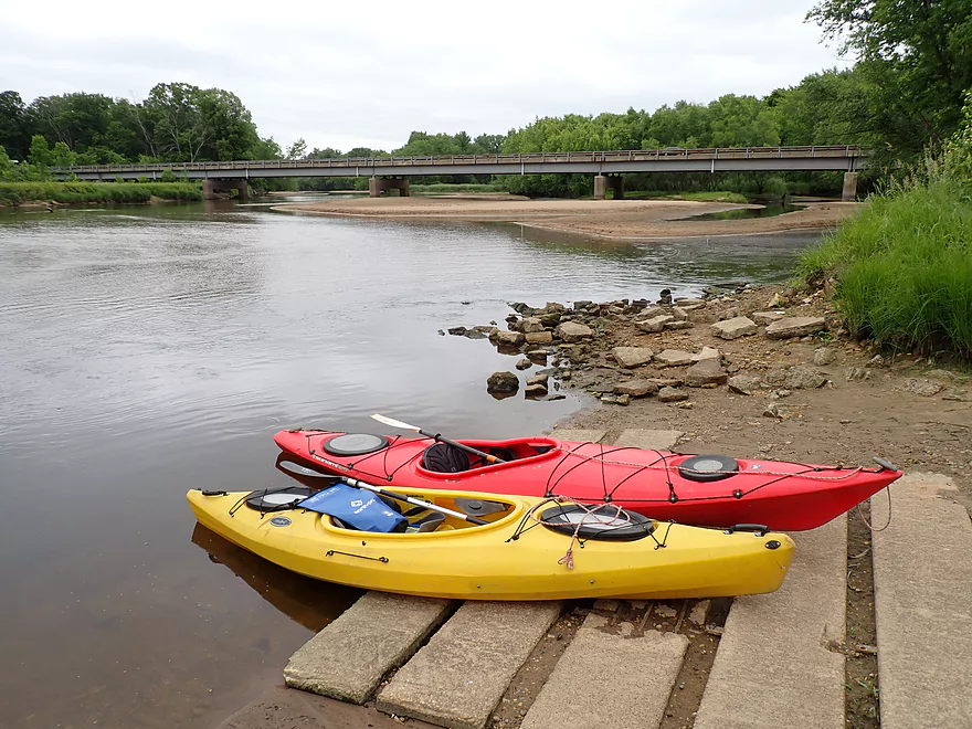
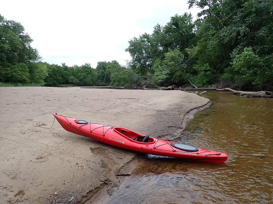
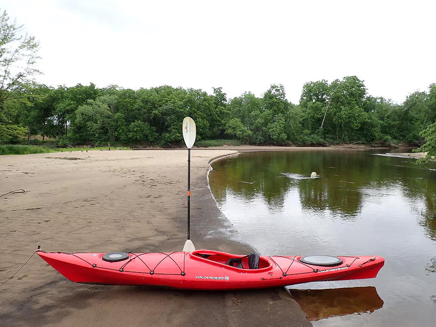
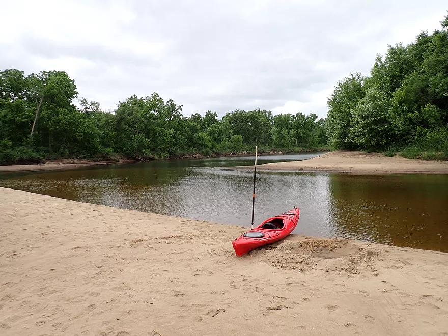
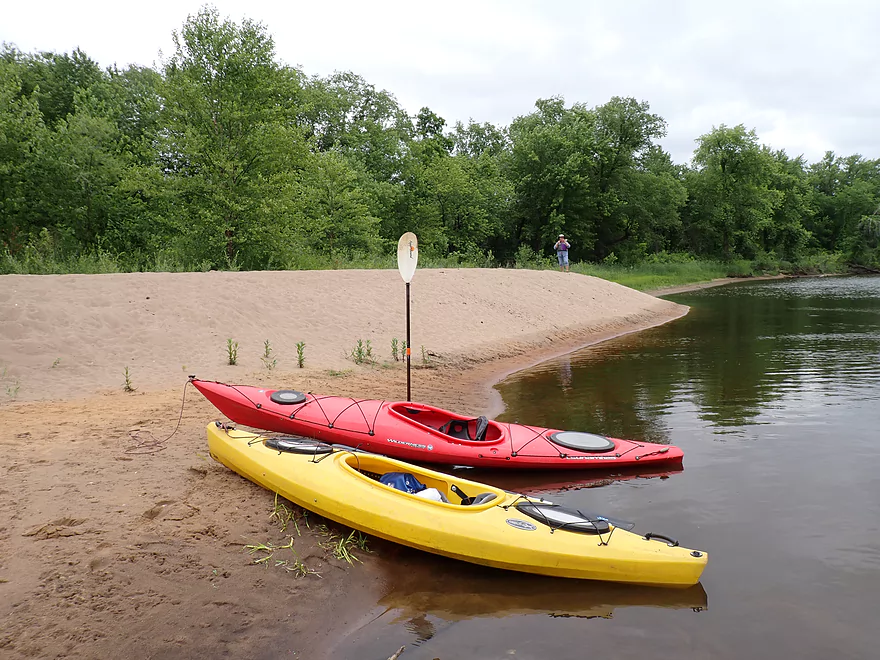
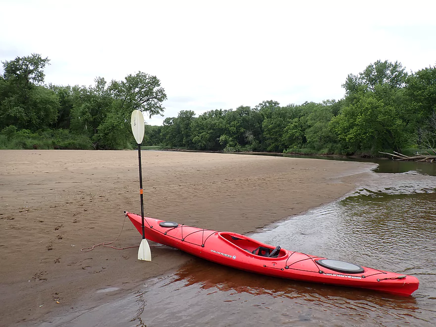
Nice put-in at the Hwy 35 Launch
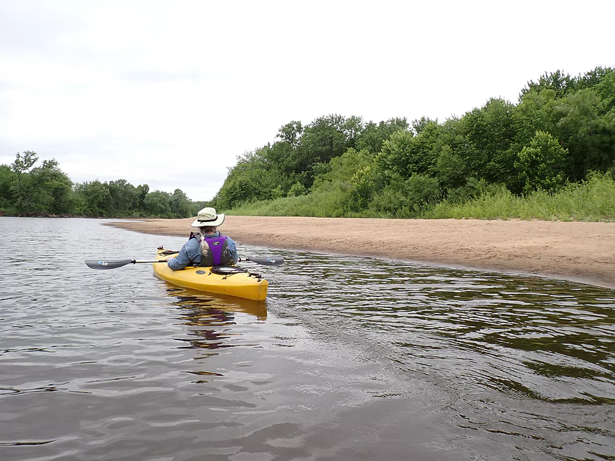
One of countless sandbars
This one had two abandoned chairs on it

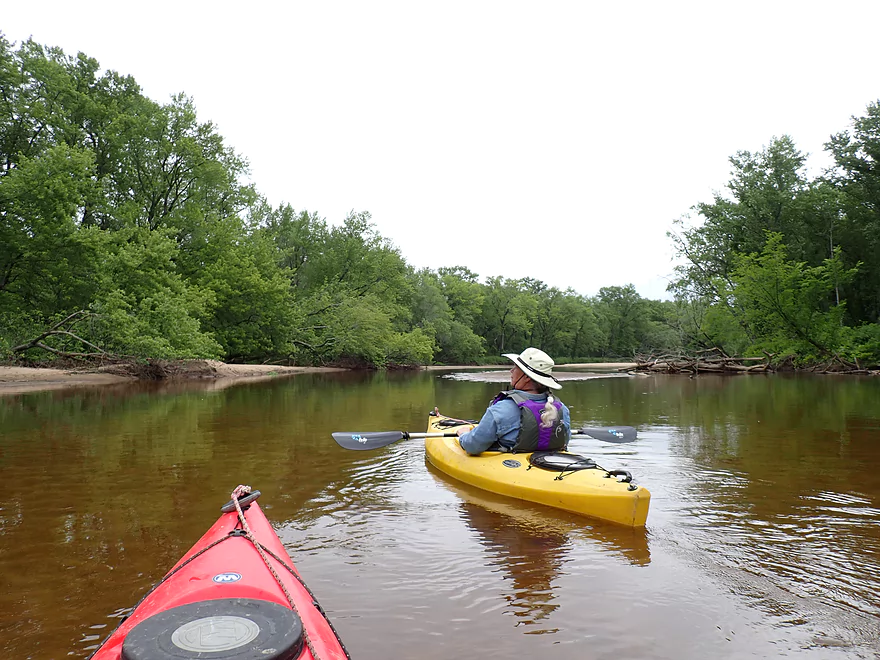
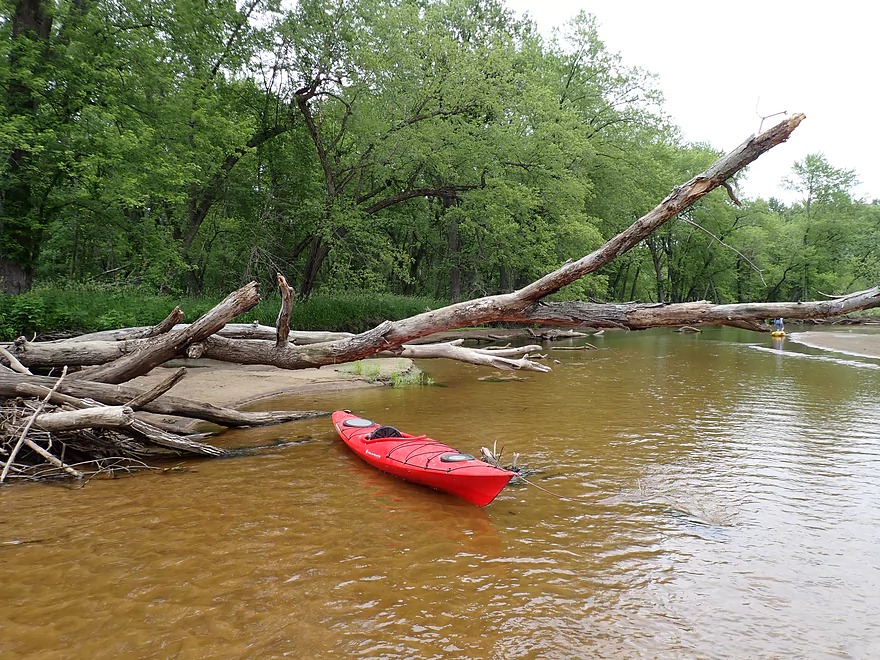
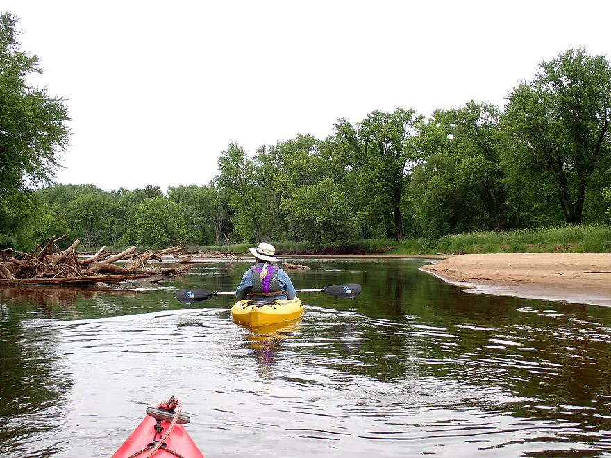
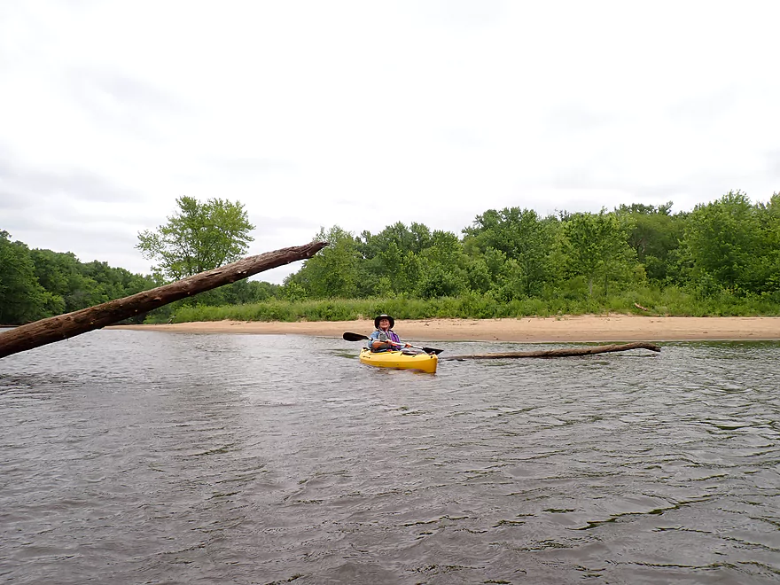
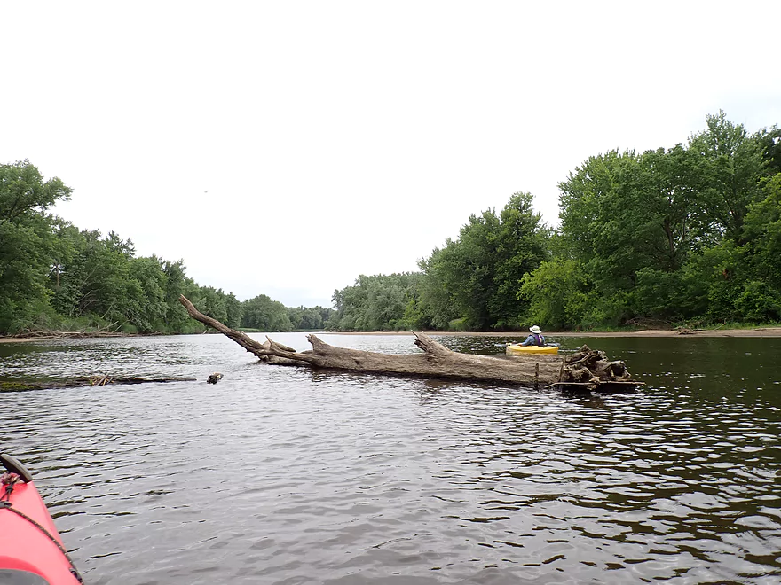
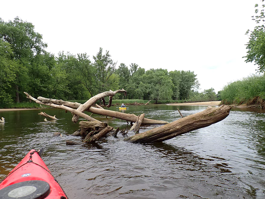
A number of downed trees, but it was almost always easy to get around them
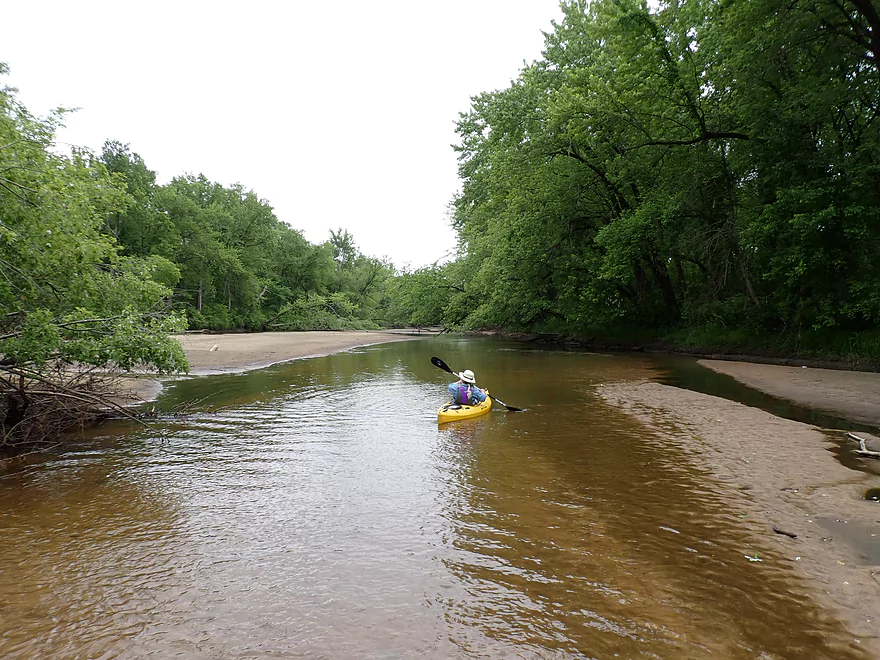
A shallow stretch that required wading
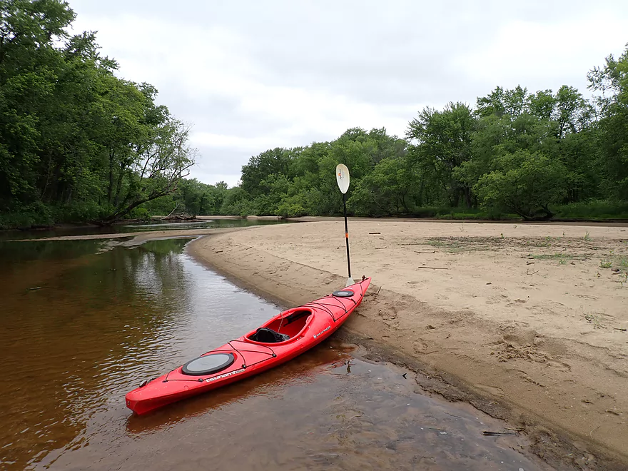
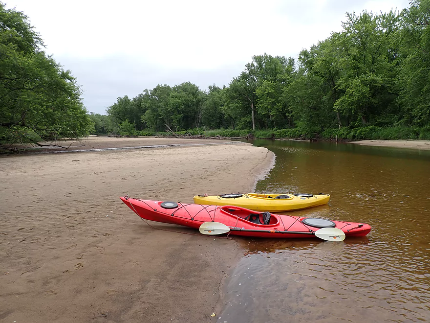
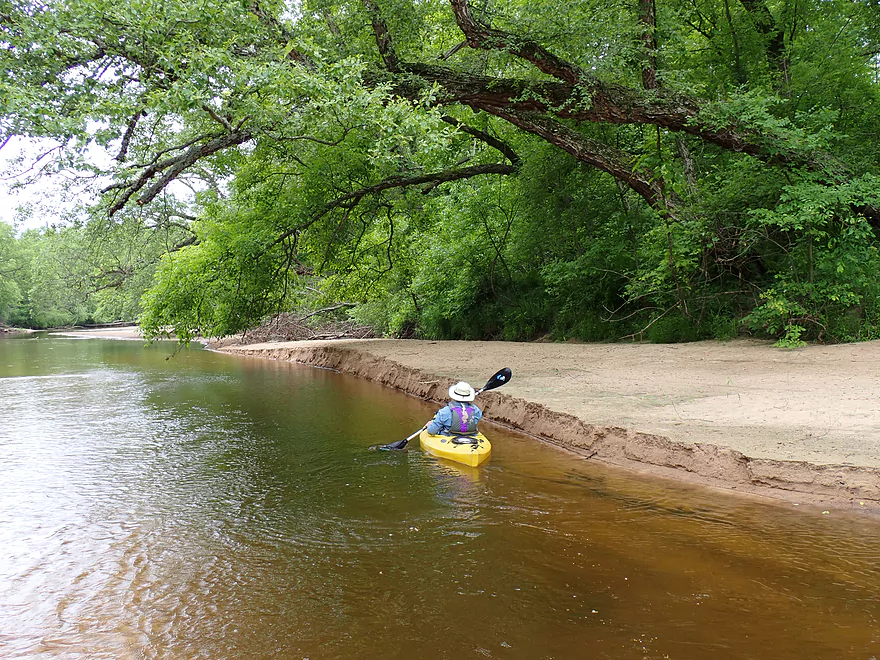
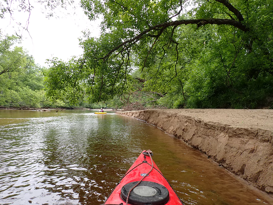
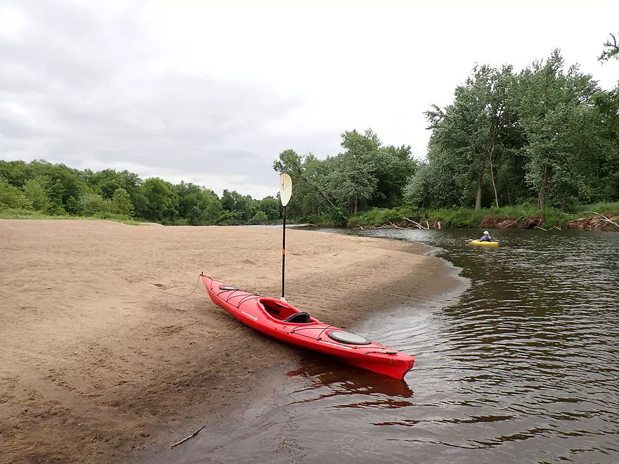
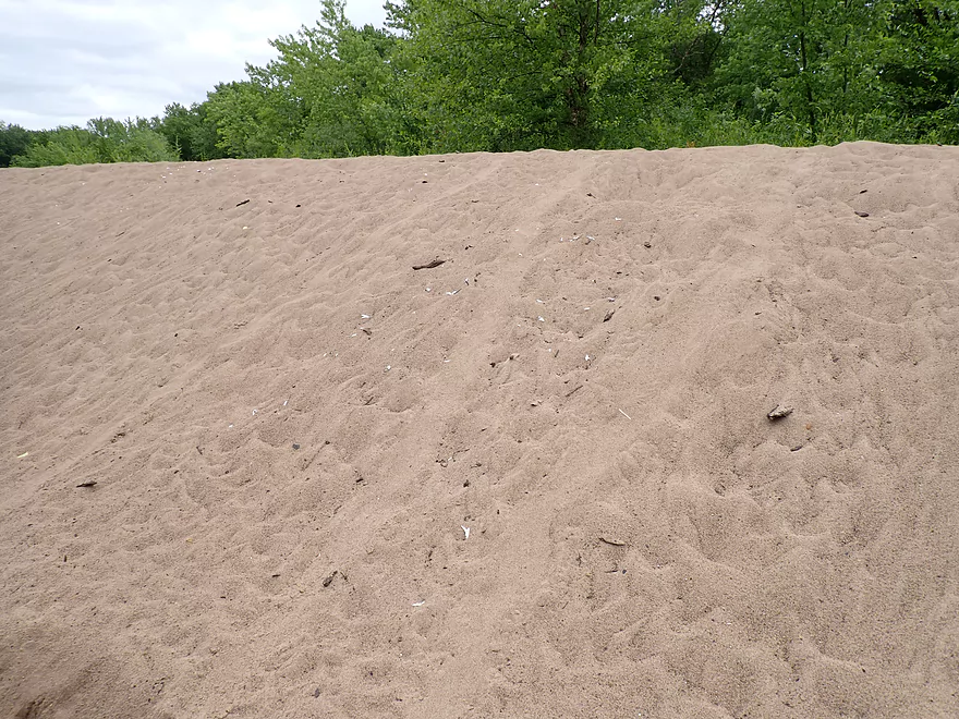
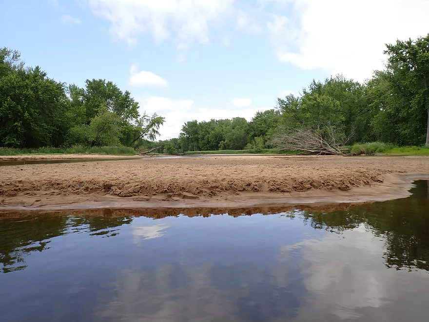
Sandbars were fantastic
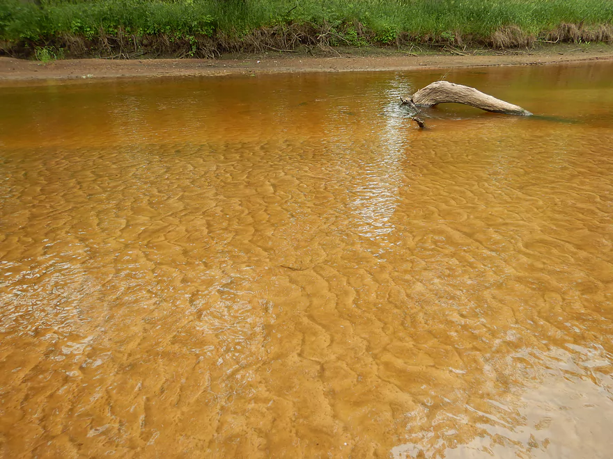
The entire bottom had these beautiful sand patterns
Another shallow stretch
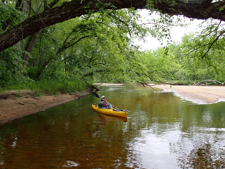
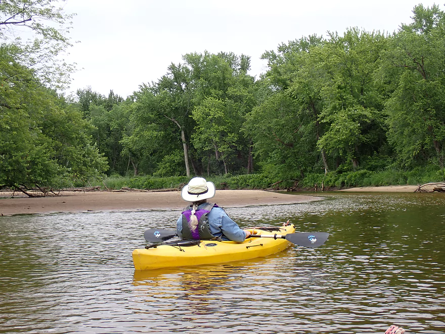
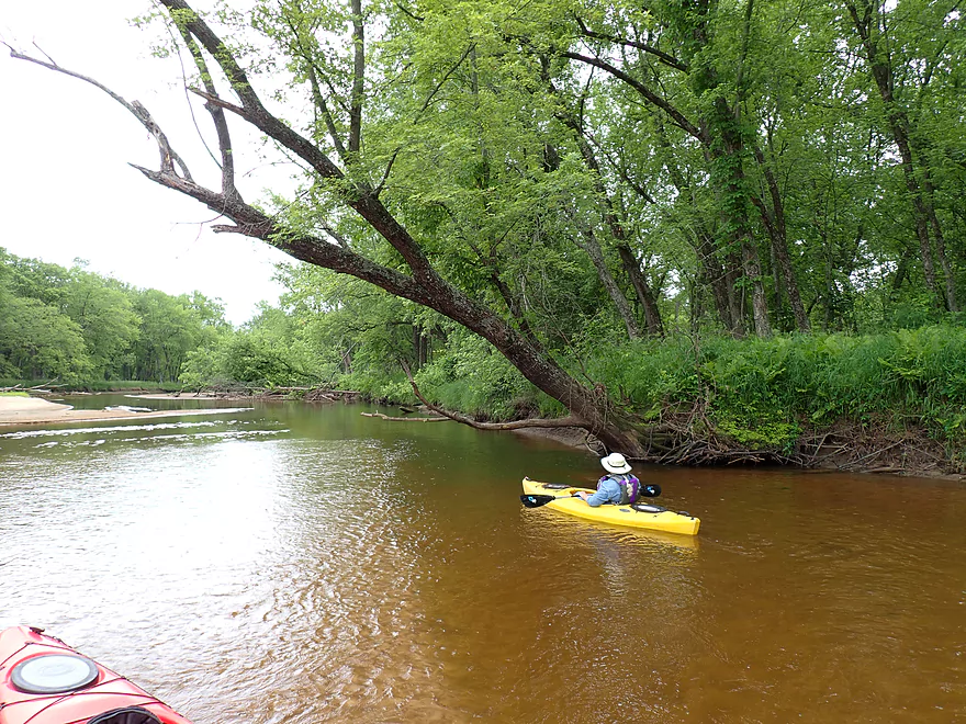
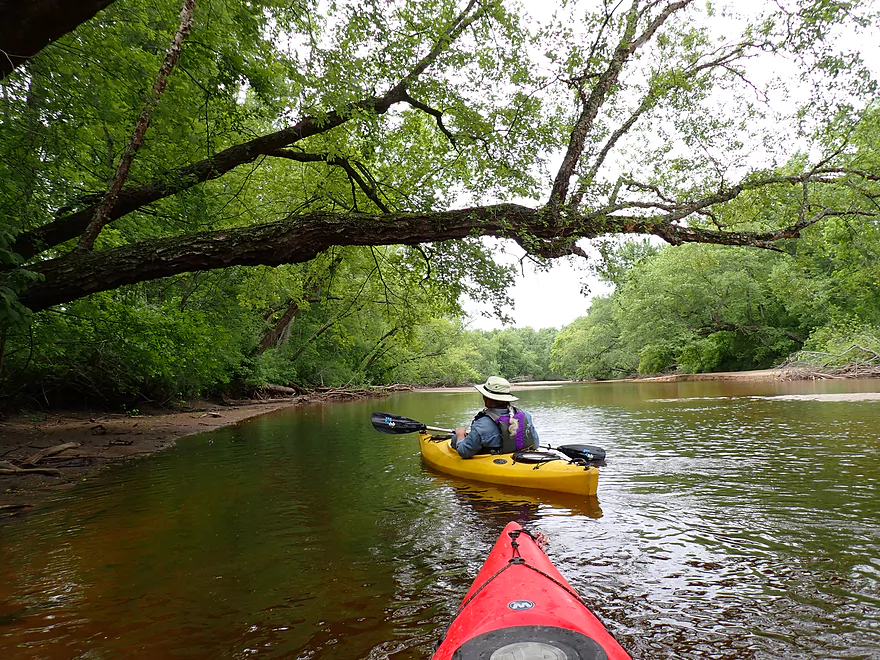
Attractive tree canopies

A turtle egg
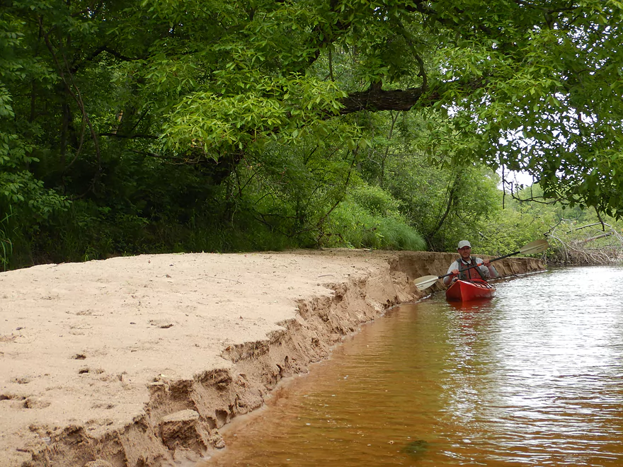
Cool “sand cliffs”
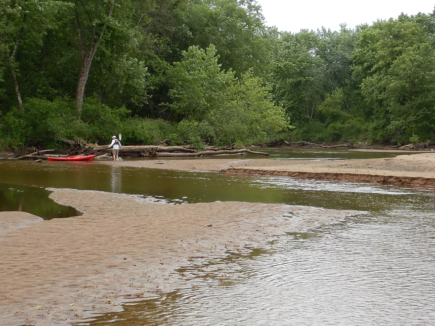
More wading…
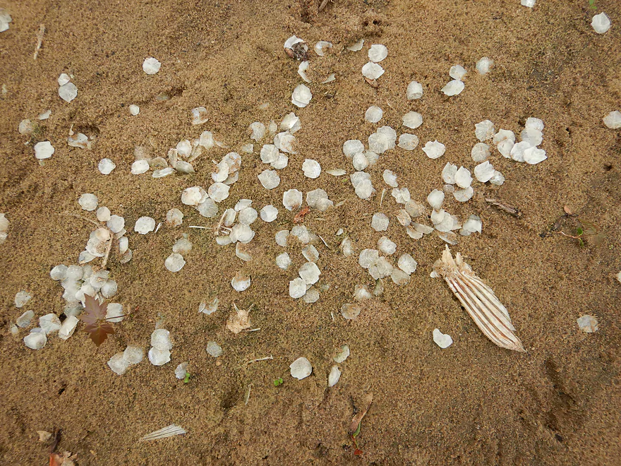
A pile of fish scales (probably carp)–somebody had a snack
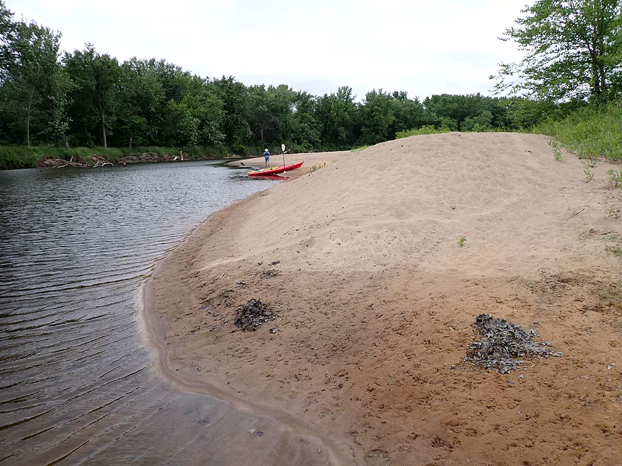
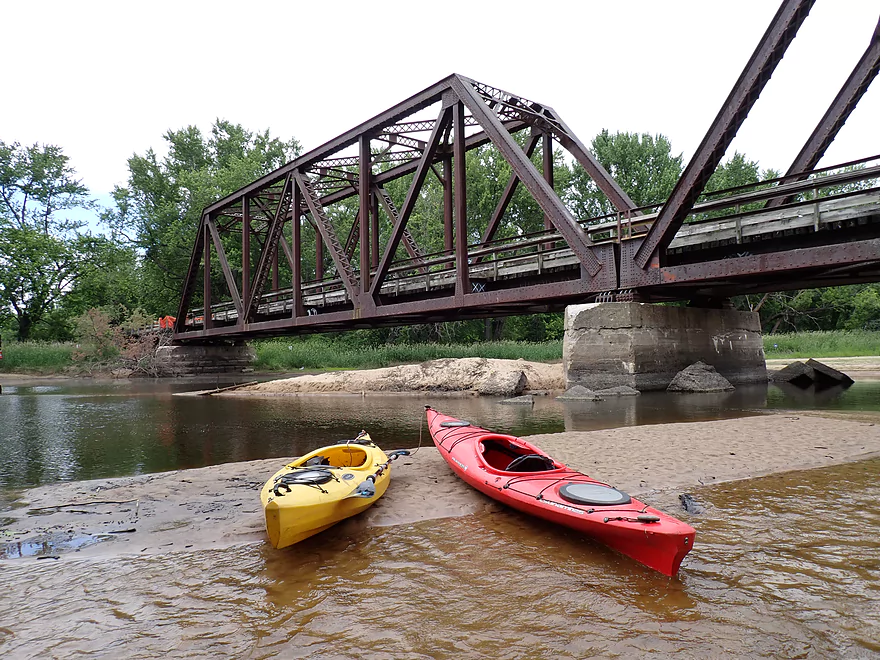
The second largest sandbar of the trip
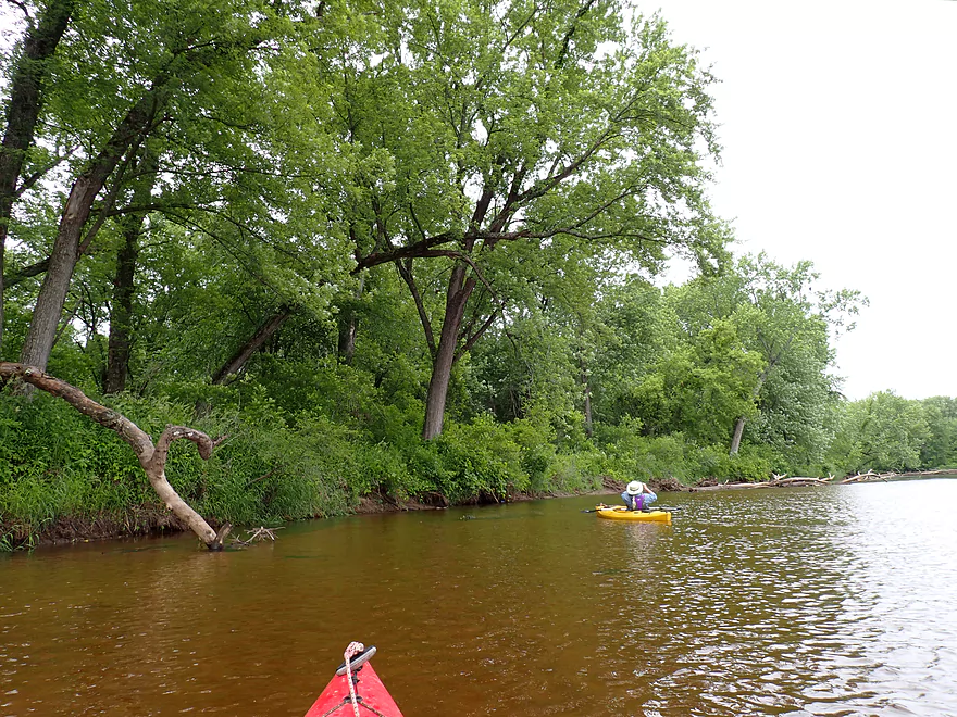
A significant side channel rejoins the main channel
From here on the Black is much bigger, deeper and more navigable
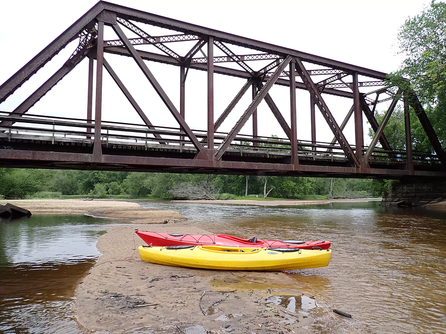
The largest and best sandbar
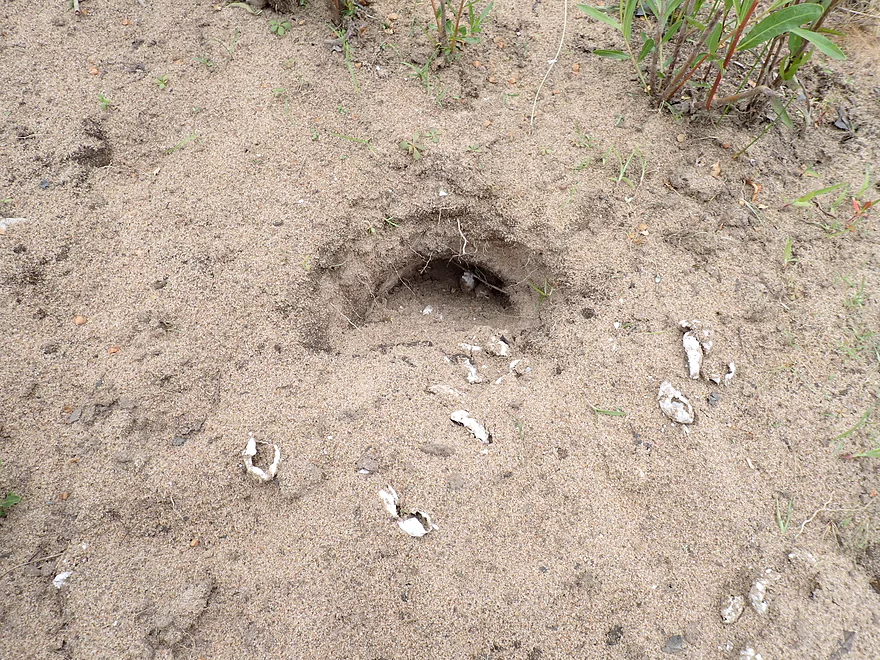
These turtle eggs had been dug up and eaten
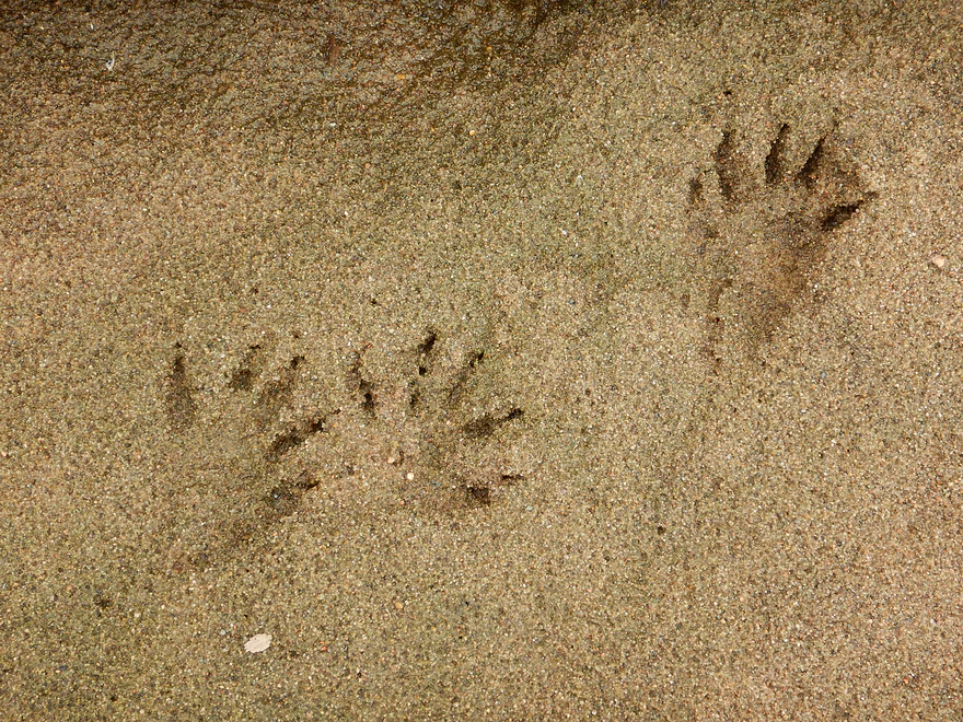
The likely culprit!
A taller sandbank that should remain even in high water
So much of this section reminded us of the Wisconsin River
This sandbar was covered with turtle trails–who were no doubt looking for places to lay eggs
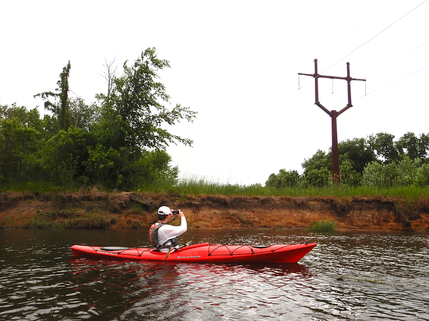
A massive highline pole
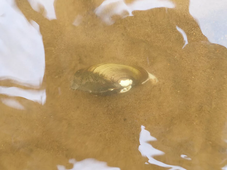
We saw several clams on the river
There were still a few shallow spots that had to be waded
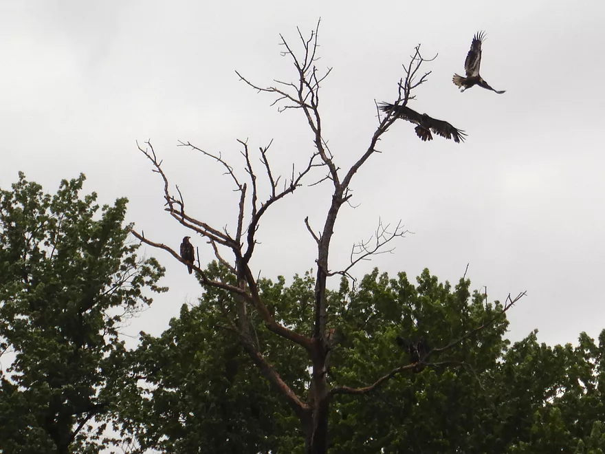
A lot of eagle activity on the river–these appeared to be newly fledged young
Sun finally coming out just as the trip almost completes
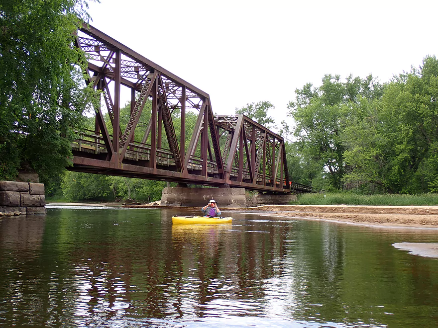
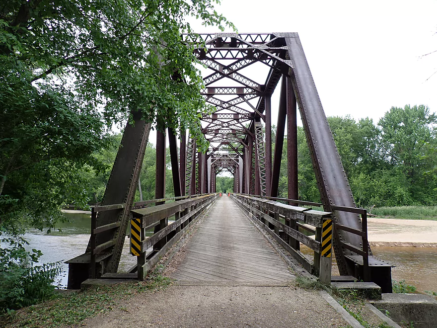
This is Lytle’s Landing bridge–an iconic local landmark
Reverse view (the Black River is to the left and Brown’s Marsh and Lytle’s Landing are to the right)
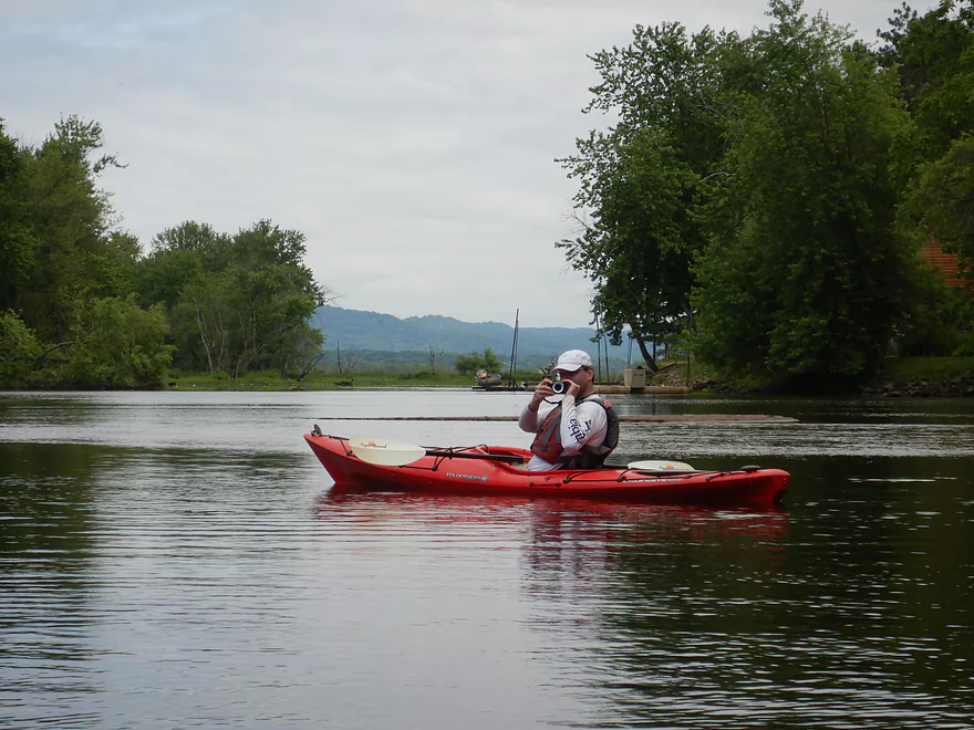
Brown’s Marsh is in the back of this photo, along with a glimpse of Mississippi River bluffs
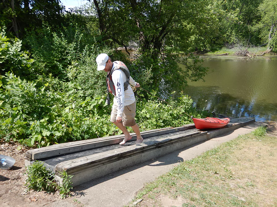
Lytle’s Landing has a nice canoe/kayak ramp
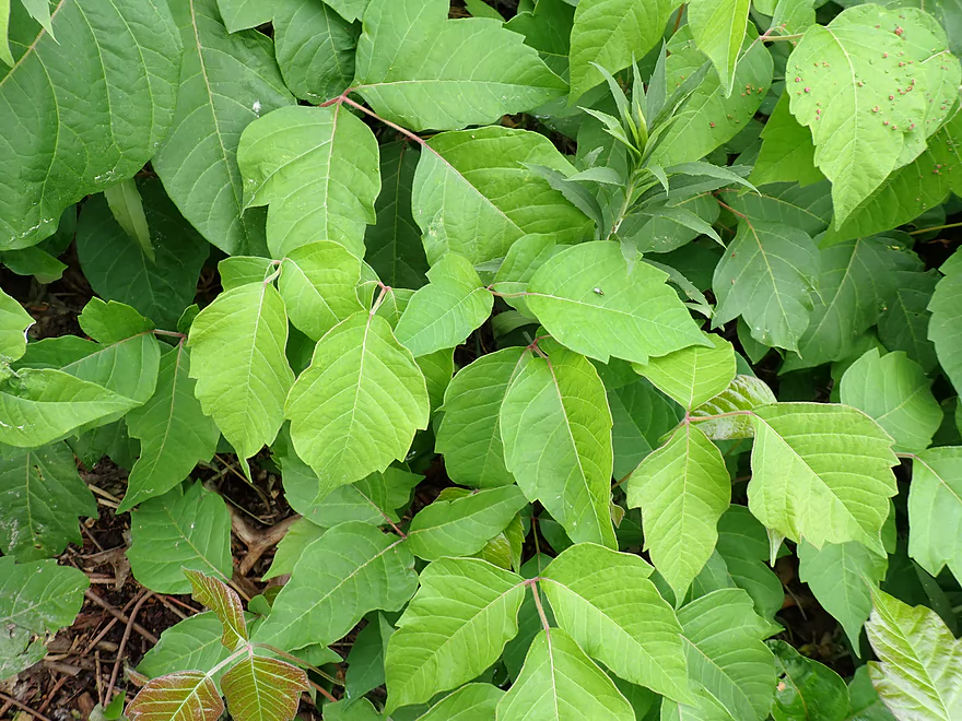
But mind the poison ivy
The landing also serves as an access point for the Great River Trail
Checking out the Seven Bridges Trail after our trip
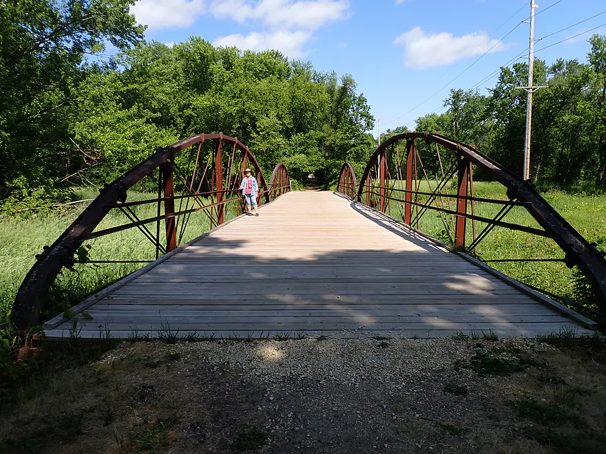
Most of the bridges on the trail have this unique arched design
Most of the Black’s six channels by the trail were pretty dried up
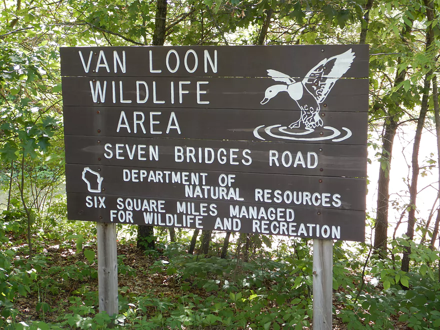
Black River – Van Loon Forest

North of the city of La Crosse, the Black splinters into a huge delta (one of the largest in the state) with multiple side channels and islands. At its heart, is the Van Loon Floodplain Forest (not to be conflated with the adjacent Van Loon Floodplain Savanna), which I wanted to explore for this week’s trip.
The boat launch off of Hwy 35 was a very nice put-in. Google says it is closed, but Google is wrong and it is open….but few people were using it (we would find out why later). Note Hwy 35 crosses multiple Black River channels, so paddlers will want to make sure they don’t choose the wrong bridge. By my rough estimate, the Black by Hwy 35 only retains maybe 60% of its volume and the rest is distributed over multiple distributaries.
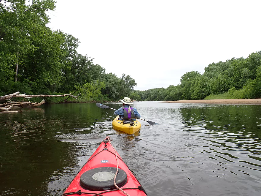
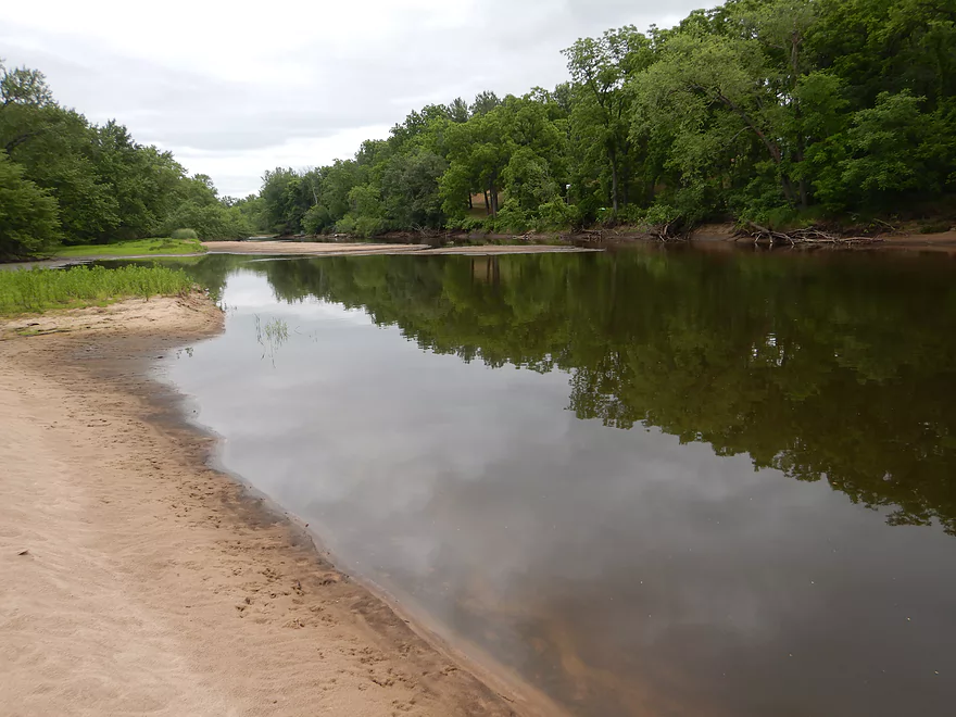
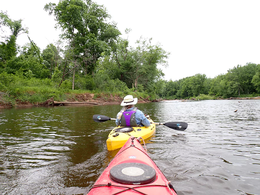
The first mile of the trip was pleasant minus loud Hwy 35. The shoreline consisted of floodplain hardwoods and sandy banks. In many ways it felt like a “mini-Wisconsin River” (a good thing).
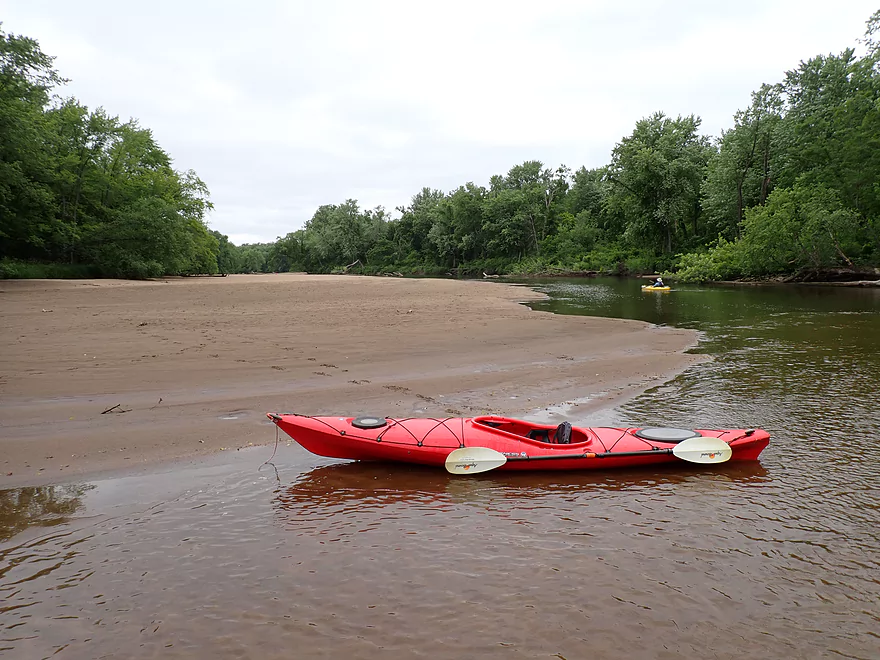
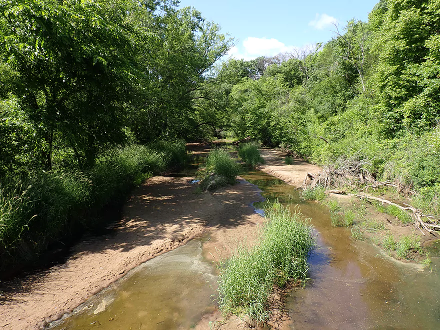
At roughly the two-mile mark, the sandbars continued to grow and actually started to constrict the channel. So much so, it became a problem and for roughly a mile the river was so shallow we had to wade much of it. A recent drought is partly to blame, but to be honest the Lower Black below Tank Creek often can be low, especially by later summer.
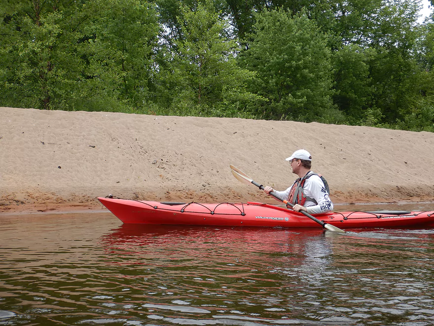
Having to wade here and there wasn’t the end of the world as the water was warm, and the bottom sandy and clean. Still, it’s not fun to constantly get into and out of a boat for a shallow spot. On the plus side, the sandbars on this shallow stretch were fantastic and among the best I’ve seen on a small river. Many looked like they would be terrific for camping, which I believe is allowed as part of the state natural area but don’t quote me on that.
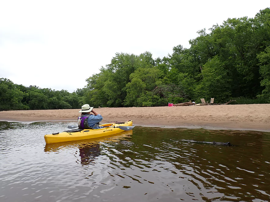
About 2 miles into the trip (the halfway point), we came to the community of New Amsterdam where a number of docks were high and dry above the drought-stricken river. It was at this point a key side channel rejoined the main channel which made the rest of the trip much deeper and more navigable. We still had to wade a few more stretches, but now it was more the exception than the norm. What was amusing was we had seen kayakers launch behind us and heard what sounded like an airboat or hovercraft attempting to get down the river. We never did see either, and assumed both gave up and returned upstream because of the shallow water.
The third mile of the trip didn’t feature as many sandbars, but they were larger, taller, and more impressive. While I suspect most of the sandbars from mile 2 will disappear under higher water, these later ones might persist.
The last mile only had a few sandbasrs, and was relatively open. Here the the banks took on a more traditional floodplain forest look with many weedy silver maple along the bank. I suspect when the Mississippi gets high it dams the Black River and results in a sediment dump of soft mud which only certain types of trees can cling to reliably.
A large iron trestle bridge and distant Mississippi bluffs marked the take-out at Lytle’s Landing. This is a really scenic area and sits adjacent to Brown’s Marsh which the US Fish and Wildlife Service has designated as an official water trail for paddlers. I may return to explore this in the future.
In summary this was a nice trip and almost 4 stars, but we went at a depth that was too shallow. If paddlers can correct for this, they will have a pleasant time. But they shouldn’t over-correct and go when the river is too high, or else they will miss out on the amazing sandbars. This is a very different experience compared to other Black River trips. The upper legs have nice cliffs, pine trees, boulder gardens, and rapids. There is none of that here and the only thing that reminds you of the Black River is the occasional root beer-colored water. It really does feel like a small version of the Lower Wisconsin River and if you enjoy that, you should enjoy this water trail.
Sights included clams, multiple eagles (including newly fledged young), animal tracks (coon, deer, & mink) and a number of songbirds including yellow warblers and yellowthroats. The highlight was seeing all the turtle tracks. They seemed to love the sandbars and climbed up on them to lay a large number of eggs (many were dug up and destroyed…likely by raccoons).
The Great River Trail: This is a fantastic bike trail that connects La Crosse to Perrot State Park.
The National Wildlife and Fish Refuge Visitor Center: The center features exhibits and information on Mississippi area wildlife.
Seven Bridges Trail: Getting across the vast Black River Delta was difficult for early residents, so they built a seven-bridge road to accomplish this. Today the road doesn’t support cars, but it is a popular hiking trail that features a series rustic iron bridges.
Hwy 35 Boat Ramp: This is an excellent public access, but mind the poison ivy. Note Google Maps says the landing is closed, which is incorrect.
Alternate Put-ins:
- Hwy 53 Landing (8.0 miles upstream from Hwy 35): This is a nice leg of the river with some large sand banks.
- Hwy 35 – Tank Creek: Located west of the main branch, Tank Creek is a large and mostly navigable distributary of the Black. It never connects back with the main branch and instead empties into the Mississippi by Big Marsh where navigation can be difficult because of all the wild rice.
- Hwy 35 – East Channel: This is another large distributary of the Black. It’s not as big as the main channel and may suffer from some logjams. It eventually rejoins the main branch by the community of New Amsterdam.
Lytle’s Landing: This is an excellent public access and features a canoe/kayak ramp to make it easier to pull your boat up the bank. This landing (like Hwy 35) has lots of poison ivy so watch your step. Bathrooms are available close to the trail bridge. The parking lot is not large, and based on the adjacent no-parking signs I suspect it fills up on popular summer weekends.
Alternate Take-outs:
- Fred Funk Landing (5.0 miles downstream from Lytle’s Landing): This is a popular boat ramp. Overflow parking should be available across the street. The final miles of the Black River won’t have as many sandbars (if any), but will feature more floodplain forests and countless side channels and chutes. Getting lost could be an issue but could also be part of the fun.
- Mosey Landing (7.8 miles downstream from Lytle’s Landing): This is a suitable landing, but is much smaller and more apt to fill up than Fred Funk Landing. These final 2-3 miles flow through a narrow side channel of Lake Onalaska.
Car Shuttle – Lytle’s Landing to Hwy 35: 12.1 miles/19 minutes. Typically I don’t list car shuttle times, but this is unusually long because of a quirk of geography.
Bike Shuttle – Lytle’s Landing to Hwy 35: 10.5 miles with 43′ of ascent. This is definitely a long bike shuttle, but half of it would be on a great bike trail (Great River State Trail). Half though is on busy Hwy 35.
Current: The current is fairly lazy with no riffles or rapids.
Logjams: There are multiple downed trees, but usually the river cuts a path around them no problem. There was one case in which a downed tree required an easy portage via an adjacent sandbar.
Shallow Water: This leg gets occasionally very low. When this happens frequent wading will be required.
Closest Gauge: Black River @ Galesville
Trip Depth: 603 CFS or 3.6′
Navigability Estimates: The following are very rough estimates. Always use your own judgement.
- < 3.7′: Likely too shallow for most paddlers unless you don’t mind a bunch of wading.
- 3.8′-4.0′: Very shallow with some wading required. Excellent sandbars though.
- 4.1-4.4′. Good target range.
- 4.5-4.8′: Above average. Should be doable but many of the nice sandbars will be underwater.
- 4.9-5.5′: High levels but should be doable for paddling. Few if any sandbars will be left.
- 5.6’+: Very high levels. Likely only suitable for expert paddlers.
Quick Overview
Black River:
- Upstream of Hwy 73: Obscure sections of the Black with little known about them. Some legs will have logjam issues.
- Hwy 73 to Lake Arbutus: 48 miles. Good legs with a mix of rapids, boulder gardens and undeveloped banks. Only reason these legs don't receive more paddling traffic is because they're located away from population centers.
- Lake Arbutus: 3 miles. A scenic but challenging lake because of the waves.
- Hatfield Dam to Halls Creek Landing: 7 miles. Some of the best and most fun whitewater on the Black River.
- Halls Creek Landing to Black River Falls Dam: 6 miles. An impounded part of the river, but nice with cool cliffs.
- Black River Falls Dam to North Bend: 37 miles. This is the heart of the Lower Black and sees the most paddling traffic. No major rapids, but there are many scenic cliffs and creek inlets.
- North Bend to Mouth: 30 miles. This is the second half of the Lower Black. While not as scenic, there are still cool sandbars and sandbanks. Few paddle these stretches.
Noteworthy Tributaries:
- Robinson Creek: One of the best paddles in all of Wisconsin.
- Halls Creek: Also one of the best and with amazing sandstone walls.
- Morrison Creek: Very scenic creek with some fun whitewater.
- Wedges Creek: Great paddle with amazing boulder gardens.
- East Fork of the Black River: Some fun riffles and unique granite geology.
- Perry Creek: Shallow but a super scenic creek.
- Dickey Creek: A wonderfully scenic creek with fantastic sandstone…but too many logjams.
- Beaver Creek: Some fun rapids and amazing sandstone in Galesville, but logjams on the downstream portions.
- Popple River: A shallow whitewater river that is very nice.
- Arnold Creek: A pleasant tributary to Lake Arbutus with really nice reflections.
- Rock Creek: Many scenic boulder gardens, but usually this creek is too shallow to run.
- Roaring Creek: Very scenic creek with a great waterfall at the mouth, but might be a challenge to paddle.
- Vismal Creek: Super scenic but has a lot of logjams and is shallow. Requires very high water conditions.
- Plus countless small creeks that are too small to paddle but quite fun to explore by foot. If you know of viable paddling options, let me know! Am very curious to know more about Douglas Creek, Levis Creek, O’Neal Creek, and Crawley Creek.
Detailed Overview
Headwaters to Neillsville:
- Upstream of Division Drive: Likely too many logjams to be navigable.
- Division Drive to Sawyer Ave: (6.5 miles) Rocky and a few light rapids. Maybe 4 logjams.
- Sawyer Ave to Hwy 64: (2.5 miles) Rocky and a few light rapids.
- Hwy 64 to Bridge Road: (14.4 miles) Solid prospect reviewed by Mike Svob. Some Class 1 rapids and nice gravel bars. Intermediate access points at Bahnkes Ave and Hwy AT.
- Bridge Road to Hwy X: (6.0 miles) Little is known of this section…likely pretty simple.
- Hwy X to Colby Factory Road: (6.0 miles) Little is known about this section…likely some rapids and outcrops. Intermediate alt access points at Hwy 29 and Hwy N.
- Colby Factory Road to Popple River Mouth: (7.9 miles) This stretch has far fewer rapids than downstream legs with only a few minor rapids. It should still be pleasant though.
- Popple River Mouth to Reese Ave: (5.3 miles)
- Popple River Mouth to Warner Drive: (1.0 miles) This is a slower and less interesting stretch, but does include 4 Class 1's and scenic Hemlock Rapids which are Class 3.
- Warner Drive to Greenwood Park: (3.4 miles) A good leg with many rapids (3 Class 2's and 17 Class 1's).
- Greenwood Park to Reese Ave: (0.9 miles) A slower stretch with just 2 Class 1's. Part of this passes through the community of Greenwood.
- Reese Ave to Twenty Six Rd: (5.1 miles)
- Reese Ave to Sladich Rd: (0.7 miles) A mostly nondescript wooded stretch. The exception is Greenwood Rapids where an island splits the river. The right side is scenic, but the left side has fun Class 3 rapids.
- Sladich Rd to Willard Rd: (1.6 miles) A somewhat slow and relatively uninteresting leg. Highlights include one nice outcrop, a few gravel bars and a 400' stretch of Class 1 rapids.
- Willard Rd to Twenty Six Rd: (2.8 miles) A great leg with 10 Class 1's and 2 Class 2's. Highlights also include scenic boulder gardens and a few outcrops.
- Twenty Six Road to Hwy H: (5.0 miles) Multiple Class 1 & 2 rapids.
- Hwy H to Grand Ave/Hill Road: (8.0 miles) A great trip with several Class 2 rapids and scenic granite outcrops.
Note, for more details on the Upper Black, I highly recommend “Indian Head Rivers” by Michael Duncanson.
Alternate Black River Trips – Neillsville to Black River Falls:
- Grand Ave/Hill Road to Opelt Road Landing: (6.7 miles)
- Grand Ave/Hill Road to Hwy 10: (2.2 miles) Nice section with a handful of rapids. These are mostly Class 1 at lower depths, but strengthen to Class 2 during high flow rates.
- Hwy 10 to River Road Landing: (4.3 miles) Fantastic whitewater section. Maybe six Class 2’s and two class 3’s. Scenic boulder gardens and a few outcrops.
- Opelt Road Landing to Bryan Ave Bridge: (1.1 miles) Not sure there is anything special about this stretch.
- Opelt Ave Bridge to Hwy 95: (4.4 miles) Ok…nothing special.
- Hwy 95 to West Arbutus County Ramp/Hatfield Dam: (4.8 miles)
- Hwy 95 to North Arbutus Boat Landing: (2.4 miles) Includes a scenic gorge, boulder gardens and rapids including the Class 3 Red Granite Rapids. River slows after rapids.
- North Arbutus Boat Ramp to West Arbutus County Ramp: (2.4 miles) A large open water paddle on Lake Arbutus that can feature challenging waves on summer afternoons.
- Hatfield Dam to West/East Channel Confluence: 0.2 or 0.3 miles.
- West Dam to West/East Channel Confluence: 0.3 miles. There is a large boulder field and Class 2 rapids below the west dam. At the outlet of the west channel is a Class 4 drop. This is easy to scout and portage.
- East Dam to West/East Channel Confluence: 0.2 miles. Perhaps the most extraordinary rapids in the state with Class 4/5+ rapids. The action starts below the dam where steep granite banks narrow the river significantly and force it down deep chutes. The gorge starts with Class 2-3 rapids but ends with two significant drops. American Whitewater warns “between the dam and this point lie some serious drops which contain near inescapable boiling cauldrons at moderate to high flows”.
- Hatfield Dam Confluence/West Clay School Road to Powerhouse Road Landing: (3.1 miles)
- Hatfield Dam Confluence to Hwy K: (0.3 miles) One of the most scenic paddling areas in the state with massive granite outcrops. There is one set of Class 2 rapids.
- Hwy K to Powerhouse Road Landing: (2.8 miles) The first half mile by Hwy K is very scenic and contains one Class 3. The second mile is mostly flatwater. The third mile is almost continuous rapids and features one Class 3.
- Powerhouse Road Landing to Halls Creek Landing: (4.0 miles) Scenic section with a few Class 2 rapids and a steep ledge.
- Halls Creek Landing to Black River Falls Dam: (6.2 miles) Wonderful sandstone cliffs.
Alternate Black River Trips – Black River Falls to Mouth:
- Black River Falls Dam to Mason’s Landing: (4.7 miles) A great little section.
- Mason’s Landing to Irving Landing: (9 miles) A good section.
- Irving Landing to Lost Falls Campground (2.3 miles) A popular stretch. Highlights include a few small outcrops, two tiny waterfalls, several impressive sandbars, and one large sandbank. A side hike to Roaring Falls can be arranged. Note Lost Falls Campground is private and you must purchase a pass from them to use their access.
- Lost Falls Campground to Grinde Landing: (6.4 miles) A popular section with some nice outcrops and a waterfall by Roaring Creek. Wolf Creek may also have a cool slot canyon. The river splinters into multiple channels, some of which may be quite shallow in later summer. As of 2023, Grinde Landing is closed because somebody stole the owner's deer stand.
- Grinde Landing to Melrose Landing: (3.9 miles) A shorter section but with a really nice rock outcrop before Melrose Landing. As of 2023, Grinde Landing is closed because somebody stole the owner's deer stand.
- Melrose to North Bend: (10.1 miles) Likely the most popular stretch with the best sandbars on the river, three sets of outcrops, and a few waterfalls.
- North Bend to Hwy 53: (13.3 miles) Likely a nice paddle with sandbars, large sandbanks and maybe a few outcrops. Unfortunately it is very long.
- Hwy 53 to Hwy 35: (8 miles) A nice section with epic sand banks.
- Hwy 35 to Lytle Road: (4.0 miles) Goes through the Van Loon Floodplain Forest. This can be a shallow trip but features many nice sandbars.
- Lytle Road to Fred Funk Boat Landing (Mississippi): (5.0 miles) Multiple options because of the river delta.
Trip Map
Overview Map
Video
Photos Size: