
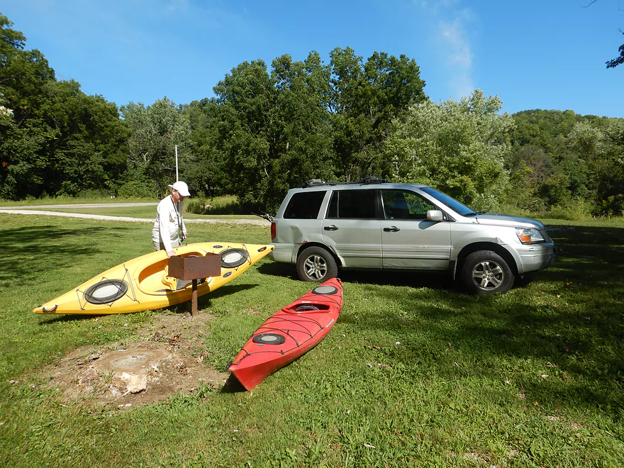
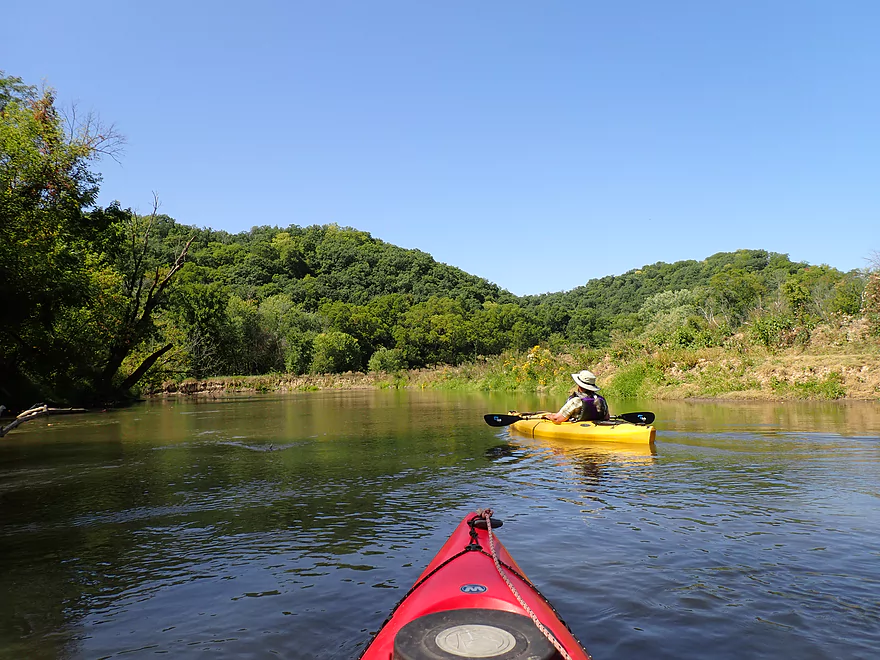
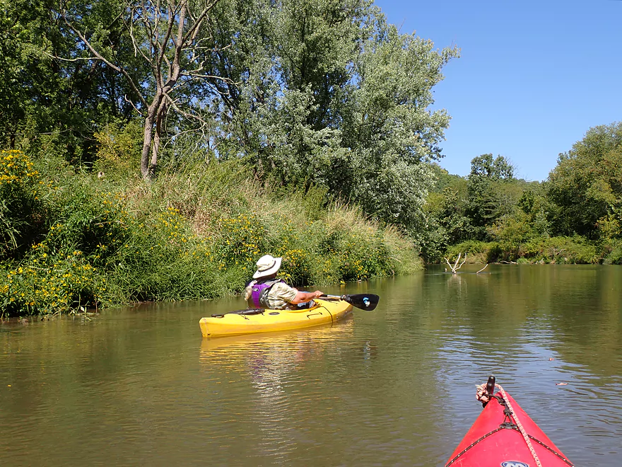
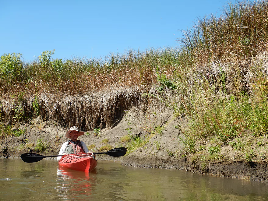
Starting the trip at Plum Creek Canoe Landing
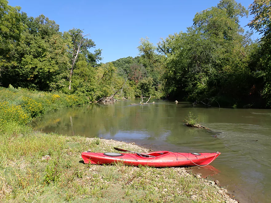
Nice put-in
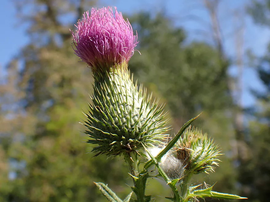
A thistle flower
The Mississippi Valley Conservancy owns 5.5 miles of frontage along the west bank of the river
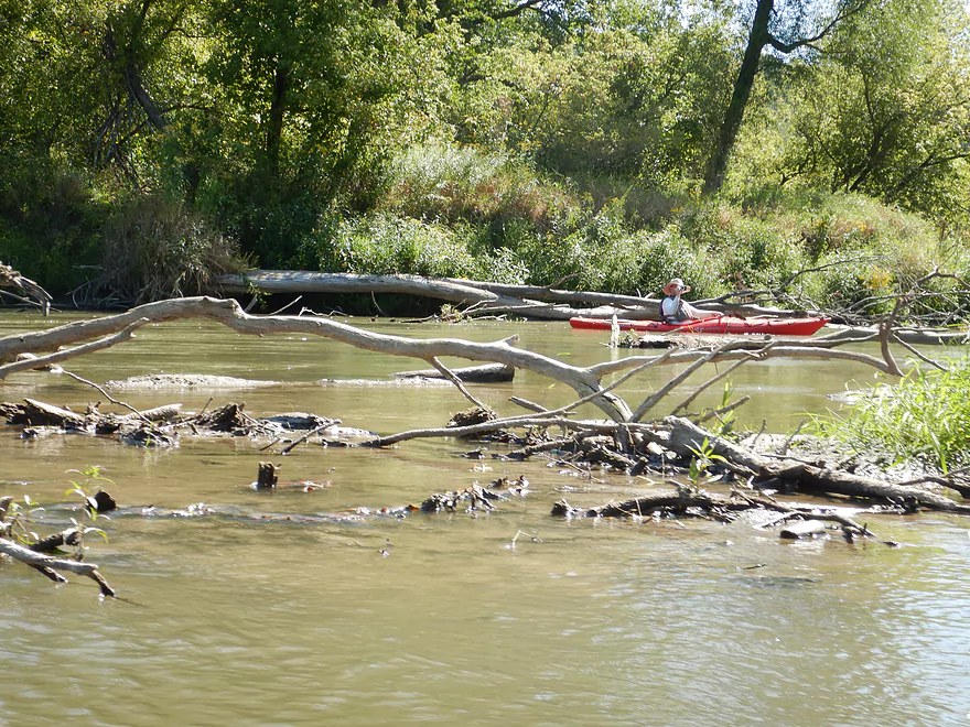
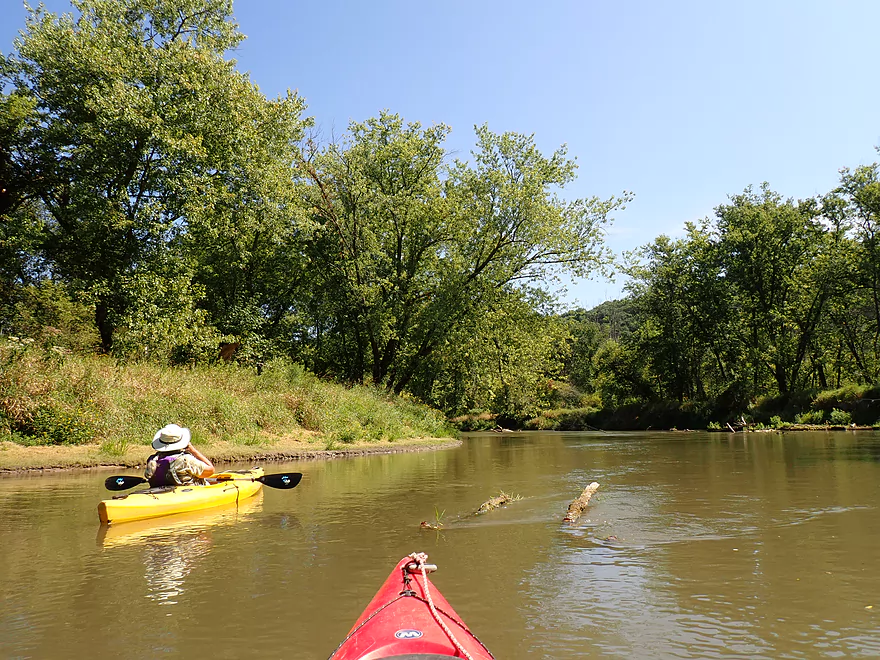
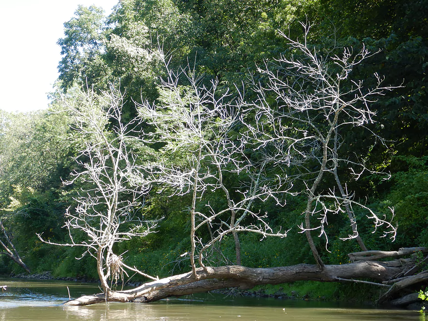
Lots of deadfall, but no logjams
The Kickapoo Wild Woods SNA (part of the Kickapoo Wildlife Area-Wauzeka Unit) is to our left
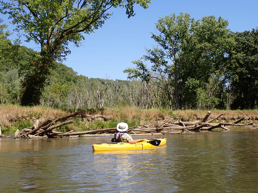
Most of the shore was undeveloped but this stretch had some cattle
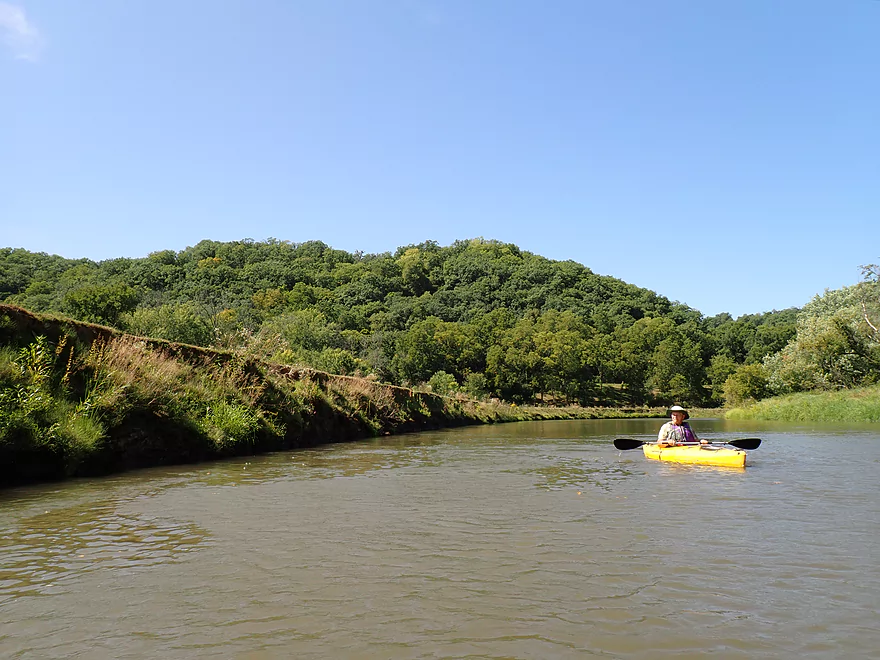
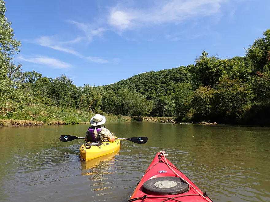
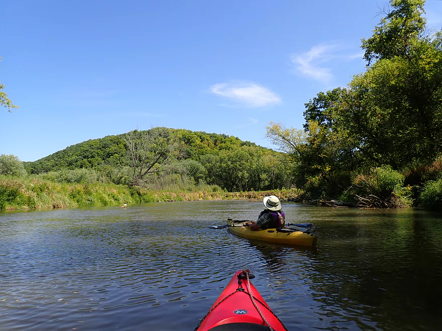
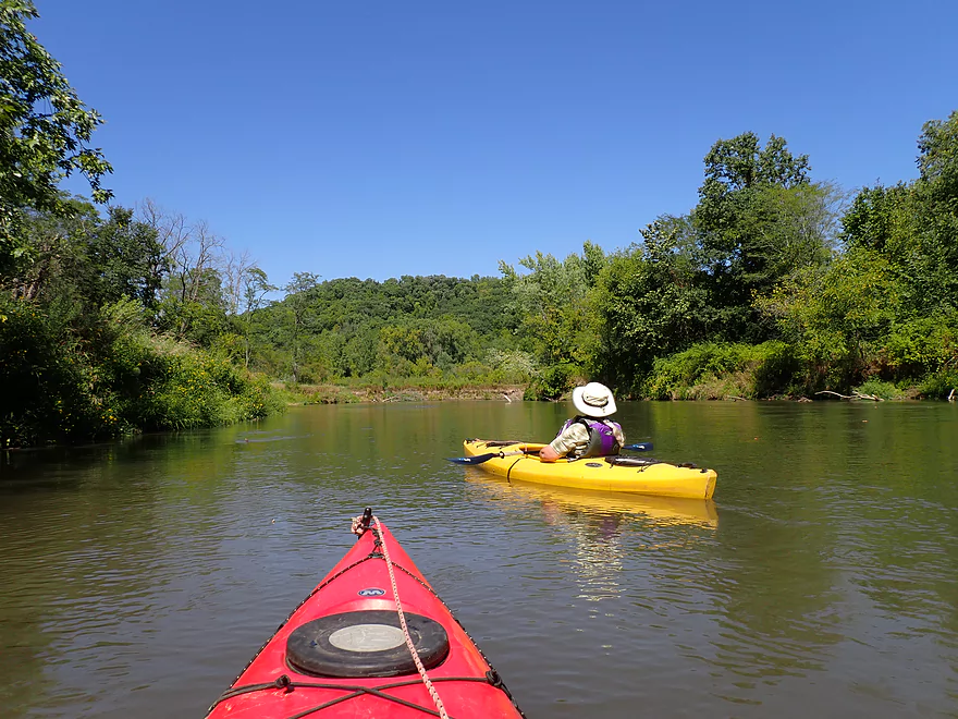
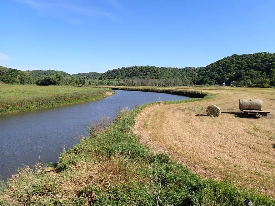
Hills starting to get bigger
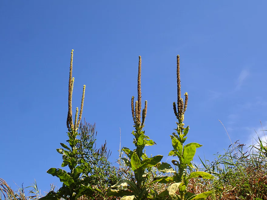
Three mullein weeds standing guard
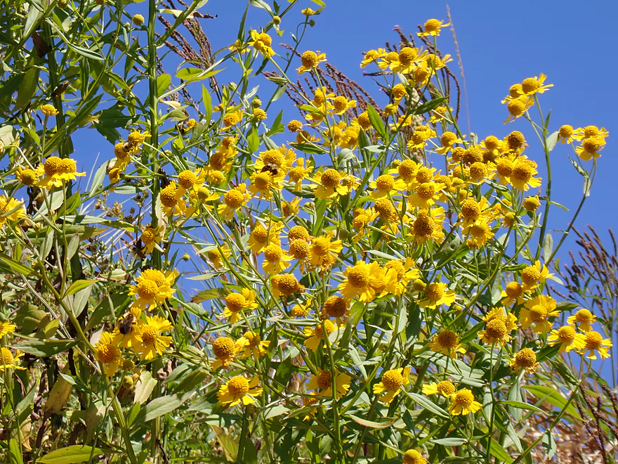
Sneezeweed
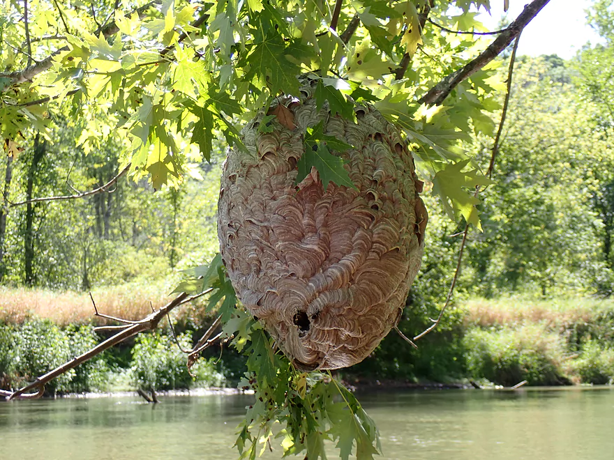
Massive bald-faced hornet nest
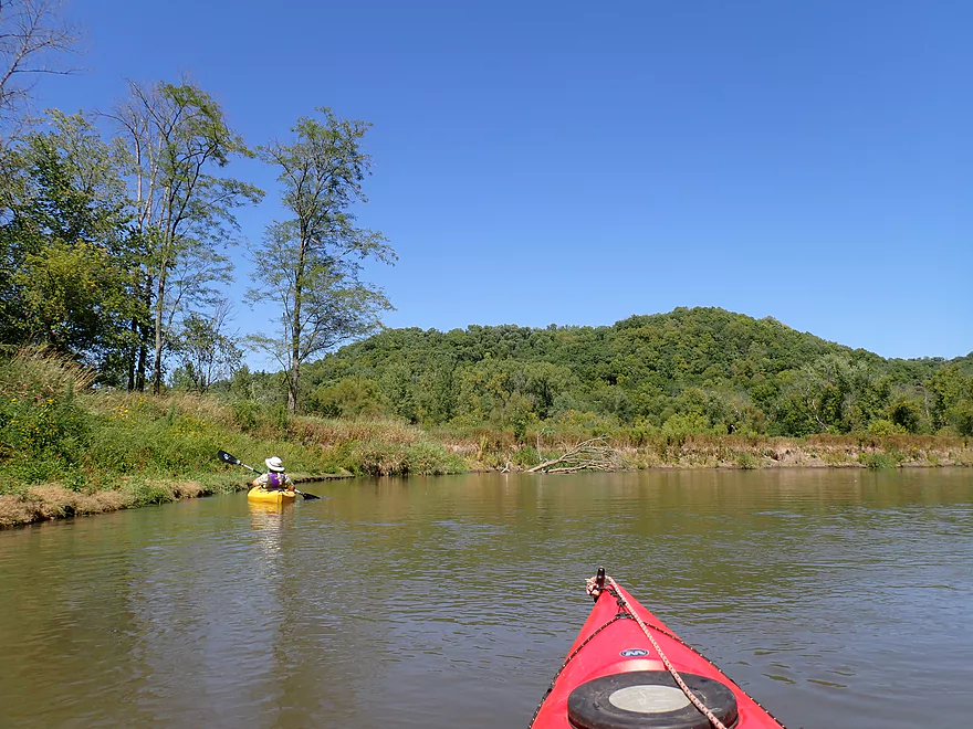
Bluff scenery was surprisingly good
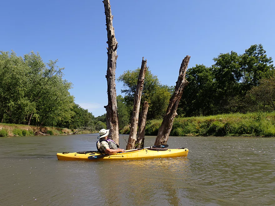
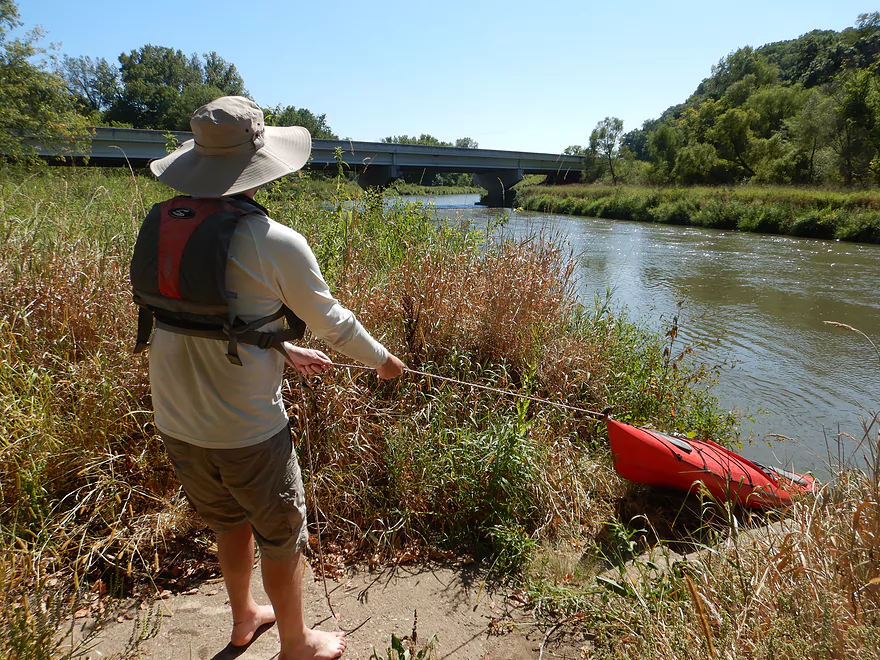
Getting forked by the Kickapoo
Many, many walnut trees grew along the river
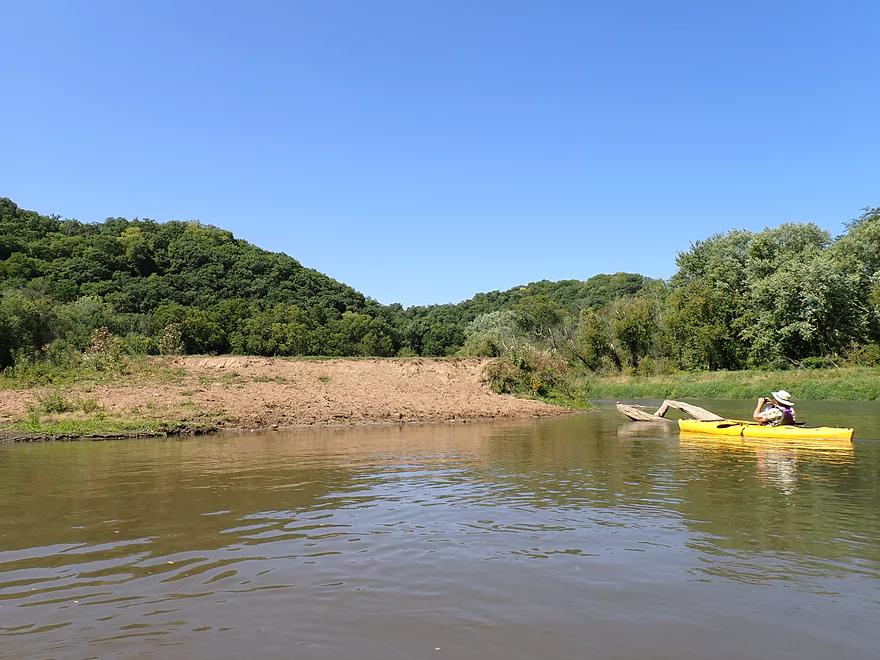
Approaching another impressive ridge line
The remnants of the old Kickapoo Valley Railroad
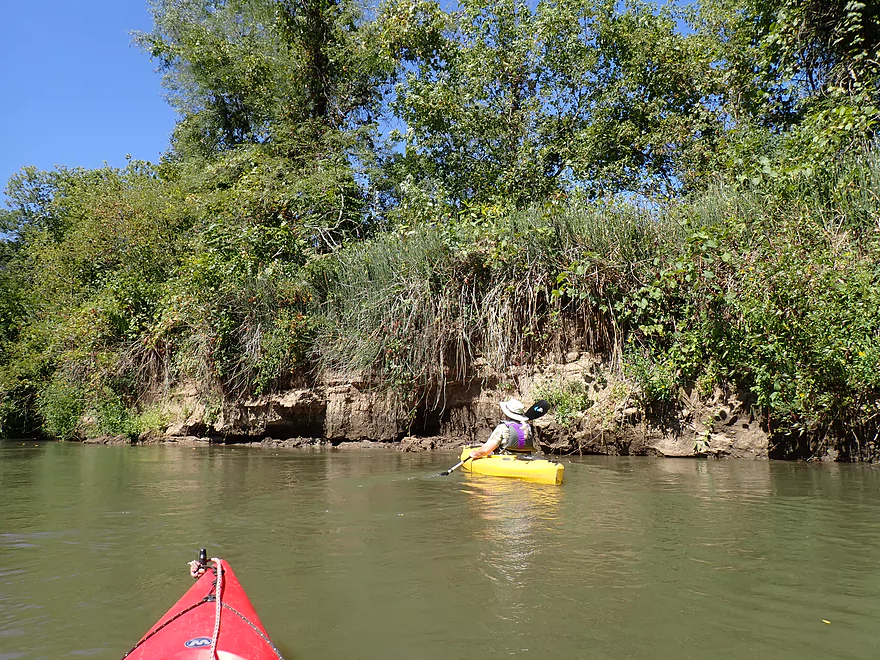
Quite a few mud banks
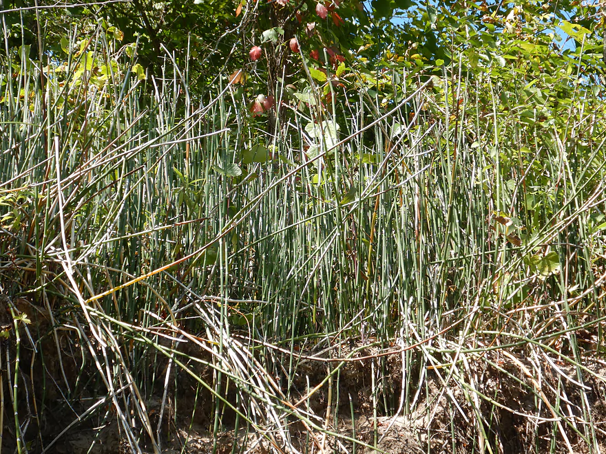
Scouring rush (also called horsetail or snake grass)
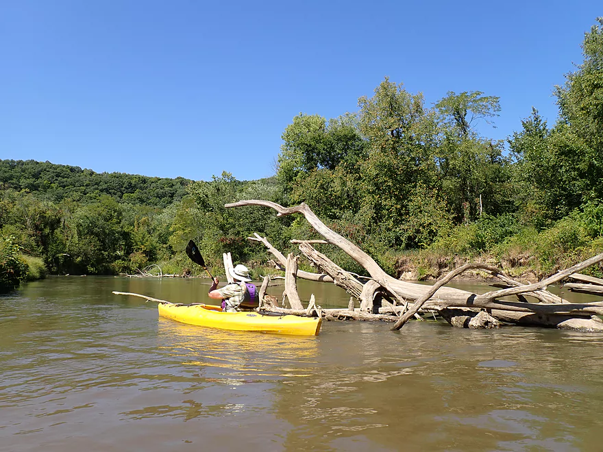
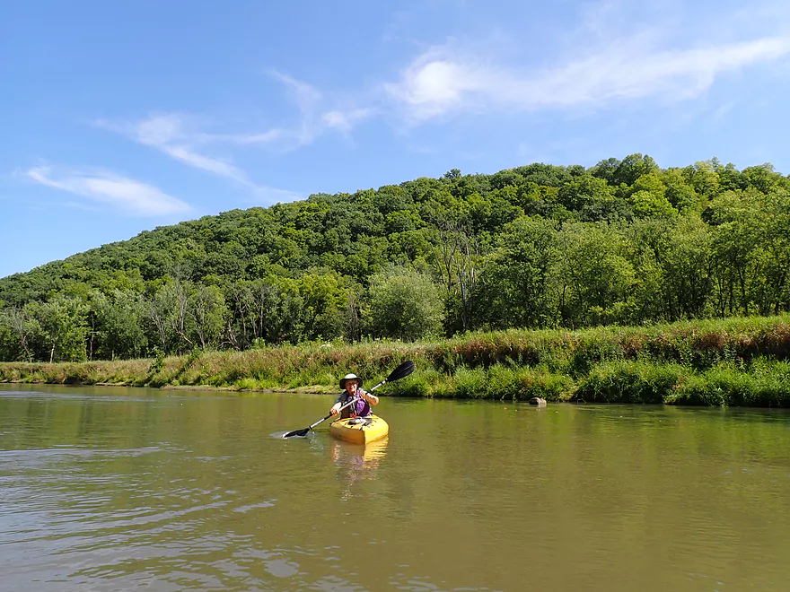
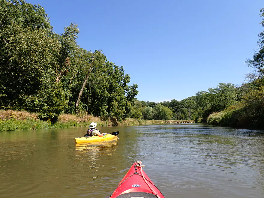
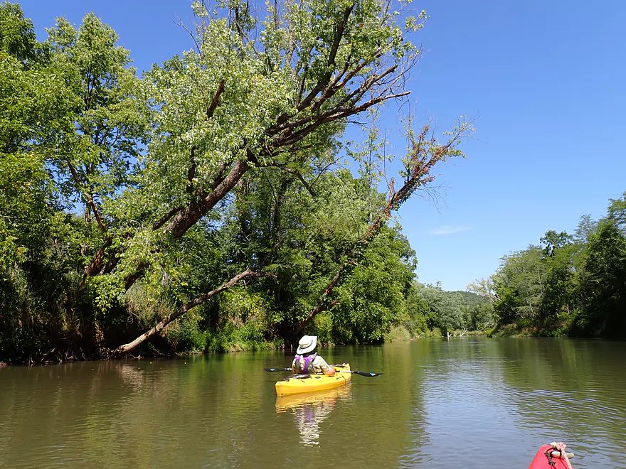
Deadfall was easy to avoid
Backlit branches
So many dead ash trees–the red-headed woodpeckers loved these
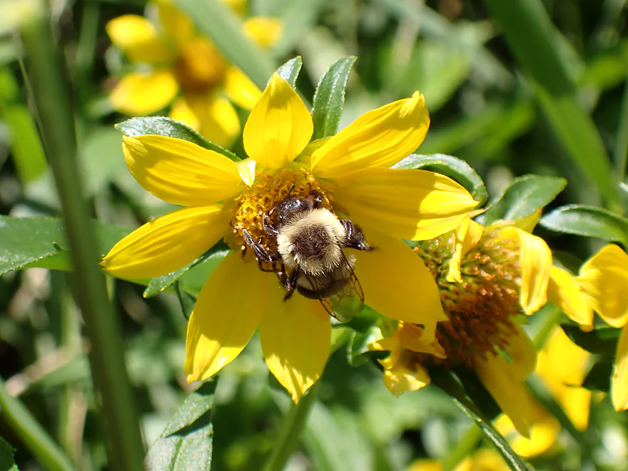
Bee having a snack
The area felt very remote–there were no signs of people on our entire trip
More mud banks
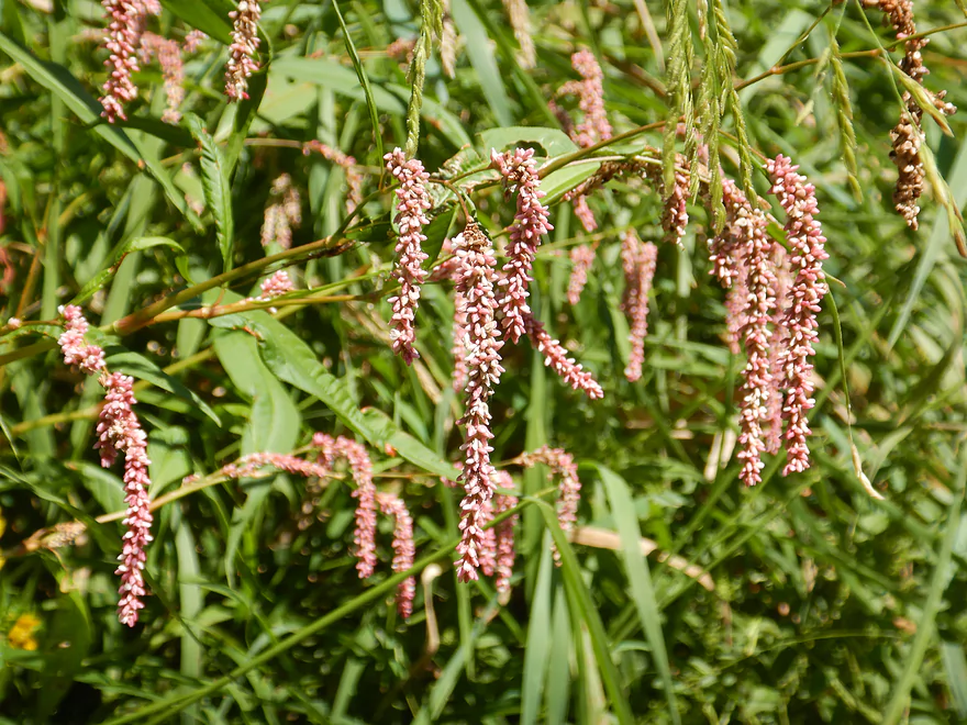
Smartweed
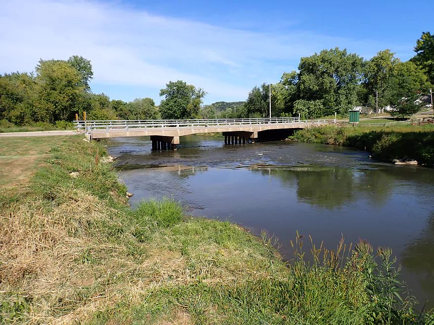
Taking out at Hwy 60
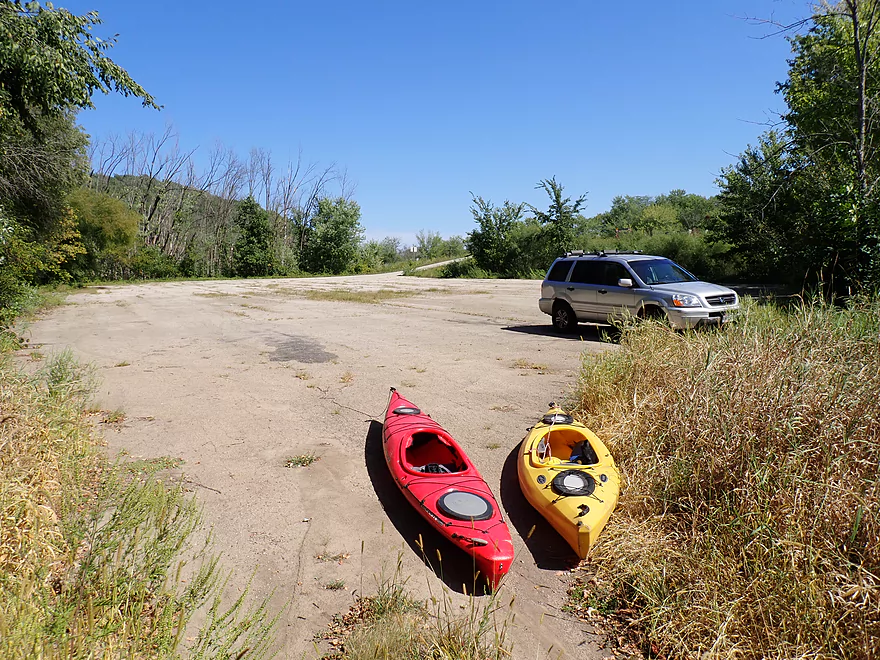
Huge landing parking lot which few use
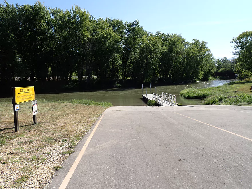
Scouting other landings…this is the downstream Wauzeka landing
Steuben (upstream from Plum Creek) has a great access
Taylor Ridge Road is scenic, but not a good access because of a fence
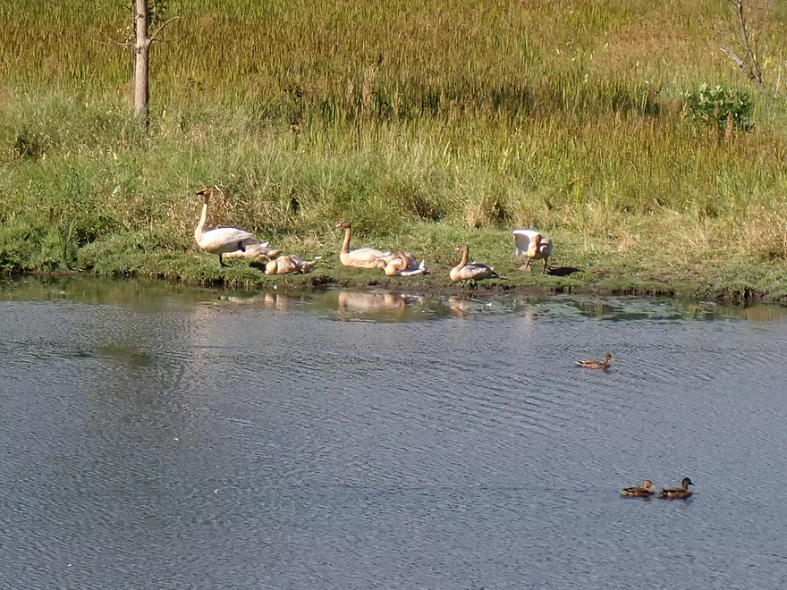
Surprised to see swans by the Kickapoo
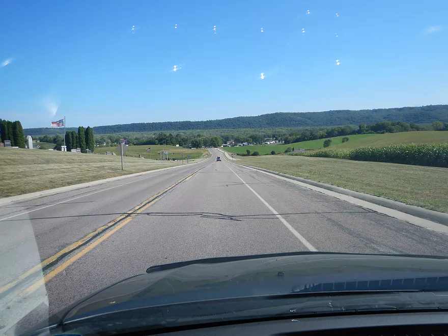
Scenic drive home
Kickapoo River – Plum Creek


The Lower Kickapoo is often spurned by paddlers in favor of the Upper Kickapoo. And rightfully so, as the Upper Kickapoo features fantastic cliffs and is one of the truly special water trails in the state. The cliffs and the magic of the Upper Kickapoo though largely peter out by Viola. So why do the Lower Kickapoo? Multiple reasons… For starters, it is a shorter drive for many kayakers. It’s also incredibly drought resistant and is easily navigable even in our current D4 exceptional drought. And lastly, it’s a new adventure for paddlers who have already explored much of the Upper Kickapoo and are looking for a less crowded alternative.
We looked at several ideas for a Lower Kickapoo trip. Steuben to Plum Creek would have been quite long, while Barnum to Steuben had a very annoying fence to deal with at Taylor Road. We settled on Plum Creek to Hwy 60, which had looked nice from previous scouting trips, and I knew it would be bookended by two nice landings.
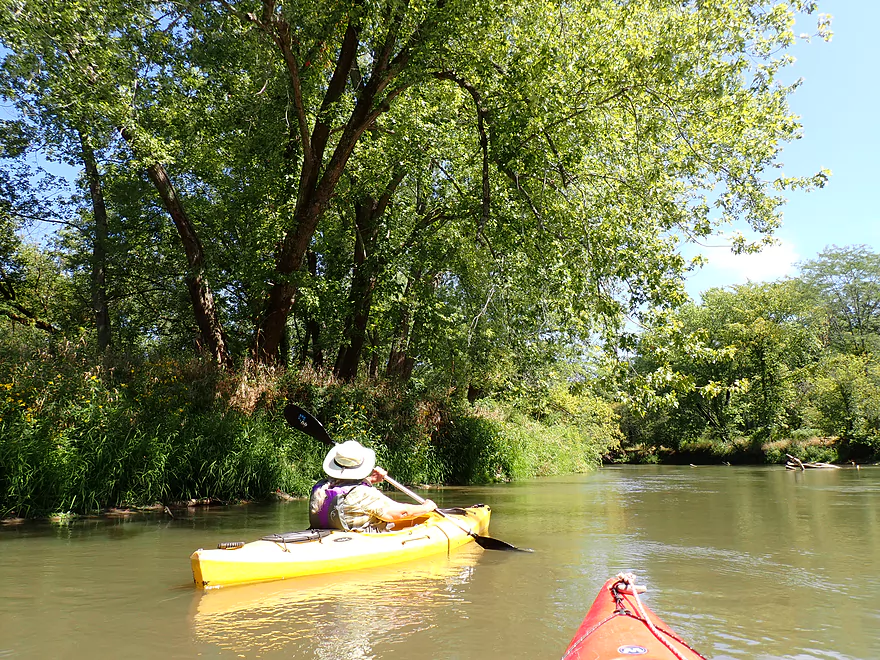
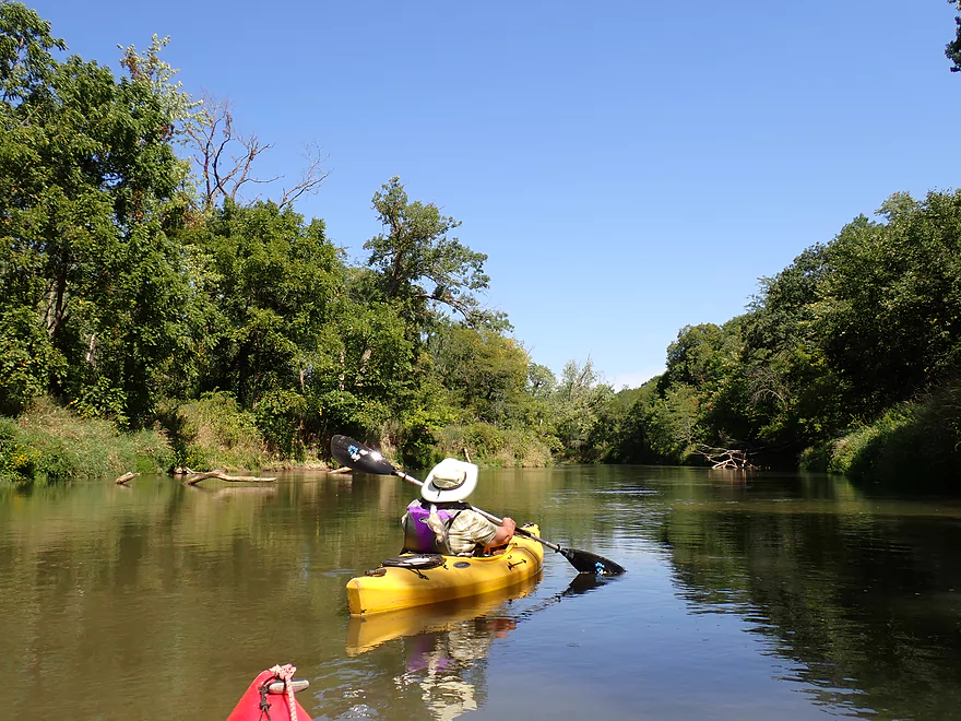
The first two miles of the trip after launching from the Plum Creek landing honestly weren’t that good. The water was turbid, fast, cold, deep (often over 5′), and filled with deadfall. The deadfall was all super easy to avoid…but it certainly wouldn’t be a trip you would want to attempt in low visibility. Most of the degraded banks were uninteresting, with large exposed “dirt cliffs” topped with disturbed soil species.
Small white signs were posted along the west bank after our put-in. The Mississippi Valley Conservancy, an organization which works to protect land in the Driftless Area, owns 5.5 miles of frontage along the west side of the river. The area east of this is owned by the DNR and is designated as the Kickapoo Wild Woods State Natural Area. It is also part of the Kickapoo River State Wildlife Area (Wauzeka Unit). Despite the majority of land in the area being part of protected natural areas, we did see cattle grazing up to the water in a few spots (but only at the beginning of our trip).
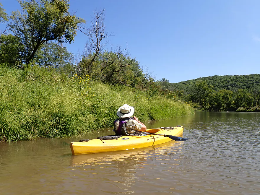
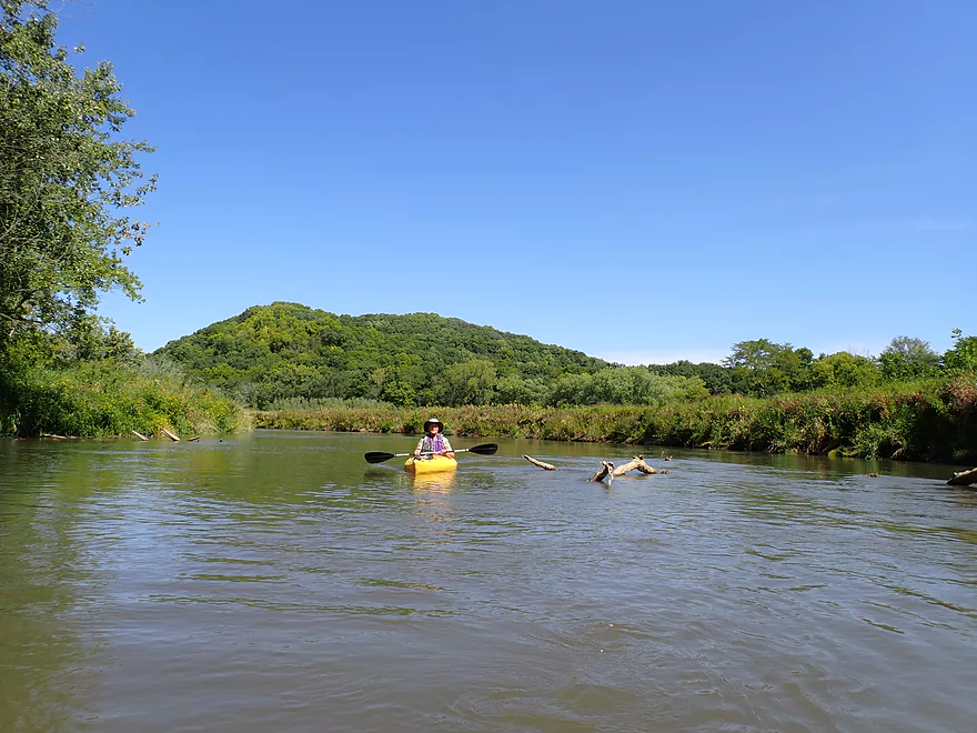
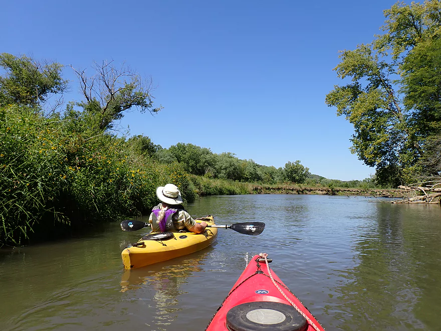
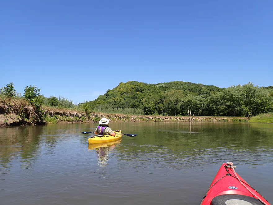
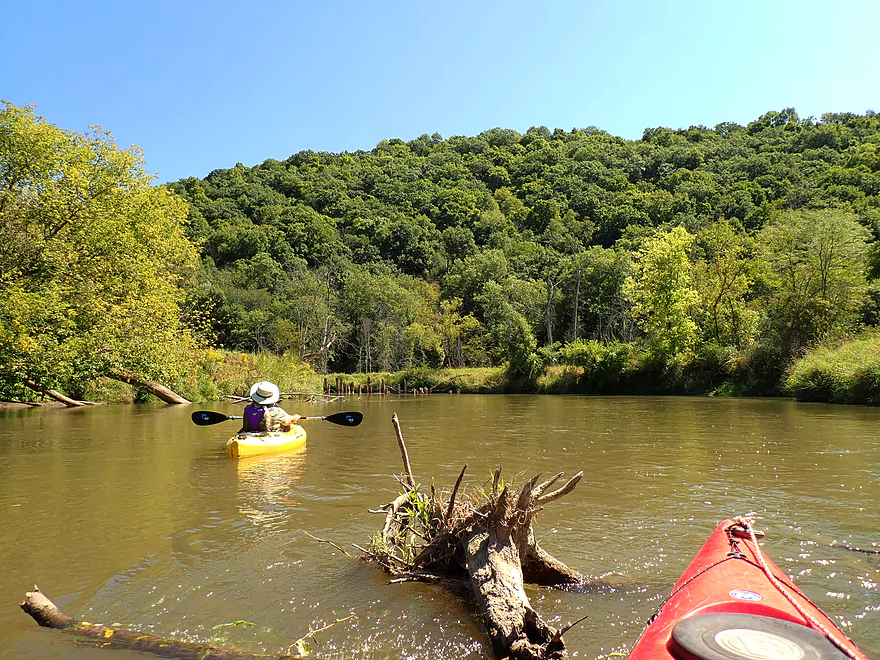
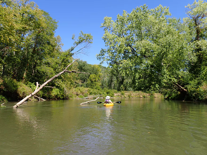
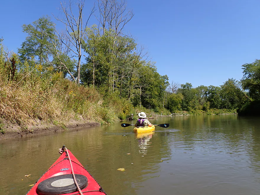
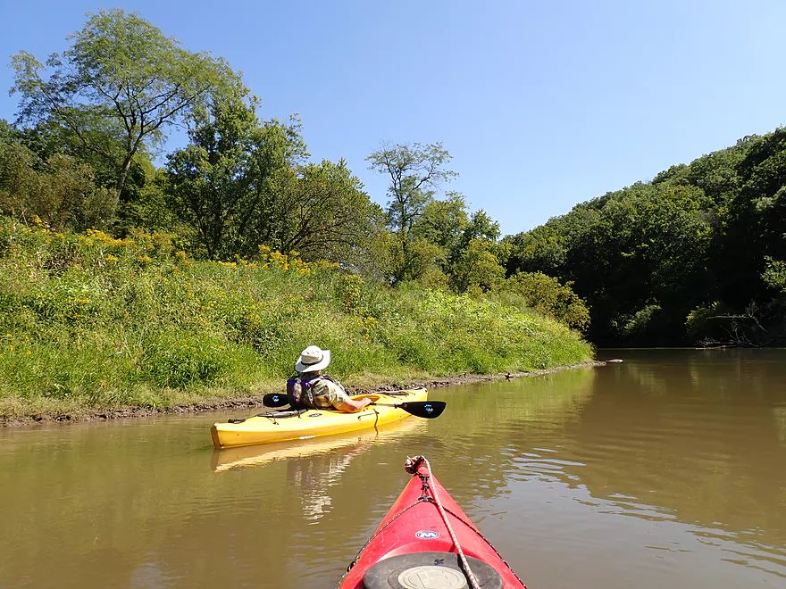
About a third of the way into the trip though, the paddle became much more interesting. The river started to flow through deeply dissected terrain with very steep ridges. It was impressive to see 250’+ little “mountains” poke their heads above the horizon line or appear as a surprise after rounding a sharp corner. These bluffs were terrific and are among the biggest in the Kickapoo watershed. Unlike other Driftless Area hills, these are much steeper, which gives them a unique character.
The bluffs were heavily wooded with oaks, basswood, maple, and lots and lots of walnuts. We even saw some honey locust trees next to the water–a tree which is found only along areas of the Wisconsin and Mississippi rivers. I think these hills could be an impressive sight in the fall when the leaves turn, making this a good fall paddle idea.
In one section of the river, we saw 10-12 red-headed woodpeckers. These are uncommon birds whose population is in decline, so this was a treat. The Lower Kickappo, in fact, is a birder’s mecca and is designated one of Wisconsin’s “Important Bird Areas” for its large number of resident and migrating bird species (including red-headed woodpeckers).
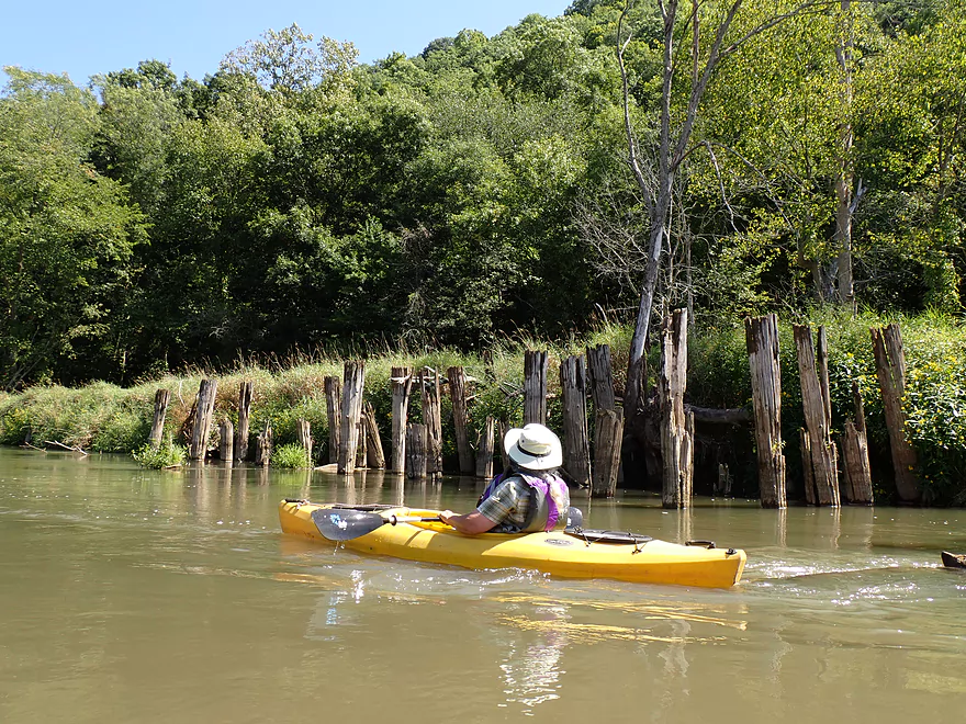
Toward the end of our trip we paddled past what looked like the remnants of an old railroad trestle. It turns out it was. At one time the Kickapoo Valley Railroad went from Wauzeka to La Farge, but flooding from the Kickapoo eventually made maintenance too costly and the line was shut down. The train was known as the “Stump Dodger.”
The trip ended sooner than expected at the Hwy 60 landing. This was a testament to the fast current…but also to the nice scenery in the second half which always seems to make trips go faster.
In summary this was a trip that turned out much nicer than we expected. No…it can’t be compared to the Upper Kickapoo as it lacks rock outcrops, but the Driftless Area ridges and lack of development (or really, almost any sign of humans) were really nice. If this same water trail were located in, say, Dane County or Milwaukee County, I suspect it would be very popular and a local favorite.
Sights included 5-6 kingfishers, a couple of wood ducks, cedar waxwings, and 10-12 red-headed woodpeckers. In a marshy area north of the put-in, we saw 8 young swans and 10 egrets.
Plum Creek Landing: This is a very good public access. Note, the shore directly across from the turn-around area is a bit steep for launching. But if you look upstream, there is a somewhat hidden gravel bar which is a much nicer launch spot.
Alt Put-ins:
- None really. I mean you could start at Steuben, but that would add an unrealistic 13 miles to a trip. It’s possible you could launch from Hwy 79, but that would still be a significant 10 mile+ add-on.
Hwy 60 Landing: This is a terrific public access for canoes and kayaks. It has a massive parking lot, but lacks evidence anybody uses it. Perhaps it originally was intended to be a boat landing? Note, Google Maps calls this the “Wauzeka Boat Landing” which is confusing. This access is NOT located in Wauzeka, while there IS a Kickapoo access located in Wauzeka but that is called the “Lowell Geitz Memorial Boat Landing”. Maybe they should have switched names?
Alt Take-outs:
- Lowell Geitz Memorial Boat Landing: 2.7 miles downstream from Hwy 60. This small leg is flatter and lacks big hills. Scenery is a mix of wetgrass and floodbottom forest. This is part of the Wauzeka Bottoms State Natural Area. Note to bike shuttlers…if your put-in is at Plum Creek, you actually save significant time shuttling by taking out later in Wauzeka instead of Hwy 60.
- Wisconsin River Take-outs:
- Adiantum Woods State Natural Area: 5.2 miles downstream from Hwy 60. This is a downstream access option on the Wisconsin River.
- Woodman Landing: 5.5 miles downstream from Hwy 60. This would require 2 miles of upstream paddling on the Wisconsin River to reach a take-out at Woodman.
Hwy 60 to Plum Creek Landing: 4.7 miles with 233′ of ascent. This is a mediocre bike shuttle. It does have a monster hill to climb north of Wauzeka. You can shave 1.6 miles off of a bike shuttle by actually taking out downstream from Hwy 60 using the Lowell Geitz Memorial Boat Landing.
Rentals/Shuttles:
- Wauzeka Canoe Rental: This is one of the few liveries on the Lower Wisconsin that doesn’t have a website, so I don’t know much about them. I think they would also service the Lower Kickapoo but you should call and ask before committing to a trip. 1304 E. Main Street, Wauzeka, WI 53826 – 608-875-6766.
Current: The current is surprisingly fast. A good trip for lazy paddlers.
Fences: The Kickapoo can have fence issues, but there are none here.
Logjams: While there are strainers, there were no logjams to portage. I think the Lower Kickapoo is too big for logjams.
Rapids: No rapids.
Strainers: There is a lot of deadfall in the fast current. As long as you are alert and sober, and water levels low, strainers are extremely easy to avoid. But if you were careless and let part of your boat hit a downed tree in fast current, your boat could stop, turn sideways, catch the current, and flip. I definitely recommend wearing a life jacket on this trip.
Wind: We did this trip with a strong 10 mph south to north headwind. But surprisingly it didn’t affect us much. This is likely because the steep bluffs and high river banks provide a degree of protection for paddlers.
Closest Gauge: Kickapoo River @ Steuben
Trip Depth: 445 CFS or 6.19′
Navigability Estimates: Note these are just rough estimates. Always use your own judgement.
- < 6.5′: Relatively low, but still plenty deep. I don’t think this leg ever gets too low to paddle.
- 6.6-6.7′: Average depth.
- 6.8-7.0′: Above average depth.
- 7.1-7.4′: High depth.
- 7.5’+: Very high depth. The fast, high current combined with the strainers could create dangerous conditions for paddling.
Quick Overview
- Wilton to Ontario: 12 miles. This stretch is seldom paddled, but is cleaner and faster than downstream legs. Those willing to endure weedy bridge accesses and occasional snags will be rewarded with spectacular outcrops. A very underrated part of the river.
- Ontario to Rockton: 13.5 miles. This is the most popular section for kayaking on the river (if not the entire state). Highlights include many spectacular sandstone outcrops. This stretch can easily be subdivided. Shuttle services are plentiful, but this leg can get crowded and noisy during summer weekends.
- Rockton to La Farge: 11 miles. This is the second most popular stretch of the river. While the outcrops here aren’t as numerous as the Ontario leg, they do tend to be larger and more impressive.
- La Farge to Mouth: ~90 miles. After La Farge there are few rock outcrops and the river becomes much less interesting. The Lower Kickapoo is a generic hardwood floodplain that is at best a mediocre paddle.
- Tributaries:
- Kickapoo River – West Fork: While lacking the outcrops of the main branch and a bit shallow in spots, this is a very underrated river with many fun rapids.
- Billings Creek: I actually like this creek better than the main river itself. There are just as many outcrops, and the water and banks are much cleaner.
- Tainter Creek: While not very big and lacking in outcrops, it’s still a cool creek with very swift current.
Detailed Overview
- Upstream from Lincoln Ave: The river is likely too small and degraded by open pasture to have much appeal for kayaking. Although "Kickapoo Springs" (the primary source of the river and a public DNR area) might be interesting.
- Lincoln Ave to Keystone Road: 2.5 miles. River is small (likely too small for most paddlers) and more scruffy with fewer outcrops. Figure 1-2 logjams and 3 outcrops. Several of the Elroy Sparta Trail bridges are quite scenic/rustic. High water will be required to do this stretch.
- Lincoln Ave to Hwy 131 (East of Midge Road): 6.3 miles.
- Lincoln Ave to Hwy 71: 1.6 miles. Section includes five outcrops including one really nice one. River is shallow here with many Class 1 rapids. There is one strainer that has to be portaged, but no other logjams. I encountered a bull on this stretch (here) which might be a deal breaker for most paddlers. You could possibly portage around the farm in question along the Elroy Sparta Trail but it would be a long and difficult portage.
- Hwy 71 to Wilton Campground/Library: 0.7 miles. A nice stretch with ~3 mediocre outcrops and one really nice one. Water clarity is stunning here. There is a low tree that requires some tight ducking to get under.
- Wilton Campground/Library to Hwy 131(by Posey Creek): 1.4 miles. Less attractive stretch but still ~4 mediocre outcrops. There is a serious logjam by Water Street that must be portaged.
- Hwy 131 (by Posey Creek) to Hwy 131 (by Mica Rd): 1.3 miles. A terrific stretch with scenic pine trees, several mediocre outcrops and one fantastic sandstone outcrop.
- Hwy 131 (by Mica Rd) to Hwy 131 (East of Midge Rd): 0.7 miles. More of a scruffy stretch, but still a few mediocre outcrops. The Black Valley hills in the distance are very scenic from this leg.
- Hwy 131 (East of Midge Road) to Hwy 131 (near Nicollet Ave): 4.1 miles.
- Hwy 131 (east of Midge) to Hwy 131 (by Michigan Ave): 0.5 miles. A good leg with a one nice set of outcrops.
- Hwy 131 (by Michigan Ave) to Hwy 131: 0.6 miles. Another good leg with 3 outcrops. Some minor rapids including a 4-6" ledge.
- Hwy 131 to Hwy 131 (by Nisswa Rd): 0.6 miles. One of the best legs on the Upper Kickapoo which features 6 noteworthy outcrops and terrific ice flows in February and early March.
- Hwy 131 (by Nisswa Rd) to Hwy 131 (by Nordale Ave): 1.1 miles. Not as scenic as other legs with messy shorelines and eroded banks. There are still a few nice outcrops.
- Hwy 131 (by Nordale Ave) to Hwy 131 (by Nicollet Ave): 1.3 miles. Another one of the Upper Kickapoo's best legs with ~6 outcrops including a small natural bridge one can paddle through.
- Hwy 131 (near Nicollet Ave) to Ontario: 5 miles.
- Hwy 131 (by Nicollet Ave) to Hwy 131 (Oil City): 2.3 miles. Two long stretches of bluffs contain great outcrops.
- Hwy 131 (Oil City) to Hwy 131 (Kickapoo Wild Adventures): 1.4 miles. Terrific stretch with two major outcrops. One set of Class 2 rapids.
- Hwy 131 (Kickapoo Wild Adventures) to Ontario (Brey Valley Road Park): 1.5 miles. One set of outcrops.
- Ontario to Hwy 131/Bridge #4: 3.6 miles. A more open and flatter stretch of the Kickapoo. There are still 3-4 outcrops. This is THE most popular leg on the entire river.
- Bridge #4 to Bridge #7: 6.0 miles.
- Bridge #4 to Wildcat Landing: 3.1 miles. A super popular stretch and the most scenic on the Kickapoo. River flows past steep hillsides and many outcrops (at least 16).
- Wildcat Landing to Bridge #5: 0.9 miles. River opens up a bit, but still three super sandstone outcrops.
- Bridge #5 to Bridge #7: 2.1 miles. A good stretch with seven major outcrops and one cave.
- Bridge #7 to Rockton/Bridge 12: 5.1 miles.
- Bridge #7 to Bridge #8: 1.2 miles. From bridge #7 onward, the Kickapoo becomes much less interesting. There are still some good spots though. This stretch has maybe 3 outcrops.
- Bridge #8 to Bridge #10: 2.5 miles. A good stretch with 5-6 outcrops.
- Bridge #10 to Rockton/Bridge #12: 1.4 miles. This stretch is more open, but still perhaps 3-4 outcrops.
- Rockton to La Farge: 10.4 miles.
- Rockton to P/Bridge 14 Canoe Landing: 2.4 miles. An ok stretch with 3-4 outcrops.
- P/Bridge 14 Canoe Landing to La Farge/Bridge 14 Landing: 8.0 miles. A great stretch with a covered bridge and 4-5 outcrops...several of which are huge (the largest on the river).
- La Farge to Hwy 131 (by Ski Hill Road): 6.8 miles. Nice section but with a few jams.
- Hwy 131/Ski Hill Road to Viola (Banker Park): 7.0 miles. Maybe 2 bluffs, but mostly open I think. Have been told there are 26 portages between La Farge and Viola, so beware.
- Viola to Hwy 131 - Bridge 1: 5.8 miles. Maybe one outcrop and 14 major logjams.
- Hwy 131 - Bridge 1 to Hwy 131 - Bridge 2: 4.3 miles. Maybe one outcrop and 13 major logjams.
- Hwy 131 Bridge 2 to Readstown Tourist Park: 3.0 miles. Maybe one outcrop and three major logjams. The river grows significantly with the addition of the West Fork.
- Readstown Tourist Park to Soldiers Grove: 6.9 miles.
- Readstown to Hwy 61: 3.1 miles. A surprisingly nice stretch with impressive hills and good current. On the downside there is a lot of tree debris although it is always avoidable. Hwy 61 is not a good access.
- Hwy 61 to Soldiers Grove: 3.8 miles. Not as good as the previous leg with fewer hills, muddier banks, and slower current but still not bad. The highlights include a few impressive bluffs and two minor rapids in Soldiers Grove.
- Soldiers Grove to Hwy B: 9.0 miles. I doubt there are logjams, but I think this stretch would not be very interesting. The river flows through one of the wider flood bottoms on the river.
- Hwy B to Gays Mills: 4 miles. Probably not interesting. A dam and flowage to contend with near Gays Mills.
- Gays Mills to Hwy S: 4.6 miles.
- Hwy S to Haney Valley Road: 5.8 miles.
- Haney Valley Road to Taylor Ridge Road: 3.6 miles. Likely an ok prospect. Note, Taylor Ridge Road is aggressively fenced by the local farm and would be a difficult access.
- Taylor Ridge Road to Steuben Landing: 5.0 miles. A good prospect with likely some nice bluffs. Note, Taylor Ridge Road is aggressively fenced by the local farm and would be a difficult access.
- Steuben Landing to Hwy 179: 2.9 miles. A mediocre prospect.
- Hwy 179 to Plum Creek Landing: 11.8 miles. A good prospect with nice bluffs.
- Plum Creek Landing to Hwy 60: 6.7 miles. Starts uninteresting with fast current, but features some surprisingly nice bluffs and overall was a decent trip.
- Hwy 60 to Lowell Geitz Memorial Boat Landing: 2.7 miles. This stretch mostly lacks interesting bluffs but does feature wetgrass and floodplain forests as part of the Wauzeka Bottoms State Natural Area.
- Take-out options on the Wisconsin River:
- Lowell Geitz Memorial Boat Landing to Adiantum Woods State Natural Area: 2.5 miles. This is mostly a downstream trip on the Wisconsin River.
- Lowell Geitz Memorial Boat Landing to Woodman Landing: 2.8 miles. This is mostly an upstream trip on the Wisconsin River .
- Lowell Geitz Memorial Boat Landing to Adiantum Woods State Natural Area: 2.5 miles. This is mostly a downstream trip on the Wisconsin River.
Trip Map
Overview Map
Video
Photos Size: