
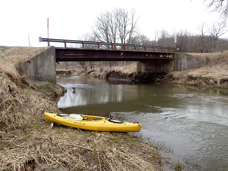
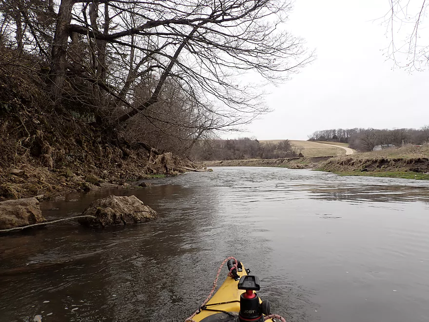
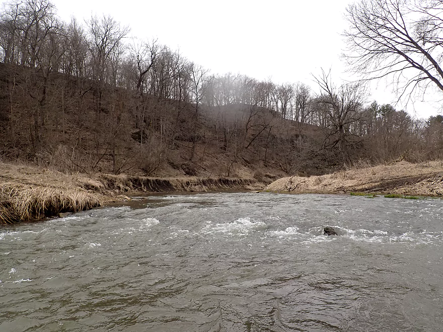
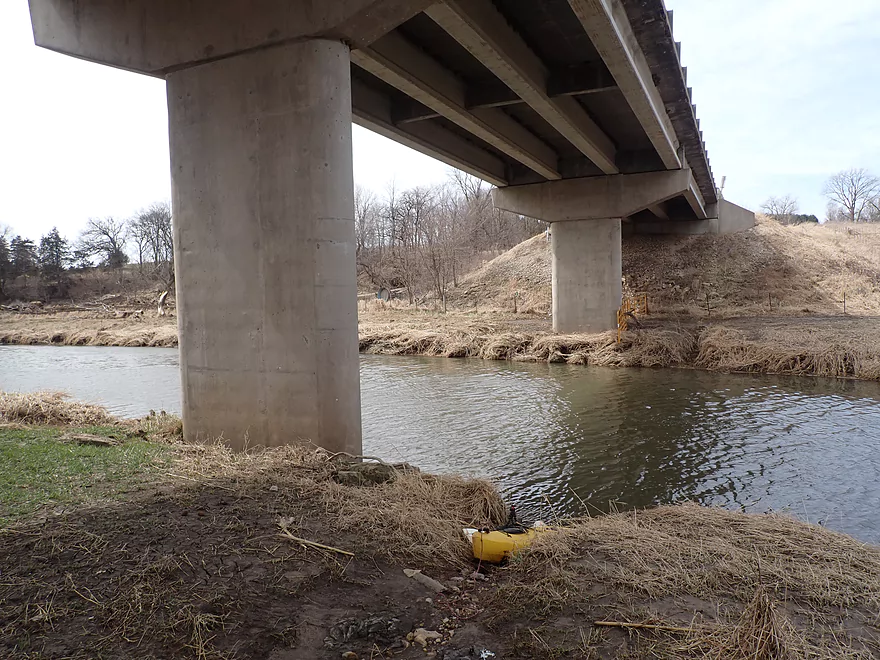
Putting in at Coon Hollow Road
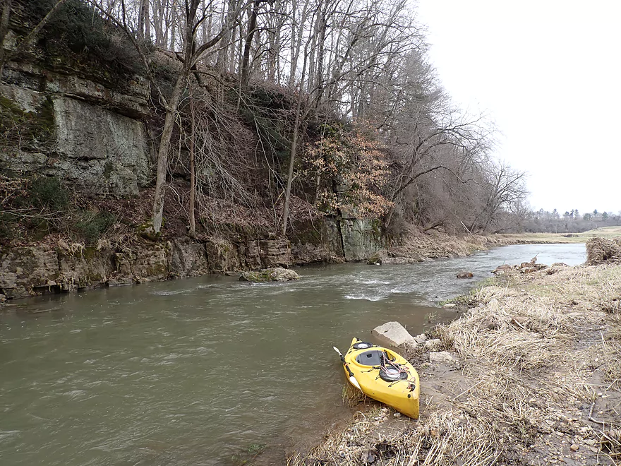
Nice outcrop just downstream from the bridge
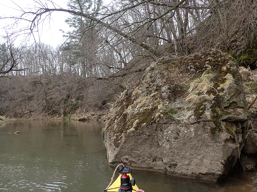
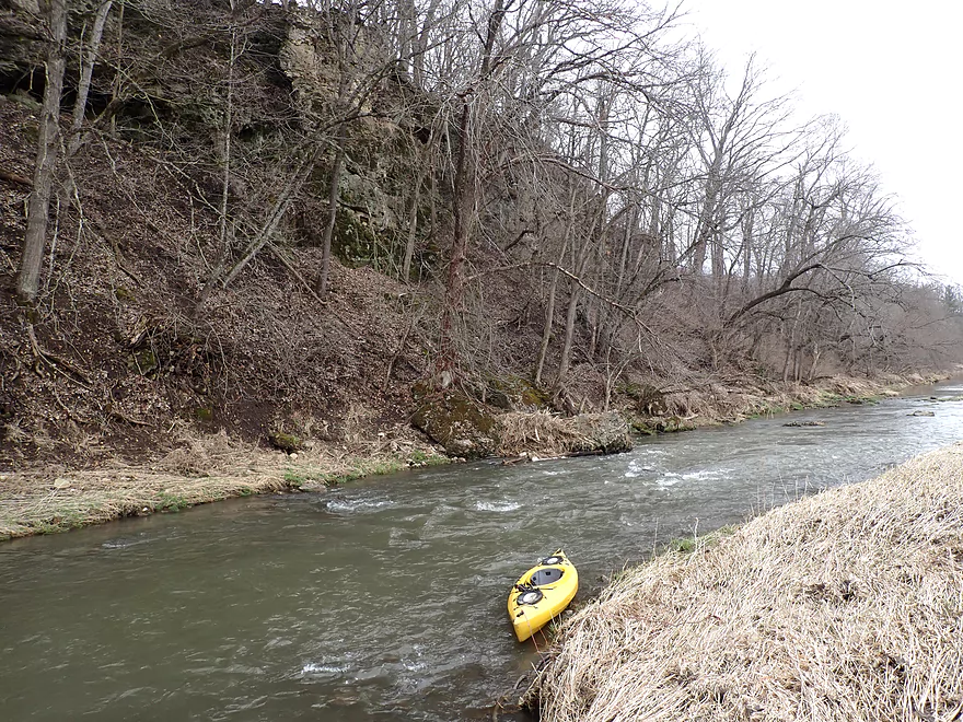
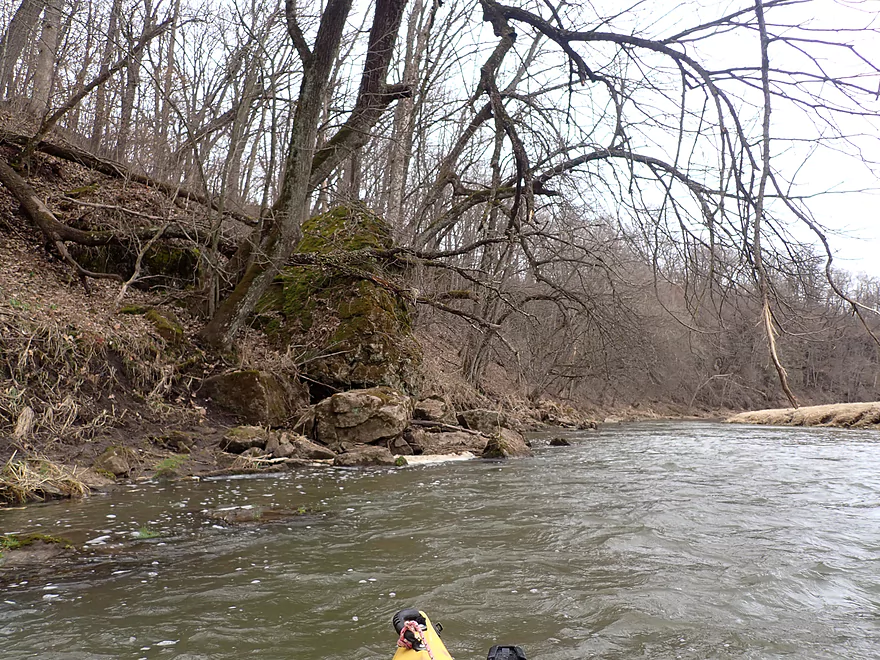
Very rugged limestone
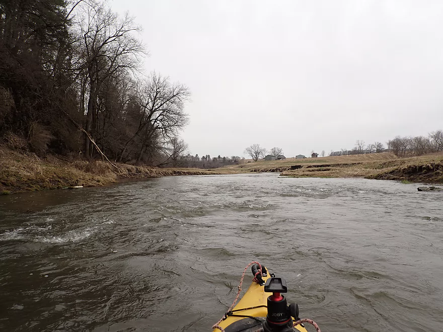
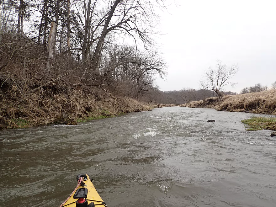
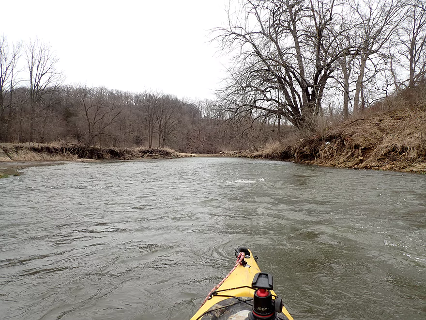
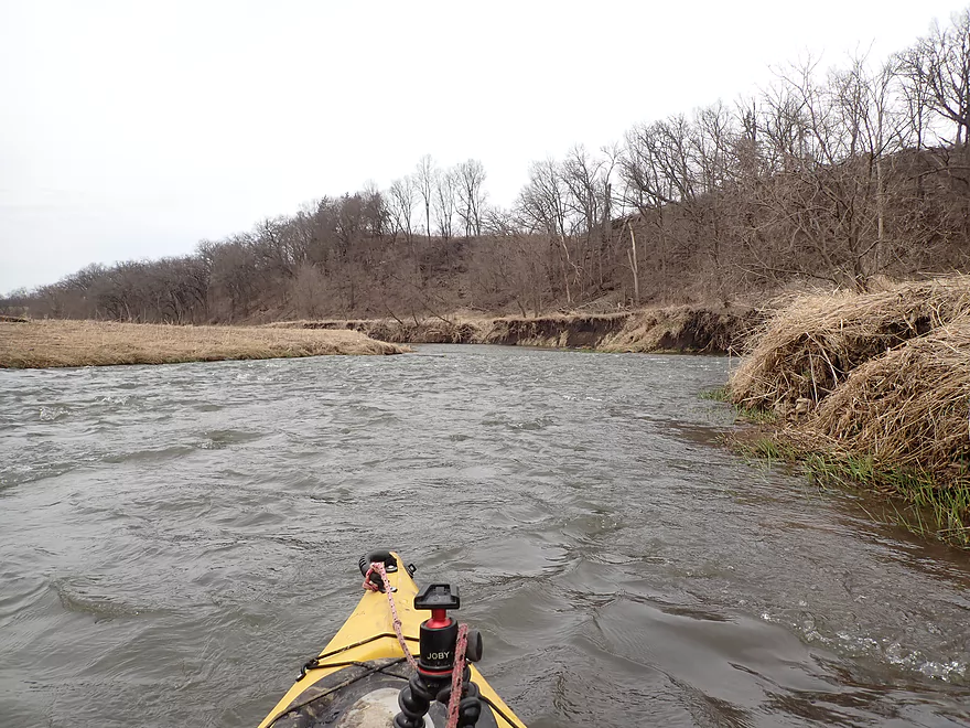
One of countless rapids
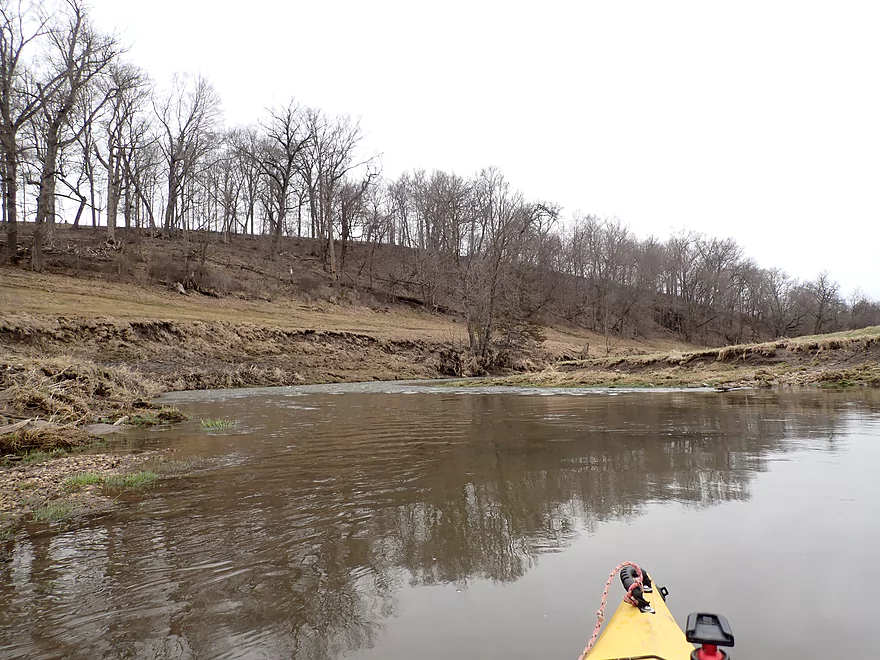
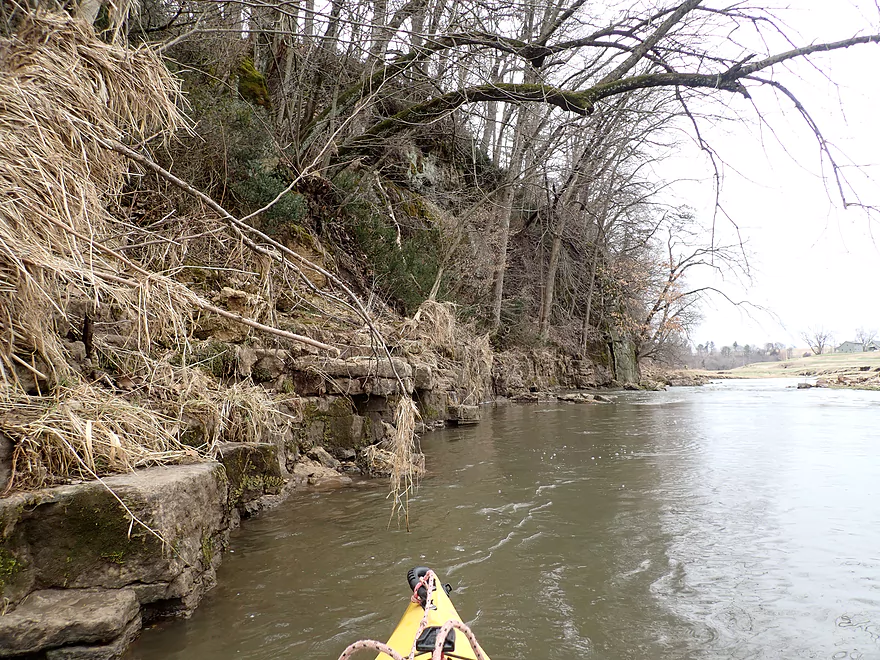
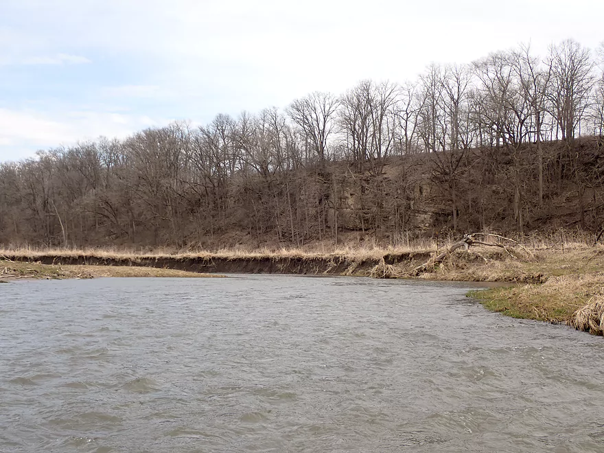
Banks were degraded from open pasture
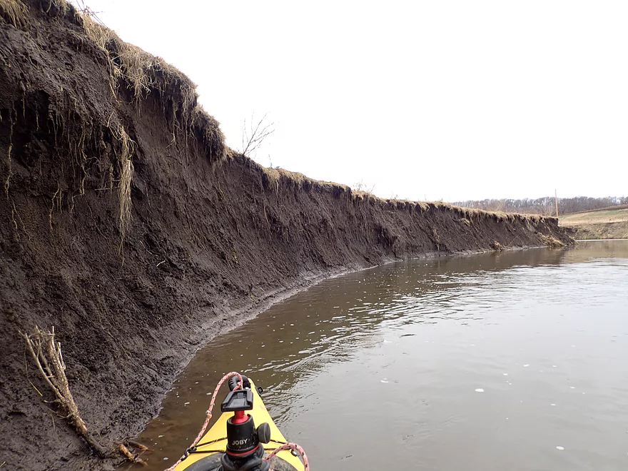
Some of the mud banks were huge
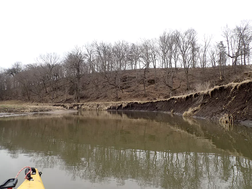
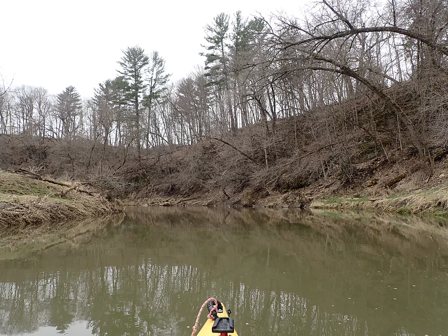
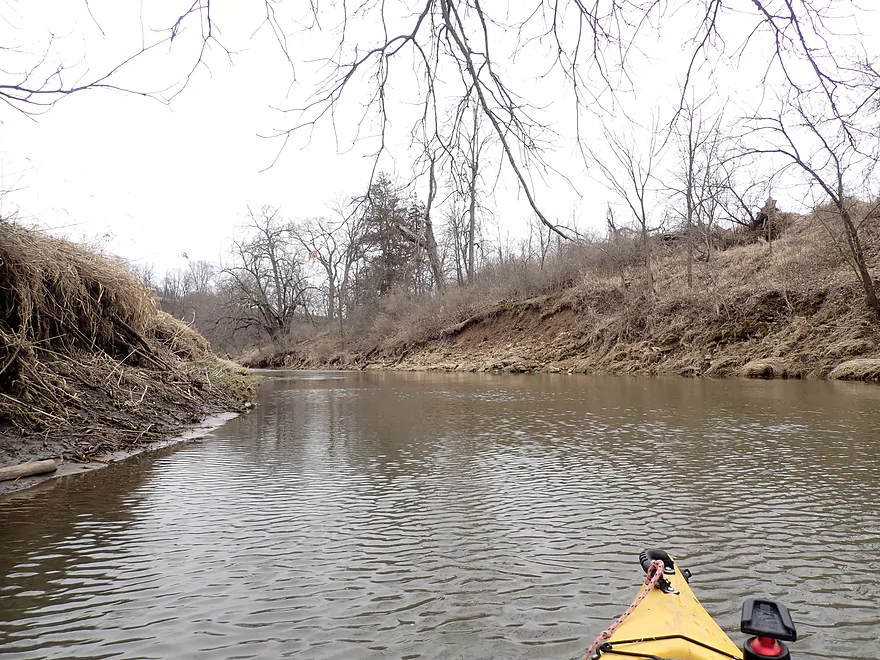
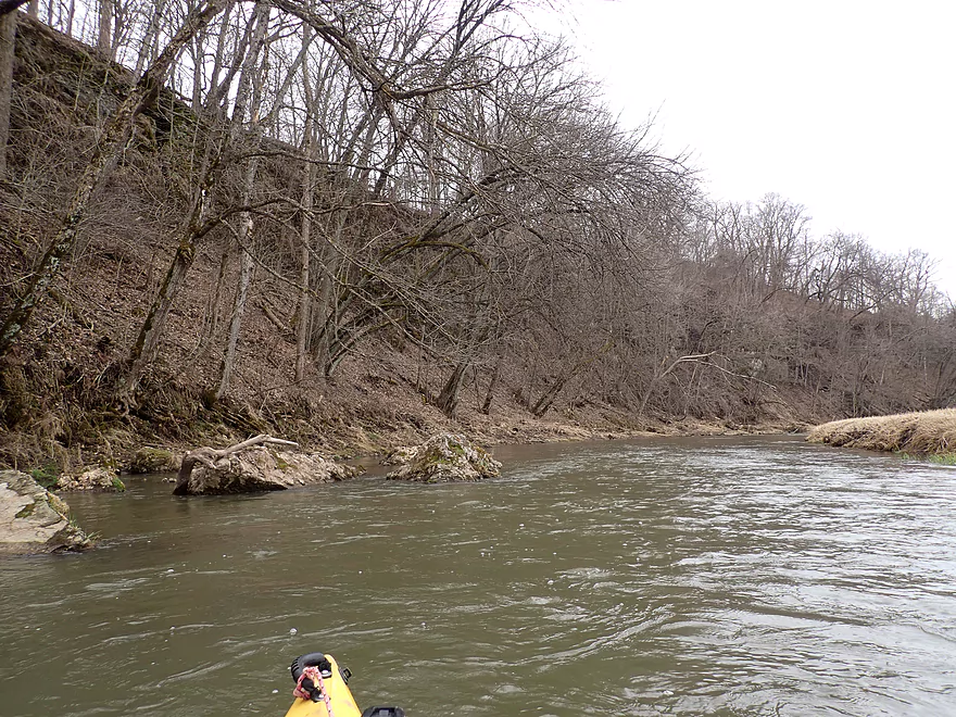
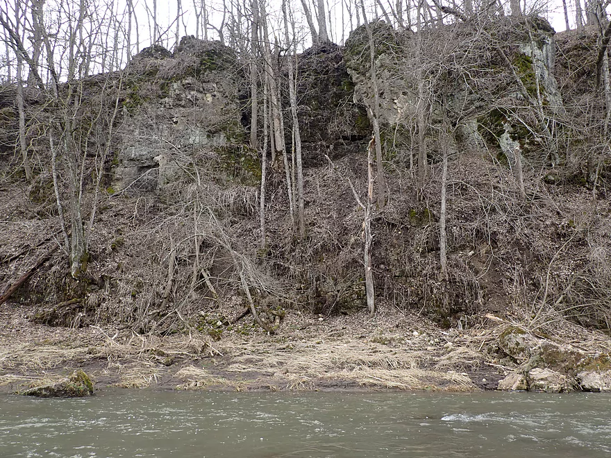
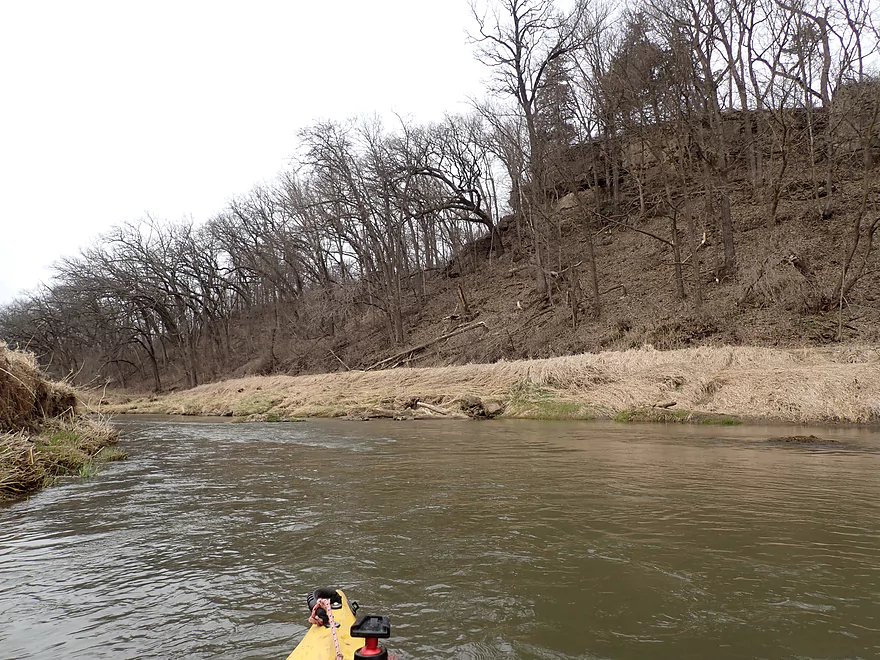
Nice bluff on the east shore
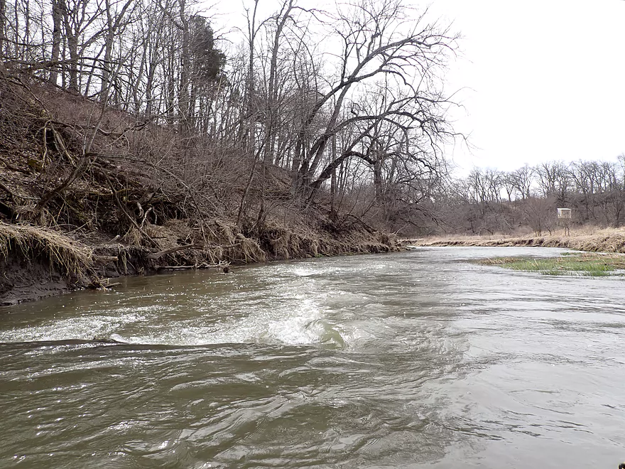
More rapids
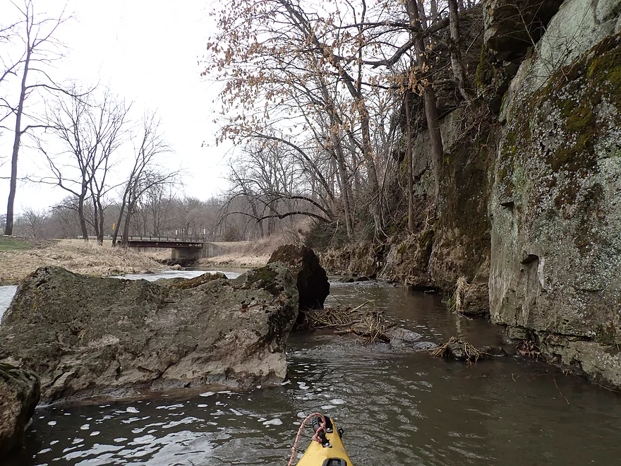
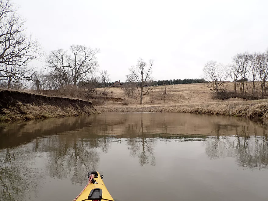
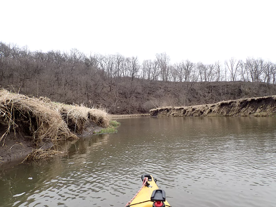
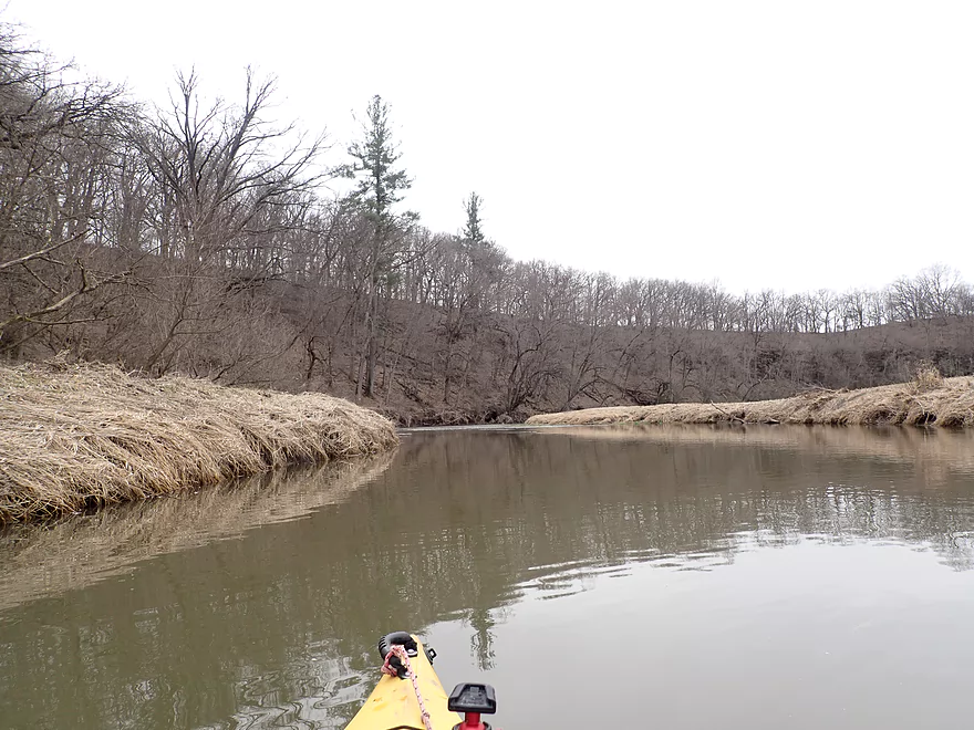
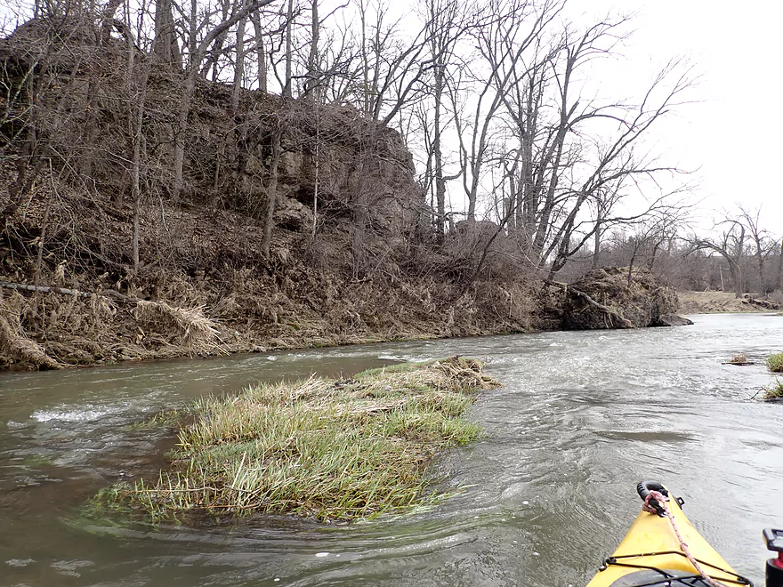
Entering a horseshoe bend
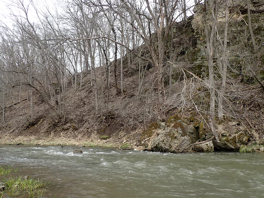
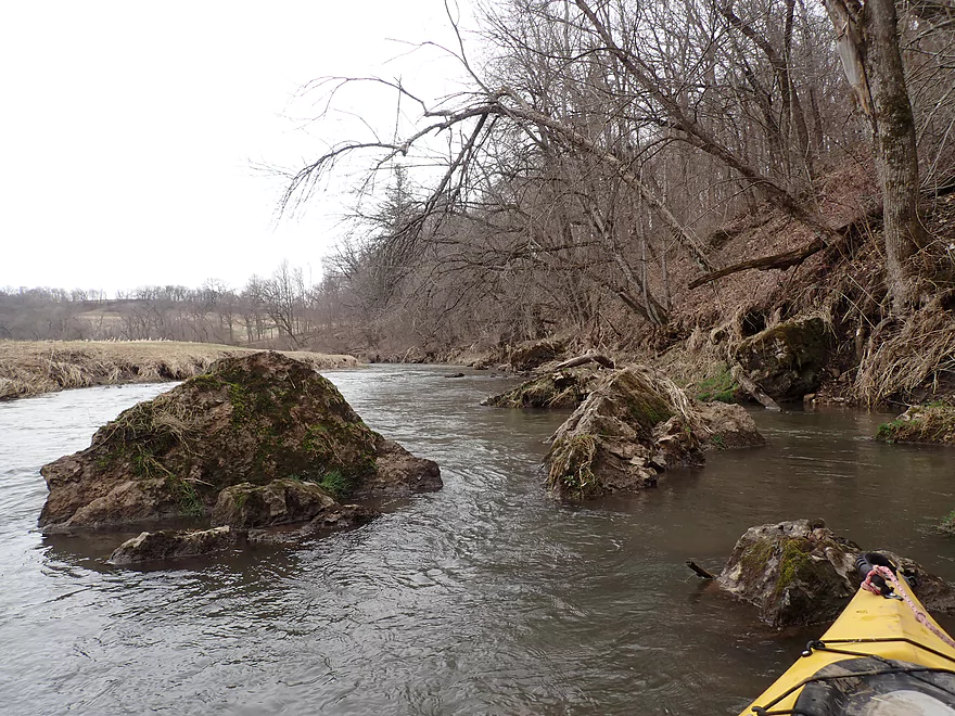
Large boulders that fell from the bluff
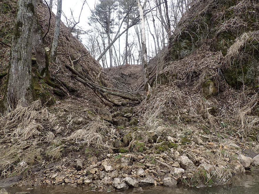
Neat little gully
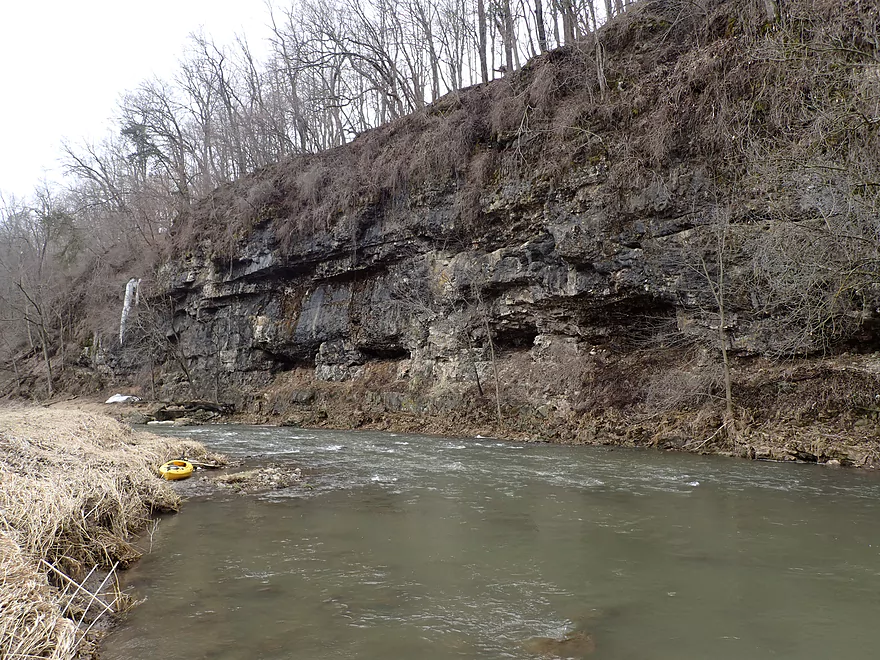
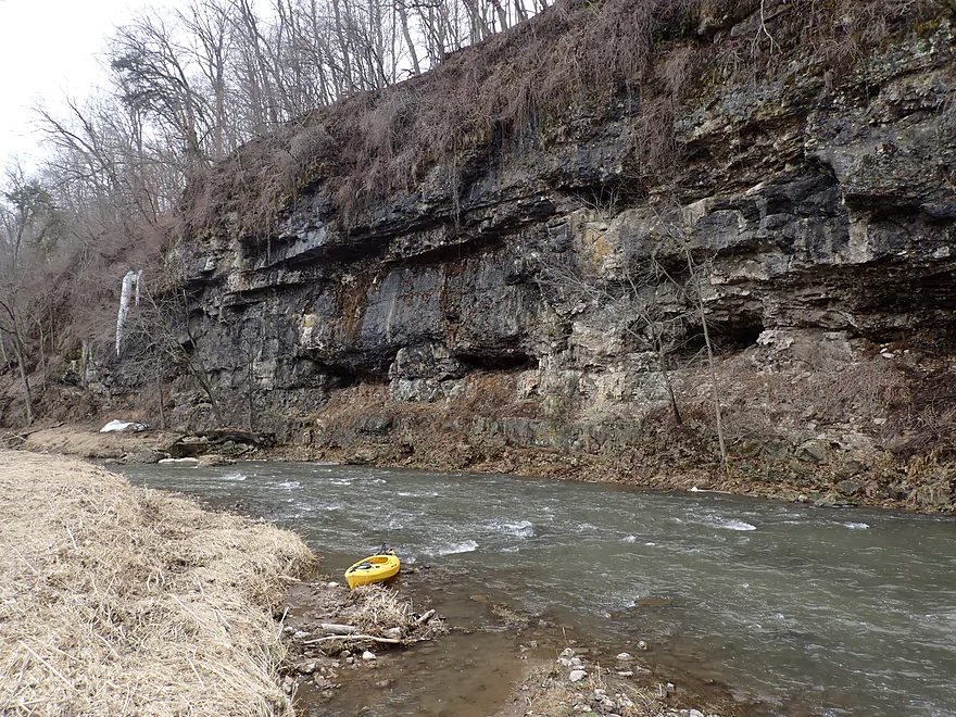
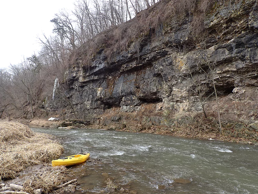
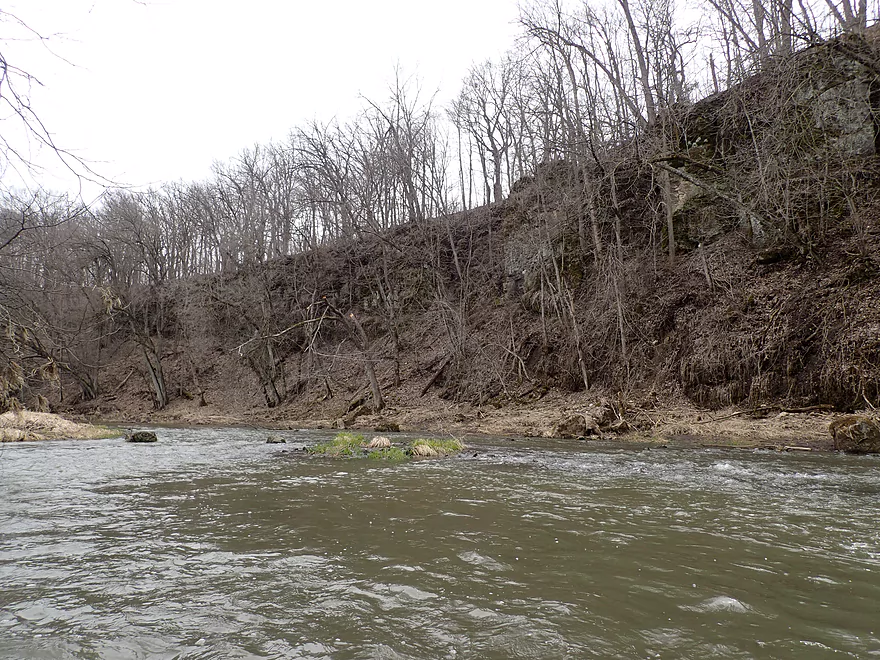
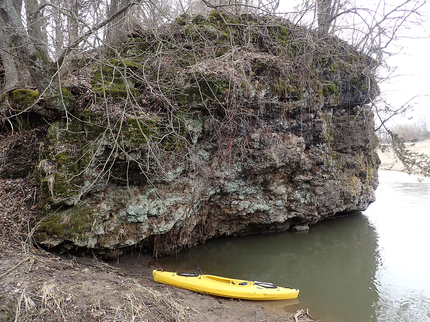
The largest outcrop of the trip
Super cool!
Fun rapids at the base
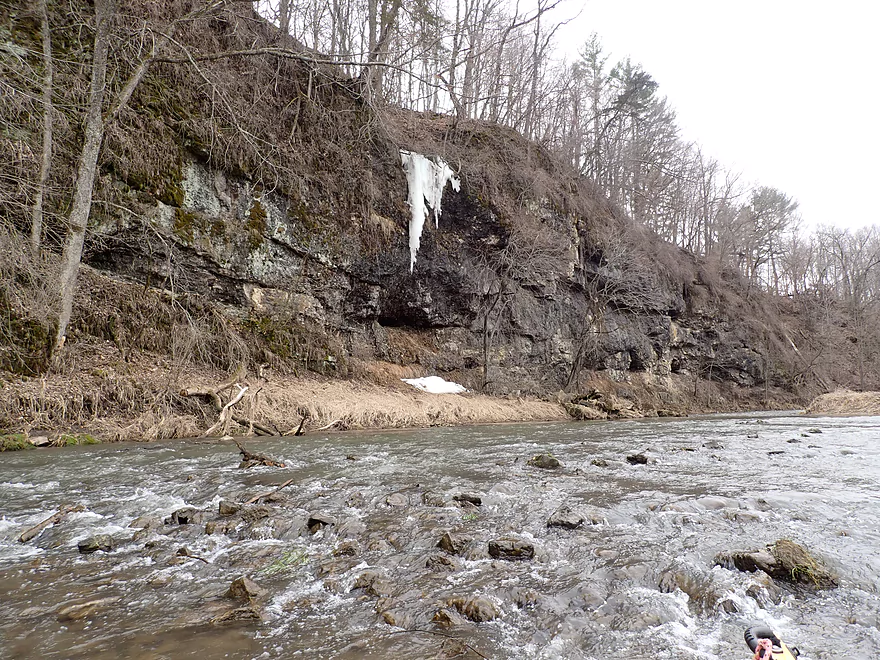
A surprise ice flow
Leaving the horseshoe bluff behind
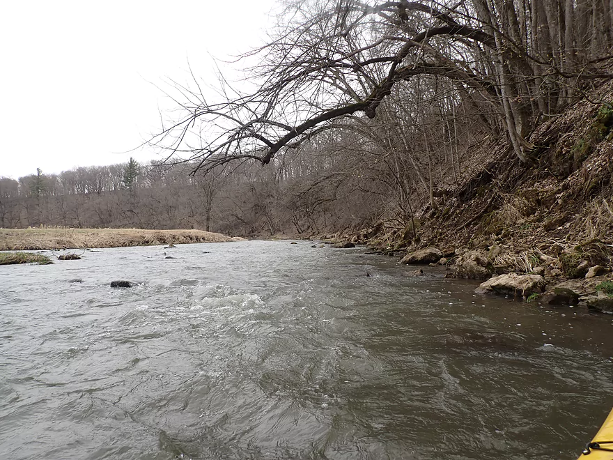
An open stretch of the river
River stays fast
Another large bluff redirects the Platte
Another nice outcrop
Approaching another large bend in the river
Great stretch
More boulders that escaped the blufftops
Some of these rock formations would be tough to see in the summer
Leaving the bluff behind
Fewer outcrops after this but still many rapids
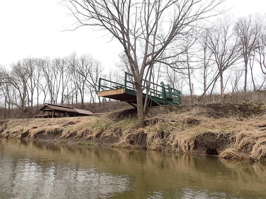
A surprise pavilion and fishing pier
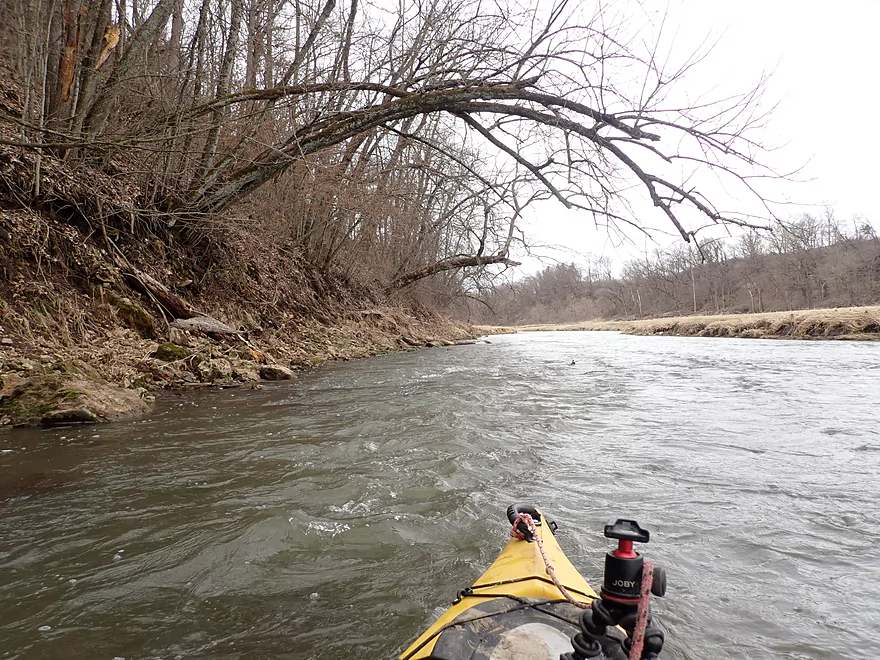
A small strainer on the left wasn’t too difficult to get past


Entering open pasture again
Flooded grass shows how high the river is (normally it’s too shallow to paddle)
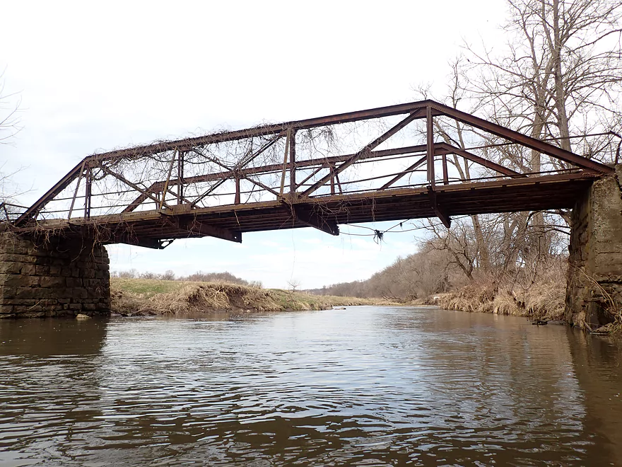
An attractive old iron trestle bridge
Terrific texture on this limestone boulder
Taking out at Hwy A
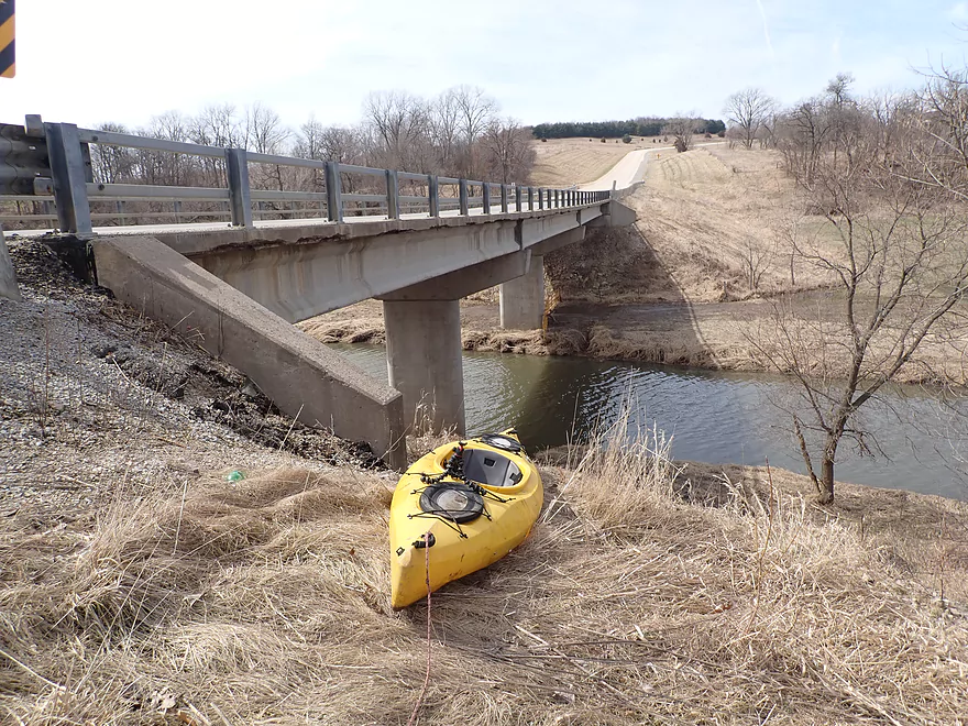
Worst take-out ever
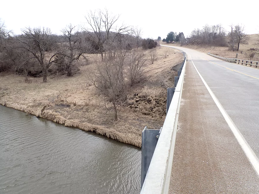
Reverse view…fence, steep slope, and long guardrail were difficult to get past
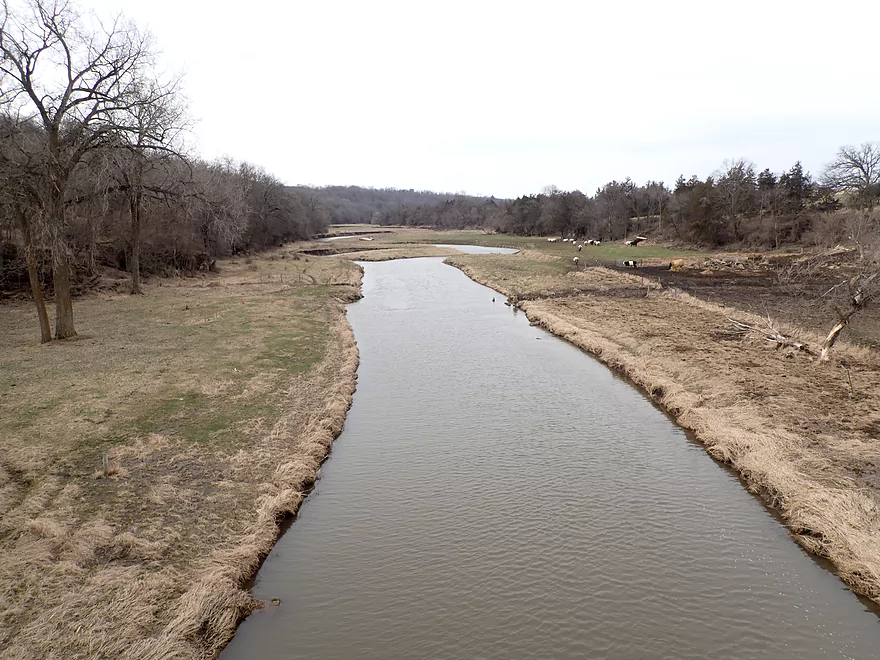
View downstream from the Hwy A bridge (a trip I did years ago)
Platte River – Coon Hollow Road


The Platte is one of the great paddling rivers of Southern Wisconsin. But most kayakers start a trip near the river’s middle, by Ellenboro. This trip instead was on the Upper Platte which few paddle. The goal was to determine if it would be navigable and scenic for other kayakers.
I started at Coon Hollow Road which was a pleasant and scenic bridge access. Just downstream from the bridge are inviting rapids and an attractive limestone outcrop. The limestone would continue off and on for the next half mile along the east bank. While scenic, I wasn’t in a great mood to appreciate it because the weather was windier, colder, more overcast, and clammier than expected. I was also bummed to see how muddy and degraded the banks were. Like many Grant County rivers and streams, cattle are allowed free access into the Platte where they trample/eat plants that would otherwise stabilize the river banks.
The trip highlight would come soon enough as the Platte is redirected sharply west-to-east by an impressive horseshoe bend. Here there was a fantastic bluff with a series of limestone cliffs at the base. The best cliff at the end of the bend was a 90′ high limestone monster. If I see big cliffs on a river trip, they’re usually sandstone. Rarely do the limestone cliffs get this big, which made this such a treat. At the base were the fun, frisky rapids (Class 2 because of the high water). At the end of the cliff flowed a large ice flow. It just goes to show you don’t have to paddle the Kickapoo to see riverside ice flows. Really any Driftless Area river with north-facing cliffs in March should have some ice formations.
The river opened up after that and became less interesting. But every time the Platte collided into a bluff and was forced to change direction, there was an impressive limestone cliff at the base. One of the nicer limestone outcrops was located near the end of the trip just after an iron trestle bridge. I ended the trip at Hwy A which was one of the worst take-outs ever (more on that later).
In summary this was a nice trip. The bluffs and limestone cliffs are actually more impressive than those by Ellenboro where most paddle. But…this is a shallow leg that I was only able to run because it had recently rained. Also the degraded banks and exposed mud were bummers. But the rapids were lots of fun and the cliffs were impressive enough to salvage a 4.5 star rating. If you’re new to the Platte River, I actually wouldn’t recommend this leg, but instead suggest starting with the most popular and classic stretch (Airport Road to Hwy A). The upper legs are best done as sequels to the lower legs and when water levels are too high paddle elsewhere.
Wildlife sightings included one muskrat, turkeys, geese, and a one fish.
Coon Hollow Road: This was a scenic and good bridge access. Note, I have learned (2nd hand) the local home owner prefers people park on the upstream shoulder of the bridge along the mowed section (northwest corner of the bridge).
Alternate Put-ins:
- Sleepy Hollow Road – 2nd Bridge (1.7 miles upstream from Coon Hollow Rd): The second Sleepy Hollow Road is not a viable access because of a fence blocking access. But this leg is a good prospect with multiple outcrops.
- Sleepy Hollow Road – 1st Bridge (3.3 miles upstream from Coon Hollow Rd): A shallow leg that is more open, but still has some nice outcrops.
Hwy A: This was one of the worst take-outs I’ve ever used. To start the banks are a bit steep/muddy for disembarking. Then there is a barbed wire fence you have to get over. This is followed up by a very steep embankment climb with loose gravel (maybe 40 degrees) that would be difficult even without lugging a 50 pound boat. Lastly there is a 330′ guard rail I had to pull my boat past before I could access the shoulder where my car was parked.
What I advise is to skip Hwy A and instead take out at a downstream bridge instead.
Alternate Take-outs:
- Kingsford Road (3.3 miles downstream from Hwy A). I am not 100% sure this is a great bridge access, but it should be way better than Hwy A. This leg is good with many scenic outcrops and rapids.
- Airport Road (6.5 miles downstream from Hwy A): Airport Road relatively speaking is a good access option. From Hwy A to Airport Road is an excellent trip with some fantastic outcrops.
Hwy A to Coon Hollow Road: 3.7 miles with 436′ of ascent. Despite being a relatively short bike shuttle at 3.7 miles, this was brutal. The hills were monstrous and took forever to walk up. The Platte River might be one of the more difficult bike shuttle rivers in the entire state.
Fences: The Platte River can be known for its tricky fences, but none were spotted on this trip (aside from the take-out on land by Hwy A).
Logjams: None.
Strainers: When water levels are high, there are a few branches and rocks that will need careful maneuvers to get past, but I mostly didn’t think this was an issue.
Rapids: There were countless Class 1 rapids which makes this (and much of the Platte River) a lot of fun. A few rapids while typically Class 1, grew to Class 2 because of the higher water levels, but for the most part these weren’t an issue.
Closest Gauge: Platte River @ Rockville
Trip Depth: 190 CFS or 4.7′
Navigability Estimates: The Upper Platte is very shallow and needs recent rain to be navigable. How much is a good question and it’s difficult to gauge because the Rockville depth station is too far downstream to be super helpful. Take the following estimates with a grain of salt and always use your own judgement when deciding whether to run a river or not.
- < 3.5′: Maybe too shallow for paddling.
- 3.6-3.7′: Shallow…maybe barely viable.
- 3.8-4.0′: Some rapids will be a bit bumpy, but mostly a doable depth (I think).
- 4.1-4.3′: A higher level and a good target range.
- 4.4-4.8′: A high level and excellent for running the rapids.
- 4.9-5.5′: A very high level. Water quality will be awful and a few rapids might be a bit rowdy. But should be doable for intermediate paddlers.
- 5.6’+: Maybe too high for enjoyable paddling. Here’s a story from the nearby Little Platte where kayaker had to be rescued after attempting a trip in very high water.
Detailed Overview
- Upstream of Rock Church Road: The river here is likely too small and degraded by pasture to be enjoyable for paddling. I don't know for sure though.
- Rock Church Road to Hopewell Road: (3.0 miles) Very small...likely needs high water. Maybe 4-6 logjams. Likely mostly a pasture paddle, but a few really nice outcrops and maybe an intriguing gorge.
- Hopewell Road to Annaton Road: (4.2 miles) Small creek. Mostly open with a mixture of wetlands and pasture. Maybe 1-2 outcrops and 4-6 logjams. Maybe some fences.
- Annaton Road to Hwy E: (0.9 miles) Maybe 1 jam. Mostly an open paddle.
- Hwy E to Sleepy Hollow Road Bridge 1: (1.8 miles) River grows from creek to small river with addition of two major tributaries. Might be a few down trees.
- Sleepy Hollow Road Bridge 1 to Sleepy Hollow Road Bridge 2: (1.6 miles) A good prospect that is mostly open. Probably a few limestone outcrops. The second Sleep Hollow Road bridge is not a viable access because of a fence.
- Sleepy Hollow Road Bridge 2 to Coon Hollow Road: (1.8 miles) A good prospect a few nice limestone outcrops.
- Coon Hollow Road to Hwy A: (3.9 miles) A good leg with many scenic outcrops (including one massive one) and multiple fun rapids. Unfortunately this stretch can only be run at high water levels and suffers from serious shoreline degradation. Hwy A is a horrible access.
- Hwy A to Airport Road: (6.4 miles) An excellent leg with great limestone outcrops.
- Hwy A to Kingsford Road: (3.3 miles) A good leg with 6 mediocre outcrops and one really nice one.
- Kingsford Road to Airport Road: (3.2 miles) An excellent leg with multiple outcrops and perhaps the best outcrop on the entire Platte River.
- Airport Road to Platte Road: (5.0 miles) An excellent leg with fun riffly current.
- Platte Road to Big Platte Road Bridge #1: (5.1 miles) An ok leg with fun riffles, limestone outcrops and nice valley vistas.
- Big Platte Road Bridge #1 to Big Platte Road Bridge #2: (3.2 miles) An ok prospect.
- Big Platte Road Bridge #2 to Hwy O: (1.3 miles) An ok prospect.
- Hwy O to Indian Creek Road: (7.6 miles) A mediocre prospect.
- Indian Creek Road to Mouth at Mississippi: (1.6 miles) A mediocre prospect.
- Mississippi Options: Tricky. The Grant River Recreational Area is 3.4 miles upstream of the mouth (that can be tough sledding especially in high water). Downstream you could take out at Eagle Point Lane (very scenic), but that is 5.5 miles on a big Mississippi.
Trip Map
Overview Map
Video
Photos Size: