
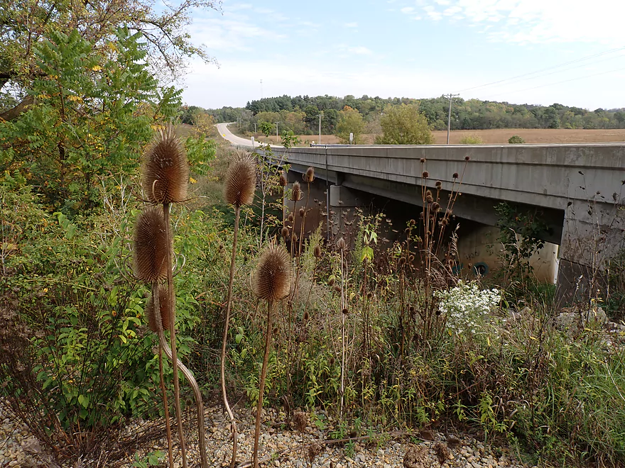
Putting in at Hwy 78
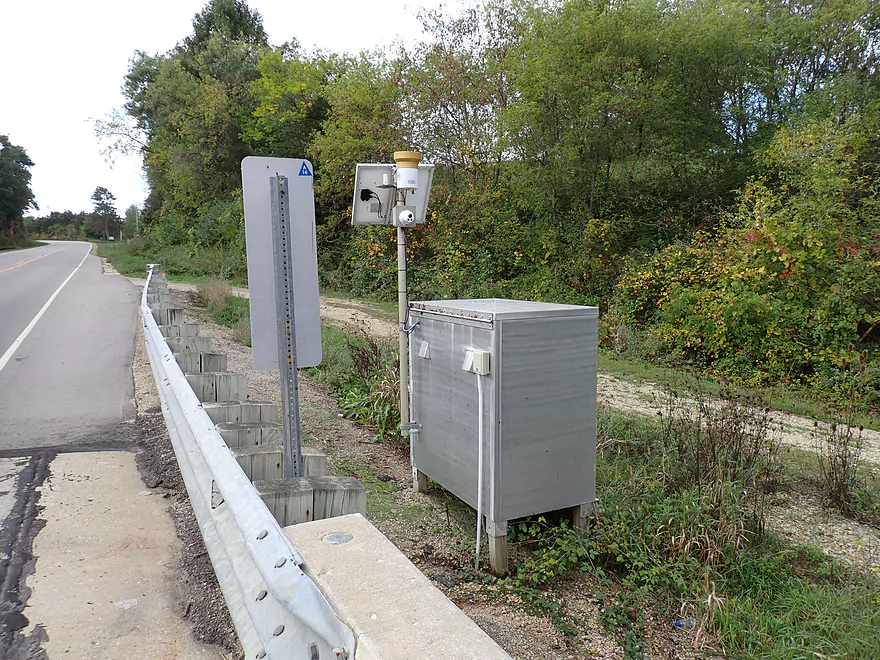
Smile…you’re on USGS cam
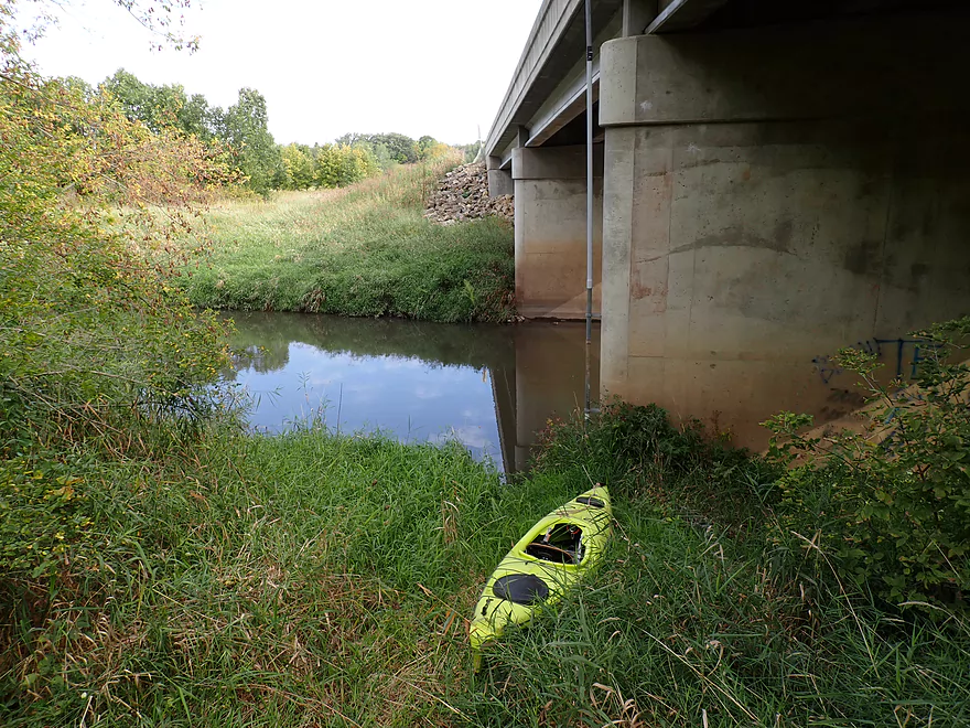
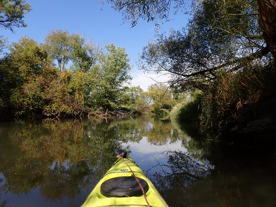
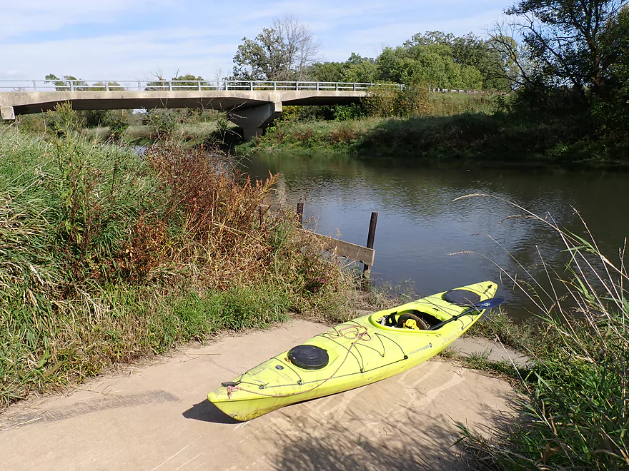
Launching under the bridge
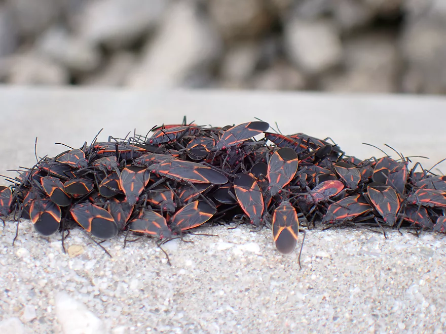
A pile of boxelder bugs
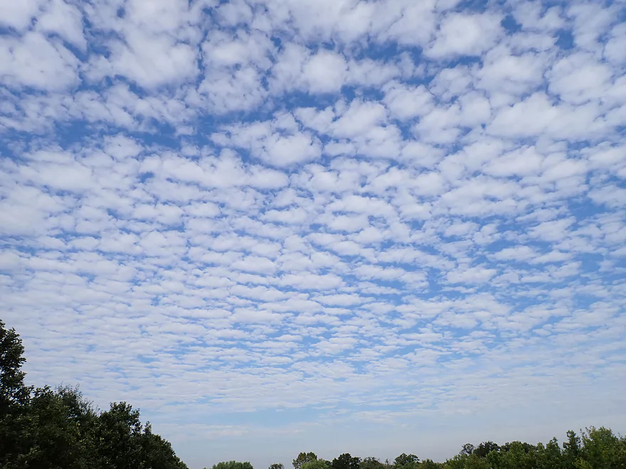
Great clouds
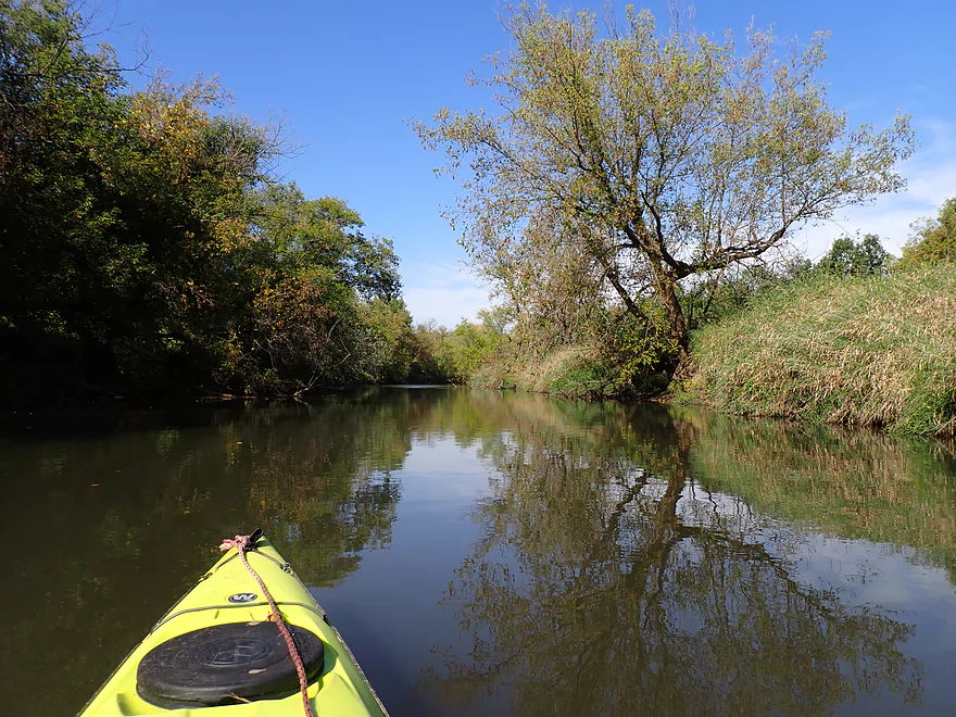
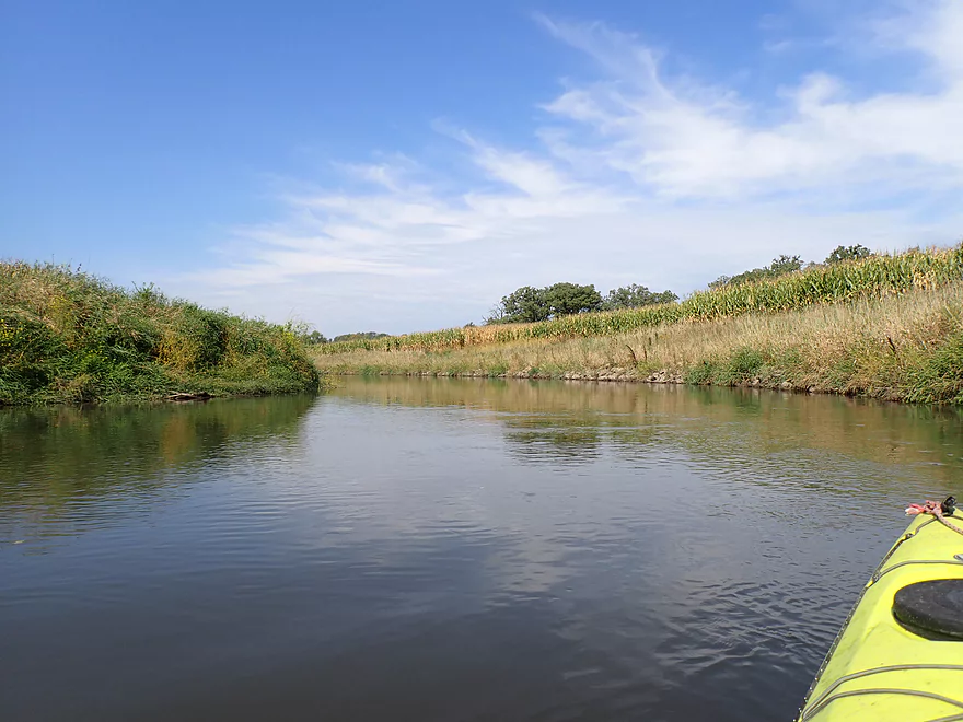
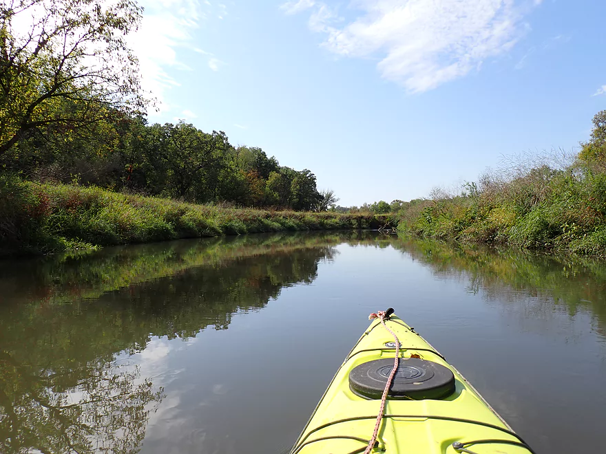
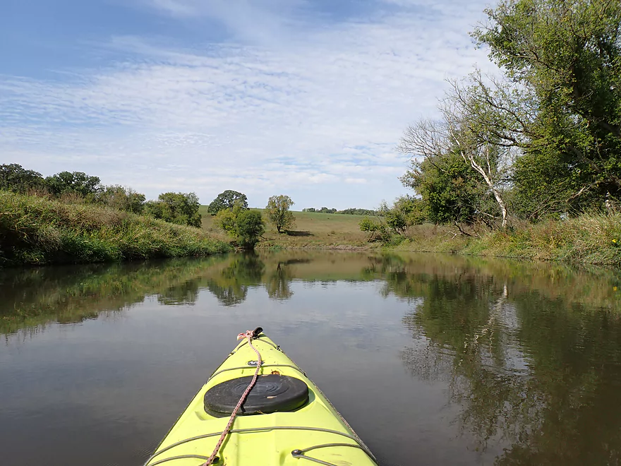
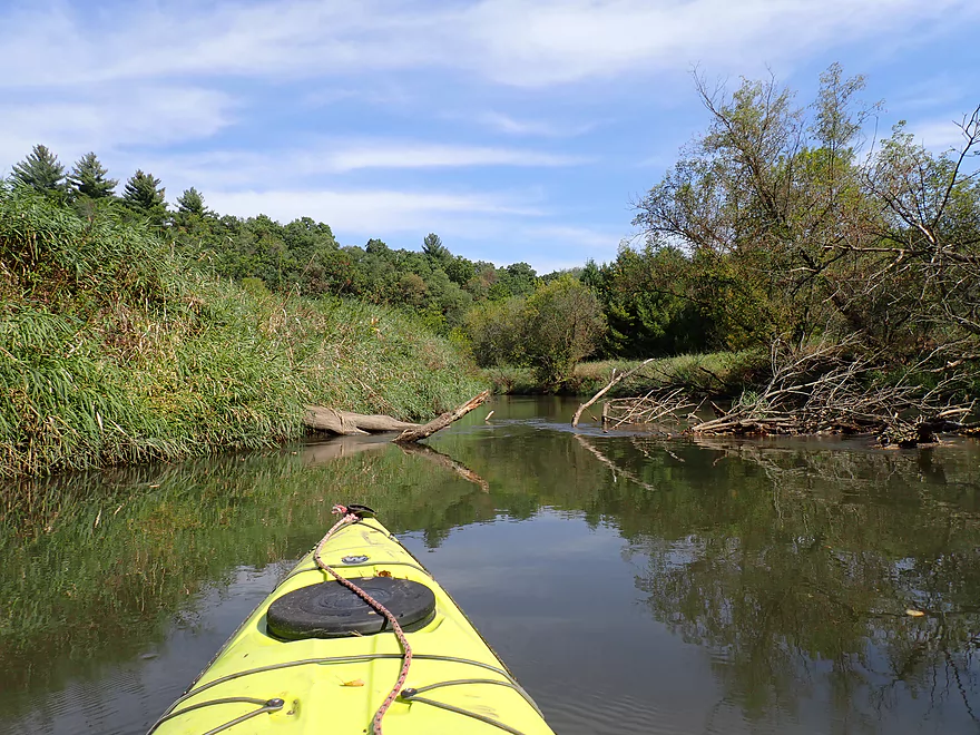
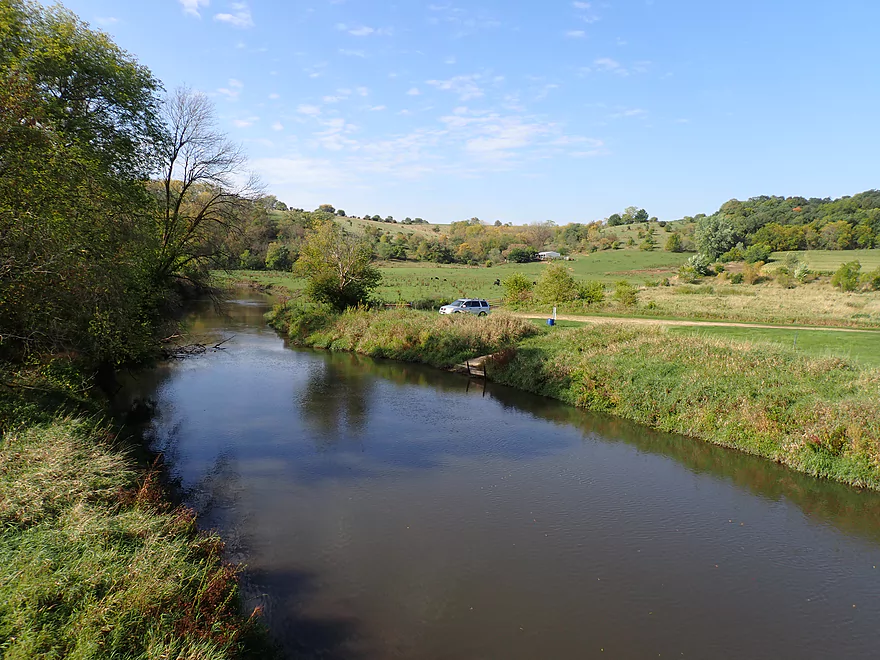
Early morning reflections
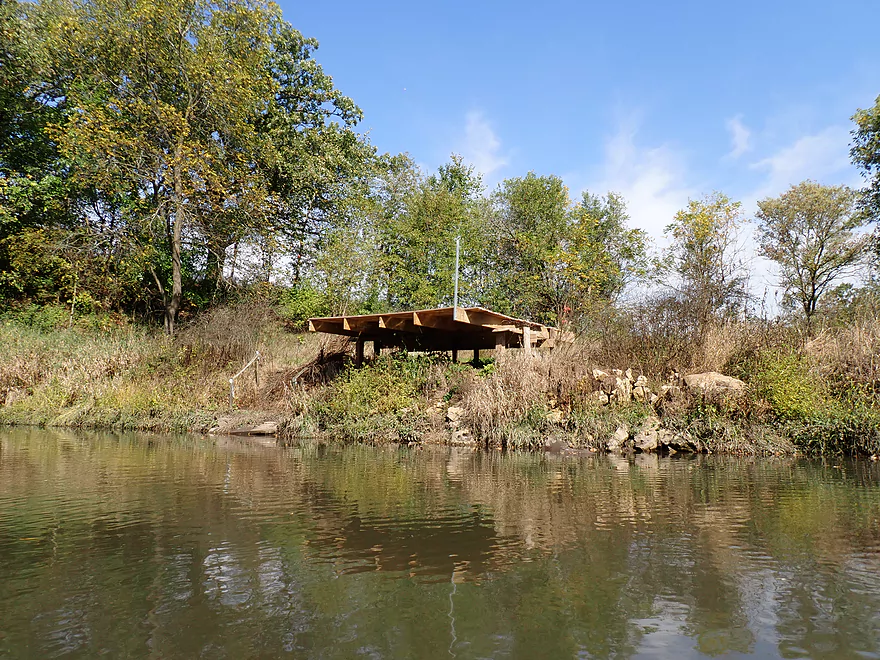
Fishing pier in the middle of nowhere
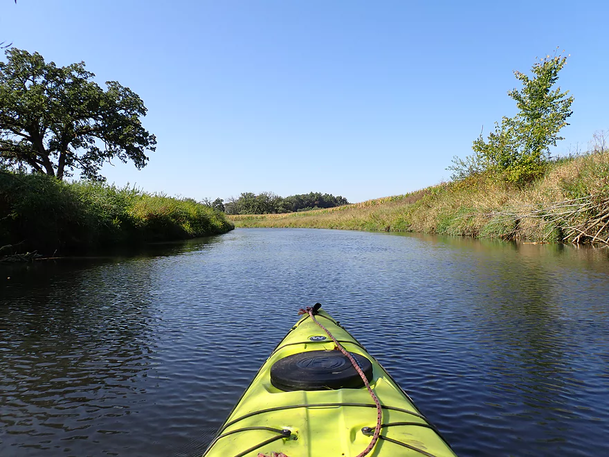
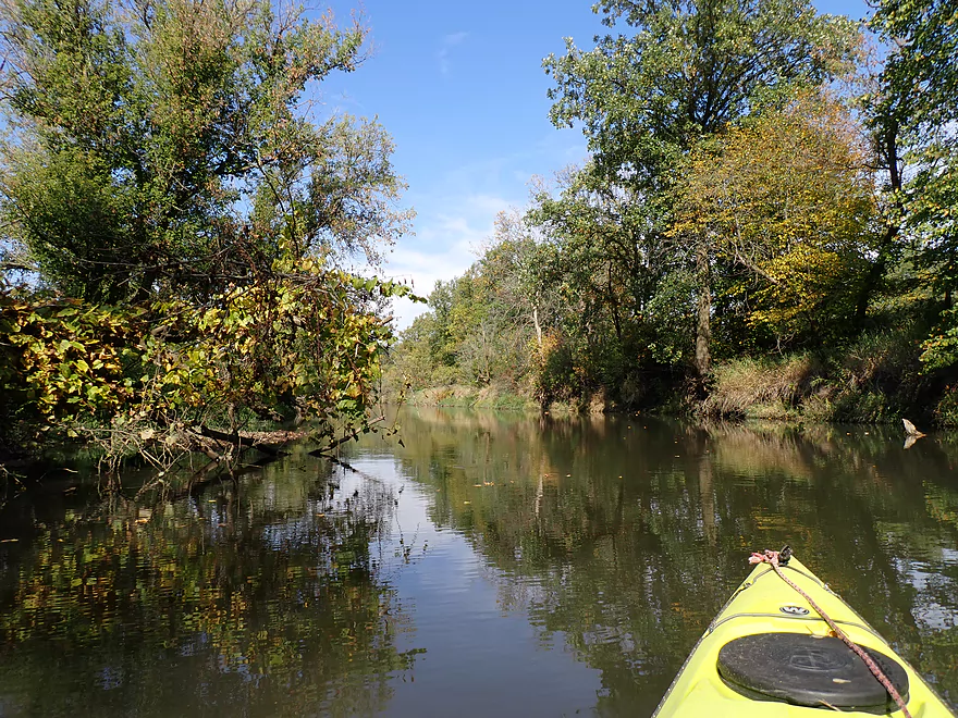
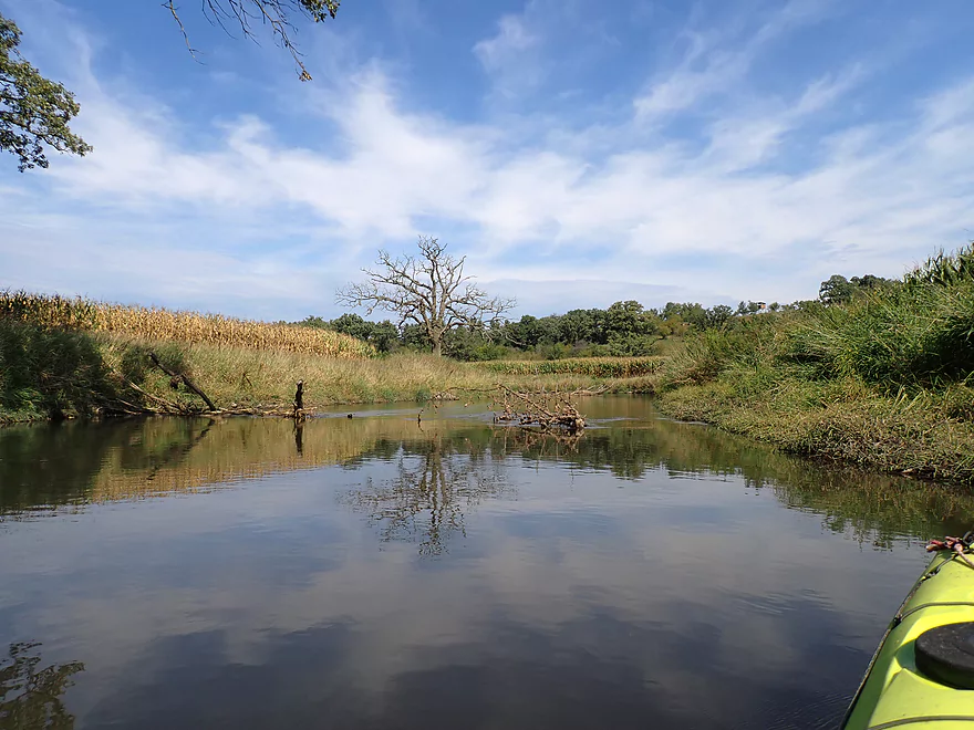
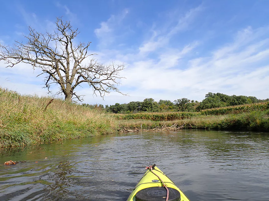
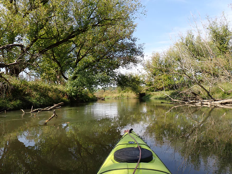
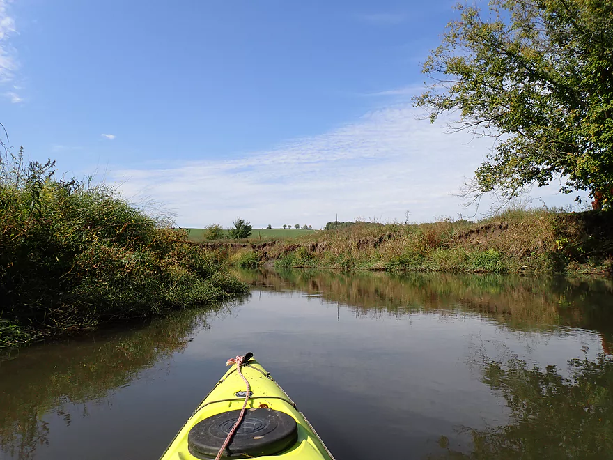
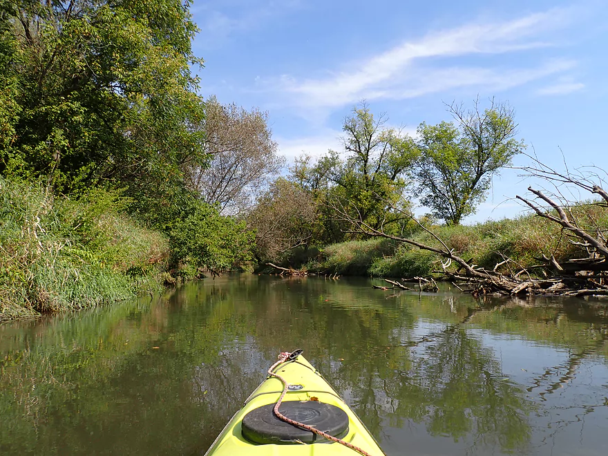
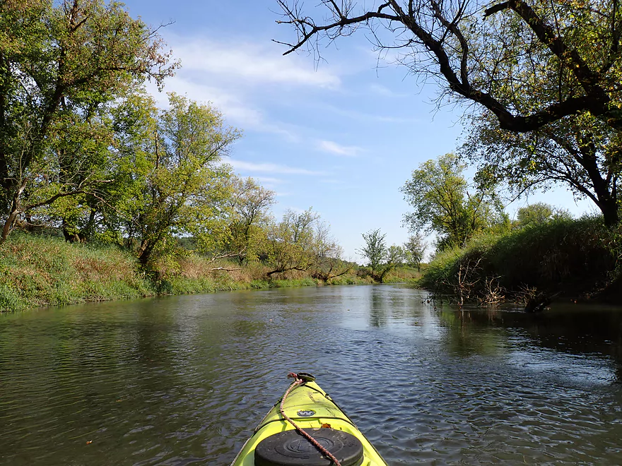
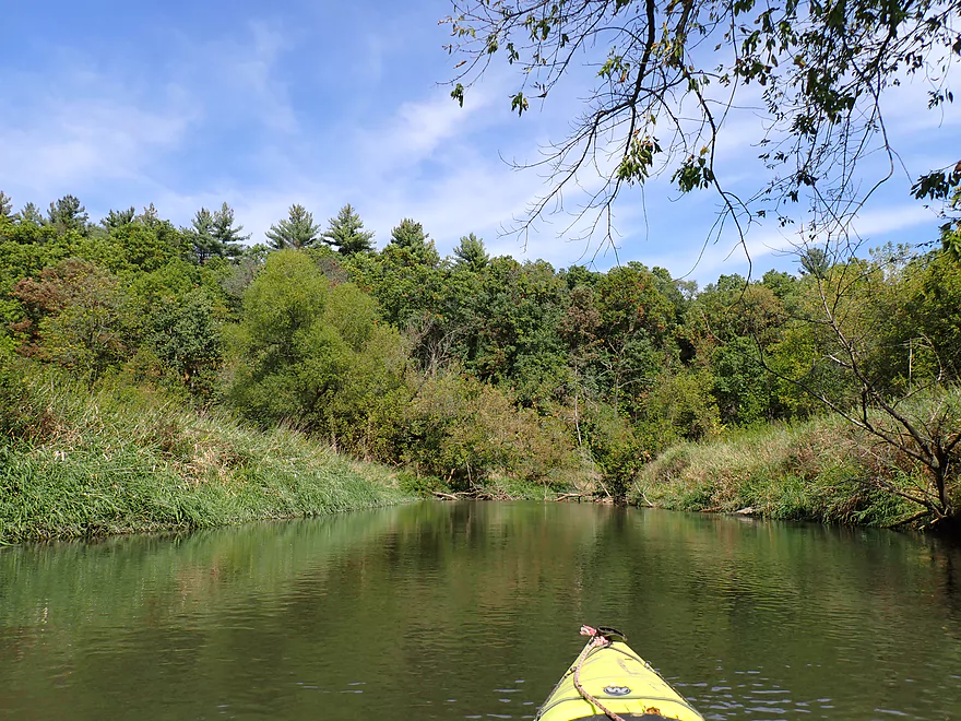
River opens up
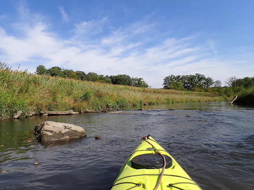
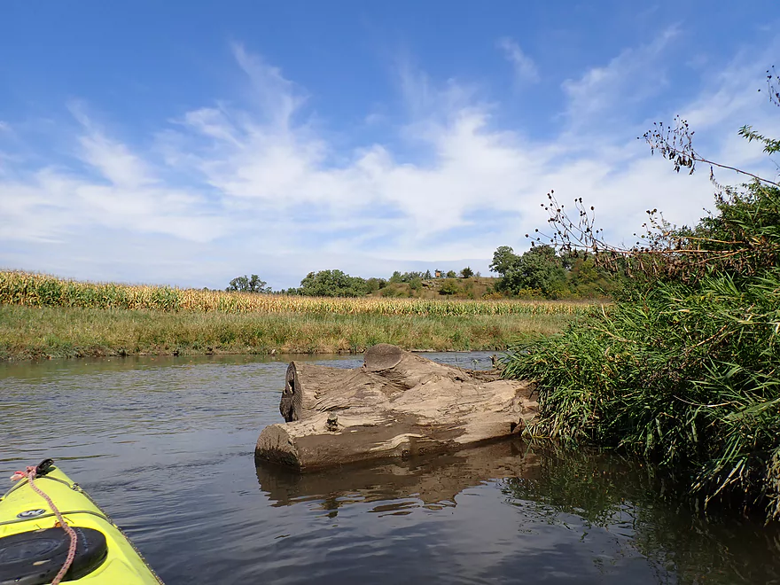
Rocks on the Pecatonica
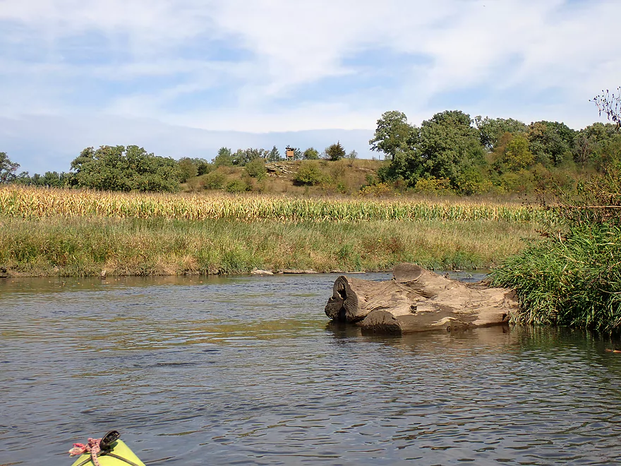
Nice vista
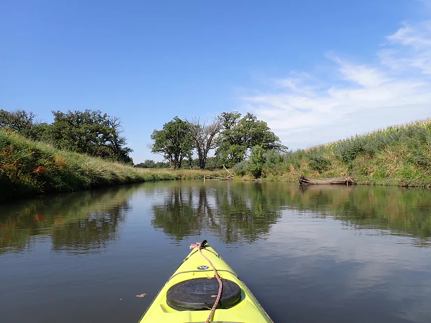
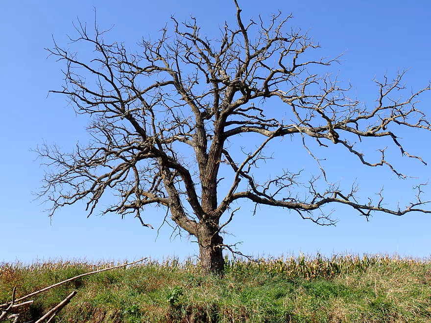
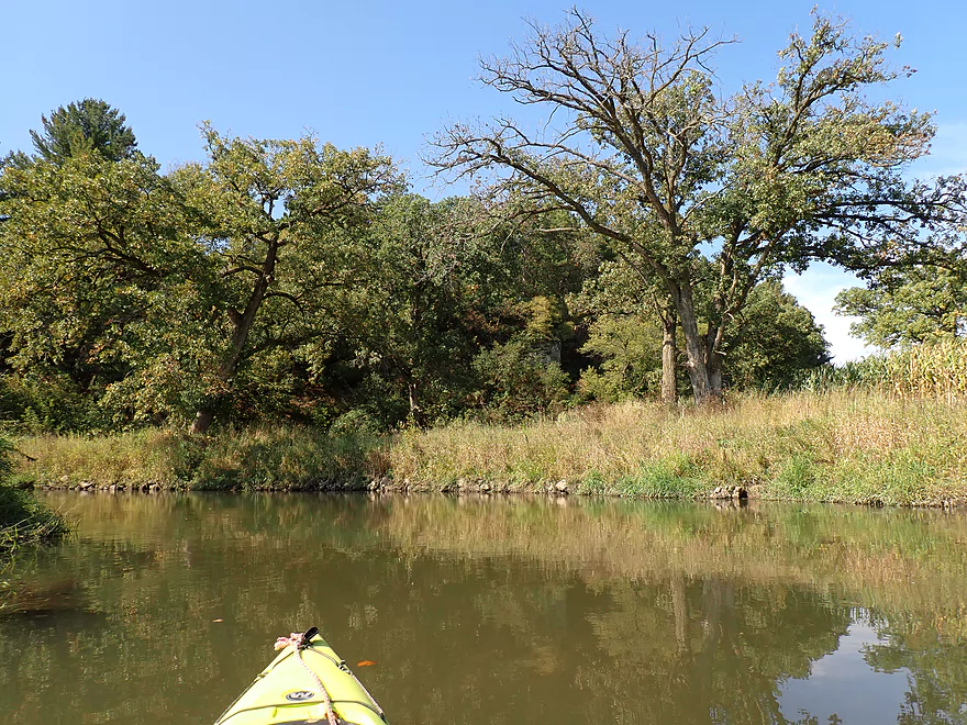
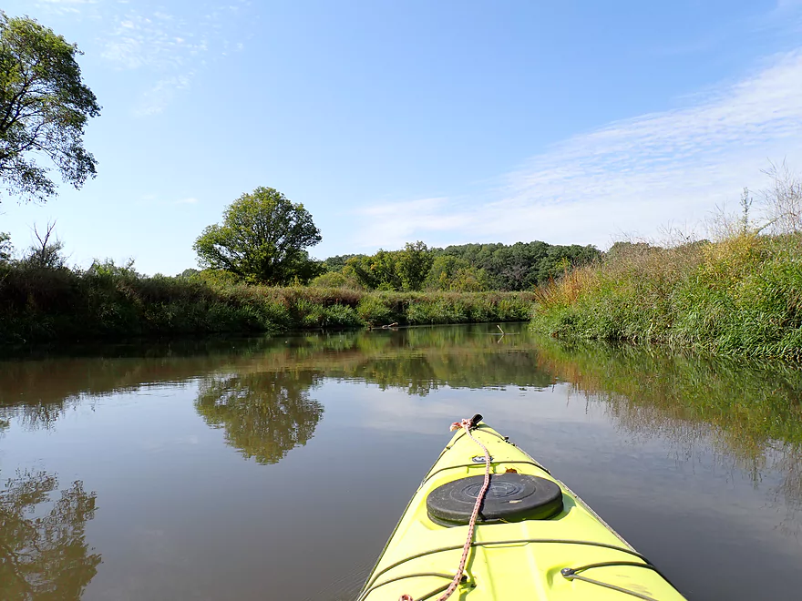
Lot of great oaks on the river
Long wall of corn
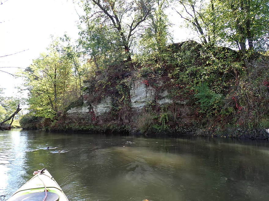
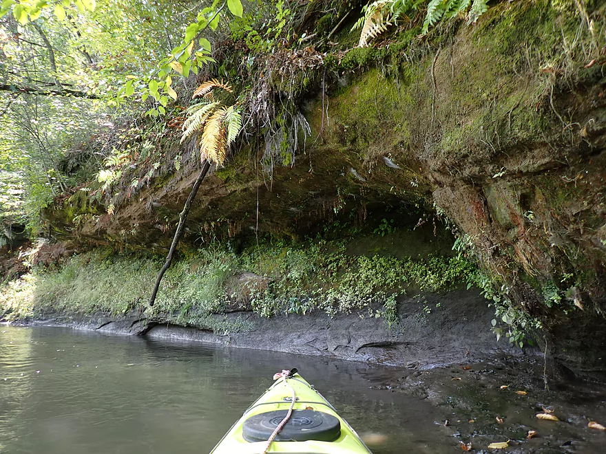
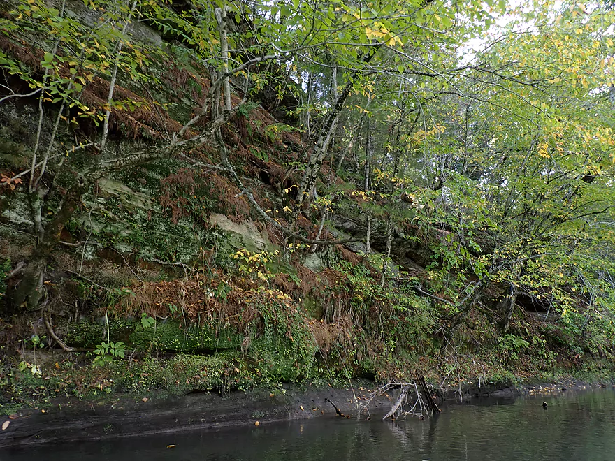
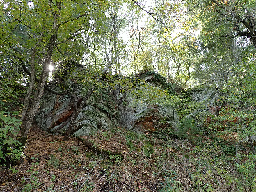
First outcrop of the trip
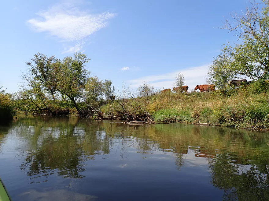
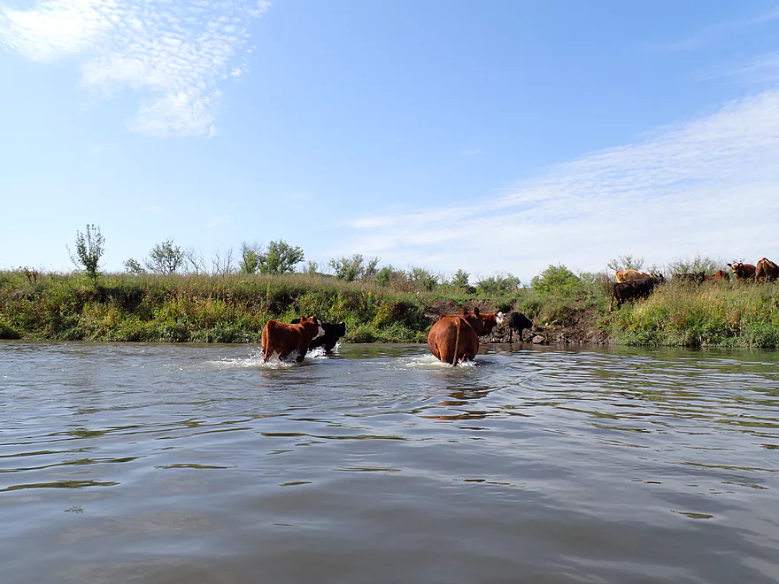
Cattle along the river
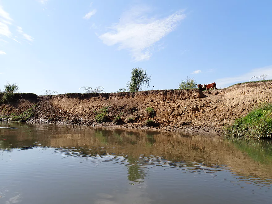
Huge eroded banks

Shore to shore cows
Waiting for the last cow to cross
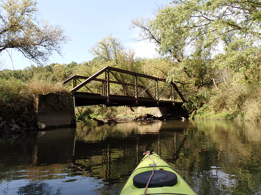
Historic iron trestle bridge
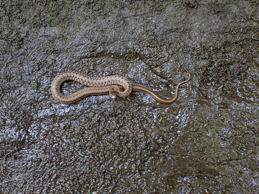
Water snake
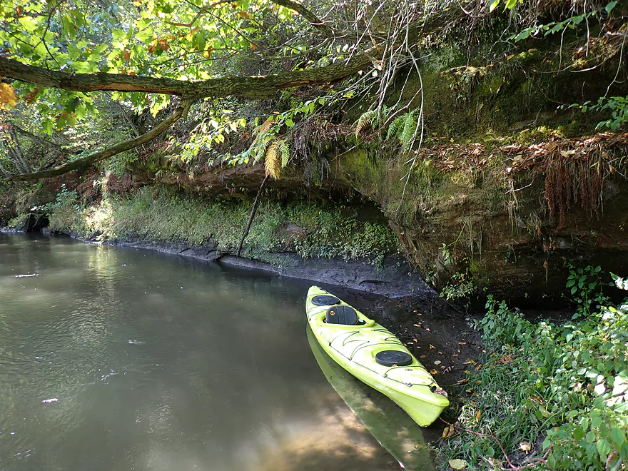
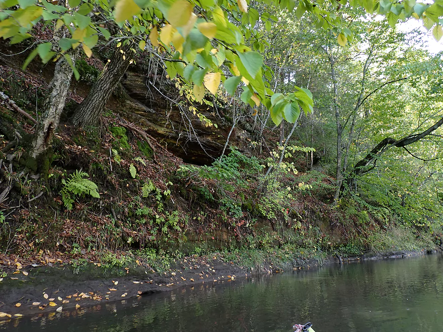
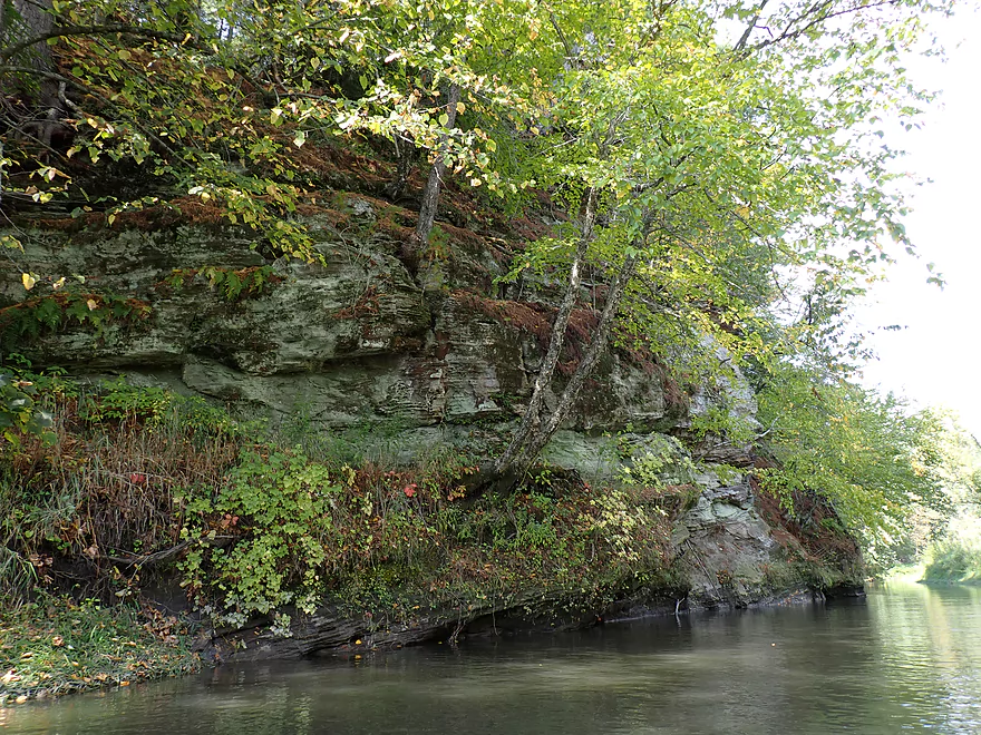
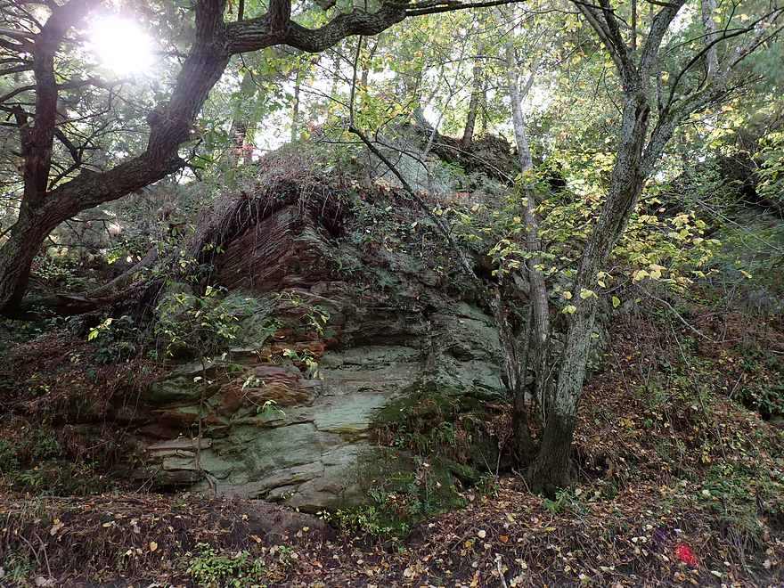
Another nice outcrop
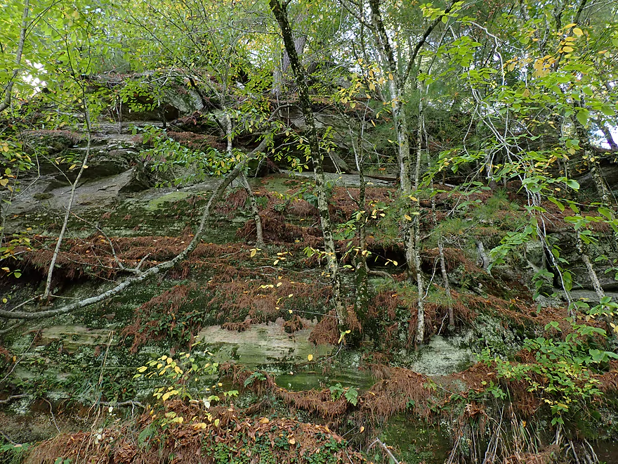
Part of a larger outcrop
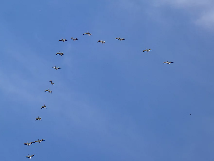
Huge flock of migrating pelicans
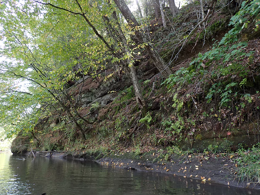
Another outcrop
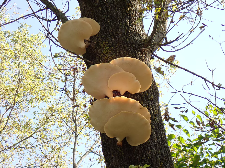
Bracket fungi growing on a tree
One of several pine stands
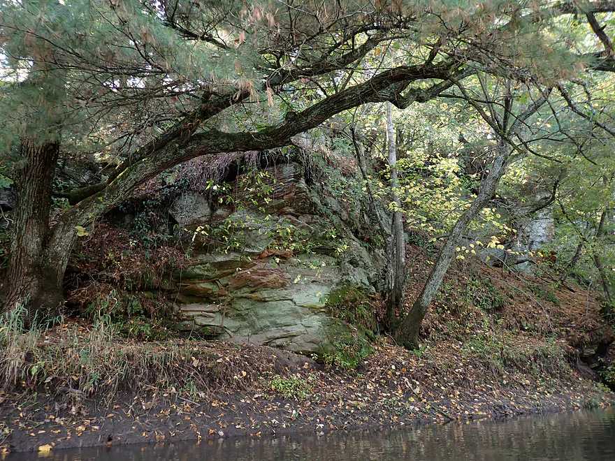
Last outcrop of the trip
Taking out by River Road
Which has a great landing
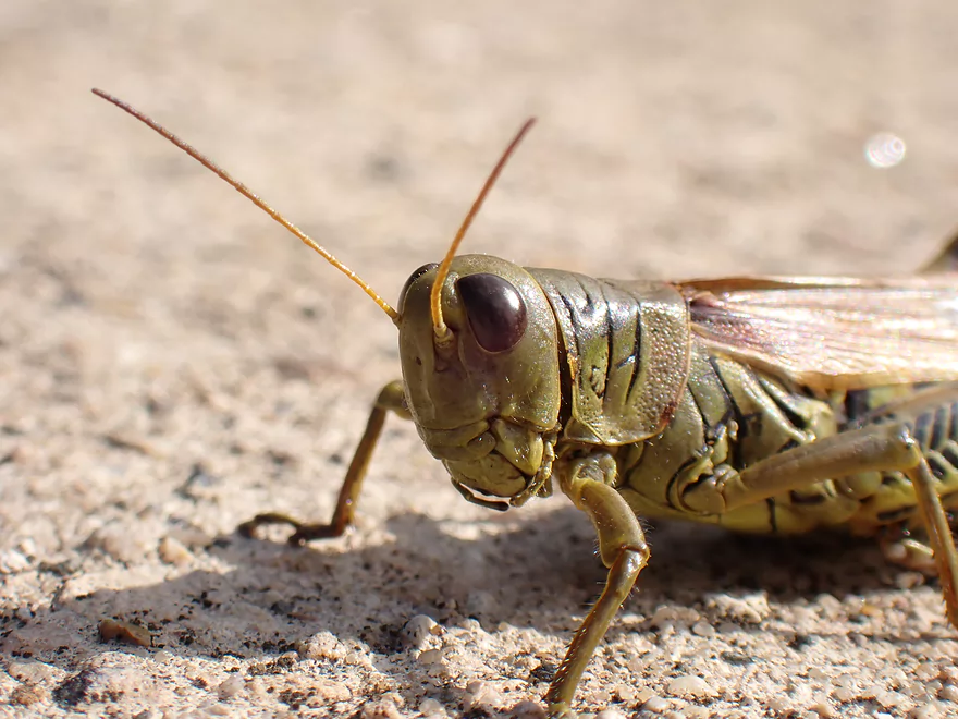
Friendly grasshopper on the ramp
Pecatonica River – East Branch – Hwy 78


I started the trip at Hwy 78, where I ended a previous 2021 trip. From memory, I knew Hwy 78 was a bad access because of the large embankment on the north side. This time around I decided to launch from the south end, where I was pleasantly surprised to find a convenient little path leading from the USGS station to the water.
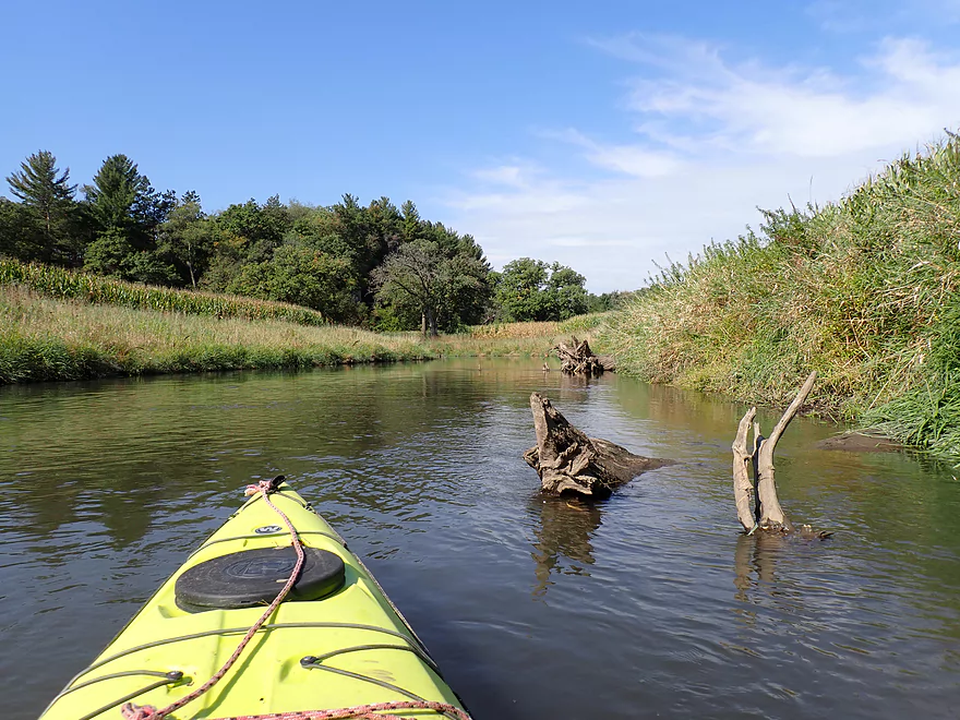
The first mile of the trip was really good with many fantastic oaks flanking the river (the most I’ve ever seen on a river). Occasional deadfall appeared in the channel, but it wasn’t common. The banks were a bit scruffy and the water somewhat turbid, but both were much better than my previous week’s trip on the Baraboo River. Parts of the river were even tidy (by Driftless Area standards) and had a peaceful vibe.
One of the highlights of the trip was seeing the Driftless Area hills in the distance (when not blocked by corn and high banks). These were terrific and several were “bald” and topped with a mix of natural plants and pasture. Most hills in Wisconsin are wooded, so it’s kind of unique seeing these open hills.
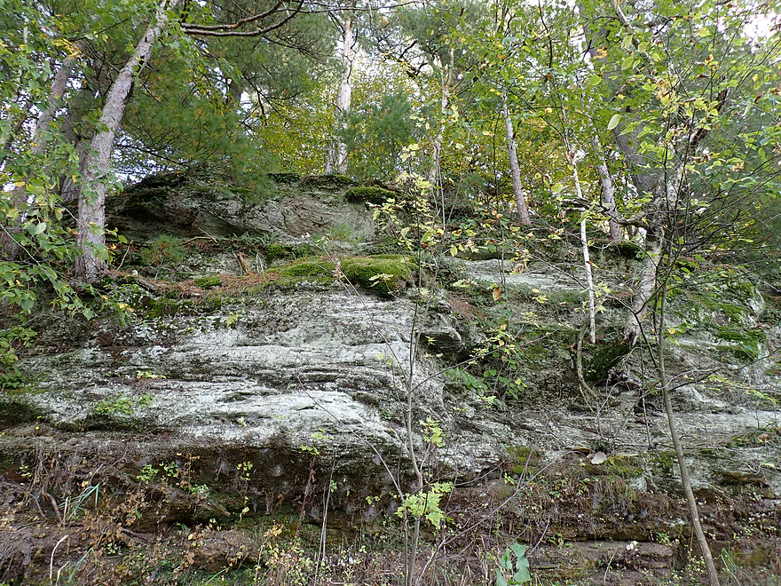
At roughly the one mile mark, I encountered the first of roughly eight outcrops on the trip. Unfortunately the first (like many of the others) was somewhat obscured by vegetation and poor lighting. I struggled to get good pictures of many of these, but I did appreciate that this leg had outcrops at all…my 2021 trip didn’t have any.
The next 1-2 miles flowed through a massive pasture. This featured a huge herd of cows on both sides of the river who were constantly mooing. Some sounded genuinely sick, but I think the main source of stress was that the river had split the herd into two separate groups. Finally I came to a stretch of the river where the banks were low enough, and witnessed the largest cattle crossing of a river I’ve ever seen. Thankfully there were no steers or bulls in the herd and I was able to easily pass by once the last had crossed. But it’s not ideal that cows have free access to rivers as they can degrade water quality and ruin shore-side vegetation. The DNR used to promote keeping cows out of rivers, but sadly no longer seems to view this as important.
Following “cow country”, the next mile featured a rustic iron trestle bridge, one of the few legit woods of the trip, and several nice outcrops.
The second half of the trip just wasn’t as interesting. It didn’t help that I was paddling almost due south into a strong sun, and the channel was straight open, and uninteresting. The banks often just had a thin border of “weed trees” like box elders. Oaks were not as common as earlier in the trip, but I was pleasantly surprised to encounter a few stands of white pine (not something you see often this close to the Illinois border). I had hoped for some fall color, but there wasn’t much…and even if it had been a week or two later, I don’t think this would be a good color river as it lacked sugar maple.
I ended the trip at the River Road landing which was surprisingly nice and where I saw another parked car (presumably another kayaker). I think most kayakers would use River Road to actually do downstream trips where there are some big outcrops (see Peter’s review and great pictures from earlier this year).
In summary this was a pleasant trip. The oaks, hilly savannas, open vistas, outcrops, and pine stands were great. But some parts were a bit bland. It was certainly more scenic than my Baraboo River trip though. Locals who live southwest of Madison should consider putting this trip on their paddling todo list.
Sights included dragonflies, a large flock of pelicans, several badly flying turkeys, two cranes, deer, two water snakes, lots of turtles, a few flopping fish, and lots of cows.
Hwy 78: The north end of Hwy 78 is a poor access because of a large embankment. The south end though has a well used trail that leads from the shoulder to the water where it’s not difficult to launch. Paddlers should respect private property. Stay close to the USGS station and inside the fence. Do not block the adjacent drive with your car.
The local gauge actually has a webcam…this is a nice way for paddlers to gauge water levels, check for fall color, and see if the river is iced up.
Alternate Put-ins:
- Blanchardville Dam (3.8 miles upstream from Hwy 78). A less interesting section of the river, but the leg through Blanchardville is pleasant.
- Hwy H Launch (3.5 miles upstream from Hwy 78). A less interesting section of the East Branch.
River Road Landing: This is an excellent public access. There is even a ramp which could launch small boats.
Alternate Take-outs:
-
Argyle Boat Launch (7.1 miles downstream from River Road). This is a good leg with several impressive outcrops. You can take out above or below the dam.
Bike Shuttle Route – River Road Landing to Hwy 78: 4.5 miles with 331′ of ascent. I consider 100′ a hilly bike shuttle…at 300′ this was quite the roller coaster and several big hills had to be walked. Hwy 78 is a fast road with narrow shoulders. Outside of that, it wasn’t a difficult shuttle at 4.5 miles and thankfully it was all paved.
Current: The current tended to be on the slow side but was consistent. Unlike other streams and rivers in the area, this was not pool + riffle.
Rapids: There was one minor riffle, but that was it.
Fences/logjams: None…this is a relatively safe/easy stretch to do.
Cattle: You could see cattle on this stretch and may encounter them in the water. Generally speaking the banks are too high for the cattle to access the river, but there are several exceptions where they can and do enter the water. If you see cattle blocking the channel, just give them plenty of space and wait for them to move on. If they don’t, clap your hands…it just takes one to leave and the rest will follow. I didn’t see any steers or bulls, but paddlers should always stay vigilant around cattle herds for aggressive animals.
Trip done at 129 CFS per a local gauge at Blanchardville.
- 0-100 CFS: A low depth, but should be fine for paddling.
- 101-200 CFS: An average depth and a good target range.
- 201-300 CFS: Above average, but a decent paddling depth.
- 301-400 CFS: A high depth.
- 401-600 CFS: A very high depth. Current may be pushy in spots.
- 601+ CFS: Maybe too high for enjoyable paddling.
Detailed Overview
- Upstream of Hwy Hk: Too many logjams to recommend.
- Hwy Hk to Burma Road: 1.3 miles. An ok prospect with perhaps some obstructions.
- Burma Road to Star Valley Road1st: 2.0 miles. An interesting prospect with good scenery and not too many logjams.
- Star Valley Road1st to Hwy 39: 3.1 miles. Good scenery potential but too congested.
- Hwy 39 to Horseshoe Bend Road: 7.6 miles.
- Hwy 39 to McKenna Road: 3.9 miles. A pleasant section with a rock outcrop near the take-out.
- McKenna Road to Horseshoe Bend Road: 3.7 miles. Another pleasant section with a massive rock wall.
- Horseshoe Bend to Blanchardville Dam: 3.6 miles. Less interesting prospect compared to the immediate upstream section. This part of the river has seen tornado damage, but this should be mostly cleared up now.
- Blanchardville Dam to Hwy 78: 3.9 miles.
- Blanchardville Dam to Gordon Creek Landing: 0.3 miles. A short, but pleasant stretch through the outskirts of Blanchardville.
- Gordon Creek Landing to Hwy 78: 3.5 miles. While not bad, this is one of the lesser interesting stretches.
- Hwy 78 to River Road: 6.4 miles. A pleasant stretch with open scenery, Driftless Area hills, and a handful of rock outcrops. On the downside some parts are a bit boring and open pasture has degraded some of the river.
- River Road to Argyle Boat Launch: 7.4 miles. A good stretch with impressive outcrops.
- River Street in Argyle to Hwy M in Woodford: 9.3 miles.
- Argyle River Street to Blackhawk Memorial Park: 8.3 miles. No outcrops and a lot of farm scenery. Not as nice as previous sections but still decent.
- Blackhawk Memorial Park to Hwy M: 1.0 miles. Section includes a very large island. You must take the east channel to reach the access on M.
- Hwy M to Cisserville Road: 6.4 miles. Probably uninteresting.
- Cisserville Road to Mouth: 2.2 miles. Probably a weak prospect.
- Mouth to Hwy 11: 3.2 miles. A leg on the Pecatonica River (main branch) to reach a take-out.
Trip Map
Overview Map
Video
Photos Size: