
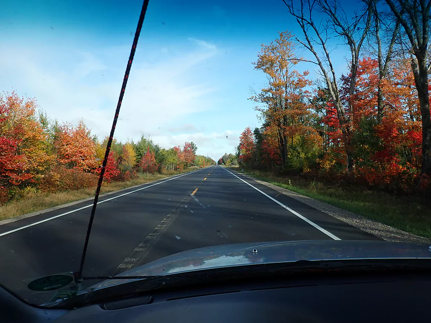
Scenic drive north to the Yellow River
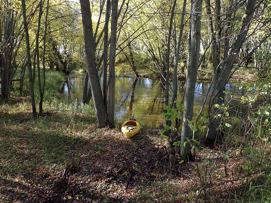
Putting in at Yellow River Road
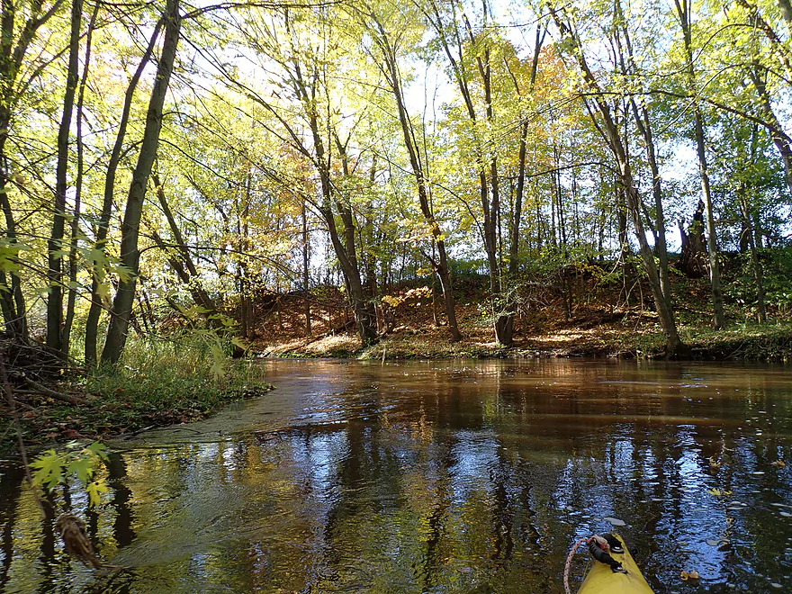
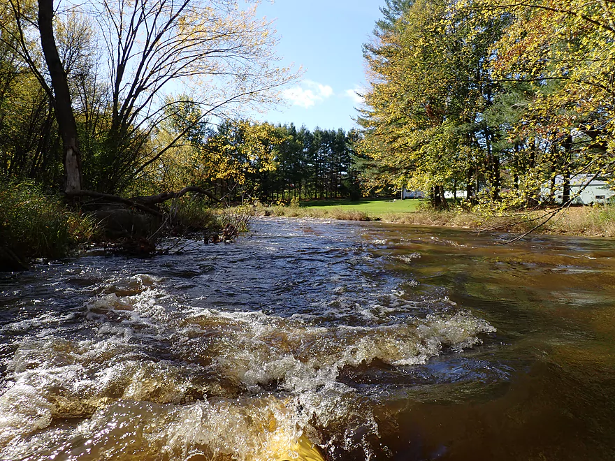
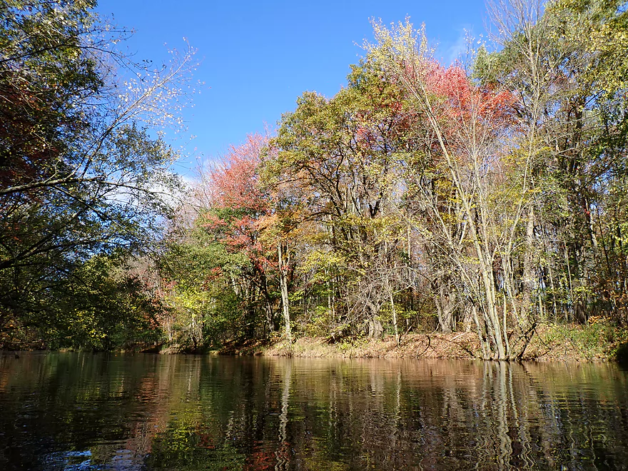
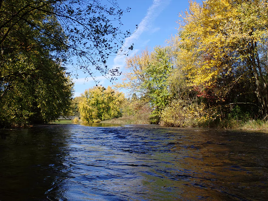
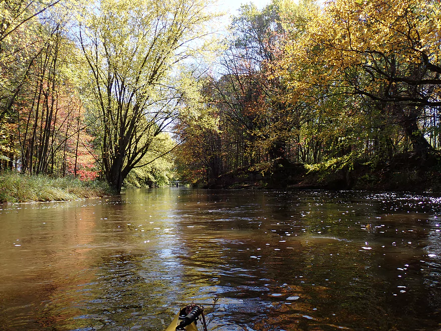
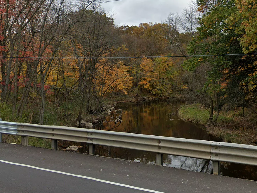
Water levels were crazy high
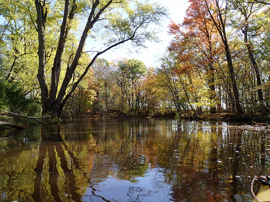
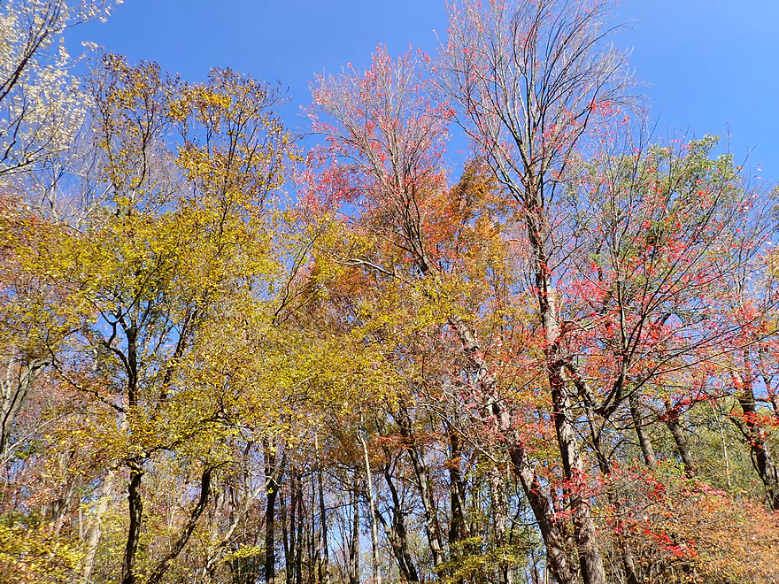
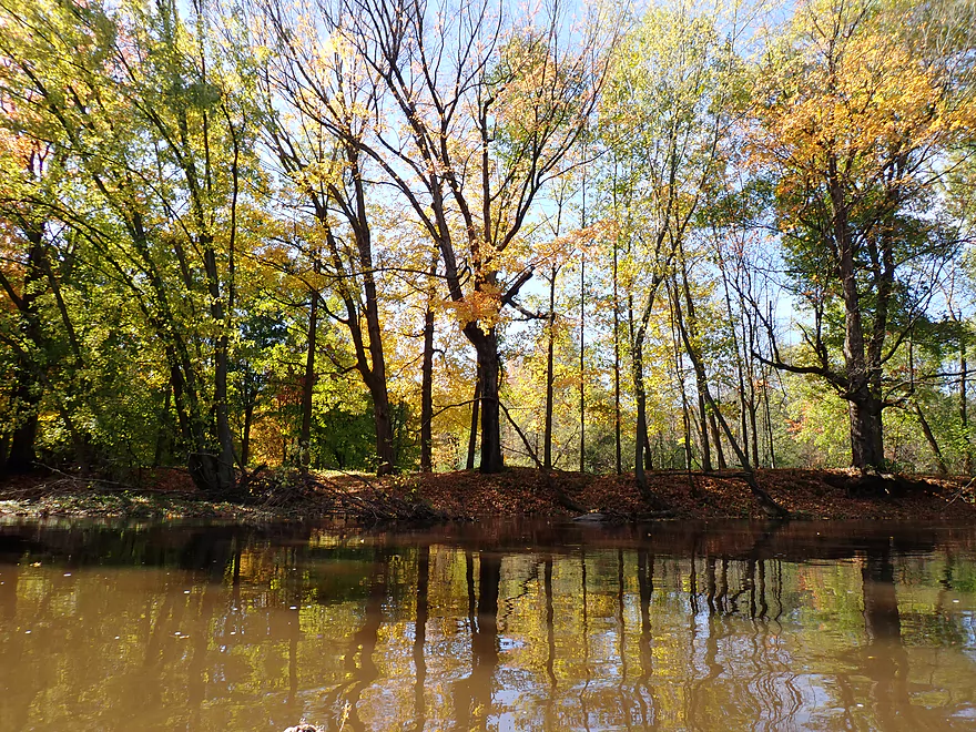
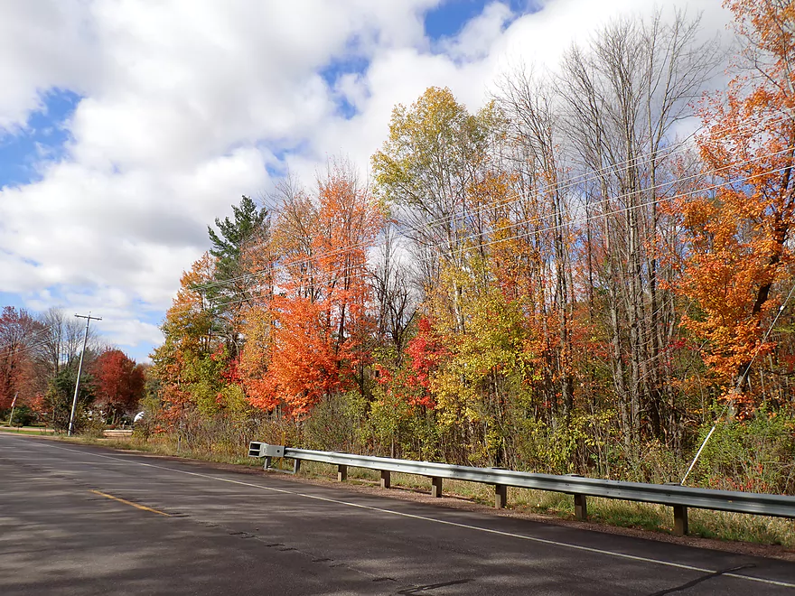
Not ideal peak, but still some decent color
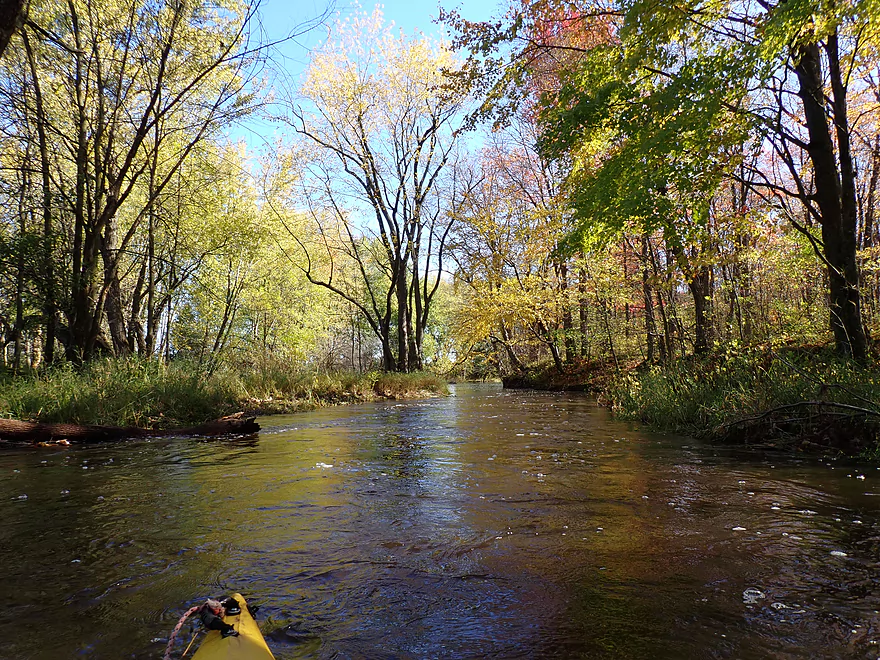
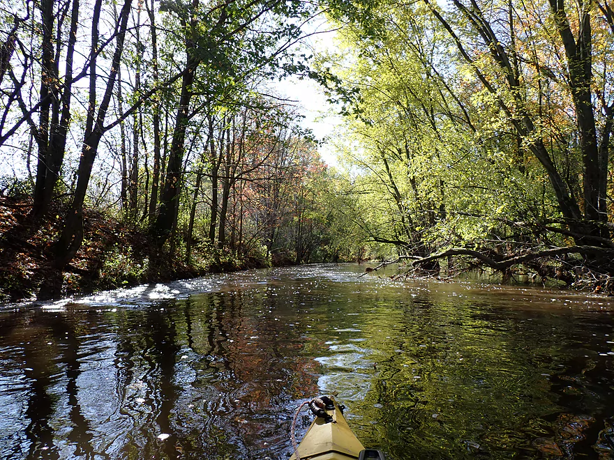
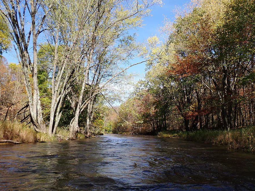
Nice narrow stretch
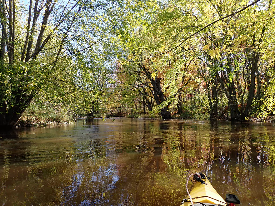
River had a surprising number of sugar maple
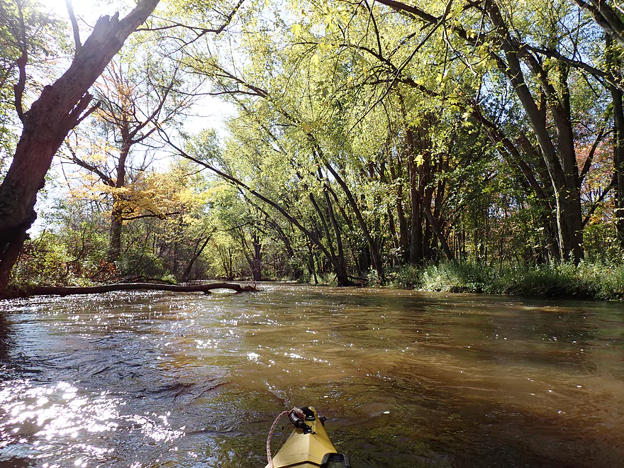
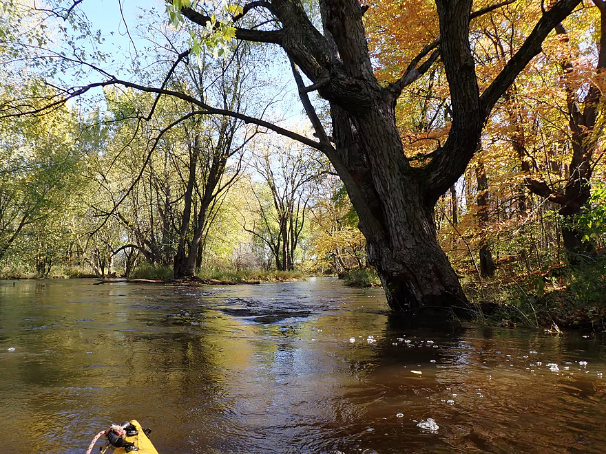
This section was likely 2-3′ higher than normal
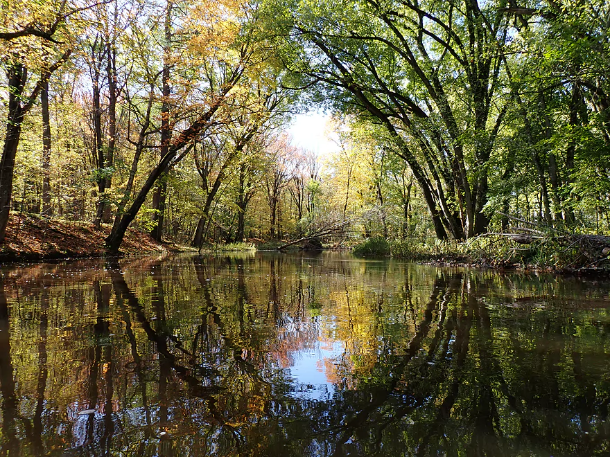
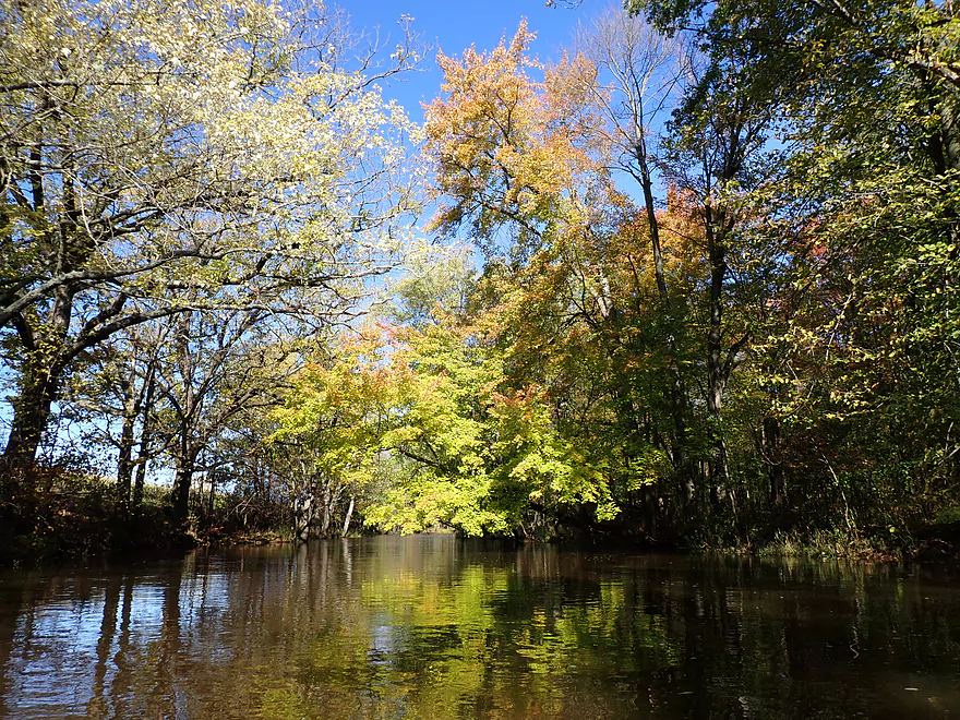
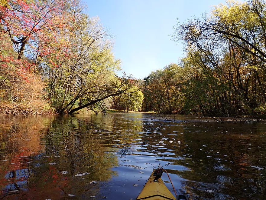
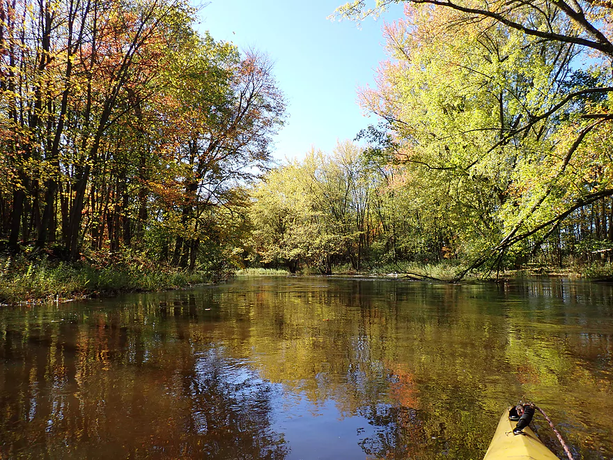
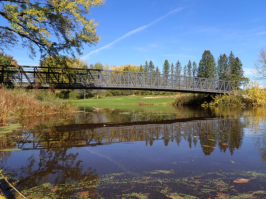
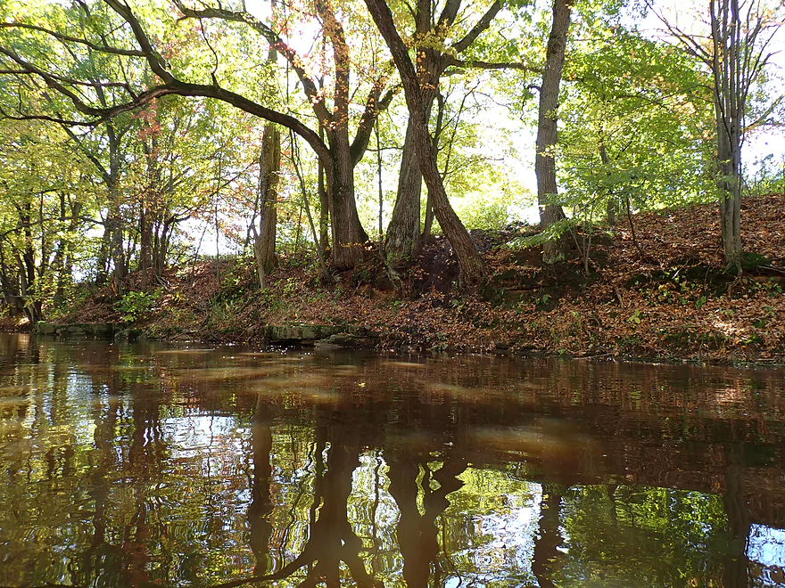
A mirrored archway
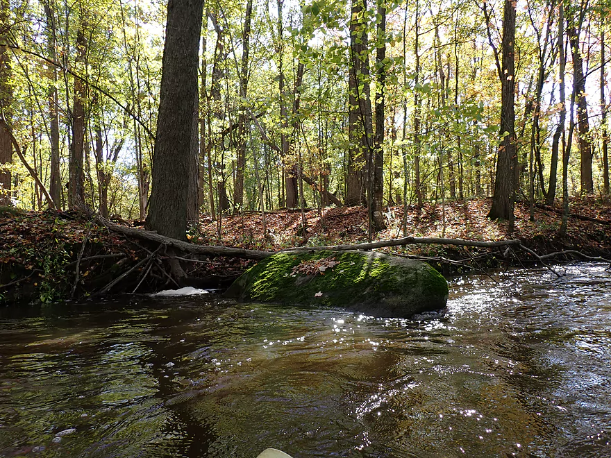
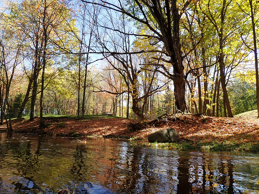
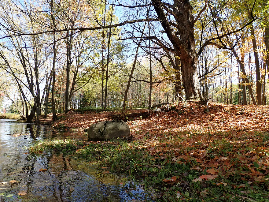
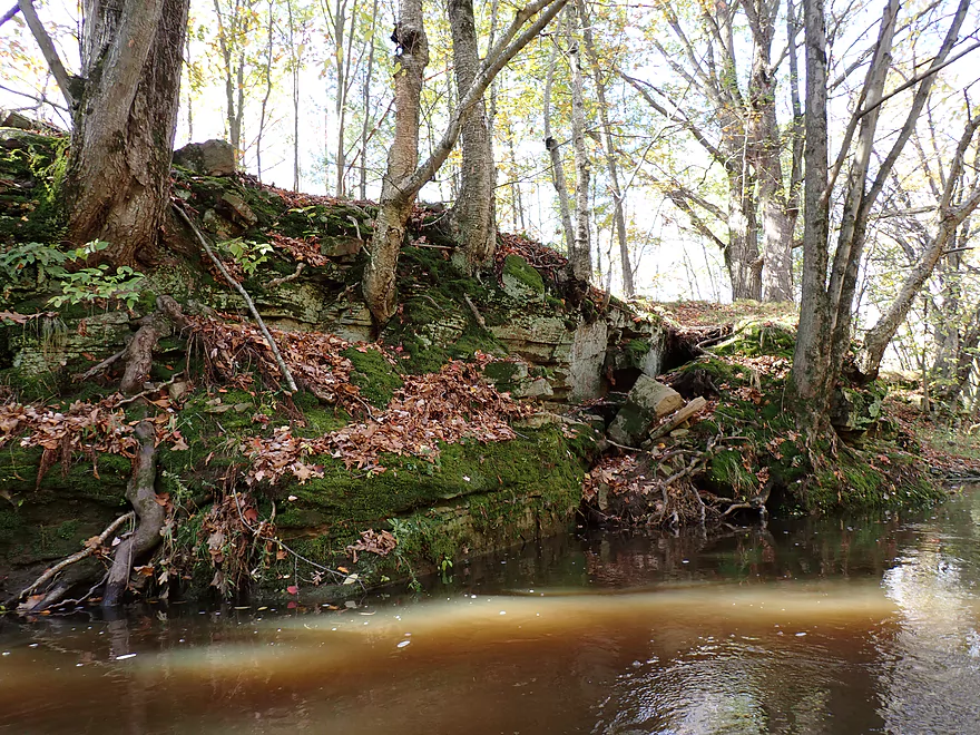
One of only a few rocks I saw…most were buried by the high water
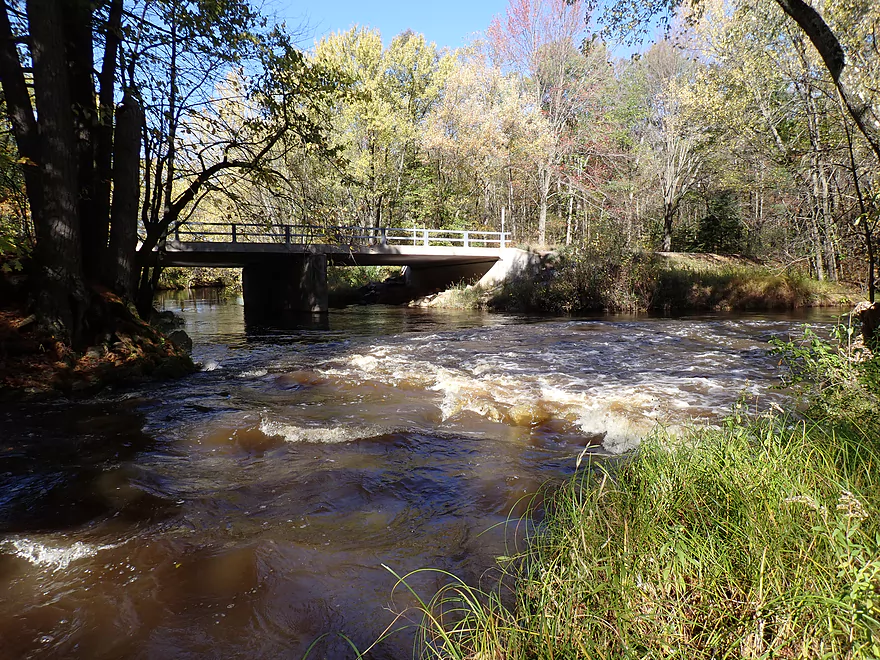
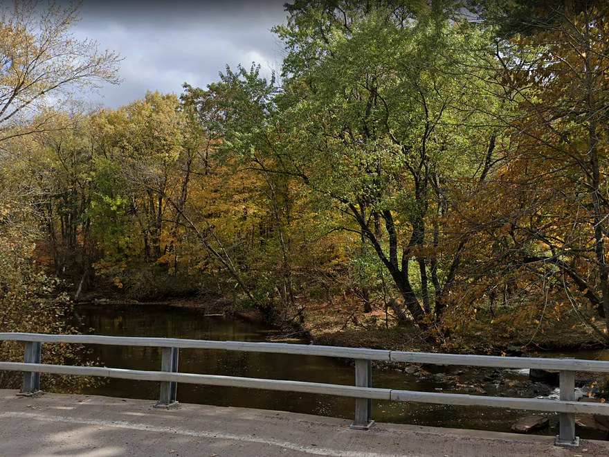
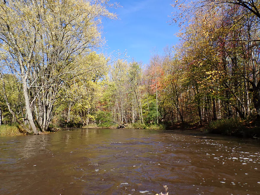
South Branch (bottom-left) adds significant volume by the BB bridge
South Branch confluence/rapids from the bridge…normally there would be a 1′ ledge here but it was buried under water
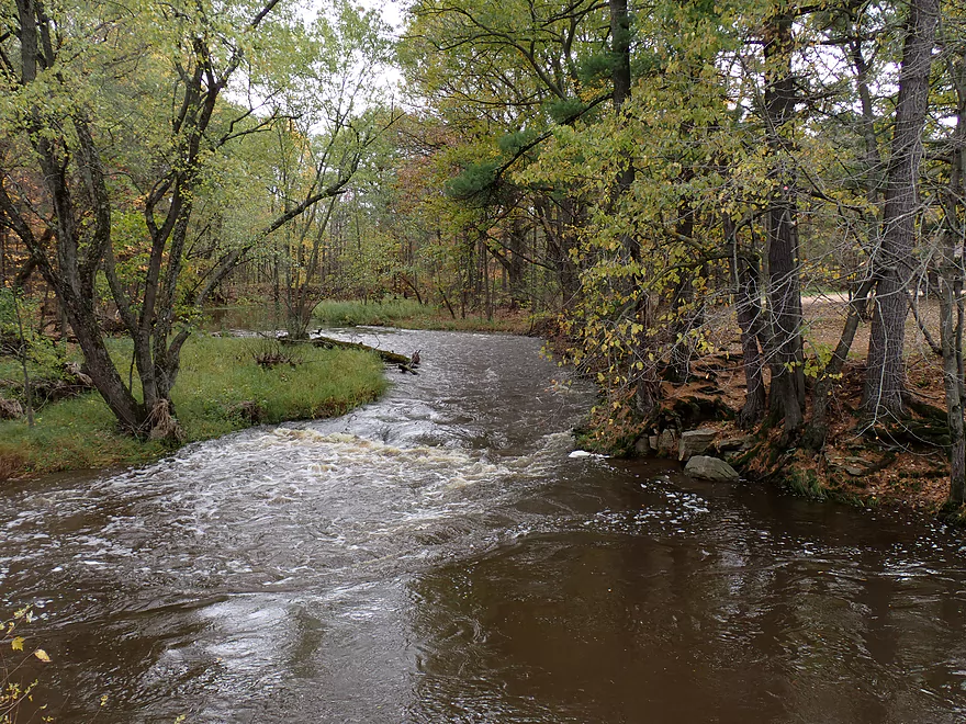
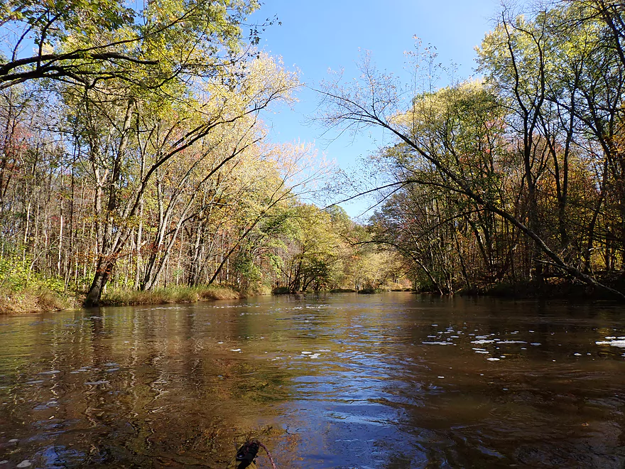
Picture shows the Yellow River with low water levels
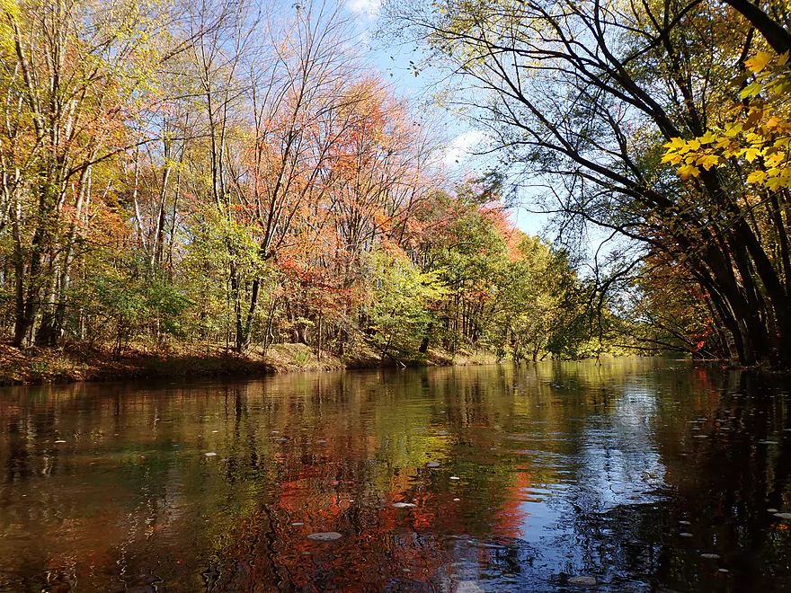
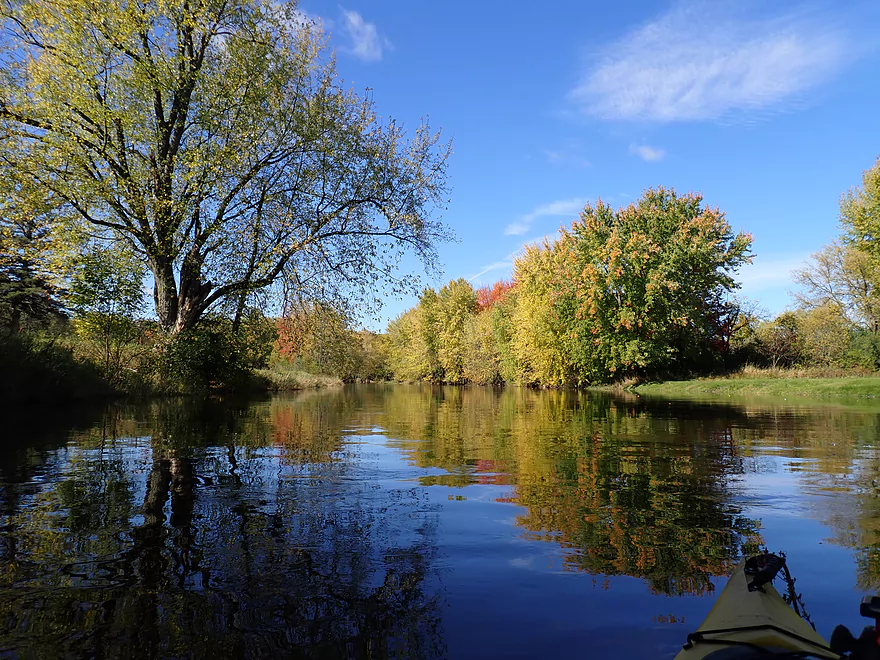
More good fall color
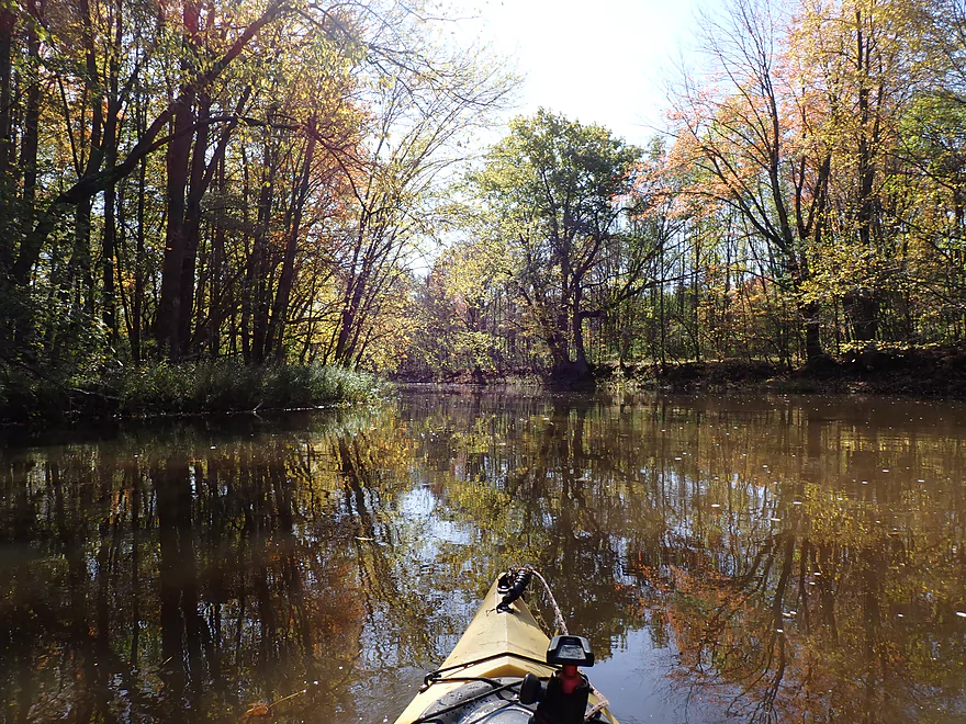
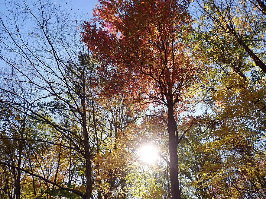
Lighting was difficult for pictures on this trip
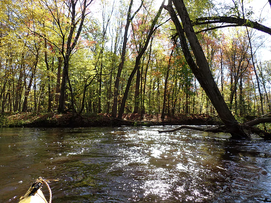
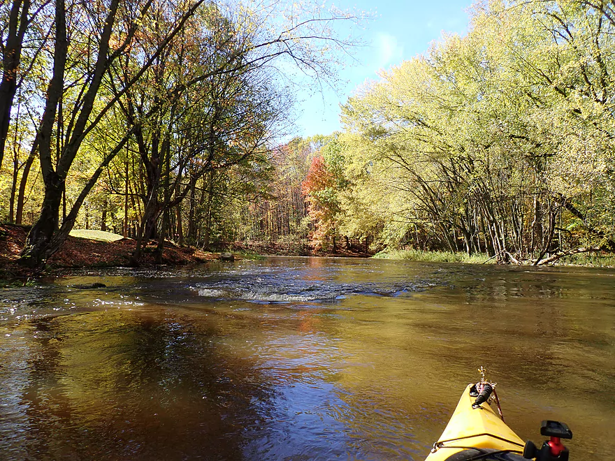
Some of the biggest rapids of the trip
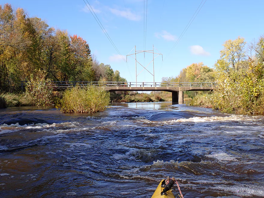
Reverse view of rapids and Robin Road
This was followed by a stretch of Class 1 rapids
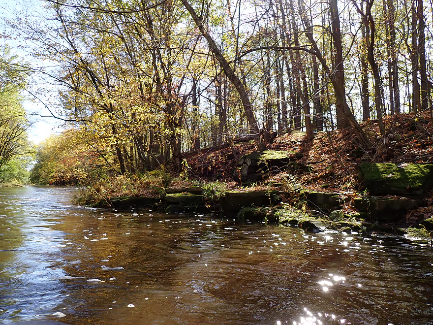
Rocky shoreline
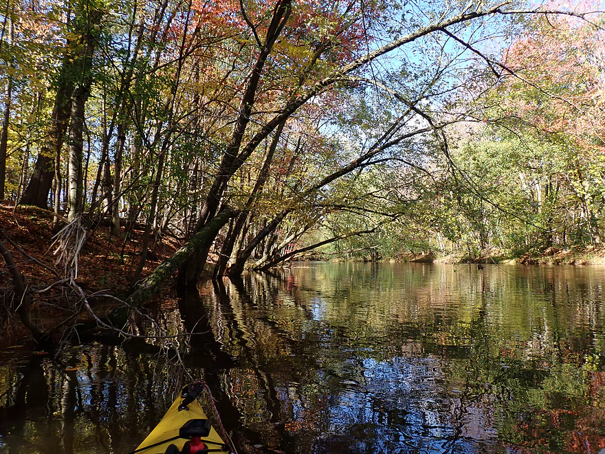
Nice tree canopies
More rapids (mostly washed out, but still fun)
Calm stretch of the river
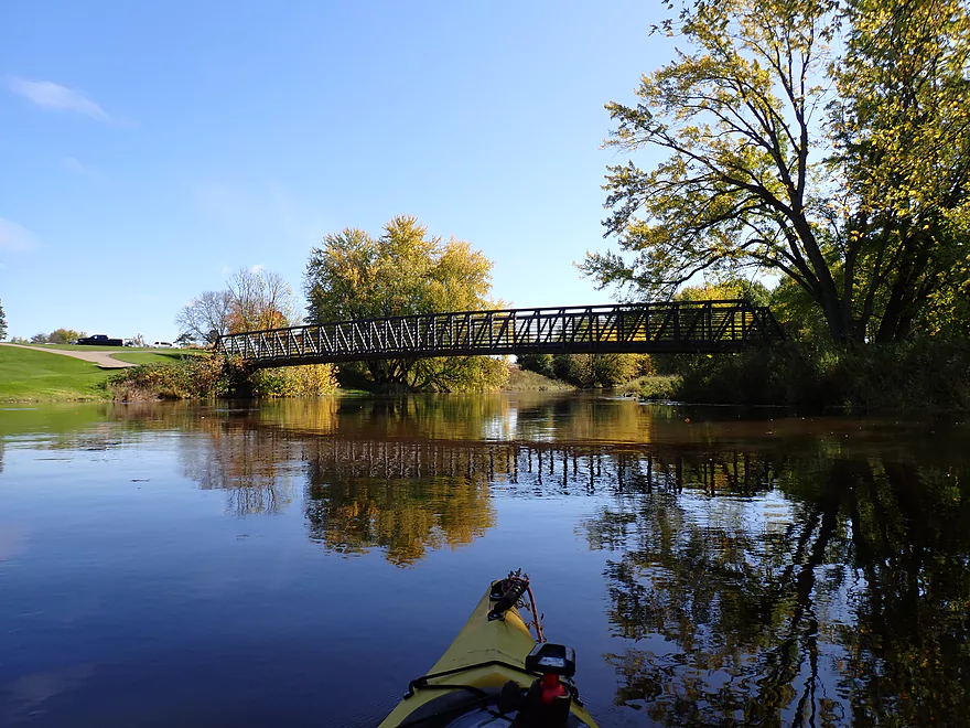
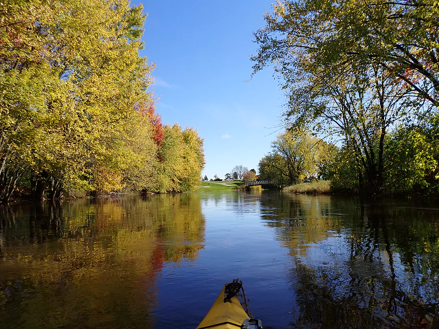
Golf cart bridge
Very scenic
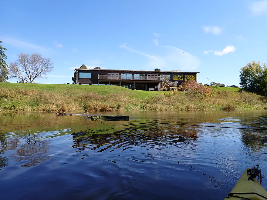
Clubhouse for RiverEdge Golf Course
More riffles
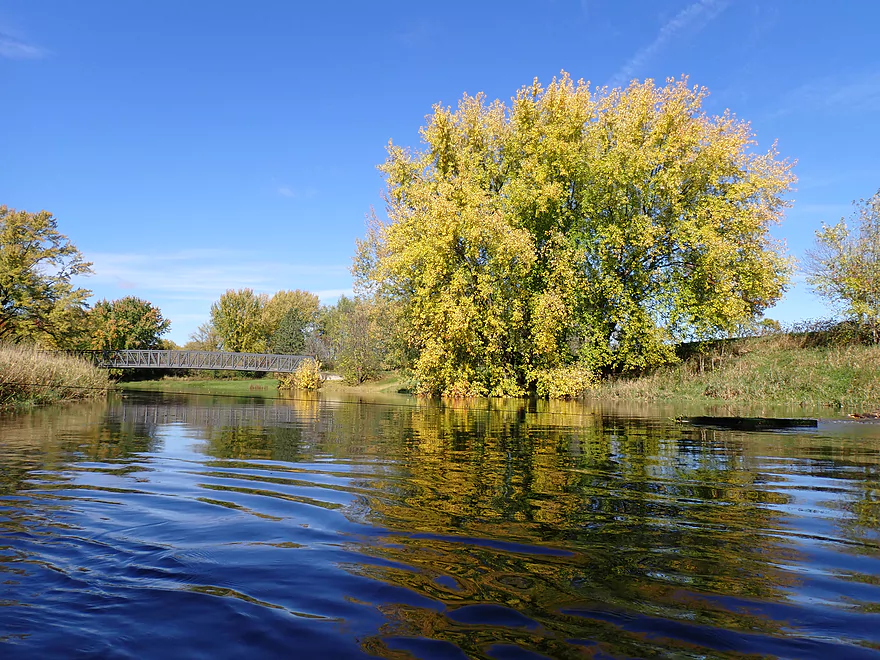
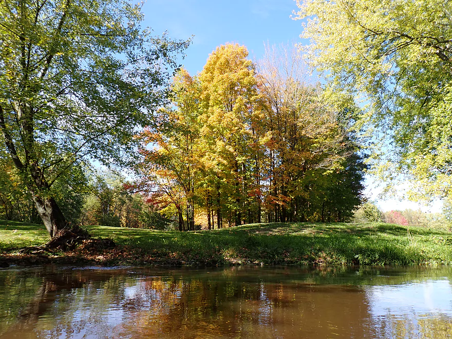
Some of the best trees and color were by the golf course
Great stretch
Carpet of red sugar maple leaves
I might have missed peak color by a week…sugar maple don’t last long
Final leg
Small but nice outcrop
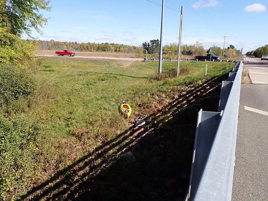
Taking out at Hwy 10
Picture of river by Hwy H…future trip
Scenic drive home
Yellow River – Yellow River Road

The Yellow is an obscure and underrated river for kayaking that I’ve paddled multiple times. Following a two-inch rainstorm, I decided to check out a far upper leg of the Yellow close to Marshfield. Previously, guest contributor (Daniel) noted this that was his favorite leg of the river.
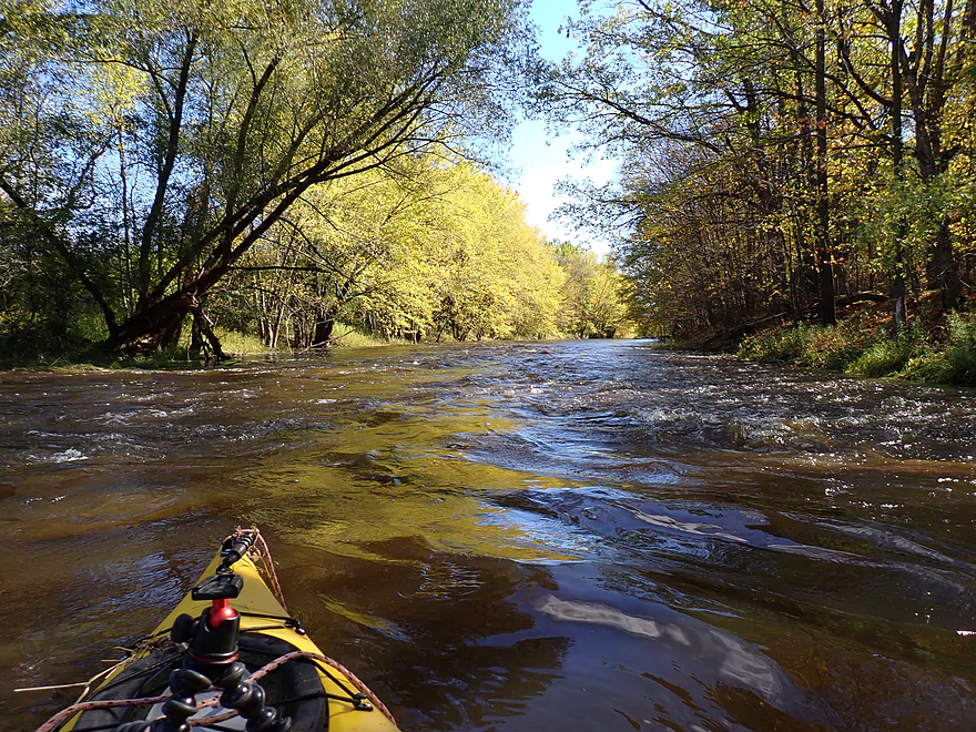
The put-in at Yellow River Road was pretty easy. After launching my first impression was just how high the river was….perhaps 2-3′ above normal, and the receding water lines on the tree trunks indicated it had recently been maybe a half foot higher. Because of the high water, the current was very fast. Thankfully this wasn’t combined with any significant rapids or strainers, but I had to be vigilant not to get pushed into a tree (not too difficult).
One of the reasons I did this trip was I knew it would have good fall color and it did. This year has been a bit of a mess for color. Many drought-stressed trees turned early, while other trees (like the oaks) are still quite green. This stretch has a lot of maple…mostly silver, but some sugar which are super photogenic in October. Often the maples and other trees would branch over and envelop the river creating cool arches and canopies.
At roughly the one-mile mark I came to the BB Road bridge. There is a park here (Ebbe Park), but it is a private snowmobile club and isn’t open to the public as a kayak launch option. The South Branch empties into the Main Branch just past the bridge which contributes significantly to the river. Typically a one-foot ledge and a large block mark the proper end to the South Branch, but it was all washed out under some fast rapids because of the high water.
Part of the reason I was excited to do this trip was because the Google Street View picture of the BB Road bridge by the river was incredibly scenic. But sadly what I saw in person didn’t measure up. The river was much higher, dirtier, and the interesting shoreline with rocks had been completely submerged. In fact I didn’t see too many rocks or much gravel at all on this trip, which is unusual for my Yellow River adventures. The reason again was the crazy high water.
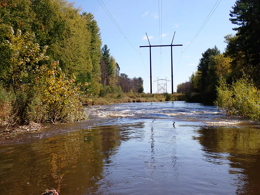
The river did seem to slow somewhat after the South Branch confluence, but there were still occasional light rapids and fast chutes. One of the more noteworthy rapids was located at the two-mile mark by the Robin Road bridge. Below the bridge were some small standing waves followed by a fast chute under a high voltage power line.
Mile 3 of the trip was mostly straight, flat, wide, and wooded. Unfortunately silver maple were common (those don’t turn red), so I was always relieved to find a sugar maple or other more photogenic tree on this stretch.
The last mile of the trip (mile 4) flowed past a large golf course. Here the trees were much nicer and featured some of the best sugar maple of the trip. Near the end I was pleasantly surprised to find a few small but nice outcrops. The trip ended sooner than I expected at the Hwy 10 bridge because of the fast current.
In summary this was a nice trip, and I can recommend it for locals, especially those in the Marshfield area. Several legs on the Upper Yellow can be a bit rough and dangerous, but really this leg isn’t one of them as it was relatively tame outside of a few minor rapids.
What personally frustrated me was that I incorrectly timed what should have been a great trip for pictures. Lighting was bad, water was too high, and the fall color while sometimes nice wasn’t top-notch. This leg is on my redo list and hopefully I can do it again during more ideal conditions. I’m also interested in doing the legs that precede this one, but they have rough Class 3-4 rapids to contend with (or more likely portage).
I didn’t see much…just a few ducks.
Jurustic Park: This whimsical metal sculpture park is a must if you are anywhere close to Marshfield.
Yellow River Road: This was a decent bridge access. The shoulders along Yellow River Road are steep, so pick your parking spot carefully.
Alternative Put-ins:
- Eagle Road: 4.3 miles upstream from Yellow River Road. Eagle Road has steep shoulders for parking but is otherwise a doable bridge access. A tricky stretch between Eagle Road and Hwy H features a fence, possible logjams in fast current, and some Class 3-4 rapids.
- Hwy H: 2.1 miles upstream from Yellow River Road. Hwy H is a busy but doable bridge access. The downstream leg is flatter and more wooded. Maybe a few rapids, but I don’t think this has anything major.
- Hwy BB: 1.3 miles downstream from Yellow River Road. You can’t launch from nearby Ebbe Park (private), but if you really wanted to you should be able to launch from the shoulder instead. Putting in here (instead of Yellow River Road) would omit a pleasant but nothing-special wooded stretch.
- Robin Road: 2.1 miles downstream from Yellow River Road. This should be a doable bridge access. Paddlers might want to launch here if they want to see the golf course stretch (which is scenic) and take out further downstream (say at Hwy 80).
Hwy 10: This is an ok bridge access. I believe most kayakers take out on the northwest shore by the “Wine Rack”. The store looked closed, so instead I got out along the northeast corner where there is an open grassy area. An island splits the channel here, so if you take out on the east shore, make sure to get on your “off ramp” before you go under the bridge.
Alternative Take-outs:
- Lincoln Ave: 2.2 miles downstream from Hwy 10. I believe Lincoln Ave is a doable access. This is a neat leg with dense tree canopies and is very scenic.
- Hwy 80: 3.9 miles downstream from Hwy 10. Hwy 80 is a steep but doable bridge access. The leg preceding Hwy 80 is scenic with a few outcrops and boulder gardens.
Bike Shuttle – Hwy 10 to Yellow River Road: 4.3 miles with 141′ of ascent. This is a manageable bike shuttle but does include a lot of hill climbing.
Current: The current for this trip was pretty fast…especially in the first half of the trip. But this just might be because of the high water. I suspect this stretch typically is somewhat slow with a few fast sections at the rapids.
Logjams: None…apparently locals sometimes clear them out.
Strainers: There were a few strainers to avoid in fast current. These are likely easier to dodge when water levels are lower.
Fences: There is a wire that mostly spans the river by the golf clubhouse…but it is easy to duck under even in high water.
Rapids: Most of the rapids for my trip washed out because of the high water levels. A few stretches featured fun and easy standing waves. I suspect in lower water levels there are maybe 6-10 Class 1’s and maybe one Class 2 (just downstream from Robin Road).
Trip Depth – Yellow River @ Pittsville: 5.25′
Depth Guide: Note, the gauge at Pittsville does not provide consistent readings so may not be reliable. I debated referencing the gauge by Babcock, but that isn’t trustworthy either because of erratic Lake Dexter dam releases. Always use your own judgement and have a plan B if in person water levels don’t look right.
- 0-4.2′: Maybe too shallow.
- 4.3-4.5′: Some shallow spots. Doable in my book, but maybe not for those with deep drafting boats.
- 4.6-4.8′: Above average depth. Maybe a good target range.
- 4.9-5.0′: A higher depth.
- 5.1-5.3: A very high depth with fast pushy current. This stretch can be done at these levels but a lot of the river’s neat character will be submerged below high water.
- 5.4’+: Maybe too high for enjoyable kayaking.
Detailed Overview
- Eagle Road to Yellow River Road: 4.3 miles. Background provided by WisconsinRiverTrips.com contributor Daniel Akin.
- Eagle Road to Hwy HH: 2.2 miles. This is a dangerous section with Class 3 and 4 rapids. There’s also a wire fence across the river to deal with.
- Hwy HH to Yellow River Road: 2.1 miles. A more wooded stretch that I don’t know much about. Nice street view image.
- Yellow River Road to Hwy 10: 4.3 miles.
- Yellow River Road to Hwy BB: 1.3 miles. A nice wooded stretch with no major rapids.
- Hwy BB to Robin Road: 0.8 miles. A scenic stretch of the river. The South Branch joins up by the BB bridge and adds significant volume.
- Robin Road to Hwy 10: 2.1 miles. Great stretch featuring several fun rapids and small outcrops. Much of this flows by a large golf course which can be scenic in the fall because of all the maple trees.
- Hwy 10 to Hwy 80: 4.0 miles.
- Hwy 10 to Lincoln Ave: 2.2 miles. Very narrow and wooded. At times little light reaches the river which is really cool. Neat boulder gardens and a great stretch, but there are two logjams.
- Lincoln Ave to Hwy 80: 1.7 miles. Good stretch with a number of scenic boulder gardens and one nice outcrop.
- Hwy 80 to Hwy N: 3.4 miles. Starts slow, but ends with nice boulder gardens and rapids.
- Hwy N to North Wood County Park (2nd Dam): 2.9 miles. A rocky stretch with some rough whitewater including a Class 3 near the put-in by the “Dells”.
- North Wood County Park (2nd Dam) to Little Bull Falls Grill: 4.2 miles.
- North Wood County Park (2nd Dam) to Hwy C: 2.8 miles. Scenic stretch with many boulder gardens and rapids. The most serious rapids are near Hwy C and include Jenny Falls which is a Class 3.
- Hwy C to Little Bull Falls: 1.2 miles. More rapids and boulder gardens. There is a logjam shortly after Hwy C. Little Bull Falls is a Class 4 and is preceded by a Class 3.
- Little Bull Falls to Dexter Park: 7.5 miles.
- Little Bull Falls to Hwy 73: 1.6 miles. Many rapids on this stretch with some nice rock outcrops. Launch below the falls and at a private access.
- Hwy 73 to Riverside Park: 1.7 miles. More rapids and the biggest and best outcrops. Hwy 73 is a weedy but doable access option.
- Riverside Park to Dexter Park: 4.2 miles. Far fewer outcrops and rapids, but a nice wooded section. Two miles in the flowage kicks in which is less interesting.
- Hwy 54 (Dexter Park) to Hwy 80 (Babcock): 9.7 miles. While you could launch by the park, your best bet will be to launch SW of the dam off Hwy 54. Paddling author Frank liked this section and said it had no logjams, but he did it during high water and there are many downed trees. Can be pushy when high and only for adventurers. Not too many sandbars.
- Hwy 80 to Hwy F: 10.6 miles. Good sandbars. Am not sure about jams.
- Hwy F to 9th Street: 8.3 miles. A nice stretch with good sandbars.
- 9th Street to the dam (Necedah): 16 miles. A lot less sandy and many oxbows. Jams are a question mark. I suspect this is a weak section.
- Necedah to Yellow River Bay: A nice stretch with good sandbars.
- Castle Rock Lake: Blah. Big, open and dangerous flowage (3rd largest in the state).
- Buckhorn State Park: You can explore the back channels and they seem nice, with interpretive signs…but with no current and only 1.5 miles. Here is a map of the official water trail in the park.
Thanks to Frank Piraino, author of “Small River Canoe Adventures of Wisconsin,” and American Whitewater for a lot of this information!
Trip Map
Overview Map
Video
Photos Size: