
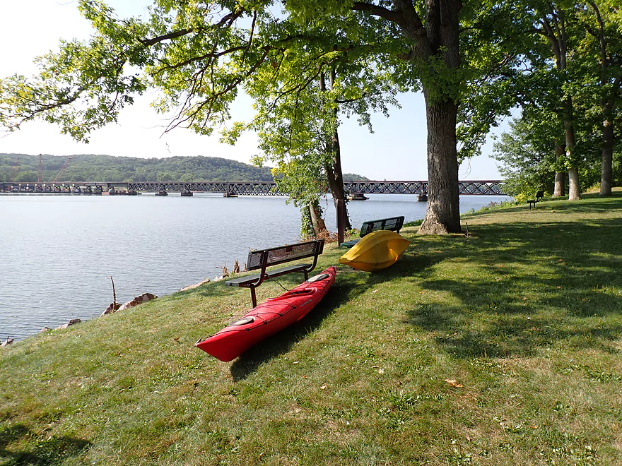
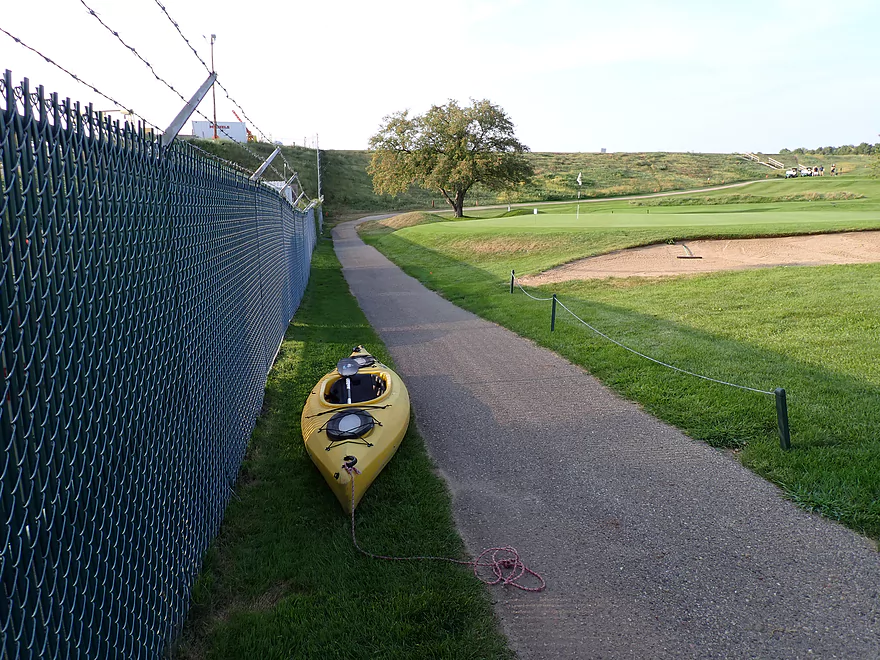
Great put-in at Merrimac Memorial Park
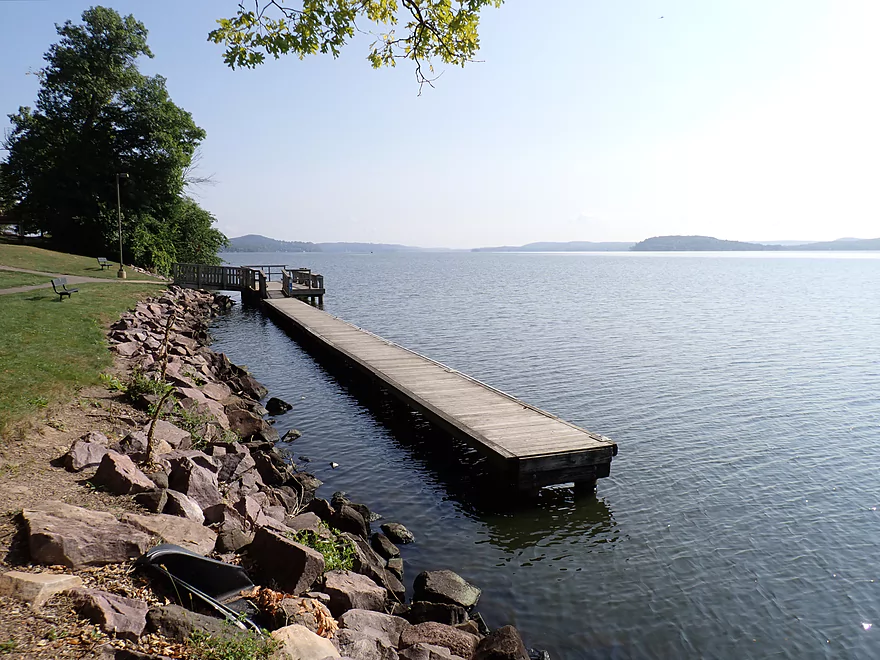
Great public dock
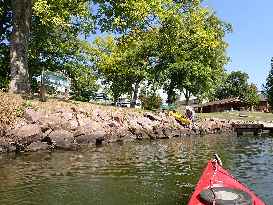
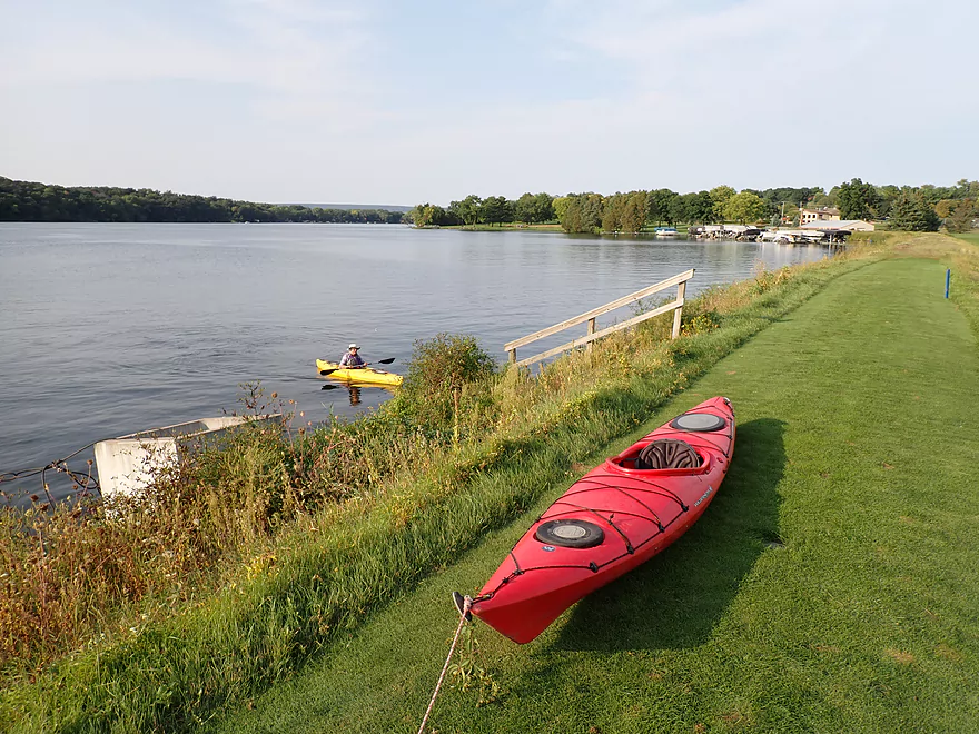
Or you can just slide your boat into the water
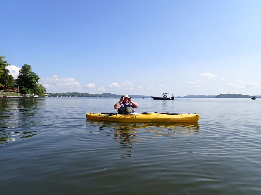
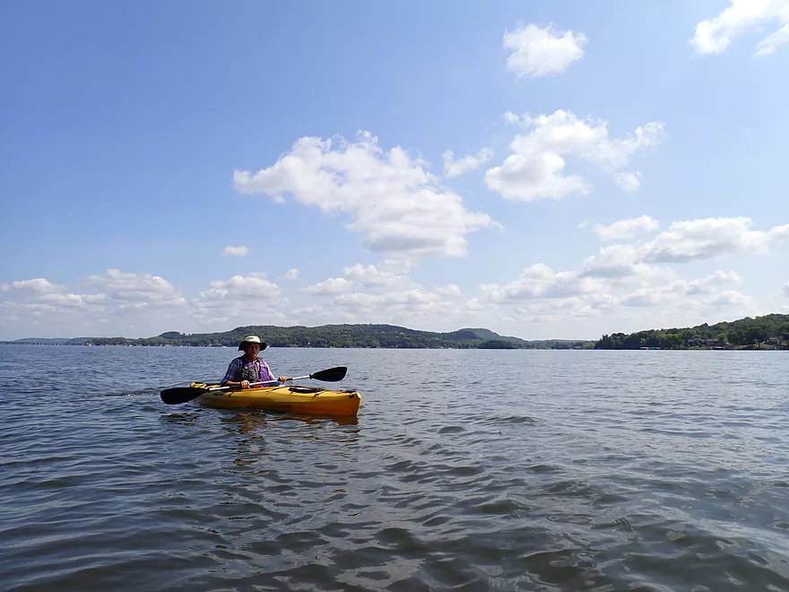
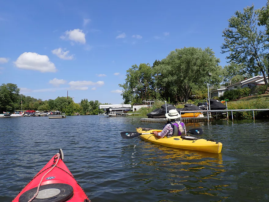
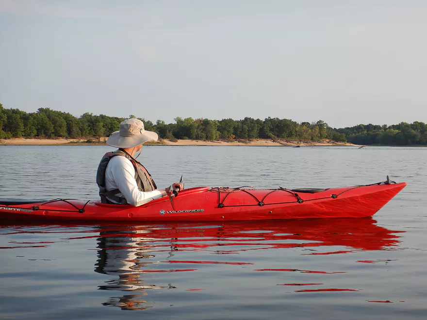
Looking upstream on Lake Wisconsin
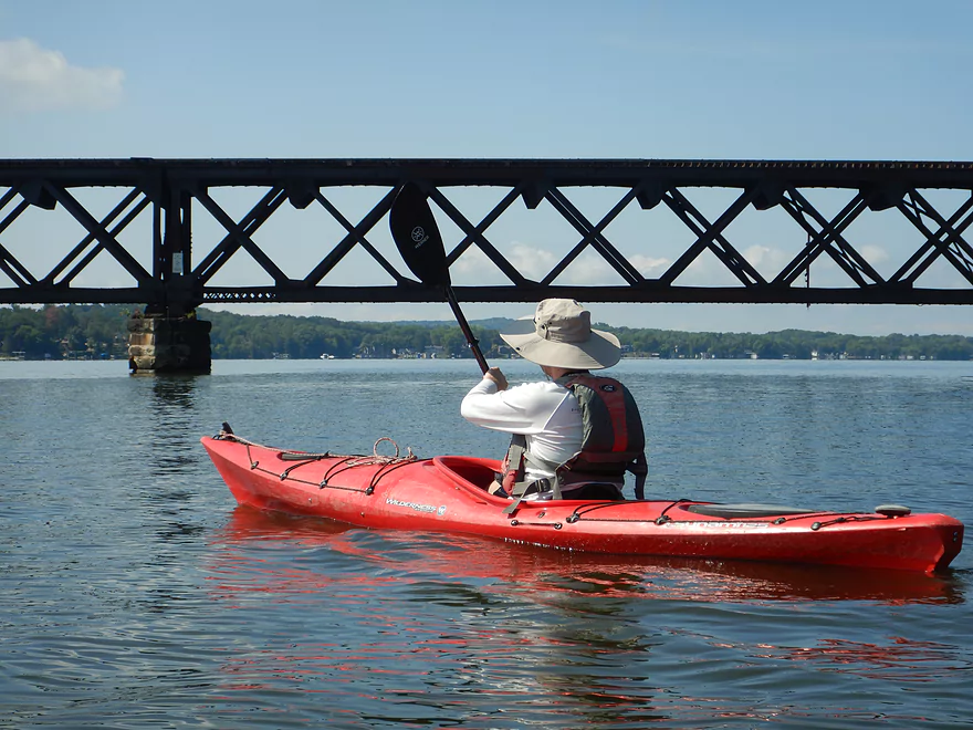
Merrimac railroad bridge
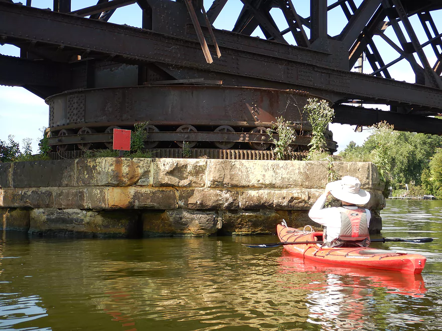
It used rotate open on a massive turret
Parts of the bridge are very low–a result of increased water level from the dam
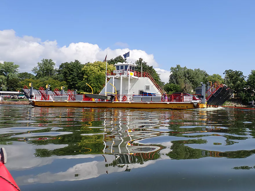
The Merrimac ferry
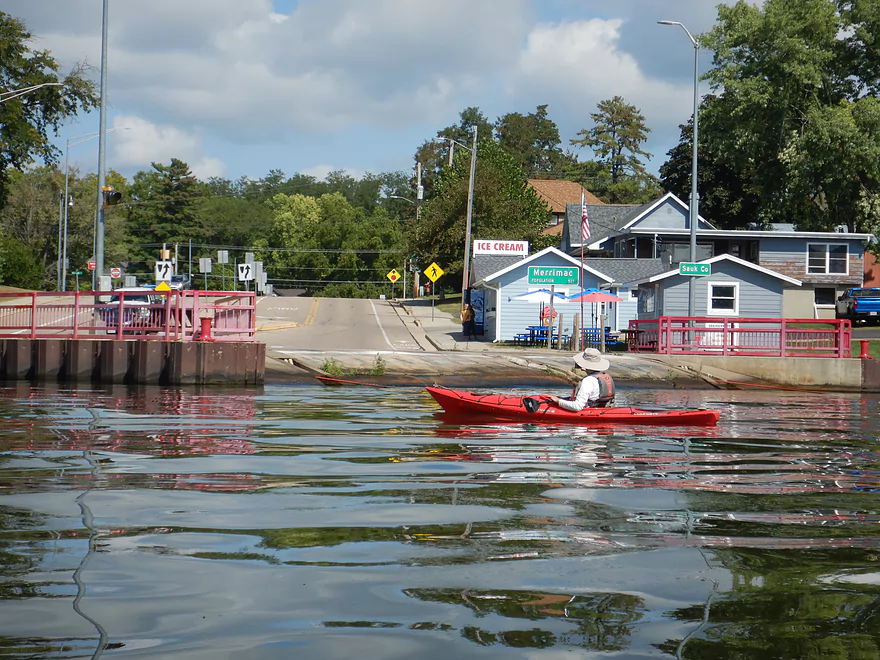
You can buy ice cream while you wait for the ferry
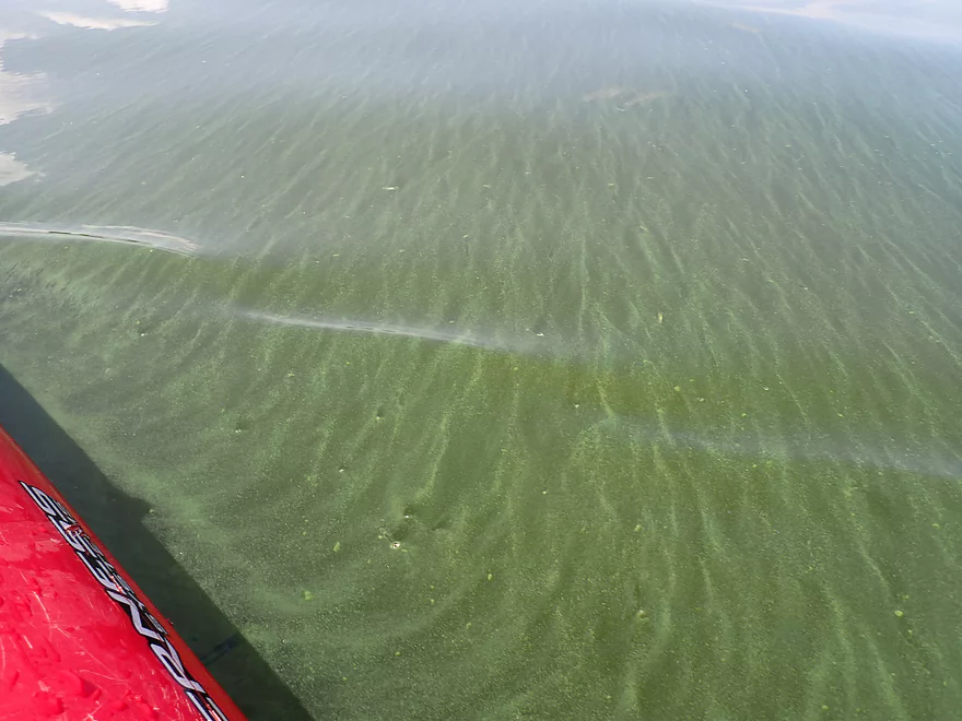
Pea soup
Heading downstream along the north shore
Another view back of Lake Wisconsin
Elaborate staircase and rail setup
Diving board filled with bird excrement
Almost endless shoreline development
Entering Moon Valley Bay (those are the Baraboo hills in the distance)
We explored this inlet, but it had a dead end
!
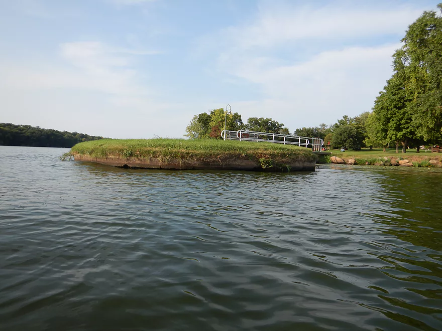
Bay
The Moon Valley boat ramp is huge
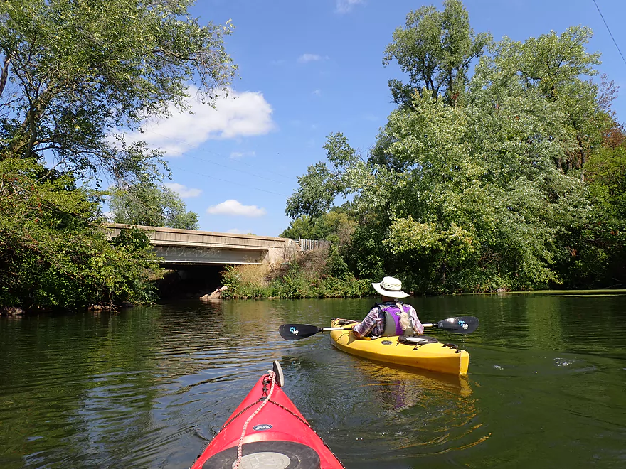
The bay now goes under the Hwy 78/113 bridge
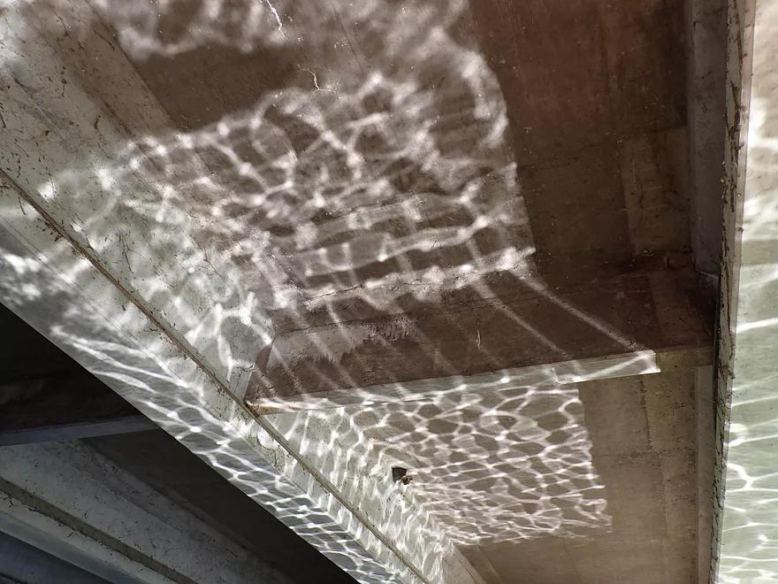
Light patterns on the underside of the bridge
Entering Manley Creek (now flooded by Lake Wisconsin)
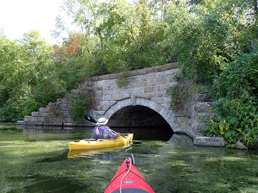
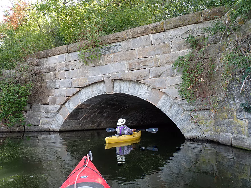
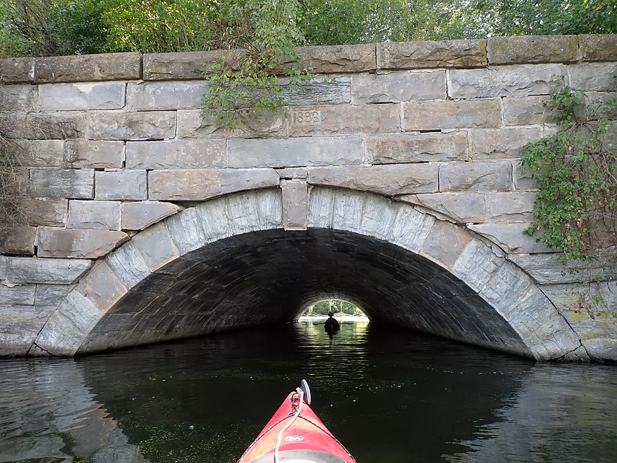
Fantastic stone arch railroad bridge
Eye of the river
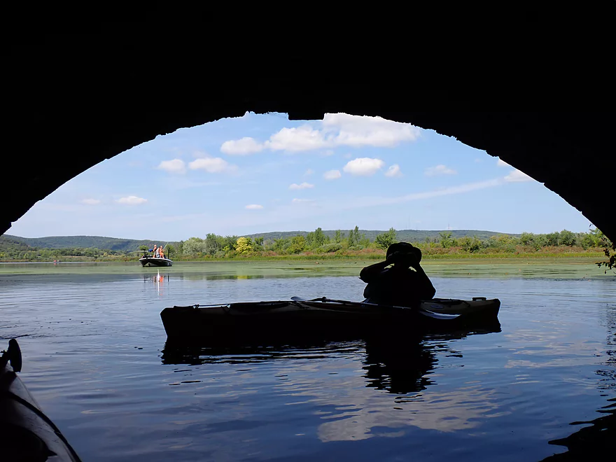
Gallus Slough is on the other side of the tunnel
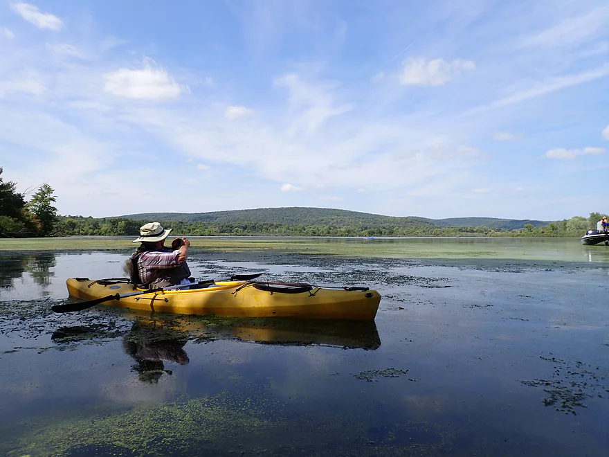
A scenic slough with many fishermen
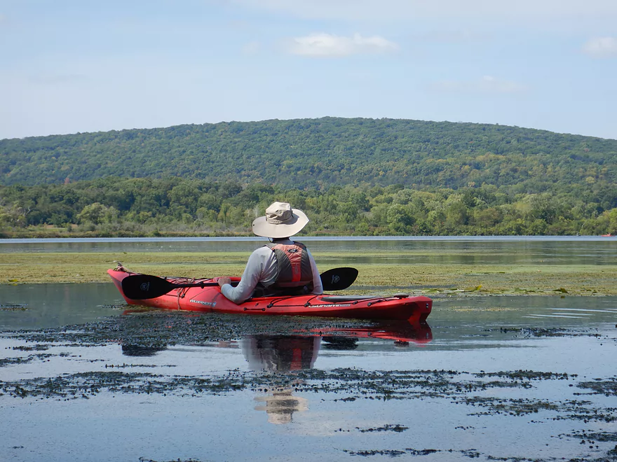
The eastern bluffs of Devil’s Lake can be seen in the distance
Heading back to the railroad bridge
Built in 1896
The bridge was undoubtedly more impressive before Lake Wisconsin flooded most of it
Posing by a couple of fake swans (they looked real from a distance)
Back on the main lake (Gibraltar Rock can be seen in the far distance)
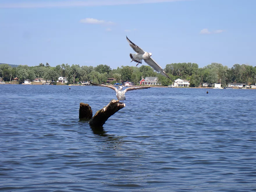
A lot of seagulls on the river
It took a mile of paddling just to cross the channel here
Next part of the trip is long, straight, and boring
A number of expensive homes on the shoreline
A golf island (part of Lake Wisconsin Country Club)
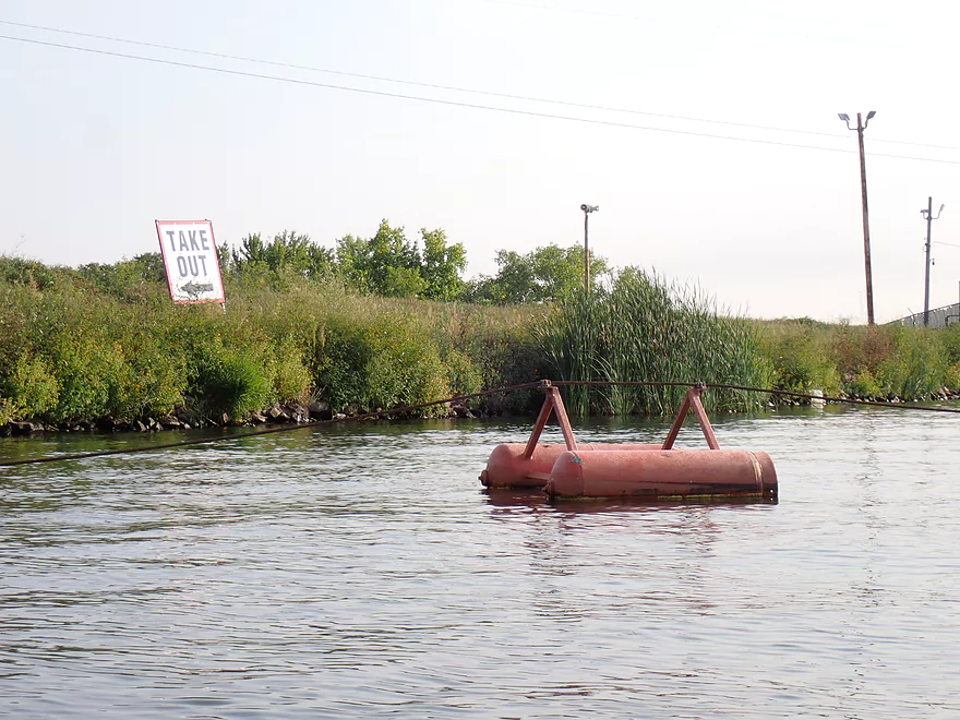
Coming up on the Prairie du Sac dam portage
Take-out steps are a bit weedy but decent
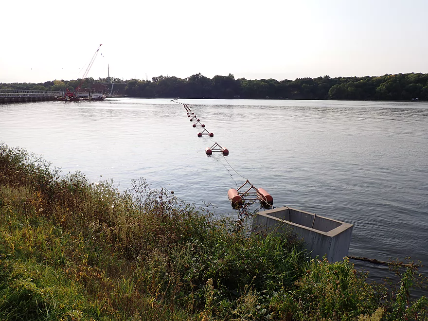
A floating cable prevents you from getting too close to the dam
View from the dike looking north
Next few photos are of the portage path…first dragging our boats down the dike
Sandwhiched between a golf course and barbed wire fence
Then you have to open a special gate for portaging

Finally at the other end of the dam!
View downstream…river is really low
Strange oily stuff oozing out of the ground
View of the dam from the east shore
Gates are in poor condition…some leak…all are being replaced
View of the dam from the west
These tall locks are no longer usable because downstream river levels have dropped 11 ft. from erosion
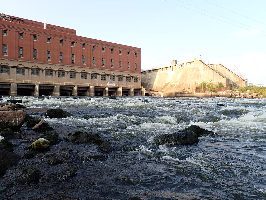
The main powerhouse
A popular hot spot with birds
Fisherman caught a massive paddlefish
Rapids below the powerhouse
Sometimes whitewater paddlers will run them….they can be tricky
Heading back downstream
Getting out by a shallow area
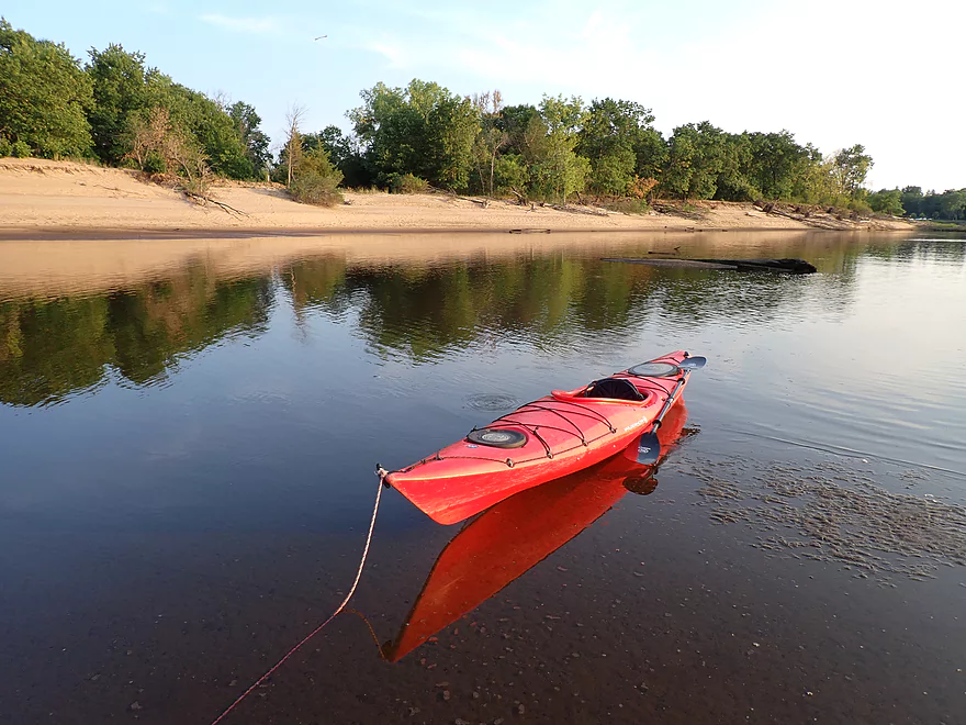
Nice to see sandbars again
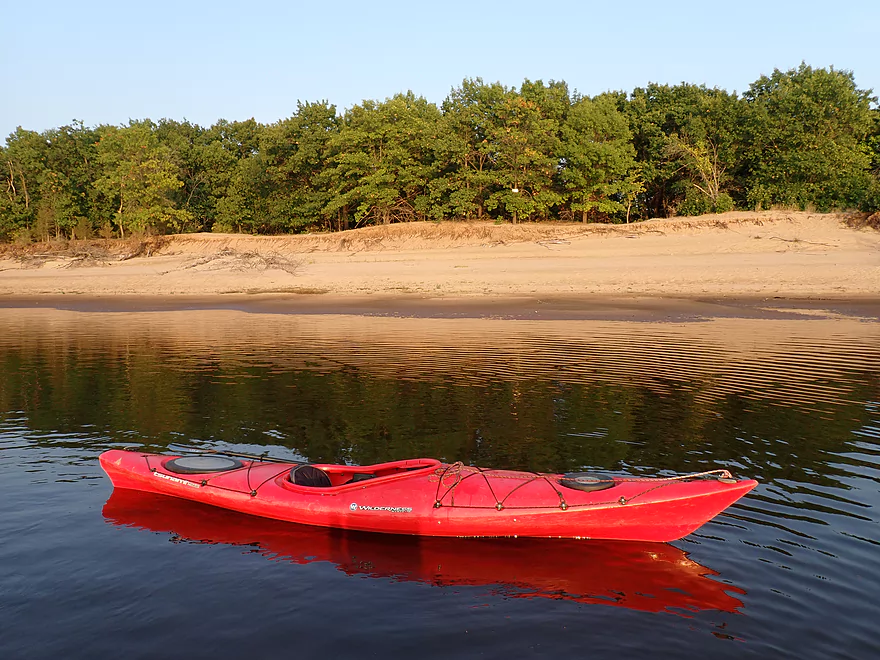
Terrific sandbank on the east shore
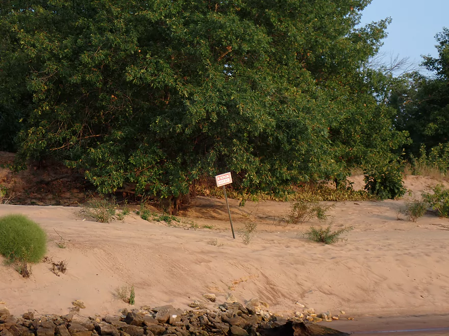
But many No Tresspassing signs prevent public access
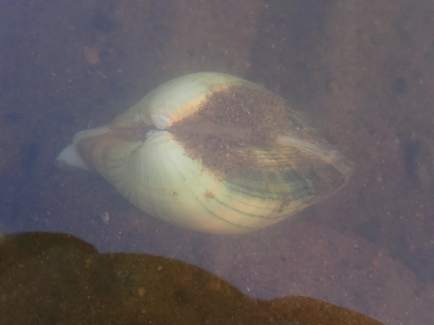
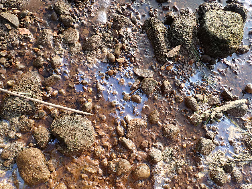
Lot of clams below the dam
Sun starting to start
Poorly pictured, but that’s the Culver’s headquarters
Taking out a Veterans Park in Prairie du Sac
Same view but photographed with morning light
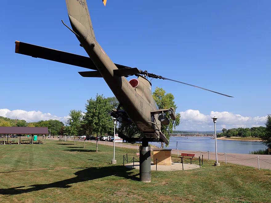
An AH-1S Cobra guards the park
Wisconsin River – Merrimac

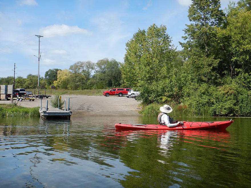
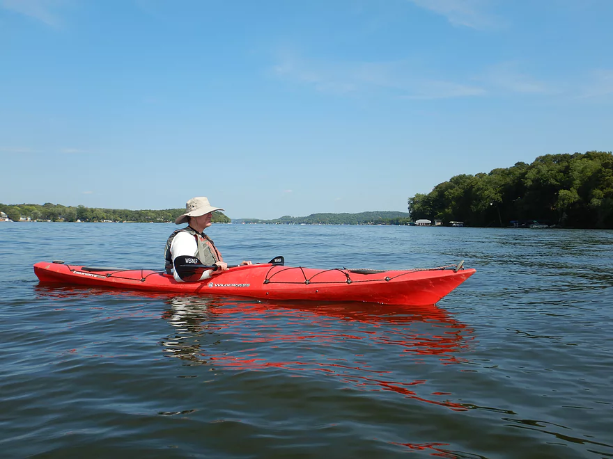
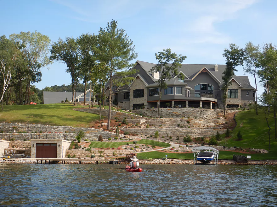
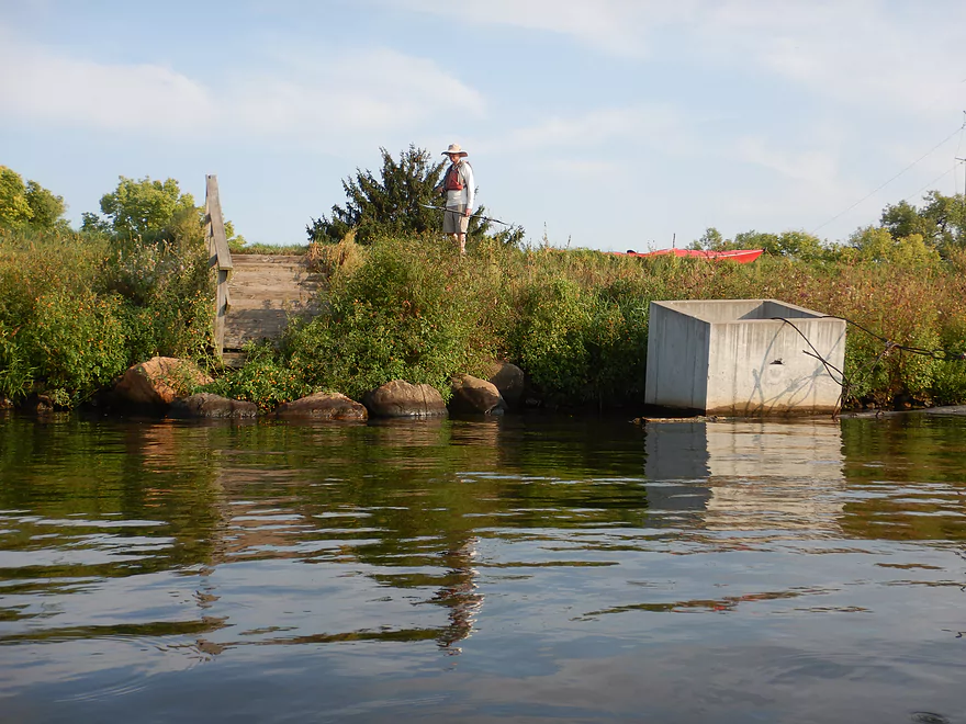
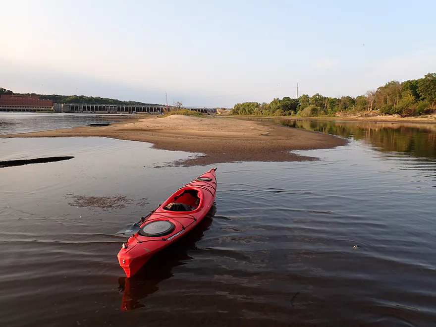
The trip started in Merrimac where there were a couple of put-in options. We scouted the Palisade Street ramp (just west of the ferry landing), which looked doable but was in a dilapidated area with No Parking signs along much (but not all) of Palisade Street. Instead we launched a half mile upstream at Merrimac Memorial Park (what Google incorrectly calls “River Park”) which was a fantastic little park. Here there were many large white oaks, a nice parking area, facilities, a great vista of Lake Wisconsin, and a dock for launching.
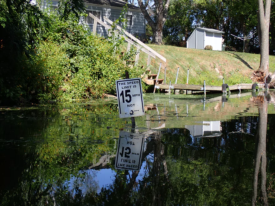
The first landmark of the trip was the Lake Wisconsin railroad bridge, which was surprisingly scenic. The north portion rested on a large turntable which, back in the day, would swing open for taller boats to pass through. Parts of the bridge are quite low and a sign warns not to go under these sections. Many years ago there was an accident in which boaters lost their heads (literally) going under the bridge at night when they couldn’t see. This is not a construction oversight–before Lake Wisconsin raised water levels, the rail bed was 40 ft. above the water.
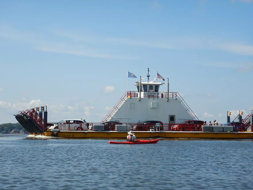
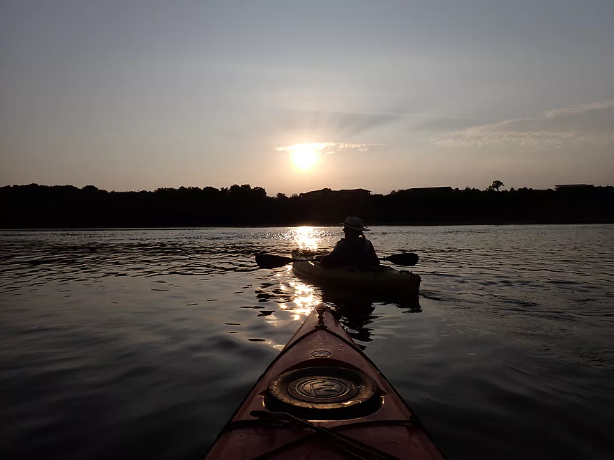
The bridge is immediately followed by the famous Merrimac Ferry. It pulls itself along on three underwater cables that rise up as the boat crosses the channel. We got somewhat close for pictures, but not too close as you wouldn’t want to get tangled in the cables. On both the north and south shores are “terminals” where cars wait to load the ferry. Relatively recently a mild tornado actually passed over the ferry while it was unloading. This was captured by the “Ferry Live Stream” and relayed live via a local TV station. The cars and ferry were unfazed, but nearby trees took a beating.
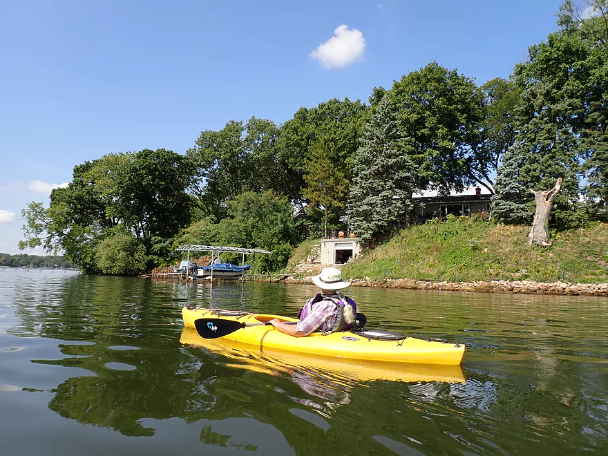
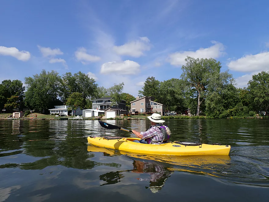
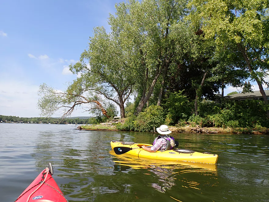
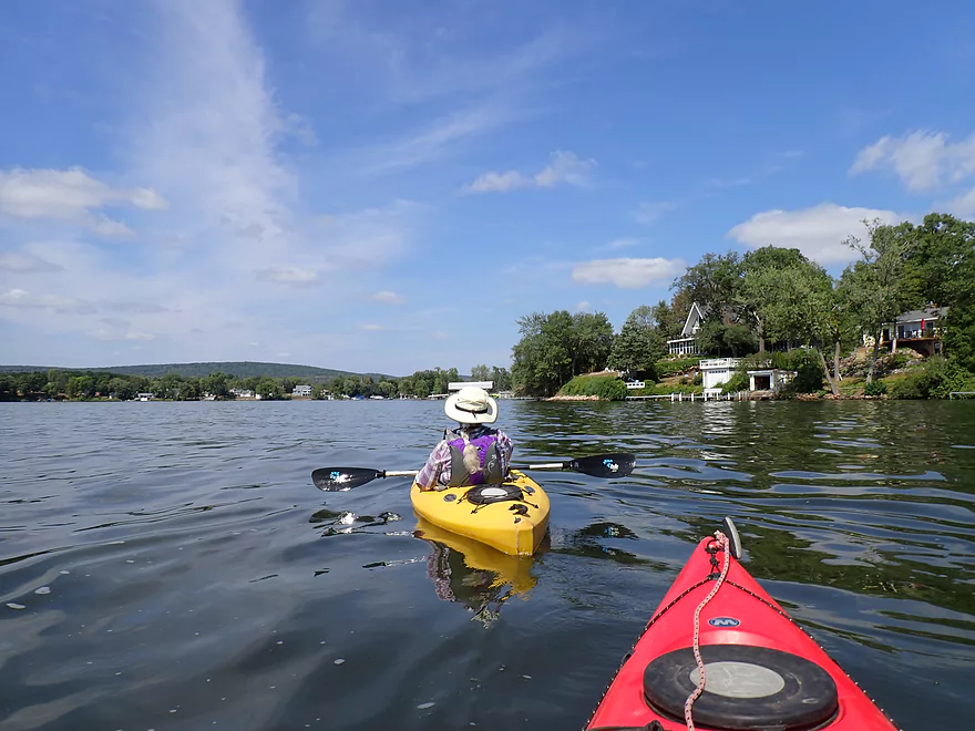
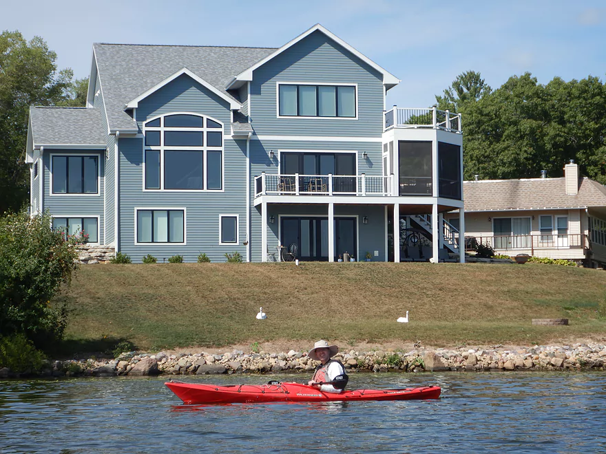
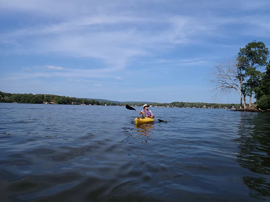
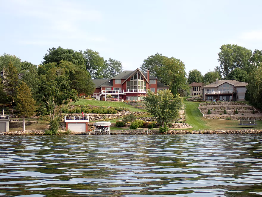
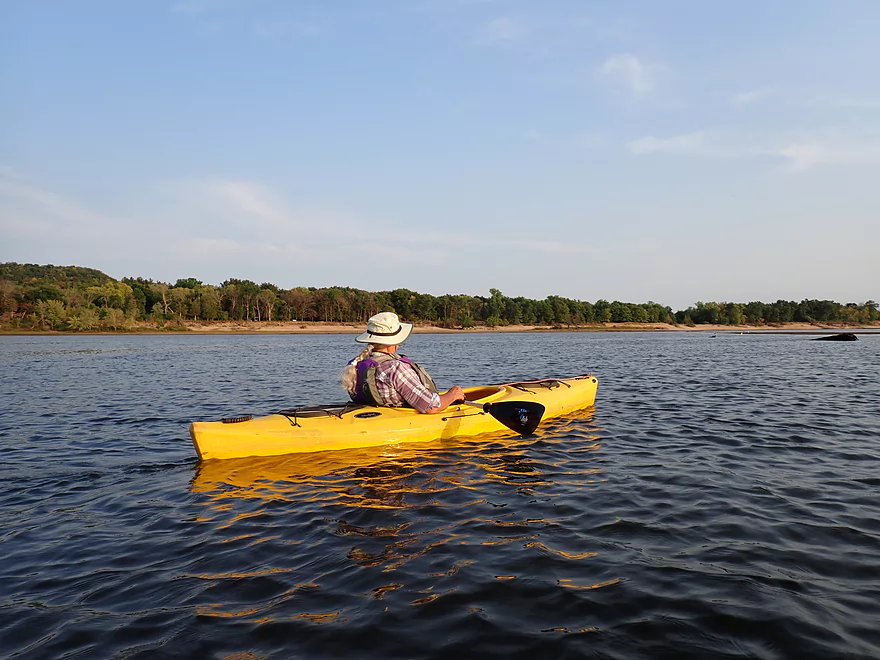
We then hugged the north shore as we continued downstream (the lake is going generally east-west at this point). The shoreline itself was mostly uninteresting, with endless lakeside homes, docks, and pontoon boats. The older cabins were more attractive…these tended to have smaller lot sizes, more trees, and just looked cozier. The more modern McMansions on the other hand looked hideous. These featured oversized lots with eco-desert lawns and gaudy landscaping mostly lacking in trees. While the shoreline development was disappointing, the river downstream from Merrimac did feature some fantastic vistas of the surrounding river bluffs, including Gilbrater Rock. If our cameras had stronger zoom, we likely could have seen hikers standing on the rock’s main overlook.
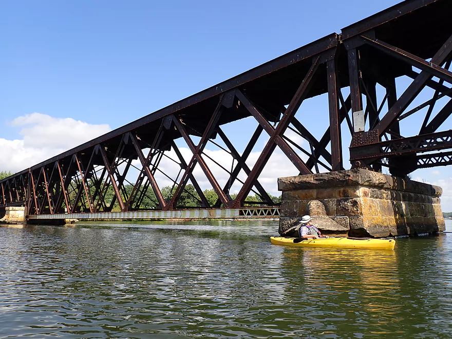
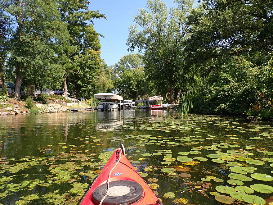
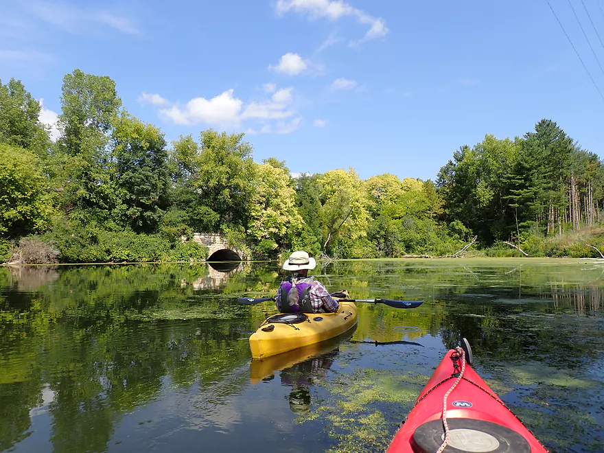
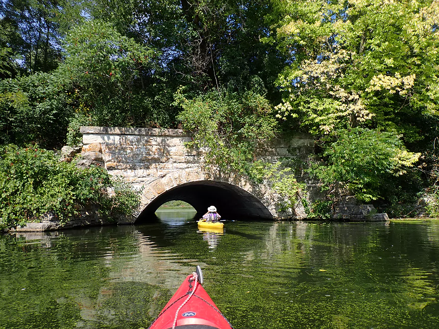
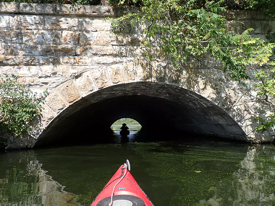
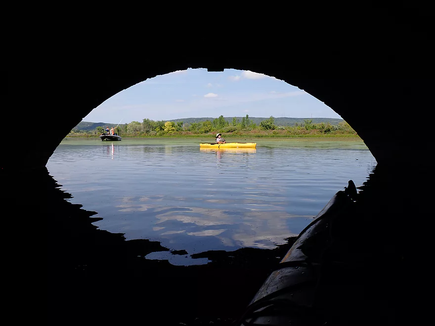
While it added two extra miles to our trip, we wanted to check out Moon Valley Bay and Gallus Slough west of Merrimac. We followed the bay north until it narrowed to a point under the Hwy 78/113 bridge. On the west side of the bay was the large Moon Valley boat ramp, which would have been a decent take-out if we had opted to do a shorter trip. We paddled north of Hwy 78/113 and encountered a fantastic 1896 stone arch railroad bridge. To our surprise a motorboat came out of the tunnel as we approached it, despite the tunnel’s low clearance. North of the tunnel was Gallus Slough, which featured a number of fishing boats (apparently everybody already knows about the secret tunnel trick for getting to the slough).
The slough is very scenic with a fantastic view of the South Bluff of Devil’s Lake. The slough is mostly surrounded by the Merrimac Preserve, with a restored prairie on the western shore. A few years back, a supposedly “controlled” prairie burn in the preserve got out of control and caused a lot of damage. Hwy 113 even had to be temporarily closed. If we had planned a shorter trip, we would have explored further north up the slough into Manley Creek. The creek joins Parfrey’s Glen Creek, so in theory, if you were to go far enough upstream, you could reach Parfrey’s Glen, but I suspect most of Manley Creek is too shallow to kayak.
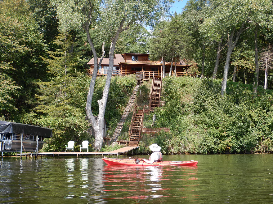
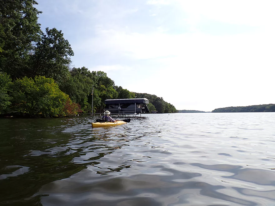
The next part of the trip would turn into a slog. Just to exit Moon Valley Bay and reach the south shore of the lake required a mile of lake paddling. The following lake section featured a long, straight, and boring river channel. The banks were mostly wooded with some bluffs. But the shoreline was heavily developed with often one bankside home after another (each with their own dock setup). Some of the docks were quite elaborate, with rails that led to covered boat houses and elevators that connected the homes to the docks.
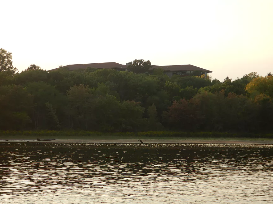
It’s mind blowing to see how much development there is on the river between Dekorra and Sauk City…while the Lower Wisconsin has virtually none. It just goes to show how important conservation is and why people need to stand up to zomby developers who care only about profits and not how they will ruin the scenery for everybody else (and introduce riverside pollution from leaky septic systems). Along the western bank was the famous (or infamous) UW Dairy Forage Research Station which features live cows with surgically added windows on their sides.
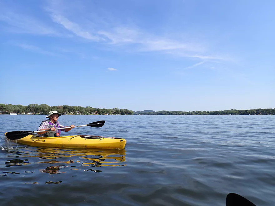
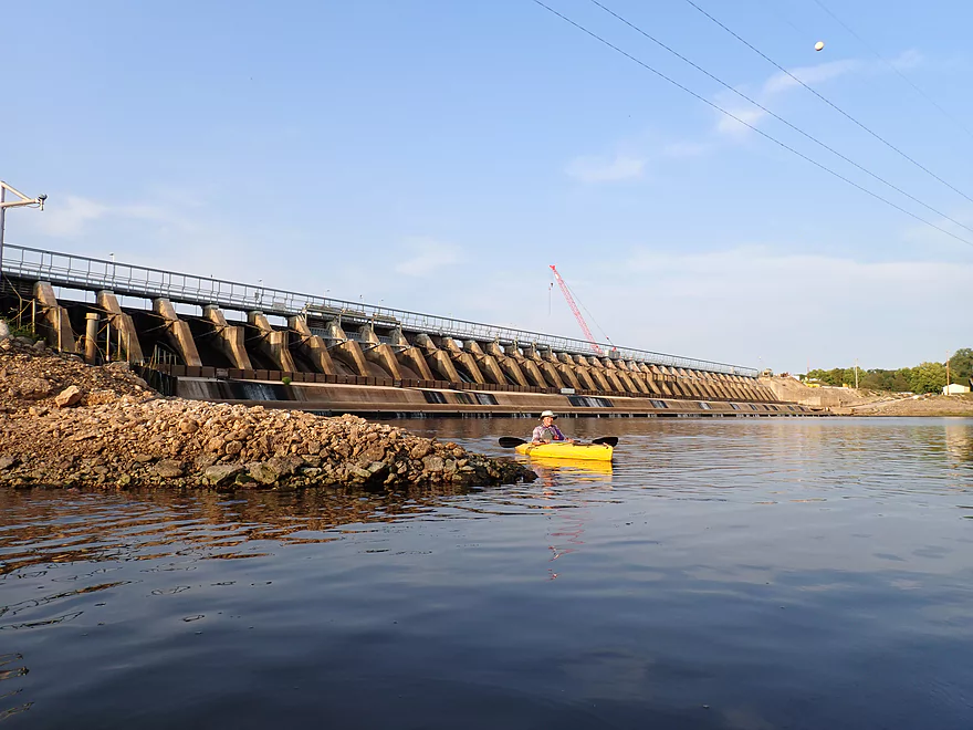
The 3-mile stretch above the Prairie du Sac dam was horrible, with heavy motorboat traffic, some heavy waves, and having to paddle directly into glaring sun. Thankfully there was no wind, but there also wasn’t any current. In fact, if I had to do this stretch again, I would actually paddle it in reverse as then I wouldn’t have to deal with the sun and I would have a constant view of the more scenic northerly bluffs.
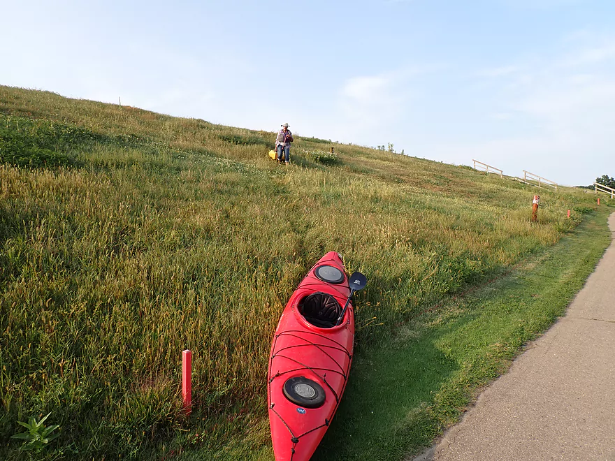
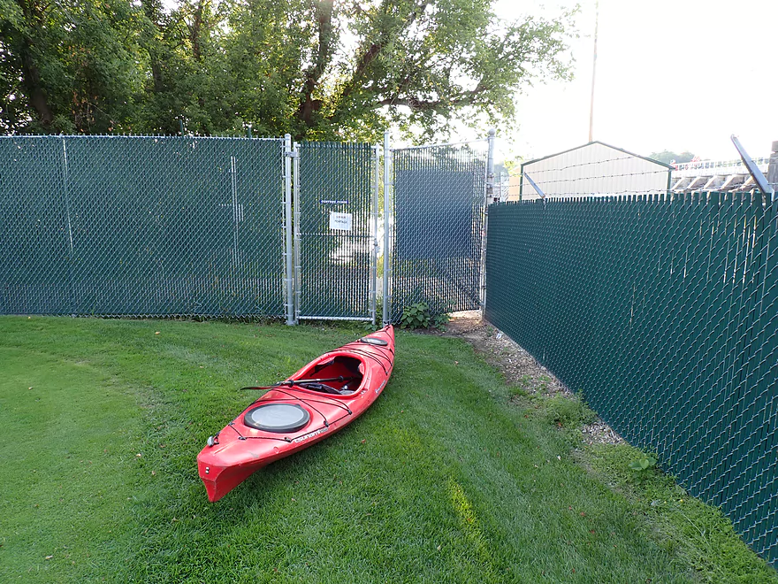
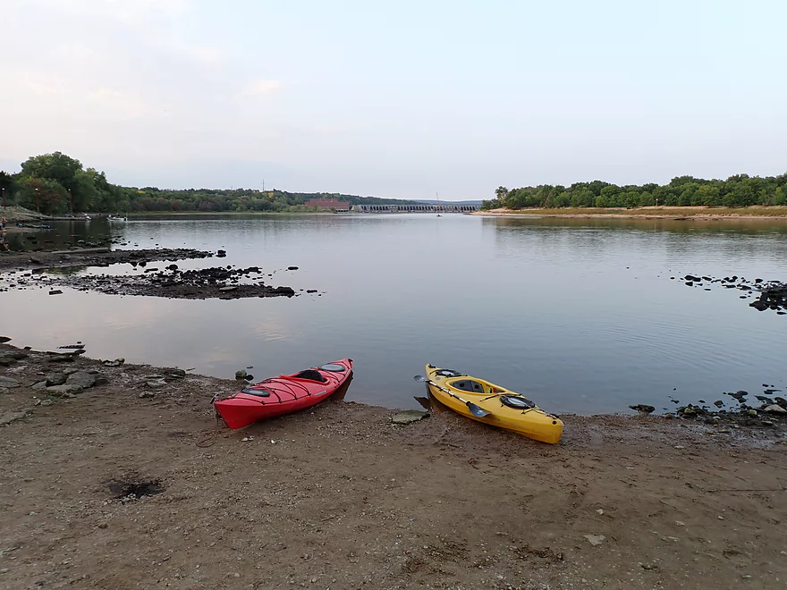
After what seemed like an eternity we reached the dam. A little white sign redirects paddlers to a portage take-out on the east shore. It’s a bit overgrown with little evidence many use it. The shoreline here is deep and rocky, but it was a manageable take-out and wood steps led to the top of the dike. On the other side of the dike was the Lake Wisconsin Country Club which featured a number of loud and rowdy golfers. One golf ball would land surprisingly close to us.
In theory a portage of the Prairie du Sac Dam should be very easy, but a long chain link fence topped with barbed wire flanked by security cameras and No Trespassing signs will force paddlers into a longish 800′ portage around the fence, through the golf course edge and to a gate. It’s not too bad though and the gate is well marked and shouldn’t typically be locked.
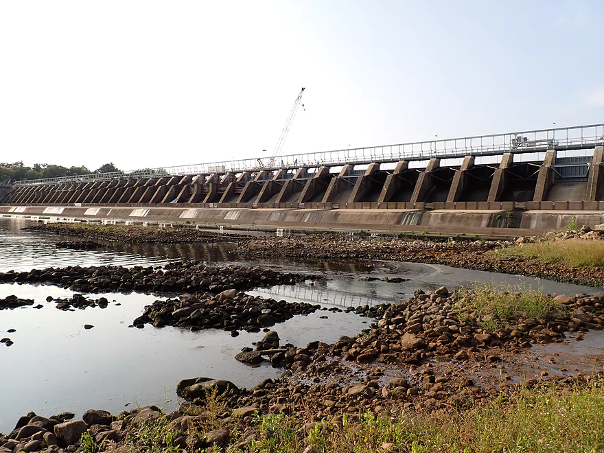
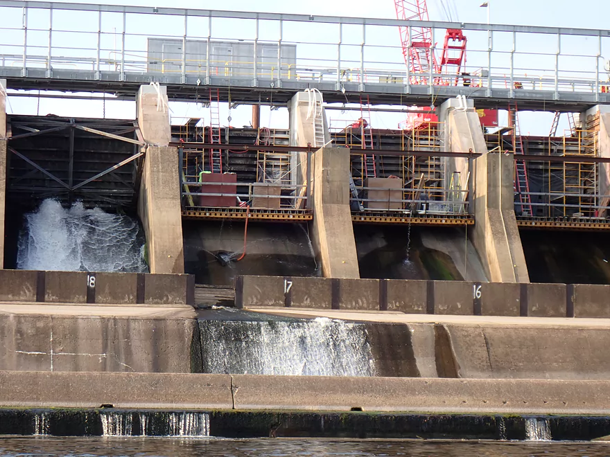
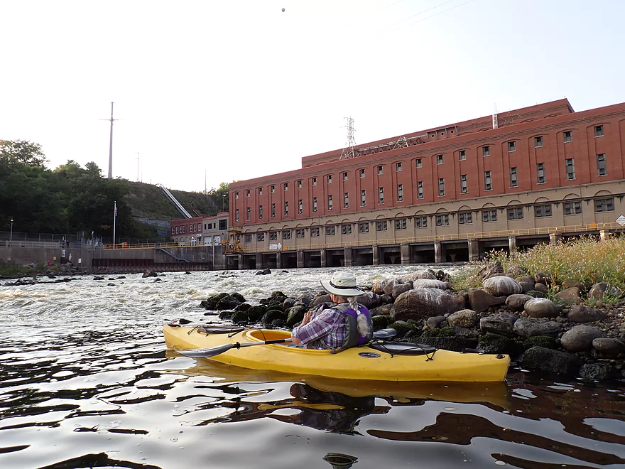
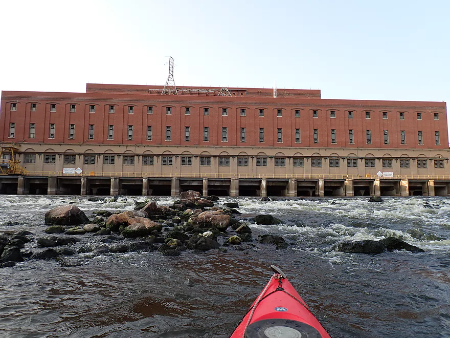
There is a rocky area southeast of the dam where we were able to get back onto the river. Odd oily pollutants were oozing up out of the ground and seeping into the river, so I had to be careful where I stepped. The dam itself had most of its gates shut because of the drought, but several gates appeared to leak. The dam is old (107 years) and in poor condition. Construction equipment is presently on the east shore where emergency repairs are taking place to replace all the gates which have weakened over the years with a few even buckling.
Personally I wish the dam would be removed instead of repaired. This would reveal some nice shoreline (pre-dam pictures) and sandbars north of Prairie du Sac. But the NIMBY’s that live along the Lake Wisconsin lake-shore would never allow this. What’s interesting is that the Prairie du Sac Dam while one of the larger dams in Wisconsin, only produces a mere 31 MW. In contrast, the Glacier Hills Wind Park also in Columbia County produces 162 MW. It just goes to show that hydro-power is a bit of a myth (unless it’s incredibly huge like the Hoover Dam).
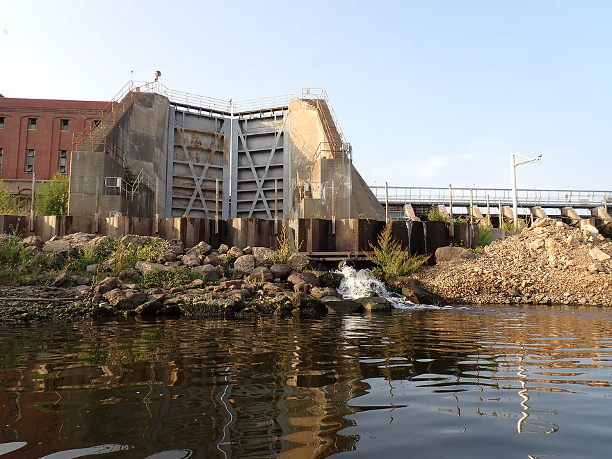
We continued west directly under the gates for pictures. This isn’t something you could do in high water as the discharge area can get crazy rowdy with huge plumes of water and strong current. Closer to the west end is the lock which hasn’t been used for years (old picture) and can’t be used today because the dam physically lowered river levels below the dam by 11 feet.
The powerhouse at the far west end is interesting with an impressive series of Class 3 rapids directly below it. I got close for photos but not too close as the currents are slightly irregular and could be a bit tricky. UW Hoofers used to do whitewater runs on the rapids here which could be fun (if you know what you’re doing and are properly equipped). The powerhouse building itself is over a century old, but is not as dilapidated as many other older powerhouses in the state. In school I actually got to take a field trip inside which was interesting. The highlight was a catwalk that overlooked the old lock and being able to see the inlet areas for the turbines. Here there were shocking number of dead fish piled up. I’m not sure if they were killed/trapped by the dam, or were already dead and just were flushed downstream into the dam by the current. Dams turbines are infamous for killing many fish…supposedly 22% of all fish that pass through them are killed.
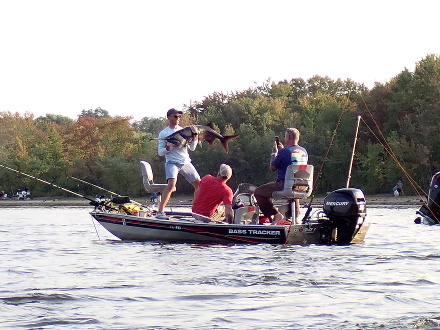
West of the powerhouse is a popular public access which featured a number of fishermen. Many fishing boats braved the shallow waters to get close to the dam because the fishing was so good. We saw (and photographed) a fisherman catch a HUGE paddlefish right in front of our eyes.
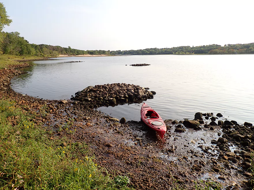
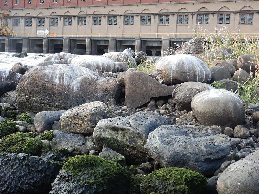
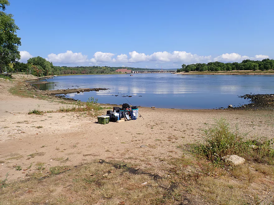
We could have taken out by the dam but decided to continue downstream to the next landing. We crossed over to the eastern shore which featured a fantastic sandbank. It would have been nice to take a break there…but a large number of No Trespassing signs are posted along the east bank. It’s kind of sad to see this…much of Europe in contrast has a “right to ramble” on undeveloped lands (even if private) and maybe that’s something that should be considered in the US. I still got out to wade by the sandbars and saw some fantastic clams and clam trails. Sadly these clams (like the paddlefish and many, many other species) are blocked by the dam and can’t go further upstream.
All in all, it was remarkable how much nicer, more varied, and scenic the Wisconsin River is below the dam. The dam, by the way, marks the beginning of the Lower Wisconsin State Riverway, a protected corridor that extends 92 miles to the Mississippi River. No more dam portages after this.
We paddled past the Culver’s Headquarters situated atop a bluff, and ended the trip at Veterans Memorial Park. Astute readers may note we ALSO put in at a “Memorial Park”. Wisconsin has countless “Memorial Parks” which can cause confusion. The Prairie park featured two take-outs. The one to the south used to be the main launch but I believe became silted in, so is now is just exclusively used for paddlers, while a newer launch to the north is used for powerboaters.
In summary this was a mostly weak trip with a lot of repetitive lake paddling. There are countless other legs of the Wisconsin River which are nicer. There were three highlight areas of the trip though that saved this from being a one-star review. That would be the ferry/RR bridge, Moon Bay, and the Dam/sandbank. This trip may have appeal for “Wisconsin River completists” and locals looking to explore. There are many intermediate landings and access points that could shorten this trip. Timing a trip for early morning for or for a late sunset may be ways of making a trip more interesting.
Sights included a lot of seagulls, a large flock of cormorants, many clams below the dam, and one lame goose. The highlight was seeing a fishermen catch (and release) a HUGE paddlefish. These are really unique fish known for their size and having a blade-like snout. They are endangered so fishermen are legally supposed to release them if caught.
Merrimac Ferry: The ferry is free and will take you and your car across the Wisconsin River. While not very fast and sometimes subject to traffic backups, it’s a neat experience and offers a great view of the Wisconsin River.
Parfrey’s Glen: Located just north of Merrimac, this is a state natural area that features a popular hiking trail along a small creek. At the far north end, the trail goes through a scenic sandstone gorge with a nice view of a small waterfall.
Merrimac Preserve: Located just east of Devil’s Lake, the preserve features a large swath of restored prairie. This is a scenic area that can be explored via several nature trails. The prairie is backdropped by scenic bluffs.
Gibraltar Rock: This is a 200′ high flat-topped bluff which has an impressive view of the Wisconsin River valley. The main overlook can be reached via a trail system from either the north or south.
Great Sauk Trail: This is a paved bike trail that connects Sauk City to the western edge of Devil’s Lake. It’s very popular with locals and features some artsy sculptures. The eventual plans are to connect it to Dane County and Reedsburg.
Alternate Put-ins:
- Palisade Street (0.5 miles downstream from Memorial Park): You have to be careful where you park, but this is a doable access. Memorial Park though is much better and allows you to paddle past the scenic railroad bridge and ferry.
- Other Put-ins: Lake Wisconsin has many access options and I won’t list them all here, but you can see them on my overview map.
Veterans Memorial Park in Prairie du Sac: This is an excellent public access with free parking and facilities. Note, there are two landings at the park. The north one is for motorboats only, and the south one is for kayaks/canoes only.
Alternate Take-outs:
- Moon Valley Landing (6.3 miles upstream from Veterans Memorial Park): In hindsight maybe we should have taken out here, as the trip proved longer than expected. The river downstream from Moon Valley isn’t very interesting outside of the dam.
- Dam Road/Prairie du Sac Dam (0.8 miles upstream from Veterans Memorial Park): This is an ok access. Sometimes whitewater paddlers will launch here to run the rapids below the powerhouse.
- Other Take-outs: Lake Wisconsin has many access options and I won’t list them all here, but you can see them on my overview map.
Bike Shuttle – Prairie du Sac to Merrimac: 10.0 miles with 194′ of ascent. Despite being able to use the Great Sauk Trail for a few miles, this would be a grueling, long and hilly shuttle that I wouldn’t recommend.
Current: None really, until you get below the dam.
Dam: A floating buoy fence will keep you away from the top gates. Below the gates, it will be pretty safe if water levels are low. But if levels are high, paddlers should be careful to stay away from the outwash which can be extreme.
Rapids: There are no rapids above the dam, but there are Class 3 rapids below the powerhouse. Sometimes whitewater paddlers will intentionally run these. These rapids can be dangerous because of the irregular currents that sometimes recirculate and strong eddies (especially in high water). These are easy to avoid if you don’t want to run them.
Wind: This is a very exposed stretch of river in which headwinds can be an issue.
Waves: Powerboat waves are annoying, especially closer to Merrimac. Waves will be worst on weekend afternoons.
Sun: Because of the amount of time spent paddling due south directly into the sun with almost no variation, paddlers should carefully consider their sun exposure. A broad-brimmed hat is recommended as well as sunglasses. Water reflects a lot of sunlight which can affect your eyes.
Depth: The river above the dam is extremely deep, while the river directly below the dam is often quite shallow.
Closest Gauge: Wisconsin River @ Muscoda
Trip Depth: 3200 CFS or 0.55′
Navigability Estimates: The following are very rough estimates. Always use your own judgement. Generally speaking the river levels above the dam will be consistent and navigable. Portaging the dam in high water can be tricky because of the open gates and strong discharges.
- 2,000-3,000 CFS: Extremely low levels.
- 3,001-5,000 CFS: Low level.
- 5,001-7,500 CFS: Average fall depth.
- 7,501-10,000 CFS: Average late summer depth.
- 10,001-12,500 CFS: Above average depth.
- 12,501-15,000 CFS: A slightly above average depth.
- 15,001-20,000 CFS: A high depth.
- 20,001+ CFS: A very high depth.
Quick Overview
- Upstream of Stevens Point: I don't have information yet on these stretches.
- Stevens Point to Lake Petenwell: ~42 miles. This stretch in Central Wisconsin used to have many natural rapids, but most have been buried under 8 dams, some of which are now difficult portages. Despite this there is still some good paddling to be had in this region.
- Lake Petenwell: 14.9 miles. This is a large flowage lake that is challenging for paddlers because of frequent strong winds and big waves.
- Castle Rock Lake: 14.5 miles. Another large flowage lake that is likely too big for enjoyable paddling.
- Castle Rock Lake Dam to Lemonweir River: 9.4 miles. This pre-Dells leg isn't elite, but is a pleasant stretch.
- Lemonweir River to Indian Trails Landing: 21.7 miles. This includes the famous Upper Dells and Lower Dells which feature many scenic sandstone outcrops.
- Indian Trails Landing to Portage: 16 miles. This is an overlooked section sandwiched between the Dells and Portage. While the scenery isn't top-notch, it does have many sandbars and few people which is a nice combination.
- Portage to Lake Wisconsin: 14.3 miles. This is a neat stretch of the river with many sandbars and cliffs, but the shoreline is very developed and motorboat traffic can be heavy on weekends.
- Lake Wisconsin: 14.5 miles. This is a challenging lake for paddling because of the huge and frequent waves created by motorboats.
- Prairie du Sac Dam to Port Andrews: 57 miles. This is the first half of the famous Lower Wisconsin Riverway. This is a super popular stretch for paddlers with the highlights being large sandbars, big bluffs, occasional cliffs, and fun side sloughs to explore.
- Port Andrews to Wyalusing: 40 miles. This is the second half of the Lower Wisconsin Riverway which has far fewer paddlers and sandbars. But the bluffs and sloughs are larger and more interesting.
Detailed Overview
- Upstream of Merrill: I don't have enough information yet on these legs to comment.
- Merrill Dam to Riverside Park: 0.5 miles. Might include some light rapids below the dam.
- Riverside Park in Merrill to Wisconsin River Forest Landing: 8.6 miles. A good prospect.
- Wisconsin River Forest Landing to Brokaw Boat Landing: 5.7 miles.
- Wisconsin River Forest Landing to Jesse Park: 1.4 miles. A terrific stretch with small boulder gardens, one set of Class 1-2 rapids, gravel bars and a nice sand bank.
- Jesse Park to Brokaw Boat Landing: 4.3 miles. A good stretch with scenic wooded banks and occasional gravel bars.
- Brokaw Boat Landing to Gilbert Park: 5.1 miles. River slows down and becomes hillier. This stretch is an ok prospect and goes past the old Brokaw paper plant that has been shut down. Paddlers must navigate Class 1 rapids and 2' drop where the old Brokaw dam used to be.
- Gilbert Park to Wausau Boat Dock: 1.5 miles. An impounded stretch through Wausau. There are numerous alternate access options to choose from.
- Wausau Boat Dock to Oak Island Boat Ramp: 1.2 miles. A nice stretch that includes Barkers Island and Isle of Ferns Park. But the Wausau dam does require a portage. This stretch parallels the famous Wausau Whitewater Park.
- Oak Island Boat Ramp to Rothschild Dam Access: 5.8 miles. Likely mostly uninteresting flowage paddling. There are many alternate access options to choose from.
- Rothschild Dam Access to Zimpro Park: 1.0 miles. This might be a nice stretch.
- Zimpro Park to River Road Boat Landing: 7.6 miles. The first half of this leg is likely nice river paddling, but the second leg is probably just an uninteresting flowage.
- Chucks Landing/Mosinee Dam to Bean's Eddy Boat Landing: 2.8 miles. Likely a nice leg. You might be able to launch by the dam where there should be some nice rapids and boulders.
- Bean's Eddy Boat Landing to Seagull Boat Landing: 5.1 miles. Mostly uninteresting flowage paddling. Although there might be some nice sand banks on the eastern shore.
- Seagull Boat Landing to Dubay Dam Access: 5.3 miles. Mostly uninteresting flowage paddling.
- Dubay Dam Access to River Road Landing: 5.5 miles. This could be a nice stretch of river.
- River Road Landing to Old US 10 Landing: 2.3 miles. Likely an ok leg.
- Old US 10 Landing to Stevens Point Dam: 5.6 miles. Probably uninteresting flowage paddling. Many alternate access options closer to Stevens Point.
- Stevens Point Dam to Blue Heron Boat Landing: 4.2 miles.
- Steven Point Dam to Whiting Dam: 2.6 miles. Starts slow and uninteresting, but the river becomes very scenic after the Hwy HH bridge. The rock formations below both dams are very striking. Many alt access points.
- Whiting Dam to Kimberly Clark Dam/Al Tech Park: 0.6 miles. Incredible scenery with exposed bedrock and boulder gardens below the Whiting Dam. Some rapids, but nothing major. The Kimberly Clark Dam is a dangerous low-head dam and should be treated carefully.
- Kimberly Clark Dam to Blue Heron Landing: 1.0 miles. Class 2 rapids below the dam, but after that the river slows dramatically and splits into many sub-channels and islands. Round trips on this leg are possible. I chose the far western channel where there were some nice rocky stretches.
- Blue Heron Landing to Mill Creek Landing: 4.1 miles. Likely a mediocre paddle with nothing special. Galecke Park is an alternate access.
- Mill Creek Landing to Biron Dam North Gate: 7.6 miles. Mostly uninteresting flowage paddling. Several alternate access options on route.
- Biron Dam North Gate to Veteran's Memorial Park: 4.5 miles.
- Biron Dam North Gate to Biron Landing: 1.0 miles. Super scenic stretch by two islands with many granite boulders.
- Biron Landing to Legion Park: 3.0 miles. A nice stretch by Big Island. The west channel is more undeveloped...but the east channel has several scenic granite islands.
- Portage through Legion Park: 680'. A steep wall separates the park from the river but in two locations the wall is short enough to get over (see map). Paddlers may want to consider a longer portage to bypass some of the shallow rocky stretches by Legion Park.
- Legion Park to Veteran's Memorial Park: 0.4 miles. A scenic stretch that features a large boulder field and the powerhouse of a large paper mill.
- Veteran's Memorial Park to Port Edwards Landing: 3.8 miles
- Veteran's Memorial Park to Demitz Park: 0.8 miles. A pleasant stretch that includes Belle Island.
- Demitz Park to Ben Hansen Park: 1.2 miles. This leg goes by Garrison Island and Edwards Island. Lyon Park is located across the river from Demitz Park and is another access option.
- Ben Hansen Park to Port Edwards Landing: 1.8 miles. Nice prospect that includes paddling past some historic islands. The Centralia dam should be an easy portage (east bank by golf course).
- Port Edwards Landing to Nekoosa/Riverside Park: 3.6 miles.
- Port Edwards Landing to Port Edwards Powerhouse: 1.3 miles. A half-mile portage is required. A very scenic boulder field is located below the dam. At high levels, the rocks are submerged and produce a half mile stretch of rapids (some strong).
- Powerhouse to Moccasin Creek Landing: 1.8 miles. A generic wooded stretch that isn't super interesting.
- Moccasin Creek Landing to Riverside Park: 0.5 miles. During the Nekoosa dam drawdown, this stretch had nice boulder fields and rapids.
- Riverside Park to Hwy 73: 0.8 miles. An ok stretch of the river. There are scenic cliffs south of Hwy 73, but these are past the dam warning line. Hwy 73 is not a good access option.
- Hwy 73 to Point Basse Ave (Portage of the Nekoosa Dam): 1.5 miles. A difficult 1.5 mile portage through downtown Nekoosa. Don't try to portage the south bank. There is a steep hill, cliffs, and large Domtar paper mill fences to deal with.
- Point Basse Ave to Jim Freeman Memorial Boat Landing: 0.8 miles. A generic stretch going by historic Point Basse. If you're willing to backtrack to the dam, you can see scenic boulder fields (during low flows) and a few cliffs. Point Basse Ave is a somewhat speculative access, but it seems public and doable for launching.
- Jim Freeman Memorial Boat Landing to Plank Hill Small Boat Access: 2.0 miles. Generic stretch.
- Plank Hill Small Boat Access to 19th Drive Landing: 5.3 miles. Features two epic sand banks. The main channel has some minor sandbars. Several of the side sloughs can provide fun side adventures.
- 19th Drive to the Petenwell Dam: 14.9 miles. This is Lake Petenwell which is a large and challenging lake for paddling. Waves and strong winds are frequently an issue. But when calm there are nice sandbanks on the northwest shore, hidden sloughs, and large islands to explore. See the overview map for more info.
- Petenwell Dam to Ganter Lane Landing: 3.8 miles. This stretch isn't too impacted by dams and may have nice sandbars at low levels.
- Ganter Lane Landing to Castle Rock Lake Dam: 10.7 miles. Castle Rock Lake is likely too big (wind/waves) for enjoyable paddling. There are many alternate launch options along the shore.
- Castle Rock Lake to the Lemonweir River: 10 miles. An ok section.
- Lemonweir River Mouth to River Bay Landing: 7 miles. The first half of the classic Upper Dells.
- River Bay Landing to Blackhawk Island: 6.5 miles. Second half of the classic Upper Dells known for its fantastic outcrops. Note, the Blackhawk Island landing is no longer accessible without special permission from the local 4H club.
- Black Hawk Island to Wisconsin Dells Dam: 2.0 miles. More nice sandstone outcrops. You can take out at a public ramp off Indiana Ave or portage the dam and take out SW of the dam by a launch off Wisconsin Dells Pkwy/Hwy 12.
- Dells Dam to Indian Trails Landing: 6.2 miles.
- Dells Dam to Newport Park: 2.2 miles. This is the heart of the famous Lower Dells with many scenic outcrops. Unfortunately jet boats are a serious plague on this stretch.
- Newport Park to Indian Trails Landing: 4.0 miles. Features the famous "Sugar Bowl" and four super cool caves. The outcrops soon disappear and this stretch is mostly uneventful (but peaceful) big river paddling.
- Indian Trails Landing to Pine Island Boat Ramp: 9.8 miles. Few paddle this stretch as it isn't as interesting. But...it does have a good concentration of sandbars and few competing paddlers for them.
- Pine Island Boat Ramp to Portage/Hwy 33 Access: 6.0 miles. Not an elite section that is lacking in cliffs and bluffs. It does have good sandbars though.
- Portage to Dekorra Park: 7.7 miles
- Portage to Baraboo River/Thunderbird Road: 5.2 miles. A good section with great sandbars. Close to Portage there are few motorboats.
- Baraboo River to Dekorra Park: 2.5 miles. River splits around massive Lib Cross Island. West channel has nice sandbars. St Lawrence Bluff has scenic sandstone outcrops and includes a cave you can paddle into.
- Dekorra Park to James Whalen Memorial Park: 6.6 miles.
- Dekorra Park to Camp Rest Park: 5.1 miles. A terrific section with rock outcrops, large island deltas, hidden sloughs, and nice sandbars. Unfortunately this part of the river is popular with motorboats and jet skis which can be a plague. Multiple alternate access options.
- Camp Rest Park to James Whalen Memorial Park: 1.5 miles. Not a great section because of the open water paddling, powerboats and big waves. The west shore though does have nice outcrops.
- James Whalen Memorial Park to Merrimac Memorial Park: 4.4 miles. River turns into "Lake Wisconsin". Generally speaking this isn't ideal for kayaking as motorboat traffic can be heavy and waves can be surprisingly big. Most direct route is the north shore which has a few bluffs, but generally speaking isn't that interesting.
- Merrimac Memorial Park to Veterans Memorial Park/Prairie du Sac: 9.6 miles.
- Merrimac Memorial Park to Moon Valley Landing: 3.3 miles. Includes a lot of developed shoreline. The ferry, railroad bridge, and Moon Bay are highlights.
- Moon Valley Landing to Veterans Memorial Park/Prairie du Sac: 6.3 miles. Other than Moon Bay and the dam, this is a boring stretch. There are numerous alt access options on this route.
- Prairie du Sac to Mazomanie: 8 miles. An ok section of the Wisconsin but lacking in sandbars.
- Mazomanie to Arena: 9.7 miles. A great section with nice sandbars and scenic bluffs.
- Arena to Hwy 14: 8.0 miles. Good section with a high concentration of sandbars. One of the more popular legs on the Lower Wisconsin.
- Hwy 14 to Hwy 23/Spring Green: 2.2 miles. Neat mini-section with sandstone outcrops. Very popular in the summer.
- Spring Green to Lone Rock: 7.4 miles. Another fine sandbar/bluff section with some nice rock outcrops too.
- Lone Rock to Gotham: 8 miles. This stretch has super impressive rock outcrops and sand banks.
- Gotham to Muscoda: 7 miles. Cool limestone rock outcroppings.
- Muscoda to Port Andrew: 7 miles. A good stretch with many islands and sandbars.
- Port Andrew to Boscobel: 9 miles. Wooded islands start to get massive.
- Boscobel to Woodman/Big Green River: 9 miles and start of the less paddled stretch of the Lower Wisconsin. Far fewer sandbars from here to the mouth, but good bluffs and side sloughs to explore.
- Woodman to Adiantum Woods State Natural Area: 3.9 miles. Good stretch with large islands.
- Adiantum Woods State Natural Area to Millville: 3.8 miles. Good stretch with large bluffs and sandbars.
- Millville to Bridgeport: 5.3 miles. A peaceful stretch with few paddlers, yet good river bluffs and islands.
- Bridgeport to Wyalusing (the mouth): 9 miles.
Trip Map
Overview Map
Video
Photos Size: