
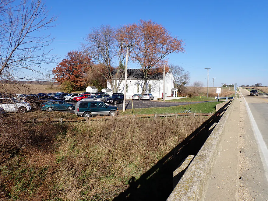
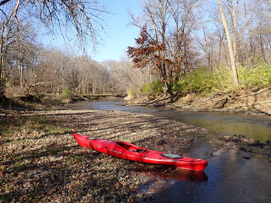
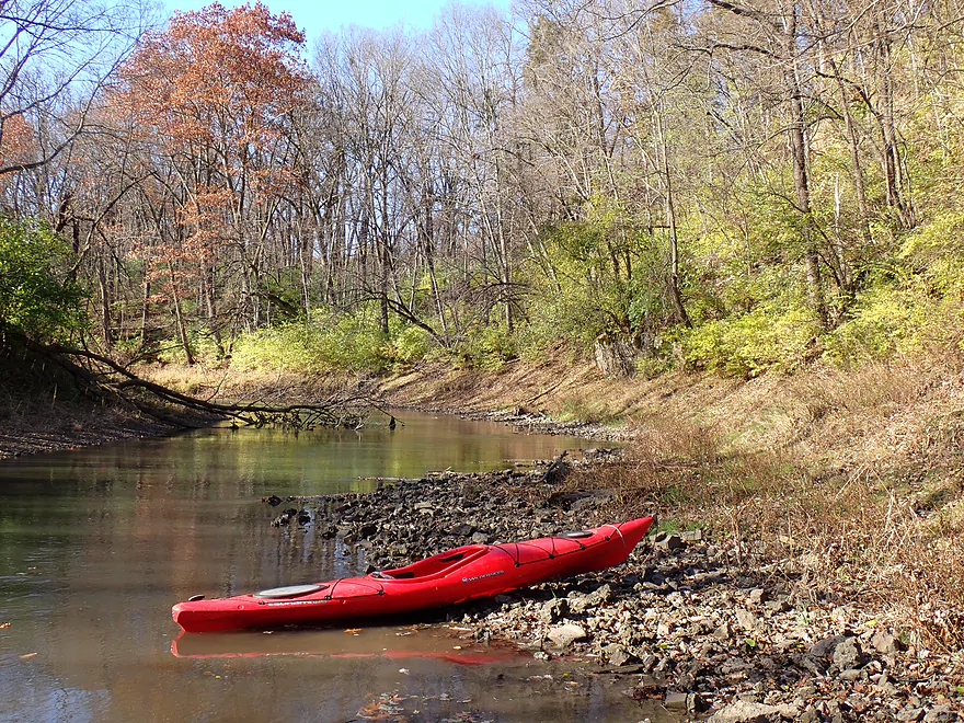
Putting in at Hwy 17 by a busy church
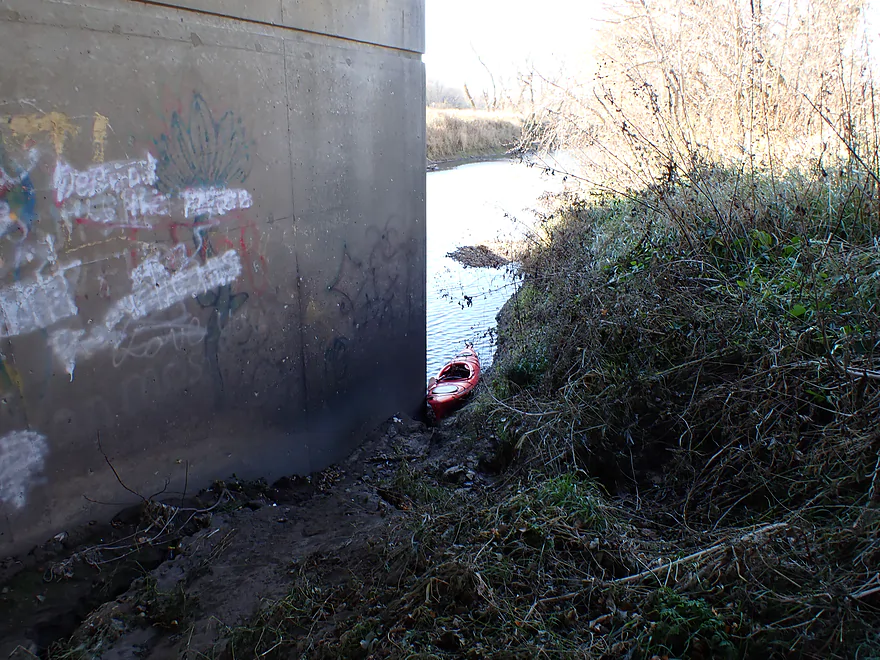
Not a great bridge put-in but doable
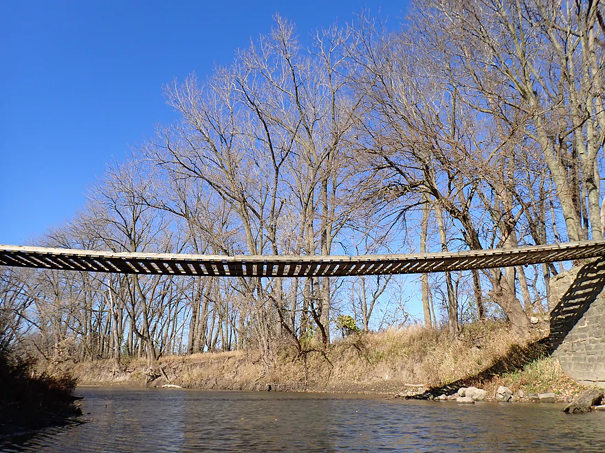
Wooden suspension bridge
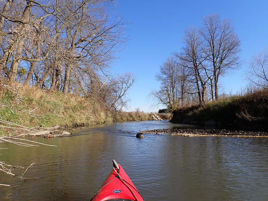
A black pumpkin sitting in the middle of the creek
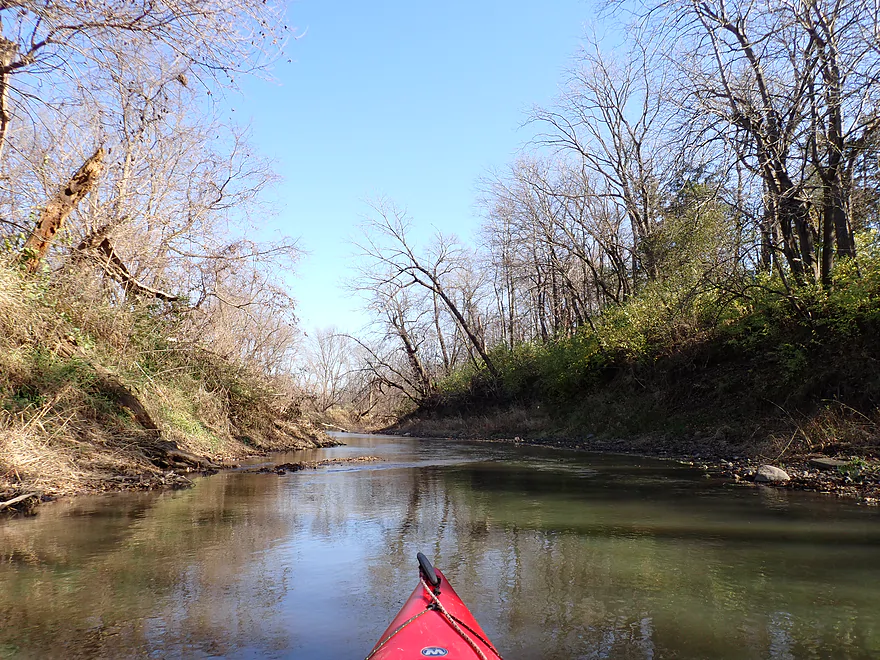
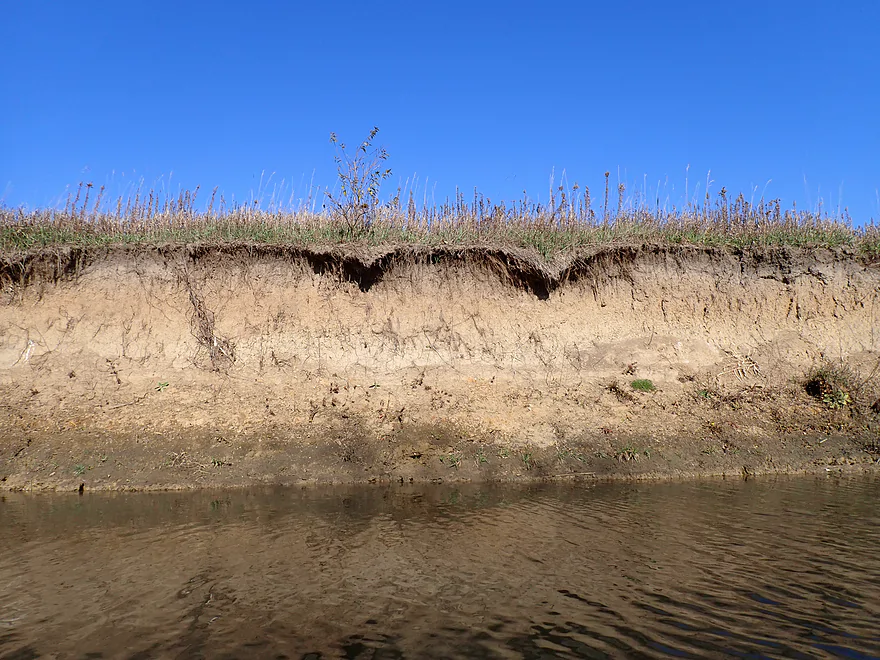
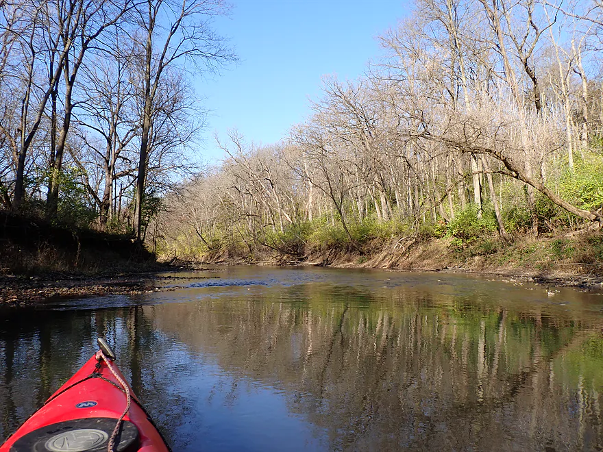
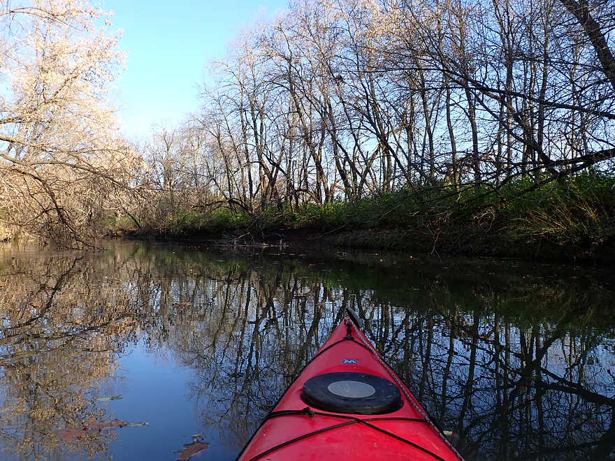
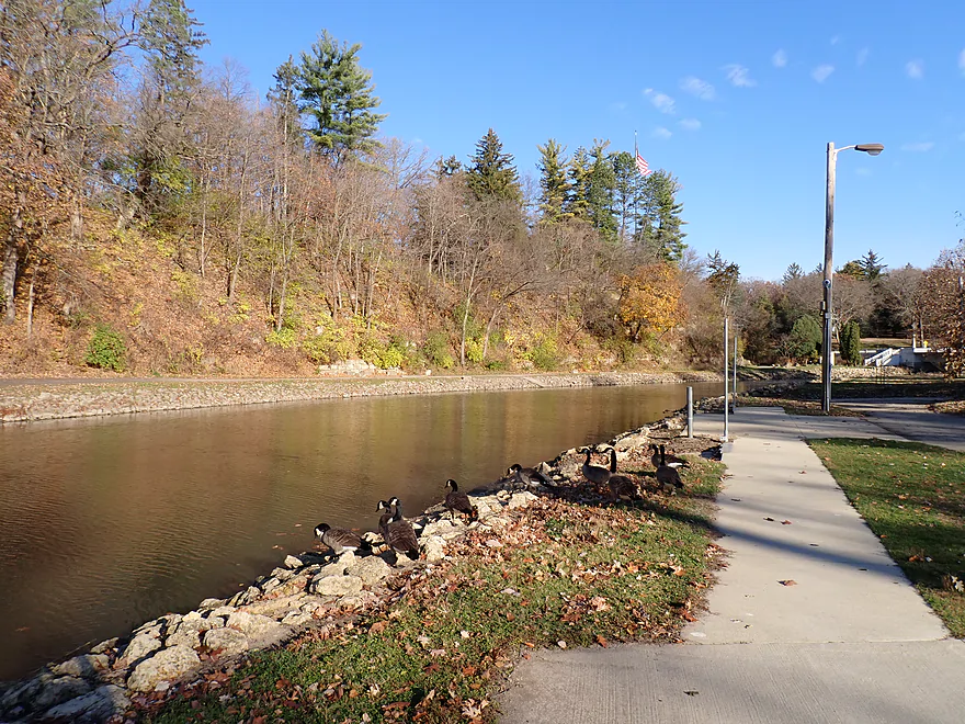
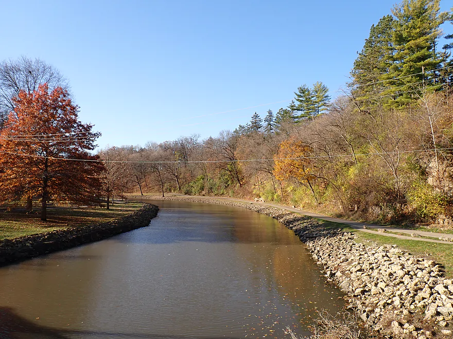
Many of the banks were propped up with artificial fill
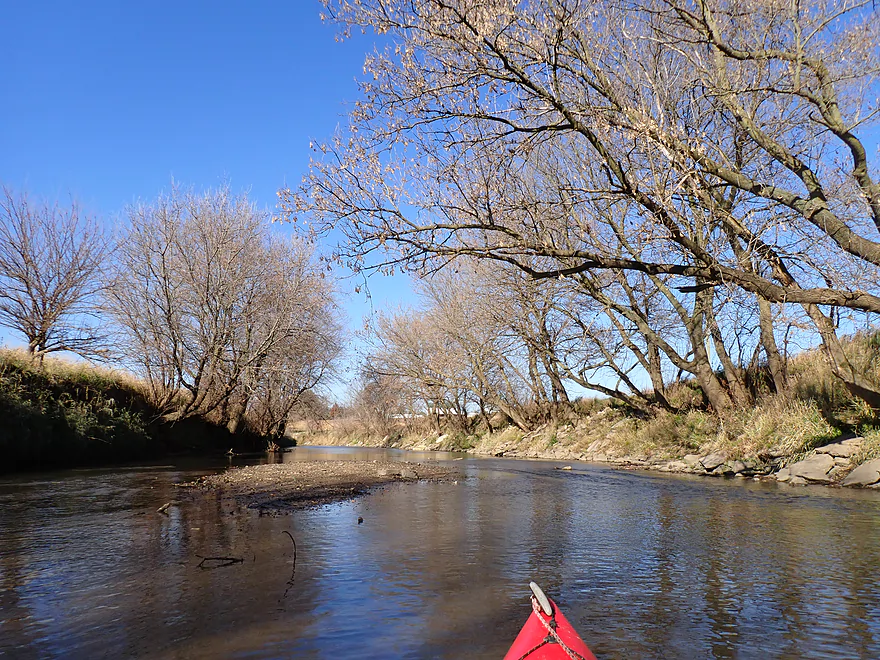
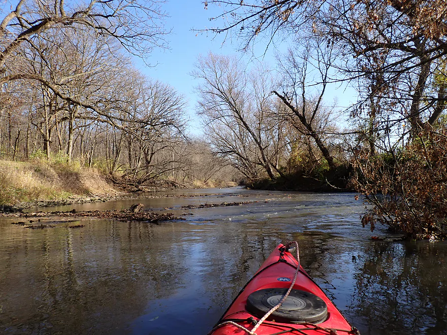
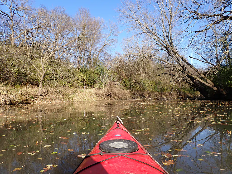
This section looks dredged
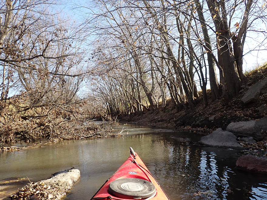
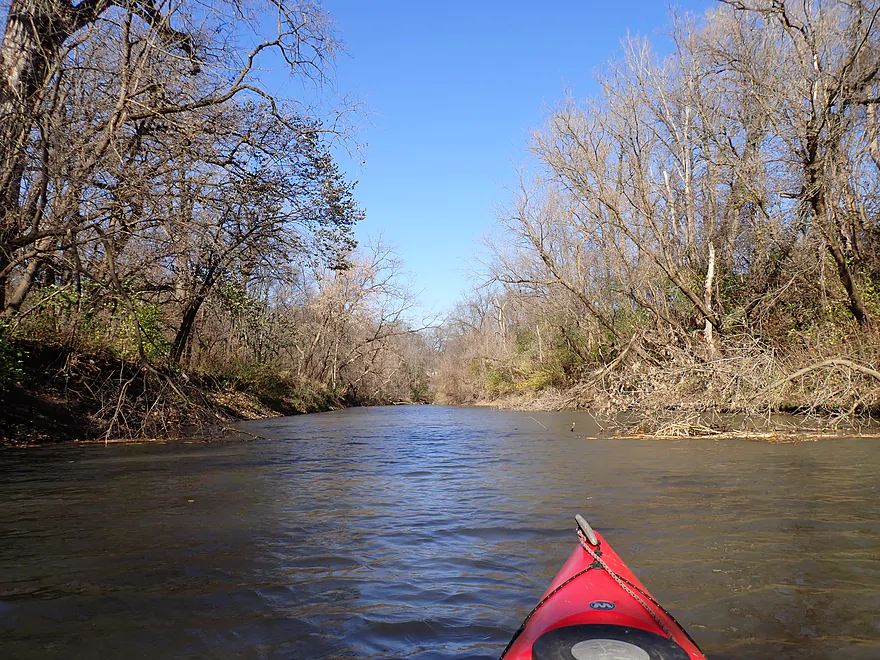
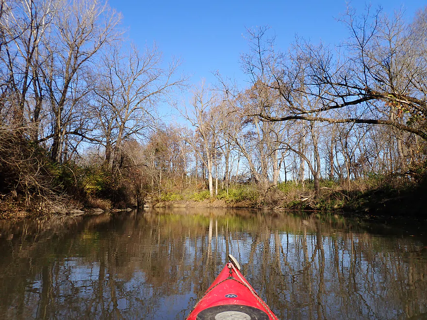
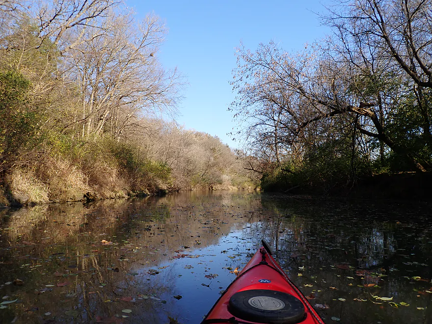
Cool tree canopy
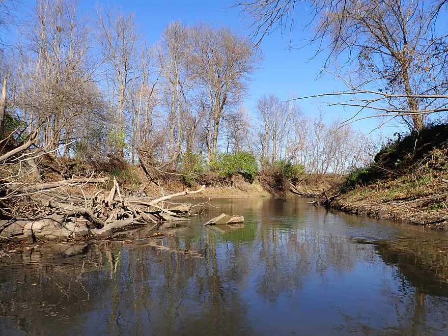
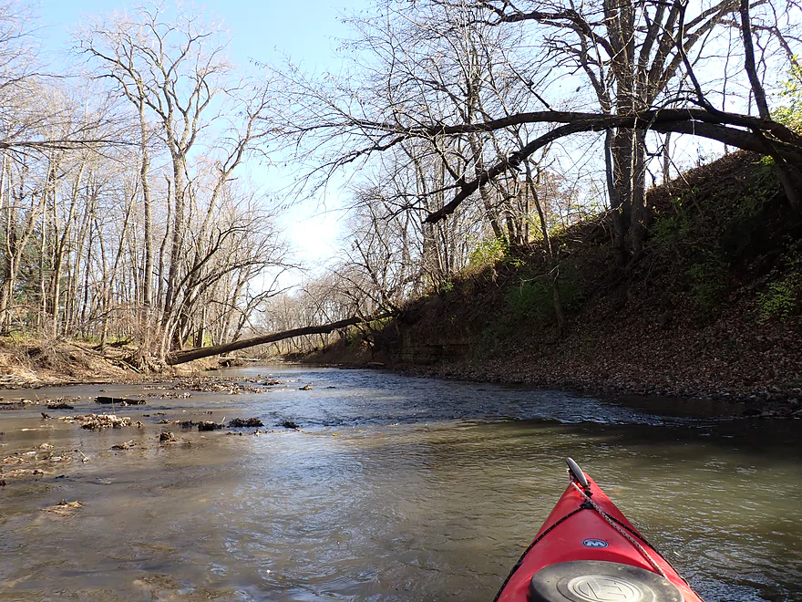
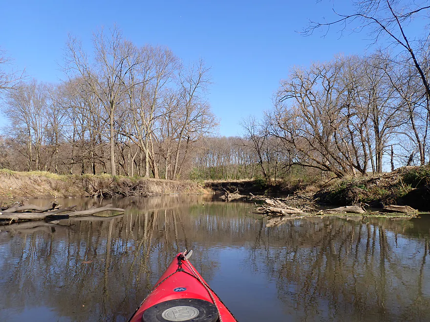
Some deadfall…but I never had to portage
Huge banks
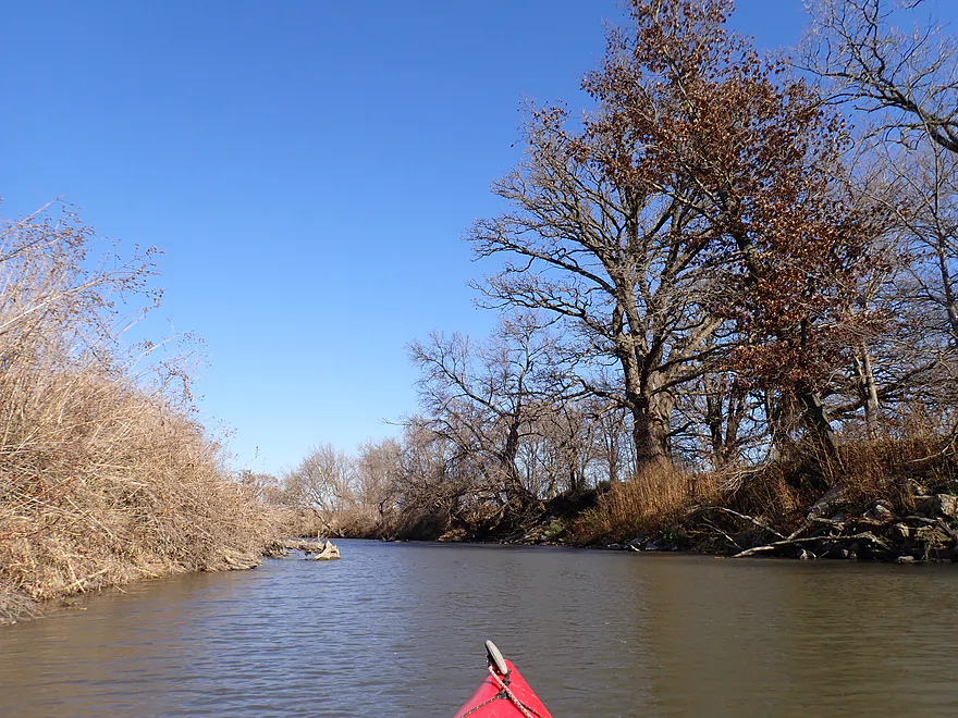
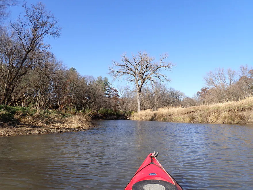
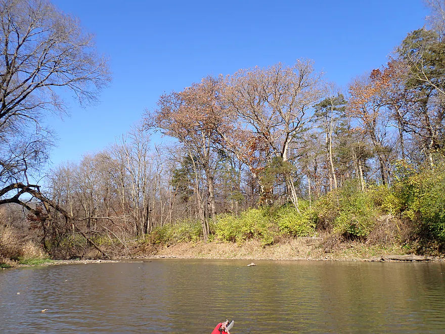
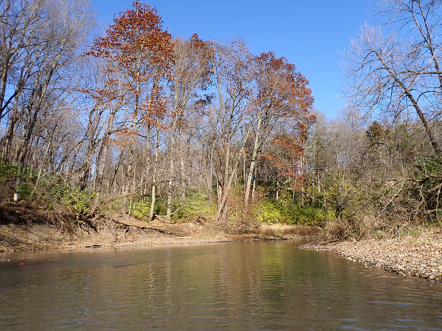
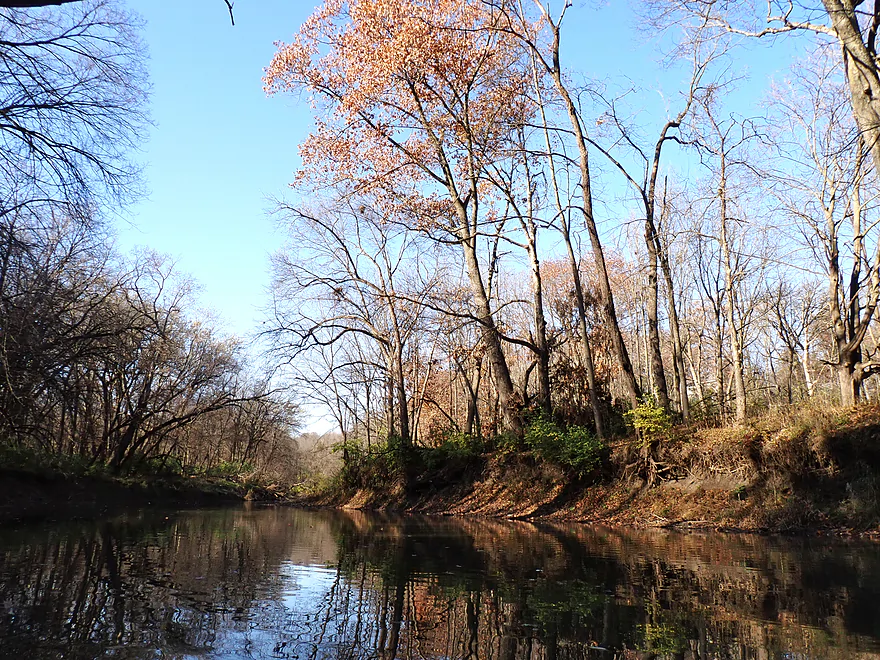
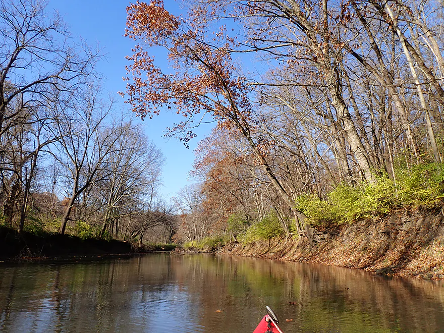
These oaks were still hanging onto their leaves
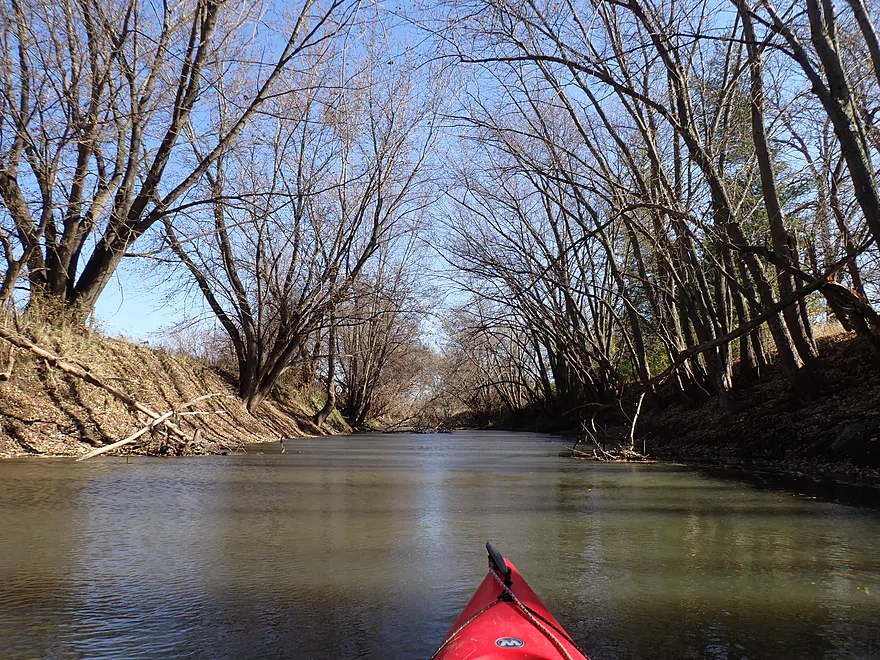
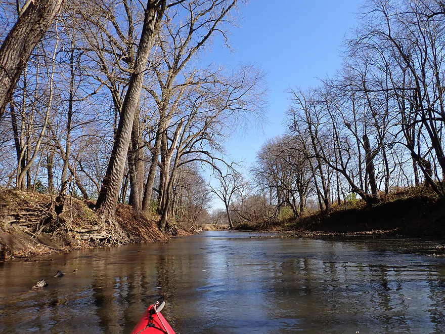
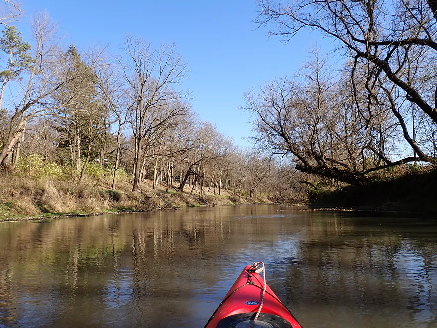
Second half of the trip was more wooded
Banks became hillier

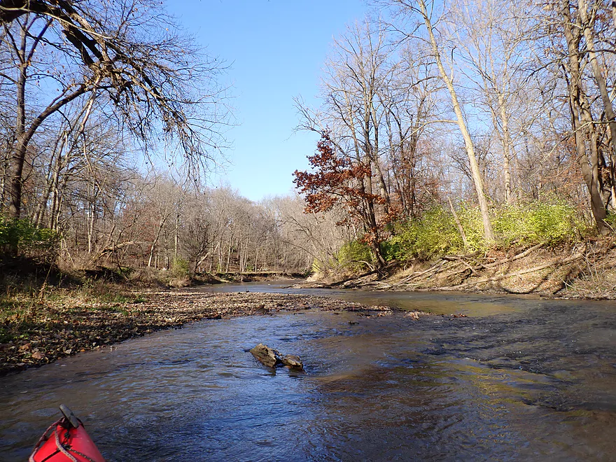
Light riffles
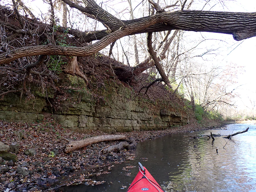
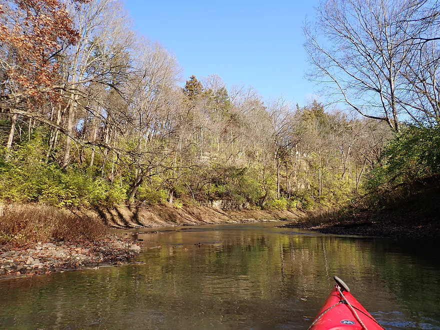
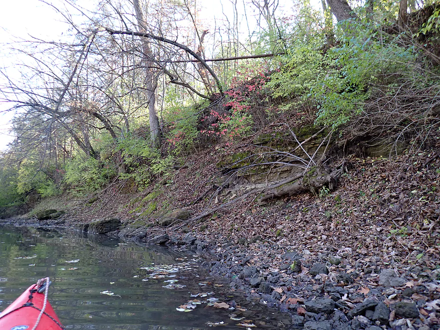
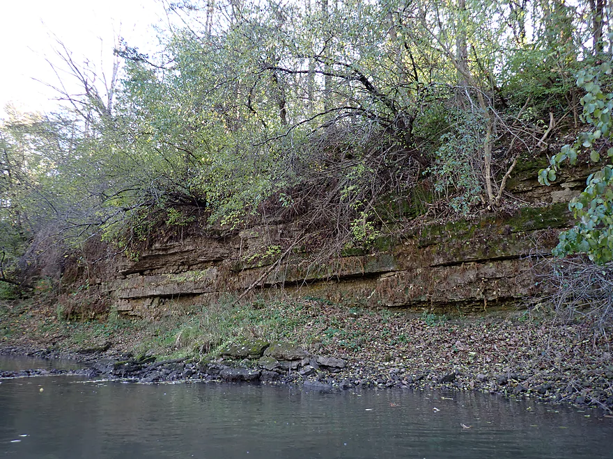
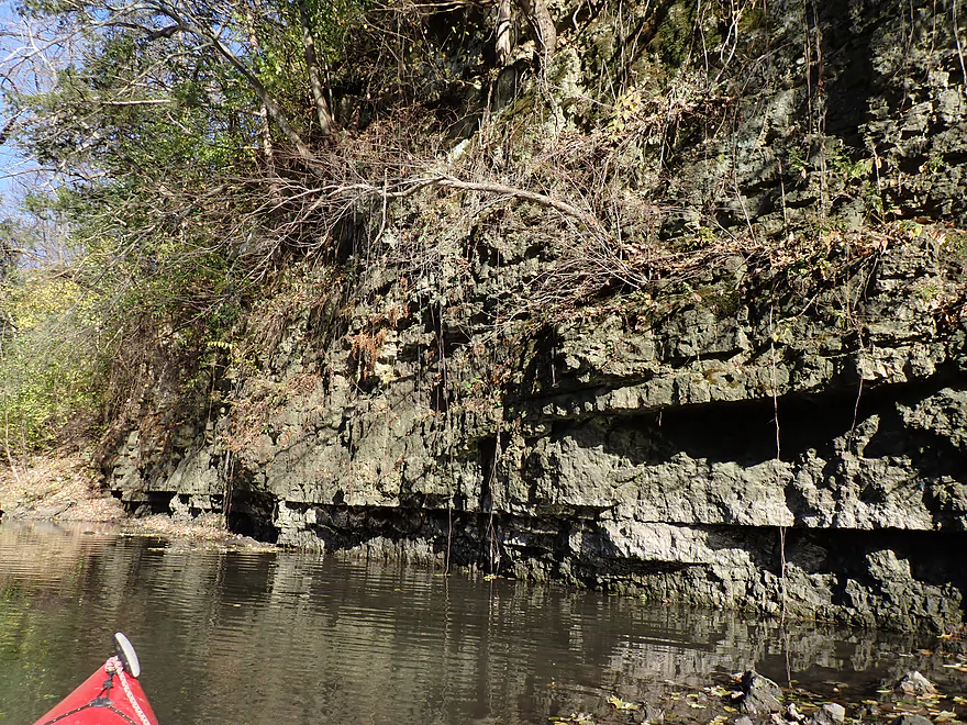
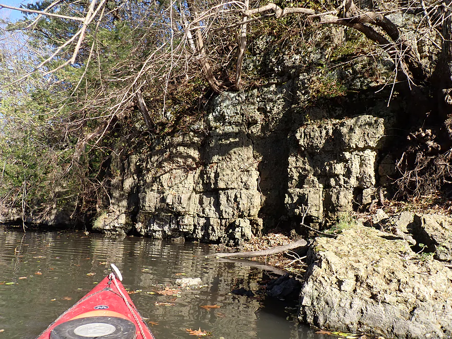
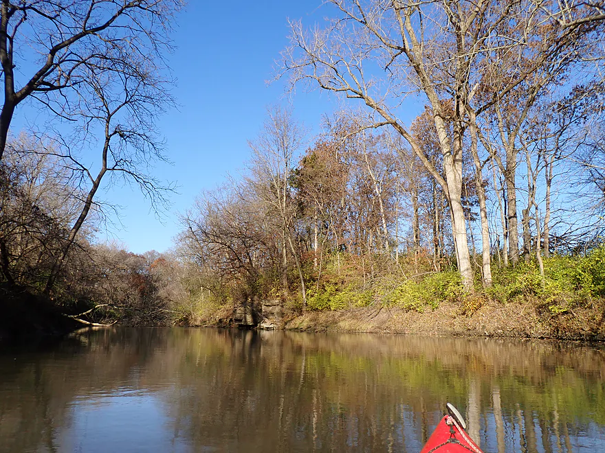
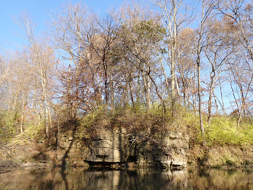
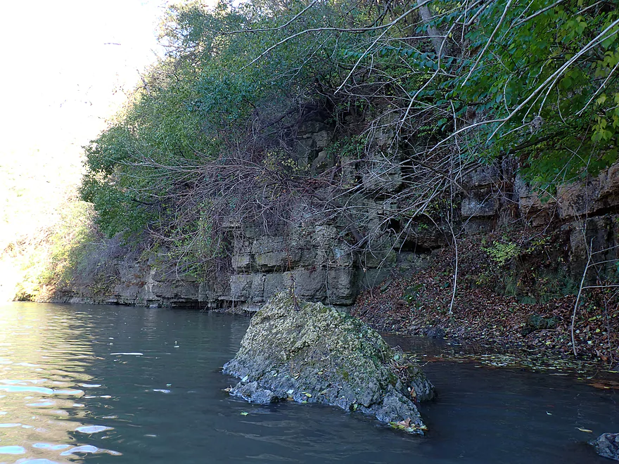
First outcrop of the trip
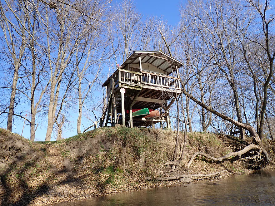
Nifty little canoe hut
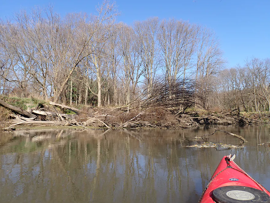
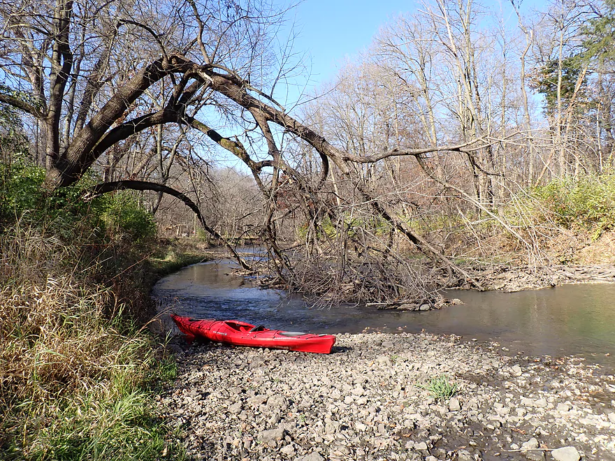
Used to be a massive logjam here…it was set on fire
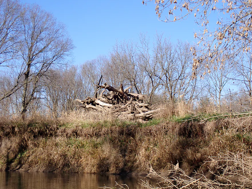
And the remains were dragged to shore
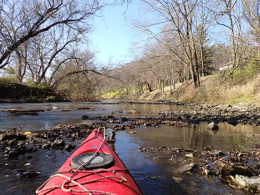
Gravel bar and tree branches create a tight chute
This is followed by a second gravel bar
More riffles
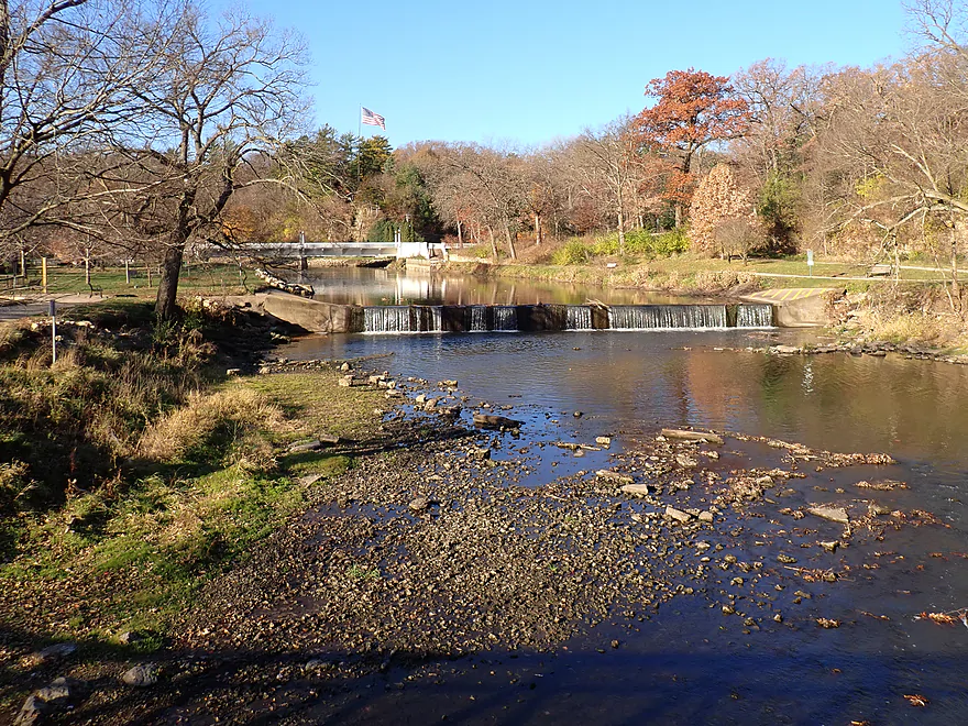
The river here is redirected sharply by a scenic ledge
Reverse view
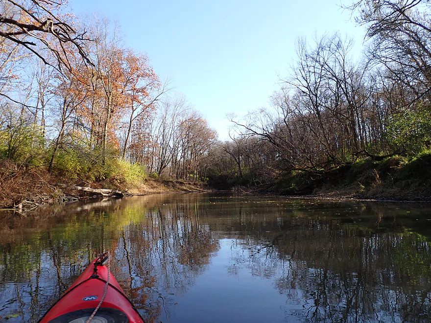
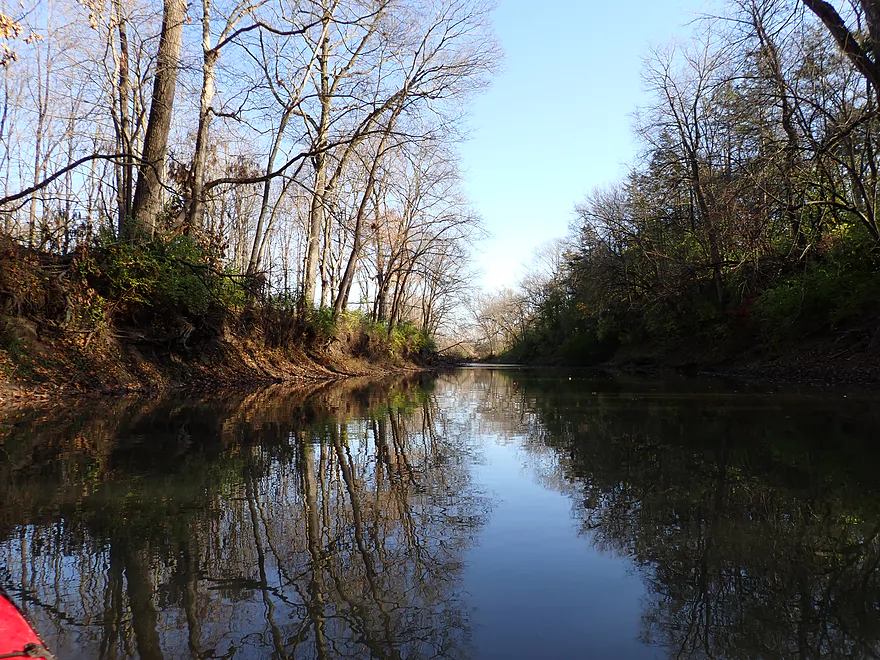
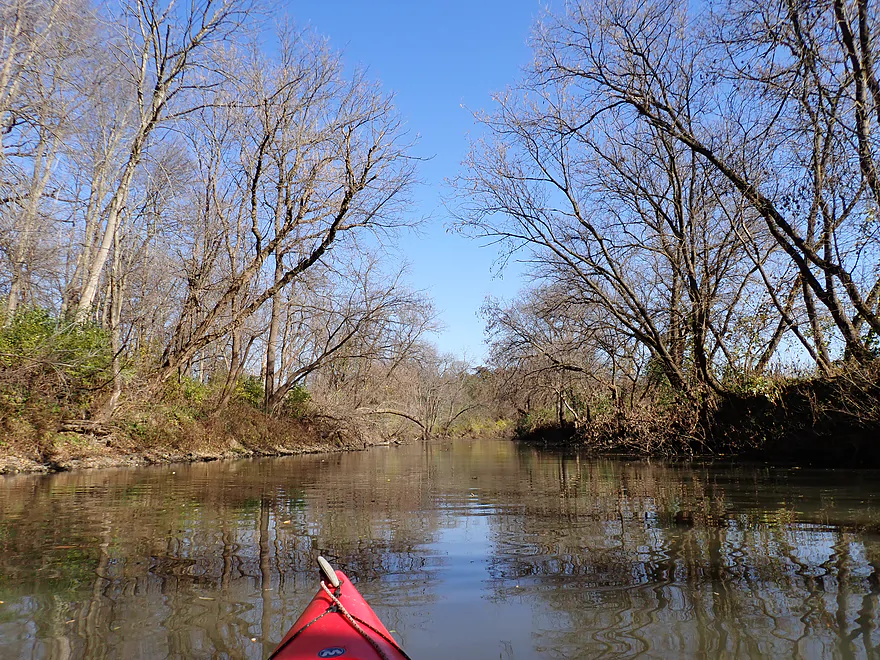
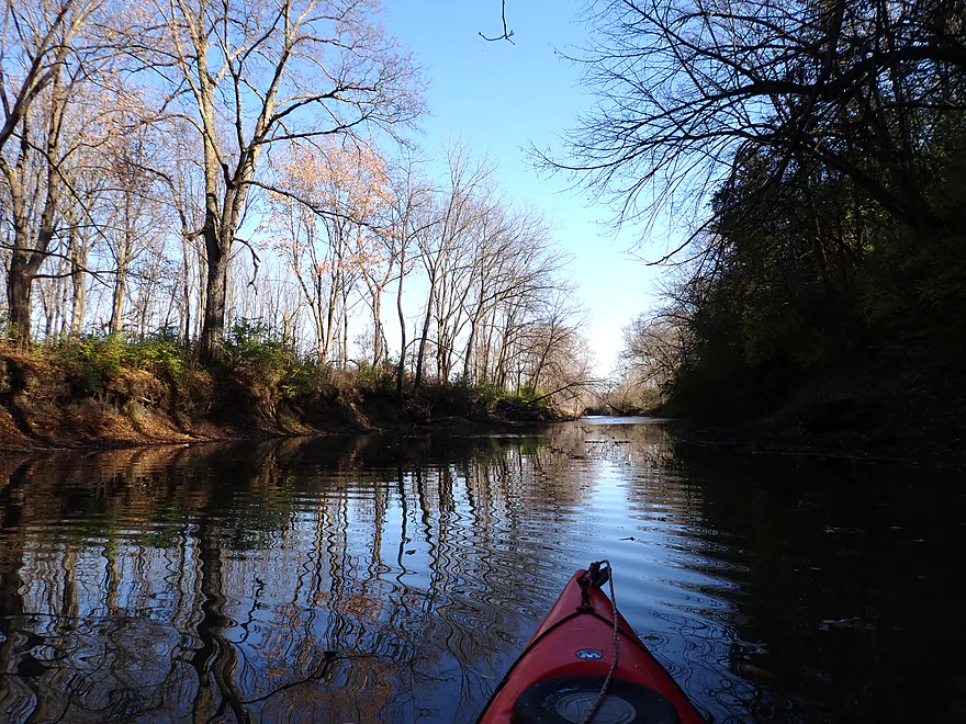
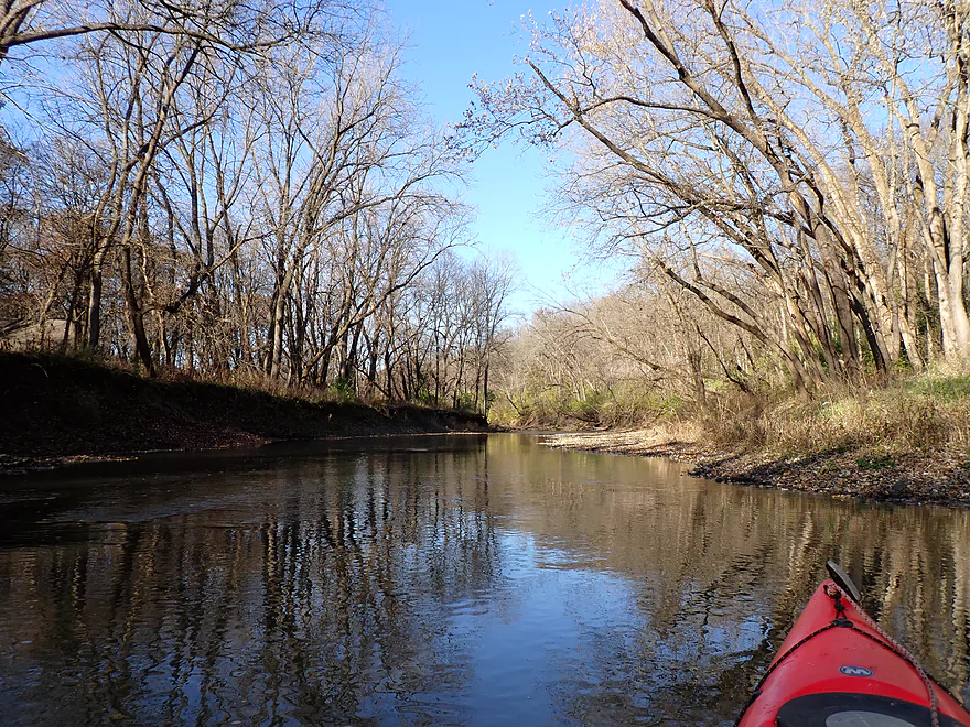
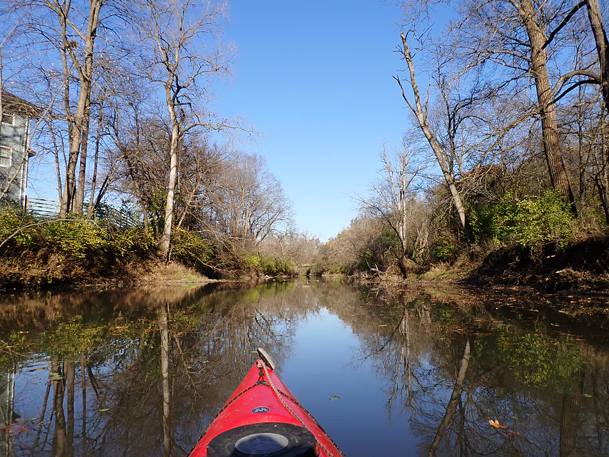
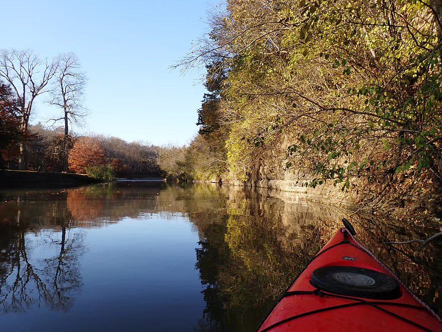
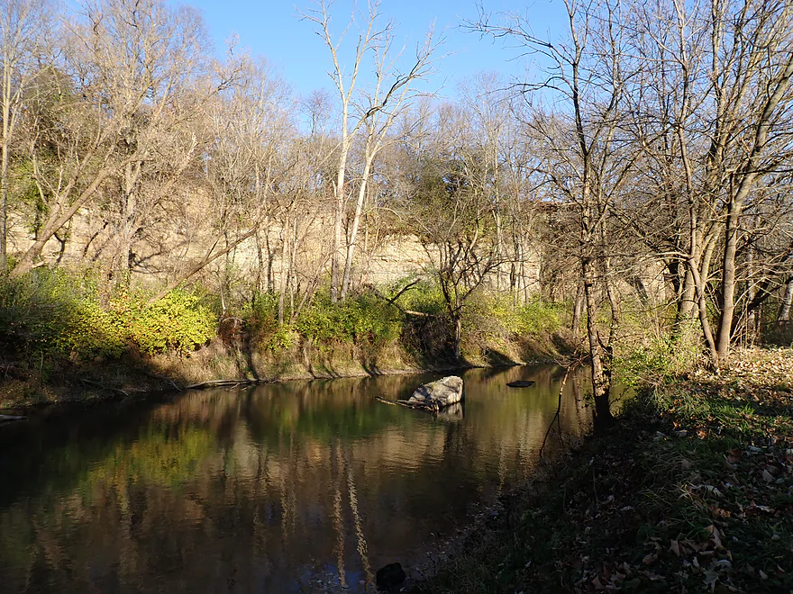
When the wind died down the creek provided some great reflections
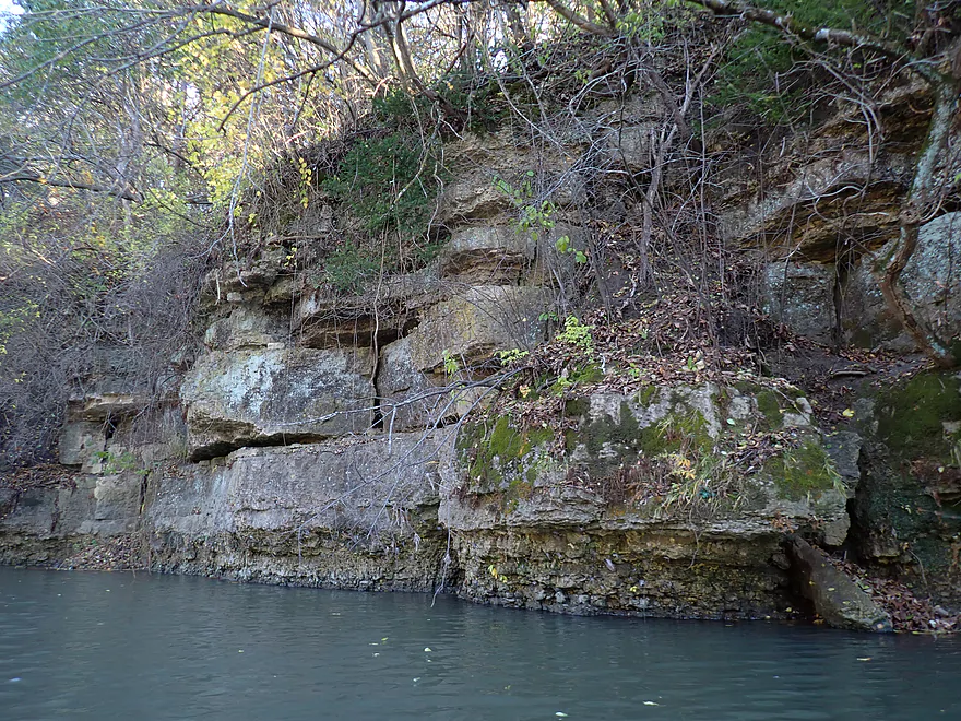
Rocky shoreline
Another limestone outcrop
Shallowest part of the trip
Was able to bump my way through
Another scenic ridge
With an outcrop at its base
Fun tight turn with fast current
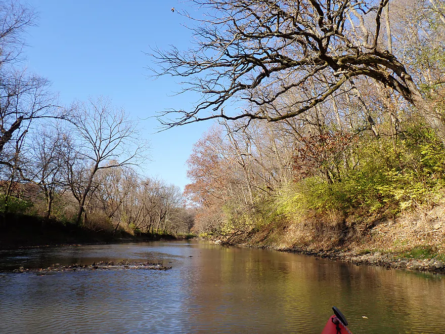
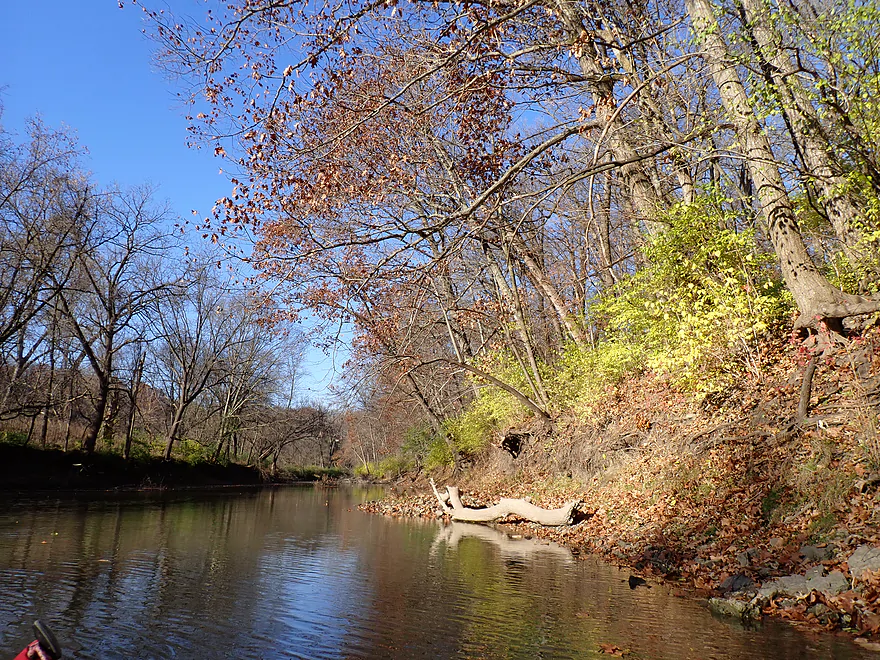
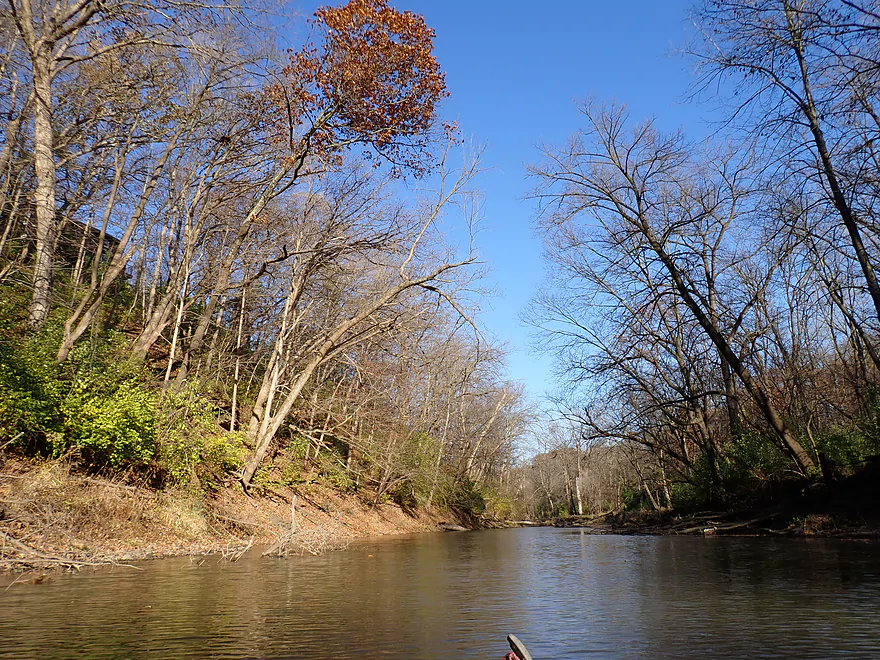
A little bit of late fall color
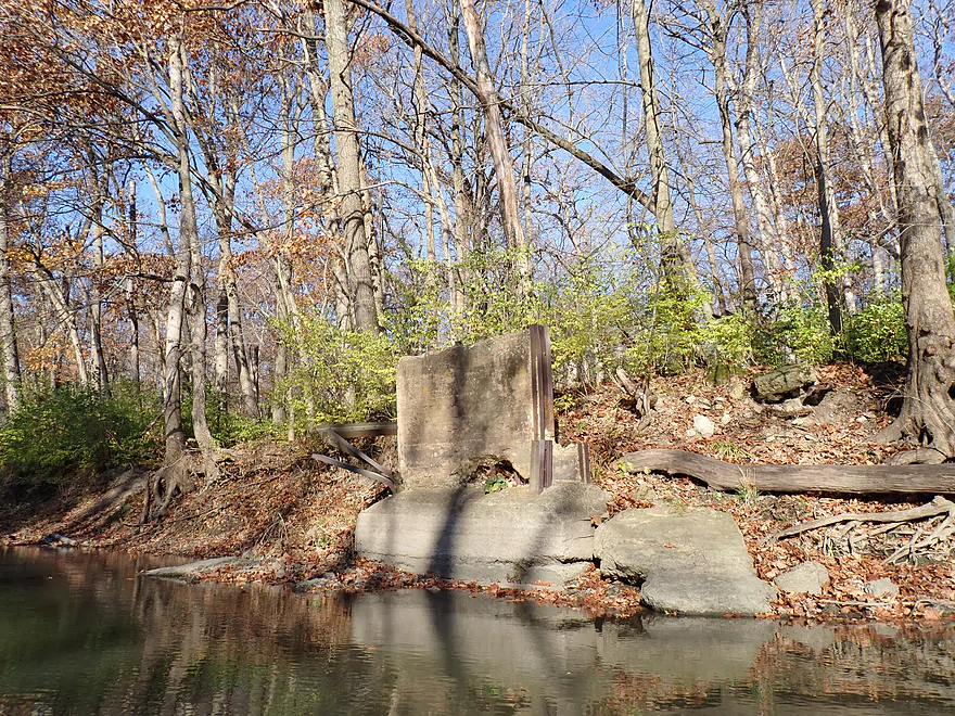
Looks like an old bridge abutment
Another huge ridge
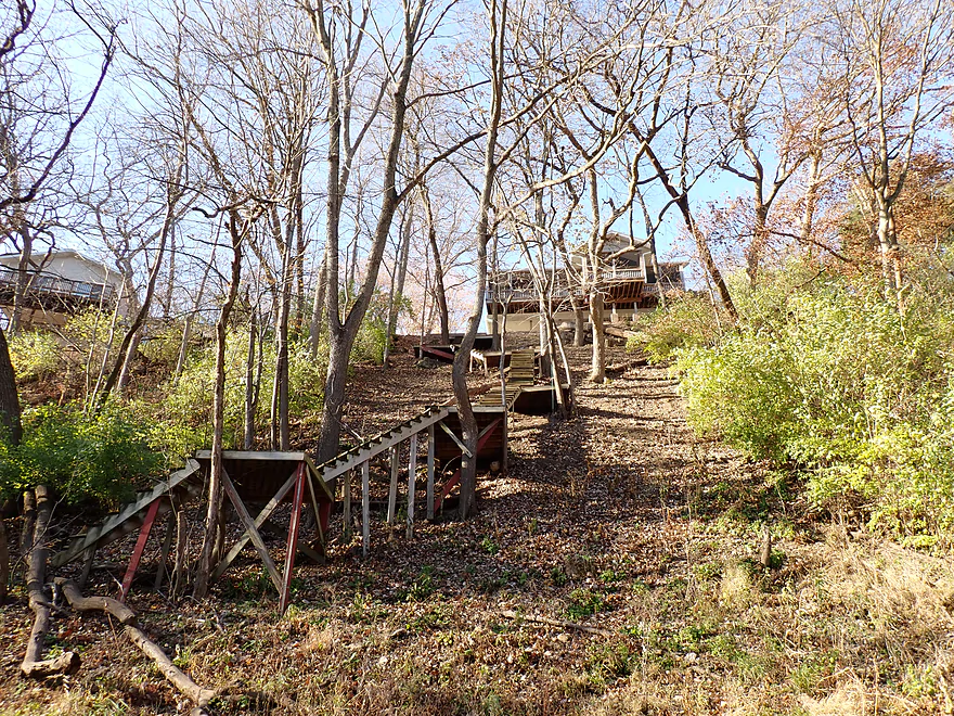
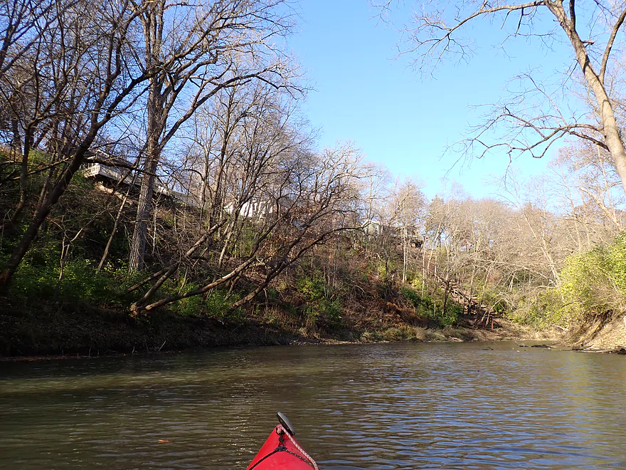
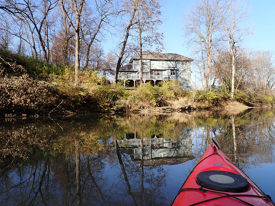
An elaborate stair system connects this house to the water
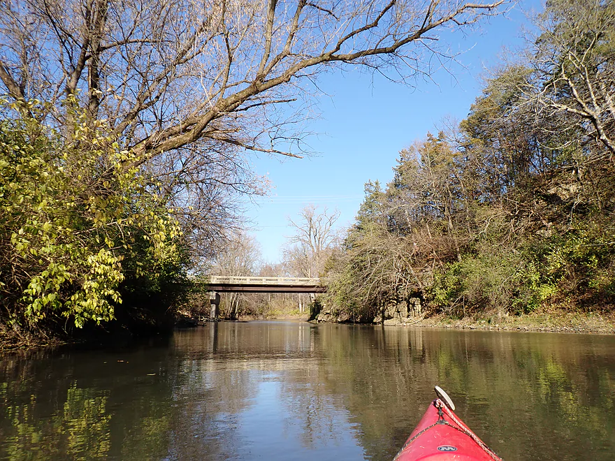
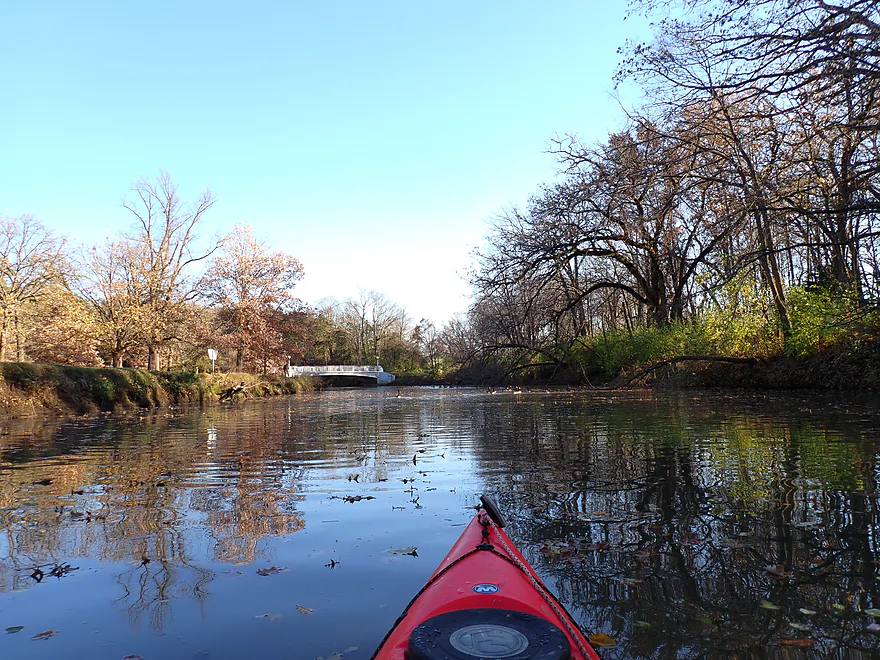
West Fairgrounds Road
An outcrop serves as a support for one side of the bridge
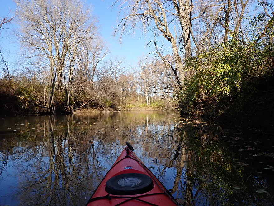
More nice reflections
Lots of dead leaves…this would have been really scenic in October

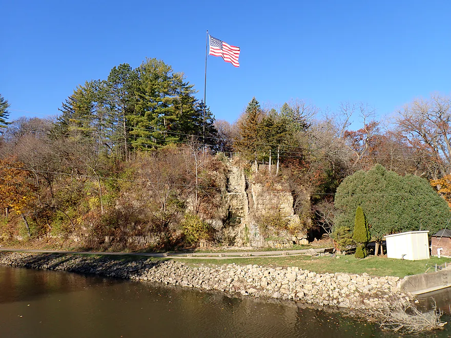
Quarry marks the official start of Krape Park
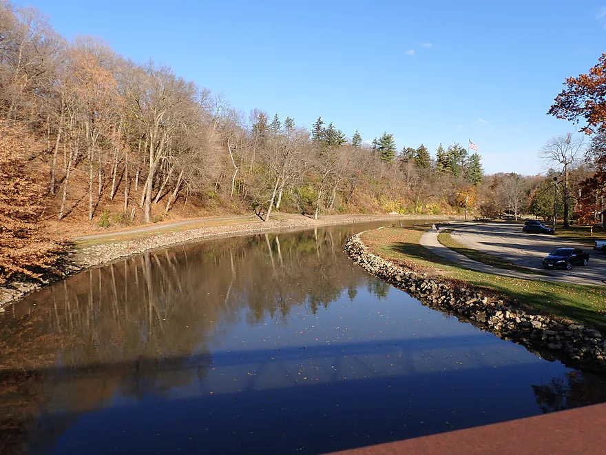
S. Park Road
The best series of outcrops is located downstream from the S. Park bridge
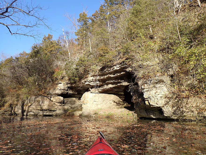
“Twin Caves”…the highlight of the trip
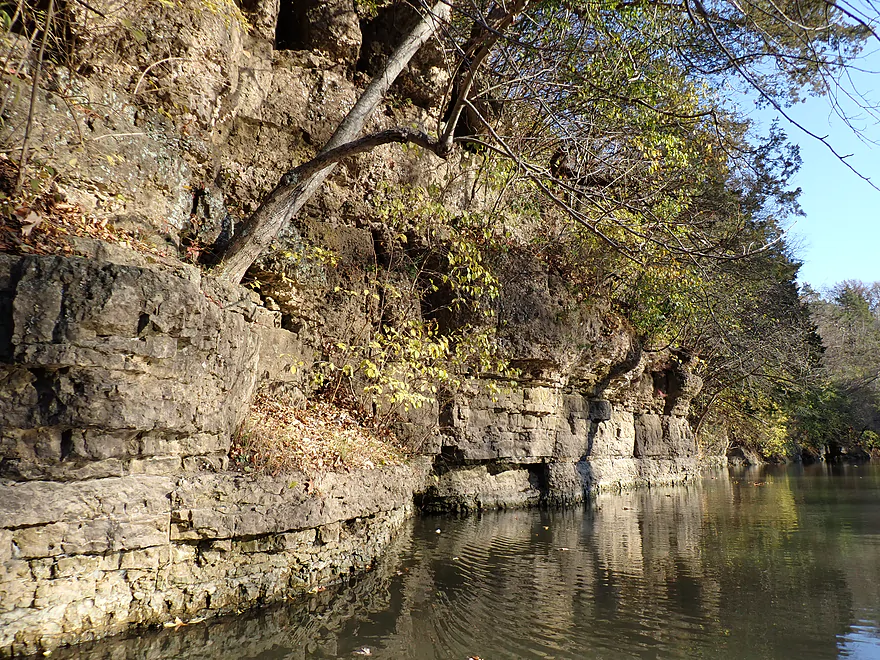
Part of a very long outcrop
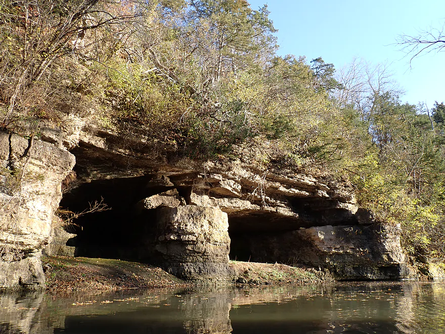
Reverse view of caves
The outcrops and caves would be more impressive if not buried by ~4′ of dammed water
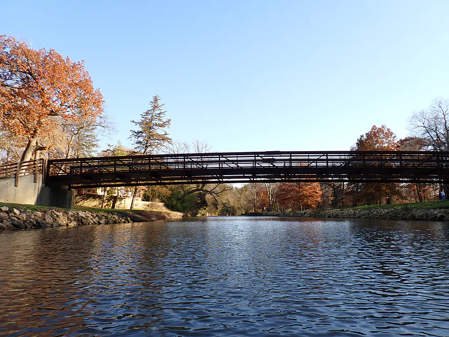
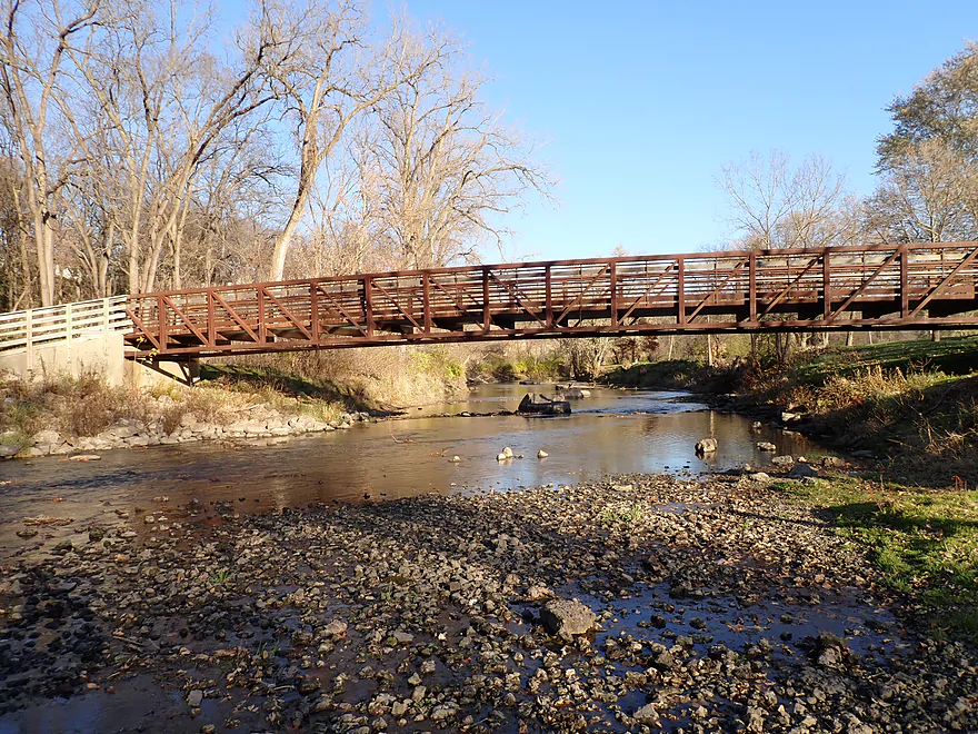
Park trail bridge
Section through the park is scenic
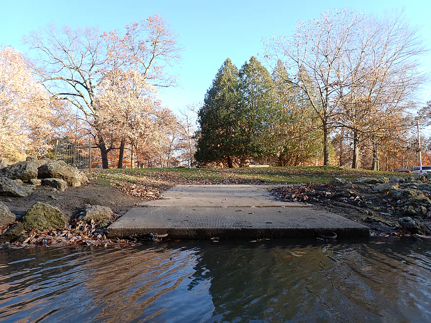
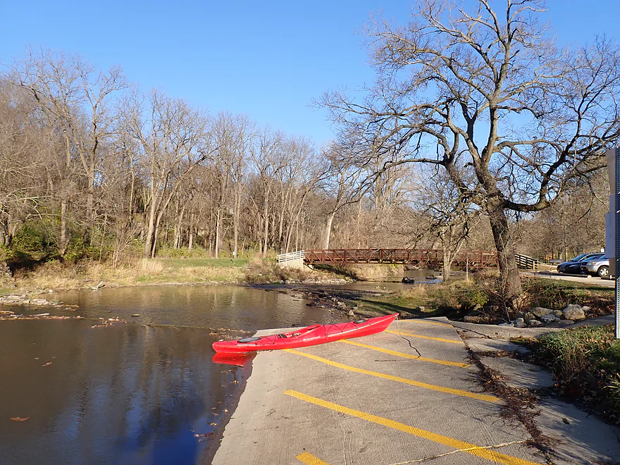
The official canoe/kayak launch
Park Blvd
Reverse view from bridge
The iconic 40′ waterfall on Flagstaff Hill (it’s artificial and was probably turned off for the season)
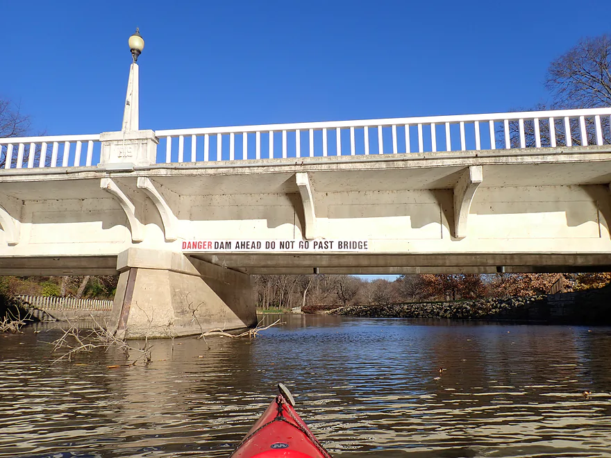
Sign warns not to go past the bridge, but that’s where my car was
Taking out just before the dam
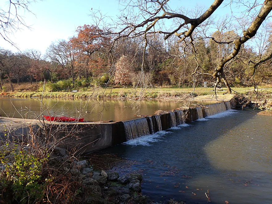
It’s a bad dam that has killed people, and submerges upstream cliffs/boulders…hopefully it is removed
Not much water going over the dam because of the drought
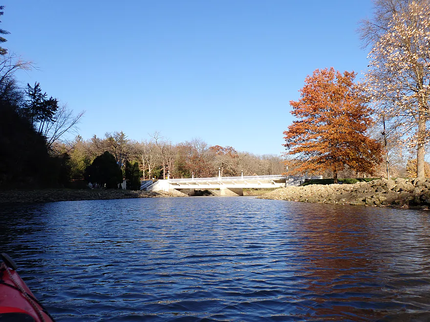
Attractive park bridge

Section below the dam contains a nice boulder garden
And a scenic cliff
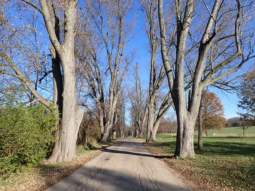
Scenic bike shuttle to the put-in (the portion through Krape Park anyways)
Yellow Creek

Yellow Creek is a small river that joins the Pecatonica near Freeport. This is a scenic and hilly part of Illinois that I actually assumed was part of the Driftless Area. But in reality the edge of the Illinoian Glacier did whack much of Stephenson County, so it and Yellow Creek are not true Driftless (despite roughly 50% of online Driftless Area maps showing the contrary). Regardless it’s a neat and rugged area that has been left with steep gorges and cliffs.
Paddling author Bob Tyler explored much of the creek. Long story short, most of it suffers from logjams. But an exception and a leg Bob really liked was from Bolton Road to Krape Park. This section has been on my todo list for a while and I finally got to it this week.
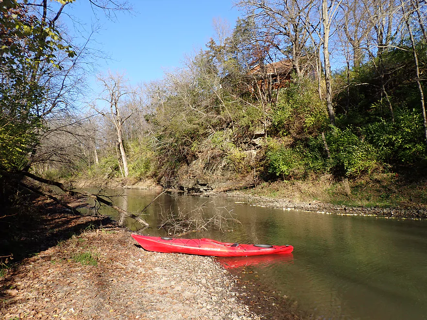
I started the trip at the Hwy 17/Bolton Road bridge. Along the north bank of the bridge is a small church (Bolton Community Church) whose parking lot was filling up fast for that day’s service. The pastor pulled up to my car, and I was nervous that I would be evicted as a trespasser or chewed out for blocking part of the parking lot. But it turns out she was really nice, and asked if SHE was blocking my car, and said if I wanted to use the church for water/bathrooms or even attend the church potluck I could. I was pleasantly shocked, as typically private landowners who approach me during kayak trips are not so friendly. Regardless, I should have asked the pastor permission to use the church parking lot prior to actually doing so.
The access by the water itself isn’t great as the bank is steep and muddy. You have to duck under the bridge, wedge your boat against a pillar, and seal launch. Not ideal, but doable.
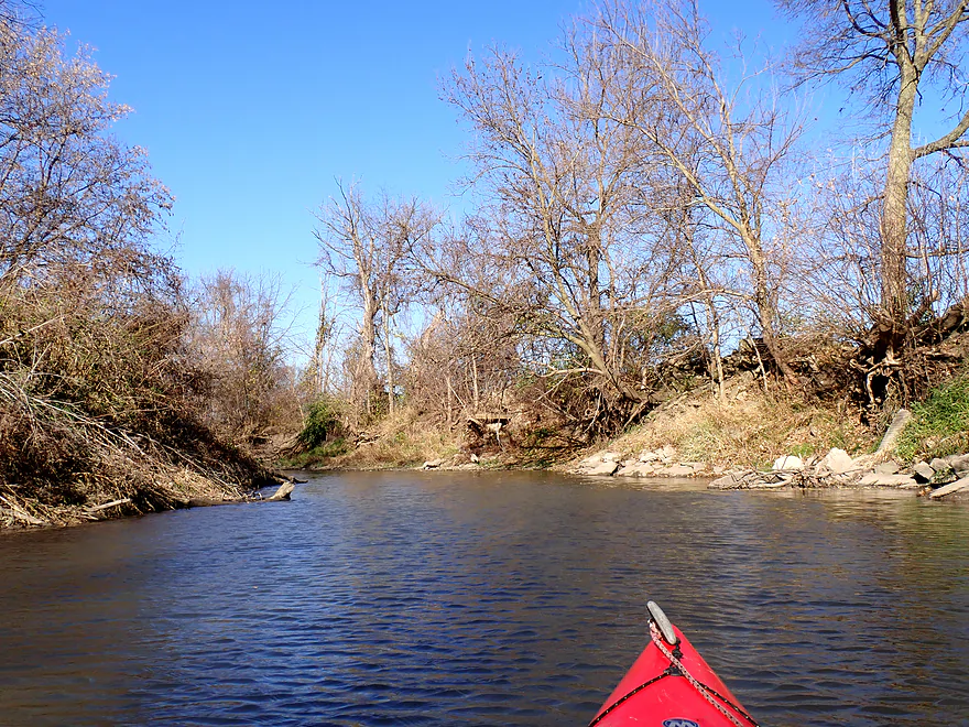
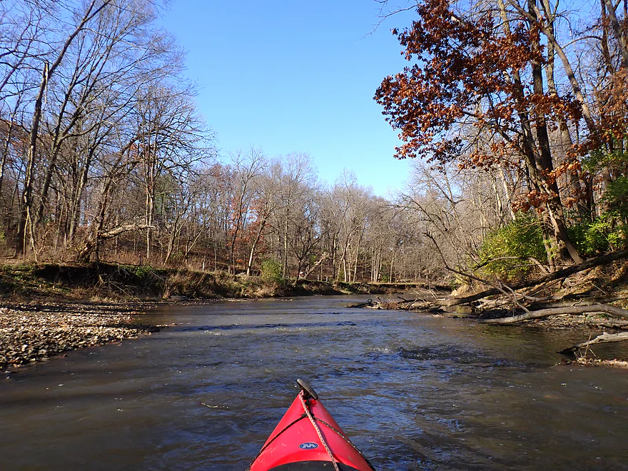
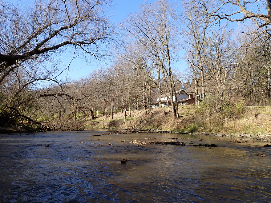
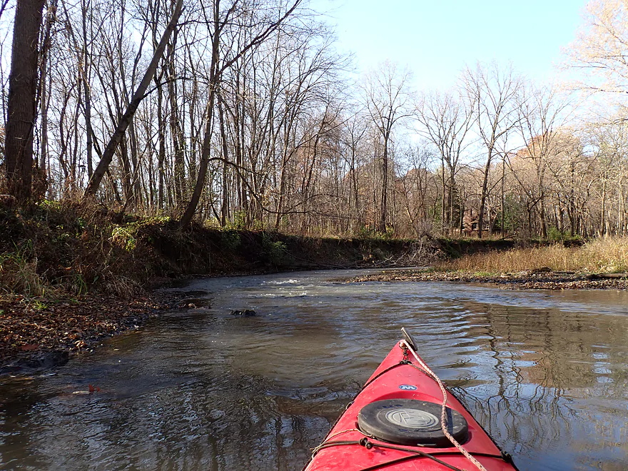
The first two miles of the trip paralleled W. Becker School Road and were pleasant, but mostly nothing special. The banks were so steep and tall it was like paddling through a micro-gorge. Combined with a thin layer of trees arching over the channel, it was somewhat scenic. Strong 20+ mph winds roared overhead, but the trough I was in provided decent protection from the gusts. Erosion has been a problem on Yellow Creek, thanks to decades of poor land use, and I could see in many spots where riprap and artificial fill were being used to prop up the banks (and keep them from nibbling into the adjacent farm fields). In many ways the first part of the trip reminded me of the Pecatonica River in Wisconsin.
In a few spots were minor riffles and rocks. I’m sure before settlers came and ruined everything, the creek was shallower, cleaner, rockier, and would have had much lower banks. I was a bit worried about shallow water given how late in the season this was, but 99.99% of the creek was fine…and only in a few spots did I run aground and had to “pole” my way through with my kayak paddle.
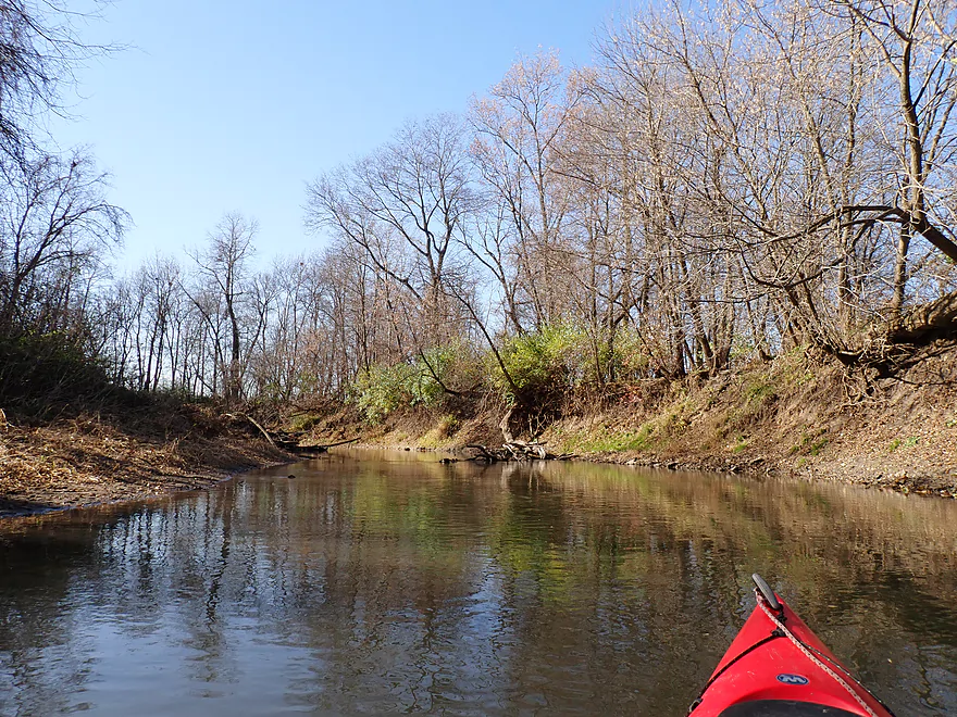
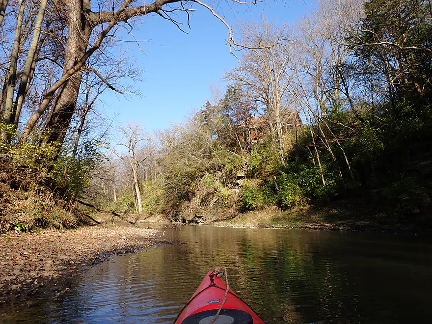
Close to Red Fox Lane, the creek really changed in character (for the better). Steep wooded hills starting replacing farm fields. Many of the weedy bank trees were replaced by larger, older, and more impressive specimens, including late-turning oaks. The creek itself became rockier with a few gravel bars and small boulder gardens. Here I would see the first of roughly a dozen outcrops I would encounter on the trip.
I had been warned about a major logjam close by Shepard Drive which I was dreading. But I was pleasantly surprised to discover it had been removed. The operation to take it out looked major…it appeared it was first set afire (good idea!), and then heavy machinery was used to pull most of what remained out of the water. For the record, I never had to portage a single logjam on the trip. Locals do a great job of keeping this stretch open.
The last two miles of the trip were the best and most scenic. Here there were the most outcrops, the best outcrops, the best gorges, and the best woods which looked terrific when reflected in the calm water. Large signs marked the entrance to Krape Park, which is a fantastic area. The longest and most impressive outcrop is located just downstream from the Park Road bridge. There is even a cave here (actually two…side-by-side). I was tempted to get out and explore them, but I was losing light fast and decided to continue on. The cliffs and caves would be even more impressive if they weren’t partially submerged by about ~4′ by dammed up water. Past the Park Blvd bridge, I passed what should have been a 40′ waterfall, but unfortunately it had been turned off for the winter (it’s artificial).
A sign on the bridge warns paddlers not to continue past the last bridge as a dangerous low-head dam (that has killed people) was ahead. But I had already left my car by the dam, so I continued on and took out by a ramp next to the lip of the dam. This sounds dangerous, but the water levels were so low, it wasn’t. Regardless, in hindsight I probably should have disembarked earlier in the park. Large yellow lines on the dam embankment (which weren’t there before) indicate the public isn’t welcome. My other thought was maybe I should have portaged the dam and taken out downstream. This would have included a nice boulder garden and another cliff.
I was met in the parking lot by an older woman and apparently a fellow kayaking enthusiast. She gave me some tips about paddling Lake Le-Aqua-Na State Park and gave me a brochure for the Friends of the Pecatonica River.
In summary this was a great trip. The first half is somewhat mediocre, but what makes it special is the second half with the highlights being the cliffs, gorges, trees, twin caves and Krape Park. Be advised this is an 8 mile trip which for some is on the long side. It bears repeating that while the take-out I used (Krape Park) was public, the put-in (Bolton Community Church) is not and you should get their permission to launch here. Special thanks to Billy Sunday for his tips and photos that served not only as an inspiration for this trip, but also for the previous trips on the Turkey River and Nippersink Creek.
Sights include a snake, many geese, a great blue heron, relatively tame deer, a few flopping fish, and several clamshells.
Krape Park: This is a really nice park. Highlights include an artificial waterfall, a massive outdoor amphitheater, a huge playground, a mini-golf course, a fantastic riverwalk, twin caves, and great trees.
Hwy 17/Bolton Road Bridge: Most paddlers launch from the Bolton Community Church Parking lot northwest of the bridge. However the parking lot is owned by the church and you should get permission from the church before using this access. You should be able to contact the pastor via the Bolton Church Facebook page. Note, the bank by the creek here is steep and launching isn’t super easy. Your best bet is to go directly under the bridge, place your boat next to the support pillar, and then otter in. On Sundays the church parking lot can get crowded and overflow. Be mindful not to block other vehicles when you park.
Alternate Put-ins:
- Mill Grove Road (6.0 miles upstream from Hwy 17). Mill Grove Road is close to a home and may not be a great access. If you launch here, please respect private property. Note this bonus leg has good potential with likely several long outcrops, but also 1-2 major logjams.
- W. Loran Road Bank (0.4 miles upstream from Hwy 17). Here the creek closely parallels the road, and this is in theory a superior launch option. However, I’ve heard conflicting rumors as to whether it is legally accessible. At this point I don’t think it is, and I wouldn’t recommend using it unless you know for sure it is public or you have permission.
- Krape Park Round Trip: Some paddlers just do a round trip from the park, which is viable as that part of the creek is slowed by the dam. To go from Park Blvd to the quarry/park border and back would be 1.5 miles. This would include some great park scenery, cliffs, and twin caves…but you still would miss out on some neat sections of the creek if you limit yourself to a short round trip.
Krape Park – Dam Access: There is a concrete ramp by the dam which is conveniently located across from a parking lot. In many ways it was an easy and scenic access. But…it is crazy close to the lip of the low-head dam which has killed people because of its strong undertow. I wasn’t in danger, as I was careful and water levels were quite low. But I’m not sure I can recommend this as a take-out. In fact, I don’t think the park wants paddlers taking out here either. Yellow stripes are painted on the ramps by the dam to deter the public, and a sign on the bridge warns not to get too close to the dam. I instead recommend taking out at the main access ramp (located just upstream).
Alternate Take-outs:
- Krape Park – Main Access (900′ upstream from the dam): This is a good public access and is the proper spot for kayakers to take out in the park. It’s located just upstream from the Park Blvd bridge here.
-
Hwy 12 (2.1 miles downstream from the dam): I believe this would be a viable bridge access as the banks east of the Hwy 12 bridge are part of a nature preserve. This bonus leg should be nice with some riffly current, some attractive boulders, and at least one large rock wall.
Bike Shuttle – Krape Park to Bolton Road: 6.1 miles with 69′ of ascent. This is an ok bike shuttle that was relatively flat. The section through the park is scenic…make sure when shuttling, you cross the bridge and follow the west end of the creek to avoid the big hill. Unfortunately I had to deal with strong headwinds during my bike shuttle which wasn’t pleasant.
Commercial Rentals/Shuttles:
- Pec-N-Paddle: This is a rental and shuttle company located near Freeport. I think they only service the Pecatonica River, but you could ask if they would make an exception for nearby Yellow Creek.
- Krape Park Boat Rentals: They provide canoes, kayaks and paddles boats that can be used for round trips within the park.
Current: The current is generally slow with a number of light riffles. In the last 1-2 miles, the current dies because of the dam which would make round-trips from Krape Park feasible.
Rapids: Again, there are a number of light rapids, but all are really easy and none greater than Class 1.
Logjams: None. There used to be a major logjam halfway into the trip but it was removed. Paddlers should stay vigilant as new logjams could appear without warning.
Dams: The dam in Krape Park is dangerous with recirculating current and strong undertows at the base. I took out on a concrete ramp next to the dam, which is shockingly close to the ledge. My advice would be to simply take out upstream by the main landing instead. Higher water levels will make the dam even more dangerous.
Cold Water: This trip was done in November and I did wear protective clothing. Paddlers are advised to either wear a wetsuit, hydroskin, or other appropriate clothing for cold water paddling.
Short Days: Paddlers are reminded that days are very short in November. Even by 4:00, I was losing a lot of light and it would have been worse had there been cloud cover. It’s advised to get an early start for late fall paddles and to keep your trips short. Nobody wants to be stuck kayaking (or bike shuttling) at night.
Closest Gauge: Elkhorn Creek @ Penrose
My Trip Depth: 49 CFS or 2.89′
Gauge Guide: Yellow Creek doesn’t have a gauge. I’m using Elkhorn Creek as an analog reference, but this is flawed as Yellow Creek is much bigger and located further north. Always use your own judgement before committing to a trip.
- < 30 CFS: The creek almost never gets this low.
- 30-45 CFS: Very shallow depth. You may may have to wade a few riffles.
- 46-55 CFS: 99.99% of the creek will be plenty deep at this depth. However a some of the riffles will be pretty bumpy.
- 56-75 CFS: Average depth. Not a bad target range.
- 76-95 CFS: Above average depth. Should be manageable.
- 96-120 CFS: High depth. Perhaps only suitable for experienced paddlers.
- 121-150 CFS: Very high depth. Perhaps only suitable for expert paddlers.
- 151+ CFS: Maybe too high for enjoyable paddling. Here’s a video of Yellow Creek in Krape Park at flood stage.
Click here for a Yellow Creek Overview Map. Not all bridge access points will be easy or even viable. Check the map link for details. Special thanks to to Bob Tyler for much of this information.
- Upstream from W. Raders Road: I suspect the far upper legs of the creek are too congested with deadfall to run.
- W. Raders Road to W. Dublin Road/Hwy 16: 0.8 miles. Very wooded banks. Maybe 2-3 logjams.
- W. Dublin Road/Hwy 16 to Hwy 73: 3.0 miles. Likely uninteresting with a straightened channel, slow water, a lot of farmland, and a thin layer of trees. Figure 2-3 major logjams.
- Hwy 73 to W. Pearl City Road: 1.4 miles. More of an open stretch. Maybe one major logjam.
- W. Pearl City Road to W. Block Road: 3.2 miles. An open stretch with a lot of farm fields. Maybe 2 major logjams.
- W. Block Road to Mill Grove Road: 3.1 miles. First two-thirds is very open. Last third is more wooded and could have a nice outcrop. Figure maybe one major logjam. Mill Grove Road bridge is close to a private home, and may not be an ideal bridge access. Please respect private property.
- Mill Grove Road to Hwy 17/Bolton Road: 6.0 miles. This is a more wooded and scenic stretch. I believe there are several impressive and long outcrops on this leg. Figure 1-2 major logjams.
- Hwy 17/Bolton Road to Krape Park: 8.0 miles. Great leg with rugged gorges and scenic cliffs. This is the best leg on the creek. The main launch is located west of the Park Blvd bridge, but some take out by the dam.
- Krape Park to Hwy 12: 2.1 miles. Likely a nice stretch with riffley current. There is a great cliff and boulder garden downstream from the dam.
- Hwy 12 to E. Yellow Creek Road: 3.6 miles. Creek slows and is likely much less interesting. Maybe 2-3 major logjams.
- E. Yellow Creek Road to Mouth on Pecatonica: 1.5 miles. Likely an uninteresting section. Maybe 3 major logjams. Finding a nearby take-out on the Pecatonica may be tricky.
Trip Map
Overview Map
Video
Photos Size: