
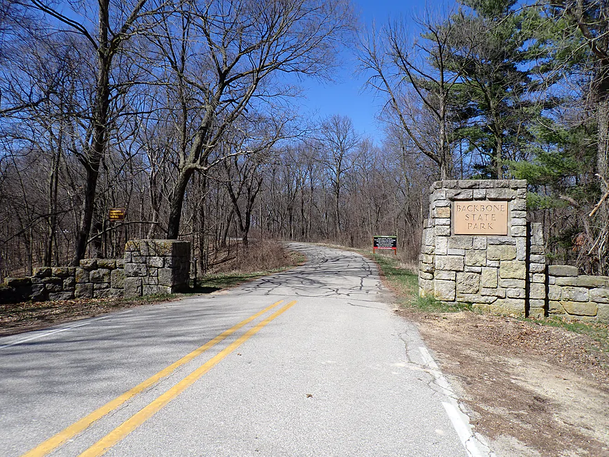
Welcome to Backbone State Park
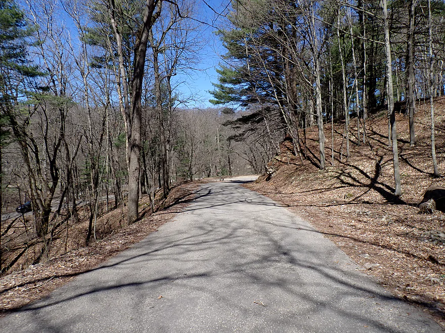
A scenic drive to the put-in
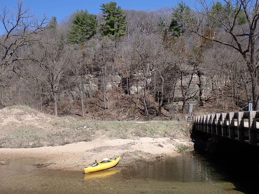
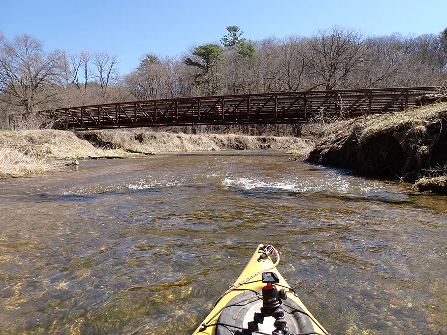
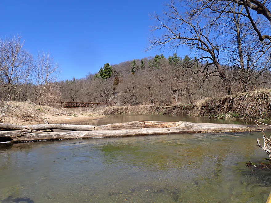
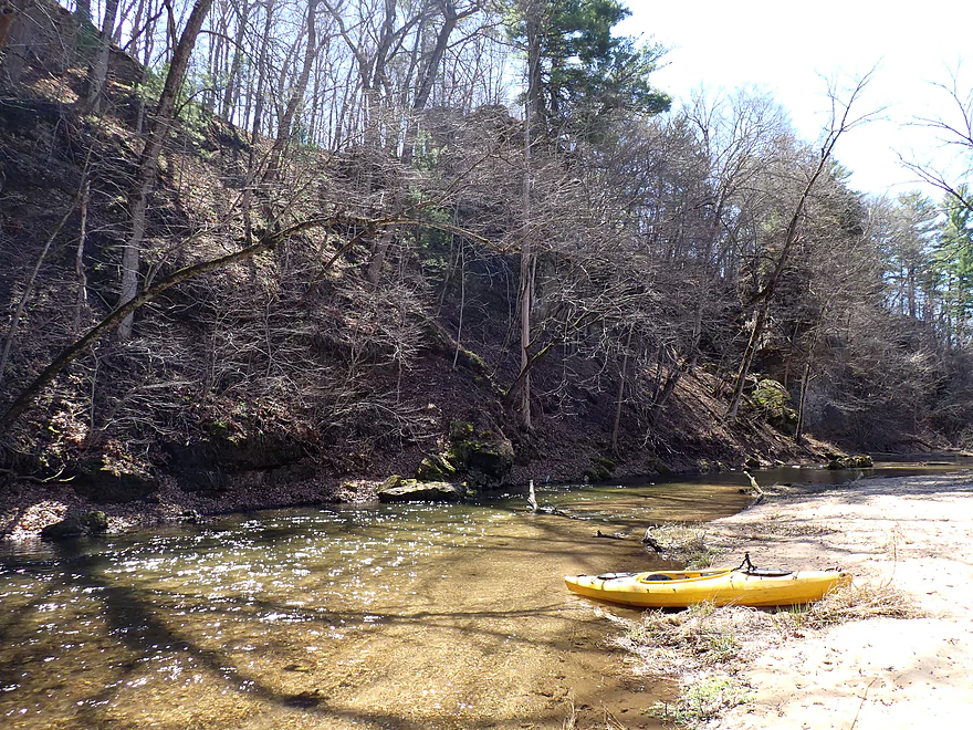
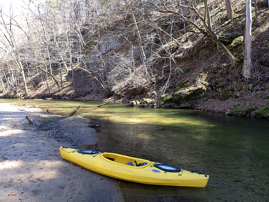
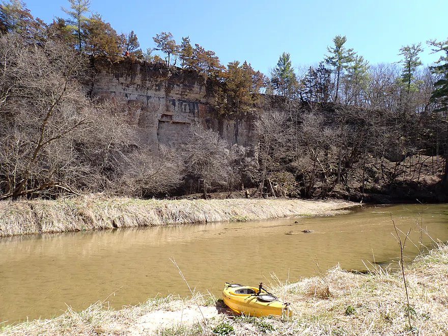
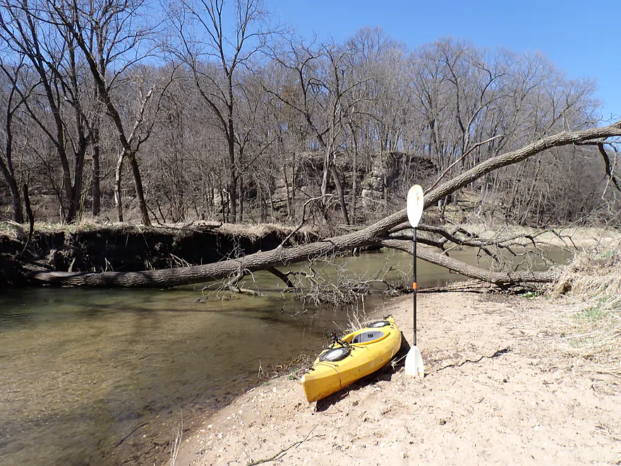
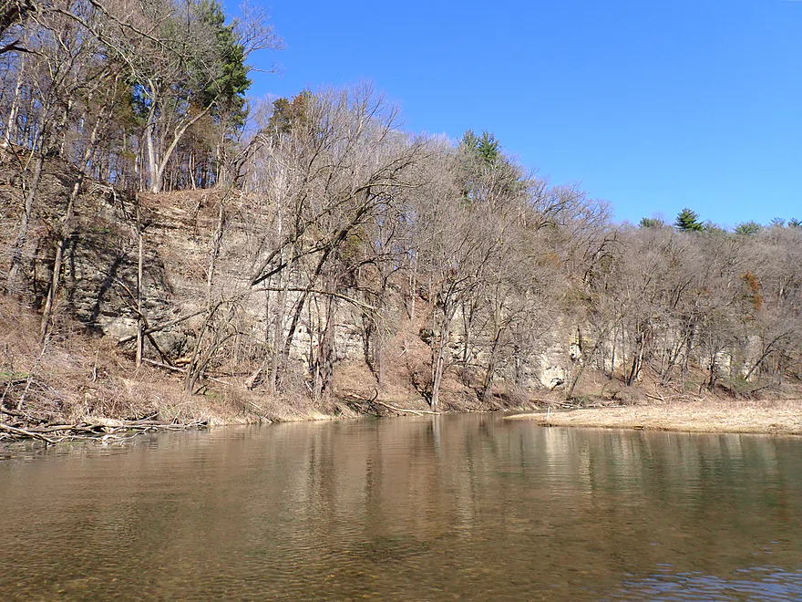
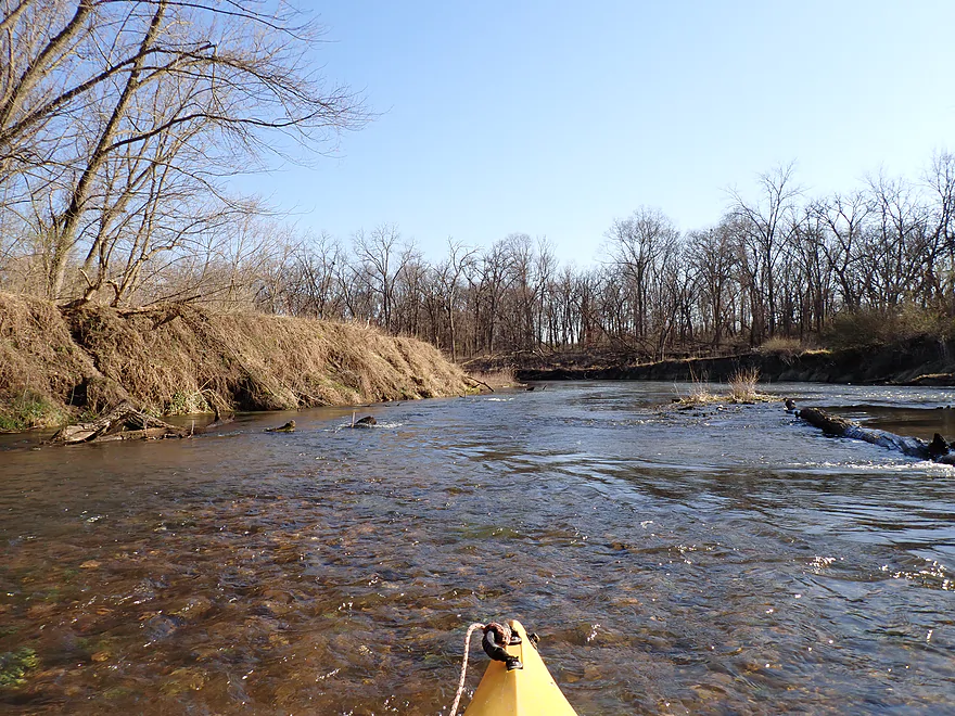
Photogenic sandbar launch by the 410 bridge
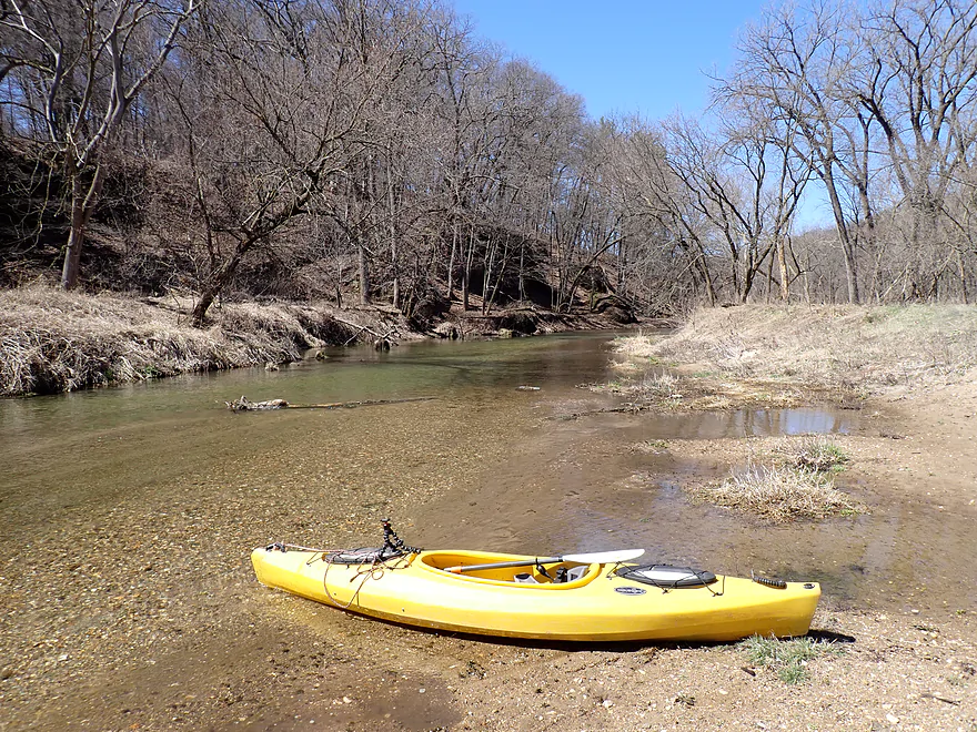
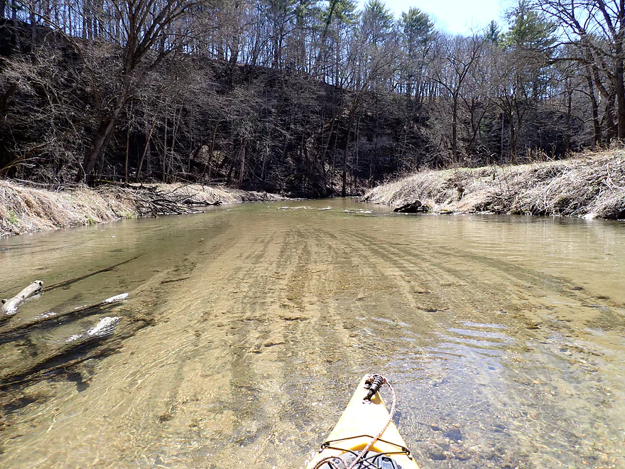
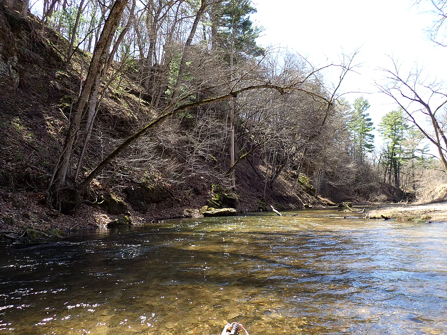
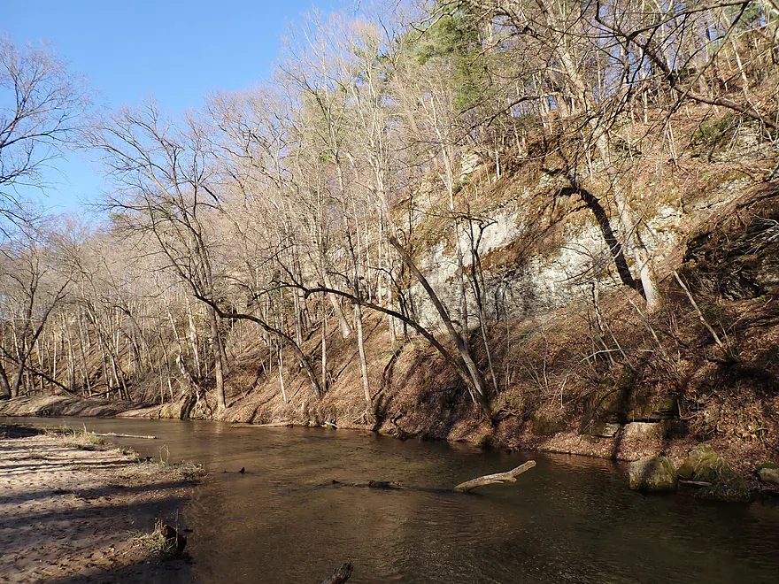
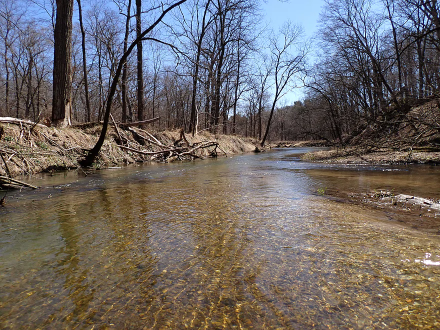
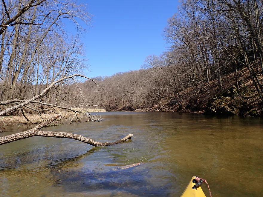
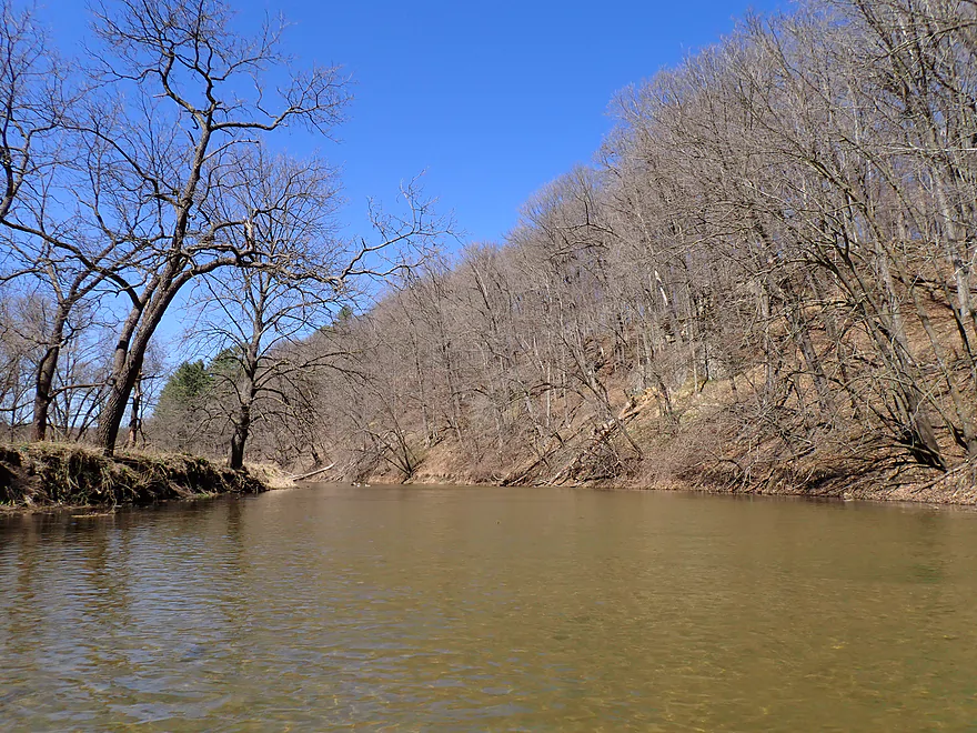
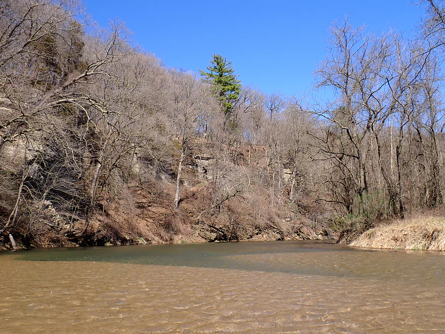
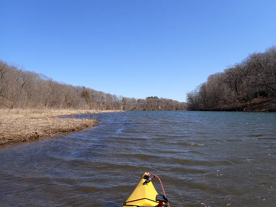
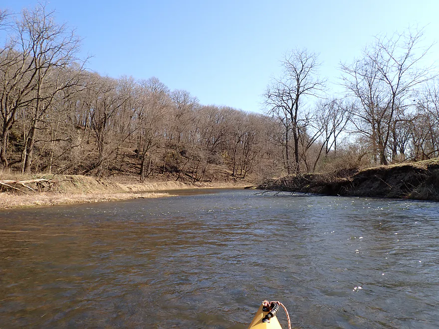
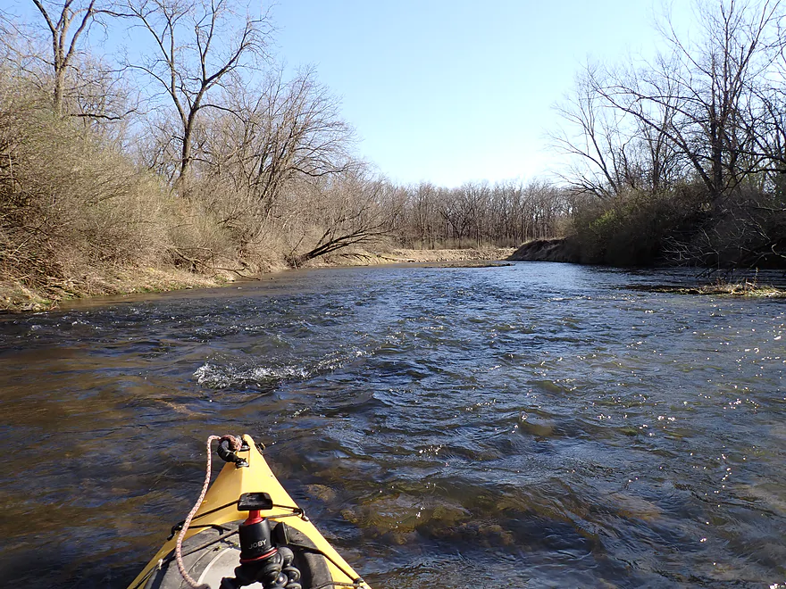
View upstream
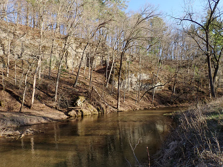
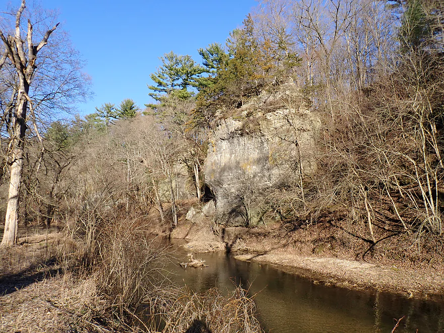
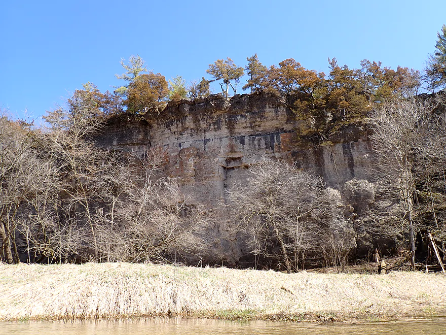
Paddling a bit upstream to check out a rugged bluff
Very exotic
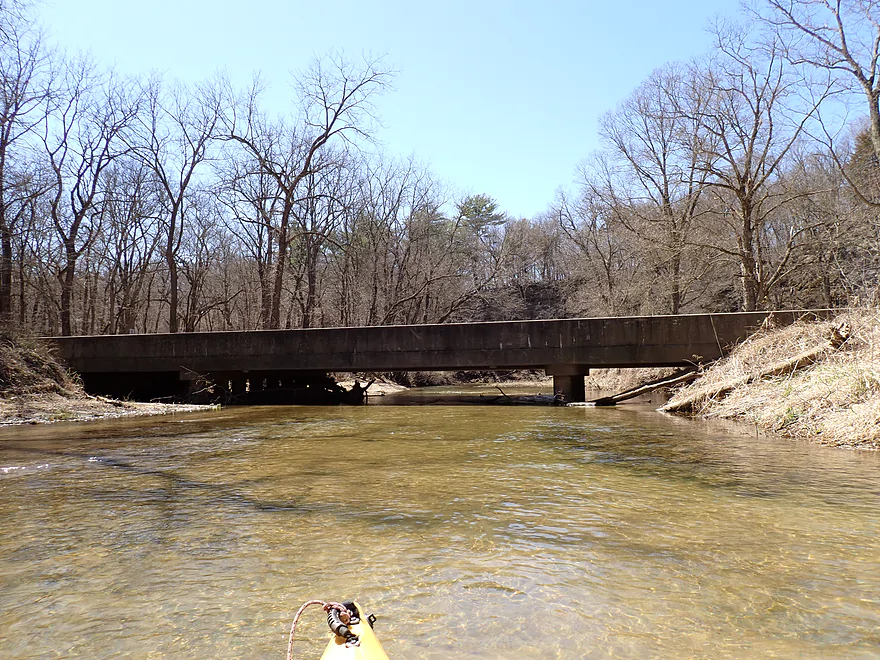
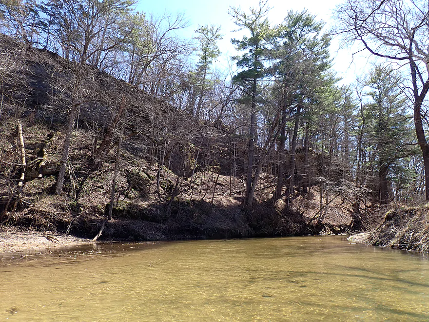
Paddling downstream past two bridges
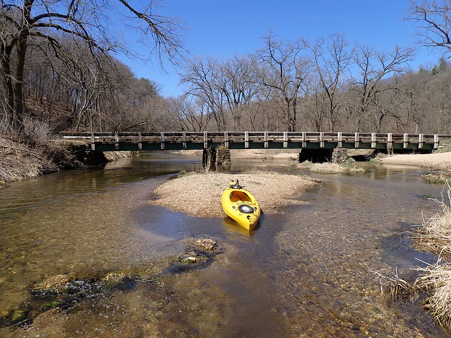
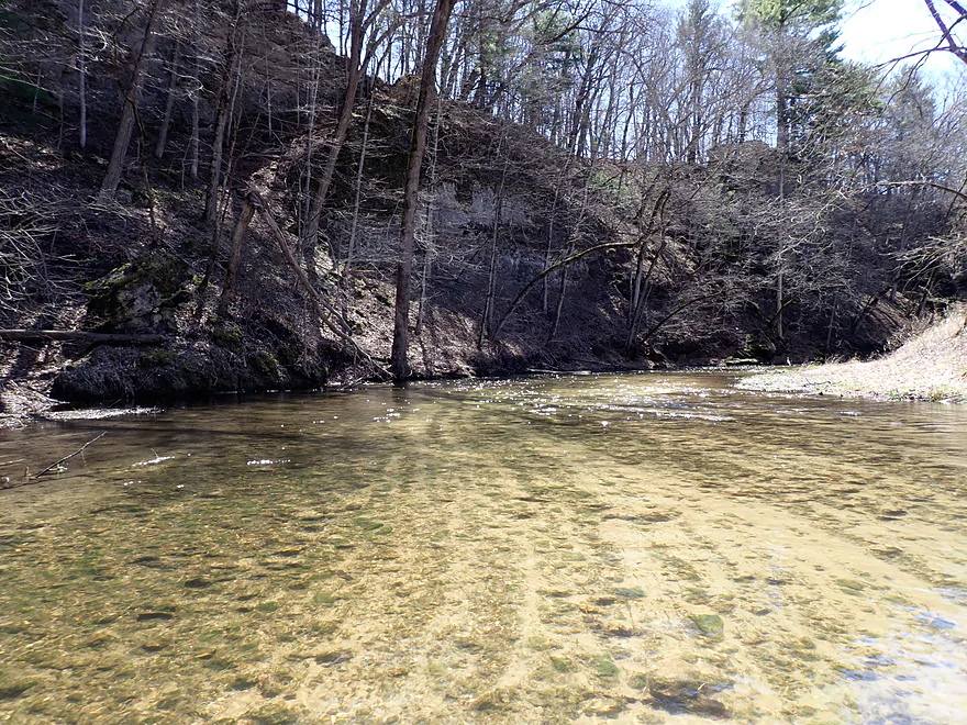
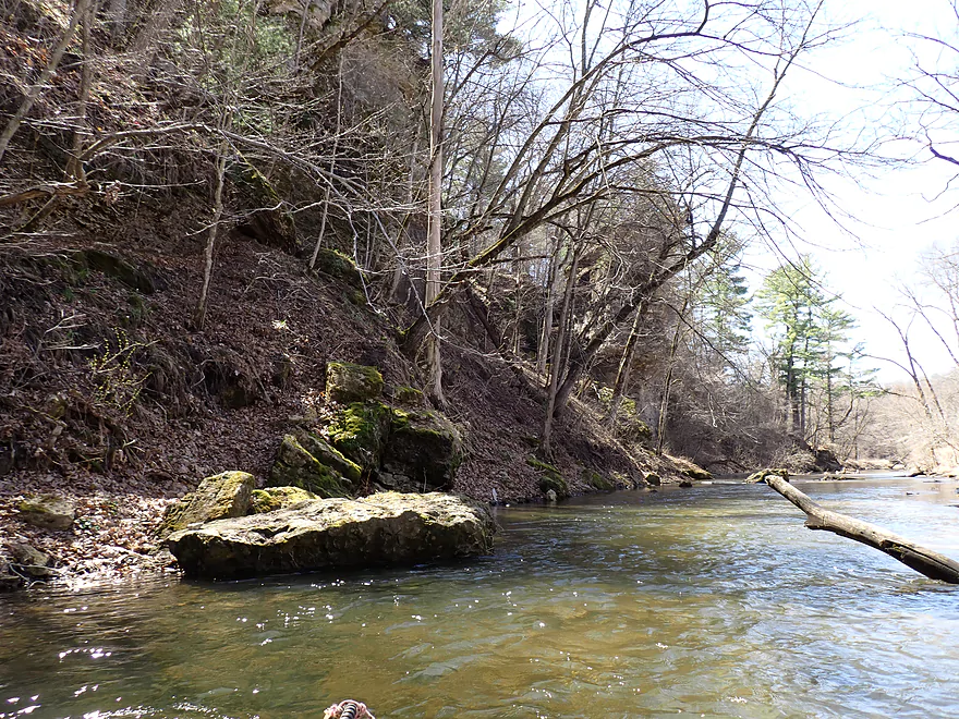
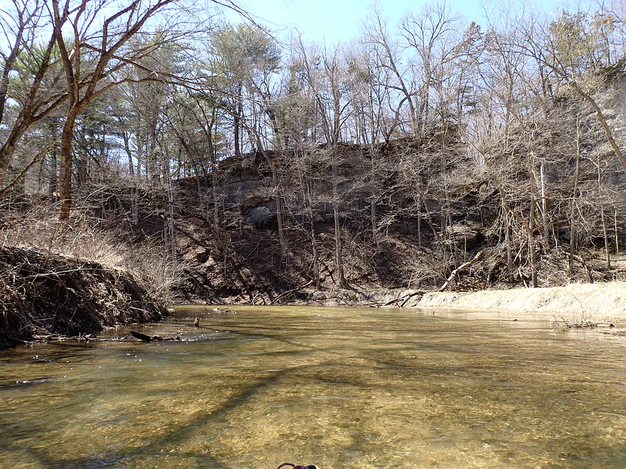
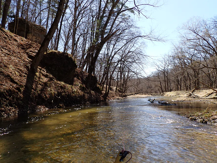
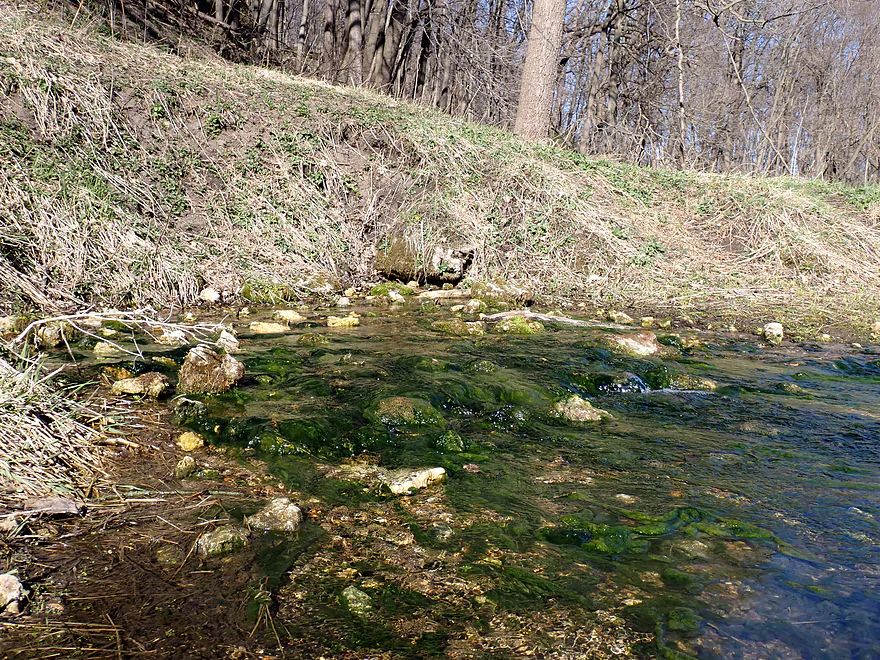
Nice gravel substrate
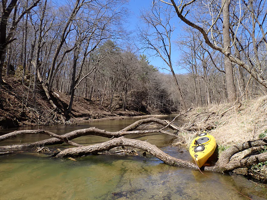
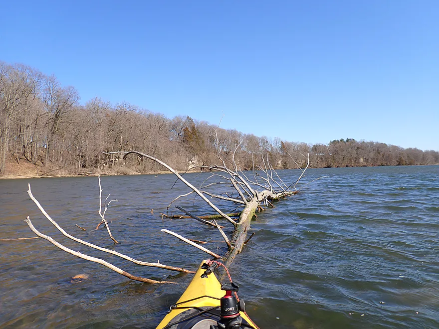
Logjam #1 (easy portage)
Cool substrate striations
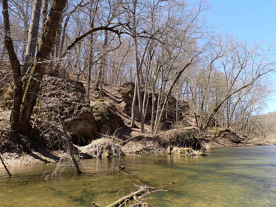
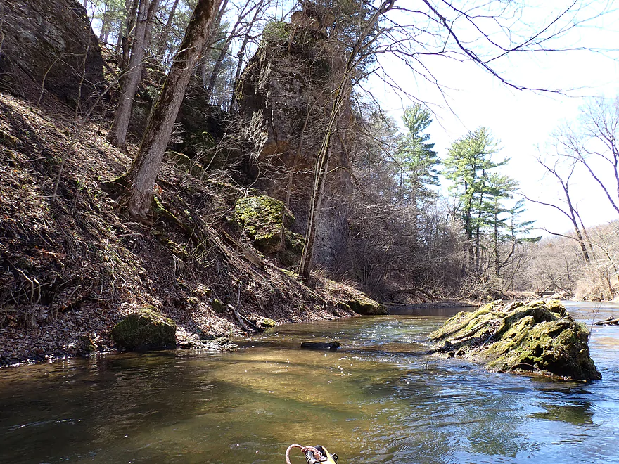
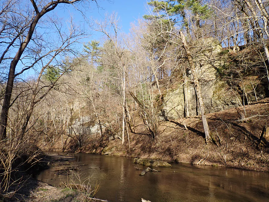
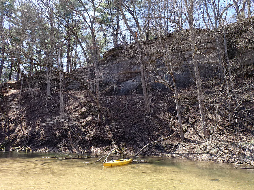
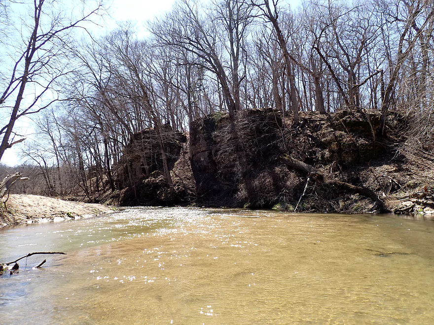
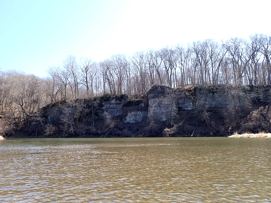
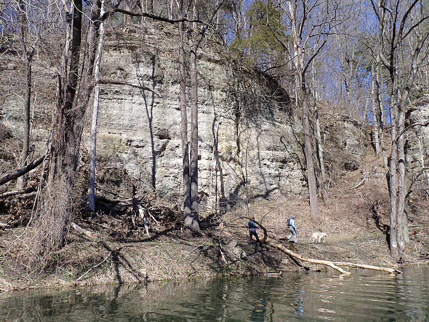
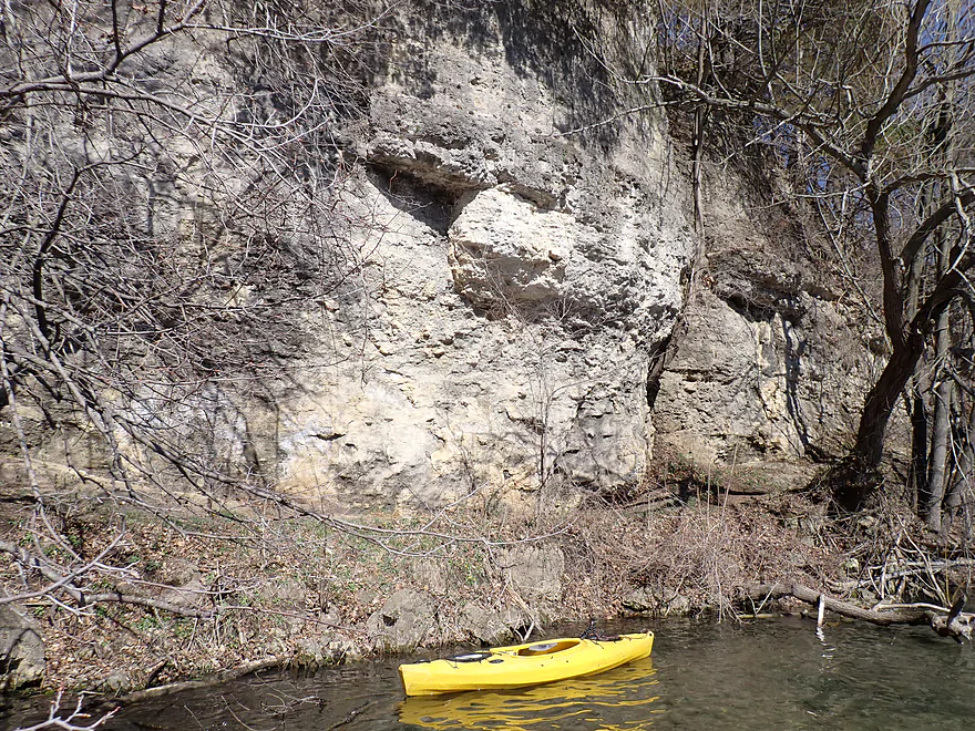
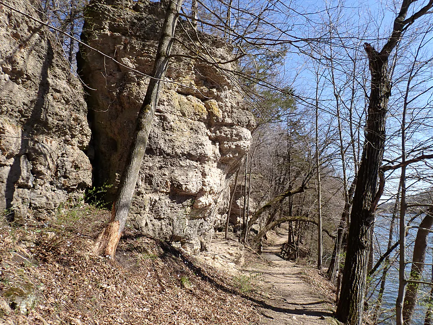
River is directed sharply east by an impressive bluff/cliff combo
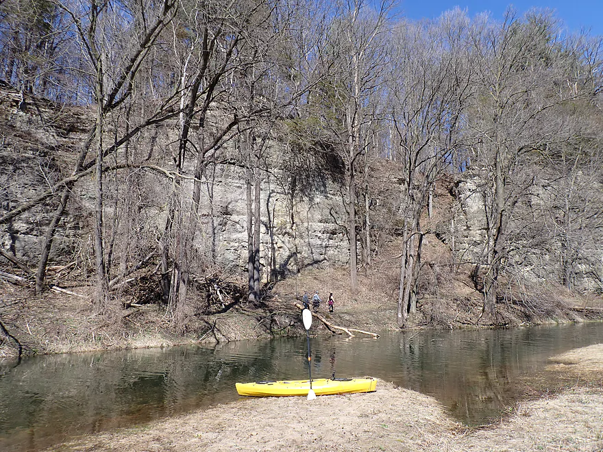
Getting out for pictures
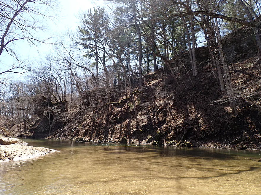
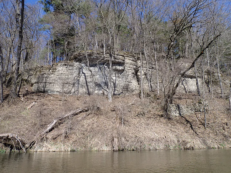
This cliff would be difficult to spot in the summer
Reverse view
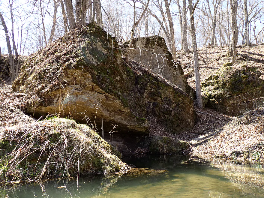
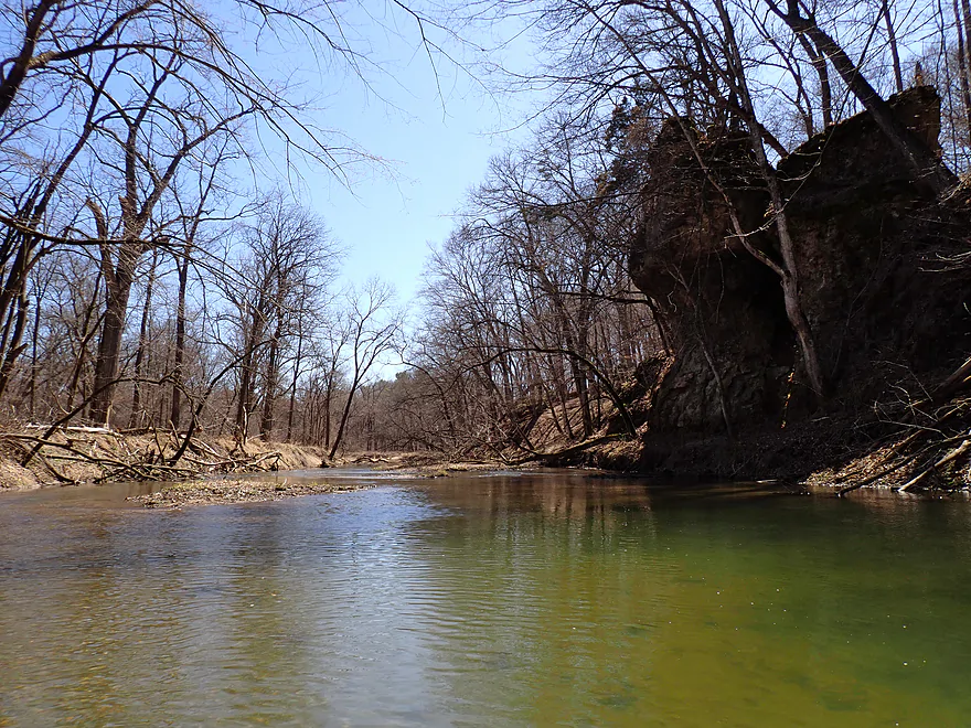
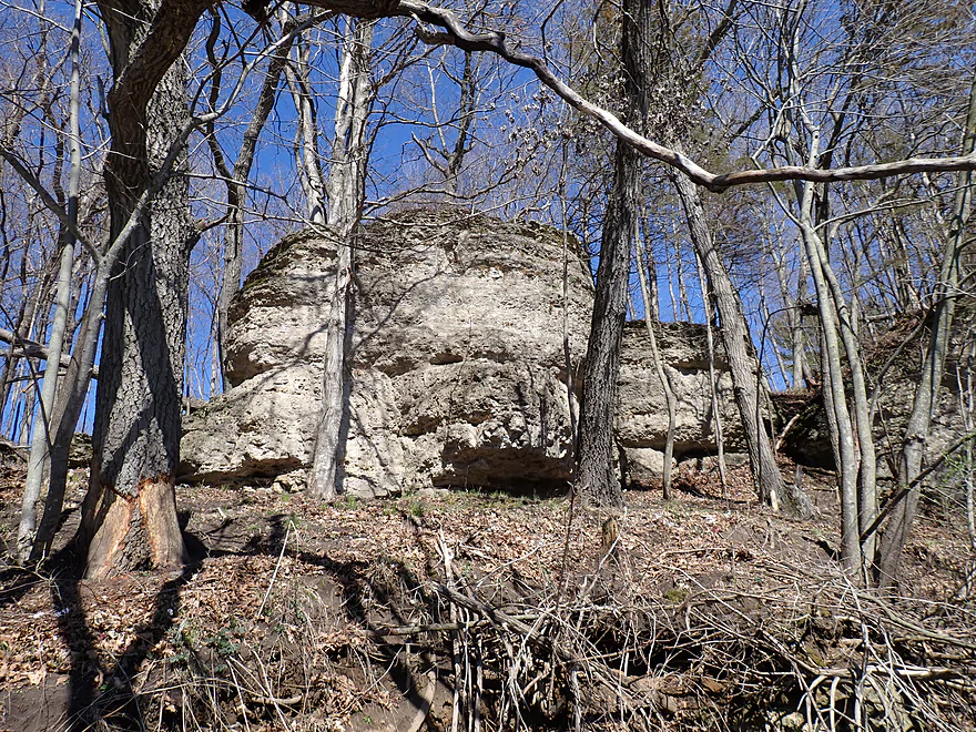
Some former rock faces are now in the river
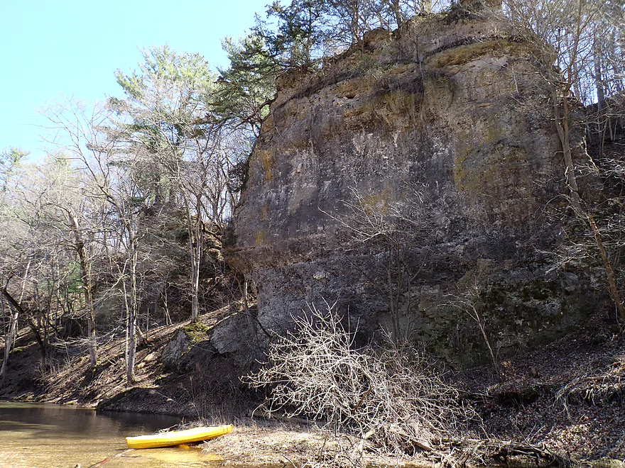
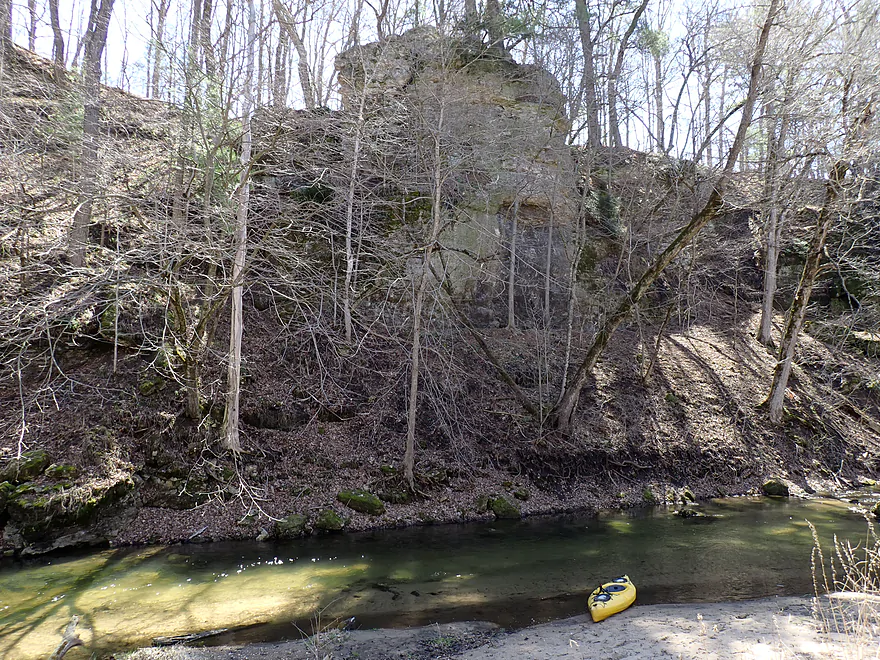
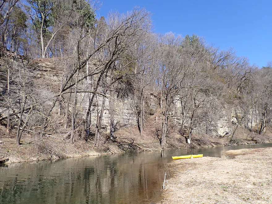
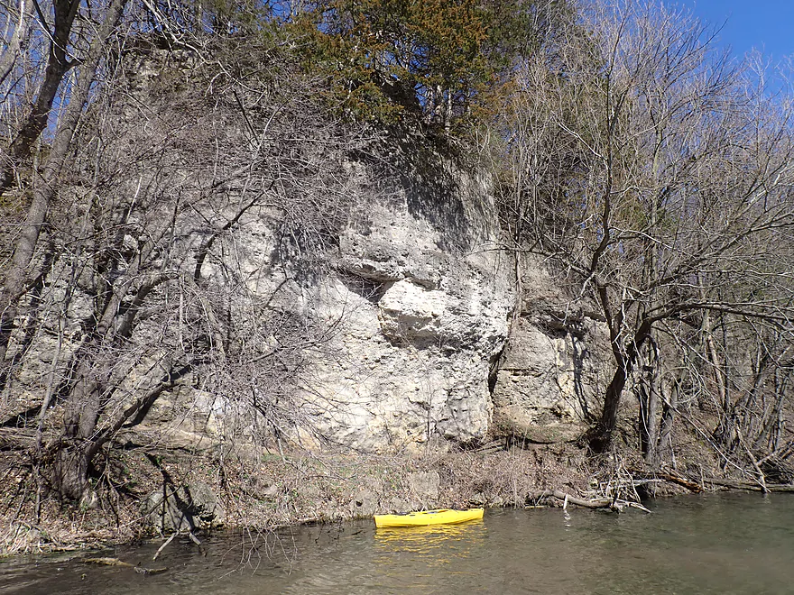
One of the larger cliffs
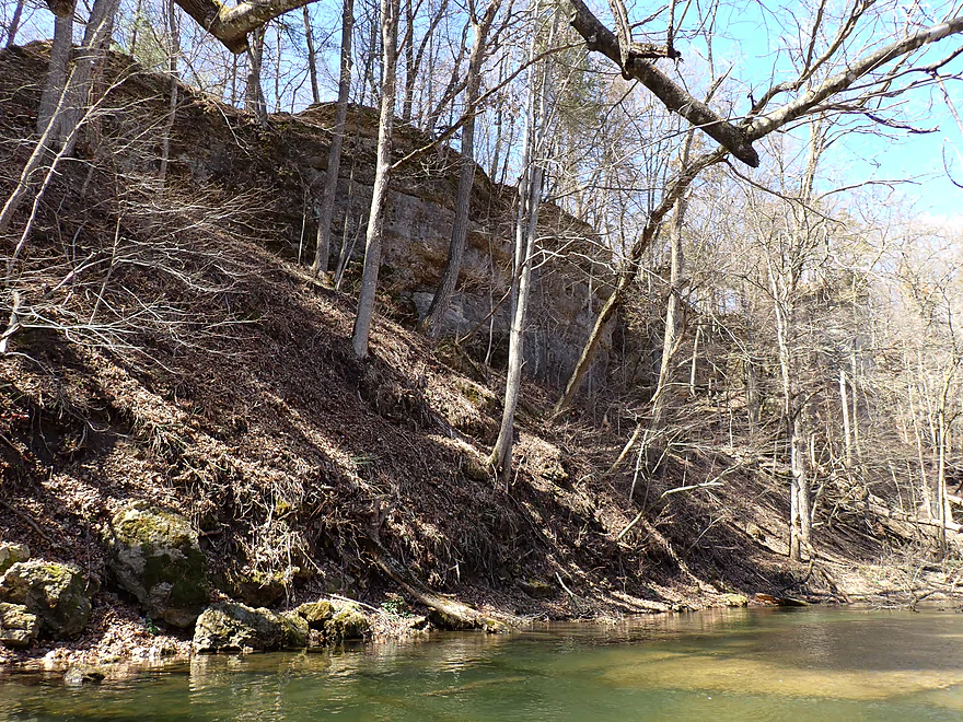
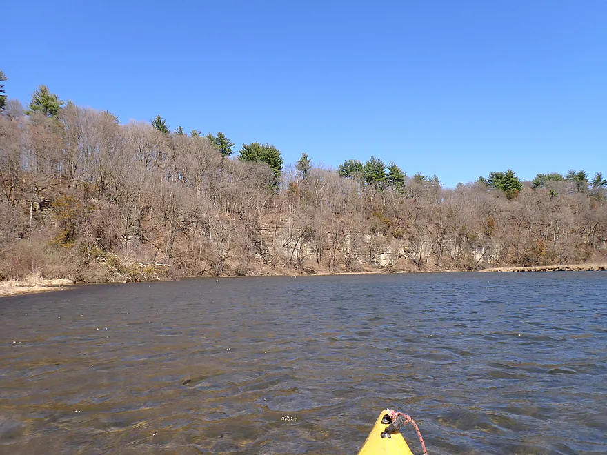
Same view but in better light after the trip
120th Street is an access option
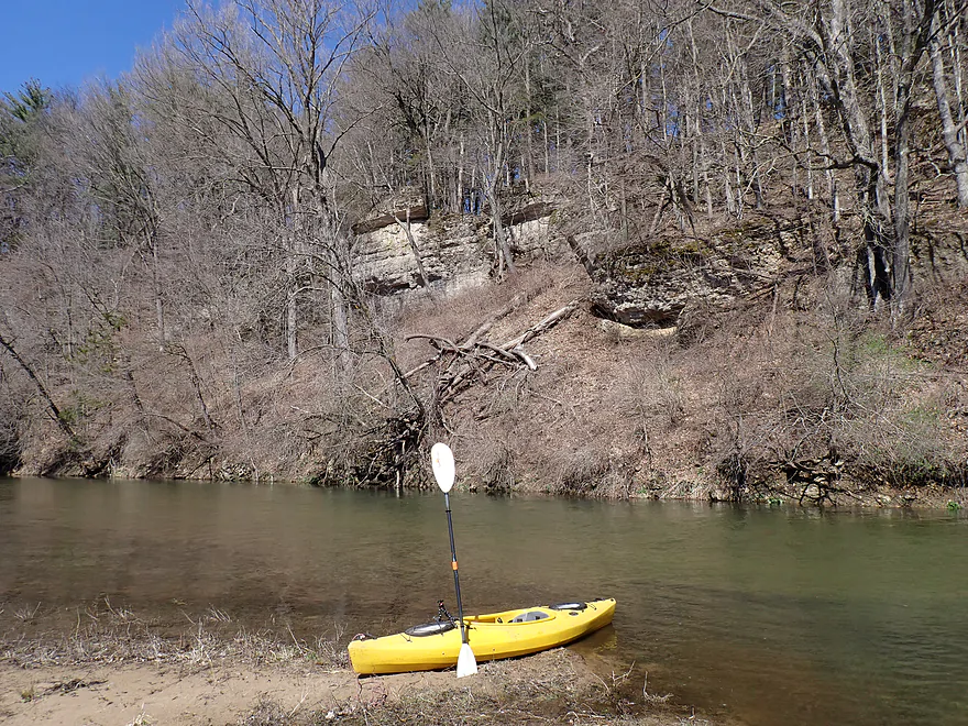
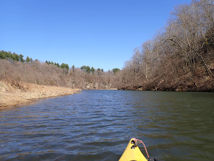
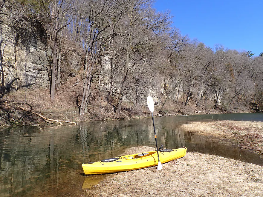
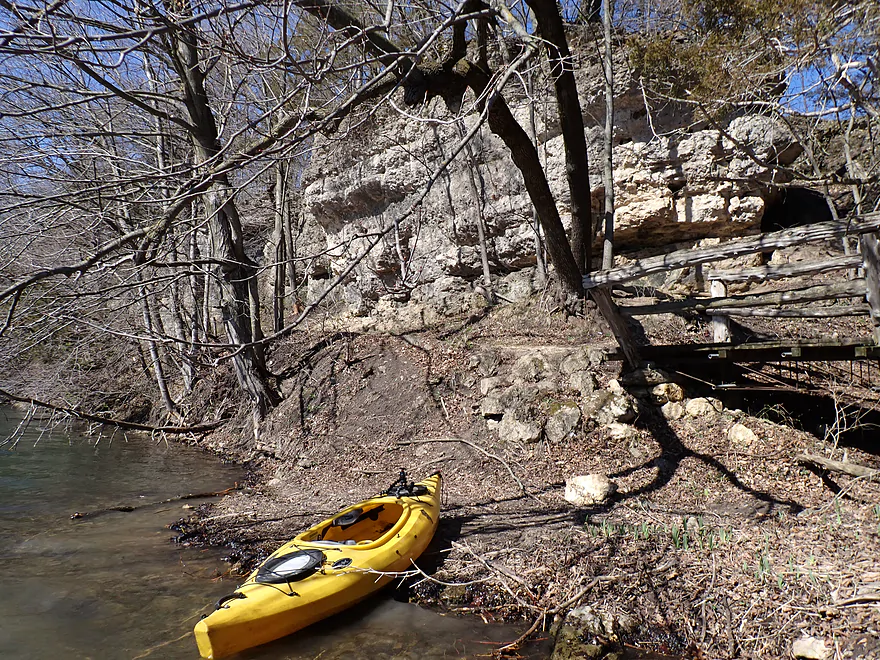
Another great bluff coming up
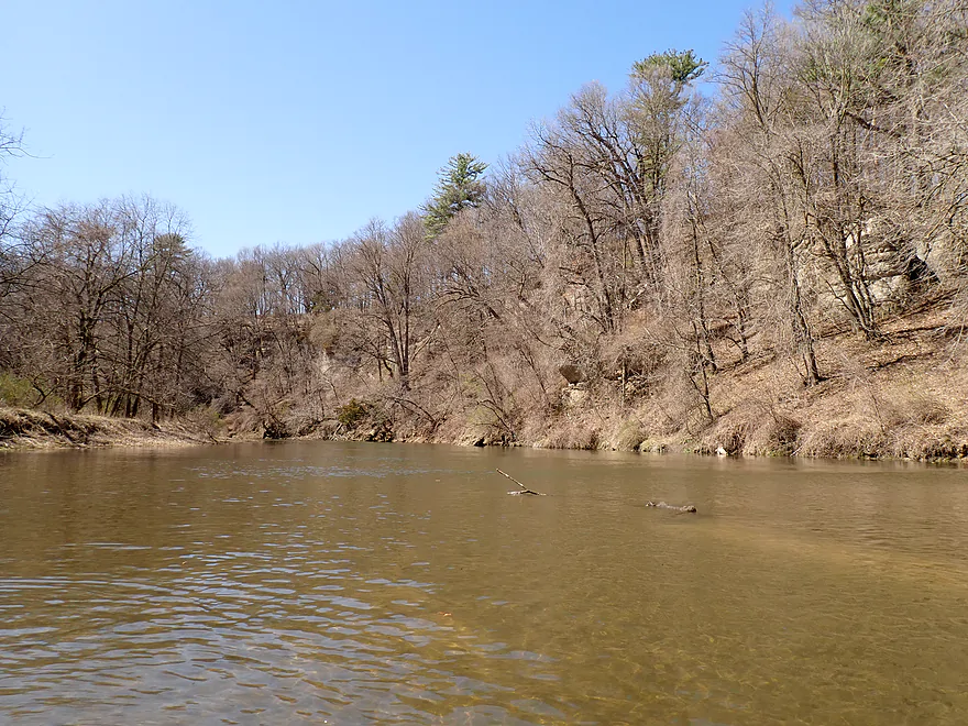
Looking back
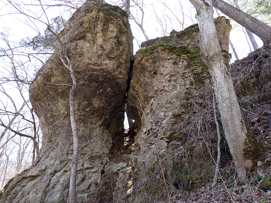
Split rock
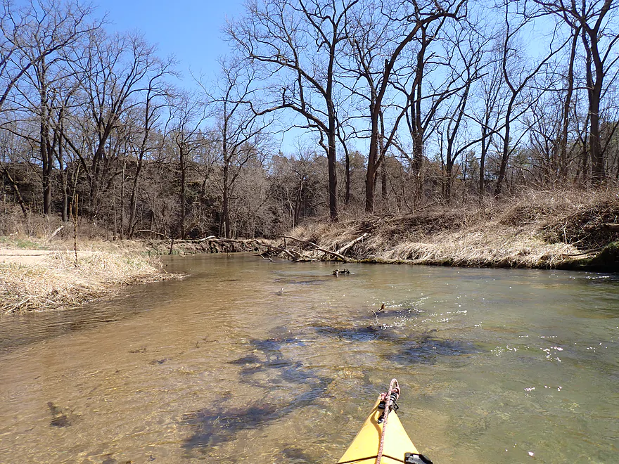
More clear water and an attractive pebble substrate
Logjam #2…easy portage
A sheer dolomite cliff–this must be at least 70′
This is the start of the famous “Devil’s Backbone” that the park is named for
A cluster of white pines
Most sharp turns had outcrops at their base
Logjam #3…sandbars make for super easy portages
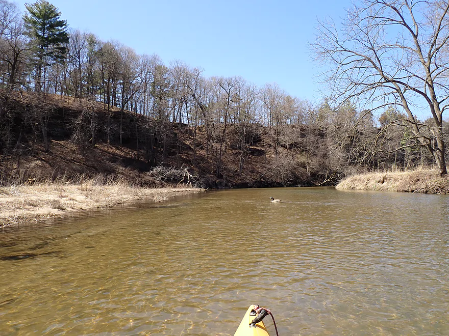
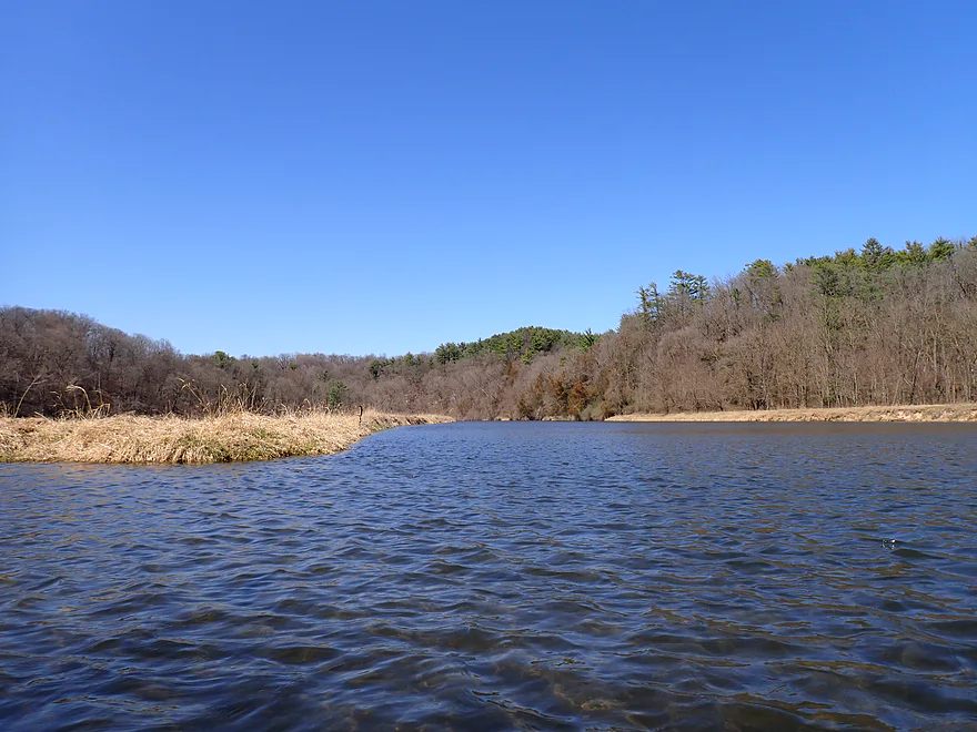
The South Fork joins up…hereafter the river slows and doubles in size
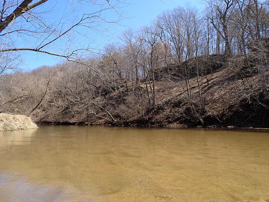
Attractive wooded bluff on the right bank
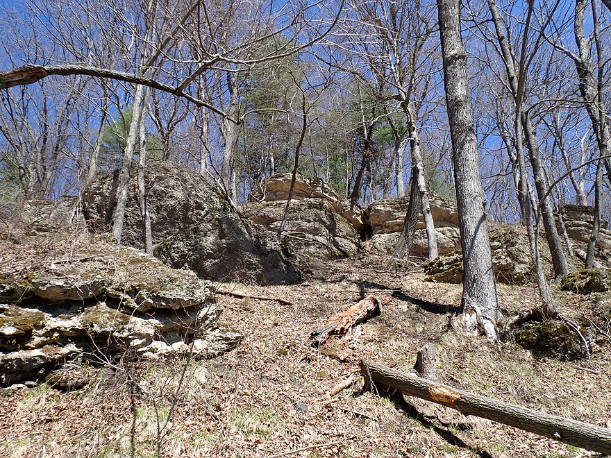
Many smaller outcrops were hidden and near the tops of the hills
Looping back north along the east side of the “Backbone”
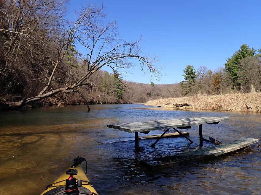
I don’t think that picnic table is supposed to be there
Terrific cliffs on the northeast corner of the “Backbone”
Getting out for pictures
Reverse view
Now past the “Backbone” but there are still great bluffs and cliffs ahead
Looking upstream…river starts to widen out into Backbone Lake
Paddling north into another impressive ridge
The top is fringed with white pines
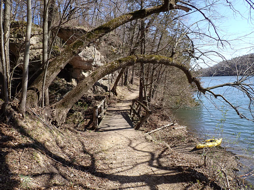
The East Lake Trail is fantastic (hikers visible by outcrops)
More outcrops…I sometimes would race hikers who were heading east like I was
Not evident from the photos, but I’m facing strong headwind gusts
Now entering the fattest portion of Backbone Lake
Great outcrops on the northeast shore
I took so many photos…
Along the shore it was one outcrop after another
Getting out to check out the “East Lake Trail’ (and to take a break from the wind)
A phenomenal hiking trail
With phenomenal rock formations
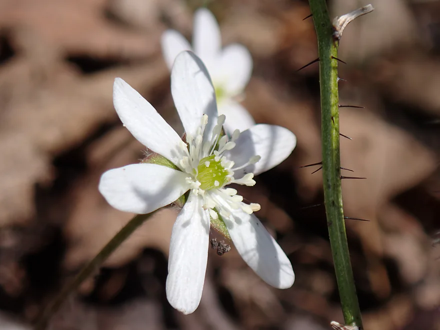
Early hepatica flowers
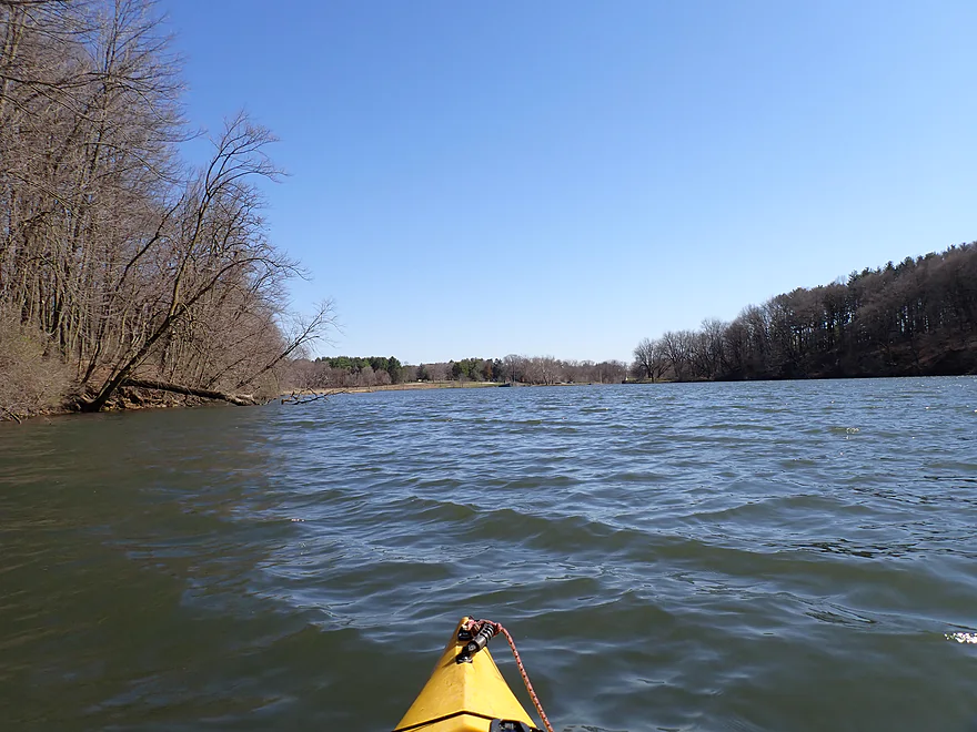
Some slow, boring lake paddling
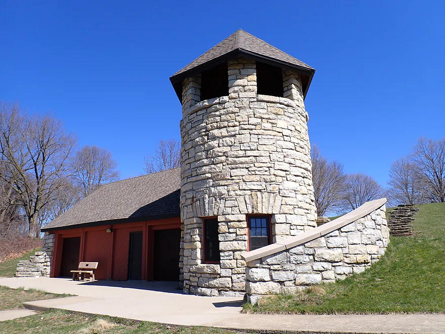
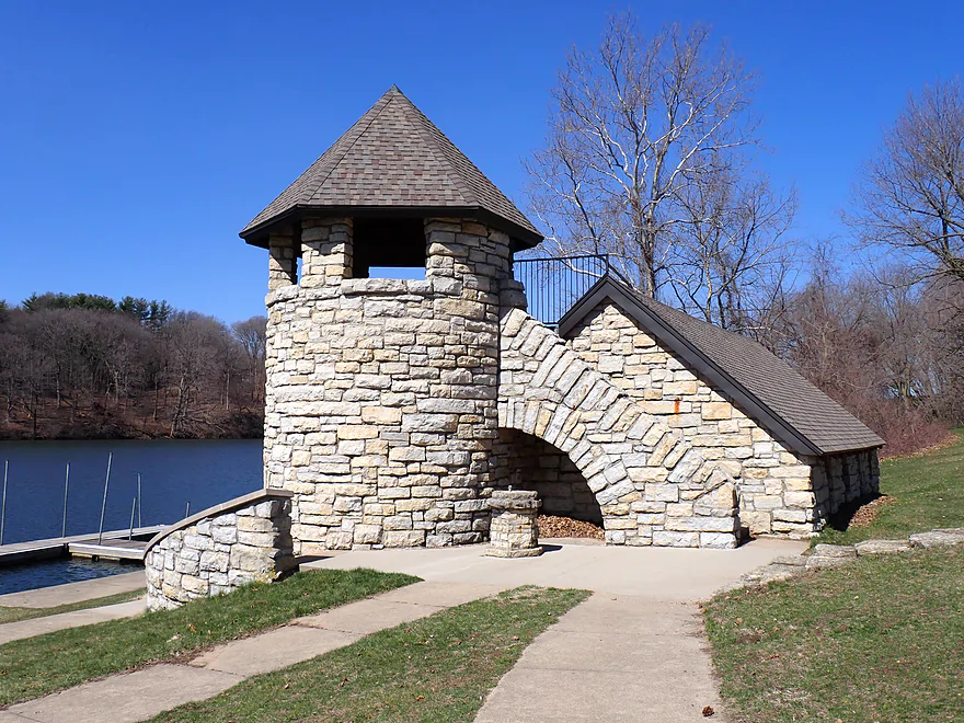
Backbone Park’s famous boathouse (you can rent canoes, kayaks, and paddle boats here)
View from behind
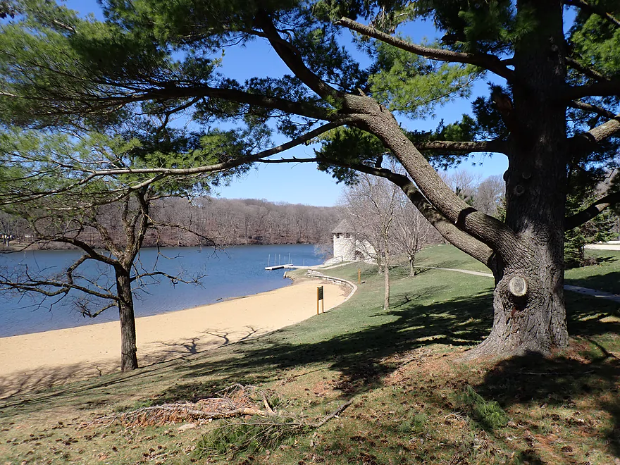
The adjacent beach
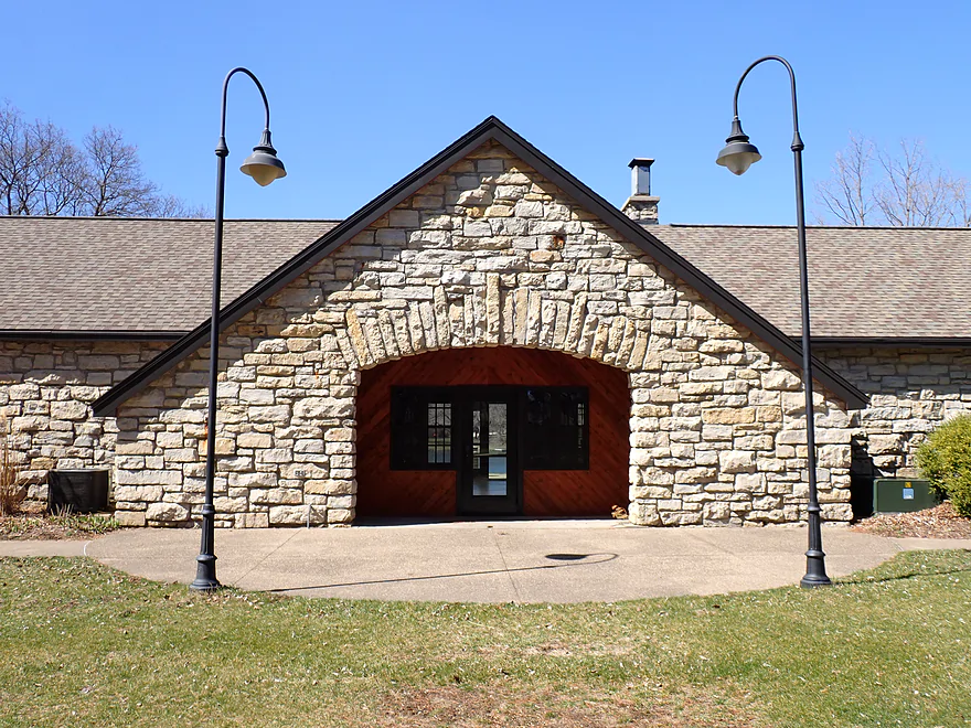
The adjacent meeting hall is also scenic
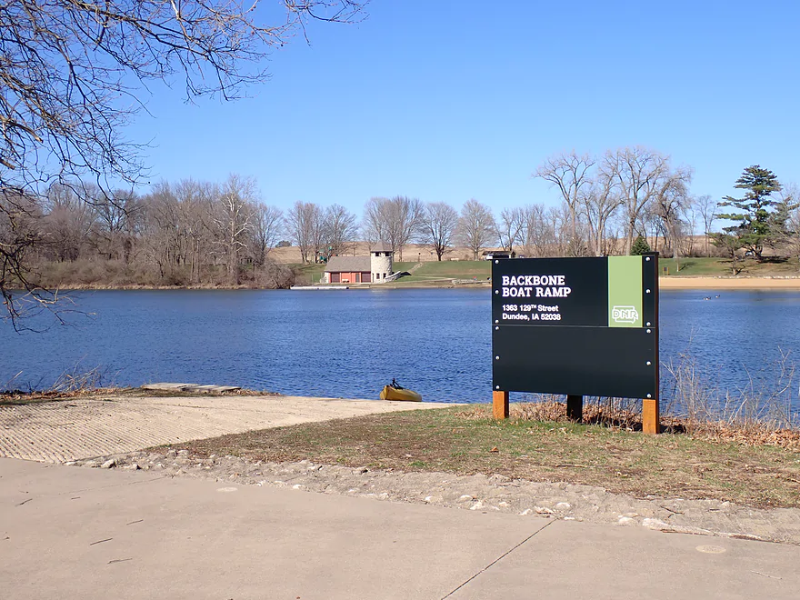
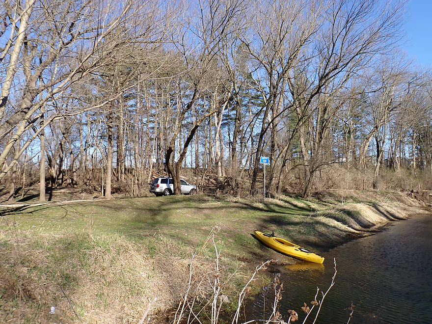
Getting out at the Backbone Ramp
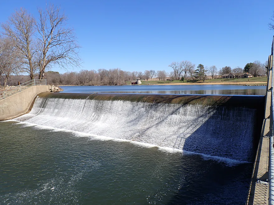
Twin dams located by the ramp
I portaged down steep banks to relaunch below the west dam
Tricky rocky ledge under the 129th Street (north channel)
Attractive bluff below the dam
With a spring at its base
Paddling toward another bluff
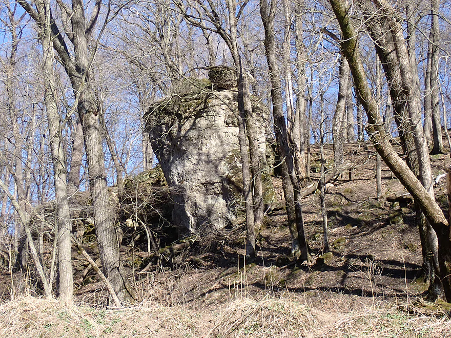
Another sneaky tower hiding in the woods
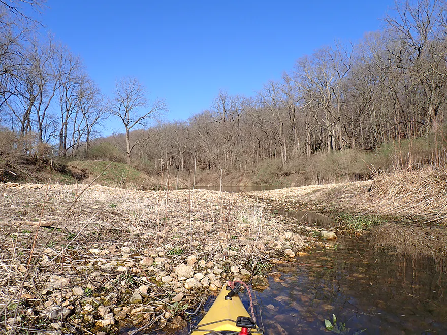
Large gravel bar
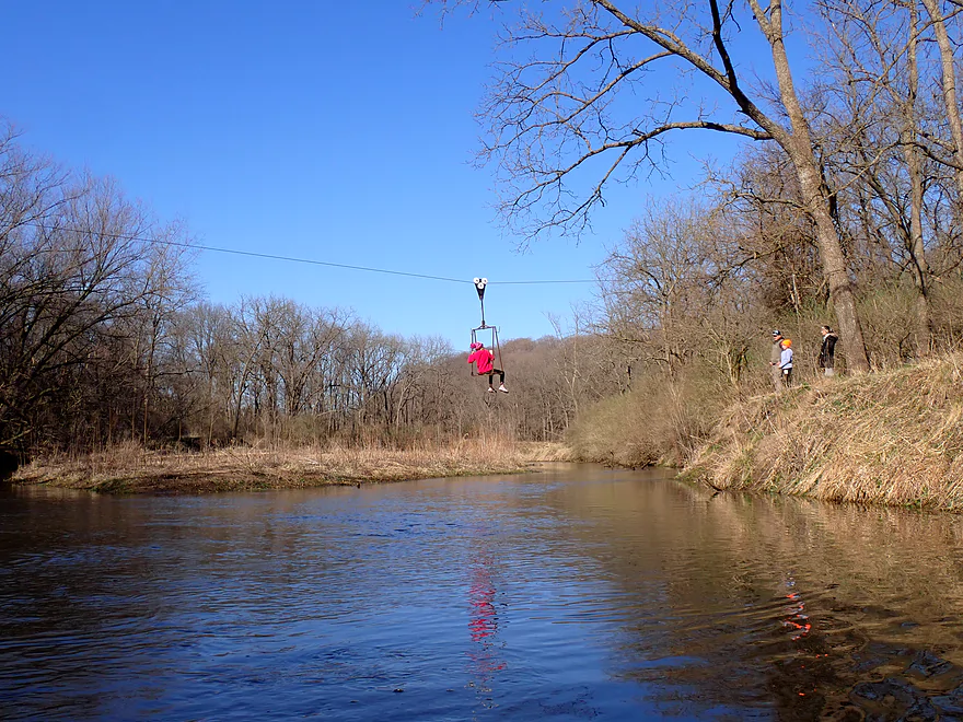
Girl traversing the river on a zipline
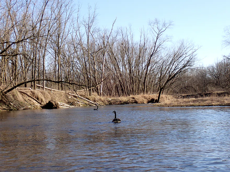
Getting a goose escort downstream

The banks here were badly eroded
One of several fun Class 1 rapids
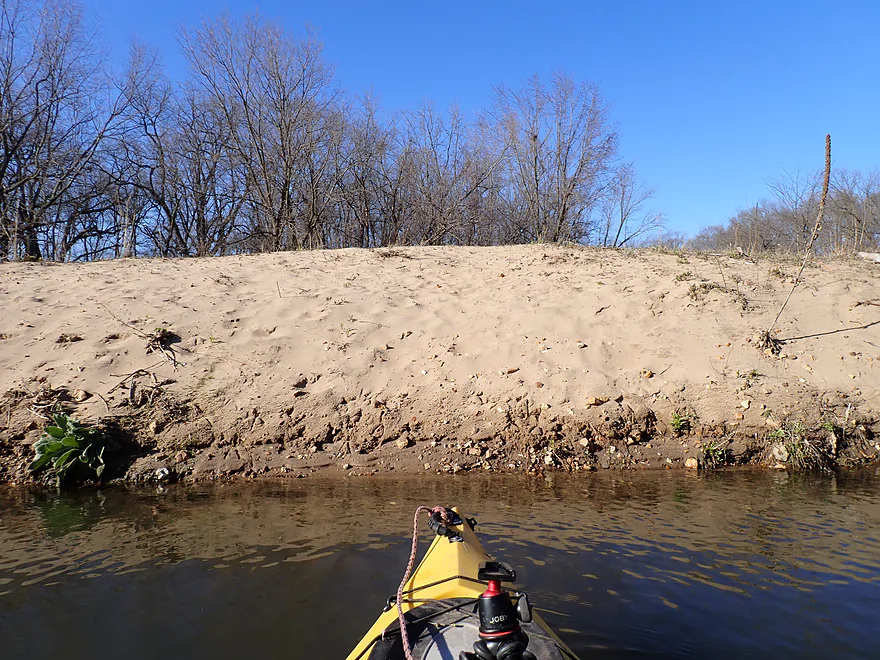
Tall sandbar
Final stretch
Taking out Dundee where there is a great access
Exploring the Richmond Spring and Fenchel Creek area (very scenic)
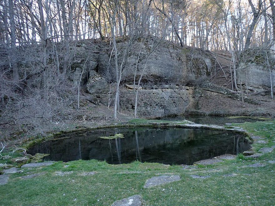
The main springs used to be a fish hatchery (hence the circular retaining walls)
Maquoketa River – Backbone State Park

The Maquoketa is one of Iowa’s most famous and popular rivers with paddlers. Many of its segments are terrific, but perhaps its best is located at the far upper end in Backbone State Park. Timing a river trip through the park though can be tricky, which will deter some paddlers, but is worth it. Upstream from the South Fork confluence, the river is shallow and needs recent rain to be runnable. Then in the “off-season”, the core of the park is closed (via road gates). Lastly in summer, thick vegetation and tree leaves obscure many of the best rock formations.
For this trip I really wanted to launch from Hwy 410 or the 120th Street bridge near the center of the park. Most paddlers instead prefer to do round trips from Backbone Lake, but I knew that would exclude some of the best cliffs. I was very much relieved to see that the 410 bridge had a great shoulder access with suitable parking and a fantastic sandbar for launching.
The first half mile of the trip had incredible scenery…perhaps the best of the trip (and I hadn’t even reached the backbone yet). I scooted under two rustic CCC bridges, over light rapids, and past crystal clear water with a great view of the gravel/sand substrate. The trees growing along the banks were fantastic…a mix of oak, maple, and pine. A passing hiker waved to me and let me know he had kayaked this leg in August, but then it was quite shallow and he had to get out a number of times. Thankfully for this trip, low water was never an issue.
Soon the river was redirected sharply west by an incredible bluff with cliffs at its base and topped with pine trees. This very much reminded me of Mormon Creek, Wisconsin Dells, and even Halls Creek (high praise). 120th Street is another bridge access option in the core of the park which would be doable, but paddlers shouldn’t be tempted… The upstream 410 bridge was the better access option and putting in at 120th Street would mean missing a great stretch of river.
After the second bridge, the river is forced south by yet another impressive bluff/cliff combo. After the main rock formation, the river opened up somewhat and flowed through a sandy wooded stretch. Much of the upper river was damaged by heavy floods in recent years. There used to be much more gravel and riffles…but much of that is now buried under huge mounds of eroded sand. Unfortunately there were a few logjams on this stretch, but they were super easy portages because of the sandy banks.
An impressive cliff wall atop the left bank marked the start of the famous “Devil’s Backbone”. Basically it is a steep, narrow bluff, made mostly of dolomite which is shaped like an upside down spoon. This forces the river to maneuver in a tight horseshoe pattern to wrap around it. At times I could see (and hear) hikers following a trail network at the top of the backbone. It’s actually the tallest point in northeast Iowa, and there are good views from on top, but trees block many of the best vistas.
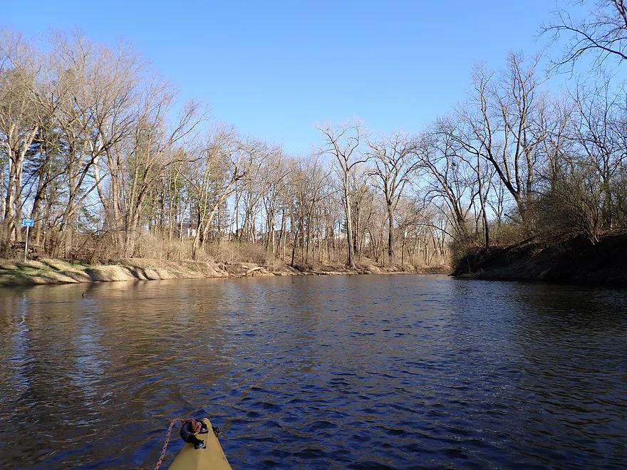
Roughly halfway around the “backbone”, the South Fork joins the main branch, which significantly enlarges the river. At roughly the same time, the current which had been peppy and quick, slowed dramatically as the effects of the downstream dam started to kick in.
Despite the slower and wider channel, the scenery remained top-notch with a number of exposed cliff faces and pine trees. At the north end of the backbone, I passed under the main overlook which ironically enough doesn’t give you a great view of the river or the rock formations. For that you really need to be in a kayak or use one of the lower riverside trails. Not to repeat myself too much, but spring and fall are the best times to kayak the park. So many of the nice outcrops I saw would be completely hidden in summer.
Following the “Backbone”, the river is actually redirected by yet another rock peninsula (a smaller opposing backbone), which also has scenic cliffs. The river makes an impressive yin-yang path snaking between the two opposing bluff peninsulas. Unfortunately by this time, strong gusts were becoming a problem. The direct head winds were creating unexpected whitecaps and topped 25 mph (you really don’t want to paddle open water in say 14+ mph winds). Despite this, I could usually paddle faster than paralleling hikers.
The river started to widen out into Backbone Lake, and I bee-lined for the east shore which had some terrific rock formations. There a fantastic trail (East Lake Trail) was narrowly sandwiched between the lake and the rock formations which was really cool. I got out to take a break from the wind and to take some pictures of the trail.
The lake itself is not in good shape, and wasn’t a fun paddle. Despite the steep height of the dam, much of Backbone Lake has silted in. The stagnant water has allowed algae, bacteria, and even E. coli to become problematic…so much so that the main beach is usually closed for swimming. The Maquoketa River has had a number of dam removal success stories…hopefully in the future that will include the Backbone Lake dam.
One of the few highlights of the lake though are the historic CCC buildings by the beach. This includes an iconic stone boathouse with a mini “silo”, and a stone lodge. Both were mysteriously closed despite this being a popular weekend.
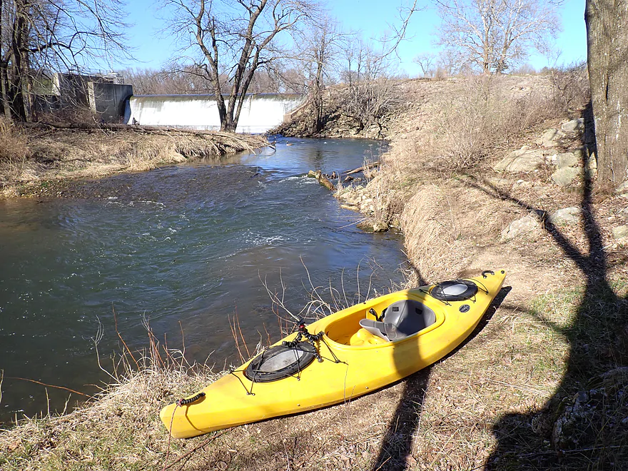
At the far southeast end of the lake is a pair of twin dams. Between the dams is a narrow island/peninsula with a public boat landing. Most paddlers get out here and it’s a great public access, but my plan was to continue on so this would only be a portage for me. While getting out was super easy, getting back into the river proved trickier. The downstream banks were steep and rocky, and both twin channels contained fast current and strainers. I opted for the west channel, but in hindsight I suspect the east channel would have been better. When I got in, I was surprised as to how pushy the current was (water levels were higher than normal), and combined with the strainers concluded this wouldn’t be suitable for most paddlers (unless you had good boat control).
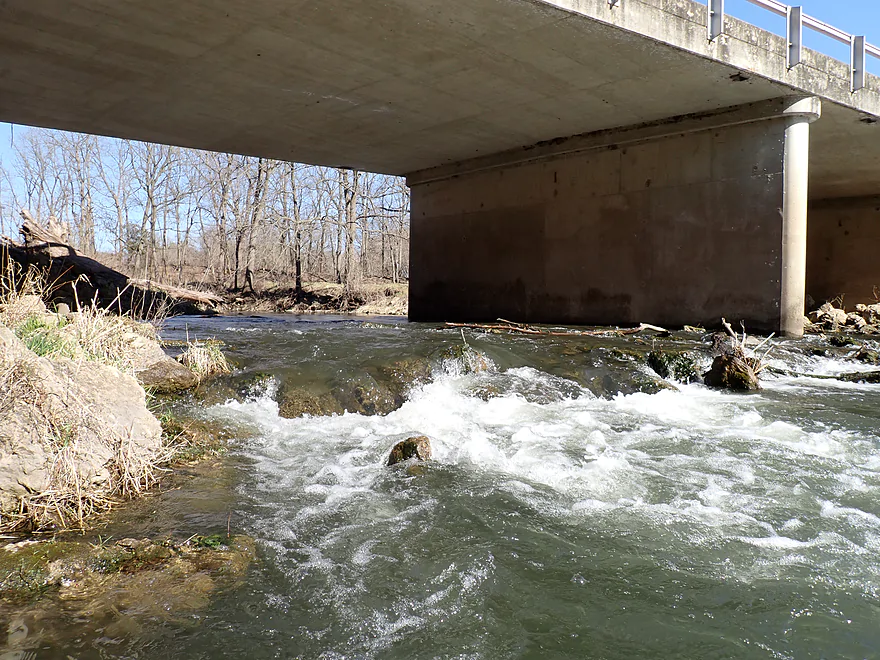
Under the 129th Street bridge was perhaps a 2-foot ledge with no clear path through. I awkwardly and gingerly bumped my way down the middle, only to learn after turning around that the far west end of the west channel would have been more runnable. Again I should have scouted the east channel as that might have been in much better shape, but I was just running out of time.
Following one more annoying strainer, the two dam channels rejoined to form the main river again. From here on, the trip would be much easier to paddle with only a few more minor strainers.
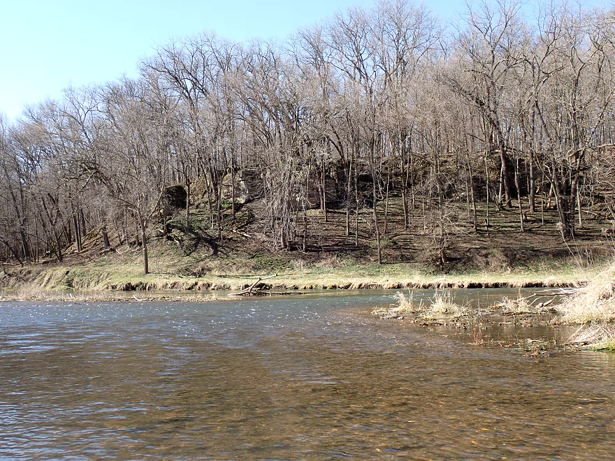
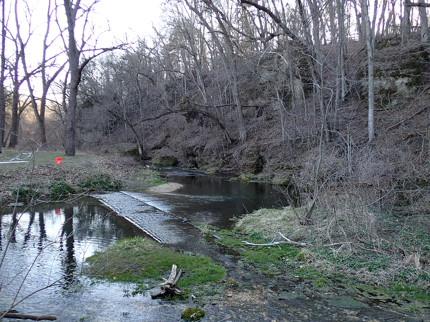
The scenery just downstream from the bridge was really good with flanking bluffs, exposed outcrops, and a terrific spring. But…it wasn’t in the same league as the cliffs in the state park, which were far superior. I would completely understand if paddlers wanted to end their trip at the dam, as that would conclude the best parts of the river and would avoid a number of downstream strainers.
The final two miles were decent. The banks though were heavily eroded, and many of the remaining outcrops were smaller and up to their knees in eroded topsoil. This stretch had a few surprisingly nice sandbars (likely Backbone State Park outcrops in a previous life).
Just past a massive gravel bar, I was surprised by a little girl scooting across the river on a zipline. She then pulled herself back to the shore using a second line. I talked to a local who asked me about the deadfall I faced below the dam. We agreed it was really bad, and he said he wouldn’t take his kids on that stretch despite them being kayakers. He really hoped the park ranger would clear it out (the park border ends close to the dam, but does also include a land buffer below it).
The trip ended in the community of Dundee where there was a fantastic public access for paddlers.
In conclusion this was a terrific trip…I suspect it is one of the most scenic paddles in all of Iowa, with perhaps only the Upper Iowa able to rival it. But it has a lot of caveats. The strainers below the dam were annoying, and most paddlers should take out above the dam instead (unless they have good boat control). The issue with the park gates being sometimes open and sometimes closed is annoying as well…I had to cancel a previous trip in March because of gate closures. Lastly, paddlers should try to paddle stretch this outside of summer, otherwise the scenery won’t match the below photos. Fall color in the park can be good so this might be a great time for a trip.
Sights included turkey vultures, deer, clamshells, ~5 eagles, some schools of fish, and countless geese. On the drive to Backbone State Park I came this >< close to hitting a pheasant which flew in front of my car.
Backbone State Park: This is Iowa’s oldest state park and among its most popular. The highlight is its dolomite rock formations which largely cluster around the Maquoketa River. The most famous of which is the “The Devil’s Backbone” (a tall, skinny bluff that is also the highest point in NE Iowa). Access to the core of the park is restricted by a gate system that is closed during the off-season. Contact the park or monitor its website to know if the gates will be closed. The good news is that Iowa (unlike Wisconsin or Minnesota) doesn’t require park stickers.
- Trails: The park has over 21 miles of trails, most of which are really nice. Some are high up atop the bluffs with occasional overlooks…but the best trails tend to be at lower elevations among the outcrops. I highly recommend the East Lake Trail which is sandwiched between Backbone Lake and impressive rock outcrops. You can also hike on top of the Backbone itself (Backbone Trail), but the views won’t be as top-notch.
- Richmond Springs: Located near the north end of the park, the springs are situated beside steep outcrops and nestled in an attractive gorge. At one point they were used as a fish hatchery, and today you can still see stocked fish swimming in the main spring pool and artificial circular pond linings.
- CCC Museum: The CCC was founded in the early 30’s to help with the then unemployment crisis. The work they did for state parks in MN, WI and IA was fantastic. Many of their trails, buildings, and bridges feature remarkable stonework, woodwork, and clever use of natural materials. Of all parks in Iowa, Backbone State Park features the most and best CCC craftsmanship. Tragically some of the historic CCC bridges and structures were damaged by recent floods. This is especially problematic since many “modern” replacements tend to be cheaper and uglier (eg cement bridges vs wooden ones). Other examples of parks with rustic infrastructure created by the CCC include Devil’s Lake and Whitewater Park in Minnesota.
- Boathouse: Located at the east end of Backbone Lake, this is an iconic CCC building that appears in many social media pictures of the park. The walls show fantastic stonework and there is even a small stone tower that I had hoped to climb up, but unfortunately the building was locked.
- Caves: Supposedly there are caves (as well as karsts and sinkholes) in the park you can explore. I didn’t have time to check these out though.
Hwy 410 Bridge: This is a good bridge access (and super scenic). Parking is available at either end. This bridge will not be accessible when the park closes its gates (during the off season). Keep tabs on the park website to know if/when they are open. Typically they are closed when there is snow, but this isn’t often perfectly correlated and sometimes the website isn’t updated. You can contact the park at backbone@dnr.iowa.gov for more info.
Alternate Put-ins:
- 400th Street (3.4 miles upstream from 410): I think you can launch from the 400th Street bridge, but be wary which shoreline you use as I believe there have been private property complaints about paddlers accessing the river from the bridge. The big advantage of this starting point is it allows you to paddle through the upper park which contains a lot of scenic bluffs and cliffs I missed. Also spring paddlers who find themselves locked out of the interior of the park, could launch here as a bypass. On the downside it may be shallow and there could be logjams.
- C57 Bridge (0.3 miles downstream from 410): This is a second very nice bridge access in the core park area. But, I recommend launching from 410 instead so you don’t miss out on some great cliffs.
- Backbone Lake Dam: There is a public launch positioned exactly in between the two dams. You could launch from the east end of the lake and paddle upstream to the cliffs and the backbone. I suspect most paddlers do this as a round trip, but I don’t recommend this because it will omit a lot of the best scenery which is too far upstream to see on a round trip.
- Backbone Beach: If you really wanted to, you could launch from the beach, but it is downhill from a parking lot, so it is not as convenient as the dam launch.
Dundee Public Access: This was a fantastic take-out…secluded, scenic, decent parking, and well marked with signs.
Alternate Take-outs:
- Backbone Lake Ramp/Dam (2.1 miles upstream from Dundee): For most this would be THE recommended take-out. The river below the dam is nice with some outcrops, but the scenery isn’t as elite and there are tricky strainers in fast current which require advanced boat control. There is also an unpleasant rocky ledge under the 129th Street bridge.
- Lindsey Bridge Access (5.0 miles downstream from Dundee): This would be an ok access. But extending the trip to Lindsey would make for a long trip…and this bonus leg is more flat and less interesting.
Bike Shuttle – Dundee to Hwy 410: 5.8 miles with 230′ of ascent. This is an ok bike shuttle that is almost entirely paved. There are a few big hills to deal with closer to Dundee but these are manageable. Descending and pedaling through Backbone State Park was a really cool experience. Bike shuttlers can if they wish take a slight detour on 132nd Street to check out the dam, beach, and boathouse.
Logjams:
- Put-in to South Fork: Three noteworthy jams, but all easy portages because the banks are so open and sandy.
- South Fork to Dam: None.
- Dam to Dundee: None, but there are tricky strainers just below the dam.
Wind: This won’t be an issue on the sheltered parts of the river, but on Backbone Lake strong winds can be problematic. Don’t do as I did (paddle Backbone Lake into strong 25+ mph headwind gusts).
Dams: There is a landing between the twin dams at the base of Backbone Lake. Getting out here is easy. A portage is trickier because the twin channels below the dam have steep and rocky banks. It’s doable though. Paddlers who opt for a longer portage can avoid some snags. Scout before portaging…both channels aren’t ideal.
There is also a two foot rock ledge hiding under 129th Street. I chose the right channel and had to awkwardly bump by way down (there does seem to be a somewhat open chute at the right side of the right channel I missed). The left channel may have a more viable ledge.
Current/Rapids:
- Put-in to South Fork: This stretch moves at a good pace with a number of light rapids/riffles. Most are very easy, although there is one tricky strainer that could simply be portaged if paddlers don’t feel comfortable running it.
- South Fork to Dam: Here the river is extremely slow as it’s impounded by the dam.
- Dam to Dundee: Below the dam, the river is split into two channels by a 1000′ long island. Both channels contain tricky current and low-hanging branches. There is also a two foot rock ledge below 129th Street that is a bit awkward to get past. Scout all this before running. The worst of the rapids/strainers conclude after the two dam channels rejoin, although there is one tricky strainer after this (easy portage). There are many light rapids leading up to Dundee…these are easy Class 1’s.
Closest Gauge: Maquoketa River @ Manchester
Trip Depth: 295 CFS or 4.8′
Navigability Estimates: Depth requirements will be very dependent on which of the three sections you do (put-in to South Fork, Backbone Lake, and/or the dam to Dundee).
- 0-50 CFS: Likely too shallow to do the pre-South Fork stretch. Lake should be ok (maybe). The leg below the dam will be pretty bumpy with maybe some wading, but should be viable.
- 51-100 CFS: The pre-South Fork stretch will likely require a bunch of wading…guy I talked to did it in August (~80 CFS), and he told me he had to get out a lot. Rest of of the river should be fine.
- 101-200 CFS: Maybe an average depth. Some wading might be required for shallow parts before the South Fork.
- 201-250 CFS: Above average depth. Still might be a few shallow spots before the South Fork.
- 251-350 CFS: High depth. Good target range for the upper parts. The leg below the dam (if you do that) will have some pushy strainers.
- 351-450 CFS: Very high depth. Good target range for the pre-South Fork part, but the leg below the dam will be rough.
- 451+ CFS: Maybe too high for safe paddling. I’m not sure though.
Click here to see an overview map of the Maquoketa River.
- Upstream from 400th Street: I think the river might be navigable, but I don’t know much more.
- 400th Street to Hwy 410: 3.4 miles. Likely a nice stretch with a number of sandbars, impressive outcrops, and steep bluffs. There might be some logjams to deal with.
- Hwy 410 to Dundee Access: 6.2 miles.
- Hwy 410 to Dam Landing 4.1 miles. Flows through the heart of Backbone State Park. First half flows by incredibly scenic bluffs, while the second half is an impounded lake.
- Dam Landing to 129th Street: 0.2 miles. Section between the dam and 129th Street is split into two channels. Both are narrow, fast, and congested. Not for beginner paddlers and should be scouted before running. I ran the west channel and dealt with an unpleasant two-foot ledge below the bridge. The east channel may be easier.
- 129th Street/Dam to Dundee Access: 2.1 miles. Attractive stretch with nice bluffs and some outcrops. Not as scenic as the preceding section.
- Dundee Access to 165th Street: 5.0 miles. This is a flatter section with many sandbars and far fewer bluffs.
- 165th Street to Quaker Mill Dam Access: 4.5 miles. This should be nicer than the preceding leg and features a return of some bluffs. A dam was removed relatively recently which has opened up this leg to paddlers. Some rapids are on this stretch.
- Quaker Mill Dam Access to Tirrill Park: 2.2 miles. A wooded stretch with lots of sandbars. River doubles in size from new tributaries.
- Tirrill Park to Manchester Whitewater Park – Upstream Access: 0.5 miles. Short leg that wraps around the town of Manchester.
- Manchester Whitewater Park – Upstream Access to Downstream Access: 0.2 miles. The famous Manchester Whitewater Park includes about 6 pitches of Class 2+ rapids.
- Manchester Whitewater Park – Downstream Access to Schram Park Access: 0.8 miles. Short leg through some suburban woods.
- Schram Park Access to Pin Oak Access: 2.6 miles. Includes some shallow but fun riffles. Per paddling author Nate, some stretches have exposed bedrock.
- Pin Oak Access to Bailey’s Ford Park: 1.9 miles. Heavily wooded stretch with some riffles.
- Bailey’s Ford Park to Turtle Creek Park: 4.7 miles. Here the river here has been impounded by a dam and the shoreline heavily developed. I’m not sure this would be a positive paddling experience.
- Turtle Creek Park to Delhi Access: 3.8 miles. This is Hartwick Lake…slow, wide, developed, and likely not interesting. Take-out is downstream from the dam (requiring a portage).
- Delhi Access to Pioneer Road Access: 4.5 miles. Likely a nice prospect with some scenic bluffs and supposedly a small canyon. Much of the bank is wooded and protected from development.
- Pioneer Road Access to Dunlap Park/Hopkinton: 5.3 miles. This stretch is flatter, sandier and more open than the previous leg. Still might be a few nice bluffs. The old dam was partly removed. What remains is a tricky stretch of boulders and rapids that may have to be portaged.
- Dunlap Park to Hard Scrabble Access: 1.8 miles. Simple stretch with wooded hills. There are irregular rapids by the put-in where the dam was removed.
- Hard Scrabble Access to Monticello Dam Upper Access: 10.2 miles. This is a longer wooded stretch. The first half has a lot of wooded hills and the second half is more open. A dam by the take-out slows the current, which may make the last few miles somewhat boring.
- Monticello Dam Lower Access to Pictured Rocks Boat Ramp: 8.1 miles. The start of one of the more popular and scenic stretches on the river. Stretch includes many bluffs with elevated exposed limestone outcrops. Crowds might be an issue on summer weekends.
- Pictured Rocks Boat Ramp to Indian Bluffs Access: 4.2 miles. Paddling author Nate Hoogeveen argues this is one of the prettiest and most dramatic stretches on the river. Highlights include more limestone bluffs, and undeveloped wooded banks.
- Indian Bluffs Access to Eby’s Mill Access: 2.7 miles. The river flattens out somewhat and there aren’t as many steep scenic bluffs, but there should still be some nice ones.
- Eby’s Mill Access to Hwy 136 Access: 5.5 miles. This is the last of the great Monticello sublegs. It still has good bluff scenery, but there are longer and flatter stretches that likely won’t be as interesting.
- Hwy 136 Access to Supples Bridge Access: 3.1 miles. River becomes much flatter, less hilly, and less interesting. Farm fields will become a common sight. On the plus side there will be some nice sandbars.
- Supples Bridge Access to Canton County Park: 6.4 miles. The bluffs finally return and provide good scenery. While likely not as dramatic as the Pictured Rocks stretch this is a solid leg enjoyed by paddlers.
- Canton County Park to Millertown Access: 6.2 miles. This is a favorite stretch for some paddlers. Here the river flows through steep bluffs. Limestone boulders, cliffs, and bedrock are a common sight.
- Millertown Access to 50th Ave: 2.9 miles. The river continues to wind between steep bluffs, and the the river valley is a bit wider and flatter. Scenery should still be good.
- 50th Ave to Chennelworth Bridge Access: 2.4 miles. River starts to open up and straighten out…likely less interesting. Still some nice bluffs.
- Chennelworth Bridge Access to Morehead Canoe Access: 1.9 miles. A flatter and less interesting stretch. The famous Maquoketa Caves State Park is located nearby and is worth checking out.
- Morehead Canoe Access to Joinerville Park: 3.7 miles. This is a terrific stretch with fantastic cliffs. Note, powerboats might start to become an issue at this point. Paddlers can overshoot Joinerville Park on purpose to check out some nice downstream cliffs and then double back.
- Joinerville Park to Lake Hurst Dam: 4.4 miles. First half of the trip goes past incredible bluffs and cliffs. Second half is slower and less interesting (Lake Hurst). Note the take-out is downstream from the dam so a portage is required. The DNR discourages portaging because of a lack of a formal portage path. Other sources indicate you can portage on the left bank. The dam is dangerous and you shouldn’t get close to the edge.
- Lake Hurst Dam to Maquoketa City Access: 1.6 miles. A generic stretch that passes the outskirts of the city of Maquoketa.
- Maquoketa City Access to Bridgeport Access: 3.7 miles. The North Fork joins up and significantly enlarges the main branch. From here on the river is much flatter, wider, shallower, siltier, and less interesting.
- Bridgeport Access to Iron Bridge Access: 8.8 miles. Despite being at best a mediocre stretch, this is relatively popular with local paddlers. The second half of the trip is more interesting with more bluffs and woods.
- Iron Bridge Access to Spragueville Access: 8.9 miles. Likely a bland section with lots of farm fields.
- Spragueville Access to Damon Bridge Access: 4.3 miles. Likely a mediocre section.
- Damon Bridge Access to Hwy 52 Ramp: 4.6 miles. A siltier stretch with lots of cornfields.
- Hwy 52 Ramp to Mouth on Mississippi: 2.8 miles. Last leg of the river…mostly straight. The Black Oak Dunes on the Mississippi might be interesting. Finding a take-out on the Mississippi might be a trick. Maybe you can get out at the end of 501st Ave, but don’t quote me on that.
Special thanks to Nate Hoogeveen and the Iowa DNR for much of this information.
Trip Map
Overview Map
Video
Photos Size: