
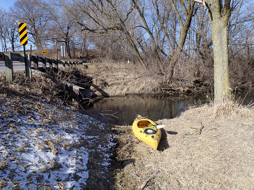
Starting the trip at Siggelkow Road
Planned to go upstream and into the Hwy 12 tunnel, but was deterred by a logjam
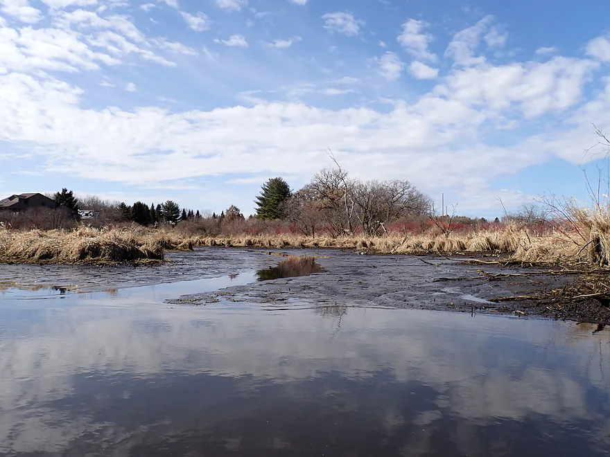
Continuing downstream from Siggelkow
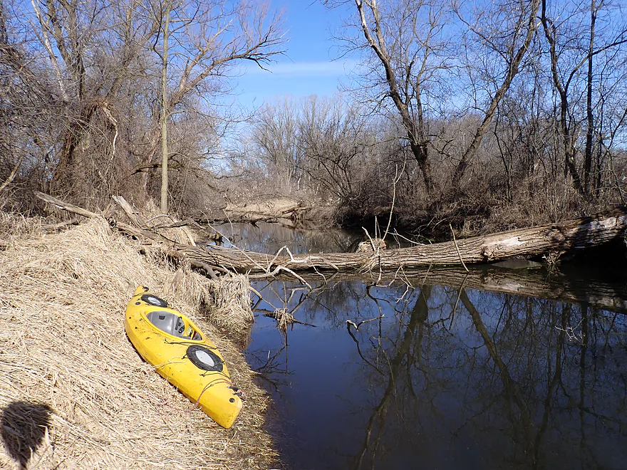
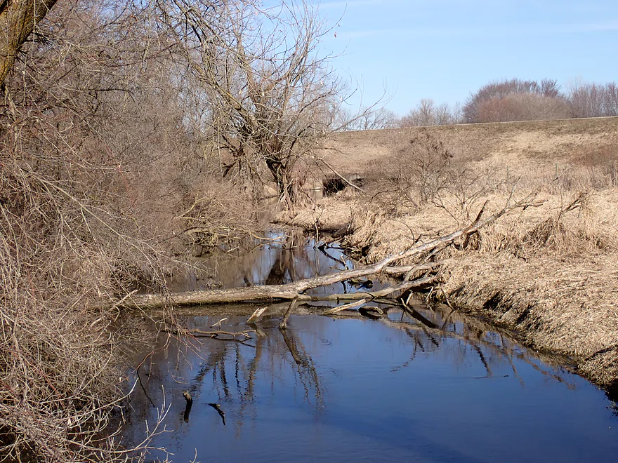
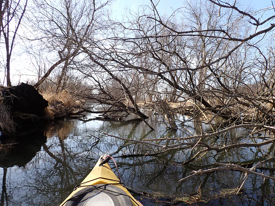
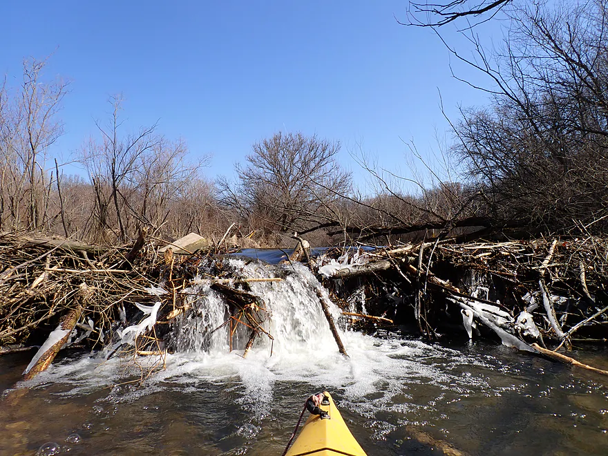
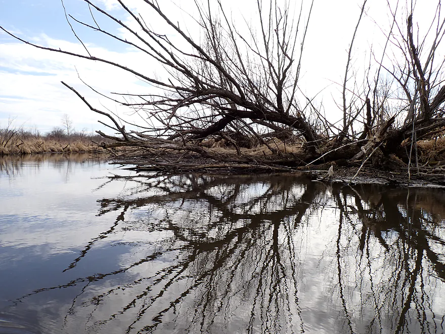
First major logjam
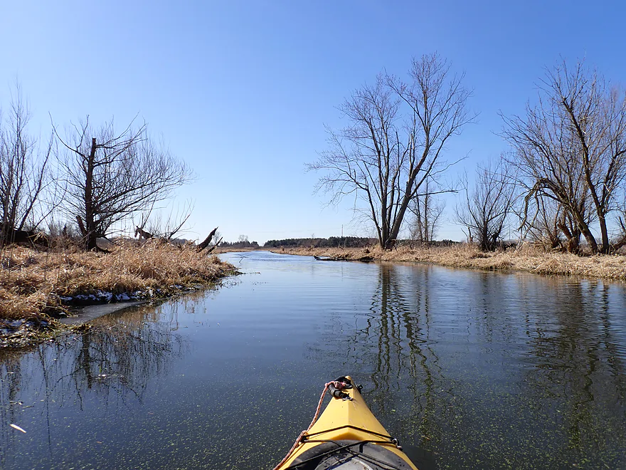
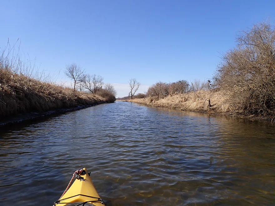
Very straight open channel
One of several annoying snags
This one had to be portaged
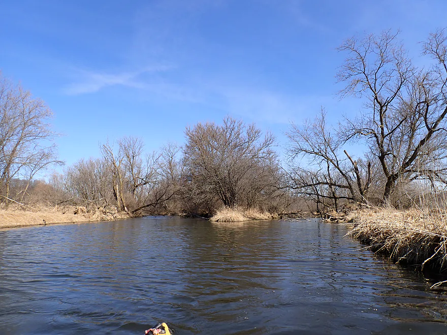
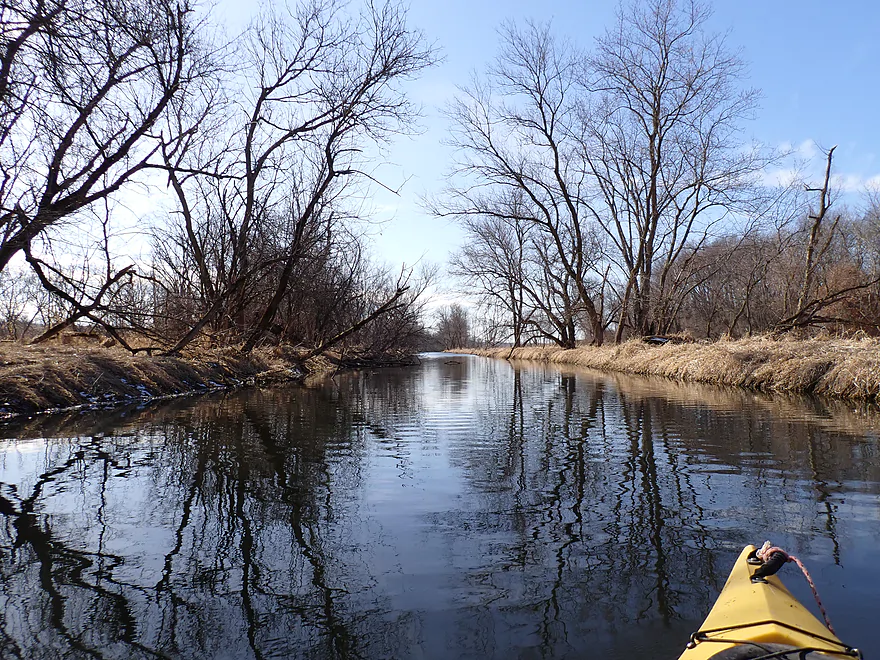
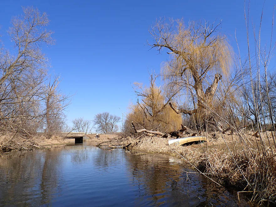
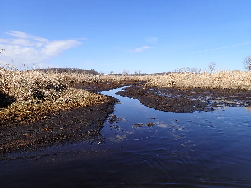
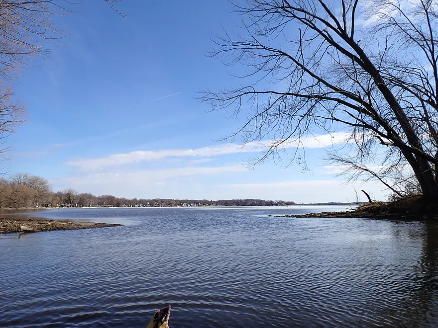
Little Door Creek (right) added significant volume to the main channel
From here on it is clear sailing with no more logjams
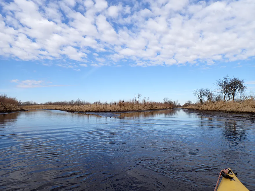
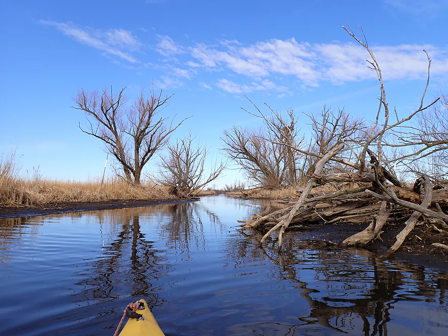
Terrific February blue sky
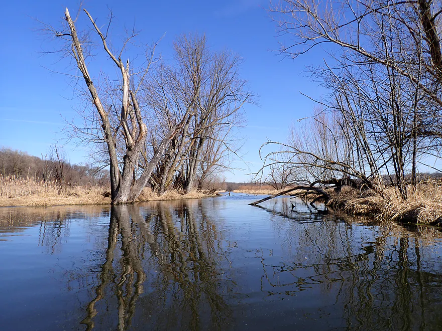
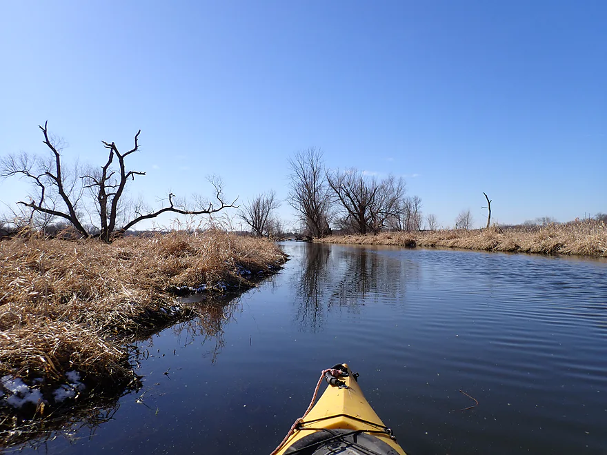
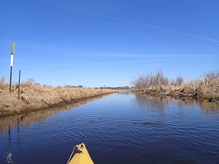
The channel has been artificially widened and straightened by farmers
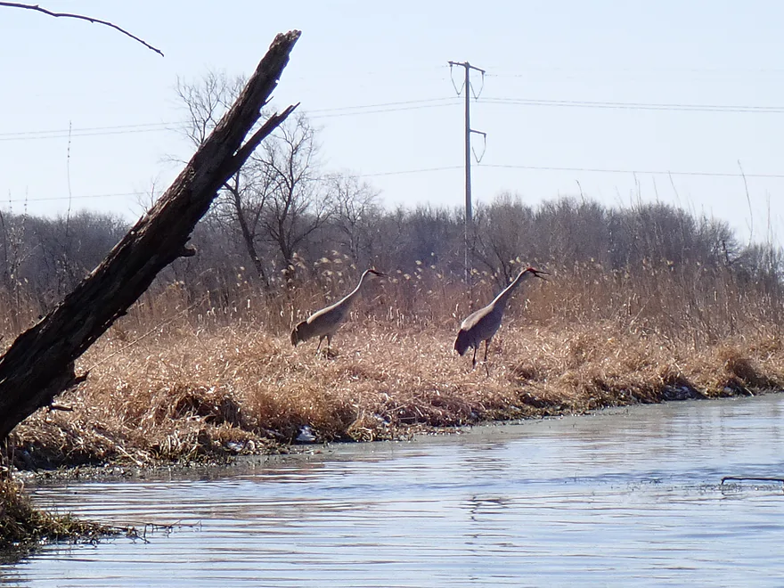
Some squawking cranes
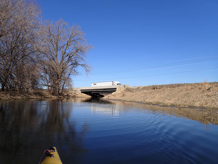
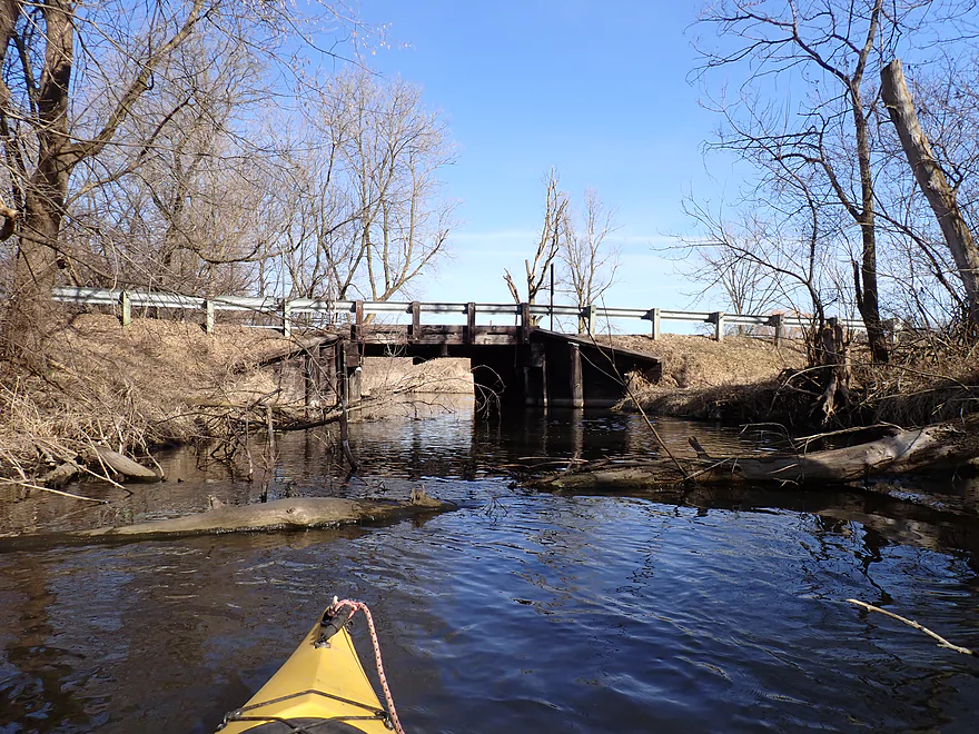
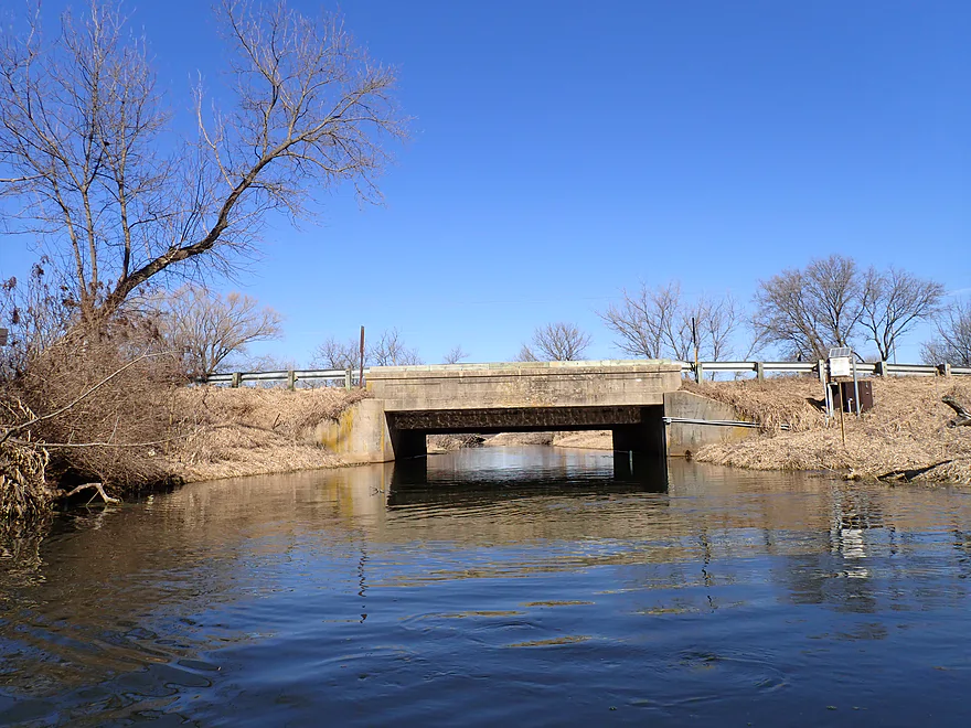
The I-90 bridge
Which is soon followed by Road MN
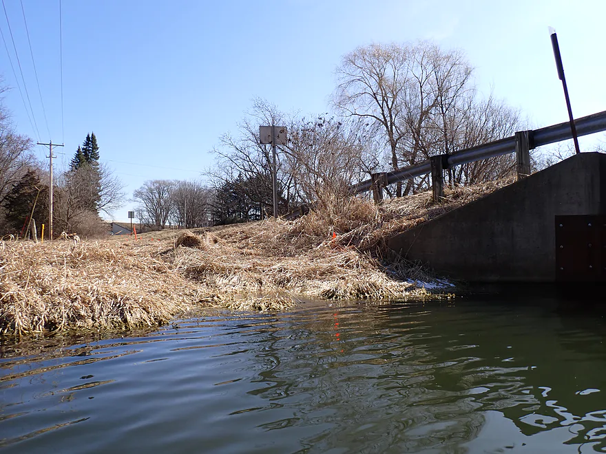
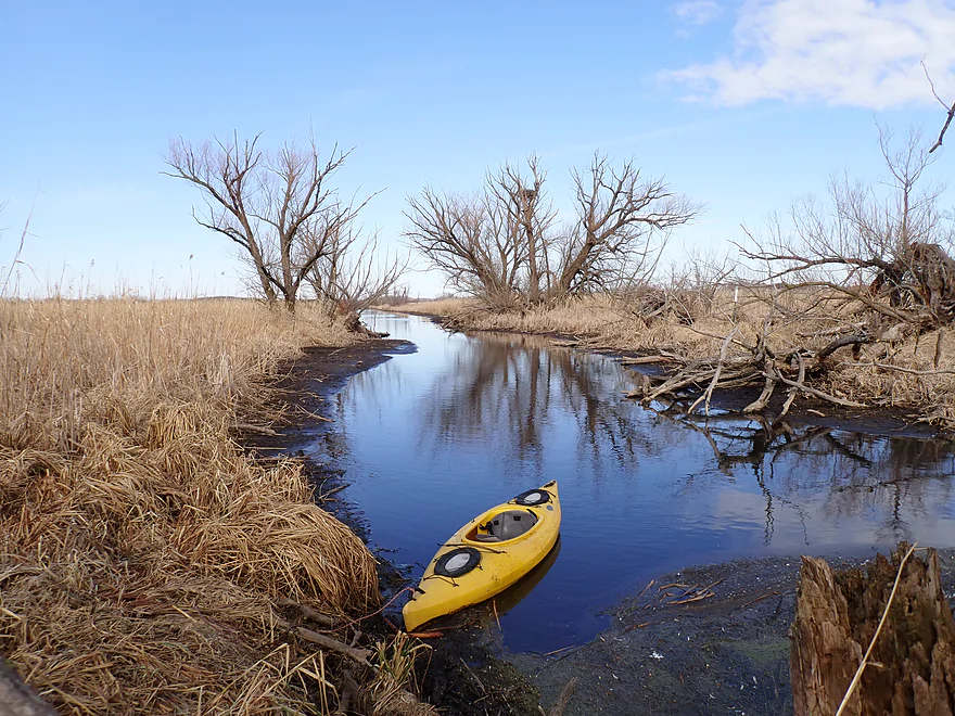
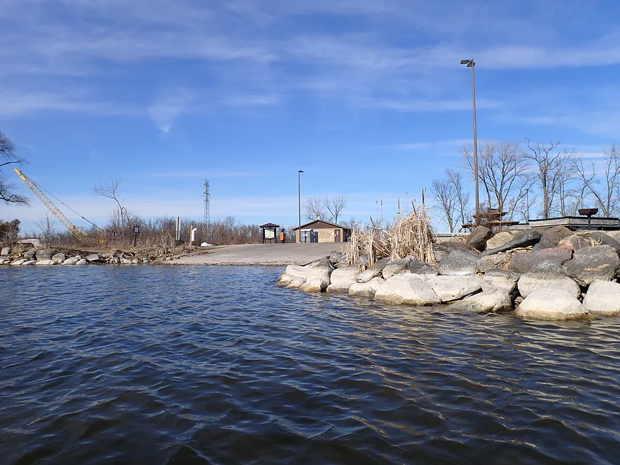
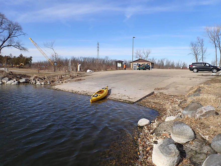
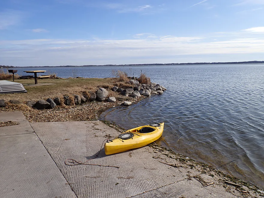
MN is a good (and recommended) put-in
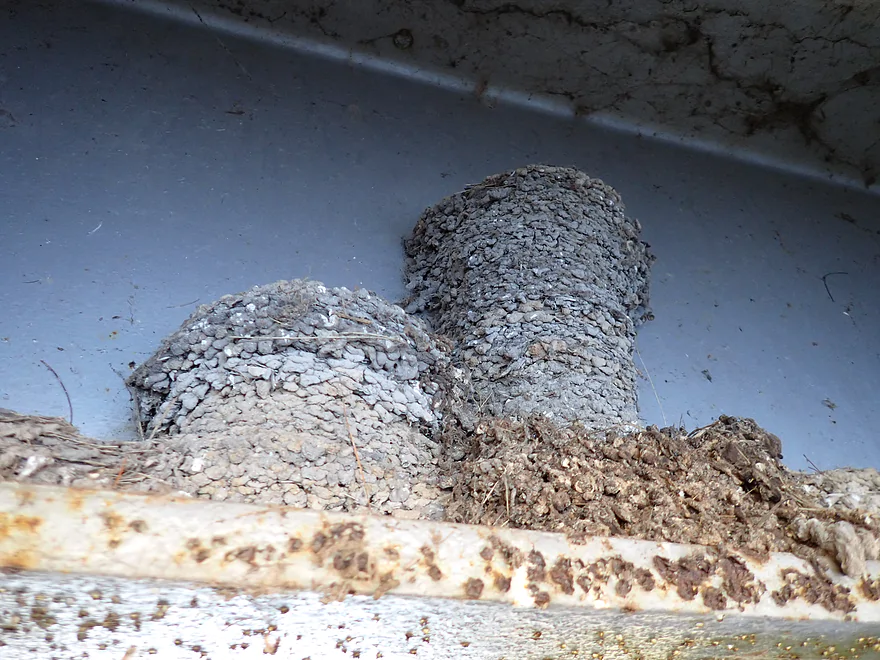
Swallow nests that are bottom mounted (typically they are side or top mounted)
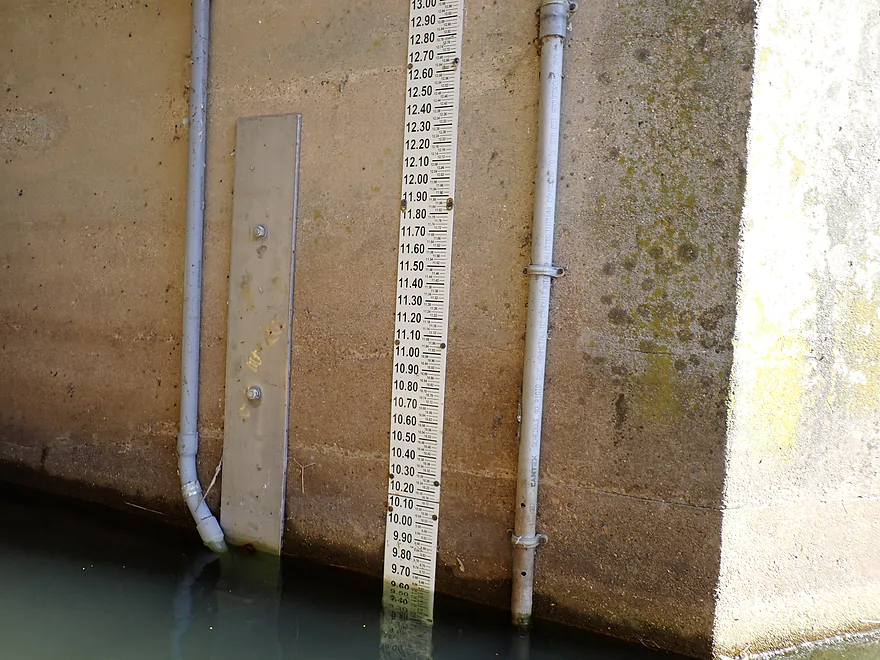
Door Creek has a gauge but I don’t trust it
Somebody else has been paddling the creek
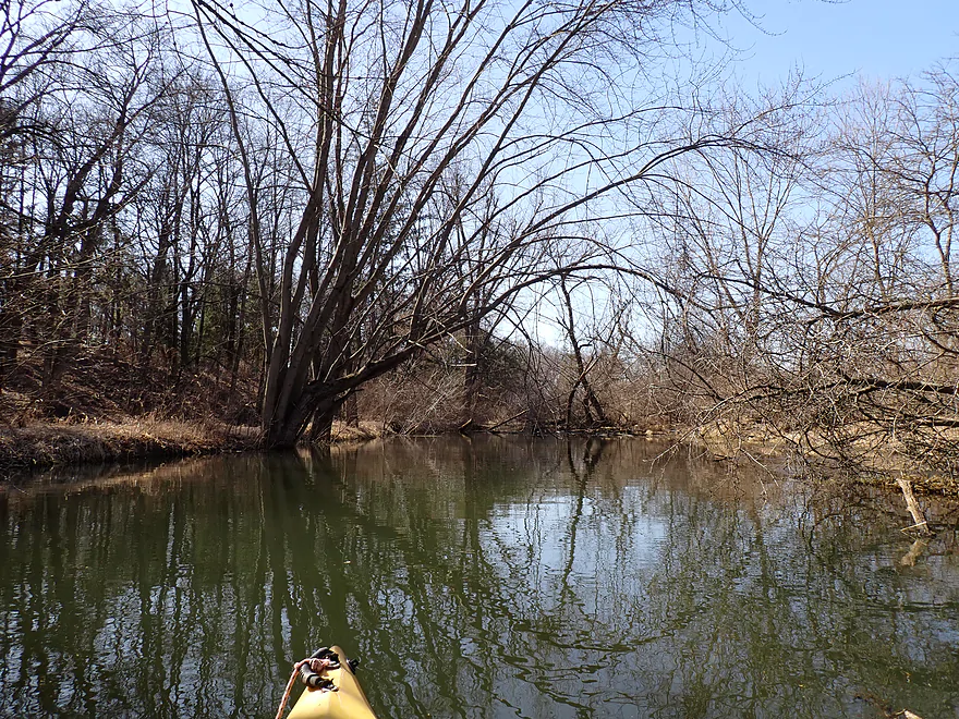
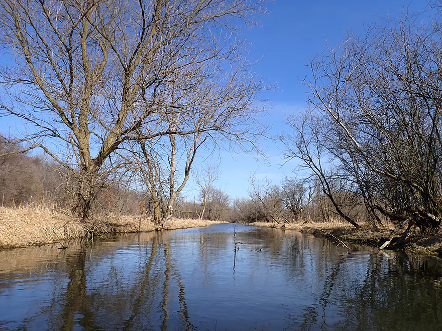
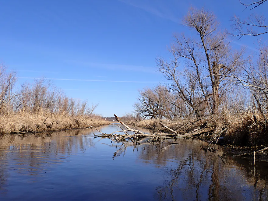
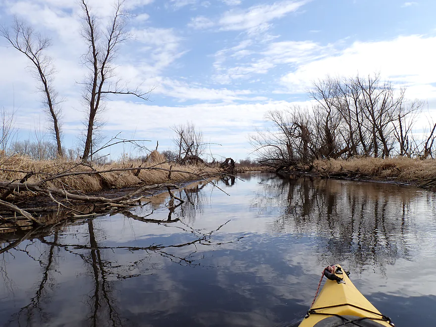
Most wooded stretch of the trip

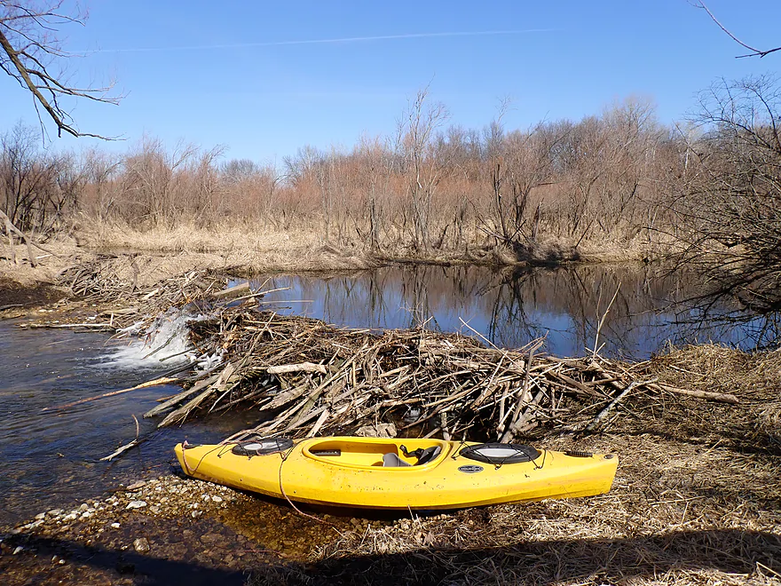
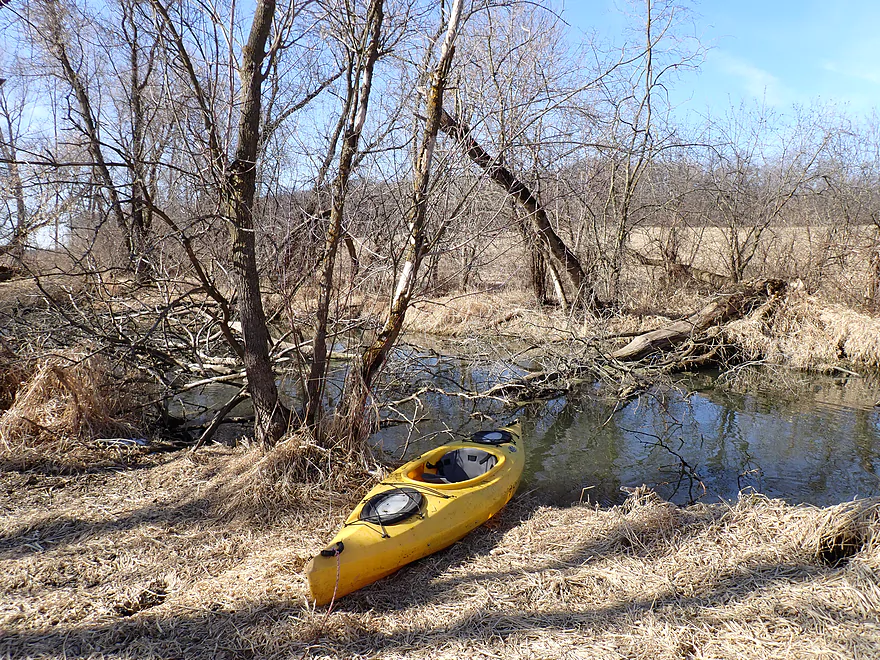
Portaging an impressive beaver dam
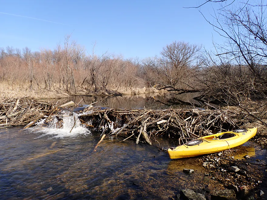
This was too tall to hop over
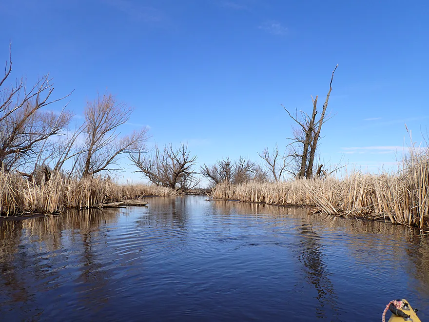
Back to straight-line paddling
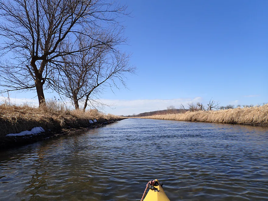
This straight leg was over a half mile long
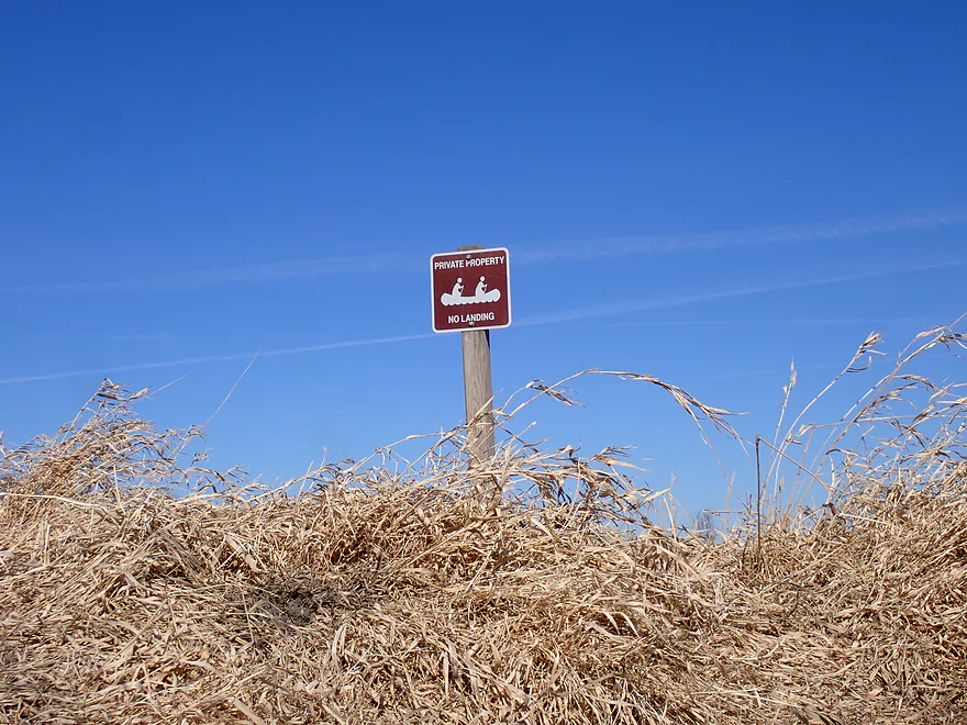
Silly “no landing” sign in the middle of nowhere (no roads are nearby)
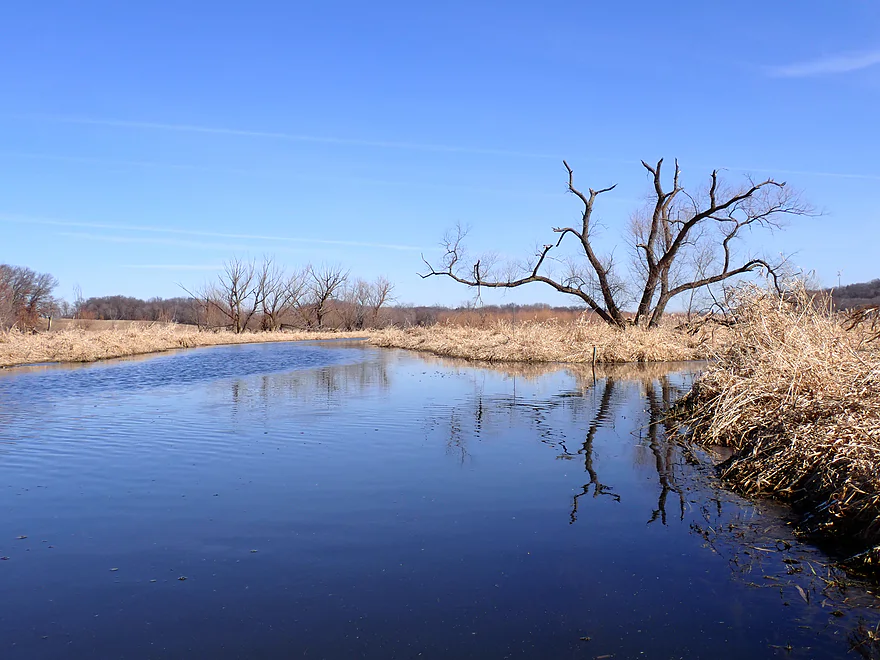
One of many feeder seeps
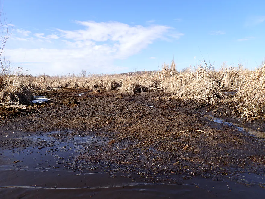
Some of these channels have dried up because of the drought and left only mud flats
Another very long straight stretch
I thought the mud flats were cool…just wouldn’t want to wade in them
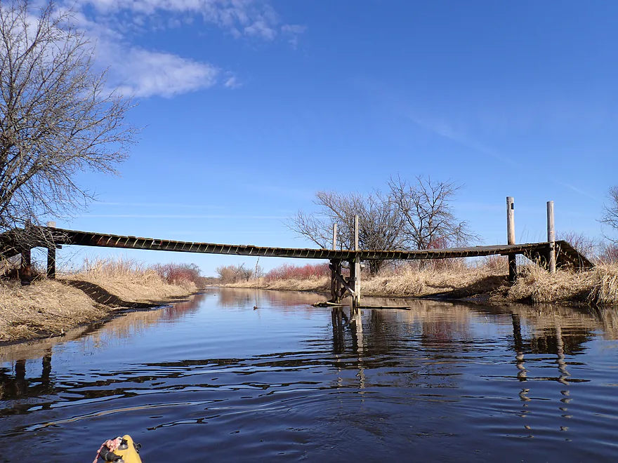
One of several nice bridges over the creek
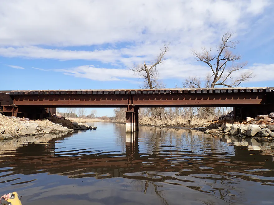
Railroad bridge
Losing my light and blue skies to incoming clouds
A Babylon 5 “shadow”
The creek splits here (or ditch detours) around a large quarter-mile island…both paths work
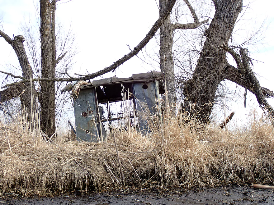
I think this is a duck blind, but it’s seen better days
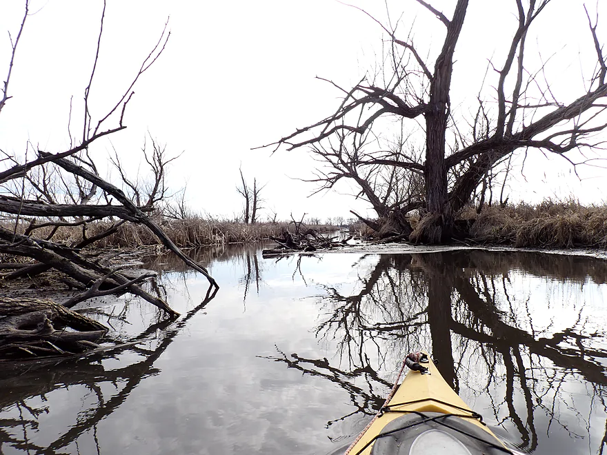
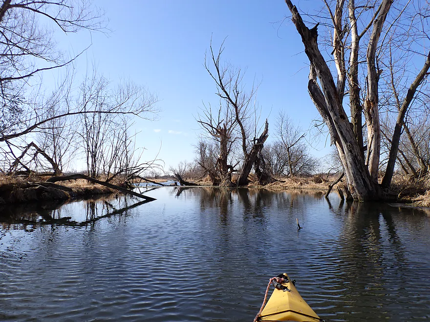
So many dead black willows
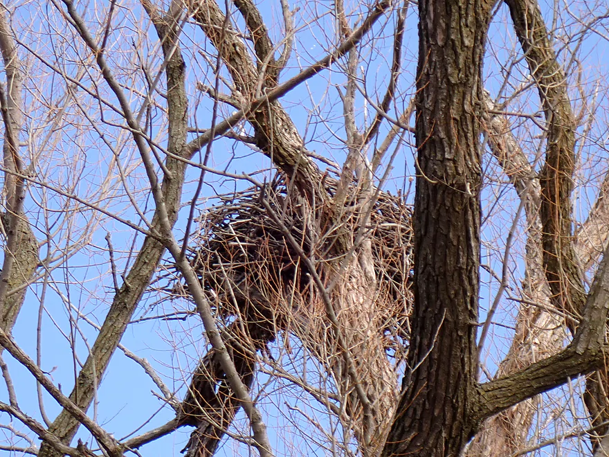
A huge eagle nest
View of the nest, boat and Door Creek together
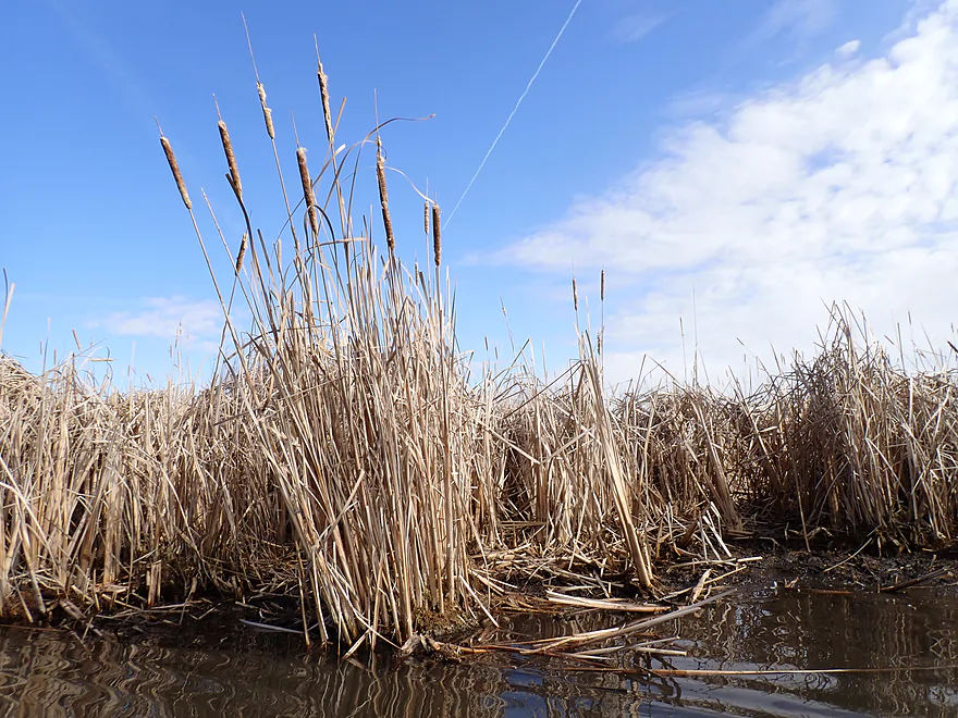
Cattails starting to replace the marsh wetgrass
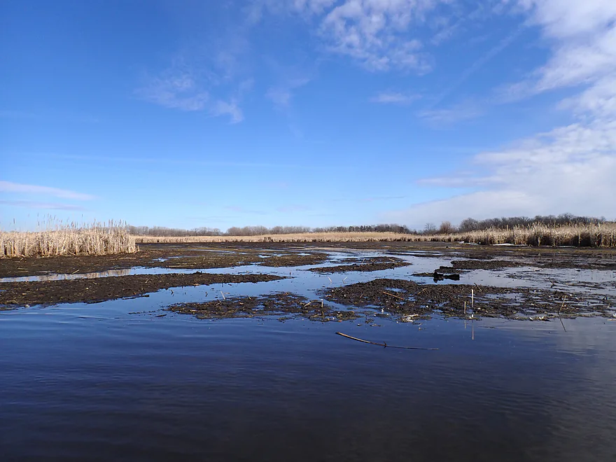
Huge side slough that now is mostly just a mud flat
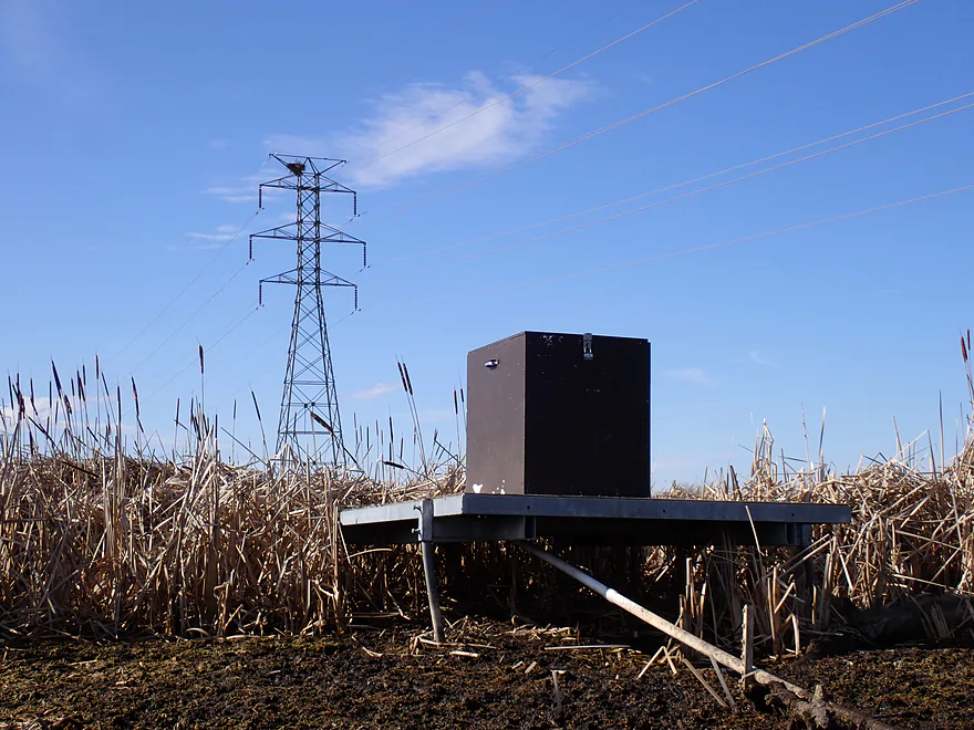
Mysterious lock-box in the middle of nowhere (note the osprey/eagle nest on the tower in back)
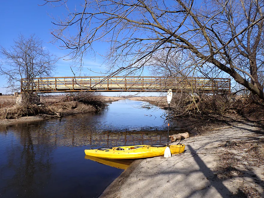
The new Lower Yahara Trail bridge…it’s not done yet, but locals were still climbing up to use it
Leaving Dorn Creek and entering Lake Kegonsa
One of the few part of the lake that isn’t packed with piers
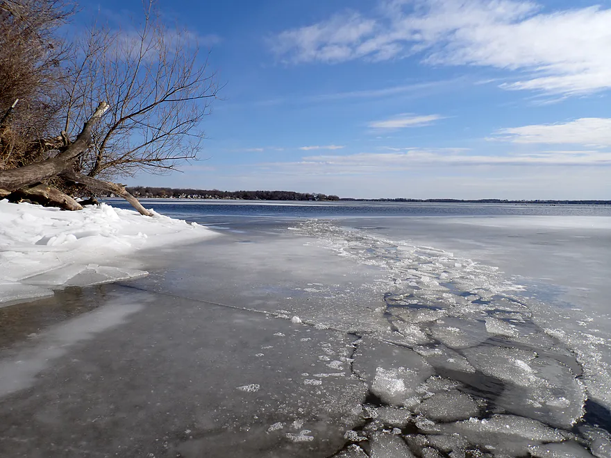
Ice breaking was required at times
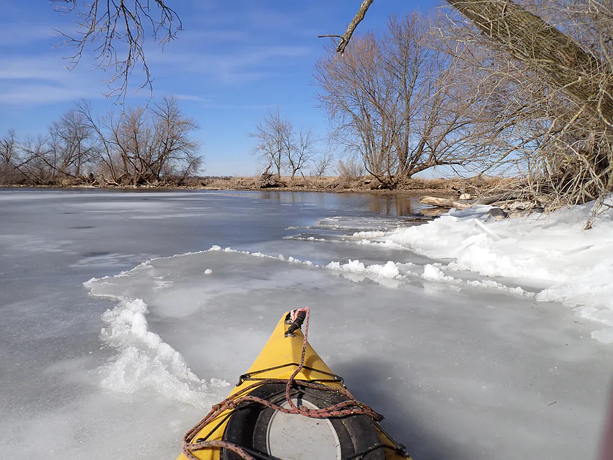
Incoming ice sheet was sliding both above and below the shore ice
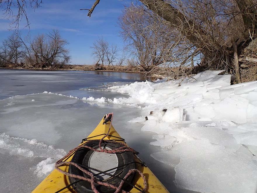
The subducted ice would erupt up through the shore ice…really cool
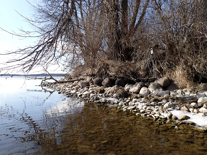
Some glacial rocks
One of the longer stretches of ice I had to plow through to get to my take-out
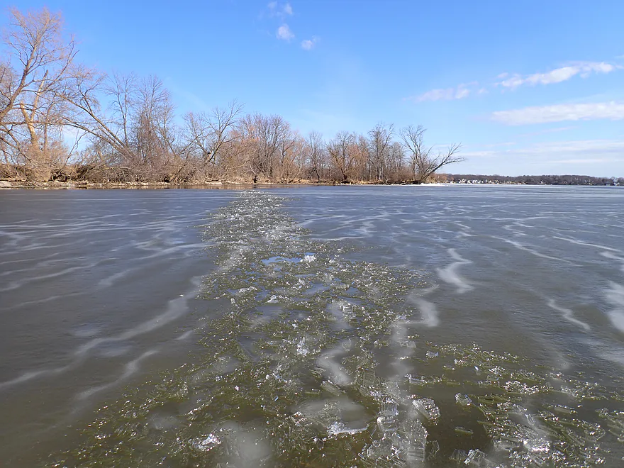
The broken ice path I left behind me
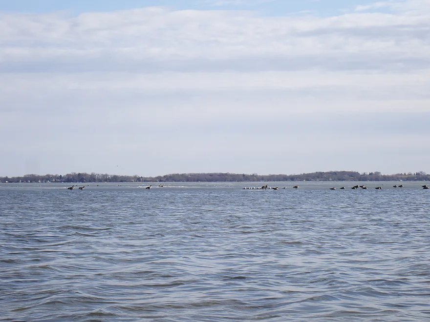
Lots of birds out on the ice
Stains on the rocks show just how low Lake Kegonsa is now
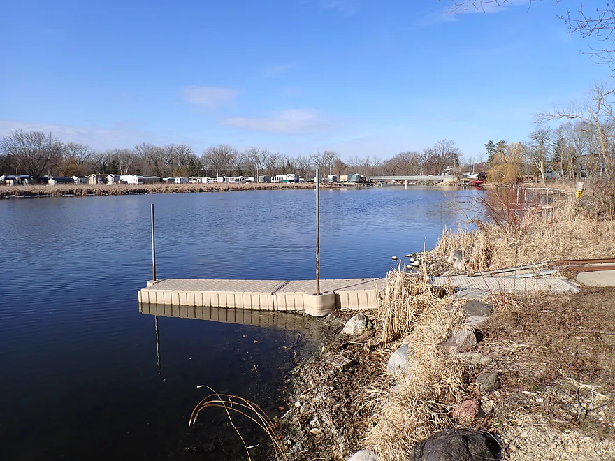
Taking out at Fish Camp Park (green ranger truck is checking stickers…good thing my car was parked at the put-in)
Looking out over Lake Kegonsa
There is a canoe ramp next to the ramp, but it is closed for most of 2024
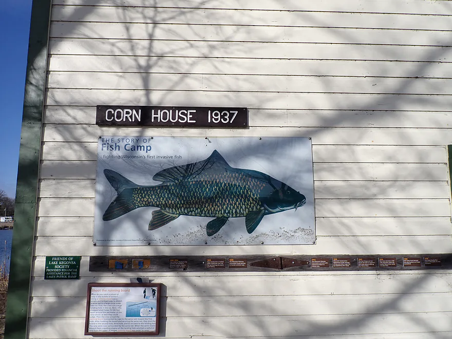
There are numerous historical signs in the park referring to the Fish Camp, which removed and sold carp from the lake for 30 years
Door Creek


Door Creek is an obscure and overlooked water trail located by the city of McFarland. There are a couple of spots you can launch from (more on this later), but I opted for Siggelkow Road. My initial plan was to actually paddle upstream from Siggelkow to explore the long Hwy 12 tunnel, but unfortunately those plans were dashed by a logjam. Cool tunnel photos weren’t worth two logjam portages.
I continued downstream on the slow current where I was surprised and disappointed by the deadfall…some of which brought up PTSD memories from last year’s Montello River trip. Thankfully it was spring (well winter), and the grass had died back, which made portaging easy (relatively). In total I had two major portages, two major limbos, and several squeakers. I thought I had heard that Capitol Water Trails had cleared out the Door Creek logjams…but perhaps that was only on the lower sections.
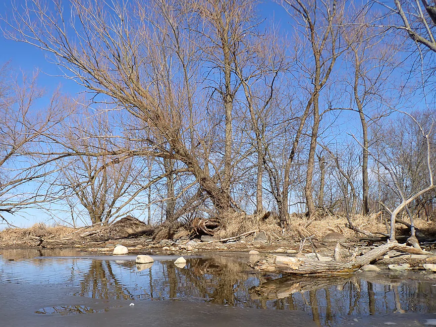
The confluence of “Little Door Creek” doubled the size of the main branch, and from here on there were no more noteworthy snags or logjams. From the Little Door Creek confluence to I-39/I-90 the creek was suspiciously straight and wide. It’s highly likely that farmers back in the day tried to straighten and drain the area to free up more farmland. But the amount of glacial till in the substrate meant the creek valley remained flat and marsh-like despite the ditching efforts. The marsh is flanked by glacial drumlins in the distance…back many years ago I believe the creek would have been part of a larger glacial lake.
The I-90 bridge is not nearly as cool to paddle under as the Hwy 12 tunnel, but it was still novel paddling under a freeway I had crossed many times in my car. The northbound drivers have a fantastic vista of the creek and my yellow boat would have really stood out. Several slowed down, likely in bemusement that you could kayak Door Creek or in February (thank you El Nino!). I could feel the vibrations of the trucks passing over through my boat, which I found remarkable.
Shortly after I-90 is the Road MN bridge, which in hindsight would be a good alternate put-in as it would avoid the upstream congestion. After MN the creek is redirected sharply east by an attractive wooded drumlin. The drumlins south of Madison really show up nicely on topo maps…like a flock of mini footballs all pointing south and slightly west.
I soon came across one of the highlights of the trip: a surprisingly tall beaver dam. Typically with beaver dams kayaks can just slide over them…not this. It was at least 3′ high and going over would have been dangerous. The portage around the dam was super easy and provided a great vista of the dam. I’m worried that the DNR will destroy it (which they have a strange obsession of doing to great beaver dams). The creek for the first time became relatively clear and shallow after the dam but was still navigable.
The final few miles of the trip were pleasant and flowed through open marsh with a few straggly trees along the bank. Along the banks were huge mud fens…typically I suspect these would have been side sloughs but were shriveled up because of the winter drought we are in. The low water revealed a consistent edge of quick-mud along the banks…not a great stretch to get out for a bathroom break! Following a massive eagle nest, the marsh ecology changed as cattails replaced the wetgrass.
Close to the mouth I passed under the new Lower Yahara Trail that has been in the news. It’s not done and there are fences blocking access to it, but that didn’t stop a surprising number of locals from using it (even though it meant some monkey work to get over the incomplete Door Creek bridge). I probably would too if I was a local. At the mouth was a nice mini-sandbar where I got out for some final pictures of Door Creek.
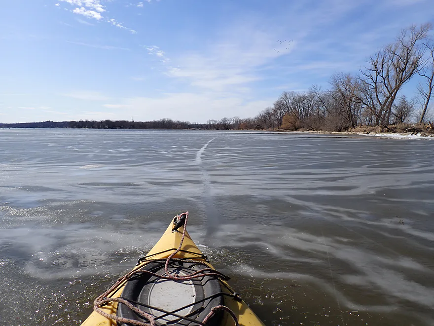
After Door Creek is of course Lake Kegonsa, one of Madison’s Chain of Lakes. While it is a natural lake, it has been enlarged by a downstream dam. Most of the shoreline is developed with nearly nonstop piers along its circumference except for a few spots by the state park and Door Creek. All in all, a pleasant but overdeveloped lake that isn’t anything special. The only reason I was on it was so I could get to my take-out at Fish Camp County Park.
Lake Kegonsa was maybe 70% frozen with much of the outside being open. I had anticipated this and scouted it ahead of time…but I hadn’t checked the lake by the creek mouth where I was in for a surprise. Typically the north side of lakes and sections by moving water melt first, which was happening here. But a surprise wind had blown several “icebergs” north into shore and blocked my access to Fish Camp. Ultimately I had to use my kayak as an ice-breaker to get past a few spots. This wasn’t a huge deal…the ice was cardboard thin and broke easily. Had the ice been thicker or in long stretches, I would have long portaged along the Lower Yahara Trail (complete or not).
When ice-breaking, one of the massive ice sheets broke free and started ramming itself into shore while I was on it. The incoming ice sheet slid both above and below the shore-side ice sheet…like fingers coming together from two hands. And all while this happened, the northbound ice sheet was sliding under my boat and pushing me ashore. The subducted ice sheet would then push up under the ice pile on the bank creating little volcanoes…a classic geology lesson in how tectonic plates worked. I thought it was really cool and got much of it on video starting at 2:59. The Lower Yahara Trail hikers were gawking at me as this happened, and likely suspected I was in trouble with the ice, which I was not. I ended the trip at the Fish Camp County Park Boat Landing next to the mouth of the Yahara River.
In summary this won’t be a trip for everybody. The slow current, muddy banks, straight channel, and marshy scenery will be a turnoff for some. One blog even calls Door, a “crummy little creek“. But personally I like marsh paddles such as Door Creek. The combination of the flat open vistas with distant drumlins, big blue skies, exotic mud flats, abundant wildlife, and zen-like simplicity made this a positive experience for me. This would have been “starred” higher if not for the logjams, but kayakers can avoid these by launching at County Road MN. Yes, this would mean a shorter trip, but paddlers could still extend a paddle by exploring upstream from MN under I-90 (the current is slow) or paddling further on Lake Kegonsa (although the lake is kinda boring). It would be great if Dane County took an interest in sprucing up the creek like what they did for Token Creek. Removing the drainage ditches, narrowing the channel, removing the phosphorus pollutants, and removing the logjams could make this a popular water trail.
Sights included geese, sandhill cranes, one raptor, a hooting owl, two huge eagle (or maybe osprey) nests, swallow nests under Road MN, one big beaver, and clams. The highlight was an impressive 3′ high beaver dam south of Road MN. When I was taking out, I saw several photographers with expensive cameras taking pictures of birds on Lake Kegonsa. Per ebird.org records, I suspect their target were tundra swans which I just missed.
Webmaster’s Update a week later…the exposed mud flats upstream from I90 are now submerged despite there being no recent rain. I suspect the beaver dam has increased significantly in height (and it was already tall).
Fish Camp County Park: Not a large park, but probably more significant for its history. Introduced carp, starting in 1880, took over the Madison lakes so that by 1934 the DNR (then called the Wisconsin Department of Conservation) established fish camps to remove carp (usually by net), which were in turn sold to markets via ice-filled train cars in Chicago and New York. The operation lasted until 1969.
Siggelkow Road: This is a good bridge access. Be careful where you park as the shoulders are steep. A Sheriff’s deputy left her business card on my windshield…I think she was just checking to see if my vehicle was abandoned (no big deal). Because the half-mile stretch below Siggelkow Road is filled with snags, I can’t recommend putting in here.
Alternate Put-ins:
- Femrite Drive (0.9 miles upstream from Siggelkow): This would be an ok bridge access, but it would add additional logjams on top of those already below Siggelkow.
- County Road MN (1.7 miles downstream from Siggelkow): This would be a suitable bridge access and is my recommended put-in. Launching here avoids the snags below Siggelkow and all logjams I encountered. For kayakers wanting a longer trip, the current is slow, so you could paddle upstream past the I-39/I-90 bridge for an add-on leg.
Fish Camp County Park: The park actually has two take-outs…there is a canoe take-out to the west and a boat landing to the east. There are some “historical” buildings and signage that commemorate the old fishing industry that used to exist and tells how carp were introduced to Lake Kegonsa.
The canoe take-out is closed for much of 2024 to be reconstructed for handicap accessibility. I’m all for the handicapped enjoying kayaking, but I think it is extraordinarily rare. Also it is a bit ironic that this landing (and others in Wisconsin like “Fox River Park”) have been made inaccessible for many months to improve accessibility. Unofficially, I think part of the reason this landing was closed is to allow the local construction company working on the Lower Yahara trail to park their equipment and construction debris here.
Paddlers can simply take out at the boat launch instead which is nice, but kayakers should observe boat landing etiquette and not park in trailer parking spots (difficult), and not bottleneck the landing when taking out/putting in…tie up after leaving the ramp area. You must have a Dane County Park sticker to use the park…there is a digital self-pay station by the outhouses.
Alternate Take-outs:
- Lake Kegonsa State Park Boat Ramp (2 miles east of the Door Creek Mouth): I suppose if you really wanted to you could take out at the State Park Ramp, but it would add at least 1.5 miles of paddling to your trip.
Bike Shuttle – Siggelkow Road to Fish Camp County Park: 5.7 miles with 89′ of ascent. This is a relatively easy and flat bike shuttle with only a few hills at the end. Note Google falsely claims the main route is on private roads, but I saw no evidence of this and was actually surprised to see a number of other bikes on this route despite it being February.
Current: Very little…almost none.
Rapids: None.
Logjams: There are a number of snags in a half-mile stretch below Siggelkow Road. This would include two major logjams that have to be portaged, and two tricky squeakers. Don’t launch from Siggelkow…instead start at County Road MN which will avoid the logjams.
Dams: The Lake Kegonsa Dam does back up the creek a bit, but there are no man-made dams on Door Creek itself. There is a 3′ high beaver dam downstream from MN that has to be portaged (pretty easy).
Cold Water: Door Creek does have a temperature gauge, and it read 45 F for my trip. Despite being relatively warm for February, this is still cold and I did wear protective clothing for this trip which I also advise paddlers to do. Paddlers in February and March should also be careful about ice which can occur on lakes and slower/wide stretches of water. Sometimes you can actually see from NASA’s daily satellite snapshots which rivers/lakes are still iced up. On big water, partly melted ice can move around as large “icebergs” in sudden and unpredictable ways depending on wind and other conditions. I had one break off on Lake Kegonsa and push me ashore.
Low Bridges: There is one very low bridge just downstream from Road MN (another reason not to put in here). There are a number of other small bridges on the trip but all others are easy to get under.
Closest Gauge: Lake Kegonsa @ Barber Drive
My Trip Depth: 2.28′
Gauge Guide: Door Creek actually has a depth gauge by Road MN which read 848.88′ above sea level, but I don’t trust it as it is just upstream from a 3′ beaver dam. The Kegonsa gauge is more applicable for the lower part of the creek which is backfilled by the lake. Upper levels will be a bit more free flowing and independent. In general Door Creek is pretty flexible…I did it at low levels, but you can easily do it at high levels too.
- < 2.5′: Very low levels. There were many exposed mudflats where there used to be sloughs, and the water lines on the Lake Kegonsa rocks indicate it was significantly lower than normal. All plenty navigable though.
- 2.6-2.8′: Low levels…typical for maybe fall.
- 2.9-3.2′: Maybe average levels.
- 3.3-3.5′: High levels.
- 3.6’+: Very high levels. Still should be plenty navigable.
Click here for a Door Creek Overview Map.
- Upstream from Femrite Drive: Likely too congested to run.
- Femrite Drive to Siggelkow Road: 0.9 miles. I suspect this stretch has multiple logjams.
- Siggelkow Road to Fish Camp Park: 5.2 miles.
- Siggelkow Road to Cty Rd MN: 1.7 miles. The first mile has a number of tricky logjams and isn’t recommended for paddlers. After the confluence of Little Door Creek, the channel opens up and thereafter was a nice marsh paddle.
- Cty Rd MN to Fish Camp County Park: 3.5 miles. This is a nice marsh stretch.
Trip Map
Overview Map
Video
Photos Size: