
Crossing the Marquette–Joliet Bridge into Iowa
Welcome to Marquette!
I started the trip further upstream by the mouth of the Yellow River
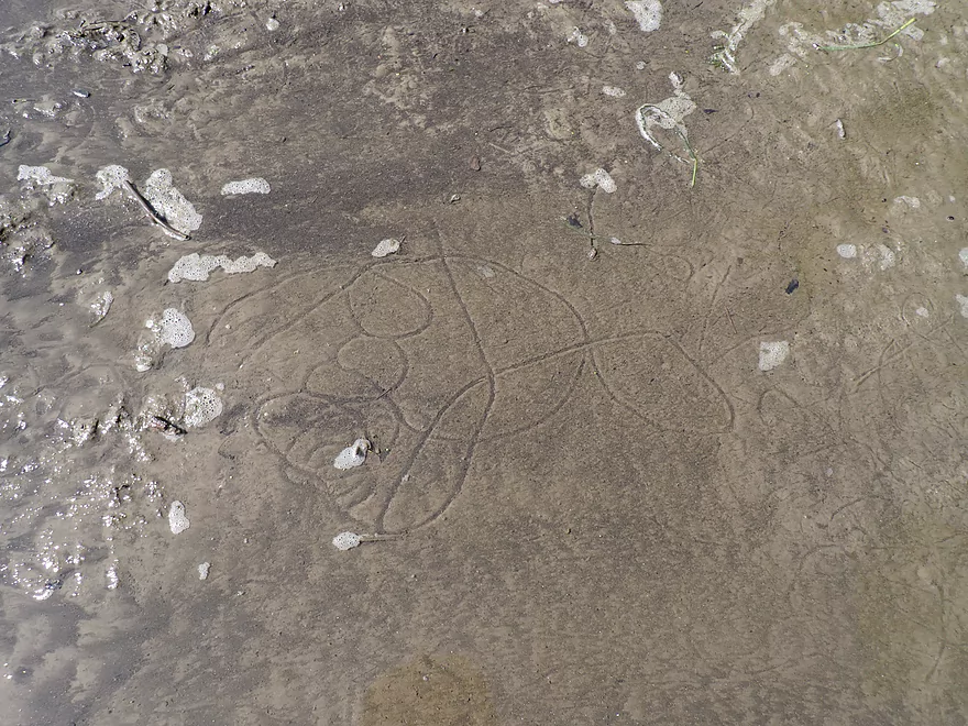
Fantastic clam trails
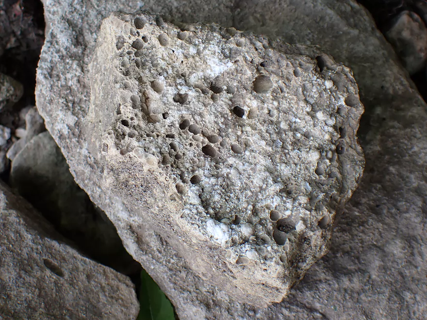
Fossils on the beach
Finally out on the river…the Yellow River mouth is hiding around the corner
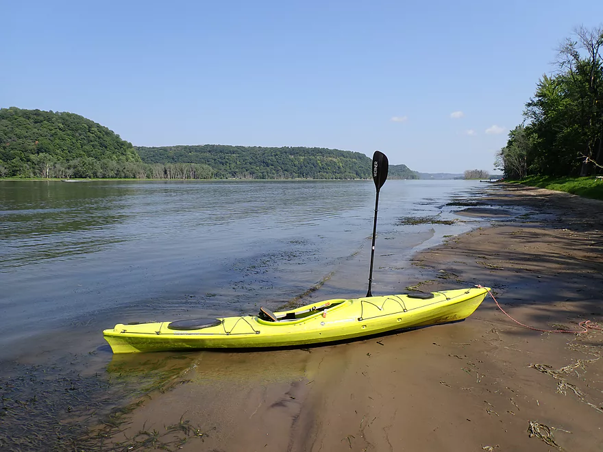
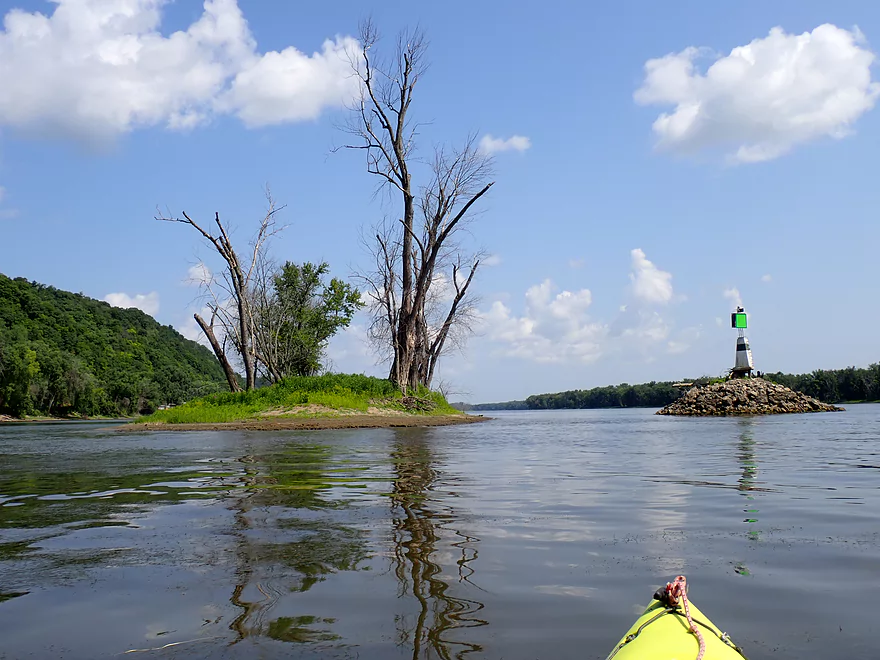
Checking out a narrow sandbar on Scrogum Island
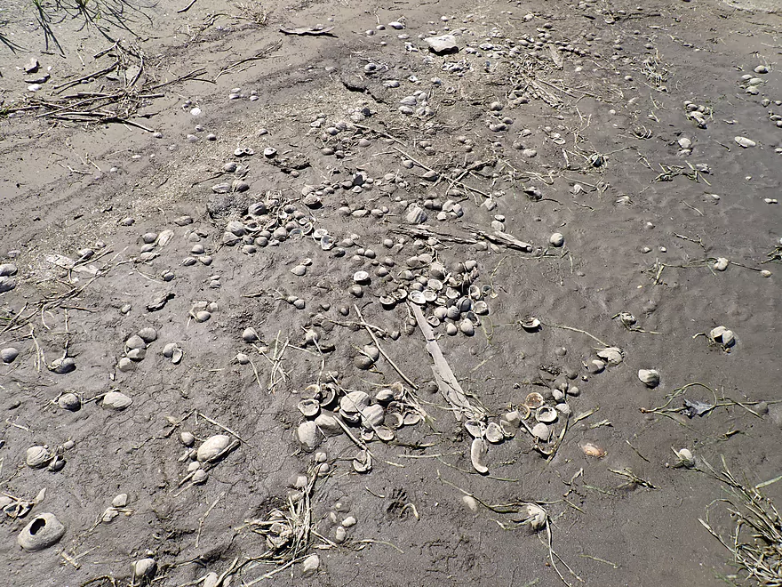
So many clamshells
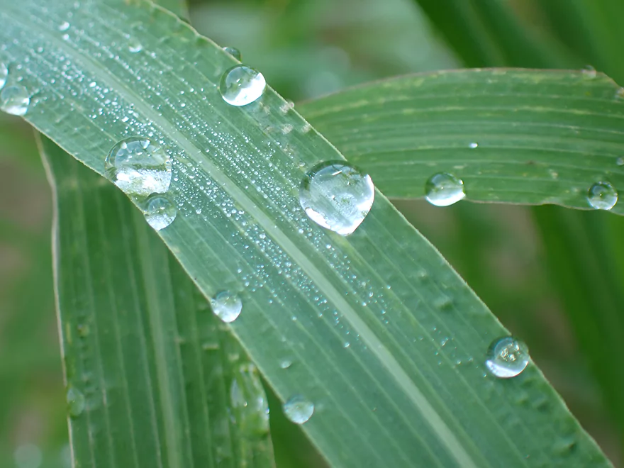
Morning dew drops
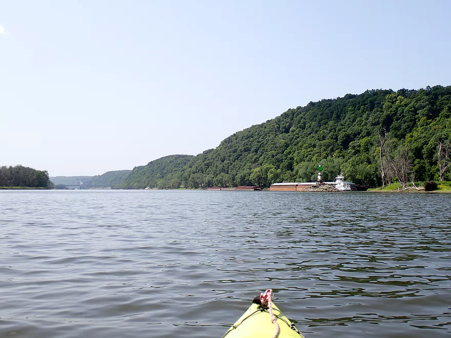
Heading downstream

Found a friendly stowaway
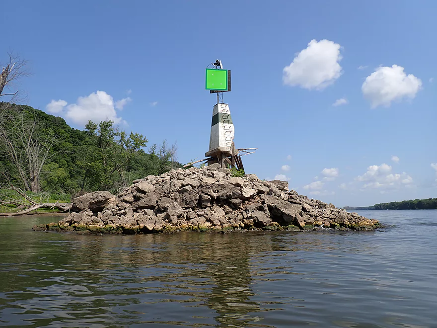
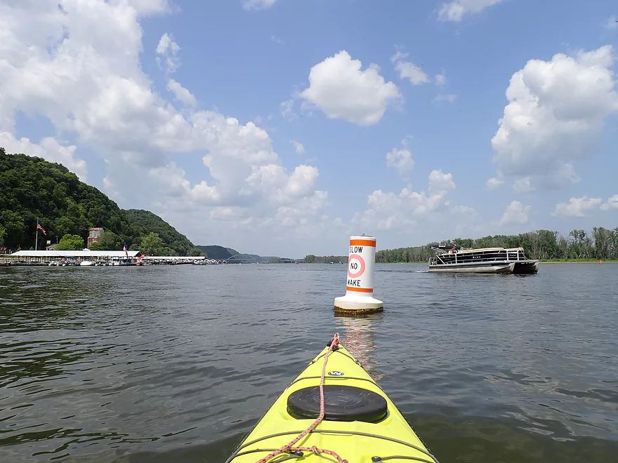
Channel marker
It also warns boats about the dredge pile to the left
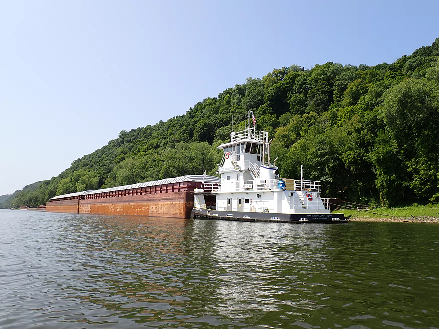
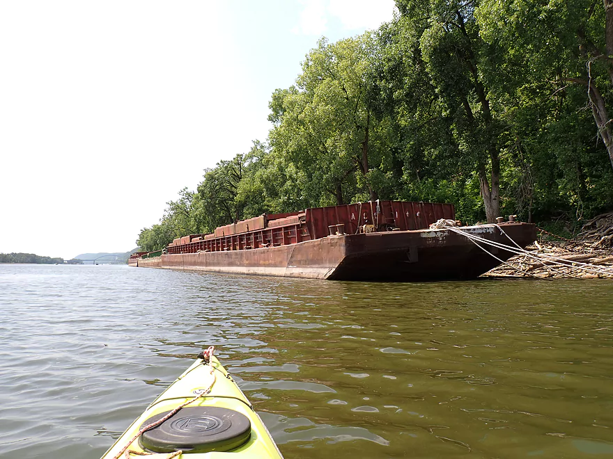
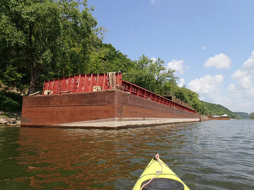
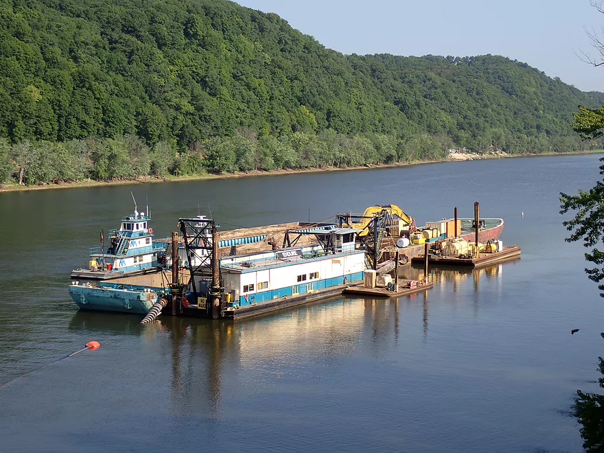
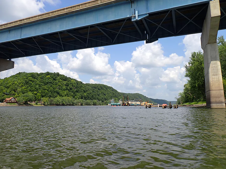
Coming up on a parked barge
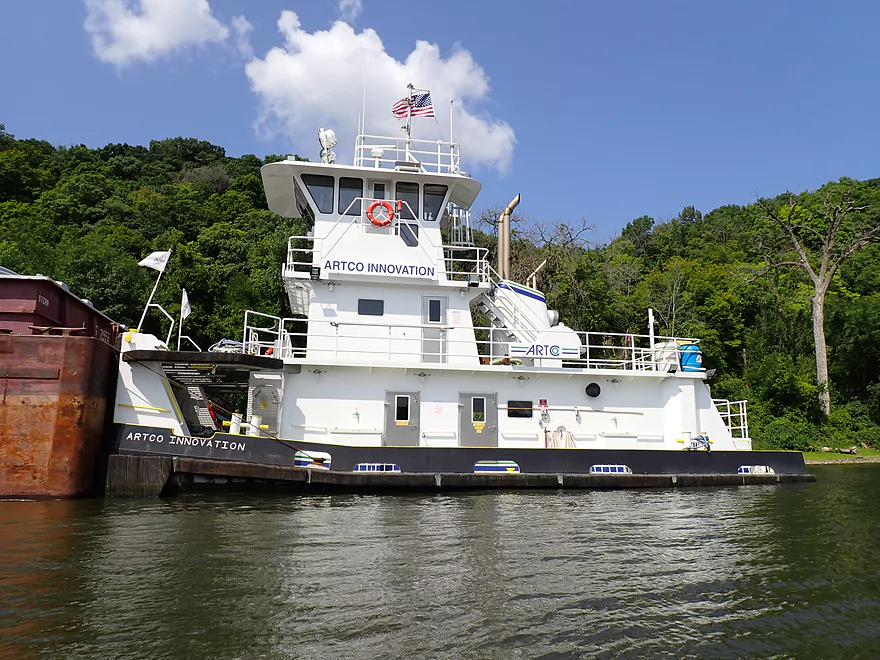
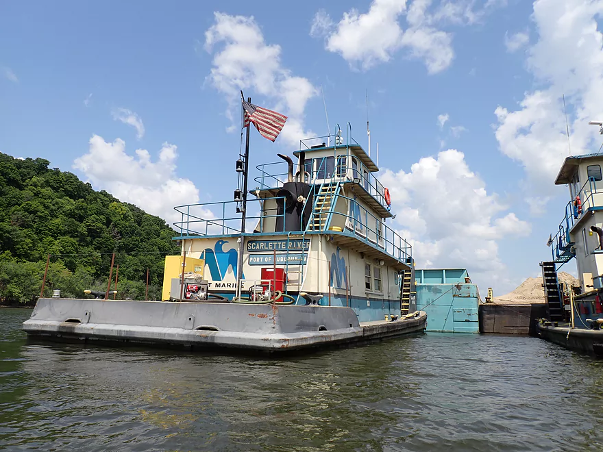
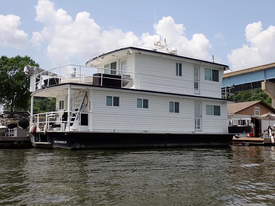
Cool tug
Not sure what is in the hull
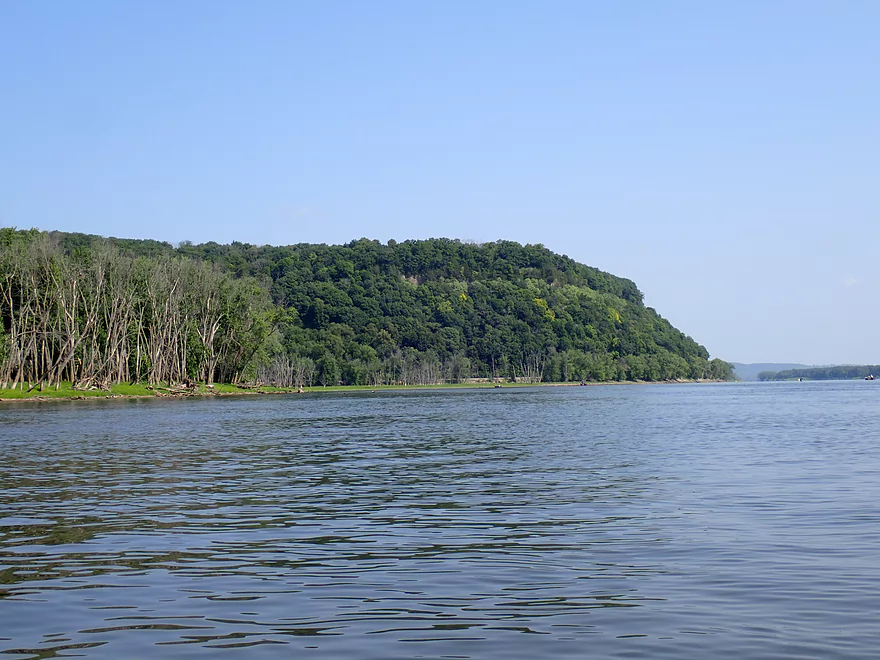
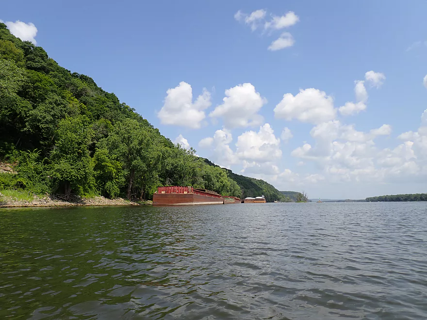
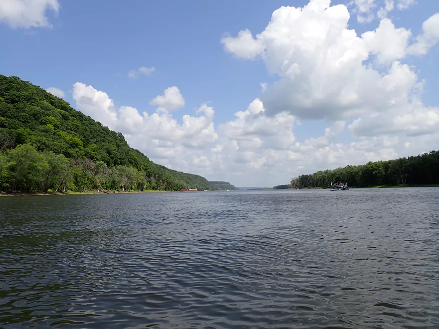
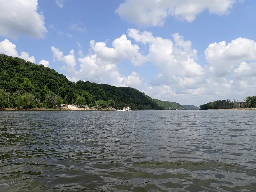
The Driftless Area bluffs were fantastic
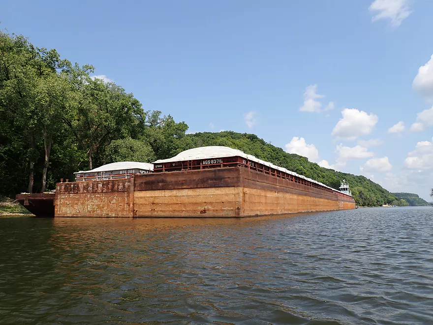
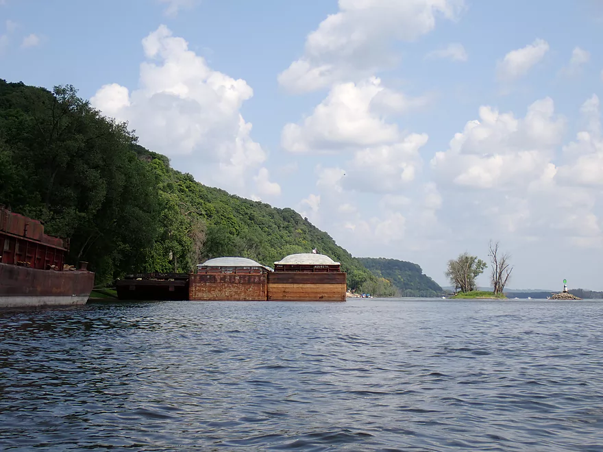
A second barge anchored to the shore
Reverse view
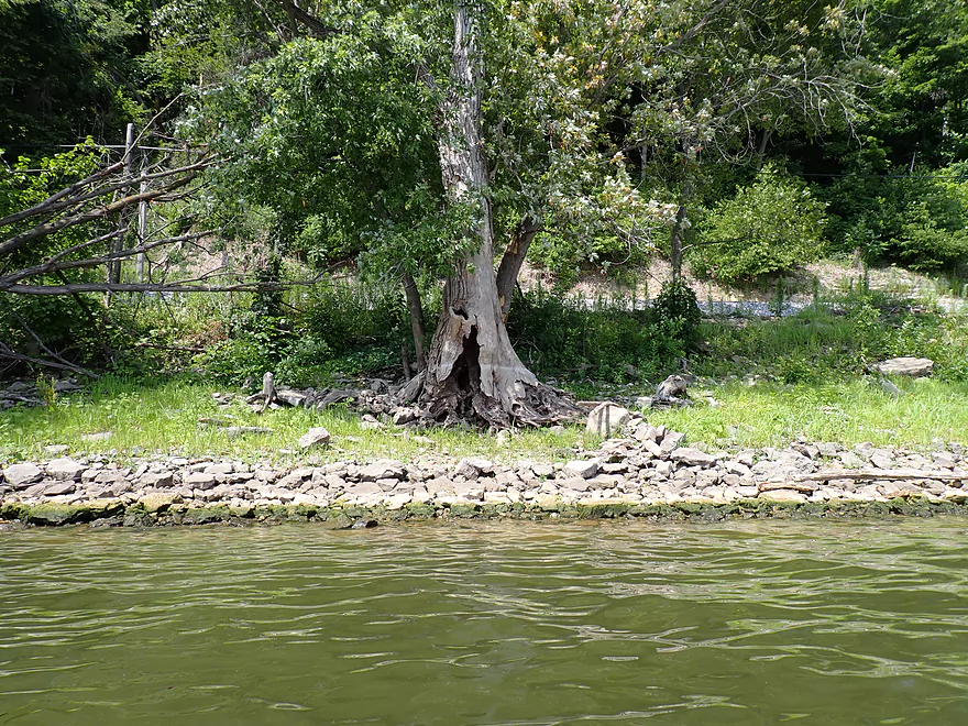
High water line
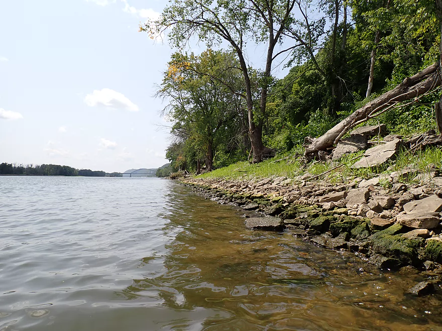
Rocky shoreline
Great to see blue skies after several days of smokey haze
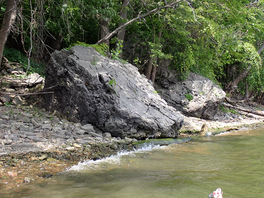
Big boulders
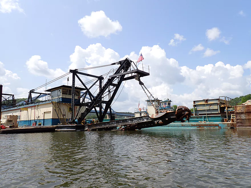
A dredge boat
Pushed around by this tug
View of the dredging operation from the bridge
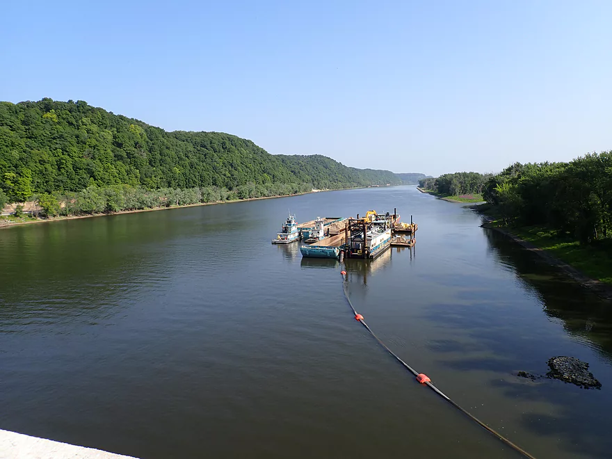
The pipe is actually transporting sediment to an island on the Wisconsin side of the river
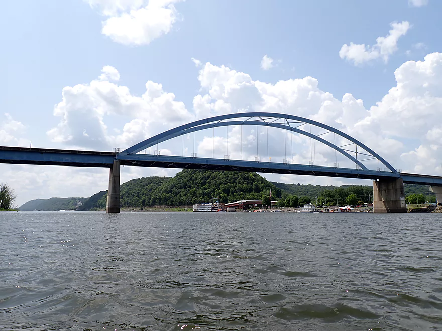
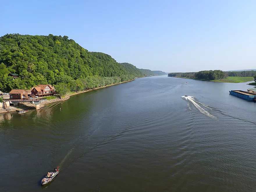
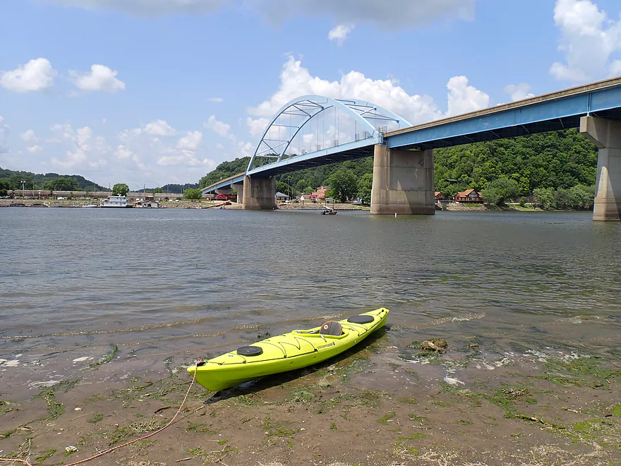
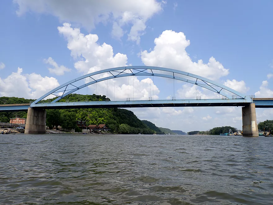
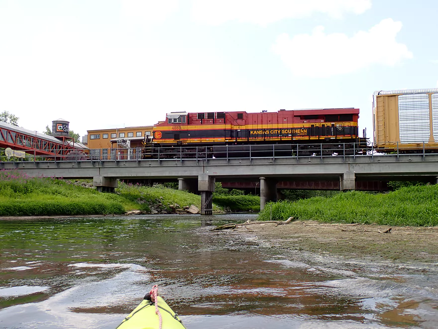
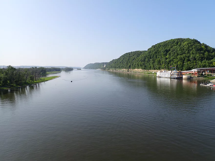
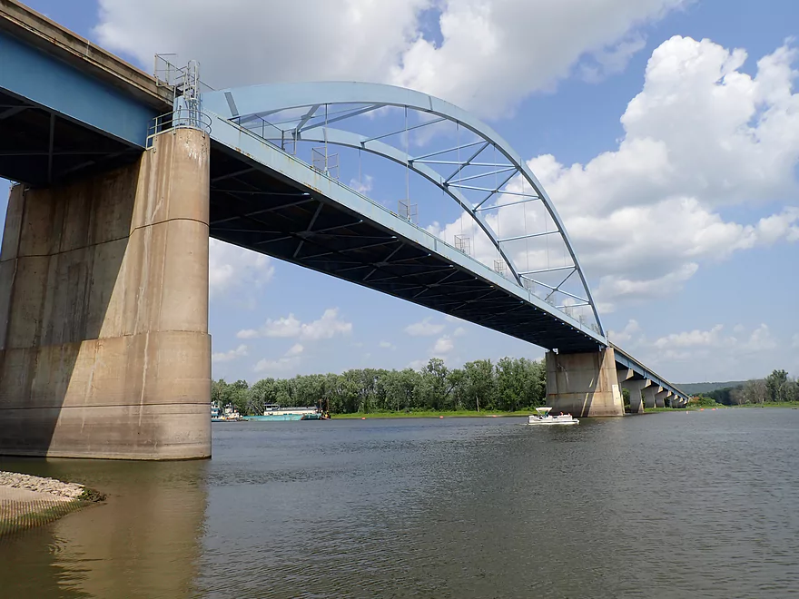
Coming up on the Marquette–Joliet Bridge, which connects Prairie du Chien, WI with Marquette, IA
Heading under the bridge to check out Sturgeon slough on the other side
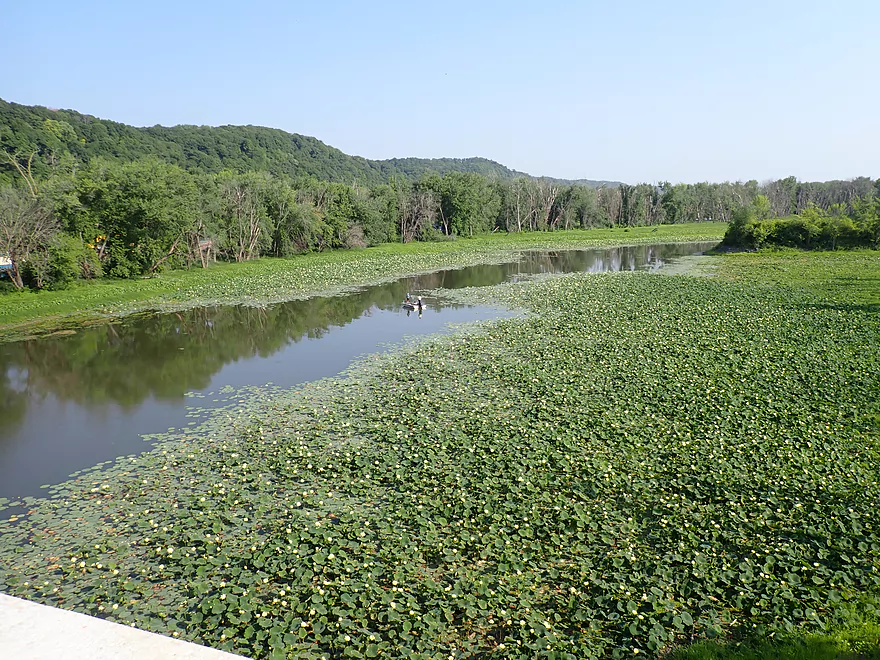
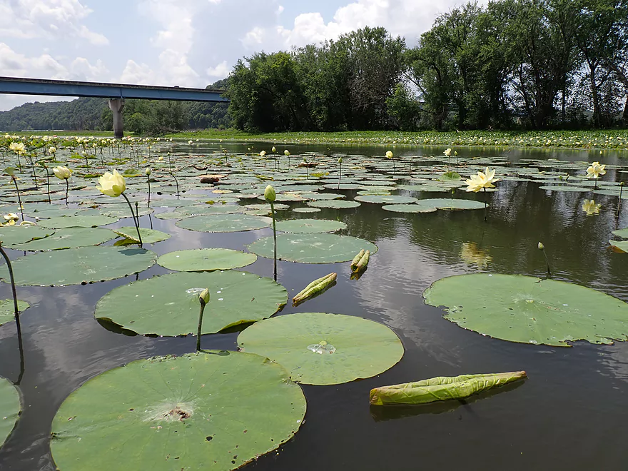
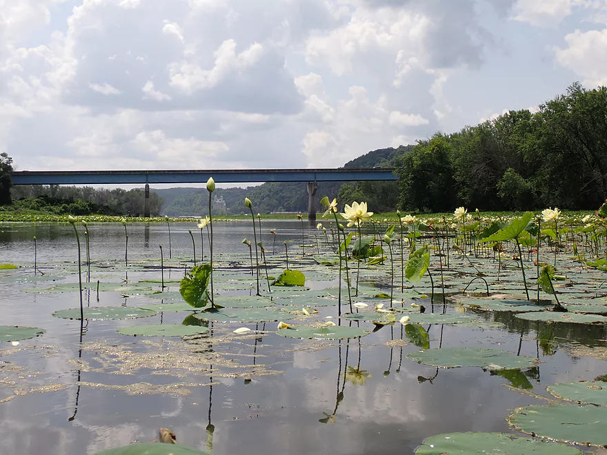
Picture of the slough from the bridge (countless lily flowers)
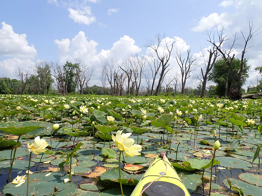
Paddling into the massive lotus field
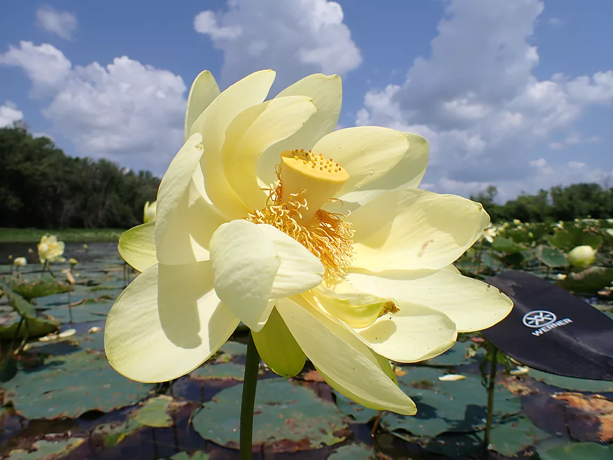
Closeup of one of the lotus flowers
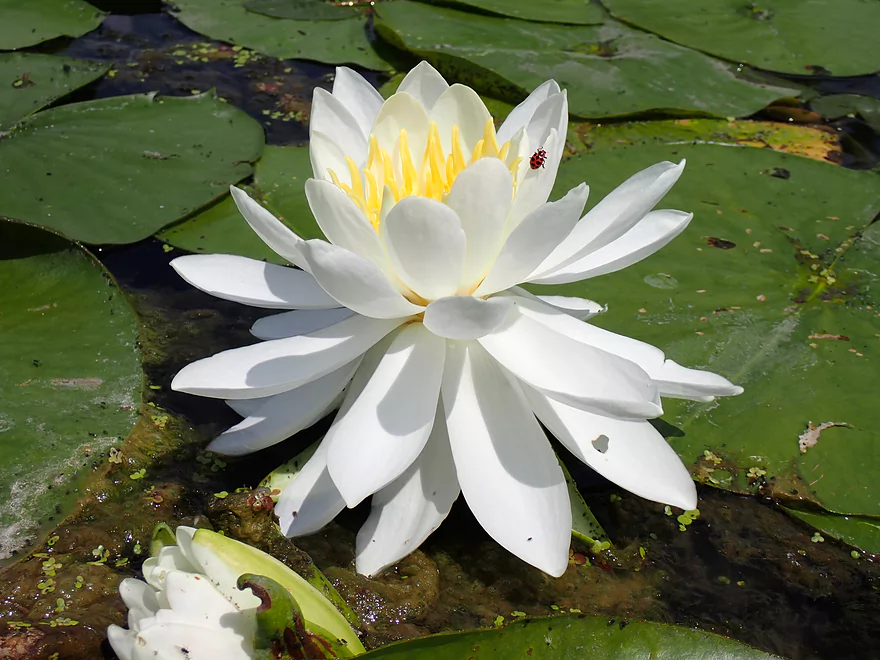
There were some common white waterlilies here, too
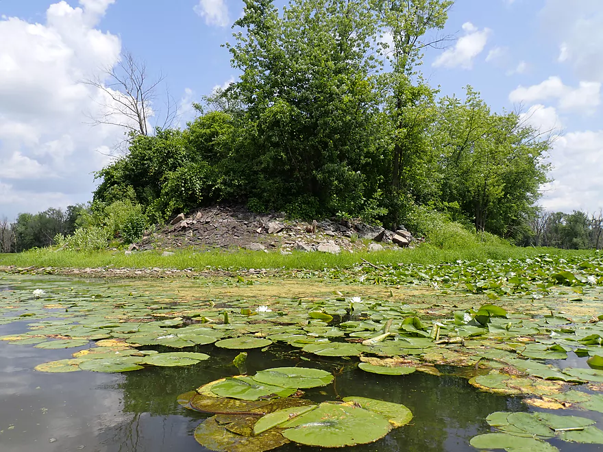
Looks like an old dredge pile
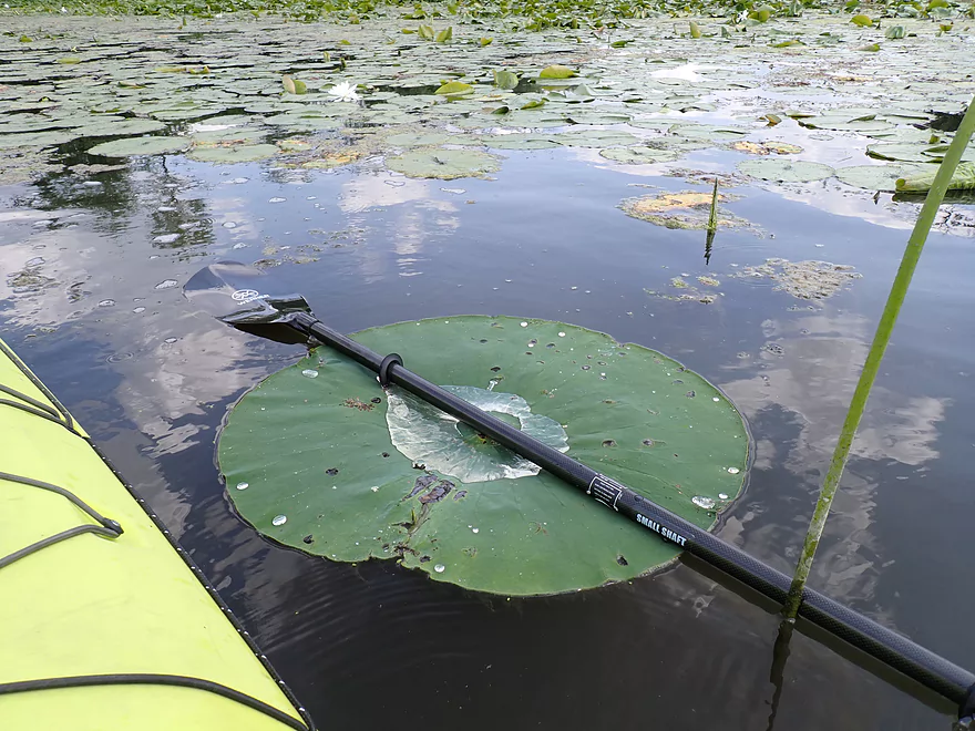
Some of the lily pads were GIGANTIC (note the paddle for scale)
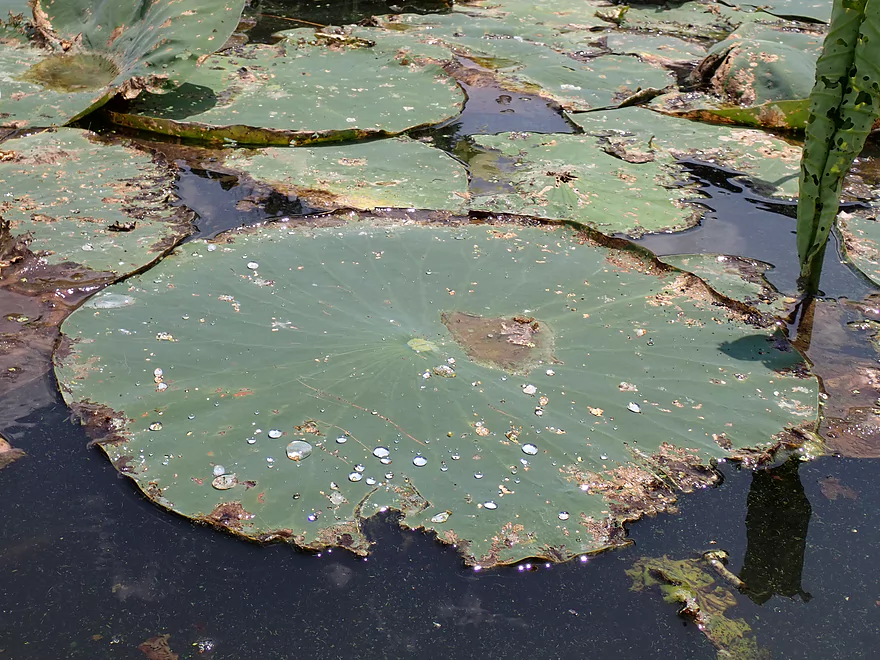
Lotus leaves have a hydrophobic surface that causes water to bead up
Heading back toward the bridge
Back on the main channel
Another bridge shot
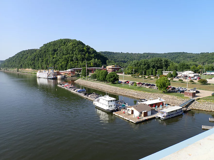
The Marquette harbor area is very scenic
This part of the Mississippi is famous for its houseboats
Checking out Bloody Run Creek
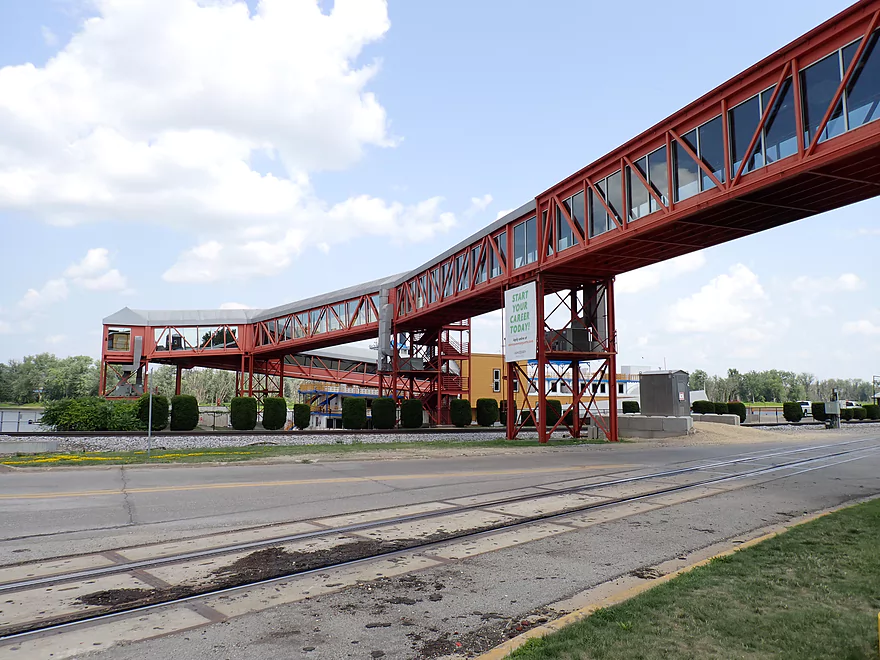
A massive catwalk routes people over traffic to a casino steamboat
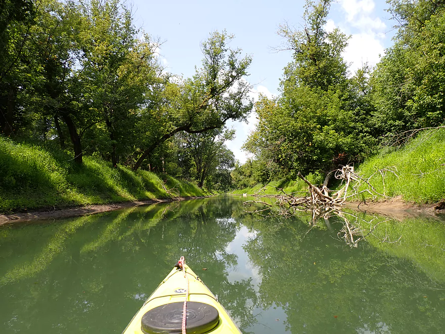
Bloody Run Creek was nice
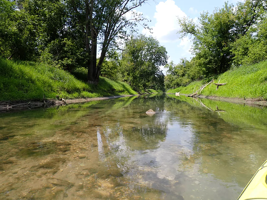
But I didn’t go up too far
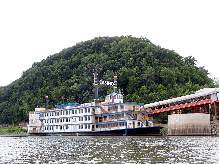
The “Casino Queen” is very striking
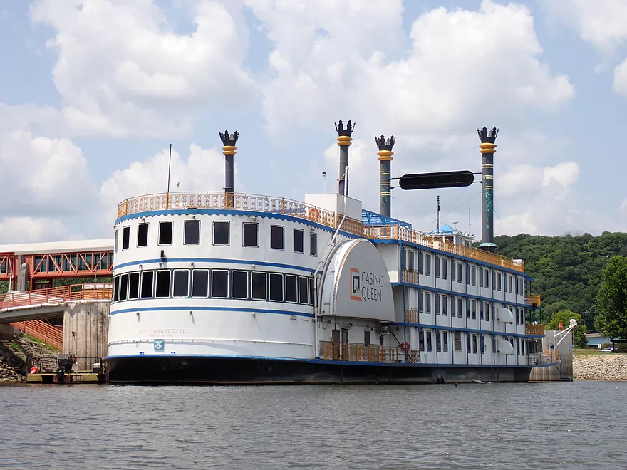
Backside view
Continuing the trip downstream to McGregor
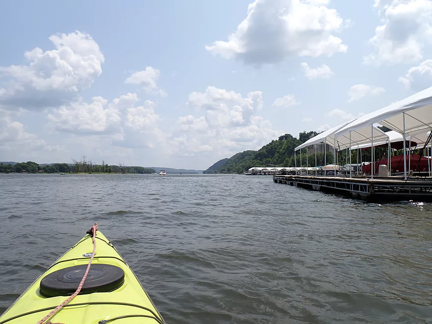
Entering the McGregor marina which is massive
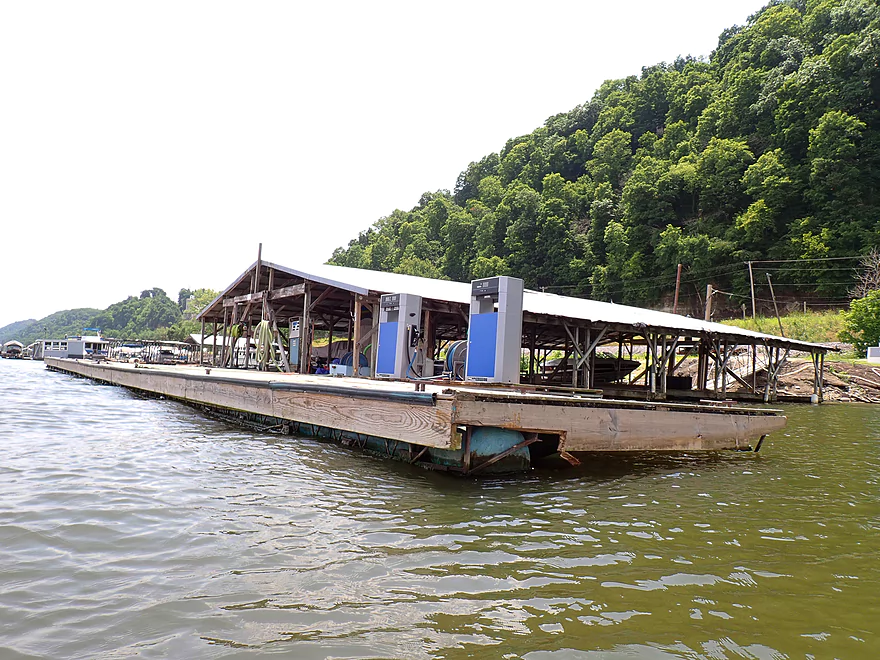
A floating gas station
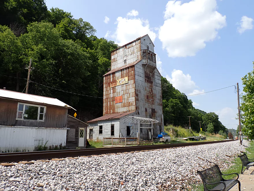
An old grain elevator
A new (and much bigger) grain elevator
No wake rules protect the McGregor area–which is nice for paddlers
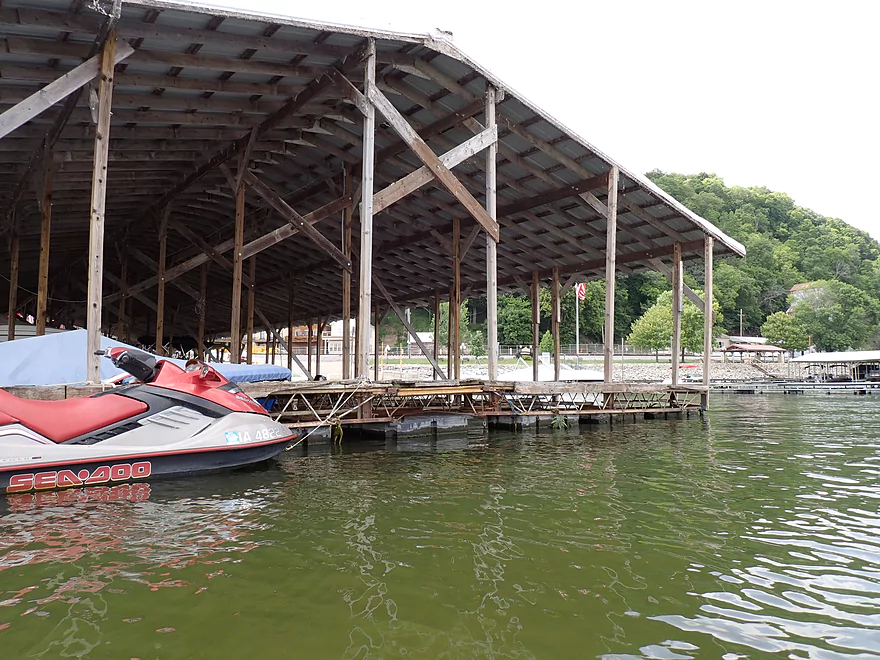
Older parts of the marina had metal rain roofs
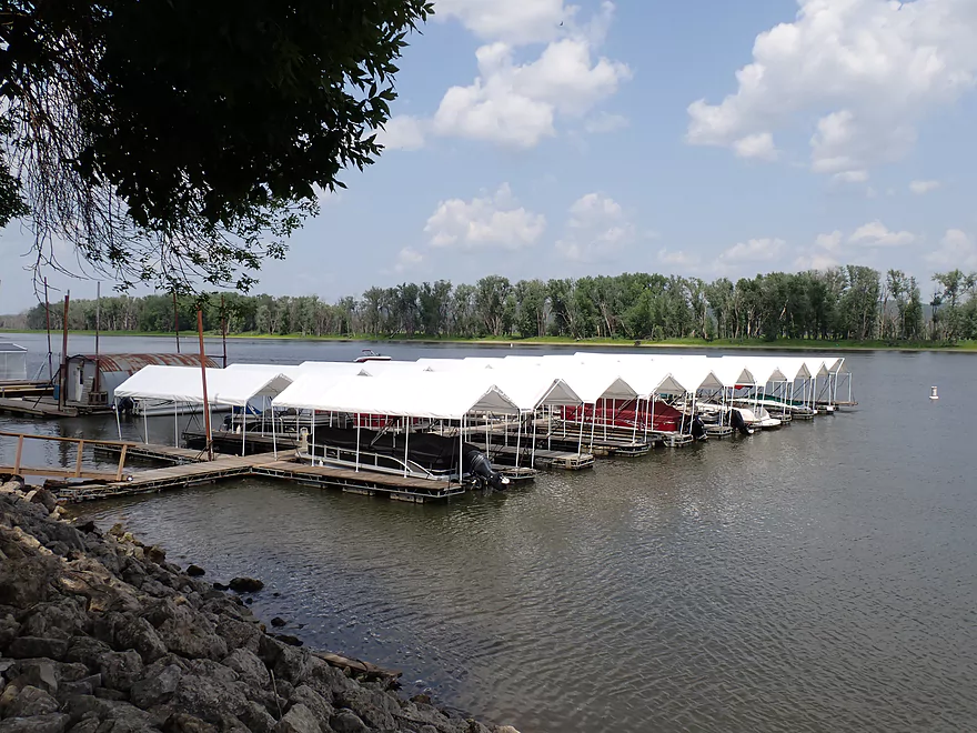
Newer covers looked like plastic
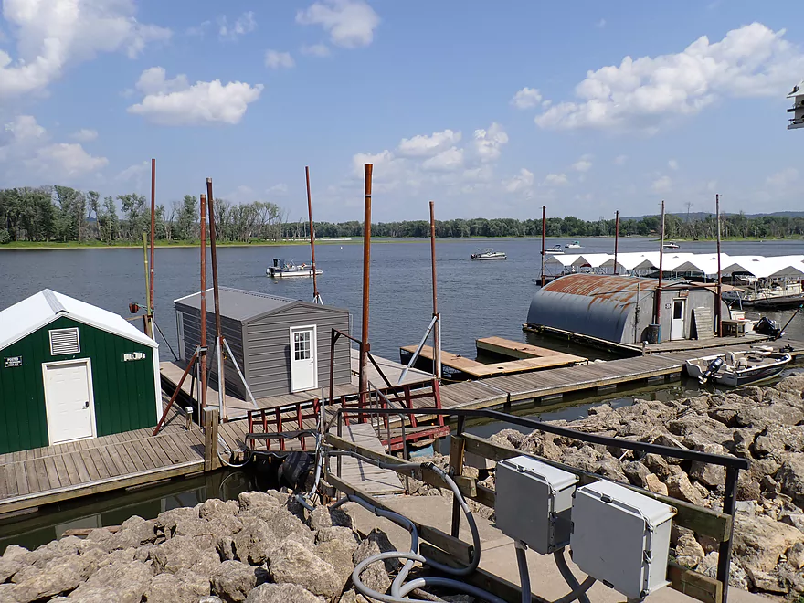
Long poles allow the docks to rise during high water
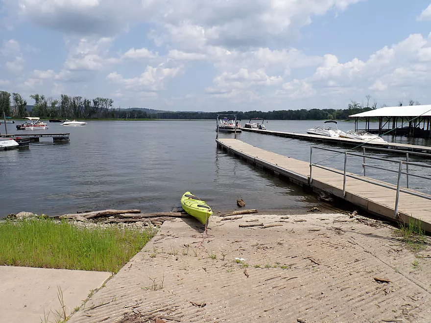
Taking out at the McGregor Boat Ramp
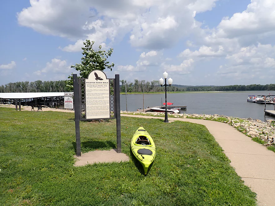
Which is adjacent to a nice river walk

A friendly jumping spider
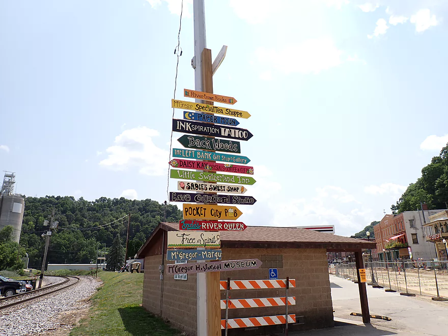
McGregor is a tourist town with lots to see but construction was inconvenient
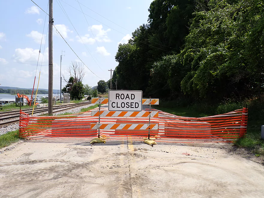
Road construction also made my bike shuttle more complicated
It still was a nice bike shuttle
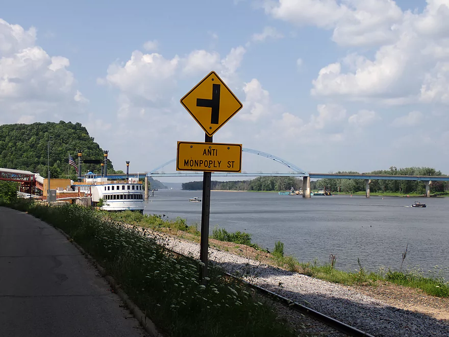
What a street name…
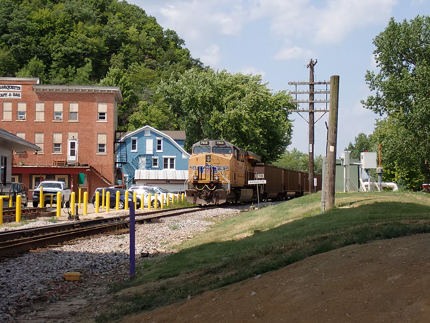
The trains would camp themselves on the roads…had to be careful not get trapped on the wrong side
One final Marquette–Joliet Bridge shot
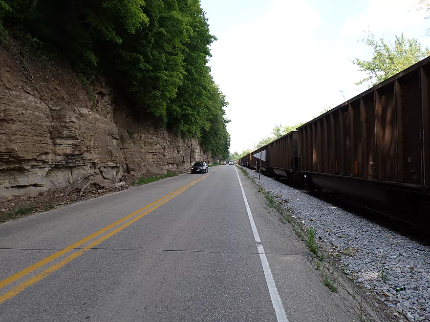
Cool tunnel effect with the rock wall and the parked train
Pikes Peak State Park is worth checking out after a trip
It has a great view of the Wisconsin River and of the Mississippi by McGregor
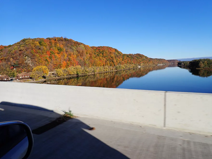
View of the Mississippi near Marquette in fall
Mississippi River – Marquette

In many ways the Mississippi isn’t friendly for kayaking. Its many huge dams create large lakes (“pools”) which are uninteresting paddling deserts with big waves. But…downstream from the dams the Mississippi retains interesting character. Here the river is significantly narrower, has more varied islands/side channels, and is generally more scenic.
The goal for this weekend was to explore such an “oasis” below “US Lock and Dam No 9” (the one above Prairie du Chien). My first thought was to do Ambro Slough which is an official water trail, but FWS warns that it can be shallow with large mats of vegetation (which could be a problem given the current drought). Instead I decided to do a custom route on the Iowa side that would be plenty deep but would require a bike shuttle.
I started at the Yellow River Landing which despite its name isn’t located at the Yellow’s mouth but rather a half mile downstream from it. Also despite being called a “landing” there really isn’t a formal ramp or launch area, and I had to clamber over rocks and a bit of muck to launch, but it wasn’t too bad. A number of cars were in the parking lot, but most were there for the local Effigy Mounds trail system.
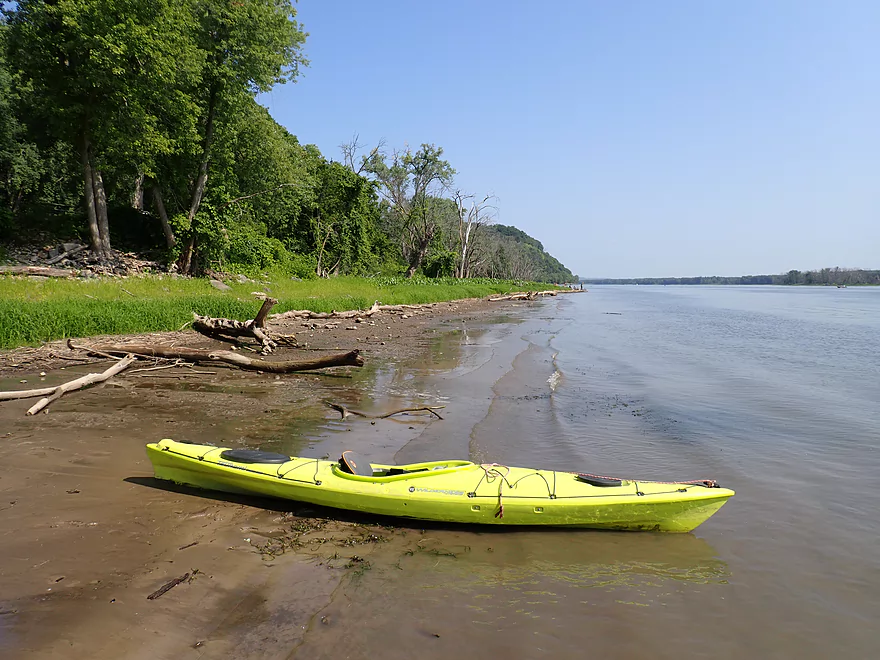
My first impression of the Mississippi was how peaceful it was despite it being 10:30 on a summer weekend (that would change). I also was surprised at seeing small sandbars on the eastern shoreline. Typically I don’t associate the Mississippi as being a big sandbar river, but the recent drought has revealed a number of them. Most weren’t too big, but were big enough for large groups to make campsites and party stops.
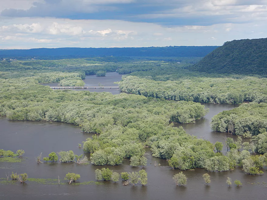
The Wisconsin shoreline (technically Scrogum Island) was somewhat generic with a flat banks and floodbottom trees. In contrast the Iowa shoreline was impressive, with steep bluffs that rolled one after another (like mini mountains). As nice as these were, the bluffs in the far, far distance by Harpers Ferry were even more impressive and were topped with exposed outcrops. In hindsight that maybe should have been my trip.
One of the treats of doing an Upper Mississippi paddle is seeing the big barges. Unfortunately I didn’t see many on this trip, but I was able to get close to one anchored along the western shoreline. The tug’s engine was running which didn’t make sense…maybe the operator was sleeping and kept the engines on to run the AC? I had to be careful about getting too close to the barge. For the most part waves on this trip weren’t too bad, but they could be a bit rough in the shallow areas or by the barges where incoming waves can bounce back into the channel and create funky interference waves.
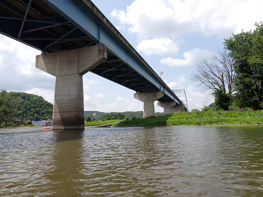
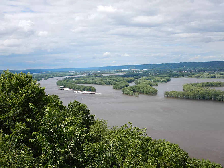
After passing the southern tip of Scrogum Island (the turnaround point for Ambro Slough paddlers), the river is split by a pair of large islands. The east channel is wider and veers off toward Prairie du Chien. Instead I stayed west and hugged the Iowa shoreline. The west channel was relatively narrow (800′) which I liked. In the distance was the Marquette-Joliet Bridge. It’s an impressive structure painted bright blue and supported by cables and two massive arches. There are surprisingly few bridges that actually cross the Mississippi. Heading south from Prairie du Chien, unless you use the Cassville Ferry, you have to travel ~60 miles and all the way to Dubuque for the next highway bridge.
Almost under the bridge itself was an impressive dredging operation with multiple tugs and barges. At the front was a long pipe with what looked like a drill head. Some sediment appeared to be stored on an adjacent barge, while some was rerouted via a huge pipeline all the way to the Wisconsin side.
This was a relatively short trip, so I decided to do a side adventure and explore Sturgeon Slough located by the Marquette-Joliet Bridge. This was much more peaceful than the main channel and featured fantastic fields of lotus flowers. The leaves were huge and far larger than what I was accustomed to.
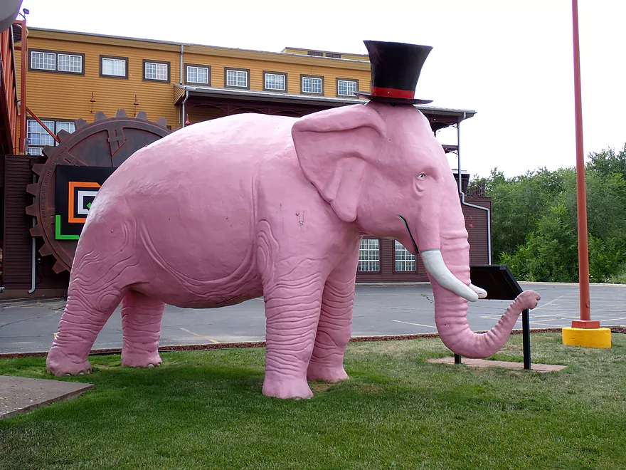
I then turned around and headed toward the community of Marquette. Its main visual feature (aside from the arched bridge) was a large replica steamboat that hosts a casino. I believe there is a “riverboat” gambling exception which is why the gaming isn’t done on land. The large boat is connected to a restaurant and welcome center via an impressive elevated catwalk. The building complex has a tourist/western theme and includes a pink elephant statue.
Bloody Run Creek empties into the Mississippi here which I decided to explore a bit. It’s a nice creek with very cold water (I could feel the temperature change right away through the hull). The bottom stretch is slack and turbid from being dammed/back-filled by the Mississippi, but the upstream legs are pleasant with somewhat clear water, a rocky bottom and pleasant shade trees. Purportedly this is a popular Iowa trout stream. I turned around before Bloody Run County Park, but I believe the park area is nice. I might put Bloody Run Creek on my future todo list, but I suspect it doesn’t have many (if any) outcrops, is shallow, and may suffer from deadfall.
I then headed back downstream to Marquette where the Mississippi was now a busy river. The no wake signs by Marquette helped, but it was still a crazy/noisy scene. In general the Mississippi is a “high energy” river with constant noise and motion coming from either the adjacent highways, the trains (both sides of the river), the barges or the powerboats. The worst time (at least for powerboats) tends to be between 12-3 on summer weekends.
While I could have taken out at Marquette, I decided to head a mile+ downstream to end my trip at McGregor. While both communities have no wake zones, the area between does not and combined with the somewhat more shallow depth, this proved to have some of the rougher waves of the trip (but it was still all manageable). The scenery was ok with more steep hills, but wasn’t as good as the leg prior to Marquette. What makes McGregor distinct is its massive boathouse and dock complex. Tall metal poles allow the docks to rise even during very high water.
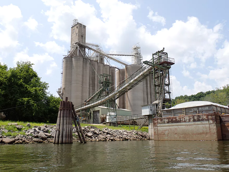
I overshot my take-out (McGregor Boat Ramp) on purpose to check out the massive grain elevator and barge loading area just to the south. This is one of the main “export” spots on the Mississippi for Iowa grain to be sent overseas via the Mississippi. The operation wasn’t active during my trip, but during the fall harvest, I’m sure it’s much more interesting.
I headed back and finally ended my trip at the McGreagor Boat Ramp where a live band was playing at the local tiki bar. McGregor is an interesting and quaint tourist community sandwiched between steep hills. It has a bit of a historic and western theme and could be thought of as a poor man’s Galena. I would have explored it more but heavy road construction had closed much of the downtown with no way to drive through (or even walk…there were large fences that blocked even pedestrians which was crazy). Just to get to the landing, I had to ask a local who directed me to two hidden drives by the grain elevator.
In summary this was a neat trip with some unique highlights. The bridge, barges, trains, bluffs, Sturgeon Slough, and the gaming boat were all really cool. But it was a noisy, busy stretch of river which wasn’t peaceful. I think it was worth it though and was a fun adventure. My only regret really was not launching further upstream by Noble’s Island or even Harpers Ferry where I think the scenery is even better.
Sights included some flopping fish (mostly in Sturgeon Slough), eagles, great blue herons, one muskrat, clam trails, and a huge pile of dead clamshells.
Pikes Peak State Park: This features a fantastic overlook with views of both the Mississippi and the Wisconsin Rivers. I consider it to be one of the best overlooks on the Mississippi and better than the one at Wyalusing.
McGregor Iowa: This is a tourist town nestled between steep hills on the Mississippi. It’s quaint with a western themed downtown that features a number of independent shops.
Effigy Mounds National Monument: This is Iowa’s only National Park and features a number of effigy mounds. For some the real highlight are the trail overlooks which provide a nice view of the Mississippi.
Yellow River Landing: This is a public wayside that mostly serves as a trailhead for the Effigy Mounds South Unit. It is also suitable as a carry-in access. You can launch north by a little side drive, or to the south by the parking area. Note when water levels are low, you may need to hike past a few rocks and muck to reach the water.
McGregor Boat Landing: This is a nice public access which is difficult (but not impossible) to access in 2023 because of construction which has closed Main Street (and much of McGregor). You can still access the landing from the south by taking a side road off of 1st Street (near the grain elevator) and another side road by the Kwik Star gas station. Or you can come from the north. Where the main street is closed, take a left onto a narrow access road. This is rough but will lead somewhat close to a public walkway and landing.
Note the following is a short guide for trips between the dam and Wyalusing (mostly the Iowa side). For additional access information see my Mississippi Overview map:
- Lock and Dam Number 9 to Harpers Ferry Landing: 2.4 miles. Short stretch of slough paddling. Here the main channel is on the Wisconsin side. Not sure you can put in by the dam.
- Harpers Ferry Landing to Nobles Island Access: 3.7 miles. Scenic stretch with impressive bluffs and outcrops.
- Nobles Island Access to Yellow River landing: 5.3 miles. Nice stretch with big bluffs. River grows in size significantly after Mud Hen Lake.
- Ambro Slough – Wisconsin Side: 8.2 miles. This is an official water trail that parallels and overlaps the above leg. Nice thing about this is it can be done as a round trip. Although the slough may dry up during droughts (not sure).
- Yellow River Landing to McGregor Landing: 3.9 miles.
- Yellow River Landing to Marquette Boat Landing: 2.6 miles. Nice leg with scenic bluffs. Paddlers can detour into Sturgeon Slough for a longer trip.
- Marais Lake – Wisconsin Side: Mostly a big long wide lake. Likely not interesting.
- Marquette Boat Landing to McGregor Landing: 1.3 miles. Highlights include Bloody Run Creek, a large gaming boat, a huge suspension bridge, a significant grain loading facility, and a large marina.
- Yellow River Landing to Marquette Boat Landing: 2.6 miles. Nice leg with scenic bluffs. Paddlers can detour into Sturgeon Slough for a longer trip.
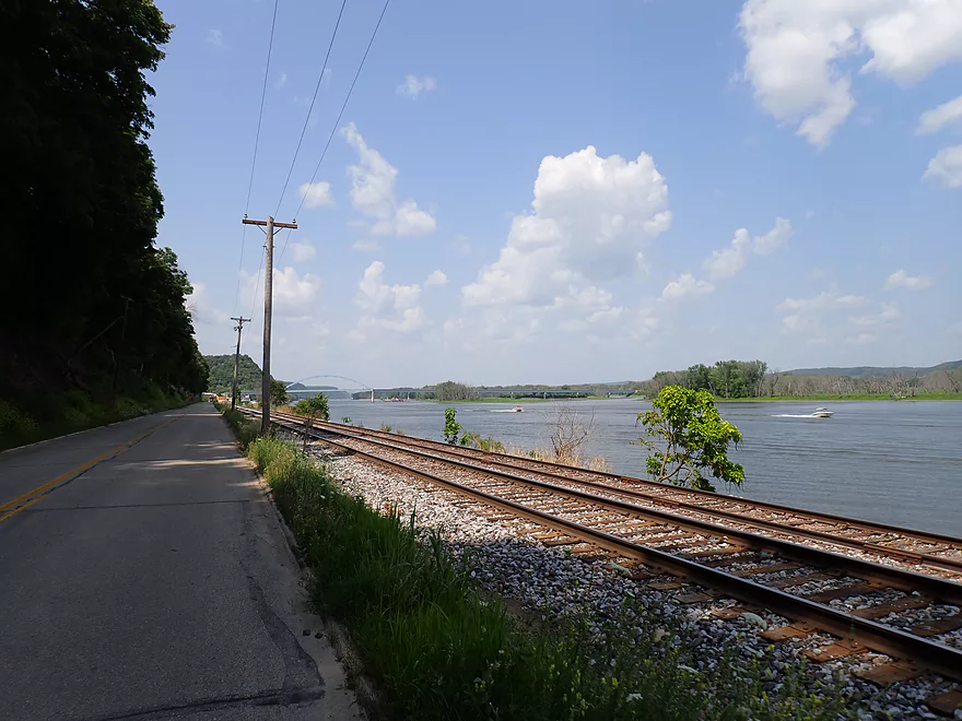
Bike Shuttle – McGregor Boat Ramp to Yellow River Landing: 3.9 miles with 39′ of ascent. River Street by McGregor is currently closed for construction. But you can still shuttle along the river by traveling first north up the river walk, then up a side access road which connects with the main road after a “road closed” sign. Aside from construction this was a nice shuttle that was shady, sheltered from the wind, and scenic with nice roadside outcrops. The only downside was the shuttle leg north of Marquette while still very scenic was very busy with car traffic and had non-existent shoulders.
Car Shuttle – McGregor Boat Ramp to Yellow River Landing: 3.9 miles or 9.2 miles. I only list car shuttles if there is a problem…and there is. Heavy construction in McGregor has closed the River Street entrance to town. The official detour is on Hwy 18 which is long and way out of the way. Even after the detour, you have to find a few hidden side streets by the grain elevator to access the boat landing. You could alternatively take River Street until the road closes, and then take a side access road south the rest of the way to a park. From there you’ll have to drag your boat 300′ to get to where you can kind of park. Construction in McGregor should end sometime in 2023. Lastly…the train in this region is infamous for doing long stops while blocking traffic (sometimes over 10 minutes). I think it is a layover spot where they switch drivers. Be careful about being “trapped” on the east side of the tracks.
Wing Dams: I did not encounter any wing dams on the trip. But…any kayaker that does Mississippi trips should be vigilant for them. Often they are located just inches below the surface and can create serious undertows that have been known to suck entire trees underwater. Paddler Jake Stachovak on his Portage to Portage trip noted the Mississippi wing dams he encountered would even create nasty whirlpools. They are the most dangerous in high water…honestly during low water like this drought, most wing dams shouldn’t be too much of a problem. The location of wing dams is mapped by the US Corps of Engineers. Note there is a large wing dam complex east of McGregor (the grey horizontal lines on the map).
Current: The current was fairly slack in this stretch, especially upstream of Marquette. This may be because of low water levels….I’m not sure. I think I could have easily done a round trip against the current if need be.
Logjams: None.
Waves: Both Marquette and McGregor have no wake zones so are somewhat protected. But outside of the towns, the river does see a fair bit of powerboat traffic. If you’re in deep water and not too close to the boats, generally speaking the waves won’t be a big deal. But if you are close to shore, in a shallow area or next to a barge (which reflects the waves) things can be a bit rough. I thought it was all manageable, but paddlers should be careful. The worst traffic will be between 12-3 on summer weekends. Outside of those times, the Upper Mississippi can be surprisingly mellow.
Wind: The Mississippi is a wide open river with little cover. Stay off it when there is a strong wind.
Closest Gauge: Mississippi @ Clayton Iowa
Trip Depth: 11.53′
Navigability Estimates: The following are very rough estimates. Always use your own judgement.
- <11′: Extremely low depth. Sloughs might not be navigable but the main channel will be.
- 11′-12′: Low depth with some sandbars. Some sloughs will be closed.
- 12′-13′: Likely an average depth.
- 13′-14′: Above average.
- 14′-15′: Minor flooding. You might be able to paddle between the trees on the islands.
- 15’+: Major flooding. River could be dirtier/faster. Perhaps only suitable for experienced paddlers.
Detailed Overview
The Mississippi is both a blessing and a curse for paddlers. While rich in beauty and majesty, it can be problematic to paddle due to high wind, current, wake, powerboats and barges. The Upper Mississippi is frequently dammed and subdivided into “pools” of which there are roughly 11 in Wisconsin. Generally speaking just upstream of a dam, the river is the least interesting (few islands, deep, monotonous, few sloughs, and a wide channel). But on the downstream side of pools there are often many sheltered islands and sloughs that offer unique paddling experiences.
For a list of Mississippi water trails see my overview map or use the bullet list below (ordered north to south). Thanks to the US Fish and Wildlife Service for many of these suggestions. Check them out for more details.
—
Chippewa River Trail: 6.8 miles. Chippewa River Landing to Tim’s Slough Landing. Basically the last part of the Chippewa River that connects with a slough on the Mississippi. Avoid in high water.
Nelson-Trevino Trail: 4.5 miles. South of the Chippewa River, Hwy 25 cuts across the river through a slough and over a grade. Many landings to pick from. Most paddlers venture south and then back north to one of the landings. The main water trail is roughly the biggest loop you can take south of Hwy 25 while remaining in the slough. Avoid in high water and high wind.
Finger Lakes Trail: 6.1 miles. North of the Zumbro River mouth, there is a sheltered collection of sloughs and lakes you can paddle. The main water trail skirts the south edge. In low water, some portages may be required. For a launch/take-out, use Pioneer Landing in Minnesota.
Halfmoon Trail: 5.1 miles. Mixture of paddling on open sloughs, narrow sloughs and on the main channel. Use Halfmoon Landing for an access. Difficult in high water and when vegetation is out in late summer.
Verchota Trail: 11.3 miles. A long upstream paddle up the main slough then you double back mostly on the same trail. Use Verchota Landing for an access. Difficult because of its long length and upstream paddling.
Aghaming Trail: 6.7 miles. Start at the park in the main channel and float downstream until you find a gap in the slough which you can paddle upstream to explore. Turn back when done. Access at Latsch Island Park and Landing. Some upstream paddling in the main channel. Not usable in high water.
Voyageurs Canoe Trail/Perrot State Park: 6.5 miles. Your best bet is to do a one-way trip from Hwy 35 to S. Park Road. Very scenic. Completely sheltered from the main channel and is technically the Trempealeau River.
Long Lake Trail: 5 miles. A counter-clockwise circle through mostly backwater sloughs. Long Lake is mediocre and French Lake is boring and weedy. But the main channel is nice with good sandbars and bluff vistas. When in season, Big Marsh can contain scenic wild rice corridors.
Brown’s Marsh Canoe Area: More of a lake paddle and a way to experience Brown’s Marsh. Access at Lytle's Road.
Lake Onalaska Trail: Technically the last miles on the Black River. Been on my to-do list for a while… Lytle's Road to Fred Funk Landing is 4 miles, while Lytle's to Mosey Landing is 8 miles.
Goose Island Trail: 8 miles. A nice paddle around Goose Island. Mostly simple sloughs but there are nice bluffs.
Reno Bottoms Trail: 3-14 miles. Put in on the Minnesota side and float down a long slough. Many intermediate take-out options. Access at Reno/Hwy 26 & New Albin. Some of the launches can be under water during high depths.
Blue Heron Trail: 3-7 miles. This cuts across the Upper Iowa River mouth. I know little more. Access points at New Albin and Blackhawk Park.
Ambro Slough: 8 miles. Very similar configuration to Wyalusing. You can paddle up the slough then downstream on the main channel if you wish. The upstream slough by Harper’s Ferry also looks interesting. Access at North Ambro Road. 8.2 miles if you do a full loop on the main channel.
Yellow River to McGregor: ~4 miles. A scenic stretch featuring impressive river bluffs and a large arched bridge.
Wyalusing: 5 miles. One of the neater areas on the Mississippi.
Johnson Slough: 6.2 miles. Just downstream of Wyalusing on the Iowa side is another nice slough to explore. Most launch at the landing, cut north through the slough and float back on the main channel. Some current to paddle against.
Jay's Landing to West Haven: 4.6 miles. This is a nice leg with many islands that protect paddlers from the main channel. Highlights include scenic bluffs.
Cassville Bluffs/McCartney Lake: 4-17 miles. There is a protected series of sloughs and islands on the Wisconsin side that features many scenic bluffs and outcrops.
Dubuque Water Trail: 9 miles. Start south of the dam by A.Y. McDonald Park. Float down the western shore by urban Dubuque, past the Mines of Spain to Massey Station Road. Easy to subdivide or to do round trip loops. For further information see the official webpage for the trail.
Trip Map
Overview Map
Video
Photos Size: