
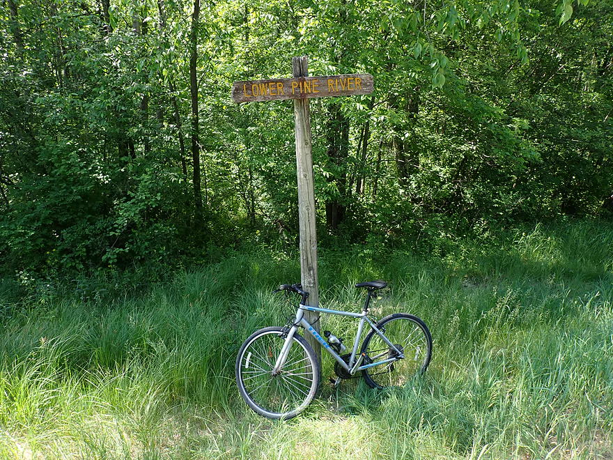
The Pine has some classy river signs
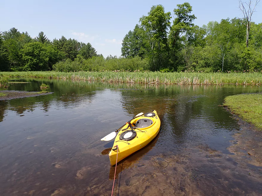
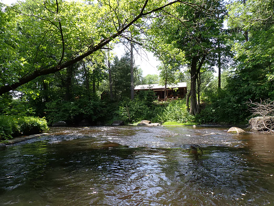
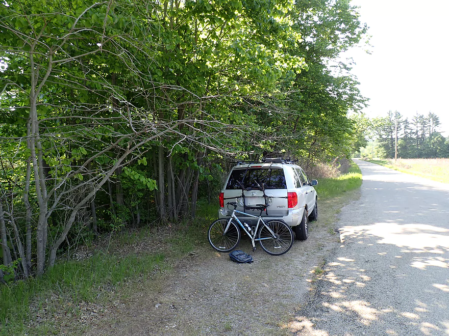
Starting the trip at Hwy A
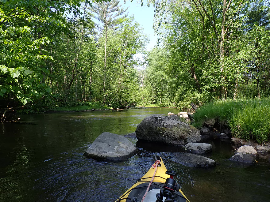
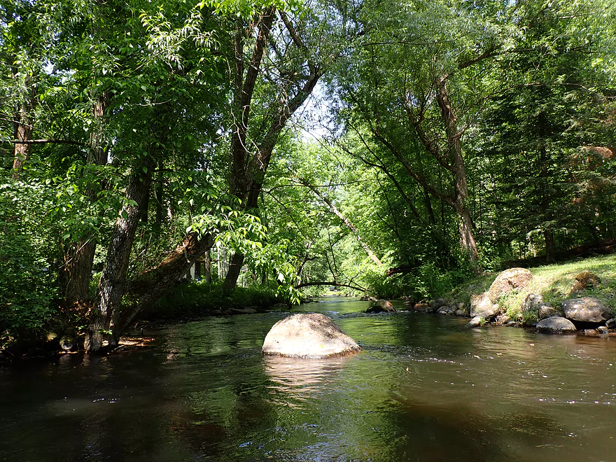
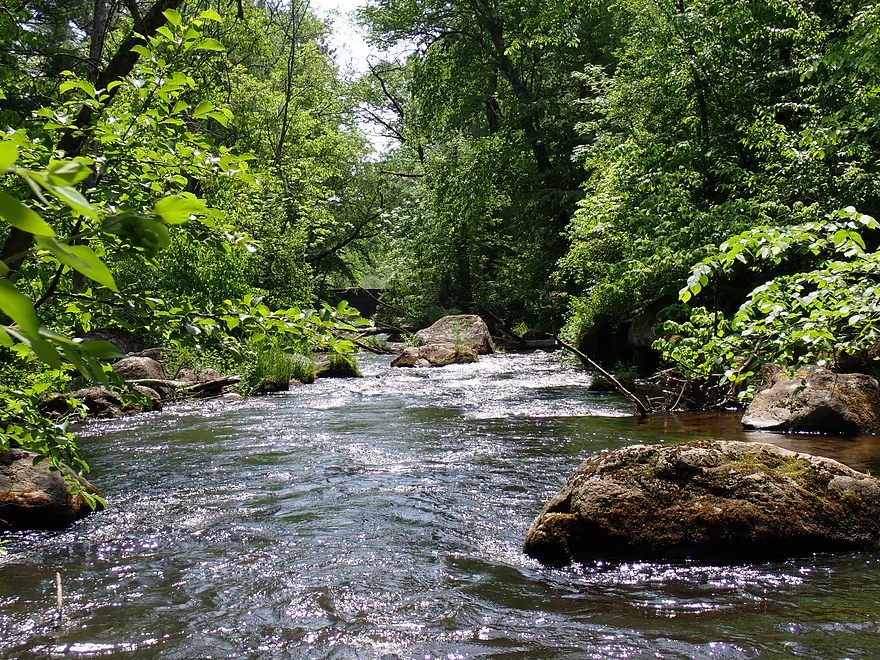
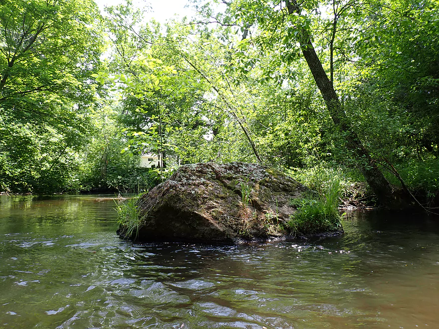
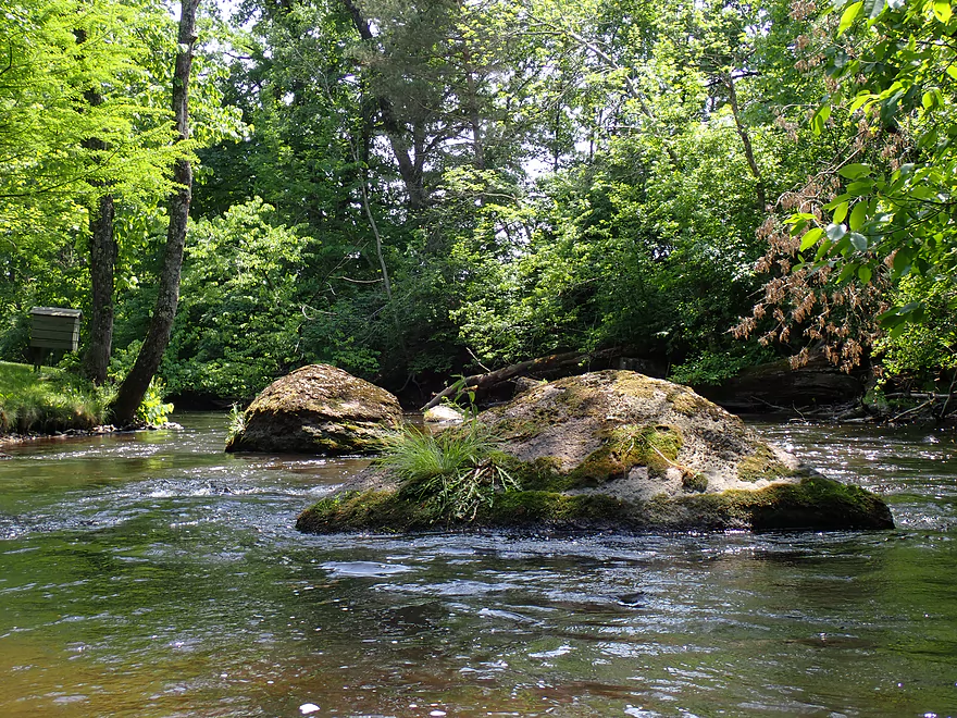
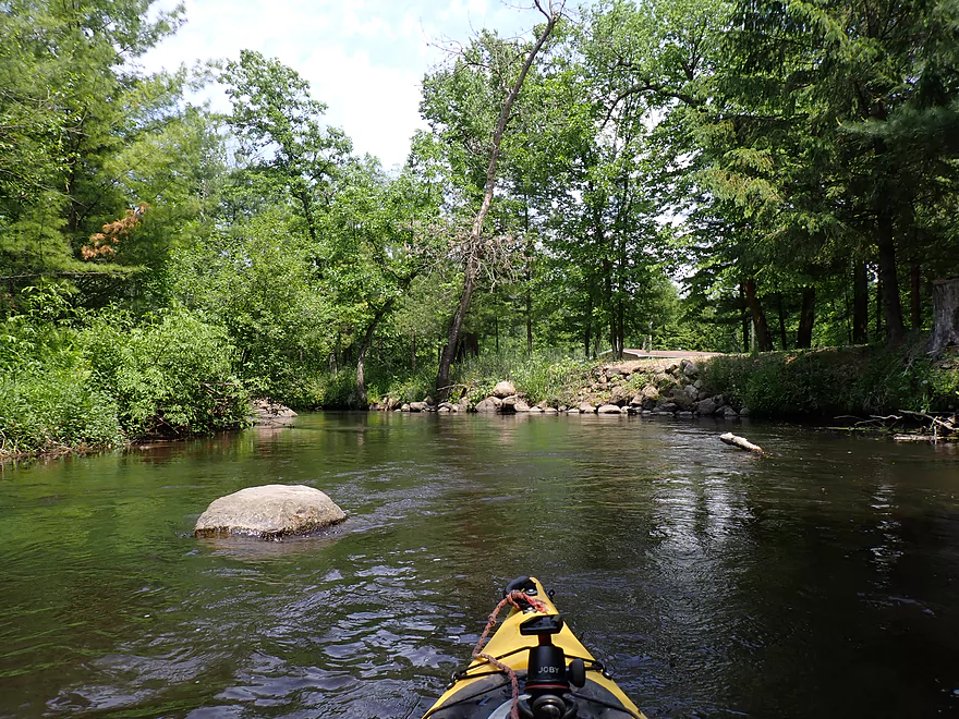
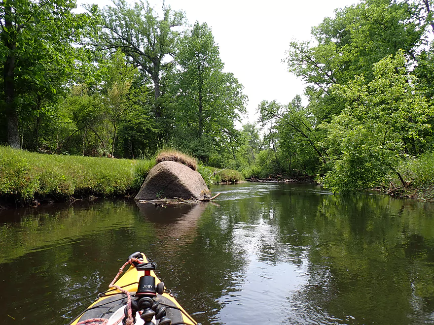
Early boulders
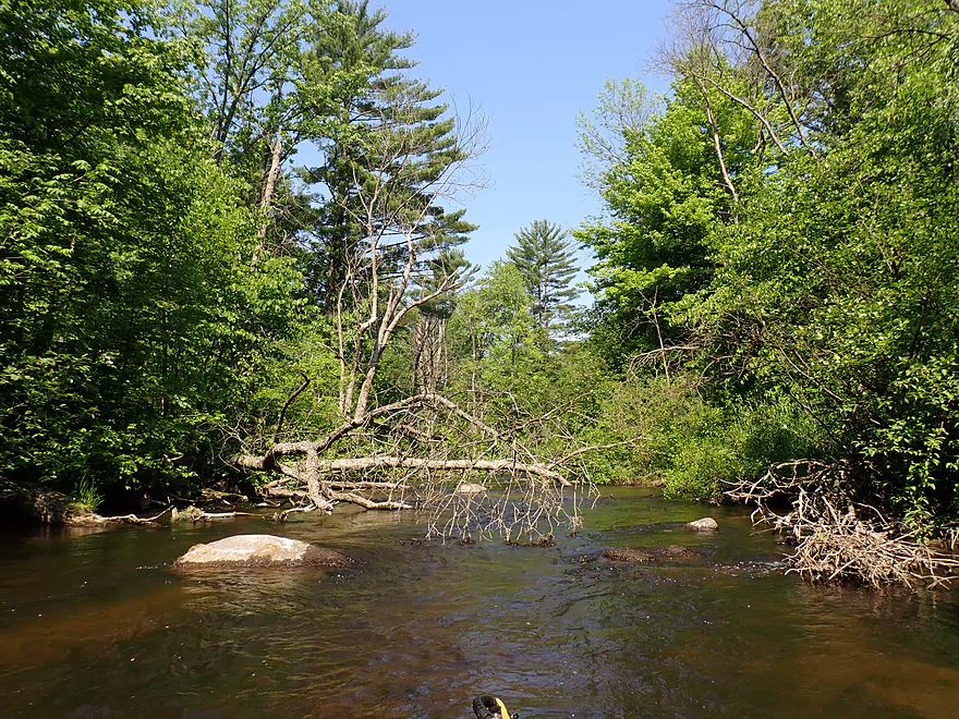
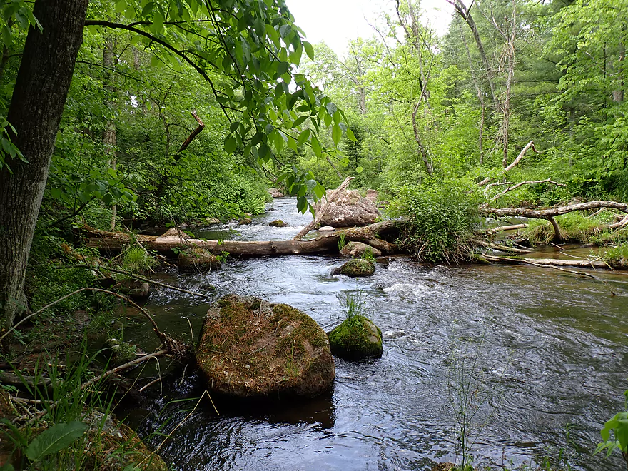
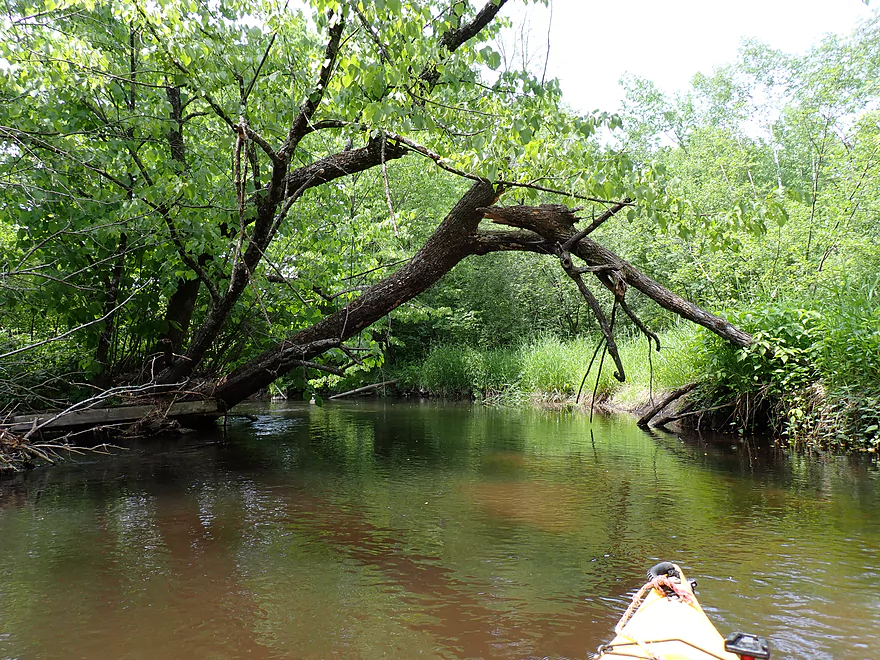
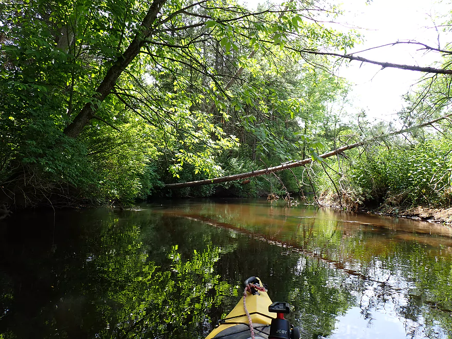
This stretch had a downed tree, but was scenic
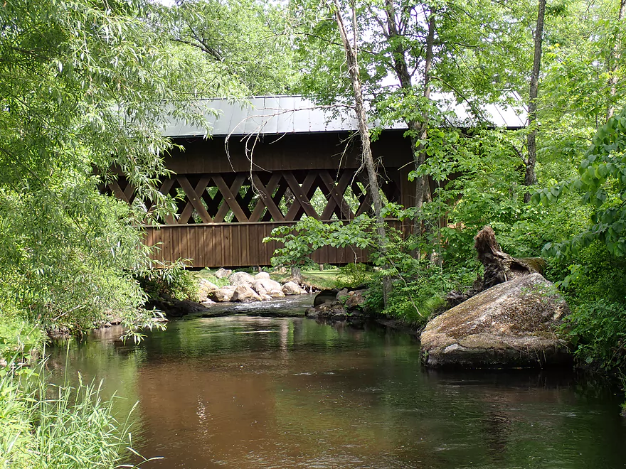
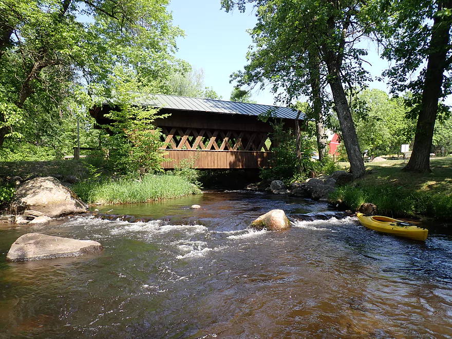
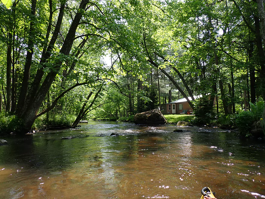
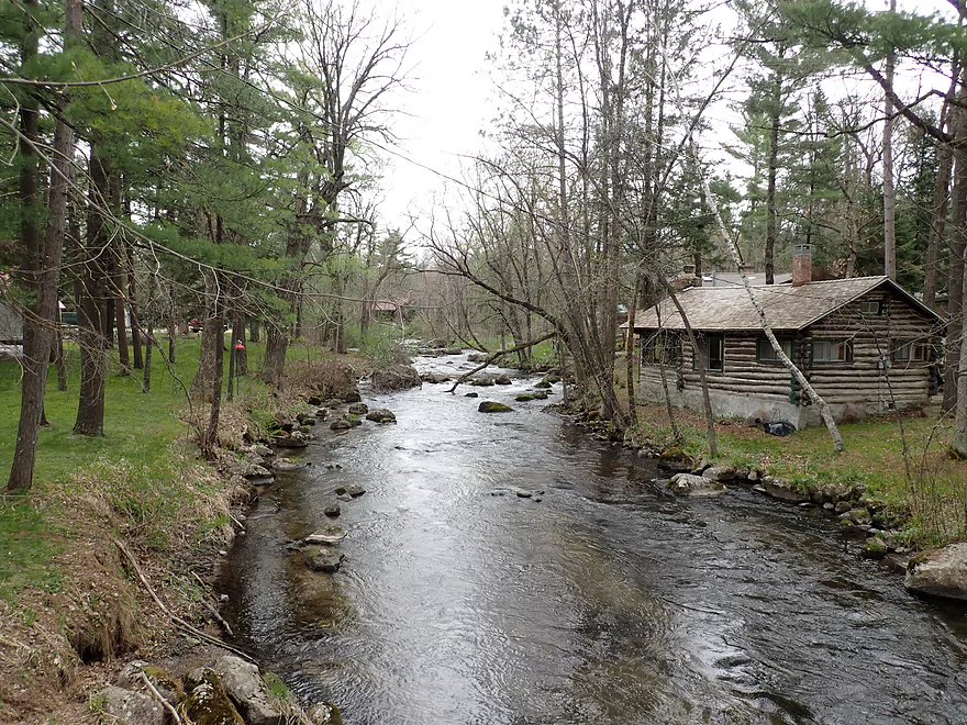
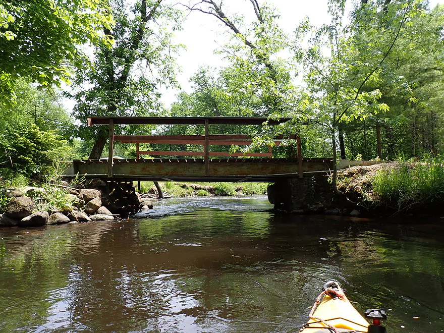
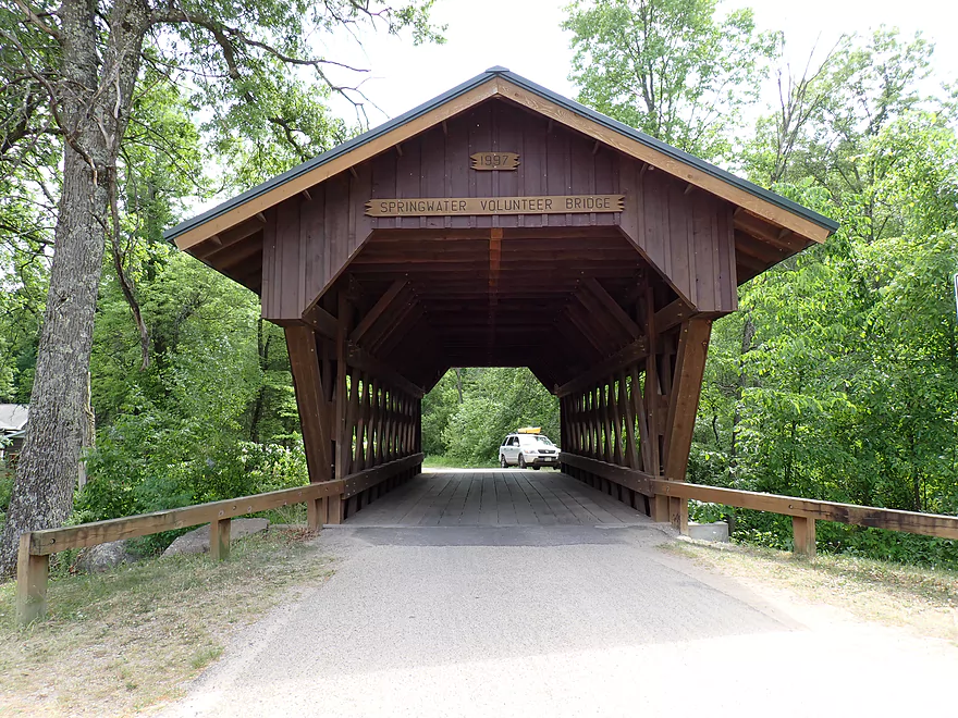
Coming up on the famous Springwater Covered Bridge
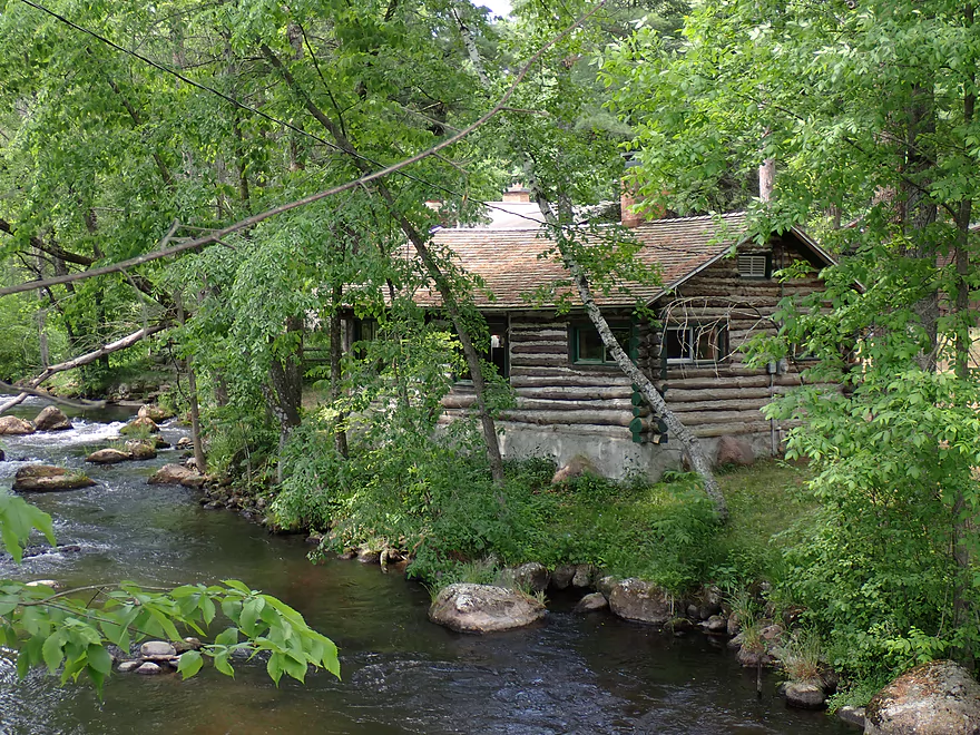
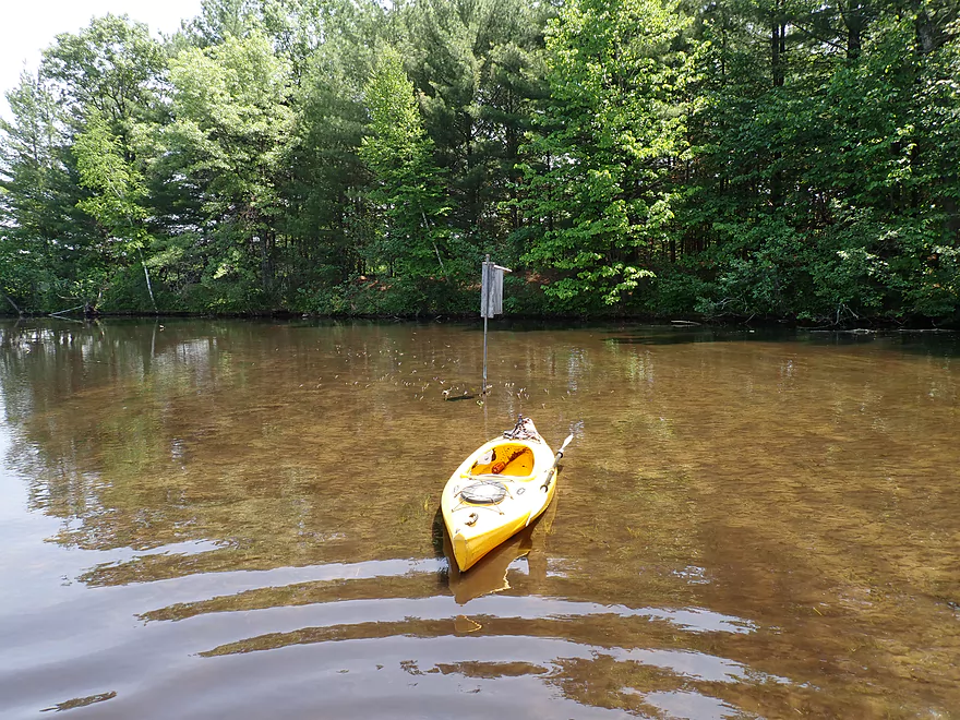
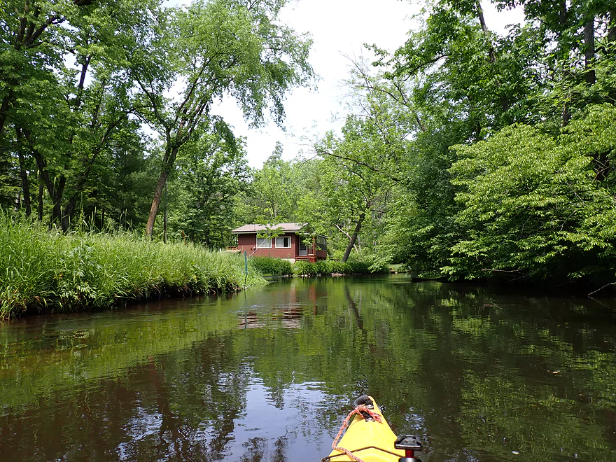
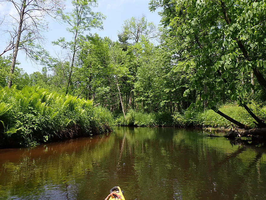
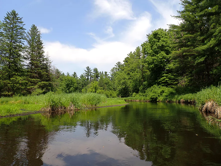
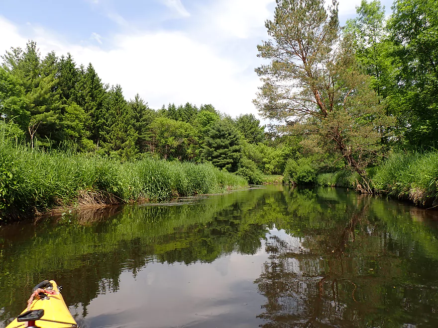
View from my spring 2020 trip
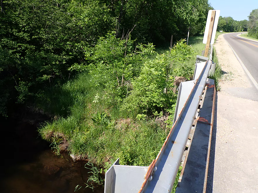
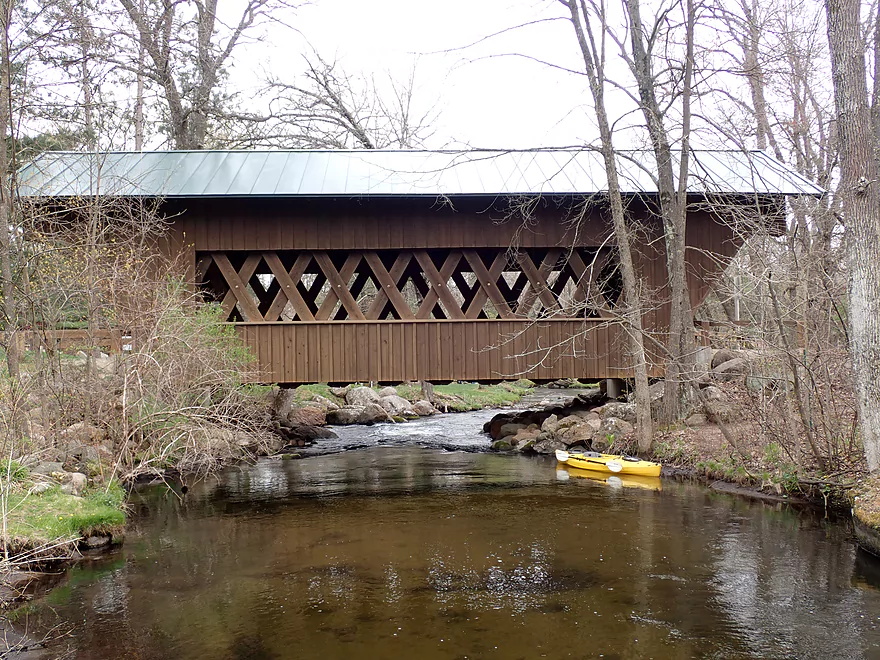
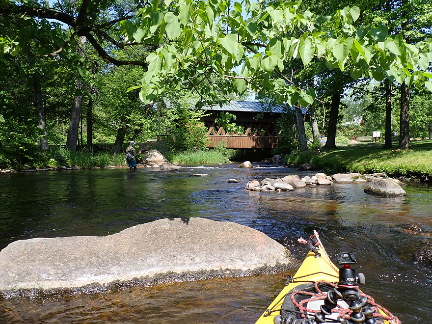
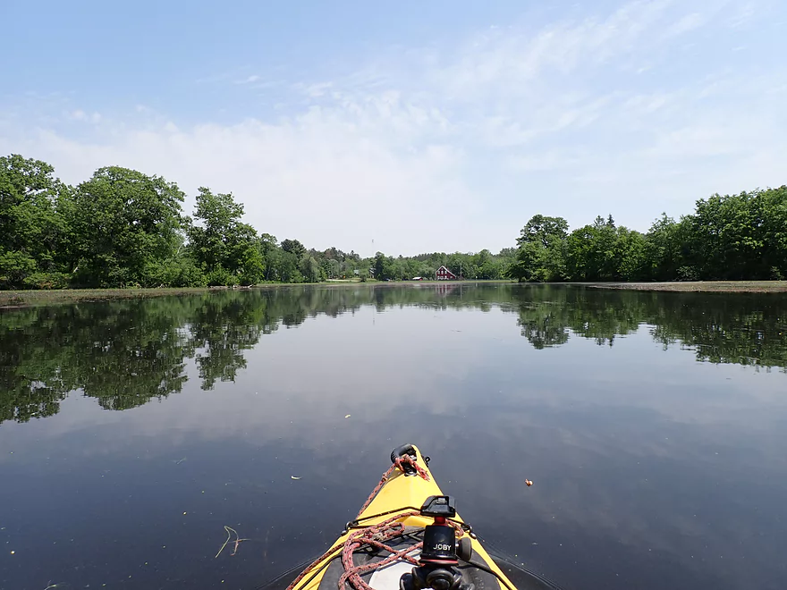
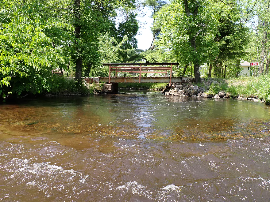
View from bridge
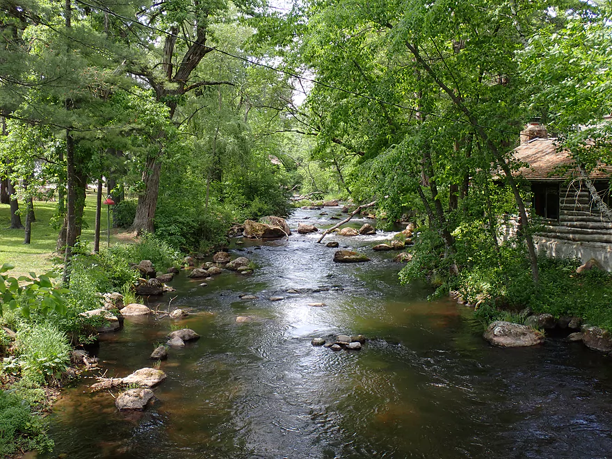
Same view but in spring
Back on the water…reverse view of rapids and bridge
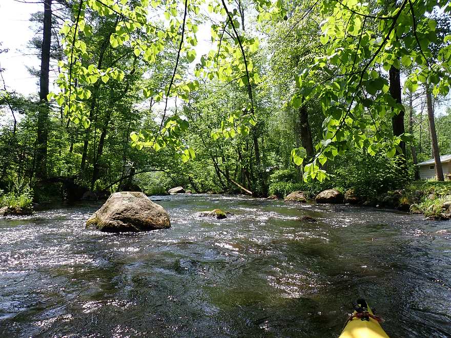
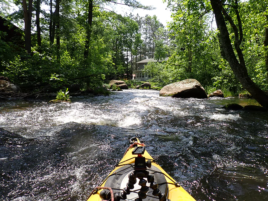
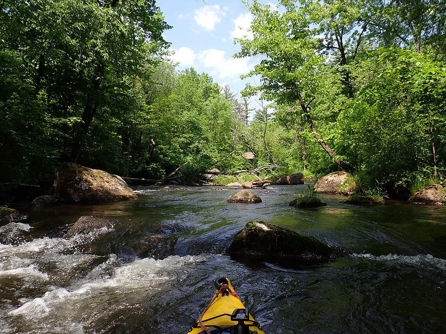
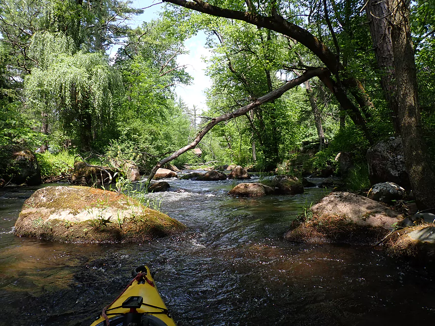
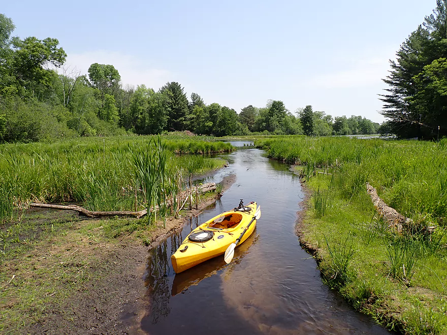
The next half mile contains many boulders and rapids
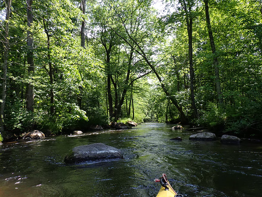
Really scenic with the tree canopies
Lighting was really tough for pictures though
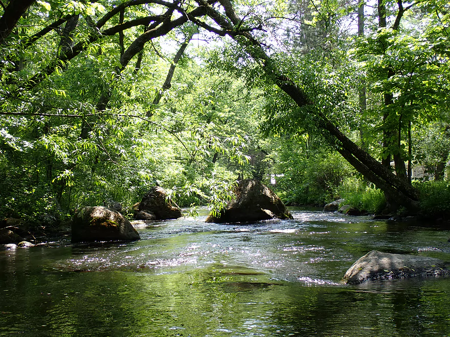
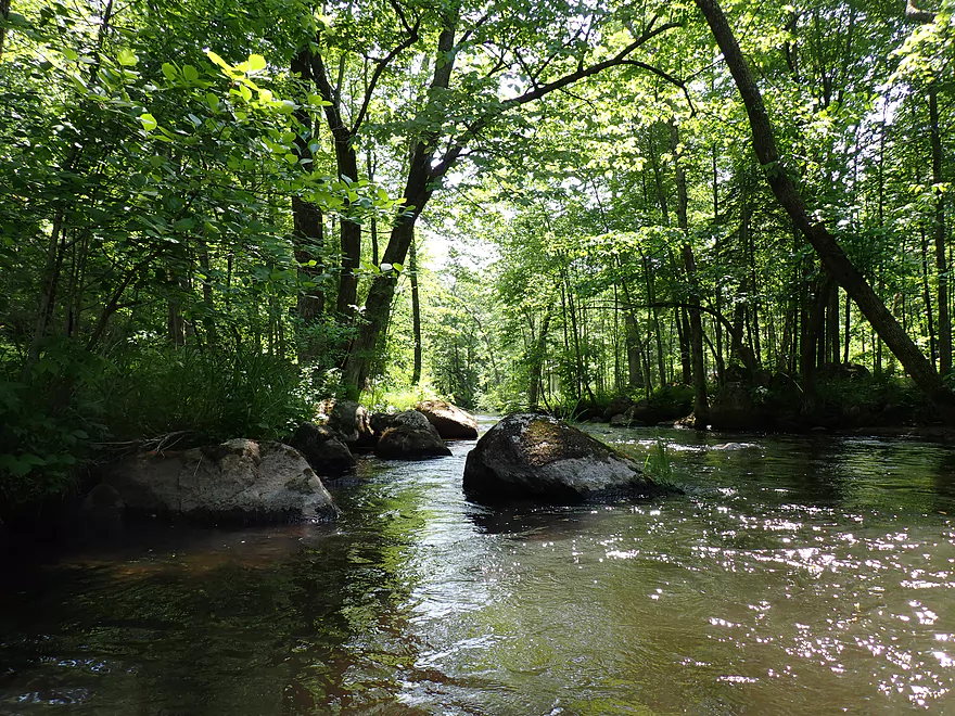
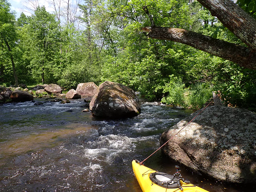
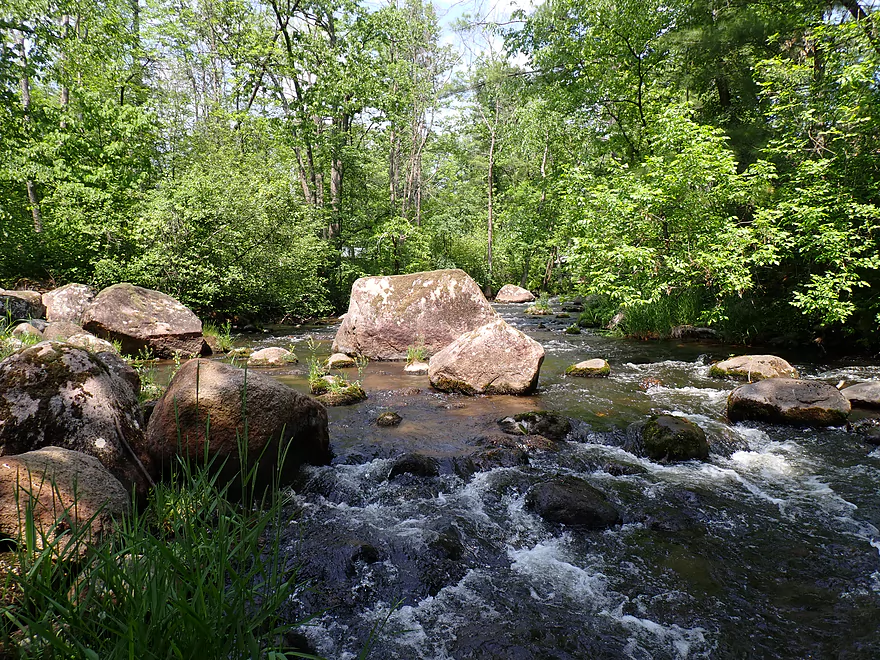
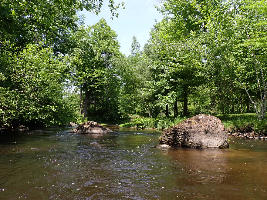
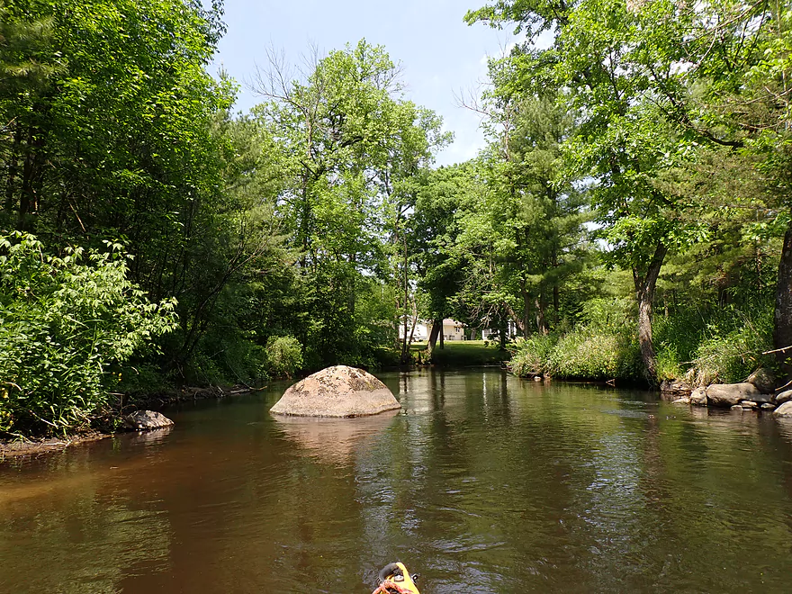
Boulders starting to get bigger
These were left by the last glacier and are called erratics
Here the river really starts to get fast and rough
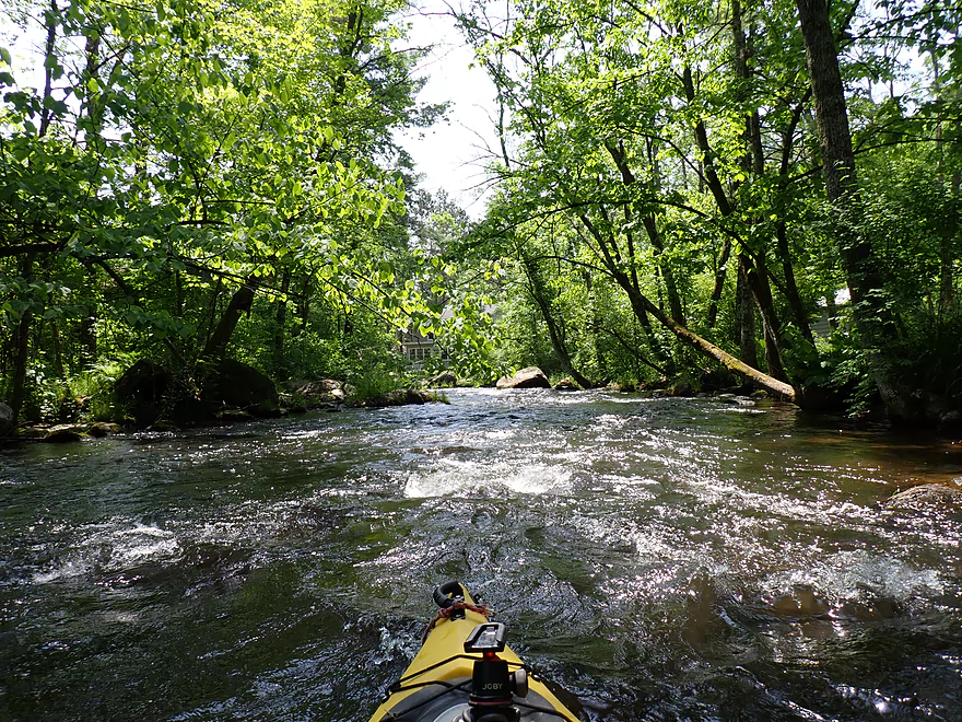
No easy eddies for me to take a break
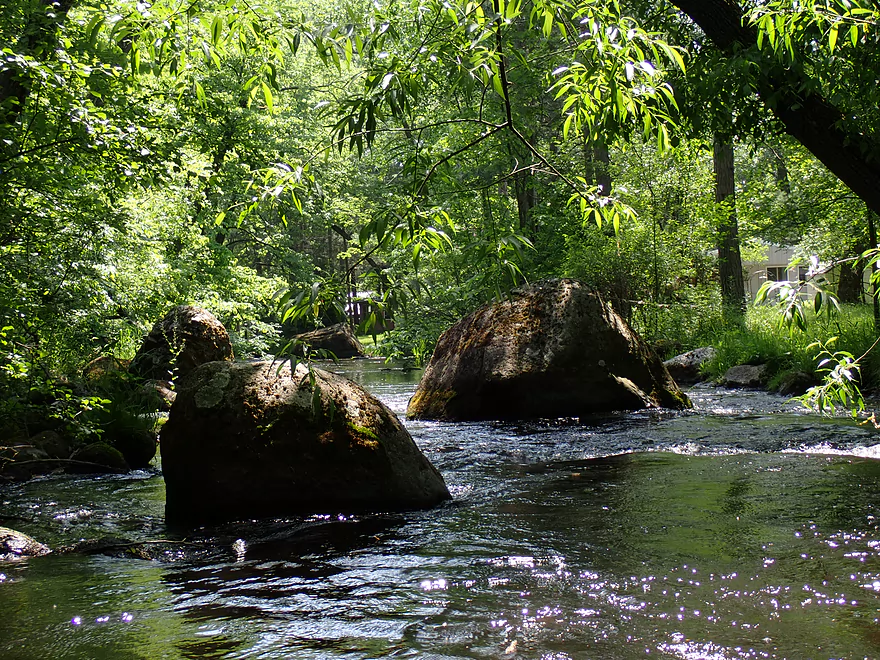
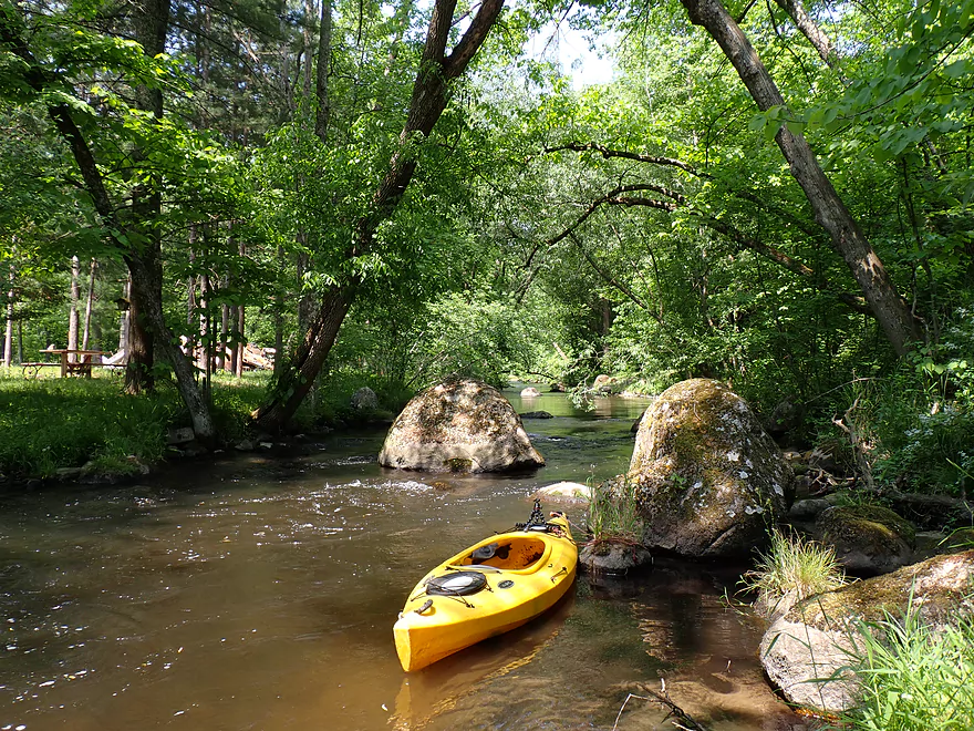
Huge boulder
That chute on the right is the only way through
To the left are too many boulders
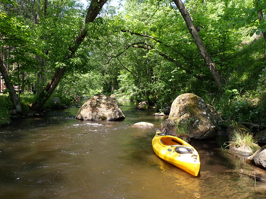
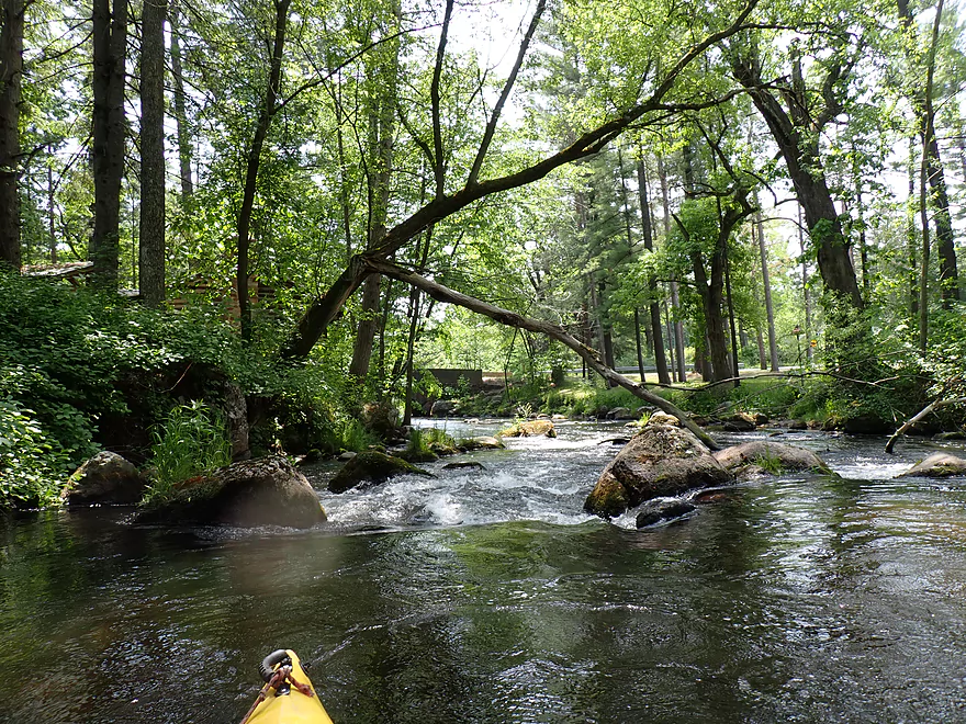
More rapids
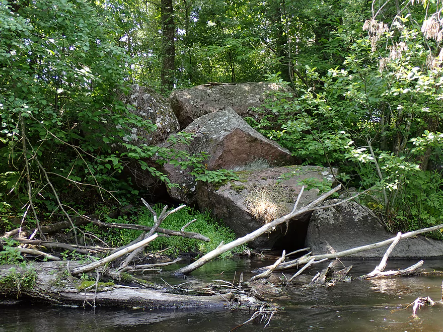
Nasty logjam…there is a way around (far right, not pictured) but it’s not easy
This stretch requires tight navigation
Very scenic
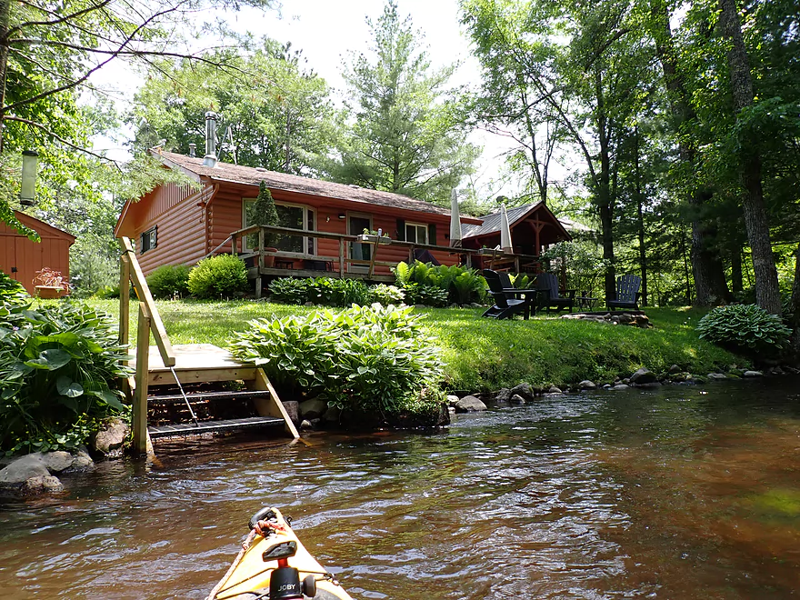
Lots of small, nice cottages by the river
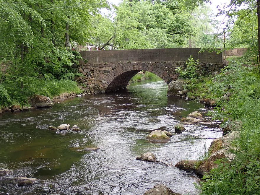
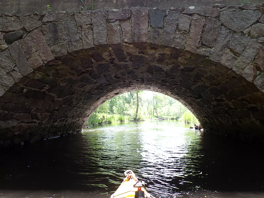
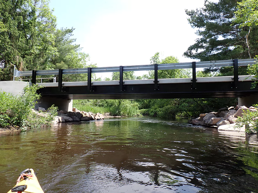
Attractive stone arch bridge
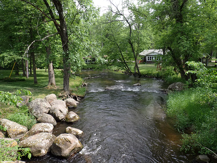
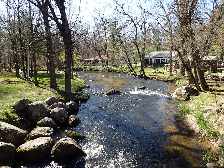
View from Portage Street bridge
Same view but in spring
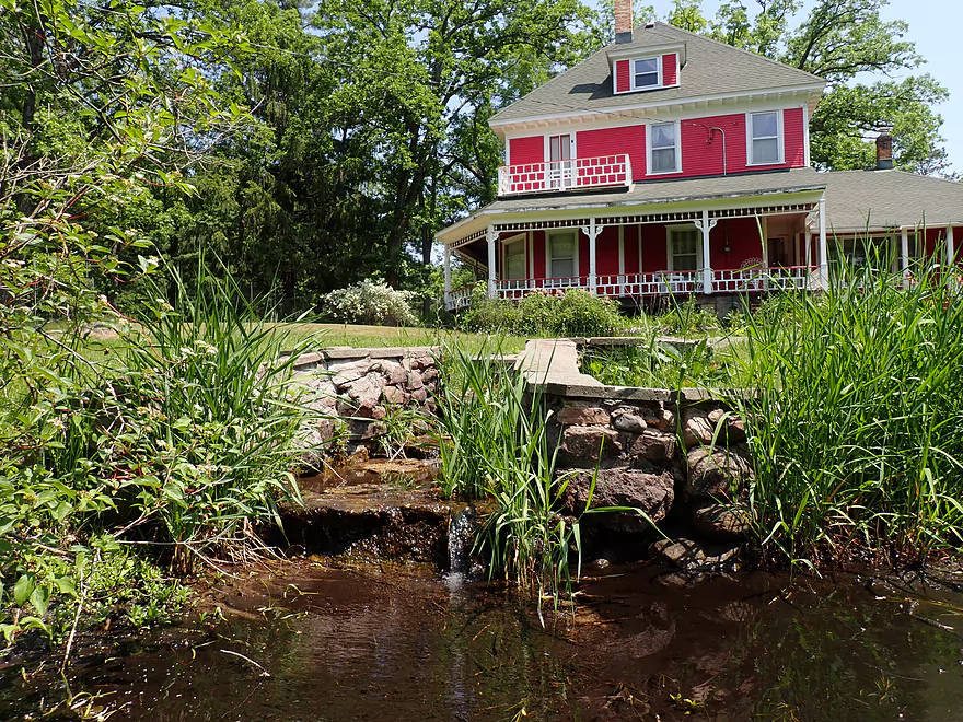
An artesian well bubbling out of the ground in front of a deep pink house
Tree skeleton
At times good clarity
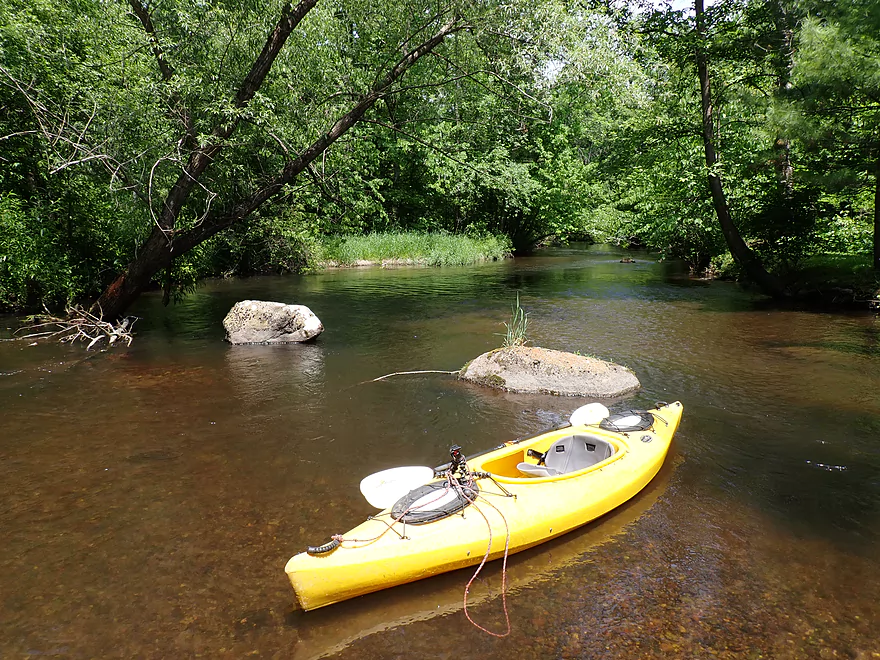
Attractive side channel
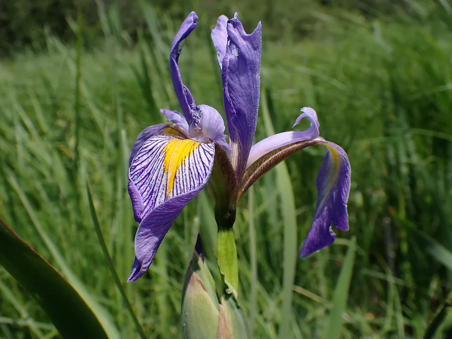
Blue flag
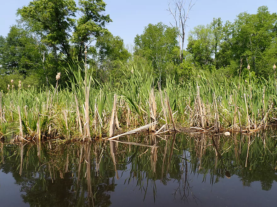
Some cattails at the beginning of the Saxeville Millpond
This is one of the most silted in millponds I’ve ever seen
A lot of wading required (the millpond was shallow)
Closer to the dam it got deeper
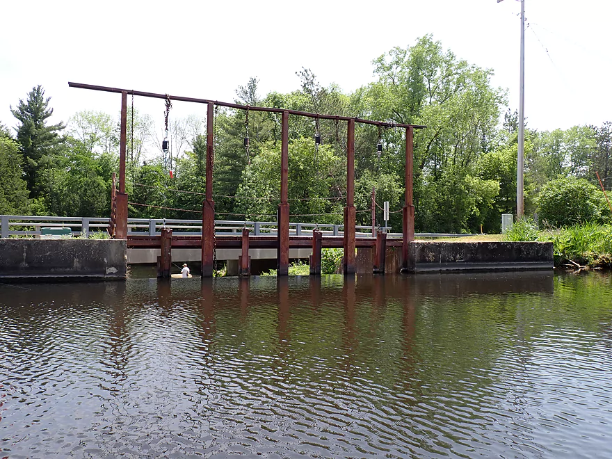
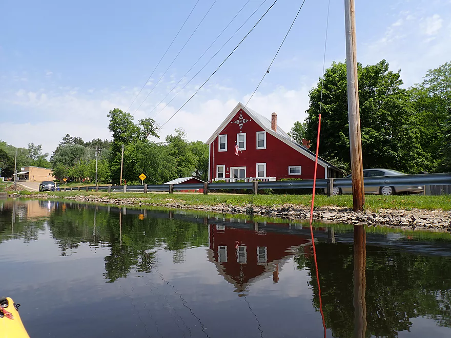
Looking at the dam
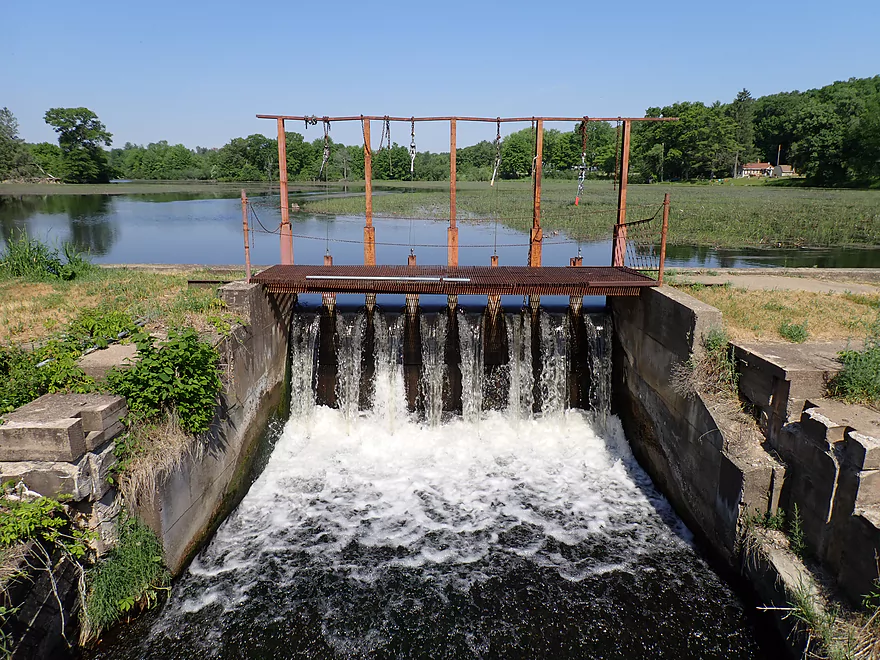
Reverse angle
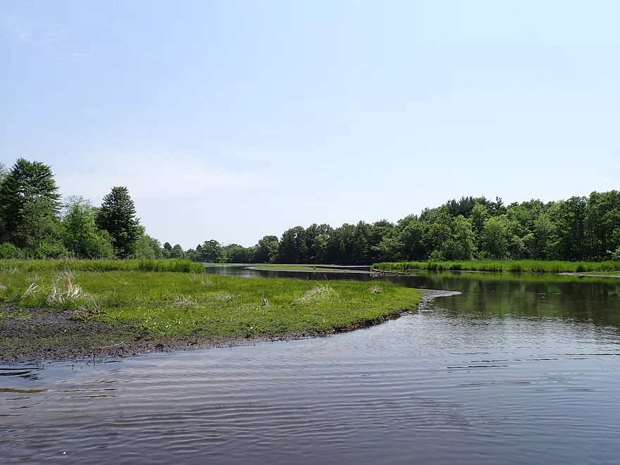
Looking upstream at the pond
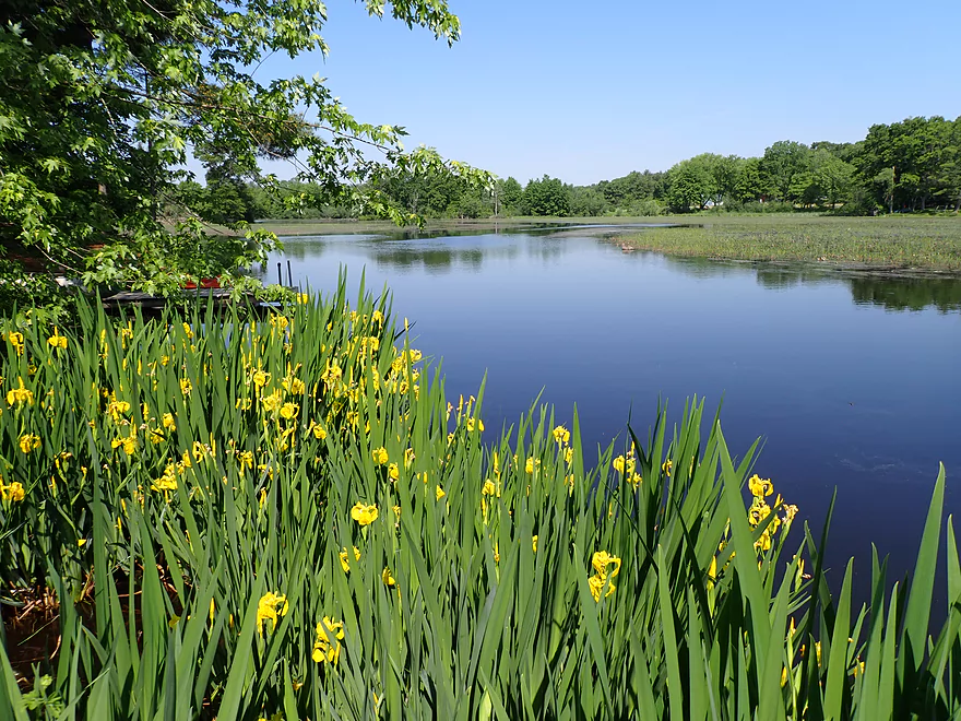
Scenic view framed by yellow flag irises
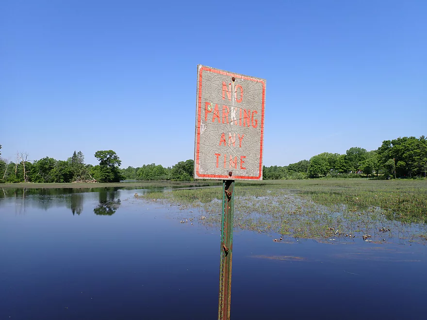
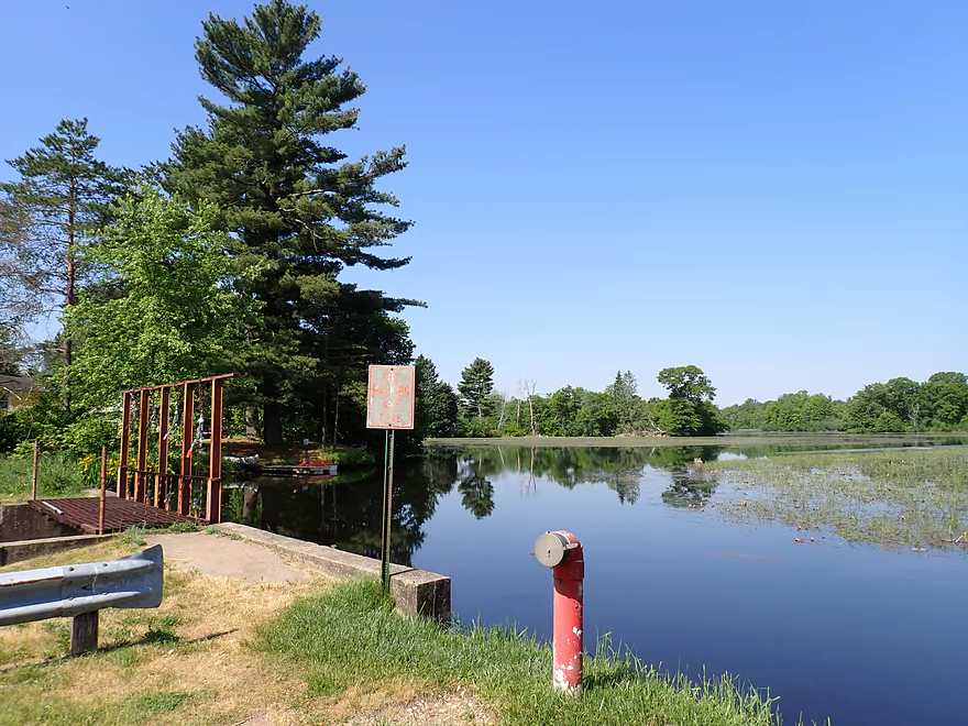
Parking is not allowed by the dam
Heading north to the millrace
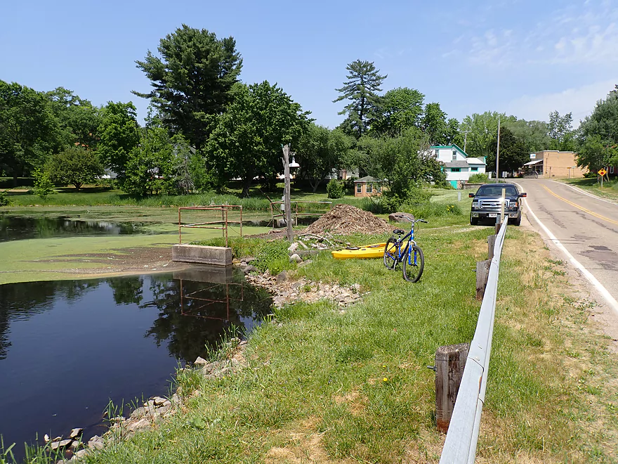
Most dam fishermen actually park by the millrace
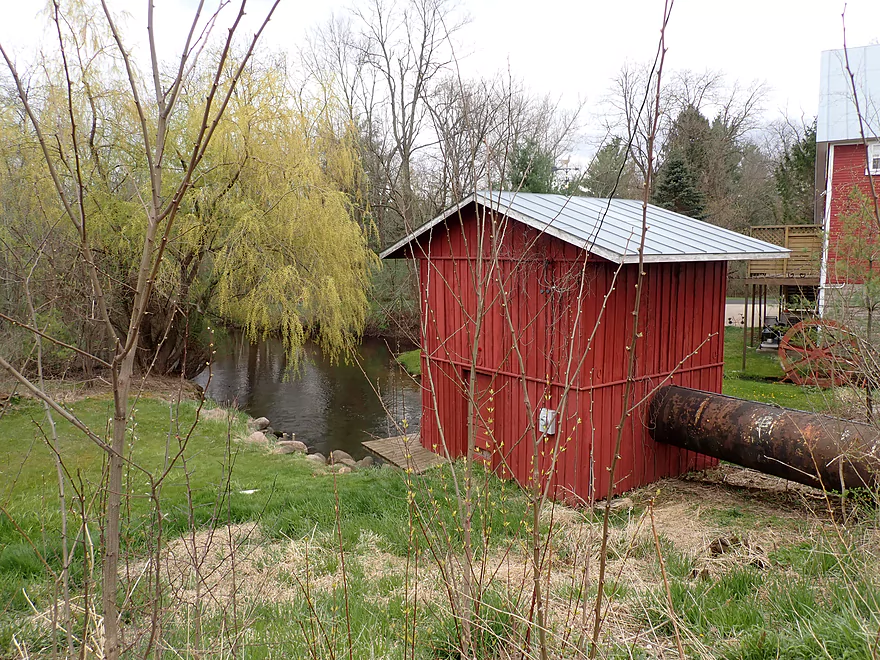
Millrace penstock (the old mill wheel can be seen in the background)
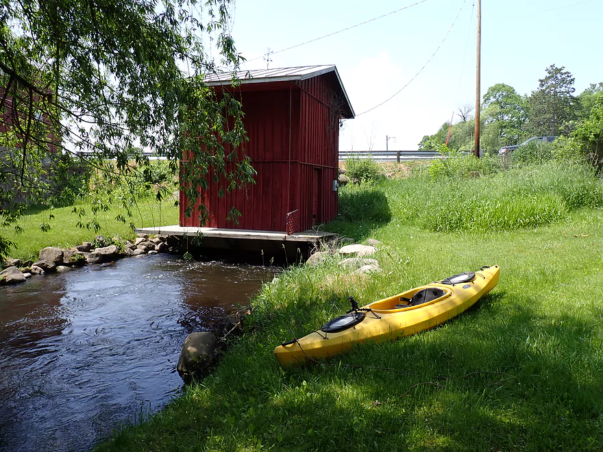
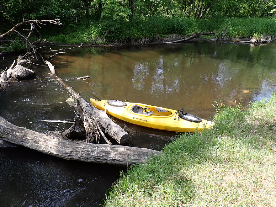
End of the portage
Back on the river which stays rocky
Nice shoreline hostas
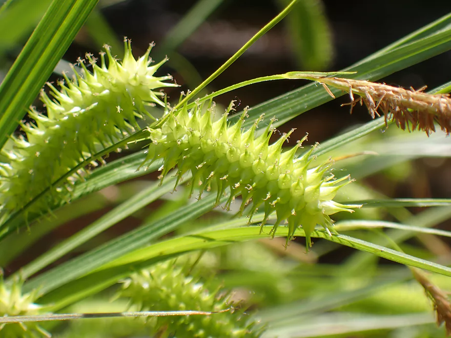
Seedheads of porcupine sedge look like little caterpillars
Still some minor rapids, but nothing major after the dam
Some bigger boulders
This reminded me a lot of the Waupaca River
Quaint bridge
More small cottages
Escapee pier
A lot of squirrel bridges on this stretch
Ferns were a common sight
Last of the boulders
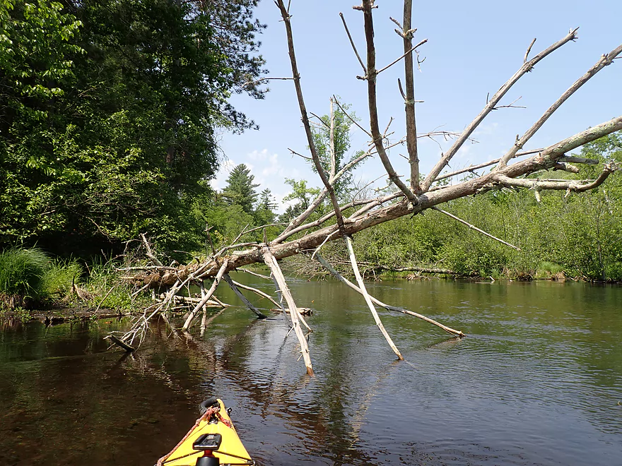
Only logjam portage of the trip
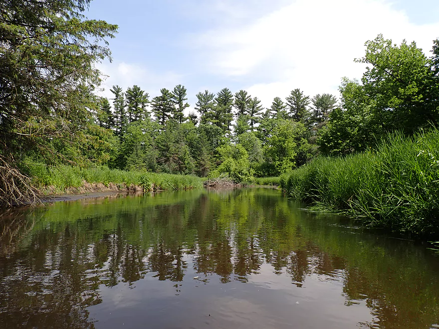
Great to see pines on the Pine
Guillotine tree
This private bridge with large guardrails means the take-out is coming up soon
A very hidden take-out
Ending the trip at the 26th Road Wayside
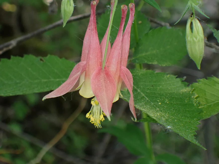
A single columbine flower
The bank is a bit steep here but parking is good
Make sure to check out the interior of the covered bridge after a trip
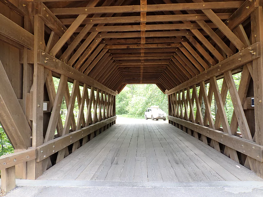
Fantastic architecture
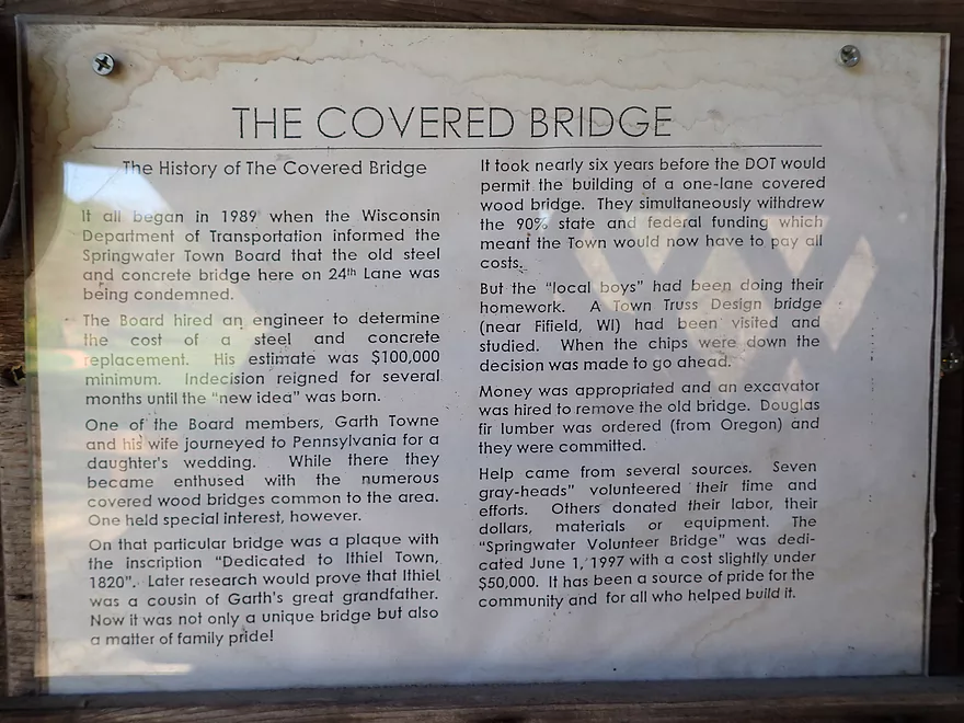
History of the bridge
There is also a public park next to the covered bridge
Pine River – Saxeville

Wisconsin has many “Pine Rivers”, but one of the nicer and more overlooked “Pines” is in Waushara County located halfway between Oshkosh and Wisconsin Rapids. Part of the reason for its obscurity is that it is overshadowed by its more popular neighbors (Waupaca and Crystal Rivers to the north…and the White and Mecan Rivers to the south). But part of it is also that a number of legs have logjams. Not all do though and there are some nice stretches if you plan carefully.
In May of 2020 I did a trip upstream from Saxeville which in many ways was a wonderful and very scenic trip, but it just had too many major logjams (9 portages were required). After the trip, I scouted the river downstream close to Saxeville and really liked what I saw. Finally three years later I was able to return to check it out.
For this trip, I decided to launch at Hwy A which would slightly overlap with my 2020 paddle. My take-out three years ago was Covered Bridge Park, but I didn’t want to leave my gear there during the shuttle. It’s a somewhat popular park and I didn’t want people nosing around my “abandoned” equipment. The stretch between Hwy A and Covered Bridge Park is fairly short (0.4 miles). It’s nice with a few pine trees, boulders, thick woods and good current. Unfortunately there was a tree down here (that wasn’t three years ago) that required a tight limbo.
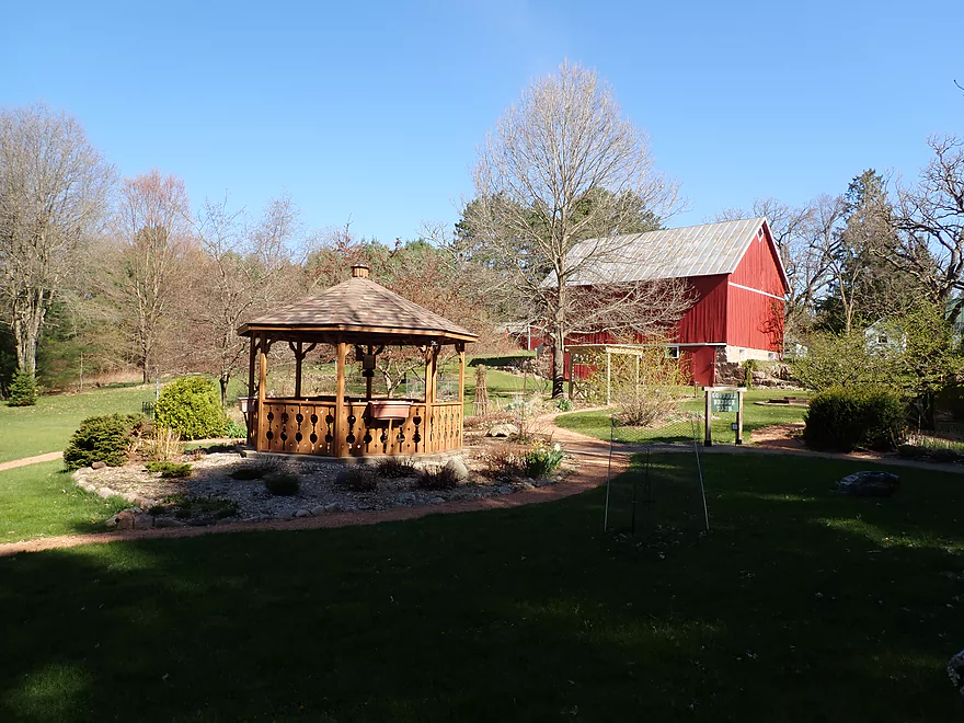
One of the highlights of the trip is Covered Bridge Park. Here a rustic covered wooden bridge crosses the river. It used to be even more striking, but sadly its shingles were replaced with an ugly metal roof. Northwest of the bridge is a small park where you can leave your car and take pictures.
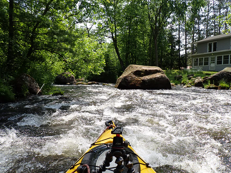
The next half-mile (Covered Bridge to the Portage Street bridge) is the most dramatic and scenic leg on the entire river. Starting under the covered bridge, the current picks up with multiple rapids and boulder gardens. The further downstream I went, the bigger and stronger the rapids got. It was amazing scenery rivaling the best features of the Waupaca River, but because of the harsh June sunlight and narrow tree tree canopies I don’t think my photos did it justice.
As a whitewater run, it was pretty cool because of the narrow channels and granite boulders. But there wasn’t much room to navigate and tight quick turns were required to get around some huge boulders. Unfortunately near the end, there weren’t many eddies where you could take a break. I couldn’t reset my camera in time and missed taking video of some of the stronger and more impressive rapids. I know my videos aren’t the most professional, but I do think of them as valuable research tools especially for whitewater and 99% of the time I always include the strongest pitches. I thought at first it wasn’t a big deal that I missed some of the rapids, as I would just rerun them, but there were private cottages everywhere and while I didn’t see many people I could “feel their eyes” on my neck and I wasn’t enthused about confronting a homeowner as I used their lawn to rerun some rapids.
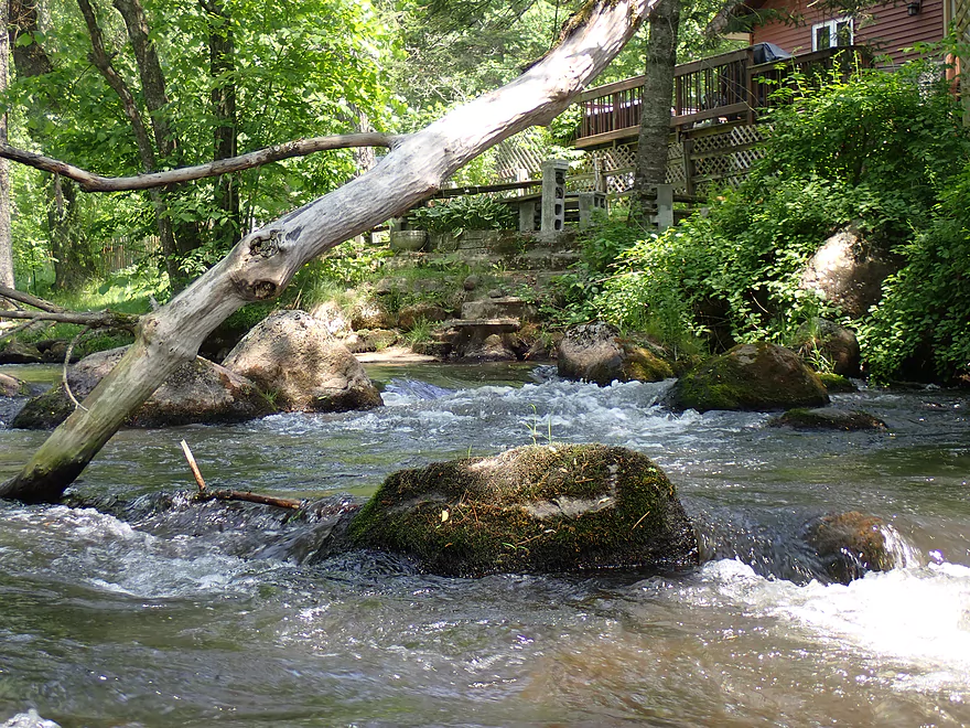
The roughest rapids were located at the end…these required very tight turns, a crazy hard left to avoid a nasty downed tree, and a careful thrust to make it through a narrow gap. For these reasons I would rate them as Class 3 and only suitable for skilled paddlers.
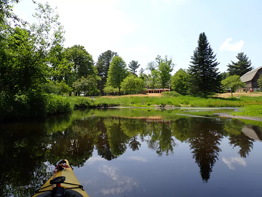
Past Portage Street (a gorgeous stone arch bridge) the river changes dramatically. It becomes marshy and impounded because of a downstream dam. Many kayakers don’t care for marsh paddles, but I like them for their open scenery, flowers, marsh plants, and insects. This millpond had some of that charm, but it was insanely shallow. The dam acts as a sediment trap and the impounded lake has largely filled in. There were channels deep enough to paddle, but sometimes you had to wade to get to them. At times the wading was on firm substrate, but sometimes it was soft and I had to use test pokes from my paddle to see where I could step. It’s tragic that the river has filled in like this. It’s quite possible the area originally had impressive boulder gardens, rapids, and maybe even a waterfall (that’s usually where dams were built). Most of that is now likely buried under many feet of water and muck.
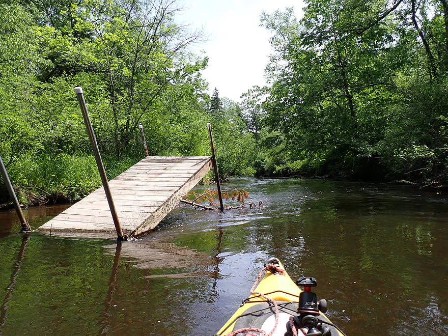
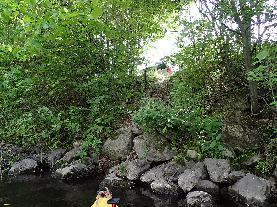
I finally made it to Hwy W and the dam which required a portage. I had a choice. I could portage the south end (main channel), but this would have been difficult as there is a guardrail and the shore re-entry bank is steep. Instead I chose to get out by the north millrace, crossed Hwy W, and then re-entered by the old powerhouse and penstock (which based on its hum seemed to be still active). I didn’t dally during the portage as the downstream bank/shore is posted. While I was legally within my rights to portage the dam/millrace, I didn’t want to waste time getting into an unneeded debate with a local landowner over DNR portage rules.
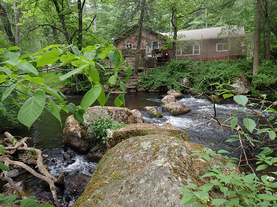
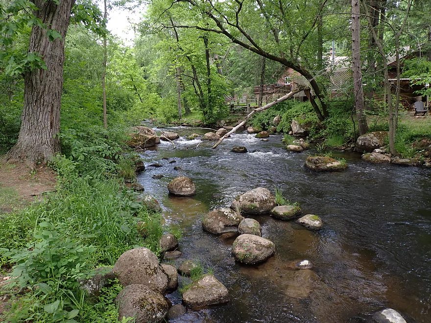
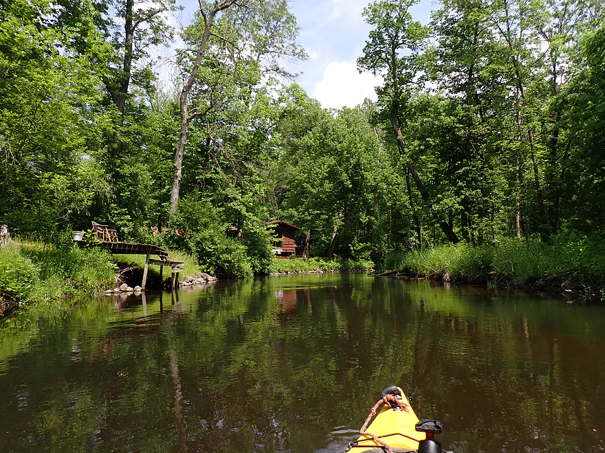
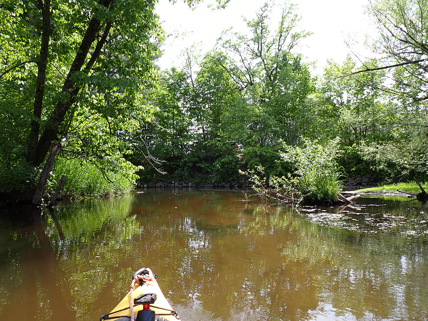
The river below the dam was surprisingly nice. Because the dam acts as a sediment trap, the downstream side has been starved from natural mud. This has left the lower river quite clean with a nice pebble bottom and a number of boulders in the water. There are many homes along the river here (mostly clustered around Nutter Street) and typically I consider this a bad thing, but many of them were surprisingly nice small cottages (not McMansions) with rustic wood and stone exteriors, and naturally landscaped shorelines (a lot of stone riprap, hostas, large trees, ferns, and skunk cabbage). It was very reminiscent of the Crystal River just 10 miles to the north and I wouldn’t be surprised if they shared a similar developer).
I was worried about logjams and low bridges, but for the entire trip I only had to portage one jam. There was significant evidence of cleanup work and I saw a number of kayaks by the cottages, so I assume locals keep this stretch somewhat open.
As the river continued to flow downstream away from the dam, it started to lose its rocks and became a bit more muddy. But it was still a really nice paddle with many fantastic tree canopies. Ironically I don’t think of pines when it comes to the Pine River (despite its namesake), so I was pleasantly surprised near the end of the trip to see a fantastic stretch of white pines, tamaracks, and oaks.
My take-out was an obscure 26th Road shoulder access, that likely only a few local fishermen know about. I had to be careful as the wayside is hidden and would have been easy to accidentally paddle past (it would be a long trip to the next bridge). The wayside bank was steeper than expected making dragging my boat up to the car a bit more difficult, but it was all manageable.
In summary this was a great trip and is likely the best and most scenic leg on the river. However it won’t be for everyone, and if you do it, you may only want to do part of what I did.
Quick Summary:
- A to Covered Bridge: Ok, but nothing special.
- Covered Bridge to Portage Street: Amazing with jaw dropping scenery…but only suitable for those with serious whitewater experience and with short boats that can make tight quick turns. Hopefully locals removed the downed tree I mentioned and rearranged some of the rocks to make this a more viable whitewater run.
- Portage Street to Hwy W: This is the millpond and can be paddled, but many parts are silted in. Careful navigation and some wading is required to find navigable stretches.
- Hwy W Dam to Portage Street Pull-off: Launching from the dam would be tricky but doable. The stretch below the dam is a nice trip though.
Sights included a few fish and lots of dragonflies. The highlight was a mink who hissed at me after I startled him (see 6:44 in video).
Hwy A: This is a decent bridge access occasionally used by trout fishermen.
Alternate Put-ins:
- Covered Bridge Park (0.2 miles downstream from Hwy A): This is an excellent public access and is located by the covered bridge. You might want to launch here instead of A to avoid an upstream logjam that required a tight limbo.
- Portage Street (0.6 miles downstream from Hwy A): Don’t launch from the downstream/west side where there is a No Trespassing sign. I think you can launch from the downstream/east side, or the upstream/west which is part of a restaurant. I don’t think the restaurant would mind if you used their shore to launch (their customers hang out by the river all the time), but you should get their permission before doing so. The stretch between Covered Bridge Park and Portage Street is exceptionally scenic with large boulders, but rough with Class 3 rapids.
- Hwy W (1.4 miles downstream from Covered Bridge Park): You can launch by the dam where fishermen usually hang out. But you would have to hoist your boat over a guardrail and down a steep bank. You can’t park by the dam, so what most fishermen do is park to the north by the millrace where there is a small pull-off. They then hike 300′ south to access the dam. It may be tempting to launch from the millrace which has a much shallower slope but a sign marks this as No Trespassing. You would only be able to go over this land if part of a portage (allowed by Wisconsin law). Why launch here? Some paddlers may not want to deal with the millpond that is quite silted in and may require some wading during low water levels.
26th Road Pull-off: This is an obscure shoulder access to the river that only local fishermen know about. So obscure it’s not on Google Maps (exact coordinates). While the area is nice and secluded, the bank by the river is steep which can make hauling your boat out difficult. Also note, the access is somewhat obscured by trees and easy to miss. Bring a GPS or carefully note area landmarks before doing a trip.
Alternate Take-outs:
- Portage Street (3.1 miles upstream from the 26th Road Pull-off): Don’t take out from the downstream/west side where there is a No Trespassing sign. I think you can take-out from the downstream/east side, or the upstream/west shore which is owned by an area restaurant. If you use restaurant land to launch, make sure to get their permission first. Whitewater paddlers only interested in the main rapids might want to take out here.
- Hwy W (2.3 miles upstream from the 26th Road Pull-off): You could take out by the millrace where there is parking on the upstream side of the road.
- Hwy E Dam (2.7 miles downstream from the 26th Road Pull-off): I believe you can take out by the dam on either the north or south shores, but don’t quote me on that (I haven’t scouted it). This downstream leg is tempting but I suspect logjam trouble (maybe 6 portages?). There could be less though as I know locals do some cleanup work on parts of the river.
Bike Shuttle – 26th Road Pull-off to Hwy A: 2.6 miles with 102′ of ascent. This is a super easy and very nice bike shuttle. Much of it is shaded and protected from the wind with excellent vistas of the millpond and river. You can also bike through the covered bridge as part of your shuttle route.
- Hwy A to Covered Bridge: A few Class 1 rapids. Mostly easy, although there is a minor logjam/strainer to duck past.
- Covered Bridge to Portage Street: The dense boulder field creates many rapids which get more difficult the more downstream you go, with the toughest being a long stretch near the end with few eddies where you can take a break. Scouting/portaging from the adjacent shoreline would be difficult because of all the private cottages. In several spots very tight turns are required to prevent getting pinned by huge boulders or to to get through narrow gaps in the rocks. In one case there is a tree that blocks the channel that requires an extreme left turn to get around. Because of all this, I would them rate as Class 3, and only paddlers with short boats and appropriate whitewater experience should attempt this stretch. Video of the rapids starts at 0:50.
- Portage Street to the Hwy W Dam: This is part of the millpond and mostly lacks any current but is shallow and parts may have to be waded.
- Hwy W Dam to 2th Road Pull-off: There are a number of minor rapids, but most are pretty easy and I would rate none greater than Class 1. There is one logjam to portage. There is also one low bridge that takes some limbo’ing to get under (you could always portage it instead).
Closest Gauge: Waupaca River @ Waupaca – I’m not sure I trust this gauge. The following are just rough estimates and you should always use your own judgement.
Trip Depth: 1.55′ (my 2020 trip was done at 1.94′)
Navigability Estimates: The following are rough estimates.
- < 1.4′: Maybe too shallow.
- 1.4′: Very shallow. Might be doable though. Much of the impounded lake will likely have to be waded.
- 1.5′. Good target range.
- 1.6-1.7′: Above average. Should be doable. The boulder garden may get pushy at these levels though.
- 1.8-1.9′: Higher levels. Boulder garden should only be attempted by skilled whitewater paddlers.
- 2.0-2.1′: Very high levels. Only suitable for expert paddlers.
- 2.2’+: Maybe too high for any paddling.
Detailed Overview
- 19th Road to Hwy K: 1.7 miles. A neat prospect with clear water and no logjams.
- Hwy K to Aniwa Road Shoulder: 0.7 miles. Maybe 4 logjams.
- Aniwa Road Shoulder to Aniwa Road Bridge: 1.0 miles. Good prospect but likely 5 logjams.
- Aniwa Road to Apache Road: 0.7 miles. Likely a scenic and wooded section but 2-3 logjams are likely present.
- Apache Road to Covered Bridge Road: 5.8 miles.
- Apache Road to Hwy A: 5.7 miles. Good scenery and clear water. But there are multiple portages...8 for logjams, 1 for a low bridge and 1 for a Class 2+ set of rapids that has a strainer.
- Hwy A to Covered Bridge Park: 0.2 miles. A good stretch with some boulders and rapids. There is one minor logjam that requires limbo'ing. The scenic Saxeville Covered Bridge is by the park.
- Covered Bridge Road to 26th Road Wayside: 3.5 miles.
- Covered Bridge Road to Portage Street: 0.4 miles. An incredibly scenic stretch with dense boulder gardens and rapids. Some of the rapids are Class 3 and require difficult tight turns.
- Portage Street to Hwy W/Dam: 0.8 miles. The creek widens and slows into an impounded pond. This can get shallow and some wading may be required.
- Hwy W/Dam to 26th Road Wayside: 2.3 miles. This is a very nice stretch with boulders, tree canopies, pines, and quaint cottages. There is a low bridge to duck under and one logjam to portage.
- 26th Road Wayside to Hwy E/Dam: 2.7 miles. Maybe 6 logjam portages.
- Hwy E/Dam to 28th Court: 2.2 miles. An attractive stretch with many rapids...but likely many jams...perhaps 17.
- 28th Court to Poy Sippi Community Park: 5.3 miles. A mediocre stretch guest reviewed by Denny Caneff. This is a mostly open stretch, with maybe one noteworthy logjam. Some flowage paddling is required.
- Poy Sippi to Badger Drive Landing: 10.2 miles.
- Poy Sippi to Mouth on Lake Poygan: 8.5 miles. A good stretch guest reviewed by Denny Caneff.
- Mouth on Lake Poygan to Badger Drive Landing: 1.7 miles. This is a short stretch due north on Lake Poygan to reach a landing. Big lake paddling can be dangerous...do not do this when it is windy.
Trip Map
Overview Map
Video
Photos Size: