
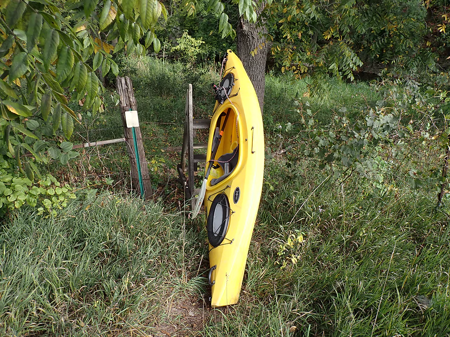
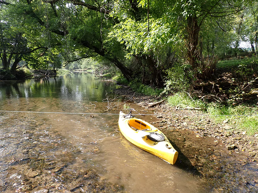
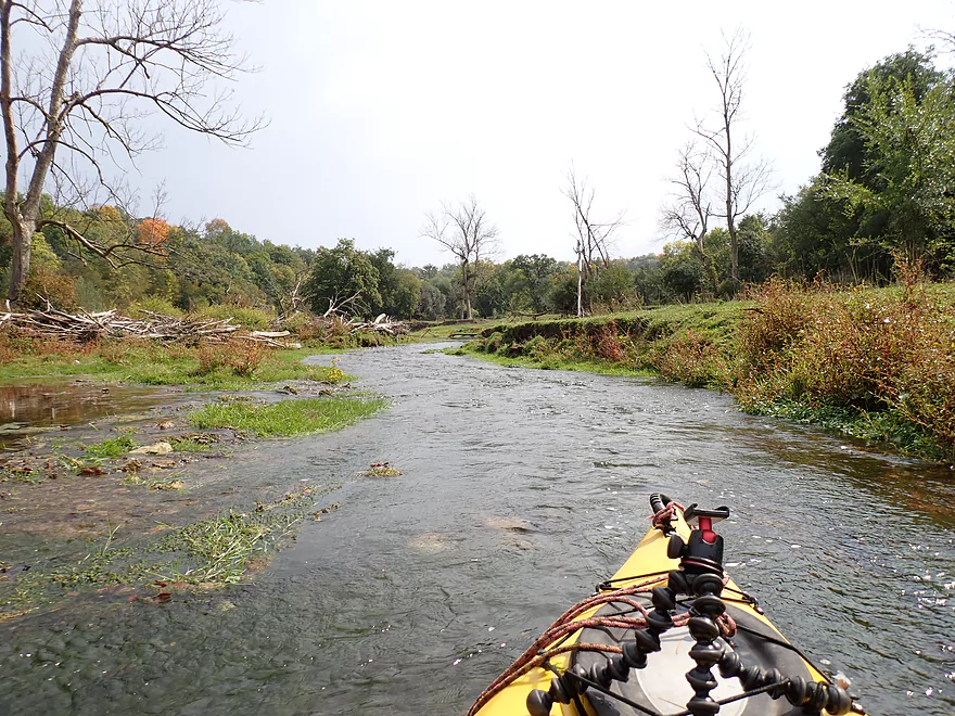
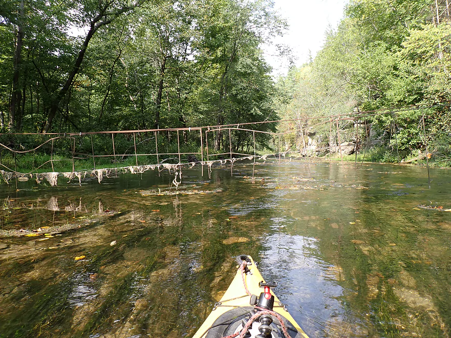
Starting the trip at Cty Road 5, where you need to hoist your boat over a stile
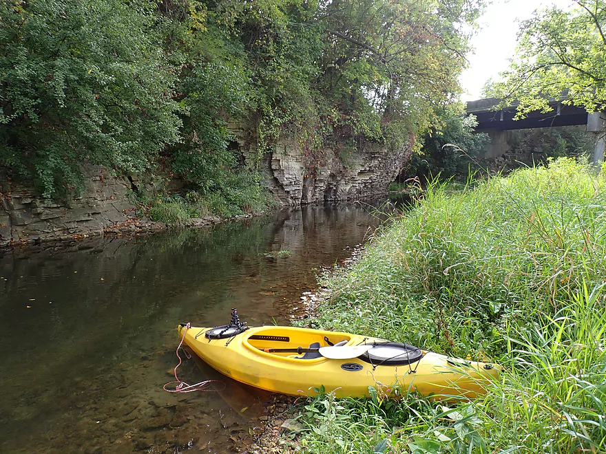
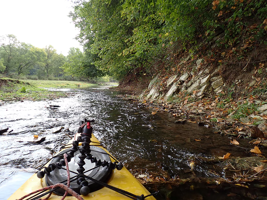
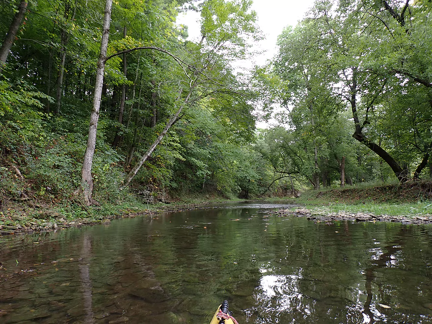
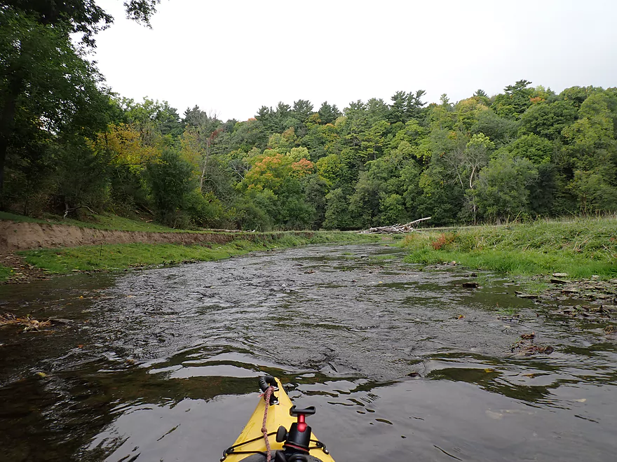
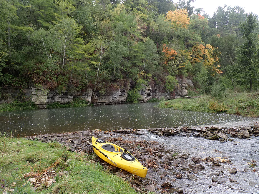
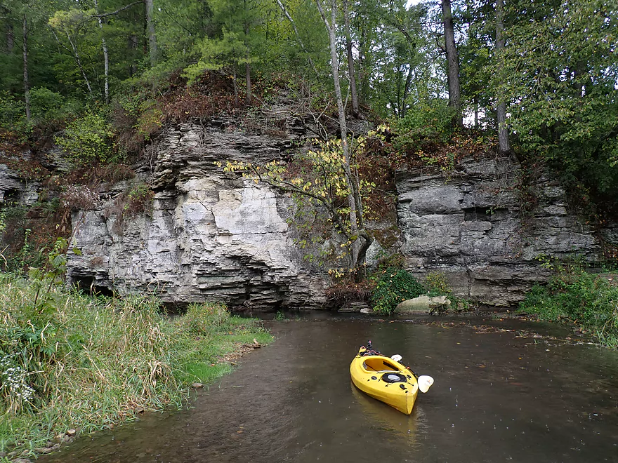
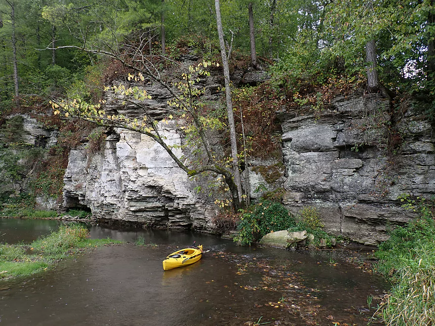
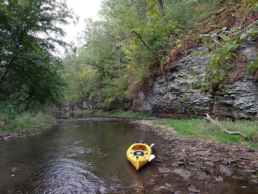
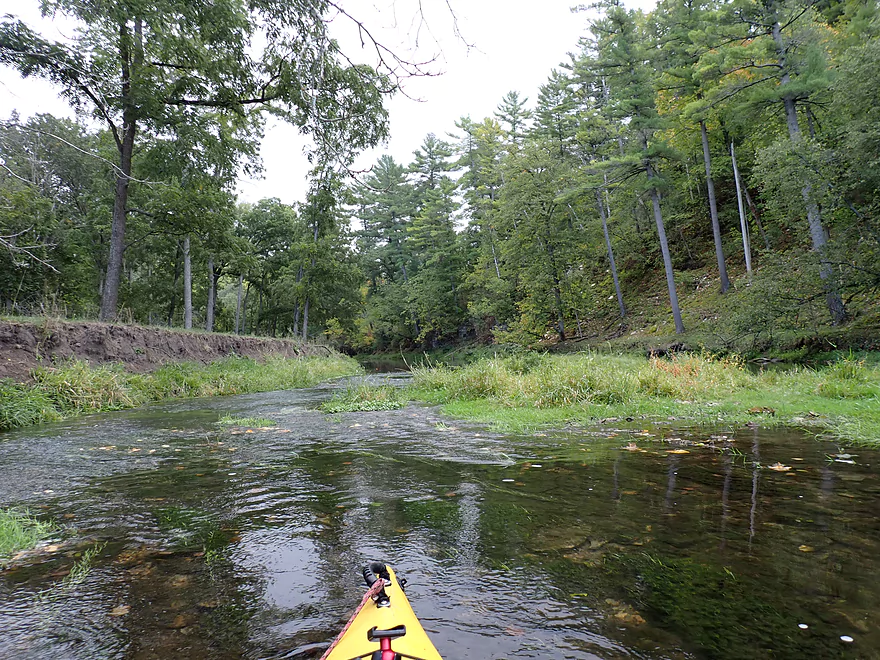
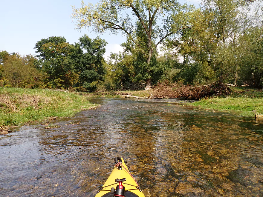
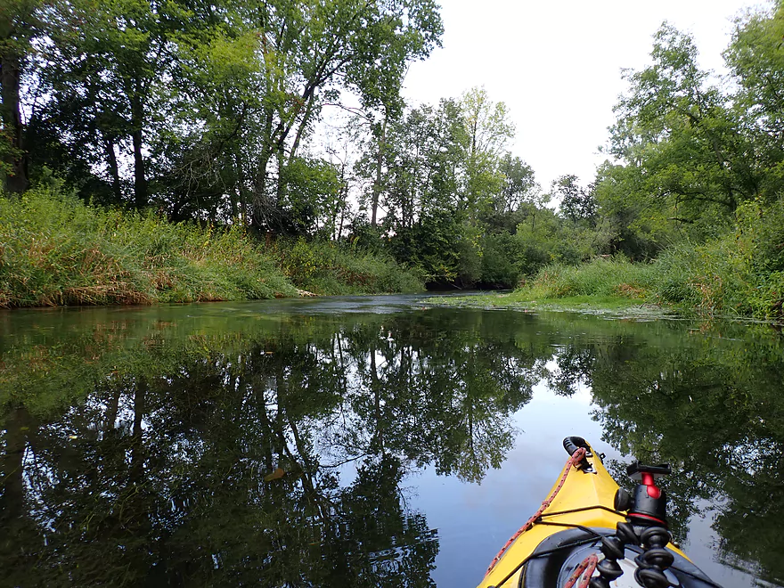
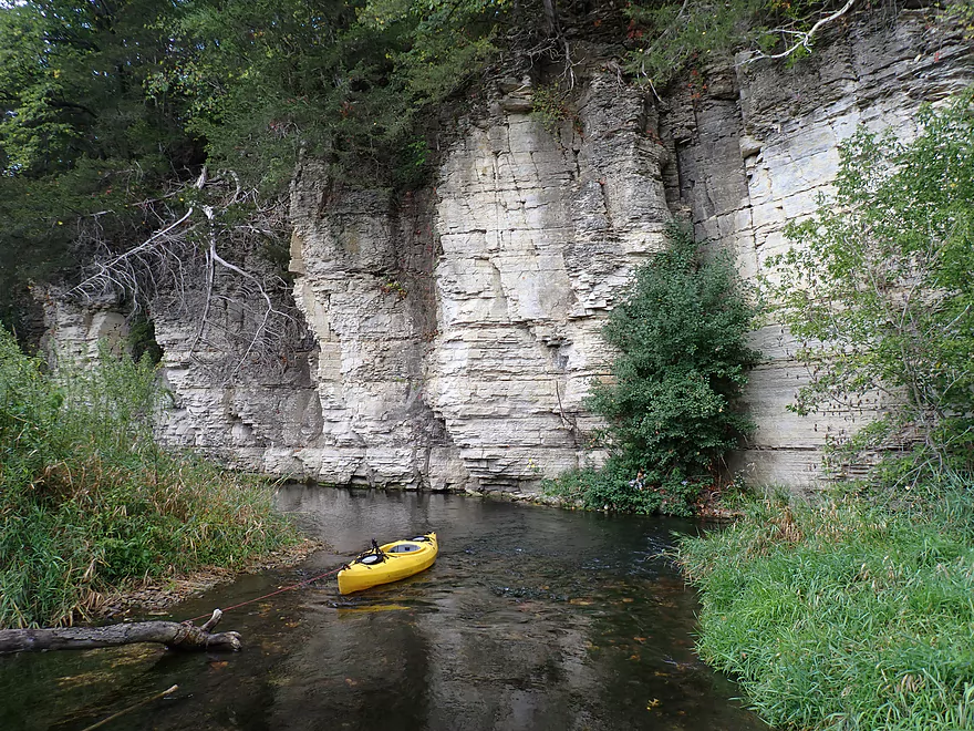
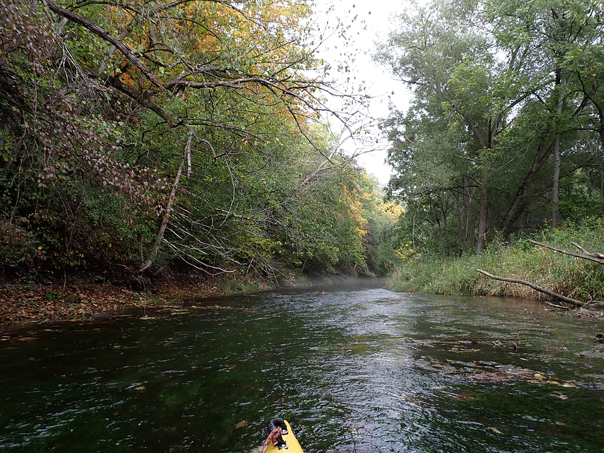
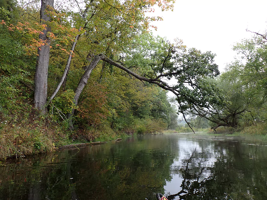
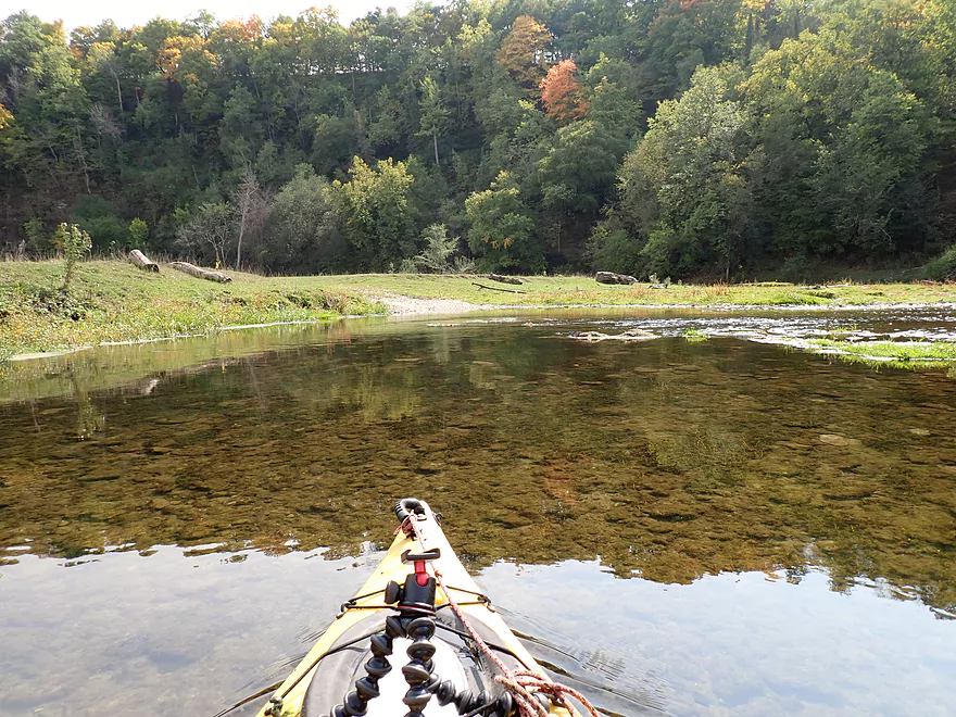
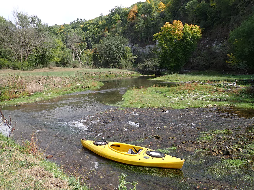
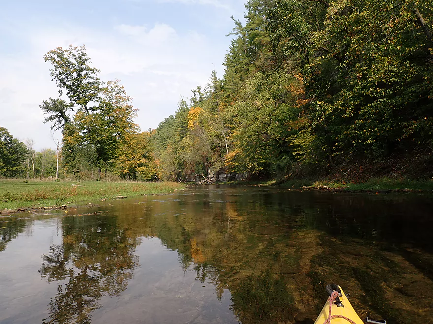
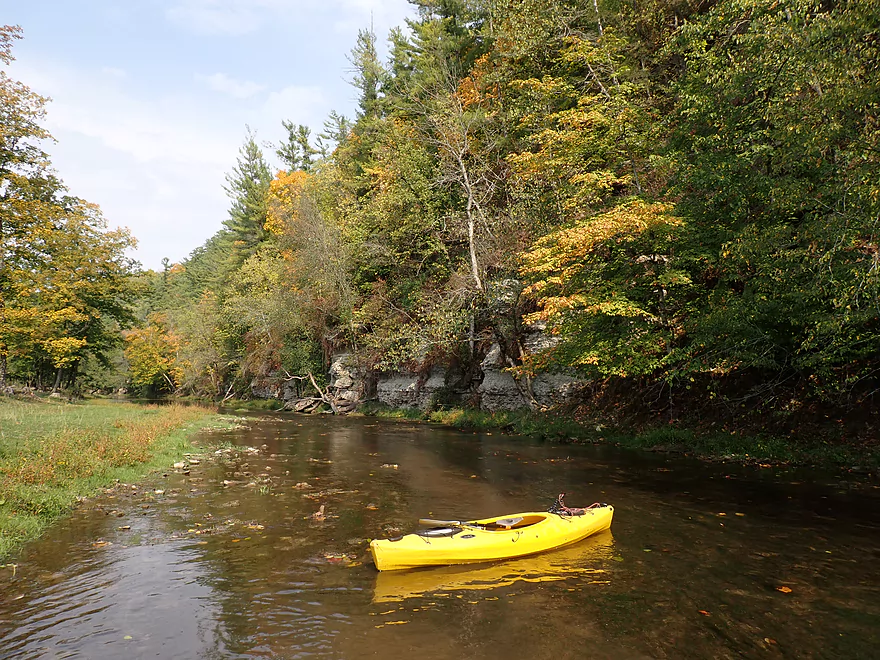
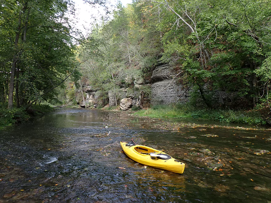
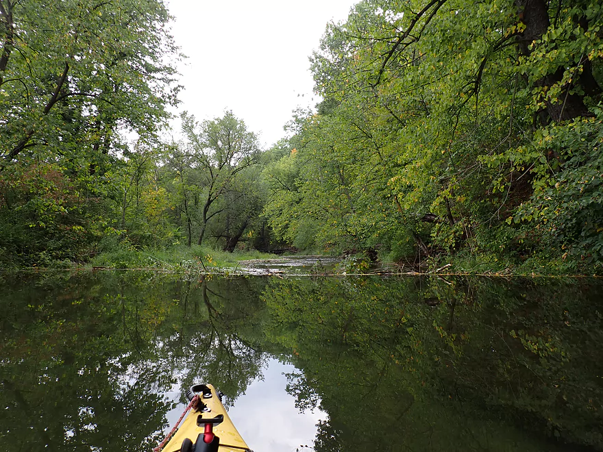
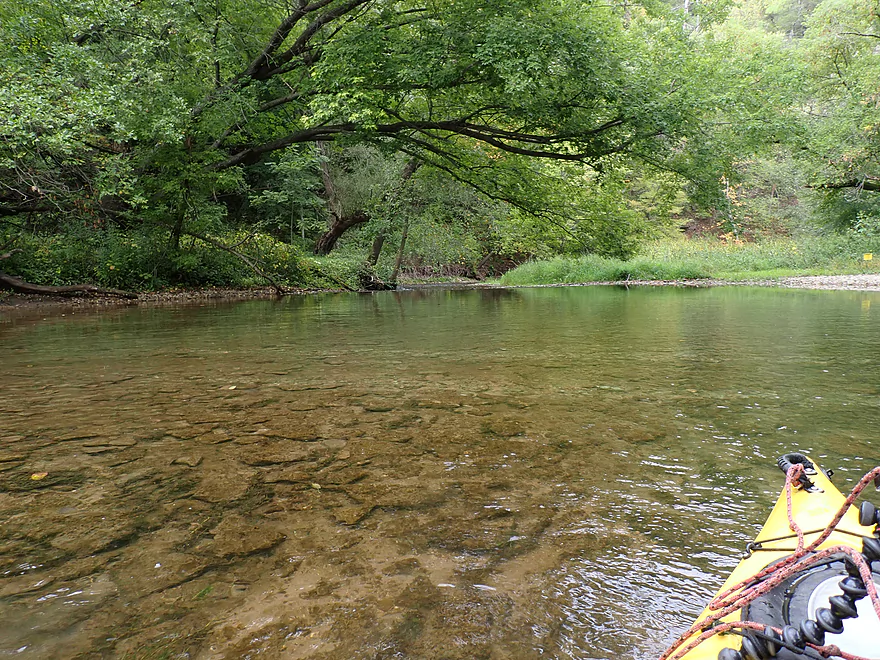
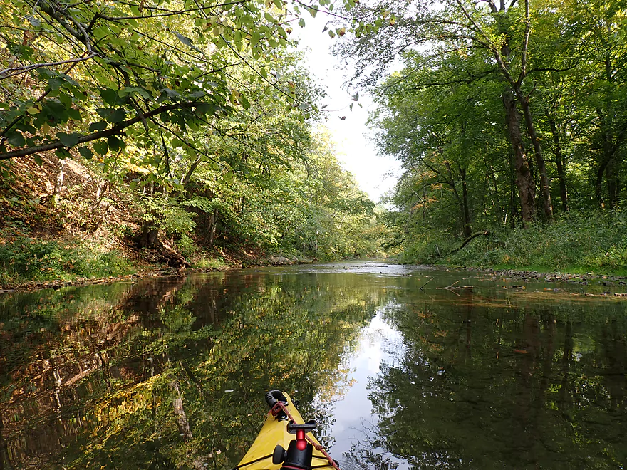
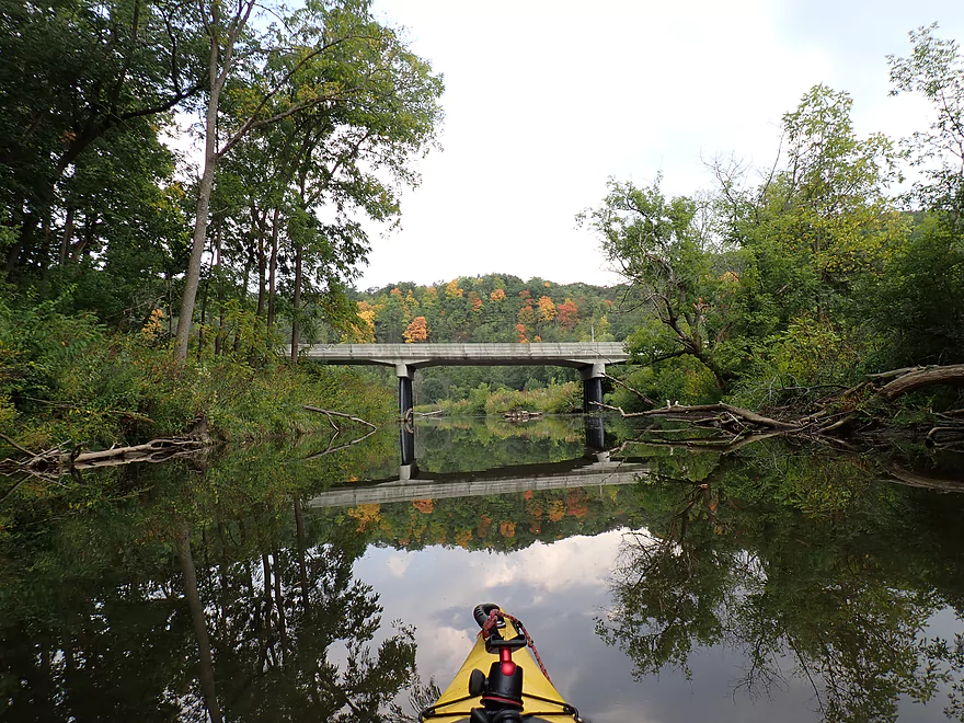
Scenic put-in
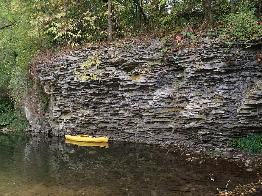
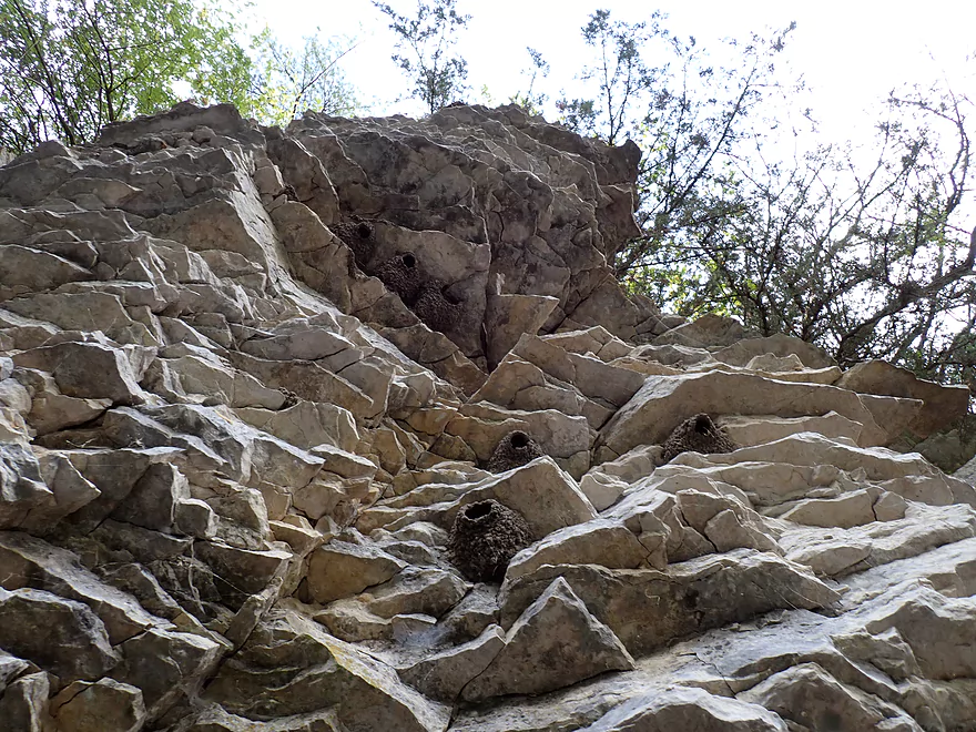
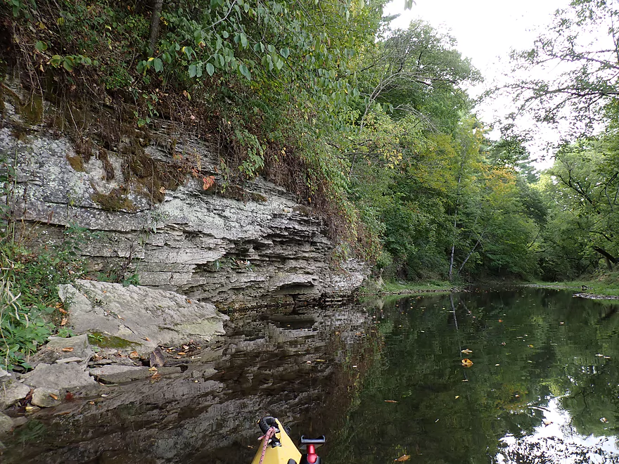
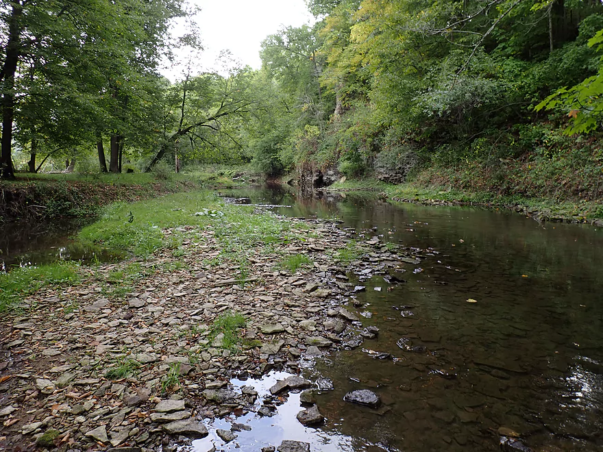
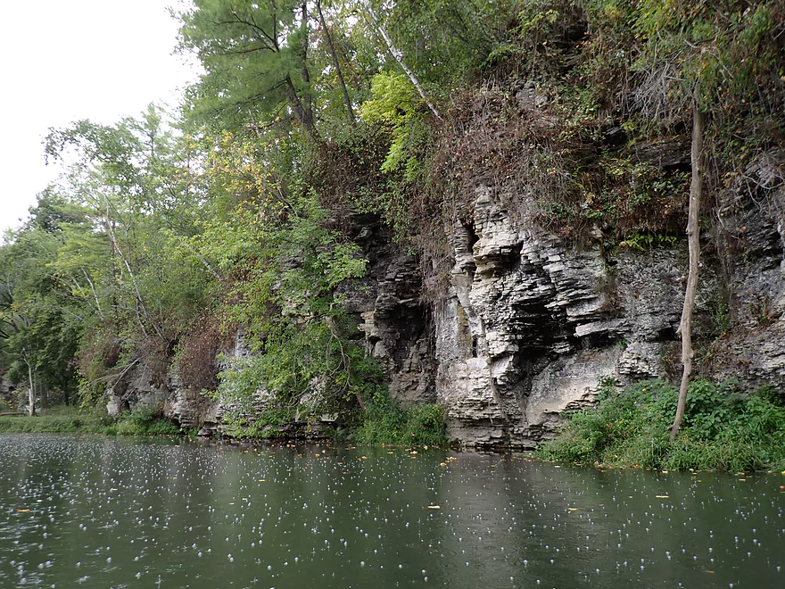
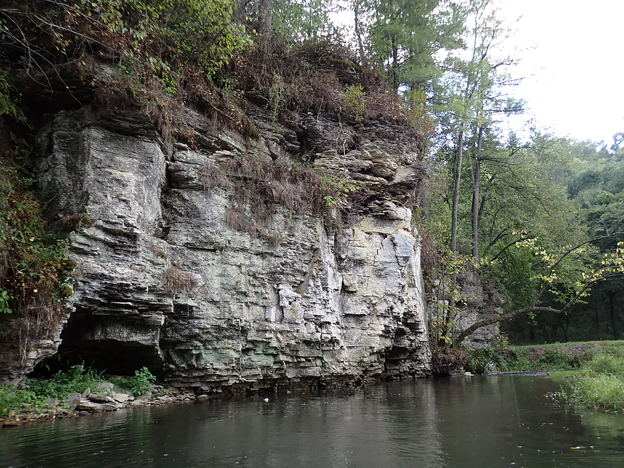
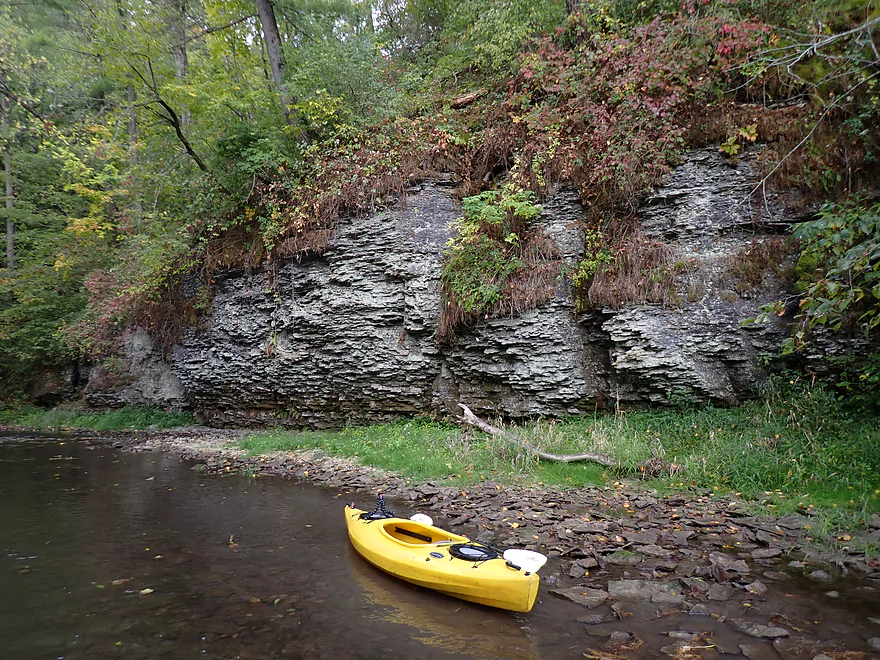
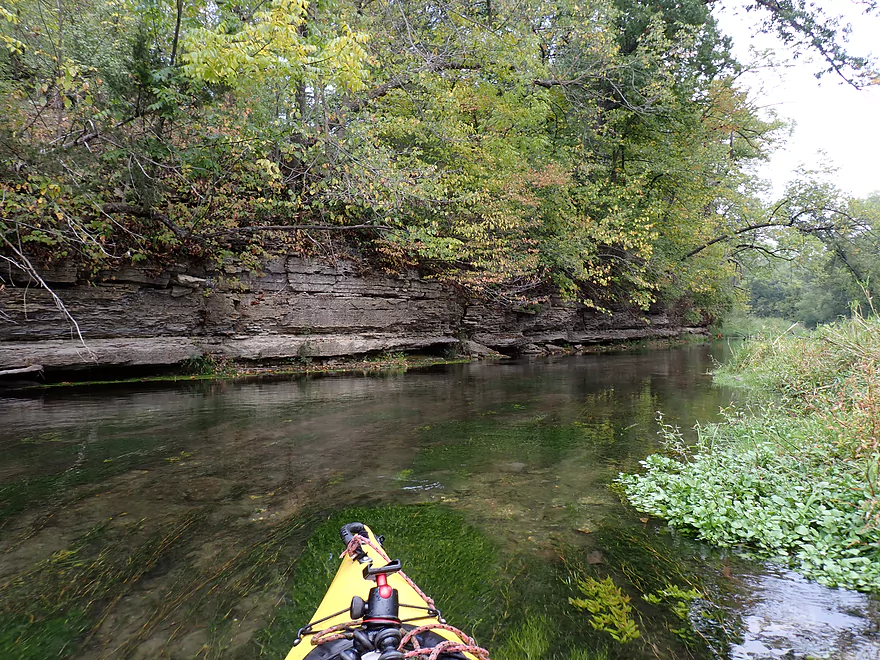
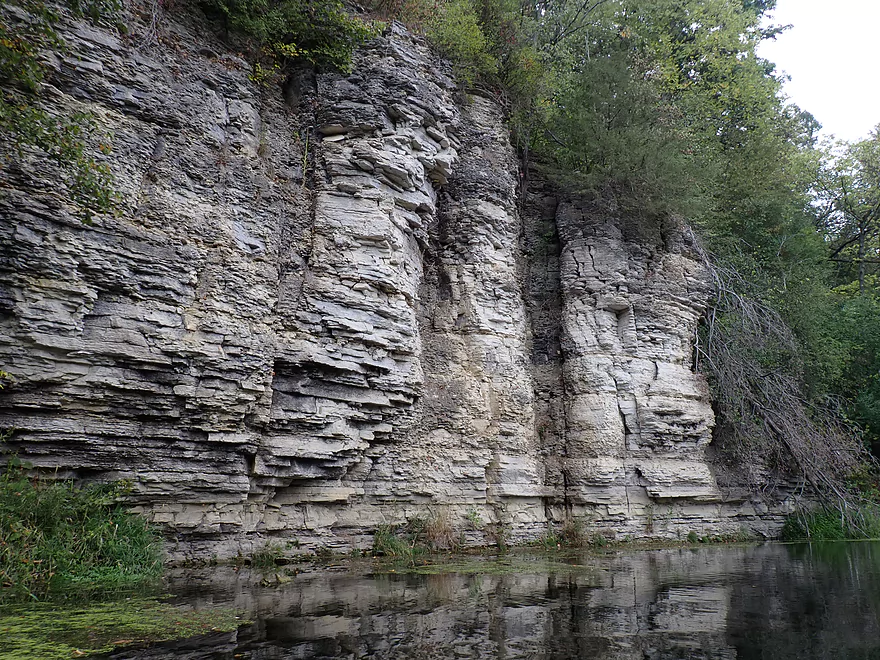
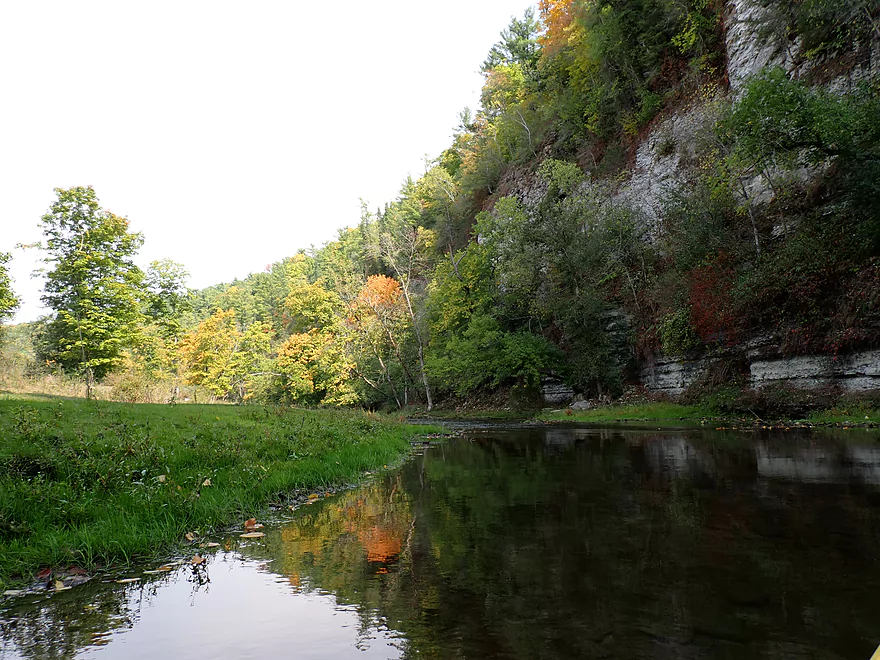
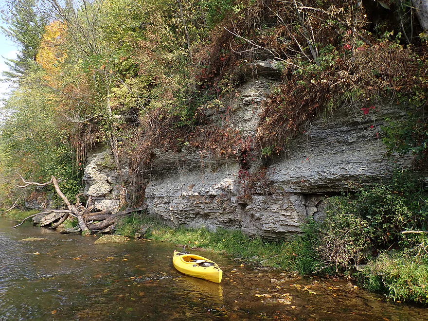
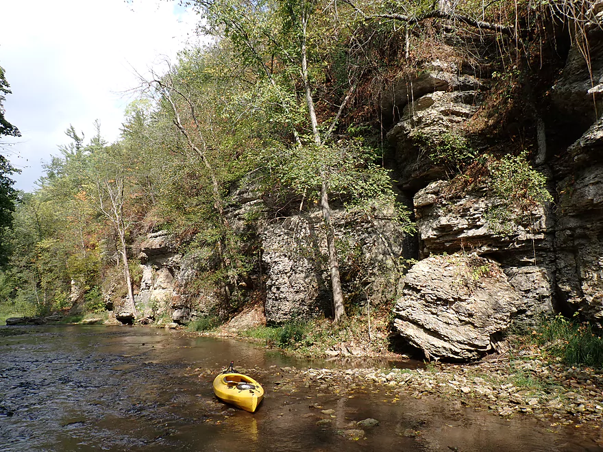
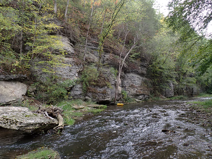
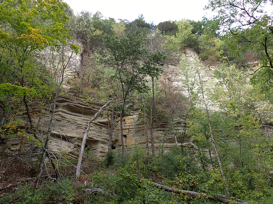
Terrific texture
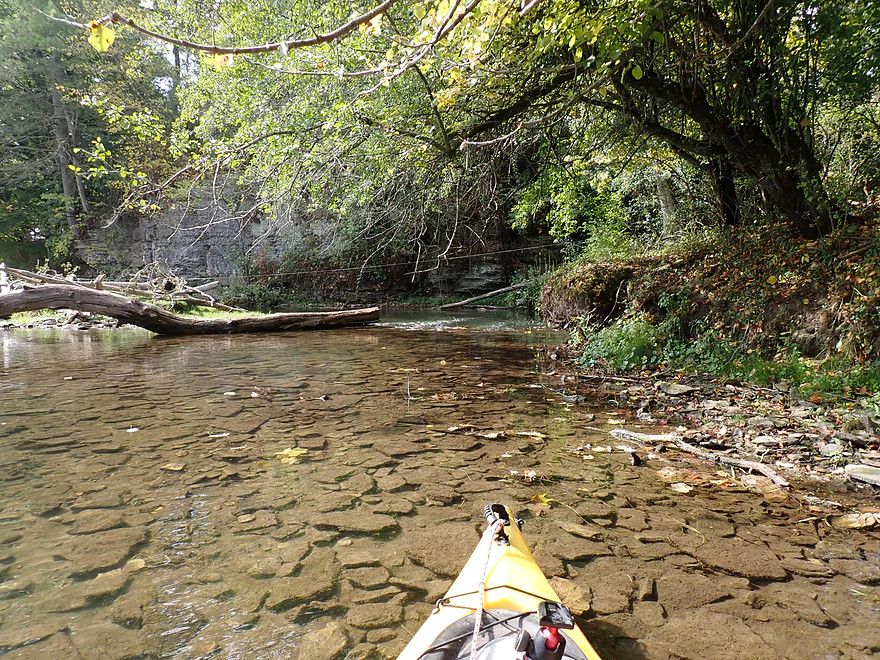
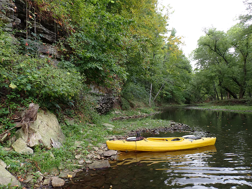
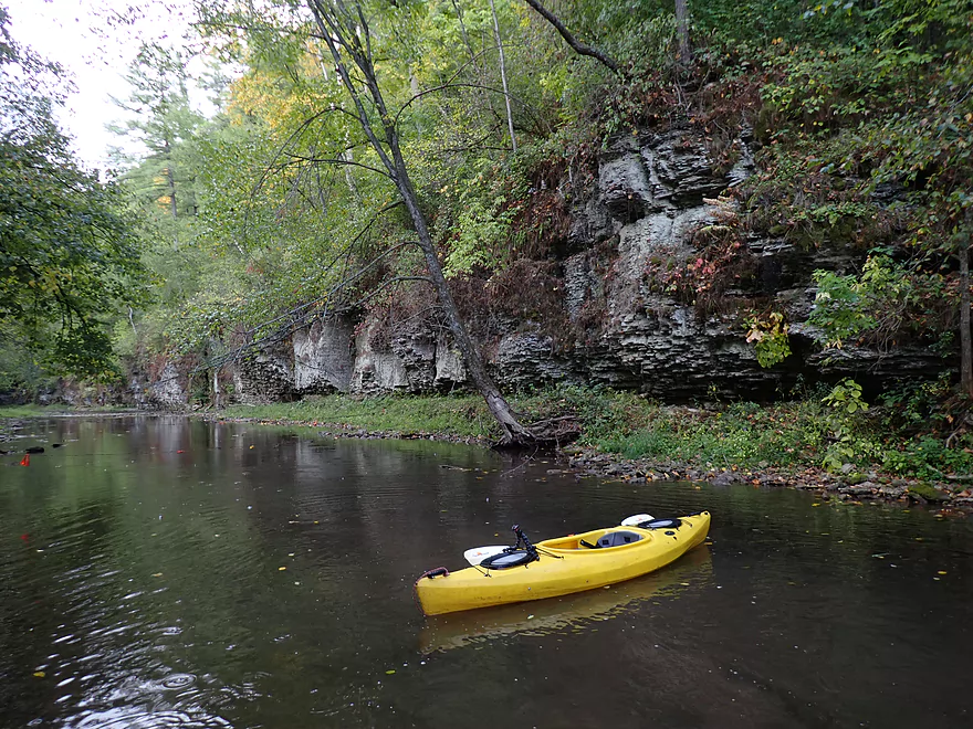
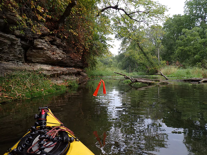
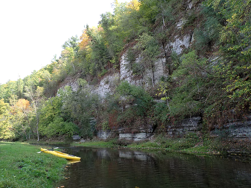
Another group of outcrops downstream from the bridge
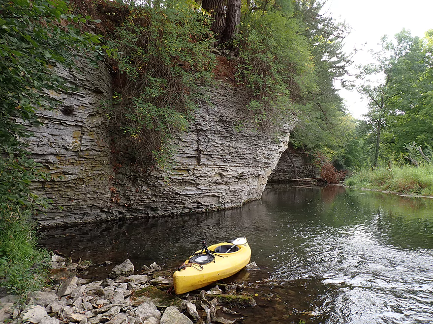
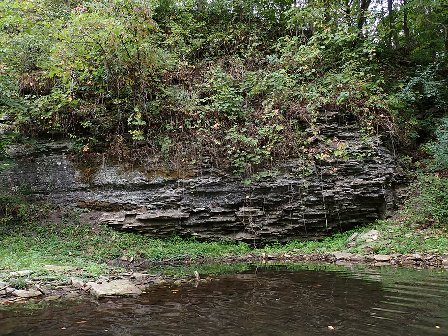
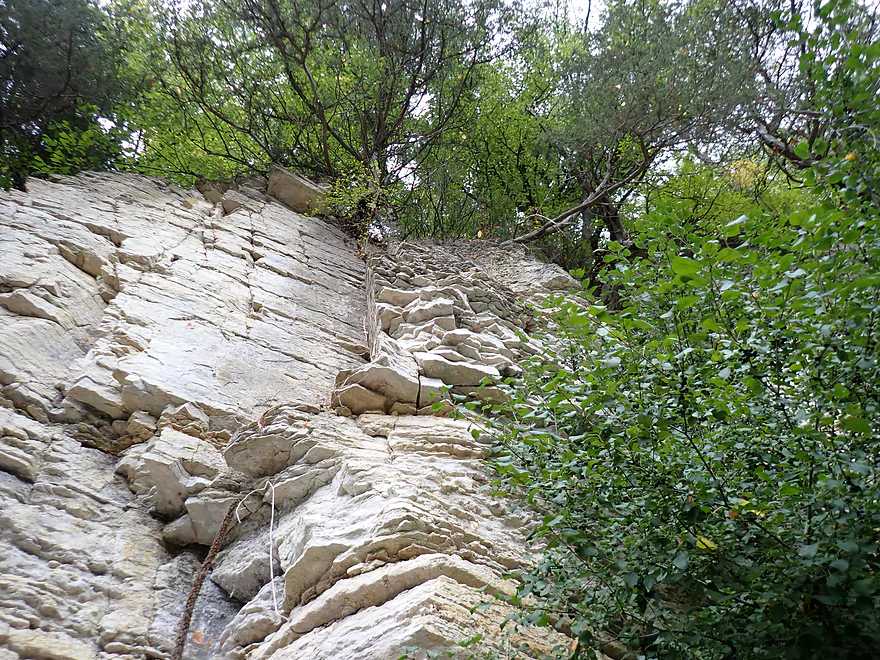
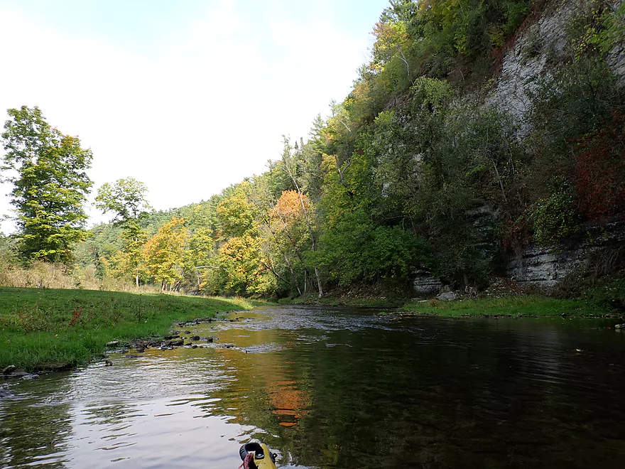
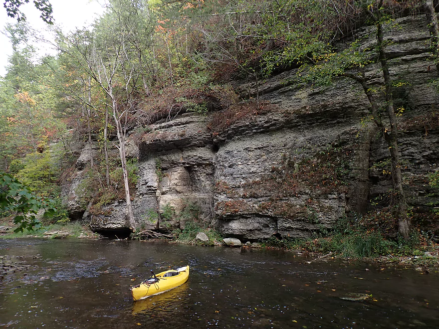
Looking up
Fence #1…very low and maybe electric…I had to hop over it
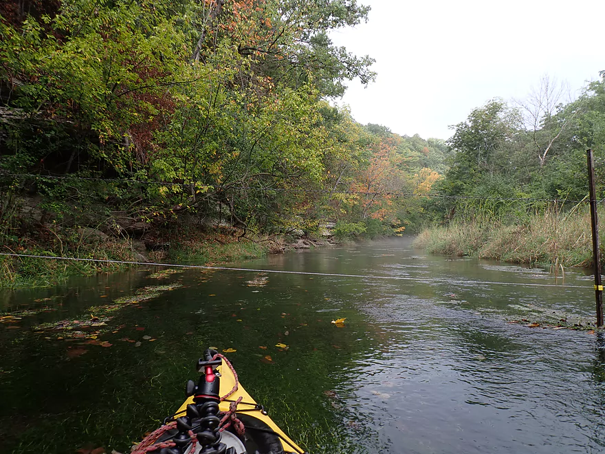
Fence #2…easy to duck under
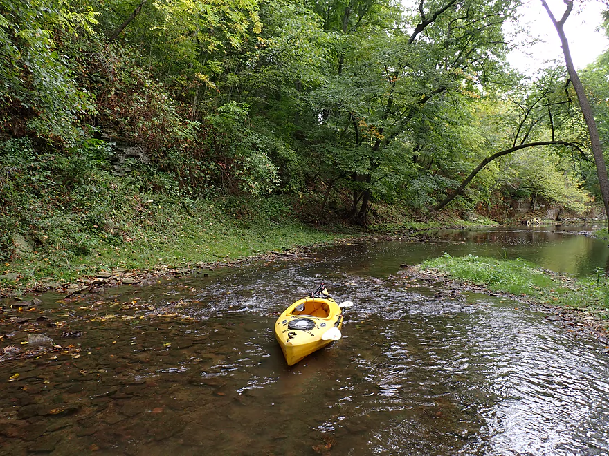
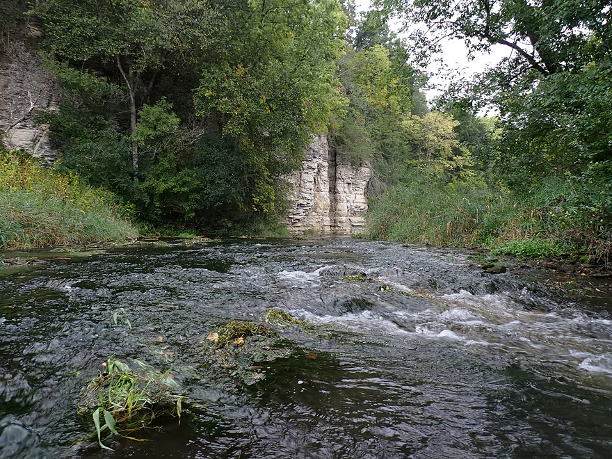
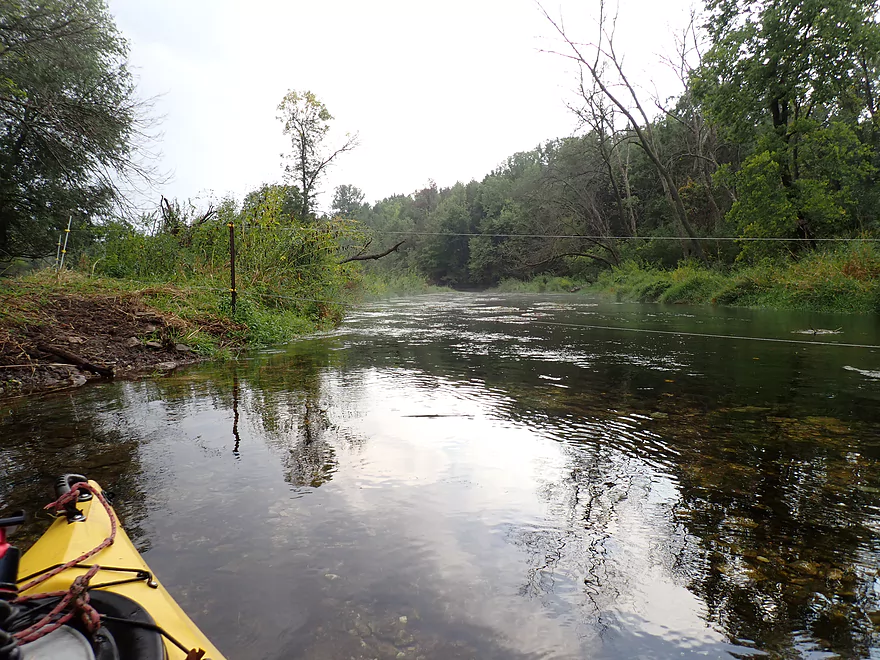
Number of light rapids…most were shallow
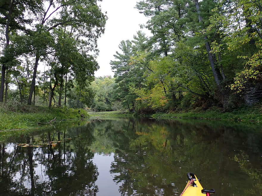
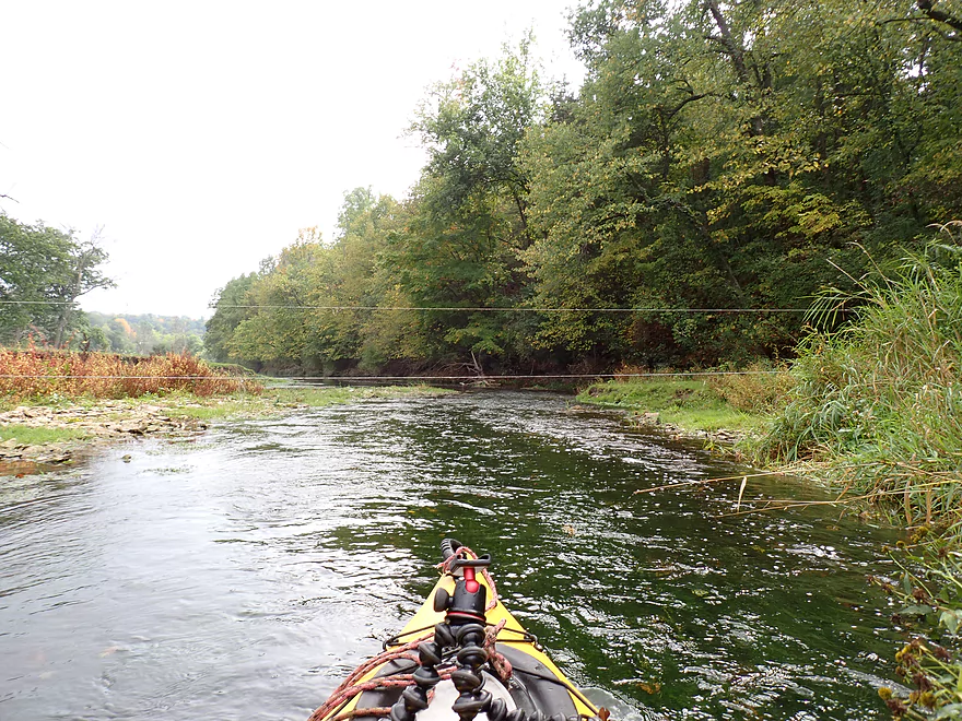
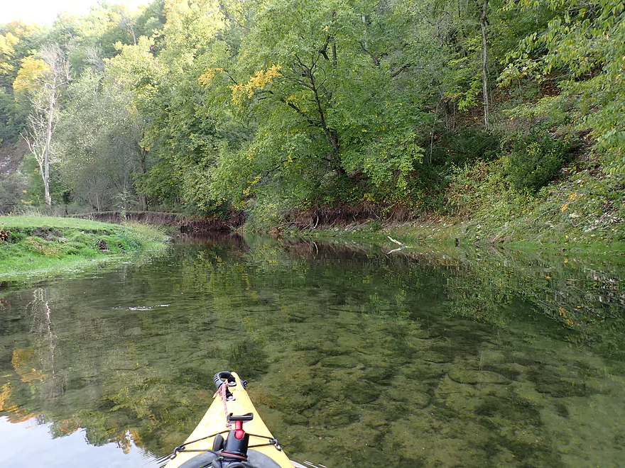
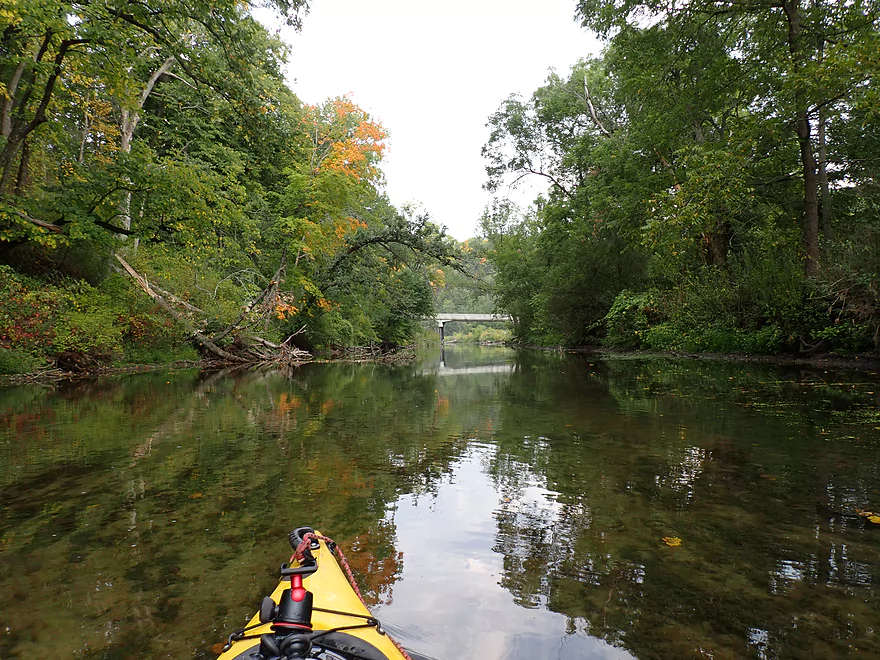
Nice wooded stretch
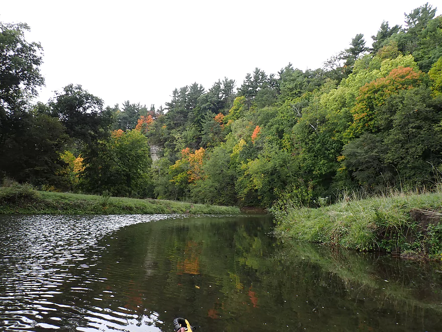
Nice pine-topped bluff
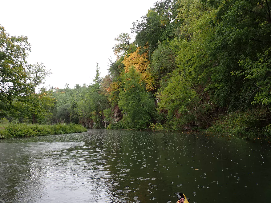
Then it started to rain!
It’s actually a neat experience to kayak in the rain
Fence #3…easy to duck under
Poorly pictured but that is fence #4…not too difficult to get past
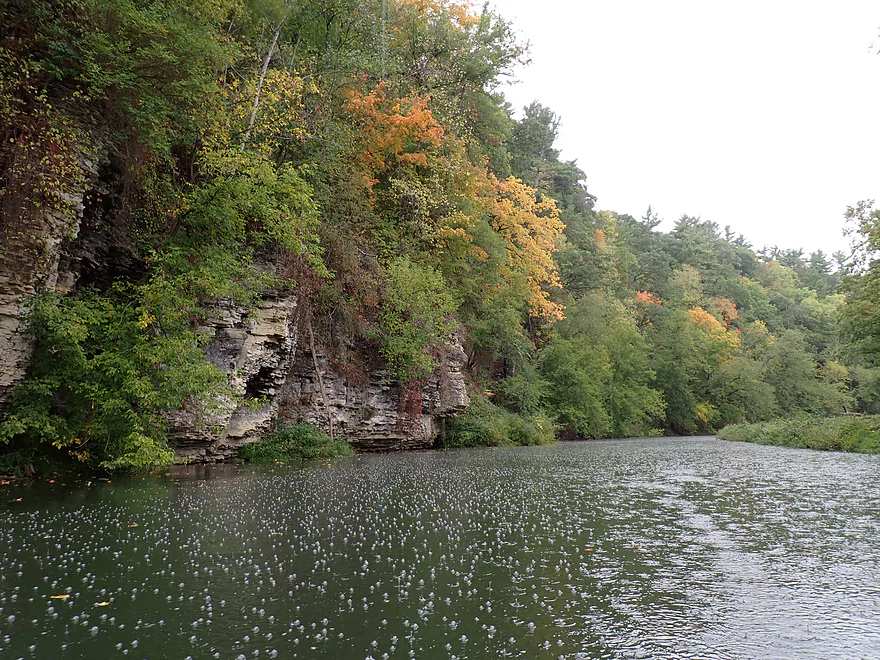
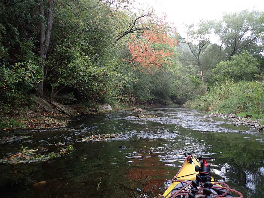
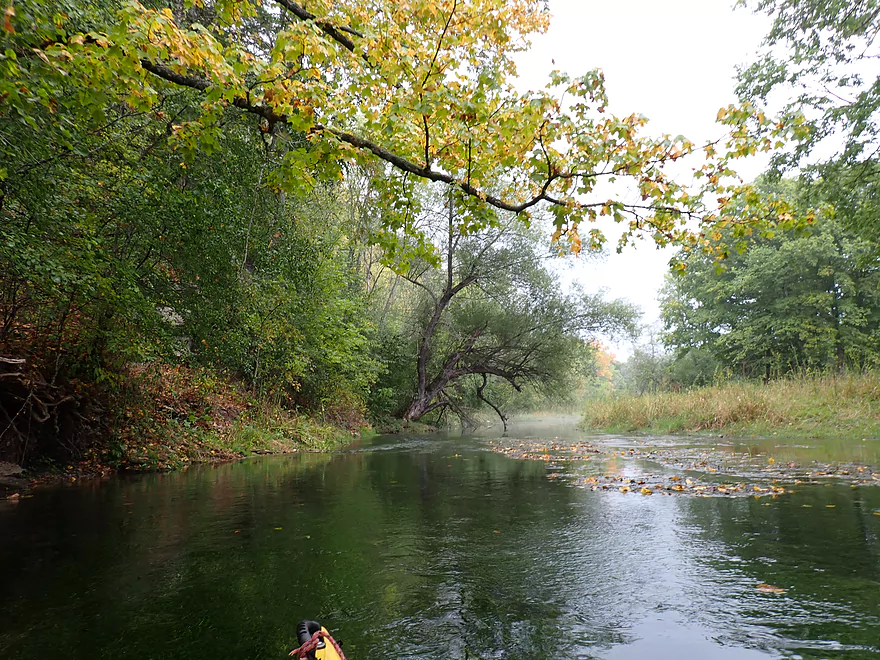
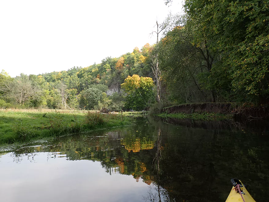
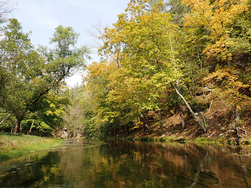
Early fall color
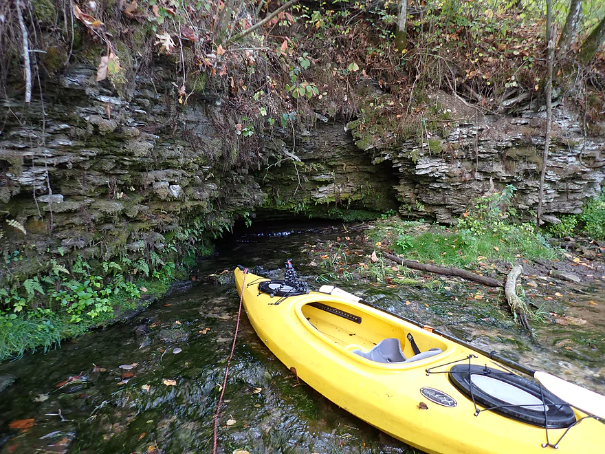
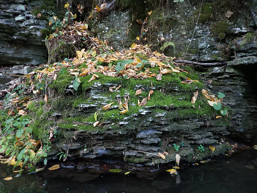
Spring water bubbling out of a micro cave
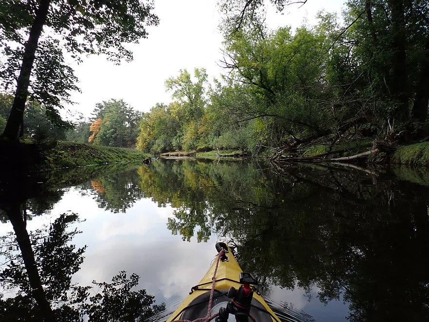
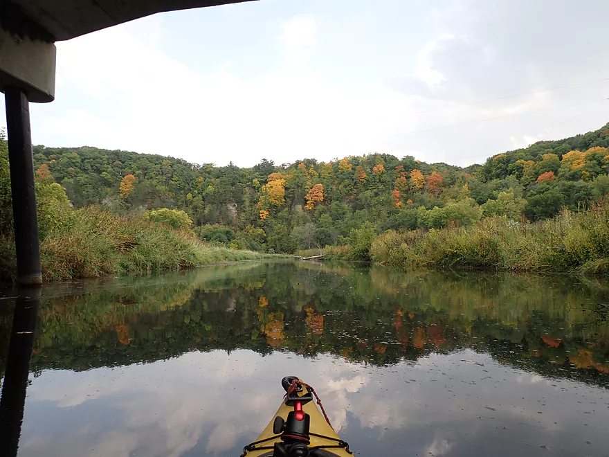
Sun finally comes out
Fence #5…barbed wire and easy to duck under
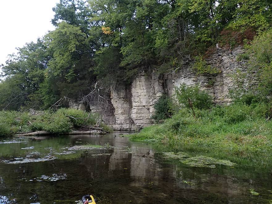
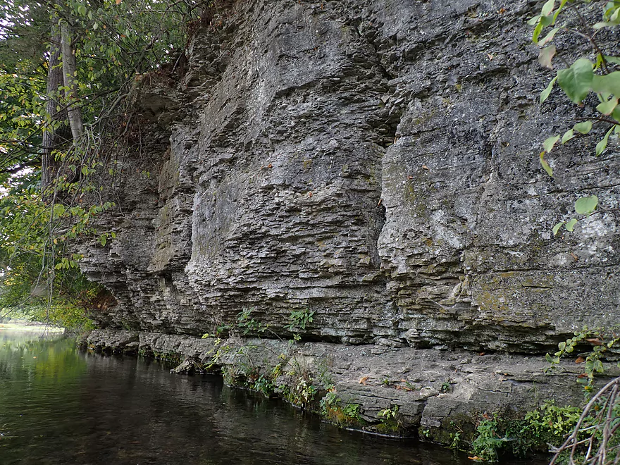
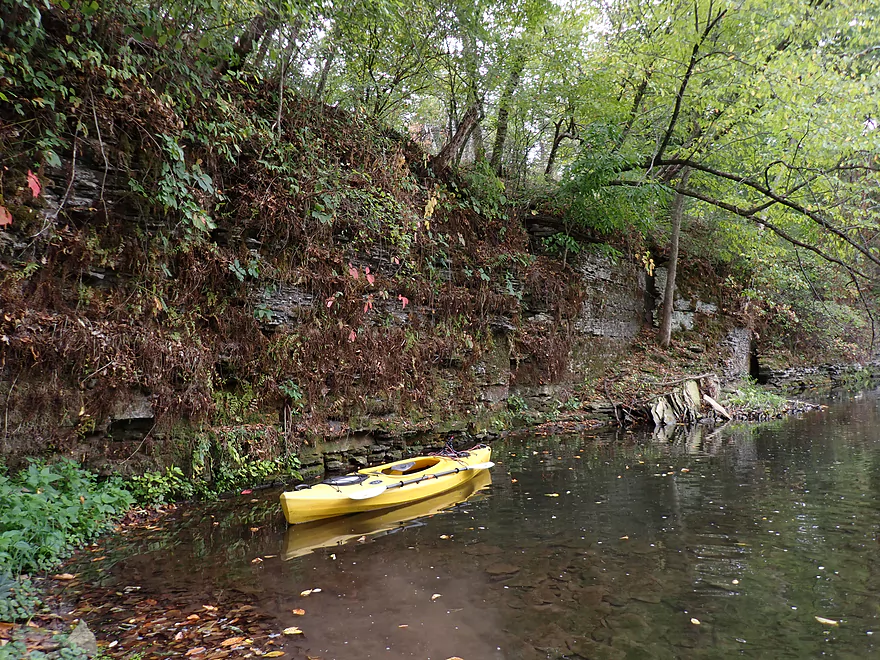
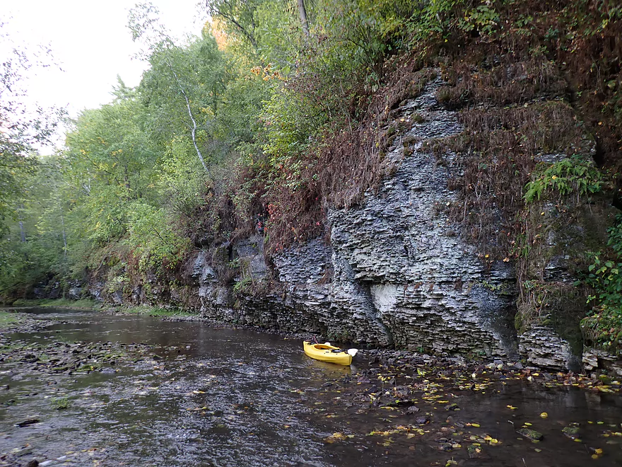
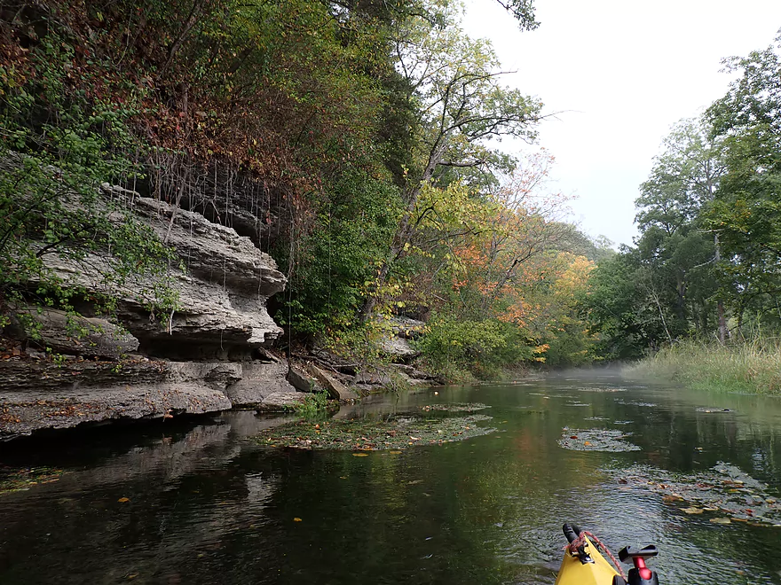
One of my favorite outcrops
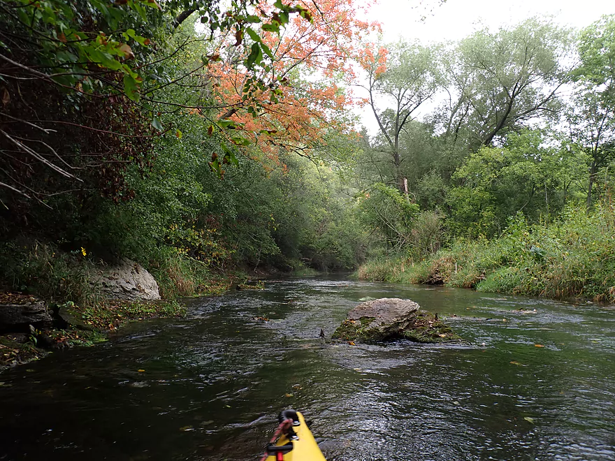
Some more very early fall color
Fence #6…maybe electric…was just able to duck under on the left
Fence #7…this one I tested and it wasn’t electric (thankfully, since this was crazy low)
Fence #8…easy ducker
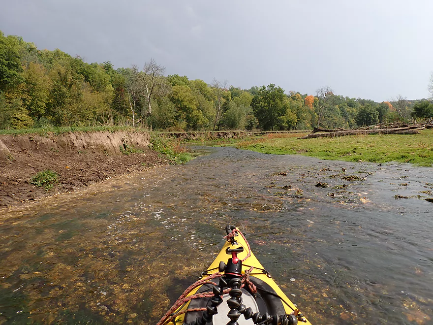
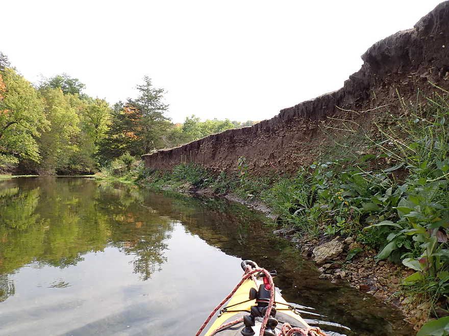
Eroded mud banks
Stretch with a lot of dead trees
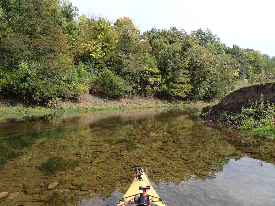
Clarity was terrific…I often had great views of the fish
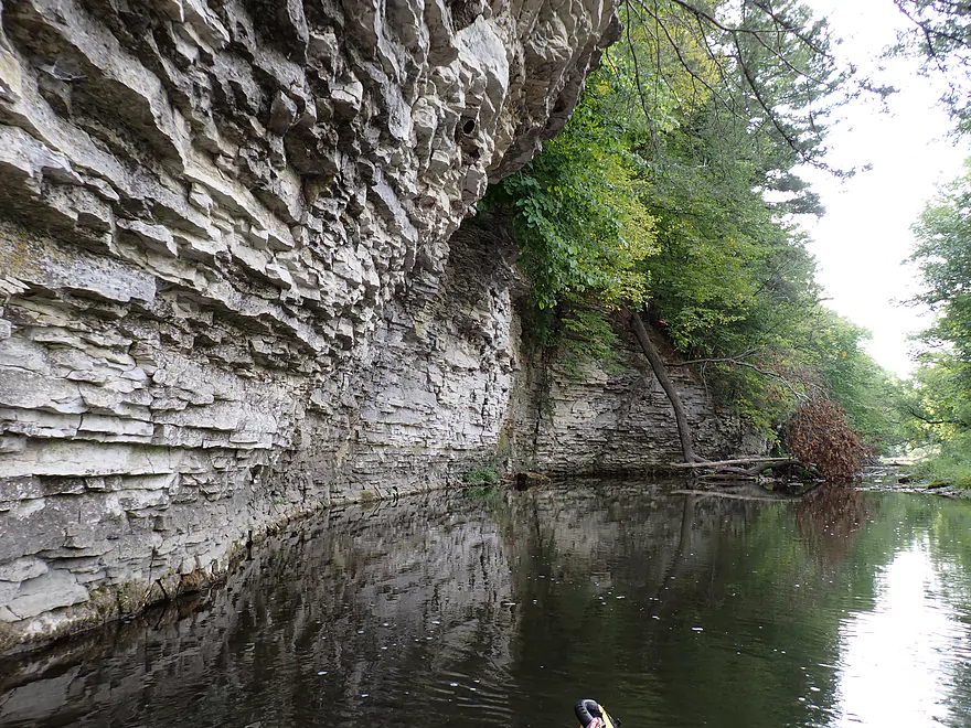
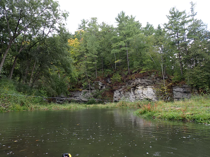
Approaching a large bluff
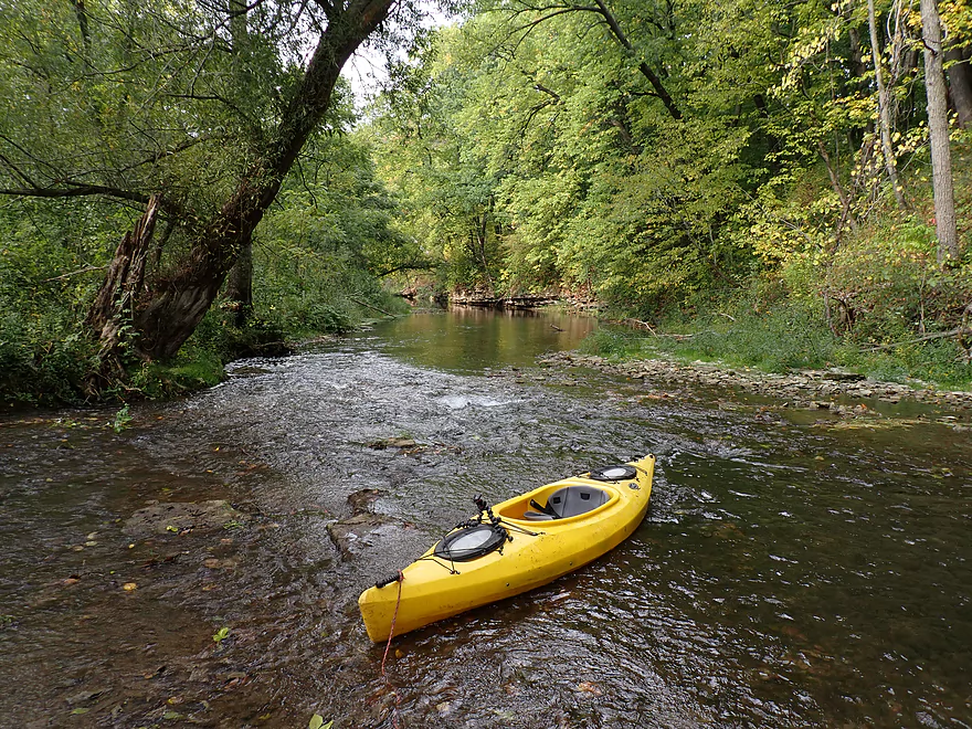
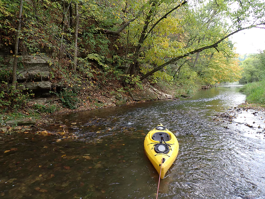
Several of the rapids were too shallow and had to be waded
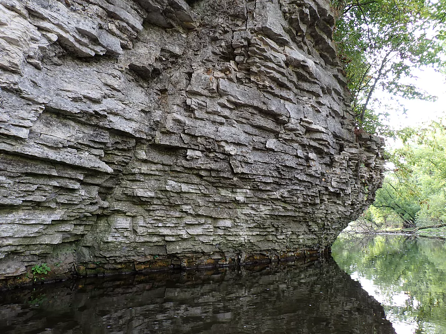
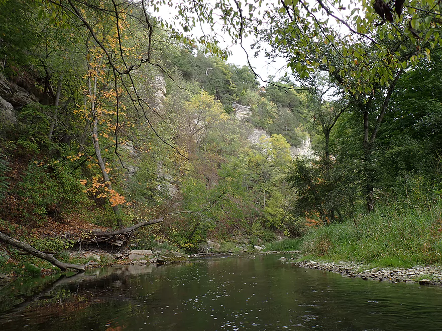
Impressive palisades
Fence #9…the last one…easy to get under
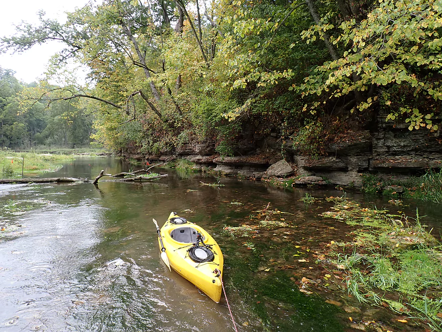
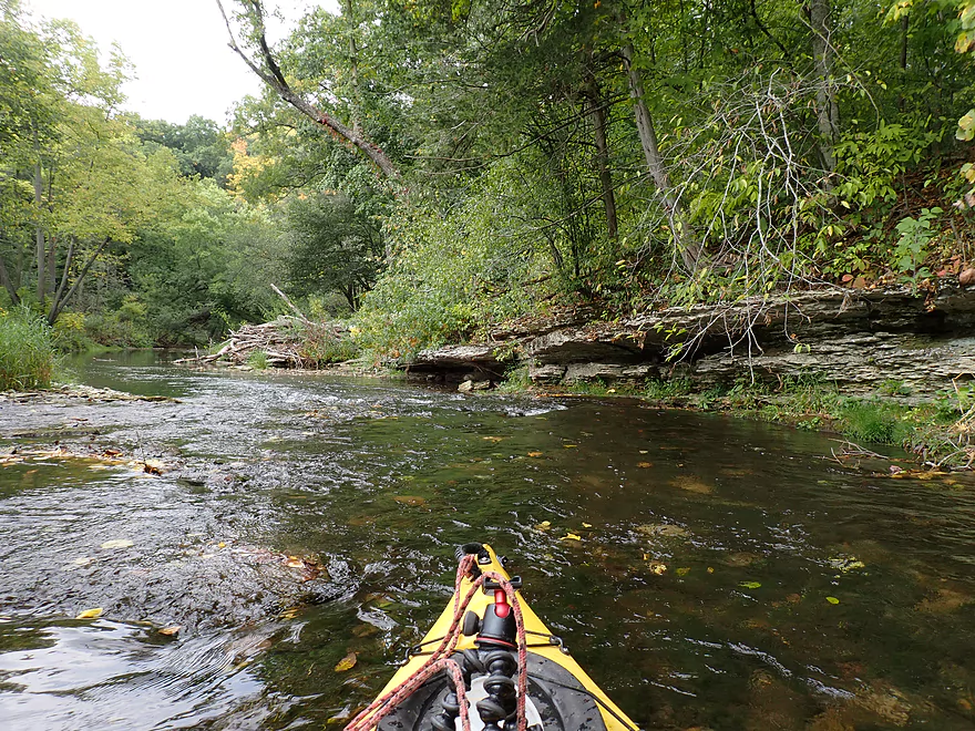
Stretch of nice outcrops
Horizon line of a beaver dam (easy hop over)
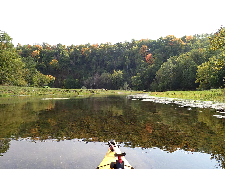
River is directed sharply right by another impressive bluff
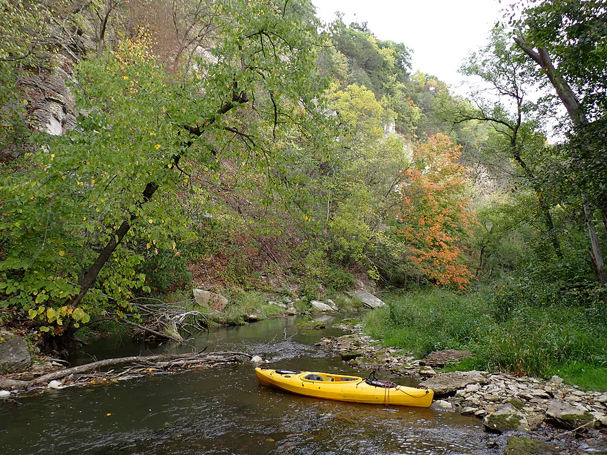
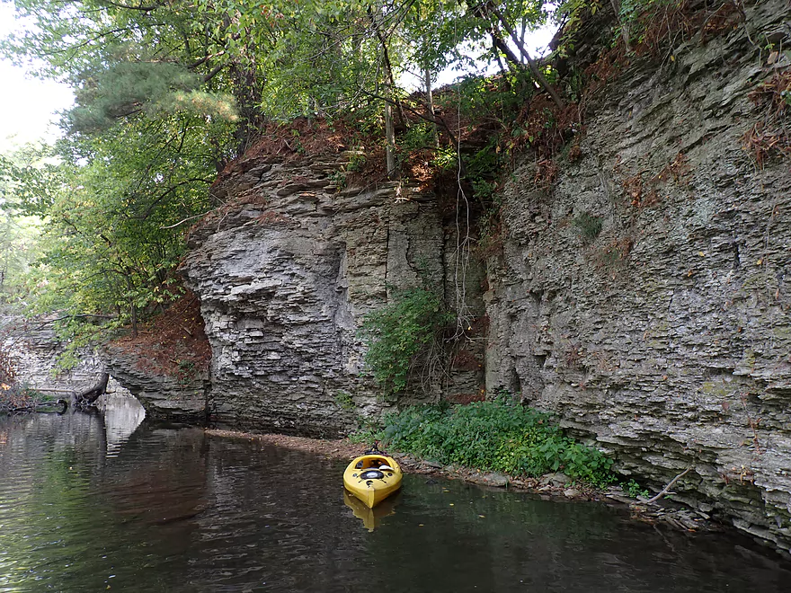
One of the best parts of the river
More palisades, very reminiscent of the Upper Iowa
Last outcrop of the trip
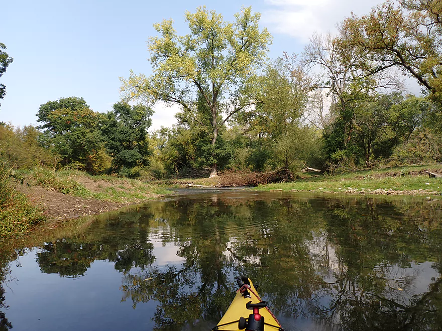
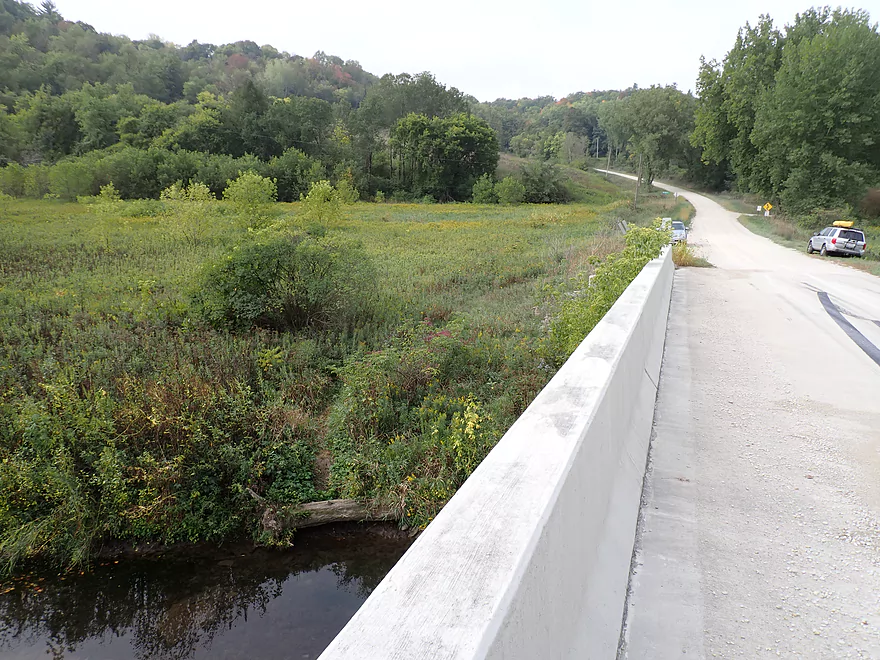
Maple Road and my take-out
The best palisades are actually located downstream from the bridge…another trip
A small path leads to the shoulder of Maple Road
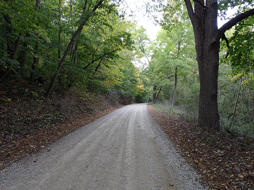
Scenic bike shuttle
South Branch of the Root River

Located in Southeast Minnesota near the tri-state border, the Root is a fantastic river for paddling. Most kayakers just do the “main stem” from say Chatfield to Rushford, which is ok, but not the best the Root has to offer. For that you need to explore its more obscure forks, branches, and creeks where there are many hidden gems. I’ve had my eye specifically on an upper portion by Forestville State Park for a while, and when the MN DNR water trail levels page rated the South Branch as green (navigable) despite the drought, I decided to go for it.
I started the trip at County Road 5 where the river looked shallow but inviting. This part of the river is popular with trout fishermen, and I bumped into one from NY as I put in. A fence blocked access to the river, but a stile allowed both of us to get over with little difficulty. After dodging acorns that were raining down on the river like hailstones, I encountered a series of light gray limestone outcrops. These featured fantastic textures…as if they were composed of many irregular bricks. It was an amazing start to the trip.
Soon after I would encounter the first of 9 fences that spanned the river. Like many of the fences, it looked electric with a single strand and no barbs, but I don’t think it was live. I wasn’t going to take any chances though as I carefully scooted my boat forward in a shallow area, then hurdled over the fence in another low area and then waded back to my boat.
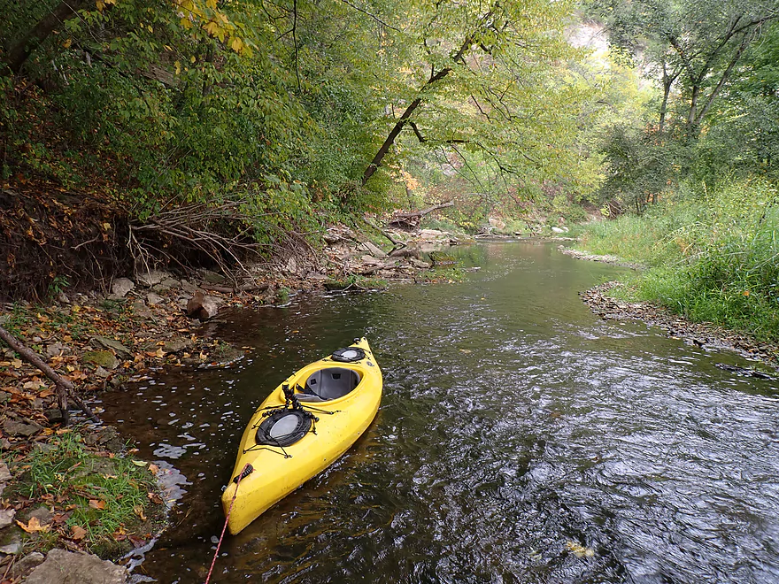
The first two miles of the trip were extremely shallow and I had to get out and wade a bunch. I didn’t mind, as I brought wading boots, rope to pull my boat, and I could use wading time for getting nice pictures. But I suspect most paddlers would find these levels to be intolerably shallow. It’s interesting that the MN DNR said this was navigable per their fancy navigability chart…but I suspect the South Branch they were referring to was more downstream closer to Lanesboro which obviously would be bigger and more navigable.
With fences, come cows and I saw quite a few on the trip. Many were friendly and curious…but they were incredibly destructive to the river. Their hooves trampled vegetation that would have protected the banks from bleeding sediment into the creek, and there were cow pies everywhere including in the creek itself. Not so coincidentally there were large algae growths downstream from many of the more active cow spots. It’s shocking that this very section is one of Minnesota’s flagship trout streams, yet the MN DNR lets cattle graze on it with impunity.
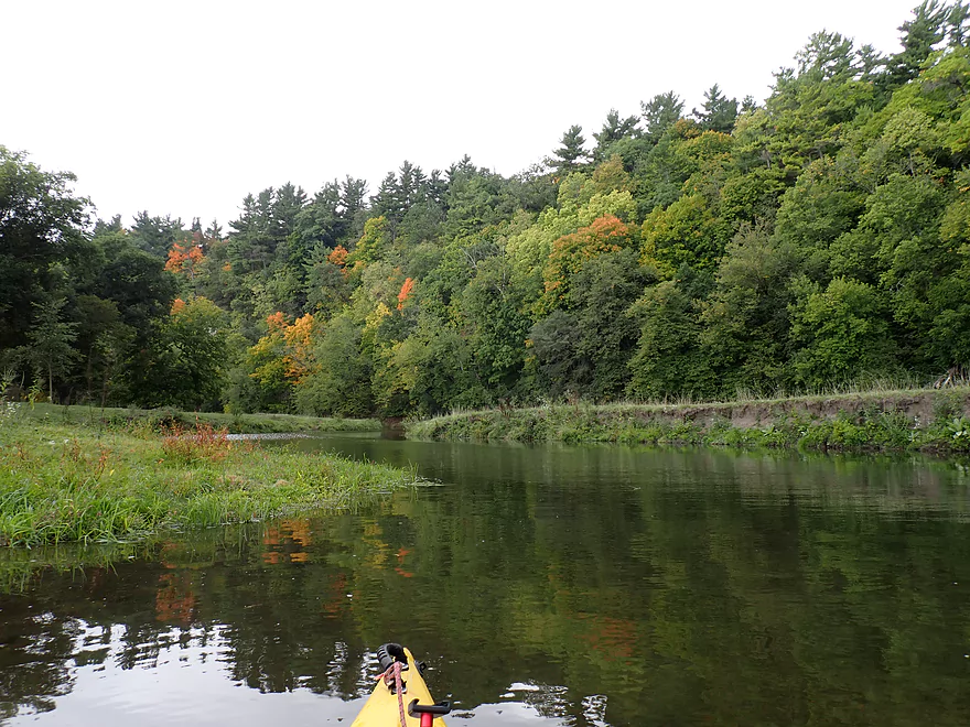
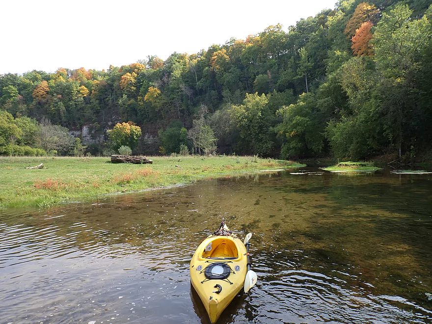
The limestone outcrops were so common I didn’t bother to keep count, Many were on the smaller side, but some weren’t and most were incredibly scenic.
To my surprise it started to rain. My forecast had said it was supposed to be blue skies…time to find another weather website. I actually don’t mind some rain when paddling as long as it’s not a downpour, it’s not windy, and it’s not cold. I did hear some atmospheric lightning which had me a bit rattled, but thankfully there was no ground lightning. The falling rain created wonderful stereoscopic pitter-patter sounds on the water, and the bluffs looked fantastic through the misty fog. The rain lasted maybe only 40 minutes before it let up significantly for the rest of the trip.
One of the nice surprises of the trip was discovering a decent sized spring coming out of one of the rock faces. This really reminded me of the Upper Iowa River which makes sense as it is located close by. The springs seemed to help water levels a bit and the river seemed a bit deeper and more navigable after that.
After the spring, the river is forced into several impressive tight turns by the cliffs. This included one of my favorite stretches where the rock looked like it had been folded vertically onto itself. In another stretch I was treated to early (for Sept 16) fall color. Sadly sugar maple which are the flagship tree for fall color, have really been stressed by this year’s drought and because of this are turning weeks earlier than the other trees. Ideally all trees would wait to turn at the same time for the best effect.
The river then opened up with a rare respite from the cliffs. This section was still scenic with incredibly clear water, but also featured some of the worst bankside erosion of the trip courtesy of the local cattle. Despite this large schools of fish were common and included trout. Some of the schools might have numbered up to 100…I’ve never seen so many fish on a river and now understand why it is so popular with trout fishermen.
The open stretch ended as the river was redirected sharply north by a huge cliff/palisade. Part of this is owned by the local Forestville State Park, but what is interesting is that some of the more impressive cliffs were not in the park. I would be curious to know why the park didn’t acquire some of the best parts of the river. For a final hoorah, the river is redirected east by one of the steepest bluffs of the trip. While trees partly blocked the best views, you could see fantastic cliffs towering over the river. The last mile or so featured many light rapids, but because of the shallow water levels most had to be waded.
I ended the trip at Maple Road where there is a terrific downstream vista of more palisades which had me wondering if I should have opted for a longer trip. I packed up in a hurry, as I wanted to make the last 5:00 tour at Mystery Cave (Minnesota’s longest cave, which is located nearby), but when I arrived at the state park, I was informed the last tour had filled with reservations. It’s frustrating that the MN DNR limits cave access to tours, as you shouldn’t need a tour guide to appreciate cave scenery. Bummed I considered exploring other parts of Forestville Park including Canfield Creek (formed by a large spring) or Palisade Trail (which has a great view of the cliffs). But it was getting dark, rain was coming in (again), and I had a long drive ahead to get home, so I decided to call it a day.
In summary this was a great trip and one of the more scenic ones I’ve done this year, and I look forward to doing future South Branch trips. It was fantastic that there wasn’t a single logjam (evidence suggests someone recently cleared these all out). The main downside was the shallow water and having to wade in many spots…but that’s not a problem with the river per say, just my timing…when it is higher, this part of the South Branch is plenty navigable. I consider the wading I had to do an acceptable tradeoff to see the great cliffs and early fall color in Forestville Park, but many paddlers may not agree.
The other downside to the trip were the fences as there were a lot (9!). I never had difficulty getting past them, but some were annoying. The big problem was not knowing which were electric. Fences that aren’t live are easy to deal with…you just lift them over your head. By fence #7, I was brave enough to check if it was live and it turned out it wasn’t, so maybe most of them aren’t? I don’t know. For some paddlers the sheer number of fences and not knowing if they electrified might be a deal breaker.
Sights included a few vultures, eagles, and a huge snapper. The highlight were the massive schools of fish I saw…the most I’ve ever seen on a kayak trip. Many were trout. You can see a portion of one of these huge schools at 4:45 in my video.
Seven Springs: I don’t know much about this area but it seems intriguing. Apparently the underground river (Saxifrage River) rejoins the South Branch a mile west of the Hwy 5 bridge via a series of springs. This adds significant volume to the river and may include scenic springs you can see from the river. But I’m not sure how much you can see and from where. The bluff above the springs is part of a state natural area but supposedly access is difficult.
Forestville: This is a late 1800’s themed village located in the state park. I think it is sort of like “Old World Wisconsin” but much smaller. Note tours are limited and the historic bridge that connects the town is closed to all traffic so plan your trip carefully.
Palisade Trail: Forestville State Park has a number of trails, but this might be one of the best. The trailhead and parking lot are located just north of the Maple Road bridge. Here you can hike a trail loop and see some of the most impressive and tallest palisades (cliffs) on the river.
Big Spring Trail: This is a longer trail that runs along Canfield Creek. The southern edge of the trail features “Big Spring” where the creek pours out of a cave. Here are some pictures and video of it on Twitter.
Stagecoach Spring by Watson Creek: This is an impressive spring and the source of Watson Creek which comes flowing out of a decent sized cave. This is much more impressive than Big Springs, but it is not located within the state park so access may be tricky (exact location). Here’s a nice picture of the springs. Note several sources online incorrectly attribute this photo to the South Branch of the Root River but it is actually part of Watson Creek.
Mystery Cave: This is the longest cave in Minnesota and features a fantastic trail and lighting system. The pools are impressive with the highlight being “Turquoise Lake“. Unfortunately you can’t explore the cave on your own, and must do so as part of a state park tour group. Reservations are highly recommended as some tours (mostly early morning and late afternoon) fill up. I found this out the hard way as I couldn’t get into the last 5:00 tour I planned on doing because it was booked up. Prepare accordingly for the tour. You will need warm clothes and they may not let you enter if you have open-toed shoes. This Youtube video kind of gives you an idea of what the cave is like.
County Road 5 Bridge: This is a good bridge access that is frequently used by trout fishermen. Note, you must use the wooden stile on site to get past the fence. I didn’t consider this too difficult.
Alternate Put-ins:
- Twp Rd 371 (2.7 miles upstream from Cty Rd 5): Likely a scenic stretch with great outcrops and a chance to see several of the “Seven Springs”. However because the Root loses so much water to the underground river/side-channel (Saxifrage River), parts of this stretch will completely dry up during low flows. After “Seven Springs”, the Saxifrage River rejoins the Root and the main river is much more navigable again.
- Old Cave Road (6.3 miles upstream from Cty Rd 5): An intriguing prospect. But because this is downstream from Mystery Cave where the Saxifrage River splits off (goes underground), this north channel often runs too low and can be bone dry by late summer.
Maple Road: This is a very good (and scenic) bridge access, but be mindful of the No Parking zones. Only park where allowed, which granted isn’t 100% clear because of the poor sign placement/verbiage. A trail southwest of the bridge leads to the water where a massive logjam was recently removed.
Alternate Take-outs:
- Angler Parking Lot (1.8 miles downstream from Maple Road): River enters the main part of Forestville State Park. This is a scenic stretch and includes some of the best palisades on the river.
- Hwy 118 (3.3 miles downstream from Maple Road): A good bonus leg that features steep rugged bluffs and a few outcrops.
-
Historic Forestville Bridge (3.8 miles downstream from Maple Road): Take-out is at the historic Forestville 1800’s town. You can’t walk or drive on the bridge. Instead park to the south in the public parking lot and hike to the river.
Bike Shuttle – Maple Road to County Road 5: 2.3 miles with 272′ of ascent. This includes a half mile of gravel and has a monster hill to walk up. After that though it is a short easy bike shuttle.
Current: The river is mostly pool & riffle…a common attribute of Driftless Area rivers.
Rapids: At my depth (10.24′), there were no major rapids but there were countless riffles. I suspect at higher depths, the river would have maybe 10-15 Class 1 rapids and a few Class 2’s. Those are just my estimates.
Logjams: None! Somebody cleared them ALL out…as this leg used to have a bunch.
Beaver dam: One beaver dam will have to be hopped over…pretty easy.
Fences: There were 9 fences which is a lot. Most were easy to get past, but a few were tricky. In several spots the fences are low which forces paddlers to do either an extreme limbo or a shore-side portage. Thankfully the river is usually shallow by the fences which makes it easier to get past them. Several of the fences appeared to be electric (although I tested one and it wasn’t). Paddlers should be very careful around these. One technique for getting past the fences is to lead your boat under with rope and then anchor it once it’s past the fence. Then you can find a low spot on fence and straddle that. Then you could double back to retrieve your boat. For some the sheer number of fences and possibility that some are electric will be a deal breaker which is too bad. I mapped all the fence locations and added short descriptions for each on my trip map.
Closest Gauge: Root River SB @ Carimona
My Trip Depth: 10.24′ Note, this was too shallow. I didn’t mind too much, but I suspect most paddlers won’t like having to get out 20+ times to portage shallow spots.
Gauge Guide: For a reference guide, I’ll instead use the Lanesboro gauge which won’t be as accurate, but does have more historical date. Per Lanesboro, I did my trip at 195 CFS or 2.09′. The following are very rough estimates that could be inaccurate. Always use your own judgement.
- < 240 CFS: River will require 20+ portage breaks to get past shallow spots and riffles.
- 241-450 CFS: Shallow depth with multiple wading spots…but I think it would be viable for flat bottom boats. Here’s a video of a run at 325 CFS. Looks very navigable to me.
- 451-750 CFS: Maybe an excellent target range? Some spots will still have to be waded.
- 751-1000 CFS: A fun target depth as the rapids should finally fill out at this depth.
- 1001-1250 CFS: An unusually high depth only suitable for advanced whitewater paddlers. Clarity will not be as good at these levels. Also some of the fences could be quite tricky to get past with the river this high.
Click here for a South Branch Overview Map.
- Upstream from 151st Ave: I’m sure there are navigable and scenic stretches of the river, but I don’t know much more. The terrain this far west isn’t as rugged so outcrops likely aren’t as common.
- 151st Ave to 161st Ave: 1.9 miles. I don’t know much about this leg. I’m sure it is ok with a few nice cliffs.
- 161st Ave to Mystery Cave Road: 2.5 miles. Maybe some logjams. The bluffs here look impressive and could be scenic.
- Mystery Cave Road to Old Cave Road: 0.4 miles. Here the river passes Mystery Cave (Minnesota’s longest cave) where a chunk of the Root is diverted underground not to emerge until a few miles downstream by Seven Springs. The underwater branch of the Root is referred to as the “Saxifrage River” and is not navigable. The north/surface branch is navigable (sometimes) but is much smaller.
- Old Cave Road to Twp Rd 371: 3.6 miles. Good prospect with multiple cliffs. Maybe some logjams though and can be extremely shallow. As of Sept 2023, parts of this were running bone dry.
- Twp Rd 371 to Cty Road 5: 2.7 miles. The stretch above Seven Springs is very shallow and as of Sept 2023 was running dry. Seven Springs/Saxifrage River significantly enlarges the South Branch. This leg is a good prospect if you can time it for enough water and should feature fantastic cliffs and springs.
- Cty Road 5 to Maple Road: 4.5 miles. A terrific leg with many cliffs. This is likely the most scenic leg on the South Branch but does get shallow by late summer.
- Maple Road to Angler Parking Lot: 1.8 miles. River enters the heart of Forestville State Park. Just downstream from Maple Road are some of the best palisades on the river. Scenery on this leg is good but partly obstructed by vegetation/trees.
- Angler Parking Lot to Hwy 118: 1.5 miles. A good prospect, but very wooded so you won’t be able to see as many outcrops.
- Hwy 118 to Historic Forestville Bridge: 0.5 miles. Ok prospect. Features a historic bridge you can’t drive or walk on.
- Historic Forestville Bridge to Hwy 12/Carimona: 4.8 miles. Not in the same tier as the previous legs, this is still a good stretch with multiple outcrops, but is not as hilly nor rugged.
- Hwy 12/Carimona to Hwy 12/Fillmore Street: 6.2 miles. An ok stretch, but far fewer outcrops.
- Hwy 12/Fillmore Street to Preston Trailhead Park: 0.8 miles. Nice stretch through the city of Preston…includes a few rapids and cliffs.
- Preston Trailhead Park to Camp Creek Wayside: 0.9 miles. Last stretch through the community of Preston. Includes a few light rapids.
- Camp Creek Wayside to Heron Road: 5.6 miles. Good leg with a few outcrops. For bike shuttlers there is a fantastic bike path.
- Heron Road to Grit Road: 5.1 miles. This is a route serviced by the local livery. I suspect it is a mediocre stretch with more mud and much less gravel.
- Grit Road to Lanesboro Dam Access: 2.0 miles. Likely a less interesting stretch that is open, artificially straightened and artificially impounded by the downstream dam.
- Lanesboro Dam Access to Mouth on Root River: 3.0 miles. Final leg of the river. Not sure it is that interesting though.
- Mouth on Root River to Hwy 16 Access: 0.8 miles. Short bonus leg on the Root River to reach the next take-out.
Trip Map
Overview Map
Video
Photos Size:
I did County Rd 5 to County Rd 12 (Carimona) back in May when there was more water, challenging and fun! There were several major log jams to contend with but overall a fantastic paddle. Check out my videos on You Tube.
Your videos are really good! For those curious to see how the South Branch looks with more water: https://www.youtube.com/watch?v=ThxH1yRbIOE