
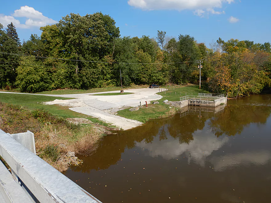
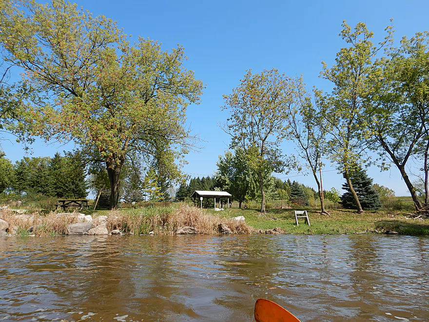
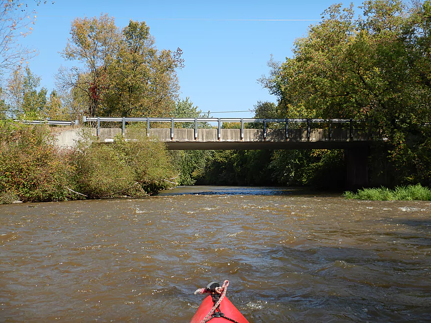
Putting in at the Clark Mills boat ramp
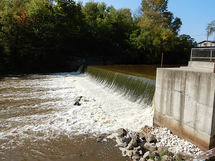
The local dam
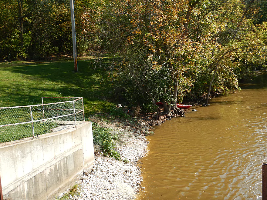
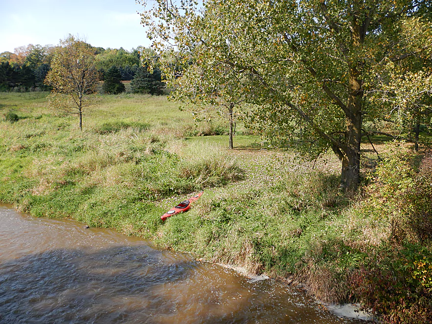
Easy to launch below the dam
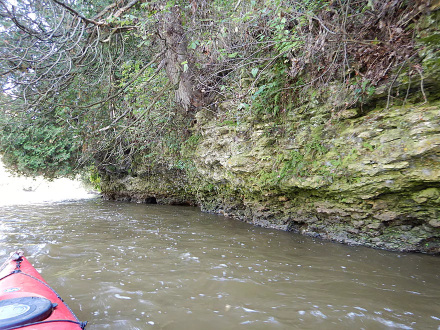
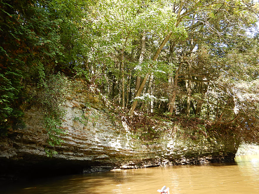
The first of several surprise dolomite outcrops
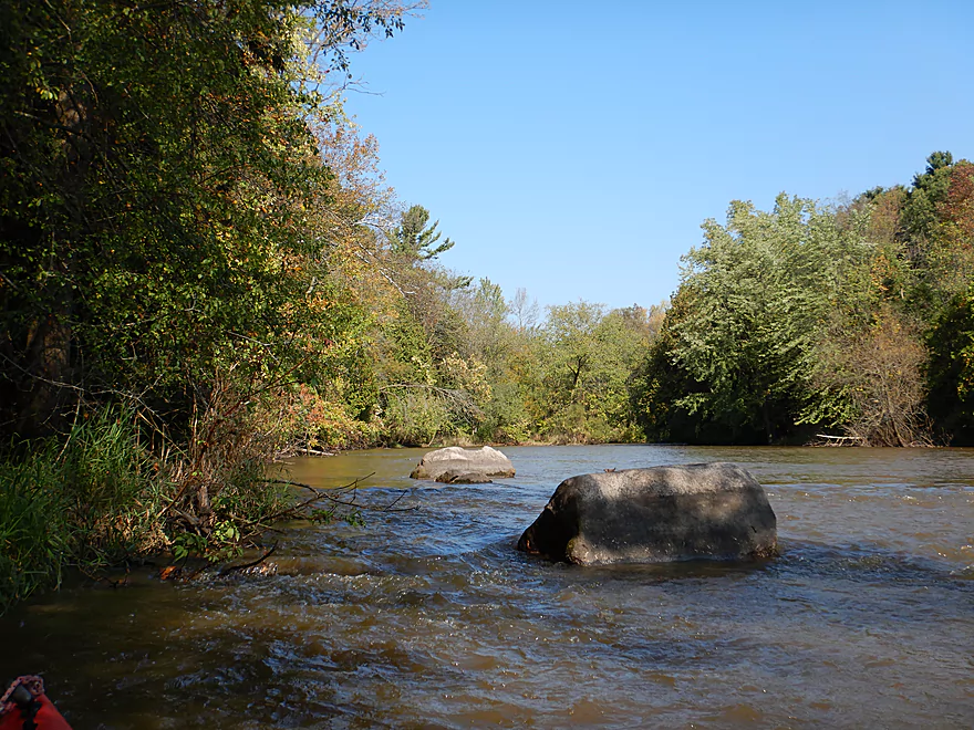
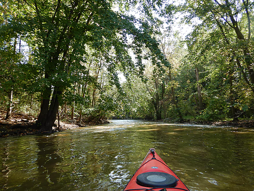
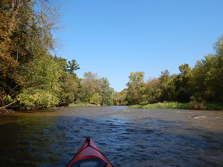
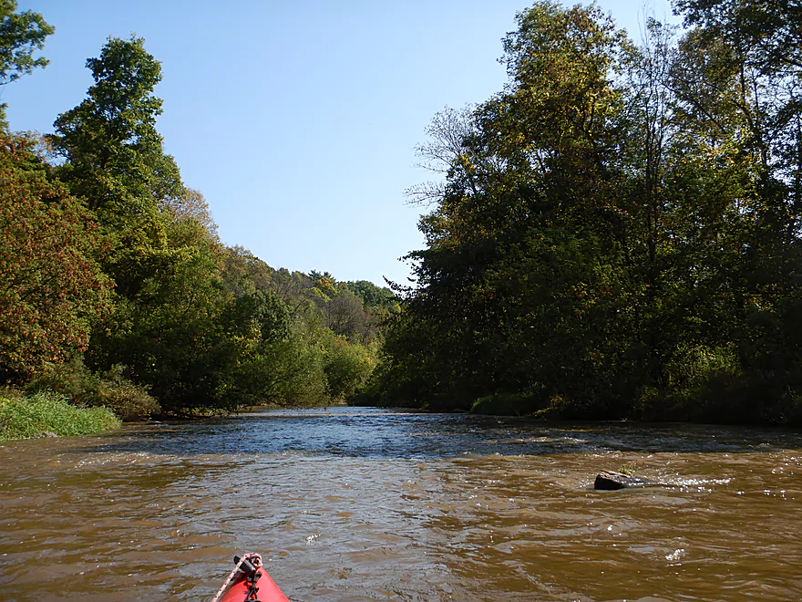
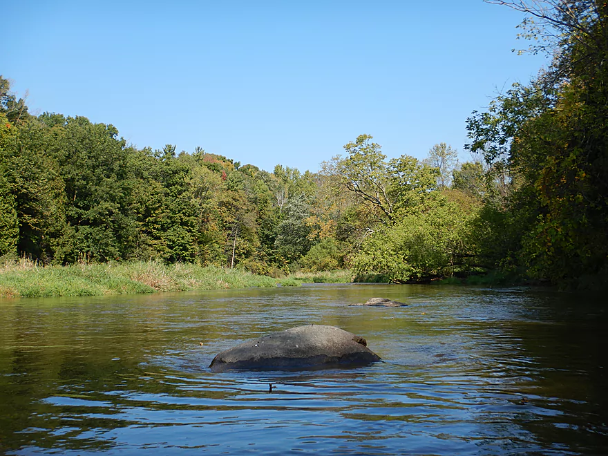
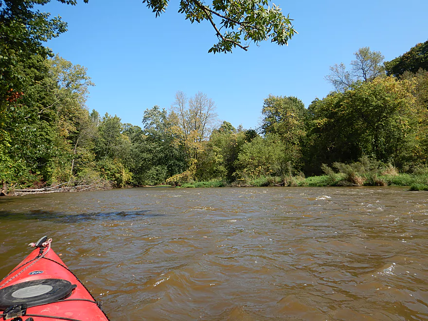
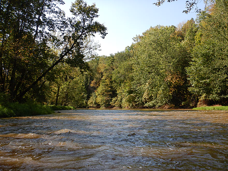
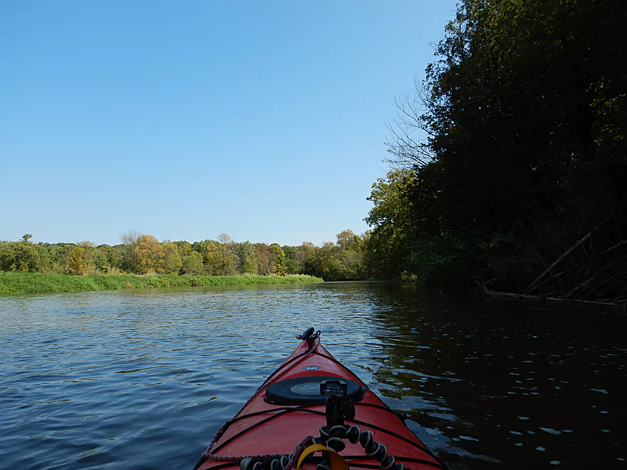
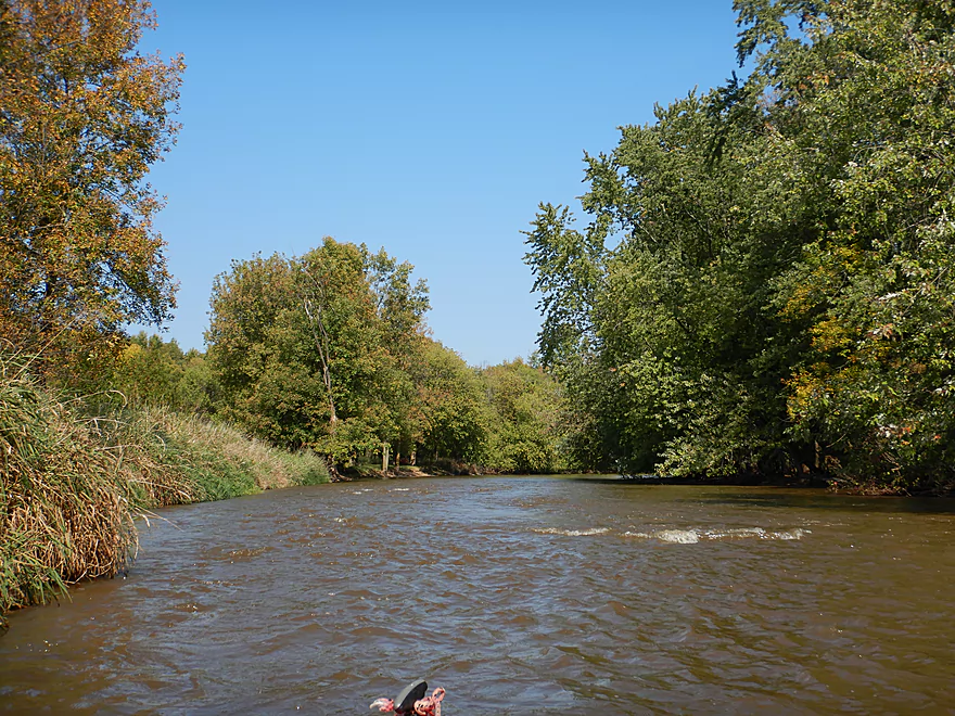
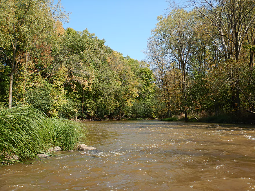
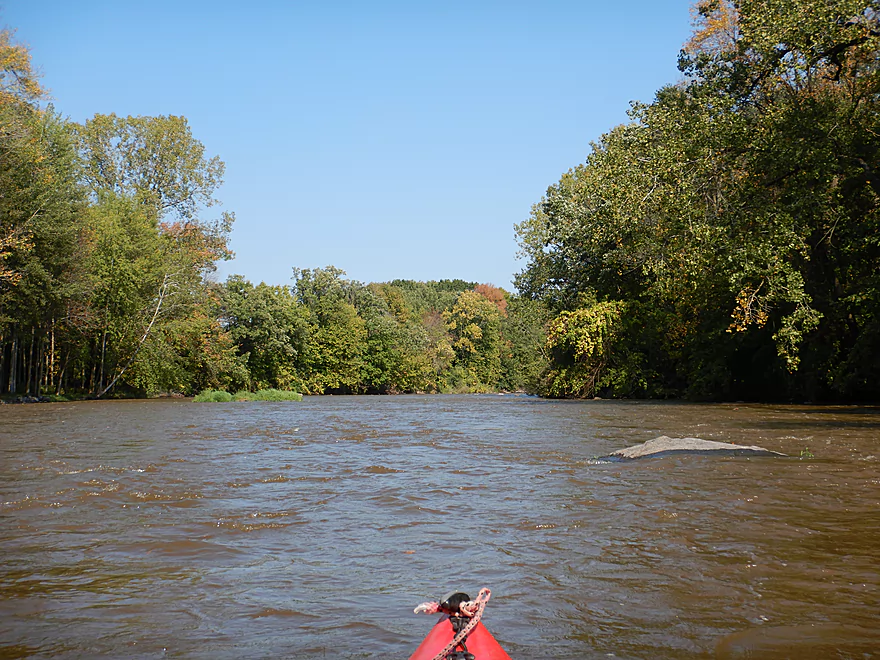
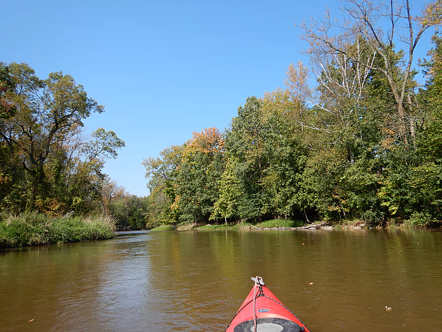
A scenic river
Current stays fast
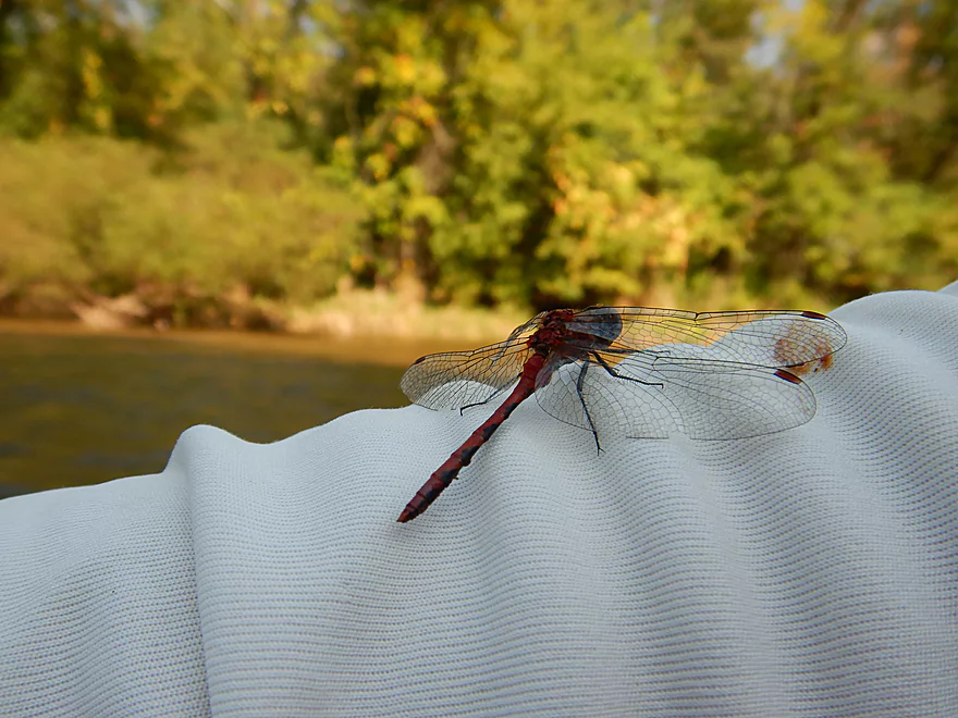
Friendly dragonfly
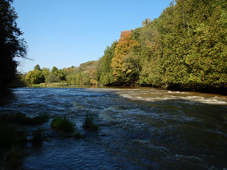
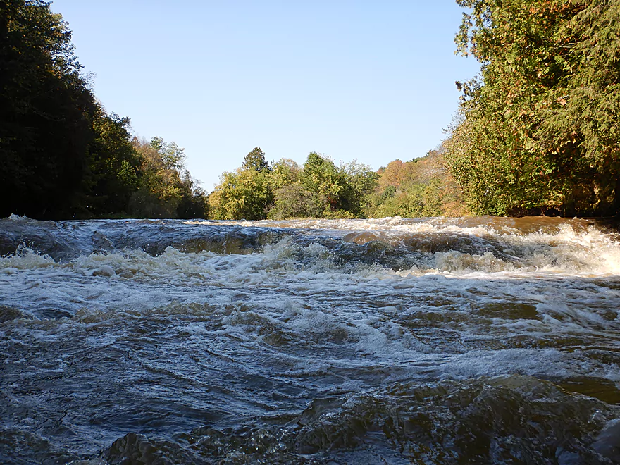
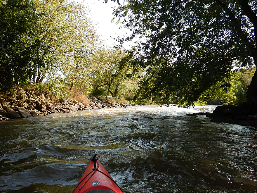
Rapids start to pick up

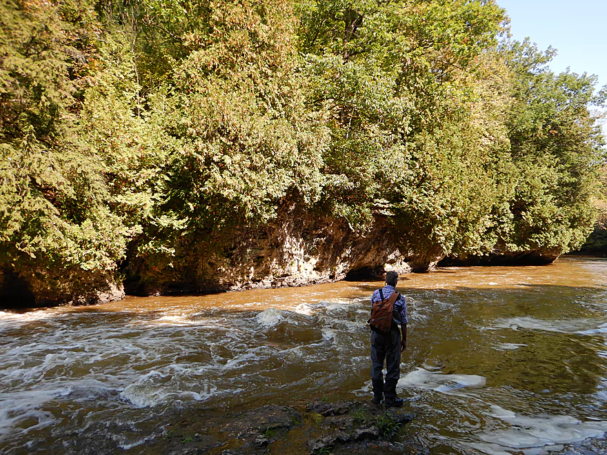
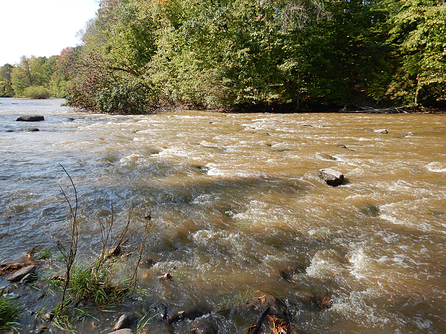
Looking down Lower Cato Falls
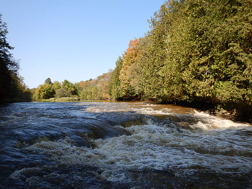
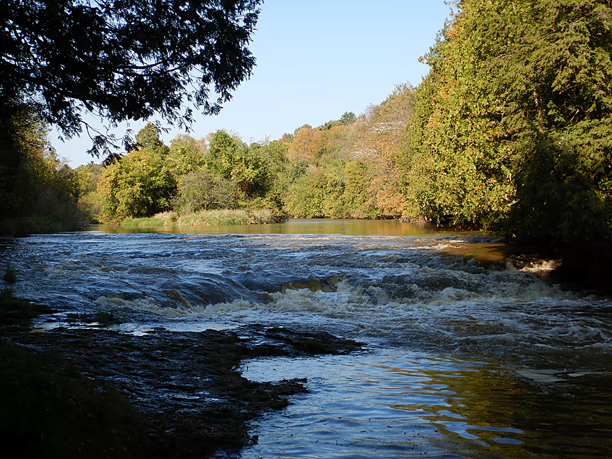
Class 3 rapids
I decided to portage
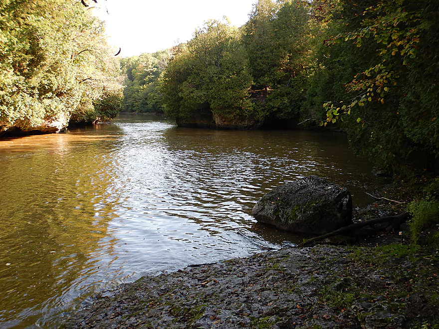
Dolomite dells after Cato Falls
Flat bedrock makes for an easy portage
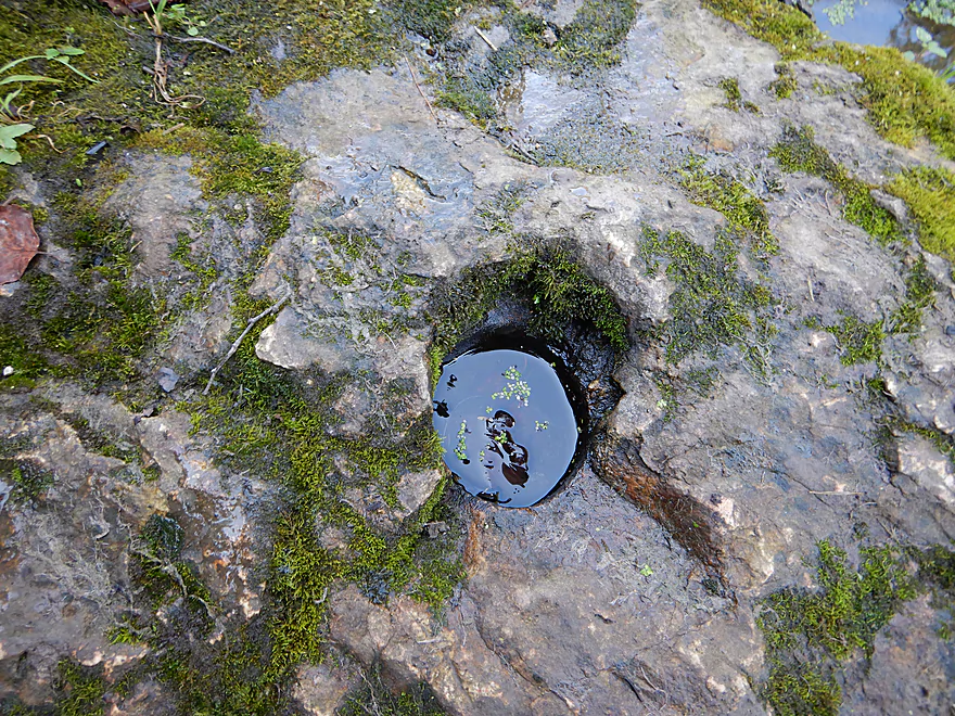
Cool eroded potholes
Paddling upstream for more pictures
One guide said this was 5 feet, but it looked more like 4
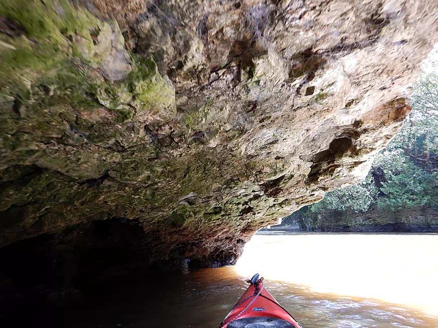
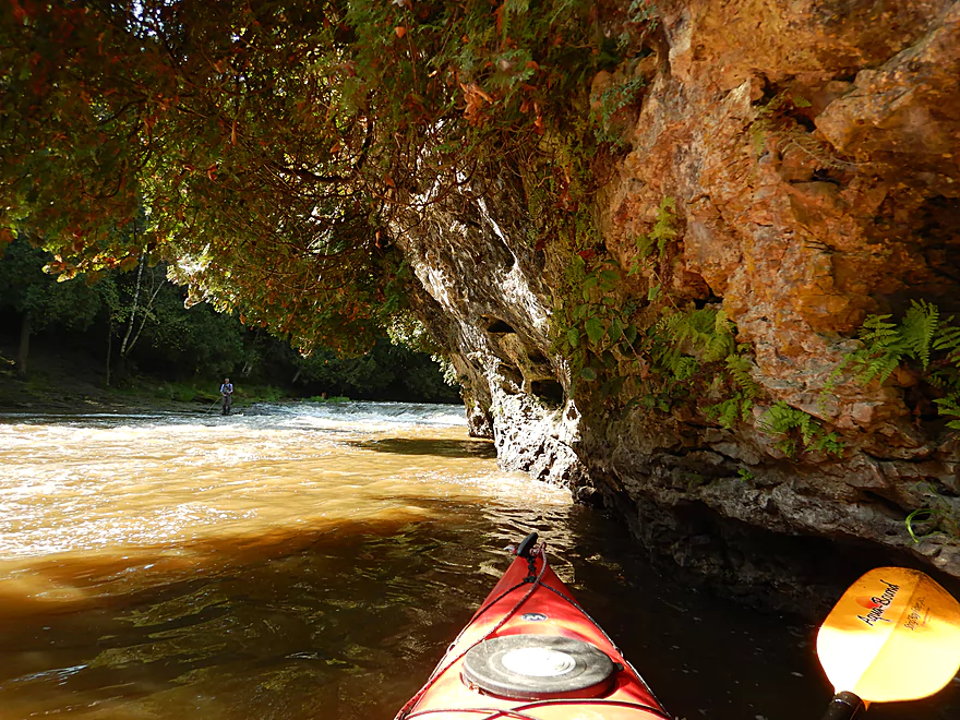
One of several cool alcoves
This is a popular spot for photography
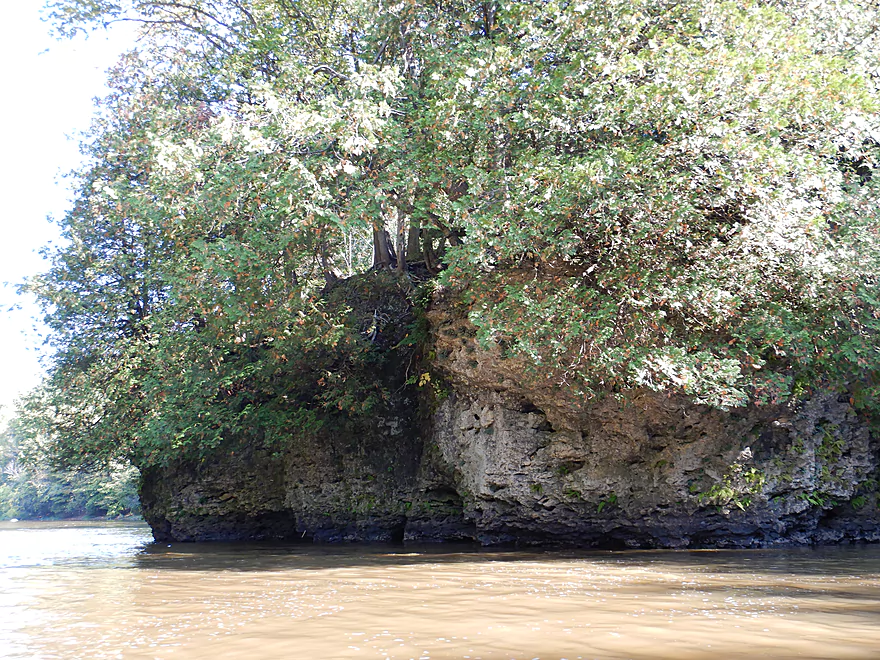
More dells on the other bank as well
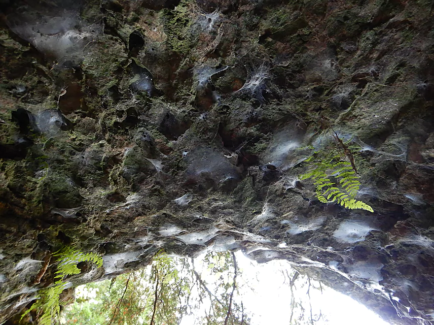
Cool archway of spiderwebs
The dolomite is smiling
Interesting textures and deformations
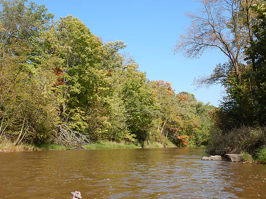
Current stays riffly
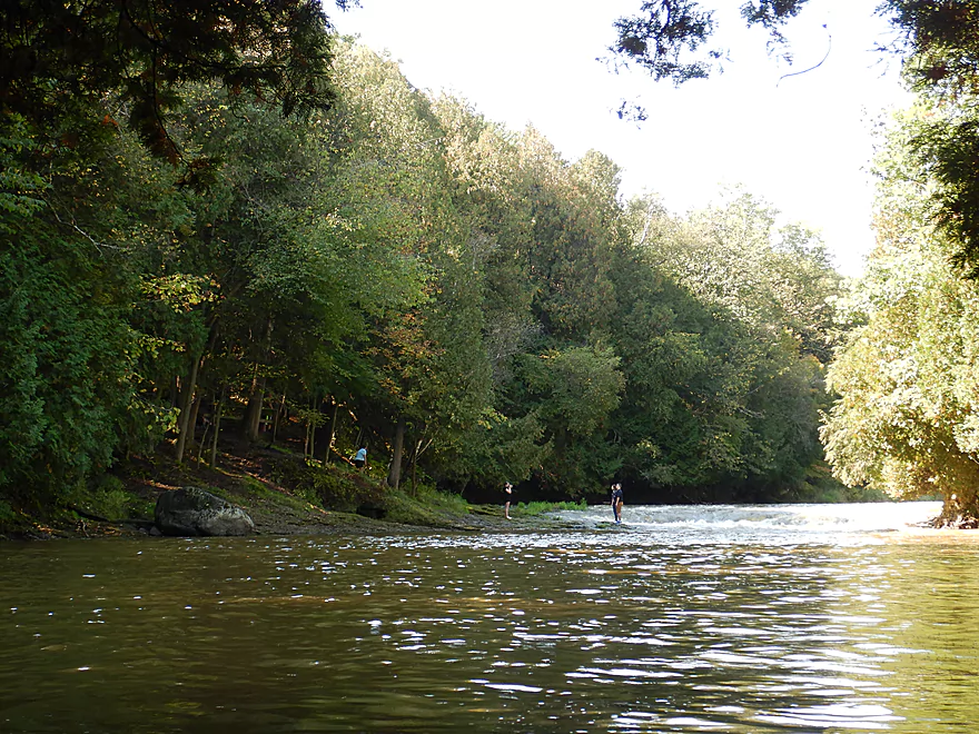
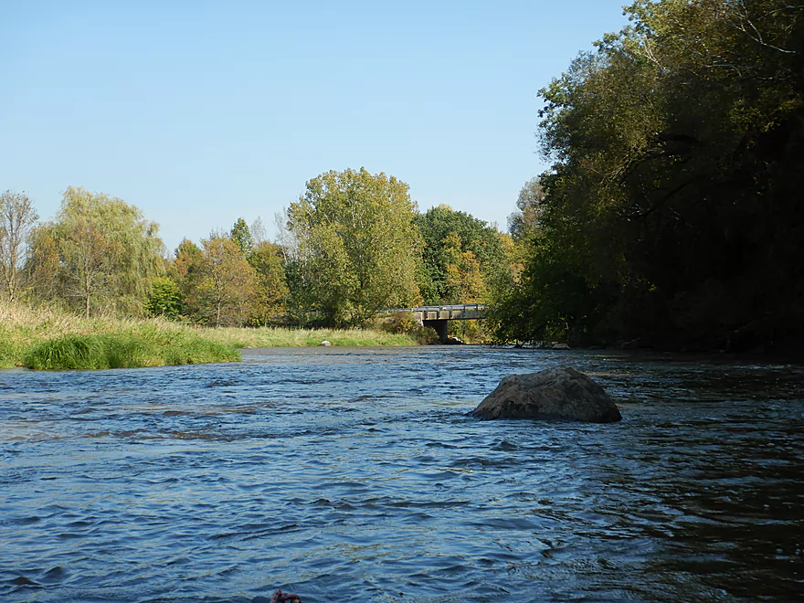
Fun rapids where the Oslo Dam used to be
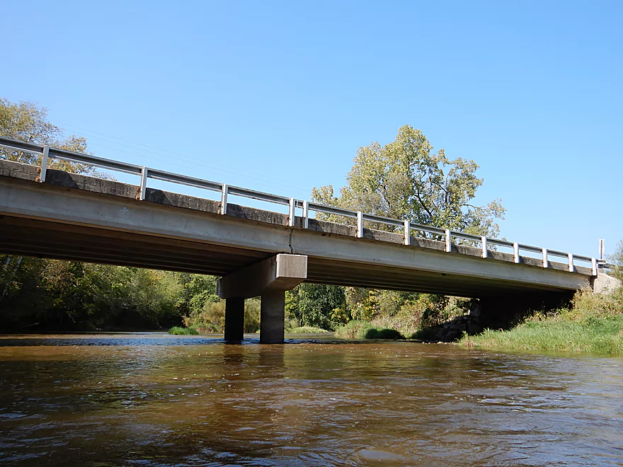
Coming up on Hwy S
There is a great public access spot here
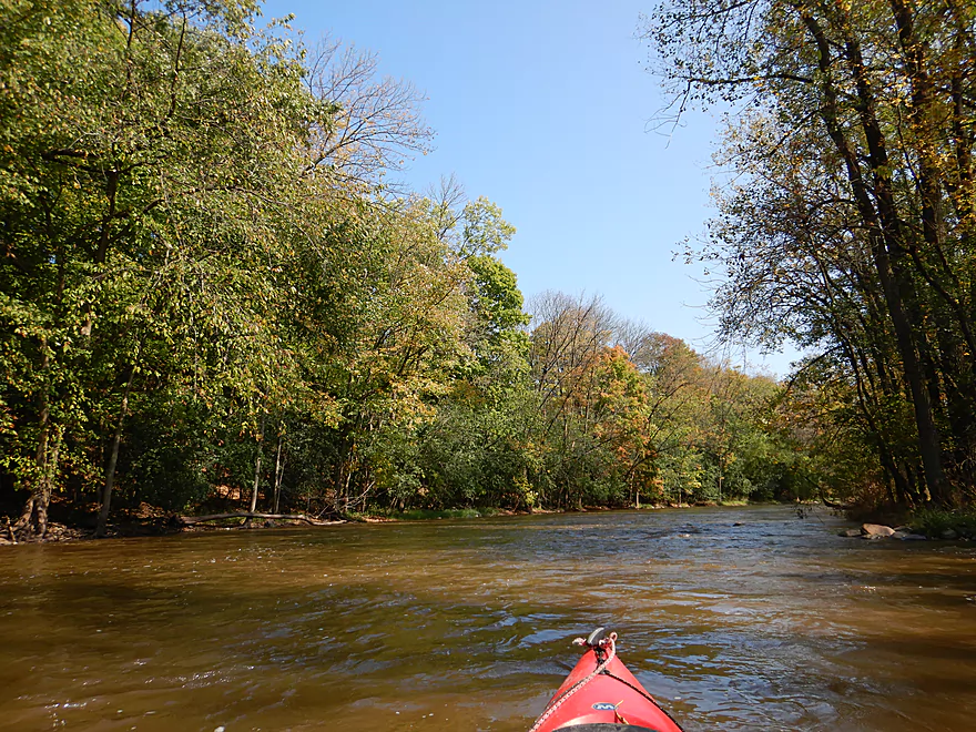
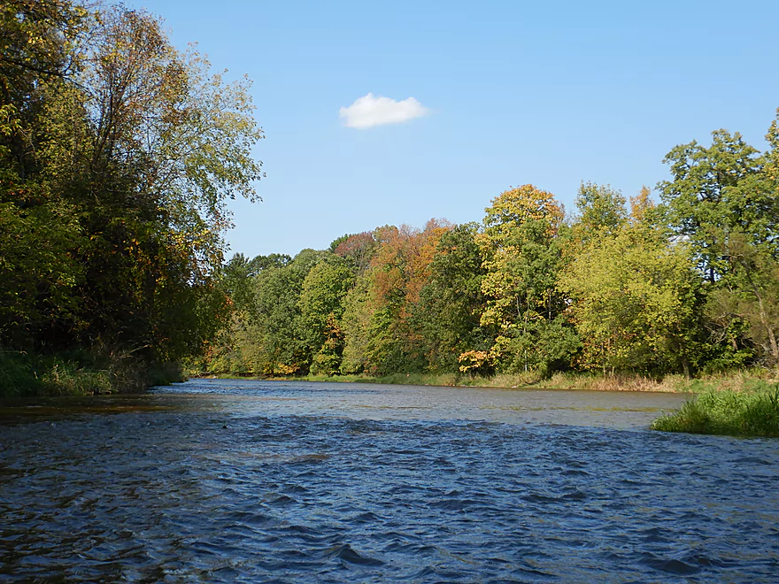
Clipping along
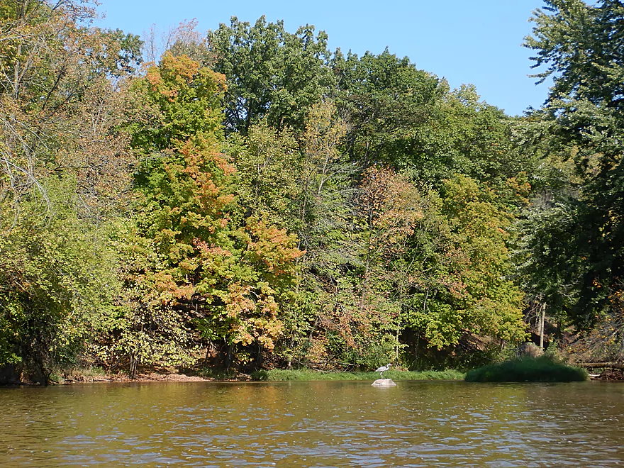
A heron balanced on the rock
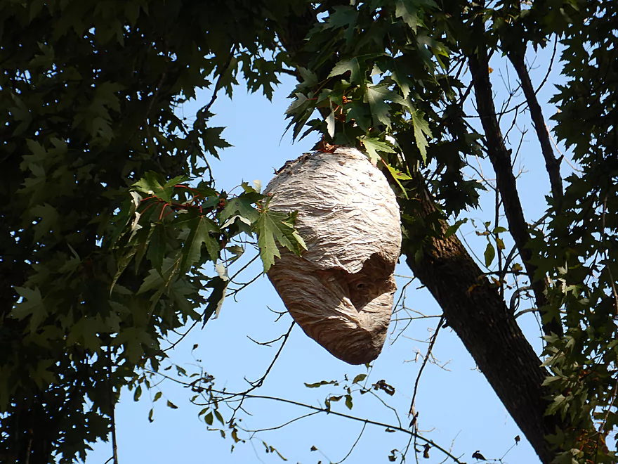
A football-sized paper wasp nest
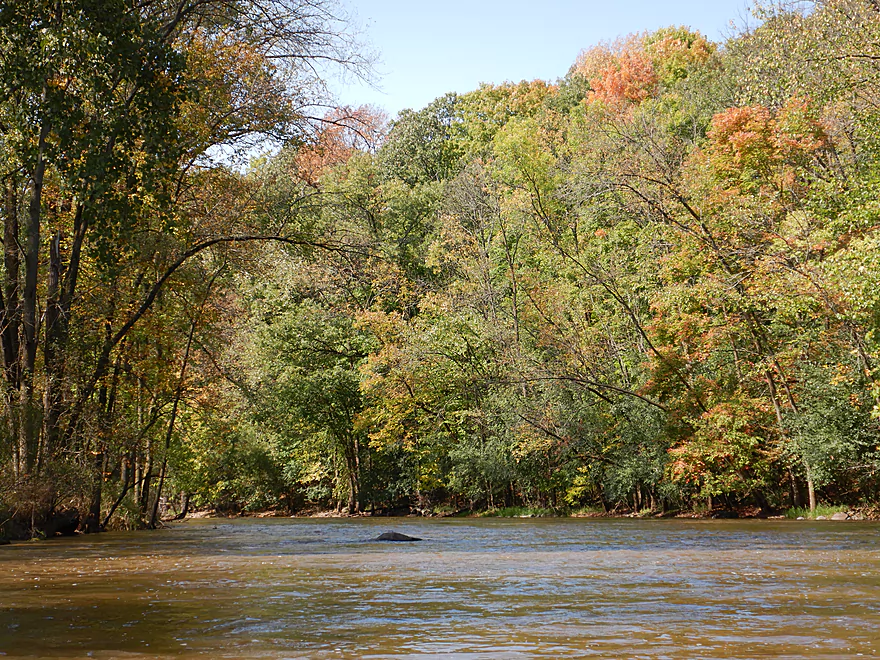
Some early fall color
Highway H is not a viable access option

Coming up on a nice boulder garden
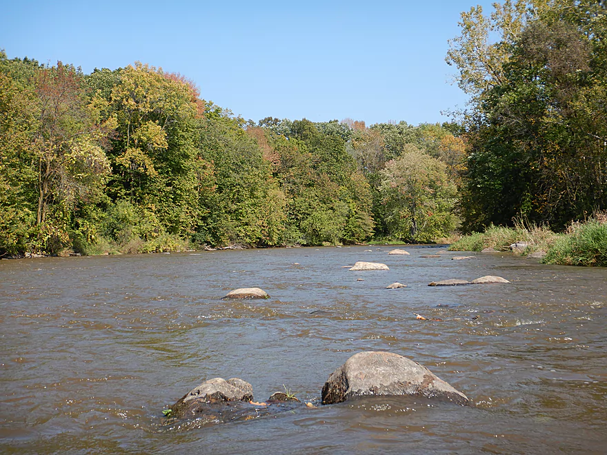
Quite cool
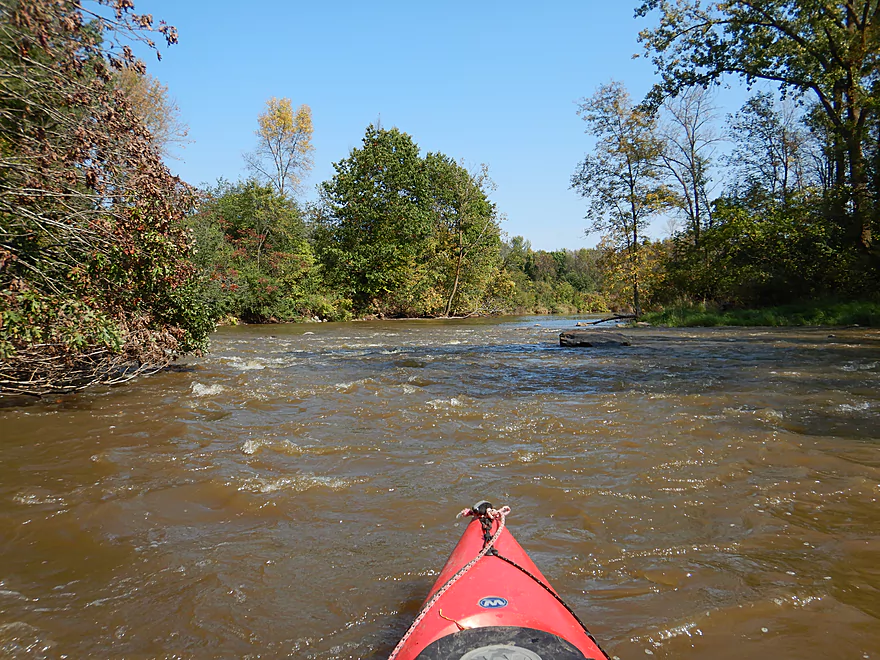
Some of the stronger rapids
Side view
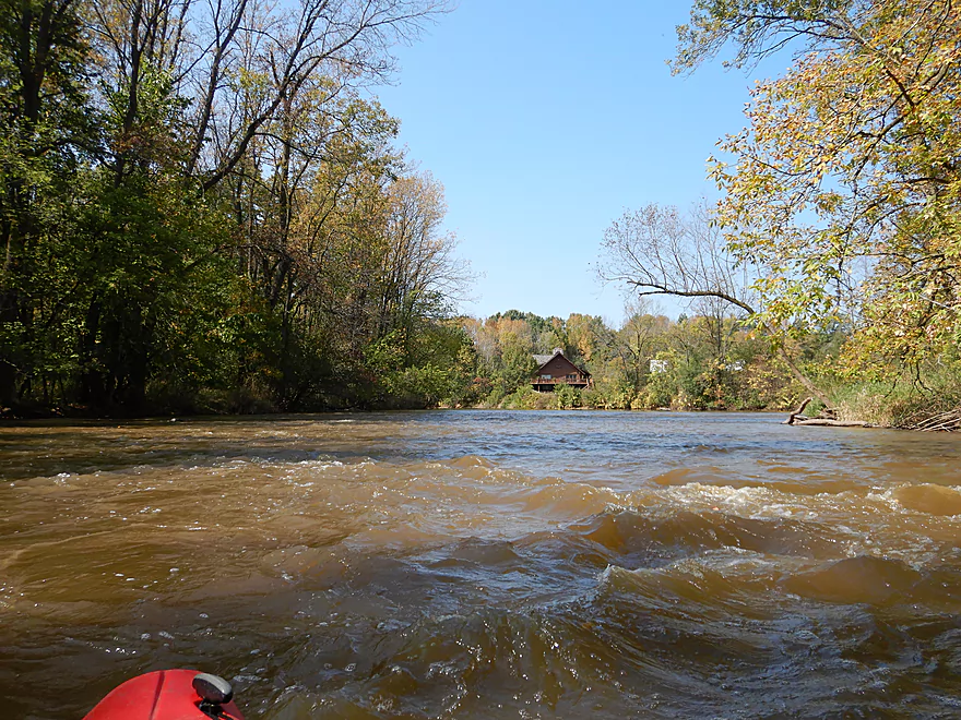
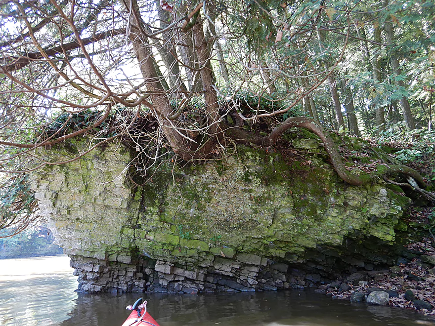
One of only a few houses I saw
Coming up on North Union Road
Great take-out
Manitowoc River

East of Lake Winnebago, the Manitowoc River flows west to east before emptying into Lake Michigan near the community of Manitowoc. The first half tends to be broad, flat, slow, and marshy. But the second half (after Hwy JJ) is completely different. Here the river narrows, speeds up significantly, becomes enveloped by steep wooded banks, and is much more interesting for paddlers.
For this trip I mulled launching at Hwy JJ or even Leist Road to experience Upper Cato Falls, but decided not to as much of the river downstream from Leist Road is impounded by the Mill Street Dam. Some flowage paddles can be ok, but generally speaking they tend not to be as interesting. Instead I launched at the dam (Mill Street), which was a very good put-in option.
My first impression of the river was, wow…this is fast! For the first few miles it was almost continuous riffles and light rapids, which is great for slow paddlers (like myself). Another unexpected surprise was the presence of dolomite outcrops along the banks. Nothing huge, but still quite nice. While the banks were relatively clean, and the rocky substrate was mostly devoid of mud, the water itself was a pretty murky brown, which was unfortunate. This is largely the by-product of poor agricultural practices upstream. In fact manure runoff in this part of the state has been so bad, even our do-nothing-DNR actually did something about it!
About a mile downstream from the dam is the best feature of the trip, if not the entire river, in Lower Cato Falls. Here there are a set of Class 3 rapids that descend 4′ over dolomite bedrock. After scouting this beforehand, I determined the ledge was too irregular to run at these “low” levels and decided to portage, which was easy enough. The falls are adjacent to ‘Lower Cato Falls County Park’ which is popular for locals who like to fish and take pictures. In fact…I think several of the locals were annoyed with how long it took me to do the portage (had to take lots of pictures and video!). Following the falls is a cool section of dells with dolomite walls on both sides of the river. The texture of the dolomite was quite exquisite…often brick-like and warped with several alcove-like caves that you could paddle under.
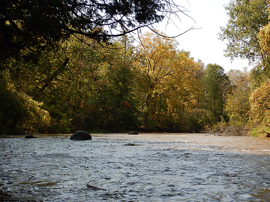
There really aren’t any more outcrops after Lower Cato Falls, but the river stays nice. The downstream section reminded me of the Sheboygan River, but faster and dirtier. Pines and cedars start to supplement the hardwoods along the banks and occasional small boulders appear in the channel. The next bridge is Hwy S which is a great take-out option. This was the site of the old Oslo Dam and all that remains is a fun little Class 1 chute.
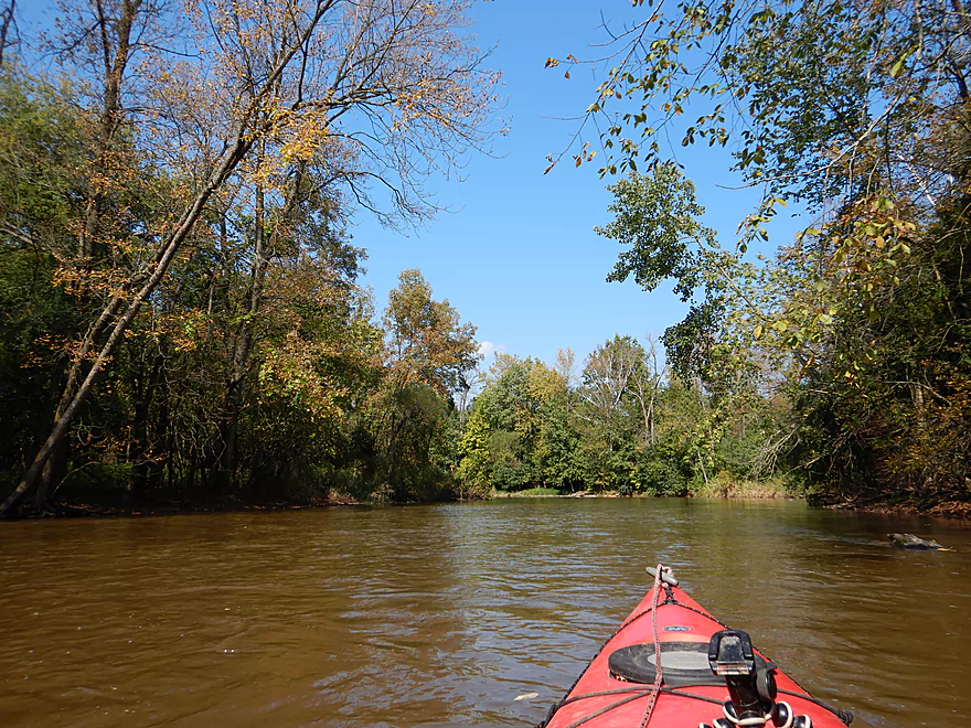
The 2nd third of the trip flowed from Hwy S to Hwy H. Here the river slows somewhat (instead of almost continuous riffles, it was maybe riffles 50% of the time). This was a nice section but not as top-notch as the first and last parts of the trip. Despite this being a pretty developed area of the state, the banks are almost always wooded and I only saw a few homes on the entire trip. Hwy H I scouted from my bike shuttle and really it isn’t a practical take-out option (too steep and close to a home).
The last third of the trip flowed from Hwy H to North Union Road. Here the current picks up speed and had several stronger Class 1 rapids. A little downstream from Hwy H was the nicest and largest boulder gardens of the entire trip. At the end of the boulder gardens is a stronger section of rapids (paddling author Mike Svob called this a Class 2). North Union Road is a nice area for paddlers to get out. Try not to miss this bridge as the next take-out option would be 9 miles downstream at Michigan Ave.
In summary, this was a great trip that I highly recommend. Just a really nice wilderness paddle with great current and fun rapids. The highlights being Lower Cato Falls and the dolomite outcrops, while the lowlight was the brown murky water.
By the dam in the community of Clark Mills there is a public landing that allows for public access. If you are taking out, you can use the main boat ramp above the dam (curiously close to the dam itself!), but if you are starting a trip, you can easily launch downstream of the dam. This launch has good parking, no fees, and is relatively unused. There is an outhouse but it is not usable.
Northwest of N. Union Road, there is a nice mowed section which makes getting out pretty easy. Parking is available along the shoulder. No outhouses nor any other amenities.
I am unaware of any local liveries or rentals.
The bike shuttle route I did wasn’t fun. The roads here are somewhat hilly with a total of 249′ of ascent and 131′ of descent. On the plus side, traffic wasn’t too bad, there was no gravel, and the route only spanned 5.2 miles. Being tired after my kayak trip, and biking in sunny 90 degree temperatures might have made this seem worse than it was though.
There aren’t any logjams to worry about, as the river is too wide for them, but there are strainers to be mindful of (easy to dodge if you are paying attention).
The current is quite fast with countless riffles and a few Class 1 rapids. Most of this at my lower depth was pretty safe and easy, but could be trickier at higher depths.
About a mile downstream from Hwy HH, there are some stronger rapids by the boulder gardens (padding author Mike Svob calls these Class 2), but at lower levels they were pretty easy.
The most significant hazard on the river would be Little Cato Falls, which is located about halfway between Hwy J and Hwy S. This is a Class 3 drop over roughly 4′. I HIGHLY advise scouting this beforehand from the adjacent county park so you can see how to run it, or how to portage it. At my depth, the falls seemed too irregular to run, so I portaged (somewhat simple enough along the south bank). If you do the rapids, you’ll want to go almost all the way to the right/south and then at the last second cut left. This will make sense when you see the video below (0:31).
The following is a very rough depth guide based on the gauge downstream.
- 0-60 CFS: A typical fall depth is 50 CFS. This might be too low to run.
- 61-100 CFS: Likely a low depth in many spots, but I think it would be manageable. There would be some nice boulder gardens at this depth.
- 101-200 CFS: Likely a good depth.
- 201-300 CFS: A good depth with no shallow issues to worry about. I did the trip at 240 CFS.
- 301-400 CFS: Starting to get on the high side for recreational paddlers, but should be doable. Likely a starting depth for hardcore whitewater paddlers.
- 401-500 CFS: A high depth and some of the banks will likely be underwater. Maybe not enjoyable for rec paddlers, but enjoyable for hardcore whitewater paddlers.
- 501+ CFS: Only suitable for hardcore whitewater paddlers. Water can be filthy then because of manure runoff.
For those just interested in running Little Cato Falls, here is a collection of videos and depth references.
- 132 CFS – RiverDarter.com: This shows a manageable run close to the center.
- 240 CFS – Wisconsin River Trips Video: My depth. I thought the falls were too irregular and portaged.
- 430 CFS – Youtube Video: High water. You can see the best line is right center.
- 764 CFS – Youtube Video: Pretty high depth.
- 1400 CFS – Quadcopter Video: Very high water.
Not much. Some dragonflies, a few blue herons and several fish, but more fishermen than fish sighted. Salmon do migrate up this river on this very stretch in October and if you’re lucky you can see one.
- Upstream of Collins: The river splits into multiple sections (North Branch, South Branch, Killsnake River, and Cedar Creek). Much of which is navigable but I know little about these parts.
- Hwy PP to Hwy W: 9.0 miles. Technically this upper part is mostly the North Branch. This is doable for paddling, but likely less interesting (broad, straight and slow).
- Hwy W to Quarry Road: 4.0 miles. Likely a simple marsh paddle. Launching from the Collins Marsh dam and Mud Creek is a nicer way to start this leg.
- Quarry Road to County Road JJ: 3.2 miles. Likely a simple, slow, and less interesting section.
- County Road JJ to Leist Road: 2.6 miles. River narrows and becomes much nicer.
- Leist Road to Clark Mills/Dam: 2.2 miles. Shortly after Leist is Upper Cato Falls, which is a fun Class 2 run. After that, the river becomes a slow flowage due to the downstream dam.
- Clark Mills to North Union Road: 6.2 miles. A great section.
- Clark Mills to Hwy S: 2.7 miles. Terrific section with near non-stop riffles, several dolomite outcrops and Lower Cato Falls (a scenic Class 3 ledge).
- Hwy S to North Union Road: 3.5 miles. Good section with many riffles, attractive wooded banks, and a few boulder gardens.
- North Union Road to Manitowoc River Access Park: 11.3 miles.
- North Union Road to Michigan Ave: 9.0 miles. A great stretch with a nearly mile long section of Class 1-2 rapids under I43. Michigan Ave is a sketchy take-out (you may have to park your vehicle further away from bridge), but it should be doable. For alternate launch options on the Branch River see AmericanWhitewater.org.
- Michigan Ave to Manitowoc River Access Park: 2.4 miles. River is slower with less rapids but should still be nice.
- Manitowoc River Access Park to Lake Michigan/Maritime Drive Beach: 4.5 miles. Nice prospect through downtown Manitowoc. Highlights include the ship building factory, the Wisconsin Maritime Museum, and the mouth on Lake Michigan. If you’re lucky, you can see a ship go under one of the drawbridges. Several alternate landings include Henry Schuette Park and Manitou Park.
One of the biggest tributaries to the Manitowoc River is the Branch River which looks like a good prospect as well.
Trip Map
Overview Map
Video
Photos Size:
In regards to the post when you launched your kayak at the Mills Clark dam. Are you able to paddle upstream on after drifting down stream.
Hi Andres. The current is very strong below the dam. You would not be able to do a down and back from there…this would likely have to be a one-way trip. If you wished to do a round-trip above the dam, that would be easy though. Just launch at the boat ramp and paddle upstream as far as you wish. You could actually paddle up to Little Cato Falls.
Thank you for such a detailed and thorough description of this trip.