
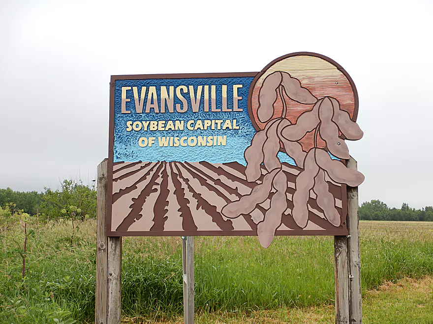
Welcome to the soybean capital of Wisconsin
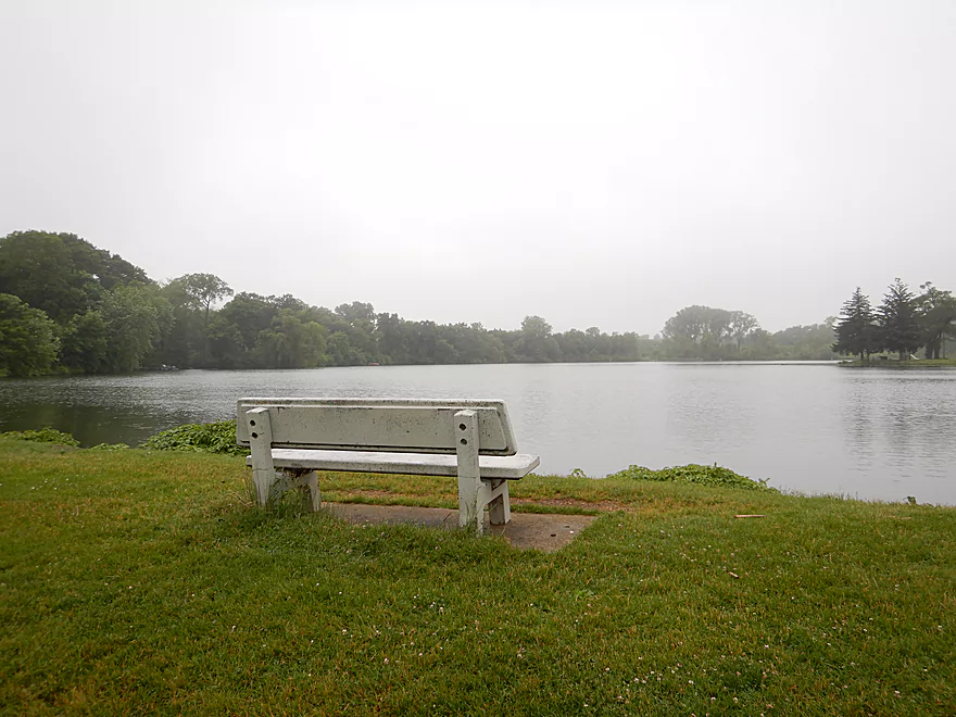
Starting the trip near Lake Leota
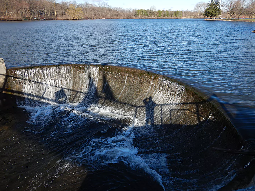
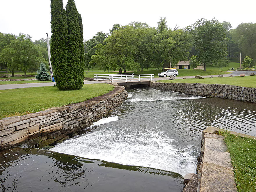
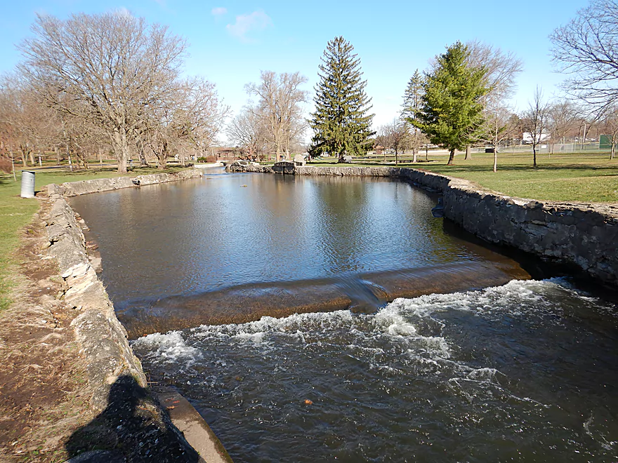
Created by two curved dams
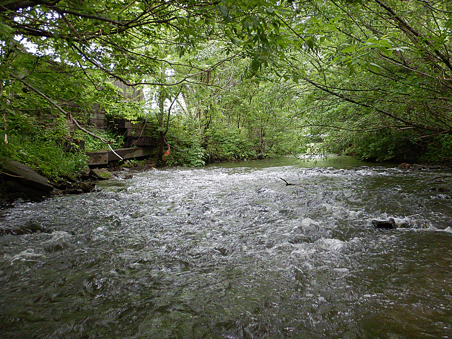
Below the dams are two chutes
These are a little strong for kayaking
Instead I started by Antes Drive
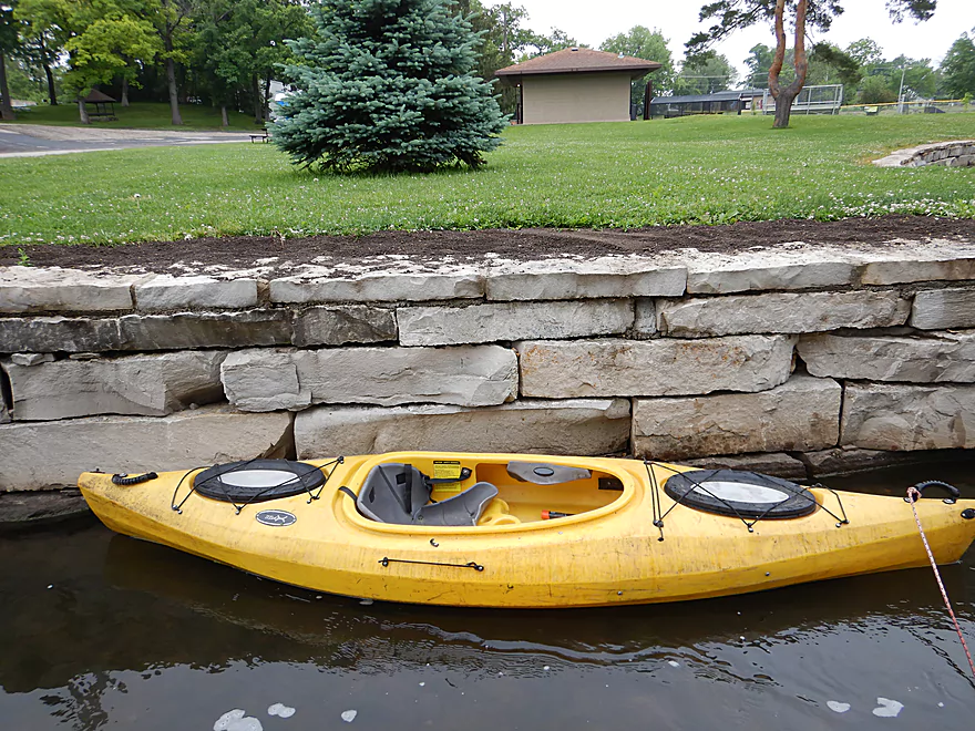
No sloped shoreline for launching so I just waded in
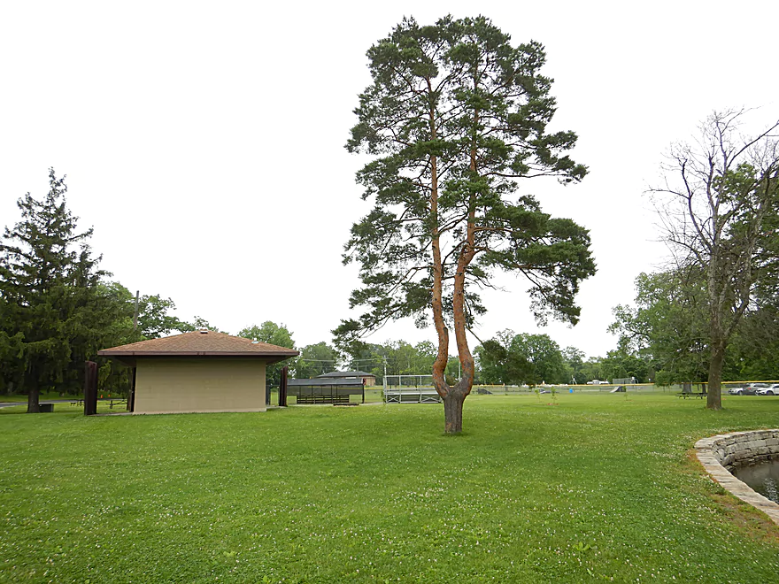
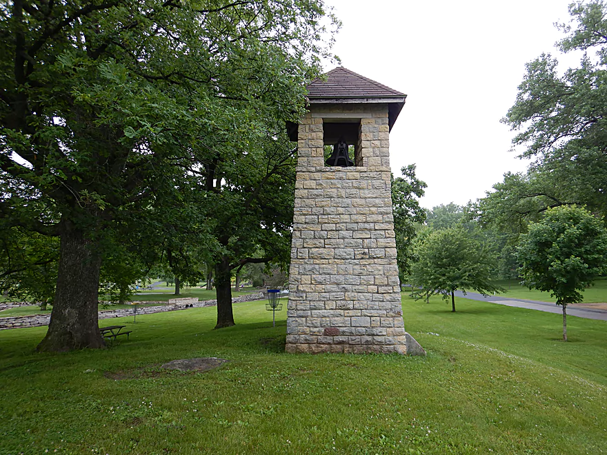
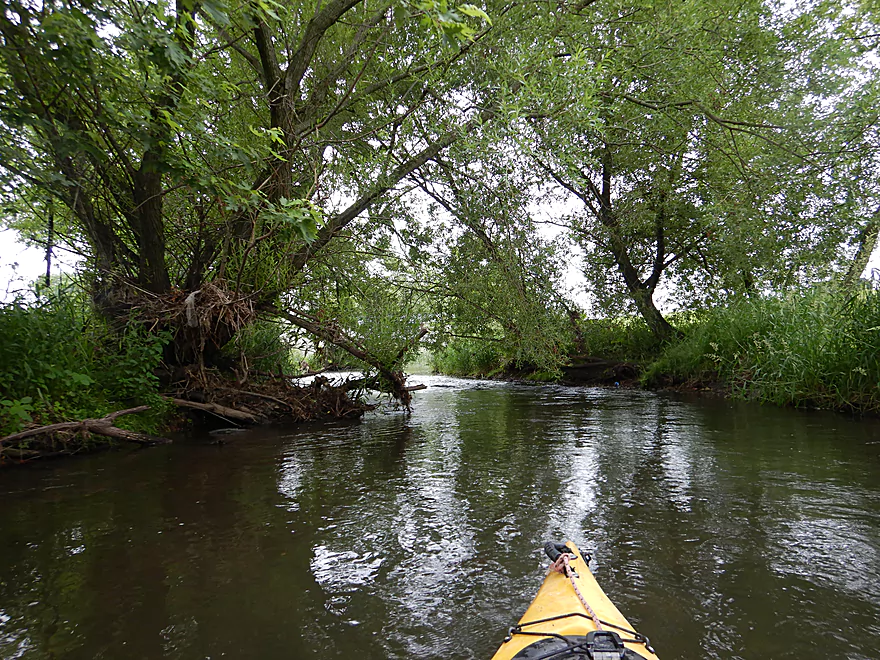
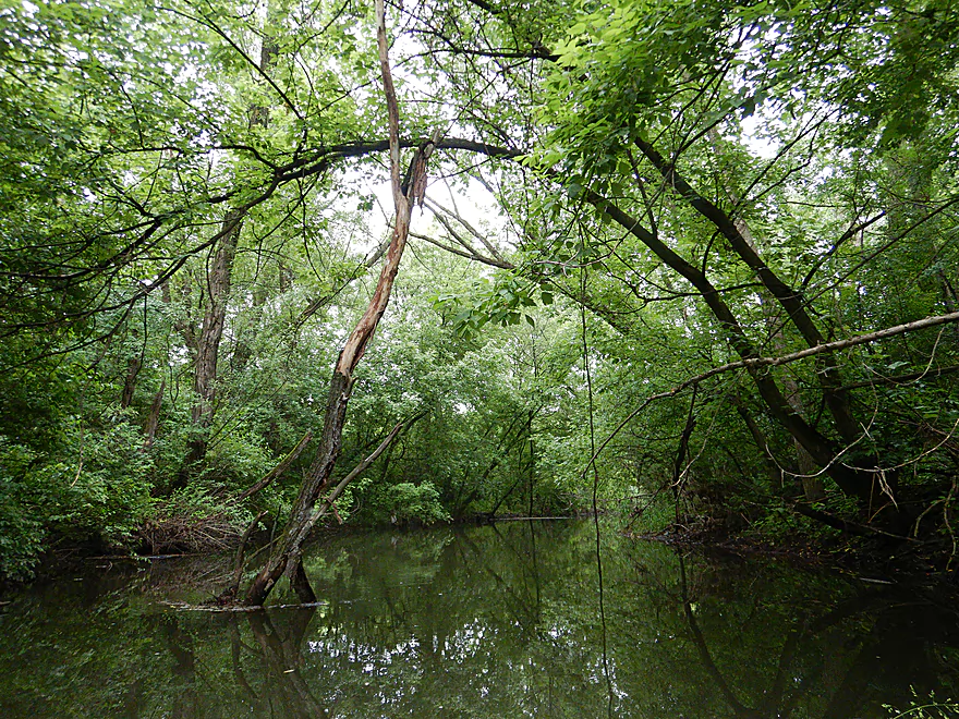
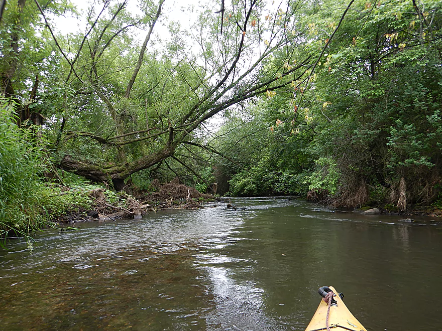
Two trees in one
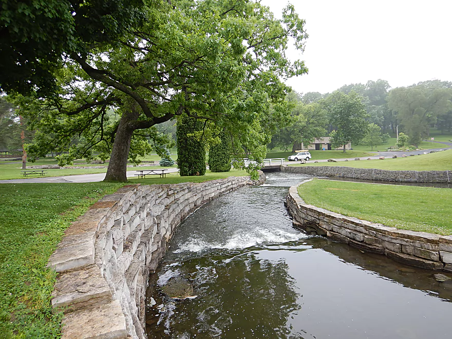
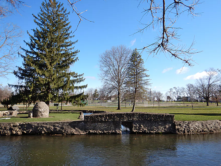
Neat little park located below the dam
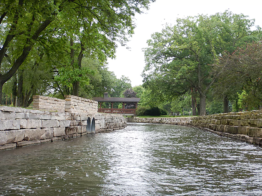
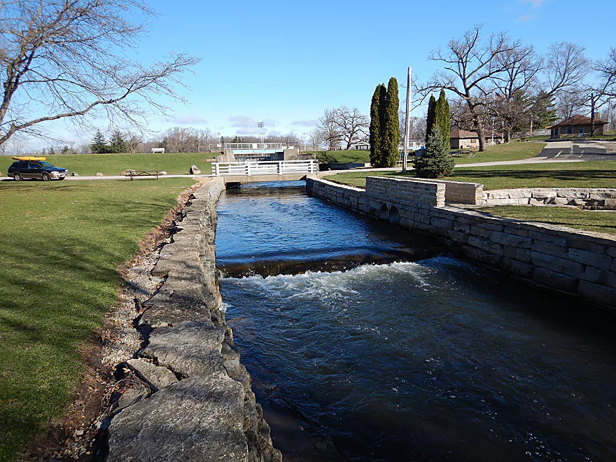
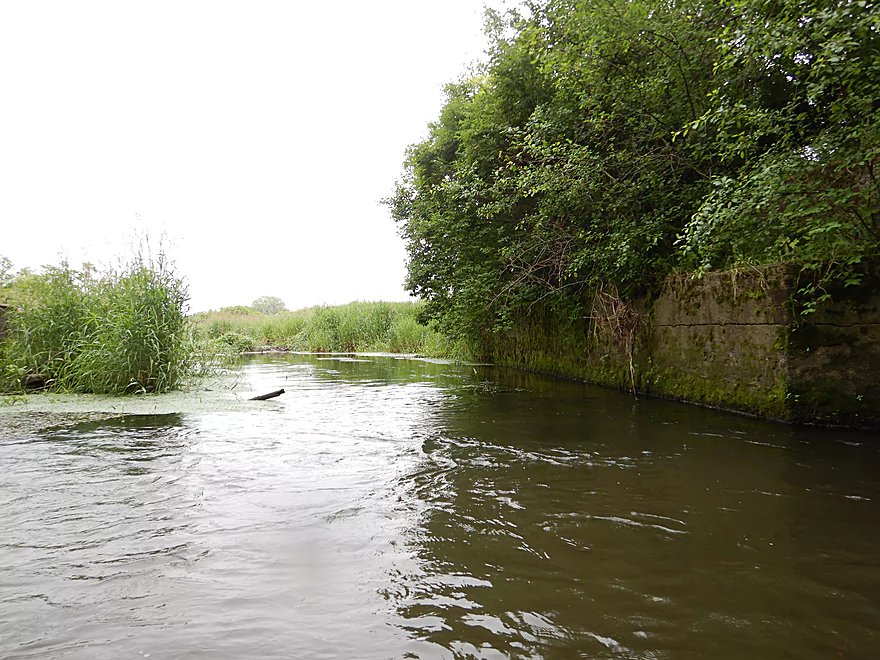
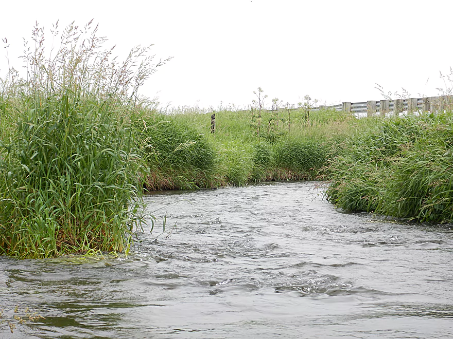
The channel here is artificial but attractive
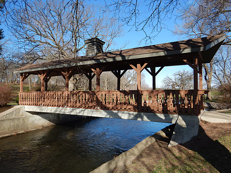
A scenic covered bridge
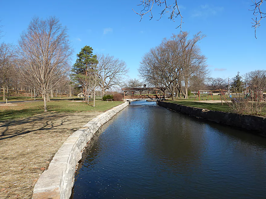
The stone block shoreline extends the length of the park
One of two side canals
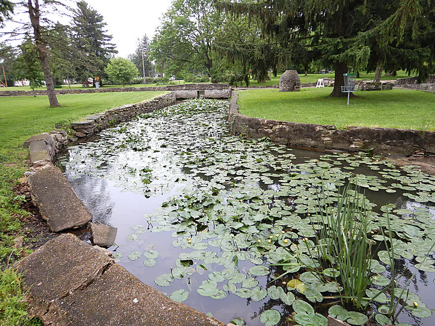
This one filled with lilies
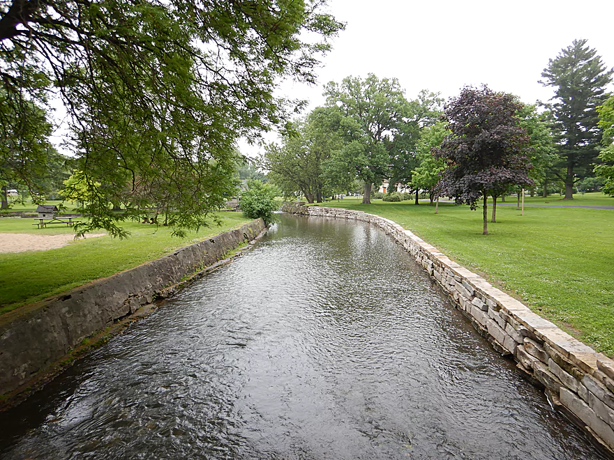
Final stretch of the park
Two more ledges to bump over
Reverse view
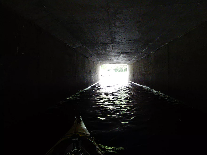
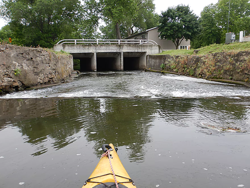
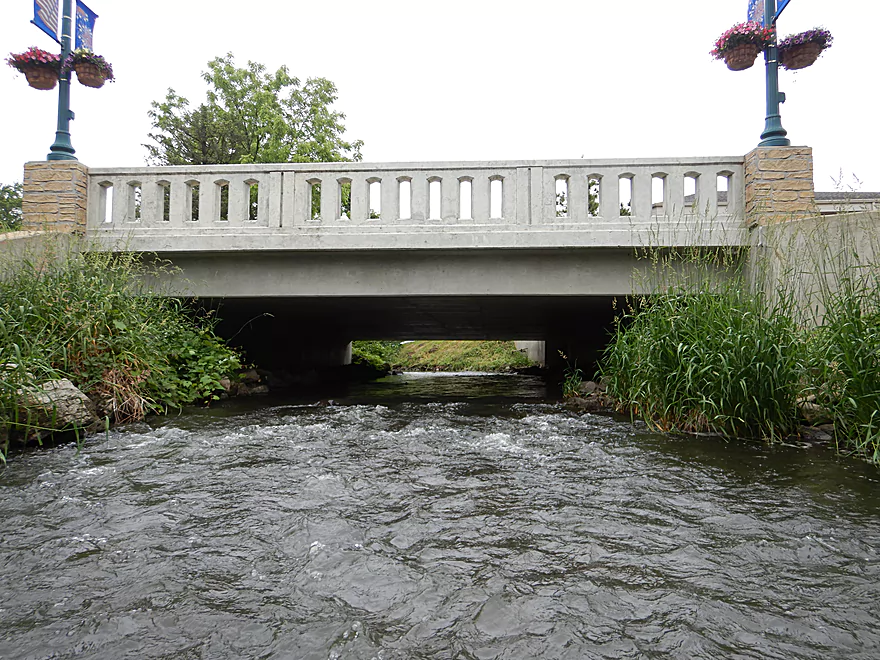
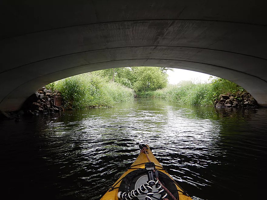
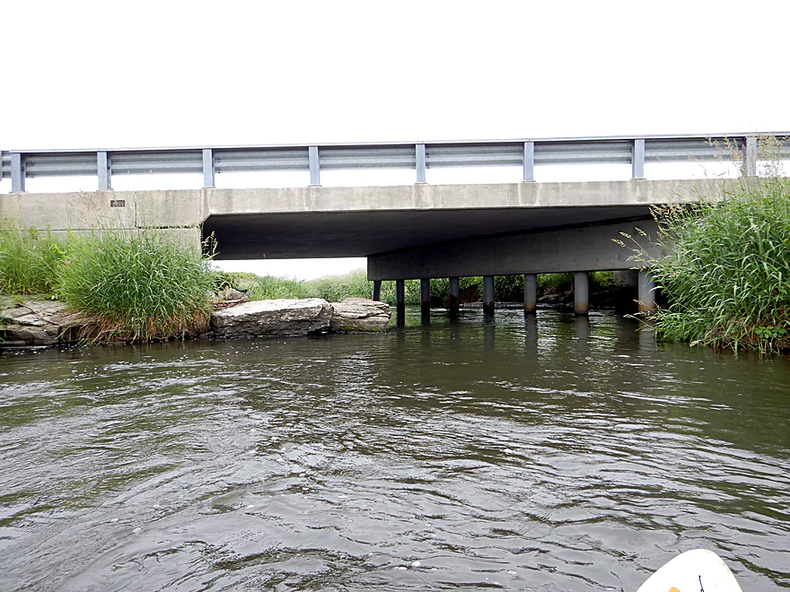
Paddling under Madison Street
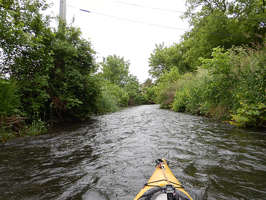
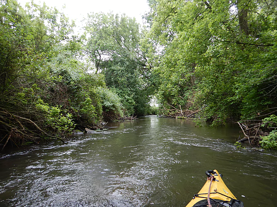
Leaving the park behind
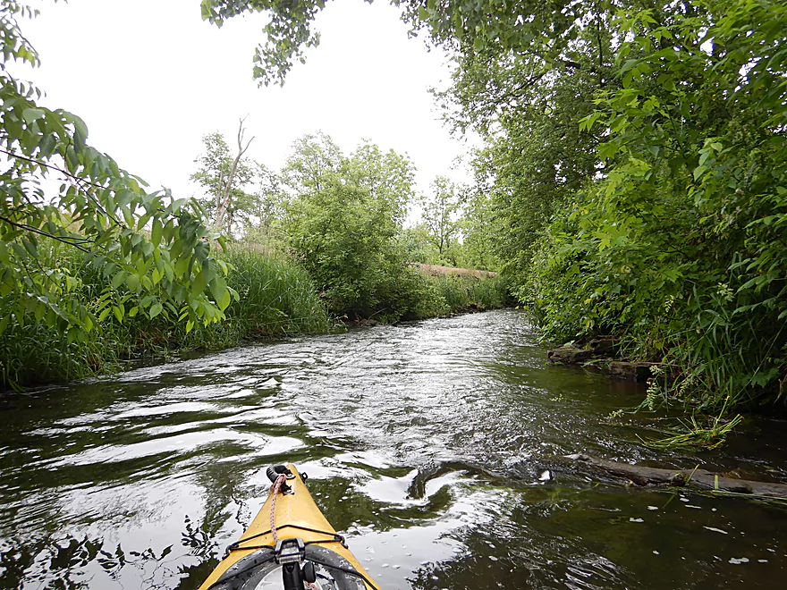
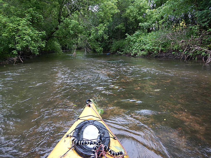
Still some light rapids
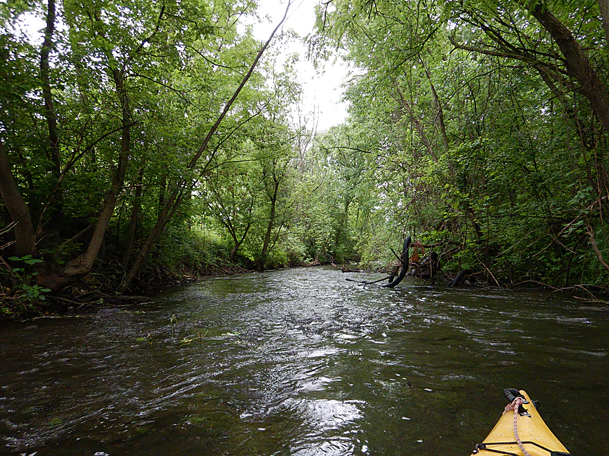
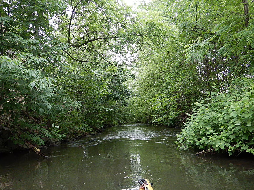
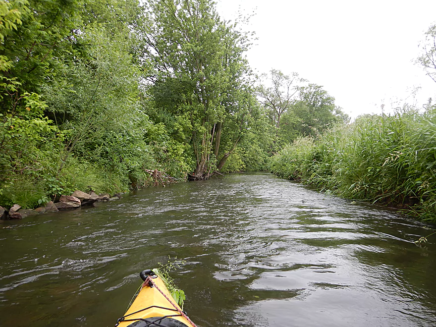
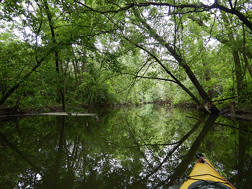
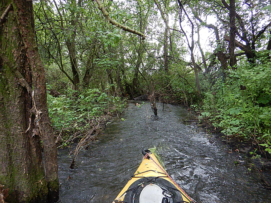
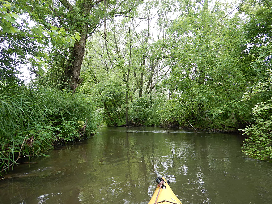
Thick tree cover
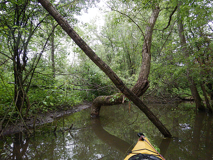
Some snags, but no portages (yet)
Main Street in Evansville
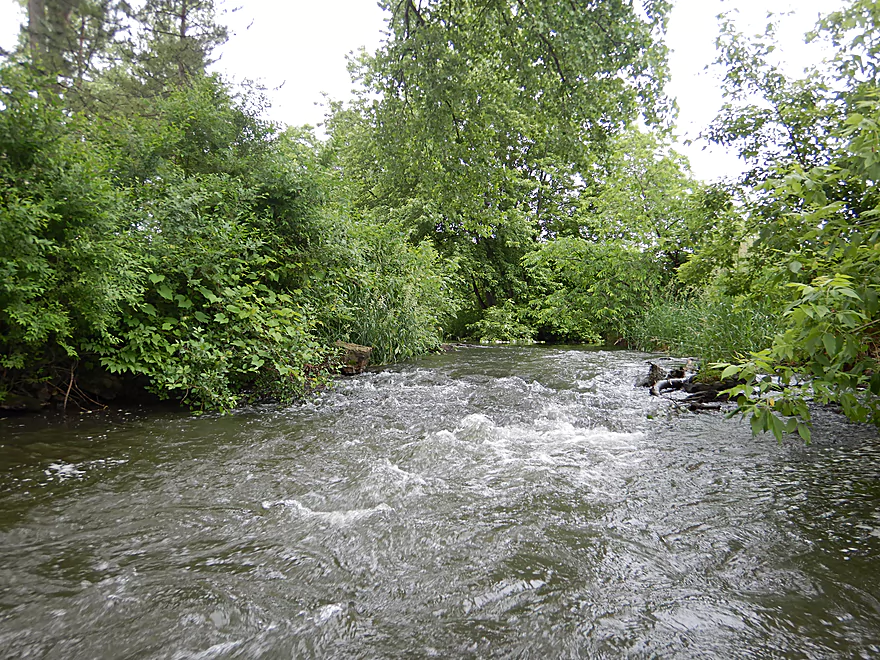
Current stays brisk
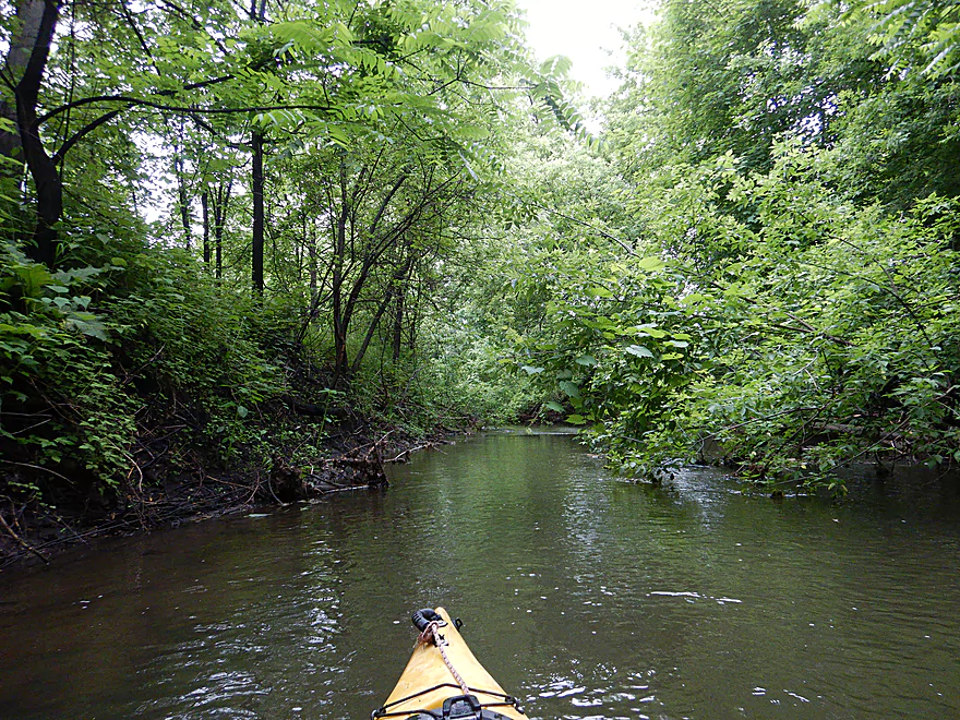
A tree tunnel
Some shallow rapids
Some mud, but not too bad
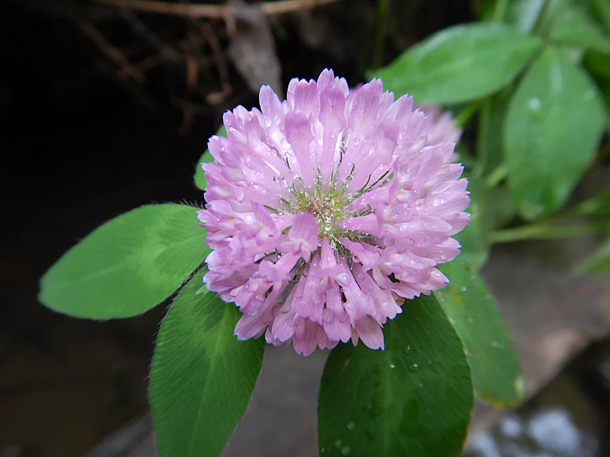
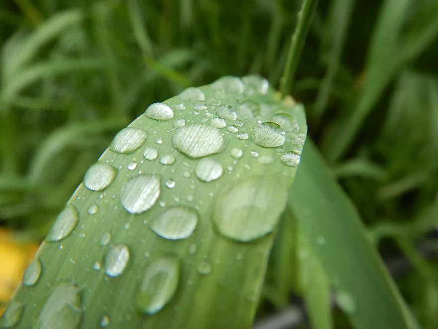
Red Clover Flower
Bit of an open area by Varco Pruden (large factory)
Starting to leave Evansville behind
First portage
Weedy but manageable
Unfortunately just then it started to rain
Creek was mostlty turbid, but there were some clear spots
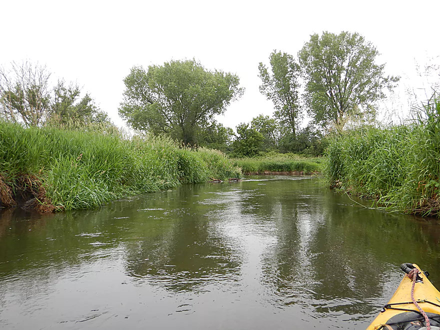
A rare open area
Then back into the jungle
Kind of cool
A reflection gateway
Curious…
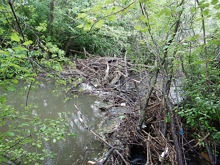
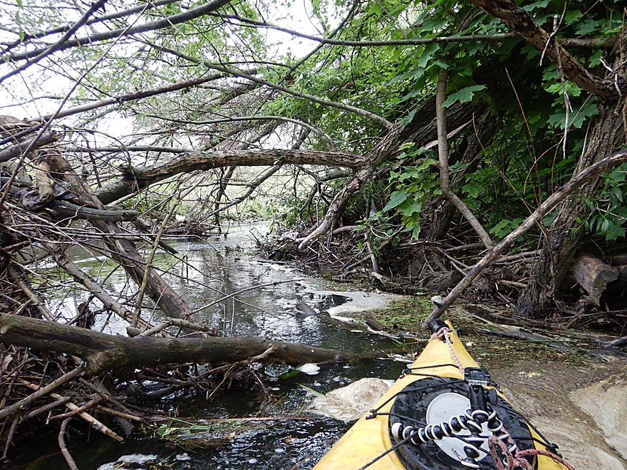
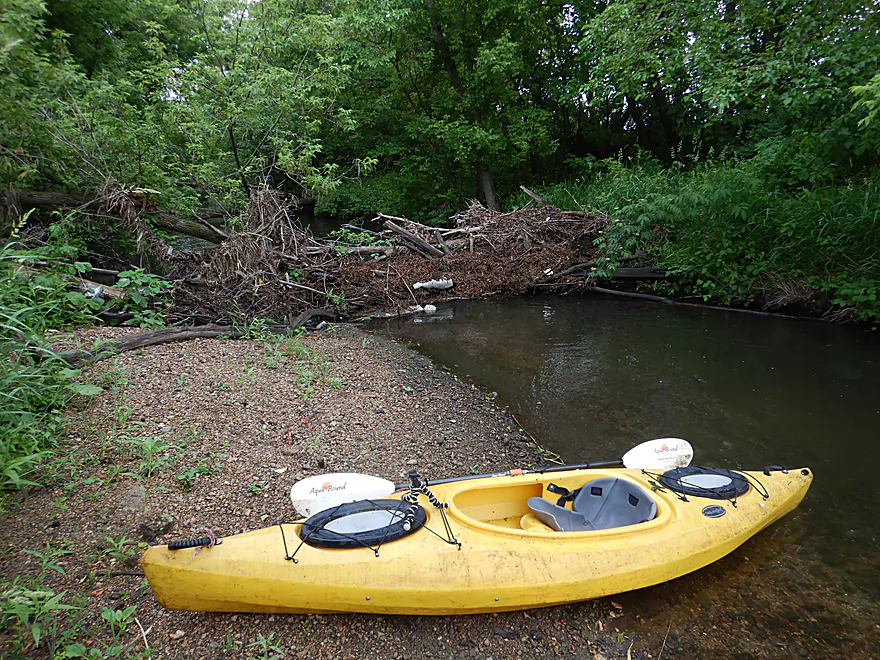
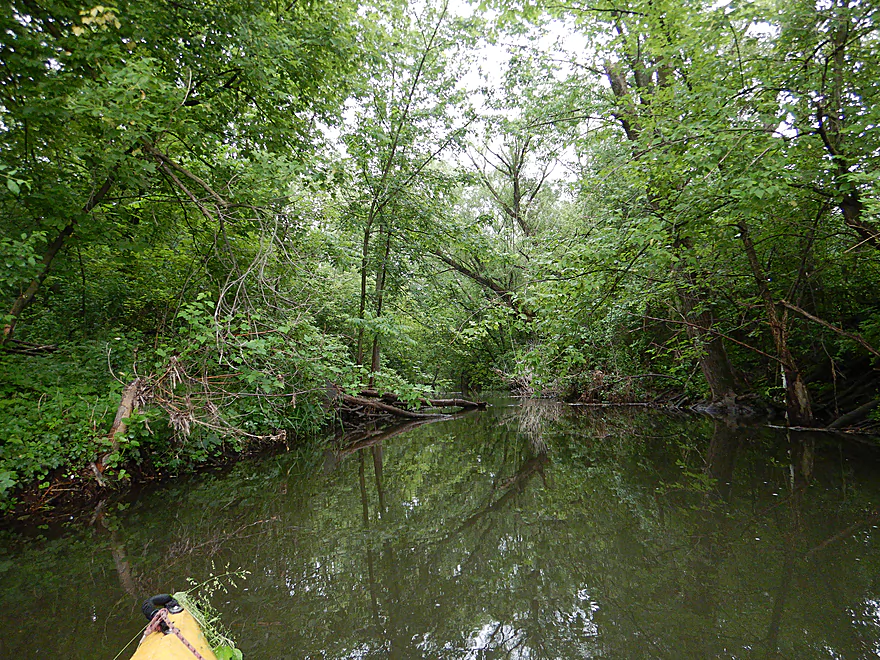
Coming up on a massive logjam
There is almost a sneaky bypass on the right
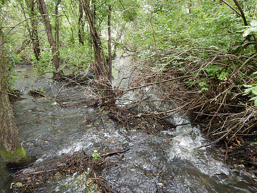
But it too must be portaged (#2)
Poorly pictured but this is a major tributary
Almost done with the woods

Logjam portage #3
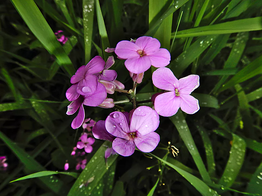
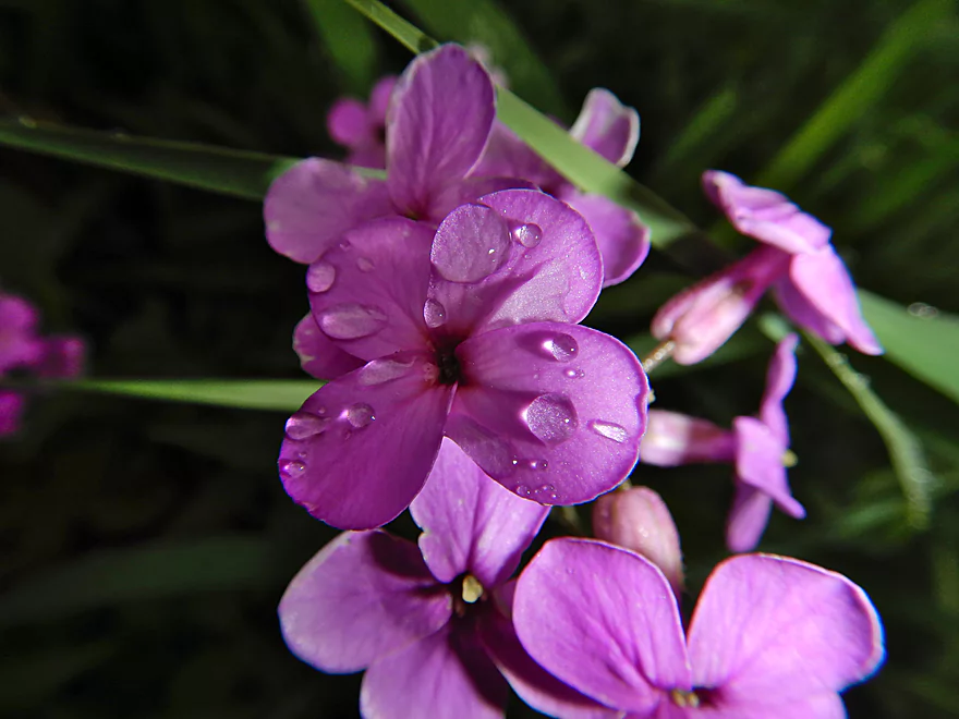
Dame’s Rocket
No need for a macro spritzer today
No more logjams from here on
Finally entering the Evansville Wildlife Area
Last of the trees
Next two miles were a lot of this
One grassy turn after another
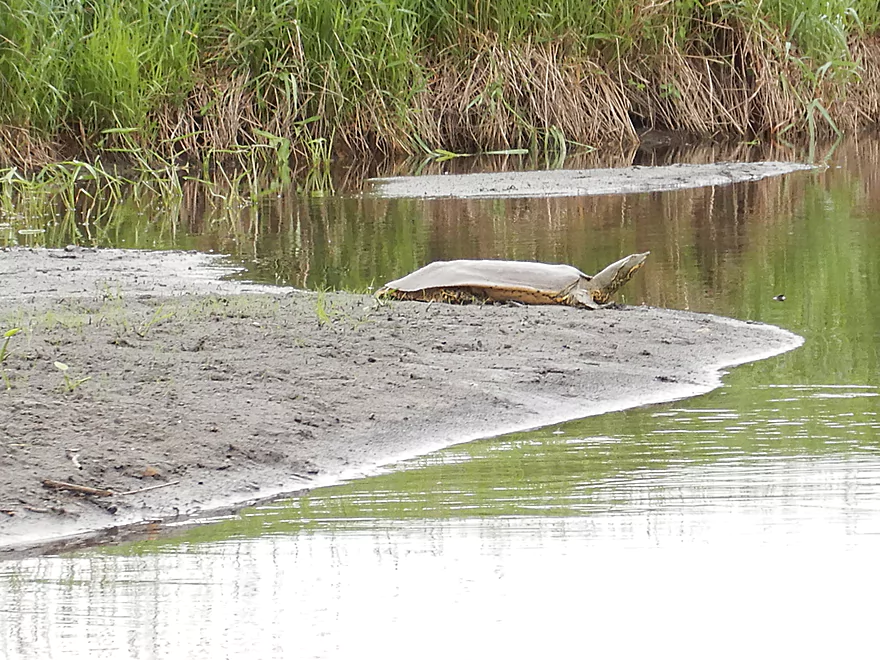
One of two softshells I saw that day
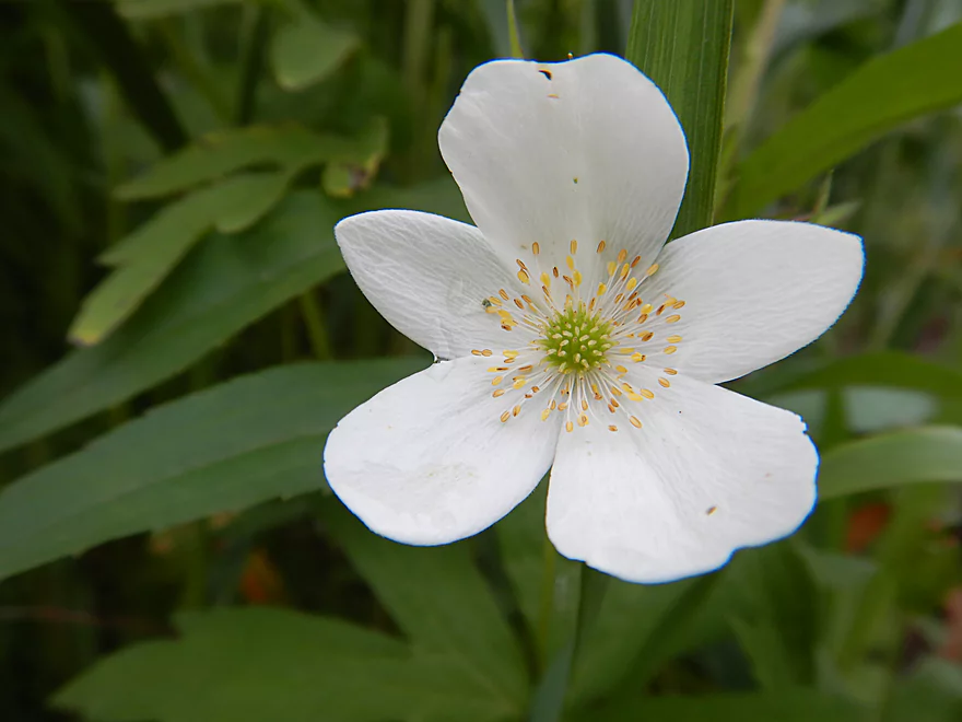
Canada anemone
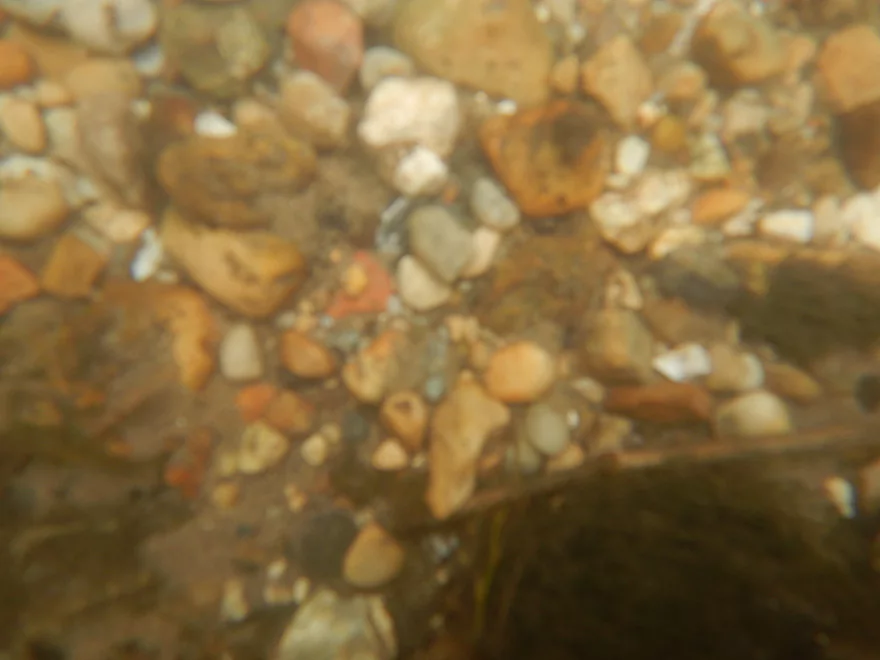
Quick underwater shot
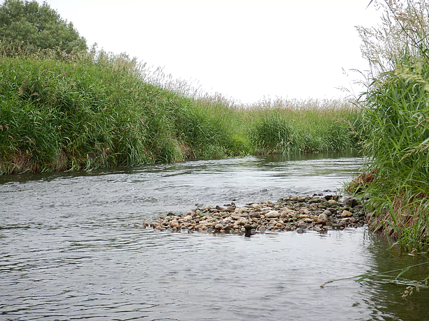
Surprising amount of gravel
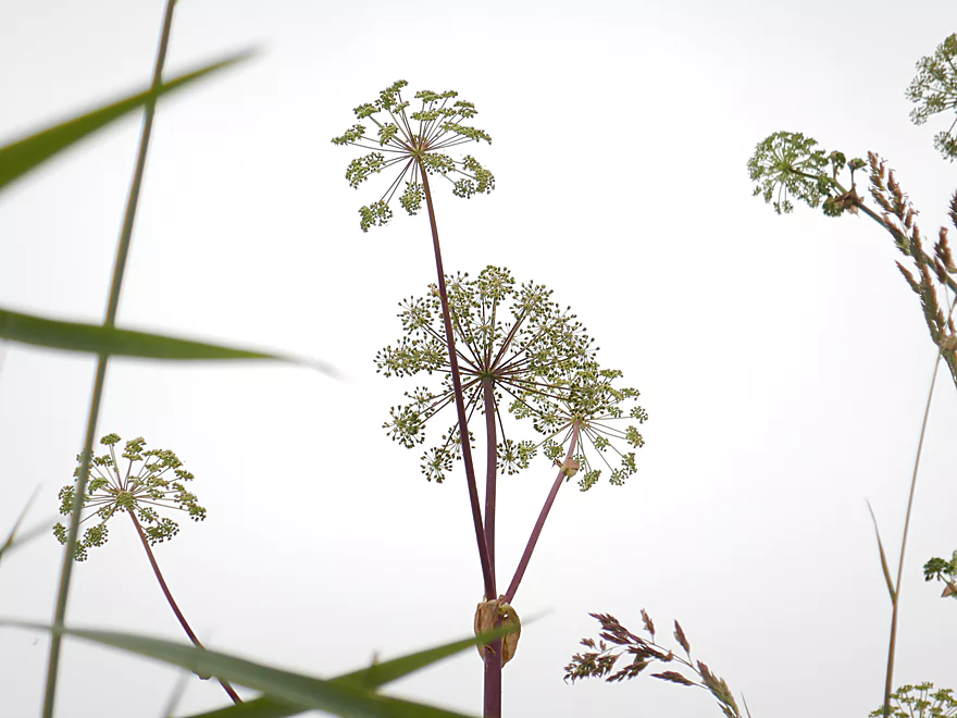
Angelica…nature’s fireworks
Last of the riffles
Ending the trip at Hwy 59
Doable but weedy take-out
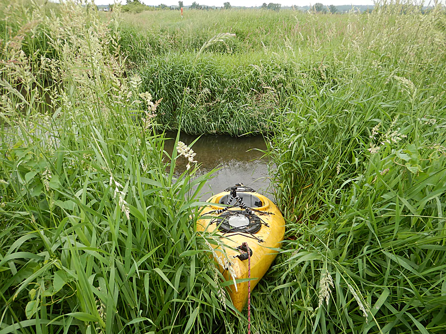
The grass was REALLY high
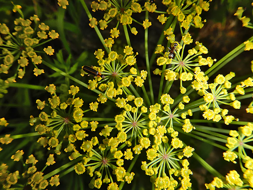
Insects don’t seem to mind the wild parsnip
Looking downstream…likely a future trip
Scouting time…Allen Creek by Hwy 92 looks really nice
It also looks good for paddling by Hwy 104
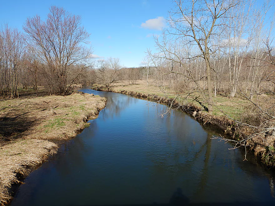
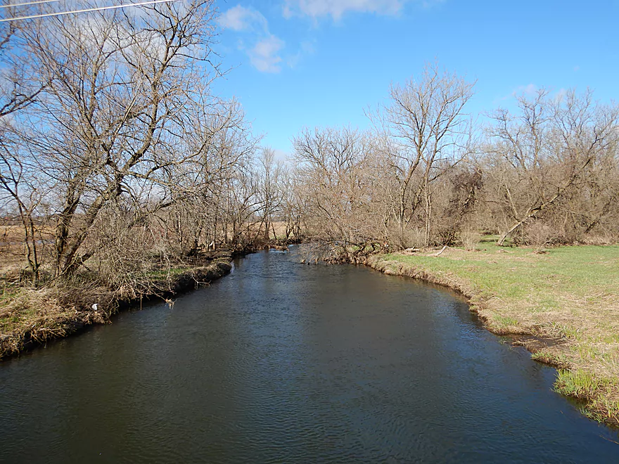
Allen Creek

Allen Creek is a small tributary of the Sugar River located just west of Janesville. While multiple segments of this creek are navigable for paddlers, I chose an obscure upstream leg which had peaked my interest when scouting it two months ago.
At the north end of Evansville, Allen Creek is held back by two concrete, semi-circular dams to create Lake Leota. The dams are followed by Lake Leota Park where the stream has been artificially straightened and modified to flow through an artificial canal with a series of ledges. Typically, concrete and creeks don’t work well together but here it did and and was kind of artsy. For the next 1000′ feet the creek flowed quickly past short concrete walls and over several ledges. Along the sides two side canals connected to the main creek, one of which had a large lily bed. The highlight was in the center of the park, which had a striking covered bridge.
I knew from scouting this that it would be a neat part of a trip but also challenging. For starters, there are no sloped banks for launching and I had to wade in to launch. The other issue was the ledges, some of which had recirculating current and others which were shallow. While I did hit a few bumps, it all worked out ok.
Following Madison Street, Allen Creek lost its concrete and became a more typical urban creek. Here the narrow channel flowed quickly under thickly wooded canopies and over several light rapids. This wasn’t the cleanest of creeks as the clarity was somewhat turbid and occasional trash lined the banks but it was scenic. The creek was mostly free of logjams with a few dodgers, but this changed at the Varco Pruden Buildings bridge where I had to endure my first logjam. This wasn’t the funnest of portages as the banks here were weedy and wet from a recent rain, but at least the channel was shallow enough to wade in.
Following this large industrial complex, the creek became a jungle. Lush branches curved over and encapsulated the creek, creating a bit of a tunnel effect. This was a really cool part of the creek, but the deadfall started to become more frequent which required some hopping, dodging and zigzagging. I soon came across a massive two-foot logjam…it looked ancient, with trees growing on an island it had created. There was a side chute to the right that almost bypassed this cluster, but it too had one snag that ultimately had to be portaged (#2). I was mostly able to wade this portage, which helped but the current was fast which made getting back into my boat difficult.
Soon I encountered a significant tributary to the left which signified the halfway point of the trip and meant I would soon be paddling onto the Evansville Wildlife Area. I did have to endure portage #3, but after that would be no more logjams for the next two miles.
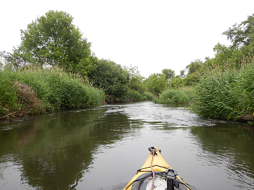
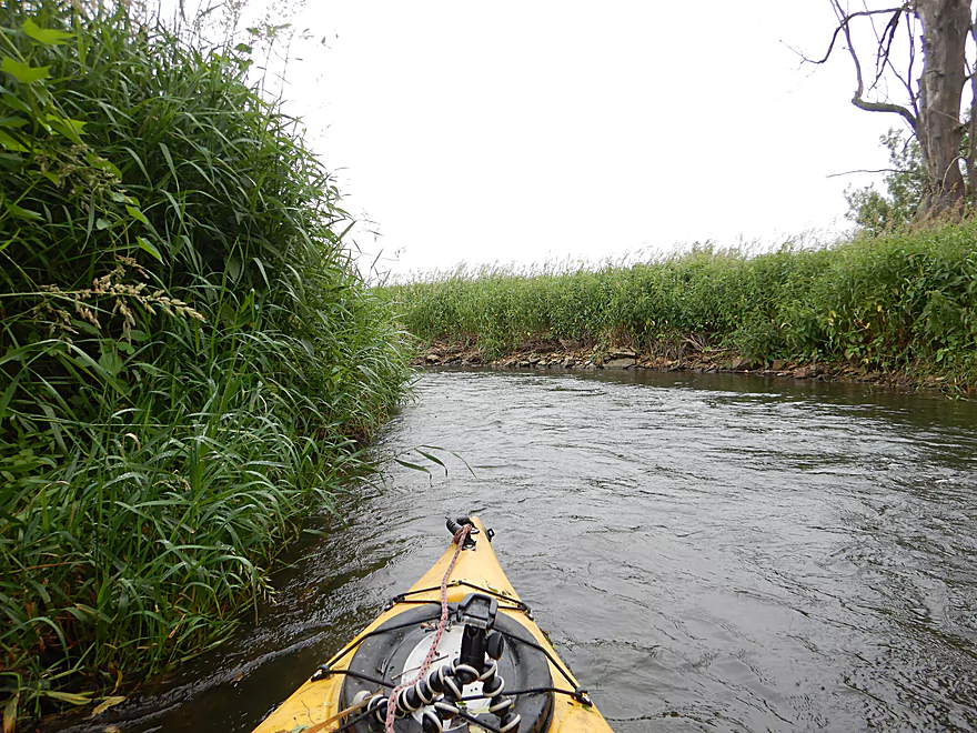
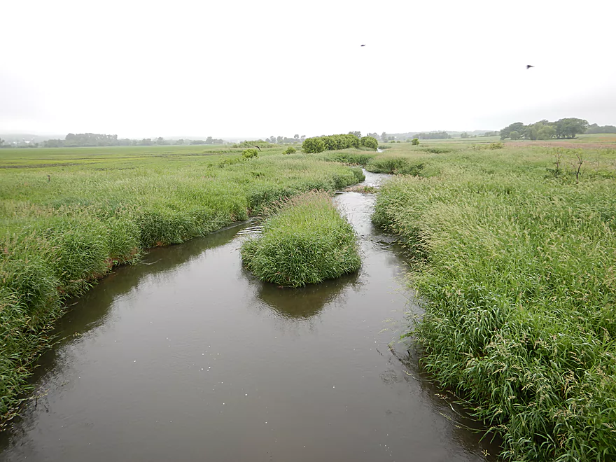
The wildlife area flowed through a large wetgrass marsh with few trees. The creek slows somewhat and starts to meander aggressively through banks topped with tall grass. This wasn’t a horrible part of the trip, but it wasn’t very interesting either. It basically was a giant slalom course through endless meanders with only grass to keep you company. That got old…I like wetgrass paddles but usually like to time them when the sun is out and the grass has died back so I can see my surroundings. I ended the trip at Hwy 59 where I had to use my paddle to cut a path through the grass safari-style to reach the car.
In summary, I’m not sure I can highly recommend this trip. Lake Leota Park had the unique canals but that was only a small portion of the trip. Paddling under dense forest canopies with occasional riffles was a lot of fun, but this was counterbalanced by three logjam portages and a few additional squeakers. Most paddlers won’t have the patience for this amount of deadfall, which is a shame as this could be a neat water trail if cleaned up. The second half of the trip while lacking in hazards was also lacking in interesting features. For those interested in getting started on Allen Creek I actually recommend the downstream legs instead, which based on my scouting look far superior.
Some ducks, one napping crane and two big softshell turtles. Below the dam a fisherman pulled a snapper out of the water by its tail and flung him back in (looked very dangerous…snappers eat fingers). I believe I hit a turtle at one point when my paddle scooped something up that bounced off my elbow. The highlight was a muskrat snacking on a leaf who let me get pretty close (see video). The lowlight was the huge number of gnats. I had several large welts from where they had bitten me.
For those interested in the history of Lake Leota checkout this overview.
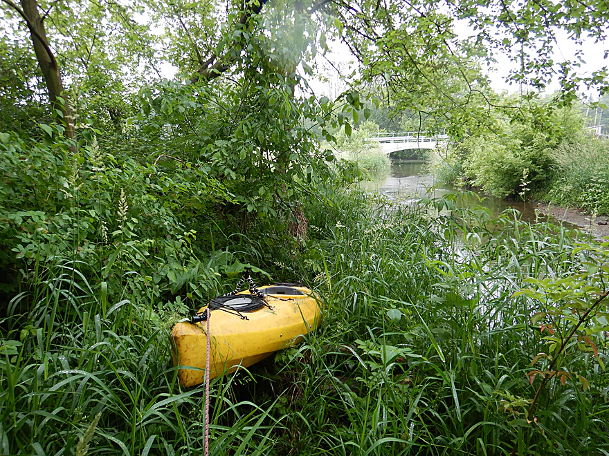
Lake Leota Park is a nice public area with good parking options and nearby outhouses. Launching is a bit tricky because the banks are vertical walls and the current is quick. I waded in just downstream of Antes Drive and pulled my boat in after me.
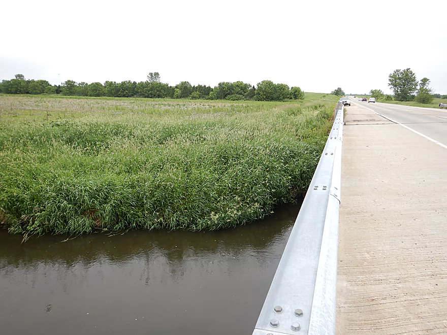
I took out at Hwy 59/213, which was extremely weedy. The best option is likely along the south side of the bridge…definitely scout this from the road before starting your trip. If you don’t want to leave your car along the shoulder of this busy highway there is a public parking lot 580′ to the north.
An alternate take-out 2.4 miles downstream would be Old Hwy 92. This wouldn’t be the greatest of bridge accesses as it is a bit rough and weedy…but is doable, with the best launch area being the southeast corner. This additional leg is a nice prospect…open and mostly free of logjams.
The bike shuttle was really easy…only 2.5 miles, paved and almost no hills. The bike route does go through downtown Evansville, which is surprisingly busy, but this wasn’t too bad.
Current: The current was surprisingly brisk. The faster parts of the creek are located at the start of the trip in Evansville. Once the creek enters the Evansville Wildlife Area it slows down (somewhat).
Logjams: I had to portage three logjams (marked on the map). On top of that there were several “duckers”, “hoppers”, and “hat pokers”. Almost all the deadfall went away once I entered the Evansville Wildlife Area (about halfway into the trip).
Rapids: Not counting the Leota Park ledges, there are a few Class 1 rapids and a handful of riffles.
Leota Park Ledges: Leota Park is unique in that after the dam, the creek falls over a series of six concrete ledges. The first few are likely too steep to kayak, so you’ll want to launch below Antes Drive. The remaining ones are runnable…but be careful. Because they are vertical ledges they can create recirculating current which can be dangerous to kayakers. Absolutely scout these before running (super easy to do). Also of note, these ledges are shallow and you want to pick your chute carefully to avoid getting hung up.
There is no gauge on Allen Creek. Badger Mill Creek is of a similar size and is somewhat in the same area. Not the most accurate analogue but the best I can muster.
- 0-10 CFS: On the low side. Lake Leota Park and some of the rapids might have to be waded. The rest of the creek should be fine. Clarity should be very good at this depth.
- 11-20 CFS: Average depth. The park and rapids will be bumpy.
- 21-40 CFS: Above average depth. Good for most ledges/rapids but still some bumps. I did the trip at 32 CFS and clarity was pretty turbid.
- 41-60 CFS: High depth. Fun for the rapids, but may be a bit pushy around some of the strainers and logjams.
- 61+ CFS: The creek might be too dirty and pushy for enjoyable paddling.
For more information on access points, see my overview map.
- N. Evansville Brooklyn Road1st to N. Evansville Brooklyn Road2nd: 2.3 miles. Tiny stream that is surprisingly open. Maybe 2 logjams.
- N. Evansville Brooklyn Road2nd to Lake Leota Park: 1.9 miles. Tiny stream that starts open then encounters woods by the railroads tracks which may contain a few jams. Then creek widens out into Lake Leota which would be a simple paddle.
- Lake Leota Park to Hwy 59/213: 4.0 miles. First half of the trip flows through a densely canopied forest with some logjam issues. Second half of the trip flows through the Evansville Wildlife Area which is open, grassy, and monotonous. Highlight of the trip are the canals in Lake Leota Park.
- Hwy 59 to Old Hwy 92: 2.4 miles. Good paddling prospect and very open. Maybe one logjam.
- Old Hwy 92 to Hwy 104: 5.0 miles. Much more wooded part of the creek and a good prospect. Maybe 3 logjams.
- Hwy 104 to English Settlement Road: 3.9 miles. Maybe 7 logjams.
- English Settlement Road to Hwy E: 1.9 miles. Maybe 3 logjams. English Settlement Road is likely not a good access.
- Hwy E to Mouth on Sugar River: 1.0 miles. Flood bottom forest…maybe 4 logjams.
- Sugar River Mouth to Albany Wildlife Area Boat Landing: 0.8 miles. Short stretch on the Sugar River to reach a nice take-out at the Albany Wildlife Area.
Trip Map
Overview Map
Video
Photos Size: