
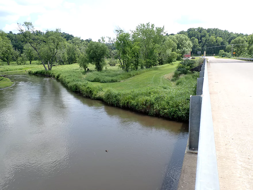
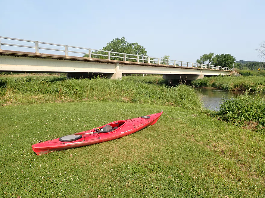
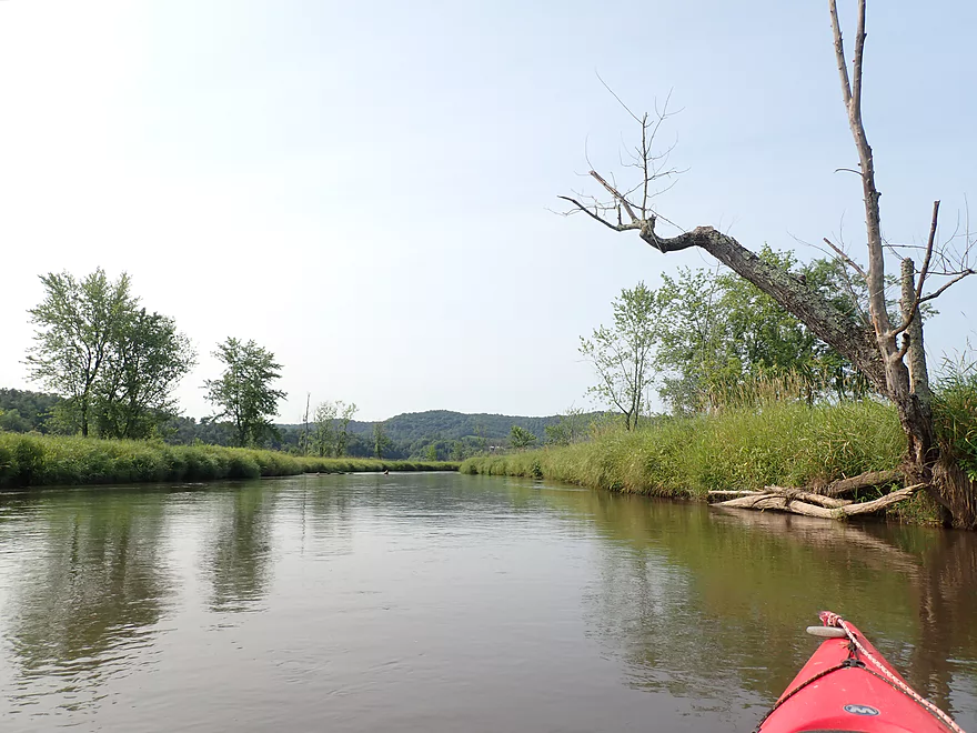
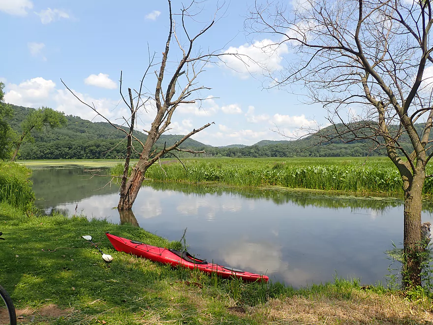
Putting in at Hwy II
Nice mowed path to the river
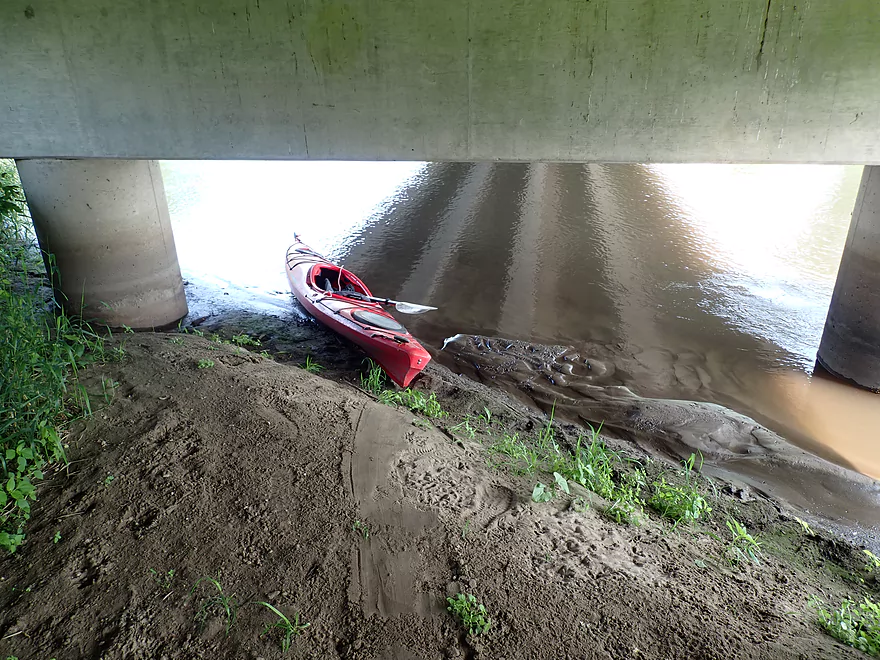
Best launch is directly under the bridge
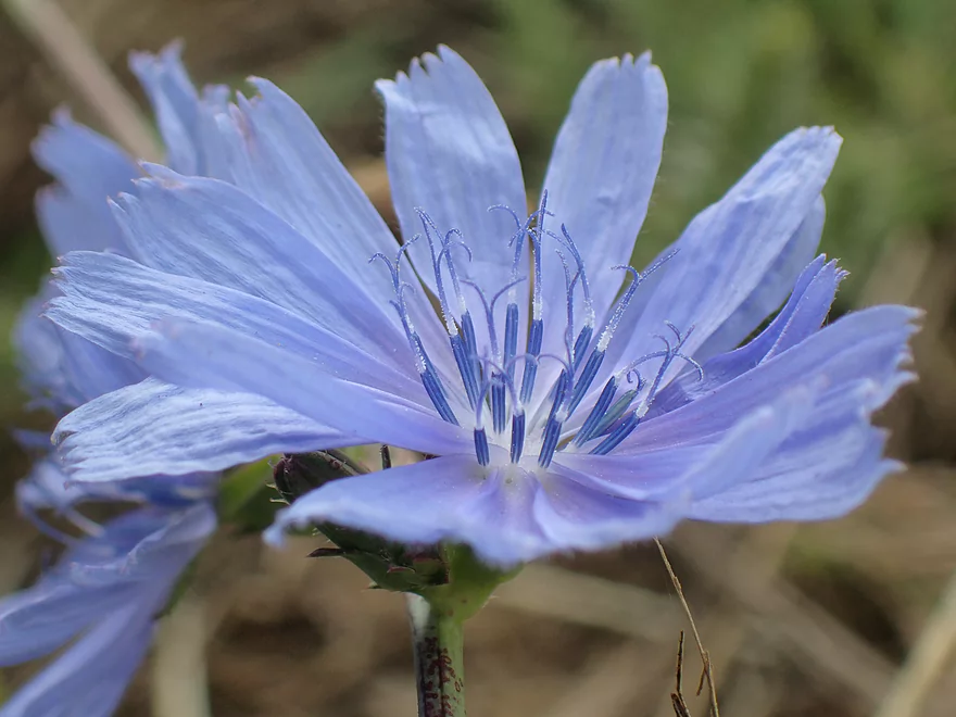
Chicory
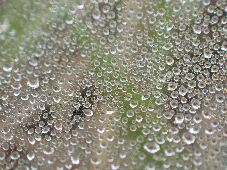
A very wet spiderweb
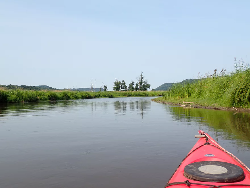
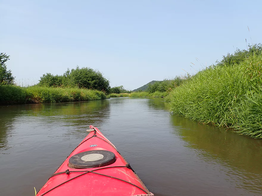
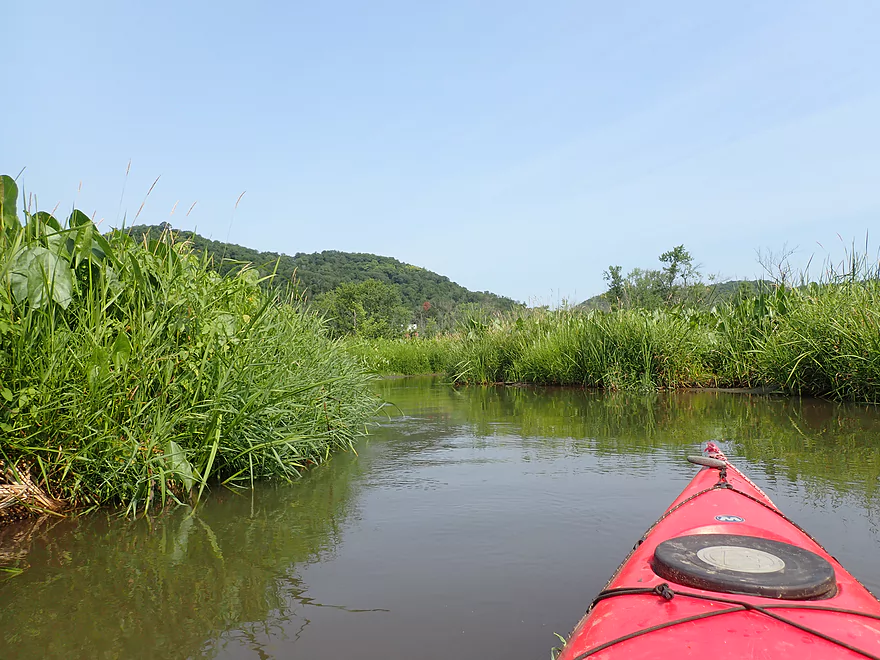
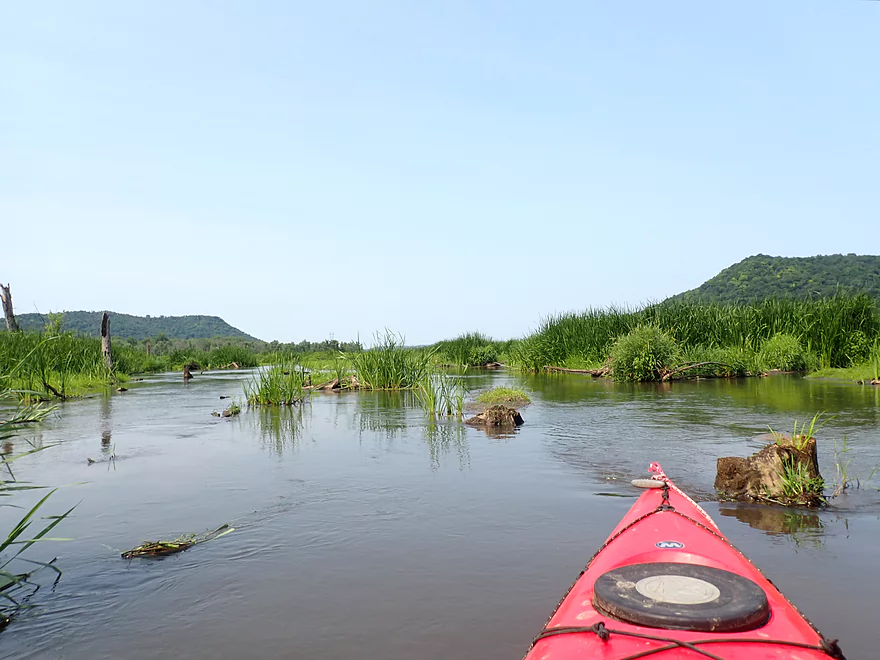
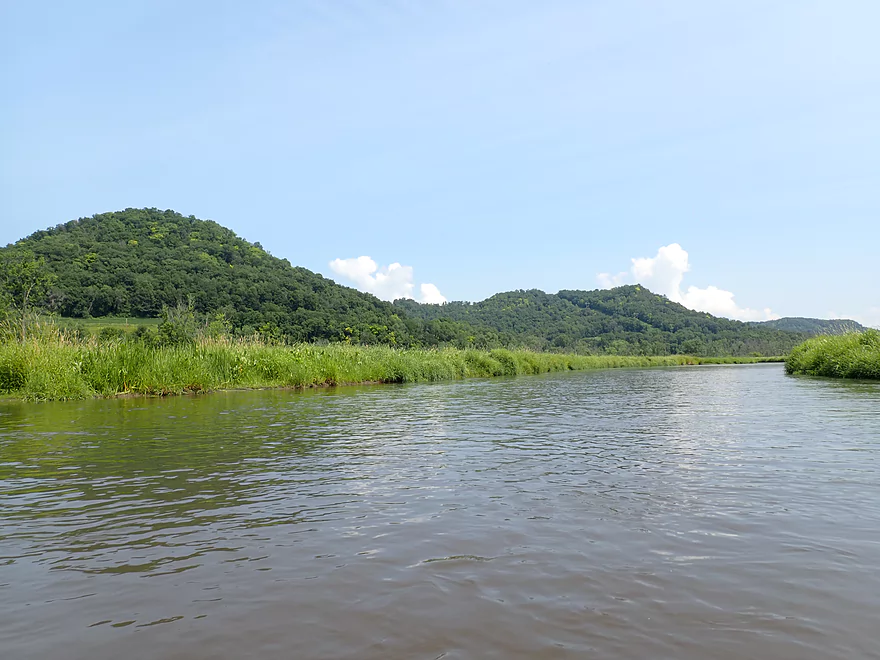
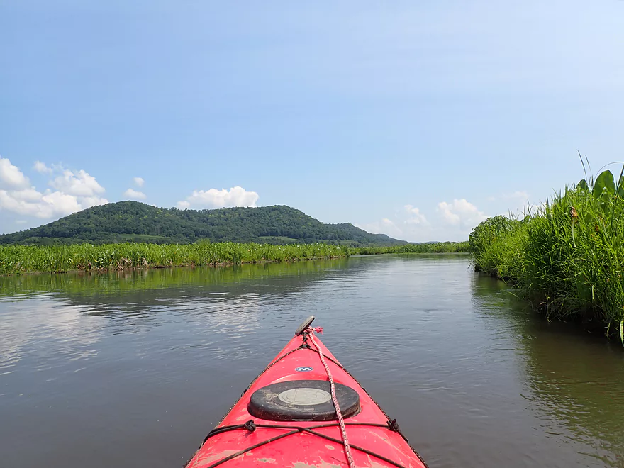
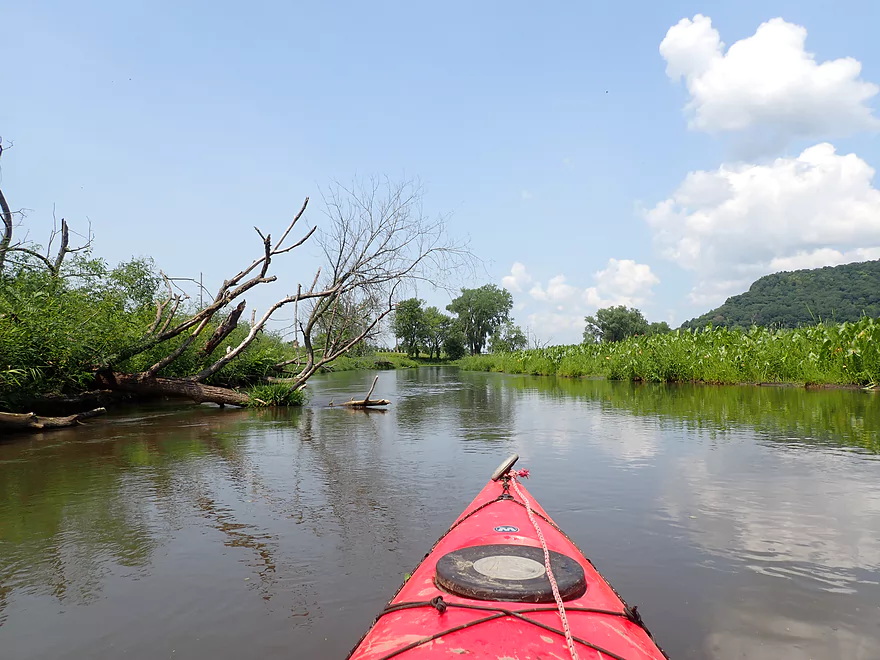
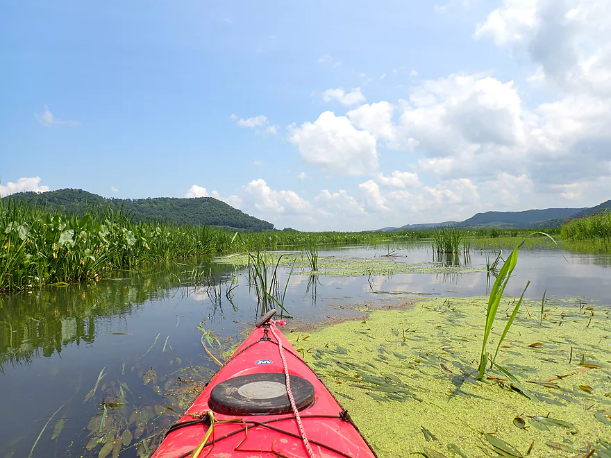
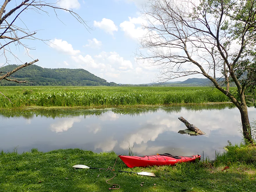
River starts a little bland…open with weedy banks
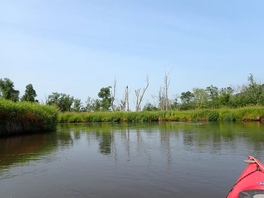
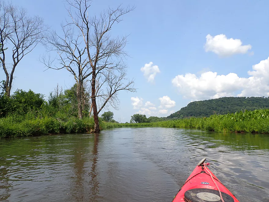
A number of dead trees along the banks
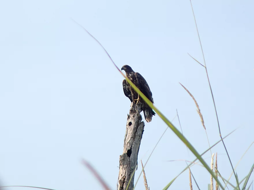
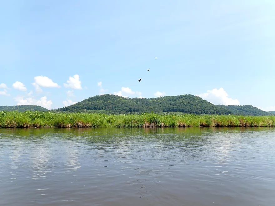
An eagle eyeing some ducks
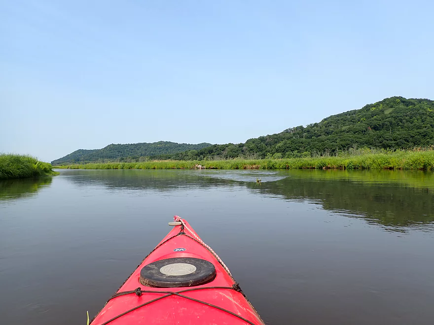
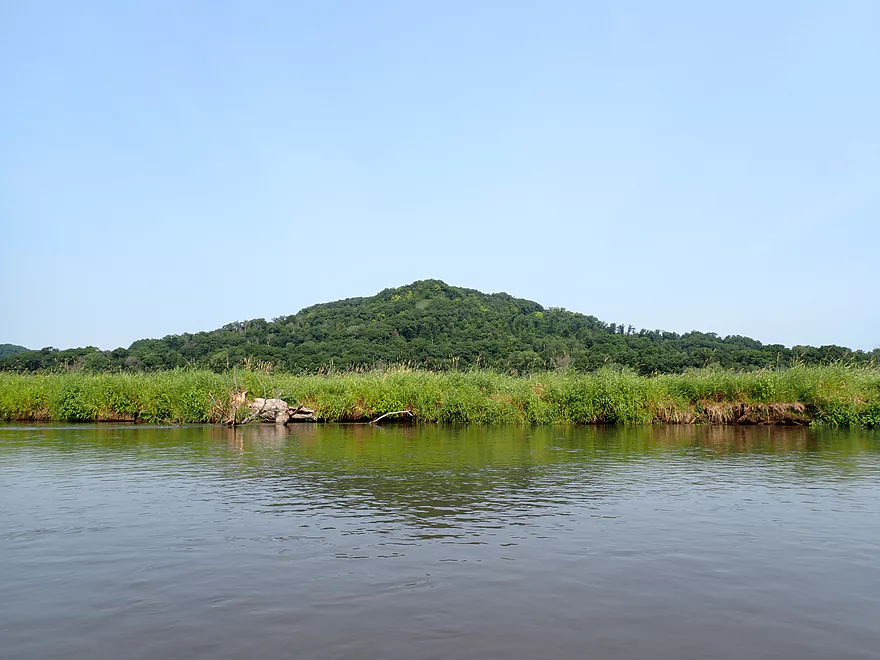
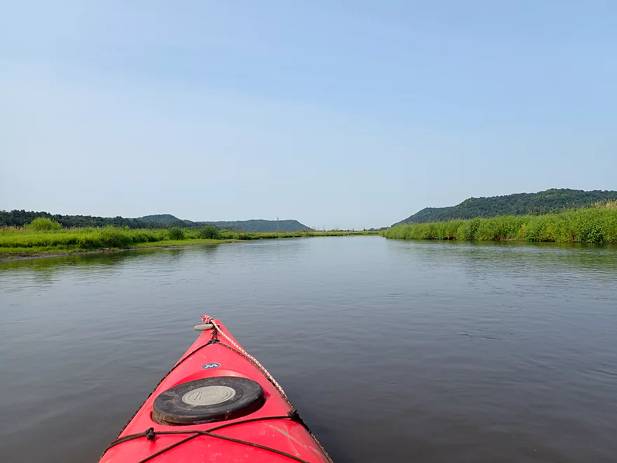
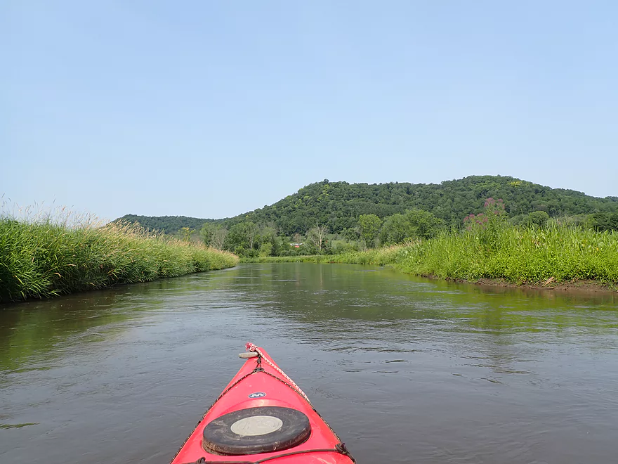
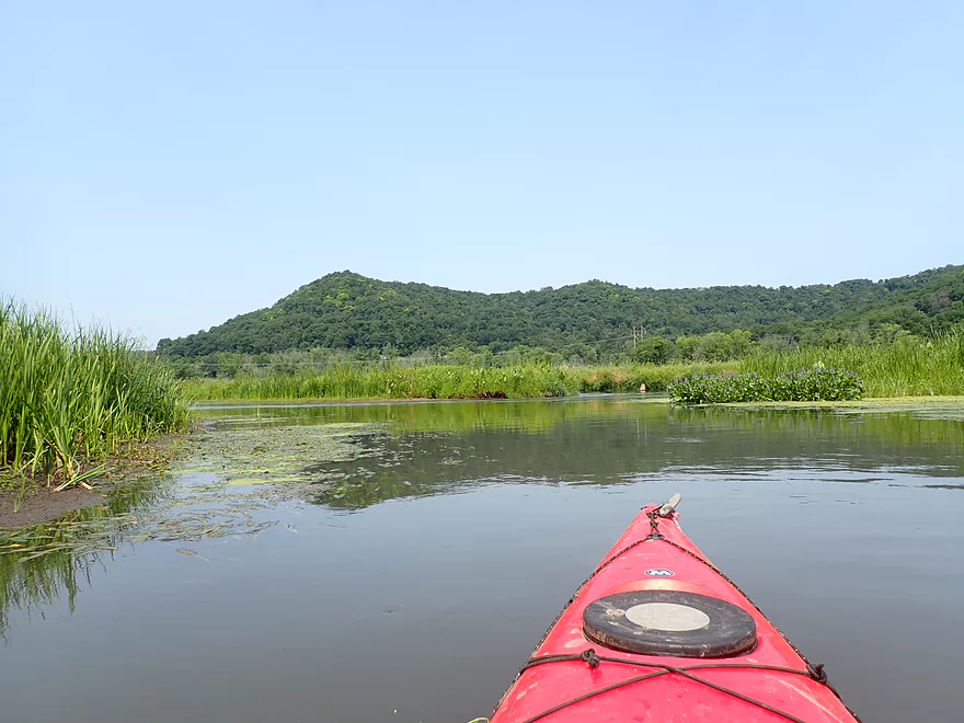
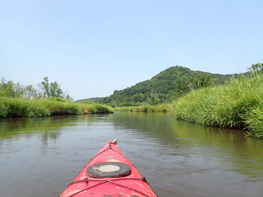
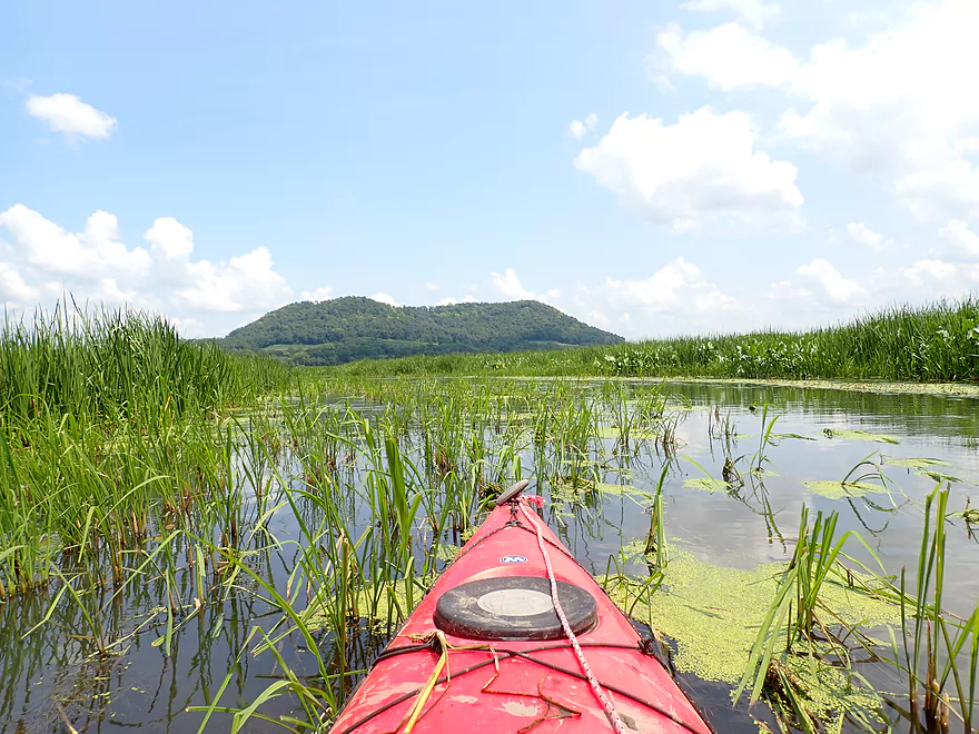
Fantastic bluffs were always visible from both banks
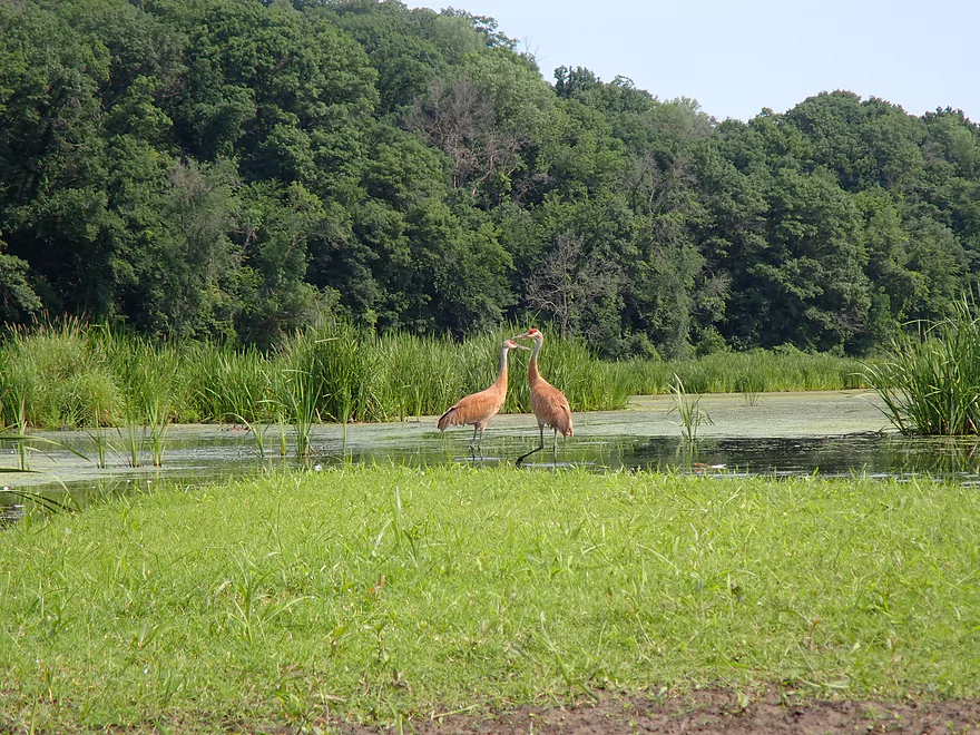
Two cranes

Getting off the main channel via an “off ramp”
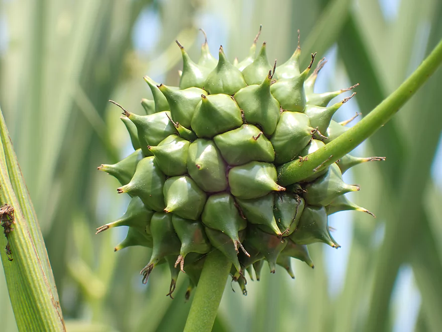
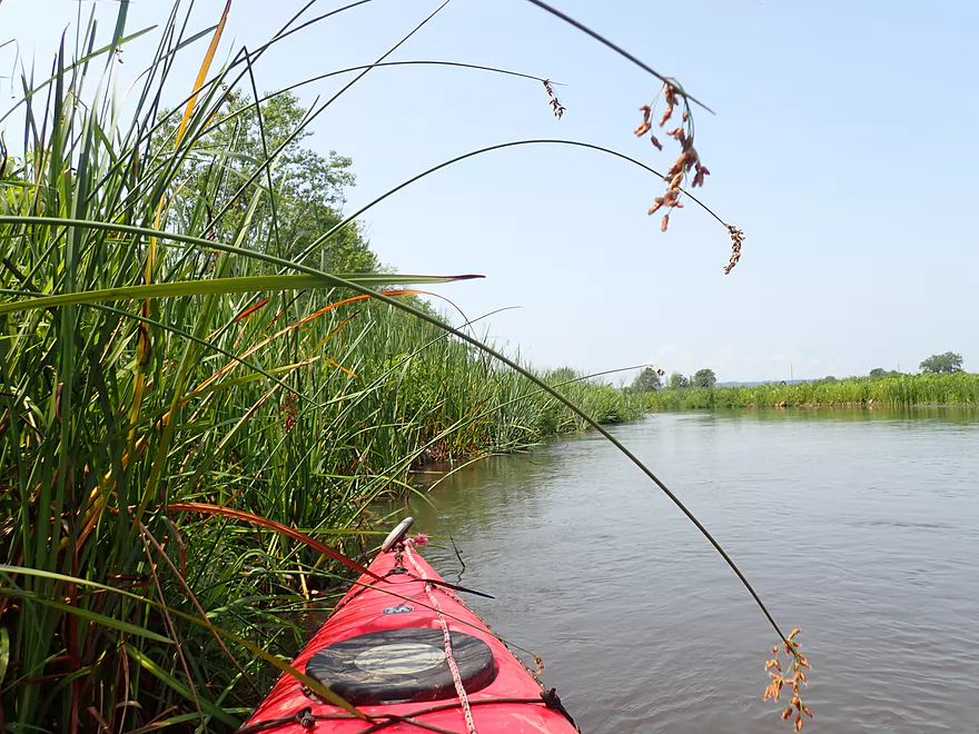
Bur-reed
This side channel was narrow but interesting
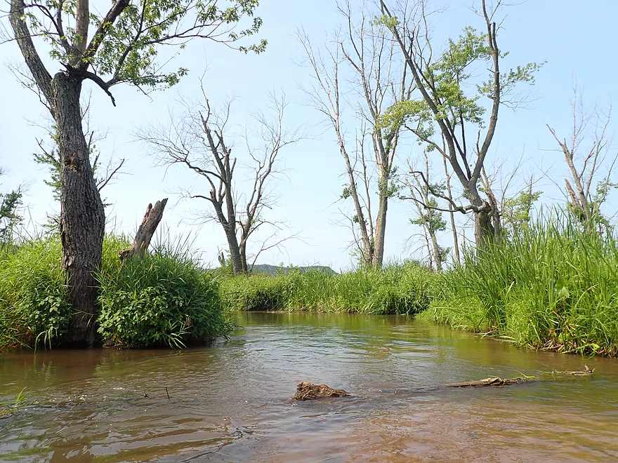
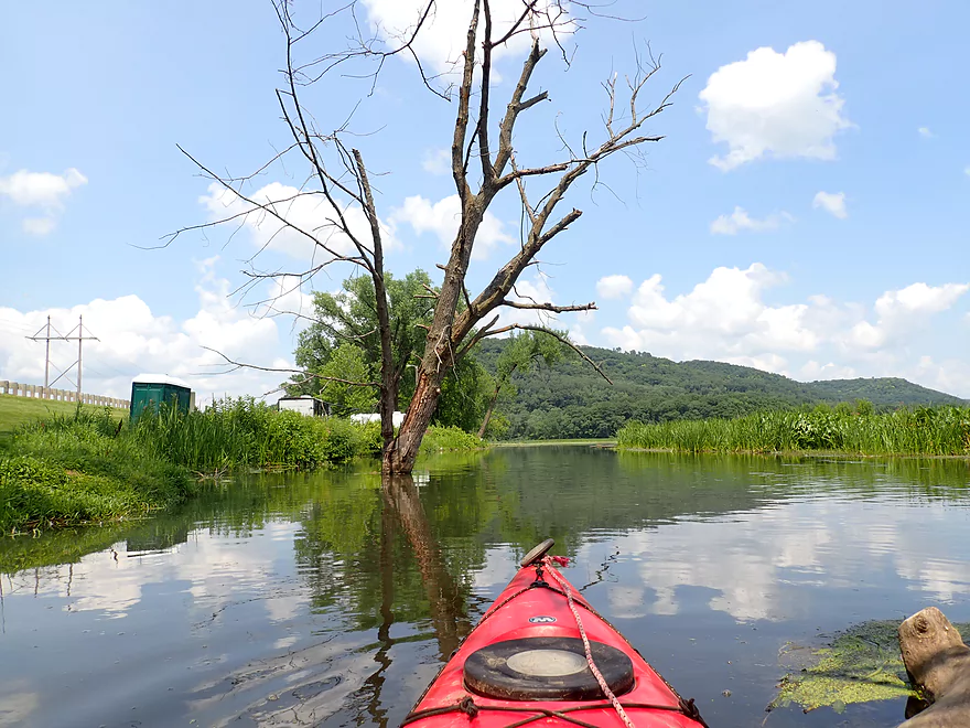
Only deadfall of the trip…not a problem
More dead trees
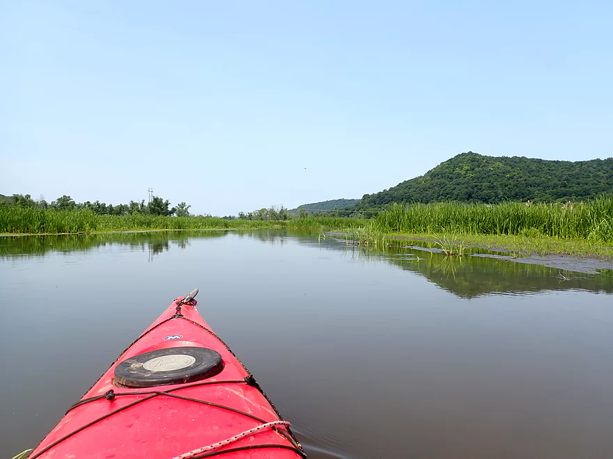
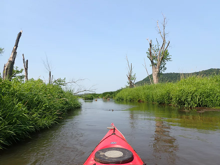
Approaching another nice bluff
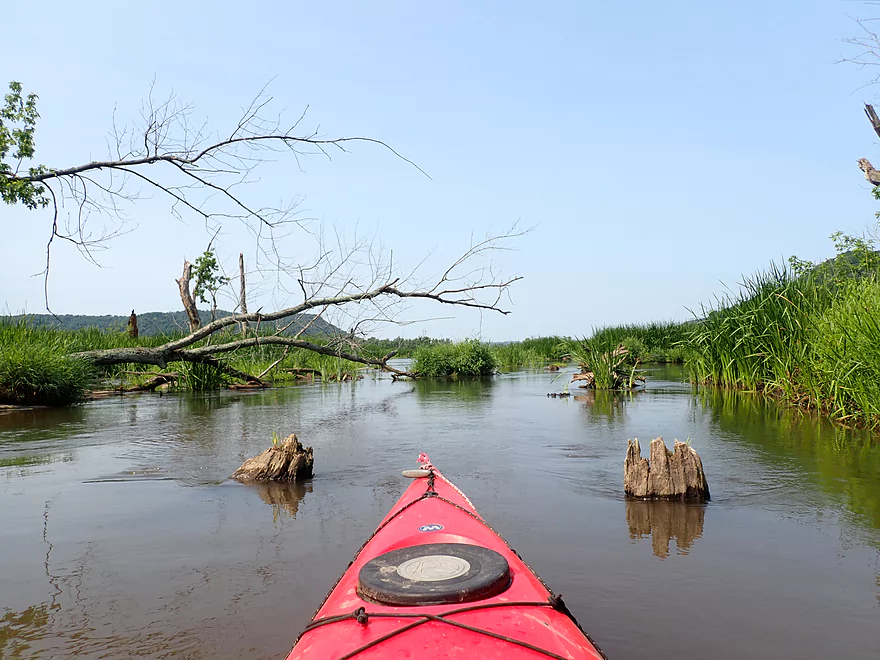
Another side channel joins the south branch
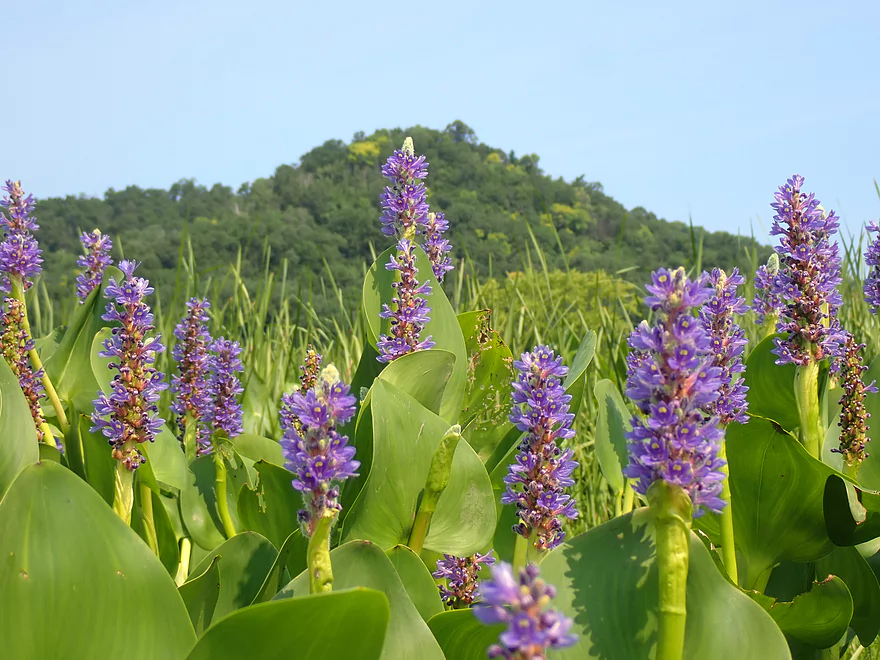
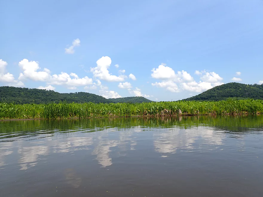
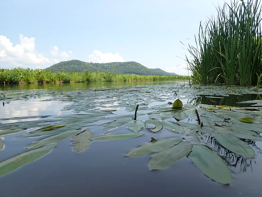
Pickerel weed with bluff in background
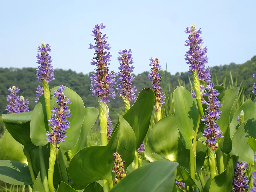
Pickerel weed without bluff in background
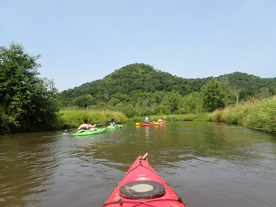
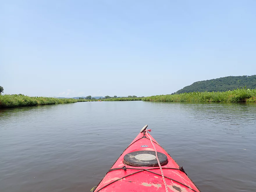
Getting passed by other kayakers

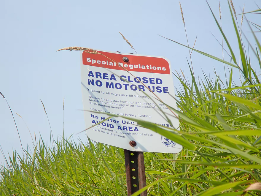
This is a federal wildlife refuge…no motors allowed
More terrific bluffs
Giant bulrushes
Reverse view
The river here splinters into four channels…I’m in the far south one
Home stretch
Heading upstream to check out a channel I missed
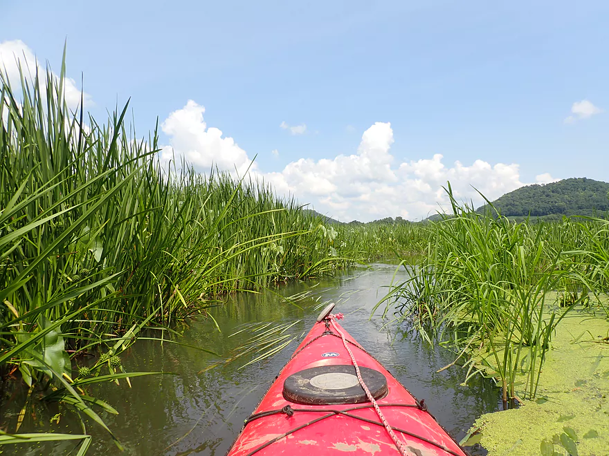
Kind of scenic
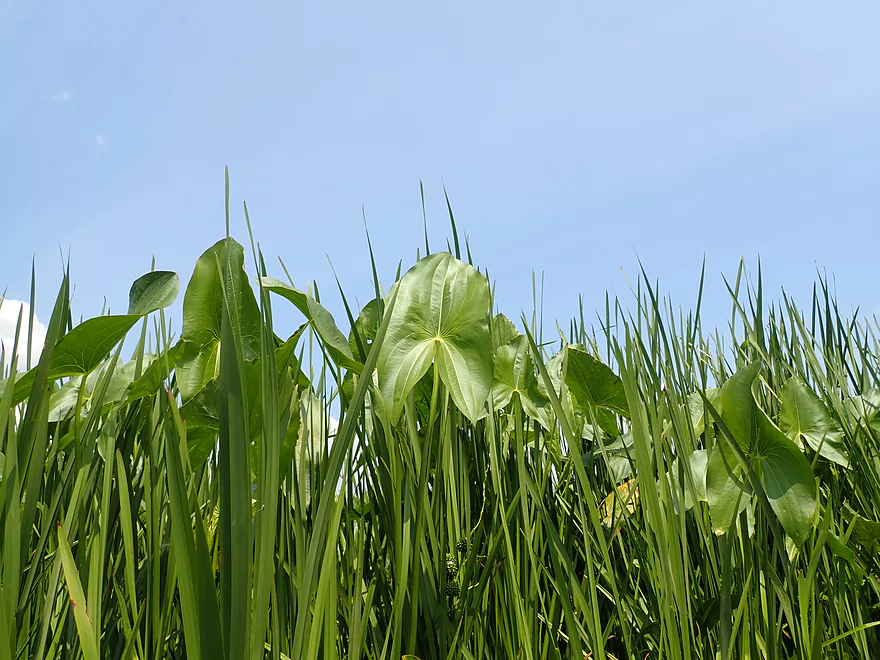
Arrowheads
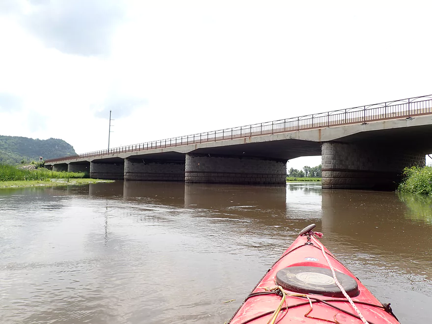
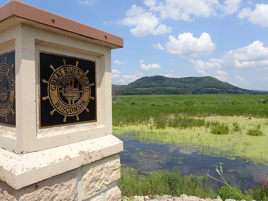
Hwy 35
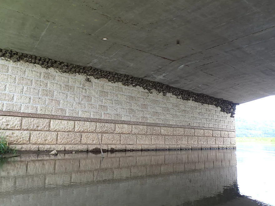
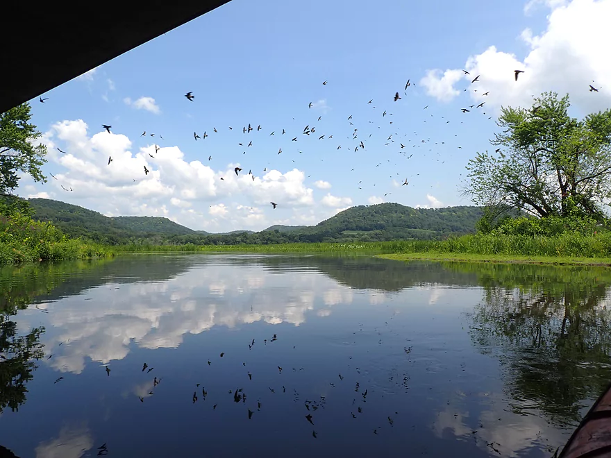
Many cliff swallow nests
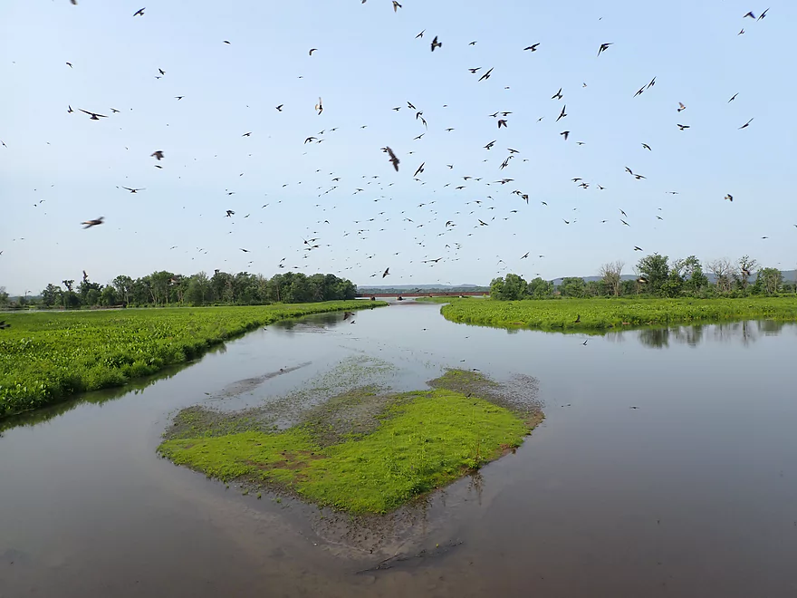
Looking downstream at the railroad bridge through a cloud of excited cliff swallows
Heading back upstream to my take-out
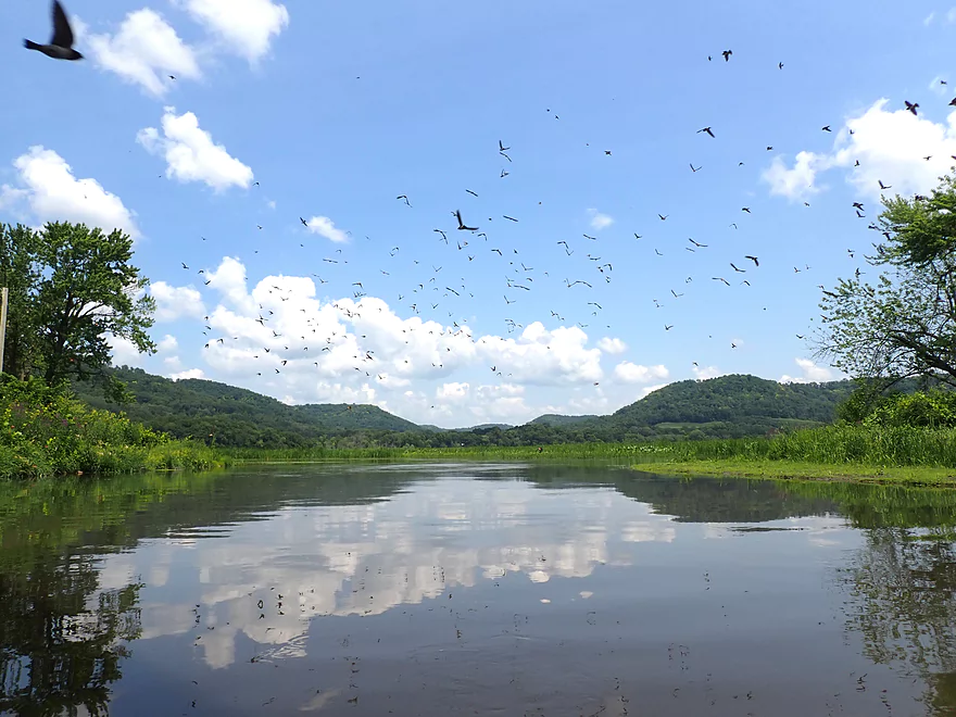
So many swallows
Paddling up to Rieck’s Lake Park
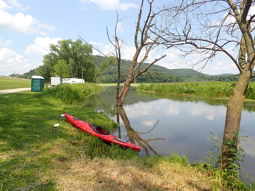
Scenic take-out
Panning right here…
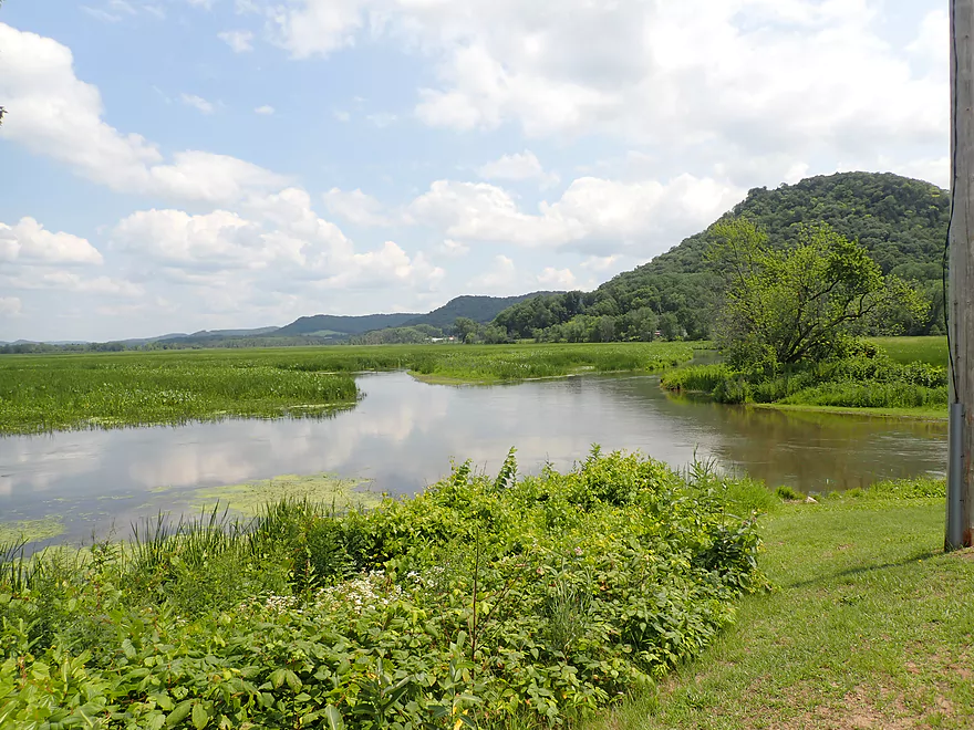
Four branches of the river converge by the bridge
Heading home on the Great River Road
Buffalo River

The Buffalo (aka the “Beef River”) is a tributary to the Mississippi sandwiched between the Trempealeau and Chippewa Rivers. I don’t think it sees a lot of kayak activity. It’s far upper reaches are sandy and likely suffer from logjams, while its lower legs seem somewhat generic and uninteresting. An exception though is the final stretch near its mouth on the Mississippi. Here the river transitions into the majestic Mississippi River valley with its scenic bluffs. Paddling author Rick Kark provided a favorable review of this trip, but what really convinced me to do this trip was a panorama Google street view image of the river that looked inviting.
I started the trip at Hwy II which was a decent bridge access. Honestly the first few miles of the trip weren’t super exciting. The river flowed through open lowlands with thick, grassy banks. Scattered trees appeared here and there, but many were dead (likely killed by sustained floods). The channel was a bit muddy (perhaps from a recent rain), but the bottom was surprisingly sandy. A big surprise was how fast the current moved. Had there been rocks in the channel, there would have been fun rapids.
What had me concerned was that this river frequently branches into sub-channels around large islands and I had to be careful to take the correct turn. Rick Kark didn’t and got seriously lost, so I wanted to make sure I learned from his misadventure. This is definitely a river you want to study satellite maps of beforehand. As a general rule “go left”, and you’ll likely be ok.
Shortly after Trout Creek joins the Buffalo, I spotted a small “off-ramp” to my left, and I decided to go for it, as I knew I had to get off the main channel eventually to avoid Kark’s infamous cattail labyrinth. This side channel was no more than a small creek, but was cool and featured more varied marsh plants. It did narrow in a few spots I feared would dead-end, but it remained open. I ultimately realized I was on the right channel when I was passed by a convoy of kayakers who had done this trip before. They actually took a second “off-ramp” to get to the south channel which was likely an easier and more open option…but not as scenic.
The closer I got to the Mississippi the more interesting things got. This was where the driftless river bluffs were at their most impressive, and many of the boring invasive grasses that plagued the first part of the trip were replaced with more interesting marsh plants like arrowheads. A good chunk of the lower Buffalo is protected by the “Upper Mississippi River National Wildlife and Fish Refuge”. Hunting is severely limited (a sharp contrast to state natural areas that love to promote hunting) and powerboats are prohibited from entering (but paddlers are ok). I actually like this arrangement as powerboats create so much noise and waves, it’s nice to paddle in areas without them.
Close to the Hwy 35 bridge the river diverged multiple times, creating three large islands. I stayed left, but was curious after I reached the bridge to see what I missed, so backtracked up one of the channels to explore. This was actually more scenic than the route I took and had a better view of the bluffs. It also contained some wild rice which may make things interesting in fall.
I paddled under the Hwy 35 bridge where I saw an impressive cluster of cliff swallow nests “glued” to the underside of the concrete. A huge flock erupted out and into the air as I passed through. Just beyond the Hwy 35 bridge was a railroad bridge which marked the main entrance to the Mississippi. Had I wanted to, I could have continued a mile downstream and taken out on the Mississippi at say Alma Beach. The rail traffic in this part of the state is remarkable (both for its volume and speed). It shows just how easy it would be to implement high frequency passenger rail with existing infrastructure, but sadly there isn’t a political will for it.
I ended the trip at Rieck’s Lake Park (just south of the campground) which is a super scenic area. While the campground is a little crowded and not super private, it might be a fun experience to combine camping with a kayaking trip. You could literally park your boat at a campsite with a fantastic view of the Buffalo River valley. And the current is slow enough by the mouth, that you could do up and back trips through some of the interesting side channels.
In summary, the Buffalo River itself wasn’t super interesting (say 3 stars) but what made the trip special were the huge bluffs on both sides of the river, as well as the attractive wetland near the mouth. This might be a fun trip to try in different conditions…say a fall color paddle, a sunset paddle, or a fog paddle (the Mississippi creates epic fog banks very early in the morning). Most paddlers might be wondering how this compares to the nearby Trempealeau River by Perrot State Park. They are actually surprisingly similar trips, but IMO, if you had to pick just one, Perrot State Park is nicer.
Sights included three muskrats, cranes, snapping turtles, great blue herons, geese, ducks, and several eagles carefully eyeing those ducks. The highlight was the huge cliff swallow swarm that was nested under Hwy 35. They were easily spooked and flew out of their mud houses in huge swarms (the largest I’ve ever seen). The lowlight was all the roadkilled turtles I saw when bike shuttling on Hwy 35.
Rieck’s Lake (the Buffalo River east of Hwy 35) is a famous birding hotspot, and up until recently hosted thousands of tundra swans in fall migration. Increasing vegetation has diminished swan numbers, but it is still an excellent spot for migrating waterfowl. Rieck’s Lake Park even has two viewing/observation platforms for birders and a public telescope.
Buena Vista Park: This is a public park that features an overlook atop a hill overlooking the Mississippi. It’s view is not as good as say Perrot State Park or Wyalusing but is still nice. The upstream vista features Lock & Dam #4, while the downstream vista overlooks a power plant.
Merrick State Park: This is a state park located on the banks of some Mississippi back channels. It’s not in the same class as nearby Perrot State Park but can be an interesting diversion. There is a self-guided canoe trail in between the islands that I may check out in the future. he bluffs behind the park can be very scenic in the fall.
Alma Lock & Dam: This is a convenient spot for tourists who want to watch the barges go through the locks. There is also a pedestrian bridge that spans the railroad tracks and allows you to watch trains pass directly underneath.
Hwy II: This was a good bridge access. Along the southeast corner of the bridge, a path is mowed from the bank to the water (very nice of the locals to do this). Specifically the best spot to launch is actually directly under the bridge where there is a nice shallow area for putting in.
Alt Put-ins:
- Hwy F (1.7 miles upstream from II): I don’t know too much about this leg or bridge access…just that it would add 1.7 miles to the trip.
Rieck’s Lake Park – South Campground: This park is located on a long, skinny isthmus between the Mississippi and the Buffalo River. South past the last campsite (and just by the bridge) there is a turnaround area that is a suitable take-out. An outhouse is located conveniently next door. The only major downside is all the goose poo…you practically can’t avoid stepping on it there is so much.
Alt Take-outs:
- Rieck’s Lake Park – Main Boat Ramp (0.5 miles north of the campground): This is probably a nicer access than the campground (no goose poo), but you may have to compete with powerboaters to use this launch and I think there is a fee. An outhouse is located at the launch.
- Alma Beach (1.2 miles south of the campground): This is a good option if you want to continue a short way out onto the Mississippi. South of the beach is the Alma Marina/Boat Launch which is another access option.
- Tank Pond Landing/Beach Harbor Rd (1.0 miles south of the campground): Another option is to continue downstream but stay within the backwaters. I think shoulder parking is available here but am not 100% sure. Either way I think the Alma beach is the better take-out option.
Bike Shuttle – Riecks Lake Park to Hwy II: 4.5 miles with 16′ of ascent. Traffic is a bit heavy/fast, but this is otherwise a nice easy bike shuttle that is also scenic.
Current: This was surprisingly fast, and I made good time on this trip. If this stretch was rocky, there would be rapids.
Logjams: Practically none. The main channels don’t have any logjams at all. One of the small side channels I took (which I suspect most paddlers wouldn’t) had a few downed trees, but they were easy to get around.
Getting Lost: This is a serious consideration. Paddling author Rick Kark took a wrong turn north and ended up in a dead-end channel. He had to plow through thick cattails to get to the take-out. Take the following steps to stay oriented:
- There are several forks in the river. If in doubt go left/south.
- Bring a GPS and study satellite maps before doing the trip.
- The first “off ramp” is located here. This is much smaller than the main channel and is kind of creek-like and scenic. I took this, but I suspect most paddlers will opt for the second “off ramp”.
- The second “off ramp” is located here. It’s technically smaller than the right channel so is easy to miss. I suspect Kark missed this specific turn and that’s how he got into trouble. This second “off ramp” is located by the second set of power line wires. If you paddle past these wires and haven’t taken a left yet, you need to backtrack.
- Once you’re on the South Channel, you’re good. The river will split several more times around several islands. The current favors the south channel, but the northern channels look more scenic. There is a small chance wild rice may fill or take over one of these slower side channels in late fall.
- I’m making this sound all worse than it is…just study a satellite map before the trip and you’ll be fine.
Nearest Gauge – Trempealeau River @ Dodge: Trip done at 440 CFS or 5.3′
- 0-300 CFS: Shallow depth but likely doable.
- 301-500 CFS: Good target depth, but channel will be a bit murky. Some of the side channels will be a bit shallow.
- 501-800 CFS: Above average depth, but doable. Current is likely quite fast at this stage.
- 801-1000 CFS: A high depth but doable.
- 1001-1500 CFS: Significant portions of the marsh might fill in and turn into a giant lake.
- 1501+ CFS: Maybe too high for enjoyable paddling.
The other variable to consider is the Mississippi River which can back-fill the lower Buffalo River. I did the trip at about 12,000 CFS which is a bit below average for this time of year. I suspect at 16,000 CFS and higher, the Mississippi will start to “dam” the lower Buffalo River and turn it into a lake.
- Upstream of Strum Lake: The upper legs likely have too many logjams.
- Strum Dam to Eleva/Hwy Y: 4.4 miles. This stretch has a lot of potential, but could have 7 logjams. Most can likely be waded over in shallow sand though.
- Missell Rd to Eleva/Hwy Y: 3.3 miles. Nice stretch that is sandy. Maybe 2 logjams.
- Eleva/Hwy Y to Thompson Rd: 3.7 miles. Maybe 6 logjams.
- Thompson Rd to Segerstrom Rd: 3.3 miles. Maybe 4 logjams.
- Segerstrom Rd to Pace Rd: 1.8 miles. Maybe 2 logjams.
- Pace Rd to CR BB: 2.5 miles. Sandy with maybe 2 logjams.
- CR BB to Alleman Rd: 1.9 miles. Good prospect but maybe 2 logjams. A nice image of Road BB:.
- Alleman Rd to Mondovi: 4.4 miles. Sandy stretch…maybe one logjam.
- Mondivi/S. Eau Claire St to Hwy H: 5.1 miles. From here on the river becomes less interesting.
- Hwy H to Hwy B: 6.3 miles.
- Hwy B to Hwy 37: 2.4 miles. A nice image of the Hwy 37 bridge.
- Hwy 37 to Hwy J: 4.3 miles. A nice image of the Hwy J bridge.
- Hwy J to Hwy KK: 3.6 miles. A nice image of the Hwy KK bridge.
- Hwy KK to Hwy F: 6.5 miles. This stretch flows by steep bluffs and could have good potential.
- Hwy F to Hwy II: 1.7 miles.
- Hwy II to Rieck’s Lake Park: 5.6 miles. A nice stretch with scenic wetlands and bluffs. The diverges in several spots and paddlers will want to choose their path wisely to avoid getting lost.
- Mississippi Take-out Options:
- Rieck’s Lake Park Campground to Rieck’s Lake Park Landing: 0.5 miles. A short leg north over open slough to reach the main landing. The landing may require access fees.
- Rieck’s Lake Park Campground to Alma Beach: 1.2 miles. This option heads out south onto the open Mississippi.
- Rieck’s Lake Park Campground to Alma Marina: 1.2 miles. Same as the above but you could take out at the marina instead of the beach.
- Rieck’s Lake Park Campground to Tank Pond Landing: 0.5 miles. This leg stays within a slough called “Tank Pond”. I’m not sure this would be as interesting.
Trip Map
Overview Map
Video
Photos Size: