
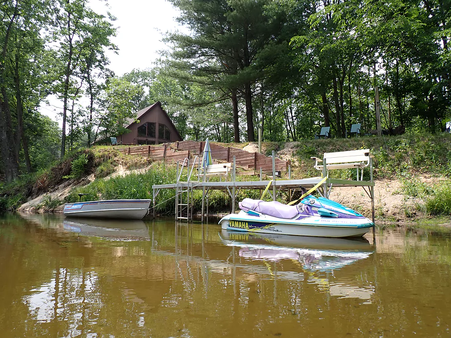
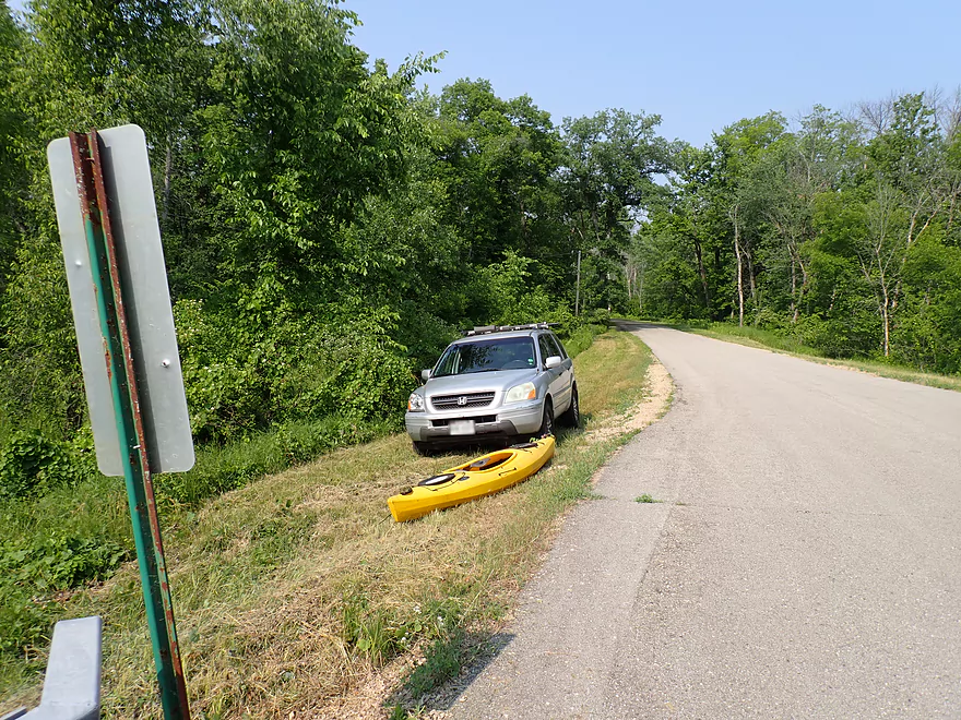
Putting in at Hwy J
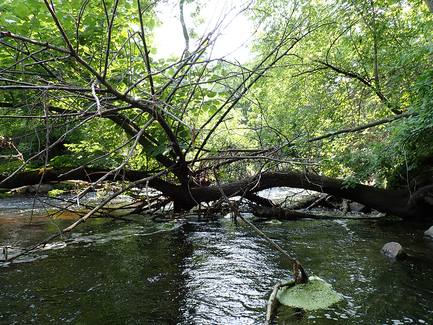
Exploring upstream first…stopped by a snag
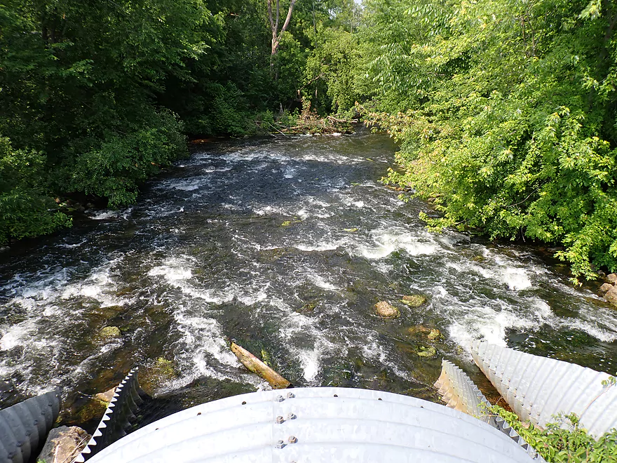
Class 2 rapids located just upstream from that
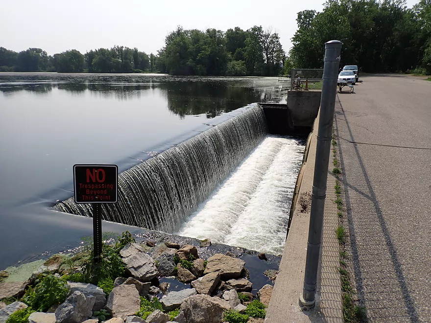
And a dam
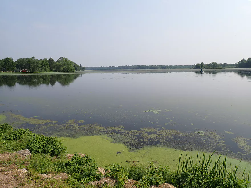
Picture of Harris Pond from the dam
Back to the trip…heading downstream under Hwy J again
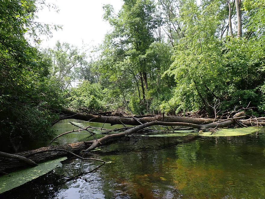
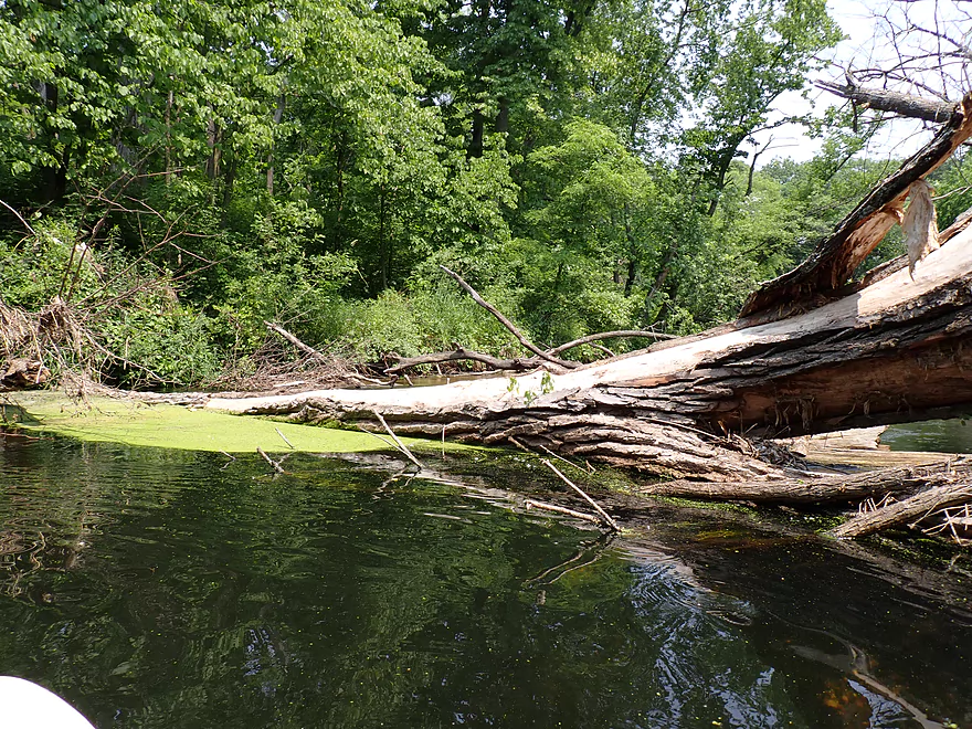
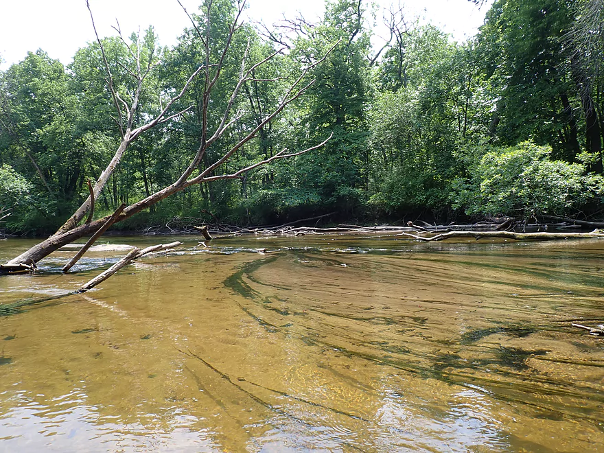
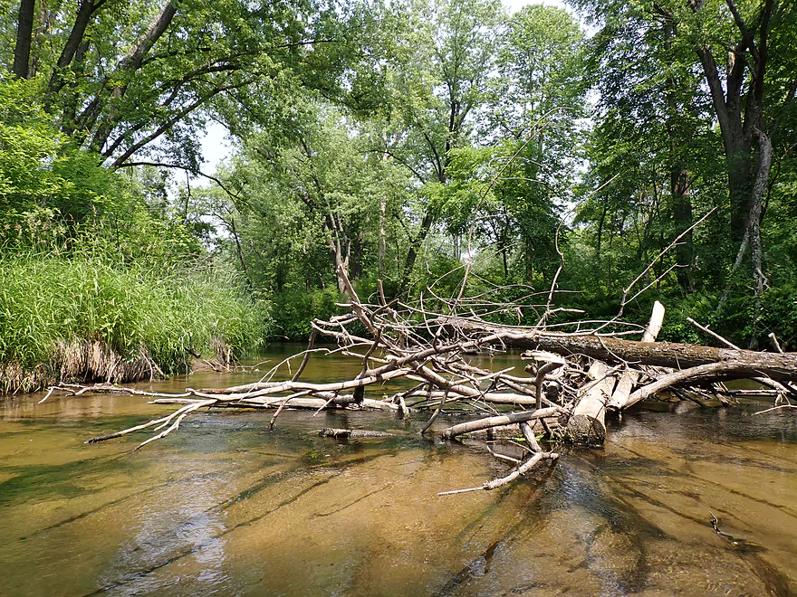
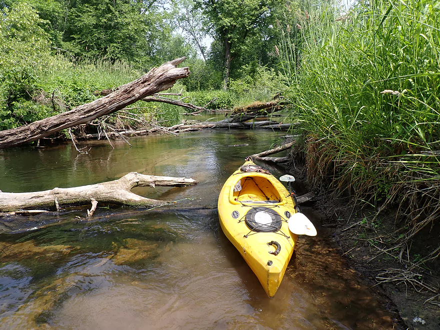
An early logjam
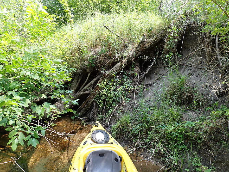
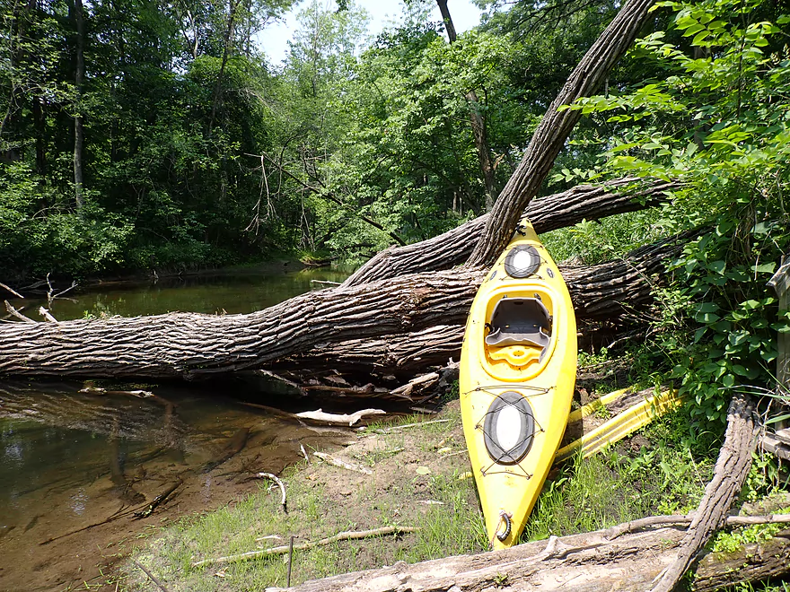
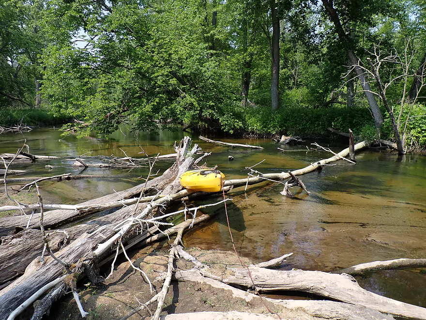
Tricky portage that required some mountain climbing on the bank
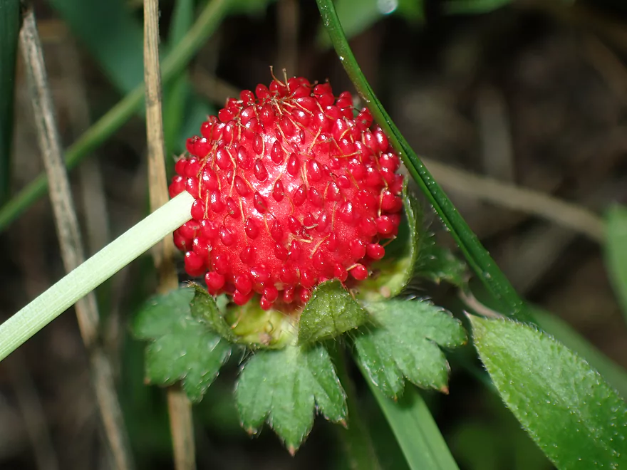
This is a wild strawberry
So much duckweed
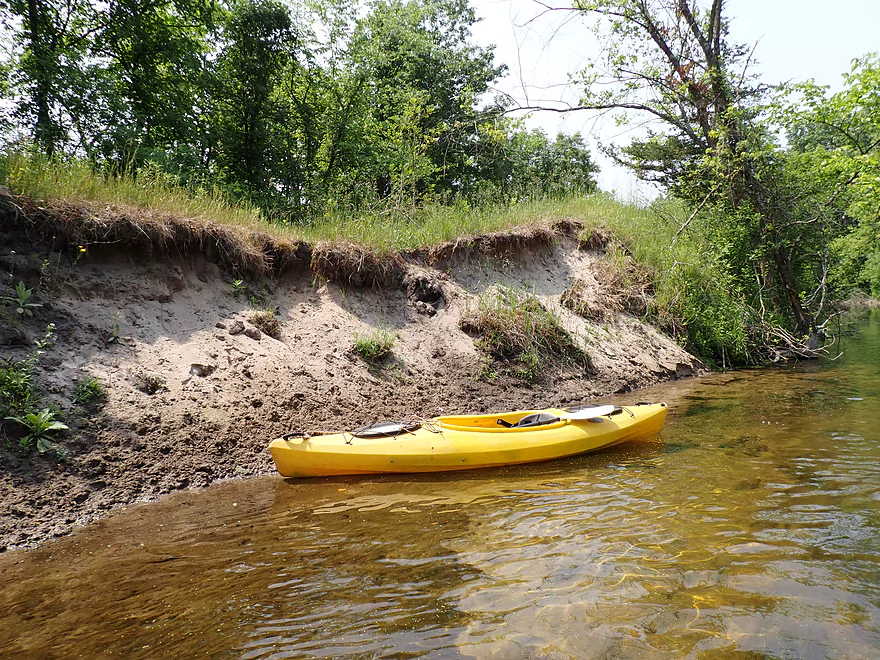
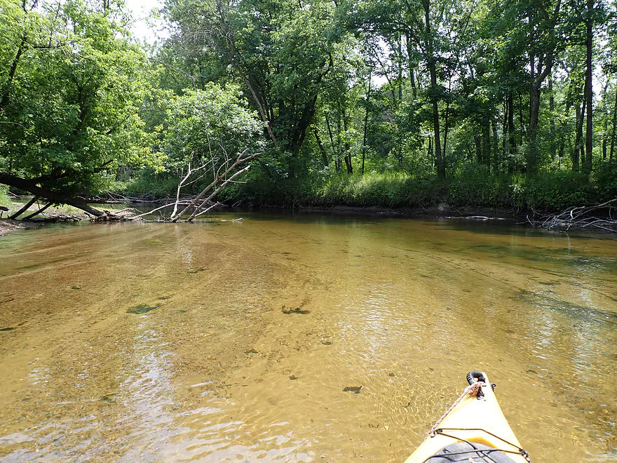
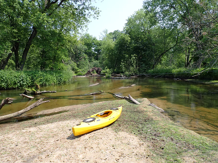
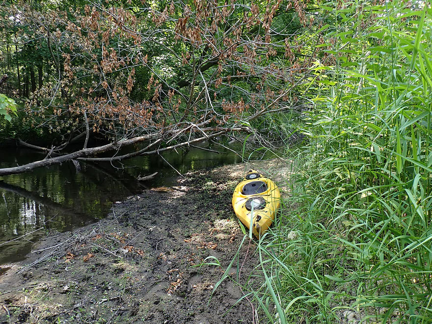
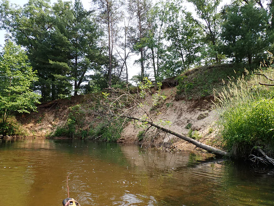
Cool sandbank
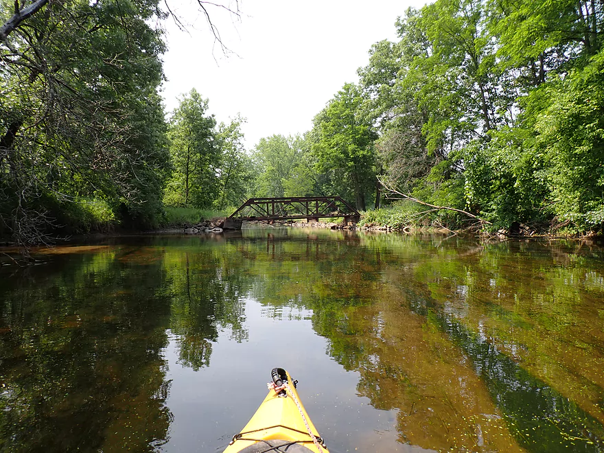
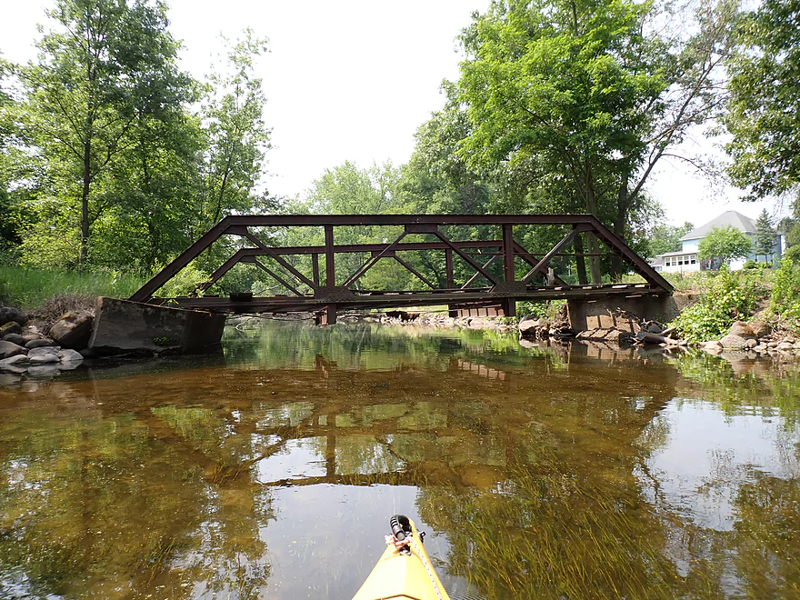
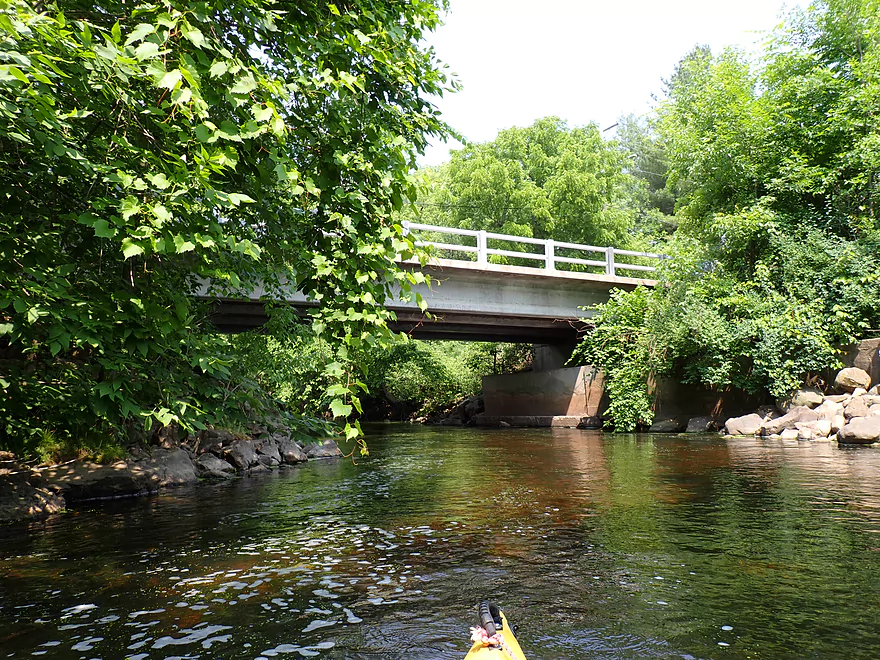
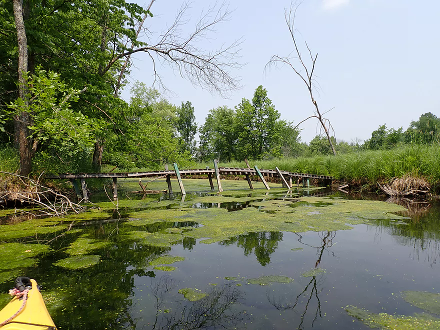
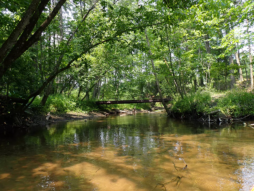
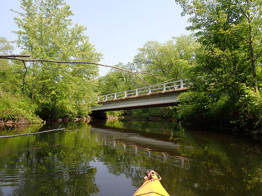
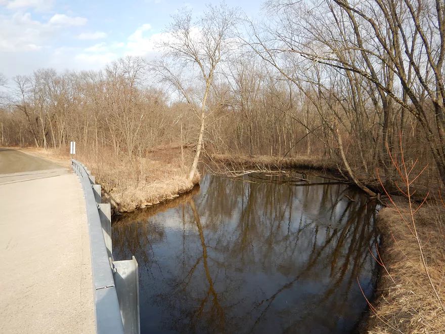
Rustic bridge
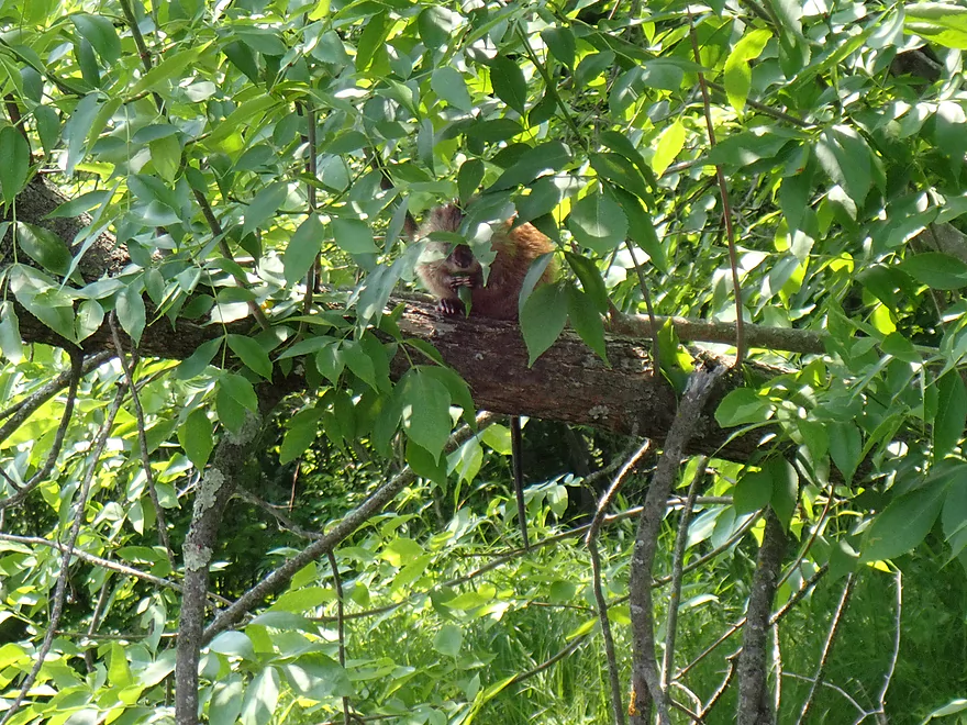
Muskrat snacking in a tree
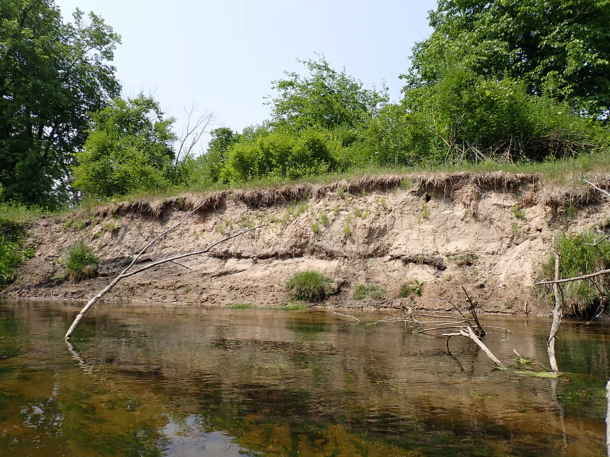
Another sandbank
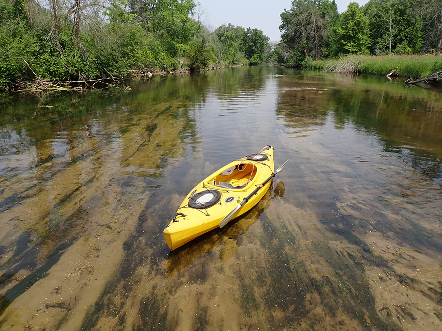
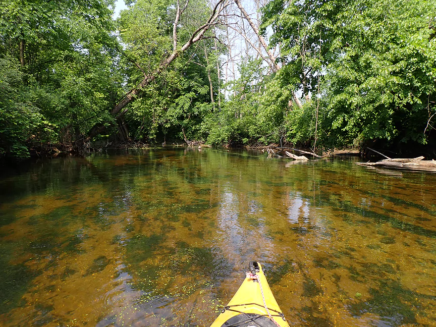
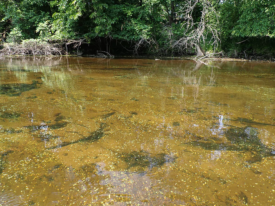
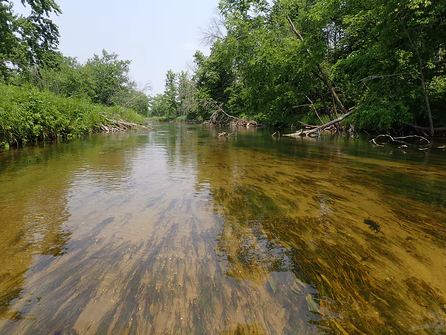
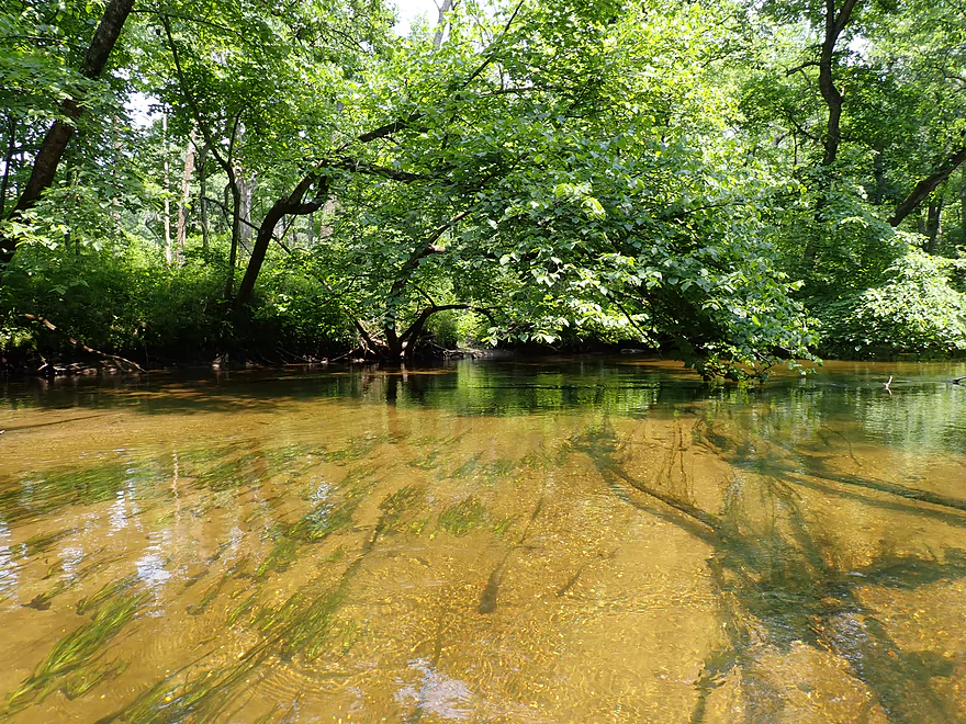
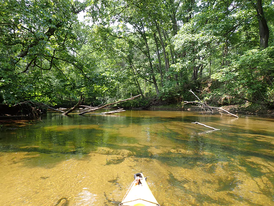
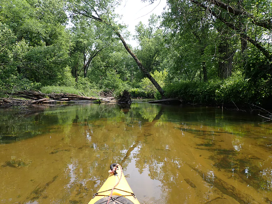
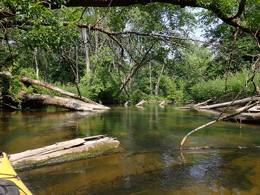
Water clarity was incredible
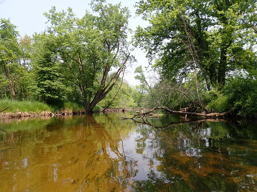
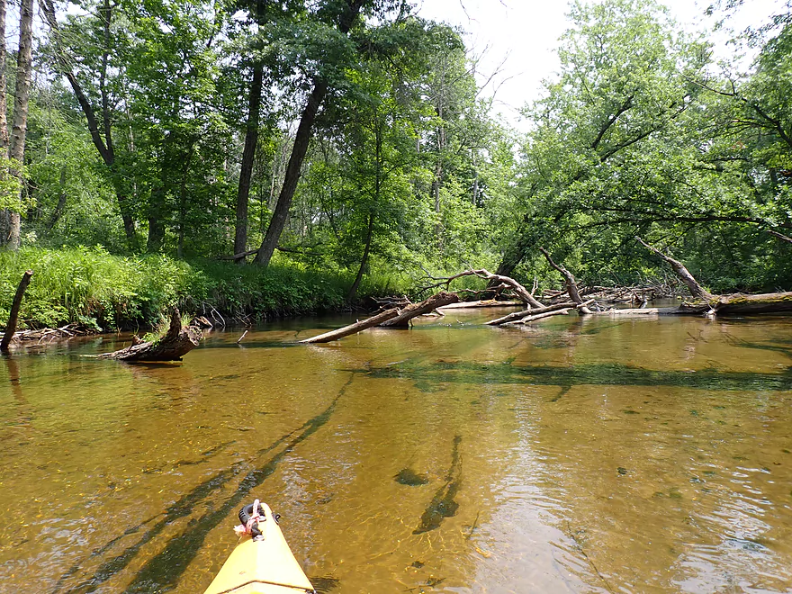
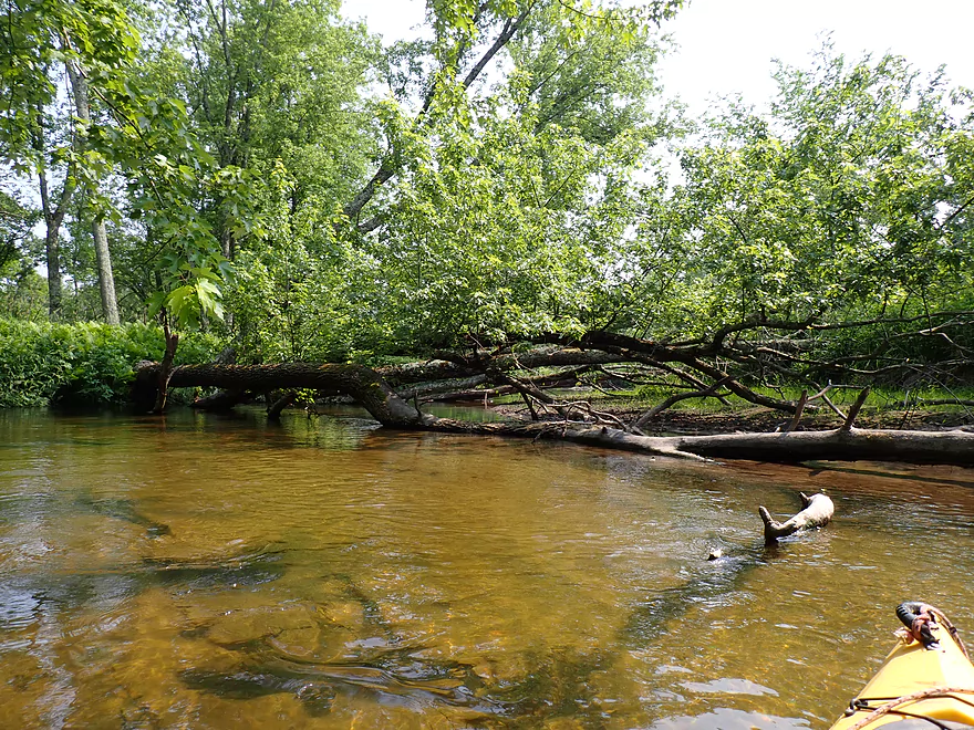
Another logjam
Very straight section of river
Very sandy bottom
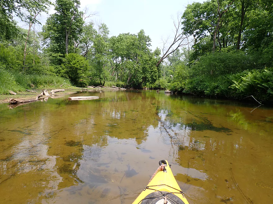
Large side slough
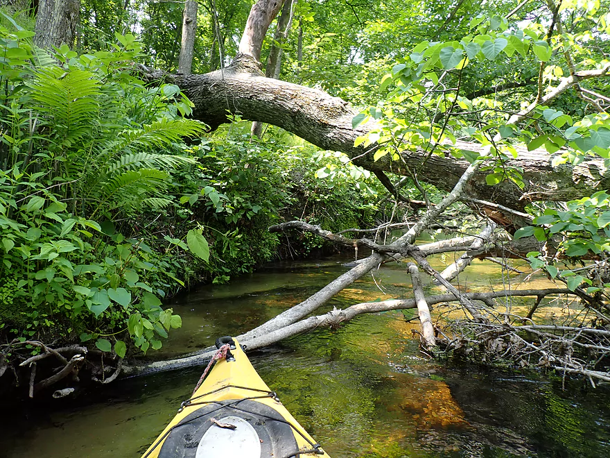
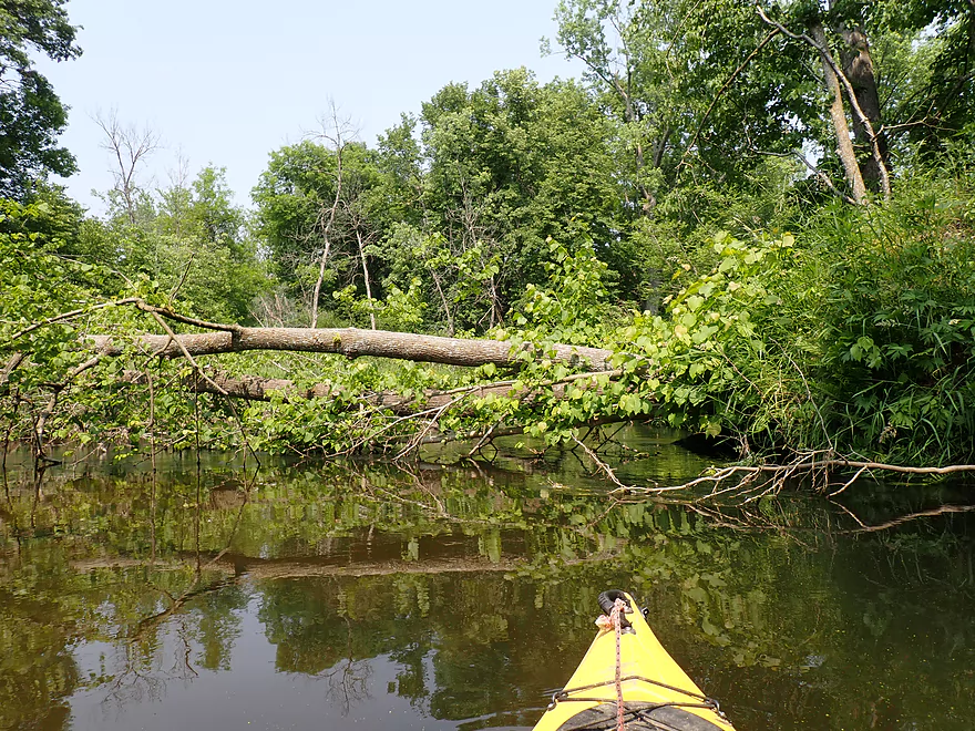
Hopping over a downed tree
Start of an obstructed stretch of the river
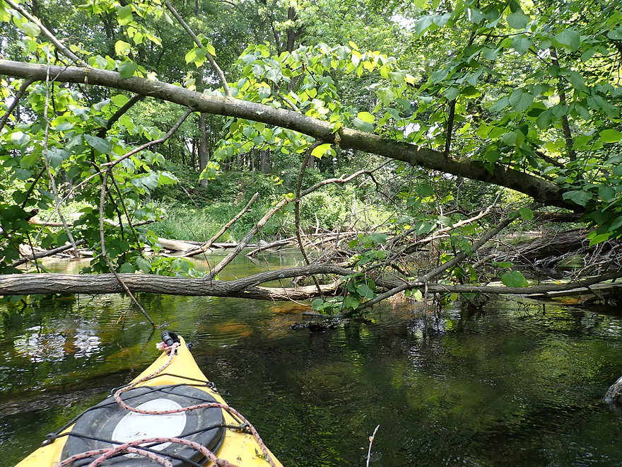
Unpleasant
Very unpleasant
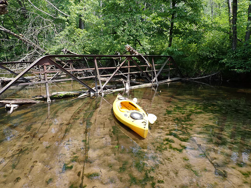
Bridge is partially submerged
Some snags were easy to paddle around
At times there were narrow windows through the jams
Klawitter Creek
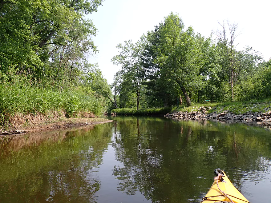
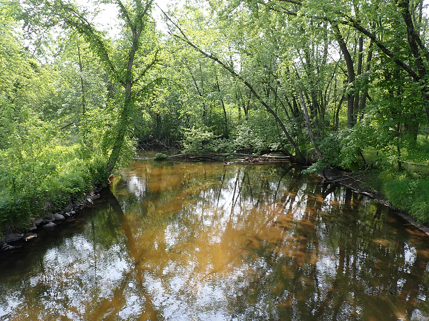
Nice stretch of the river
Start of some serious logjam cleanup
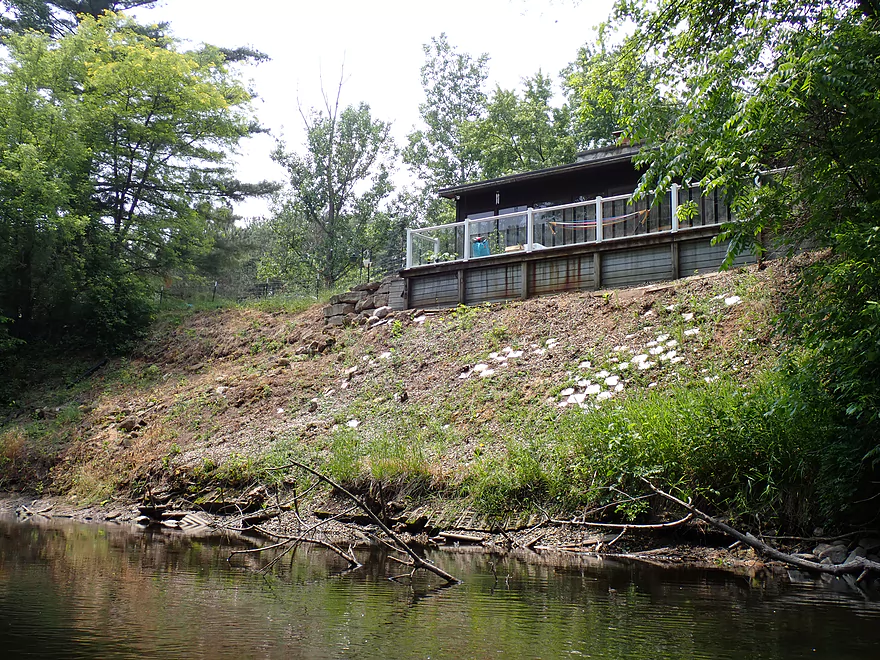
House built on steep sandy banks
Paddling around a large island
Surprised to see boats
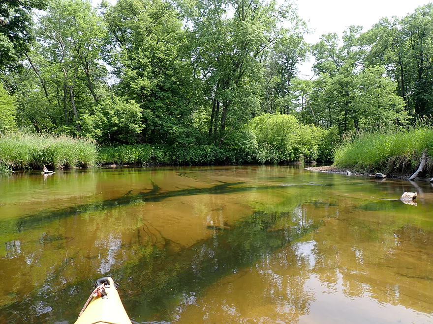

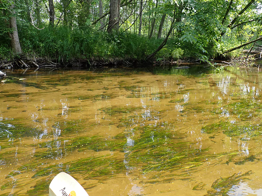
Amazing clarity
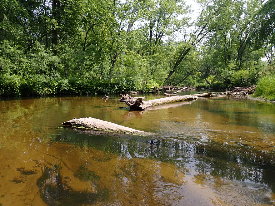
Still deadfall but mostly a way around
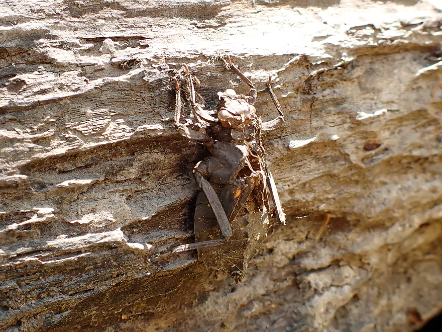
Huge dragonfly exuvia
End of the cleanup work
Logjams return with a fury
Some were easy portages
This was on a sandbar
Dreading what is around the corner
Portaging a tight corner
Ugh
Largest sandbank of the trip
Ember Lane
Steep banks at the take-out but good shoulder parking
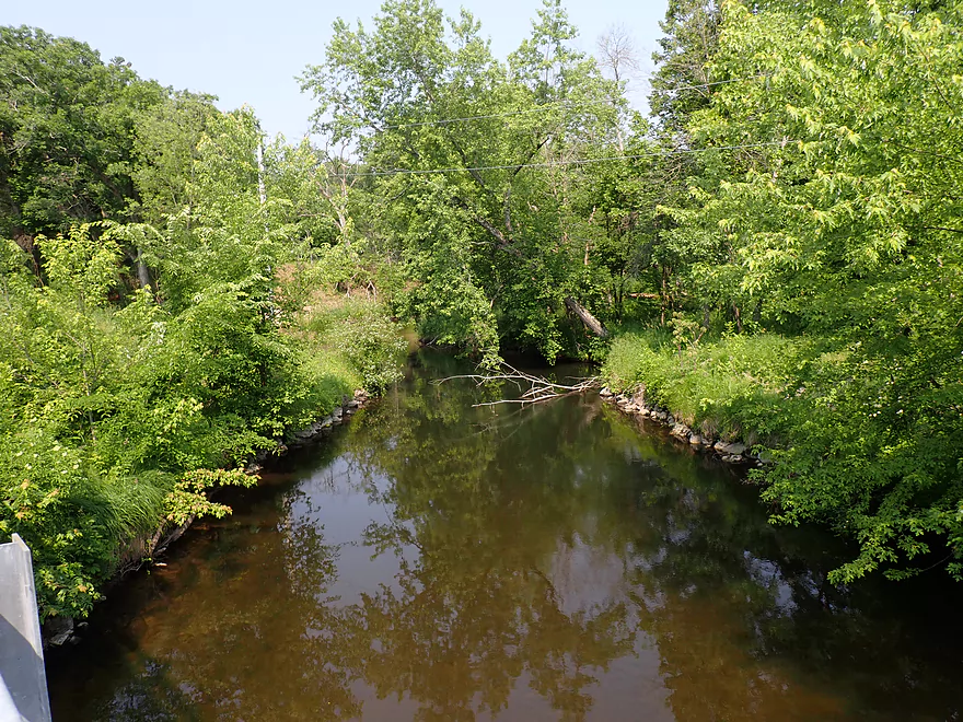
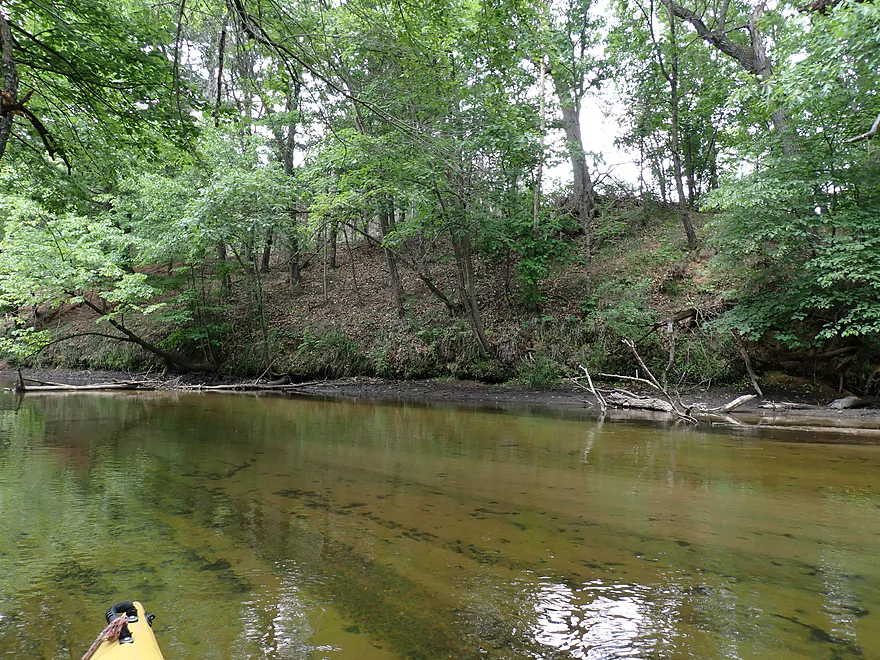
View upstream
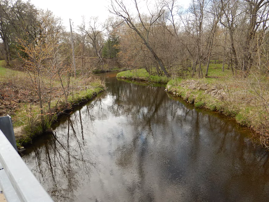
Same view but in spring
View downstream
Same view but in spring
Montello River – Harrisville

The Montello River is a somewhat obscure tributary of the Fox River located north of Portage. Its upper legs (Lawrence Creek and Westfield Creek) are surprisingly good paddles and some of the more underrated water trails in the area. But almost all legs of the Montello have some logjams and they tend to get worse the further downstream you go. I was quite mindful of this when I decided to do a lower stretch from Harrisville to Ember Lane, but hoped the logjams would be manageable.
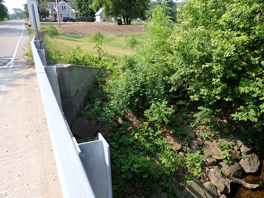
Initially the plan was to start from the Harris Pond dam. I scouted it and it was swarming with fishermen. But numerous No Trespassing signs on the downstream side and what appeared to be a nasty strainer deterred me. Instead I launched from the Hwy J bridge located just a bit downstream. It wasn’t an ideal bridge access (the neighbor’s dog “Odin” barked up a storm and chased after me as I attempted to launch). But it was a doable bridge access.
The first leg (0 – 0.2 mi) of the trip wasn’t great. Tight limbos were required to get past some low branches and finally I had to get out of my boat for a difficult portage up steep banks. It was at this point I debated giving up on the trip and dragging my boat back to the bridge. But this would have meant crossing over private property and past “Odin” again. I decided to soldier on which in my case I think was the right decision.
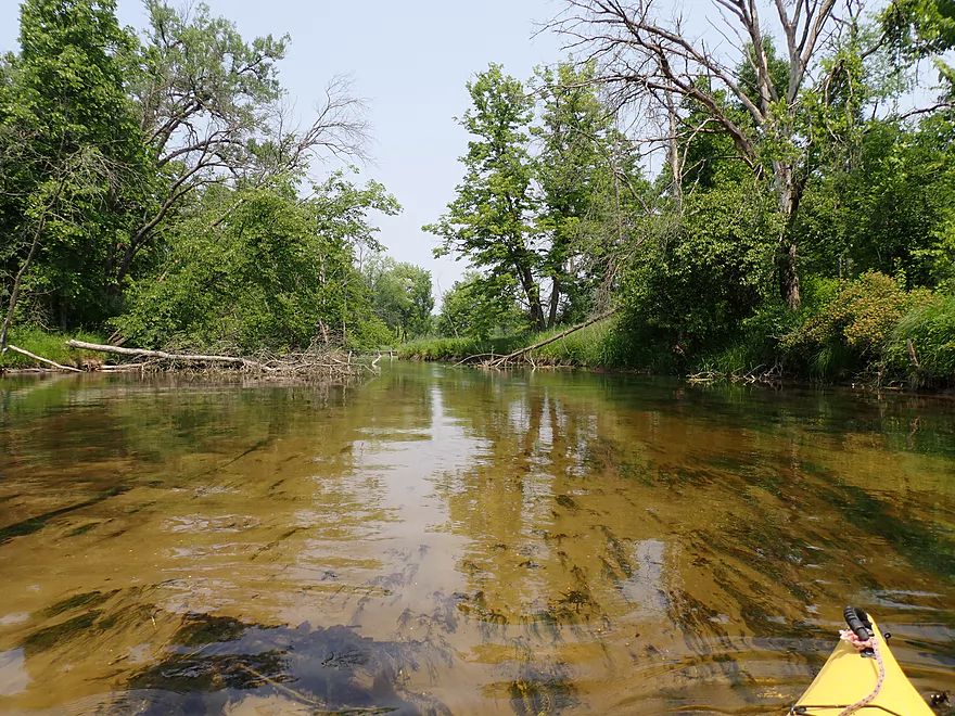
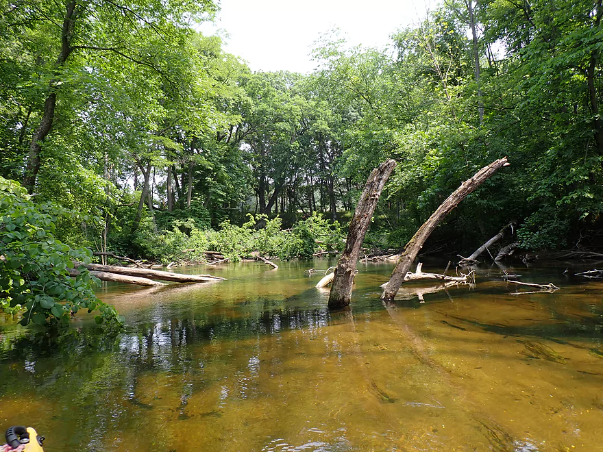
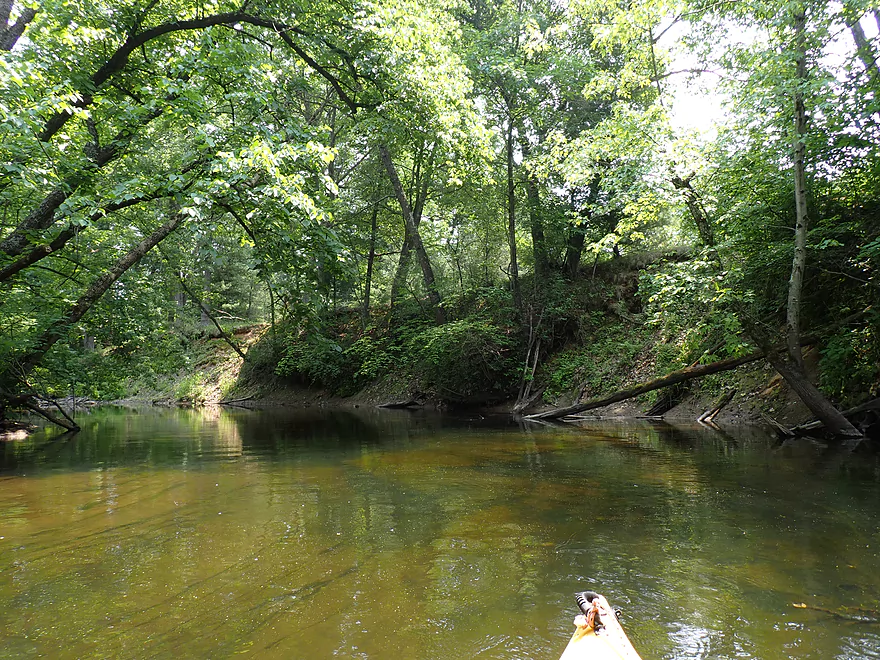
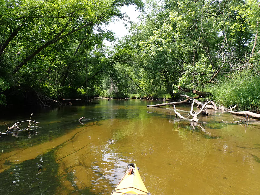
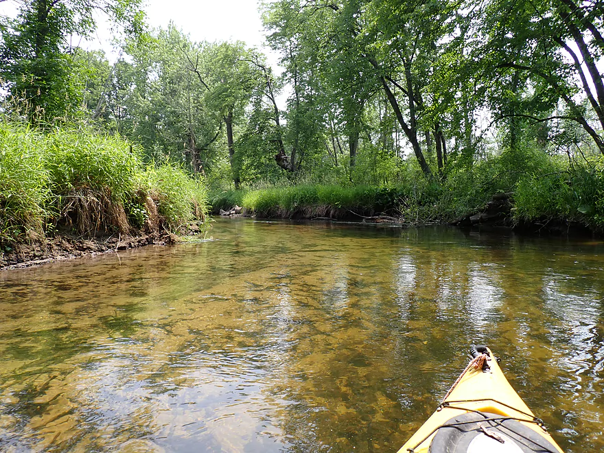
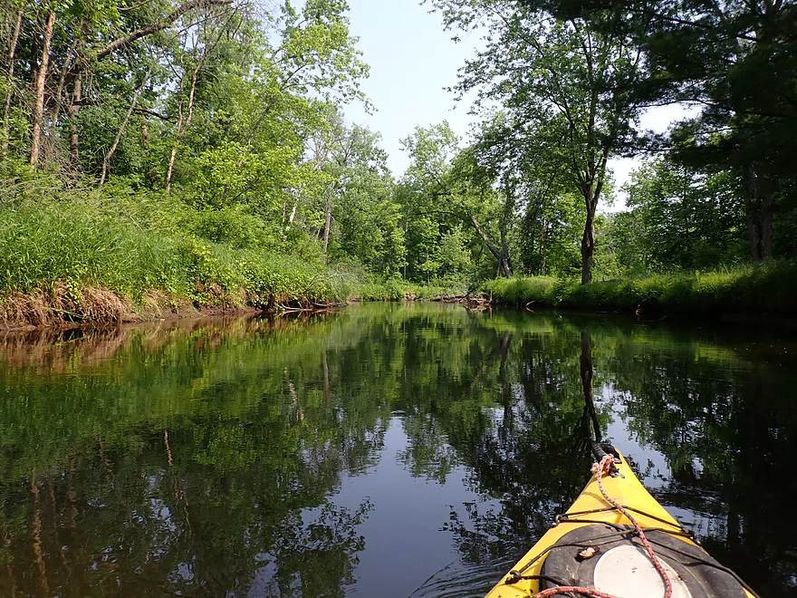
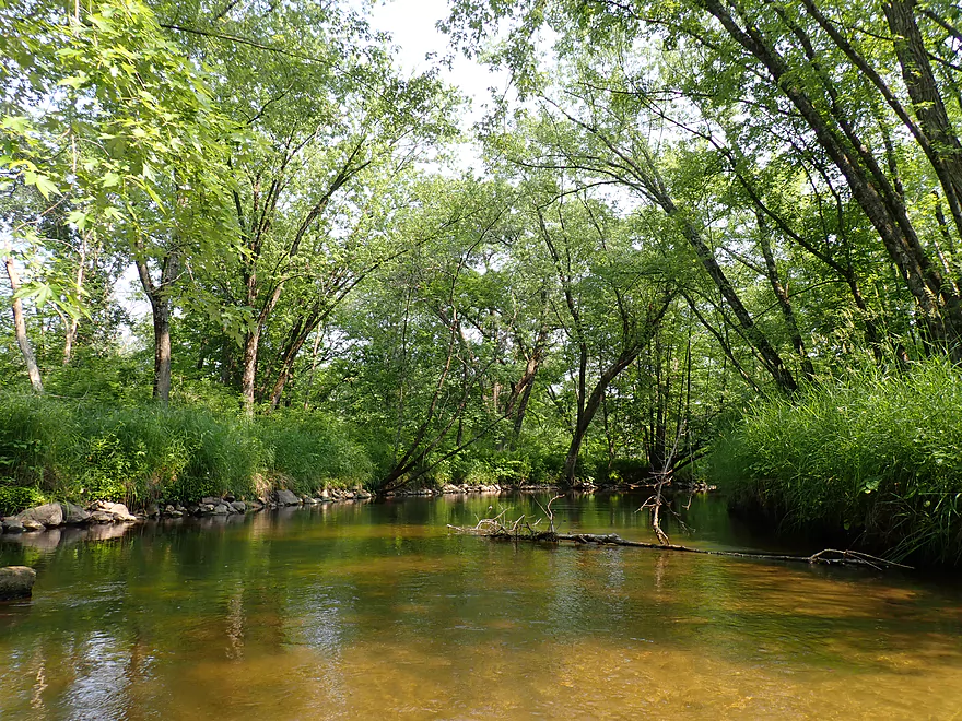
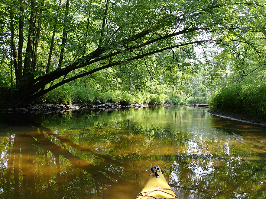
The second leg (0.2 – 1.75 mi) was surprisingly nice. Here the river was incredibly straight (suspiciously so), but was teeming with wildlife. Fish, clams, and snails were everywhere and were incredibly easy to spot through the perfect clarity. At times it felt like paddling in an oversized aquarium and was fantastic. Other highlights in this stretch included sandy banks, a bright sandy bottom, and a rustic iron trestle bridge. There were still downed trees, but it was usually easy to get around them. Only once on this leg did I have to get out for a logjam and it was an easy “wader”.
Leg 3 (1.75 – 2 mi) featured an abrupt transformation as the river turned sharply left and went through a number of nasty and difficult logjams. If the prior leg was artificially straightened by farmers, I suspect this is where their work ended, as from here on the river would start to meander naturally. The logjams were a bummer as the trip continued to alternate between Jeckle and Hyde. Awful then wonderful, then awful, etc…
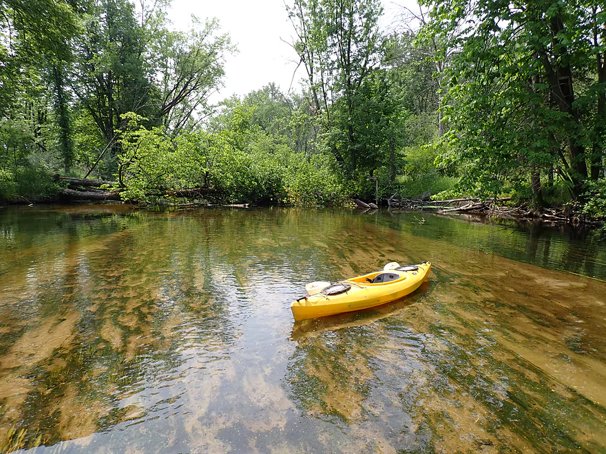
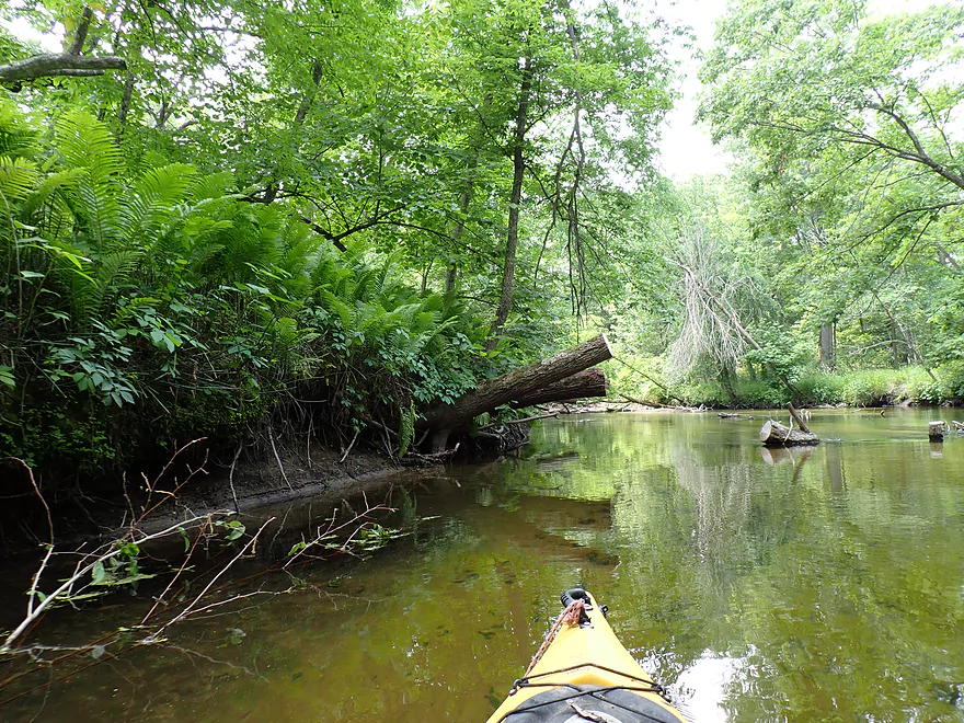
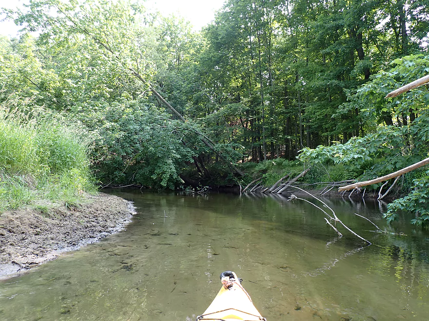
Leg 4 (1.75 – 2.5 mi) was fantastic. This was much more wooded with terrific tree canopies. Water clarity was immaculate and the scenery excellent. Other highlights included another iron trestle bridge (this partially submerged by the river) and a cool sandbank. There were more downed trees, but usually you could simply zigzag around them or at worst wade in shallow sand over them. Klawitter Creek marks the end of this leg. The creek itself looked scenic and it’s a pity it’s likely filled with logjams as it crosses a nearby Hwy B bridge which could have been an intermediate access for this trip.
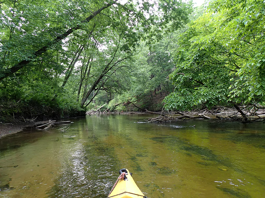
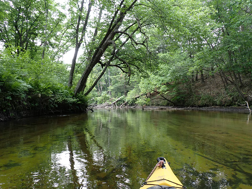
Leg 5 (2.5 – 3.9 mi) featured the best surprise of the trip. This entire stretch had been cleaned out by locals and it was clear sailing with no logjams (not even squeakers). The river stayed attractive with more clear water and a fun island to paddle around. But this stretch was more open and maybe not as scenic as the prior legs.
Leg 6 (3.9 – 5.3 mi) was the last and final stretch of the trip. Tragically this is where the locals stopped their cleanup work and “Hyde” returned with a vengeance. Some of the logjams I was able to zigzag, hop, or get past, but a handful were quite tricky. I really didn’t want to portage along the high weedy banks, so I tried to stay in the river whenever possible, but that usually meant getting filthy squeaking past branches and downed trees. I was relieved to see the largest sandbank of the trip as I knew from memory that meant my take-out at Ember Lane was just around the corner. It wasn’t a great bridge access, but dealing with its weeds and the steep bank didn’t phase me after all the logjams I had faced.
In summary this was a disappointing trip. The river itself was incredibly scenic and if it was ever cleaned out it would be a fantastic and popular water trail. It’s quite uplifting that a mile and a half have already been cleared and hopefully these cleanup efforts continue into the future. But until then, I can’t recommend this stretch for kayakers. In fact just based on this trip, I took the downstream leg (Ember Lane to 11th Road) off my todo list as I suspect it’s just as bad. If anybody reading this knows more about the current cleanup efforts on the river, feel free to leave a comment below.
Wildlife on this trip (especially the first half) was excellent. Sights included countless small shells, many fish, countless damselflies, dragonflies, and a number of raptors. I was able to paddle close to and under(!) a muskrat and later a groundhog who were snacking on leaves from an overhead branch. There was what appeared to be an escapee domestic duck and her baby duckling scooting around on the river perilously close to some eagles. One of the highlights was an owl that flew across my bow with what looked like a mouse in its talons.
One of the reasons this stretch of the Montello River is so clear is because of the clams which do a fantastic job of cleaning up waterways. Check out this time-lapse video of them cleaning up a murky aquarium. Unfortunately dams (like the one by Harrisville) are a big problem for clams.
Hwy J: This is a doable bridge access, but it is a bit steep/weedy and uncomfortably close to homes. The local dog “Odin” barked up a storm as I was attempting to launch and ran at me. He only stopped once the owner yelled at him to come back.
Alternate Put-ins:
- Harris Pond Dam (800′ upstream from Hwy J): This was a very tempting put-in with shoulder parking on the north side of Water Street. But…downstream from the culverts/dam there are No Trespassing signs. Maybe this is more of a restriction for fishermen who could wander further inland, but I didn’t want to mess around. The section below the dam is super scenic and has several Class 2 rapids…but also has a nasty strainer.
Ember Lane: This is an acceptable bridge access with nice mowed shoulders for parking. But the banks are a bit tricky. You either have to drag your boat through suspect weeds or up steep rough rocks.
Alternate Take-outs:
- 11th Road (4.0 miles downstream from Ember Lane): This is a doable bridge access, but I don’t trust the stretch between Ember Lane and 11th Road (too many logjams).
Bike Shuttle – Ember Lane to Hwy J: 3.4 miles with 52′ of ascent. This was a very easy bike shuttle.
Current: The current is fairly lazy with no riffles or rapids. There are Class 2 rapids located between the dam and Hwy J, but I didn’t run those because of a nasty strainer.
Logjams: There are countless downed trees. Many you can simply zigzag around, some can be hopped/ducked, but others have to be portaged. I would rank maybe 8 as “significant” in that they require a shore portage or significant effort to get around. As of this trip date (June 2023) there are too many logjams to recommend this trip. However…there are efforts to clean up this river with impressive progress already having been made. If this continues this may be a navigable and really nice water trail in the future.
Closest Gauge: Chaffee Creek @ I-39
Trip Depth: 11.6 CFS or 3.63′
Navigability Estimates: Note, this gauge is on a different watershed and may not provide the best estimates. Always use your own judgement when choosing to paddle a water trail or not.
- 10-11′: Shallow depth but plenty doable. I don’t think this stretch ever gets too shallow to run.
- 11-12′: Below average depth. A good target range with exceptional clarity.
- 12-13′: An ok target range with good clarity.
- 13-14′: Likely ok for paddling but clarity won’t be as good.
- 14-15′: A high depth with maybe meh clarity.
- 15’+: Maybe too high for good paddling.
Detailed Overview
- Headwaters to 1st Ave: 1.0 miles. In theory, there should be a spring located at the headwaters a mile upstream from 1st Ave. This might be more viable as a roundtrip.
- 1st Ave to Lawrence Lake (North Ramp): 3.0 miles. Technically Lawrence Creek, this is a small paddle with some logjams, but is really nice with stunning water clarity and virtually no mud. A very underrated paddle.
- Lawrence Lake (North Ramp) to Lawrence Lake Dam: 0.8 miles. A simple lake paddle.
- Lawrence Lake Dam to Pioneer Memorial Park: 5.6 miles.
- Lawrence Lake Dam to Westfield Veterans Park: 4.8 miles. A terrific paddle because of the incredible clarity and natural springs. Only downside are a few logjams, but they are easy portages.
- Westfield Veterans Park to Pioneer Memorial Park: 0.8 miles. The river here is faster, deeper, more wooded and less clear. It's a scenic stretch flanked by steep clay banks.
- Pioneer Memorial Park to Hwy E(by Charles St): 0.6 miles. A nice little prospect. Mostly within earshot of busy I39.
- Hwy E(by Charles St) to Hwy E/B(by Maynard Dr): 5.1 miles. Maybe 15-20 logjams.
- Hwy E/B(by Maynard Dr) to 10th Lane: 1.4 miles. This section should be mostly clear with I believe the only jam being the one you’ll see from the Hwy E bridge.
- 10th Lane to Hwy E: 0.7 miles. Nice open marsh paddle. Good access at both the put-in and take-out.
- Hwy E to Water Street Dam: 1.7 miles. A boring flowage.
- Water Street Dam to Hwy J: 600'. There are cool rapids between the two bridges in this short stretch, but a nasty strainer and a No Tresspassing sign by the dam make this a difficult leg to access.
- Hwy J to Ember Lane: 5.1 miles. A very scenic stretch of river with clear water and a sandy bottom. Currently there are too many logjams here to recommend, but it may get cleaned out in the future.
- Ember Lane to 11th Rd: 4.0 miles. Likely a scenic stretch of river, but I bet it has too many logjams.
- 11th Rd to Lake Montello (park on south shore): 3.7 miles. A simple section with some lake paddling.
- Montello Dam to the Fox River: 0.6 miles. A nice little urban stretch.
Trip Map
Overview Map
Video
Photos Size: