
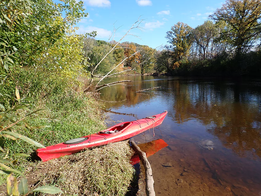
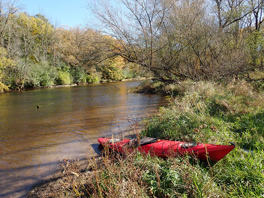
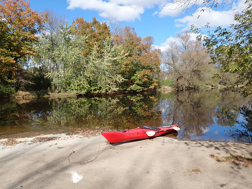
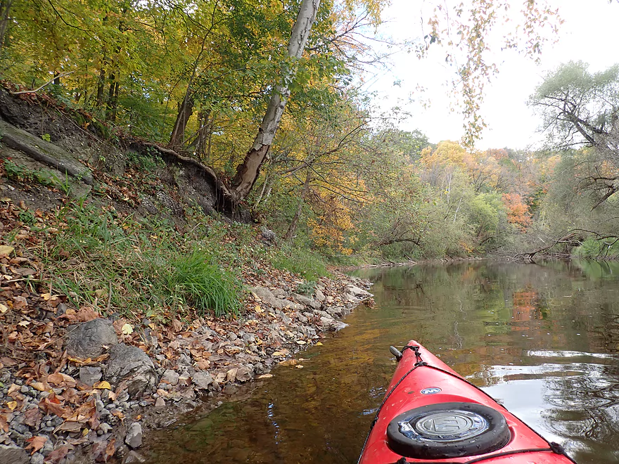
Nice put-in at Rochester Park
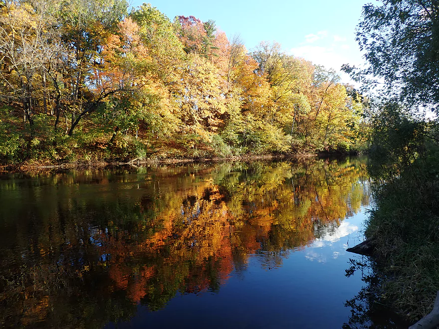
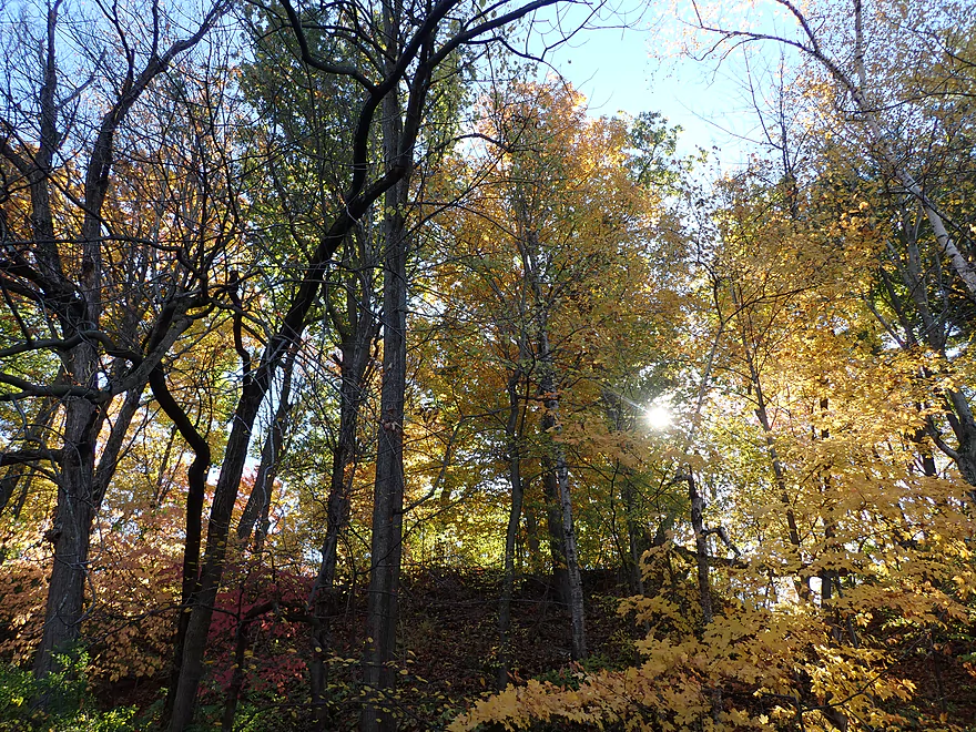
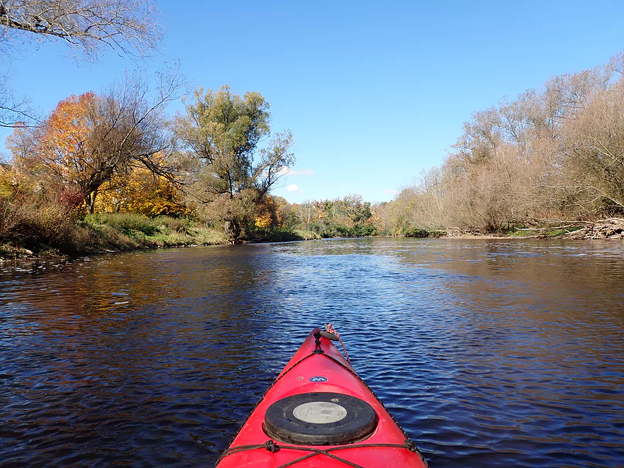
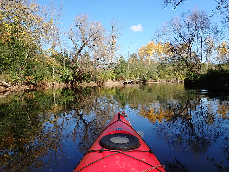
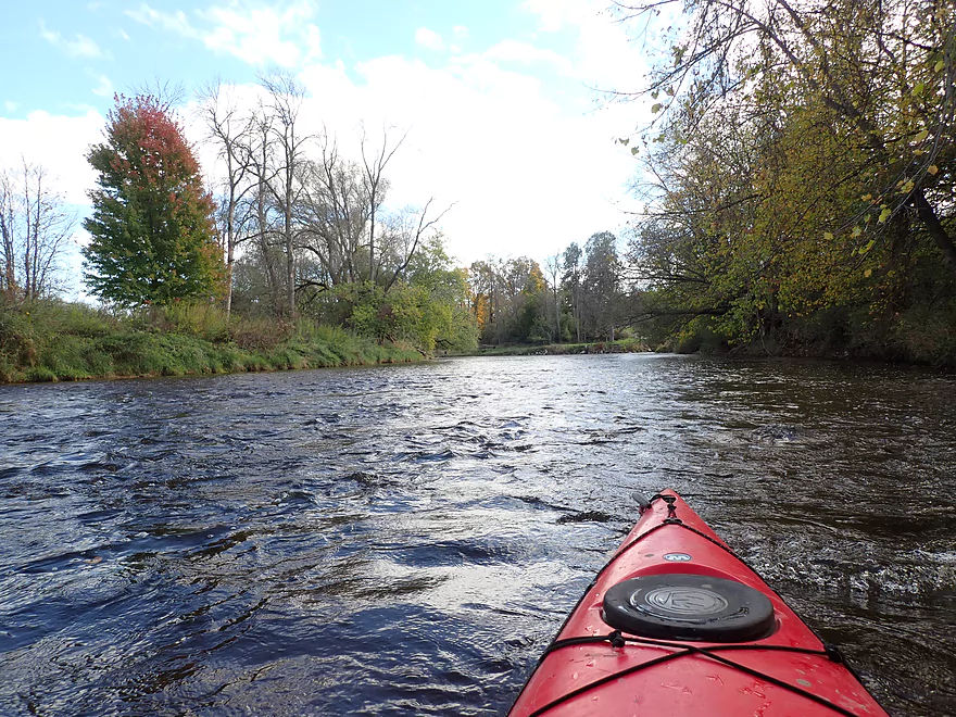
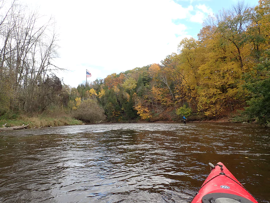
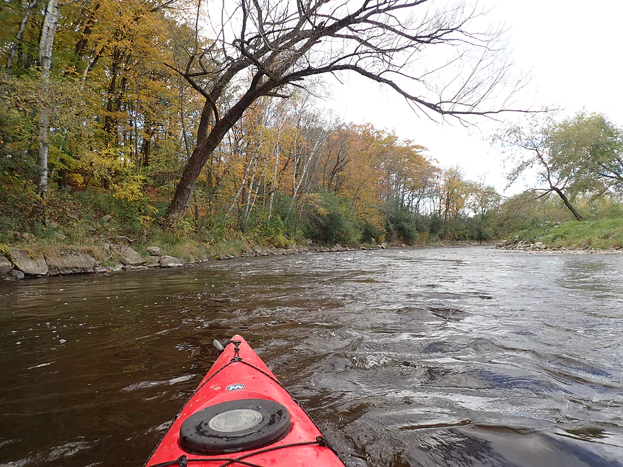
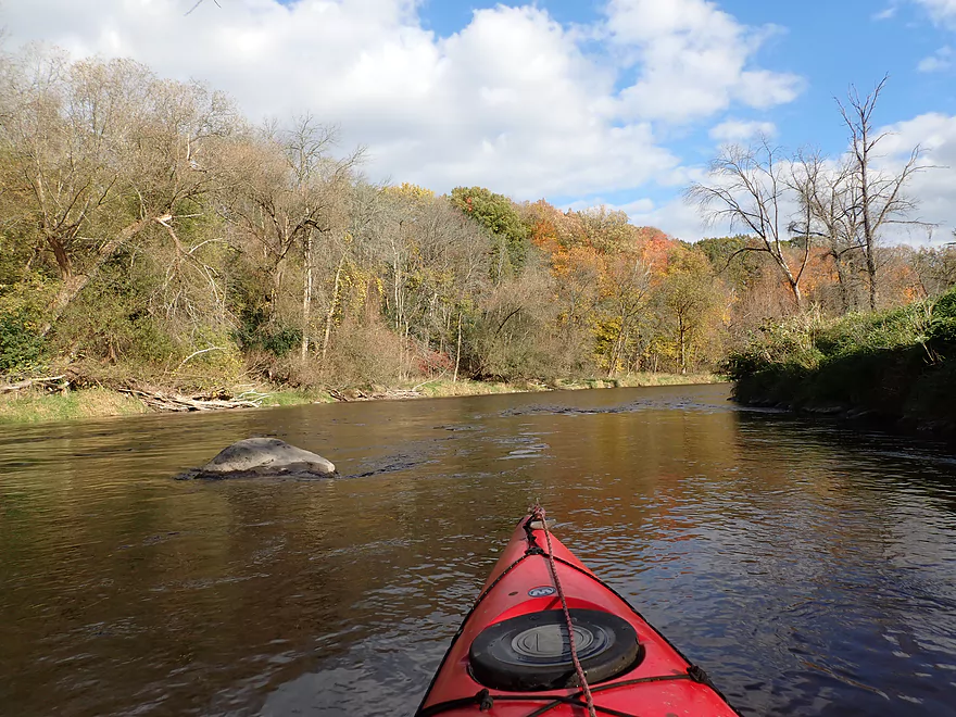
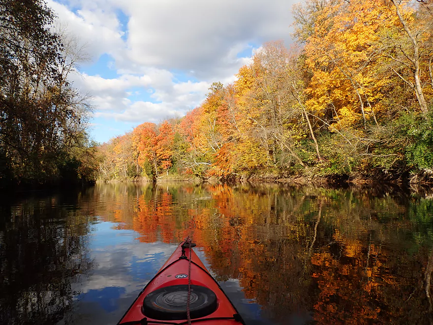
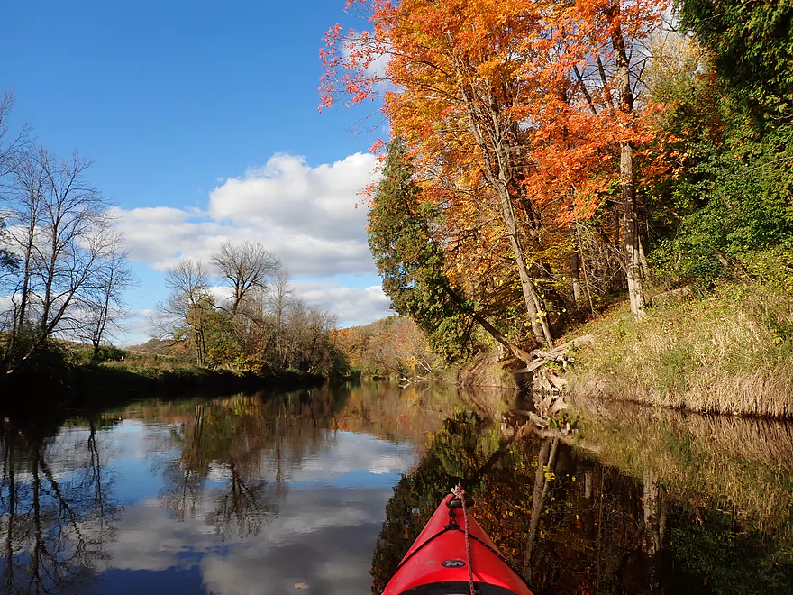
Good color right off the bat
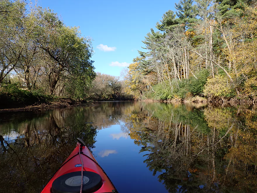
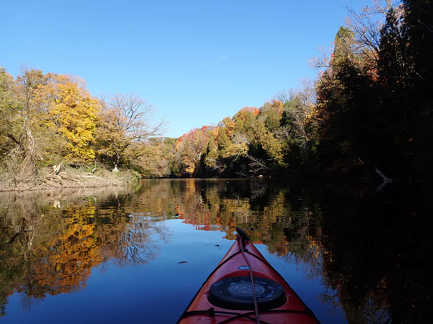
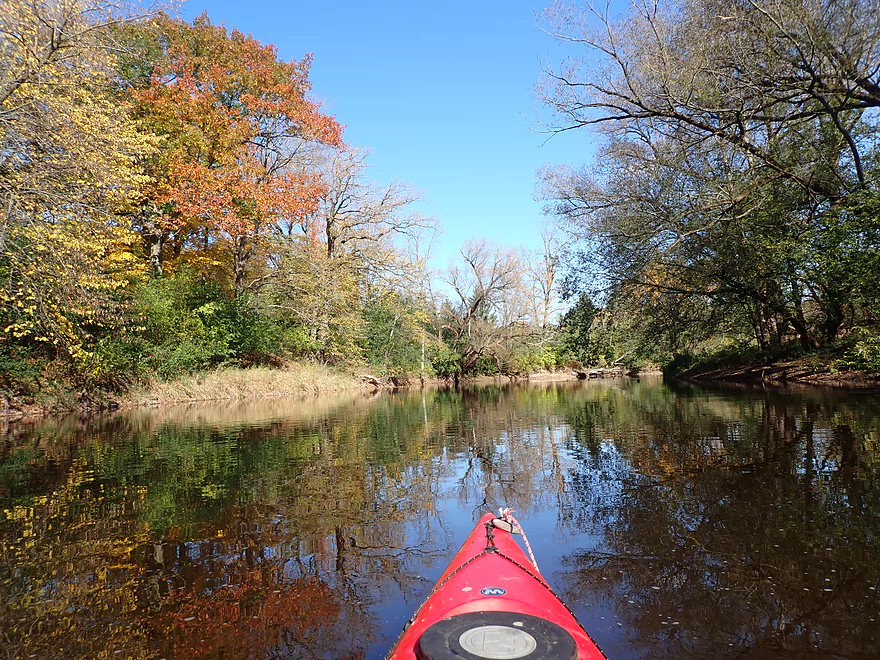
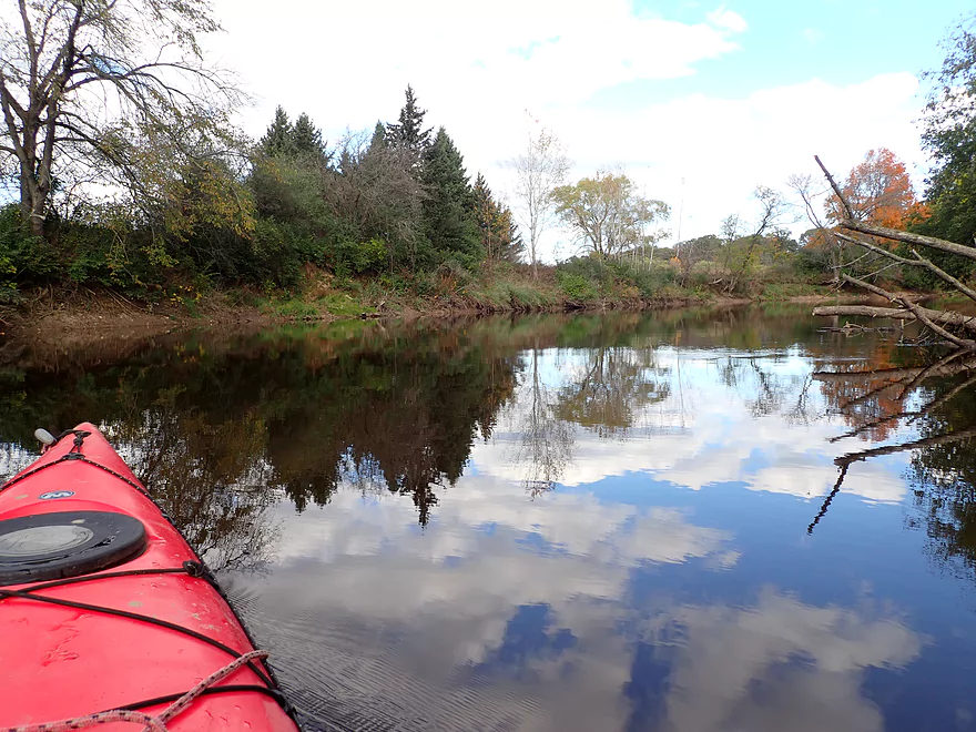
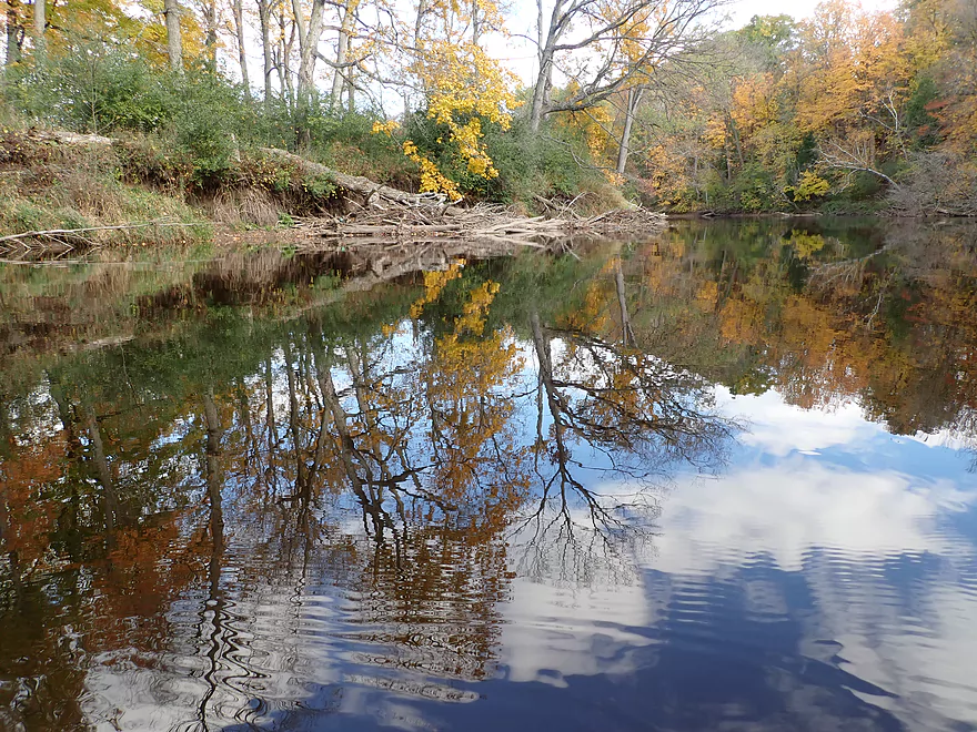
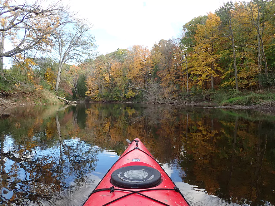
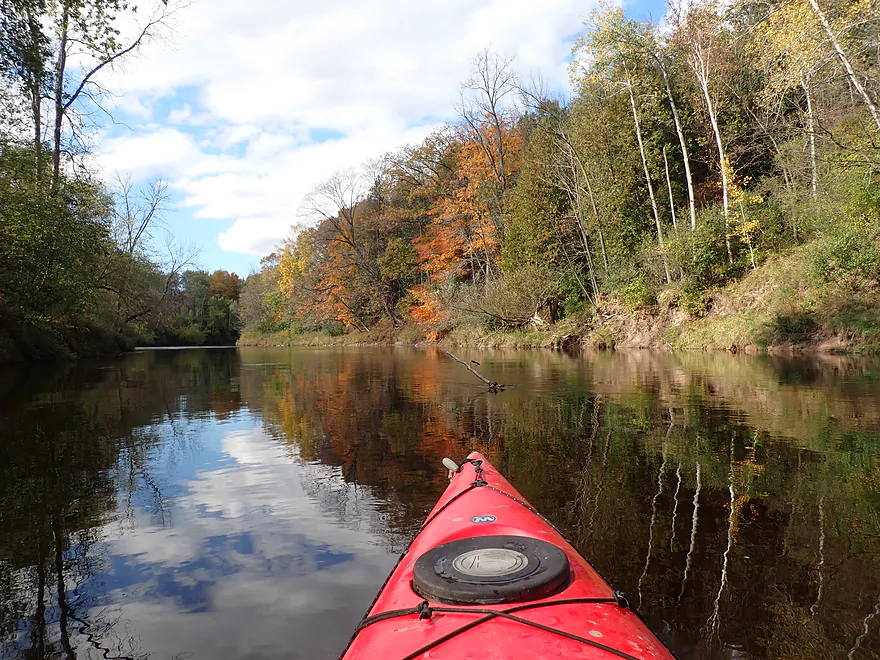
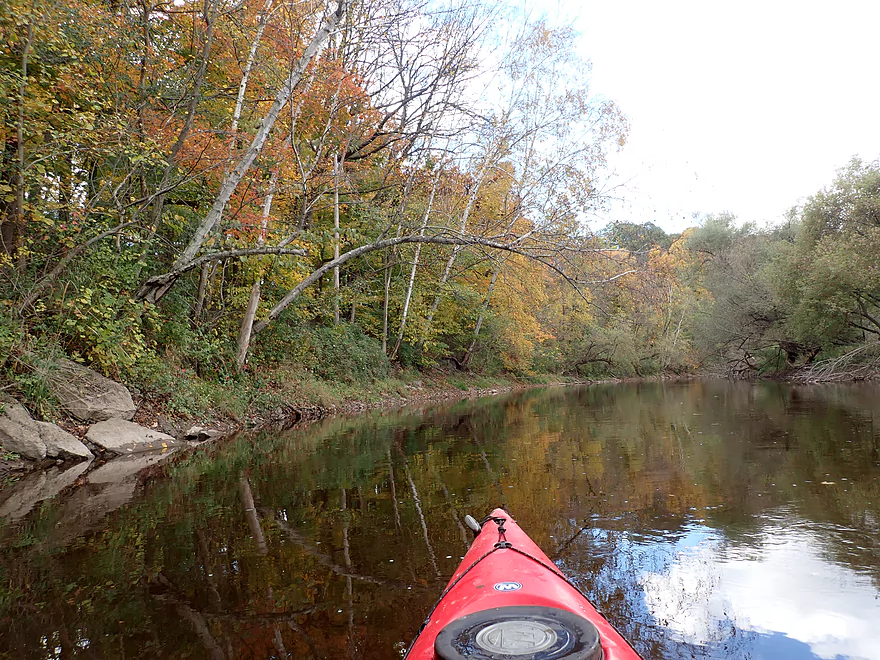
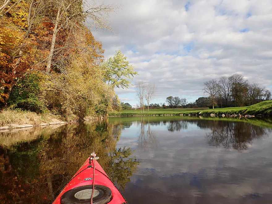
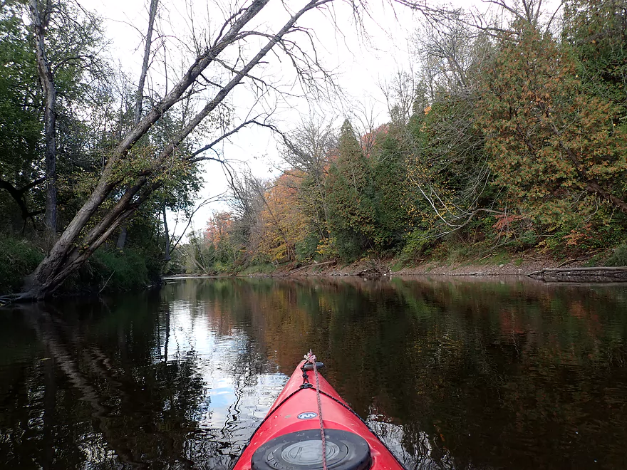
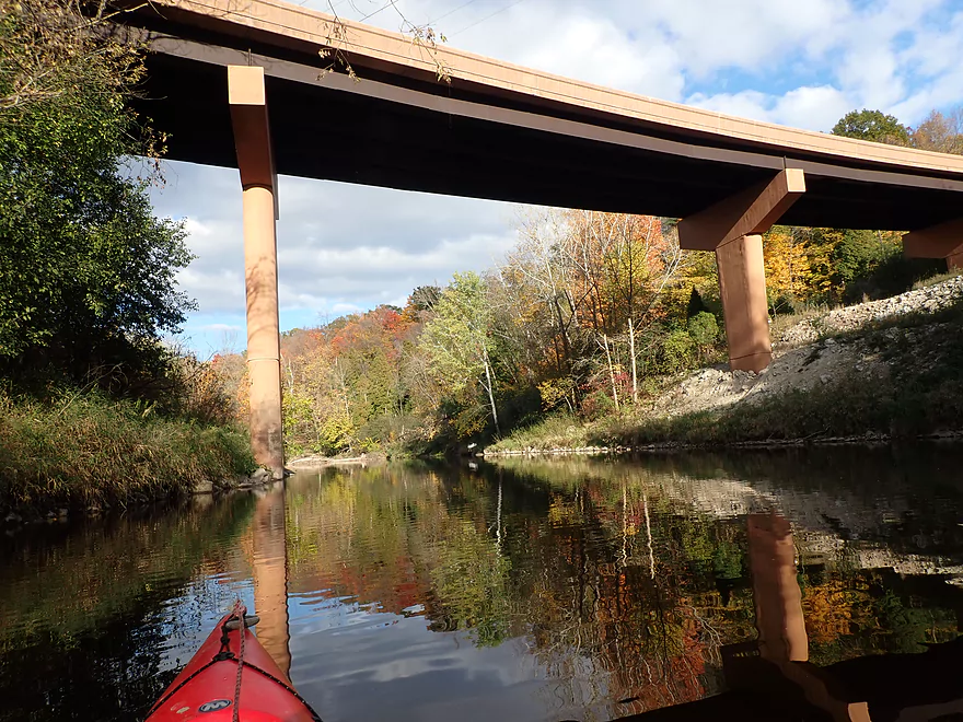
Nice reflections
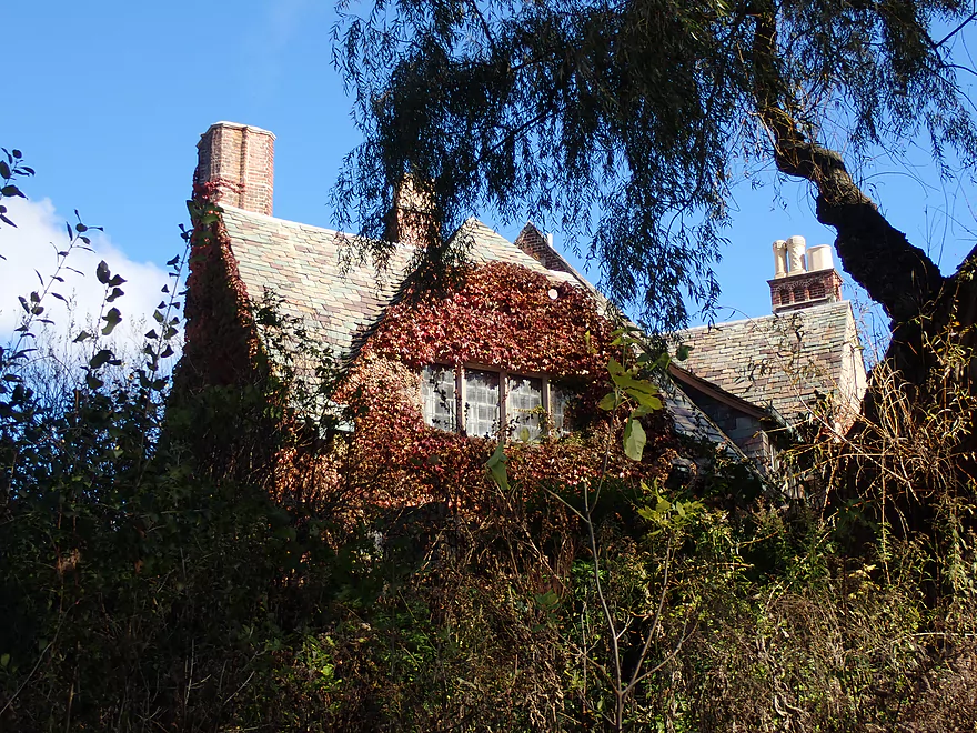
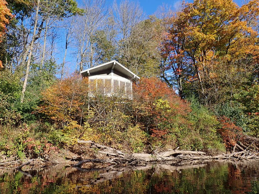
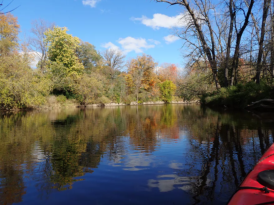
Neat riverside architecture
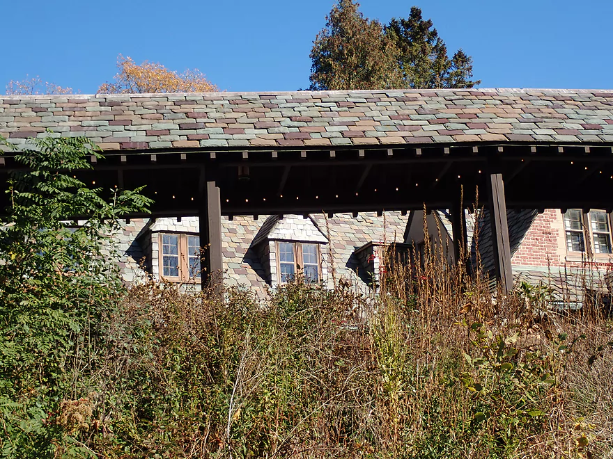
Expensive slate shingles
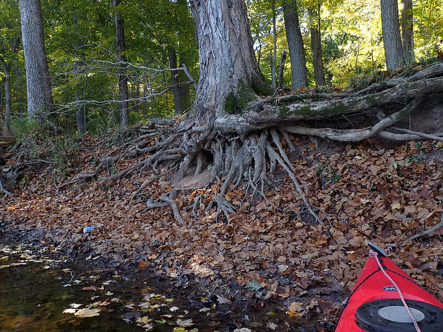
Exposed roots
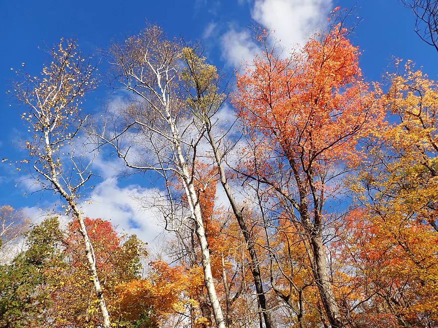
Sheboygan is a great river for sugar maple
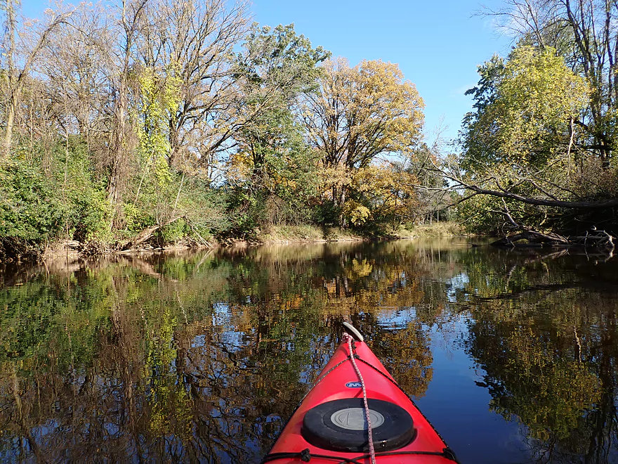
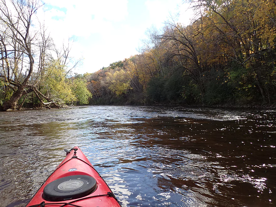
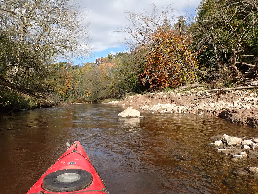
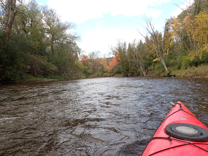
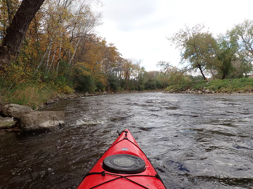
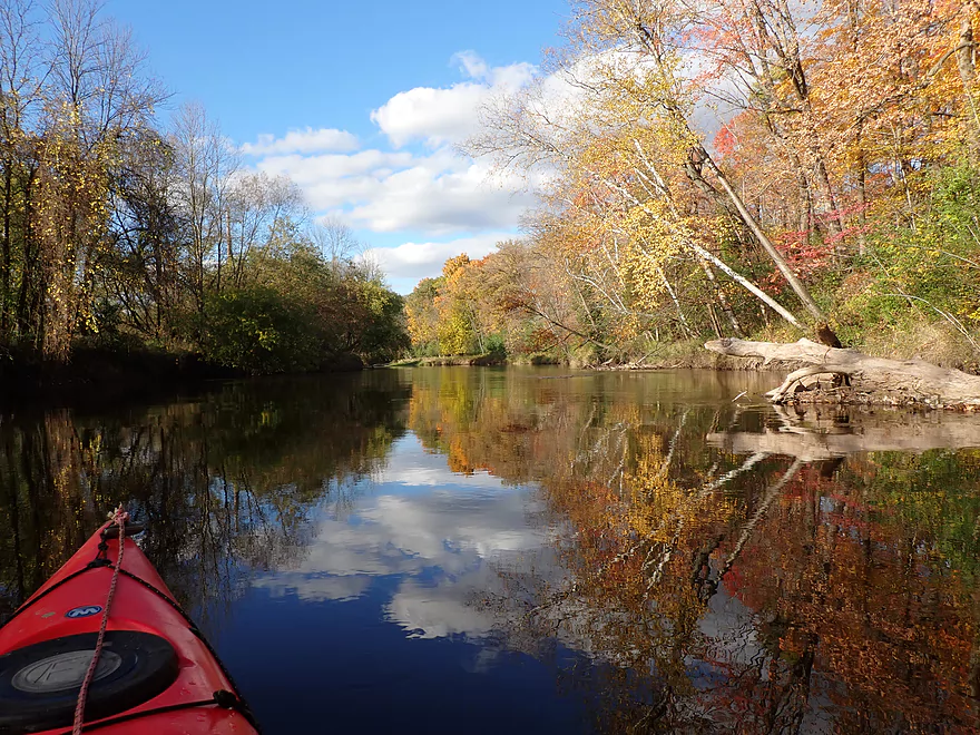
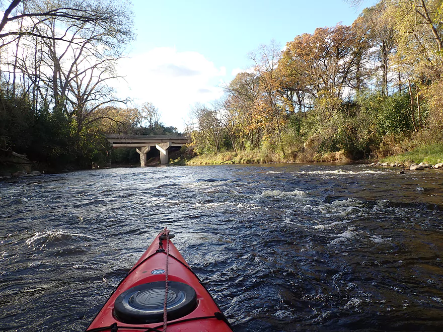
First part of the trip was wide and slow
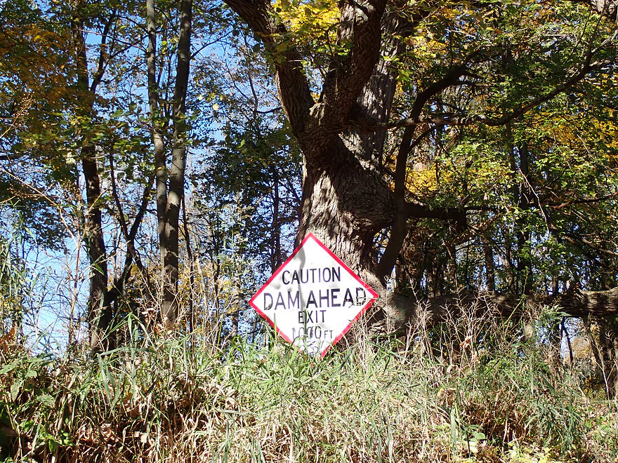
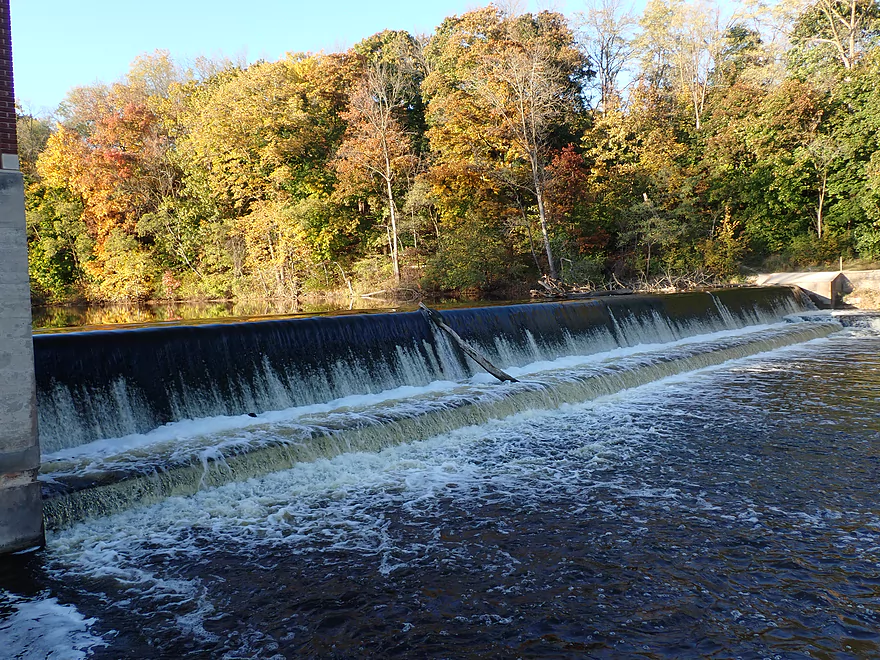
Riverbend Dam is an easy portage
Skilled whitewater paddlers, with the right conditions, might be able to run it
Bottom view
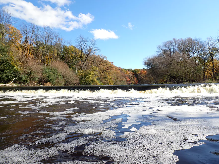
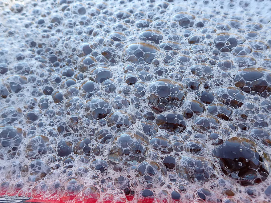
I wonder if laundry detergent is getting into the river
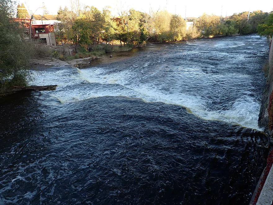
Another flowage right after the dam
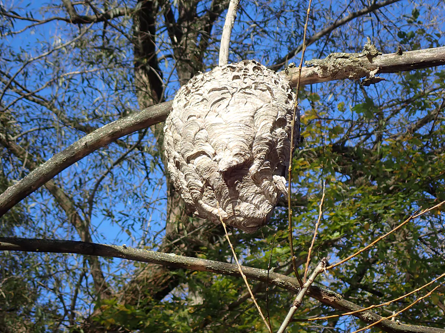
Bald-faced hornet nest
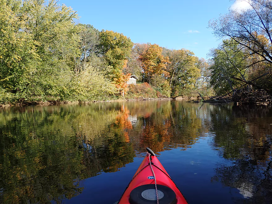
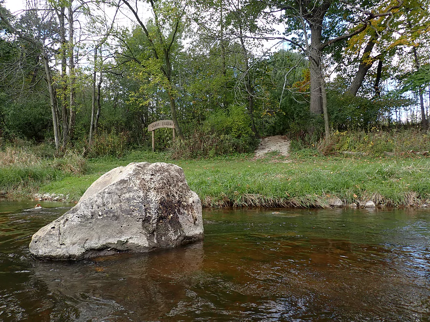
I think these are the remants of the old Walderhaus mill
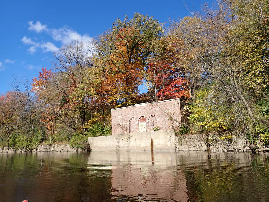
Kind of scenic
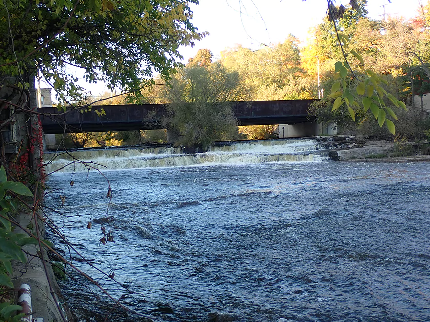
Portaging the Walderhaus dam
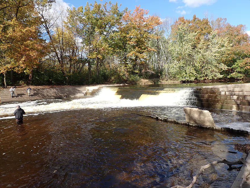
Cool steps on the downstream side
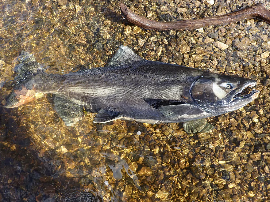
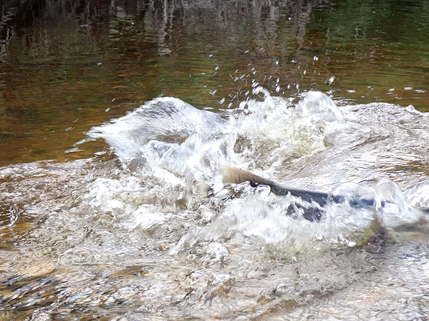
From here on, I see a lot of salmon
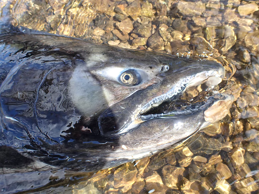
Some sharp teeth…
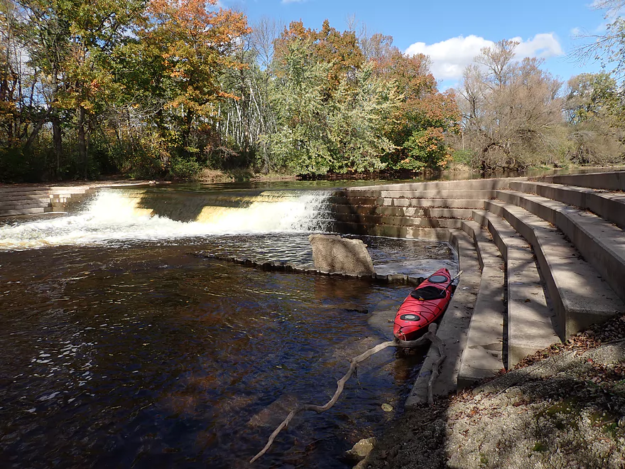
Portaging around the dam…some steps to deal with but not bad
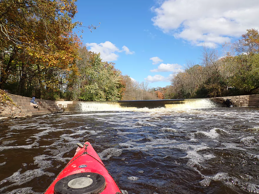
Reverse view
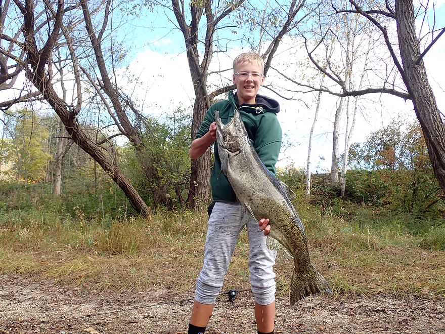
These salmon get huge!
Spawning salmon
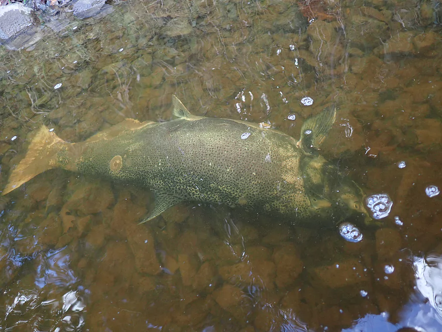
Lot of dead salmon too…this one had a lamprey bite mark
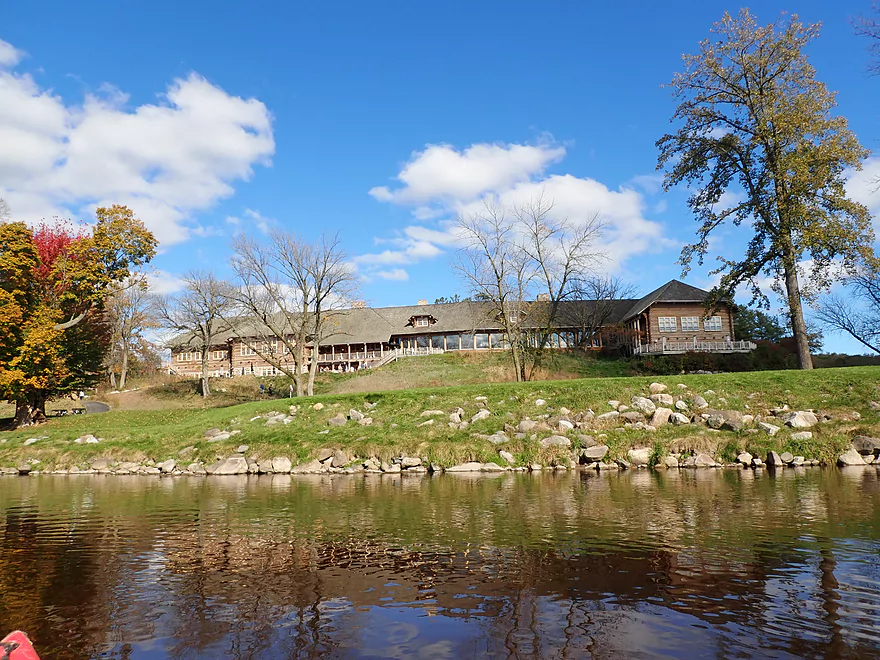
Massive clubhouse for “Blackwolf Run Golf Course”
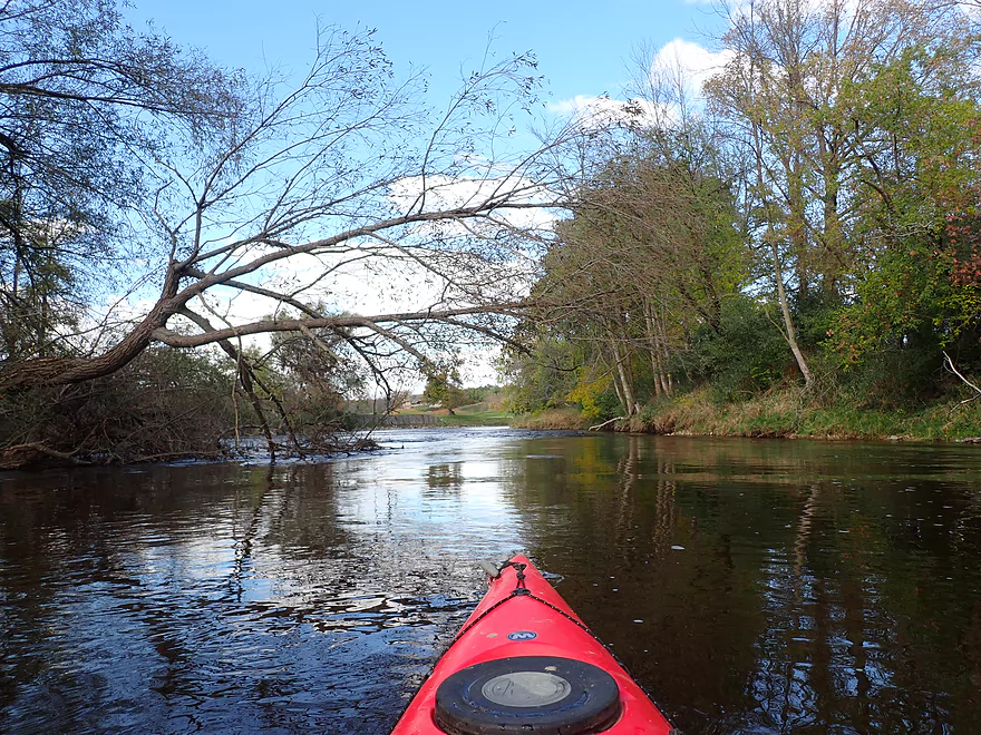
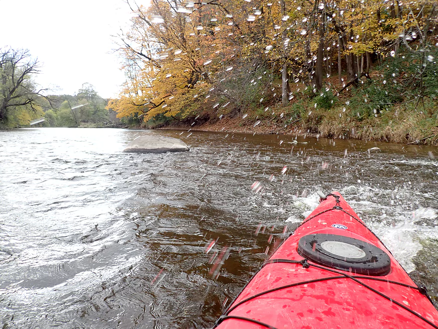
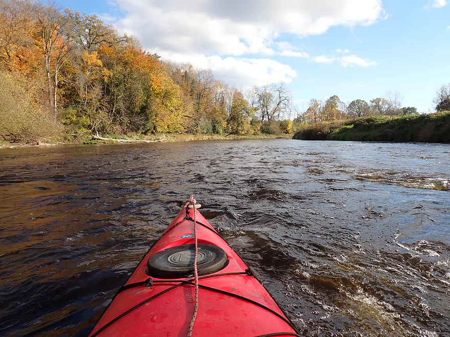
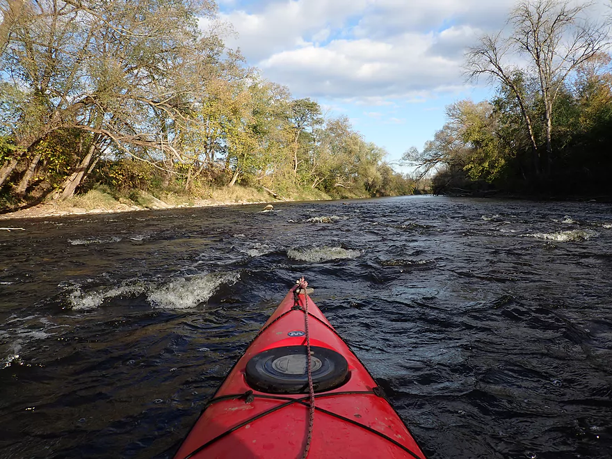
Second half of the trip had good current and many riffles
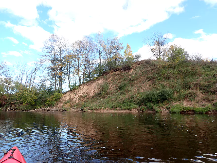
Exposed sand bank
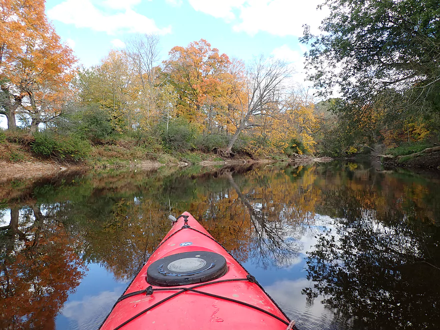
Wind died down which created nice reflections
Exposed clay
While an inviting canoe landing, it is private
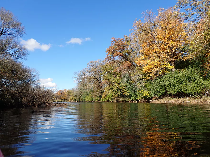
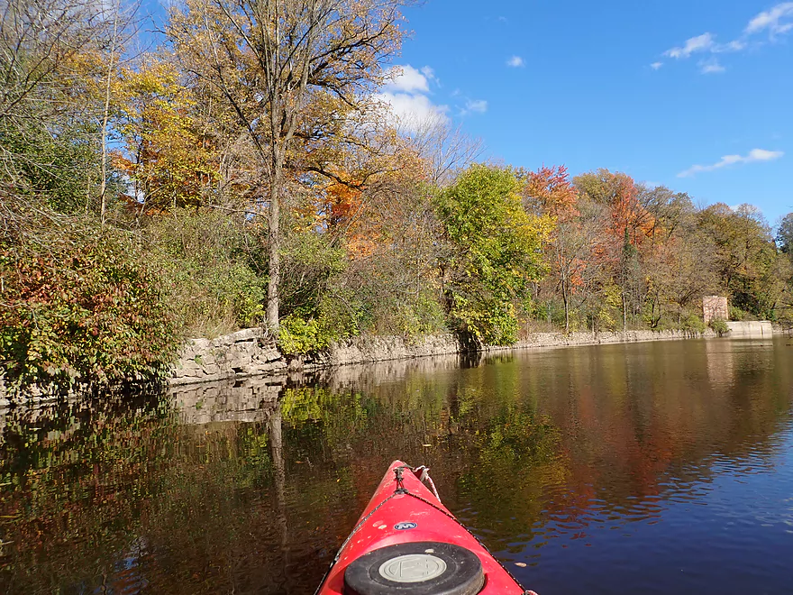
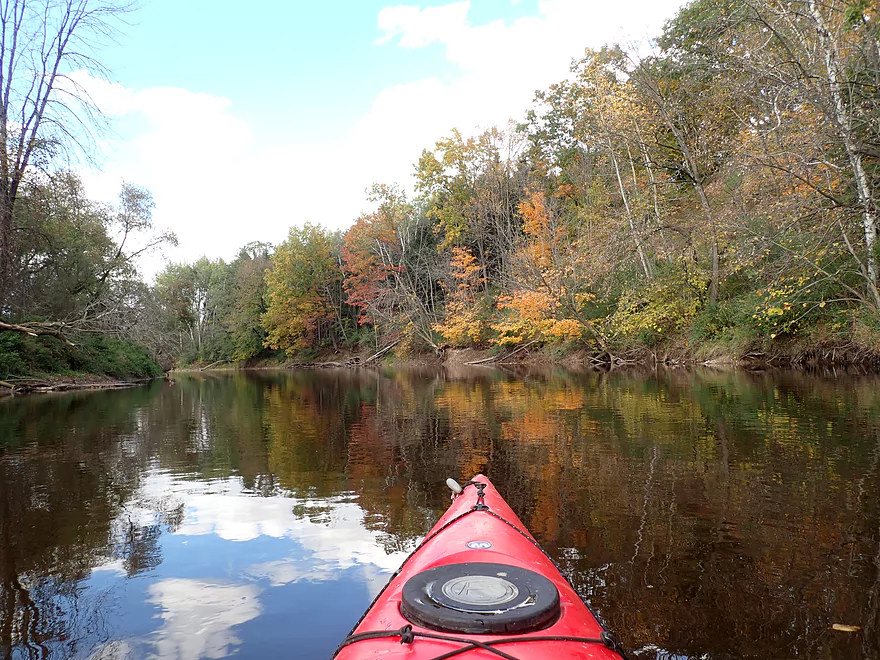
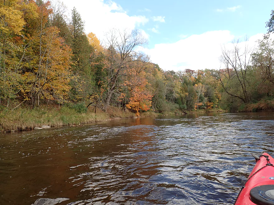
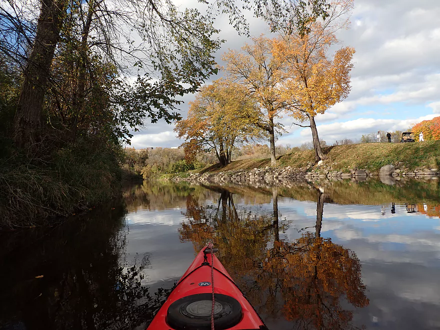
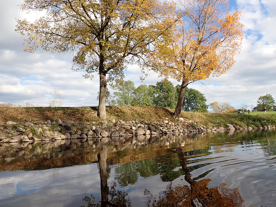
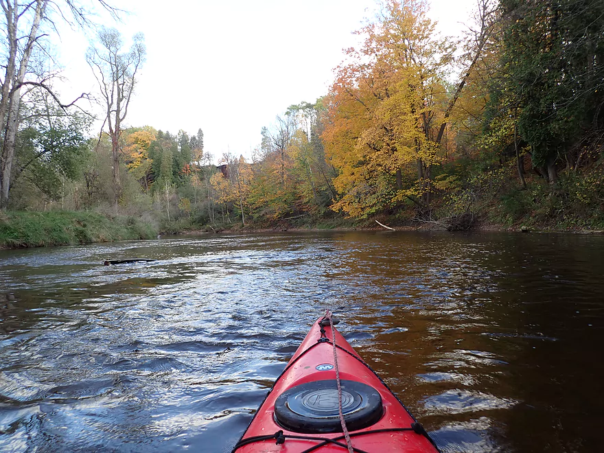
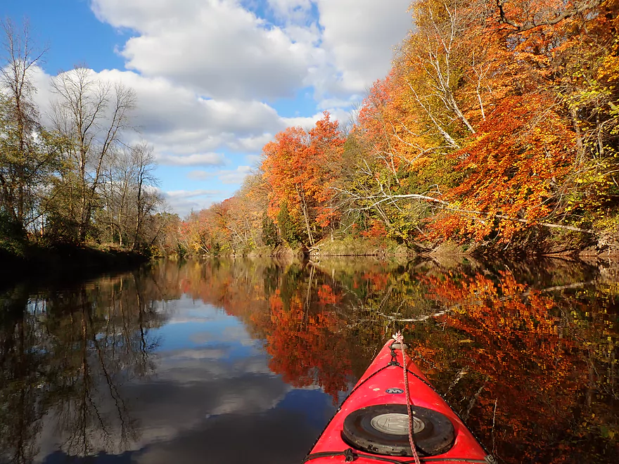
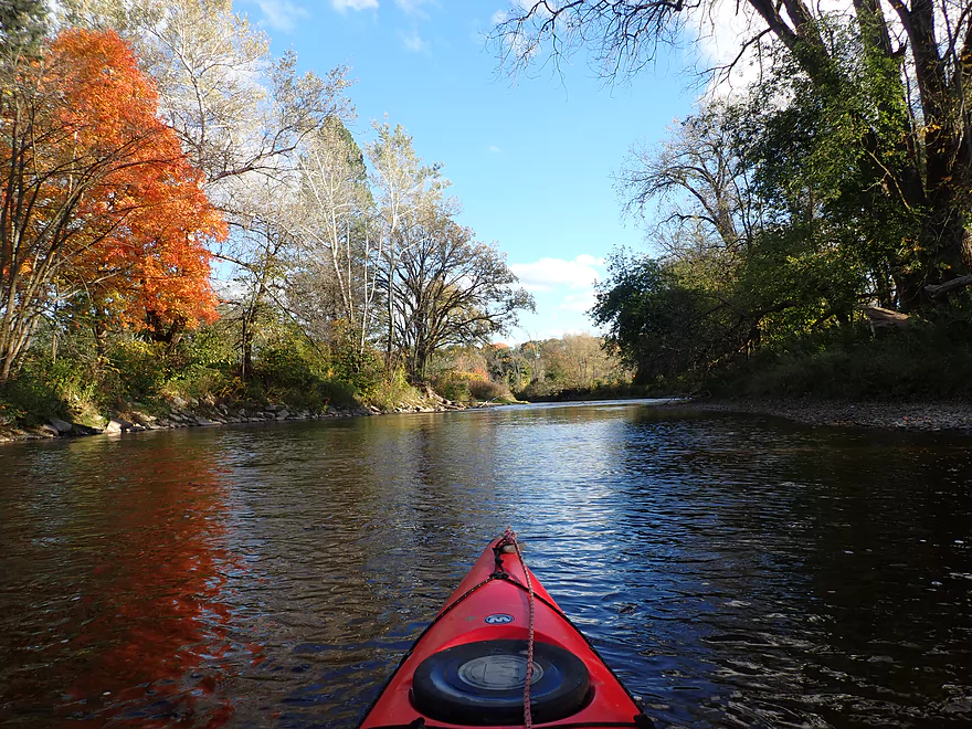
Nice stretch of color
My camera and face got splashed good by a salmon
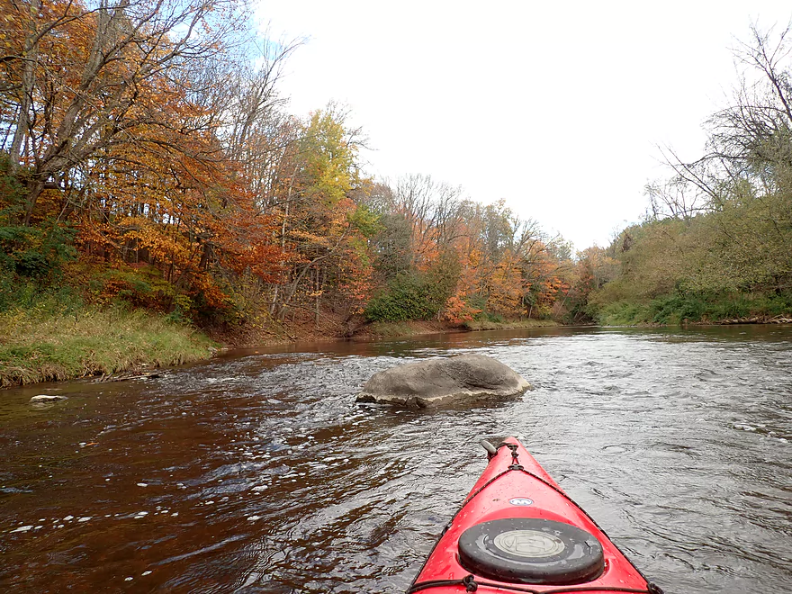
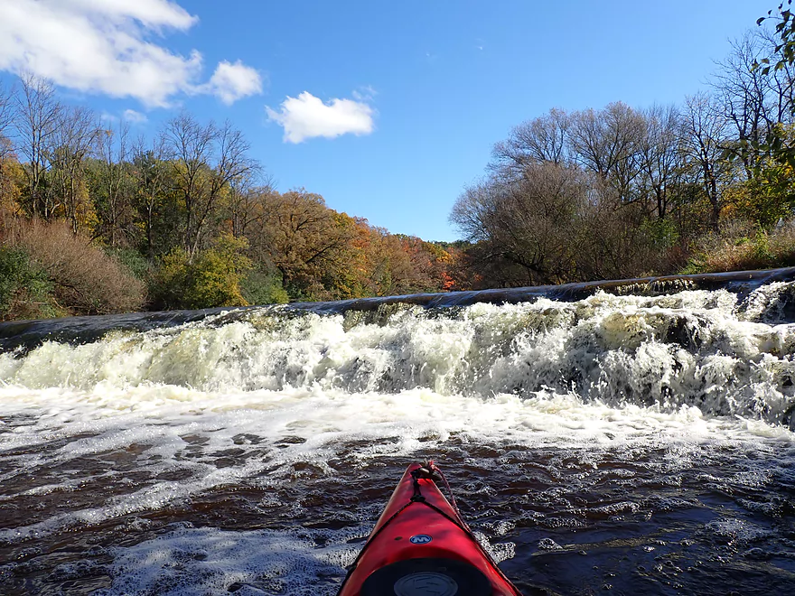
Some of the stronger rapids of the trip
Still only Class 1
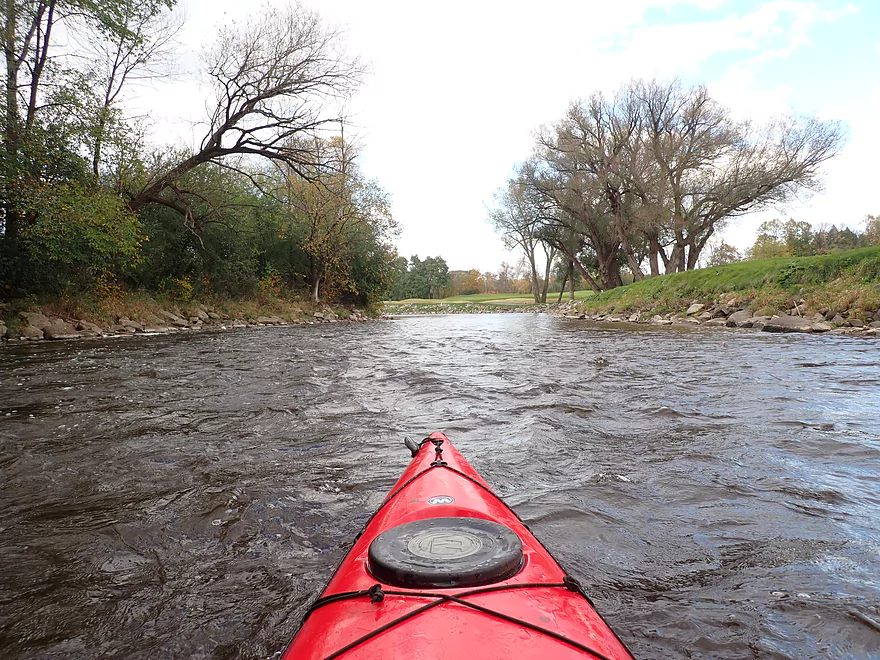
I kept seeing the same golf course for some time
Minor rapids…I get slashed again by a salmon just below here
Hwy A
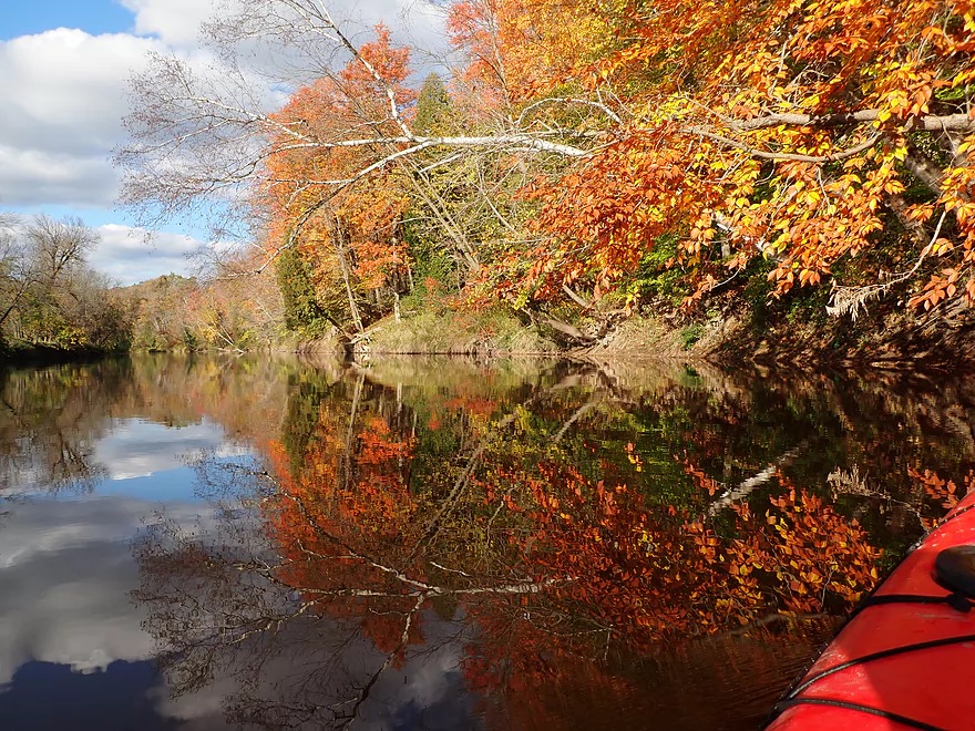
The color after Hwy A was fantastic
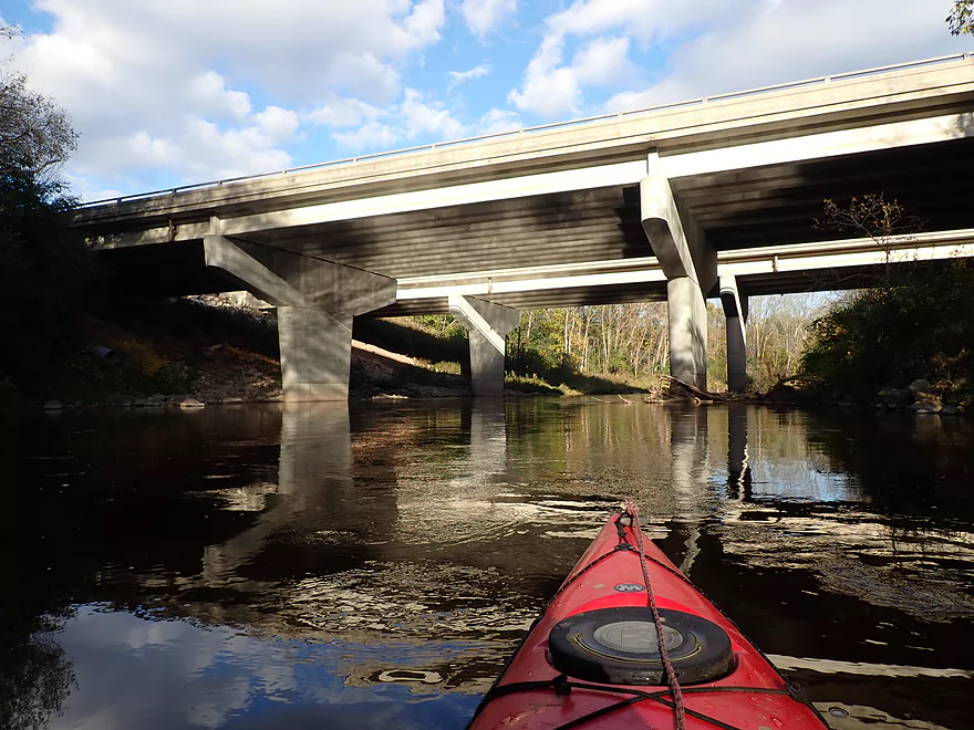
I-43
Maybe the strongest rapids of the trip
Final leg
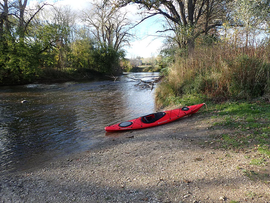
Taking out at Esslingen Park
Scouting Sheboygan Falls…this is the dam by Broadway
This is followed by a natural waterfall
Reverse view
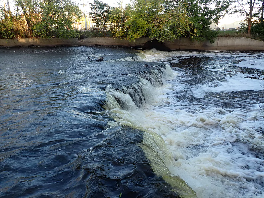
Then another smaller ledge
Sheboygan River – Kohler

The Sheboygan is one of the nicer paddling rivers that empties into Lake Michigan. Much of its length is great for kayaking, but the stretch through Kohler might be its best and is one I’ve wanted to do for some time. I knew it had good fall color, huge salmon, and nice rocky stretches, so my plan was to time this for late October. Year after year passed, and ideal conditions never really lined up. Finally in 2021 everything (lighting, water levels, salmon, fall color) all aligned and I pulled the trigger.
I started the trip at Rochester Park which was a good put-in with some great fall color. The Shebogyan is one of the better fall paddles in the state because of its many sugar maples and it can put on quite the light show in late October. Unfortunately the current was quite slow and the channel fairly wide. The first few miles of the trip weren’t that interesting and kind of reminded me of the Sheboygan Falls flowage stretch I did during my Mullet River trip.
Roughly a quarter into the trip, I discovered the reason the river had such pathetic current…the River Bend dam. There is a well-marked and easy portage. After the dam, I thought I would finally see boulders and enjoy fast current. But no…almost immediately the river came to another halt courtesy of the Walderhaus flowage (which was about 2 miles long).
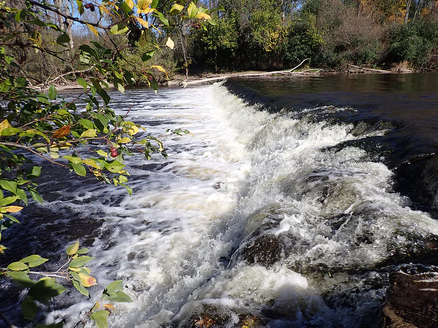
The Walderhaus dam was a relatively easy portage, but did require descending down some steep steps. The dam itself is kind of artsy with a series of concentric steps on the downstream side. This very spot is the most popular area for salmon fishing on the entire river. In late October, HUGE salmon swim up from Lake Michigan to spawn. Unfortunately because of the Waelderhause dam they don’t get far and often bottleneck below the dam. One kid caught a salmon maybe half his size right in front of me. He was nice enough to let me take his picture with the fish which you can see in the gallery. It was incredible to see these fish in person…like a Natural Geographic special but without the bears.
Following the second dam was the start of what I dubbed the “never-ending golf course”. It’s officially known as the “Blackwolf Run Golf Course” and consists of 36 holes. It’s so large, it is I believe larger than the neighboring city of Kohler. Let that sink in…one golf course takes up more space than a town of 2000. The river is also extremely convoluted here and if straightened out would probably extend to Lake Michigan.
Kohler is a wealthy city sandwiched between Sheboygan and Sheboygan Falls, and is named after the Kohler Co. which is a major corporation specializing in plumbing supplies. This company (and more specifically the Kohler family) dominate the area and are practically feudal land barons over the community. Everywhere you look the 27th most wealthy family in America has left their mark. There are the opulent riverside homes with stone slate shingles, the over-the-top “John Michael Kohler Arts Center”, the huge “Blackwolf Run” and “Whistling Straights” golf courses, and the extravagant Kohler stables. Most concerning for paddlers though is they own a huge swath of the Sheboygan River shoreline (~10 miles long) and restrict public access. During my trip I did pass a really nice canoe landing that I would have loved to use, but it turned out that too was owned by the Kohlers and set aside exclusively for “River Wildlife” members (their private resort). I’m not sure it is a good thing that so few people can control so much land and resources…
Despite the river being mostly golf course for the next 5+ miles, it was still really nice and it was great to see the Sheboygan finally free of its evil dams. The current picked up speed with a number of light rapids and the shoreline became rocky and attractive.
The highlight of the second half of the trip were the salmon and I must have seen 50+ between the Walderhaus dam and my take-out. For these salmon spawning is a suicide mission and they die shortly thereafter. Dead salmon were a common sight (and smell). It’s too bad there weren’t animals there to clear them up. Many of the salmon loved to hang out in the shallow rocky areas. Often they were oblivious to me and I could get relatively close. When spooked they would hydroplane across the surface (kind of like what you see in nature specials). I saw a second fisherman catch a salmon right in front of my eyes…but it was so powerful it snapped the line and escaped.
Near Hwy A was some of the best fall color of the trip. When the wind died down, I was able to get some amazing reflection photos. Hwy A marked (finally) the end of the “never-ending golf course”. Just under I43, I enjoyed some of the better rapids of the trip and then took out at Esslingen Park. This is where the “poor salmon fishermen” hang out that don’t pay the exclusive “River Wildlife” member fees. While there weren’t as many salmon this far downstream, there were some.
In summary this was a really nice trip, with the two main highlights being the fall color and the salmon. The first half of the trip (upstream from the first two dams) actually isn’t that interesting and had I taken out at the second dam it would have been just 3 stars. Hopefully one day these dams will be removed (which the salmon would appreciate). The river after the two dams though was fantastic (despite the “never-ending golf course”) and by itself is an elite paddle and IMO the best stretch on the entire Sheboygan River. If you do this trip though try (if possible) to time this for later October so you can see the salmon and fall color like I did.
Sights included a few hawks, one great blue heron, a muskrat, and a relatively tame deer. The trip highlight were the salmon. These are huge fish that swim upstream from Lake Michigan to spawn in the fall and then die. I saw at least 50…many dead. These are powerful fish…several when spooked by my boat splashed me pretty good. Timing a paddle trip to see salmon spawning can be tricky. I think your best bet is the third week of October, but I suspect this varies year to year. If in doubt, you can contact the DNR which keeps tabs on salmon spawning schedules.
Sheboygan Falls: Just upstream from my Kohler trip, the Sheboygan River runs through the heart of Sheboygan Falls and features some spectacular rapids and small waterfalls. For all but the most skilled kayakers, these are too dangerous to run. But they are still worth checking out from shore. The first main scenic stretch is by Settlers Park. Below the dam the river features several outcrops and a number of Class 1-2 rapids. Under Monroe Street/Hwy PP, is the main waterfall. It’s very scenic and is followed by a series of minor rapids and then a very jagged 1-2 foot ledge. The bottom of the falls is best viewed from “Sheboygan Falls View Park”.
Rochester Park – East End: This was a good put-in. It’s a large park, so you’ll have several launch options. I launched on the east end by the dog park. Here there was a nice dirt launch by the river, but I did have to drag my boat 260′ to get to the water. If I did this again, I would have instead launched at the south end where there is a dedicated river access parking lot and you only have to hike 150′ to get to the water.
Alternate Put-ins:
- Sheboygan Falls View Park: 0.7 miles upstream from Rochester. This park is known for its view of the famous Sheboygan Falls. Most paddlers don’t want to run these…but you should be able to launch below them if you wish. However this would require a 290′ hike including down steep stairs. The stretch from here to Rochester is narrow and wooded. I suspect there might be some Class 1 and 2 rapids, and it could be nice. In hindsight I should have started my trip here.
Esslingen Park: This was a very good public access.
Alternate Take-outs:
- River Wildlife: 4 miles upstream of Esslingen. There is a private canoe landing that requires permission from River Wildlife (an exclusive nature resort) to use. For most this will not be a practical option.
- Downstream Options: Downstream from Esslingen you enter the city of Sheboygan where there are a number of decent access options. For example Kiwanis Park IMO would be a good bet. For more take-out options near Lake Michigan see my overview map.
Bike Shuttle Route – Esslingen Park to Rochester Park: 3.2 miles with 118′ of ascent. Given the length of the river trip, that was a relatively short shuttle. It wasn’t too difficult and mostly went through the high-end community of Kohler. Maybe 50% was on dedicated bike/pedestrian paths (really nice!) and 50% was on busy streets with narrow curbed shoulders (not so nice). I can’t complain too much though.
Logjams: None
Current: Prior to the two dams, mostly non-existent. After the second dam, the river zips along at a good pace with a number of light rapids.
Dams:
- River Bend Dam: This is a super easy dam to portage and has a well-marked path. For skilled whitewater paddlers in the right conditions (and after scouting) it might be runnable.
- Walderhaus Dam: The portage take-out is pretty easy. Putting in is a bit trickier because you’ll have to lug your boat down some steep concrete steps, but it isn’t bad. The dam is kind of scenic and is popular with fishermen who pay the local resort to fish here.
There is a river gauge located just downstream in Sheboygan. I did this trip at 270 CFS which was a good depth.
- 0-100 CFS: A shallow depth that might require some wading. Water clarity though should be excellent and you will really be able to see the rocky substrate.
- 101-200 CFS: An average depth and good target range.
- 201-350 CFS: Slightly above average, but still a good target range. All the rapids will have good padding.
- 351-500 CFS: River is on the high side. Poor clarity and you won’t see as many rocks, but should be doable.
- 501-800 CFS: River is pretty high and likely not as enjoyable for paddling.
- 801+ CFS: Maybe too high for casual recreation paddlers.
Detailed Overview
Thanks to Mike Svob, author of "Paddling Southern Wisconsin", for much of this information.
- Upstream of Hwy CCC: River looks too small and channelized to be interesting.
- Hwy CCC to Palm Tree Road landing: 3.17 miles. Interesting creek prospect with a mix of wetlands and woods. Part of a State Natural Area with a cool bridge. Warning the weeds in late summer can make navigation difficult. A group got lost here and had to call 911.
- Palm Tree Road to Sheboygan Marsh Tower: 8.8 miles. The heart of the Sheboygan Marsh and probably similar to Horicon Marsh. Some flowage paddling and channelized sections.
- Sheboygan Marsh Tower to Hwy MM: 1.1 Miles. Probably nice, but with logjams and a possible fish barrier. Am not 100% sure that Hwy MM is ok for public access.
- Hwy MM to Kiel (8th St.): 5.9 miles. First 1.3 miles is mostly wooded and probably nice, with perhaps a few jams. Then it is open marsh to Kiel.
- Kiel (8th St. landing) to Kiel (Rockville Road landing): 2 miles. Seemingly pleasant urban paddle, but a dam and two flowages to contend with.
- Kiel (Rockville Road) to Steinthal Road/Dam: 0.7 miles. Very big flowage...looks boring.
- Steinthal Road/Dam to Rockville Road: 1.2 miles. Looks like a pleasant wooded section with maybe a log jam.
- Rockville Road to Millhouse (Gierke Road/Dam): 2.5 miles. Mostly minor flowage paddling.
- Millhouse Dam to Hwy FF: 5 miles and a good prospect. Dam might not be a good put-in though. Hwy 57 is a half-mile downstream and a good backup plan.
- Hwy FF to Johnsonville Dam: 5 miles and also a good prospect. Be careful of the dam in high water.
- Johnsonville to Dassow Park: 6.4 miles. A good stretch. Hwy J and Hwy M are alternate launch options.
- Dassow Park to Hwy TT: 5 miles and a good prospect.
- Hwy TT to Hwy C: 3 miles and also seems good.
- Hwy C to Settlers Park (by the dam): 2.8 miles. A mediocre urban paddle through the city of Sheboygan Falls.
- Settlers Park to Sheboygan Falls View Park: 0.3 miles. A scenic but dangerous section with strong whitewater. Americanwhitewater.org has a nice review.
- Sheboygan Falls View Park to Rochester Park: 0.7 miles. A narrow wooded stretch with perhaps some Class 1 and even Class 2 rapids.
- Rochester Park to Esslingen Park: 9.5 miles. Despite being mostly a golf course paddle and needing to portage two dams, this is a really nice paddle. This trip is best timed in October when fall color can be quite good and you can see large salmon spawn.
- Esslingen Park to the 8th St. landing: 3.1 miles through the heart of Sheboygan. One more mile and you can get out onto the breakwater and disembark on one of Sheboygan's Lake Michigan parks.
Also nearby are the Pigeon, Meeme, Mullet, Black, and Onion rivers, as well as Sauk and Sucker Creek. I'm trying to find which are feasible water trails, so if you have some tips leave them in the comment section below.
Trip Map
Overview Map
Video
Photos Size:
There is an eagle nest (not in the frame) to the left at 5:40 on the video.
Salmon start running in September.
Appreciate the clarifications.