

Putting in at 1st Street
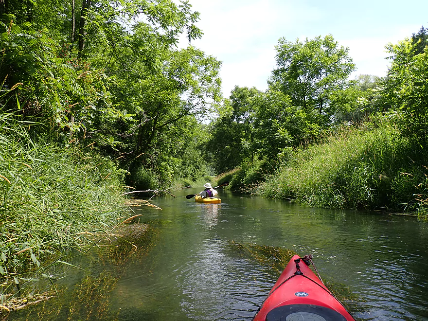
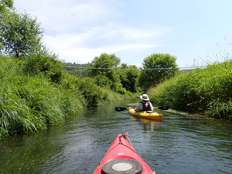
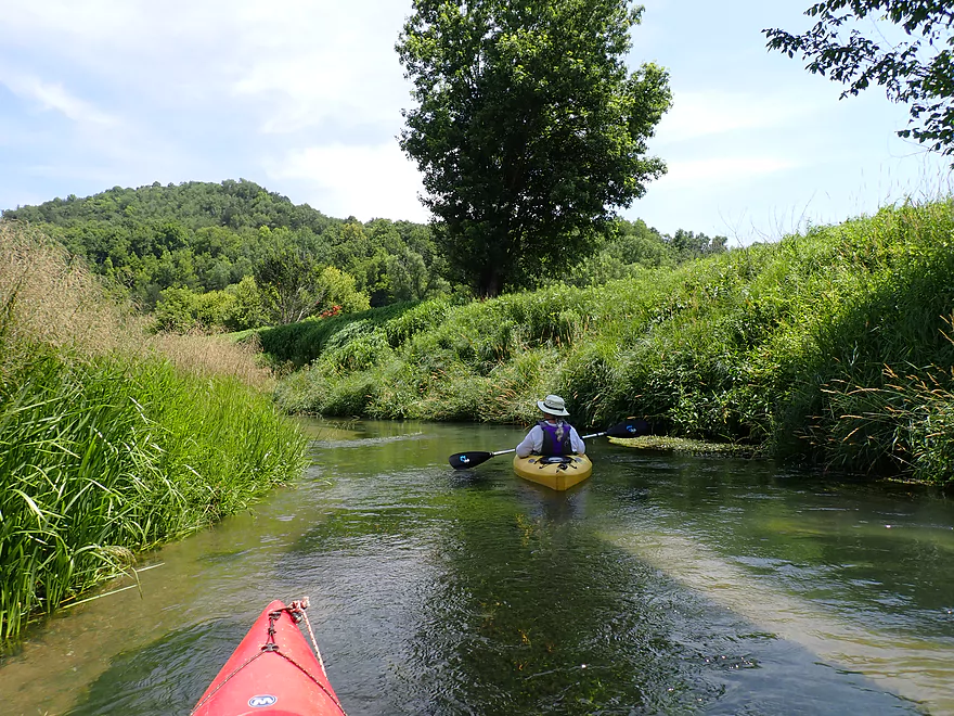
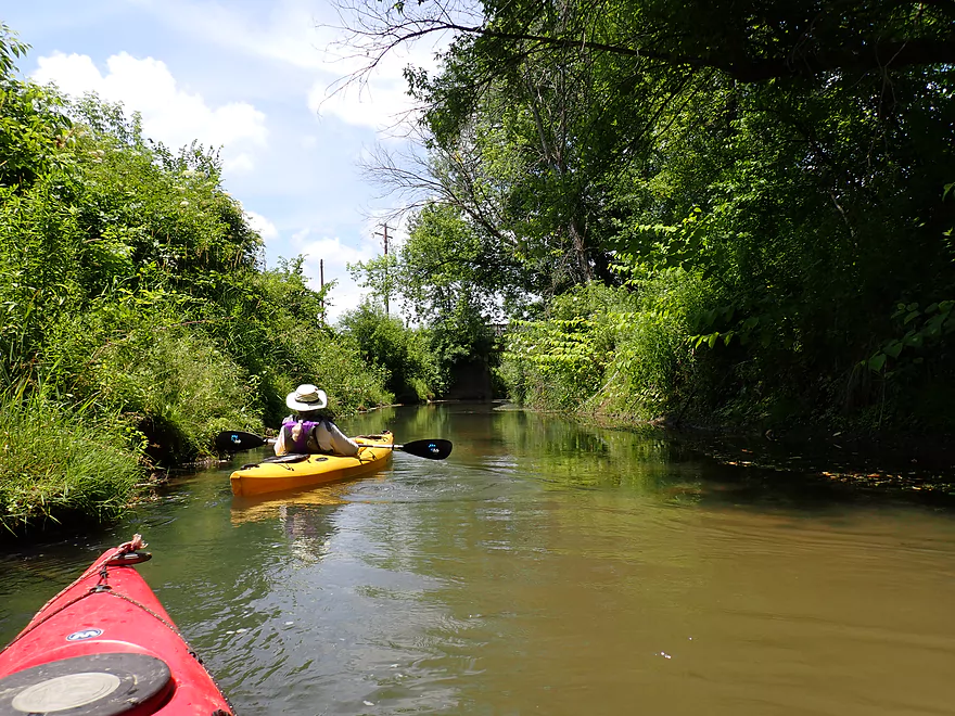
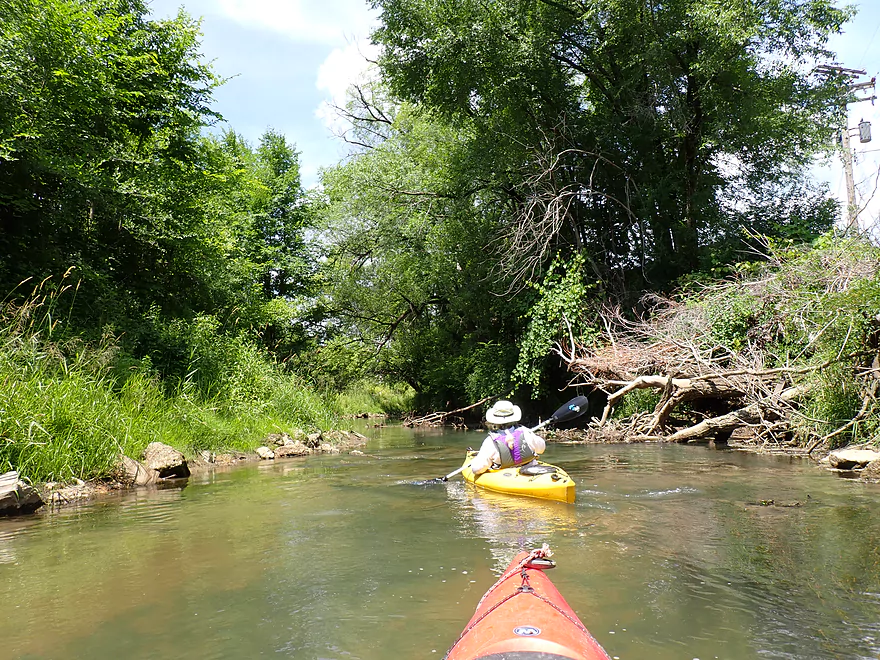
Thompson Creek is scenic to start
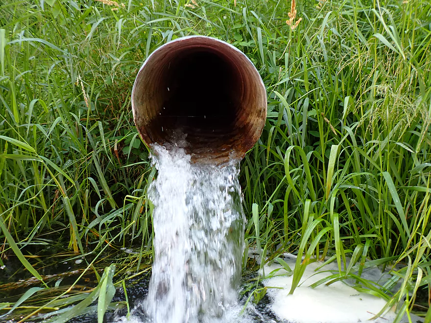
One of several discharge pipes into the creek…not sure what they are for
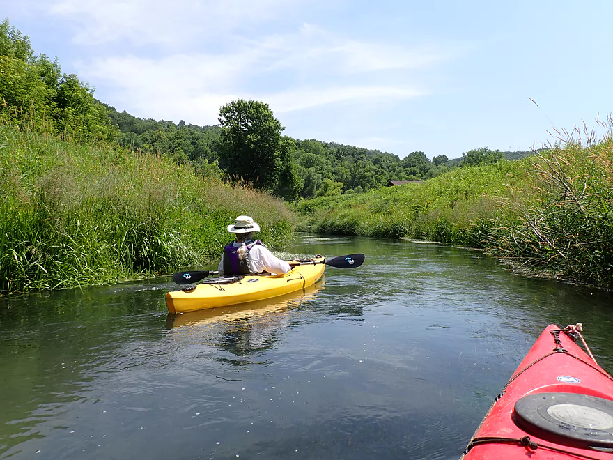
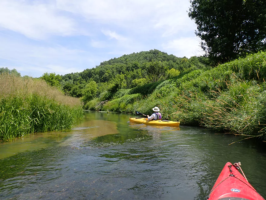
Good water clarity
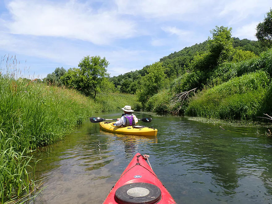
Water was fairly deep
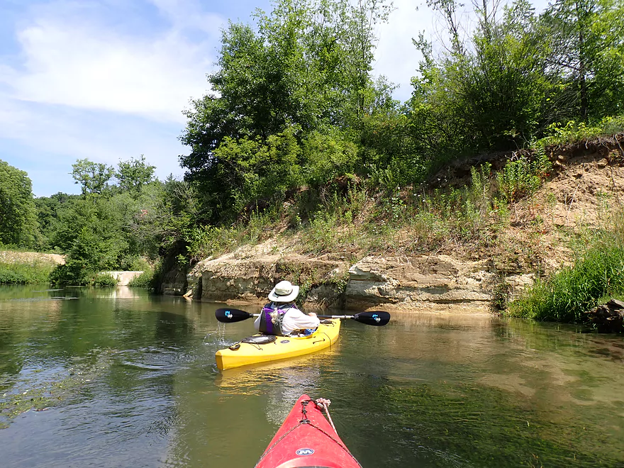
This sandstone outcrop signals upcoming Como Falls
This looks artificially cut
You can take out on the right side here to portage the falls
The left side is a shorter but steeper portage
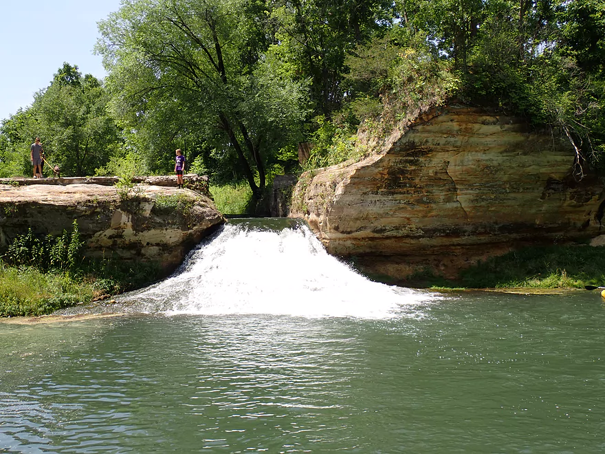
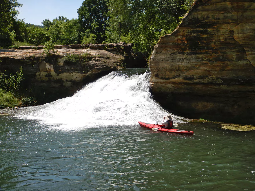
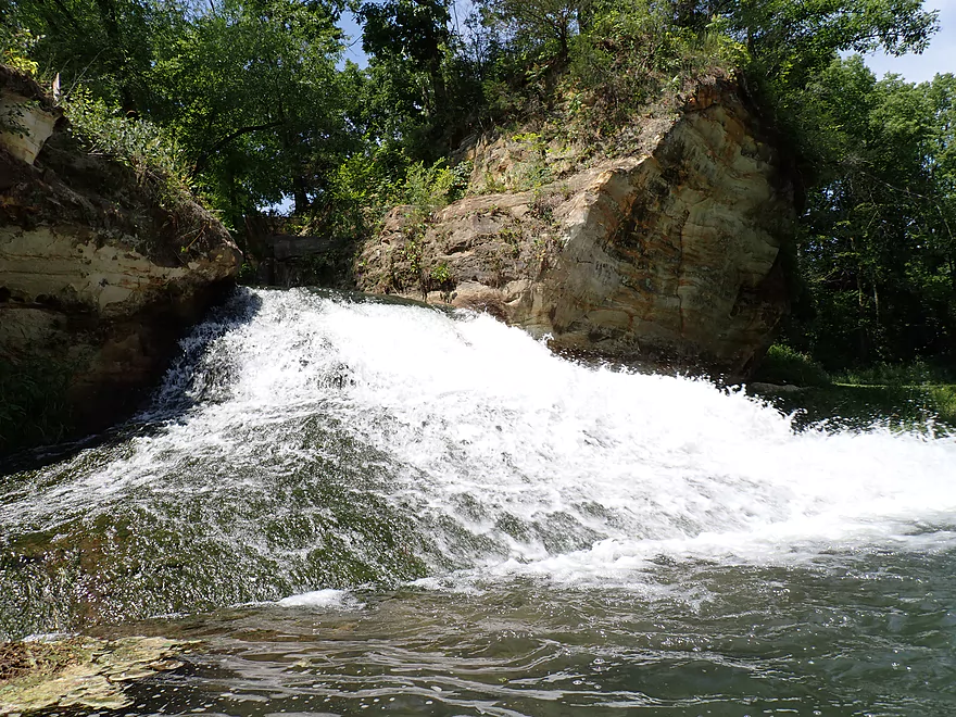
A small ledge precedes the main falls (the sign is a warning)
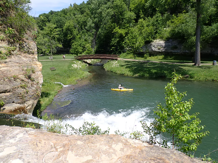
Overlooking the pond and picnic area below the falls
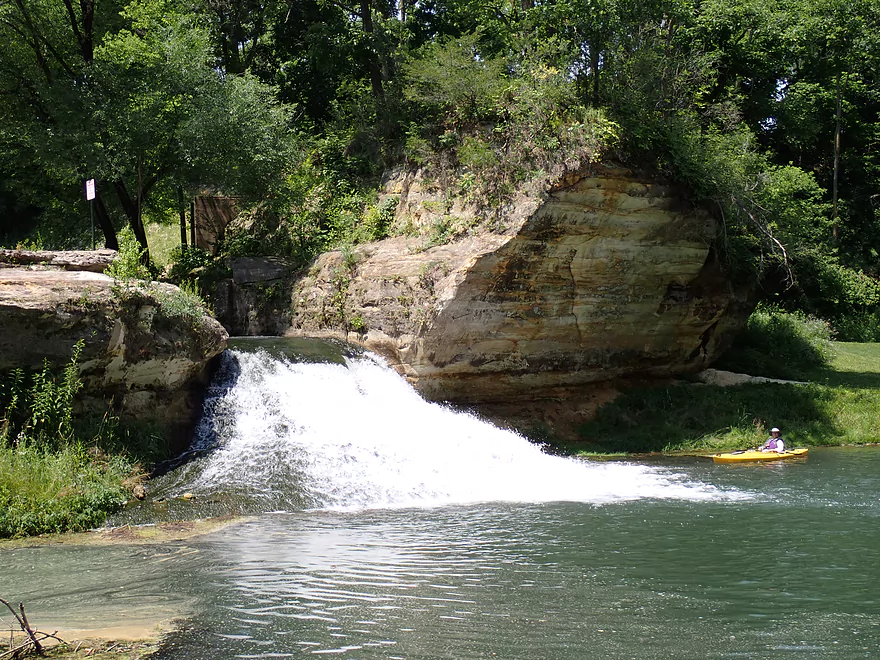
Reverse view of Como Falls
You can see remnants of the old dam on the left–the falls used to flow over this too
A gate at one time extended across the falls and backed up Thompson Creek
The cascading water created a cool breeze
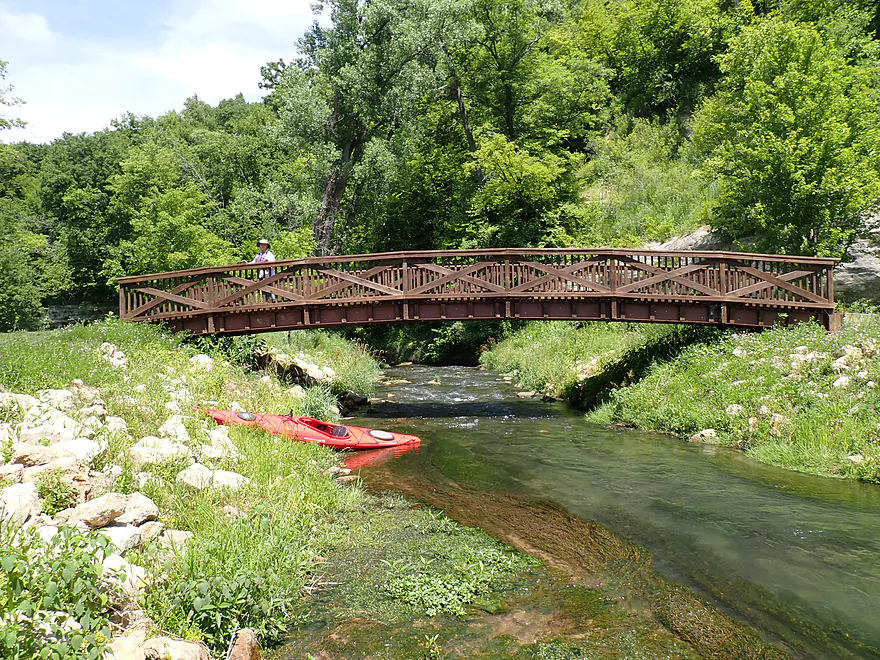
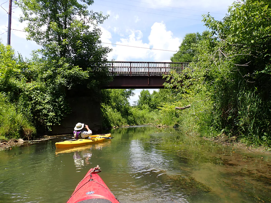
Attractive park bridge located downstream from the falls
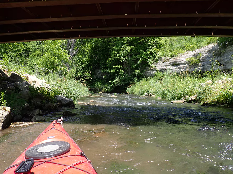
Followed by a fast channel that flows into a cliff
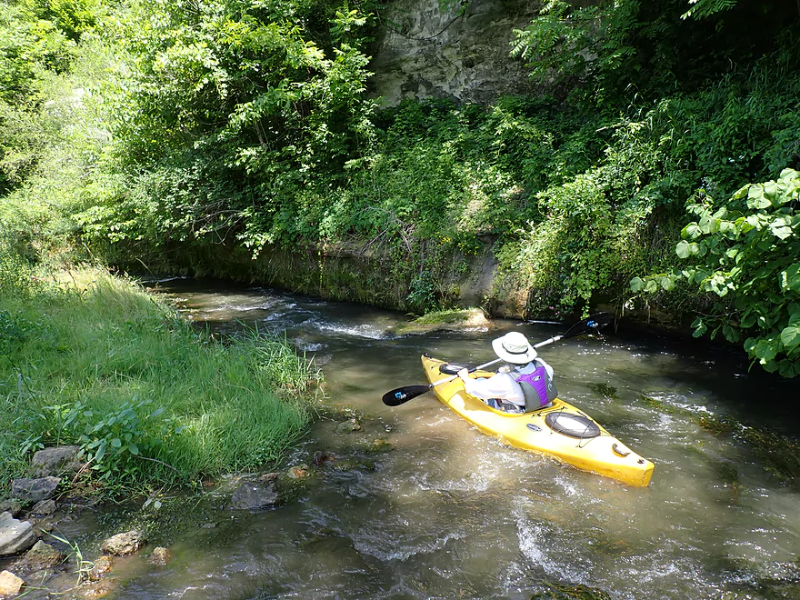
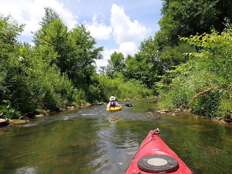
Fun Class 1 rapids
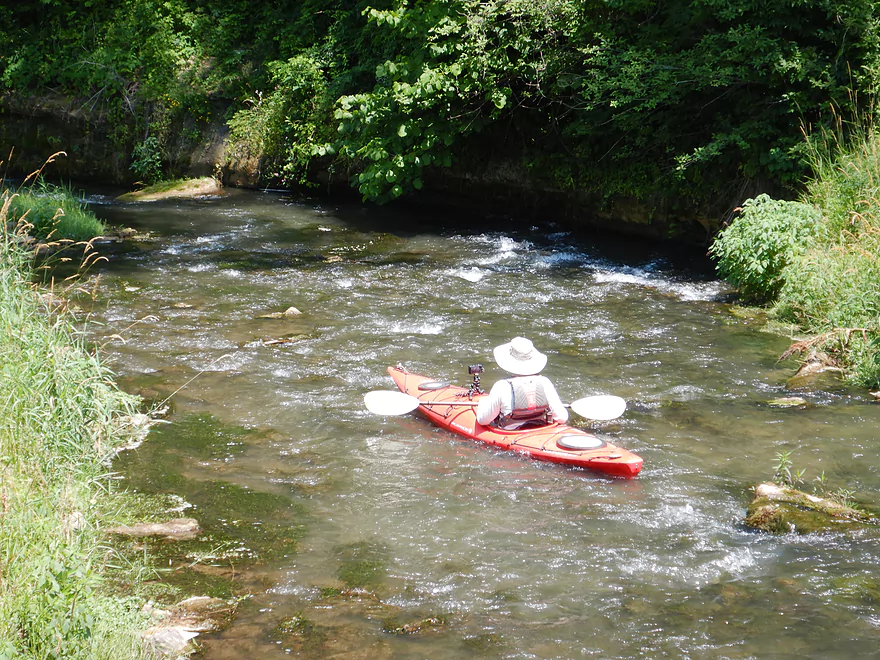
But shallow
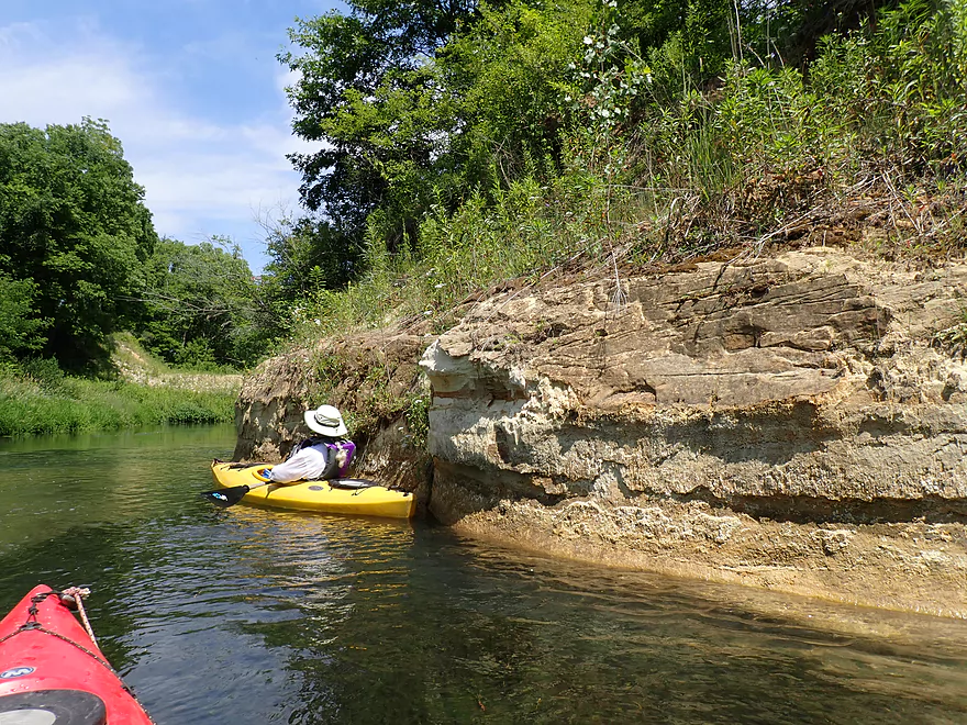
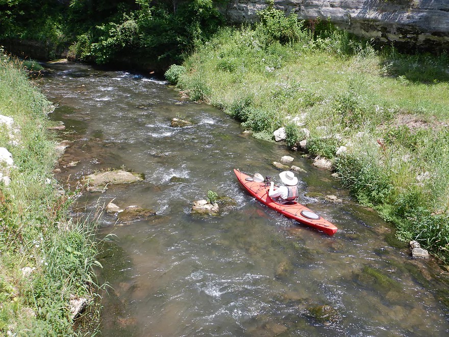
A hard left turn to avoid the rock wall
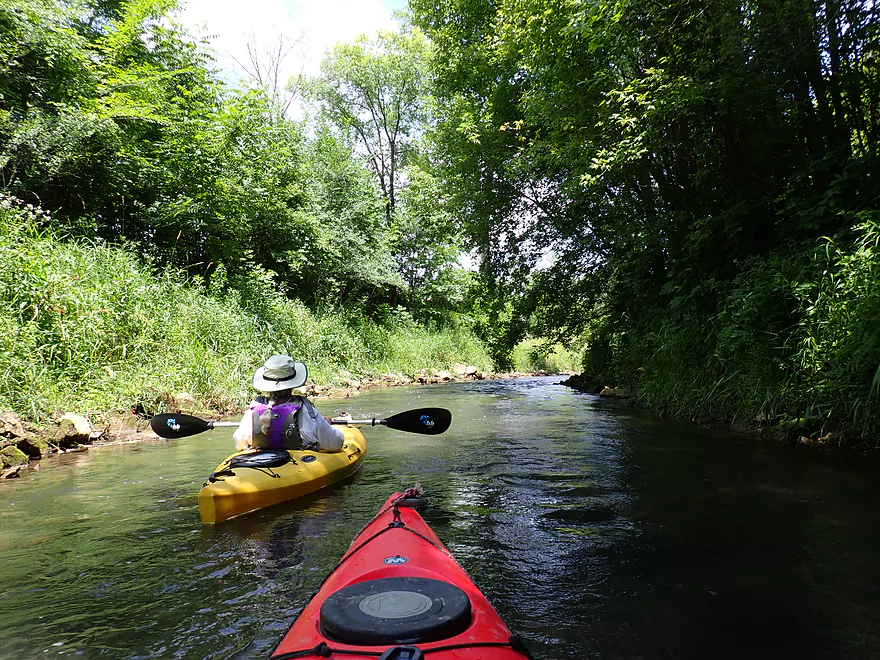
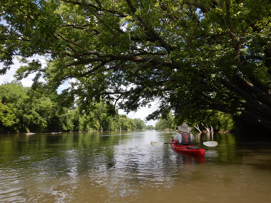
Very scenic
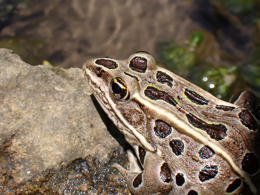
One of several frogs we saw along the creek
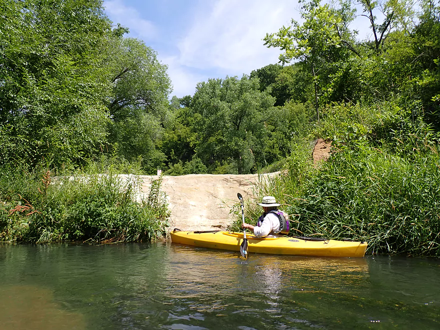
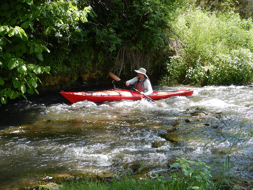
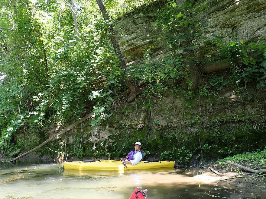
The rapids by the rock face continue downstream
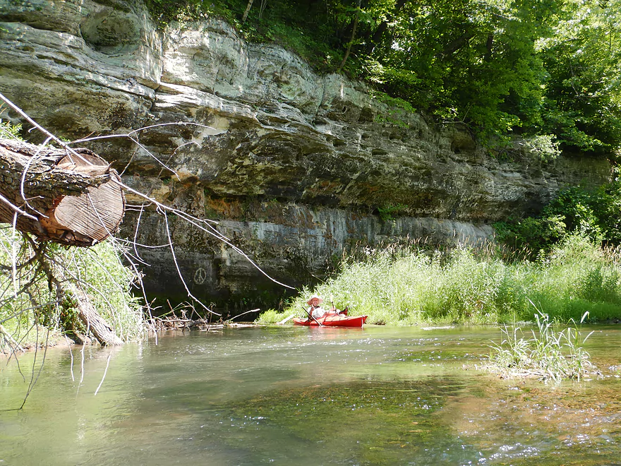
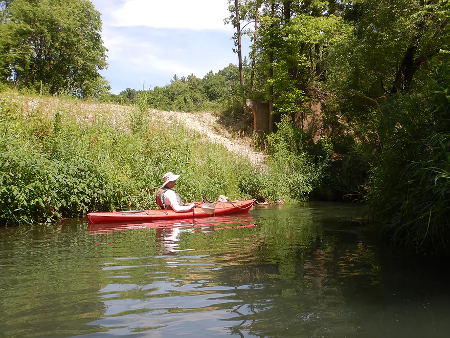
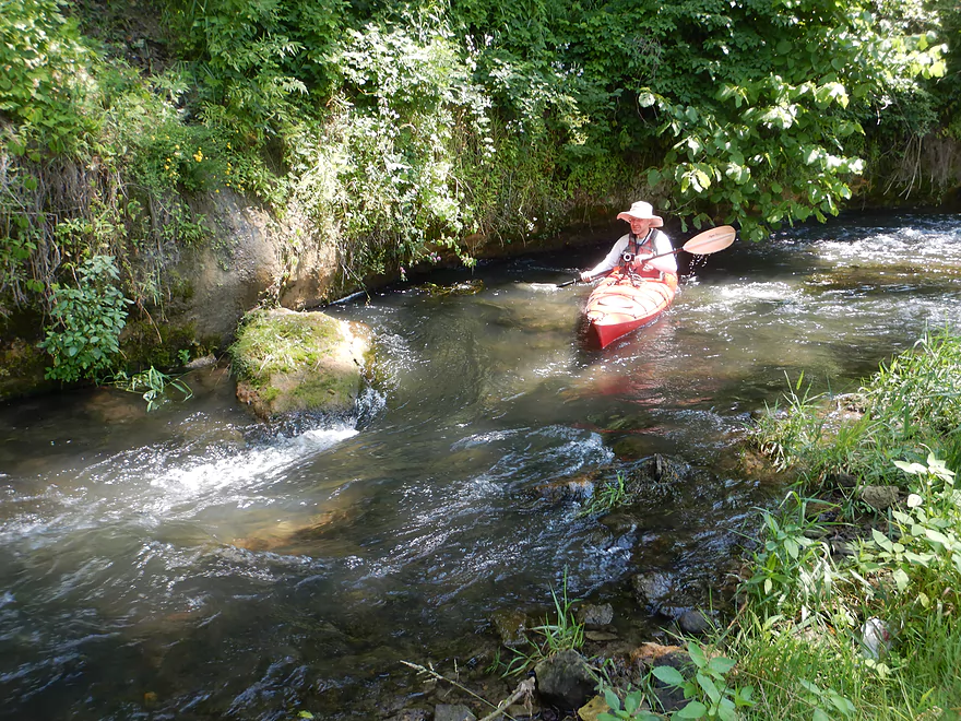
Large outcrop

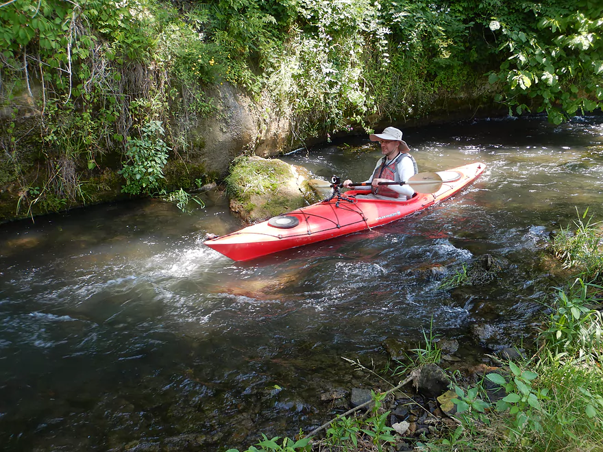
Last major outcrop of the trip
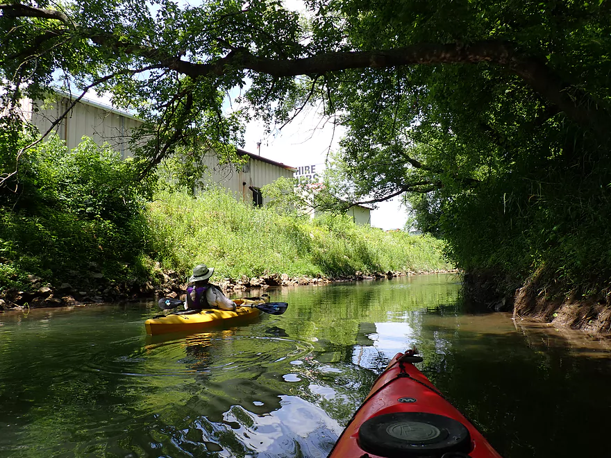
Paddling through the outskirts of Hokah
A private trail bridge
Still some minor rapids
Some deadfall, but we never had to portage
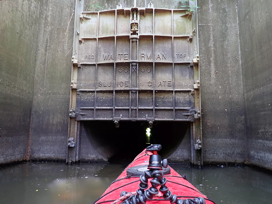
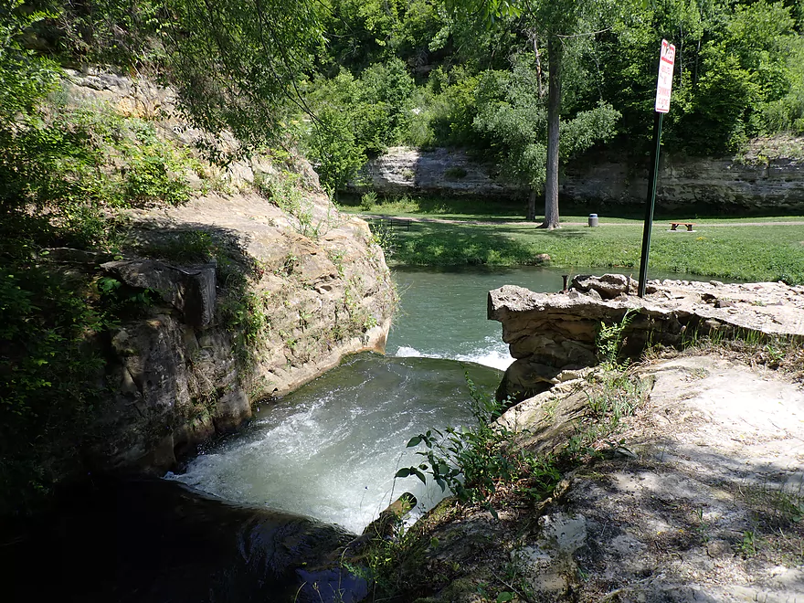
Interesting sluice gate…
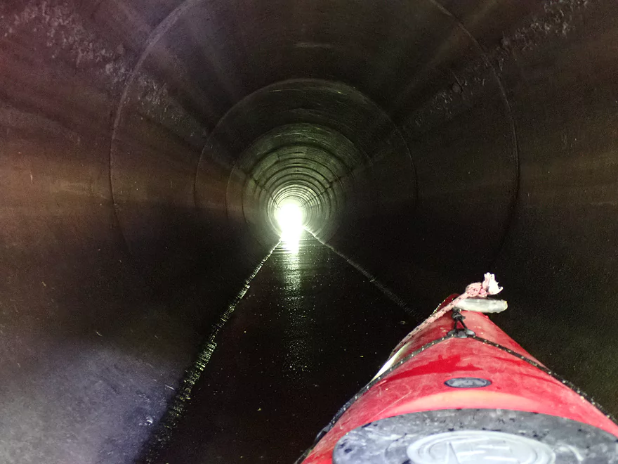
Which regulates water flow through this long tunnel
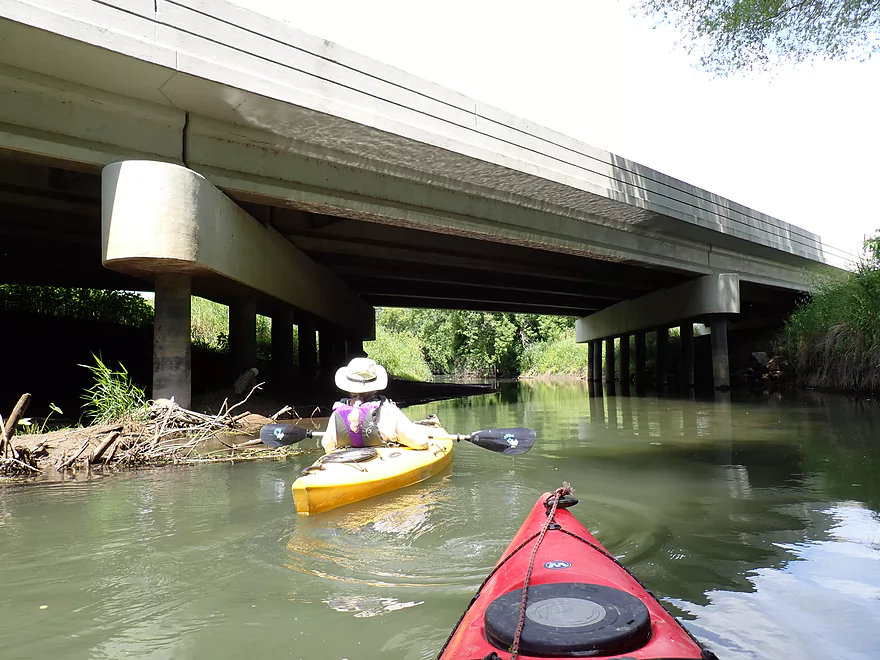
Hwy 7
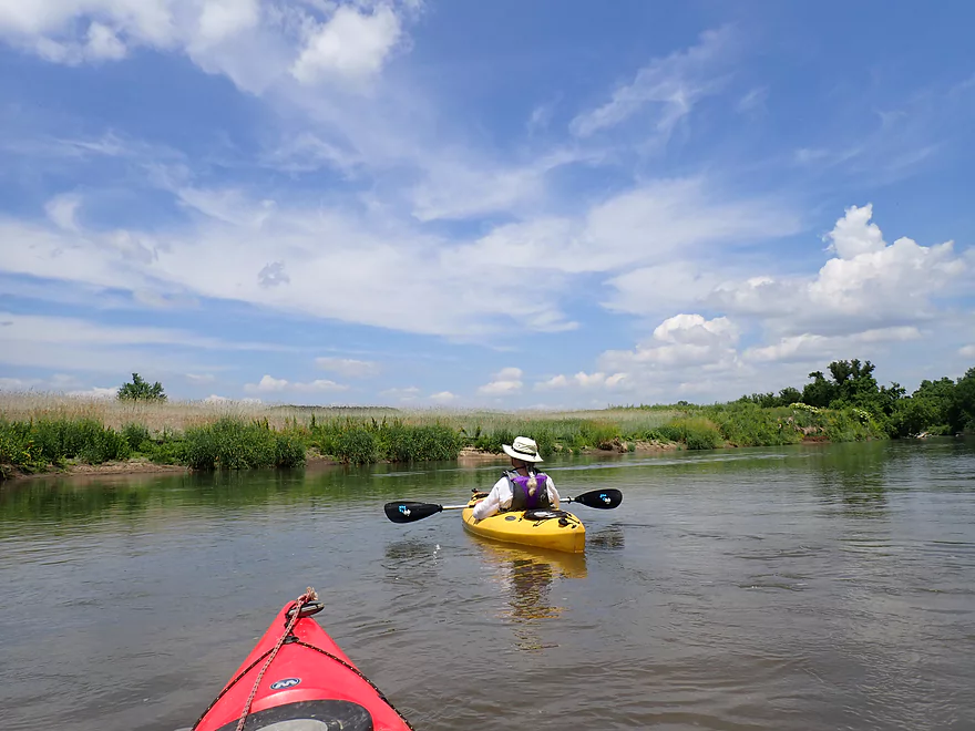
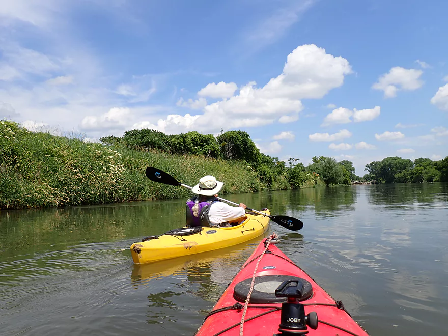
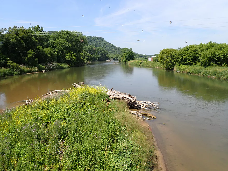
Thompson Creek joins the Root River
The Root River Landing in Hokah is an access option
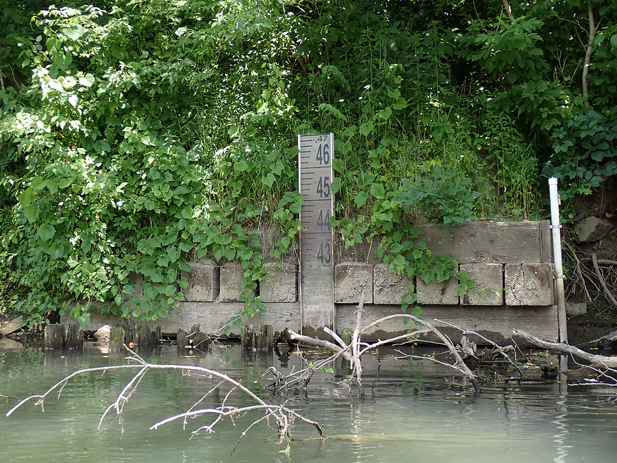
Depth gauge on the Root
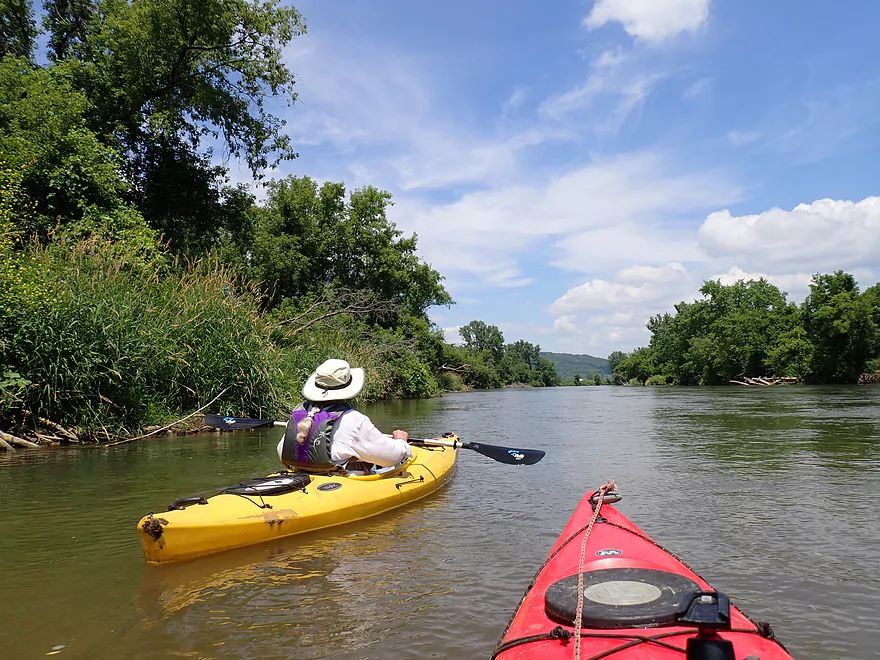
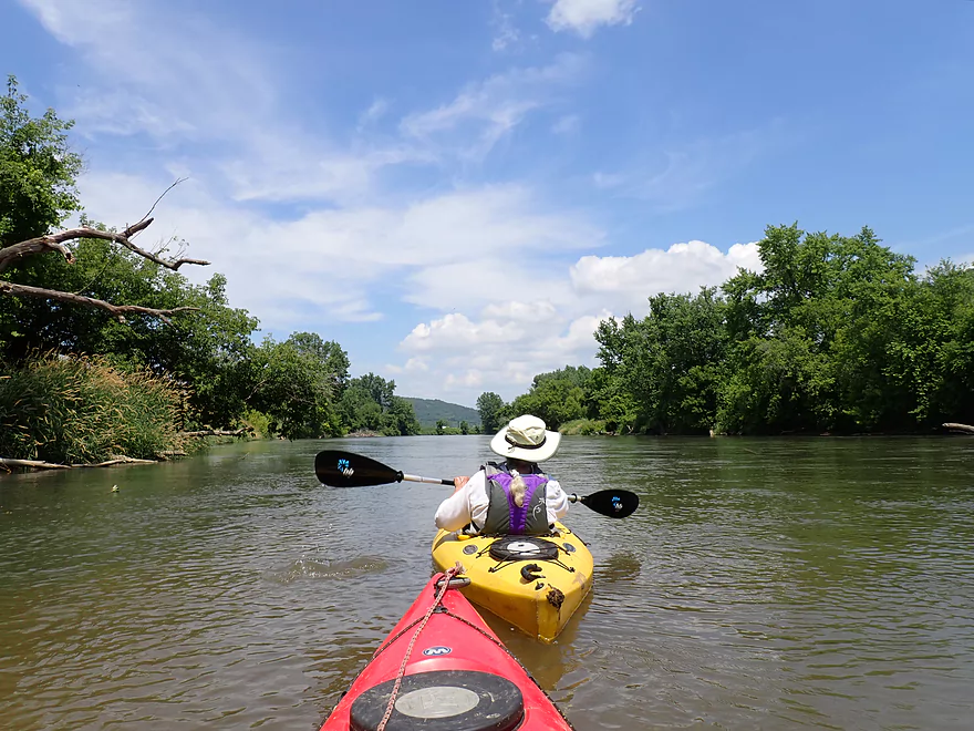
The Root River is much bigger than Thompson Creek
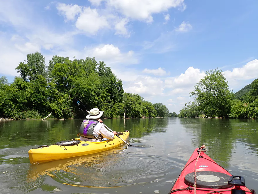
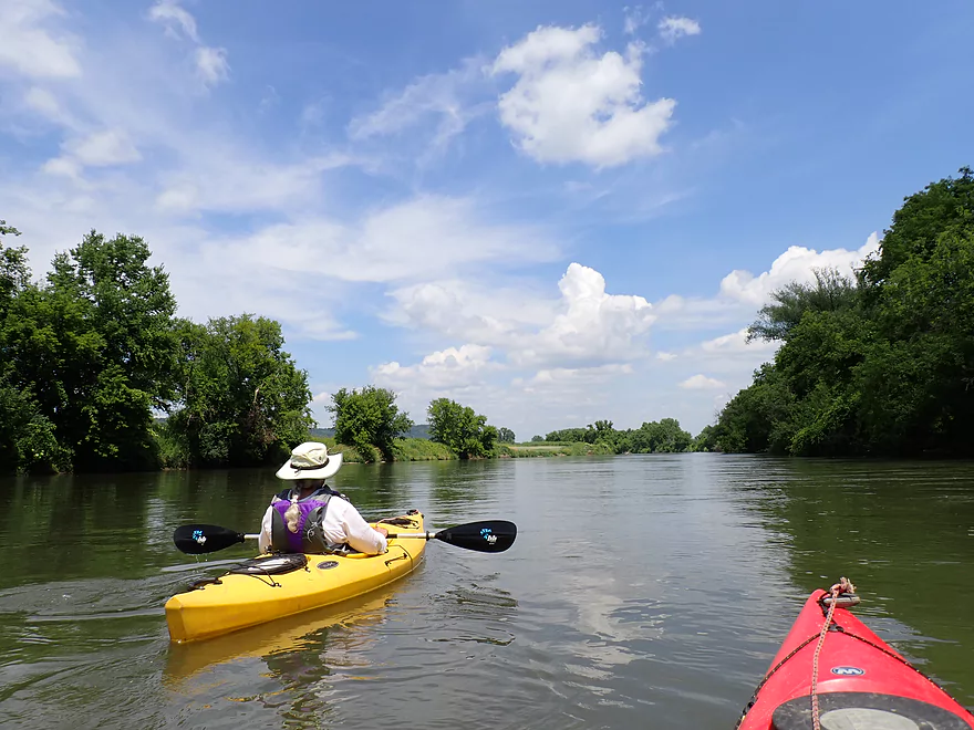
After many days of haze, it was nice to see blue skies
Most of this section of the Root was extremely straight (obviously channelized)
Rye growing on the left bank was probably planted for erosion control
Layers of grass
The Root had a few sandbars
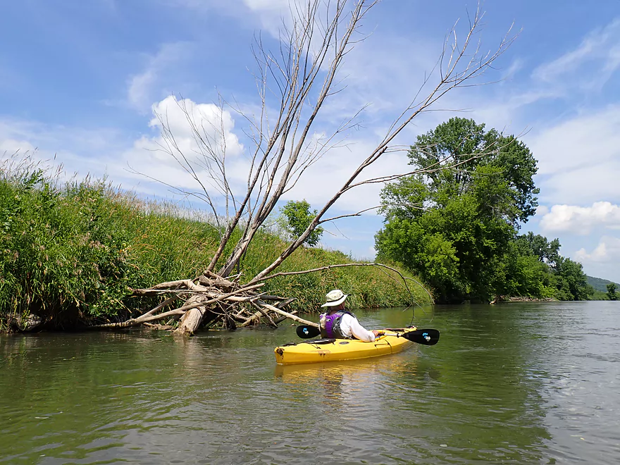
Some deadfall along the edges
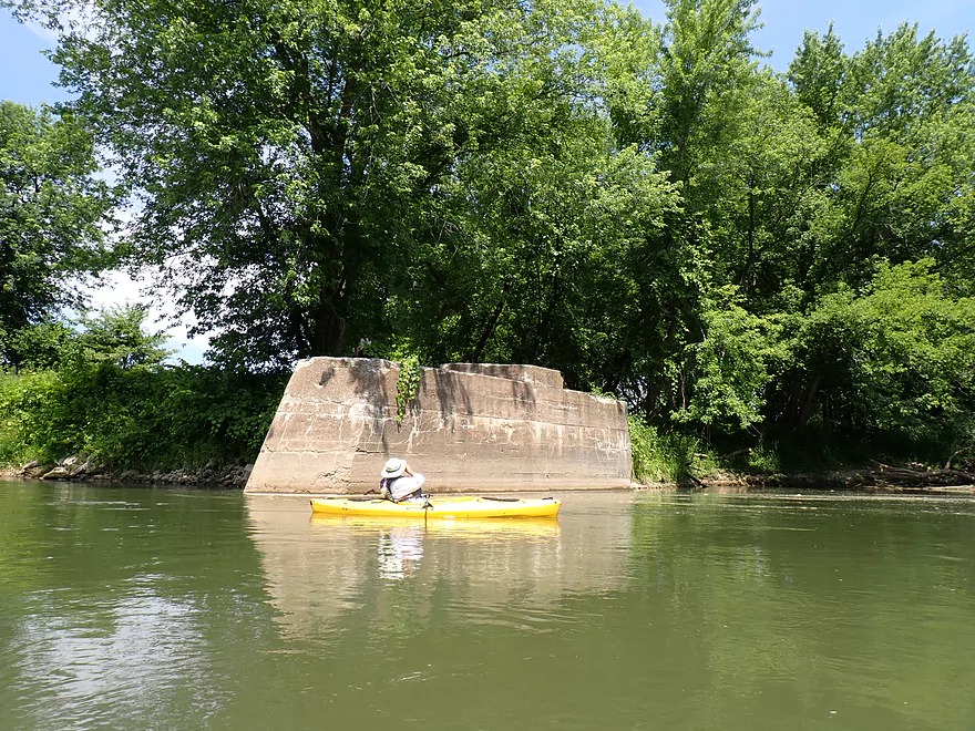
Old bridge pylon
A large sand bank
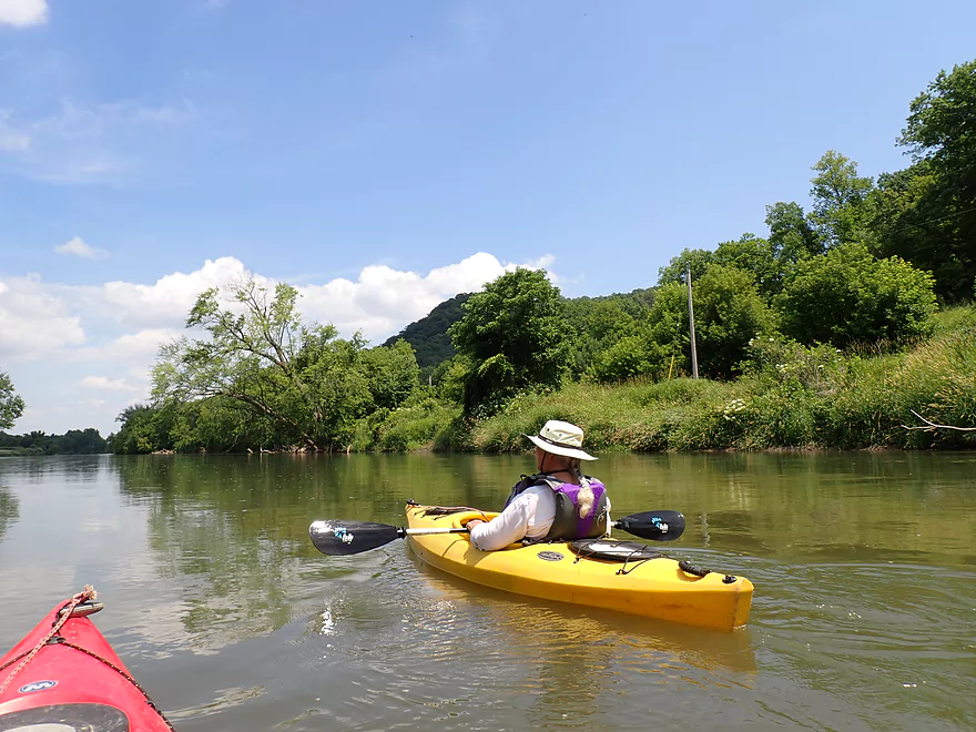
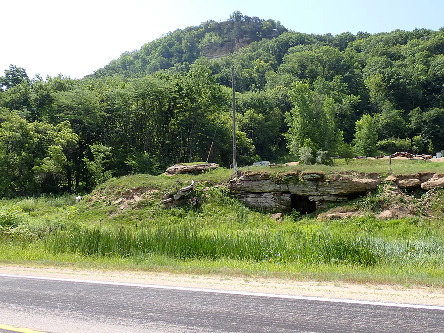
Terrific bluff and goat prairie
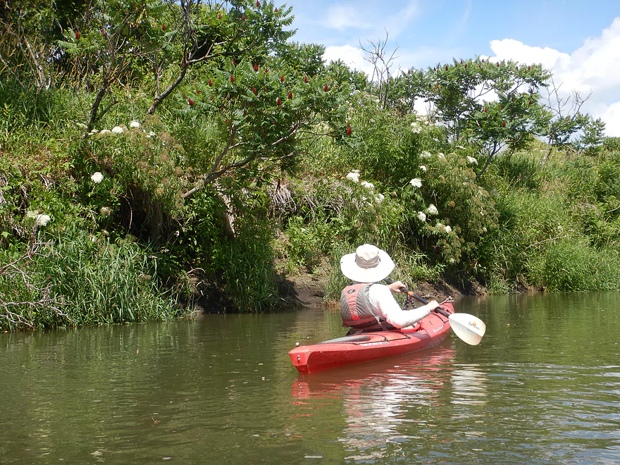
Sumac and wild elderberries
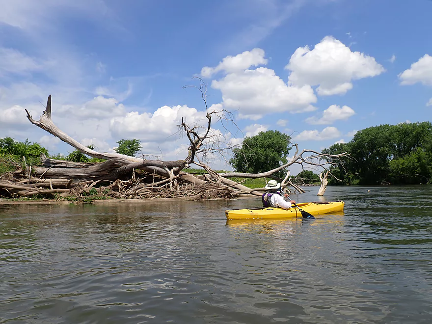
Current was very fast…you don’t want to get swept into these deadfall piles
Reverse view of bluffs
Hwy 26
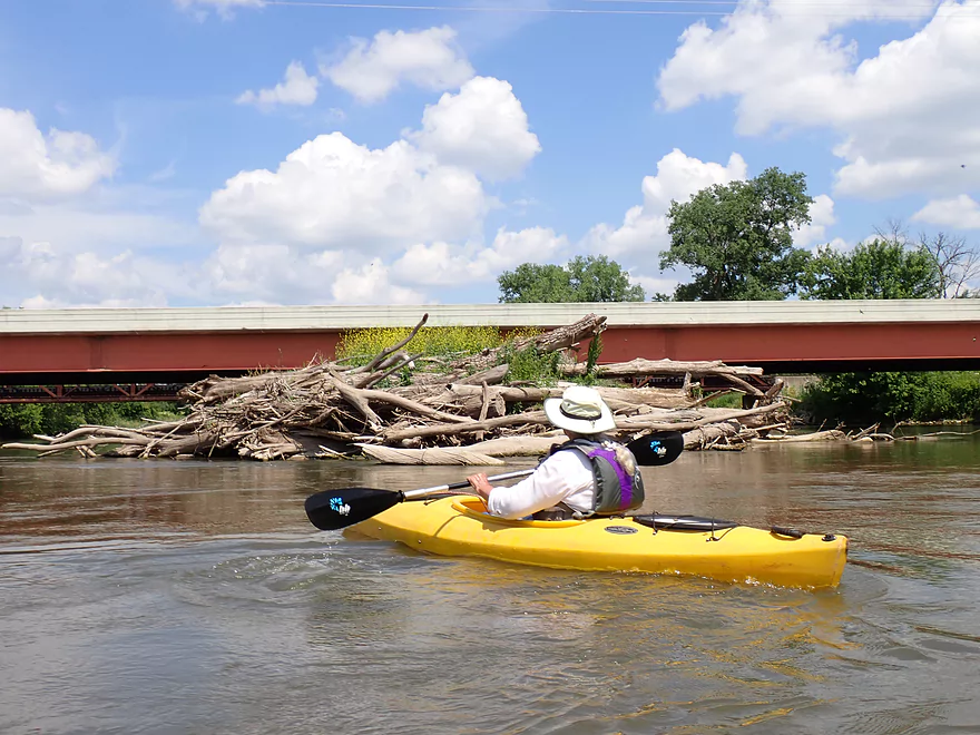
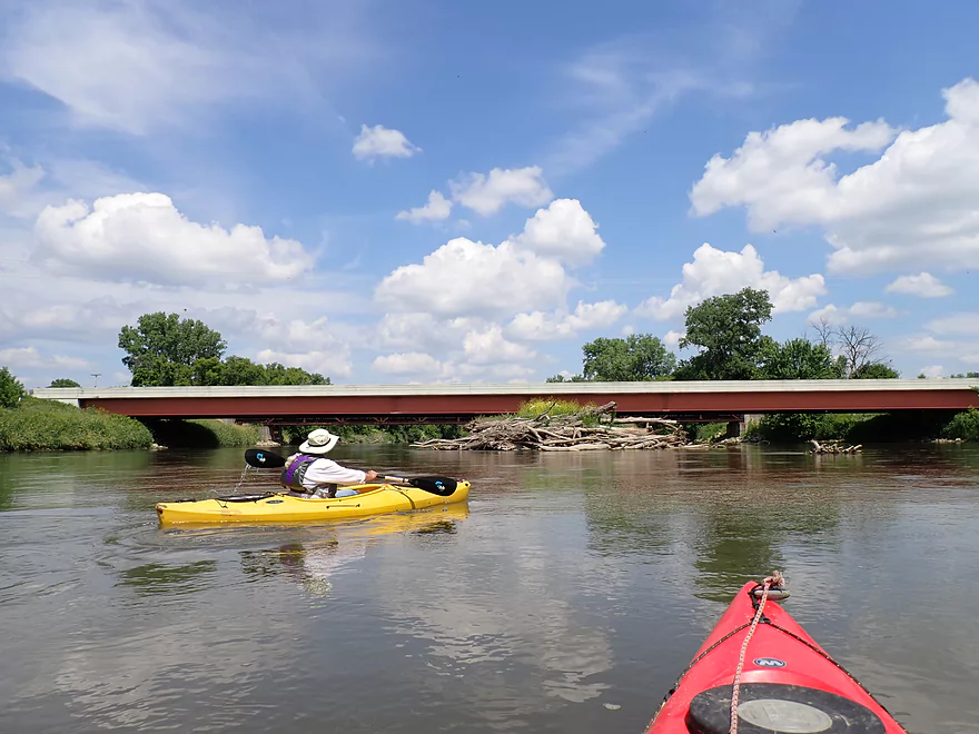
Massive dead fall island with plants growing on it
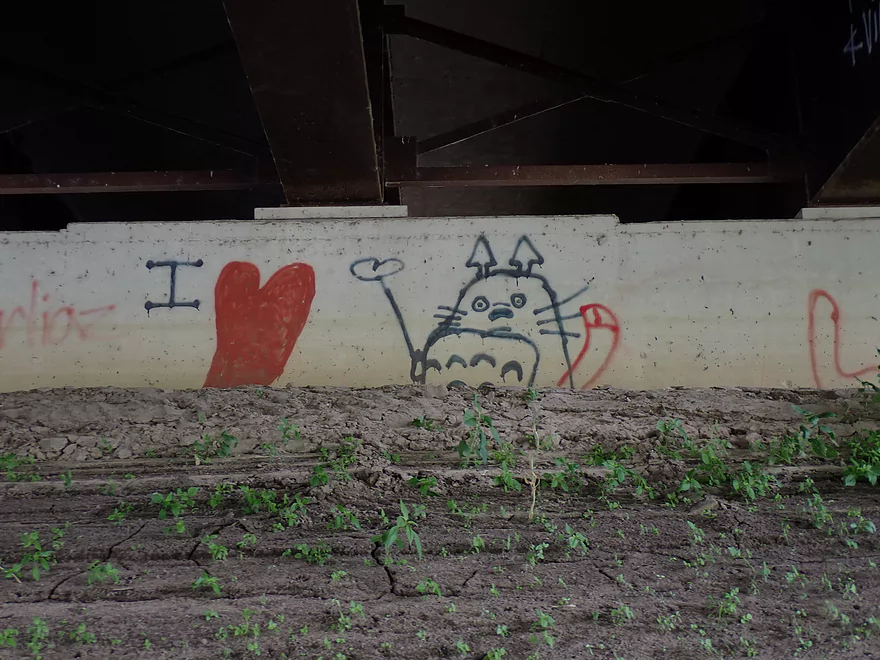
Somebody is a fan of Totoro
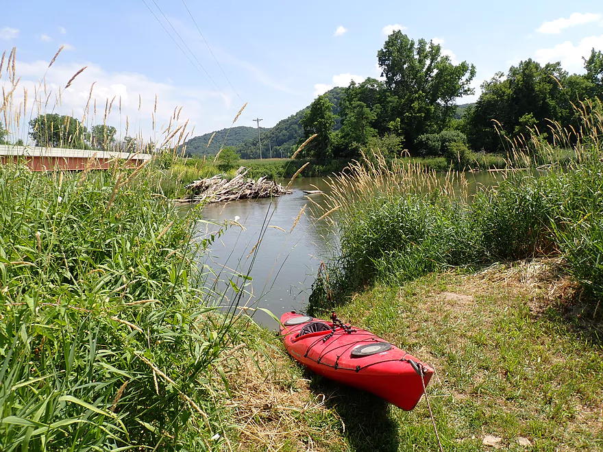
Decent take-out at Hwy 26
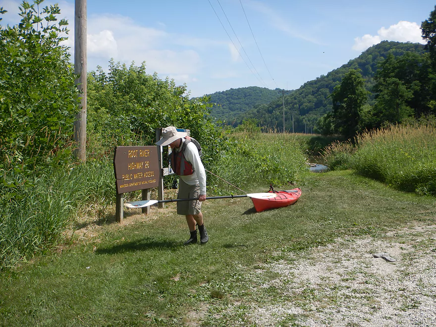
A mowed path leads to a public parking area
View from the bridge looking upstream
A “goat cave” on the shuttle road (a goat is hiding far left–one of many at this farm)
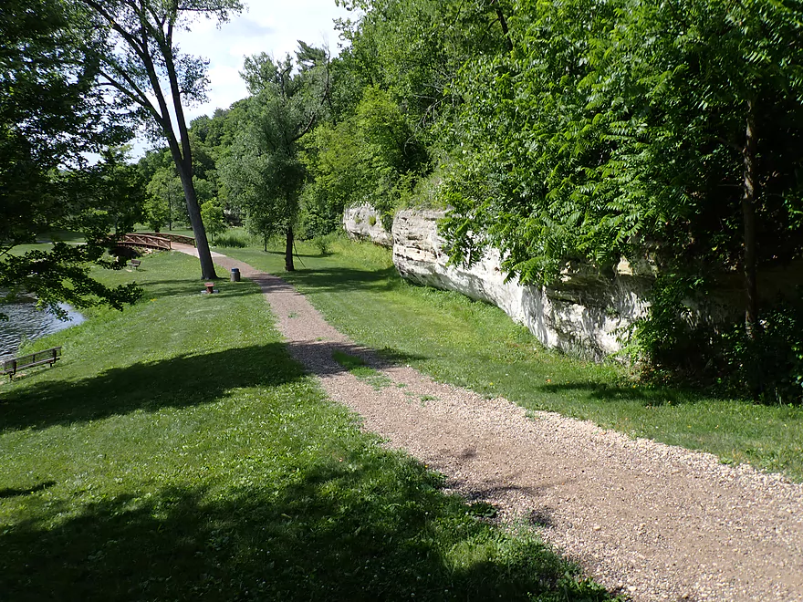
Revisiting Como Falls Park after the trip
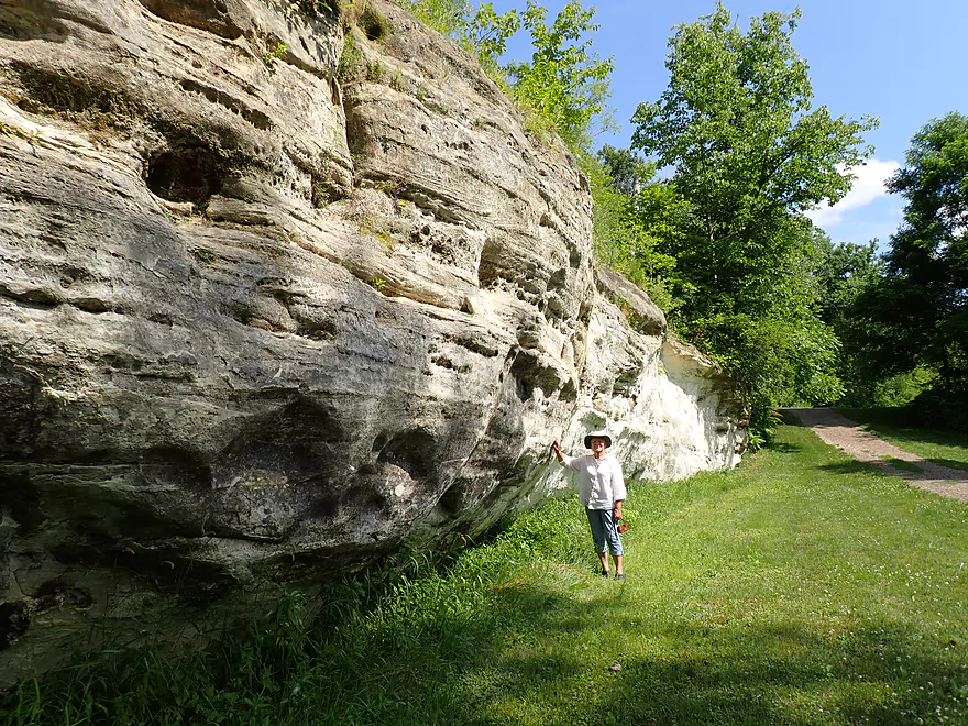
This sandstone wall is a twin to the one that Como Falls descends over
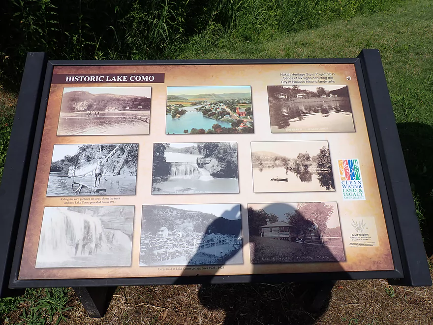
History of Lake Como–a one-time 90-acre mill pond and resort lake
The grassy ridge behind the bench is where the creek carved a new channel during the 2018 flood

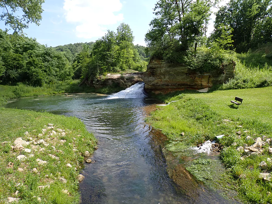
One last photo of Como Falls
Thompson Creek and the Root River


Thompson Creek is a tributary of the Root River located in Minnesota just west of La Crosse. Its main claim to fame is “Como Falls,” which has a very interesting history. In 1858, a dam was constructed across Thompson Creek at Como Falls to power a series of mills. The resulting 90-acre millpond (“Lake Como”) became a popular local resort. However, in the 1930s the artificial pond silted in because of upstream erosion, which effectively ended the lake. In 2018 a massive flood destroyed part of the dam and allowed Thompson Creek to flow around the falls. The community (relatively recently) fixed the breach, restored the falls, and repaired the area park, which had sustained heavy flood damage.
The idea for this trip was to explore as much of Thompson Creek as possible, and then pad it with a bonus trip on the Root River. The trip would start at 1st Street by the “Legion Ball Field”.
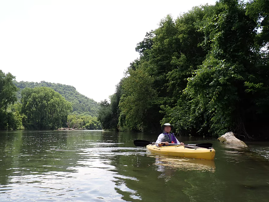
The first quarter mile flowed through what used to be the bottom of Lake Como. This was a terrific stretch with clear deep water, a sandy bottom, and fast current. The banks were a bit steep and weedy, but this actually provided a cool “tunnel effect”. This combined with a large Driftless bluff backdropping the creek, provided some great scenery.
The creek then passed the popular Hokah Pool (which is uniquely spring fed) and the Como Falls parking lot on the right. A sandstone wall and a roar marked the approach of the falls. This is too steep to run and has to be portaged. Paddlers will have a choice…they can portage up the left bank up the restored dike wall, which is fairly steep but direct. Or they can portage on the right bank which connects to a trail system that winds its way around the falls. The latter is way longer but more gradual. Either way, I suggest taking a time-out on the right ledge (which most park visitors do) for a great view of the falls and the park below it.
After portaging, you can re-enter Thompson Creek at the base of the falls where there is a small pool. The view of the pool and falls is very striking and a lot of people take pictures here.
The creek then flows under a nice pedestrian bridge and over some shallow rapids before running into a very long and impressive sandstone wall. Even if the falls didn’t exist, the separate sandstone cliffs east of the creek would be noteworthy in their own right. It’s always a treat to be able to paddle next to steep rock walls especially in fast current, but I wish this stretch had been a little deeper.
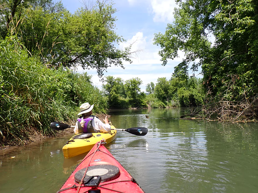
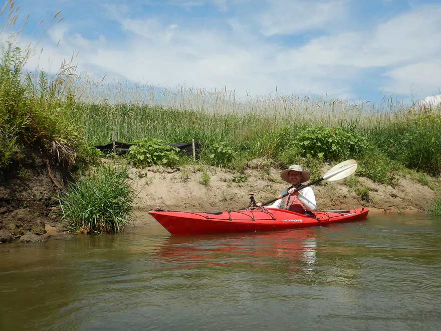
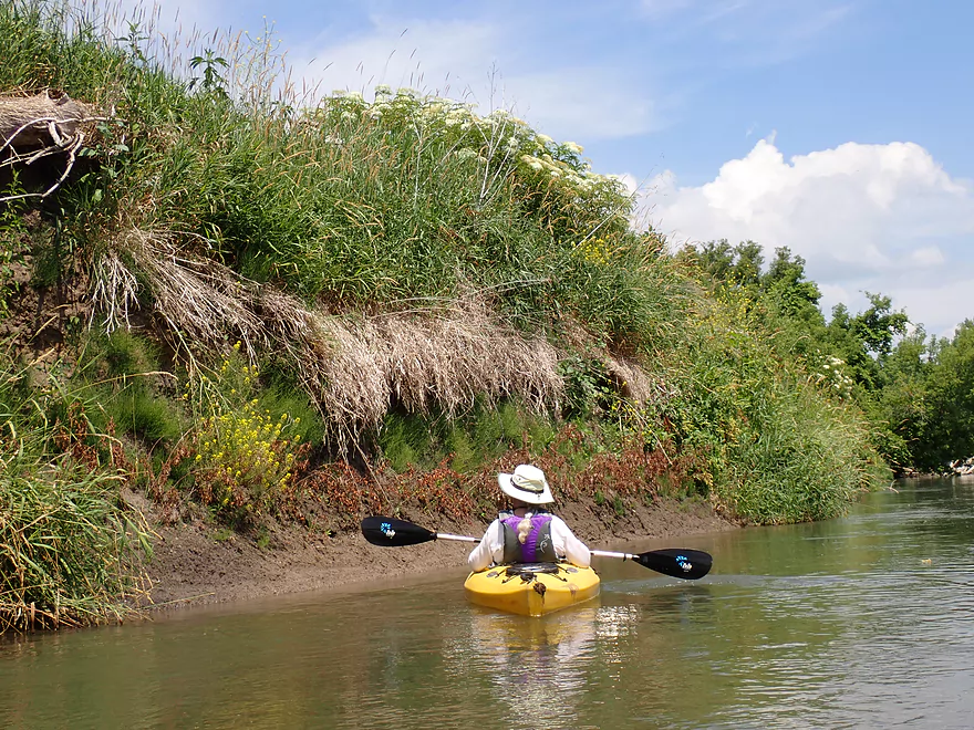
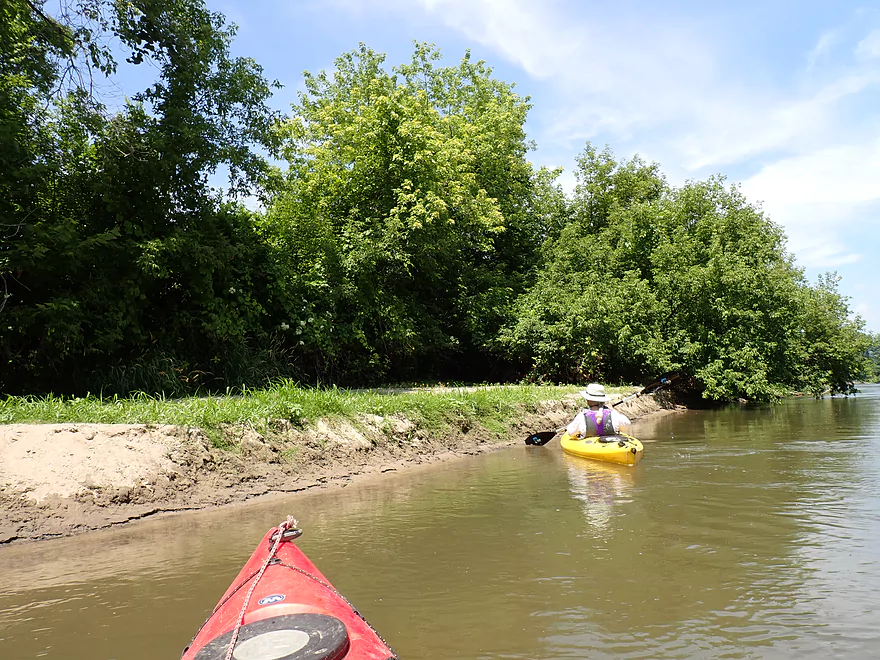
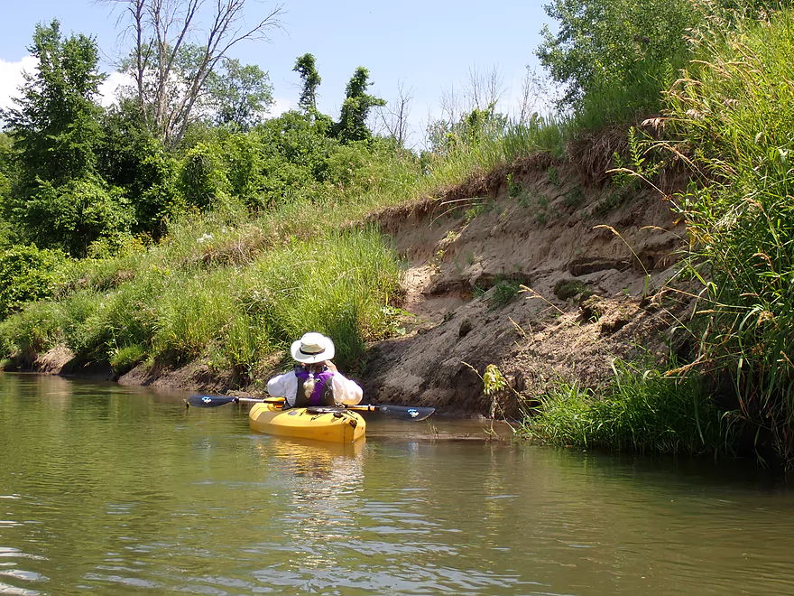
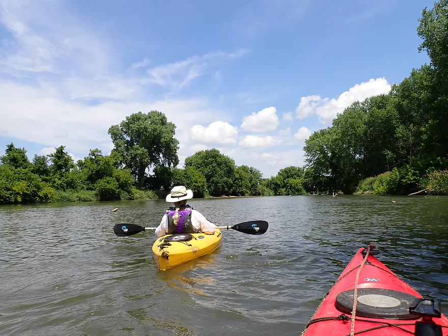
After the creek bounces off the sandstone a few times, it settles down and flows through the community of Hokah. This was a great stretch of creek with light riffles, big shade trees, relatively clear water, and a rocky substrate. Just past the Hwy 7 bridge, Thompson Creek came to an end as it joined the Root River. We could have ended our trip right there (Hokah Landing is located by the mouth) but it would have been a short trip. Instead the plan was to continue 2.7 miles on the Root River to the next landing (Hwy 26).
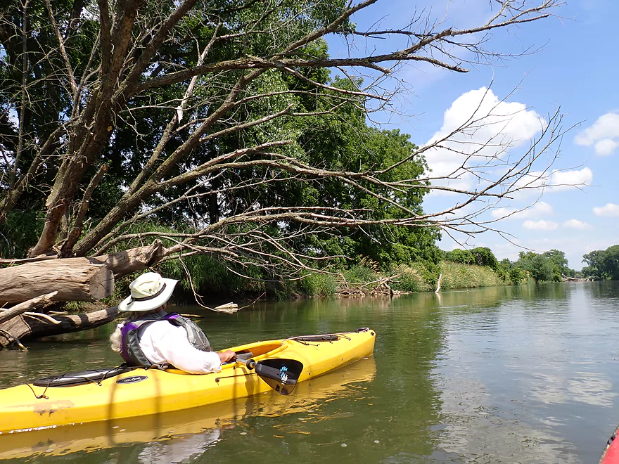
The Root is very popular with SE Minnesota paddlers, but the lower stretches aren’t as interesting as the upper legs. This second to last leg of the Root was relatively big, lacked riverside cliffs, and had dirty turbid water. The current was also surprisingly fast…in fact maybe faster than Thompson Creek and had there been boulders there likely would have been major rapids. I don’t think this leg was always like this and evidence suggests it has been artificially ditched and straightened by farmers to keep it from meandering into nearby farm fields. When rivers are straightened artificially, they do tend to speed up. With the fast current we did have to be vigilant about avoiding strainers but that wasn’t difficult.
This might be one of the weakest legs on the Root, but it still wasn’t bad. The weather was terrific and it was wonderful to finally see rich blue skies and crisp white clouds after weeks of hazy smoke in Wisconsin. While not super sandy, there were a few small sandbars and sandbanks on this leg. While the right banks contained mostly generic hardwoods, the artificially bermed left bank had a number of interesting grasses and shrubs including rye.
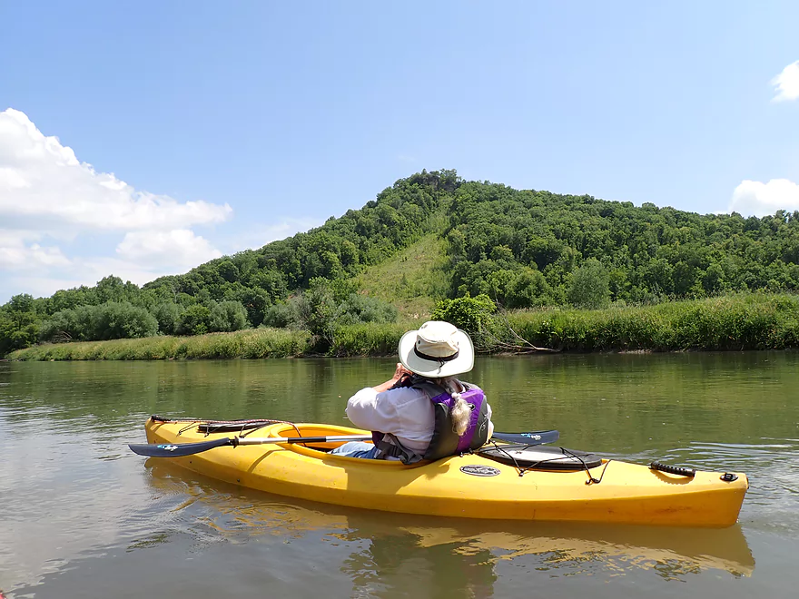
One of the highlights of this Root segment were the fantastic Mississippi Bluffs frequently seen in the distance. The best was located about a half mile upstream from Hwy 26 and had a bare face (I think called a “goat prairie”) and was topped with an exposed outcrop.
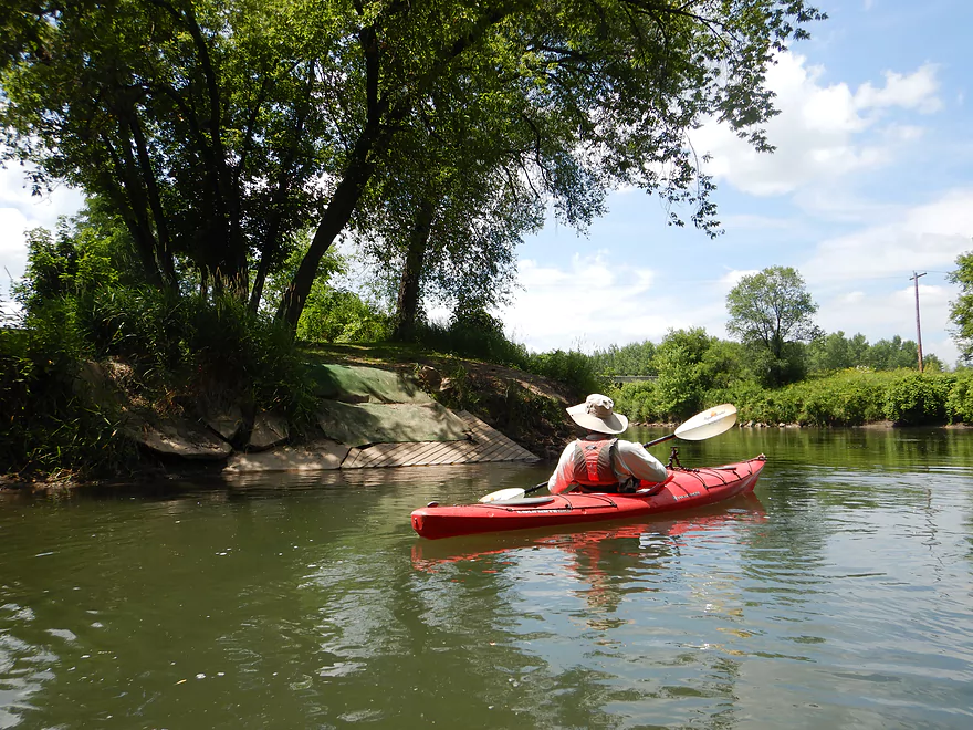
We ended the trip at Hwy 26 where there was a nicely mowed DNR landing. I’m actually impressed with how the Minnesota DNR builds and maintains carry-in access points for paddlers. Wisconsin in contrast seems to rely more on local governments to build and maintain landings which they sometimes do…and sometimes don’t. It was surprising to see a number of cars at the Hwy 26 carry-in access, which suggest locals enjoy this leg of the Root (or were heading downstream to the Mississippi).
In summary, this was quite an interesting trip. Thompson Creek was fantastic and very scenic. But portaging Como Falls wasn’t exactly easy and won’t be be for everyone. Also the rapids directly below the falls are a bit shallow and which might deter some paddlers (although they could be easily portaged). In retrospect I wonder if I should have launched even further upstream by Butterfield Valley Road which may have included a nice bonus leg of the river.
The Root River in contrast was a completely different experience and wasn’t elite, but locals may enjoy it. As a general rule with the Root River…the further upstream you go the more scenic it becomes. IMO the only reason to do a trip on the Lower Root, would be if the Upper Root is running shallow, you’re worried about a longer drive coming from the east (aka Wisconsin), or you’ve already experienced the Upper Root and are looking for new adventures.
Sights included deer, a few frogs, one snake, a kingfisher, one redtail, and a couple of spotted sandpipers
1st Street: Located by the baseball field, this isn’t a bad bridge access although the banks are a bit weedy.
Alternate Put-ins:
- Butterfield Valley Road (1.1 miles upstream from 1st Street): Putting in here would add a mile of Thompson Creek. I don’t know much about this leg but think it could have potential although there might be a snag or two.
- Como Falls Park – Hokah Pool (0.2 miles downstream from 1st Street): You could launch just north of the main parking lot, although the banks are weedy and you would soon have to portage the falls. You could also drag your boat along the public trail to launch below the falls, but it would be a decent 800′ trek.
- Como Falls Park – Fire Department (0.3 miles downstream from 1st Street): I believe there is public parking and trail access to the park west of the parking lot. It would still be a decent hike to reach the falls though.
- Hokah Landing (0.5 miles downstream from 1st Street): If you’re only interested in running the Root River, this is a good public access option.
Hwy 26: This is a good public access.
Alternate Take-outs:
- 7th Street Boat Ramp (5.4 miles downstream from Hwy 26): This would include the final leg of the Root plus a few miles of upstream Mississippi paddling to reach a take-out in La Crosse.
- Goose Island North Ramp (6.5 miles downstream from Hwy 26): Last leg of the Root plus a few miles of backwater Mississippi paddling.
- Wildcat Park (8.6 miles downstream from Hwy 26): Last leg of the Root plus a few miles of main channel Mississippi paddling.
Bike Shuttle – Hwy 26 to 1st Street: 3.7 miles with 69′ of ascent. This is an easy bike shuttle with the only noteworthy hill being in the city of Hokah.
Current: Both Thompson Creek and the Root River have brisk current.
Rapids: There are no rapids on this leg of the Root. Como Falls would be a Class 4-5 pitch and only runnable by expert whitewater paddlers after a big rain. Below the falls there are multiple Class 1 rapids on the creek. In a few cases the current can push you into rock walls and the channel becomes quite narrow. This is easy to scout and/or portage.
Logjams: There is a lot of deadfall on the Root, but the channel is so wide it’s easy to paddle around it. On Thompson Creek, there were a few snags below Como Falls, but these weren’t too difficult to duck past and no portages were required.
Strainers: This leg of the Root is fast and has a lot of deadfall. You’ll be fine if you’re paying attention. But if you’re completely distracted the fast current could push you into a pile of dead trees.
Closest Gauge: Root River @ Houston
Trip Depth: 690 CFS or 3.67′
Navigability Estimates: Thompson Creek is much smaller and therefore may not reflect levels on the Root. Ideally Thompson Creek should be a bit above average to make the falls look more impressive and to pad the rapids below them.
- < 3.5′: Very low.
- 3.6-3.9′: Typical summer depth.
- 4.0-5.0′: High
- 5.1’+: Very high and perhaps dangerous.
For more information on the Root River see this overview map.
-
Upstream from Butterfield Valley Road: The creek is likely too small and congested to run.
- Butterfield Valley Road to 1st Street: An intriguing prospect that is mostly open but there might be one logjam.
- 1st Street to Hwy 26 Carry-In Access: 3.5 miles.
- 1st Street to Como Falls Park (Upstream Side of Falls): 0.2 miles. Very nice stretch of creek with clear deep water and good current.
- Como Falls Park (Upstream Side of Falls) to Como Falls Park (Downstream Side of Falls): 0.1 miles. A series of sandstone outcrops marks the start of Como Falls. The falls themselves are too steep to run. A shorter but steep portage is on the left/north bank. A longer but less steep portage is on the right/south bank.
- Como Falls Park (Downstream Side of Falls) to Hwy 16/Hokah Landing: 0.5 miles. A nice stretch of the creek with some rapids and impressive rock outcrops. There were a few snags but they were easy to get past.
- Hwy 16/Hokah Landing to Hwy 26 Carry-In Access: 2.7 miles. A generic and straight stretch of the Root River with fast current. Scenery isn’t elite, but there are a few nice river bluffs.
- Hwy 26 Carry-In Access to Mouth on Mississippi: 3.3 miles. The final leg of the Root River includes more turns and flood-bottom forests.
- Mouth to Mississippi Take-out: There are multiple take-out options on the Mississippi.
- North – 7th Street Boat Ramp: 2.1 miles. You could reach La Crosse but it would require some upstream paddling.
- Southeast – Goose Island North Ramp: 3.2 miles. Goose Island is a take-out option, but would require navigation through a complex set of islands and channels.
- South – Wildcat Park: You can take the main channel or side channel south to Wildcat Park.
Trip Map
Overview Map
Video
Photos Size: