
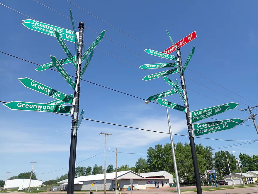
Welcome to Greenwood!
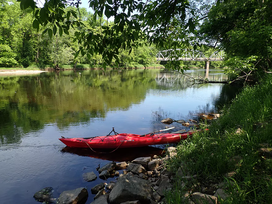
Nice put-in off Reese Ave
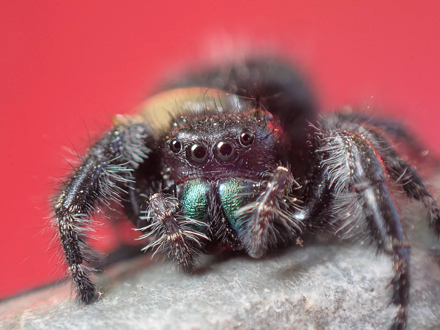
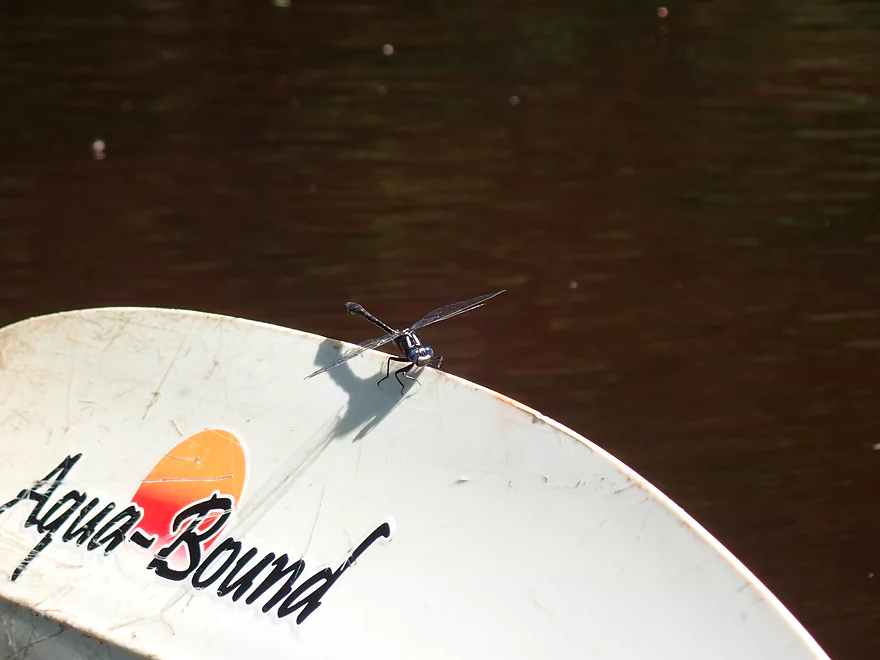
A friendly (and large) jumping spider
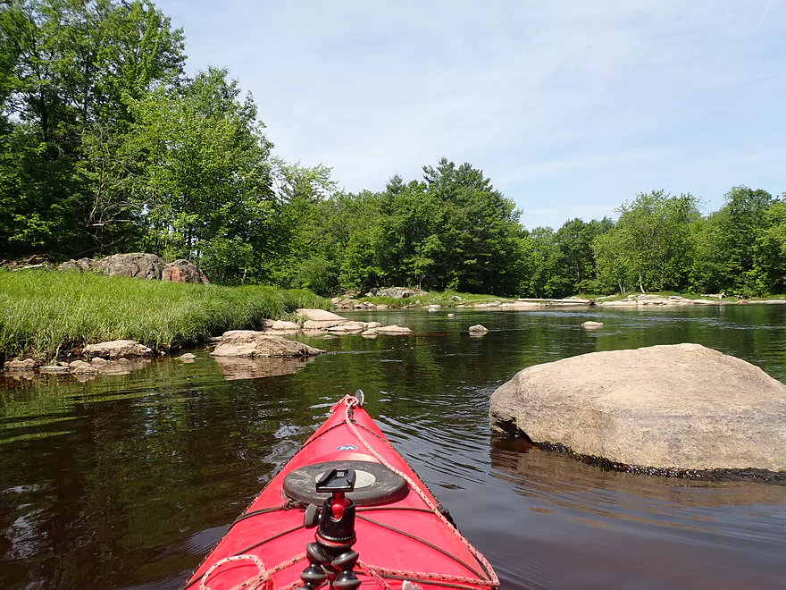
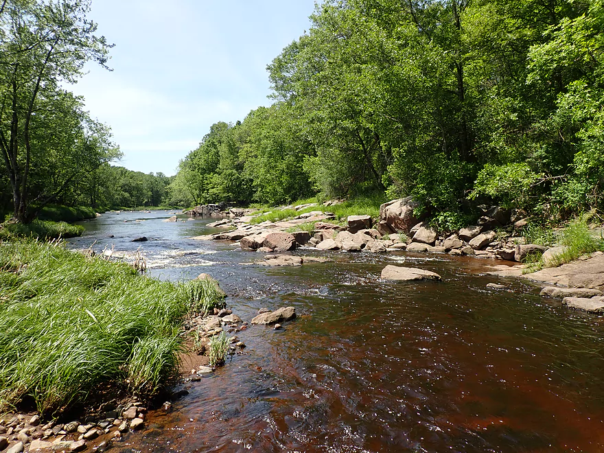
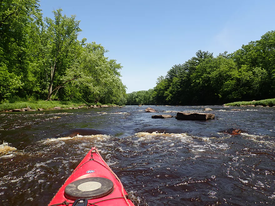
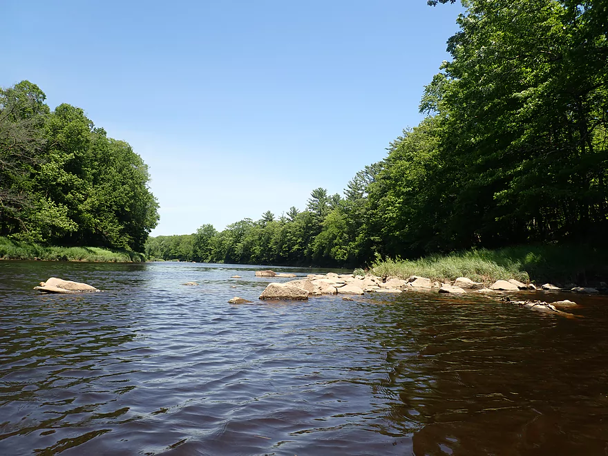
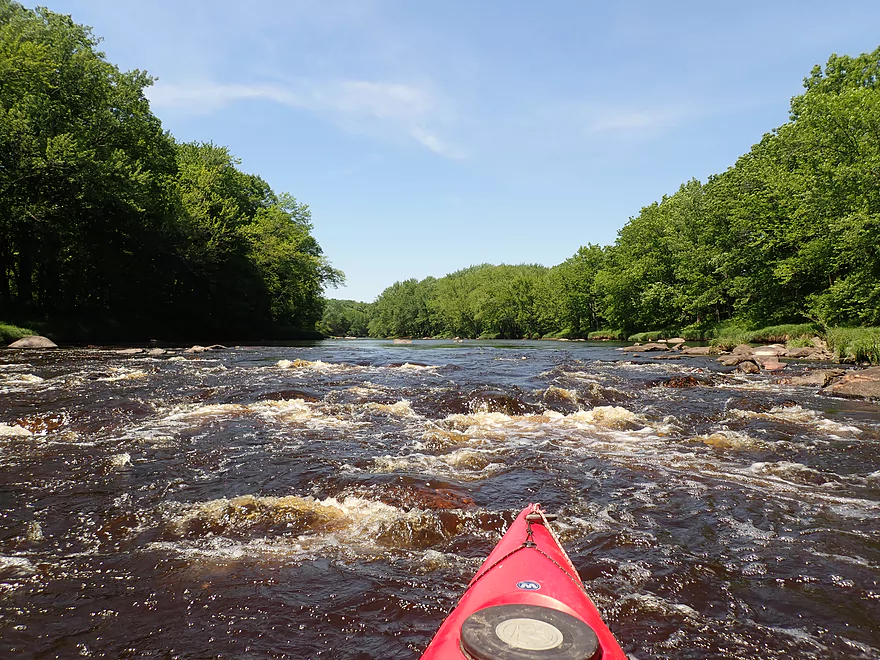
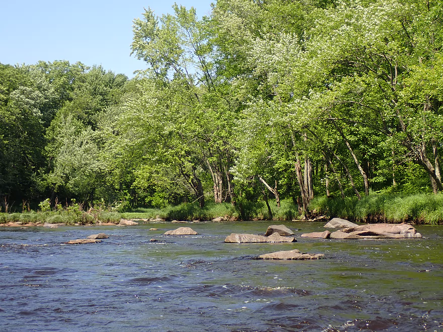
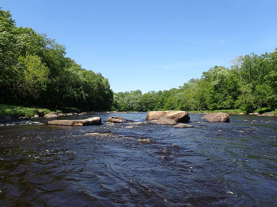
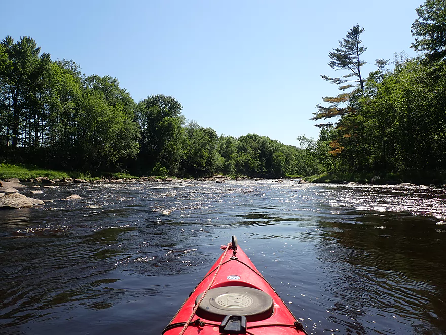
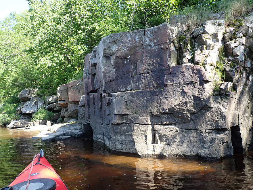
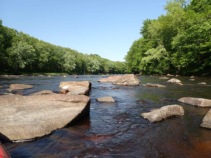
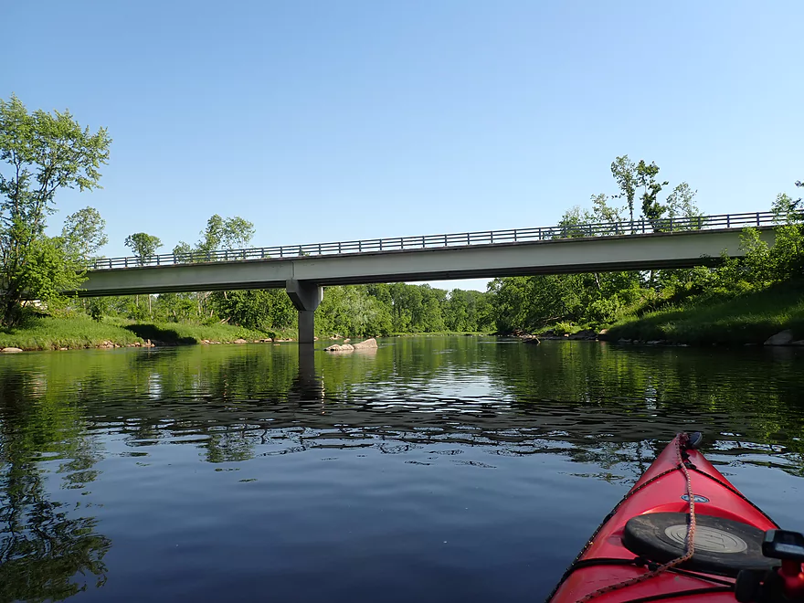
Approaching the Greenwood Rapids
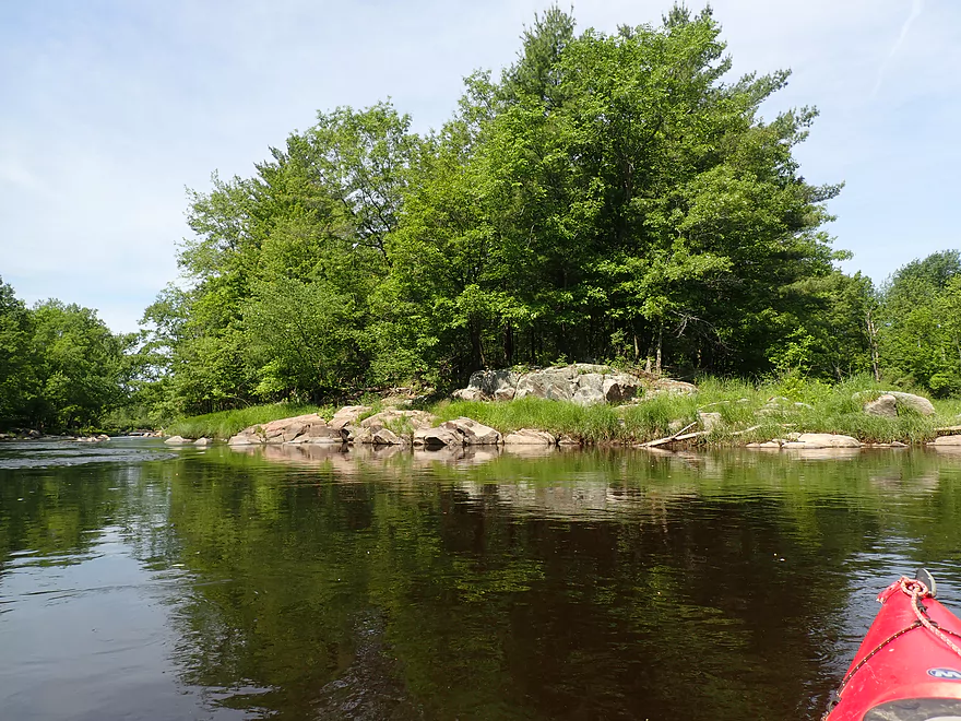
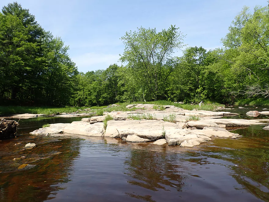
A rocky island splits the channel
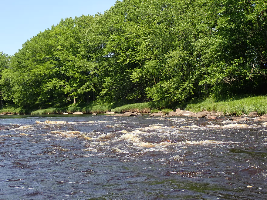
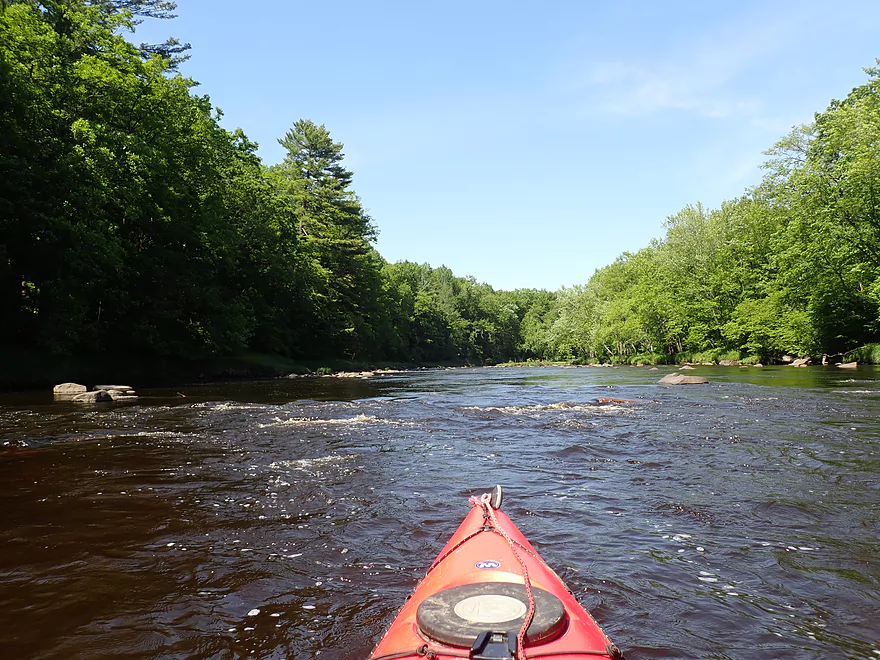
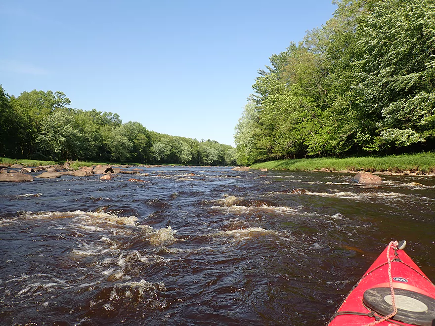
Class 3 rapids
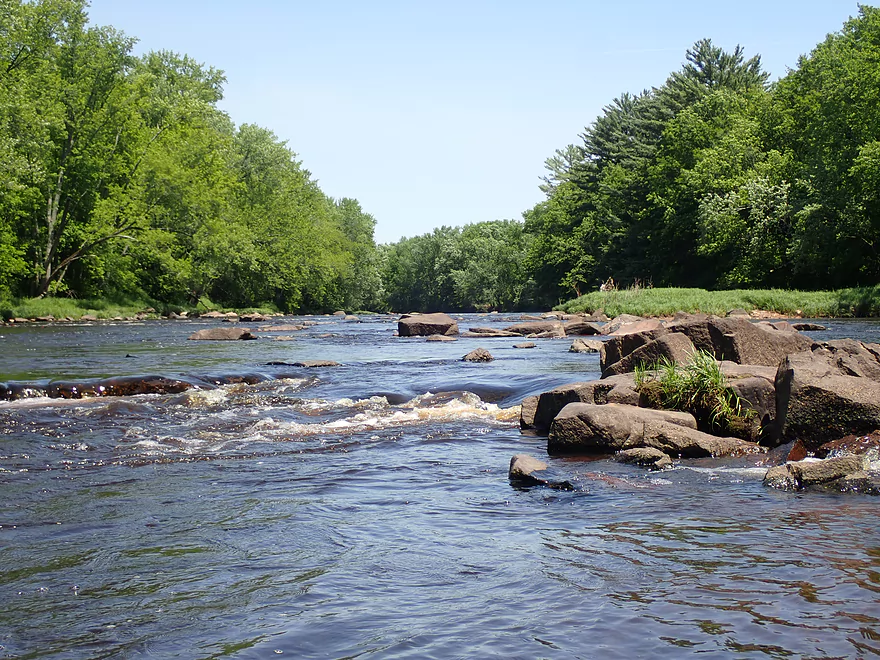
Reverse view
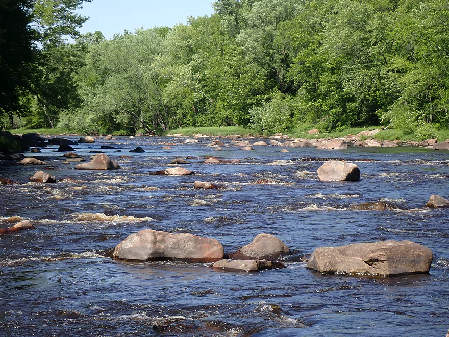
This is followed by a nice boulder garden
But I head back upstream to check out the other channels
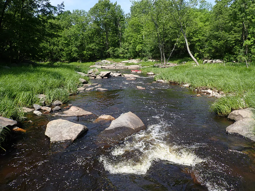
The middle channel is very scenic
But very shallow
In high water this could be fun
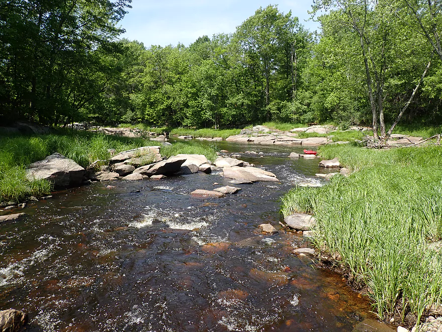
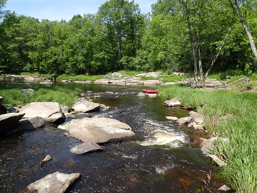
The third channel (to the right) is also cool
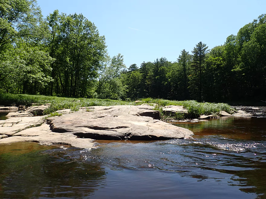
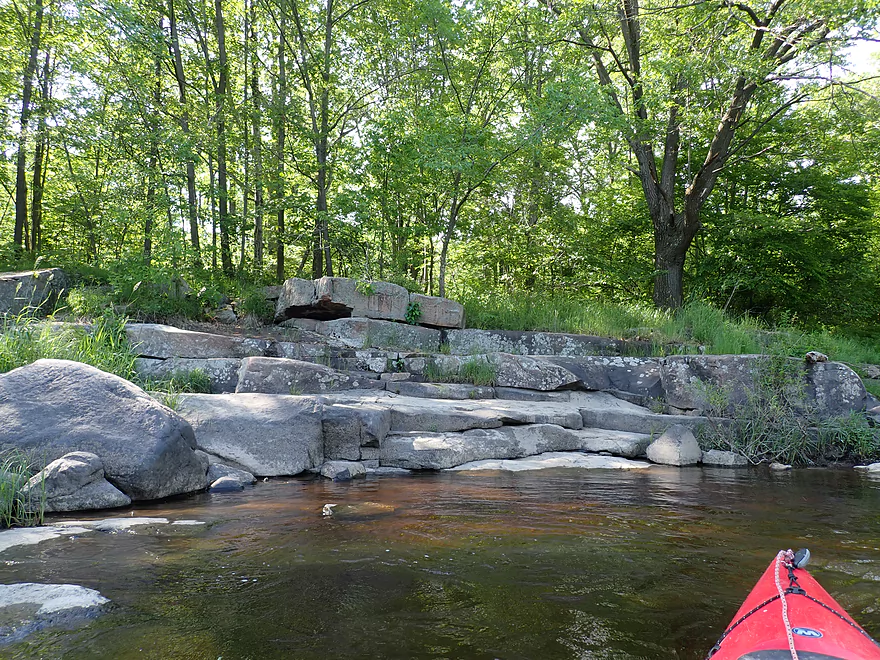
Exposed bedrock
Some large boulders
Class 1 rapids and boulder field
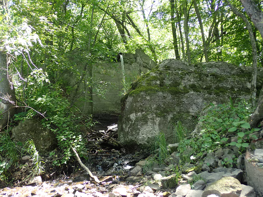
Sanitation discharge for Greenwood (I think)
Rock Creek joins the Black River
Class 1 rapids
These are called “Rock Creek Rips”
About 400′ long
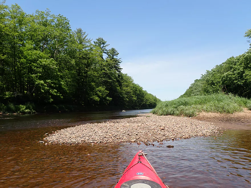
A gravel bar (not to be confused with a sandbar)
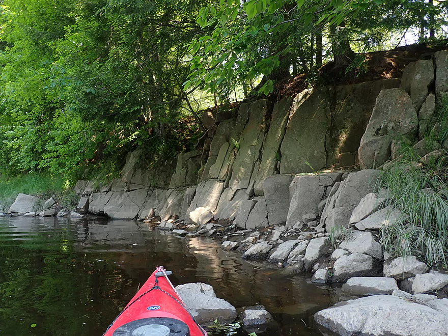
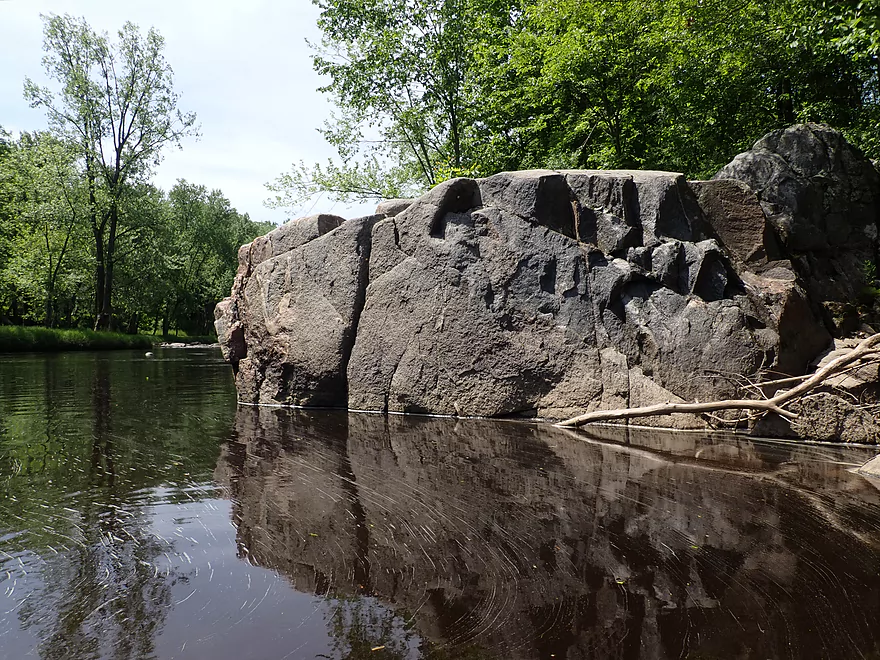
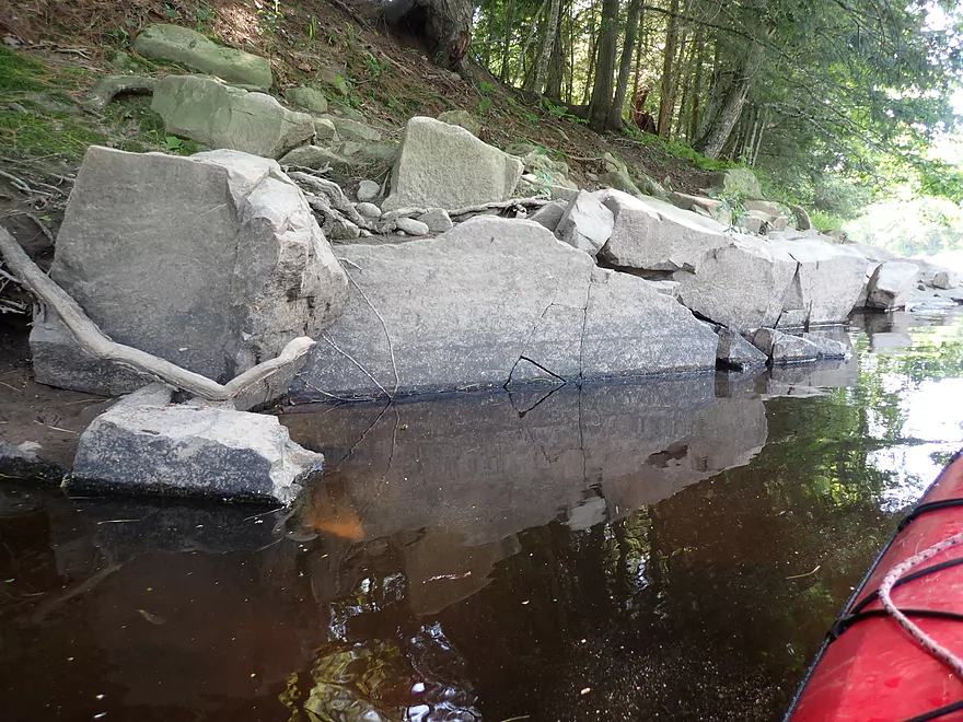
Nifty outcrop
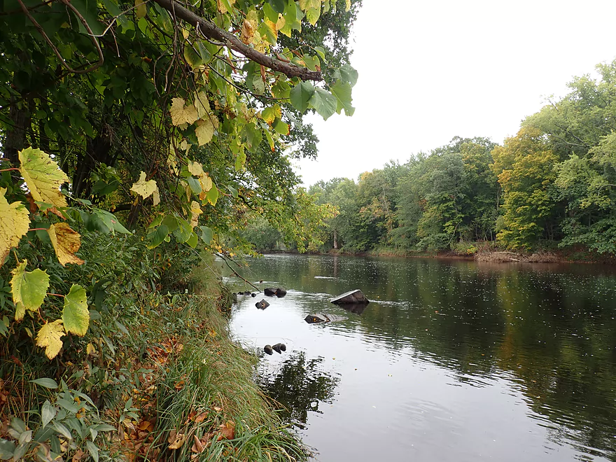
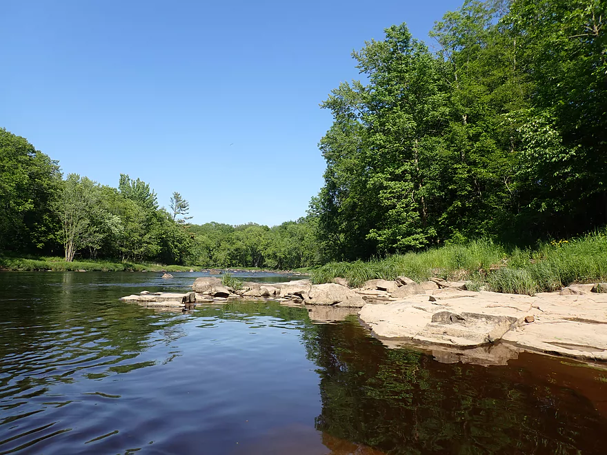
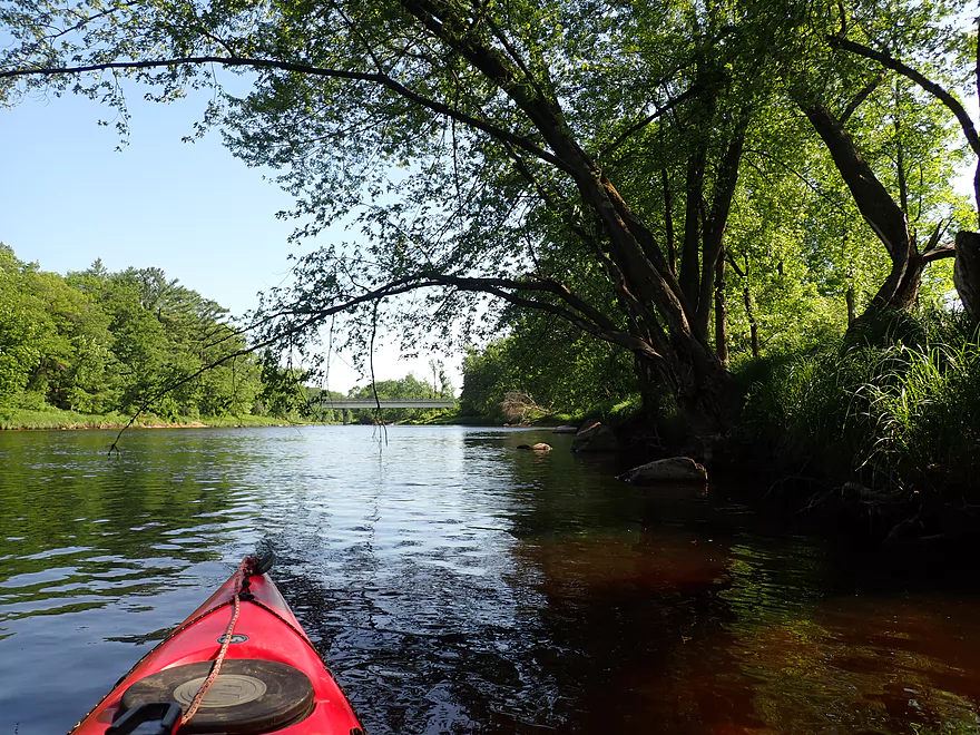
Lot of open river paddling in the first half of the trip
An Amish family fishing from the banks
A surprise Class 2
Getting out…
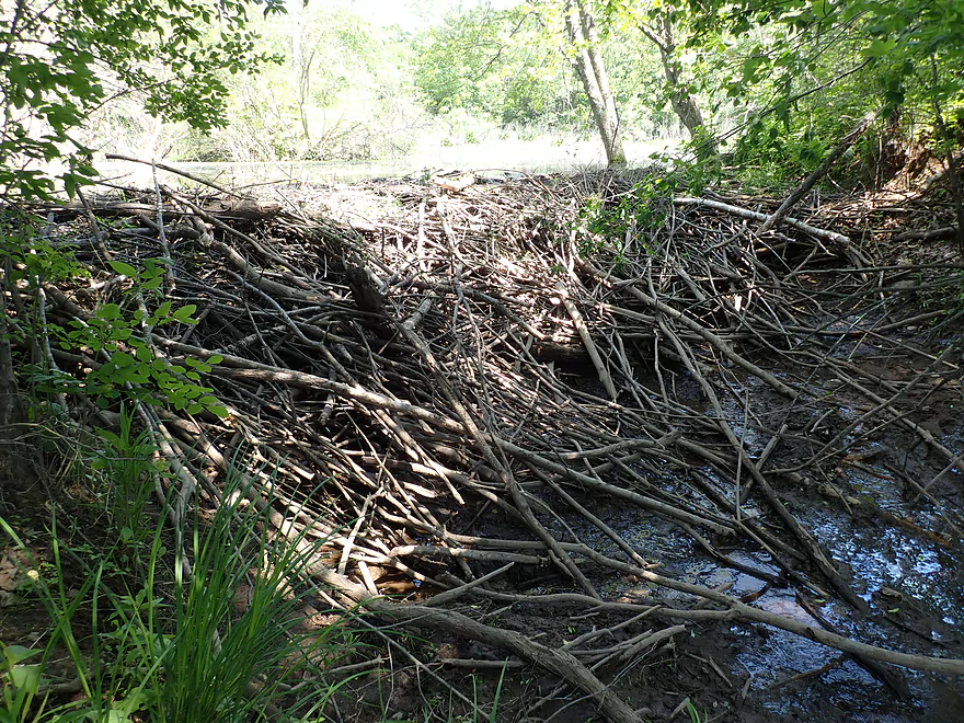
To check out a huge beaver dam
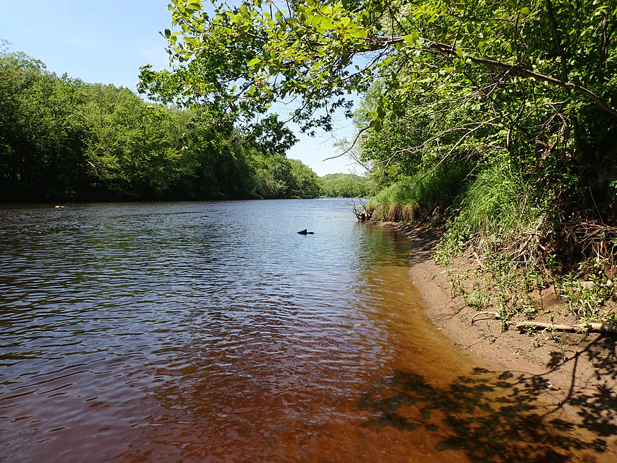
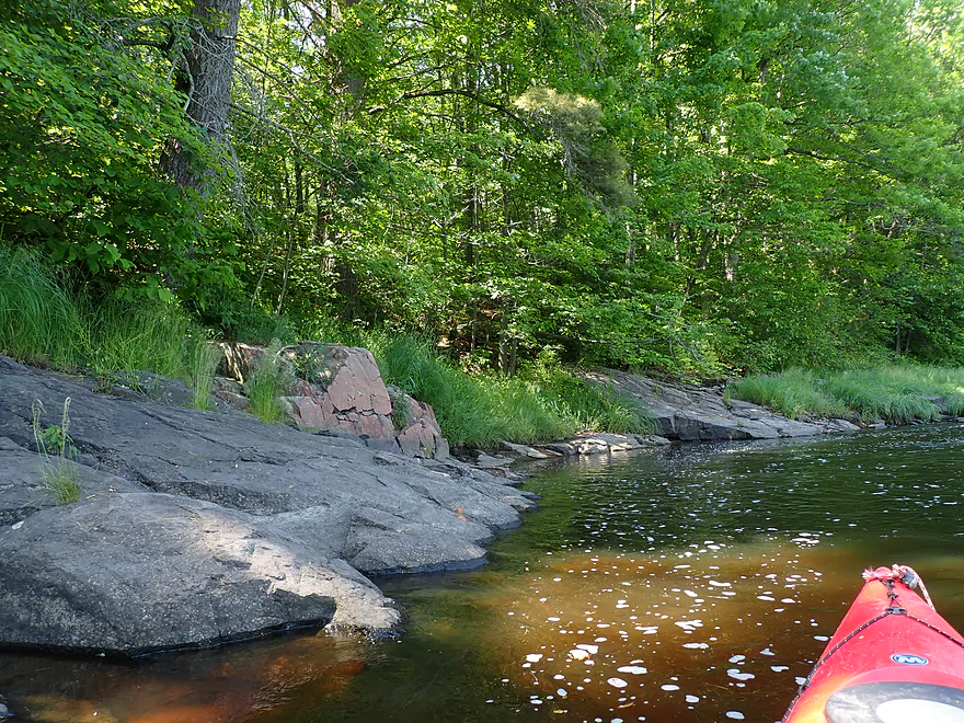
Scenic shoreline
Simple Class 1’s
Cool blue eyes
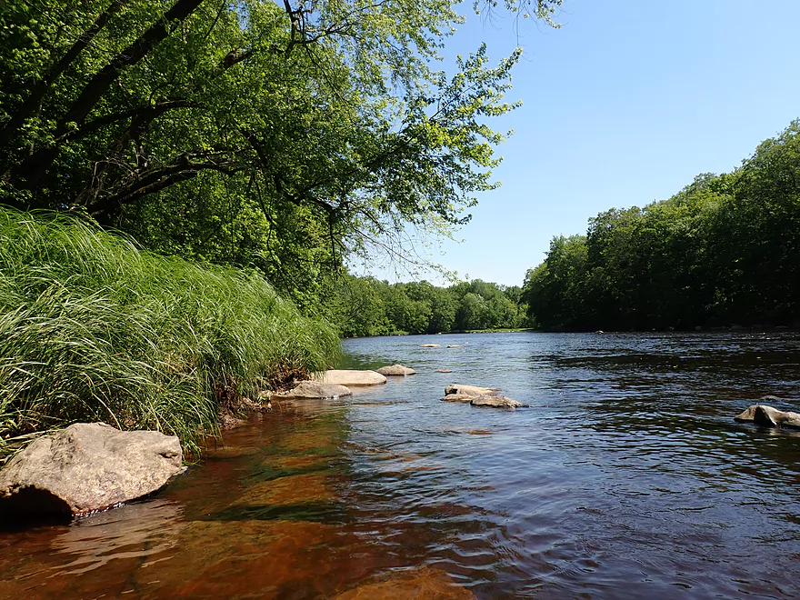
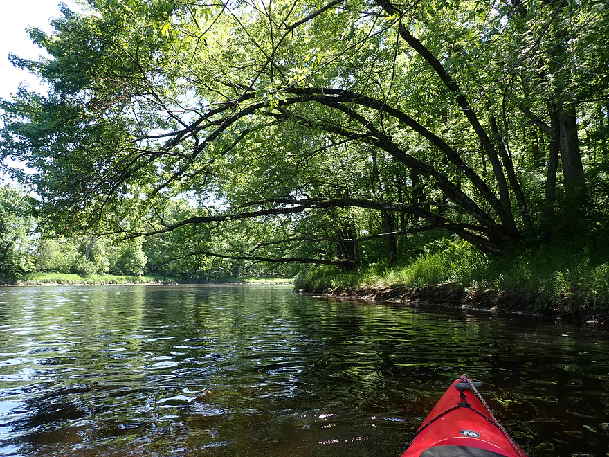
Tall, arching sedges line the river bank
Exposed bedrock–smoothed and pitted by the last glacier
Being passed by a trio of kayakers
They handled the Class 1’s pretty well
My turn
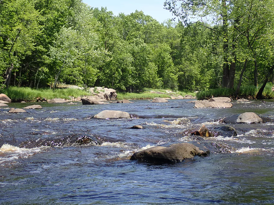
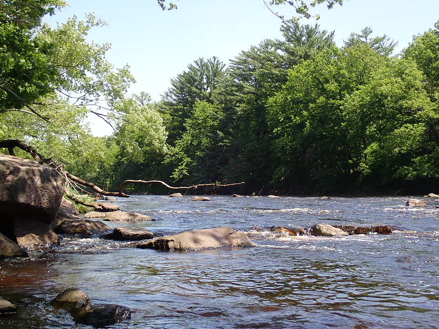
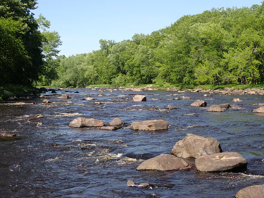
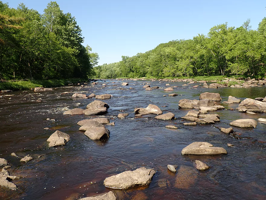
Part of a 2000′ stretch of almost continuous rapids and boulders
Very cool
Rapids get more intense…this is Pike Rapids
Rated Class 2
Running the last pitch
Finding open lines through here is a bit tricky
Very cool though
An “asteroid” field on the Black River
Another nice outcrop
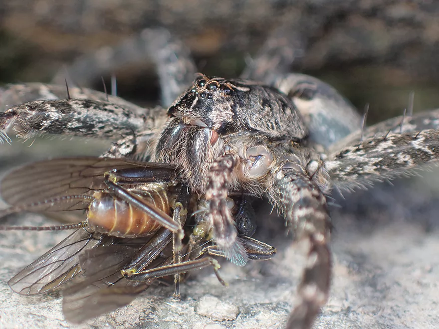
Fishing spider snacking on a stonefly
Arrowhead reflection
Black Rapids (Class 1)
Double ‘O’ Rips (Class 1)
A natural amphitheater
Twenty Six Road

Good take-out
A steep fishing trail leads to the road
Black River – Greenwood

The Black River is a great paddling river and popular with kayakers, but most just do trips downstream from Black River Falls or Hatfield. The Upper Black is undeservedly overlooked by paddlers and features many scenic boulder gardens and rapids that are great for kayaking. One of my long-term goals is to paddle the entirety of the Upper Black from Hwy 73 to Black River Falls, and next on my list was the Upper Black by Greenwood.
The main bridge that crosses the river by Greenwood isn’t really practical as a put-in, but thankfully there is a trail and access located just downstream off of Reese Ave.
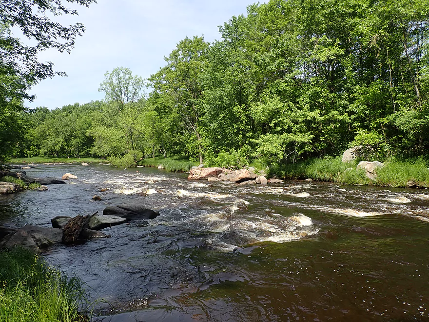
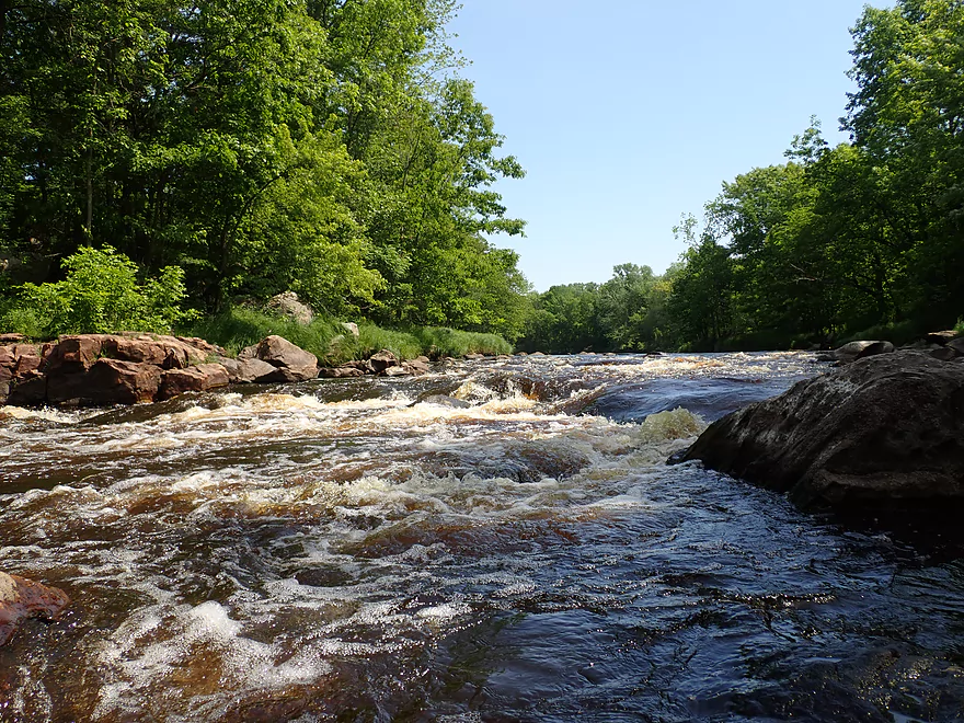
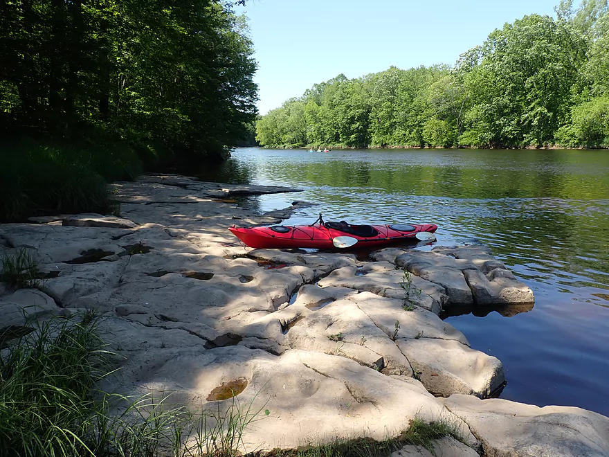
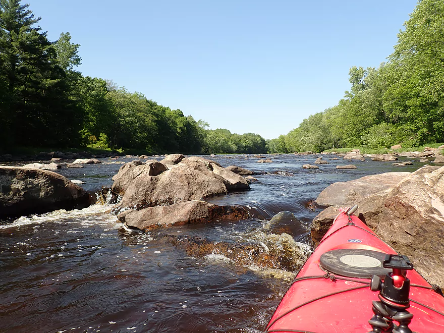
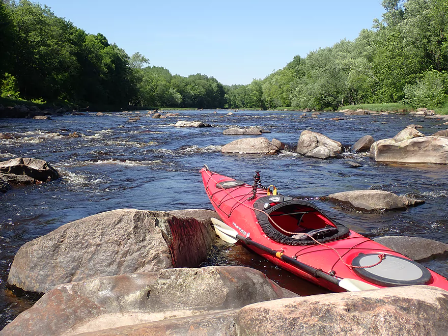
The first quarter-mile of the trip was somewhat nondescript, but what kept things interesting was the constant roar of the Greenwood rapids. While out of sight, these could be heard far downstream. Just above the rapids, the river is split into three channels by two islands (one island if levels are high). The bulk of the river goes to the left channel and tumbles down a Class 3 pitch. Most paddlers will prefer this channel as the rapids there are really fun…but make sure to scout them first which is easy to do from the left shoreline. IMO the best line is along the right of the pitch (close to the main island). See video for more details.
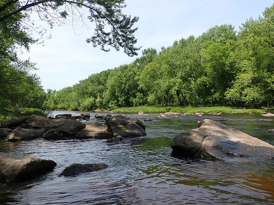
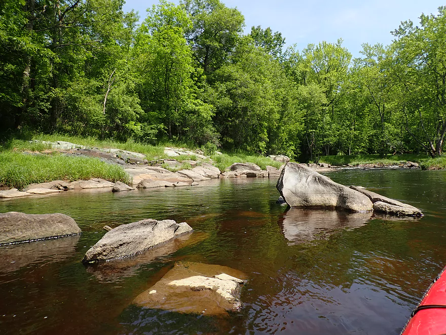
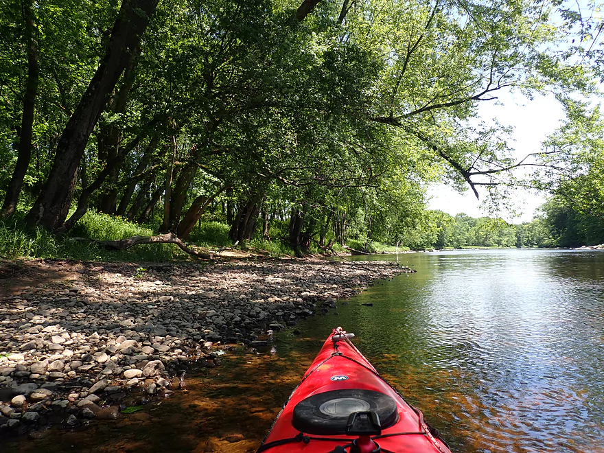
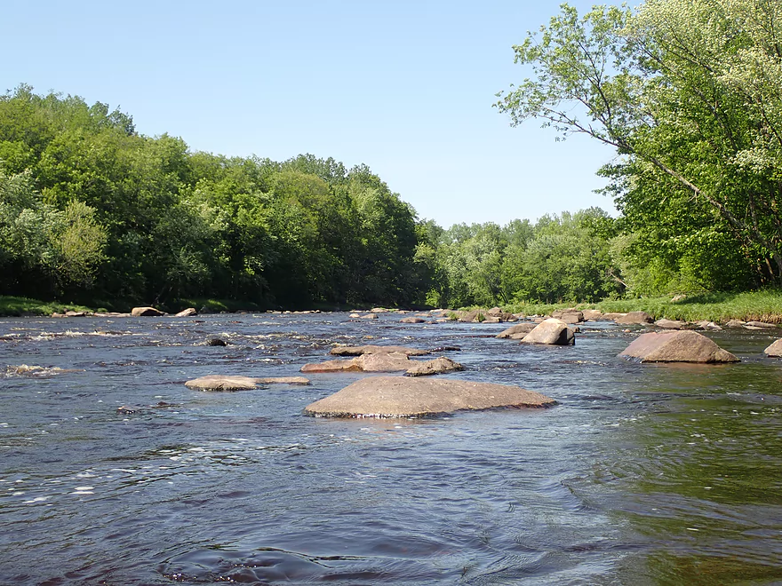
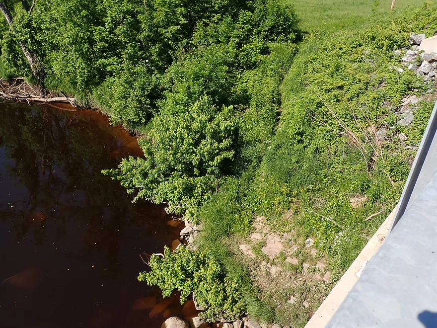
After I ran the main pitch, I headed back upstream to explore the right/west channels which I missed. These were much shallower but in some ways were more scenic because of the exposed bedrock and the outcrops at the base of the rapids.
Just after Greenwood Rapids is Sladich Road which is a public pull-off and an ok access option. Immediately across from this wayside is the mouth of Rock Creek. This brought back memories from a trip I did two years ago. This was THE SHALLOWEST creek I’ve ever paddled (or waded). I remember immense relief when reaching the Black River and hearing the alluring roar of Greenwood Rapids coming from upstream…making me wish I had done that trip instead.
The next 1.5 miles honestly weren’t too interesting and consisted mostly of slow current and generic wooded banks. There were hardly any rapids outside of Rock Creek Rips (a nice pitch of Class 1’s). Adjacent to the river were a number of old quarries that are now just stagnate lakes. I had to wonder if long ago these used to be scenic rocky bluffs that were leveled for profit.
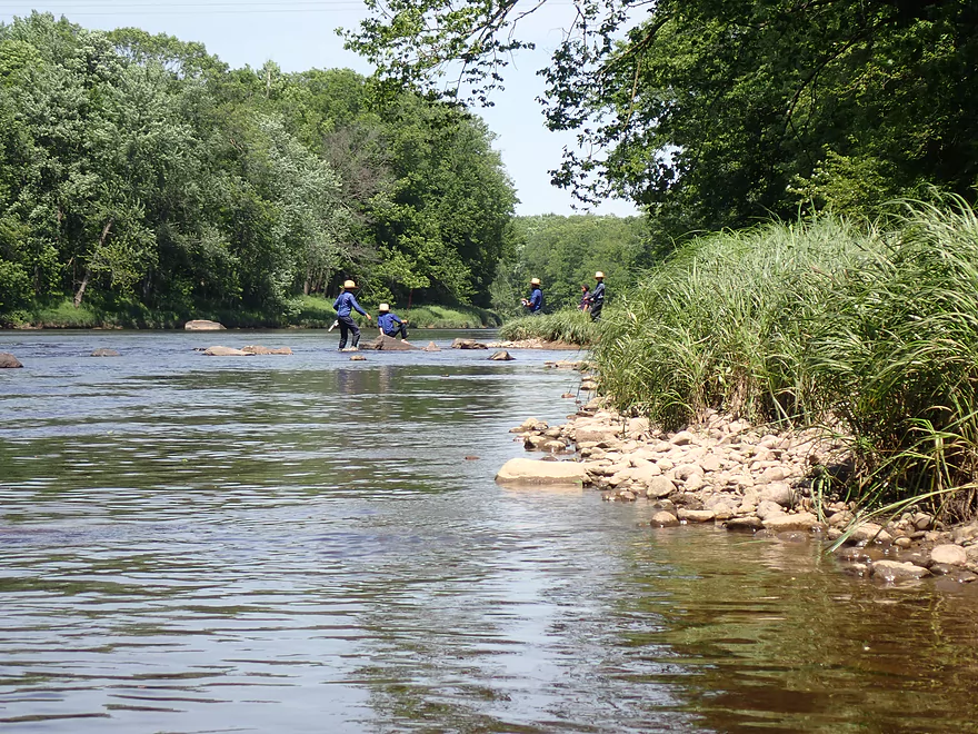
Roughly at the halfway point in the trip was the Willard Rd access which paddlers sometimes use. There were a large number of Amish fishermen here which surprised me. I must have surprised them as well as they kept staring at my boat. I doubt the Amish see many kayaks….or perhaps they were thinking about paddling the Upper Black themselves.
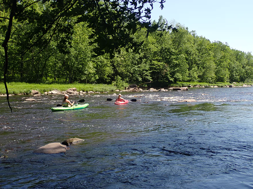
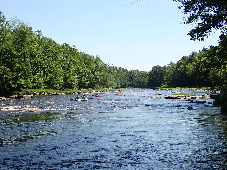
After Willard the river became much more interesting. Not only were there more rapids, but they were more intense. The best part of the river starts south of W. Chickadee Rd. I was taking pictures from a large slab of exposed bedrock when I was surprised to see three kayakers come down the bend. They ran the downstream rapids ok, but one did get hung up briefly on a rock. I don’t want to be a safety nazi…but none were wearing life jackets. If you know what you’re doing you can do this with Class 1’s. But for Class 2’s (which were located just downstream out of sight) you really should have a life jacket on. If you get thrown from a boat, things can get chaotic and you might not know which way is up…but the life jacket will always know.
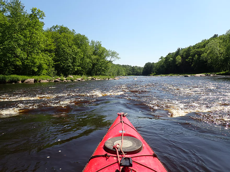
Just north of Central Ave were a series of five pitches that got progressively stronger and more difficult. This 1800′ stretch of almost continuous rapids was one of the best parts of the trip. It ended with two Class 2 pitches that wove through a dense boulder garden. In hindsight I maybe should have scouted this first, as finding a clear route through this maze proved more tricky than I expected, but it all worked out.
This was followed by a few small but nice outcrops and then it was back to mundane flatwater paddling. The trip ended with two Class 1 rapids. Paddling author Michael Duncanson disagreed and thought one of the rapids (which he called Black Rapids) was a Class 2, but maybe he did this during high flow rates. I took out at Twenty Six Rd which was a decent take-out with a fishing trail leading from the road to the water…but it was surprisingly steep.
In summary this was a good trip that I can recommend. Usually this stretch will be too shallow or too high, so be mindful of levels. Outside of Greenwood Rapids (which were fantastic), the first half of the trip honestly was a bit disappointing with a bit too much flatwater paddling. I was thinking of giving the trip 4 stars…but Pike Rapids located near the end of the trip was terrific and boosted this trip rating to five stars.
Special thanks to the Friends of the Black River and specifically Daniel Moore for the information he provided. Dan let me know about the secret landing in Greenwood (that most outsiders would totally miss) and gave me valuable intel on how to run Greenwood Rapids. You can follow them on Facebook.
Sights included a few clams, dragonflies, and eagles. The highlight was a huge (maybe 4′ high) beaver dam I encountered on a side creek.
Reese Ave: This is the main launch in Greenwood and is located west from Reese Ave and south of the Hwy G bridge. A somewhat hidden 390′ public trail leads to the water. This is a decent launch option, but there is poison ivy in a few spots. You should be fine to park on the Reese Ave shoulder.
Alt Put-ins:
- Greenwood County Park (0.9 miles upstream from Reese): I almost put in here. Greenwood County Park isn’t a bad access but the parking lot isn’t located next to the water, so you have to drag your boat 280′ down a grassy hill to reach the water. This leg has two sets of Class 1 rapids.
- Sladich Road (0.8 miles downstream from Reese): This is a public fishing pull-off that isn’t a bad access option. But if you put in here you miss out on the Greenwood Rapids which IMO are a trip highlight.
Twenty Six Rd: Southwest of the bridge is a public fishing trail which leads to the water. This isn’t a bad access, but the trail is steep and 200′ long…this does require some effort to get your boat to the shoulder. It’s all doable though.
Alt Take-outs:
- Willard Rd (2.9 miles upstream from Twenty Six): There is a public access here (popular with local Amish fishermen!). I’m not sure I can recommend this as take-out though…as the river below Willard Rd has more rapids and is more interesting than the river prior to it.
- HH (5.0 miles downstream from Twenty Six): There is a great public access and parking lot by the HH bridge. This leg includes multiple Class 1 and Class 2 rapids.
Twenty Six Rd to Reese Ave: 6 miles with 121′ of ascent. While having a few hills and being a bit on the longer side, this didn’t seem like a bad bike shuttle. It might have helped that I was assisted by a significant tailwind. Note, some navigating programs will tell you to shuttle west of the river…don’t do this. West of the river the roads are generally unpaved, while east of the river the roads are paved and much better for biking. Note, this bike shuttle was done on a hot day (90 degree+). A trick to dealing with hot bike shuttles is to do them first early in the morning when temps are much cooler.
Logjams: None.
Current: This is a pool and riffle river…long slow stretches interrupted by multiple rapids.
Wind: Much of this river is in the open so be mindful of the forecasted wind speed/direction. I actually paddled into a 15 mph headwind but didn’t mind as it felt very refreshing in the 90 degree heat and I could usually dodge much of the wind by hugging the shoreline.
Rapids: By my count there were 13 Class 1’s, 4 Class 2’s, and 1 Class 3. See my trip map for locations of rapids and more detailed information. Generally speaking most of the rapids (and the best ones) were downstream from Willard Rd.
The exception was Greenwood Rapids. The Upper Black (upstream of Hatfield) doesn’t have too many Class 3’s but this is one and it is located just downstream from the Greenwood bridge. The river here is split into three channels by two islands. The main channel flows left/east. This contains the Class 3 pitch (see 0:24 in the video). Definitely scout this before running…the left side of the pitch is rougher and has a ledge at the end followed by a small hole. I highly recommend staying right through the pitch which is closer to the island (again see video).
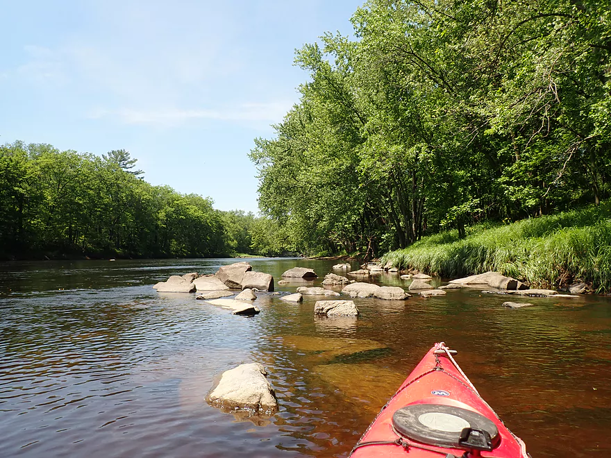
Alternatively you can take the middle channel. This is a very narrow and scenic chute, but is often too low to properly run. I rate this a Class 2.
Lastly you could take the far right channel. This too can be a bit shallow (not as shallow as the middle channel) but is also scenic. The rapids here are a strong Class 1 or weak Class 2.
The main rapids (left channel) are the funnest and what I recommend for most paddlers. But…you MUST know what you’re doing if you decide to run a Class 3. Whitewater newbies should take the far right channel or just portage everything (easier done right of the main island).
Neillsville Gauge on the Black River: 340 CFS or 3.85′.
Often the Upper Black is too low or too high for safe paddling…so make sure to carefully monitor the Neillsville gauge.
- 0-100 CFS: Too shallow (unless you are ok with wading most of the rapids).
- 101-200 CFS: Likely too shallow. Most of the river will be navigable but the rapids will be tough to get through.
- 201-300 CFS: On the low end, but IMO doable for shallow-drafting kayaks.
- 301-400 CFS: Some bumps here and there but mostly not bad. A good target range for rec paddlers.
- 401-500 CFS: All rapids should have good padding at this level, but a few could start to get pushy.
- 501-750 CFS: Rapids will be much stronger, pushier and less forgiving. You should know what you’re doing before going out at this depth. Also many of the scenic boulder gardens will be submerged at this depth.
- 751-1200 CFS: Perhaps only suitable for whitewater paddlers.
- 1201+ CFS: Definitely only appropriate for expert whitewater paddlers.
Quick Overview
Black River:
- Upstream of Hwy 73: Obscure sections of the Black with little known about them. Some legs will have logjam issues.
- Hwy 73 to Lake Arbutus: 48 miles. Good legs with a mix of rapids, boulder gardens and undeveloped banks. Only reason these legs don't receive more paddling traffic is because they're located away from population centers.
- Lake Arbutus: 3 miles. A scenic but challenging lake because of the waves.
- Hatfield Dam to Halls Creek Landing: 7 miles. Some of the best and most fun whitewater on the Black River.
- Halls Creek Landing to Black River Falls Dam: 6 miles. An impounded part of the river, but nice with cool cliffs.
- Black River Falls Dam to North Bend: 37 miles. This is the heart of the Lower Black and sees the most paddling traffic. No major rapids, but there are many scenic cliffs and creek inlets.
- North Bend to Mouth: 30 miles. This is the second half of the Lower Black. While not as scenic, there are still cool sandbars and sandbanks. Few paddle these stretches.
Noteworthy Tributaries:
- Robinson Creek: One of the best paddles in all of Wisconsin.
- Halls Creek: Also one of the best and with amazing sandstone walls.
- Morrison Creek: Very scenic creek with some fun whitewater.
- Wedges Creek: Great paddle with amazing boulder gardens.
- East Fork of the Black River: Some fun riffles and unique granite geology.
- Perry Creek: Shallow but a super scenic creek.
- Dickey Creek: A wonderfully scenic creek with fantastic sandstone…but too many logjams.
- Beaver Creek: Some fun rapids and amazing sandstone in Galesville, but logjams on the downstream portions.
- Popple River: A shallow whitewater river that is very nice.
- Arnold Creek: A pleasant tributary to Lake Arbutus with really nice reflections.
- Rock Creek: Many scenic boulder gardens, but usually this creek is too shallow to run.
- Roaring Creek: Very scenic creek with a great waterfall at the mouth, but might be a challenge to paddle.
- Vismal Creek: Super scenic but has a lot of logjams and is shallow. Requires very high water conditions.
- Plus countless small creeks that are too small to paddle but quite fun to explore by foot. If you know of viable paddling options, let me know! Am very curious to know more about Douglas Creek, Levis Creek, O’Neal Creek, and Crawley Creek.
Detailed Overview
Headwaters to Neillsville:
- Upstream of Division Drive: Likely too many logjams to be navigable.
- Division Drive to Sawyer Ave: (6.5 miles) Rocky and a few light rapids. Maybe 4 logjams.
- Sawyer Ave to Hwy 64: (2.5 miles) Rocky and a few light rapids.
- Hwy 64 to Bridge Road: (14.4 miles) Solid prospect reviewed by Mike Svob. Some Class 1 rapids and nice gravel bars. Intermediate access points at Bahnkes Ave and Hwy AT.
- Bridge Road to Hwy X: (6.0 miles) Little is known of this section…likely pretty simple.
- Hwy X to Colby Factory Road: (6.0 miles) Little is known about this section…likely some rapids and outcrops. Intermediate alt access points at Hwy 29 and Hwy N.
- Colby Factory Road to Popple River Mouth: (7.9 miles) This stretch has far fewer rapids than downstream legs with only a few minor rapids. It should still be pleasant though.
- Popple River Mouth to Reese Ave: (5.3 miles)
- Popple River Mouth to Warner Drive: (1.0 miles) This is a slower and less interesting stretch, but does include 4 Class 1's and scenic Hemlock Rapids which are Class 3.
- Warner Drive to Greenwood Park: (3.4 miles) A good leg with many rapids (3 Class 2's and 17 Class 1's).
- Greenwood Park to Reese Ave: (0.9 miles) A slower stretch with just 2 Class 1's. Part of this passes through the community of Greenwood.
- Reese Ave to Twenty Six Rd: (5.1 miles)
- Reese Ave to Sladich Rd: (0.7 miles) A mostly nondescript wooded stretch. The exception is Greenwood Rapids where an island splits the river. The right side is scenic, but the left side has fun Class 3 rapids.
- Sladich Rd to Willard Rd: (1.6 miles) A somewhat slow and relatively uninteresting leg. Highlights include one nice outcrop, a few gravel bars and a 400' stretch of Class 1 rapids.
- Willard Rd to Twenty Six Rd: (2.8 miles) A great leg with 10 Class 1's and 2 Class 2's. Highlights also include scenic boulder gardens and a few outcrops.
- Twenty Six Road to Hwy H: (5.0 miles) Multiple Class 1 & 2 rapids.
- Hwy H to Grand Ave/Hill Road: (8.0 miles) A great trip with several Class 2 rapids and scenic granite outcrops.
Note, for more details on the Upper Black, I highly recommend “Indian Head Rivers” by Michael Duncanson.
Alternate Black River Trips – Neillsville to Black River Falls:
- Grand Ave/Hill Road to Opelt Road Landing: (6.7 miles)
- Grand Ave/Hill Road to Hwy 10: (2.2 miles) Nice section with a handful of rapids. These are mostly Class 1 at lower depths, but strengthen to Class 2 during high flow rates.
- Hwy 10 to River Road Landing: (4.3 miles) Fantastic whitewater section. Maybe six Class 2’s and two class 3’s. Scenic boulder gardens and a few outcrops.
- Opelt Road Landing to Bryan Ave Bridge: (1.1 miles) Not sure there is anything special about this stretch.
- Opelt Ave Bridge to Hwy 95: (4.4 miles) Ok…nothing special.
- Hwy 95 to West Arbutus County Ramp/Hatfield Dam: (4.8 miles)
- Hwy 95 to North Arbutus Boat Landing: (2.4 miles) Includes a scenic gorge, boulder gardens and rapids including the Class 3 Red Granite Rapids. River slows after rapids.
- North Arbutus Boat Ramp to West Arbutus County Ramp: (2.4 miles) A large open water paddle on Lake Arbutus that can feature challenging waves on summer afternoons.
- Hatfield Dam to West/East Channel Confluence: 0.2 or 0.3 miles.
- West Dam to West/East Channel Confluence: 0.3 miles. There is a large boulder field and Class 2 rapids below the west dam. At the outlet of the west channel is a Class 4 drop. This is easy to scout and portage.
- East Dam to West/East Channel Confluence: 0.2 miles. Perhaps the most extraordinary rapids in the state with Class 4/5+ rapids. The action starts below the dam where steep granite banks narrow the river significantly and force it down deep chutes. The gorge starts with Class 2-3 rapids but ends with two significant drops. American Whitewater warns “between the dam and this point lie some serious drops which contain near inescapable boiling cauldrons at moderate to high flows”.
- Hatfield Dam Confluence/West Clay School Road to Powerhouse Road Landing: (3.1 miles)
- Hatfield Dam Confluence to Hwy K: (0.3 miles) One of the most scenic paddling areas in the state with massive granite outcrops. There is one set of Class 2 rapids.
- Hwy K to Powerhouse Road Landing: (2.8 miles) The first half mile by Hwy K is very scenic and contains one Class 3. The second mile is mostly flatwater. The third mile is almost continuous rapids and features one Class 3.
- Powerhouse Road Landing to Halls Creek Landing: (4.0 miles) Scenic section with a few Class 2 rapids and a steep ledge.
- Halls Creek Landing to Black River Falls Dam: (6.2 miles) Wonderful sandstone cliffs.
Alternate Black River Trips – Black River Falls to Mouth:
- Black River Falls Dam to Mason’s Landing: (4.7 miles) A great little section.
- Mason’s Landing to Irving Landing: (9 miles) A good section.
- Irving Landing to Lost Falls Campground (2.3 miles) A popular stretch. Highlights include a few small outcrops, two tiny waterfalls, several impressive sandbars, and one large sandbank. A side hike to Roaring Falls can be arranged. Note Lost Falls Campground is private and you must purchase a pass from them to use their access.
- Lost Falls Campground to Grinde Landing: (6.4 miles) A popular section with some nice outcrops and a waterfall by Roaring Creek. Wolf Creek may also have a cool slot canyon. The river splinters into multiple channels, some of which may be quite shallow in later summer. As of 2023, Grinde Landing is closed because somebody stole the owner's deer stand.
- Grinde Landing to Melrose Landing: (3.9 miles) A shorter section but with a really nice rock outcrop before Melrose Landing. As of 2023, Grinde Landing is closed because somebody stole the owner's deer stand.
- Melrose to North Bend: (10.1 miles) Likely the most popular stretch with the best sandbars on the river, three sets of outcrops, and a few waterfalls.
- North Bend to Hwy 53: (13.3 miles) Likely a nice paddle with sandbars, large sandbanks and maybe a few outcrops. Unfortunately it is very long.
- Hwy 53 to Hwy 35: (8 miles) A nice section with epic sand banks.
- Hwy 35 to Lytle Road: (4.0 miles) Goes through the Van Loon Floodplain Forest. This can be a shallow trip but features many nice sandbars.
- Lytle Road to Fred Funk Boat Landing (Mississippi): (5.0 miles) Multiple options because of the river delta.
Trip Map
Overview Map
Video
Photos Size: