
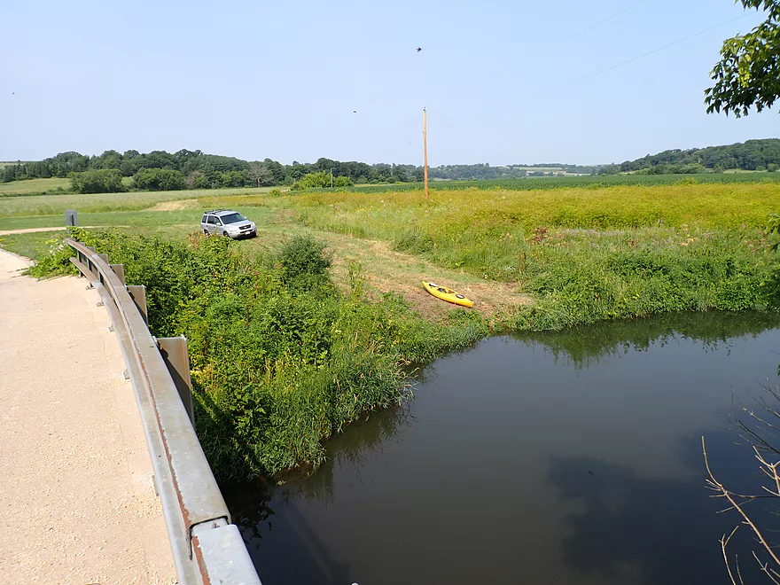
Putting in at S. Oak Park Road
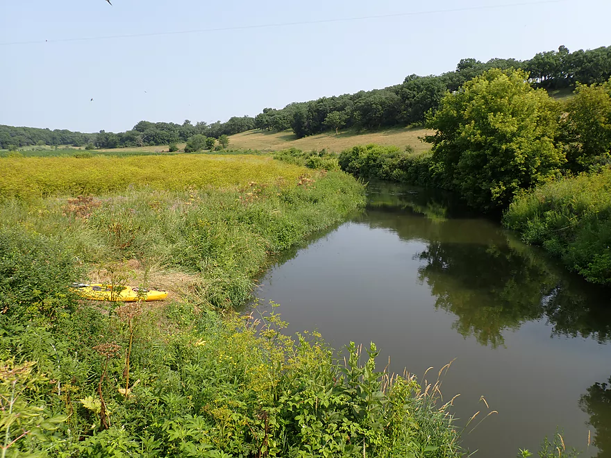
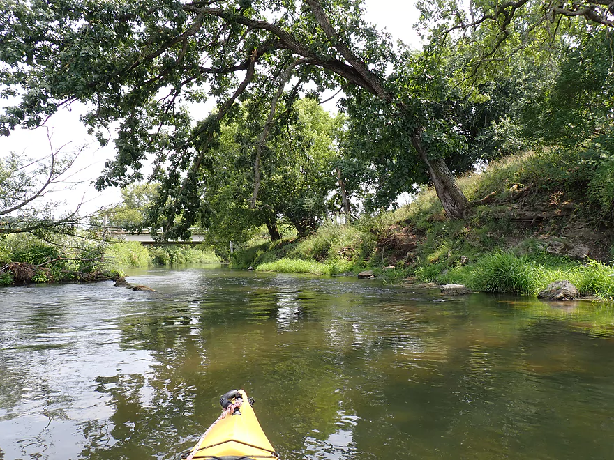
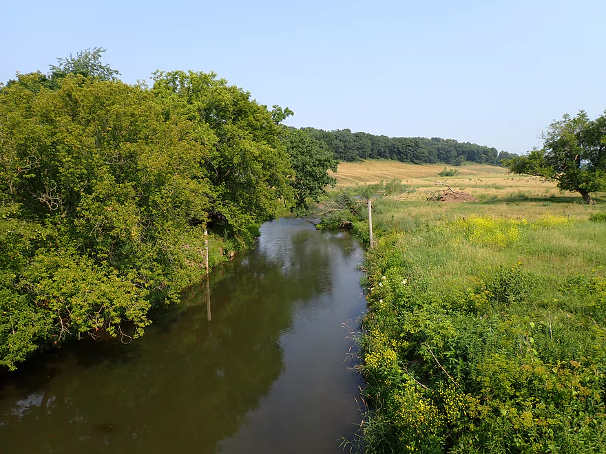
Nice pastoral view from the bridge
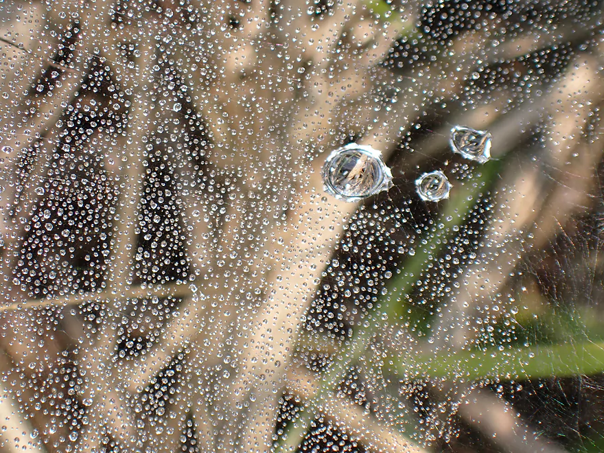
Morning dew
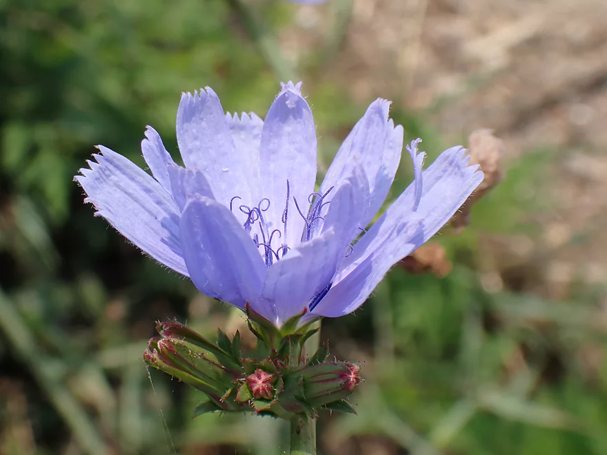
Chicory
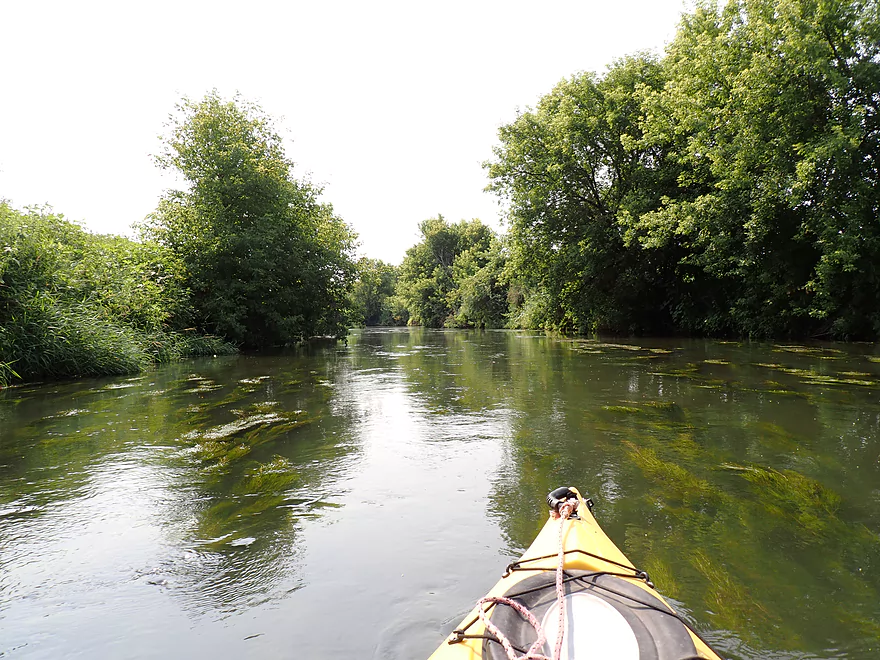
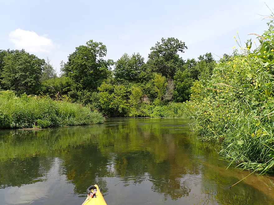
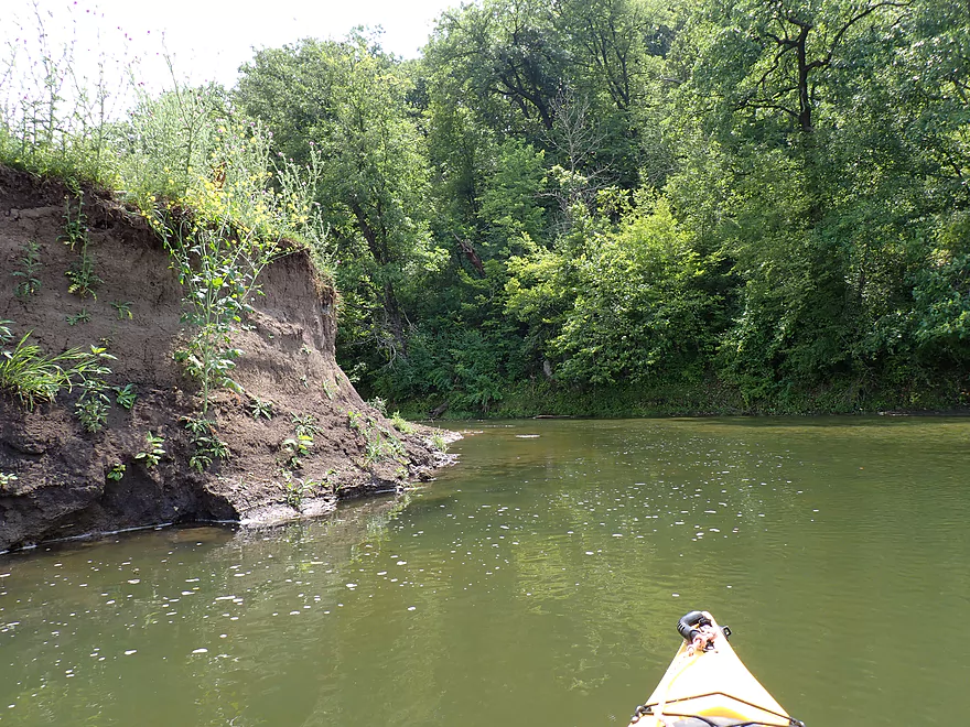
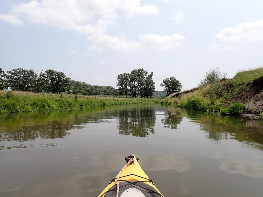
First mile of the trip wasn’t super interesting
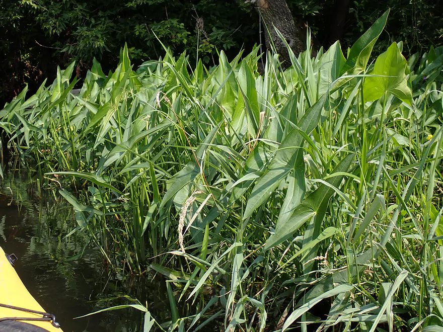
Pointy arrowheads
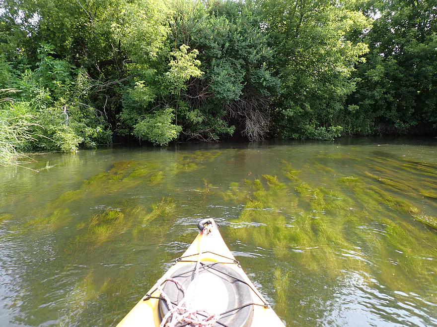
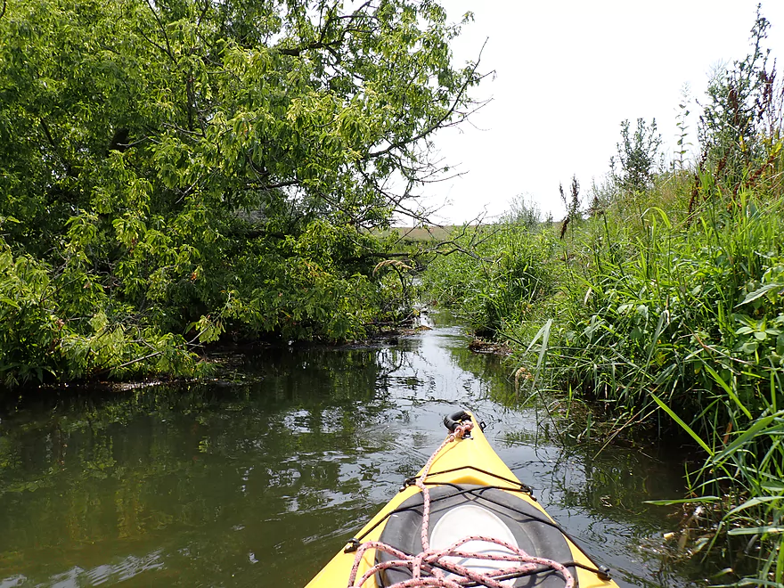
Aquatic weeds swaying with the current
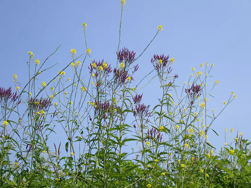
Black mustard and blue vervain
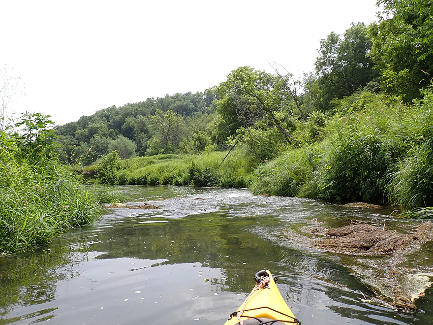
Current wasn’t super fast but moved at a good pace
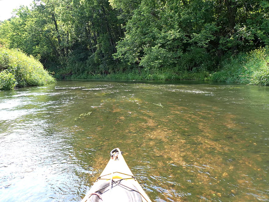
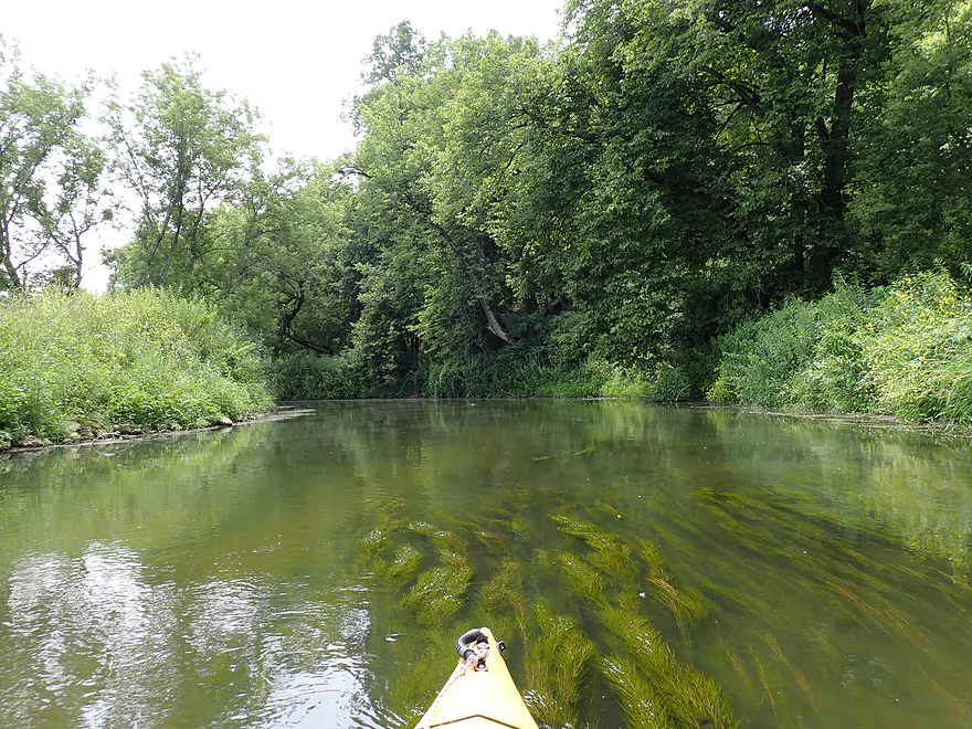
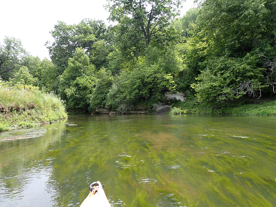
Sometimes good clarity
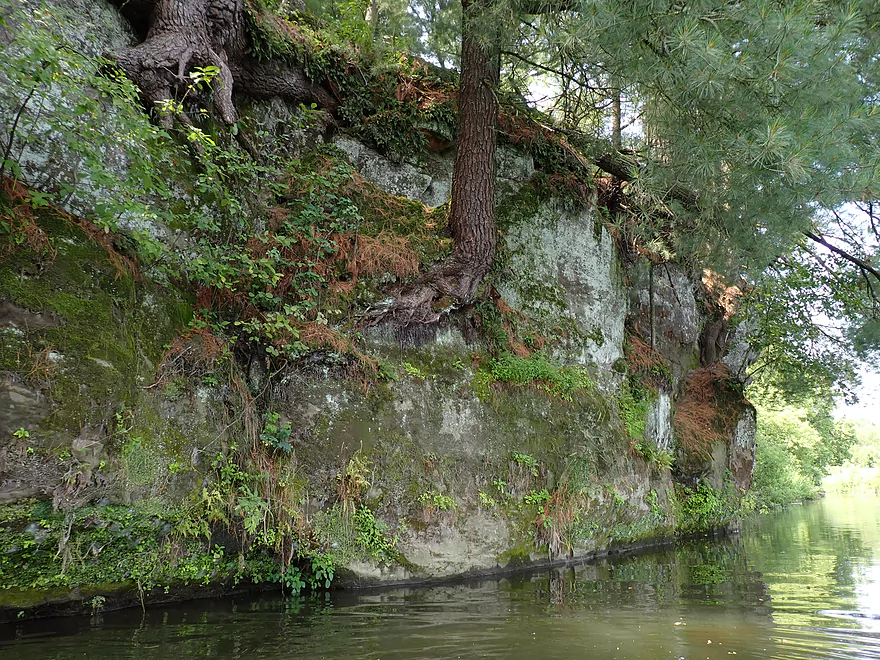
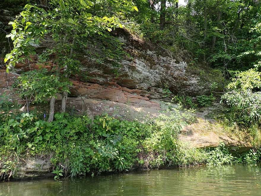
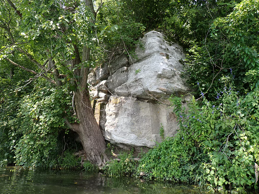
First outcrop of the trip
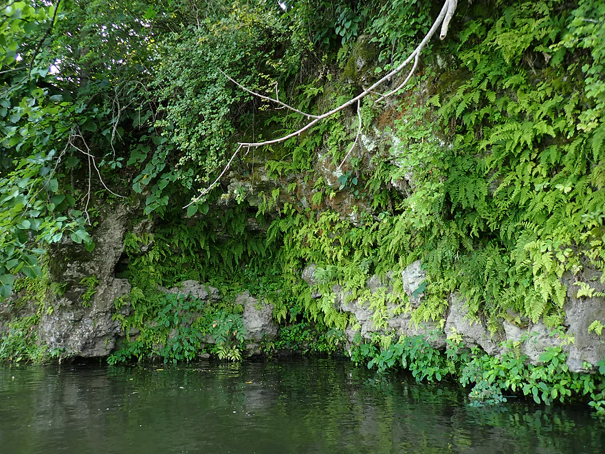
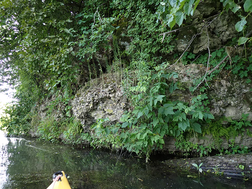
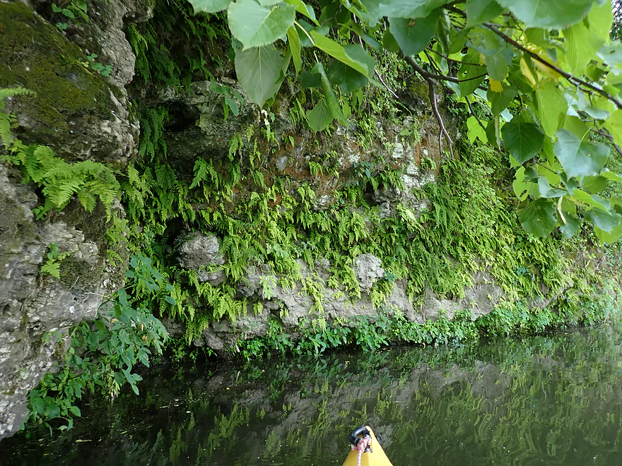
Fantastic ferns
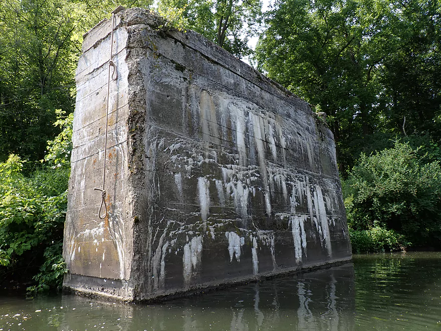
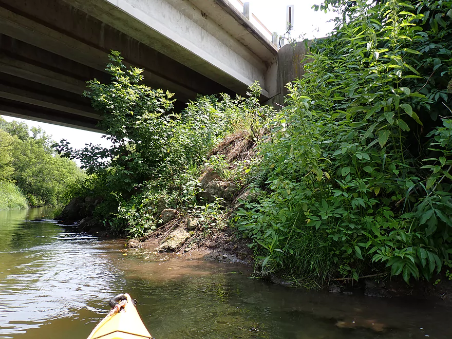
Old bridge pylon (with a climbing rope)
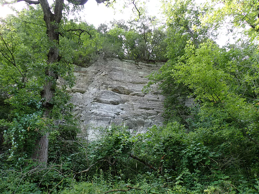
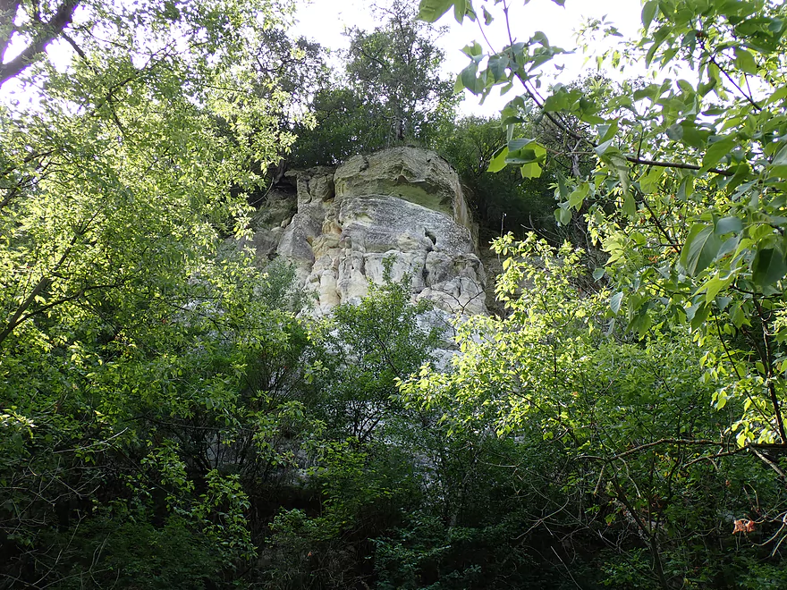
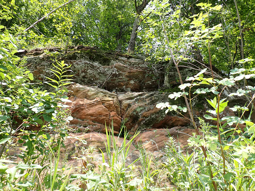
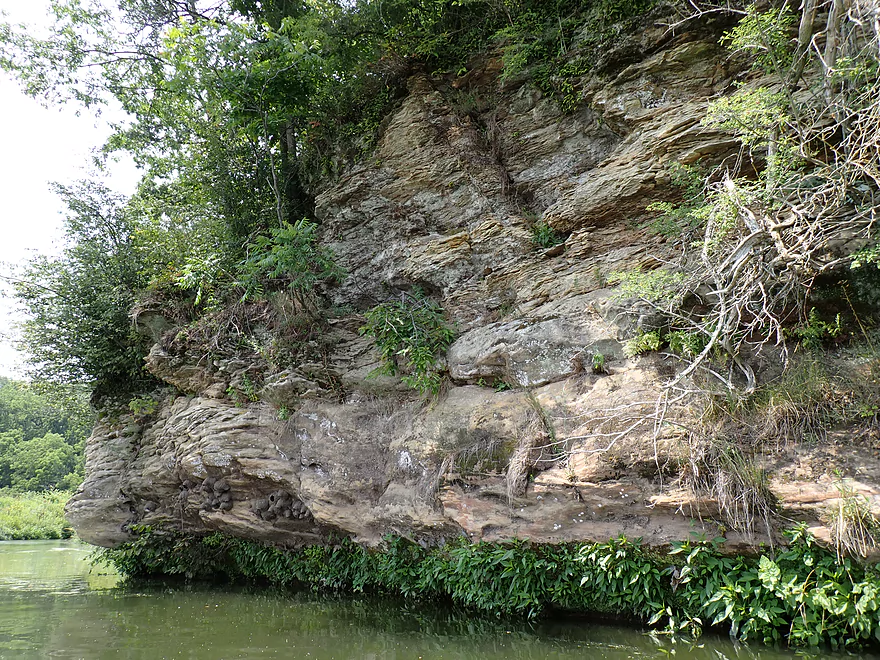
Some of the biggest outcrops of the trip were partly hidden by vegetation
Nice little boulder garden
Sandstone with pines reminded me of the Kickapoo
Tartarian honeysuckle–invasive and poisonous
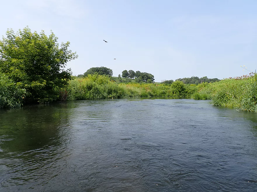
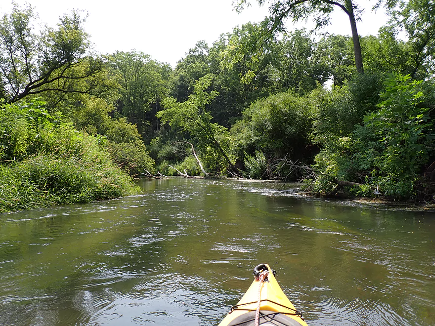
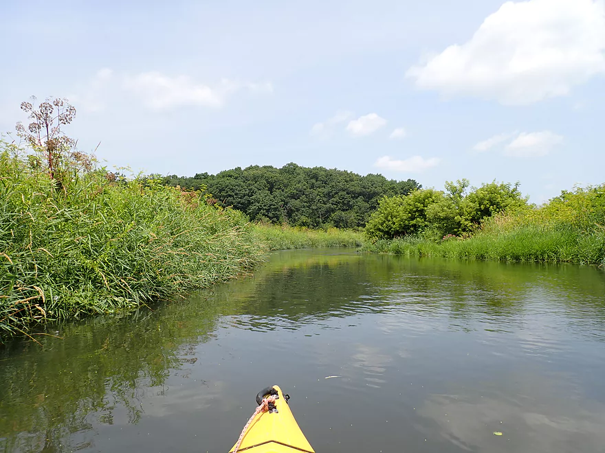
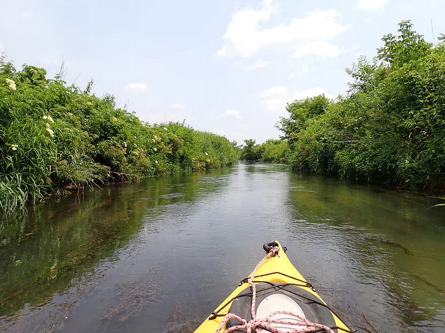
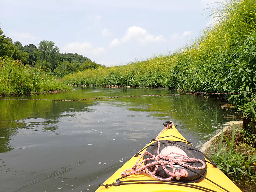
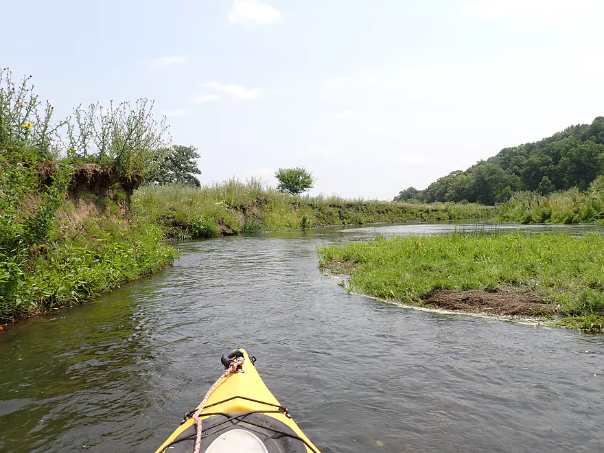
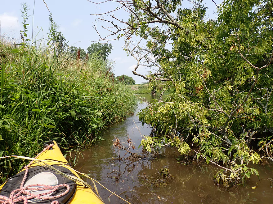
Entering an open stretch
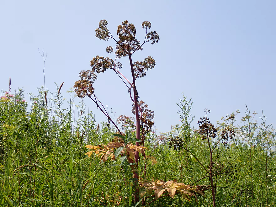
Banks had exotic plants like Angelica
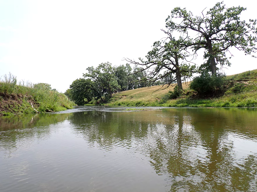
Returning to another bluff
More outcrops
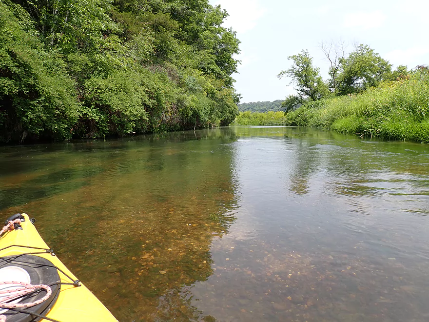
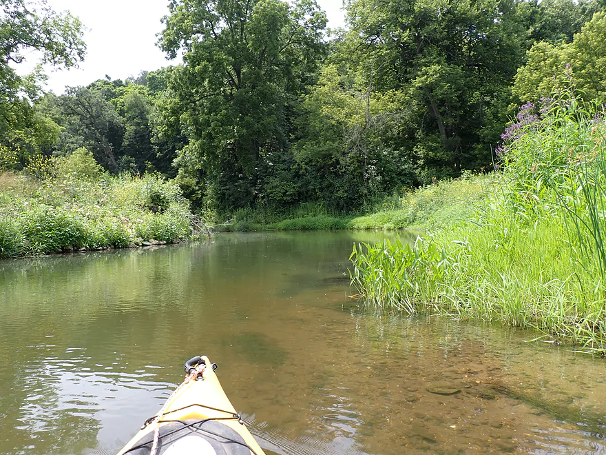
Nice gravel bottom
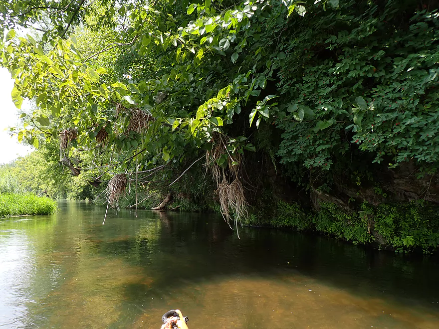
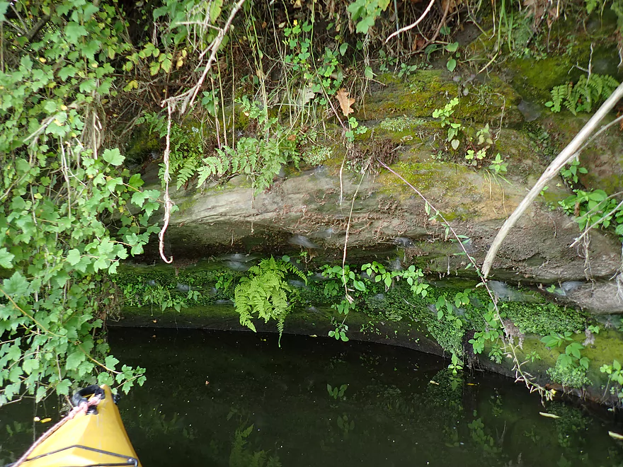
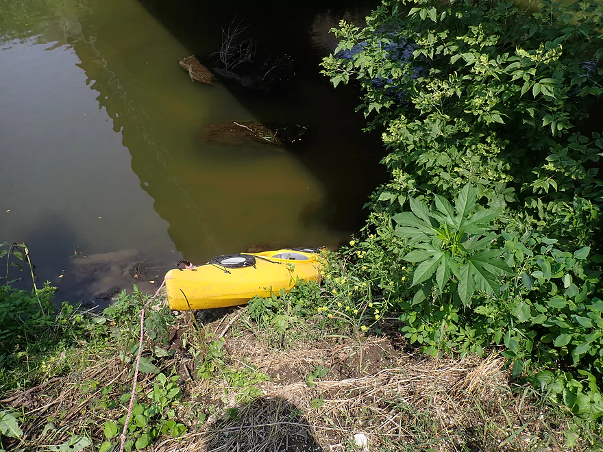
Shady overhang
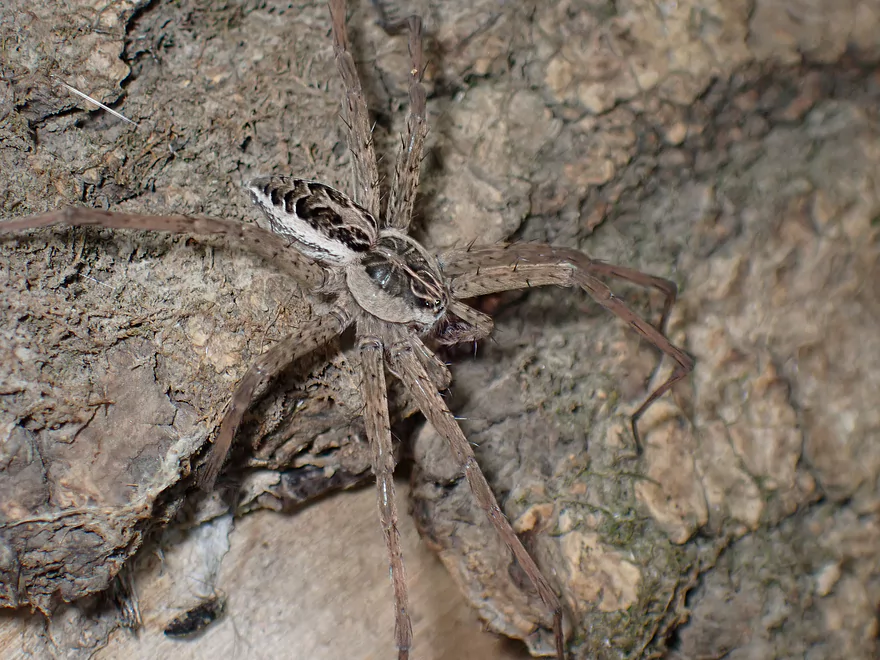
A large fishing spider
Tree growing around a boulder
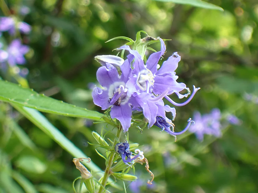
Tall bellflower
Lots of little spider webs along this ledge
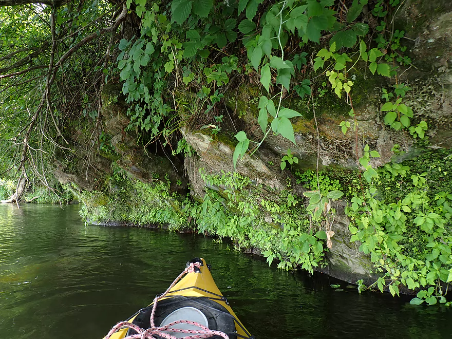
One of my favorite outcrops of the trip
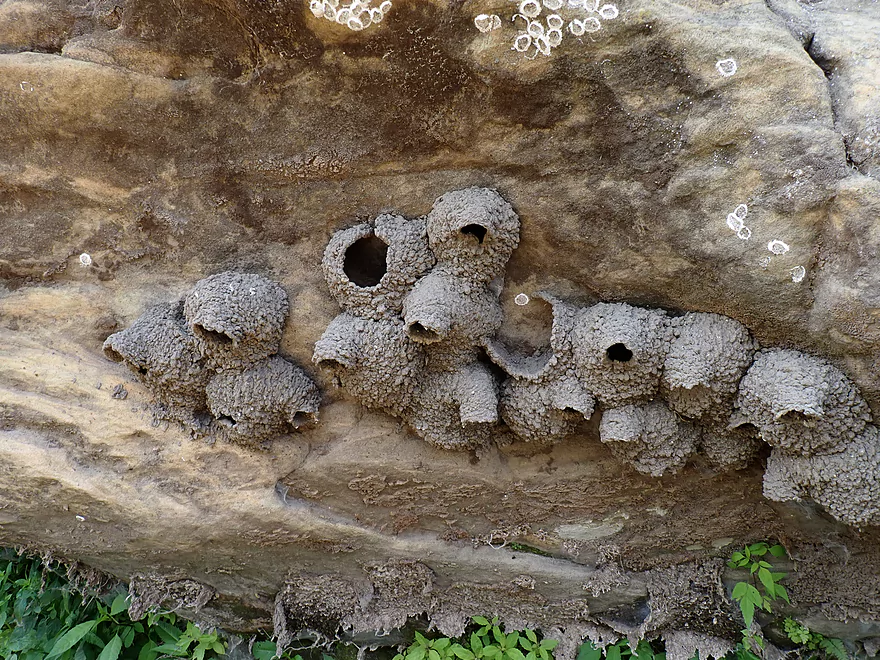
Gravity defying cliff swallow nests
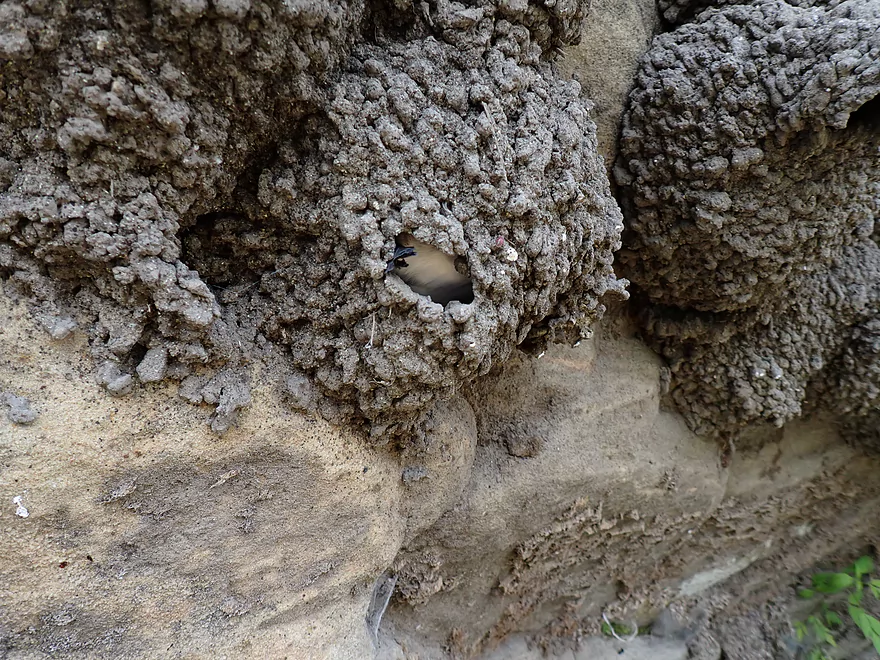
This one had wriggling feet sticking out
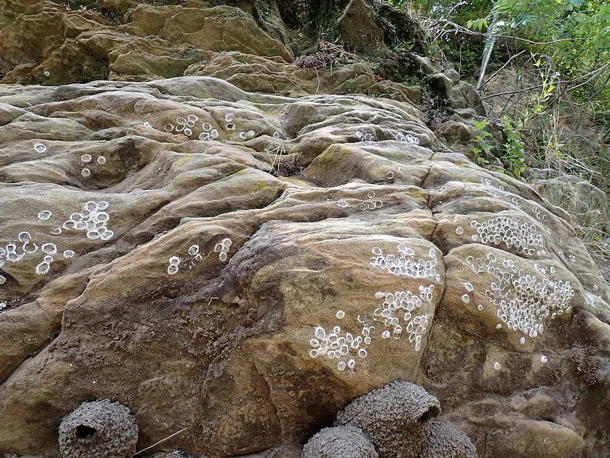
Dobsonfly egg cases on sandstone
Reverse view
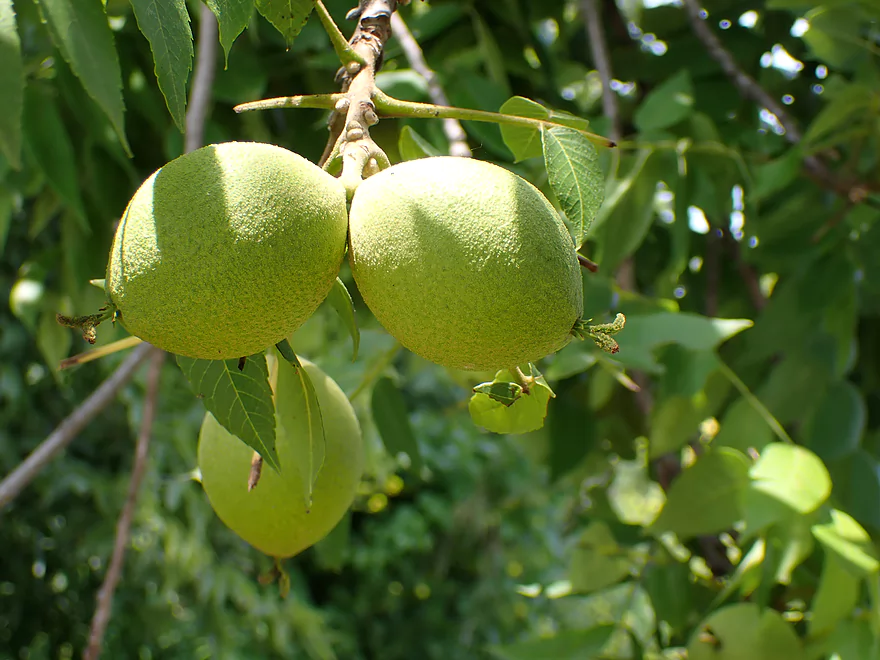
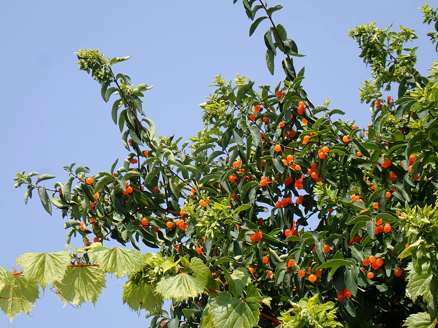
These green walnuts had a nice citrus smell
Looking up Furnace Creek, a Mineral Point Branch tributary
Back on the Mineral Point
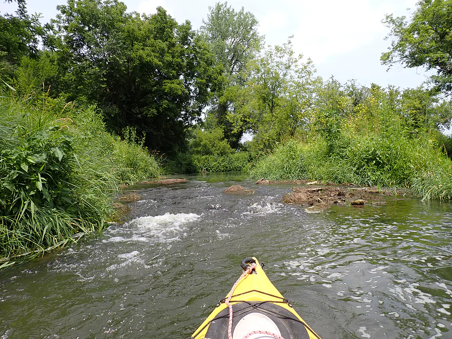
Only “rapids” of the trip
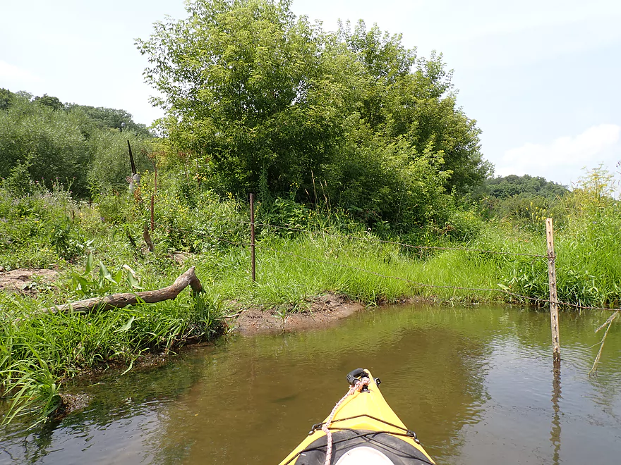
Barbed wire fence…I was able to duck under easily
You could portage/limbo via the adjacent sandbar too
Entering cattle country
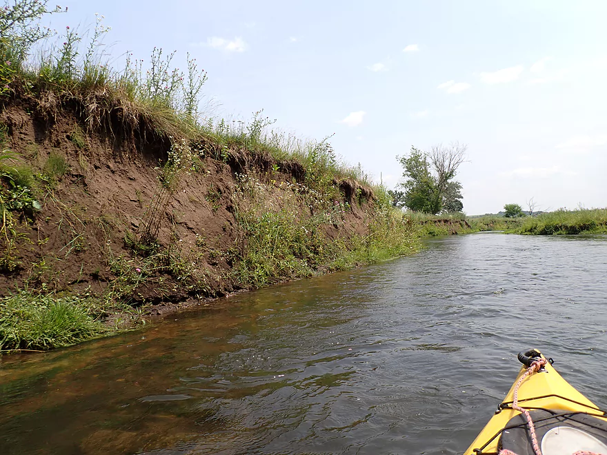
Small mud banks here translate into huge mud banks many miles downstream
Second to last outcrop of the trip
More exposed banks
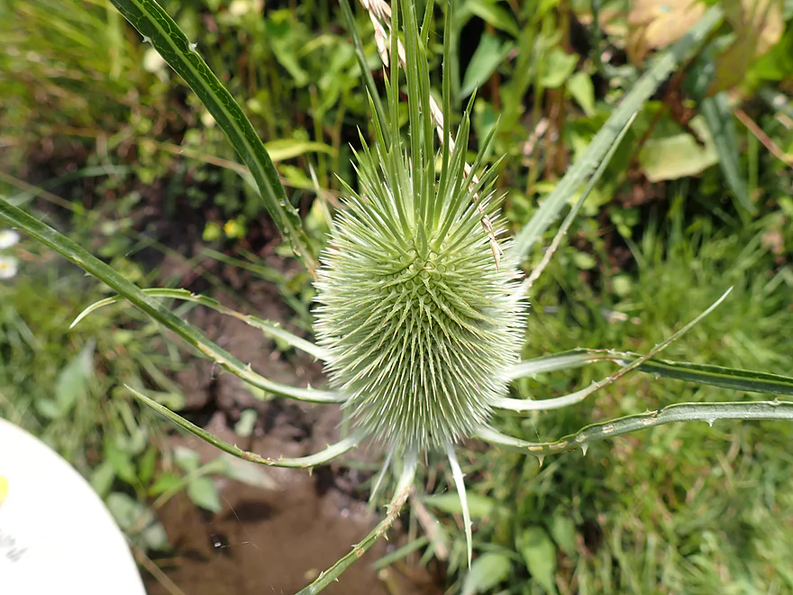
A teasel head
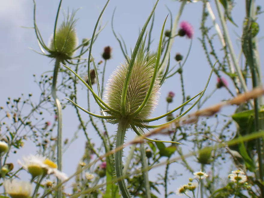
Very photogenic
Last outcrop of the trip
Second fence…I was able to hop/duck under a middle stretch that sagged a bit
Leaving the bluffs behind
Before cleanup
After cleanup

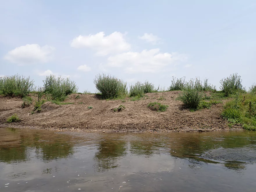
This area of the state is somewhat unique in having exposed “bald” hillsides
Final stretch
Steep take-out at Hwy O (1st bridge)
My kayak is almost vertical (that steep)
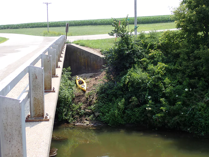
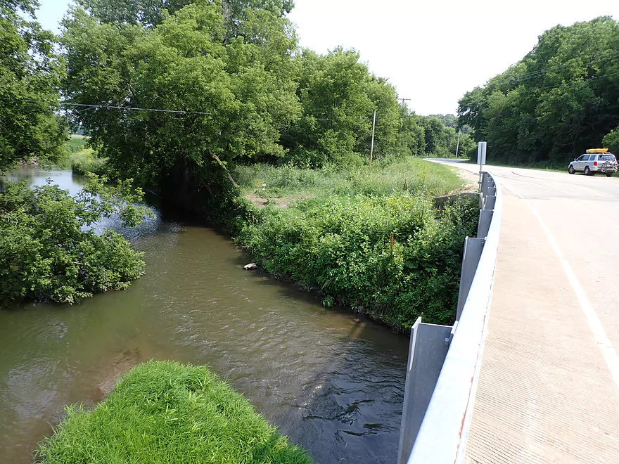
View from the bridge…getting over that concrete wing wall was the worst
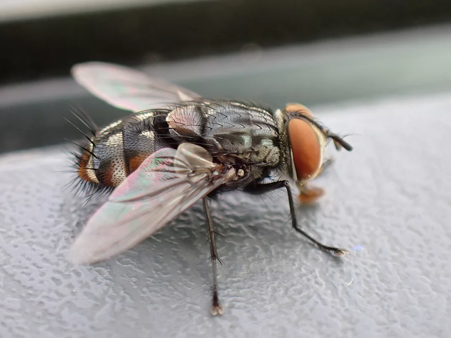
Can’t resit taking a macro fly picture at the take-out
View from the 1st Hwy O bridge
The second Cty O bridge (where the Mineral Point Branch merges with the main branch) is likely a better take-out
Pecatonica River – Mineral Point Branch – Oak Park Road

I started the trip at Oak Park Road where I was pleasantly surprised to discover a mowed path to the river which made launching easy. The area by the bridge was scenic with many cliff swallows and bare rolling hills.
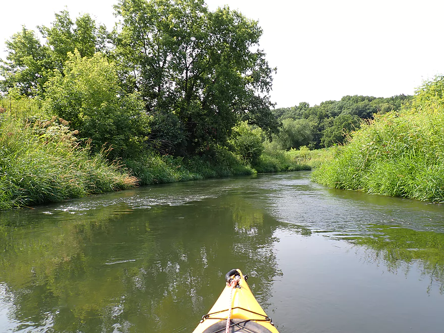
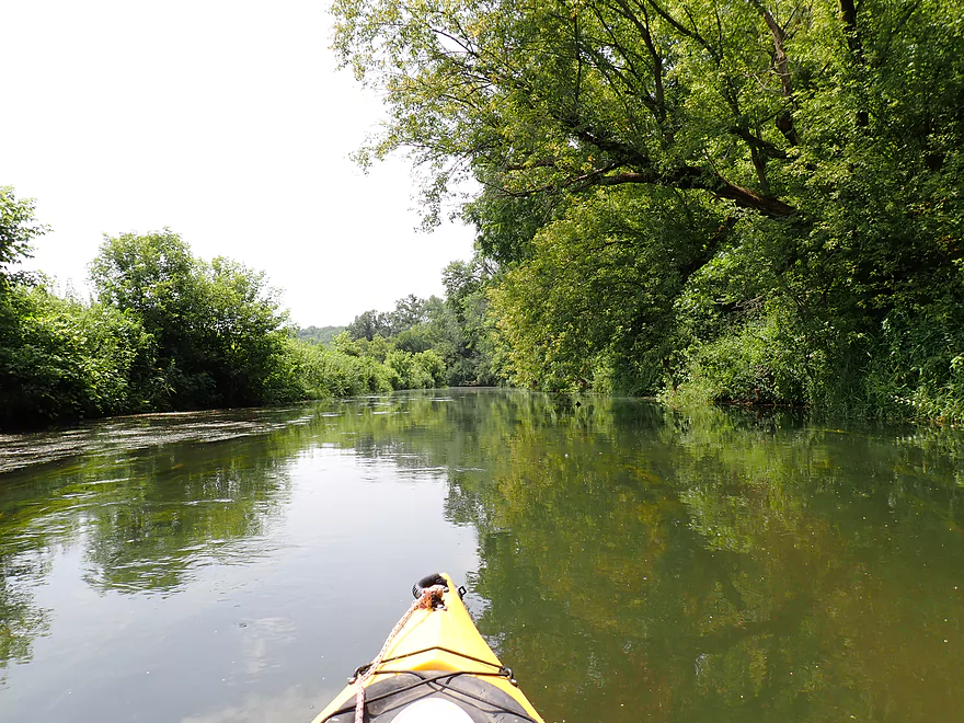
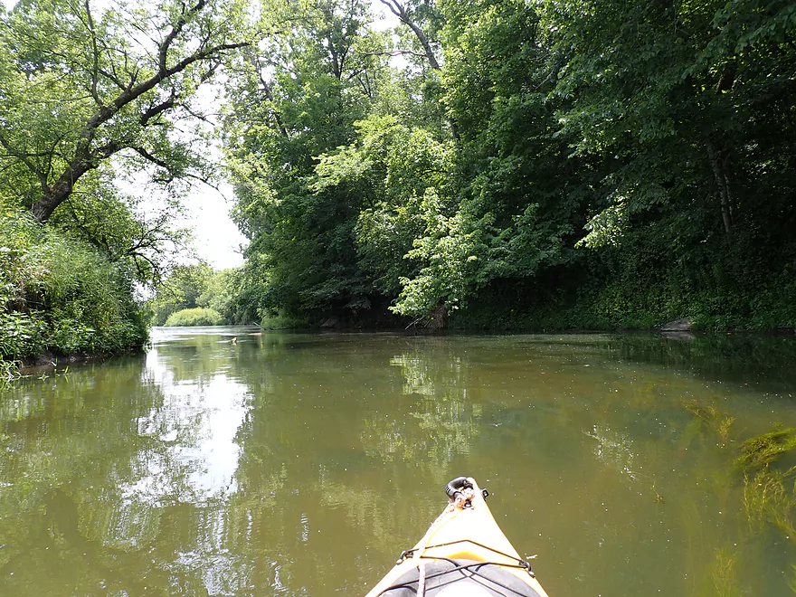
While overall this was a nice trip, the first mile wasn’t that great. The channel here was suspiciously straight and flanked by generic farm fields and weedy banks. The water was a bit turbid with a number of aquatic weeds lazily swaying in the current.
It was remarkable how much different this trip on the Mineral Point Branch (hereafter referred to as the MPB) was compared to my 2018 trip which was much faster, shallower, rockier, and filled with rapids. I suspect the infusion of the Sudan Branch (which roughly doubles the MPB) really changed the river.
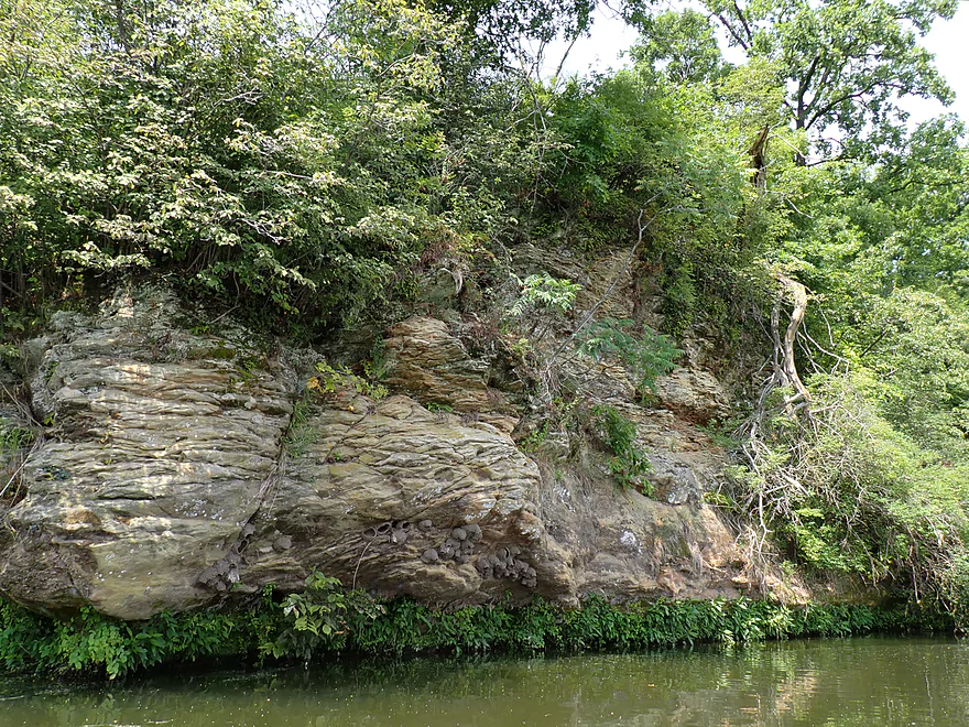
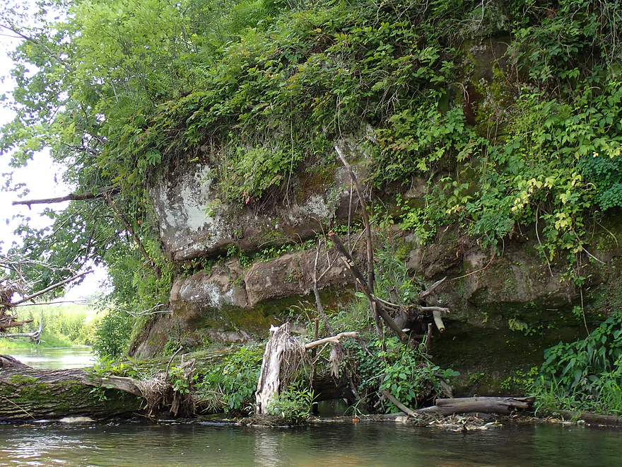
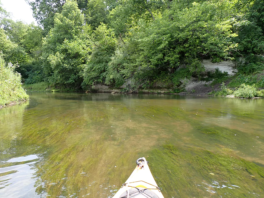
After flowing southeast, the MPB is redirected due east by a large bluff complex. At its base were a number of impressive limestone and sandstone outcrops. The limestone walls tended not to be as big but had exotic textures and ferns growing on them which was really cool. Some of the sandstone outcrops were surprisingly big, but unfortunately were largely obscured by vegetation and leaves. Had I known this would be such an issue I would have saved this trip for a leafless month.
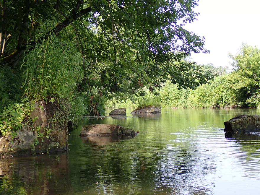
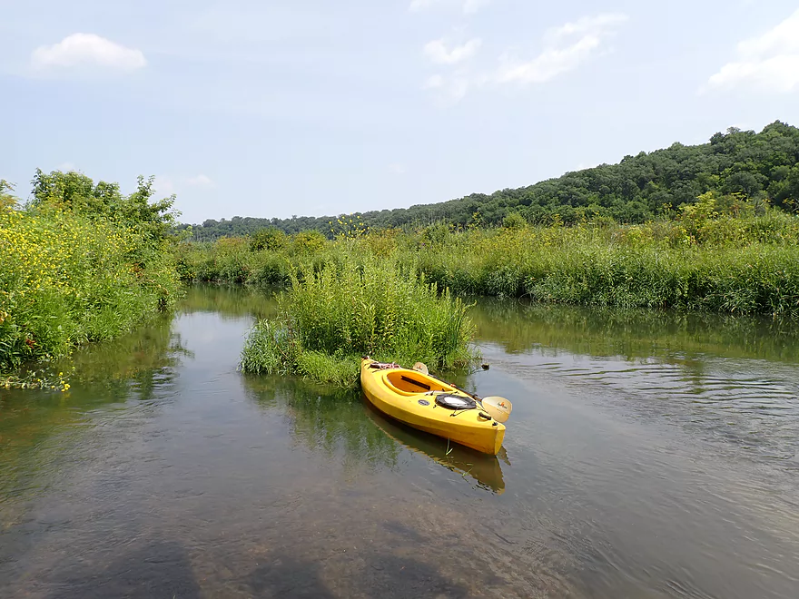
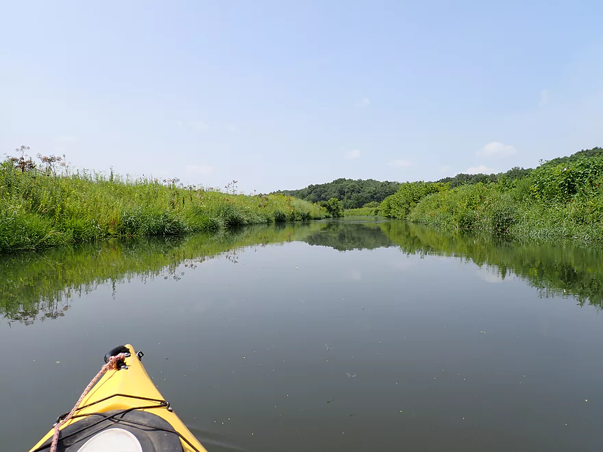
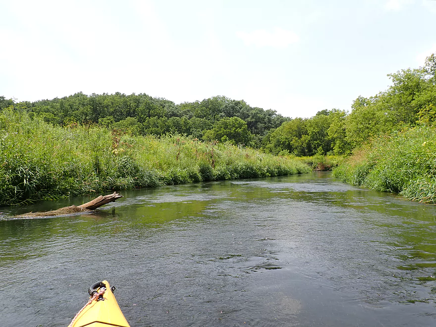
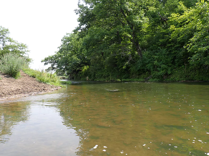
The river then moves away from the bluffs into an open stretch I really liked. Here there was a nice gravel bottom and the water clarity improved significantly. The banks were filled with exotic plants, thistles, and were swarming with insects and songbirds. In the distance were fantastic Driftless hills.
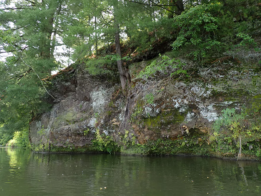
For the second half of the trip the river flowed south along a huge east-facing bluff. It was a remarkable contrast between the two shorelines. The eastern shore was open with farm fields, while the western shore was hilly, wooded, and contained a decent number of cool outcrops.
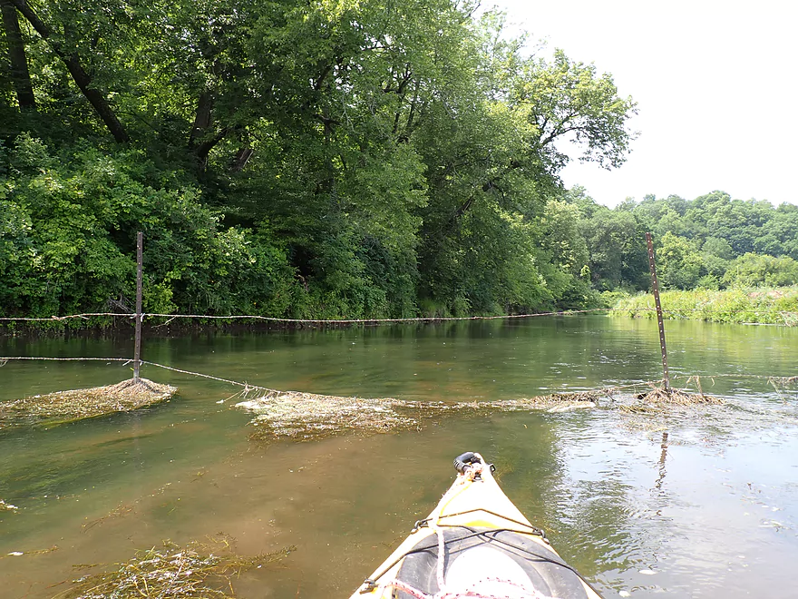
While I never had to face any logjams on this trip, I did encounter a pair of barbed wire fences after Furnace Creek. The first was super easy to get past. There was a single strand on the east side that sagged…I just ducked a bit and raised it over my head (with about 2′ of water clearance) and snuck under. Maybe this is more difficult in high water? But as a backup plan, there is an adjacent sandbar which could offer a relatively easy portage/limbo combo.
The second fence soon followed…this one was trickier. It was double-stranded, with the bottom strand being low and somewhat taut. Thankfully in one spot, weeds had collected on the bottom wire which had sagged into the water naturally. This allowed me to scoot over without scratching my boat (too much). At the same time I was able to raise the high wire above my head to get past with little difficulty. Again this too might be tougher in high water. The river is shallow here, so you could simply get out, lead your boat through and then duck/hop over yourself. All of this is documented in my video, pictures, and map so you can determine for yourself if you think this is a big deal or not. It wasn’t for me.
With fences come cattle, and while I didn’t see many I could hear them mooing incessantly for the last mile of the trip. Unfortunately these cattle have free reign of the river which has left the shoreline heavily degraded (part of the reason the mud banks on the lower Pecatonica are so large). I don’t think these are dairy cows, but rather beef steers which are popular in the area.
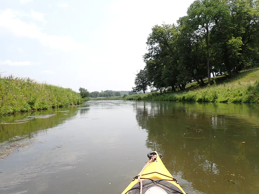
The final half mile was quite open with some impressive treeless, rolling hills. Very few hills in Wisconsin are “bald”, but here it is common and cool looking. Occasionally these are dotted with oaks and are called oak savannas. The grasses on the hills were really hurting from the drought (as well as the open grazing) which was turning the hills brown (unusual for July).
I ended the trip at Hwy O by Rock Road which was a very steep take-out. In fact difficult enough, that I wonder in hindsight if I should have continued another mile+ to the next bridge by the Mineral Point/Main Branch confluence. I had considered this beforehand, but I was worried about logjams in the last mile and I knew my bike shuttle wasn’t going to be a cakewalk, so I didn’t want to make it any longer than necessary.
In summary this was a very nice trip, and I consider the Mineral Point Branch a hidden gem for SW Wisconsin. The lack of logjams, combined with the outcrops, the pseudo-prairies, and the open hillsides made this trip special. The only downsides were the two fences and the unpleasant take-out, but I didn’t consider them deal-breakers.
Sights included flopping fish (some carp), lots of damselflies, some dragonflies, what looked like an otter, and cattle. The highlight was the huge flocks of cliff swallows. Their gravity-defying mud nests could be seen under the bridges and on the cliff faces.
South Oak Park Road: This was an ok bridge access. Somebody mowed a nice path to the river NW of the bridge which was much appreciated. Note if you park here, don’t block access to the field which farmers may need to use.
Alternate Put-ins:
- North Oak Park Road (4.3 miles upstream from South Oak Park Road): N. Oak Park Road isn’t an ideal put-in as it’s next to a farm and fences, but a sign does mark it as part of a public easement, so you should be ok. This upstream leg I haven’t paddled, but it seems intriguing with open landscapes and perhaps a few outcrops. Cattle and cattle fences may be a hazard.
Hwy O 1st Bridge: There are two Hwy O bridges…this is the first one by Rock Road. This was a bad take-out. You can get out ok directly under the bridge/south side…but the bank after that is very steep. Rope and having a second person could help. For some the embankment here is too steep, and they may prefer to take out at the next bridge instead.
Alternate Take-outs:
- Hwy O 2nd Bridge (1.6 miles downstream from the 1st bridge): Located near the confluence, this is an access paddlers occasionally use for downstream trips. There is a worn area southeast of the bridge where people access the river. It’s not an ideal access with some mud/weeds and a small ledge…but it is much easier than the first Hwy O bridge. However if you continue to the second bridge, be advised the last leg of the Mineral Point Branch may have some snags and portage necessitating logjams.
- Hwy G/Calamine (7.6 miles downstream from the 1st Bridge): This is a pleasant but slow stretch of the Pecatonica. There are a few outcrops, but also a few logjams some of which can be challenging to portage.
Bike Shuttle – Hwy O 1st Bridge to South Oak Park Road: 4.0 miles with 246′ of ascent. Note, while the Pecatonica State Trail is nearby, you can’t really use it for this trip. I considered this a difficult shuttle route despite its “short” 4-mile length because of the steep hills and strong wind. With Driftless bike shuttles you’re often up at a higher elevation and there are rarely trees along the road providing cover, so sometimes the wind can be just as bad as the hills (and those can be pretty bad). It’s shuttles like this which have me thinking about getting an e-bike or e-scooter…
Current: The current was medium…it lacked serious rapids and strong current, but the river moved at a consistent pace and featured a few riffles.
Logjams: There are no logjams on this stretch.
Shallow Water: I don’t think this stretch of the MPB ever gets too low to run.
Fences:
- Fence #1: See trip map for exact location. The left side sags and only has a single strand. I was able to lift the barbed wire about 2′ above the water and easily over my head/boat. There is an adjacent sandbar if paddlers wanted to do a short portage/limbo from shore instead. I did not consider this a difficult fence, but it could be a bit more problematic in high water.
- Fence #2: See trip map for exact location. This is a double stranded barbed wire fence. The lower strand is somewhat taunt but does sag in one section. Weeds collect on the bottom wire and you can kind scooch over it while pushing the second strand over your head. This was trickier than the first fence, but I didn’t find it overly difficult. If this trip were done in high water though it could be more trying. Portaging via the shore wouldn’t be easy because the fence continues on land. But it is shallow and you could wade/lead your boat under and then duck under yourself.
Strainers: None.
Cattle: In the last mile of the trip (past the first fence) cattle have free access to the river. While I never came close to one, I don’t think they would be much of a hazard. Cattle in these parts are mostly beef steers, which while not as gentle as cows, shouldn’t be a major problem. If you see a steer in the water, just keep your distance and wait for them to move. If they don’t, clap sharply at one of them and that should encourage it to move. Once one moves the rest usually follow suit. Always keep a lookout for bulls in cattle herds. These are VERY dangerous and should be carefully avoided.
Smoke: As most of you know Wisconsin has suffered from a lot of smoke this summer (courtesy of Canadian wildfires that never seem to go out). This paddle was done during such a smoke-filled day, which might not be advisable for all. When smoke is thick it introduces small particulate matter into the air which can get into your lungs and bloodstream causing all sorts of problems. The Canadian smoke can get especially bad because it spends so much time in the atmosphere and actually breaks down into toxic benzene and formaldehyde, which I can sometimes smell. When this happens it might be a good idea to take a day off from paddling and stay indoors. You can get an air quality forecast from airnow.gov or windy.com. I also like the astrospheric.com forecasts which do a good job of showing where the smoke will be the most intense.
Closest Gauge: Pecatonica River @ Darlington
Trip Depth: 156 CFS or 2.83′
Navigability Estimates: The following are very rough estimates. Always use your own judgement.
- < 100 CFS: The river rarely gets this low, but even if it did it, this leg should still be navigable.
- 101-210 CFS: Ideal depth range. This should add a bit of clarity and add character to the river.
- 211-250 CFS: An average depth, fine for paddling.
- 251-290 CFS: A bit above average, but less ideal as things will be a bit muddier.
- 291-350 CFS: High water but still likely navigable.
- 351-600 CFS: Very high water. Maybe navigable but not ideal as the water quality may be bad and the current may be pushy in spots.
- 601+ CFS: River may be at flood stage at this point.
- Mill Creek Road to Ludden Lake Boat Ramp: 4.0 miles. Very small and will require high water. Fences might be an issue. Mostly open pasture with maybe 1-2 logjams. There are likely several scenic outcrops on this section.
- Ludden Lake Boat Ramp to N. Oak Park Road: 4.8 miles. A nice paddle through open pastures, rolling green hills, occasional outcrops and some light rapids.
- Ludden Lake Boat Ramp to Ludden Dam: 0.5 miles. Ludden Lake is popular kayaking lake that consists of a scenic rocky shore with occasional outcrops.
- Ludden Dam to Hwy 39: 0.7 miles. A fun section with maybe three Class 1 rapids and several sandstone outcrops. I am not 100% sure the land below the dam is public access, but the locals and fishermen use this all the time.
- Hwy 39 to N. Oak Park Road: 3.6 miles. A great stretch through an open valley with fast current, several larger outcrops and only one logjam.
- N. Oak Park Road to S. Oak Park Road: 4.3 miles. Mostly open and clear of logjams. Maybe one jam. Likely a couple of outcrops. A good prospect.
- S. Oak Park Road to Hwy O 1st Bridge: 4.7 miles. A good leg with many outcrops and no logjams.
- Hwy O 1st Bridge to Hwy O 2nd Bridge: 1.6 miles. There could be a few logjams. Likely no outcrops, but maybe one. Hwy O (2nd Bridge) marks the confluence with the main branch of the Pecatonica.
- For more paddling options on the main branch, see my Pecatonica River Overview Map.
Trip Map
Overview Map
Video
Photos Size: