
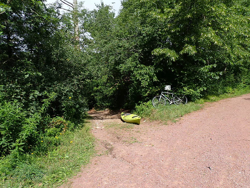
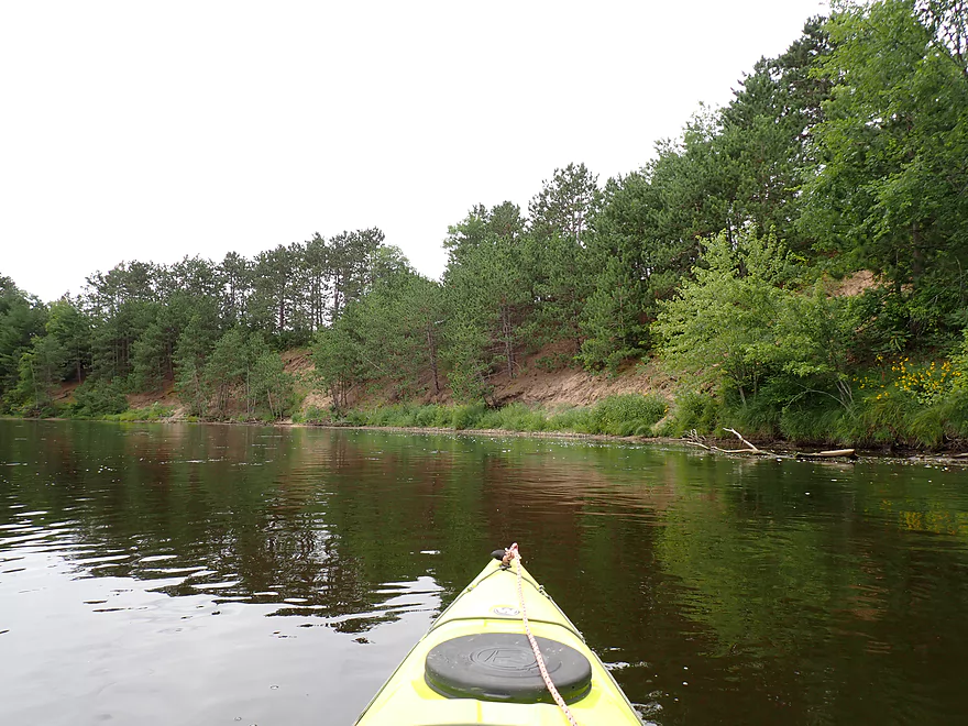
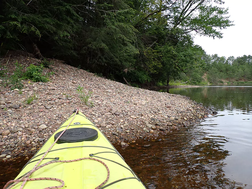
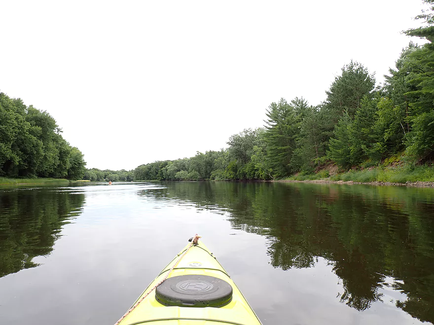
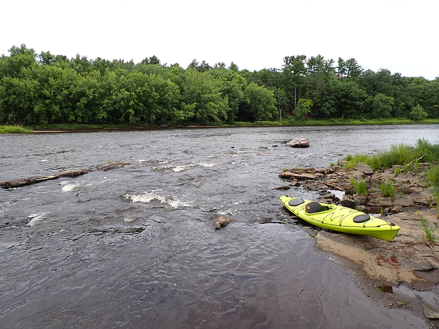
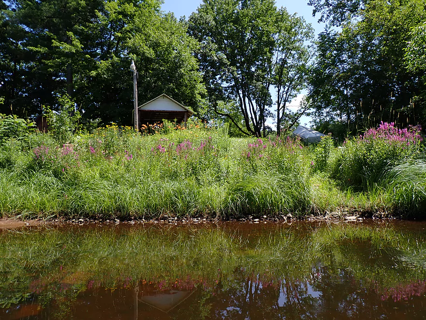
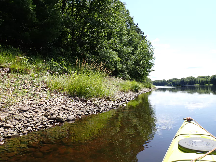
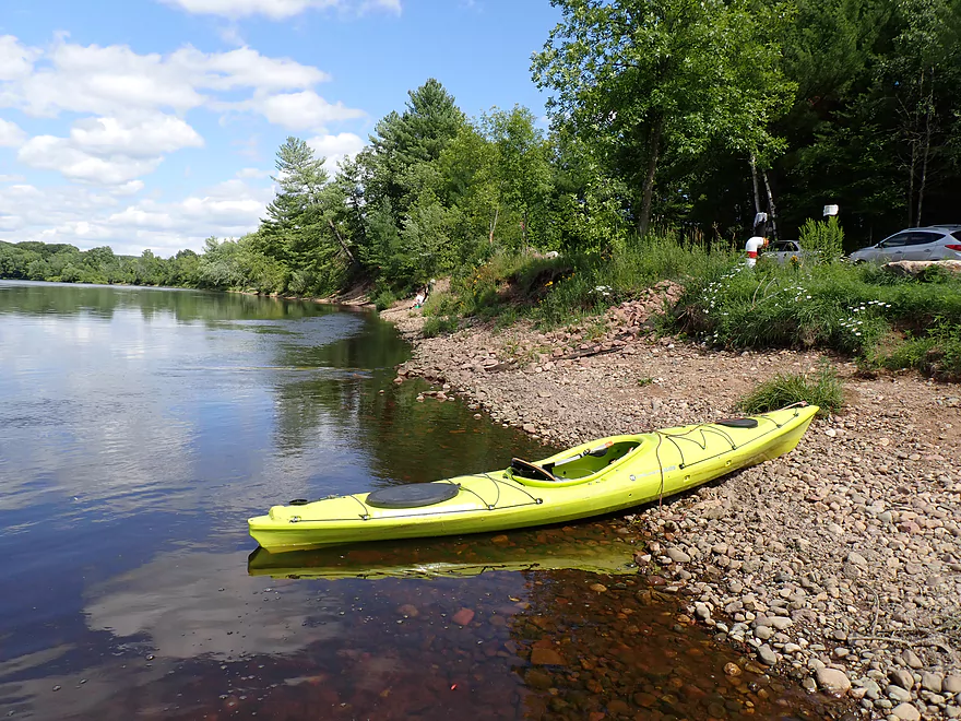
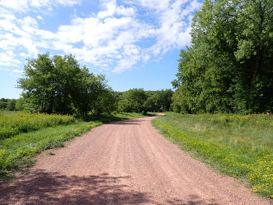
Starting the trip at a cool put-in off Pine Bluff Road
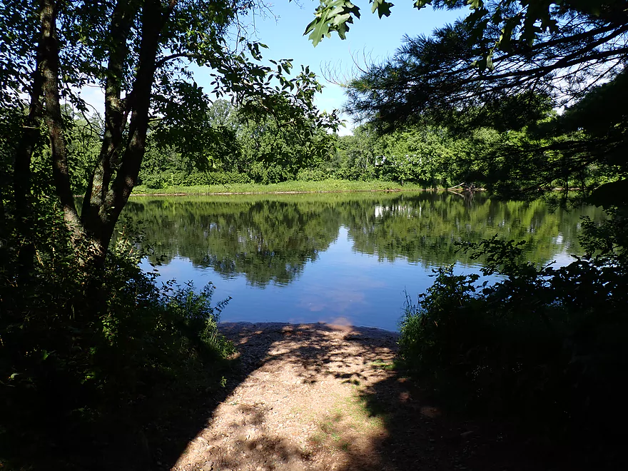
Attractive little trail leads to the river
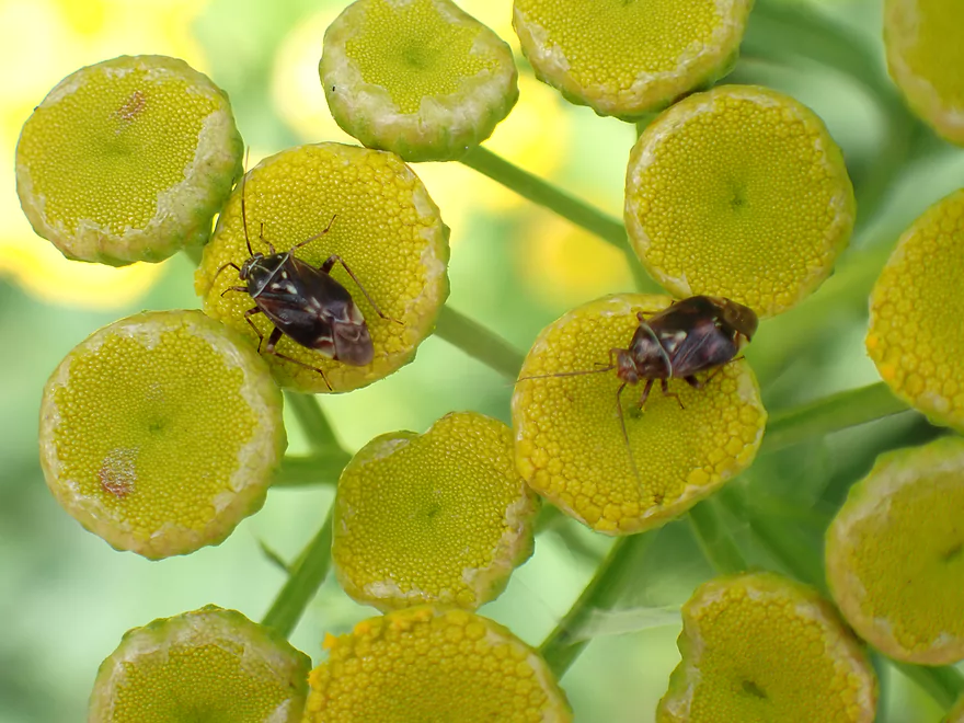
A couple of plant bugs on tansy flowers
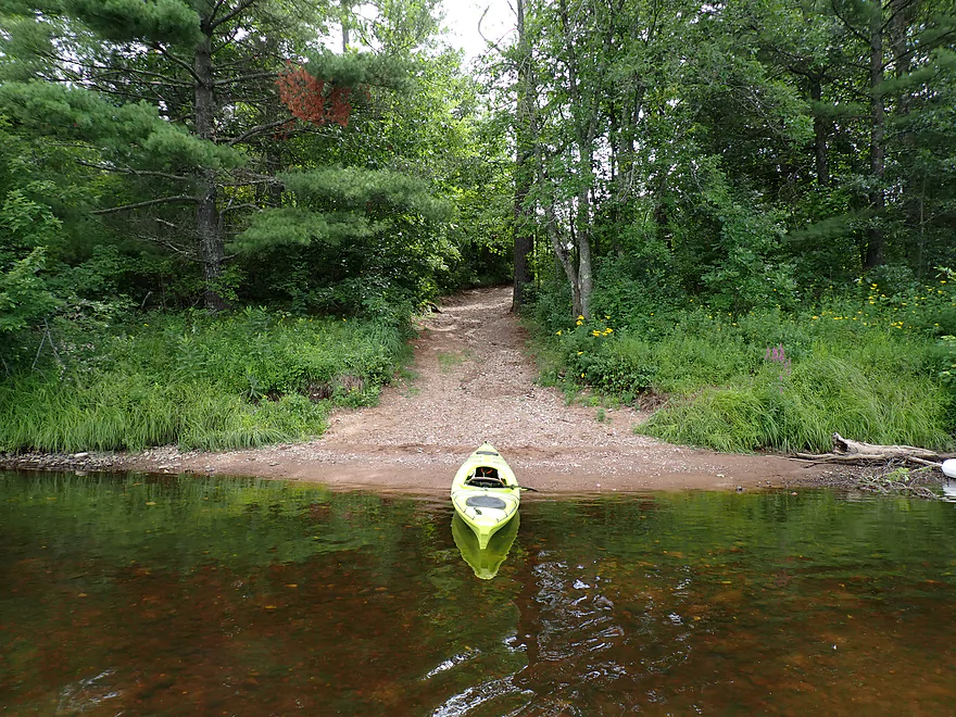
Reverse view of landing
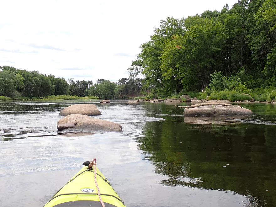
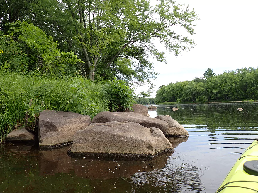
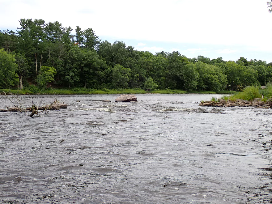
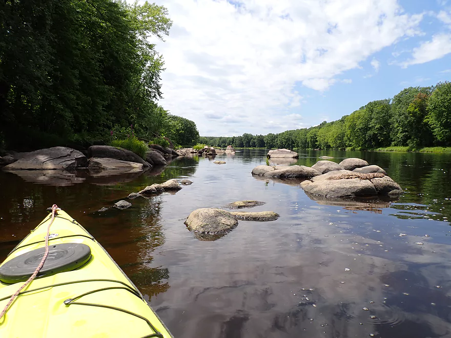
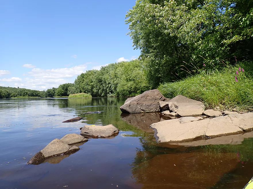
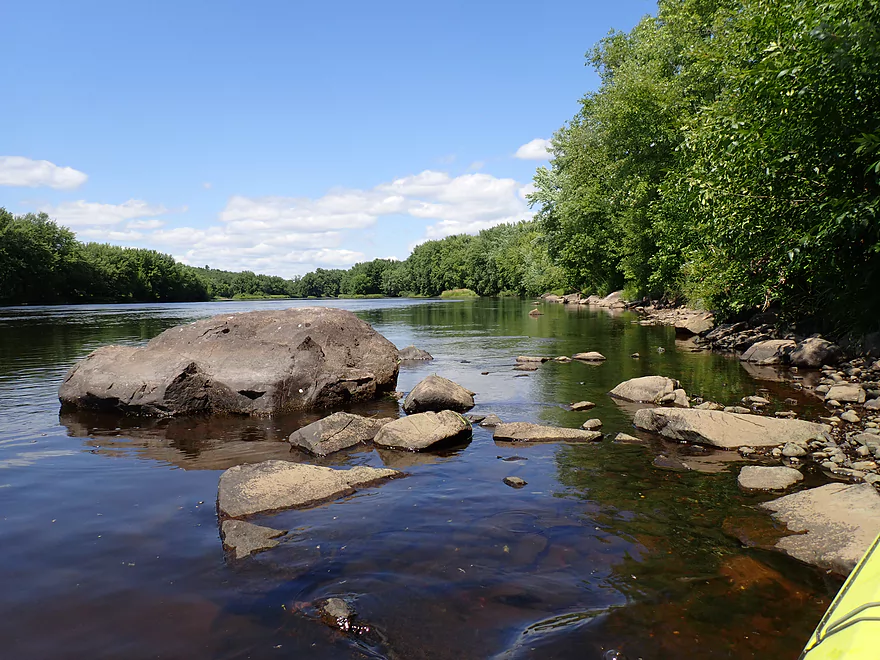
Right away, a nice boulder garden
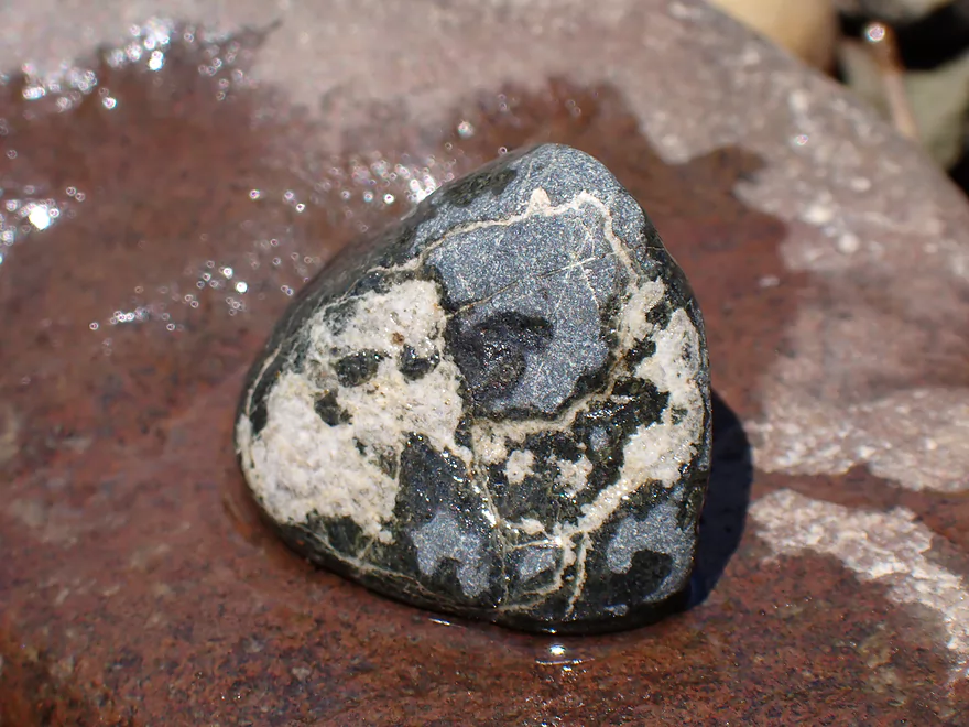
I’m sure that has an interesting geologic story
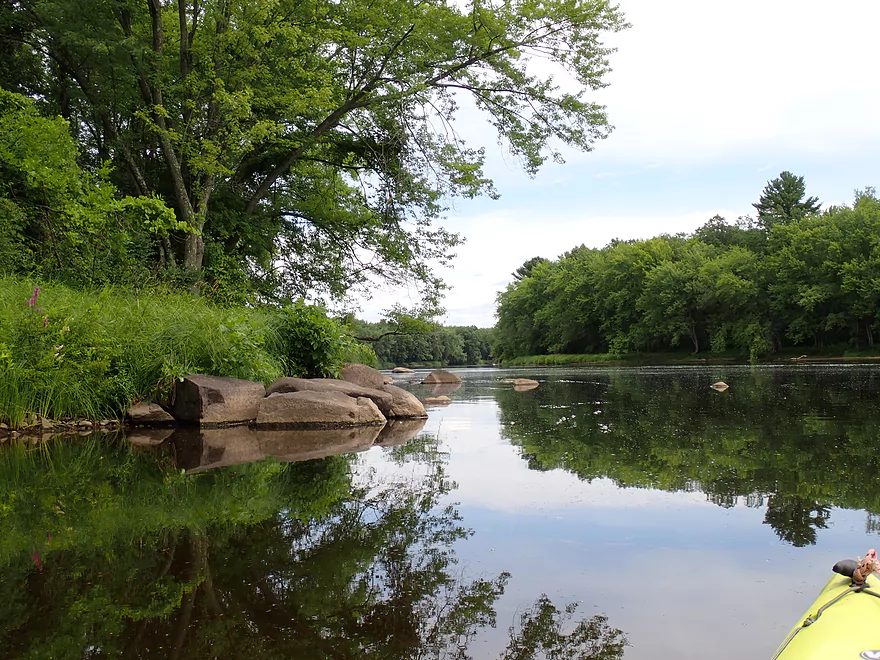
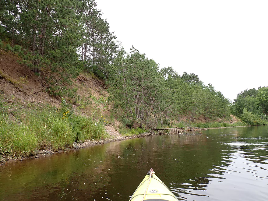
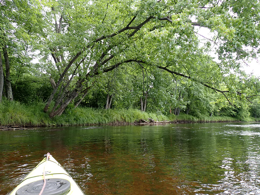
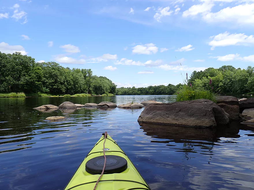
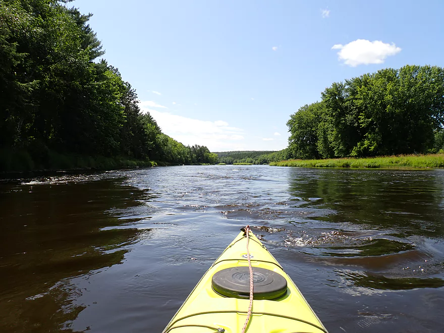
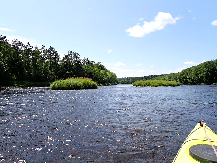
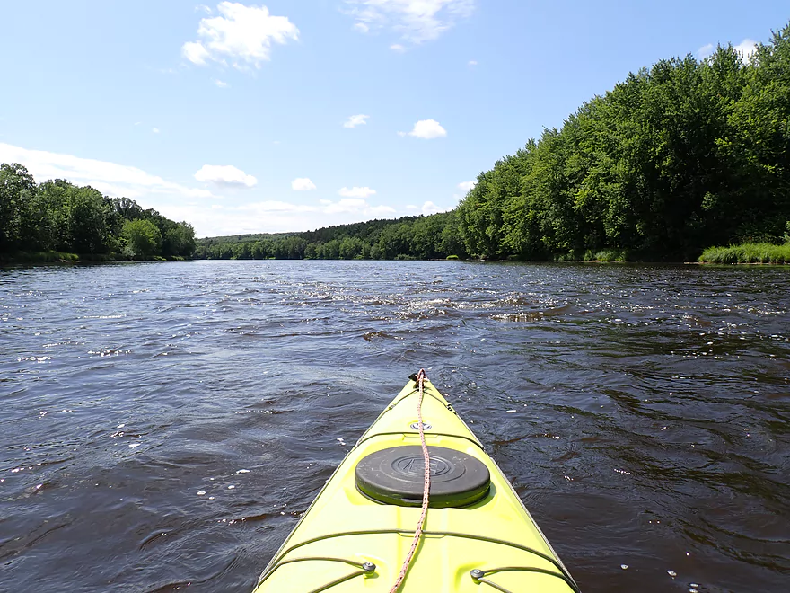
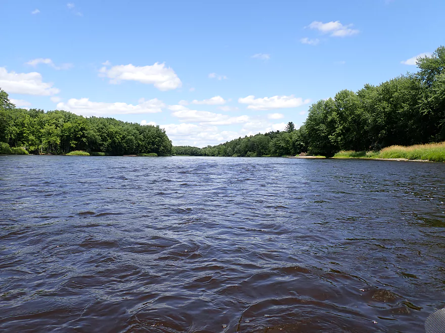
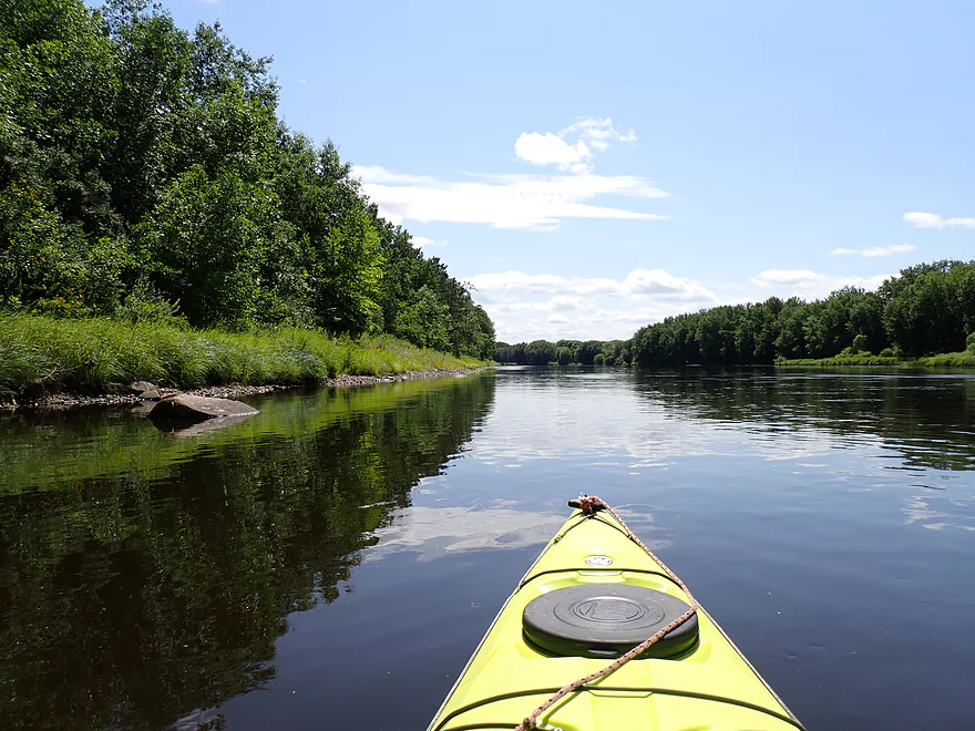
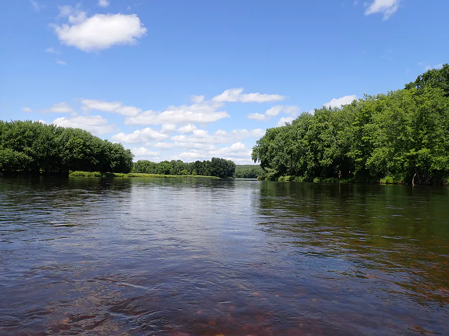
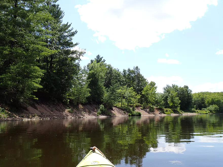
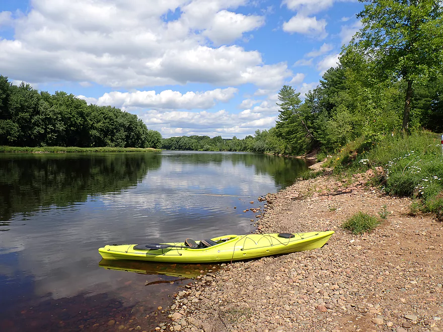
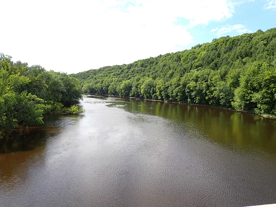
Scenic stretch of the river
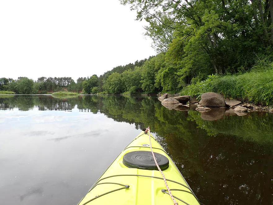
Reverse view
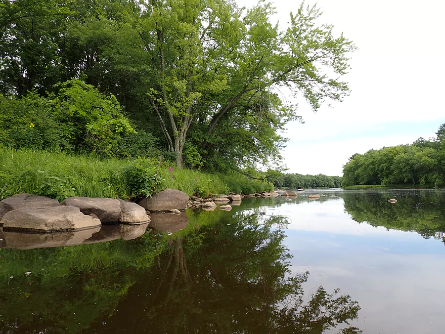
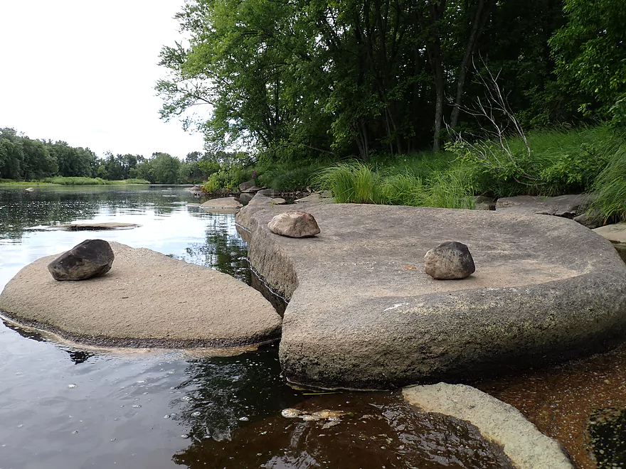
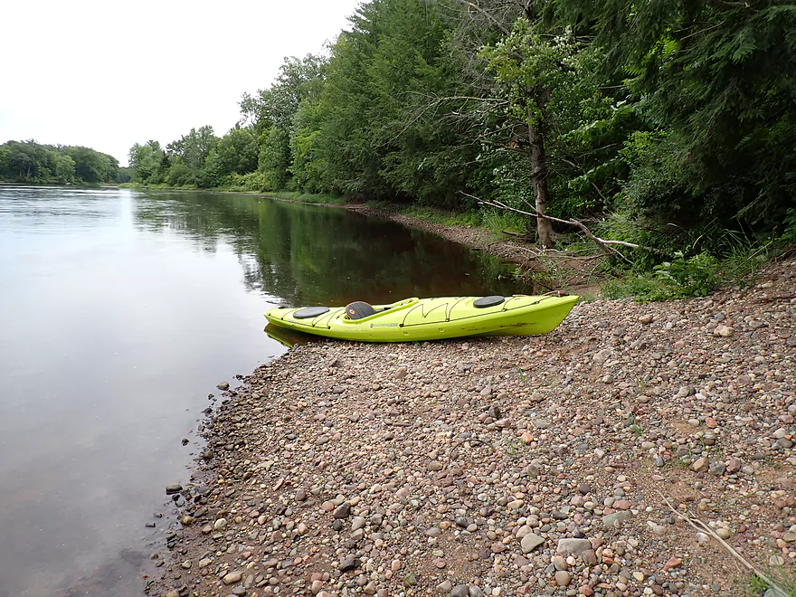
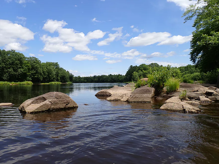
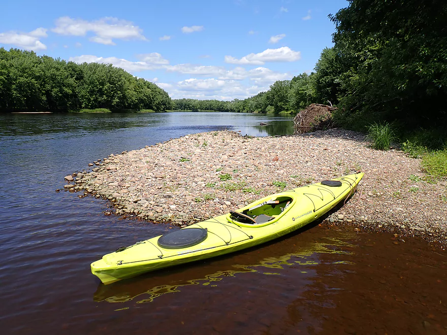
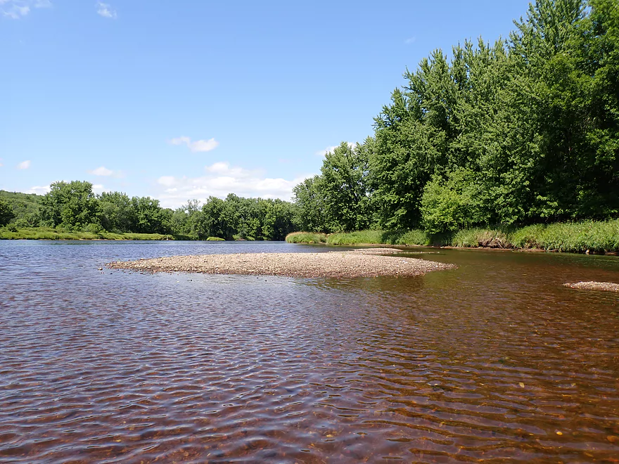
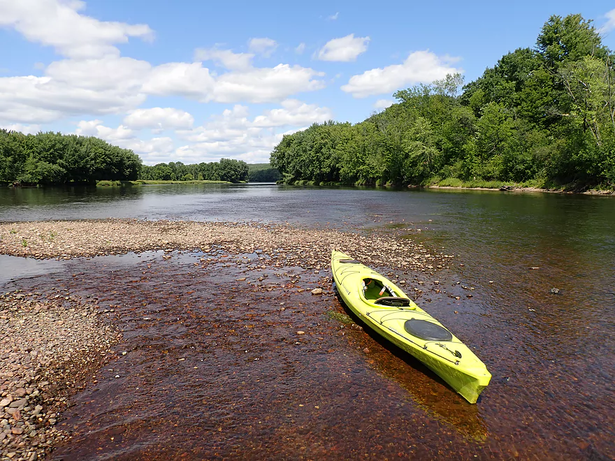
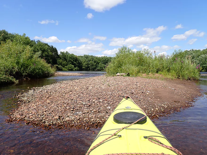
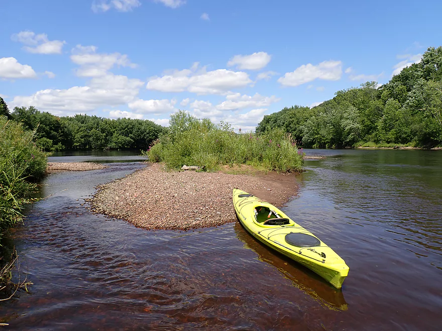
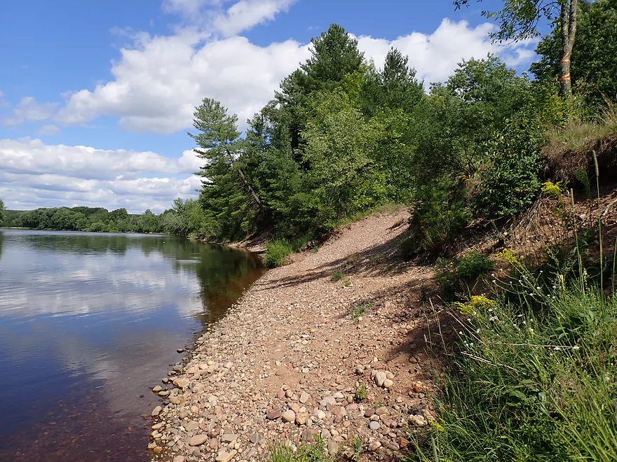
One of several nice gravel bars on the trip
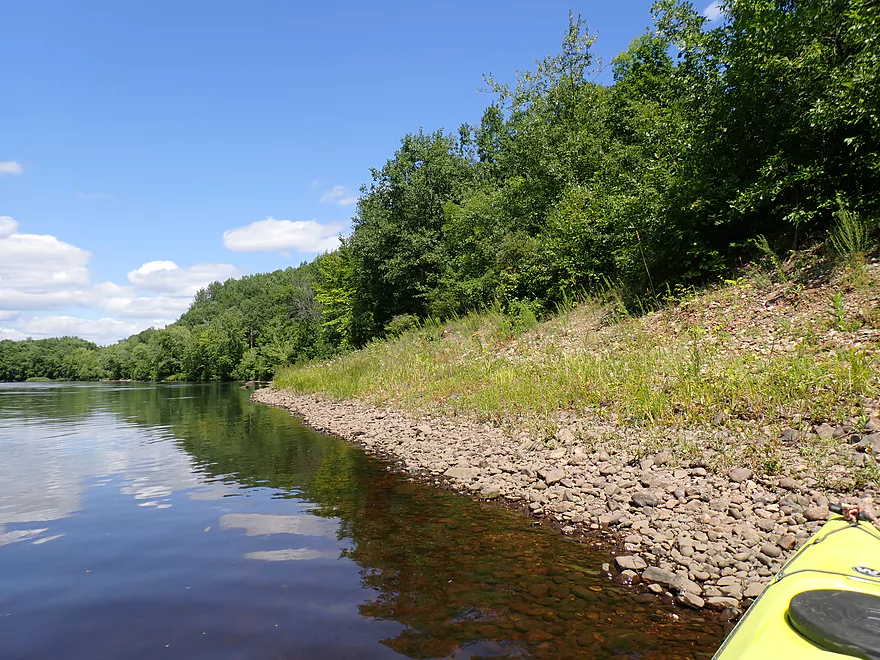
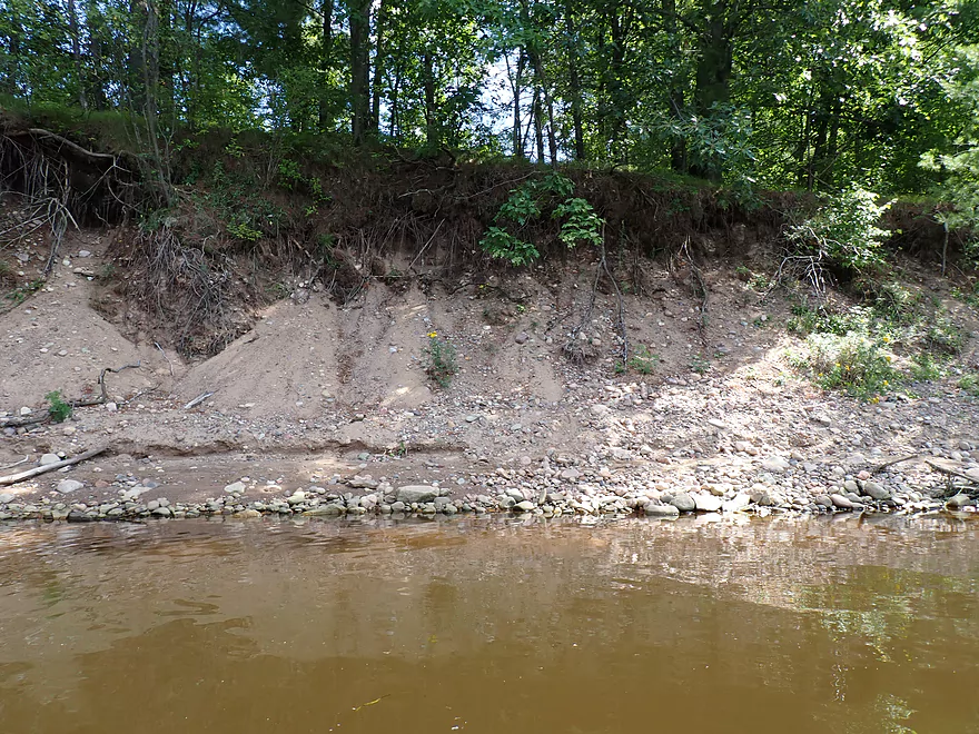
A sand bank on the western shore
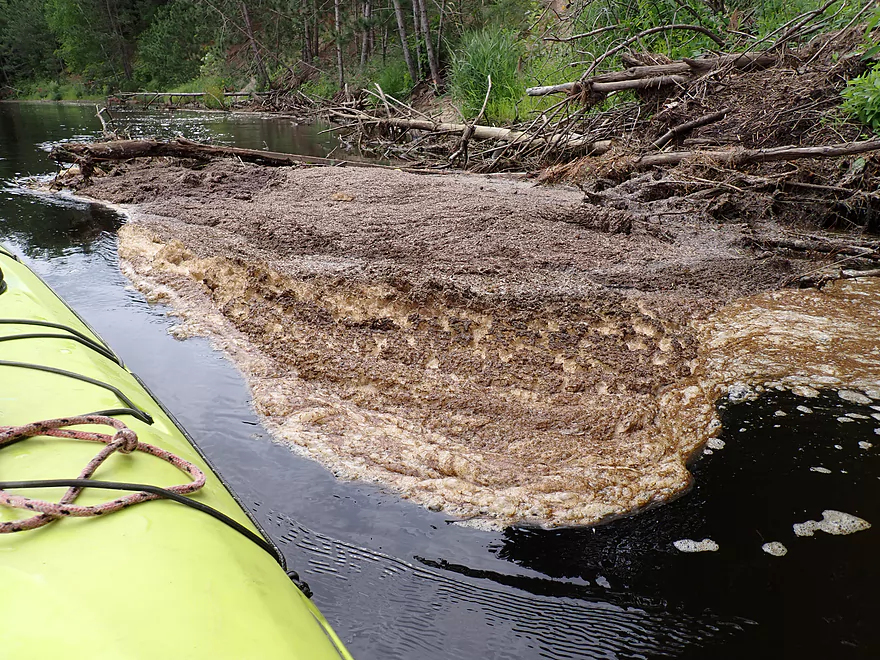
Odd scum appeared on the trip…it smelled awful
Close-up of the sand bank
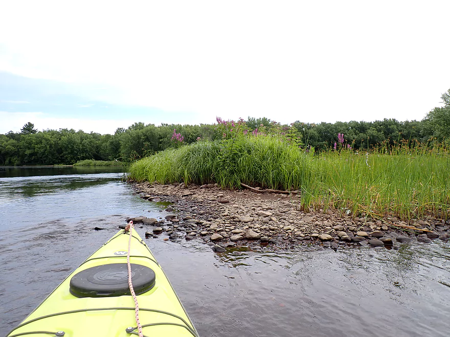
Interesting mound of gravel
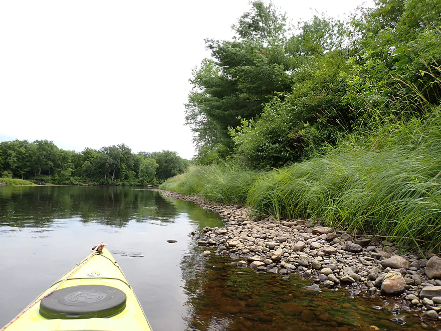
Tall bulrushes along the bank
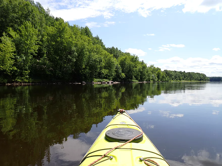
Poorly pictured, but I’m passing a kayaking on the left
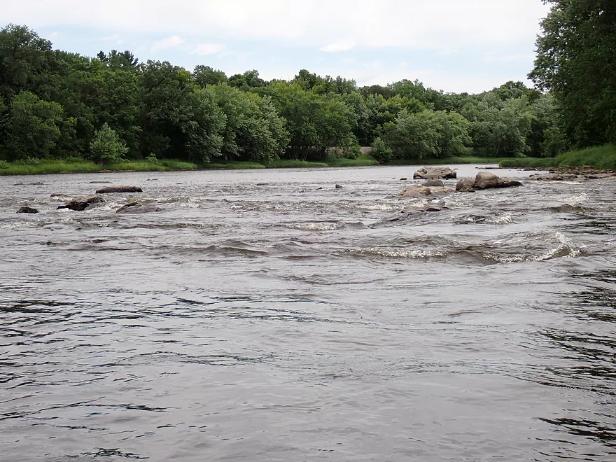
Approaching “Trappe Rapids” (Class 2)
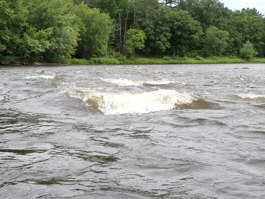
Middle channel had some decent standing waves
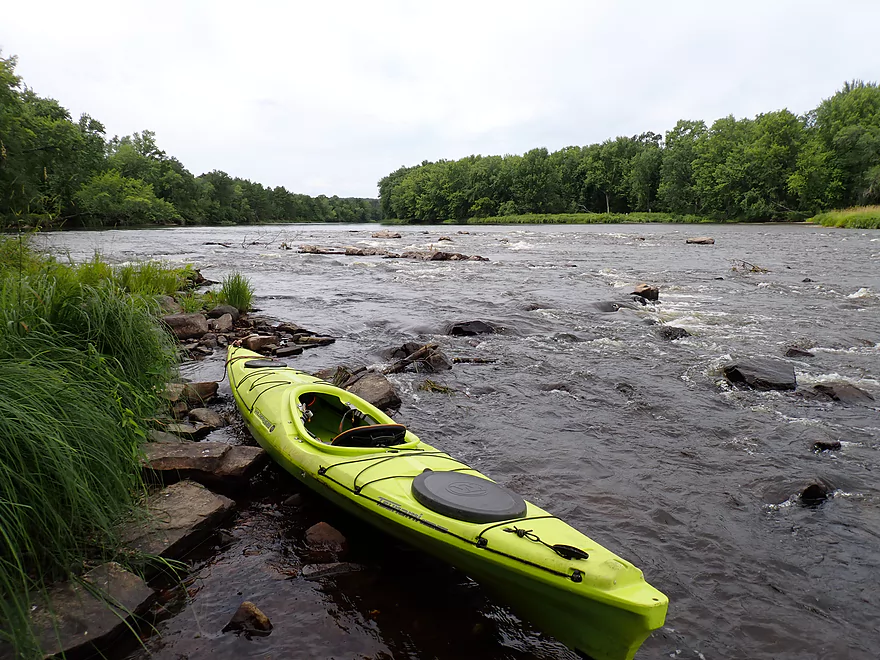
View from shore
Running the rapids again for video
There is a gap on the far right side through the boulder field
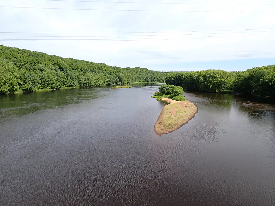
Mouth of the Trappe River (also an access option)
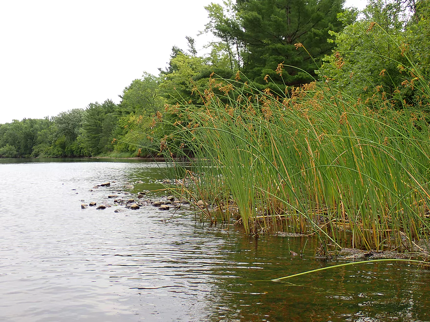
All those tall, flowing plants are sedges
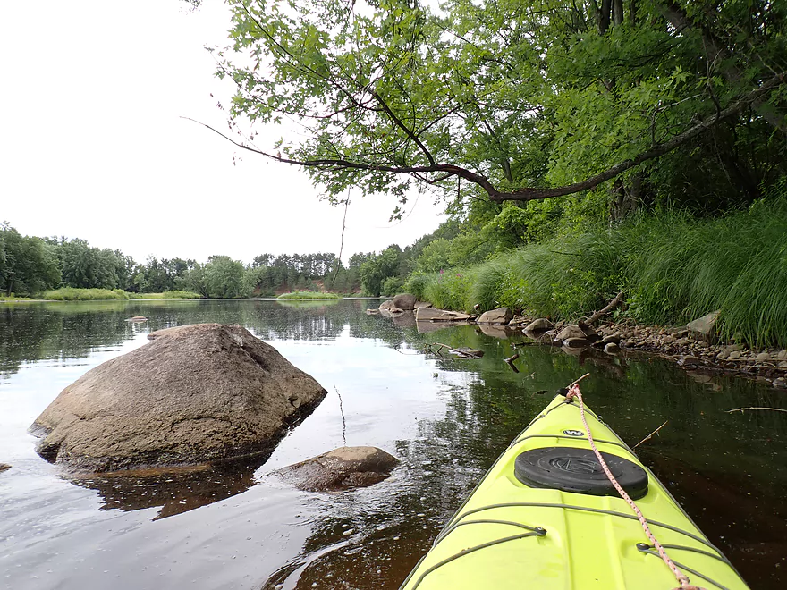
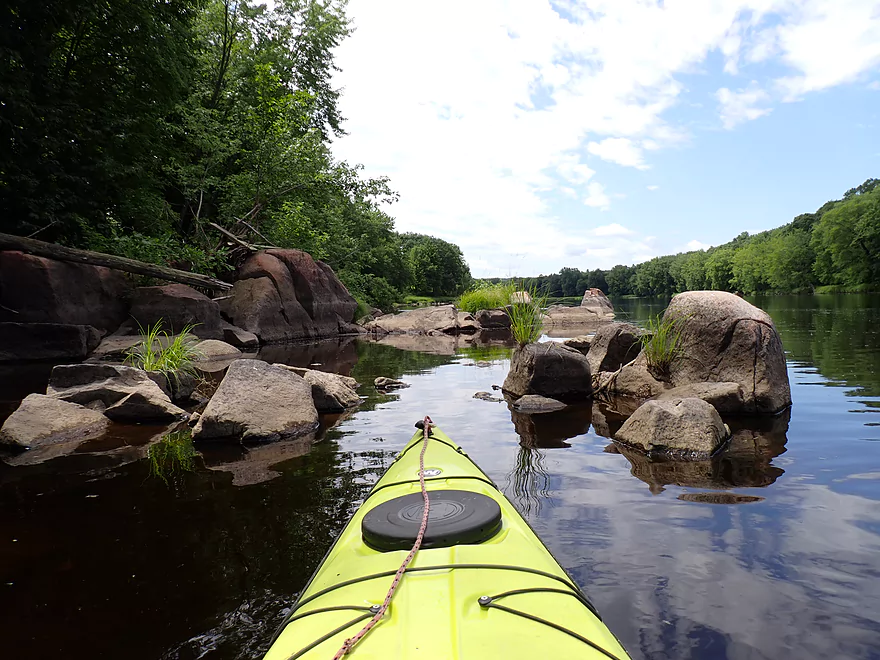
Another nice boulder garden
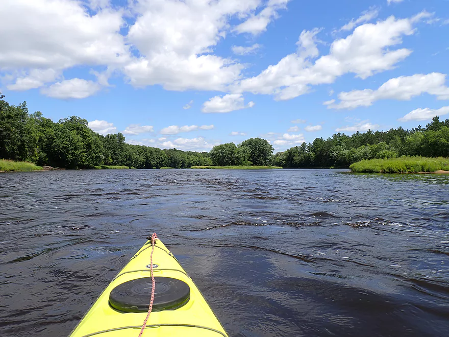
Sun finally comes out and provides some nice blue color to the scenery
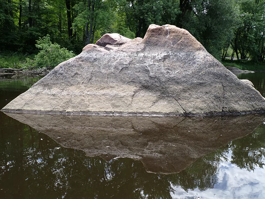
A “Star Destroyer” rock
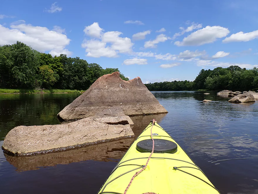
Reverse view
More granite boulders
Light riffles
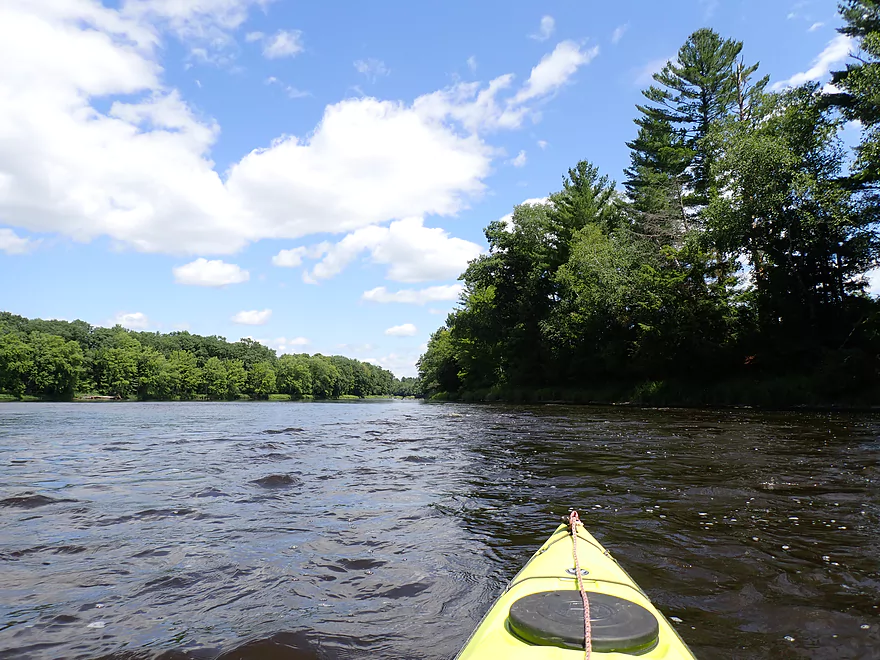
Nice to occasionally see pines on the trip
A pair of hairy islands
More baby rapids
Great to see the Canadian wildfire smoke finally cleared away
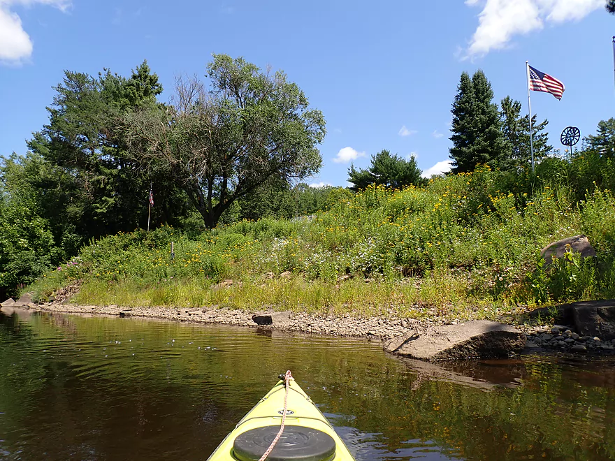
The community of Granite Heights
There used to be an access here, but it looks private now
Yet another nice gravel bar
So many nice pebbles
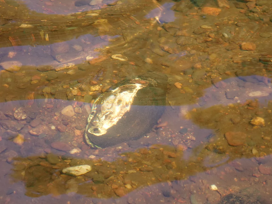
An abstract clam
Another nice mini-boulder garden
Rocky shore
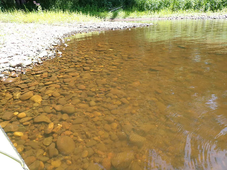
Water had a red hue from upstream tree tannins
One of the nicer gravel bars
Final stretch
Rugged banks
This part of the river used to be underwater because of the now-removed Brokaw dam
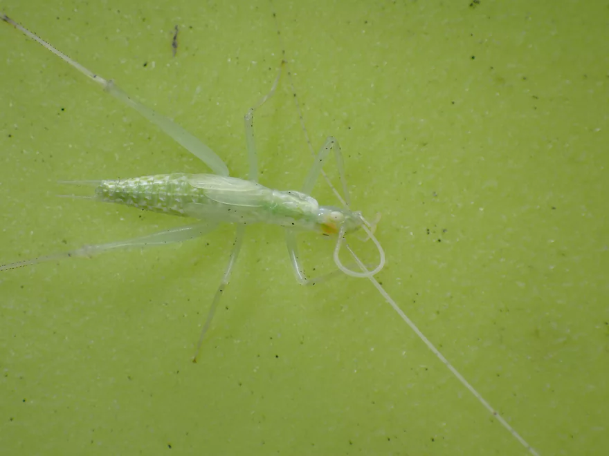
A nicely camouflaged tree cricket
Taking out at the Brokaw Landing
Scenic part of the river
Part of a long bike shuttle back to the put-in
Upstream view from the WW bridge (future trip idea)
Downstream view
Wisconsin River – Granite Heights

The central portion of the Wisconsin River can be a frustrating paddling experience because of the high concentration of dams and flowages. Sure, there will be a nice boulder garden or rapids here or there…but these are short-lived, as they are soon swallowed up by a subsequent dam, paper mill, and flowage. One of the longer and nicer free-flowing stretches is a 19 mile stretch between Merrill and Wausau. That’s too long to do for one trip, so instead I opted for a subsection between the Trappe River and Brokaw.
I started the trip at the “Wisconsin River Forest Unit”, which is a public forest on the banks of the Wisconsin with a public carry-in access. The landing is wonderfully secluded and wooded with that “up-north” vibe. It wasn’t too secluded though as I did see several other cars here (one fishermen and some fellow paddlers).
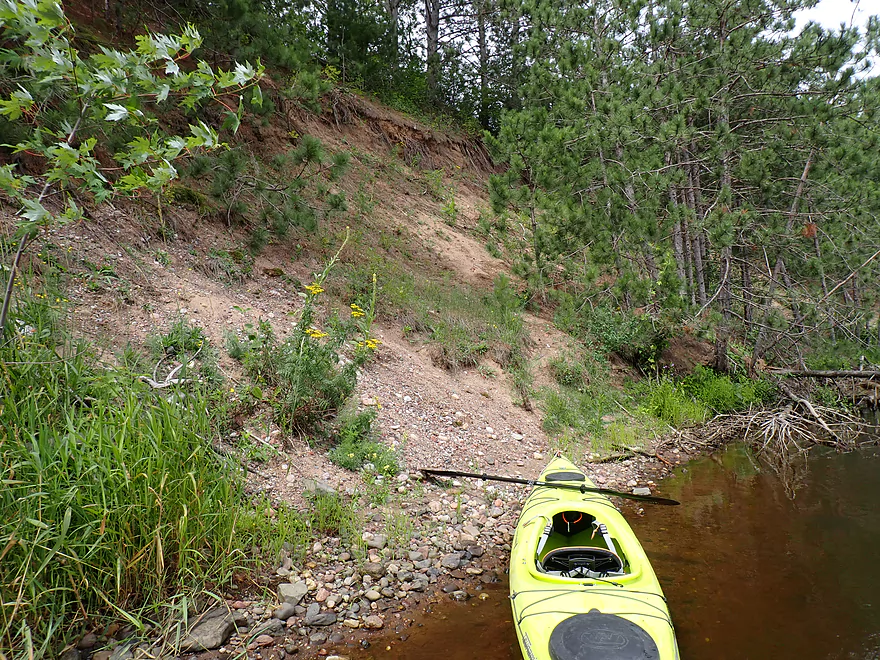
The trip got off to a nice start with appreciable current and scenic wooded banks. Following a small but scenic boulder garden, the river is split by a large island. The inside channel appeared to be closed because of low water, but I didn’t mind as the outside channel was much more scenic. Here there were medium-sized sand banks and an attractive gravel bar filled with granite pebbles.
Water quality was hit and miss. In some spots it was clear with a red hue (created by tree tannins), but often it was murky and turbid. In many spots odd froth would pile up on branches which smelled awful…like rotting animals. I suspect some type of pollutant had entered the river. Typically the DNR would monitor and protect river quality, but they’ve de-evolved significantly over the years and I doubt they care much about issues like this anymore.
Following the island and the sandbanks, I was passed by a kayaker who was doubling back to the put-in and warned me about rapids up ahead. I wasn’t surprised about the rapids but was surprised that a kayaker would do a round trip on this stretch. You wouldn’t be able to go too far (upstream or down from the Forest Unit Landing), but I suppose it would be an option.
The waves from “Trappe Rapids” could be seen from the far distance. I approached carefully and sized up the situation. The far right side was very rocky with two channels…one was closed but the other seemed somewhat runnable with Class 2 rapids. The middle of the river lacked rocks, but contained surprisingly large standing waves (~2-3′). In contrast the far left channel had no rapids and it would have been very easy to paddle around everything, but I opted for the middle channel and the “big” waves which were pretty fun. Unfortunately my video didn’t turn out (I didn’t pack my tripod) so I doubled back by the boulder garden. Here I got some nice pictures, rescouted the rapids and determined one of the rocky south channels was a runnable Class 2 which I did and enjoyed.
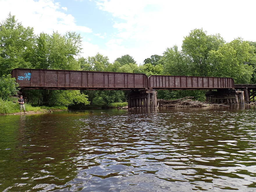
Trappe Rapids was soon followed by the mouth of the Trappe River. Here a railroad bridge arched over the Trappe River and a trail led from the banks to Jesse Park which could have been an alternate put-in. The Trappe River itself is a nice prospect that’s long been on my to-do list, but it’s tricky to time as it is often too shallow/rocky or too rough with strong whitewater. My weekend plans were to do either the Trappe or the Granite Heights stretch of the Wisconsin depending on how much rain fell from Friday’s storm. Not enough fell so I opted for the Wisconsin River…it hasn’t been a good kayak season for small rivers and creeks.
Following another nice boulder garden, the smoky skies cleared and the sun came out. This is a big deal for pictures as clear skies are needed for vibrant blues. Much of this trip reminded me of the Upper Black River (which is a compliment). It doesn’t have nearly as many rapids, pines or boulder gardens, but it has a surprisingly similar vibe and I suspect much of Central Wisconsin was like this before it was mutilated by the dams.
About halfway into the trip I passed the small community of Granite Heights along the east bank. Paddling author Mike Svob said the “Granite Heights Landing” was here. I looked and looked (from land and water) and all I could find were No Trespassing signs. Mike Svob’s Paddling Northern Wisconsin is a great water trail guide I highly recommend, but sadly much of his information is outdated and I’m not sure there will be another edition. For example just on this stretch he says the Brokaw Landing is private (not true…it’s now public) and Brokaw Paper Mill smoke could be seen in the distance (the paper mill was shut down years ago).
The last few miles lacked any rapids or boulder gardens, but did feature some fantastic gravel bars. I considered myself fortunate to see these, as the Merrill dam operator had significantly cut the flow to the river (they likely expected more rain and let out too much water but then had to overcompensate the other way). It’s unfortunate that the Upper Wisconsin is subject to these volatile dam corrections as they can impact wildlife, shoreline health, and boat trips.
I ended the trip at the Brokaw Boat Landing, which is a very scenic area with large gravel banks and a nice vista of the upstream section of the river. Here locals were fishing, hanging out, and swimming (not sure the last was a good idea given the rotting odor I smelled on parts of the trip).
In summary this was a really nice trip that I absolutely recommend for locals. I can’t give it five stars as it lacks elite attributes (clear water, cliffs, unique geology, etc…), but it was a well-rounded and easy trip, with scenic wooded banks. This would be a great beginner trip for Wausau paddlers just learning to kayak. The only major drawback was the road noise which might have been the loudest I’ve ever heard on a trip. Nearby Hwy 51 was crazy busy with heavy and fast traffic (75 mph for the slow lane).
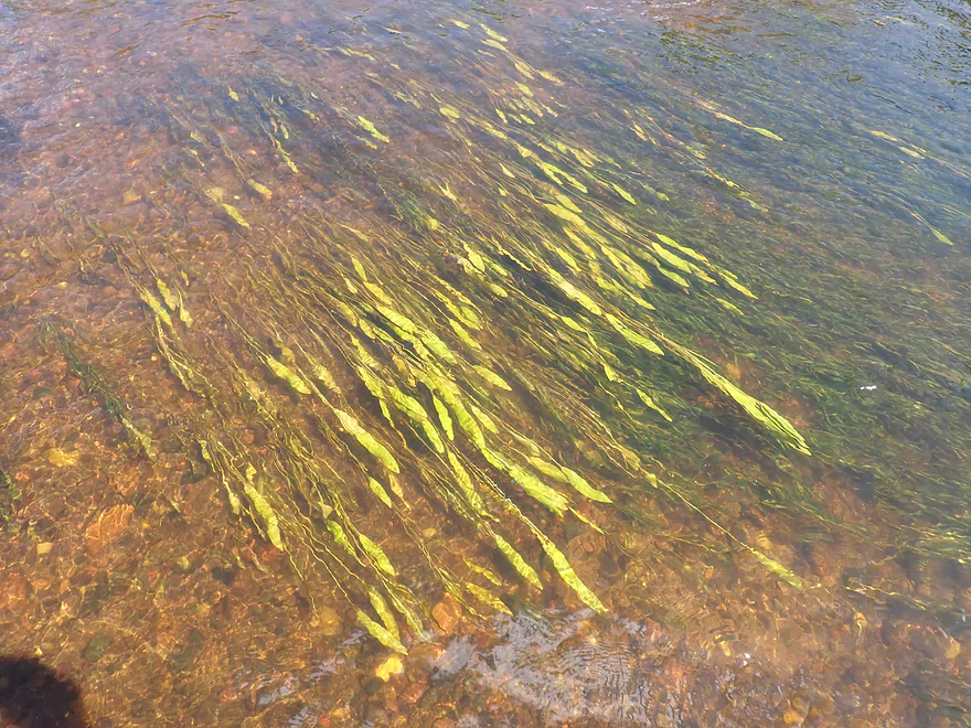
Sights included a lot of clams, a few eagles, dragonflies, some large flopping fish, a great blue heron and mayflies. The highlight was the countless number of crayfish I saw.
Wausau Whitewater Park: Controlled releases from the Wausau dam route water down a side channel of the Wisconsin River and over rocks and barriers to create a whitewater run for kayakers. The park has become popular in recent years.
Pine Bluff Road: Located in a public forest, this is a secluded and excellent carry-in access.
Alternate Put-ins:
- Riverside Park/Merrill (8.6 miles upstream from Pine Bluff Road): This is a decent public access. The leg between Merrill and Pine Bluff Road should be a good prospect.
- Jesse Park (1.4 miles downstream from Pine Bluff Road): There is a public access by the park but you need to take a long/steep trail to access the water. I don’t advise putting in here, because you would miss out on a scenic stretch of the river and fun rapids.
Brokaw Boat Landing: This is a very good public access.
Alternate Take-outs:
- Gilbert Landing (4.3 miles downstream from Brokaw): River slows and has more hills. This is a decent leg and Gilbert Landing is a good public access.
Bike Shuttle – Brokaw Boat Landing to Pine Bluff Road: 7.5 miles with 262′ of ascent. I considered this one of the more difficult bike shuttles of the season. The reason was because of the length, several big hills, and about a half mile of gravel. It was all manageable though and shouldn’t be a problem for those in bike shape. My new trick for bike shuttles is to do them in the morning when the wind is less strong.
Current: The current moved at a good pace, but wasn’t too pushy. So many stretches of the central Wisconsin are robbed of current by dams, it’s kind of a miracle to encounter a stretch with it.
Logjams: There are no logjams on this stretch.
Shallow Water: I don’t think this stretch of the Wisconsin ever gets too low to run.
Rapids: Located halfway between Pine Bluff Road and Jesse Park are Trappe Rapids which I would rate as a Class 2, although in high water these actually may wash out and become Class 1’s. The middle chute has appreciable standing waves that are fun to kayak. The right side is rocky and congested, but you can navigate through if you pick the right spot. If you don’t like rapids…then you can simply paddle the far left shore/north shore where there are none. Here is a video I shot of the rapids.
Closest Gauge: Wisconsin River @ Merrill
Trip Depth: 1500 CFS or 4.4′
Navigability Estimates: The following are very rough estimates. Always use your own judgement.
- < 1250 CFS: A low depth, but the river should still be navigable.
- 1251-2000 CFS: An average late summer depth and a good target range for paddling.
- 2001-3000 CFS: An average spring depth. Somewhat on the high side, but should still be navigable. Some of the gavel bars may be submerged at these levels.
- 3001-5000 CFS: High depth. Maybe navigable, but the water quality may be bad.
- 5001+ CFS: Maybe too high for enjoyable paddling. I’m not sure though.
Located just downstream from the take-out is the community of Brokaw which once featured a dam, paper mill and pulp mill. The dam was the first thing removed which left some Class 1 rapids and a 2′ drop. These are manageable for paddlers but they should be treated carefully as exposed rebar from the old dam wasn’t properly cleaned up. The pulp mill plant was later closed and finally in 2011 the paper mill itself was closed.
The closure was controversial and has (IMO) an interesting backstory. A large East Coast hedge fund (Starboard Value) wanted Wausau Paper to close/sell their non-bathroom tissue products and use the proceeds to buy back their stock. Despite Starboard Value being a minority shareholder, they convinced the board of directors of their plan and it went through, with the Brokaw paper plant being shuttered. With their lucrative stock buyback complete, Starboard sold their shares for a handsome profit. There was national outrage that a big investment firm could swoop in, destroy jobs, extract significant equity from a company, and then leave with big profits. A national bill was proposed to stop this called the Brokaw Bill but it failed to pass.
If you’re interested in learning more about the history of how hedge funds and private equity firms are destroying American companies, I highly recommend the book “The Buyout of America: How Private Equity Is Destroying Jobs and Killing the American Economy“. People assume that when a firm fails it’s just bad business or economics…but few understand how private equity loots otherwise healthy companies, loads them up with debt, extracts out equity, and steals from minority shareholders using illegal expense maneuvers and conveyance fraud. Many famous Wisconsin companies over the years have been needlessly destroyed by these greedy East Coast investment firms (eg Shopko, Rippin Good Cookies, Evinrude Motors, etc…).
Quick Overview
- Upstream of Stevens Point: I don't have information yet on these stretches.
- Stevens Point to Lake Petenwell: ~42 miles. This stretch in Central Wisconsin used to have many natural rapids, but most have been buried under 8 dams, some of which are now difficult portages. Despite this there is still some good paddling to be had in this region.
- Lake Petenwell: 14.9 miles. This is a large flowage lake that is challenging for paddlers because of frequent strong winds and big waves.
- Castle Rock Lake: 14.5 miles. Another large flowage lake that is likely too big for enjoyable paddling.
- Castle Rock Lake Dam to Lemonweir River: 9.4 miles. This pre-Dells leg isn't elite, but is a pleasant stretch.
- Lemonweir River to Indian Trails Landing: 21.7 miles. This includes the famous Upper Dells and Lower Dells which feature many scenic sandstone outcrops.
- Indian Trails Landing to Portage: 16 miles. This is an overlooked section sandwiched between the Dells and Portage. While the scenery isn't top-notch, it does have many sandbars and few people which is a nice combination.
- Portage to Lake Wisconsin: 14.3 miles. This is a neat stretch of the river with many sandbars and cliffs, but the shoreline is very developed and motorboat traffic can be heavy on weekends.
- Lake Wisconsin: 14.5 miles. This is a challenging lake for paddling because of the huge and frequent waves created by motorboats.
- Prairie du Sac Dam to Port Andrews: 57 miles. This is the first half of the famous Lower Wisconsin Riverway. This is a super popular stretch for paddlers with the highlights being large sandbars, big bluffs, occasional cliffs, and fun side sloughs to explore.
- Port Andrews to Wyalusing: 40 miles. This is the second half of the Lower Wisconsin Riverway which has far fewer paddlers and sandbars. But the bluffs and sloughs are larger and more interesting.
Detailed Overview
- Upstream of Merrill: I don't have enough information yet on these legs to comment.
- Merrill Dam to Riverside Park: 0.5 miles. Might include some light rapids below the dam.
- Riverside Park in Merrill to Wisconsin River Forest Landing: 8.6 miles. A good prospect.
- Wisconsin River Forest Landing to Brokaw Boat Landing: 5.7 miles.
- Wisconsin River Forest Landing to Jesse Park: 1.4 miles. A terrific stretch with small boulder gardens, one set of Class 1-2 rapids, gravel bars and a nice sand bank.
- Jesse Park to Brokaw Boat Landing: 4.3 miles. A good stretch with scenic wooded banks and occasional gravel bars.
- Brokaw Boat Landing to Gilbert Park: 5.1 miles. River slows down and becomes hillier. This stretch is an ok prospect and goes past the old Brokaw paper plant that has been shut down. Paddlers must navigate Class 1 rapids and 2' drop where the old Brokaw dam used to be.
- Gilbert Park to Wausau Boat Dock: 1.5 miles. An impounded stretch through Wausau. There are numerous alternate access options to choose from.
- Wausau Boat Dock to Oak Island Boat Ramp: 1.2 miles. A nice stretch that includes Barkers Island and Isle of Ferns Park. But the Wausau dam does require a portage. This stretch parallels the famous Wausau Whitewater Park.
- Oak Island Boat Ramp to Rothschild Dam Access: 5.8 miles. Likely mostly uninteresting flowage paddling. There are many alternate access options to choose from.
- Rothschild Dam Access to Zimpro Park: 1.0 miles. This might be a nice stretch.
- Zimpro Park to River Road Boat Landing: 7.6 miles. The first half of this leg is likely nice river paddling, but the second leg is probably just an uninteresting flowage.
- Chucks Landing/Mosinee Dam to Bean's Eddy Boat Landing: 2.8 miles. Likely a nice leg. You might be able to launch by the dam where there should be some nice rapids and boulders.
- Bean's Eddy Boat Landing to Seagull Boat Landing: 5.1 miles. Mostly uninteresting flowage paddling. Although there might be some nice sand banks on the eastern shore.
- Seagull Boat Landing to Dubay Dam Access: 5.3 miles. Mostly uninteresting flowage paddling.
- Dubay Dam Access to River Road Landing: 5.5 miles. This could be a nice stretch of river.
- River Road Landing to Old US 10 Landing: 2.3 miles. Likely an ok leg.
- Old US 10 Landing to Stevens Point Dam: 5.6 miles. Probably uninteresting flowage paddling. Many alternate access options closer to Stevens Point.
- Stevens Point Dam to Blue Heron Boat Landing: 4.2 miles.
- Steven Point Dam to Whiting Dam: 2.6 miles. Starts slow and uninteresting, but the river becomes very scenic after the Hwy HH bridge. The rock formations below both dams are very striking. Many alt access points.
- Whiting Dam to Kimberly Clark Dam/Al Tech Park: 0.6 miles. Incredible scenery with exposed bedrock and boulder gardens below the Whiting Dam. Some rapids, but nothing major. The Kimberly Clark Dam is a dangerous low-head dam and should be treated carefully.
- Kimberly Clark Dam to Blue Heron Landing: 1.0 miles. Class 2 rapids below the dam, but after that the river slows dramatically and splits into many sub-channels and islands. Round trips on this leg are possible. I chose the far western channel where there were some nice rocky stretches.
- Blue Heron Landing to Mill Creek Landing: 4.1 miles. Likely a mediocre paddle with nothing special. Galecke Park is an alternate access.
- Mill Creek Landing to Biron Dam North Gate: 7.6 miles. Mostly uninteresting flowage paddling. Several alternate access options on route.
- Biron Dam North Gate to Veteran's Memorial Park: 4.5 miles.
- Biron Dam North Gate to Biron Landing: 1.0 miles. Super scenic stretch by two islands with many granite boulders.
- Biron Landing to Legion Park: 3.0 miles. A nice stretch by Big Island. The west channel is more undeveloped...but the east channel has several scenic granite islands.
- Portage through Legion Park: 680'. A steep wall separates the park from the river but in two locations the wall is short enough to get over (see map). Paddlers may want to consider a longer portage to bypass some of the shallow rocky stretches by Legion Park.
- Legion Park to Veteran's Memorial Park: 0.4 miles. A scenic stretch that features a large boulder field and the powerhouse of a large paper mill.
- Veteran's Memorial Park to Port Edwards Landing: 3.8 miles
- Veteran's Memorial Park to Demitz Park: 0.8 miles. A pleasant stretch that includes Belle Island.
- Demitz Park to Ben Hansen Park: 1.2 miles. This leg goes by Garrison Island and Edwards Island. Lyon Park is located across the river from Demitz Park and is another access option.
- Ben Hansen Park to Port Edwards Landing: 1.8 miles. Nice prospect that includes paddling past some historic islands. The Centralia dam should be an easy portage (east bank by golf course).
- Port Edwards Landing to Nekoosa/Riverside Park: 3.6 miles.
- Port Edwards Landing to Port Edwards Powerhouse: 1.3 miles. A half-mile portage is required. A very scenic boulder field is located below the dam. At high levels, the rocks are submerged and produce a half mile stretch of rapids (some strong).
- Powerhouse to Moccasin Creek Landing: 1.8 miles. A generic wooded stretch that isn't super interesting.
- Moccasin Creek Landing to Riverside Park: 0.5 miles. During the Nekoosa dam drawdown, this stretch had nice boulder fields and rapids.
- Riverside Park to Hwy 73: 0.8 miles. An ok stretch of the river. There are scenic cliffs south of Hwy 73, but these are past the dam warning line. Hwy 73 is not a good access option.
- Hwy 73 to Point Basse Ave (Portage of the Nekoosa Dam): 1.5 miles. A difficult 1.5 mile portage through downtown Nekoosa. Don't try to portage the south bank. There is a steep hill, cliffs, and large Domtar paper mill fences to deal with.
- Point Basse Ave to Jim Freeman Memorial Boat Landing: 0.8 miles. A generic stretch going by historic Point Basse. If you're willing to backtrack to the dam, you can see scenic boulder fields (during low flows) and a few cliffs. Point Basse Ave is a somewhat speculative access, but it seems public and doable for launching.
- Jim Freeman Memorial Boat Landing to Plank Hill Small Boat Access: 2.0 miles. Generic stretch.
- Plank Hill Small Boat Access to 19th Drive Landing: 5.3 miles. Features two epic sand banks. The main channel has some minor sandbars. Several of the side sloughs can provide fun side adventures.
- 19th Drive to the Petenwell Dam: 14.9 miles. This is Lake Petenwell which is a large and challenging lake for paddling. Waves and strong winds are frequently an issue. But when calm there are nice sandbanks on the northwest shore, hidden sloughs, and large islands to explore. See the overview map for more info.
- Petenwell Dam to Ganter Lane Landing: 3.8 miles. This stretch isn't too impacted by dams and may have nice sandbars at low levels.
- Ganter Lane Landing to Castle Rock Lake Dam: 10.7 miles. Castle Rock Lake is likely too big (wind/waves) for enjoyable paddling. There are many alternate launch options along the shore.
- Castle Rock Lake to the Lemonweir River: 10 miles. An ok section.
- Lemonweir River Mouth to River Bay Landing: 7 miles. The first half of the classic Upper Dells.
- River Bay Landing to Blackhawk Island: 6.5 miles. Second half of the classic Upper Dells known for its fantastic outcrops. Note, the Blackhawk Island landing is no longer accessible without special permission from the local 4H club.
- Black Hawk Island to Wisconsin Dells Dam: 2.0 miles. More nice sandstone outcrops. You can take out at a public ramp off Indiana Ave or portage the dam and take out SW of the dam by a launch off Wisconsin Dells Pkwy/Hwy 12.
- Dells Dam to Indian Trails Landing: 6.2 miles.
- Dells Dam to Newport Park: 2.2 miles. This is the heart of the famous Lower Dells with many scenic outcrops. Unfortunately jet boats are a serious plague on this stretch.
- Newport Park to Indian Trails Landing: 4.0 miles. Features the famous "Sugar Bowl" and four super cool caves. The outcrops soon disappear and this stretch is mostly uneventful (but peaceful) big river paddling.
- Indian Trails Landing to Pine Island Boat Ramp: 9.8 miles. Few paddle this stretch as it isn't as interesting. But...it does have a good concentration of sandbars and few competing paddlers for them.
- Pine Island Boat Ramp to Portage/Hwy 33 Access: 6.0 miles. Not an elite section that is lacking in cliffs and bluffs. It does have good sandbars though.
- Portage to Dekorra Park: 7.7 miles
- Portage to Baraboo River/Thunderbird Road: 5.2 miles. A good section with great sandbars. Close to Portage there are few motorboats.
- Baraboo River to Dekorra Park: 2.5 miles. River splits around massive Lib Cross Island. West channel has nice sandbars. St Lawrence Bluff has scenic sandstone outcrops and includes a cave you can paddle into.
- Dekorra Park to James Whalen Memorial Park: 6.6 miles.
- Dekorra Park to Camp Rest Park: 5.1 miles. A terrific section with rock outcrops, large island deltas, hidden sloughs, and nice sandbars. Unfortunately this part of the river is popular with motorboats and jet skis which can be a plague. Multiple alternate access options.
- Camp Rest Park to James Whalen Memorial Park: 1.5 miles. Not a great section because of the open water paddling, powerboats and big waves. The west shore though does have nice outcrops.
- James Whalen Memorial Park to Merrimac Memorial Park: 4.4 miles. River turns into "Lake Wisconsin". Generally speaking this isn't ideal for kayaking as motorboat traffic can be heavy and waves can be surprisingly big. Most direct route is the north shore which has a few bluffs, but generally speaking isn't that interesting.
- Merrimac Memorial Park to Veterans Memorial Park/Prairie du Sac: 9.6 miles.
- Merrimac Memorial Park to Moon Valley Landing: 3.3 miles. Includes a lot of developed shoreline. The ferry, railroad bridge, and Moon Bay are highlights.
- Moon Valley Landing to Veterans Memorial Park/Prairie du Sac: 6.3 miles. Other than Moon Bay and the dam, this is a boring stretch. There are numerous alt access options on this route.
- Prairie du Sac to Mazomanie: 8 miles. An ok section of the Wisconsin but lacking in sandbars.
- Mazomanie to Arena: 9.7 miles. A great section with nice sandbars and scenic bluffs.
- Arena to Hwy 14: 8.0 miles. Good section with a high concentration of sandbars. One of the more popular legs on the Lower Wisconsin.
- Hwy 14 to Hwy 23/Spring Green: 2.2 miles. Neat mini-section with sandstone outcrops. Very popular in the summer.
- Spring Green to Lone Rock: 7.4 miles. Another fine sandbar/bluff section with some nice rock outcrops too.
- Lone Rock to Gotham: 8 miles. This stretch has super impressive rock outcrops and sand banks.
- Gotham to Muscoda: 7 miles. Cool limestone rock outcroppings.
- Muscoda to Port Andrew: 7 miles. A good stretch with many islands and sandbars.
- Port Andrew to Boscobel: 9 miles. Wooded islands start to get massive.
- Boscobel to Woodman/Big Green River: 9 miles and start of the less paddled stretch of the Lower Wisconsin. Far fewer sandbars from here to the mouth, but good bluffs and side sloughs to explore.
- Woodman to Adiantum Woods State Natural Area: 3.9 miles. Good stretch with large islands.
- Adiantum Woods State Natural Area to Millville: 3.8 miles. Good stretch with large bluffs and sandbars.
- Millville to Bridgeport: 5.3 miles. A peaceful stretch with few paddlers, yet good river bluffs and islands.
- Bridgeport to Wyalusing (the mouth): 9 miles.
Trip Map
Overview Map
Video
Photos Size: