
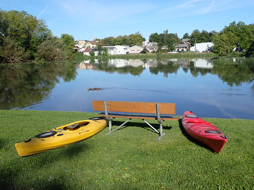
Scenic mill pond by Campbell Street
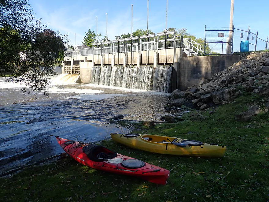
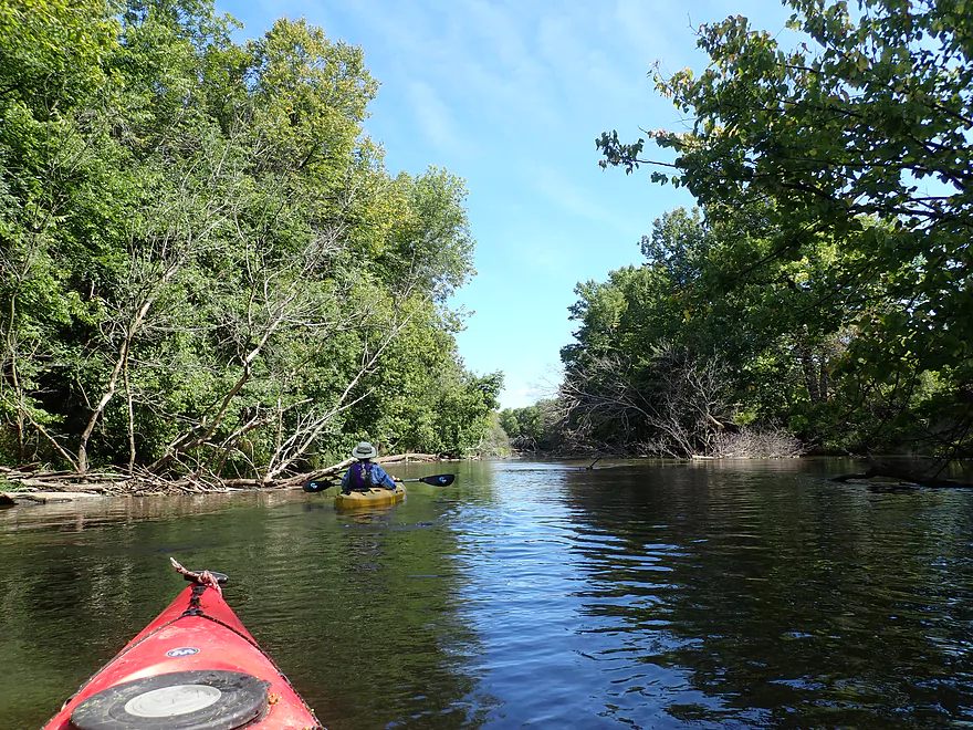
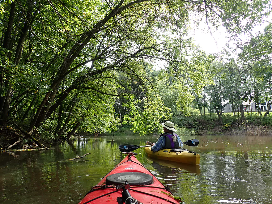
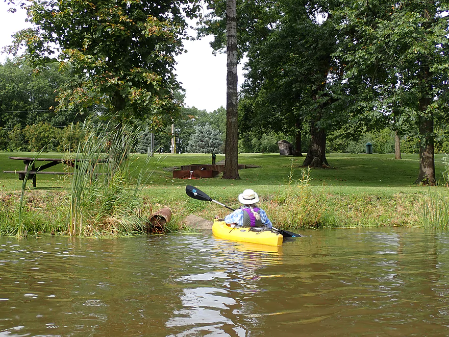
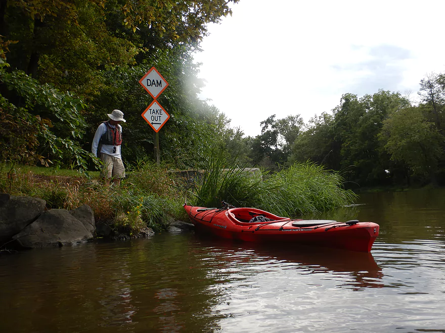
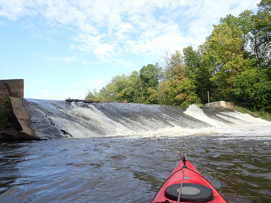
Launching just below the Udey Dam
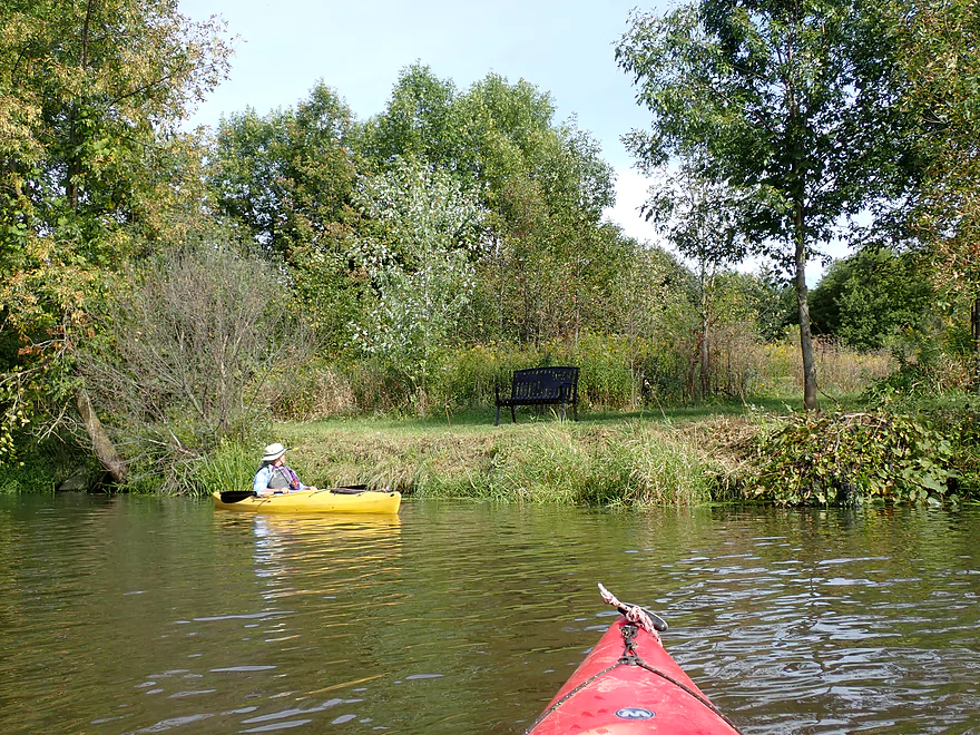
Reverse view
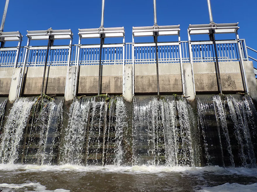
The gates were partly open that day (means higher water)
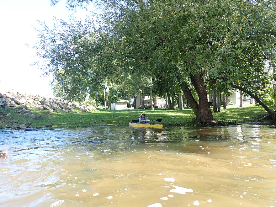
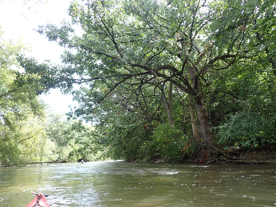
Zipping along in the very fast current
I’ve driven over Hwy 60 many times wondering what the Crawfish would be like
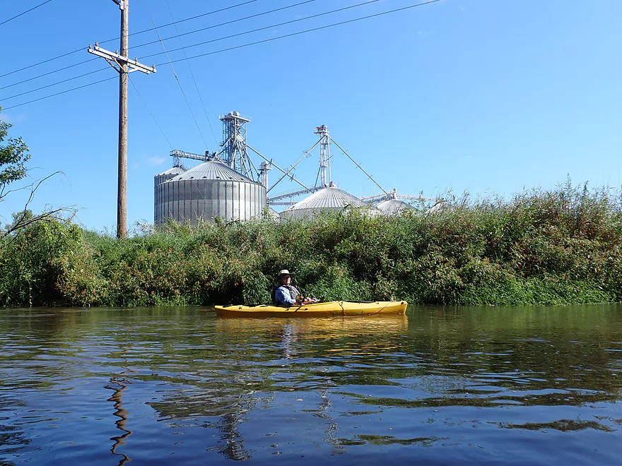
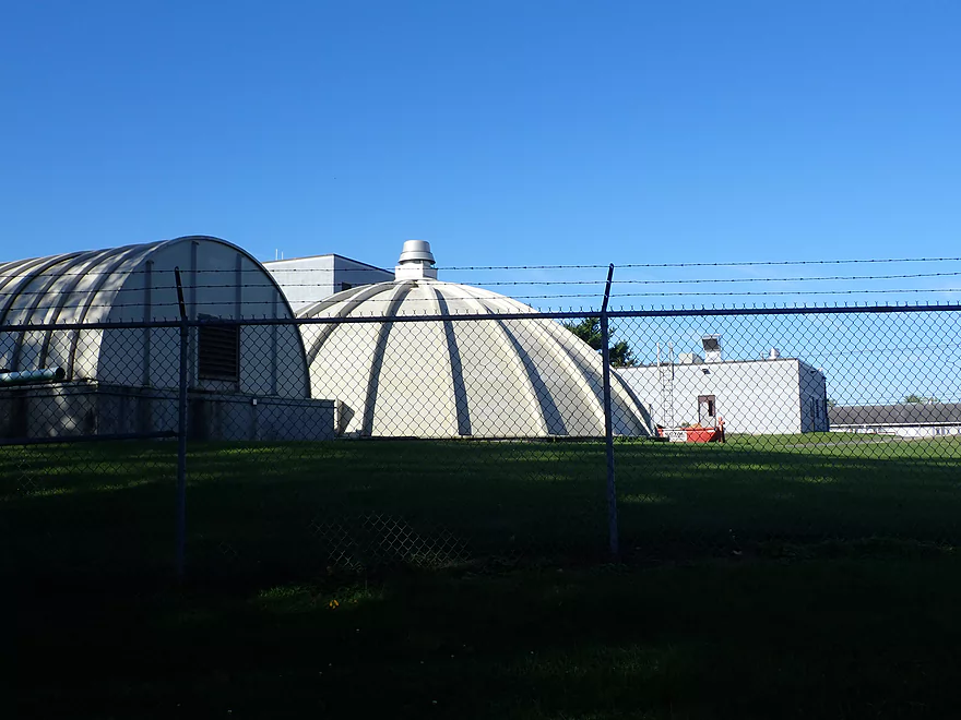
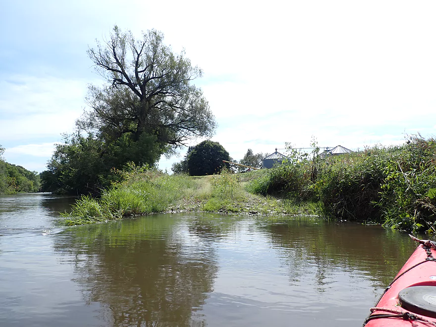
Massive grain bins

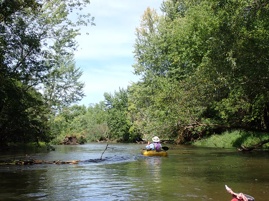
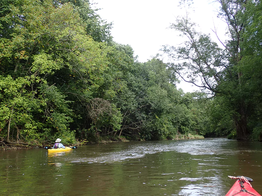
Current stays fast
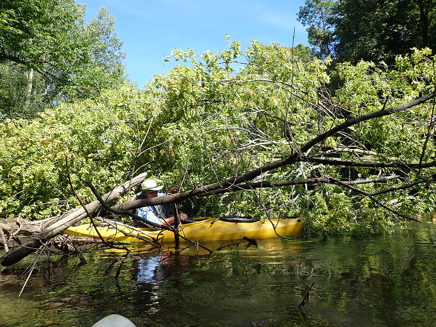
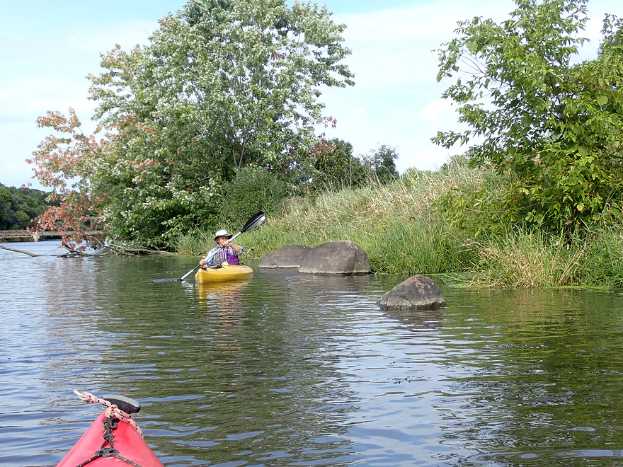
First of two minor jams
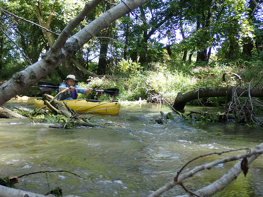
Very easy to get through
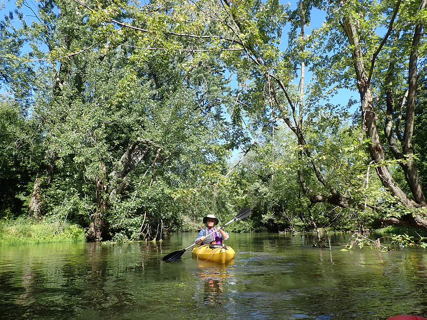
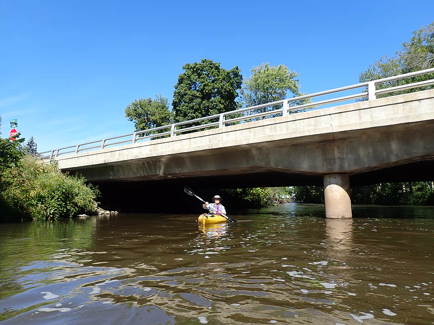
Leaving the city of Columbus behind
The local waste water plant
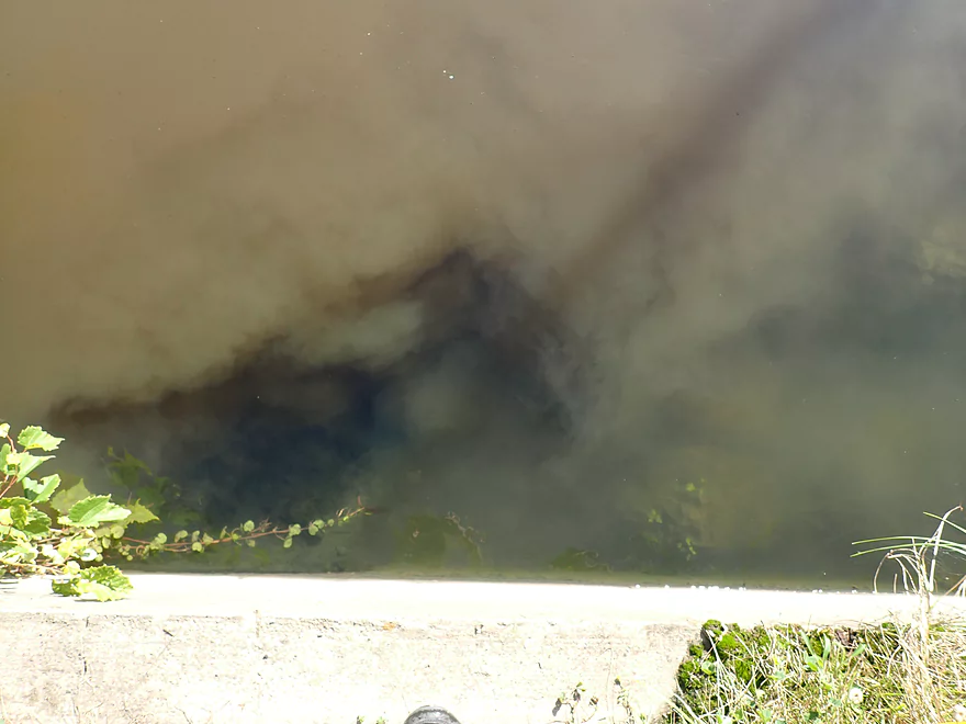
The effluent is clearer than the river!
There is a public landing here
River starts to slow
The only significant jam on the trip
Just able to squeak past
Shoreline is beat-up with dead trees

River starts to open
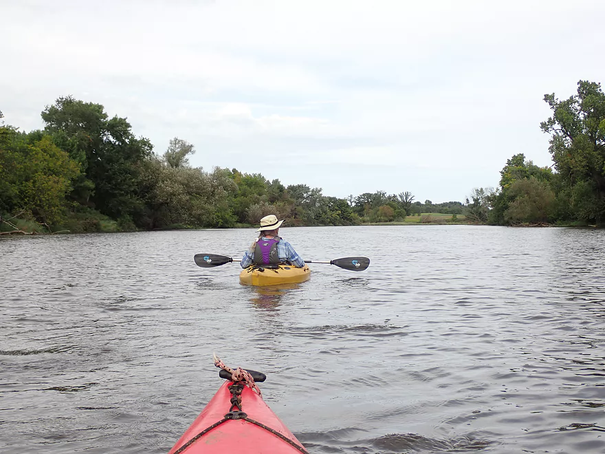
Still pleasant
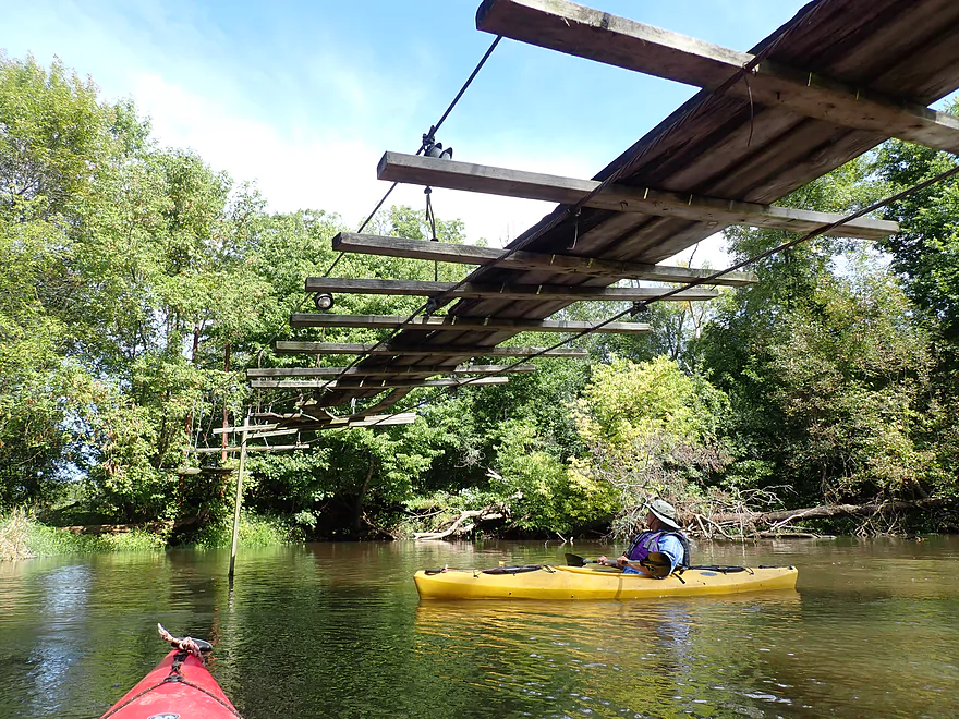
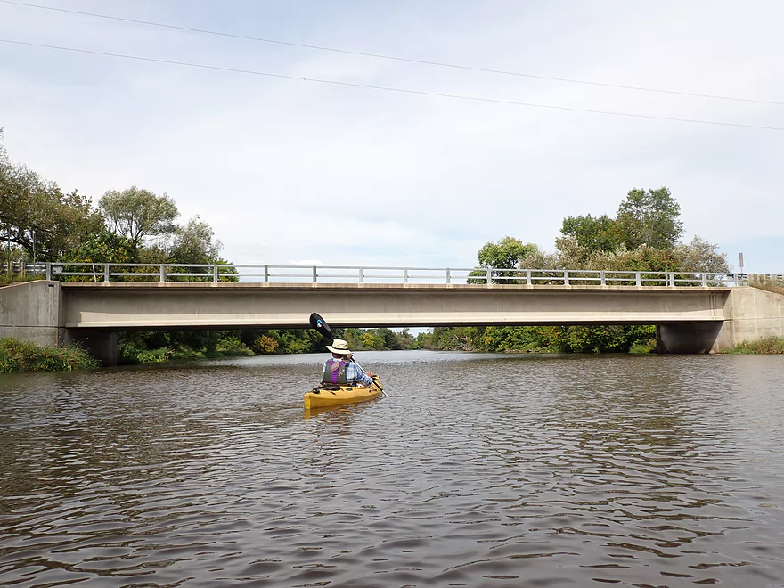
A local walk bridge
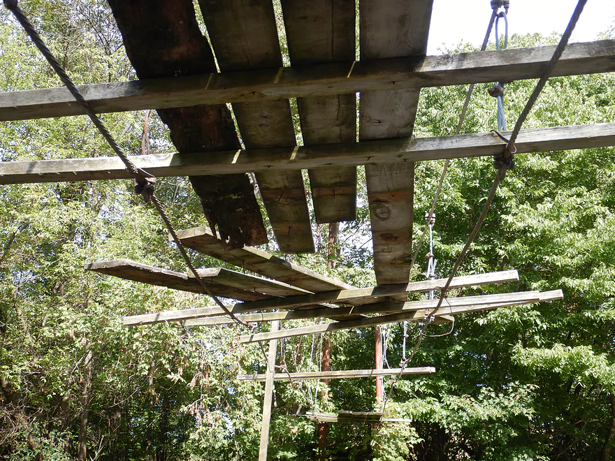
Somewhat destroyed by flooding
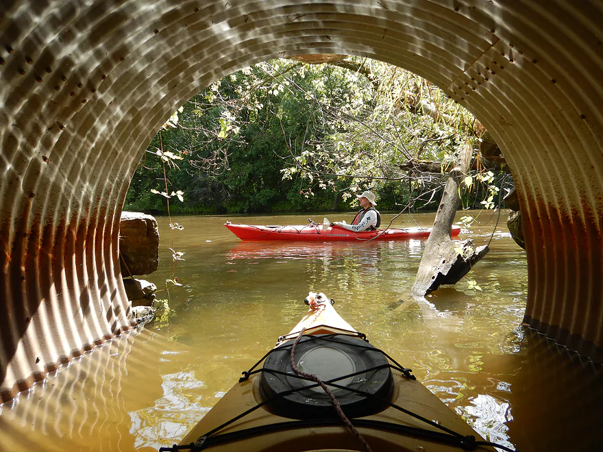
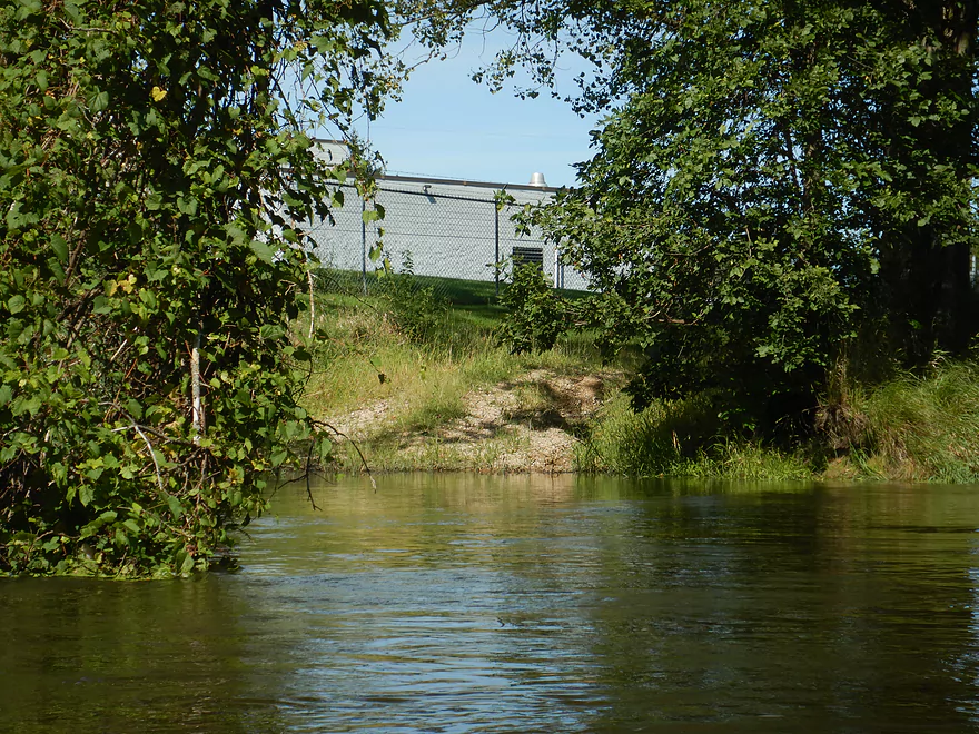
Framed by the culvert
Two of the creeks on River Road would be theoretical access options
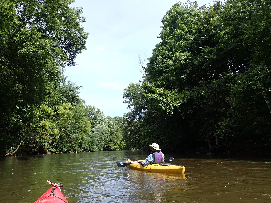
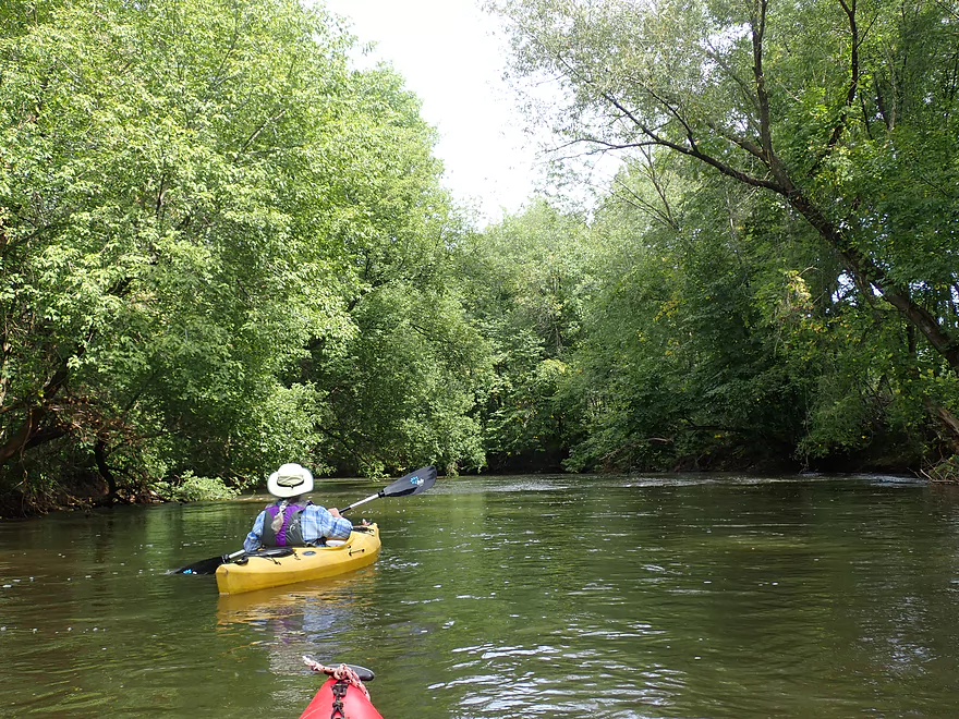
Stretch of mixed hardwoods with some oaks
Very nice
Unusable farm fords because of the high water
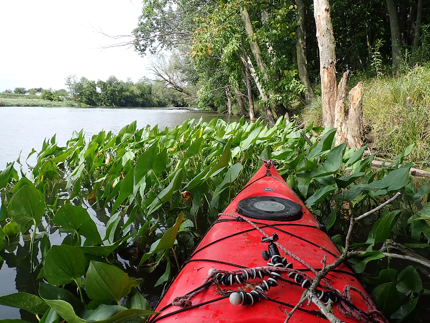
A colony of arrowhead on the Crawfish
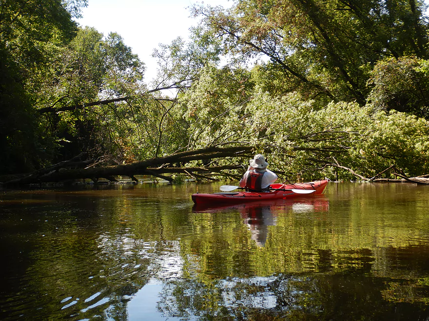
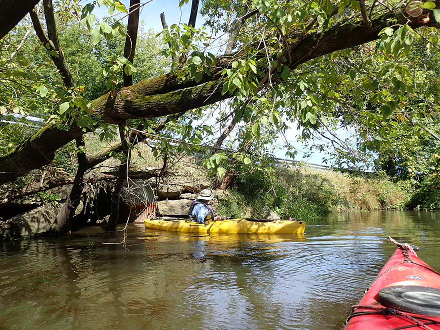
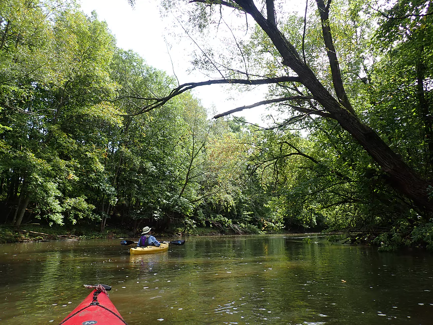
Entering a dense section of woods
Some minor riffles
There were a number of fantastic bur oaks on this leg
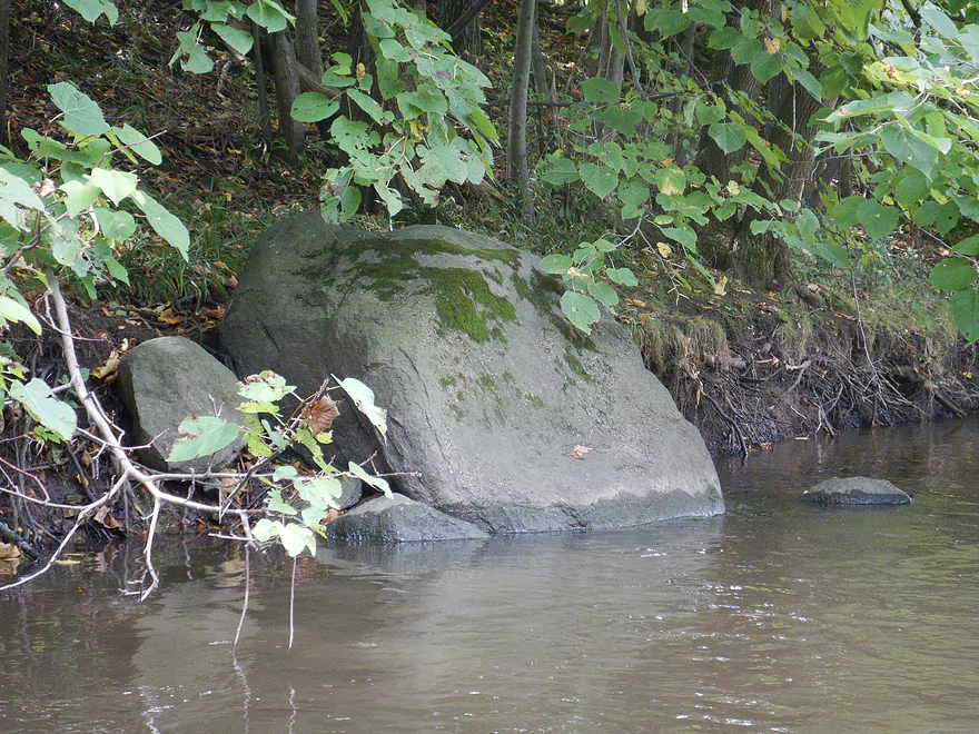
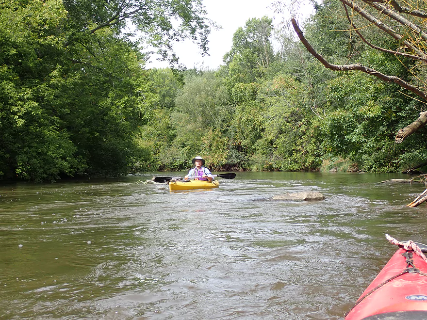
Surprisingly rocky too
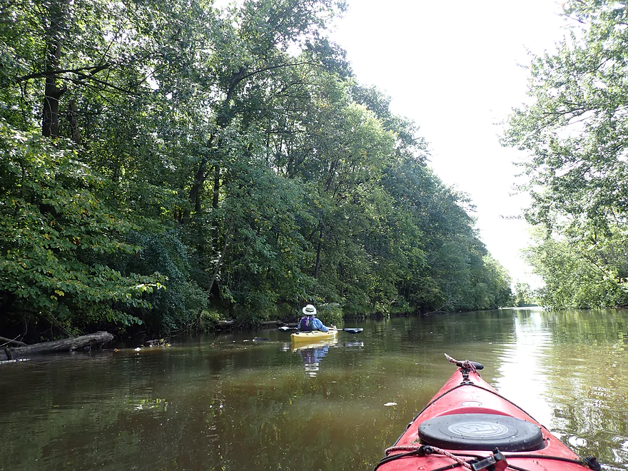
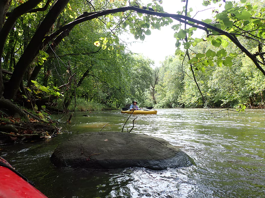
Paddling into the big woods
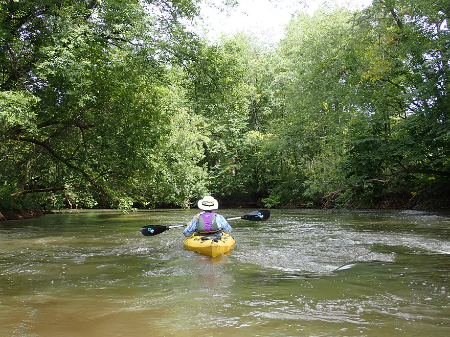
The riffles would be more pronounced in low water
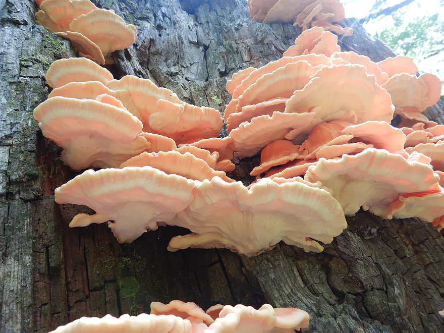
Sulphur shelf fungus
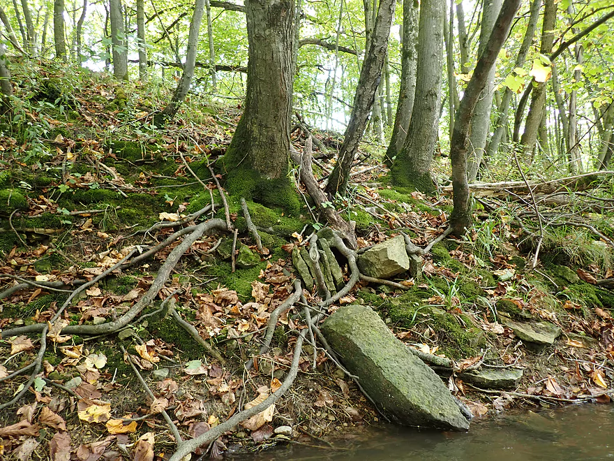
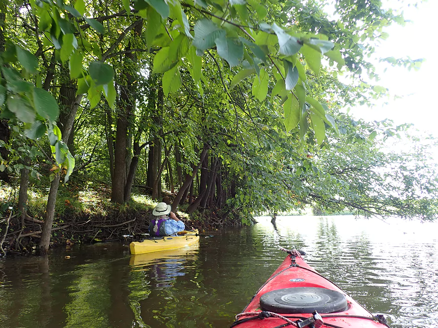
Healthy shoreline
Framed by a branch
There were a few homes on the shore…not many
Last of the woods

Start of the flowage
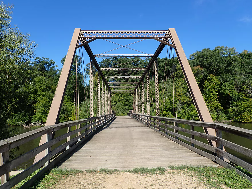
Ninabuck Road (new bridge…the old bridge was moved to Astico Park)
There is practically no current left
County Road TT is a nice access
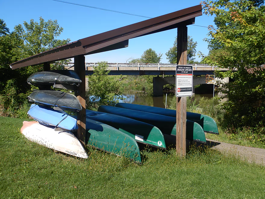
Nearby rentals available from Astico Park
View from the dock
Paddling through Astico Park
The Hwy 60 Wayside is an access option
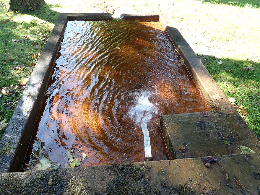
One of three artesian wells (note the iron content)

Another small creek tributary
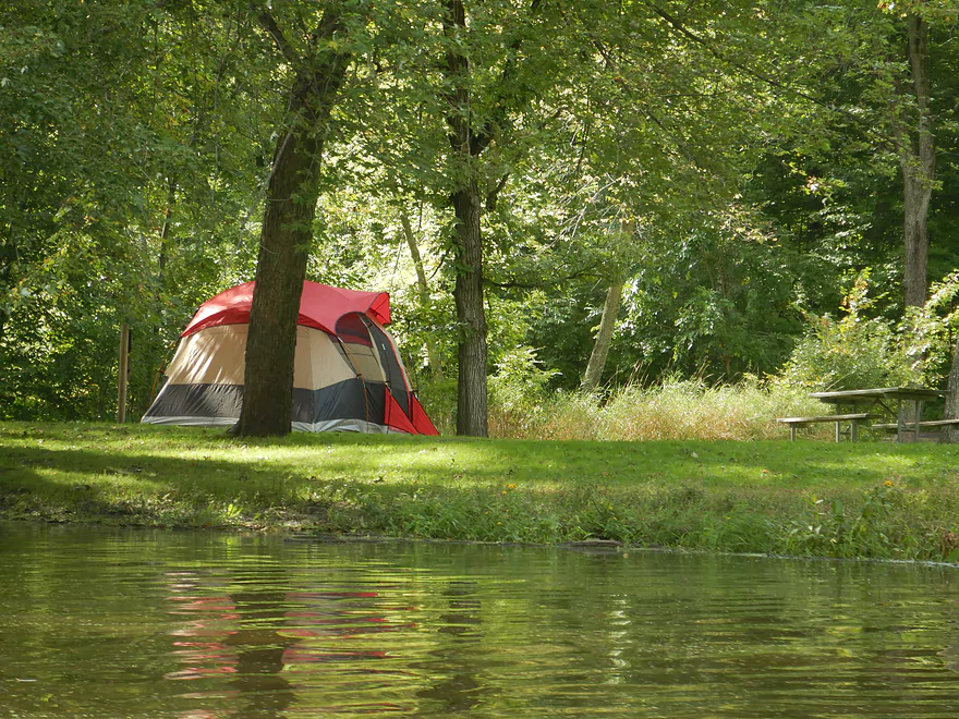
Camping at Astico Park is very popular
Rounding a huge hairpin in the river
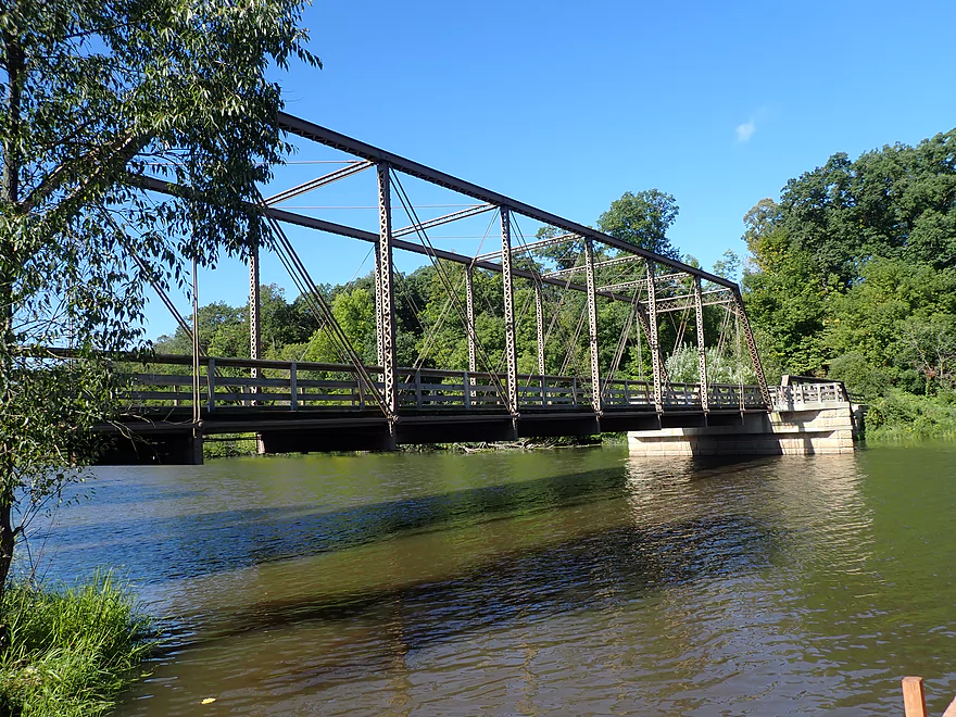
A scenic trestle (and the old Ninabuck bridge that was moved)
Part of the local trail network
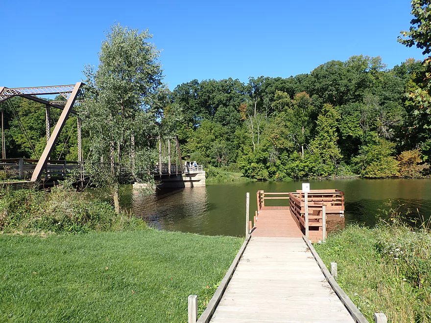
There is a dock here for taking out
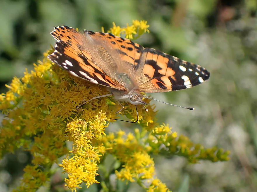
There were many butterflies here
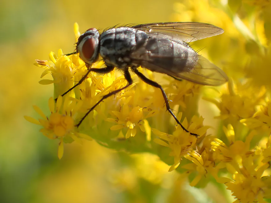
…and flies
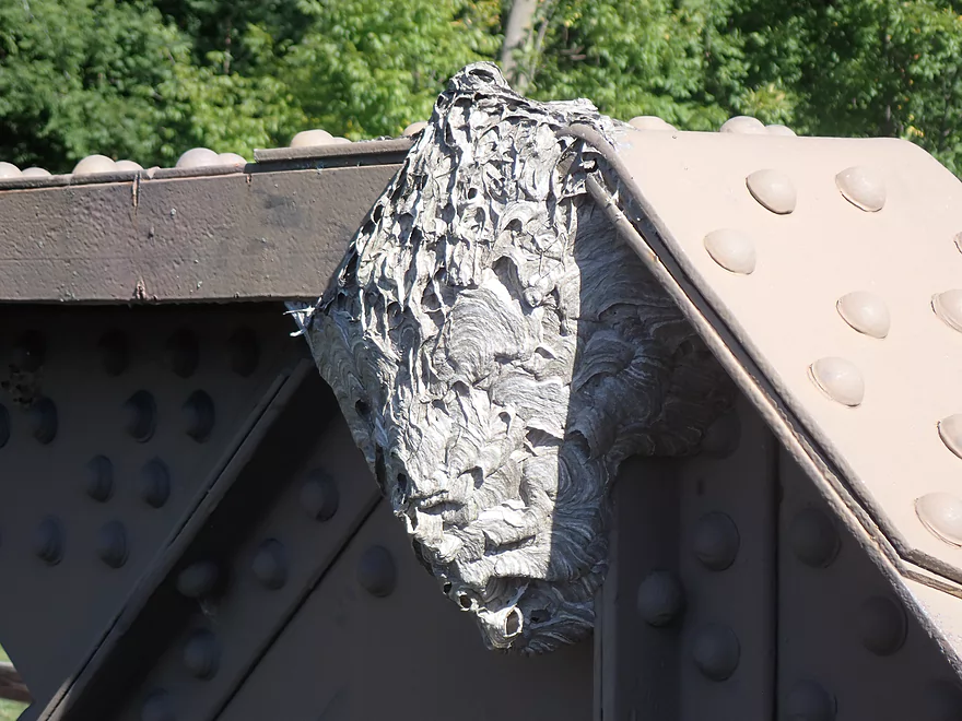
Bald-faced hornet nest
The park trail system is really nice
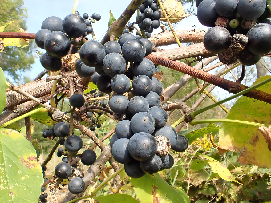
Wild grapes
Still some rocks
Attractive shoreline
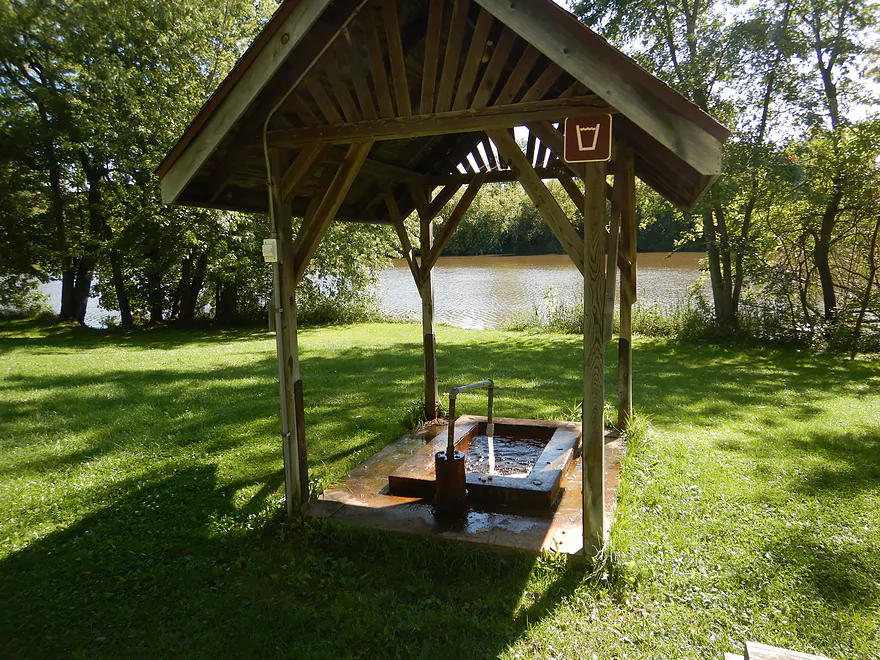
The third artesian well
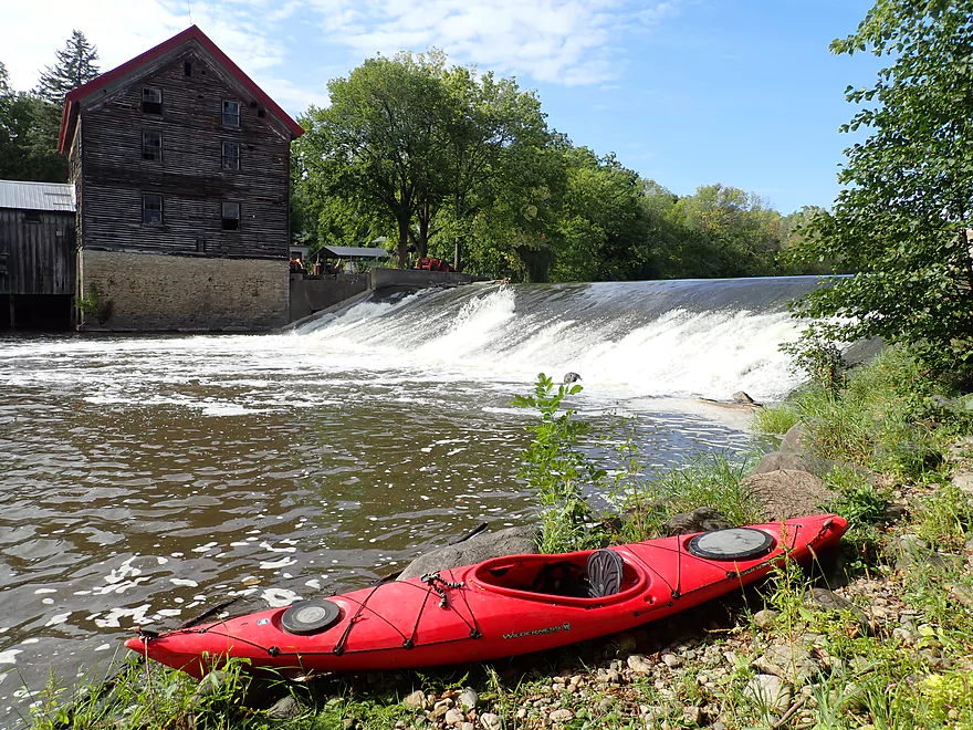
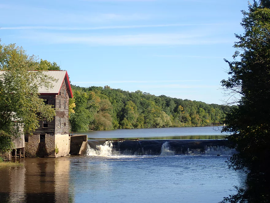
Approaching the dam
The portage path is well marked
View upstream
View from the bottom of the portage
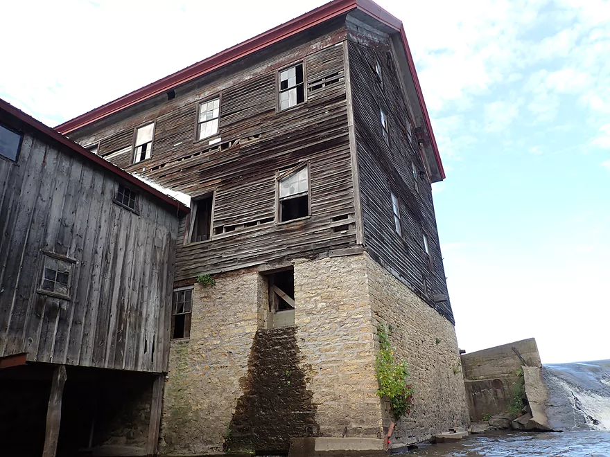
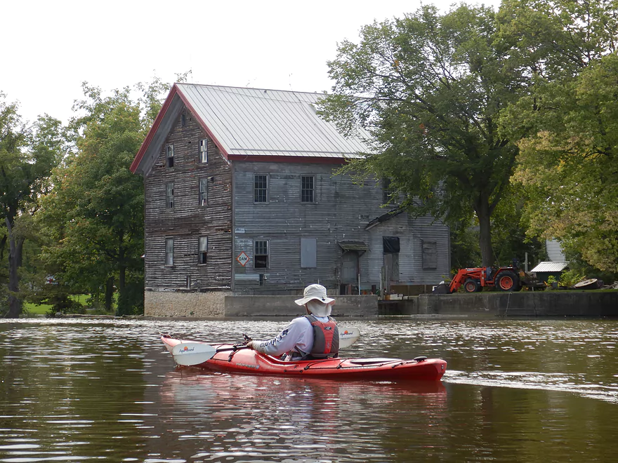
The mill is scenic but is a bit beat up
The dam is very dangerous and you don’t want to go down it
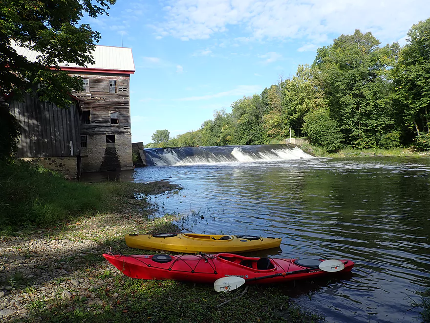
Taking out below the dam
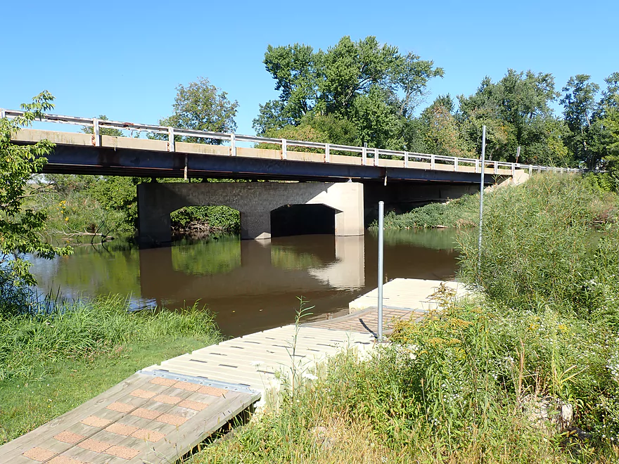
View from the downstream bridge
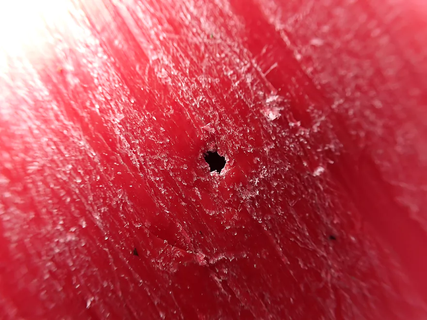
A hole in my kayak directly under my seat…not fun
Crawfish River


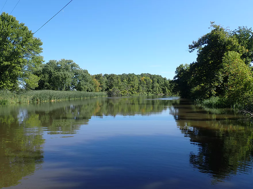
The Crawfish River is a significant tributary to the Rock River located in East Central Wisconsin. I’ve spent some time personally scouting its many sections over the years, but in many ways it is just not a paddle friendly river. Upstream of the North/South Branch confluence, logjams are everywhere and I’m not sure if it has a single viable water trail. This is a shame as both branches are gorgeous, rocky and feature many light riffles. The lower Crawfish is just the complete opposite. It’s relatively logjam free, but is boring, muddy, slow, and wide. Between the upper and lower parts is an intriguing compromise segment by Columbus. This seemed to have the best of both worlds and I finally got around to paddling it.
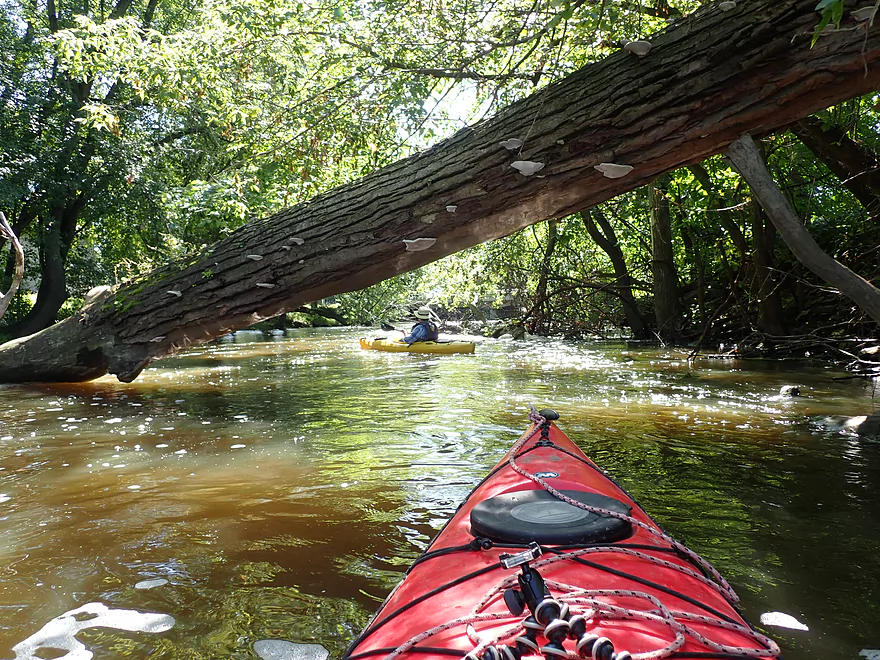
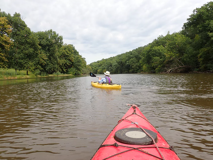
Most paddlers starting in the Columbus area will launch by the waste water plant landing, but we opted to start further upstream at the Udey Dam itself. From the dam to the waste water plant is almost one mile and it is a nice section. Yes the banks are a bit ratty and beat-up, but the current was excellent and there are actually light riffles here during low levels. Unfortunately we did encounter two downed trees, but we were able to hop over them with little difficulty.
Unfortunately, my trusty Wilderness Tsunami 125 sprung a leak at the start of the trip. A hole developed directly under my seat which I suspect was caused by Cedar Creek (that was pretty rough). It wasn’t a large hole, as a fly wouldn’t fit through it, but it did release a steady amount of water into the boat. Thankfully I had my sponge with me and I was able to periodically sponge out the boat to keep afloat (at a rate of perhaps two cups every five minutes). So that was a bit distracting and annoying to say the least. Previously when my boat sprang a leak, I had it professionally fixed and they did a good job. But kayak repair can take weeks if not more to complete and with this being a busy time of the season, I’ll simply have to use my “yellow boat” for now. Something that I’m looking at is a special epoxy adhesive repair kit which people rave about online, and my brother has successfully used it to repair a leak in his boat.
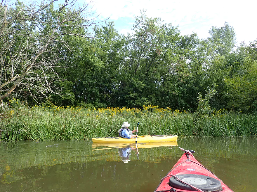
Following the waste water plant, we encountered a fresh logjam that spanned almost the entire width of the river. We were however able to sneak around the far end and there were no more notable downed trees from that point forward. The river though became much less interesting as the current slowed and the channel widened. Along the banks we saw 3-4 farm fords that ran straight through the river. The Crawfish though was a deep river averaging 4-5′ and unless farmers saw a dry spell to get river levels down, they would not be able to access farm fields on the opposite side.
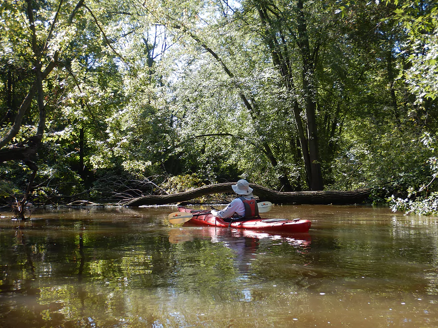
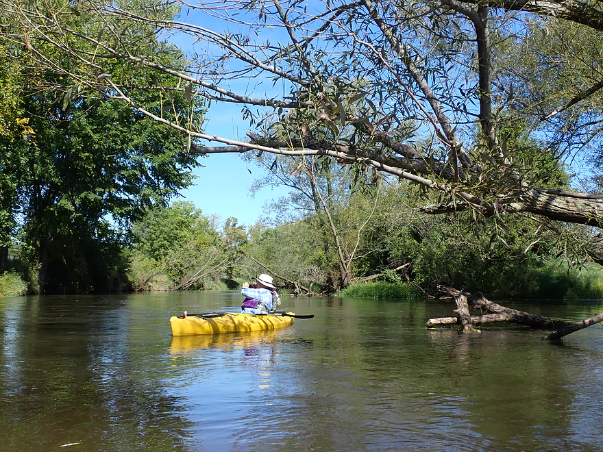
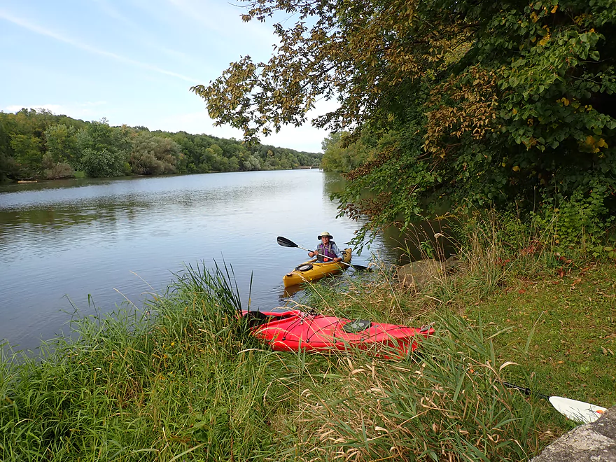
If you imagine this trip as a huge “L”, the bottom leg takes a significant turn east which marked a big change to the trip. Here the channel narrowed, the woods became bigger/healthier, the current improved, rocks started replacing mud, and there were a few light riffles. A highlight was the many majestic bur oaks that towered over the river. It was unfortunate we did this trip on the high side as many rocks and light rapids were submerged underwater…but this was still a really scenic part of the trip.
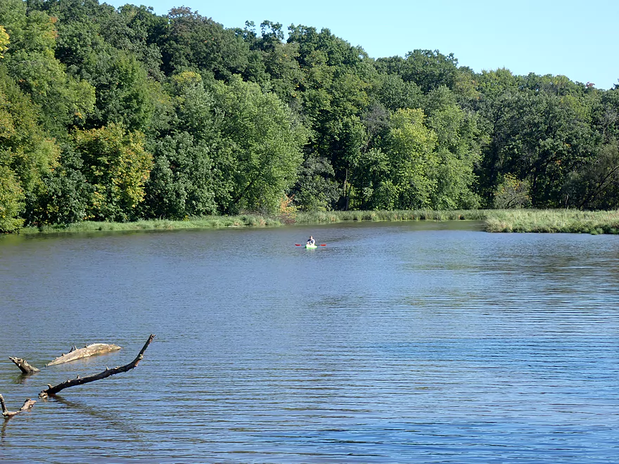
About a mile south of Ninabuck Road, the current slowed and the river widened as the effects from the Danville Dam started to kick in. By the Ninabuck bridge the current practically died and the final two miles of the trip were for all intents and purposes a lake paddle.
County Road TT marked the start of Astico Park. This is an attractive area shaped like a bowling pin that forces the river to flow around it along a huge hairpin turn. In the middle is a large wooded hill separating the two legs of the river. This was a scenic part of the trip with the highlight being a rustic trestle park bridge on the east leg.
Close to the dam, the channel became surprisingly shallow (at times only a foot deep). This is remarkable as the dam itself is about 10′ which means the Danville Millpond is heavily silted in. The portage is well marked and easy to use, but it is surprisingly close to the main spillway. From the east bank is a fantastic view of the mill and dam…both of which are super photogenic. We ended the trip just below the dam along a gravel bank. This is private property, but we did get permission from the owner to use it.
In summary, this is a bit of a tricky trip to judge. It’s certainly a long trip by my standards (~9 miles), it’s incredibly muddy, and there are a few long boring sections. But…the section by Columbus, the middle section through the big woods, and the river by Astico Park were fantastic. The highlight was the Danville dam and mill which while in considerable disrepair (water was leaking out of one of the mill windows), was an incredible sight to behold. I think this is definitely a water trail locals should put on their to-do list.
Astico Park: This is a nice county park located near the end of the paddle. It’s main feature is its campground, but it has an attractive trail network, a scenic trestle walk bridge, and several artesian wells.
We started the trip at the Udey Dam in Columbus. Locals fish along the east bank here and it is a pretty nice access.
The dam is very easy to portage, so putting in at one of the upstream parks in Columbus is certainly viable (eg Meister Park or Rotary Park).
An alternate access 0.8 miles downstream from the dam is the waste water plant. This is an ok public access but the access road and landing have been pretty beat up by flood damage. Putting in here bypasses two minor snags, but also a zippy and fun section of the river.
We ended the trip just downstream of the Danville Dam. Along the west bank and by Elba Street there is an open gravel area where locals fish and it is easy to get out. But…this is private. Whether you need to get permission or not isn’t exactly clear. I did talk to the owner and received permission, but most fishermen presumably do not get permission to use this shoreline and I don’t think the owner minds. If you take out here, be considerate…the owner doesn’t want people drinking, littering, causing trouble, etc… Also he prefers it if you leave your car a bit downstream from the gravel bar so as not to block other fishermen.
One alternative would be to simply take out at nearby Hwy T (likely the NW shoulder) which would be a suitable bridge access.
There are numerous alternate access options located upstream of the dam. At Astico Park there are three excellent options (see map). Note, while there are no outhouses at the main put-in or take-out, there are outhouses in Astico Park.
The bike shuttle is a pretty reasonable 3.4 miles. The only downside is that Hwy 60 is pretty busy.
Astico Park does rent out canoes and kayaks but does not do shuttles. Most paddlers do simple round trips on the Danville Millpond along Astico Park. Rentals are located at the main pier.
Current: Mostly slow, but there are a few fast sections. The first is between the Udey Dam and the Columbus waste water plant. The second fast section is a wooded section south of Tiedt Road. From Ninabuck Road to the take-out at the dam there is virtually no current.
Rapids: There are none at higher water levels. But at low flow rates attractive riffles will form below Columbus and south of Tiedt Road.
Logjams: There are two minor logjams that we were able to hop over between the Udey Dam and the waste water plant. There is a more serious logjam after the waste water plant that we were barely able to paddle around. In lower water, this may need to be portaged.
Wind: This is an open paddle so be mindful of forecasted wind speed.
Danville Dam: Some paddlers may be tempted to run the Danville Dam given its sloped spillway. This would be an awful idea as there is recirculating current at the bottom and irregularities along the face could easily knock a boat sideways. The portage path is well marked and easy to use (although it is concerningly close to the main spillway itself).
There is a gauge on the Crawfish but it is located almost 30 miles downstream, so it may significantly lag actual flow rates. We did the trip at 500 CFS.
- 0-100 CFS: A typical fall level. An excellent target rate…the river should be navigable and attractive boulders and light rapids should be visible in select spots.
- 101-200 CFS: An average summer flow rate. A good depth with some riffles.
- 201-400 CFS: An average spring flow rate. Some of the interesting river character would be submerged at this point.
- 401-600 CFS: A high depth. Water clarity will be quite bad.
- 601-1000 CFS: A very high depth, but the river is still quite viable for paddling.
- 1001-1400 CFS: Water quality will be exceedingly bad at this point (a mud fest). Paddlers may want to limit themselves to the parts by Astico Park.
- 1401+: This might be too high for paddling.
Detailed Overview
- Upstream of Columbus-Fall River Road: The Crawfish splits into two branches upstream of the bridge. Both branches are very scenic and have some rocky sections that I've scouted extensively before. Unfortunately, logjams are a major problem this far upstream and I'm not sure there are many if any viable legs in this stretch.
- Columbus-Fall River Road to Old Hwy 73: 3.8 miles. A mostly wooded section with perhaps 4 logjams.
- Old Hwy 73 to Udey Dam/Columbus: 3.2 miles. Mostly slow flowage paddling. Somewhat of an urban paddle that goes through the northern outskirts of Columbus. Area parks are alternate access options.
- Udey Dam to Danville Dam/Hwy T: 9.5 miles.
- Udey Dam to Columbus Wastewater Plant: 0.8 miles. An attractive fast section. Rapids and rocks will be visible at low flow rates. As of Sep 2019, there were two logjams, but they can be hopped over.
- Wastewater Plant to River Road (Creek Bridge): 2.9 miles. A mediocre section with one logjam to sneak around. Current slows and the banks consist of a mix of woods and open sections.
- River Road to Ninabuck Road: 3.2 miles. Terrific section with good current, healthy woods, light riffles and small boulders. This would be a very scenic section at low water levels.
- Ninabuck Road to Astico Park (West Landing): 1.0 miles. Mostly uninteresting flowage paddling.
- Astico Park (West Landing) to Astico Park (East Landing): 1.1 miles. A nice hilly section by Astico Park. Current is almost nonexistent though.
- Astico Park (East Landing) to Danville Dam (Elba Street): 0.5 miles. A half mile of paddling a very silted-in flowage. The dam can be easily portaged along the eastern bank. Take out southwest of the dam. The mill here is very scenic.
- Note: While local fishermen regularly use the shoreline south of the dam, it is private property. The owner is very nice about letting people use the shoreline to access the water. But be considerate if you take out here. If you want a more public access option, you could take out at Hwy T just downstream.
- Hwy T to County Road TT: 5.1 miles. Artificially straightened by farmers, I suspect this might be an uninteresting segment.
- County Road TT to Austin Road: 3.1 miles. Likely wide, slow and muddy.
- Austin Road to Hwy I: 3.0 miles. Likely a mediocre section.
- Hwy I to Hwy BB: 4.8 miles. A mediocre section that features the mouth of the Maunesha River.
- Hwy BB to Hwy G: 2.3 miles.
- Hwy G to Hubbleton: 4.3 miles. The Beaver Dam River adds considerable volume to the Crawfish.
- Hubbleton to Olson Road: 1.3 miles. Wide, slow, muddy and likely boring.
- Olson Road to Hwy A: 7.7 miles. Likely an uninteresting section.
- Note: I'm not sure if Hwy A is a viable access.
- Hwy A to Aztalan State Park: 3.1 miles. Likely a boring paddle. The highlight is Aztalan State Park.
- Aztalan State Park to Riverview Drive Boat Launch: 7.4 miles. A mediocre trip with a few nice boulder gardens. The highlights are the start (Aztalan State Park) and the end (Jefferson/Goat Island).
- Aztalan State Park to Hwy 18: 5.6 miles. A nice rocky stretch with good waterfowl and a number of boulders.
- Hwy 18 to Riverfront Park: 1.3 miles. A weak uninteresting section with slow current. The highlight at the end is Goat Island which in the summer will have goats on it.
Trip Map
Overview Map
Video
Photos Size:
Yesterday (06/12/2020) my niece and I put in at Rotary Park in Columbus, planning on kayaking down the Crawfish River. We took out at the Udey dam and put back in after the dam, but there’s a huge tree down right around the first bend (you cannot see it) and we got caught in the strong current & tree. Made it out ok, but suggest putting in AFTER the tree or staying in Rotary Park.
Appreciate the tip!
Suggestion for future hole in kayak. Years back on a trip down the St Croix river we hit a rock with an aluminum canoe, spun sideways and tipped up river, the canoe filled with water and folded in half. after prying it of the rock we got it to shore. My buddy, a big guy, tried stomping it straight. It straightened out but resulted in two tears just below the waterline. We still had two more days to go. We ended up cutting strips from a garbage bag, tucking them through the hole with a pointed knife and pulling them even. Packed in as many as we could, ended up with a ball of plastic on the inside and outside, still had a little seepage but nothing we couldn’t mop up. I believe this would work on a poly-ethylene kayak as long as the repair doesn’t hit too many rocks.
Thanks for the tips. Your advise is timely…as I have recently encountered hole #3 and hole #4 in my red boat :(.
I love paddling on the Crawfish. There are frequently downed trees in the early section after the Hy 16 bridge. But we usually manage to find a way through. There is a nice hike at the park. I have some videos on YouTube from a hike and from a paddling trip. Not as complete as your photos. If you would like to view them they are at WENDTWORKS Stories ‘N Flight!
Karen
Thanks for the feedback Karen! Here’s the video for readers that you referenced: https://www.youtube.com/watch?v=z3sUqTrYAEU
Crawfish River from Columbus to Dam at Astico Park/Campground. Saturday 8-14-21. Water as at 82 CFS on USGS gage at Beaver Dam River, the closest one to this section of river. Beautiful trip first hour. Second hour thru 2 miles of riffles there was some dragging. Would have been a lot of fun with about t6 more inches of water. Last section wide and calm. Lots of Blue Herons, Kingfishers, Green Herons, and Egrets. Current is minor as gradient is 0.5 fpm, except in riffles. Camping at Astico Co Park is great home base as the River runs around 3 sides of it. Three areas of riverside camping, esp. for smaller tent or pop-up campers.
Appreciate the update!