
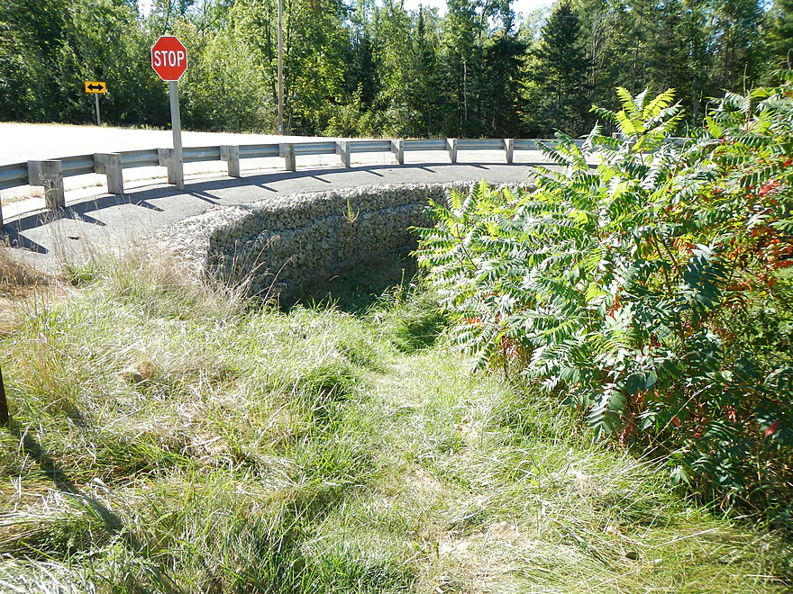
Hwy 161/Loberg Rd access
Nice landmark
Nice natural trail to the landing
Steep landing…so you either slide in or wade in
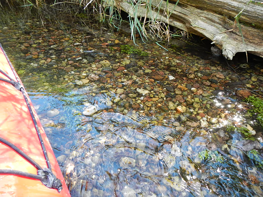
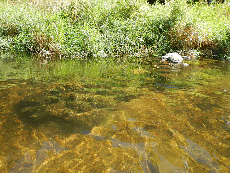
Attractive gravel bottom

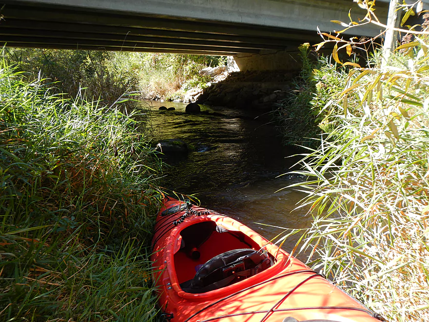
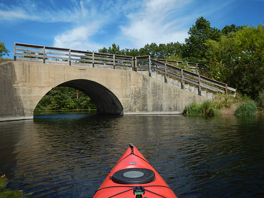
1st Street Bridge
Most people put in here (nice)
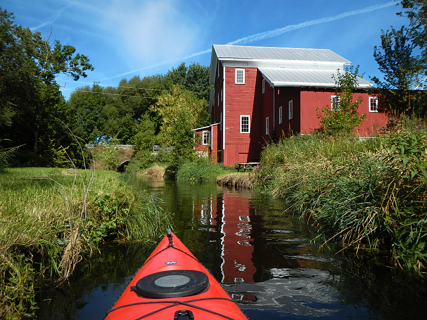
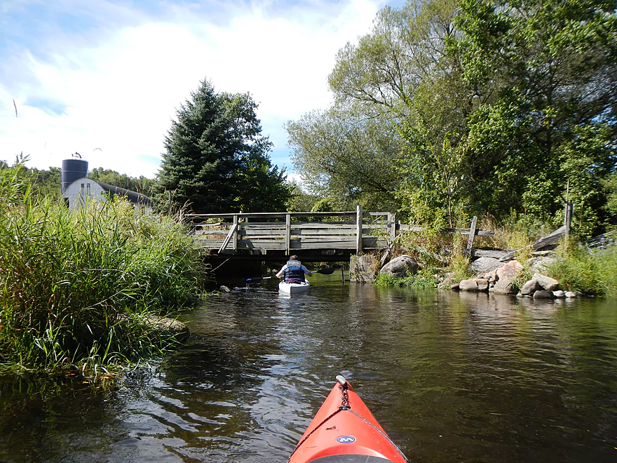
Nelsonville Mill…very historic
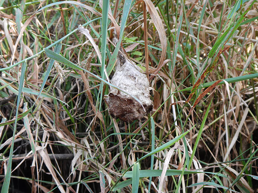
Paper wasp nest
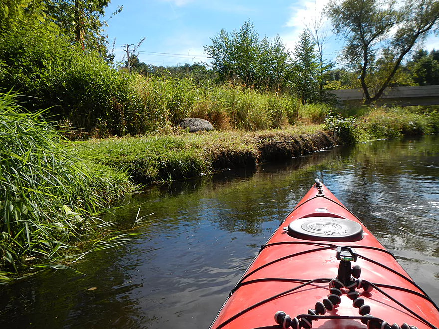
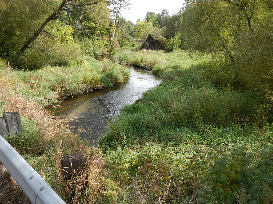
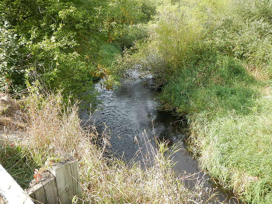
Narrow river at times
More evidence of cleanup
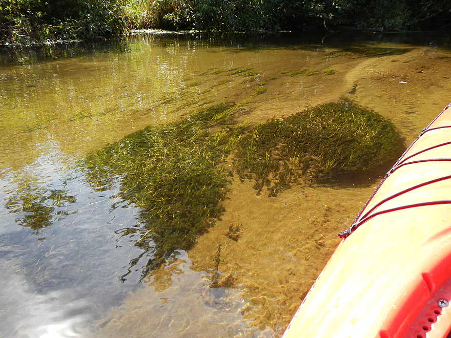
Cool aquatic plant colonies
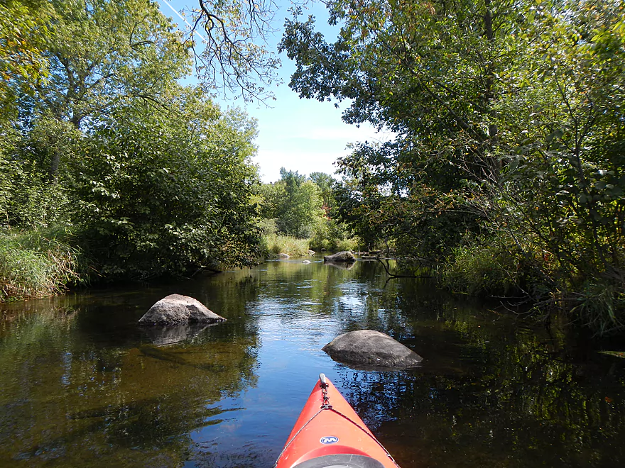
Start of the boulder gardens
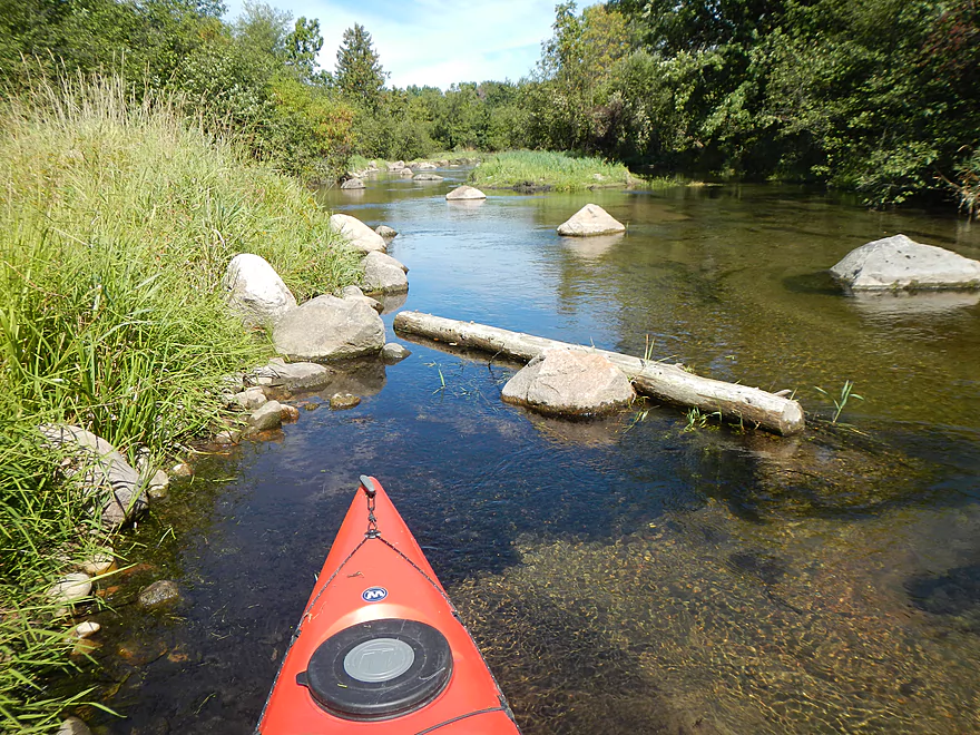
Cow bridge (that requires limbo-ing)
More boulder gardens
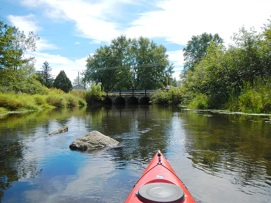
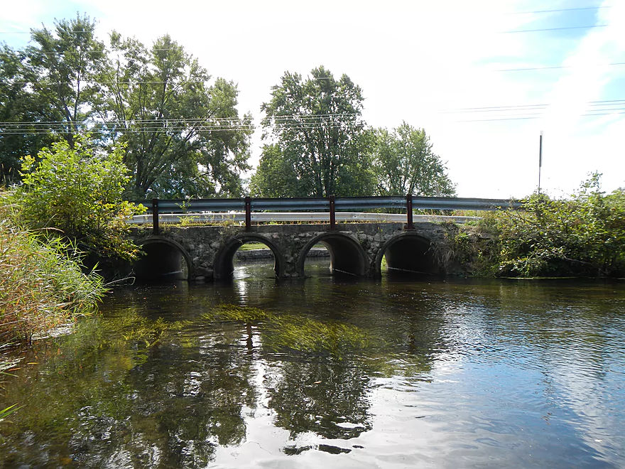
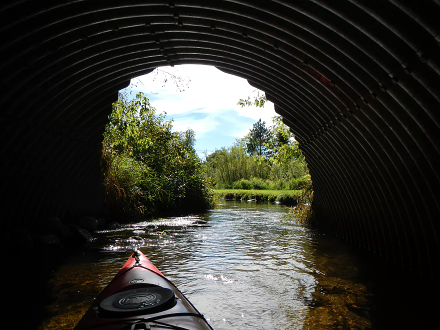
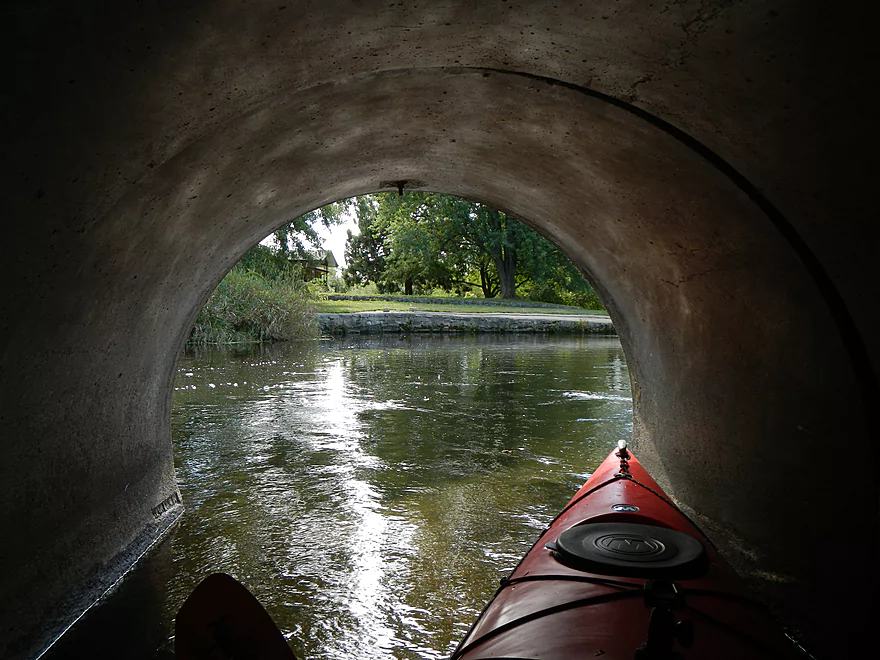
Four tunnel bridge
Not so friendly hitchhiker
Last bridge
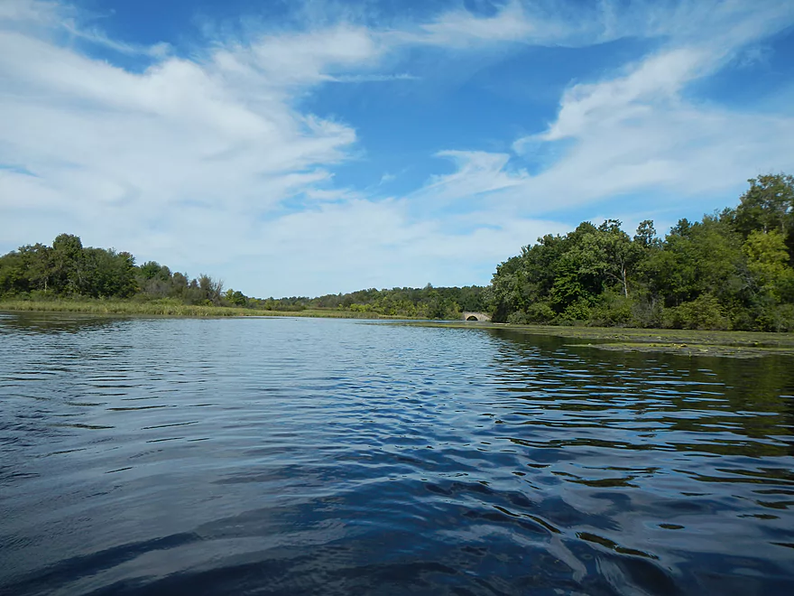
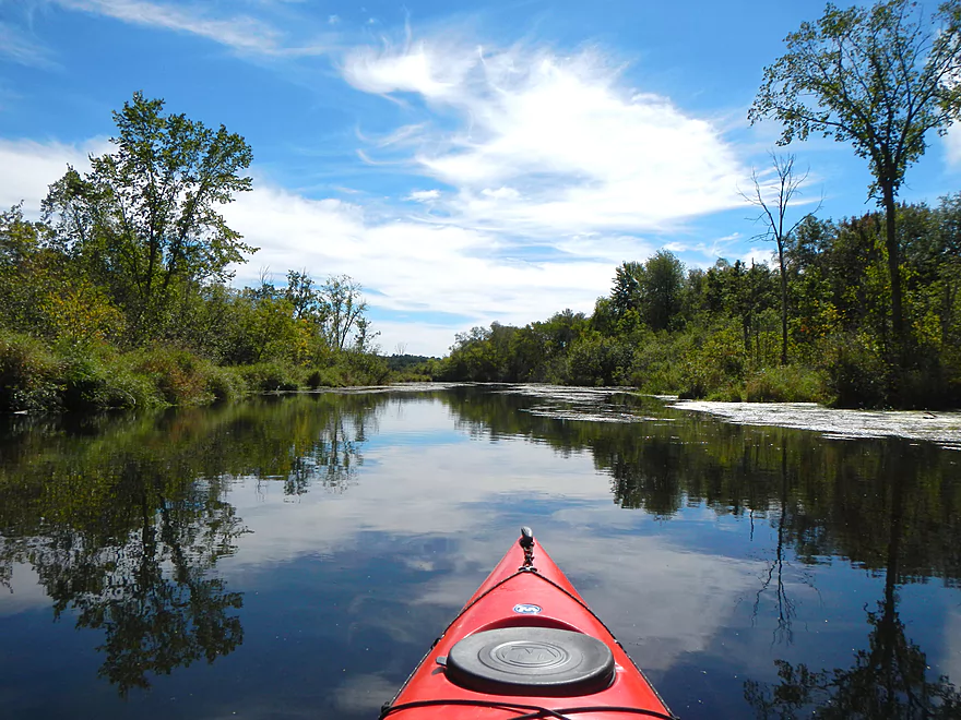
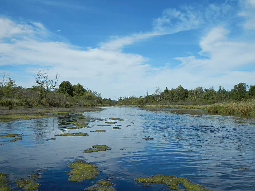
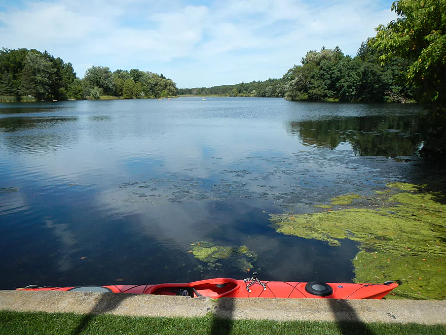
Almost no current on the flowage
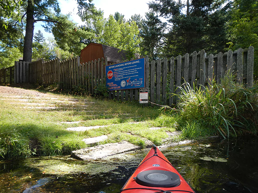
Public landing (I didn’t use this one)
Approaching the end of the flowage
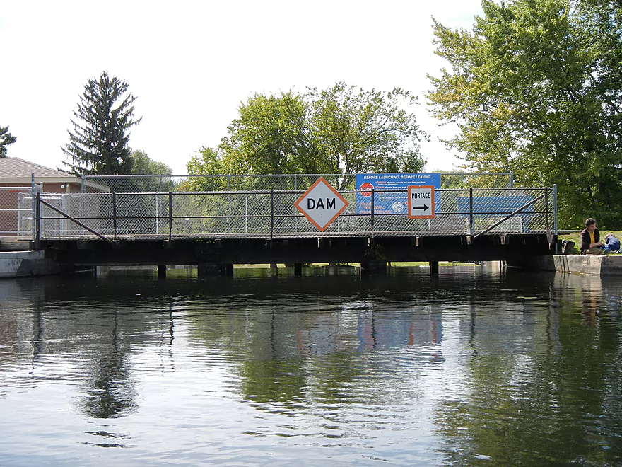
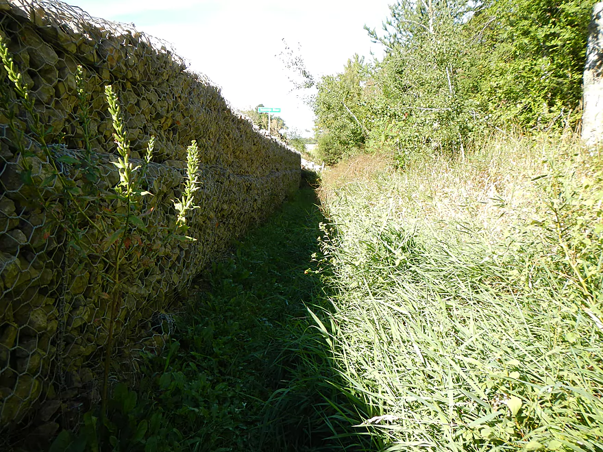
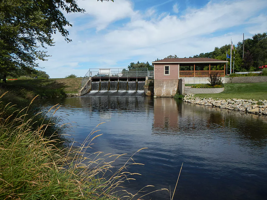
Cause of the flowage
Public access to right of the dam
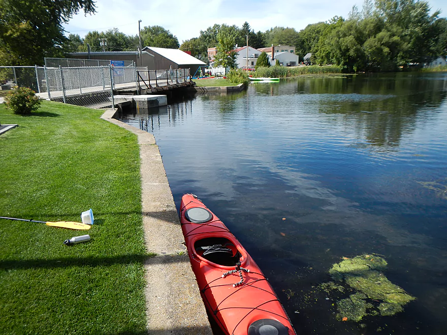
I took out left of the dam (close to parking)
That entire flowage for….only 3 KWH of energy!?
Wouldn’t be too hard to portage
Alt put-in – Hwy Q
Tight fit…but I think it would be navigable
Tomorrow River

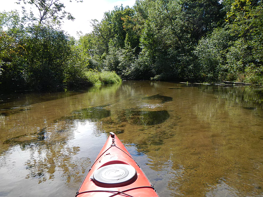
A tributary to the Wolf River, this is a very nice river/stream that is often overlooked because of its popular neighbors (Little Wolf/Waupaca/Crystal/Wolf/Plover). The Tomorrow never gets very big before it gets to Amherst and “magically” turns into the Waupaca River (an oddity, as Rivers don’t usually change names like this). Despite this being September and much of the state being in drought, I never once had to get out of my boat due to shallow water. The reason why is because the river is largely spring fed, which keeps the water levels remarkably stable throughout the year. And it also means the water is super clean and cold (my bare feet would get numb when they rested against the kayak walls).
For this trip I considered a bike shuttle, but ultimately went with a local livery service called Nature Treks based in Stevens Point (just 15 miles west of the Tomorrow River). Their bread and butter service is the Plover, and while they do service the Tomorrow, they only like to do groups, as this is more efficient for them (but bad for solo paddlers). Surprise group requirements are always an issue you have to keep an eye out for when choosing liveries. I was ultimately able to convince the service to ferry me and the kayak to the put-in though for 20 dollars.
There are multiple spots that you can put in on the Tomorrow (and take out…more on that later). The most common put-in area is at the 1st Street Bridge or Nelsonville Mill (noted canoe author Mike Svob incorrectly calls this Hwy 161). There is a big red grain mill by the river here and a very nice grassy landing for putting in. The grain mill is no longer functional, but local community events and concerts are hosted there. There is also an outhouse and good parking. Unfortunately, if you put in here, the trip will be only 4.5 miles.
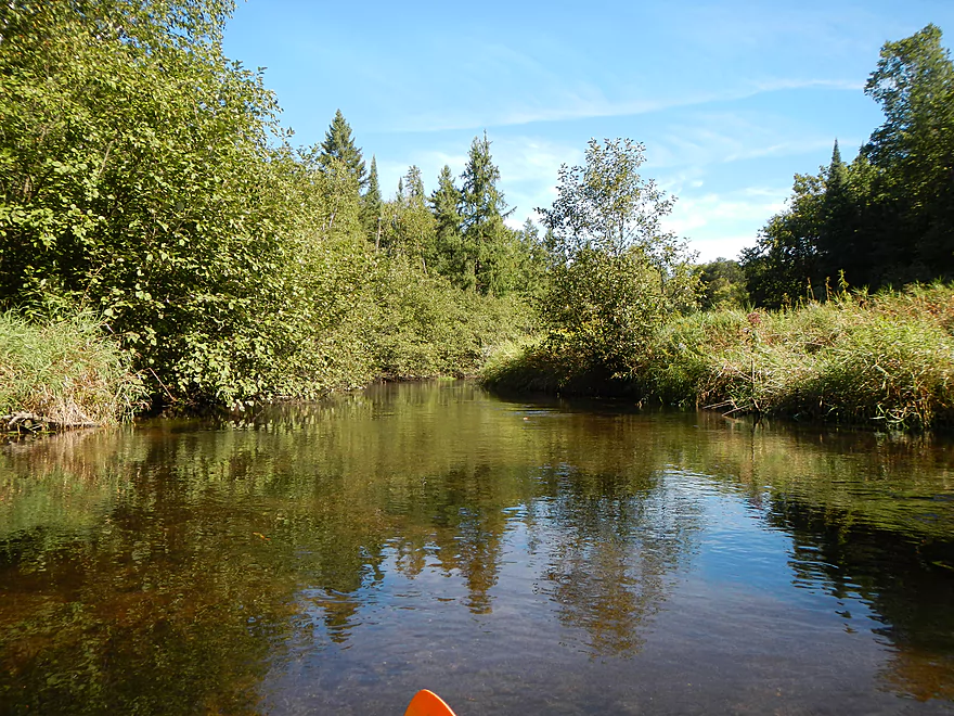
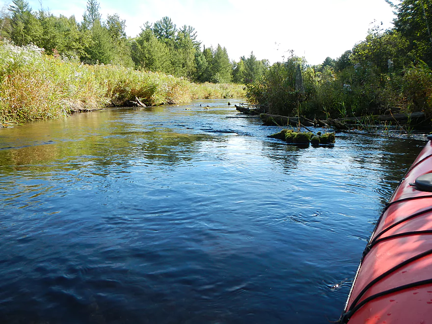
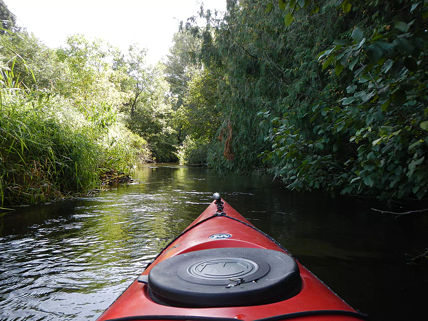
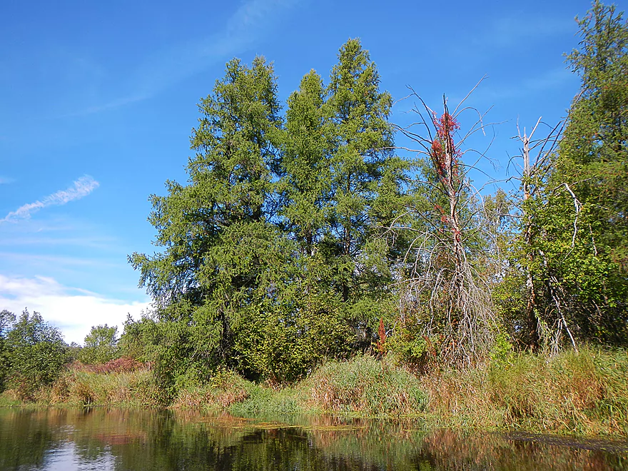
The next bridge up is Hwy 161/Loberg Road, which is where I put in. No bathrooms, but okay parking. There is a little grassy trail that leads down to the landing by the bridge. Note: the launch area isn’t that great. The ground is maybe 2 feet above the water and the current is zippy here. The livery driver suggested going in like an otter (or whitewater kayak) by sliding in, but added that a previous customer of his flipped when he tried this. My suggestion is to not do that, but just wade in the water (maybe 2′ deep) to get your center of gravity down and to mount your kayak by sitting in it sideways (super easy). By putting in here, you’ll add a mile or two that is zippy, scenic, has nice gravel substrate, and is somewhat open. This section used to be a flowage, and you can tell–the surrounding tree cover hasn’t completely recovered yet to pre-flowage levels. There are some trees, but it is mostly open area above Nelsonville. Some of this is engineered by the DNR and trout fishermen who have artificially deepened and narrowed the river to make it easier for their stocked trout to survive.
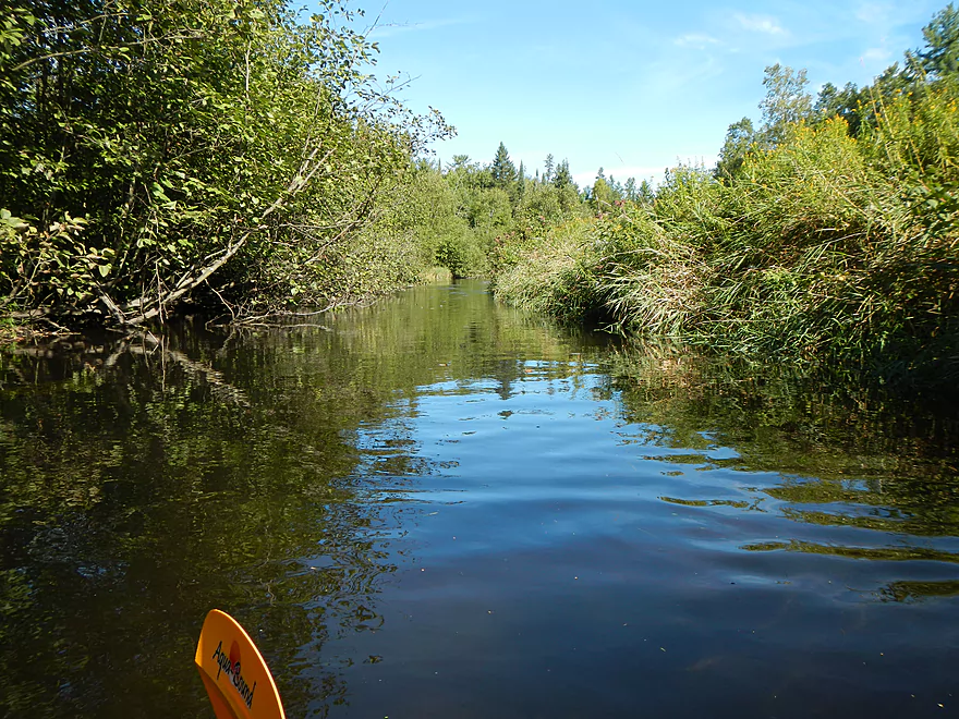
While the river is pretty narrow between Hwy 161 and Nelsonville/Old Mill, it’s not that bad. The livery driver was worried that my 12.5′ boat would be too long for that segment, but it was just fine. In fact, I think a 14′ boat would be able to run this section with little problems (you’ll need the extra length for the flowage paddling at the end!). The river actually seemed narrower at Nelsonville than the upstream mile or two.
In hindsight, I regret not putting up even further at Hwy. Q. Originally I asked the shuttle driver to drop me off there. When we arrived, he saw a trout fisherman at the bridge and was concerned that I would spook his trout, so decided unilaterally that he would just put me in at Hwy 161 instead. I wasn’t in a mood to argue, but even though this section looked narrow, I thought it was doable. The nice thing about the section above Hwy 161 is it escaped the affect from the old flowage, so the tree cover is great and purportedly this is a nice section of the river to paddle through (this might be tough for longer boats though!).
As a side note, while I appreciate the efforts done to improve trout fishing in our state’s creeks and rivers, I think it is a mistake to singularly focus on a water body for its “sporting” value. Would we manage a natural prairie for its ability to breed deer for hunters? A river is a multi-dimensional ecosystem, and if you focus on trout by artificial means–like bank clear-cutting/wing dams/artificial bank walls/artificial debris/stocking programs…which the Tomorrow endures (all of this), you take away from other less obvious species of plants and animals and the character of the river. Personally, I suspect trout find being hooked more traumatic than having big kayaks slide overhead. End rant. Just think conservation takes a backseat to the hook and bullet interests in this state more often than not.
In my quick note at the start of the page, I noted the that the river gradient is 2.5′ per mile, but this is deceptive. For starters, this doesn’t include the segments above Nelsonville. The river upstream is quick and, while never quite class 1 rapids, I wouldn’t be surprised if the upper sections fell at maybe 8′ per mile (which is fast). Again, safe but zippy…perfect for lazy paddlers! What skews the average gradient is the flowage at the end of the trip in which the current really slows to a turtle’s pace.
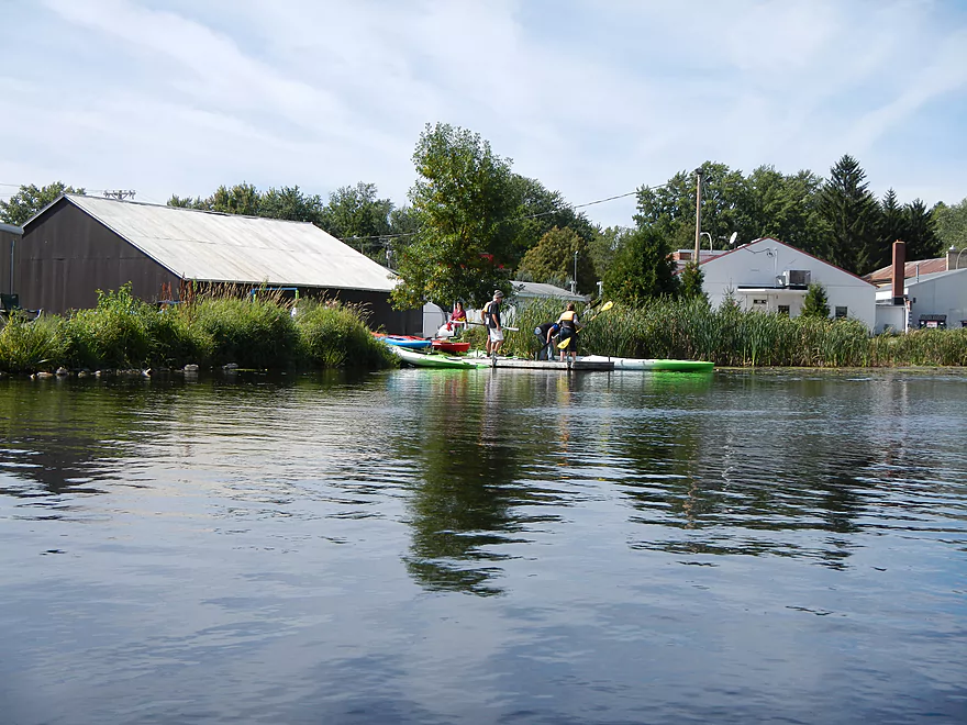
Don’t be surprised if you stumble into other paddlers on this trip…while not super popular, there is evidence of a decent amount of paddling traffic on the river. When I paddled through Nelsonville, I was surprised to see another group putting in, thinking that such a small river this late in the season would hardly have any paddlers.
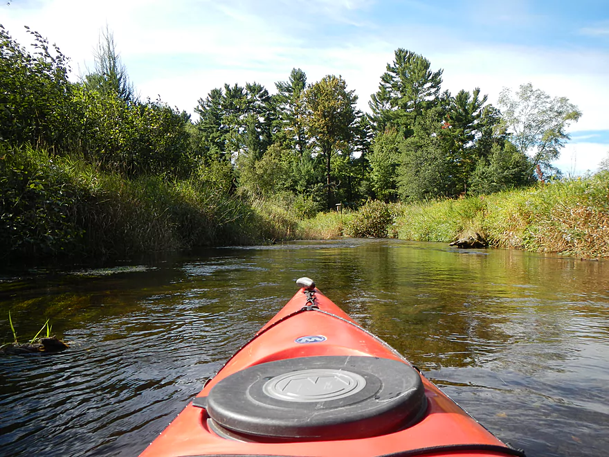
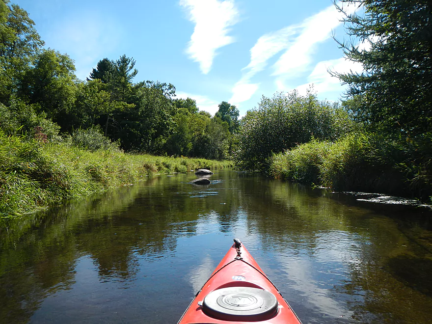
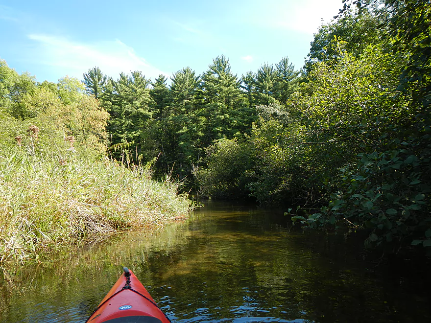
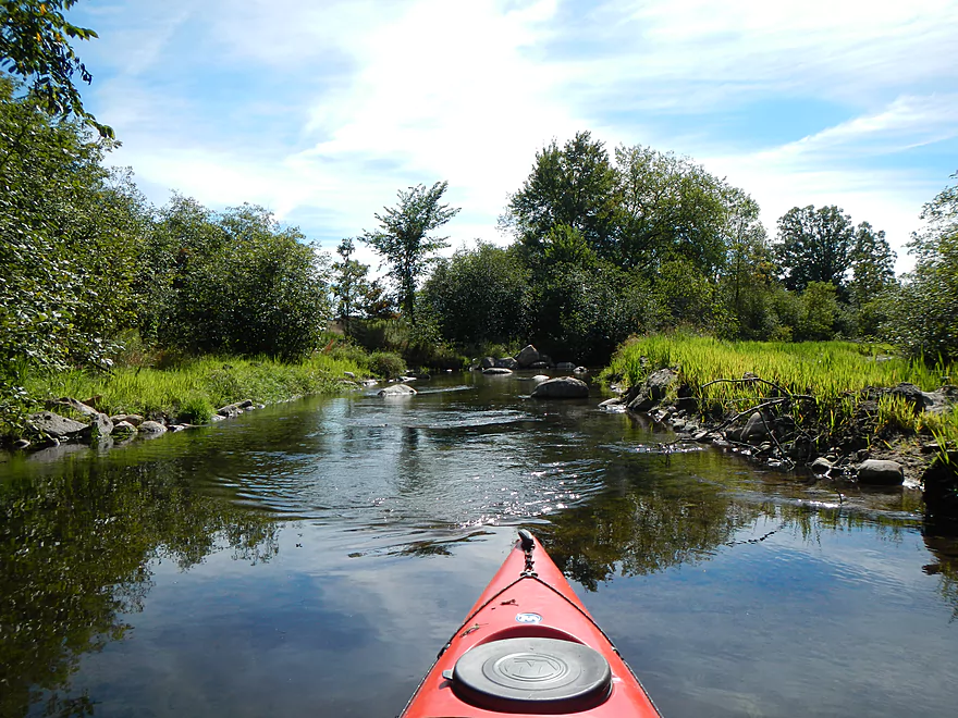
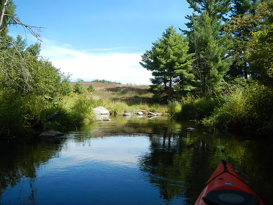
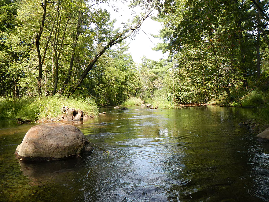
The scenery, while never really five star, is still pretty good. The upper sections are somewhat open (from the bank clear-cutting the DNR/Trout Fishermen have done to improve trout habitat), with intermediate tree cover that gets better toward the middle section. The highlight of the river were the boulder gardens in the middle section, which, while not as epic as, say, the Eau Claire River (an hour north) or even the Waupaca River downstream, they are still very nice. Be careful navigating or you’ll bump into your share of boulders (I find it is best to lean away from boulders as you go over them). The other scenic highlight of the trip was the fantastically clear water. It’s always a treat to be able to paddle over water in which you can see the bottom, fish scooting along, and aquatic plants gently waving in the current.
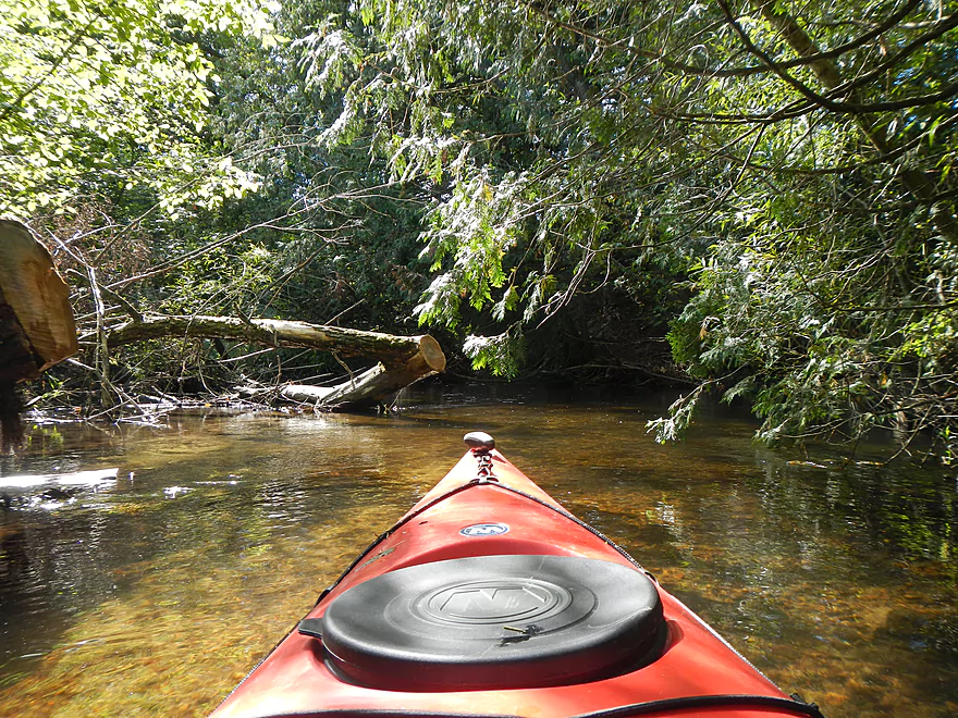
Something to keep an eye out for will be a cow bridge maybe halfway into your trip. It’s super low and requires some limbo-ing to get under. A quick digression for some basic limbo tips (good general skill to have when faced with low hanging branches). First, never go under fixed obstacles with decent current. You will stop but your kayak won’t, and the boat will flip easily. These are extremely dangerous situations. Secondly, avoid ducking in high kayaks/canoes as you have an awful center of gravity. Portage instead. Third, don’t duck your head back. Duck it forward. This gives you much better control of your balance, the kayak, and the branch/bridge. Plus, it allows you to back out of bad situations much easier. When ducking, try to turn your head sideways for extra clearance and brace the side of the kayak tightly with your feet for balance in case you need to tilt your kayak gently to get through. I was able to get under the cow bridge with little effort, much to the astonishment of the nearby kayakers who could not get through themselves.
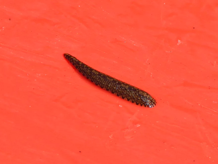
Some of the other bridges are kind of cool as well. There is one large c-shaped bridge, one with two tunnels, and another with four tunnels. Once you paddle past the four-tunnel bridge, the river starts to feel the effect of the flowage, which is unfortunate. You lose your helping current, the scenery becomes simple and the aquatic plants become more scummy. The riverbed also becomes muddy and not as nice as the sandy/rocky areas upstream. In fact, the mud is perfect for leeches–I got a picture of one attached to my kayak (perhaps he thought I was a big fish).
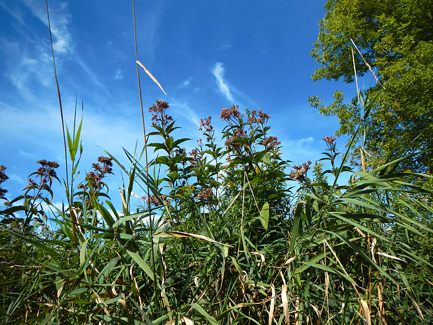
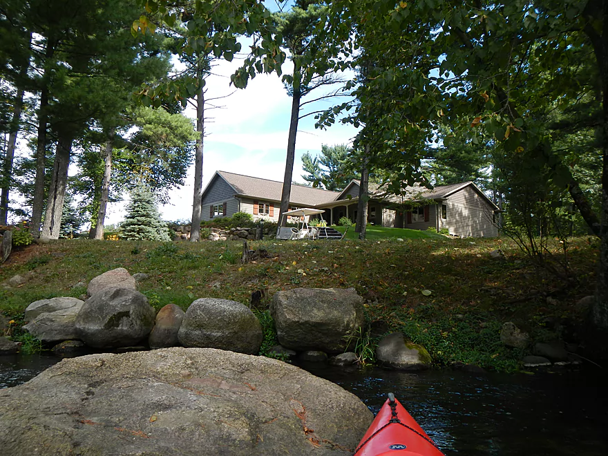
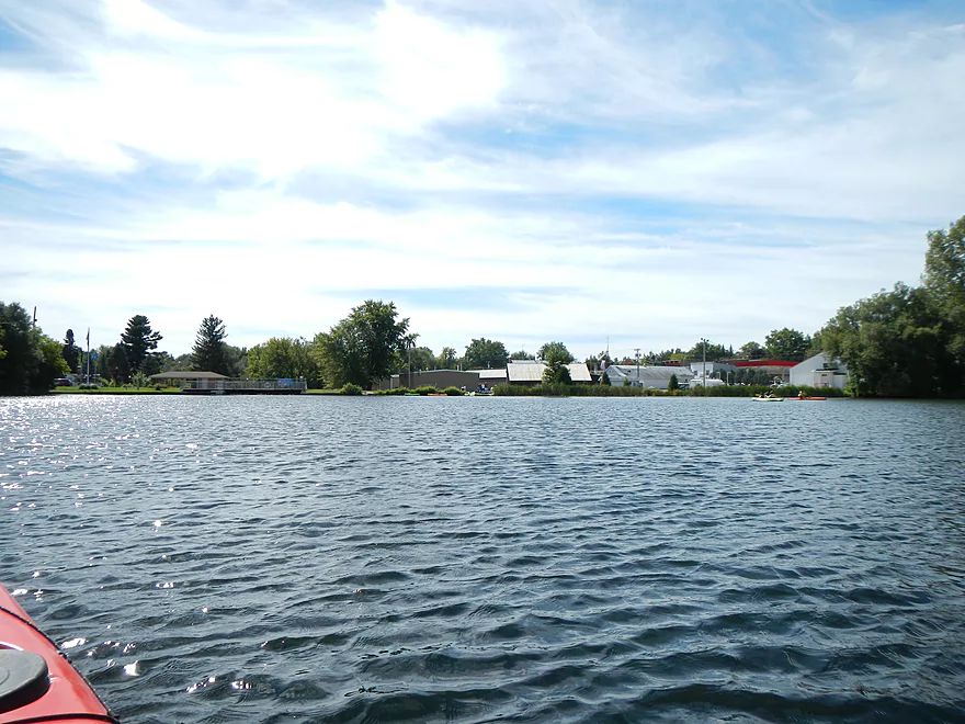
Wildlife was nice. There were some dragonflies, a hawk, blue heron (that seemed very upset with the hawk), paper wasp nest (I think I’ve seen one in 3-4 consecutive trips now), a spotted sandpiper, and an otter playing around. The human wildlife consisted of three other kayakers, two trout fishermen, and a group of paddlers at the Amherst pond (apparently there was some local community event going on in which paddling was a sub-activity). You can hear occasional road noise here and there, but I couldn’t complain. There were 3-4 houses on the river before a more developed shoreline by the time you get to the Amherst dam.
There are multiple take-out options. If you’re not nuts about the last mile or two of flowage paddling, you could probably take out at the Tomorrow River State Bike Trail bridge (nice steps leading down to the water) and then it should be a brief hike east to the Tomorrow River road (am not 100% certain this is feasible though, as I haven’t scouted this). The next downstream option is Cate County Park, but the trail leading to the water is super hidey (I didn’t see it). Probably the best option is the public boat ramp on Pond Street (all this is marked on the map). The last option is to take out at the dam, which I did. There is a public take-out area to the right but I took out left of the dam, as it was close to the municipal parking lot. Not sure you can park here during weekdays.
I suppose you could portage the dam (easy to do) and continue on to the Waupaca River. It’s a great prospect, but the section just after the dam is rumored to have log jams, according to my livery driver…some of which are kept in place intentionally by trout fisherman, which I was also told. Hwy Q to the city of Waupaca is the most popular section and should be log jam free.
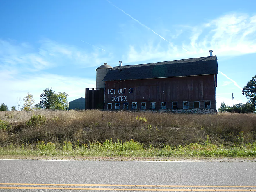
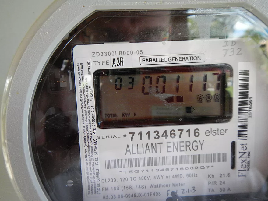
There is another mill at the dam, but it no longer grinds wheat and has been converted into a simple electric producing dam…of just 3 KWH’s… That’s what the public gauge on the building said. So that’s maybe powering one household? Not worth it when you consider the effect the dam has on this nice little river.
This area of the state is great for paddling, and some of the nearby neighboring rivers are top-notch and worth consideration. The Little Wolf is fast, clean, and relatively safe when it comes to rapids. The Crystal River has amazing water quality and the Wolf River is, of course, a national scenic river. The Plover is a two stage river that is more wooded/Wisconsin River-ish close to the mouth, but more rocky up north, with nice boulder gardens. The Plover’s neighbor to the north, the Eau Claire, is an amazing five star river with terrific boulder gardens and rock outcroppings. The upper Crystal River is formed by a chain of lakes that are super transparent (paddling some of them is like floating on air if there isn’t a lot of wake). In the heart of the lake chain is Hartman State Park, which would be a great spot to camp if need be. Then there is, of course, the Wisconsin River, which has sweet spots between flowages. Great place to live if you’re into paddling!
Detailed Overview
- Clementson Road to Hwy Q: 0.9 miles. Possible prospect, but the river is very small here.
- Hwy Q/Rolling Hills Road to Hwy 161: 1.2 miles. A good prospect.
- Hwy 161 to Amherst Dam: 5.4 miles. More of an oversized creek than a river, the Tomorrow River is still a nice paddle known for its clear water.

- Hwy 161 to 1st Street: 1.3 miles. Great trip.
- 1st Street to the Amherst Dam: 4.1 miles. Great put-in and trip.
- Hwy 161 to 1st Street:
- Amherst Dam to Buchholz Road: 5.7 miles. This section was great fun because of its many rapids, clear water, narrow channel, boulder gardens and wooded banks.
- Amherst Dam to Hwy A: 1.7 miles. Great segment through Amherst.
- Hwy A to Keener Road: 0.6 miles. A short but good section with a nice boulder garden.
- Keener Road to Buchholz Road: 3.4 miles. Aside from some Class 2 rapids at Keener Road and a few boulders, this is a more open and less interesting section.
- Amherst Dam to Hwy A:
- Buchholz Road to Stedman Park: 6.1 miles. A fantastic paddle that was narrow, fast, rocky, and scenic.
- Buchholz Road to Otto Road: 1.5 miles. Great stretch with some huge boulder gardens.
- Otto Road to Hwy T: 0.9 miles. Another great section with some boulder gardens and light rapids.
- Hwy T to Stedman Park: 3.7 miles. Good stretch with some great rapids and boulder gardens at the end.
- Buchholz Road to Otto Road:
- Stedman Park to Durant Road: 2.1 miles. A really nice leg. Starts with some terrific boulder gardens, rapids and pine stands by Stedman Park. River then flattens out for the middle portion and becomes a bit less interesting. The final leg features some terrific pine stands.

- Durant Road to Cobbtown Road: 1.4 miles. A nice section, but not as good as upstream parts with less boulder gardens and rapids. Maybe one logjam.
- Cobbtown Road to Frost Valley Road Access: 1.7 miles. Starts nice with fun rapids and a decent boulder garden. But satellite images suggests 3-5 logjams that might require portaging.
- Frost Valley Road Access to County Q Canoe Landing: 2.0 miles. Satellite images suggest a number of logjams (maybe 8). I would wait for this stretch to get cleared out before attempting.
- Hwy Q Launch to Brainard's Bridge Park: 7.8 miles. A great trip that is very popular with paddlers.
- Brainard's Park to Elm Street Dam: 0.8 miles. Half of this is a nice river paddle, half a boring flowage. There is a portage path around the dam.
- Elm Street Dam to Kiwanis Park: 3.3 miles. Great prospect, but perhaps a logjam or two. The Mill Street dam is VERY dangerous and preceded by Class 2 rapids. This is also a difficult portage. Scout before committing to a trip.
- Kiwanis Park to Harrington Road: 7.7 miles. A good prospect.
- Harrington Road to Weyauwega Dam: 4.4 miles. Maybe 3 miles is open flowage paddling.
- Weyauwega Dam to Decker Memorial Park (and the Wolf River): 6.2 miles. A mediocre prospect.
Trip Map
View Tomorrow River in a larger map
Overview Map
Video
Photos Size:
Thanks for the review of the Tomorrow River. We enjoyed kayaking from the Mill to the State trail this past weekend despite temperature in the 50s and windy but we also were able to stay out of the icy cold water. You do have to know how to steer your boat around obstacles though. We were able to kayak under the cow bridge!
I would make a comment about the “rant” of the above reviewer regarding fishing potentially taking prioroity over kayaking. As both a kayaker/hiker and a hunter/fisherman, I do know for a fact that 98% of the money and efforts put in to the conservation of wild areas in WI come from hunters and fishermen, not we kayakers and hikers. I am a freeloader, even when I am on public land where hunters and fishermen are not allowed yet they exist because of the dollars and efforts of these sportsmen.
Perhaps it is time for we kayakers and hikers to also buy an annual license and pay taxes on our kayaks/gear to help fund the conservation efforts of hunters and fishermen in our state?
Can you take out at the bike trail?
I don’t know myself. I think it would be doable, but likely taking out at the lake would be a better bet.
Thanks for the reply Tim. Glad you enjoyed the trip as yeah it was cold this last weekend.
I will respectfully disagree in regards to taxing paddlers. In my opinion a nice natural area (lake, river, forest) is a public good. What makes it special is not proportionate to the amount of user fees it generates (be they hunting fees or otherwise). Devil’s Lake for example was cool before any human experienced it or “improved it”.
Hunting also differs from low-impact sports in that it creates a void when a fish or animal is caught, and thus in my opinion needs to be treated, regulated and rationed quite differently than an activity that leaves no impact on a state natural area (like kayaking). Iowa and Minnesota require paddlers register their boats over a certain length, but to me that seems overbearing and discourages a sport that more should be encouraged to partake in.
I did a slightly different section of this trip (Rolling Hills Rd to Cate County Park) on 5/21/20 and would highly recommend it to anyone. The river is pretty enough to keep experienced paddlers happy and easy enough that beginners should have little problem. There is an easy put-in on river left on the downstream side of the bridge, there is shoulder parking for several cars as seems to be a popular place for fishing and kayaking/canoeing. There were no blockages thanks to the obvious work of other working to keep the river clean. There is one really low farm bridge that required an easy portage. Lots of wildlife with the highlight being eagles on and near a nest just before the take out. The take out at Cate park is easy to miss so be sure to check it out during the shuttle, or as someone had done when I was there to a piece of flagging/marking tape on a tree. Taking out at Cate park saves a boring paddle on the flowage, and since it is right on the bike trail makes for an easy bike shuttle. The trip took about 2.5 hours and the bike shuttle took about 25 mins with a stop for ice cream. Here is a link to some of my photos from the trip and the shuttle https://1drv.ms/a/s!AjC8S6n5i35Vggdp5IuMqYModZxY
Thanks for the updates and pictures. So you put in upstream of what I did…yet didn’t have any logjam issues which is great news. I’ll have to put the Tomorrow River on my “redo todo” list…
Just Googled Tomorrow River on bus trip back from Brewers game. Never heard of it before. I sold my whitewater kayak a few years back. Need to get a 12 footer as I am now too big for 9 footer. I enjoyed everybody’s comment and the original post. Very informative!
It’s a nice river…small but I think you’ll enjoy it.